Extracted figure lettering and translations
Legible lettering has been transcribed from the original figures. Inconsistencies and illegible text are recorded separately.
p1_1.png
PDF 1 · Original p. —
Symbol of the Japan Association for Quaternary Research

Original Japanese lettering
No lettering
English translation
No lettering
p1_2.png
PDF 1 · Original p. —
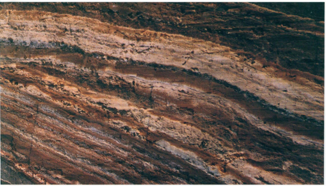
The Great Geological Section at Senbazaki, Izu-Oshima, showing alternating scoria beds of the Older Oshima Group.
Original Japanese lettering
No lettering
English translation
No lettering
p2_3.png
PDF 2 · Original p. —
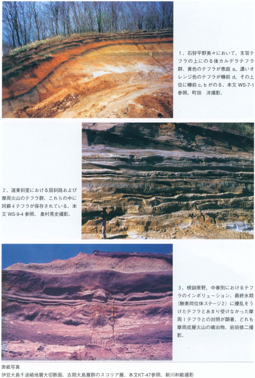
Three photographs and captions: post-caldera tephras at Bibi; Kutcharo and Mashu tephras at Shari; involutions at Nakashunbetsu.
Original Japanese lettering
-
石狩平野美々において、支笏テフラの上にのる後カルデラテフラ群。黄色のテフラが恵庭a、濃いオレンジ色のテフラが樽前d、その上位に樽前c、bがのる。本文WS-7-1参照。町田洋撮影。
-
道東斜里における屈斜路および摩周火山のテフラ群。これらの中に阿蘇4テフラが保存されている。本文WS-9-4参照。奥村晃史撮影。
-
根釧原野、中春別におけるテフラのインボリューション。最終氷期(酸素同位体ステージ2)に擾乱をうけたテフラとあまり受けなかった摩周1テフラとの対照が顕著。どれも摩周成層火山の噴出物。岩田修二撮影。
表紙写真:伊豆大島千波崎地層大切断面。古期大島層群のスコリア層。本文KT-47参照。新川和範撮影。
English translation
-
Post-caldera tephras overlying the Shikotsu tephra at Bibi on the Ishikari Plain. The yellow tephra is Eniwa-a, and the dark orange tephra is Tarumae-d; Tarumae-c and -b overlie them. See WS-7-1. Photograph: 町田洋 (Hiroshi Machida).
-
Tephras from Kutcharo and Mashu volcanoes at Shari in eastern Hokkaido. The Aso-4 tephra is preserved within this succession. See WS-9-4. Photograph: 奥村晃史 (Koji Okumura).
-
Tephra involutions at Nakashunbetsu on the Konsen Plain. There is a marked contrast between tephras disturbed during the last glacial period (oxygen isotope stage 2) and the Mashu-1 tephra, which was affected relatively little. All are products of Mashu stratovolcano. Photograph: 岩田修二 (Shuji Iwata).
Cover photograph: The Great Geological Section at Senbazaki, Izu-Oshima. Scoria beds of the Older Oshima Group. See KT-47. Photograph: 新川和範.
p3_4.png
PDF 3 · Original p. —
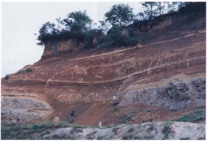
The Shimosueyoshi Formation and tephras at Chitose, Kawasaki, including thin white layers.
Original Japanese lettering
No lettering
English translation
No lettering
p3_5.png
PDF 3 · Original p. —
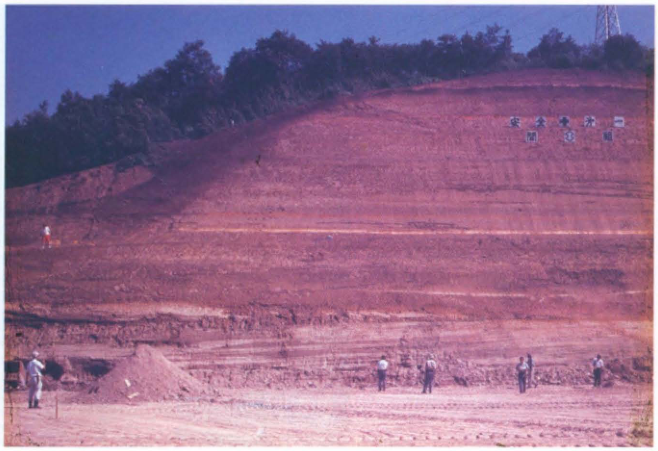
The Tama Loam exposed during construction of the Kawasaki interchange, with people indicating scale.
Original Japanese lettering
写真上部に札があるが、文字の一部は判読不明。
English translation
Signs appear near the top of the photograph; part of their lettering is illegible.
写真中の札の全字は低解像度のため確定できない。
p3_6.png
PDF 3 · Original p. —
Interbedded fallout tephra and soil between the Saigo and Ashino units of the Shirakawa pyroclastic-flow deposits.
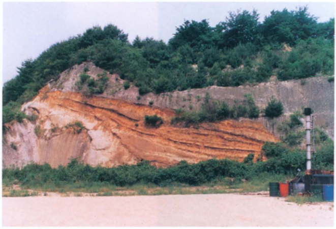
Original Japanese lettering
No lettering
English translation
No lettering
p4_7.png
PDF 4 · Original p. —
Pumice fall and two pyroclastic-flow deposits of the Kikai-Akahoya eruption on Takeshima, with the Nagase deposit at the left edge.
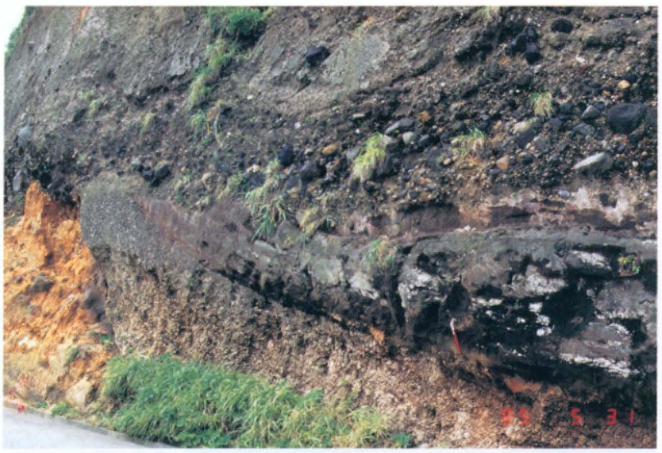
Original Japanese lettering
右下に撮影日を示す数字がある。一部判読不明。
English translation
Numerals indicating a photographic date occur at lower right; some digits are illegible.
撮影日の年は確定せず。
p4_8.png
PDF 4 · Original p. —
Osumi pumice fall and the Ito pyroclastic-flow deposit on the Shibushi coast, with underlying tephras.
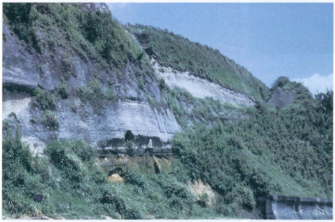
Original Japanese lettering
No lettering
English translation
No lettering
p4_9.png
PDF 4 · Original p. —
Sueyoshi stage I tephras of Higashiyama volcano, Hachijojima, with the white Aira-Tn ash layer on the left.
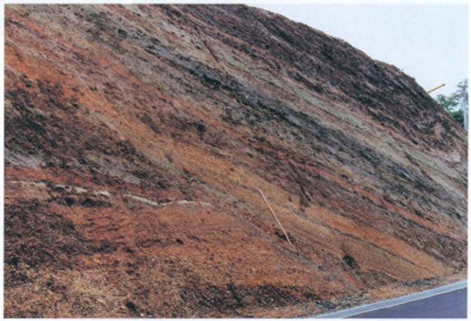
Original Japanese lettering
No lettering
English translation
No lettering
p5_10.png
PDF 5 · Original p. —
Excavation of a valley at the Sannai-Maruyama site, showing an Early Jomon embankment and pottery-bearing deposits.
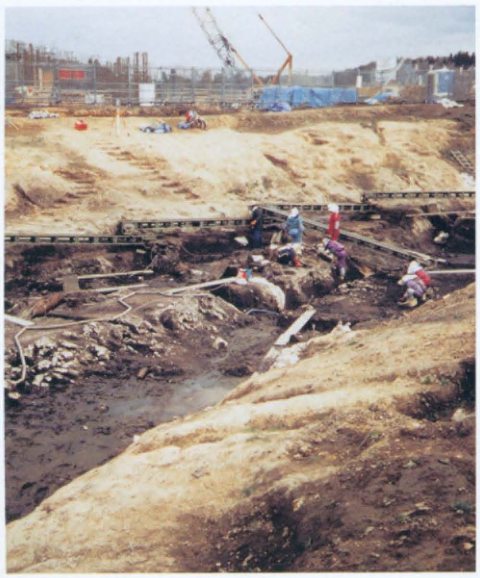
Original Japanese lettering
No lettering
English translation
No lettering
p5_11.png
PDF 5 · Original p. —
The Atotsugawa fault in the upper Makawa valley: granite on the left, terrace gravel on the right, with observers in the foreground.
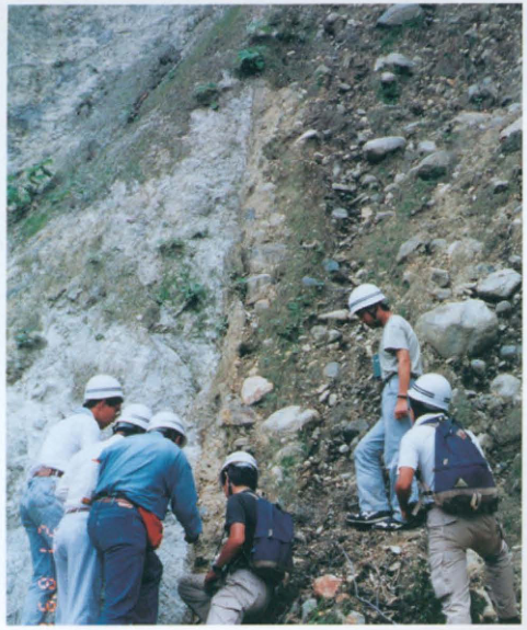
Original Japanese lettering
左下に撮影日を示す数字があるが、全桁は判読不明。
English translation
Numerals indicating a photographic date appear at lower left, but the complete date is illegible.
写真中の撮影日全桁は判読不明。
p5_12.png
PDF 5 · Original p. —
Tephra section at the Iwajuku site, with the white Haruna-Hassaki tephra intercalated near its base.
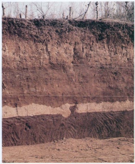
Original Japanese lettering
No lettering
English translation
No lettering
p16_13.png
PDF 16 · Original p. xi
Classification of tephra by grain size: blocks, lapilli, pumice, scoria, coarse and fine ash.
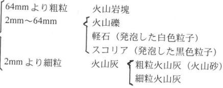
Original Japanese lettering
| 粒径 | 分類・性状 |
|---|---|
| 64 mmより粗粒 | 火山岩塊 |
| 2–64 mm | 火山礫;軽石(発泡した白色粒子);スコリア(発泡した黒色粒子) |
| 2 mmより細粒 | 火山灰:粗粒火山灰(火山砂)、細粒火山灰 |
English translation
| Grain size | Classification and characteristics |
|---|---|
| Coarser than 64 mm | Volcanic blocks |
| 2–64 mm | Lapilli; pumice (vesiculated white particles); scoria (vesiculated black particles) |
| Finer than 2 mm | Volcanic ash: coarse ash (volcanic sand) and fine ash |
p16_14.png
PDF 16 · Original p. xi
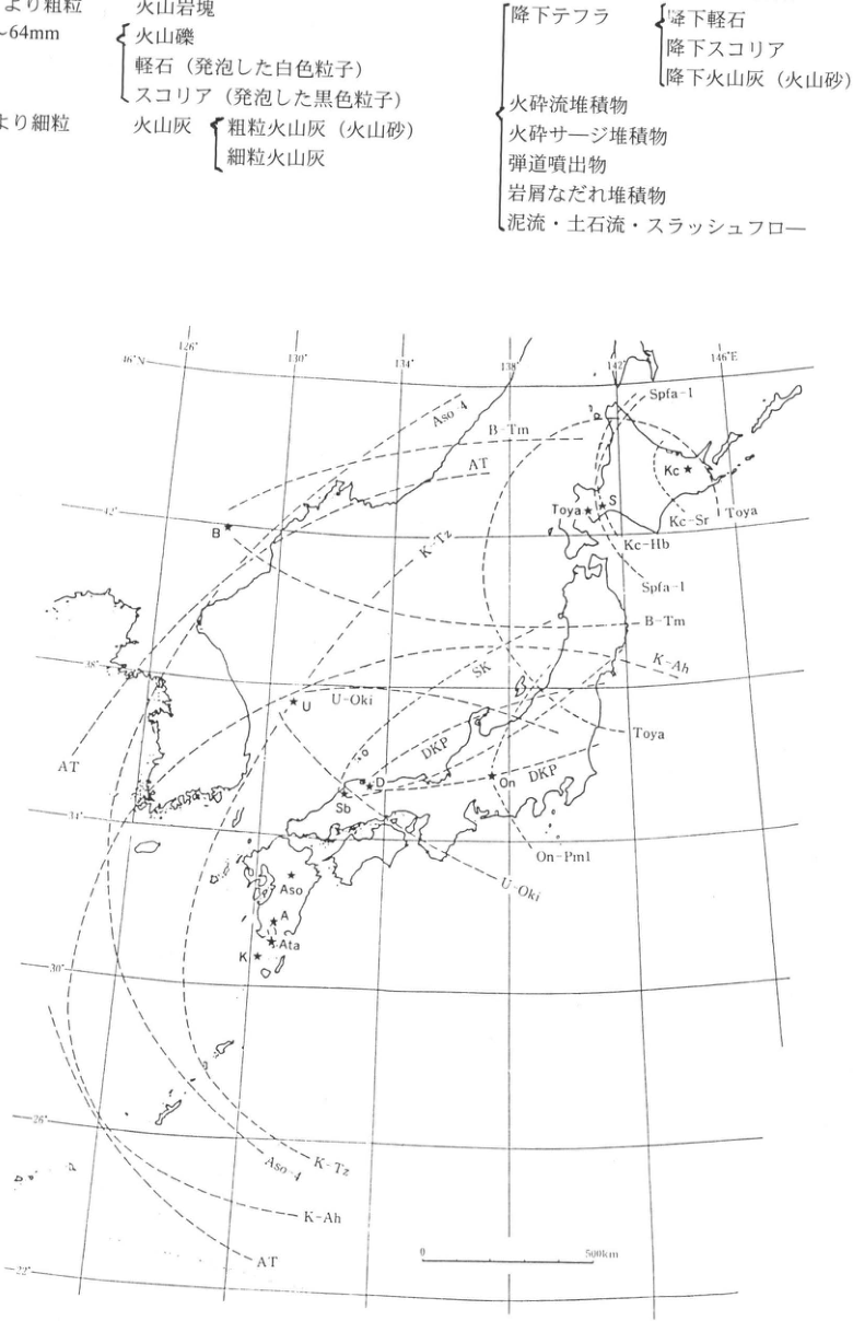
Composite containing the classification of tephra by transport process and a map of Late Pleistocene widespread tephra distributions; a fragment of Table 1 remains at upper left.
Original Japanese lettering
| 運搬過程による分類 | 細分 |
|---|---|
| 降下テフラ | 降下軽石、降下スコリア、降下火山灰(火山砂) |
| 火砕流堆積物 | — |
| 火砕サージ堆積物 | — |
| 弾道噴出物 | — |
| 岩屑なだれ堆積物 | — |
| 泥流・土石流・スラッシュフロー | — |
図1. 日本とその周辺地域における更新世後期の代表的広域テフラの分布範囲(町田・新井、1992)。火山(星印):Kc(屈斜路)、S(洞爺)、On(御岳)、D(大山)、Sb(三瓶)、Aso(阿蘇)、A(姶良)、Ata(阿多)、K(鬼界)、B(白頭山)、U(鬱陵)。
図中のテフラ略号:Aso-4、B-Tm、AT、K-Tz、Spfa-1、Kc-Sr、Kc-Hb、Toya、SK、K-Ah、U-Oki、DKP、On-Pm1。経度目盛:126°、130°、134°、138°、142°、146°E。緯度目盛:46°N、42°、38°、34°、30°、26°、22°。縮尺:0–500 km。
English translation
| Classification by transport process | Subdivisions |
|---|---|
| Fallout tephra | Pumice fall, scoria fall, ash fall (volcanic sand) |
| Pyroclastic-flow deposits | — |
| Pyroclastic-surge deposits | — |
| Ballistically ejected material | — |
| Debris-avalanche deposits | — |
| Mudflows, debris flows, and slushflows | — |
Figure 1. Distribution limits of representative Late Pleistocene widespread tephras in Japan and adjacent regions (Machida and Arai, 1992). Volcanoes (stars): Kc, Kutcharo; S, Toya; On, Ontake; D, Daisen; Sb, Sambe; Aso, Aso; A, Aira; Ata, Ata; K, Kikai; B, Baitoushan; U, Ulleung.
Tephra abbreviations in the map: Aso-4, B-Tm, AT, K-Tz, Spfa-1, Kc-Sr, Kc-Hb, Toya, SK, K-Ah, U-Oki, DKP, On-Pm1. Longitude ticks: 126°, 130°, 134°, 138°, 142°, 146°E. Latitude ticks: 46°N, 42°, 38°, 34°, 30°, 26°, 22°. Scale: 0–500 km.
p17_15.png
PDF 17 · Original p. xii
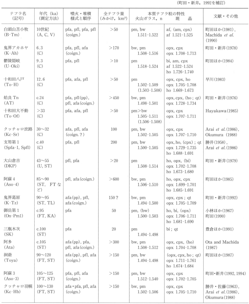
Table 3. Widespread tephras from giant eruptions in Japan and adjacent regions during the late Quaternary (approximately the past 130,000 years)
Original Japanese lettering
| テフラ名(記号) | 年代 ka(測定方法) | 噴火・堆積様式と順序 | 全テフラ量(みかけ、km³) | 本質テフラ粒:火山ガラス、n | 本質テフラ粒:斑晶 | 文献・その他 |
|---|---|---|---|---|---|---|
| 白頭山苫小牧 (B-Tm) | 10世紀 (A, C, V) | pfa, pfl, pfa, pfl (coign.) | >50 | pm, bw; 1.511–1.522 | af, (am, cpx); af 1.521–1.525 | 町田ほか (1981); Machida et al. (1990) |
| 鬼界アカホヤ (K-Ah) | 6.3 (C) | pfa, pfl, afa (coign.) | >170 | bw, pm; 1.508–1.516 | opx, cpx; opx 1.708–1.713 | 町田・新井 (1978) |
| 鬱陵隠岐 (U-Oki) | 9.3 (C) | pfa, pfl | >10 | pm; 1.518–1.524 | bi, am, cpx; af 1.522–1.524; ho 1.726–1.740 | 町田ほか (1984) |
| 十和田八戸 (To-H) | 12.6 (C) | pfa, afa, pfl | >50 | pm; 1.502–1.509 (1.503–1.508) | opx, cpx, ho; opx 1.705–1.708; ho 1.669–1.673 | 早川 (1983) |
| 姶良Tn (AT) | c.24 (C) | pfa, pfl (pp), pfl, afa (coign.) | >450 | bw, pm; 1.498–1.501 | opx, cpx, (ho; qt); opx 1.728–1.734 | 町田・新井 (1976) |
| 十和田大不動 (To-Of) | >33 (C) | pfa, afa, pfl | >50 | pm>bw; 1.505–1.511 (1.506–1.508) | opx, cpx; opx 1.707–1.711 | Hayakawa (1985) |
| クッチャロ庶路 (Kc-Sr) | 30–32 (C) | afa, pfl, afa (coign.?) | 100 | pm, bw; 1.502–1.505 | opx, cpx; opx 1.707–1.710 | Arai et al. (1986); Okumura (1988) |
| 支笏第1 (Spfa-1, Spfl) | c.40 (C) | pfa, pfl | 200 | pm, bw; 1.500–1.505 | opx, ho, (cpx); qt; opx 1.729–1.735; ho 1.688–1.691 | 勝井 (1958); Arai et al. (1986) |
| 大山倉吉 (DKP) | 43–55 (U, ST) | pfl, pfa | >20 | pm; 1.508–1.514 | ho, opx, (bi); opx 1.702–1.708; ho 1.673–1.680 | 町田・新井 (1979) |
| 阿蘇4 (Aso-4) | 85–90 (ST, FTなど) | pfl, afa (coign.) | >600 | bw, pm; 1.506–1.510 | ho, opx, cpx; opx 1.699–1.701; ho 1.685–1.691 | 町田ほか (1985) |
| 鬼界葛原 (K-Tz) | 90–95 (ST, TL) | afa (pp), pfl, afa (coign.) | 150? | bw, pm; 1.494–1.500 | opx, cpx; qt; opx 1.705–1.709 | 町田・新井 (1992) |
| 御岳第1 (On-Pm1) | c.95 (FT, KA) | pfa | 50 | pm, (bw); 1.500–1.503 | ho, bi, (opx); opx 1.706–1.711; ho 1.681–1.690 | 小林ほか (1967); 町田 (1990) |
| 三瓶木次 (SK) | c.100 (ST) | pfa | 20 | pm; 1.494–1.498 | bi; qt | 豊倉ほか (1991) |
| 阿多 (Ata) | c.105 (ST) | afa (pp), pfa, pfl, afa (coign.) | >300 | bw, pm; 1.508–1.512 | opx, cpx, (ho); opx 1.704–1.708 | Ota and Machida (1987) |
| 洞爺 (Toya) | 90–120 (FT, ST) | afa (pp), pfl, afa (coign.) | >150 | pm, bw; 1.494–1.498 | (opx, cpx, ho; qt); opx 1.711–1.761; ho 1.674–1.684 | 町田ほか (1987) |
| 阿蘇3 (Aso-3) | 105–125 (FT, ST) | pfa, pfl, afa (coign.) | >150 | pm, bw; 1.512–1.540 | opx, cpx; opx 1.702–1.705 | 町田・新井 (1992, 1994) |
| クッチャロ羽幌 (Kc-Hb) | 100–130 (FT, ST) | afa·pfa, pfl, afa (coign.) | >150 | bw, pm; 1.502–1.506 | opx, cpx; opx 1.705–1.710 | 勝井・佐藤 (1963); Arai et al. (1986); Okumura (1988) |
English translation
| Tephra (symbol) | Age, ka (dating method) | Eruption/deposition modes and sequence | Total tephra volume (bulk, km³) | Juvenile tephra: volcanic glass, n | Juvenile tephra: phenocrysts | References and other information |
|---|---|---|---|---|---|---|
| Baitoushan–Tomakomai (B-Tm) | 10th century (A, C, V) | pfa, pfl, pfa, pfl (coign.) | >50 | pm, bw; 1.511–1.522 | af, (am, cpx); af 1.521–1.525 | Machida et al. (1981); Machida et al. (1990) |
| Kikai-Akahoya (K-Ah) | 6.3 (C) | pfa, pfl, afa (coign.) | >170 | bw, pm; 1.508–1.516 | opx, cpx; opx 1.708–1.713 | Machida and Arai (1978) |
| Ulleung-Oki (U-Oki) | 9.3 (C) | pfa, pfl | >10 | pm; 1.518–1.524 | bi, am, cpx; af 1.522–1.524; ho 1.726–1.740 | Machida et al. (1984) |
| Towada-Hachinohe (To-H) | 12.6 (C) | pfa, afa, pfl | >50 | pm; 1.502–1.509 (1.503–1.508) | opx, cpx, ho; opx 1.705–1.708; ho 1.669–1.673 | Hayakawa (1983) |
| Aira-Tn (AT) | c.24 (C) | pfa, pfl (pp), pfl, afa (coign.) | >450 | bw, pm; 1.498–1.501 | opx, cpx, (ho; qt); opx 1.728–1.734 | Machida and Arai (1976) |
| Towada-Ofudo (To-Of) | >33 (C) | pfa, afa, pfl | >50 | pm>bw; 1.505–1.511 (1.506–1.508) | opx, cpx; opx 1.707–1.711 | Hayakawa (1985) |
| Kutcharo-Shoro (Kc-Sr) | 30–32 (C) | afa, pfl, afa (coign.?) | 100 | pm, bw; 1.502–1.505 | opx, cpx; opx 1.707–1.710 | Arai et al. (1986); Okumura (1988) |
| Shikotsu-1 (Spfa-1, Spfl) | c.40 (C) | pfa, pfl | 200 | pm, bw; 1.500–1.505 | opx, ho, (cpx); qt; opx 1.729–1.735; ho 1.688–1.691 | Katsui (1958); Arai et al. (1986) |
| Daisen-Kurayoshi (DKP) | 43–55 (U, ST) | pfl, pfa | >20 | pm; 1.508–1.514 | ho, opx, (bi); opx 1.702–1.708; ho 1.673–1.680 | Machida and Arai (1979) |
| Aso-4 (Aso-4) | 85–90 (ST, FT, etc.) | pfl, afa (coign.) | >600 | bw, pm; 1.506–1.510 | ho, opx, cpx; opx 1.699–1.701; ho 1.685–1.691 | Machida et al. (1985) |
| Kikai-Tozurahara (K-Tz) | 90–95 (ST, TL) | afa (pp), pfl, afa (coign.) | 150? | bw, pm; 1.494–1.500 | opx, cpx; qt; opx 1.705–1.709 | Machida and Arai (1992) |
| Ontake-1 (On-Pm1) | c.95 (FT, KA) | pfa | 50 | pm, (bw); 1.500–1.503 | ho, bi, (opx); opx 1.706–1.711; ho 1.681–1.690 | Kobayashi et al. (1967); Machida (1990) |
| Sambe-Kisuki (SK) | c.100 (ST) | pfa | 20 | pm; 1.494–1.498 | bi; qt | 豊倉 et al. (1991) |
| Ata (Ata) | c.105 (ST) | afa (pp), pfa, pfl, afa (coign.) | >300 | bw, pm; 1.508–1.512 | opx, cpx, (ho); opx 1.704–1.708 | Ota and Machida (1987) |
| Toya (Toya) | 90–120 (FT, ST) | afa (pp), pfl, afa (coign.) | >150 | pm, bw; 1.494–1.498 | (opx, cpx, ho; qt); opx 1.711–1.761; ho 1.674–1.684 | Machida et al. (1987) |
| Aso-3 (Aso-3) | 105–125 (FT, ST) | pfa, pfl, afa (coign.) | >150 | pm, bw; 1.512–1.540 | opx, cpx; opx 1.702–1.705 | Machida and Arai (1992, 1994) |
| Kutcharo-Haboro (Kc-Hb) | 100–130 (FT, ST) | afa·pfa, pfl, afa (coign.) | >150 | bw, pm; 1.502–1.506 | opx, cpx; opx 1.705–1.710 | Katsui and Sato (1963); Arai et al. (1986); Okumura (1988) |
p18_16.png
PDF 18 · Original p. xiii
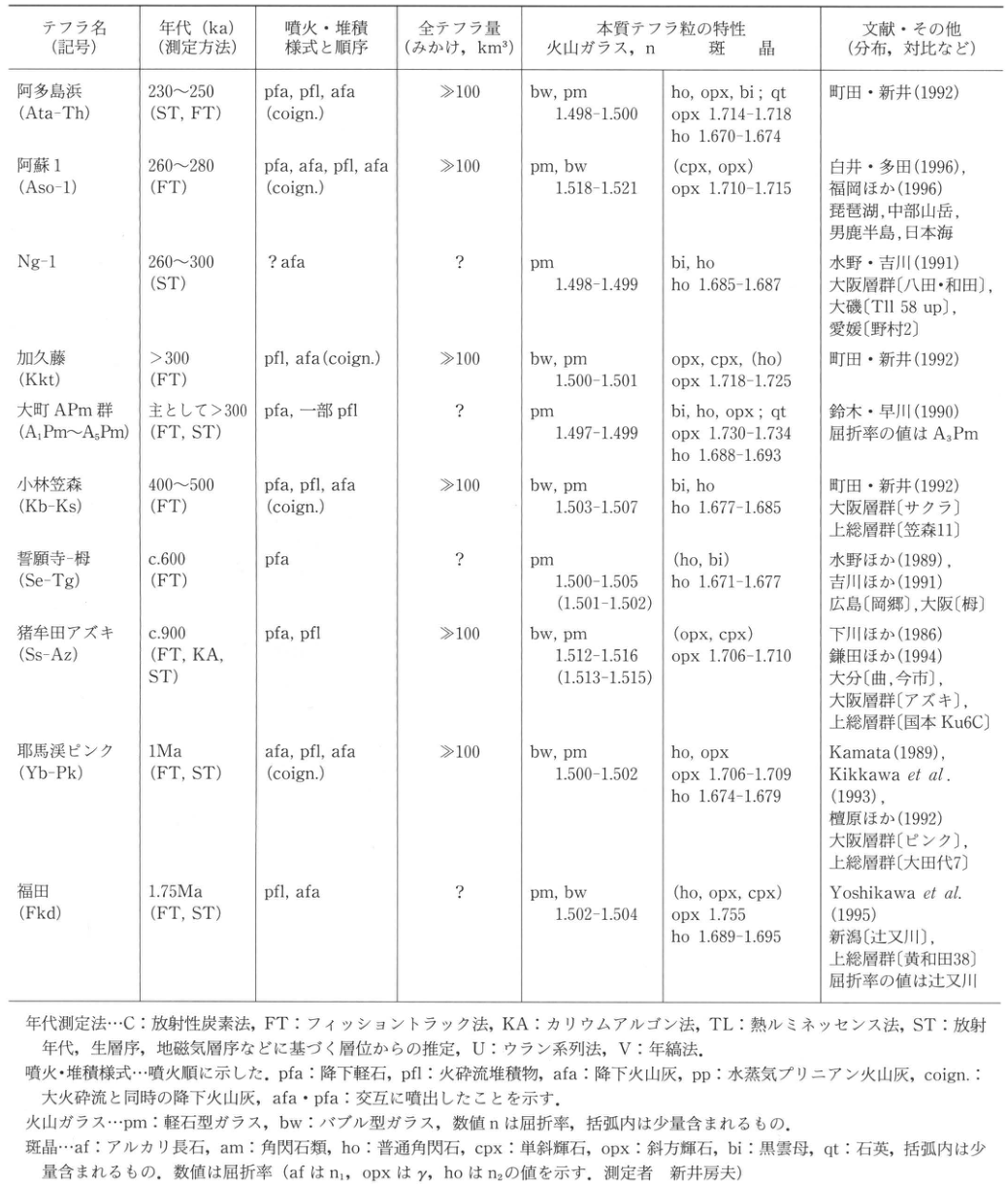
Table 4. Widespread tephras from giant eruptions in Japan during the middle and early Quaternary
Original Japanese lettering
| テフラ名(記号) | 年代 ka(測定方法) | 噴火・堆積様式と順序 | 全テフラ量(みかけ、km³) | 本質テフラ粒:火山ガラス、n | 本質テフラ粒:斑晶 | 文献・その他 |
|---|---|---|---|---|---|---|
| 阿多鳥浜 (Ata-Th) | 230–250 (ST, FT) | pfa, pfl, afa (coign.) | ≫100 | bw, pm; 1.498–1.500 | ho, opx, bi; qt; opx 1.714–1.718; ho 1.670–1.674 | 町田・新井 (1992) |
| 阿蘇1 (Aso-1) | 260–280 (FT) | pfa, afa, pfl, afa (coign.) | ≫100 | pm, bw; 1.518–1.521 | (cpx, opx); opx 1.710–1.715 | 白井・多田 (1996); 福岡ほか (1996)。琵琶湖、中部山岳、男鹿半島、日本海 |
| Ng-1 (Ng-1) | 260–300 (ST) | ? afa | ? | pm; 1.498–1.499 | bi, ho; ho 1.685–1.687 | 水野・吉川 (1991)。大阪層群〔八田・和田〕、大磯〔Tl1 58 up〕、愛媛〔野村2〕 |
| 加久藤 (Kkt) | >300 (FT) | pfl, afa (coign.) | ≫100 | bw, pm; 1.500–1.501 | opx, cpx, (ho); opx 1.718–1.725 | 町田・新井 (1992) |
| 大町APm群 (A₁Pm–A₅Pm) | 主として>300 (FT, ST) | pfa, 一部pfl | ? | pm; 1.497–1.499 | bi, ho, opx; qt; opx 1.730–1.734; ho 1.688–1.693 | 鈴木・早川 (1990)。屈折率の値はA₃Pm |
| 小林笠森 (Kb-Ks) | 400–500 (FT) | pfa, pfl, afa (coign.) | ≫100 | bw, pm; 1.503–1.507 | bi, ho; ho 1.677–1.685 | 町田・新井 (1992)。大阪層群〔サクラ〕、上総層群〔笠森11〕 |
| 誓願寺–栂 (Se-Tg) | c.600 (FT) | pfa | ? | pm; 1.500–1.505 (1.501–1.502) | (ho, bi); ho 1.671–1.677 | 水野ほか (1989); 吉川ほか (1991)。広島〔岡郷〕、大阪〔栂〕 |
| 猪牟田アズキ (Ss-Az) | c.900 (FT, KA, ST) | pfa, pfl | ≫100 | bw, pm; 1.512–1.516 (1.513–1.515) | (opx, cpx); opx 1.706–1.710 | 下川ほか (1986); 鎌田ほか (1994)。大分〔曲、今市〕、大阪層群〔アズキ〕、上総層群〔国本 Ku6C〕 |
| 耶馬渓ピンク (Yb-Pk) | 1 Ma (FT, ST) | afa, pfl, afa (coign.) | ≫100 | bw, pm; 1.500–1.502 | ho, opx; opx 1.706–1.709; ho 1.674–1.679 | Kamata (1989); Kikkawa et al. (1993); 檀原ほか (1992)。大阪層群〔ピンク〕、上総層群〔大田代7〕 |
| 福田 (Fkd) | 1.75 Ma (FT, ST) | pfl, afa | ? | pm, bw; 1.502–1.504 | (ho, opx, cpx); opx 1.755; ho 1.689–1.695 | Yoshikawa et al. (1995)。新潟〔辻又川〕、上総層群〔黄和田38〕。屈折率の値は辻又川 |
表3・4の略記
- 年代測定法:C=放射性炭素法;FT=フィッショントラック法;KA=カリウムアルゴン法;TL=熱ルミネッセンス法;ST=放射年代、生層序、地磁気層序などに基づく層位からの推定;U=ウラン系列法;V=年縞法。
- 噴火・堆積様式:噴火順に示した。pfa=降下軽石;pfl=火砕流堆積物;afa=降下火山灰;pp=水蒸気プリニアン火山灰;coign.=大火砕流と同時の降下火山灰;afa·pfa=交互に噴出したことを示す。
- 火山ガラス:pm=軽石型ガラス;bw=バブル型ガラス。数値nは屈折率。括弧内は少量含まれるもの。
- 斑晶:af=アルカリ長石;am=角閃石類;ho=普通角閃石;cpx=単斜輝石;opx=斜方輝石;bi=黒雲母;qt=石英。括弧内は少量含まれるもの。数値は屈折率(afはn₁、opxはγ、hoはn₂の値を示す。測定者:新井房夫)。
English translation
| Tephra (symbol) | Age, ka (dating method) | Eruption/deposition modes and sequence | Total tephra volume (bulk, km³) | Juvenile tephra: volcanic glass, n | Juvenile tephra: phenocrysts | References and other information |
|---|---|---|---|---|---|---|
| Ata-Torihama (Ata-Th) | 230–250 (ST, FT) | pfa, pfl, afa (coign.) | ≫100 | bw, pm; 1.498–1.500 | ho, opx, bi; qt; opx 1.714–1.718; ho 1.670–1.674 | Machida and Arai (1992) |
| Aso-1 (Aso-1) | 260–280 (FT) | pfa, afa, pfl, afa (coign.) | ≫100 | pm, bw; 1.518–1.521 | (cpx, opx); opx 1.710–1.715 | Shirai and Tada (1996); Fukuoka et al. (1996). Lake Biwa, mountains of central Japan, Oga Peninsula, Sea of Japan |
| Ng-1 (Ng-1) | 260–300 (ST) | ? afa | ? | pm; 1.498–1.499 | bi, ho; ho 1.685–1.687 | Mizuno and Yoshikawa (1991). Osaka Group [Hatta and Wada], Oiso [Tl1 58 up], Ehime [Nomura 2] |
| Kakuto (Kkt) | >300 (FT) | pfl, afa (coign.) | ≫100 | bw, pm; 1.500–1.501 | opx, cpx, (ho); opx 1.718–1.725 | Machida and Arai (1992) |
| Omachi APm tephra group (A₁Pm–A₅Pm) | Mainly >300 (FT, ST) | pfa, partlypfl | ? | pm; 1.497–1.499 | bi, ho, opx; qt; opx 1.730–1.734; ho 1.688–1.693 | Suzuki and Hayakawa (1990). Refractive-index values are for A₃Pm |
| Kobayashi-Kasamori (Kb-Ks) | 400–500 (FT) | pfa, pfl, afa (coign.) | ≫100 | bw, pm; 1.503–1.507 | bi, ho; ho 1.677–1.685 | Machida and Arai (1992). Osaka Group [Sakura], Kazusa Group [Kasamori 11] |
| Seiganji–Toga (Se-Tg) | c.600 (FT) | pfa | ? | pm; 1.500–1.505 (1.501–1.502) | (ho, bi); ho 1.671–1.677 | Mizuno et al. (1989); Yoshikawa et al. (1991). Hiroshima [Okago (岡郷)], Osaka [Toga] |
| Shishimuta-Azuki (Ss-Az) | c.900 (FT, KA, ST) | pfa, pfl | ≫100 | bw, pm; 1.512–1.516 (1.513–1.515) | (opx, cpx); opx 1.706–1.710 | Shimokawa et al. (1986); Kamata et al. (1994). Oita [Magari, Imaichi], Osaka Group [Azuki], Kazusa Group [Kokumoto Ku6C] |
| Yabakei-Pink (Yb-Pk) | 1 Ma (FT, ST) | afa, pfl, afa (coign.) | ≫100 | bw, pm; 1.500–1.502 | ho, opx; opx 1.706–1.709; ho 1.674–1.679 | Kamata (1989); Kikkawa et al. (1993); Danhara et al. (1992). Osaka Group [Pink], Kazusa Group [Otadai 7] |
| Fukuda (Fkd) | 1.75 Ma (FT, ST) | pfl, afa | ? | pm, bw; 1.502–1.504 | (ho, opx, cpx); opx 1.755; ho 1.689–1.695 | Yoshikawa et al. (1995). Niigata [Tsujimatagawa], Kazusa Group [Kiwada 38]. Refractive-index values are for Tsujimatagawa |
Abbreviations for Tables 3 and 4
- Dating methods: C, radiocarbon; FT, fission track; KA, potassium–argon; TL, thermoluminescence; ST, age inferred from stratigraphic position based on radiometric ages, biostratigraphy, magnetostratigraphy, etc.; U, uranium series; V, varve chronology.
- Eruption/deposition modes are listed in eruption order: pfa, pumice fall; pfl, pyroclastic-flow deposit; afa, ash fall; pp, phreatoplinian ash; coign., ash fall contemporaneous with a large pyroclastic flow; afa·pfa, alternating eruptions of the two types.
- Volcanic glass: pm, pumice-type glass; bw, bubble-type glass. Numerical n values are refractive indices. Parentheses indicate minor components.
- Phenocrysts: af, alkali feldspar; am, amphiboles; ho, hornblende; cpx, clinopyroxene; opx, orthopyroxene; bi, biotite; qt, quartz. Parentheses indicate minor components. Numerical values are refractive indices (n₁ for af, γ for opx, and n₂ for ho; measured by Fusao Arai).
Ng-1の対比欄、大磯[Tl1 58 up] — 細い縦画が判別しづらく、Tl1の末尾は数字1/小文字lの可能性が残る。原図も併載し、符号の読みを確定していない。
p19_17.png
PDF 19 · Original p. xiv
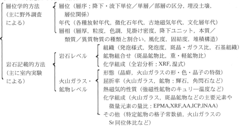
Methods of tephra identification: stratigraphic position, age and facies, and textures, morphology, refractive indices and chemical compositions of rocks, glass and minerals.
Original Japanese lettering
| 方法 | レベル・項目 | 観察・分析する特徴 |
|---|---|---|
| 層位学的方法(主に野外調査による) | 層位 | 層序:降下・流下単位/単層/部層の区分、埋没土壌、層位関係 |
| 同上 | 年代 | 各種放射年代、微化石年代、古地磁気年代、文化層年代 |
| 同上 | 層相 | 層厚、粒度、色調、見掛け密度、降下ユニット、本質/類質/異質物質の種類と割合い、風化度、固結度、堆積構造 |
| 岩石記載的方法(主に室内実験による) | 岩石レベル:組織 | 発泡様式、発泡度、斑晶・ガラス比、石基組織 |
| 同上 | 岩石レベル:鉱物組合せ | 斑晶鉱物比、重・軽鉱物比 |
| 同上 | 岩石レベル:化学組成 | 全岩分析:XRF、湿式 |
| 同上 | 火山ガラス・鉱物レベル:形態 | 晶癖、火山ガラスの形・色・晶子の特徴 |
| 同上 | 火山ガラス・鉱物レベル:屈折率 | 火山ガラス、鉱物:輝石、角閃石など |
| 同上 | 火山ガラス・鉱物レベル:熱磁気的性質 | 強磁性鉱物のキュリー温度など |
| 同上 | 火山ガラス・鉱物レベル:化学組成 | 火山ガラス、斑晶鉱物などの主要元素や微量元素の量比:EPMA、XRF、AA、ICP、INAA |
| 同上 | 火山ガラス・鉱物レベル:その他 | 特定鉱物の格子常数値、火山ガラスのSr同位体比など |
English translation
| Method | Level or criterion | Features observed or analyzed |
|---|---|---|
| Stratigraphic methods (mainly field investigation) | Stratigraphic position | Stratigraphy: distinction of fall and flow units, beds, and members; buried soils; stratigraphic relationships |
| Same | Age | Various radiometric ages, microfossil ages, paleomagnetic ages, and ages of cultural horizons |
| Same | Facies | Thickness, grain size, color, apparent density, fallout units, types and proportions of juvenile/accessory/accidental material, weathering, induration, and sedimentary structures |
| Petrographic methods (mainly laboratory investigation) | Rock level: texture | Vesiculation style, vesicularity, phenocryst/glass ratio, and groundmass texture |
| Same | Rock level: mineral assemblage | Ratios of phenocryst minerals and of heavy to light minerals |
| Same | Rock level: chemical composition | Whole-rock analysis: XRF and wet-chemical methods |
| Same | Volcanic-glass and mineral level: morphology | Crystal habit; shape, color, and crystallite characteristics of volcanic glass |
| Same | Volcanic-glass and mineral level: refractive index | Volcanic glass and minerals, including pyroxenes and amphiboles |
| Same | Volcanic-glass and mineral level: thermomagnetic properties | Curie temperatures of ferromagnetic minerals, etc. |
| Same | Volcanic-glass and mineral level: chemical composition | Relative abundances of major and trace elements in volcanic glass and phenocryst minerals: EPMA, XRF, AA, ICP, INAA |
| Same | Volcanic-glass and mineral level: other properties | Lattice constants of particular minerals, Sr isotope ratios of volcanic glass, etc. |
p23_18.png
PDF 23 · Original p. 2
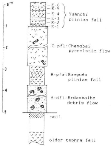
Stratigraphy of Baitoushan eruptive deposits with a 0–5m thickness scale
Original Japanese lettering
0m; 1; 2; 3; 4; 5 E-6; E-5; E-4; E-3; E-2; E-1 — Yuanchi plinian fall C-pfl: Changbai pyroclstic flow B-pfa: Baegudu plinian fall A-dfl: Erdaobaihe debris flow soil; older tephra fall
English translation
0m; 1; 2; 3; 4; 5 E-6; E-5; E-4; E-3; E-2; E-1 — Yuanchi plinian fall C-pfl: Changbai pyroclstic flow B-pfa: Baegudu plinian fall A-dfl: Erdaobaihe debris flow soil; older tephra fall
p24_19.png
PDF 24 · Original p. 3
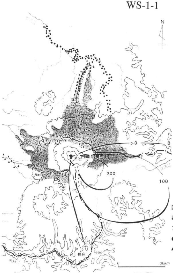
Isopachs of fallout tephra and distributions of pyroclastic-flow, mudflow, and rock-avalanche deposits around Changbai Mountain
Original Japanese lettering
WS-1-1; N; 白頭山(長白山); 圓池; 長白; 鴨緑江; 豆満江; B; >0; 100; 200; 1000; 1500; 2000; 0; 30km
English translation
WS-1-1; N; Baitoushan (Changbai Mountain); Yuanchi (圓池); Changbai; Yalu River; Tumen River; B; >0; 100; 200; 1000; 1500; 2000; 0; 30km
豆満江 — 地図の薄い河川名は低コントラストで一部不鮮明;読みは暫定。
p24_20.png
PDF 24 · Original p. 3
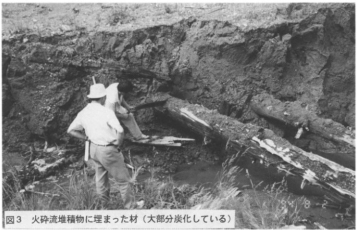
Two people examining large charred logs at an outcrop
Original Japanese lettering
図3 火砕流堆積物に埋まった材(大部分炭化している)
English translation
Figure 3. Wood buried in the pyroclastic-flow deposit (mostly charred).
p25_21.png
PDF 25 · Original p. 4
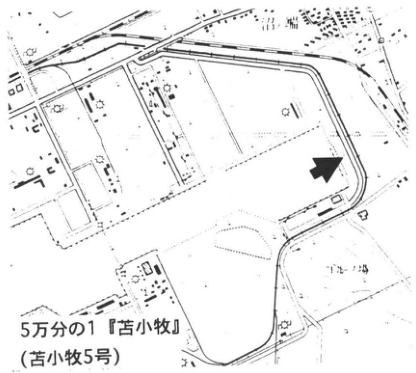
Outcrop indicated by an arrow in the eastern part of Tomakomai Port
Original Japanese lettering
5万分の1『苫小牧』(苫小牧5号); ゴルフ場
English translation
1:50,000 “Tomakomai” map sheet (Tomakomai No. 5); golf course
p25_22.png
PDF 25 · Original p. 4
Thin Baitoushan–Tomakomai tephra within thick peat and Tarumae pumice layers
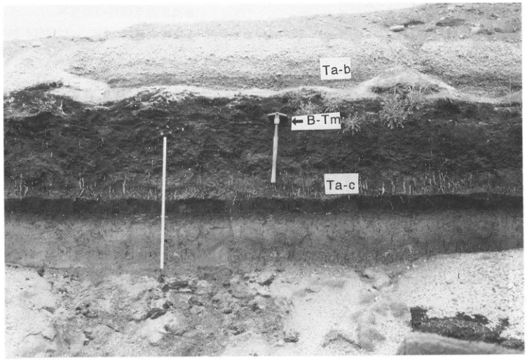
Original Japanese lettering
Ta-b; ←B-Tm; Ta-c
English translation
Ta-b; ←B-Tm; Ta-c
p26_23.png
PDF 26 · Original p. 5
Topographic map showing the wetland plant community and outcrop at Tashirotai
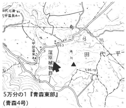
Original Japanese lettering
田代元湯; 田代平温泉; 八甲田温泉; 湿原植物群; 田代平; 駒川; 563; 596.1; 5万分の1『青森東部』(青森4号)
English translation
Tashiro Motoyu; Tashirotai hot spring; Hakkoda hot spring; wetland plant community; Tashirotai; Koma River (駒川); 563; 596.1; 1:50,000 “Aomori Tobu” (Aomori No. 4)
p26_24.png
PDF 26 · Original p. 5
Two volcanic-ash layers, B-Tm and To-a, separated by thin peat
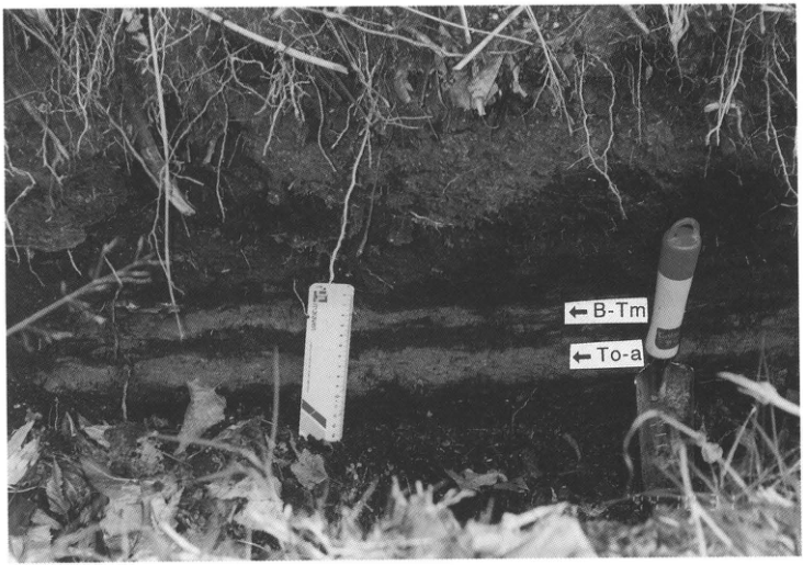
Original Japanese lettering
←B-Tm; ←To-a
English translation
←B-Tm; ←To-a
p27_25.png
PDF 27 · Original p. 6
Topography of Takeshima and outcrop location near Funakura Port
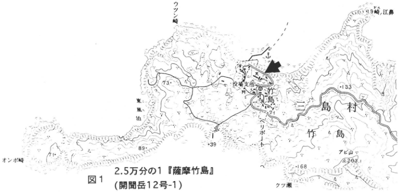
Original Japanese lettering
図1; 2.5万分の1『薩摩竹島』(開聞岳12号-1); 三島村; 竹島; 役場支所; ヘリポート; アビ山; オンボ崎; ウツン崎; 東風泊; クツ瀬; 71; 73; 89; 39; 133; 168; 203.1
English translation
Figure 1; 1:25,000 “Satsuma Takeshima” (Kaimondake No. 12-1); Mishima Village; Takeshima; village office branch; heliport; Abi-yama (アビ山); Onbo Point (オンボ崎); Utsun Point (ウツン崎); 東風泊 [reading uncertain]; Kutsu-se (クツ瀬); 71; 73; 89; 39; 133; 168; 203.1
島東北端の小地名 — 小さい文字が不鮮明で全字を確定できない。(未確定候補 / Unconfirmed candidate: [判読不明]崎,江鼻)
p28_26.png
PDF 28 · Original p. 7
Funakura pyroclastic-flow and Takeshima pyroclastic-flow deposits overlying Funakura pumice fall
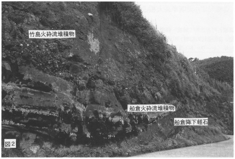
Original Japanese lettering
図2; 竹島火砕流堆積物; 船倉火砕流堆積物; 船倉降下軽石
English translation
Figure 2; Takeshima pyroclastic-flow deposit; Funakura pyroclastic-flow deposit; Funakura pumice fall
p28_27.png
PDF 28 · Original p. 7
Outcrop where Takeshima pyroclastic flow unconformably overlies Funakura pumice fall and Funakura and Nagase pyroclastic flows
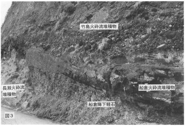
Original Japanese lettering
図3; 竹島火砕流堆積物; 長瀬火砕流堆積物; 船倉火砕流堆積物; 船倉降下軽石
English translation
Figure 3; Takeshima pyroclastic-flow deposit; Nagase pyroclastic-flow deposit; Funakura pyroclastic-flow deposit; Funakura pumice fall
p29_28.png
PDF 29 · Original p. 8
Outcrop location near Onejime at left and photograph of the stratigraphy of Kikai-Akahoya eruptive deposits at right
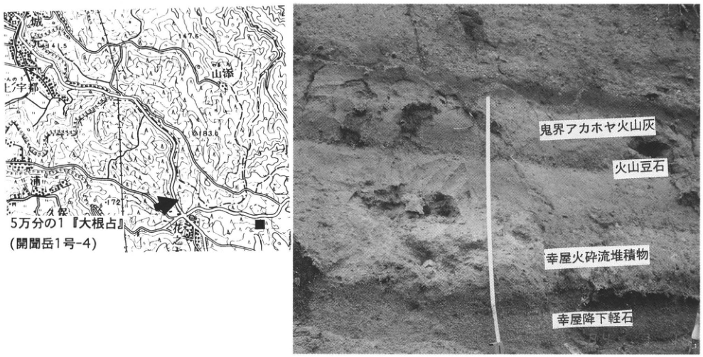
Original Japanese lettering
5万分の1『大根占』(開聞岳1号-4); 城; 上宇都; 山添; 花之本; 浦; 久保; 41.5; 77.6; 83.6; 172; 鬼界アカホヤ火山灰; 火山豆石; 幸屋火砕流堆積物; 幸屋降下軽石
English translation
1:50,000 “Onejime” (Kaimondake No. 1-4); 城; 上宇都; 山添; Hananomoto (花之本); 浦; 久保 [small place-name readings unverified]; 41.5; 77.6; 83.6; 172; Kikai-Akahoya ash; accretionary lapilli; Koya pyroclastic-flow deposit; Koya pumice fall
p30_29.png
PDF 30 · Original p. 9
Topographic map near Minashiro showing the outcrop along the 鬼付女 River
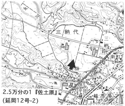
Original Japanese lettering
2.5万分の1『佐土原』(延岡12号-2); 三納代; 一丁田; 二丁田; 新町; 鬼付女; 一池; 下城島; 84; 4.90
English translation
1:25,000 “Sadowara” (Nobeoka No. 12-2); Minashiro (三納代); 一丁田; 二丁田; 新町; 鬼付女; 一池; 下城島 [place-name readings unverified]; 84; 4.90
p30_30.png
PDF 30 · Original p. 9
Thick outcrop of marine clay and sand with intercalated water-laid K-Ah
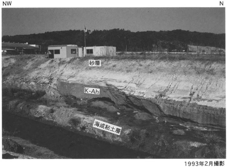
Original Japanese lettering
NW; N; 砂層; K-Ah; 海成粘土層; 1m; 1993年2月撮影
English translation
NW; N; sand layer; K-Ah; marine clay layer; 1m; photographed in February 1993
p31_31.png
PDF 31 · Original p. 10
Topographic map showing the Nakamura River outcrop beneath the Shinkansen bridge
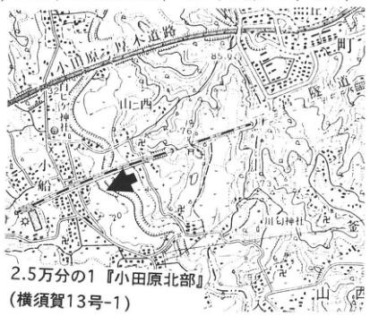
Original Japanese lettering
2.5万分の1『小田原北部』(横須賀13号-1); 東海道; 小田原厚木道路; 中村川; 山西; 小船; 二宮; 山神社; 32.11; 85.9; 76; 20; 73.1
English translation
1:25,000 “Odawara Hokubu” (Yokosuka No. 13-1); Tokaido; Odawara–Atsugi Road; Nakamura River; Yamanishi; Obune; Ninomiya; mountain shrine (山神社); 32.11; 85.9; 76; 20; 73.1
p31_32.png
PDF 31 · Original p. 10
Stratigraphic column from 13.8 to 25.5m elevation showing K-Ah and four radiocarbon dates
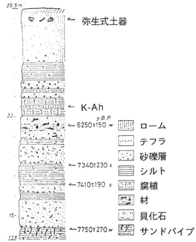
Original Japanese lettering
25.5m; 20; 15; 13.8; 弥生式土器; K-Ah; y.B.P.; 6250±150 w; 7340±230 s; 7410±190 s; 7750±270 w; ローム; テフラ; 砂礫層; シルト; 腐植; 材; 貝化石; サンドパイプ
English translation
25.5m; 20; 15; 13.8; Yayoi pottery; K-Ah; y.B.P.; 6250±150 w; 7340±230 s; 7410±190 s; 7750±270 w; loam; tephra; sand and gravel layer; silt; humus; wood; molluscan fossils; sand pipes
p31_33.png
PDF 31 · Original p. 10
Geological section of marine strata and uplifted terraces along the Nakamura River
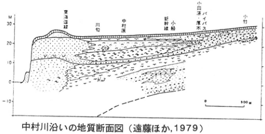
Original Japanese lettering
M; 30; 20; 10; 0; -10; 東海道線; 川勾; 中村原; 新幹線; 小船; 小田原・厚木バイパス; 小竹; 0; 500m; 中村川沿いの地質断面図(遠藤ほか,1979)
English translation
M; 30; 20; 10; 0; -10; Tokaido railway; Kawawa (川勾); Nakamurahara; Shinkansen; Obune; Odawara–Atsugi bypass; Odake (小竹); 0; 500m; geological section along the Nakamura River (遠藤ほか, 1979)
断面内の斜体地層略号 — 小さく低解像度で一部の文字を確定できない。(未確定候補 / Unconfirmed candidate: [判読不明])
p32_34.png
PDF 32 · Original p. 11
Location of the 喜子川 archaeological-site outcrop near Tomori
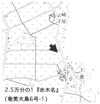
Original Japanese lettering
崎原; 土盛; 38; 2.5万分の1『赤木名』(奄美大島6号-1)
English translation
Sakibaru (崎原); Tomori; 38; 1:25,000 “Akakina” (Amami Oshima No. 6-1)
p32_35.png
PDF 32 · Original p. 11
Excavated exposure of K-Ah and the maji layer below artifact-bearing sand
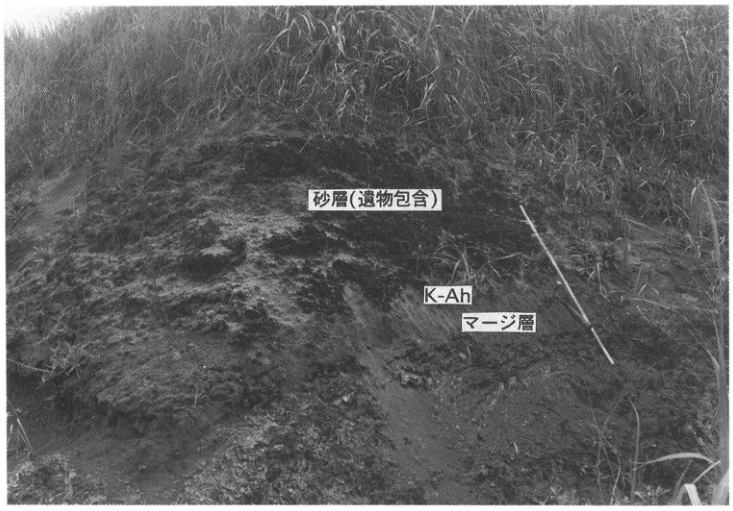
Original Japanese lettering
砂層(遺物包含); K-Ah; マージ層
English translation
sand layer (artifact-bearing); K-Ah; maji layer
p33_36.png
PDF 33 · Original p. 12
Outcrop identifiers and U-2 isopachs and grain-size isopleths on Ulleung Island
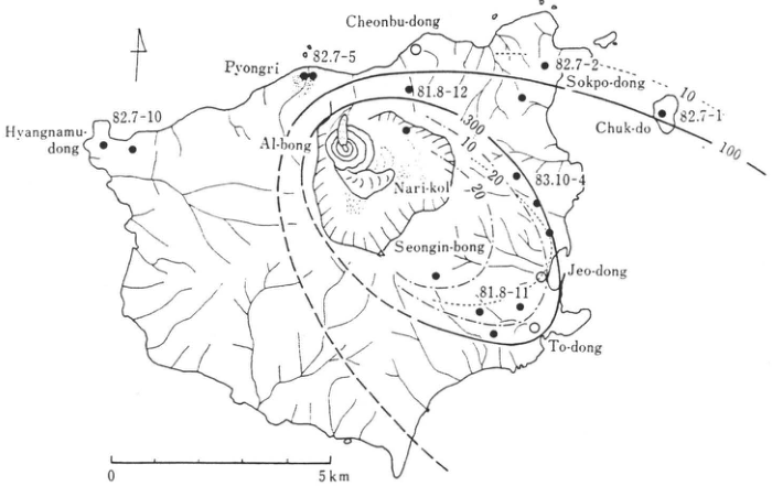
Original Japanese lettering
Cheonbu-dong; Pyongri; Hyangnamu-dong; Al-bong; Nari-kol; Seongin-bong; Sokpo-dong; Chuk-do; Jeo-dong; To-dong; 82.7-10; 82.7-5; 81.8-12; 82.7-2; 82.7-1; 83.10-4; 81.8-11; 300; 100; 10; 20; 0; 5km
English translation
Cheonbu-dong; Pyongri; Hyangnamu-dong; Al-bong; Nari-kol; Seongin-bong; Sokpo-dong; Chuk-do; Jeo-dong; To-dong; 82.7-10; 82.7-5; 81.8-12; 82.7-2; 82.7-1; 83.10-4; 81.8-11; 300; 100; 10; 20; 0; 5km
p34_37.png
PDF 34 · Original p. 13
Stratigraphic correlation of seven Ulleung tephras with K-Ah and AT
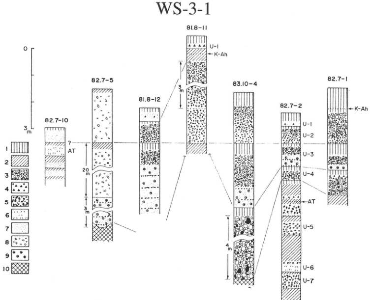
Original Japanese lettering
WS-3-1; 82.7-10; 82.7-5; 81.8-12; 81.8-11; 83.10-4; 82.7-2; 82.7-1; U-1; U-2; U-3; U-4; U-5; U-6; U-7; K-Ah; AT; ?; 0; 3m; 20m; 3m; 4m; 1; 2; 3; 4; 5; 6; 7; 8; 9; 10
English translation
WS-3-1; 82.7-10; 82.7-5; 81.8-12; 81.8-11; 83.10-4; 82.7-2; 82.7-1; U-1; U-2; U-3; U-4; U-5; U-6; U-7; K-Ah; AT; ?; 0; 3m; 20m; 3m; 4m; 1; 2; 3; 4; 5; 6; 7; 8; 9; 10
p34_38.png
PDF 34 · Original p. 13
Researchers examining an outcrop containing U-2 and U-3
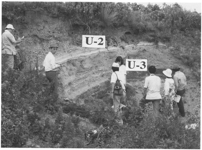
Original Japanese lettering
U-2; U-3
English translation
U-2; U-3
p35_39.png
PDF 35 · Original p. 14
Location of the Torihama Shell Midden and stratigraphic relationships of U-Oki, K-Ah, and Jomon pottery
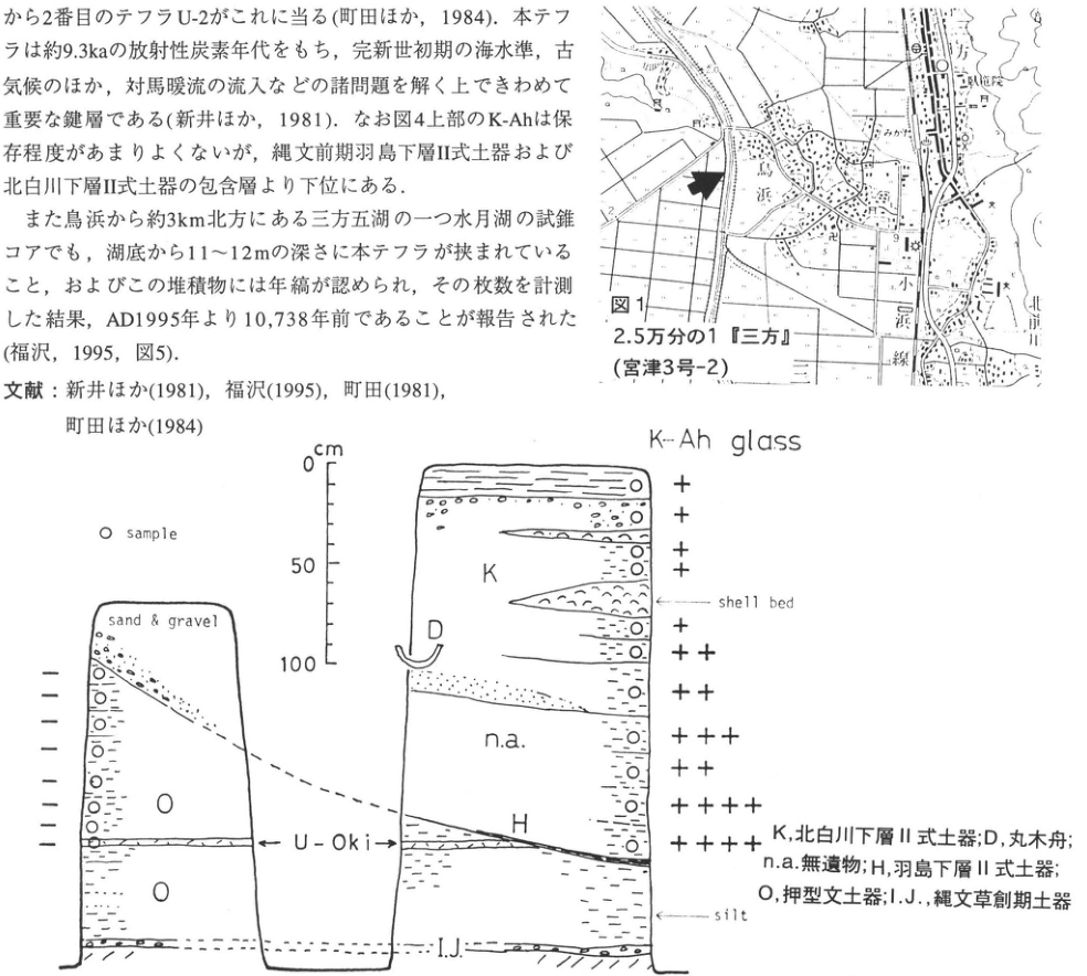
Original Japanese lettering
図1; 2.5万分の1『三方』(宮津3号-2); 鳥浜; 三方; 三島; 北前川; 小浜線; 2; 9 cm; 0; 50; 100; K-Ah glass; ○ sample; sand & gravel; shell bed; silt; U-Oki; K; D; n.a.; H; O; I.J. K,北白川下層Ⅱ式土器;D,丸木舟;n.a.,無遺物;H,羽島下層Ⅱ式土器;O,押型文土器;I.J.,縄文草創期土器 左柱状図:上から-,-,-,-,-,-,-,-(8点) 右柱状図:上から+,+,+,+,+,++,++,+++,++,++++,++++(11点)
English translation
Figure 1; 1:25,000 “Mikata” (Miyazu No. 3-2); Torihama; Mikata; Mishima; 北前川 [reading unverified]; Obama railway; 2; 9 cm; 0; 50; 100; K-Ah glass; ○ sample; sand & gravel; shell bed; silt; U-Oki; K; D; n.a.; H; O; I.J. K, Kitashirakawa Lower II-type pottery; D, dugout canoe; n.a., no artifacts; H, Hashima Lower II-type pottery; O, impressed-pattern pottery; I.J., Incipient Jomon pottery Left column, top downward: −, −, −, −, −, −, −, − (8 points). Right column, top downward: +, +, +, +, +, ++, ++, +++, ++, ++++, ++++ (11 points).
p36_40.png
PDF 36 · Original p. 15
Thin U-Oki ash layer in an excavation wall
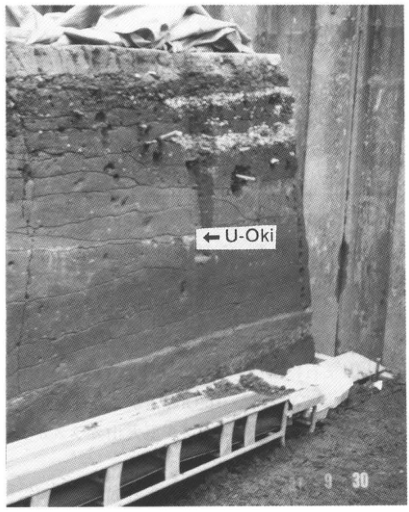
Original Japanese lettering
←U-Oki; 9 30
English translation
←U-Oki; 9 30
写真右下の日付 — 左側の年・月部分は不鮮明で読み切れない。
p36_41.png
PDF 36 · Original p. 15
Column with a 0–200cm scale showing K-Ah, sand, clay, mud, U-Oki, and Jomon pottery
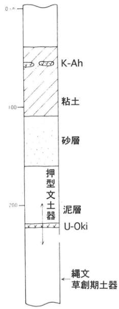
Original Japanese lettering
0cm; 100; 200; K-Ah; 粘土; 砂層; 押型文土器; 泥層; U-Oki; 縄文草創期土器
English translation
0cm; 100; 200; K-Ah; clay; sand layer; impressed-pattern pottery; mud layer; U-Oki; Incipient Jomon pottery
p36_42.png
PDF 36 · Original p. 15
Correlation of four Lake Suigetsu cores with depths, tephras, varves, and tentative climatic horizons
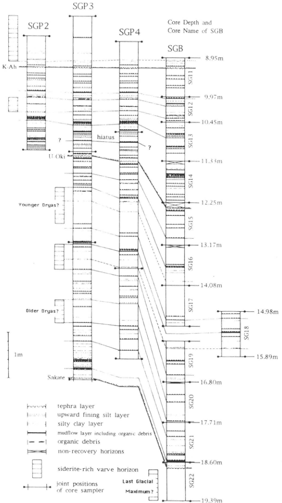
Original Japanese lettering
SGP2; SGP3; SGP4; SGB; Core Depth and Core Name of SGB K-Ah; U-Oki; Sakate; hiatus; ?; Younger Dryas?; Older Dryas?; Last Glacial Maximum?; 1m SG11: 8.95m–9.97m; SG12: 9.97m–10.45m; SG13: 10.45m–11.33m; SG14: 11.33m–12.25m; SG15: 12.25m–13.17m; SG16: 13.17m–14.08m; SG17: 14.08m–14.98m; SG18: 14.98m–15.89m; SG19: 15.89m–16.80m; SG20: 16.80m–17.71m; SG21: 17.71m–18.60m; SG22: 18.60m–19.39m tephra layer; upward fining silt layer; silty clay layer; mudflow layer including organic debris; organic debris; non-recovery horizons; siderite-rich varve horizon; joint positions of core sampler
English translation
SGP2; SGP3; SGP4; SGB; Core Depth and Core Name of SGB K-Ah; U-Oki; Sakate; hiatus; ?; Younger Dryas?; Older Dryas?; Last Glacial Maximum?; 1m SG11: 8.95m–9.97m; SG12: 9.97m–10.45m; SG13: 10.45m–11.33m; SG14: 11.33m–12.25m; SG15: 12.25m–13.17m; SG16: 13.17m–14.08m; SG17: 14.08m–14.98m; SG18: 14.98m–15.89m; SG19: 15.89m–16.80m; SG20: 16.80m–17.71m; SG21: 17.71m–18.60m; SG22: 18.60m–19.39m tephra layer; upward fining silt layer; silty clay layer; mudflow layer including organic debris; organic debris; non-recovery horizons; siderite-rich varve horizon; joint positions of core sampler
p37_43.png
PDF 37 · Original p. 16
Outcrop locations southwest and north of Ninokura Dam
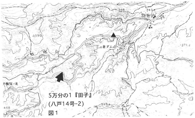
Original Japanese lettering
図1; 5万分の1『田子』(八戸14号-2); 二ノ倉ダム; 羽井内; 迷川; 590; 398; 340.0; 375.1; 371.2; 502.9; 517.3; 468
English translation
Figure 1; 1:50,000 “Takko” (Hachinohe No. 14-2); Ninokura Dam; 羽井内; 迷川 [readings unverified]; 590; 398; 340.0; 375.1; 371.2; 502.9; 517.3; 468
p38_44.png
PDF 38 · Original p. 17
Valley-filling To-Of and To-H and their immediately underlying To-BP1 and To-HP layers
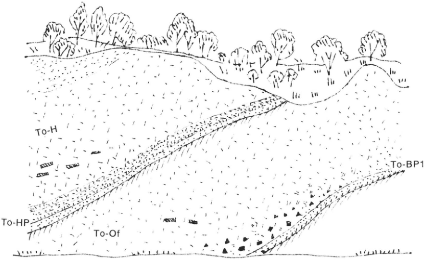
Original Japanese lettering
To-H; To-HP; To-Of; To-BP1
English translation
To-H; To-HP; To-Of; To-BP1
p38_45.png
PDF 38 · Original p. 17
Stratified exposure of curved To-Nk, To-Nb, and To-Cu layers overlying To-H
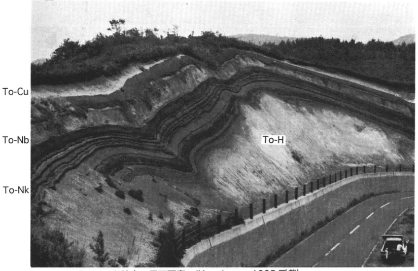
Original Japanese lettering
To-Cu; To-Nb; To-Nk; To-H
English translation
To-Cu; To-Nb; To-Nk; To-H
p39_46.png
PDF 39 · Original p. 18
Outcrop location in the sea cliff east of Shibushi Port
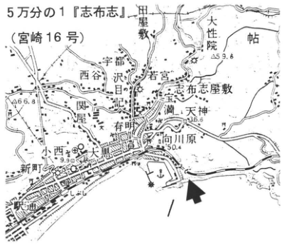
Original Japanese lettering
5万分の1『志布志』(宮崎16号); 田畦敷; 大性院; 帖; 宇都; 西谷; 沢目; 若宮; 宝満; 志布志屋敷; 天神; 向川原; 有明; 関屋; 小西; 大黒; 新町; 内田; 59.6; 66.8; 36.6; 50.4; 9.9
English translation
1:50,000 “Shibushi” (Miyazaki No. 16); 田畦敷; 大性院; 帖; 宇都; 西谷; 沢目; 若宮; 宝満; 志布志屋敷; 天神; 向川原; 有明; 関屋; 小西; 大黒; 新町; 内田 [local place-name readings unverified]; 59.6; 66.8; 36.6; 50.4; 9.9
p39_47.png
PDF 39 · Original p. 18
Sea cliff of thick A-Ito overlying stratified A-Os
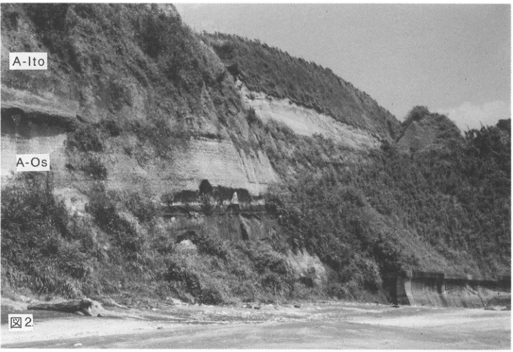
Original Japanese lettering
図2; A-Ito; A-Os
English translation
Figure 2; A-Ito; A-Os
p40_48.png
PDF 40 · Original p. 19
A-Os isopachs and distributions of Ito and Tsumaya pyroclastic flows in southern Kyushu
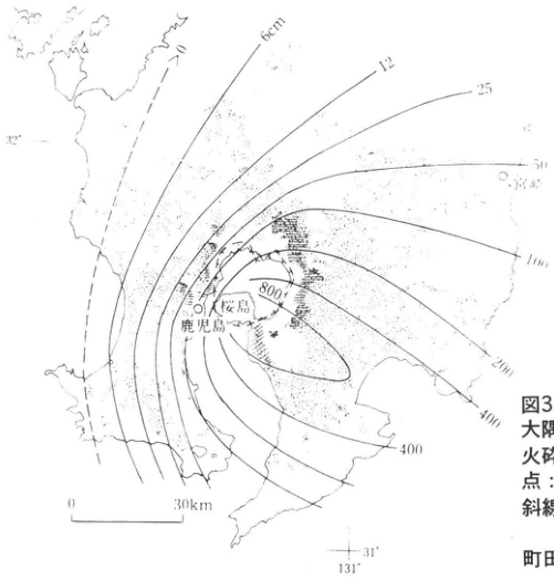
Original Japanese lettering
6cm; 12; 25; 50; 100; 200; 400; 400; 800; >0; 鹿児島; 桜島; 宮崎; 32°; 31°; 131°; 0; 30km
English translation
6cm; 12; 25; 50; 100; 200; 400; 400; 800; >0; Kagoshima; Sakurajima; Miyazaki; 32°; 31°; 131°; 0; 30km
p40_49.png
PDF 40 · Original p. 19
Outcrop of K-Tz, A-Fk, A-Iw, and A-Os above Ata welded tuff
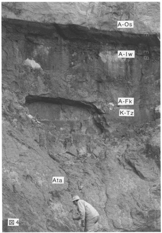
Original Japanese lettering
図4; A-Os; A-Iw; A-Fk; K-Tz; Ata
English translation
Figure 4; A-Os; A-Iw; A-Fk; K-Tz; Ata
p41_50.png
PDF 41 · Original p. 20
Outcrop location near Ogawa at the Kochi–Ehime prefectural boundary
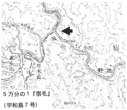
Original Japanese lettering
5万分の1『宿毛』(宇和島7号); 小川; 野地; 東台地; 草木藪; 63; 62.12; 38.0; 25; 302.8
English translation
1:50,000 “Sukumo” (Uwajima No. 7); Ogawa; 野地; 東台地; 草木藪 [readings unverified]; 63; 62.12; 38.0; 25; 302.8
p41_51.png
PDF 41 · Original p. 20
Schematic outcrop section of K-Ah and AT separated by talus
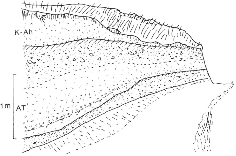
Original Japanese lettering
K-Ah; AT; 1m; P
English translation
K-Ah; AT; 1m; P
p42_52.png
PDF 42 · Original p. 21
Outcrop location on the left bank of the Sakawa River at Oguchi Bridge
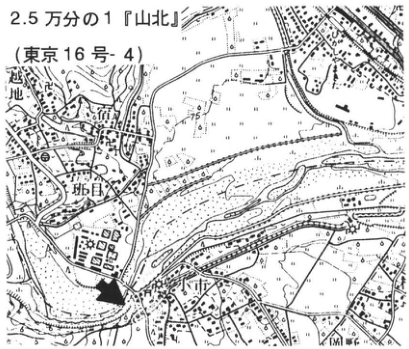
Original Japanese lettering
2.5万分の1『山北』(東京16号-4); 行沢; 班目; 75; 110
English translation
1:25,000 “Yamakita” (Tokyo No. 16-4); 行沢; 班目 [readings unverified]; 75; 110
p42_53.png
PDF 42 · Original p. 21
Schematic section of Older Fuji tephra containing AT above Hakone pyroclastic flow, with Gotemba mudflow at the top
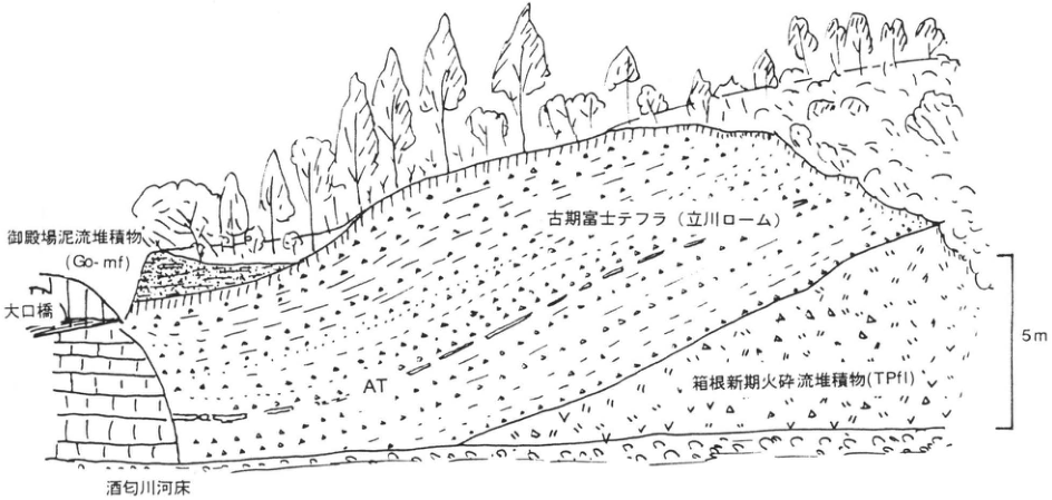
Original Japanese lettering
御殿場泥流堆積物(Go-mf); 大口橋; 古期富士テフラ(立川ローム); AT; 箱根新期火砕流堆積物(TPfl); 酒匂川河床; 5m
English translation
Gotemba mudflow deposit (Go-mf); Oguchi Bridge; Older Fuji tephra (Tachikawa Loam); AT; Hakone younger pyroclastic-flow deposit (TPfl); Sakawa River bed; 5m
p43_54.png
PDF 43 · Original p. 22
Location of site A near Nogawa Bridge
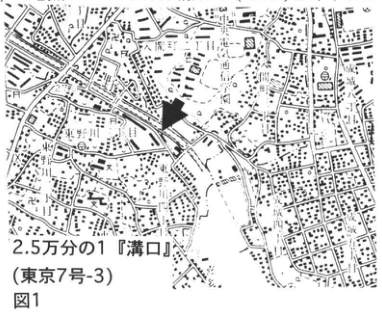
Original Japanese lettering
図1; 2.5万分の1『溝口』(東京7号-3)
English translation
Figure 1; 1:25,000 “Mizonokuchi” (Tokyo No. 7-3)
p43_55.png
PDF 43 · Original p. 22
Correlation of stratigraphic columns and pollen zones at sites A and B using AT
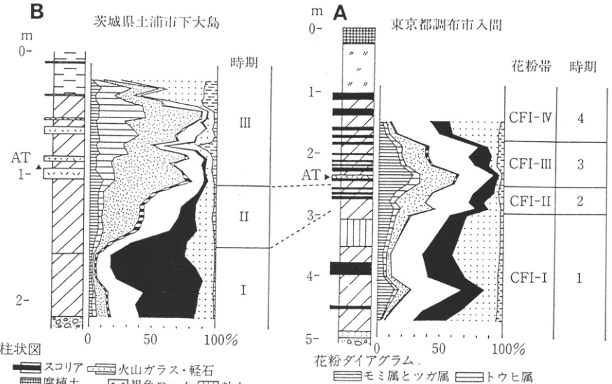
Original Japanese lettering
B:茨城県土浦市下大島; m; 0; 1; 2; AT; 時期:Ⅲ,Ⅱ,Ⅰ; 0,50,100% A:東京都調布市入間; m; 0; 1; 2; 3; 4; 5; AT; 花粉帯・時期:CFI-Ⅳ—4,CFI-Ⅲ—3,CFI-Ⅱ—2,CFI-Ⅰ—1; 0,50,100% 柱状図:スコリア,火山ガラス・軽石,腐植土,褐色ローム,粘土,泥炭質堆積物,砂,礫,凝灰質シルト 花粉ダイアグラム:モミ属とツガ属,トウヒ属,マツ属,カラマツ属かトガサワラ属,コナラ属コナラ亜属,ハンノキ属,カバノキ属,その他の木本花粉
English translation
B: Shimo-oshima, Tsuchiura City, Ibaraki Prefecture; m; 0; 1; 2; AT; phases: III, II, I; 0, 50, 100% A: Irima, Chofu City, Tokyo; m; 0; 1; 2; 3; 4; 5; AT; pollen zones and phases: CFI-IV—4, CFI-III—3, CFI-II—2, CFI-I—1; 0, 50, 100% Stratigraphic column: scoria; volcanic glass and pumice; humic soil; brown loam; clay; peaty deposits; sand; gravel; tuffaceous silt Pollen diagram: Abies and Tsuga; Picea; Pinus; Larix or Pseudotsuga; Quercus subgenus Quercus; Alnus; Betula; other woody pollen
p44_56.png
PDF 44 · Original p. 23
Abundances of diatom groups and valve numbers per gram of dry sediment before and after AT
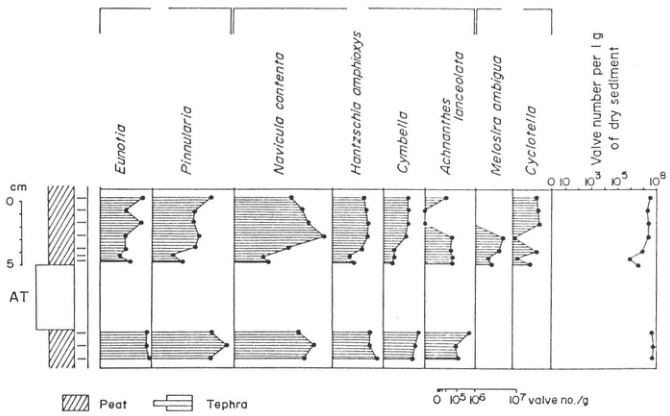
Original Japanese lettering
Eunotia; Pinnularia; Navicula contenta; Hantzschia amphioxys; Cymbella; Achnanthes lanceolata; Melosira ambigua; Cyclotella; Valve number per 1g of dry sediment; 0; 10; 10³; 10⁵; 10⁸; cm; 0; 5; AT; Peat; Tephra; 0; 10⁵; 10⁶; 10⁷ valve no./g
English translation
Eunotia; Pinnularia; Navicula contenta; Hantzschia amphioxys; Cymbella; Achnanthes lanceolata; Melosira ambigua; Cyclotella; Valve number per 1g of dry sediment; 0; 10; 10³; 10⁵; 10⁸; cm; 0; 5; AT; Peat; Tephra; 0; 10⁵; 10⁶; 10⁷ valve no./g
p44_57.png
PDF 44 · Original p. 23
AT fallout at 24,000 years B.P. and changes in upland and valley-floor plant communities
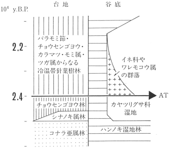
Original Japanese lettering
10⁴ y.B.P.; 台地; 谷底; 2.2; 2.4; AT バラモミ節・チョウセンゴヨウ・カラマツ・モミ属・ツガ属からなる冷温帯針葉樹林 イネ科やワレモコウ属の群落; チョウセンゴヨウ林; シナノキ属林; コナラ亜属林; カヤツリグサ科湿地; ハンノキ湿地林
English translation
10⁴ y.B.P.; upland; valley floor; 2.2; 2.4; AT Cool-temperate coniferous forest comprising Baramomi-section spruce (バラモミ節), Korean pine, larch, Abies, and Tsuga. Communities of Poaceae and Sanguisorba; Korean-pine forest; Tilia forest; Quercus-subgenus forest; Cyperaceae wetland; Alnus wetland forest.
p45_58.png
PDF 45 · Original p. 24
Quarry outcrop location northeast of Shoro Station
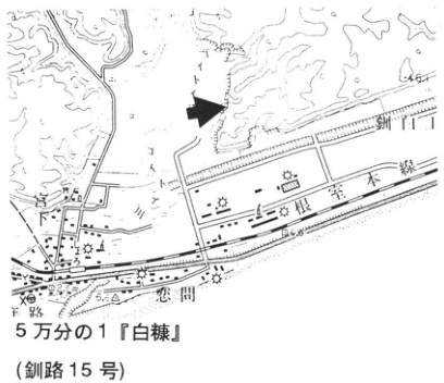
Original Japanese lettering
5万分の1『白糠』(釧路15号); 根室本線; 庶路; 65; 54
English translation
1:50,000 “Shiranuka” (Kushiro No. 15); Nemuro Main Line; Shoro; 65; 54
p45_59.png
PDF 45 · Original p. 24
Section of Kc-4, Aso-4, Kt-8, Spfa-1, and Kc-Sr above the Otanoshike Formation
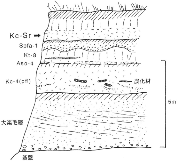
Original Japanese lettering
Kc-Sr; Spfa-1; Kt-8; Aso-4; Kc-4(pfl); 炭化材; 大楽毛層; 基盤; 5m
English translation
Kc-Sr; Spfa-1; Kt-8; Aso-4; Kc-4(pfl); charred wood; Otanoshike Formation; basement; 5m
p46_60.png
PDF 46 · Original p. 25
Two reference outcrops west and east of Koshimizu Town
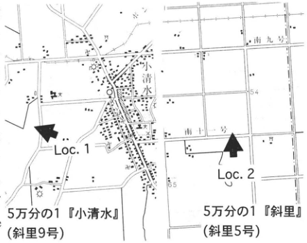
Original Japanese lettering
Loc.1; Loc.2; 小清水; 南九号; 南十一号; 54; 65; 5万分の1『小清水』(斜里9号); 5万分の1『斜里』(斜里5号)
English translation
Loc.1; Loc.2; Koshimizu; Minami 9-go; Minami 11-go; 54; 65; 1:50,000 “Koshimizu” (Shari No. 9); 1:50,000 “Shari” (Shari No. 5)
p46_61.png
PDF 46 · Original p. 25
Valley filling by KP I–KSr and repeated ash, pumice, and accretionary-lapilli layers
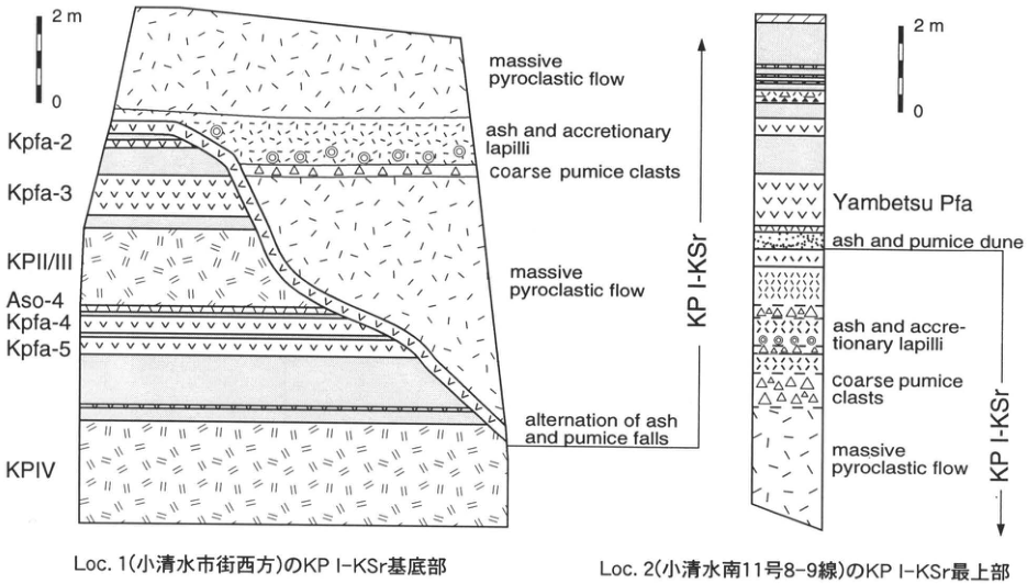
Original Japanese lettering
Loc.1: 2m; 0; Kpfa-2; Kpfa-3; KPII/III; Aso-4; Kpfa-4; Kpfa-5; KPIV; KP I-KSr; massive pyroclastic flow; ash and accretionary lapilli; coarse pumice clasts; massive pyroclastic flow; alternation of ash and pumice falls. Loc.2: 2m; 0; Yambetsu Pfa; ash and pumice dune; ash and accretionary lapilli; coarse pumice clasts; massive pyroclastic flow; KP I-KSr. Loc.1(小清水市街西方)のKPⅠ-KSr基底部;Loc.2(小清水南11号8–9線)のKPⅠ-KSr最上部
English translation
Loc.1: 2m; 0; Kpfa-2; Kpfa-3; KPII/III; Aso-4; Kpfa-4; Kpfa-5; KPIV; KP I-KSr; massive pyroclastic flow; ash and accretionary lapilli; coarse pumice clasts; massive pyroclastic flow; alternation of ash and pumice falls. Loc.2: 2m; 0; Yambetsu Pfa; ash and pumice dune; ash and accretionary lapilli; coarse pumice clasts; massive pyroclastic flow; KP I-KSr. Basal KP I–KSr at Loc. 1 west of central Koshimizu; uppermost KP I–KSr at Loc. 2, Koshimizu Minami 11-go, 8–9-sen.
p47_62.png
PDF 47 · Original p. 26
Location of the Bibi outcrop southeast of Chitose
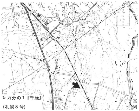
Original Japanese lettering
5万分の1『千歳』(札幌8号); 美々; 美々川; 御前水; 富岡; 千歳線; 22.60; 22.7; 3.76; 7.80; 26.5
English translation
1:50,000 “Chitose” (Sapporo No. 8); Bibi; Bibi River; Gozen-sui (御前水); Tomioka; Chitose railway; 22.60; 22.7; 3.76; 7.80; 26.5
p48_63.png
PDF 48 · Original p. 27
En-a and Tarumae tephras above thick Spfa-1 and Spfl, with the B-Tm horizon
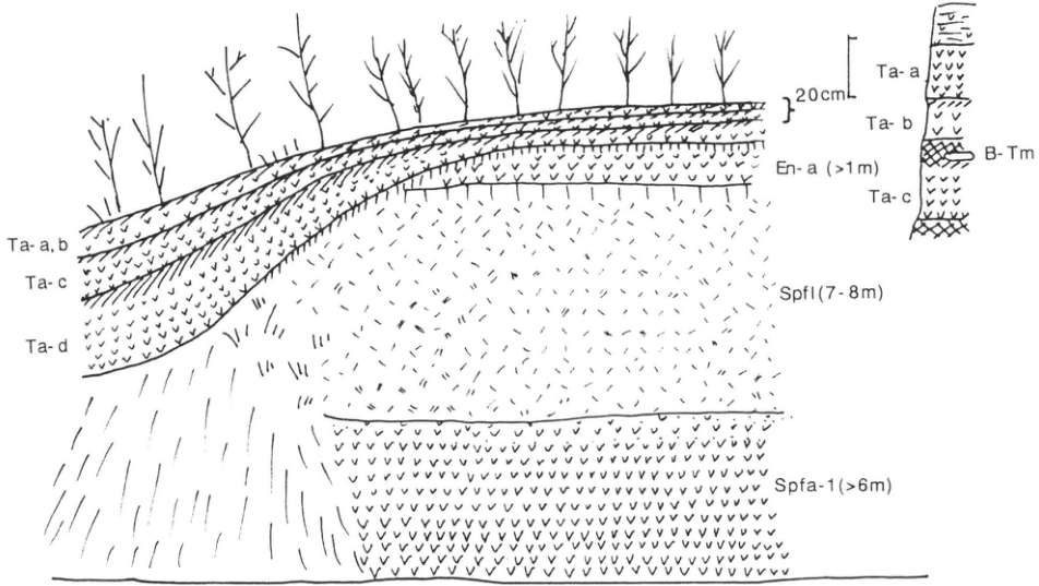
Original Japanese lettering
Ta-a,b; Ta-c; Ta-d; En-a (>1m); Spfl (7–8m); Spfa-1 (>6m); 20cm; Ta-a; Ta-b; B-Tm; Ta-c
English translation
Ta-a,b; Ta-c; Ta-d; En-a (>1m); Spfl (7–8m); Spfa-1 (>6m); 20cm; Ta-a; Ta-b; B-Tm; Ta-c
p48_64.png
PDF 48 · Original p. 27
Cliff on factory premises with stratified tephras above thick Shikotsu-1 pumice and pyroclastic flow
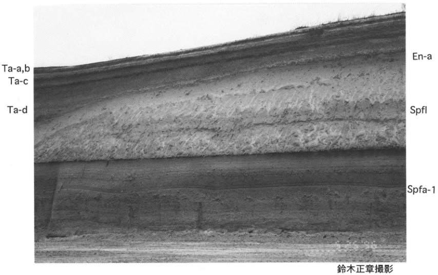
Original Japanese lettering
Ta-a,b; Ta-c; Ta-d; En-a; Spfl; Spfa-1; 鈴木正章撮影
English translation
Ta-a,b; Ta-c; Ta-d; En-a; Spfl; Spfa-1; photograph by 鈴木正章
p49_65.png
PDF 49 · Original p. 28
Roadside outcrop location at Sakae 8-go, 2-sen
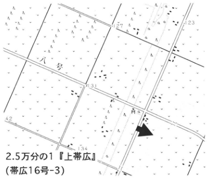
Original Japanese lettering
2.5万分の1『上帯広』(帯広16号-3); 八号; 九号; 127; 123; 131; 134; 142
English translation
1:25,000 “Kamiobihiro” (Obihiro No. 16-3); 8-go; 9-go; 127; 123; 131; 134; 142
p49_66.png
PDF 49 · Original p. 28
Spfa-1, En-a, and Ta-d above terrace gravel, with irregular deformation in Spfa-1
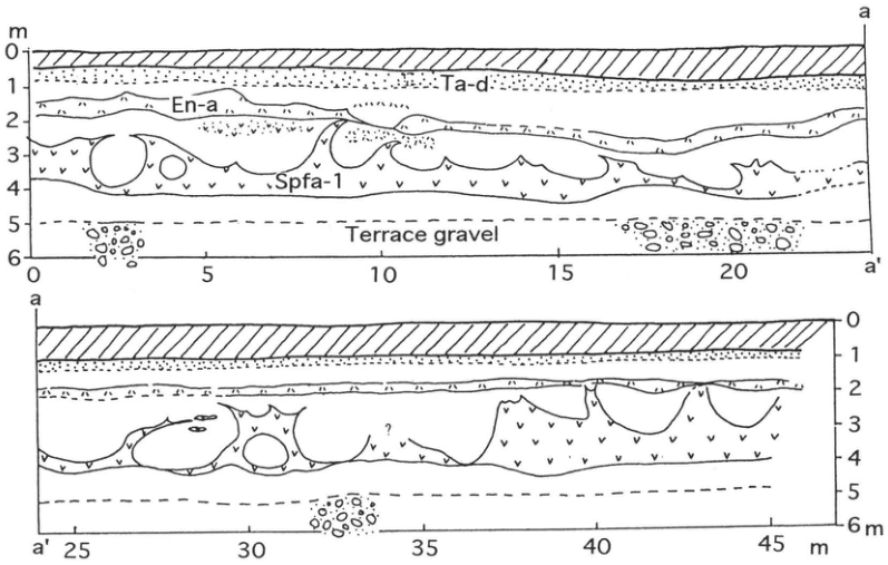
Original Japanese lettering
Ta-d; En-a; Spfa-1; Terrace gravel; m; 0; 1; 2; 3; 4; 5; 6; 0; 5; 10; 15; 20; 25; 30; 35; 40; 45; a; a′; ?
English translation
Ta-d; En-a; Spfa-1; Terrace gravel; m; 0; 1; 2; 3; 4; 5; 6; 0; 5; 10; 15; 20; 25; 30; 35; 40; 45; a; a′; ?
p50_67.png
PDF 50 · Original p. 29
Topographic map locating the exposure near Shuen with an arrow.
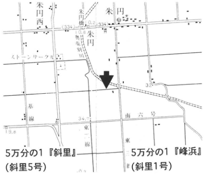
Original Japanese lettering
5万分の1『斜里』(斜里5号);5万分の1『峰浜』(斜里1号)。朱円西,朱円,朱円東,ストーンサークル,幹線,道六号,東一線,東二線。可読数値:33.4,34.7,32,19.8。
English translation
1:50,000 Shari (Shari sheet 5); 1:50,000 Minehama (Shari sheet 1). Shuen West; Shuen; Shuen East; stone circle; trunk line; Road No. 6; East Line 1; East Line 2. Legible numerical labels: 33.4, 34.7, 32, 19.8.
地図内の微細な文字と数値 — 一部は解像度が低く確実に読めない。
p50_68.png
PDF 50 · Original p. 29
Exposure showing deformed Spfa-1 beneath ash and pumice beds.
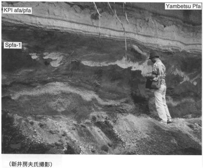
Original Japanese lettering
KPI afa/pfa;Spfa-1;Yambetsu Pfa;(新井房夫氏撮影)。
English translation
KPI afa/pfa; Spfa-1; Yambetsu Pfa. Photograph by Fusao Arai.
p50_69.png
PDF 50 · Original p. 29
Stratigraphic column and lithologic legend spanning Yambetsu pumice fall and deformed Spfa-1.
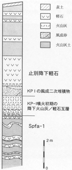
Original Japanese lettering
凡例:表土,軽石,火山灰,風成砂,火山灰土。上から:止別降下軽石;KP Iの風成二次堆積物;KP-I噴火初期の降下火山灰/軽石互層;Spfa-1。スケール:2m,0。
English translation
Legend: topsoil; pumice; ash; aeolian sand; volcanic-ash soil. From top: Yambetsu pumice fall; secondary aeolian deposits of KP I; alternating ash and pumice falls from the early KP-I eruption; Spfa-1. Scale: 2 m, 0.
p51_70.png
PDF 51 · Original p. 30
Topographic map locating the Daisen Pond exposure.
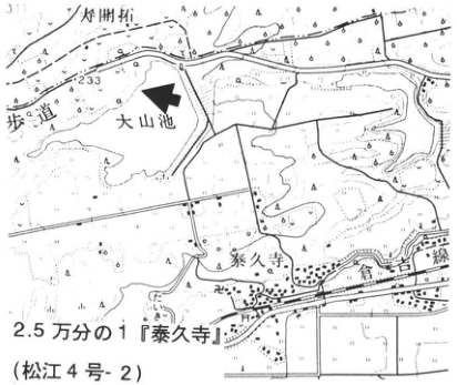
Original Japanese lettering
2.5万分の1『泰久寺』(松江4号-2)。大山池,泰久寺,倉吉線,歩道,大明神。233。
English translation
1:25,000 Taikyuji (Matsue sheet 4-2). Daisen Pond; Taikyuji; Kurayoshi railway line; footpath; Daimyojin (大明神). 233.
p51_71.png
PDF 51 · Original p. 30
Three thick pumice beds exposed on the slope at Daisen Pond.
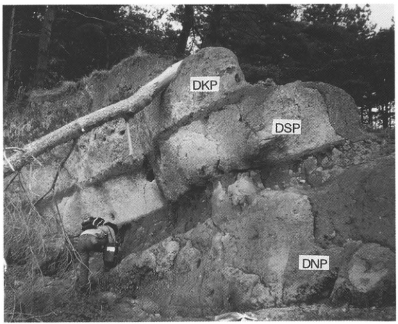
Original Japanese lettering
DKP;DSP;DNP。
English translation
DKP; DSP; DNP.
p51_72.png
PDF 51 · Original p. 30
Depth-scaled tephra stratigraphy at Daisen Pond.
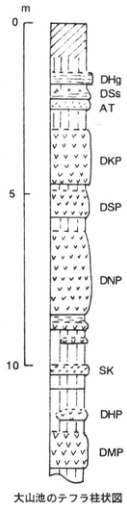
Original Japanese lettering
大山池のテフラ柱状図。深度:0,5,10 m。上から:DHg,DSs,AT,DKP,DSP,DNP,SK,DHP,DMP。
English translation
Tephra stratigraphic column at Daisen Pond. Depth: 0, 5, 10 m. From top: DHg, DSs, AT, DKP, DSP, DNP, SK, DHP, DMP.
p52_73.png
PDF 52 · Original p. 31
Topographic map along the Joganji River showing the two sites at 天林 and Chigaki.
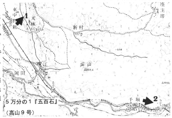
Original Japanese lettering
5万分の1『五百石』(高山9号)。地点1,2。東中野,新,天林,新村,横江,岡田,尖山,千垣,座主坊。可読標高等:434,559.4,860,263,284.2。
English translation
1:50,000 Gohyakukoku (Takayama sheet 9). Sites 1 and 2. Map place labels: 東中野, 新, 天林, 新村, 横江, 岡田, 尖山, Chigaki (千垣), 座主坊. Legible elevations and other numbers: 434, 559.4, 860, 263, 284.2.
地図内の天林付近の標高と微細な注記 — 小さく不鮮明で確定できない。
p52_74.png
PDF 52 · Original p. 31
Photographs of DKP on the Uwadann terrace (left) and white AT within sand and silt (right).
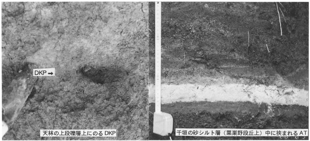
Original Japanese lettering
DKP→;天林の上段礫層上にのるDKP;千垣の砂シルト層(粟巣野段丘上)中に挟まれるAT。
English translation
DKP →; DKP resting on the Uwadann gravel bed at 天林; AT interbedded in sand and silt at Chigaki, on the Awasuno terrace.
p53_75.png
PDF 53 · Original p. 32
Composite of the exposure at 房中, a location map, and a close-up of DKP and Hk-TP.
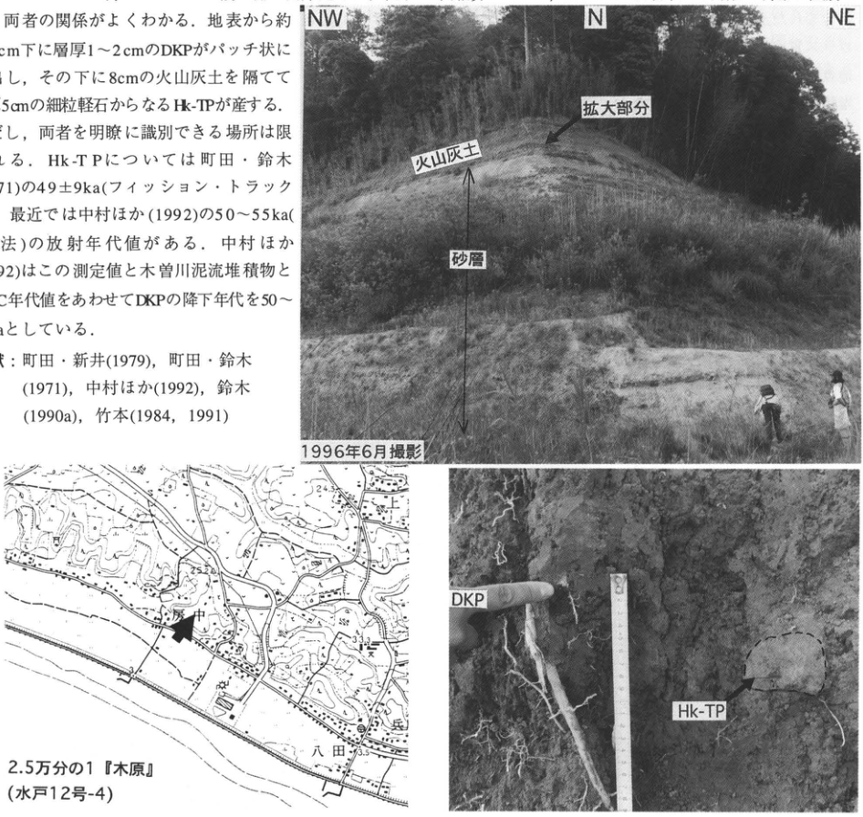
Original Japanese lettering
全景:NW,N,NE;拡大部分;火山灰土;砂層;1996年6月撮影。接写:DKP,Hk-TP。位置図:2.5万分の1『木原』(水戸12号-4);房中,八田;可読数値24.3,25.2,33.3,23.5。画像左上の本文断片は本文欄に収録済み。
English translation
Overview: NW, N, NE; enlarged area; volcanic-ash soil; sand bed; photographed June 1996. Close-up: DKP, Hk-TP. Map: 1:25,000 Kihara (Mito sheet 12-4); 房中, 八田. Legible numbers: 24.3, 25.2, 33.3, 23.5. The cropped prose at upper left is included in the main text.
地形図の小さな文字・数値 — 不鮮明な箇所は読取りを確定できない。
p54_76.png
PDF 54 · Original p. 33
Location map of the roadside Aso-4 exposure south of Nagayu.
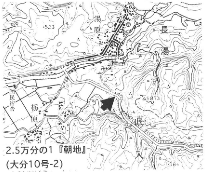
Original Japanese lettering
2.5万分の1『朝地』(大分10号-2)。長湯,栃原,国民宿舎,田原。可読数値:523,587.3,684。
English translation
1:25,000 Asaji (Oita sheet 10-2). Nagayu; 栃原; public lodge; 田原. Legible numbers: 523, 587.3, 684.
地図内の微細な標高・地名 — 一部が不鮮明で確実には読めない。
p54_77.png
PDF 54 · Original p. 33
Flattened pumice protrudes from a weathered surface of weakly welded tuff; a hammer lies at lower right.
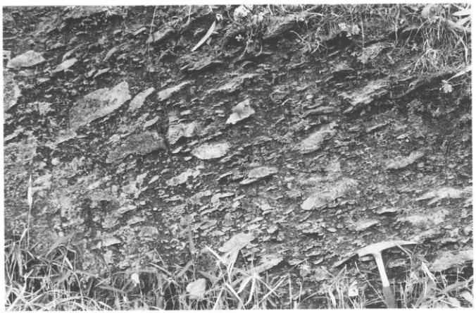
Original Japanese lettering
No lettering
English translation
No lettering
p55_78.png
PDF 55 · Original p. 34
Two maps showing the route to Takano Formation exposures and numbered exposures along the river.
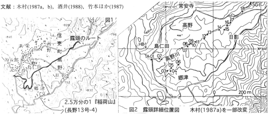
Original Japanese lettering
図1。露頭のルート。2.5万分の1『稲荷山』(長野13号-4)。信更町,高野,島仁田,郷津,平条,日影。数値846,828,796,752,832。図2 露頭詳細位置図 木村(1987a)を一部改変。常安寺,高野,日影,島仁田,高野川,郷津。地点HB-1,TA-01,02,03,04,05,06,07,08,09,10,11,12,13,14,15,16,17,18,SG-1。等高線800m,750m。座標138°02′10″,36°32′40″。距離0~200m。画像左上の文献行は本文に収録済み。
English translation
Figure 1. Route to the exposures. 1:25,000 Inariyama (Nagano sheet 13-4). Shinko Town; Takano; 島仁田; 郷津; 平条; Hikage. Numbers: 846, 828, 796, 752, 832. Figure 2. Detailed exposure-location map, modified from Kimura (1987a). 常安寺; Takano; Hikage; 島仁田; Takano River; 郷津. Sites: HB-1, TA-01, 02, 03, 04, 05, 06, 07, 08, 09, 10, 11, 12, 13, 14, 15, 16, 17, 18, SG-1. Contours: 800 m, 750 m. Coordinates: 138°02′10″, 36°32′40″. Distance: 0–200 m. The reference line at upper left is included in the main text.
p56_79.png
PDF 56 · Original p. 35
Correlation of stratigraphic columns from 18 exposures, with member divisions of the Takano Formation.
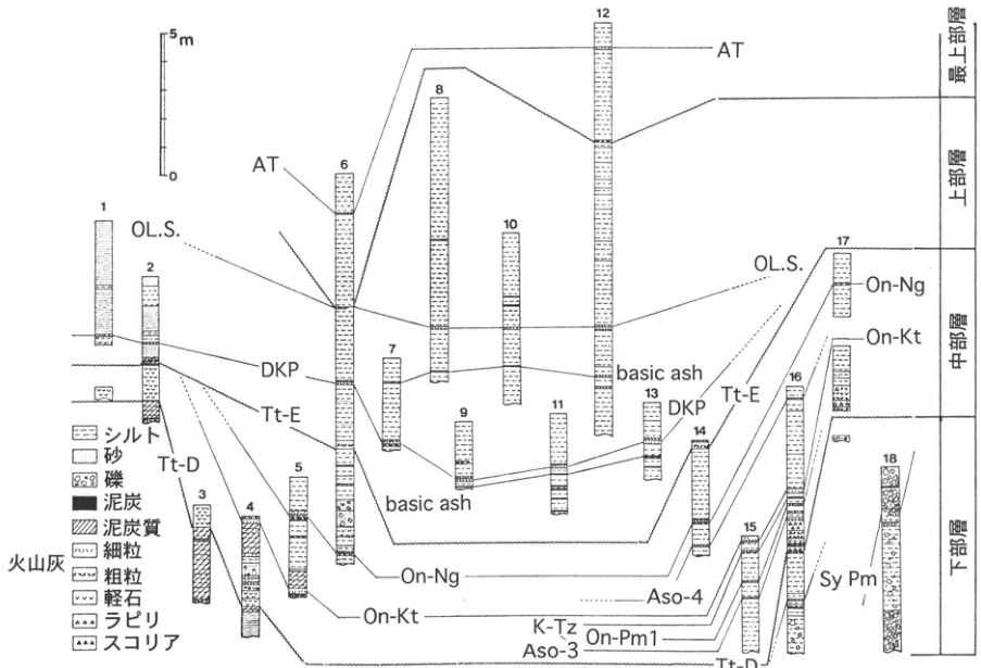
Original Japanese lettering
露頭番号:1,2,3,4,5,6,7,8,9,10,11,12,13,14,15,16,17,18。スケール:0,5m。凡例:シルト,砂,礫,泥炭,泥炭質;火山灰:細粒,粗粒,軽石,ラピリ,スコリア。相関ラベル:AT,OL.S.,DKP,Tt-E,Tt-D,basic ash,On-Ng,On-Kt,Aso-4,K-Tz,On-Pm1,Aso-3,Sy Pm。部層(上から):最上部層,上部層,中部層,下部層。相関線は各列間の同一層準を結び、一部は点線。
English translation
Exposure numbers: 1–18. Scale: 0, 5 m. Legend: silt; sand; gravel; peat; peaty sediment. Volcanic-ash symbols: fine-grained; coarse-grained; pumice; lapilli; scoria. Correlation labels: AT, OL.S., DKP, Tt-E, Tt-D, basic ash, On-Ng, On-Kt, Aso-4, K-Tz, On-Pm1, Aso-3, Sy Pm. Members, from top: uppermost; upper; middle; lower. Correlation lines link equivalent horizons between columns; some are dotted.
p56_80.png
PDF 56 · Original p. 35
Geological map of the four Takano Formation members, with faults, flexure, sites, and section lines.
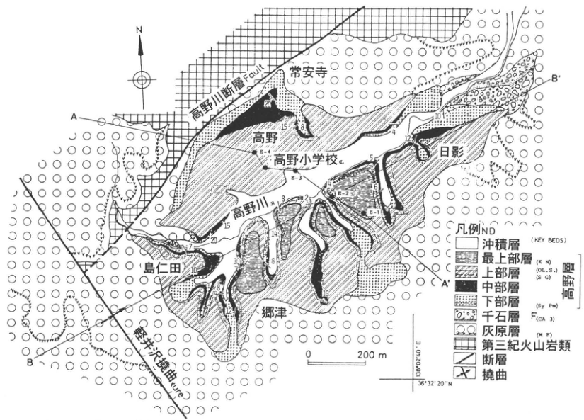
Original Japanese lettering
方位N。断面線A–A′,B–B′。高野川断層 Fault;軽井沢撓曲 flexure;高野川。常安寺,高野,高野小学校,日影,島仁田,郷津。測点E-1,E-2,E-3,E-4。地層凡例:沖積層;最上部層(K N),上部層(OL.S.)(S G),中部層,下部層(Sy Pm)〔以上高野層〕;千石層(CA 3);灰原層(M F);第三紀火山岩類;断層;撓曲。KEY BEDS。距離0~200m。座標138°02′40″E,36°32′20″N。可読の走向傾斜等数値:2,4,5,7,8,10,12,14,15,16,18,20。
English translation
North arrow: N. Section lines: A–A′, B–B′. Takanogawa Fault; Karuizawa Flexure; Takano River. Place labels: 常安寺; Takano; Takano Elementary School; Hikage; 島仁田; 郷津. Survey points: E-1, E-2, E-3, E-4. Geological legend: alluvium; uppermost member (K N), upper member (OL.S.) (S G), middle member, lower member (Sy Pm), collectively the Takano Formation; 千石 Formation (CA 3); 灰原 Formation (M F); Tertiary volcanic rocks; fault; flexure. KEY BEDS. Distance: 0–200 m. Coordinates: 138°02′40″E, 36°32′20″N. Legible strike-and-dip and other numbers: 2, 4, 5, 7, 8, 10, 12, 14, 15, 16, 18, 20.
地図の微細な数値とKEY BEDSの略記 — 多くが小さく、一部は数字・文字の区切りを確定できない。可読形を保持。
p57_81.png
PDF 57 · Original p. 36
Topographic map indicating the exposure group in upper Nishizawa north of Ikido.
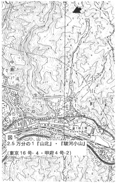
Original Japanese lettering
図1。2.5万分の1『山北』・『駿河小山』(東京16号-4・甲府4号-2)。生土,小山町,中島滝,落合,三淵,小山,川。富士紡工場(かねがふち)。可読標高・数値:449.1,416,407,293,379.2,350,246,300,370。
English translation
Figure 1. 1:25,000 Yamakita and Suruga-Oyama (Tokyo sheet 16-4; Kofu sheet 4-2). Ikido; Oyama Town; Nakajima Falls; Ochiai; 三淵; Oyama; river. Fuji spinning factory (Kanegafuchi). Legible elevations and other numbers: 449.1, 416, 407, 293, 379.2, 350, 246, 300, 370.
富士紡工場の括弧内文字と地図の微細な注記 — 括弧内は「かねがふち」と読めるが解像度が低く、他の小文字も一部は確定不能。
p58_82.png
PDF 58 · Original p. 37
Stratigraphic column tying together four upper Nishizawa sites and showing widespread tephra positions and spacing.
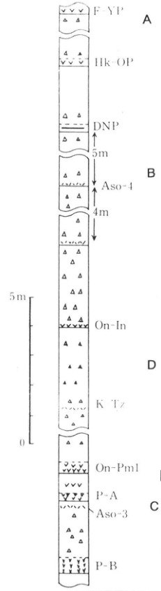
Original Japanese lettering
上からF-YP,Hk-OP,DNP,Aso-4,On-In,K-Tz,On-Pm1,P-A,Aso-3,P-B。地点A,B,D,C。層位間隔:DNPからAso-4まで5m;Aso-4から下の指示層準まで4m。左のスケール0~5m。
English translation
From top: F-YP, Hk-OP, DNP, Aso-4, On-In, K-Tz, On-Pm1, P-A, Aso-3, P-B. Sites: A, B, D, C. Stratigraphic intervals: DNP to Aso-4, 5 m; Aso-4 to the indicated lower horizon, 4 m. Scale at left: 0–5 m.
p58_83.png
PDF 58 · Original p. 37
Route map showing observation sites A–D along the stream and forest road.
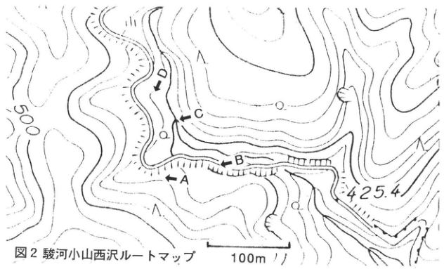
Original Japanese lettering
地点A,B,C,D;500;425.4;100m。
English translation
Sites A, B, C, D; 500; 425.4; 100 m.
p58_84.png
PDF 58 · Original p. 37
Exposure photograph with an arrow marking pale Aso-4 ash near the slope base and a person at right.
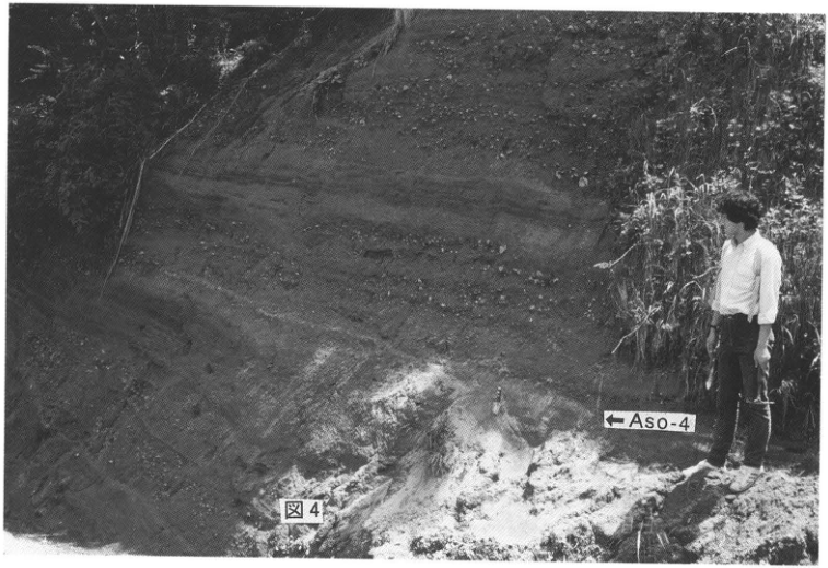
Original Japanese lettering
←Aso-4。
English translation
← Aso-4.
p59_85.png
PDF 59 · Original p. 38
Topographic map showing site 1 and the lost site 2 near Kawakami Bridge.
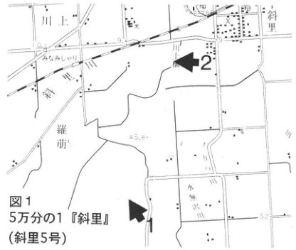
Original Japanese lettering
5万分の1『斜里』(斜里5号)。地点1,2。川上,斜里,斜里川,羅萌,来運,水無沢。可読数値45.8,52。
English translation
1:50,000 Shari (Shari sheet 5). Sites 1, 2. Kawakami; Shari; Shari River; 羅萌; Raiun; 水無沢. Legible numbers: 45.8, 52.
地図内の微細な地名 — 一部は解像度が低い。
p59_86.png
PDF 59 · Original p. 38
Stratigraphic column from Kutcharo IV to Yambetsu pumice, showing equivalences among several naming schemes.
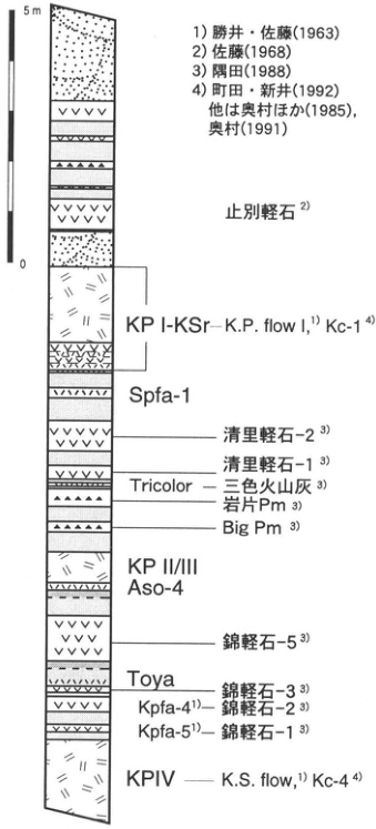
Original Japanese lettering
スケール0~5m。上から:止別軽石²⁾;KP I-KSr―K.P. flow I¹⁾ Kc-1⁴⁾;Spfa-1;清里軽石-2³⁾;清里軽石-1³⁾;Tricolor―三色火山灰³⁾;岩片Pm³⁾;Big Pm³⁾;KP II/III;Aso-4;錦軽石-5³⁾;Toya;錦軽石-3³⁾;Kpfa-4¹⁾―錦軽石-2³⁾;Kpfa-5¹⁾―錦軽石-1³⁾;KP IV―K.S. flow¹⁾ Kc-4⁴⁾。出典:1)勝井・佐藤(1963),2)佐藤(1968),3)隅田(1988),4)町田・新井(1992),他は奥村ほか(1985),奥村(1991)。
English translation
Scale: 0–5 m. From top: Yambetsu pumice²⁾; KP I-KSr—K.P. flow I¹⁾, Kc-1⁴⁾; Spfa-1; Kiyosato pumice 2³⁾; Kiyosato pumice 1³⁾; Tricolor—three-color ash³⁾; lithic Pm³⁾; Big Pm³⁾; KP II/III; Aso-4; Nishiki pumice 5³⁾; Toya; Nishiki pumice 3³⁾; Kpfa-4¹⁾—Nishiki pumice 2³⁾; Kpfa-5¹⁾—Nishiki pumice 1³⁾; KP IV—K.S. flow¹⁾, Kc-4⁴⁾. Sources: 1) Katsui and Sato (1963); 2) Sato (1968); 3) Sumita (1988); 4) Machida and Arai (1992); others from Okumura et al. (1985) and Okumura (1991).
p60_87.png
PDF 60 · Original p. 39
Kutcharo tephras exposed in a large excavated face, with a bulldozer at lower right.
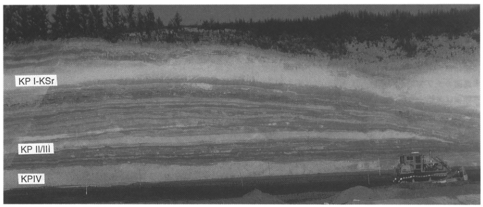
Original Japanese lettering
KP I-KSr;KP II/III;KP IV。
English translation
KP I-KSr; KP II/III; KP IV.
p60_88.png
PDF 60 · Original p. 39
Stratified exposure south of Kawakami Bridge with major units, including Spfa-1 and Aso-4, labeled.
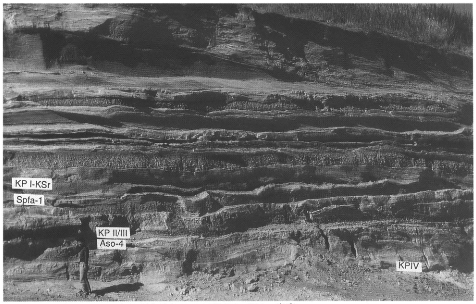
Original Japanese lettering
KP I-KSr;Spfa-1;KP II/III;Aso-4;KP IV。
English translation
KP I-KSr; Spfa-1; KP II/III; Aso-4; KP IV.
p61_89.png
PDF 61 · Original p. 40
Kikai-Tozurahara tephra showing its finely stratified lower half and unstratified upper half, with a person holding a measuring rod at left.
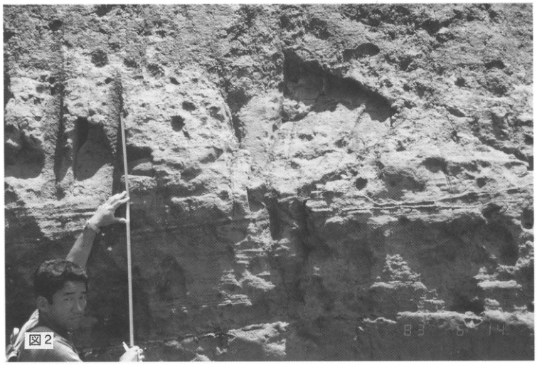
Original Japanese lettering
図2;写真の日付表示:83 6 14。
English translation
Figure 2; photographic date stamp: 83 6 14.
p62_90.png
PDF 62 · Original p. 41
Topographic map of central Tanegashima locating the Noma exposure.
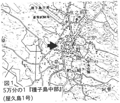
Original Japanese lettering
5万分の1『種子島中部』(屋久島1号)。種子島空港,乗馬訓練場,伏之前,上方,野間,増田,野山崎,中央公園,阿曽。可読数値:142,83,6。
English translation
1:50,000 Central Tanegashima (Yakushima sheet 1). Tanegashima Airport; equestrian training ground; 伏之前; 上方; Noma; Masuda; 野山崎; Central Park; 阿曽. Legible numbers: 142, 83, 6.
地図の細かな地名・数値 — 一部不鮮明。読みの確認ができない地名は英訳でも日本語保持。
p62_91.png
PDF 62 · Original p. 41
Map showing terrace-surface distribution on Tanegashima and Mageshima with seven legend classes.
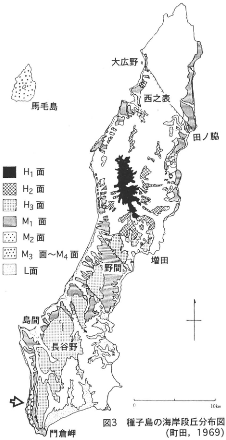
Original Japanese lettering
凡例:H₁面,H₂面,H₃面,M₁面,M₂面,M₃面~M₄面,L面。地名:馬毛島,大広野,西之表,田ノ脇,増田,野間,島間,長谷野,門倉岬。スケール:0~10km。南西岸を矢印で示す。
English translation
Legend: H₁ surface; H₂ surface; H₃ surface; M₁ surface; M₂ surface; M₃–M₄ surfaces; L surface. Place labels: Mageshima; 大広野; Nishinoomote; 田ノ脇; Masuda; Noma; Shimama; 長谷野; Cape Kadokura. Scale: 0–10 km. An arrow marks the southwestern coast.
p62_92.png
PDF 62 · Original p. 41
Schematic section showing terraces M1–M4 and their relationships to Ata and K-Tz.
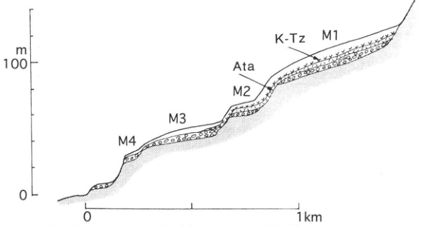
Original Japanese lettering
陸側から海側:M1,M2,M3,M4。テフラ:K-Tz,Ata。垂直スケール:0,100 m;水平スケール:0~1km。
English translation
From landward to seaward: M1, M2, M3, M4. Tephras: K-Tz, Ata. Vertical scale: 0, 100 m. Horizontal scale: 0–1 km.
p63_93.png
PDF 63 · Original p. 42
Location map around Tozurahara and a stratigraphic column of marker tephras within a thick sand, mud, and gravel succession.
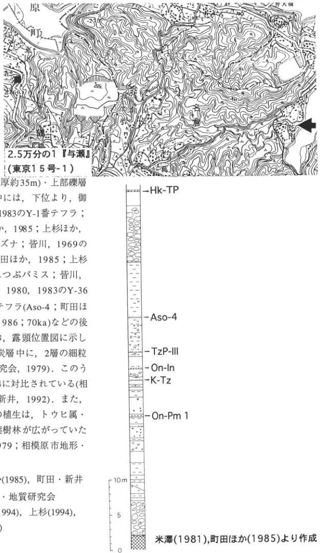
Original Japanese lettering
位置図:2.5万分の1『与瀬』(東京15号-1);葛原,芝田,鶴島,上野原町,相模川;上野原大橋(上部で一部切れる)。可読数値200,250,266.5。柱状図上から:Hk-TP,Aso-4,TzP-III,On-In,K-Tz,On-Pm1。スケール0,5,10m。米澤(1981),町田ほか(1985)より作成。画像左側の本文断片は本文欄に収録済み。
English translation
Map: 1:25,000 Yose (Tokyo sheet 15-1). Tozurahara; Shibata; Tsurushima; Uenohara Town; Sagami River; Uenohara Bridge (partly cropped at top). Legible numbers: 200, 250, 266.5. Column, from top: Hk-TP, Aso-4, TzP-III, On-In, K-Tz, On-Pm1. Scale: 0, 5, 10 m. Compiled from Yonezawa (1981) and Machida et al. (1985). The prose fragment at left is included in the main text.
地図中の小さな標高・地名 — 一部不鮮明で確定できない。
p64_94.png
PDF 64 · Original p. 43
Map locating the exposure beside a paddy field at Hetano.
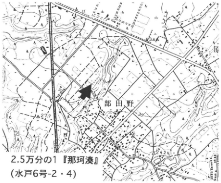
Original Japanese lettering
2.5万分の1『那珂湊』(水戸6号-2・4)。部田野,原。可読数値:36.6,27.7,30,24.2。
English translation
1:25,000 Nakaminato (Mito sheets 6-2 and 6-4). Hetano; 原. Legible numbers: 36.6, 27.7, 30, 24.2.
p64_95.png
PDF 64 · Original p. 43
Close-up of K-Tz ash lumps in sand at left, and exposure overview including overlying Ag-KP at right.
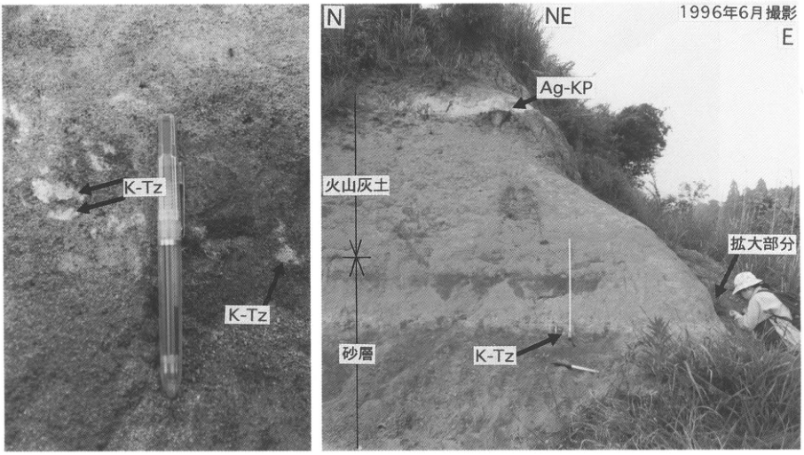
Original Japanese lettering
K-Tz(左に2箇所、右に1箇所);N,NE,E;1996年6月撮影;Ag-KP;火山灰土;砂層;拡大部分。
English translation
K-Tz (two labels at left, one at right); N, NE, E; photographed June 1996; Ag-KP; volcanic-ash soil; sand bed; enlarged area.
p65_96.png
PDF 65 · Original p. 44
Topographic map marking the forest-road exposure in upper Nakajima Stream.
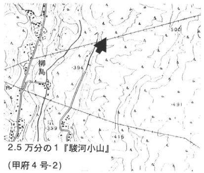
Original Japanese lettering
2.5万分の1『駿河小山』(甲府4号-2)。柳島。可読標高:500,394,491,359,416。
English translation
1:25,000 Suruga-Oyama (Kofu sheet 4-2). Yanagishima. Legible elevations: 500, 394, 491, 359, 416.
p65_97.png
PDF 65 · Original p. 44
Exposure of the well-preserved pumice bed and its fine-grained interval, with a pen near the center and a photographer at left.
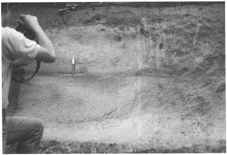
Original Japanese lettering
No lettering
English translation
No lettering
p66_98.png
PDF 66 · Original p. 45
Topographic map locating the roadside exposure at Wakayanagi, Isawa Town.
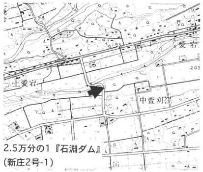
Original Japanese lettering
2.5万分の1『石淵ダム』(新庄2号-1)。上愛宕,愛宕,中萱刈窪。可読数値:198,195,203,200。
English translation
1:25,000 Ishibuchi Dam (Shinjo sheet 2-1). 上愛宕; Atago; 中萱刈窪. Legible numbers: 198, 195, 203, 200.
小さな地名・数値 — 一部は不鮮明。
p66_99.png
PDF 66 · Original p. 45
Exposure sketch of thin marker tephras over terrace gravel beneath an upper pumice bed.
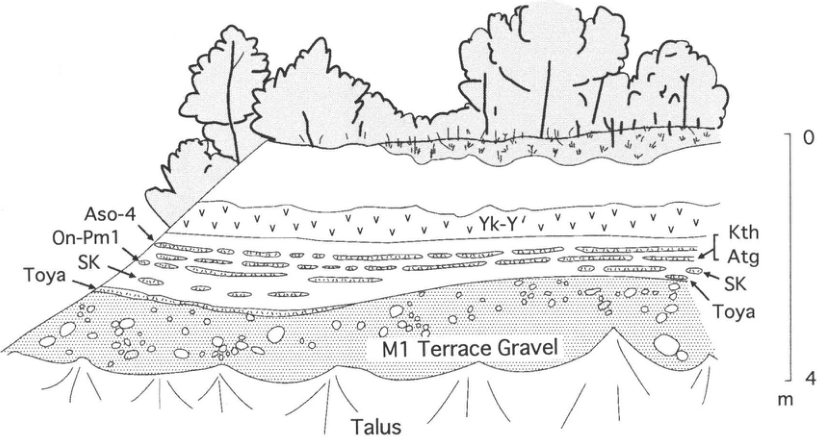
Original Japanese lettering
Yk-Y′;Aso-4;On-Pm1;SK(左右);Toya(左右);Kth;Atg;M1 Terrace Gravel;Talus。右スケール0~4m。
English translation
Yk-Y′; Aso-4; On-Pm1; SK (left and right); Toya (left and right); Kth; Atg; M1 Terrace Gravel; Talus. Right-hand scale: 0–4 m.
p67_100.png
PDF 67 · Original p. 46
Topographic map marking the former exposure in southern Matsue.
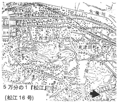
Original Japanese lettering
5万分の1『松江』(松江16号)。朝日町,大橋川,西津田,東津田町,上乃木町,古志原町。可読数値:1.4,2.2,4.5,2.3,31。
English translation
1:50,000 Matsue (Matsue sheet 16). Asahi Town; Ohashi River; Nishitsuda; Higashitsuda Town; Agenogi Town; Koshihara Town. Legible numbers: 1.4, 2.2, 4.5, 2.3, 31.
地図の小さい数値・施設名 — 一部は解像度が低く確定できない。
p67_101.png
PDF 67 · Original p. 46
Sketch showing DMP and SK pumice beds above old red soil.
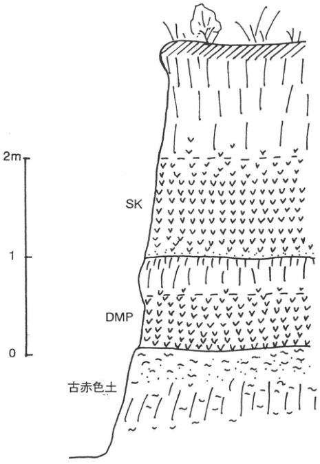
Original Japanese lettering
SK;DMP;古赤色土。スケール0,1,2m。
English translation
SK; DMP; old red soil. Scale: 0, 1, 2 m.
p68_102.png
PDF 68 · Original p. 47
Map locating the exposure near Midori-no-Hiroba on the Hamaji coast.
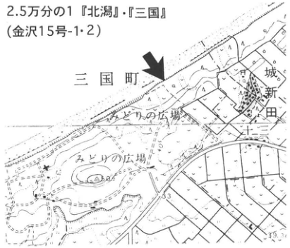
Original Japanese lettering
2.5万分の1『北潟』・『三国』(金沢15号-1・2)。三国町,城新田,みどりの広場(2箇所)。可読数値33,39.3。
English translation
1:25,000 Kitagata and Mikuni (Kanazawa sheets 15-1 and 15-2). Mikuni Town; 城新田; Midori-no-Hiroba (two labels). Legible numbers: 33, 39.3.
p68_103.png
PDF 68 · Original p. 47
Close-up of white ash within coarse sand and rounded pumice above it.
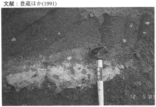
Original Japanese lettering
日付表示の可読部分:12 5 89。上端の文献行は本文に収録済み。
English translation
Legible date stamp: 12 5 89. The reference line at the top is included in the main text.
12 5 89 — 日付表示の左側が不鮮明。順序・完全な日付は確定しない。
p68_104.png
PDF 68 · Original p. 47
Sea-cliff photograph showing SK low in the section and tephra-bearing soil zones above.
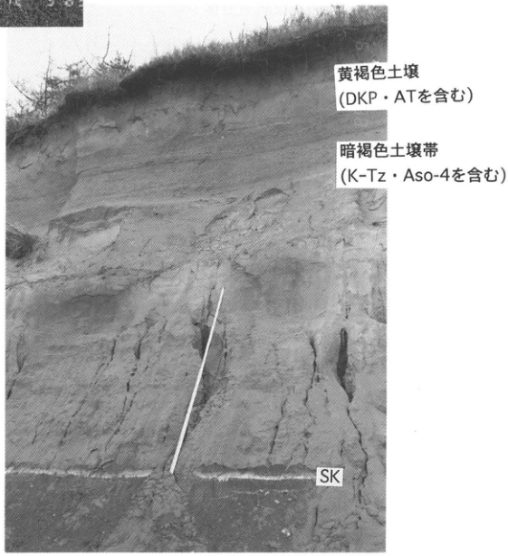
Original Japanese lettering
黄褐色土壌(DKP・ATを含む);暗褐色土壌帯(K-Tz・Aso-4を含む);SK。左上の数字断片は隣の写真の端部。
English translation
Yellowish-brown soil (containing DKP and AT); dark-brown soil zone (containing K-Tz and Aso-4); SK. The cropped numbers at upper left belong to the adjacent photograph.
p69_105.png
PDF 69 · Original p. 48
Topographic map locating two valley-wall exposures south of Mount Usu and Showa-Shinzan.
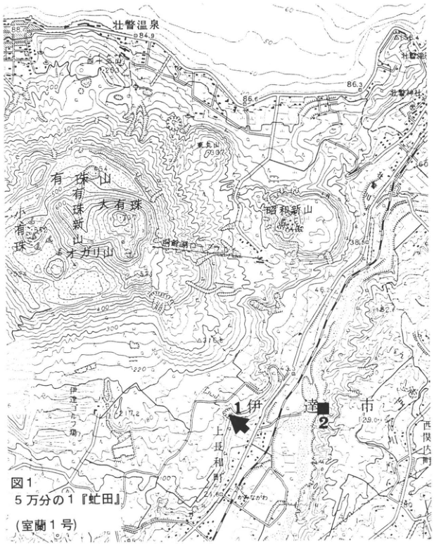
Original Japanese lettering
図1。5万分の1『虻田』(室蘭1号)。地点1,2。有珠山,有珠新山,大有珠,小有珠,有珠山方,東丸山,昭和新山,壮瞥温泉,壮瞥滝,壮瞥神社,伊達市,上長和町,上長和郵,西関内町,長流川。可読数値:88.5,84.9,263,86.6,86.3,60,398,38.50,46.2,82.6,43,29.0,17.2,80,100,200,220,300,400,500,600。
English translation
Figure 1. 1:50,000 Abuta (Muroran sheet 1). Sites 1, 2. Mount Usu; Usu-Shinzan; O-Usu; Ko-Usu; 有珠山方; Higashi-Maruyama; Showa-Shinzan; Sobetsu hot spring; Sobetsu Falls; Sobetsu Shrine; Date City; Kaminagawa Town; Kaminagawa post office; 西関内町; Osaru River. Legible numbers: 88.5, 84.9, 263, 86.6, 86.3, 60, 398, 38.50, 46.2, 82.6, 43, 29.0, 17.2, 80, 100, 200, 220, 300, 400, 500, 600.
地形図中の一部山名・微細な数値 — 不鮮明な文字は原図で確定できない。「有珠山方」は図上の可読形を保持。
p70_106.png
PDF 70 · Original p. 49
Stratigraphic column of Toya tephra and younger volcanic products, with an exposure photograph of Osr and Tpfl I above the Kaminagawa Formation.
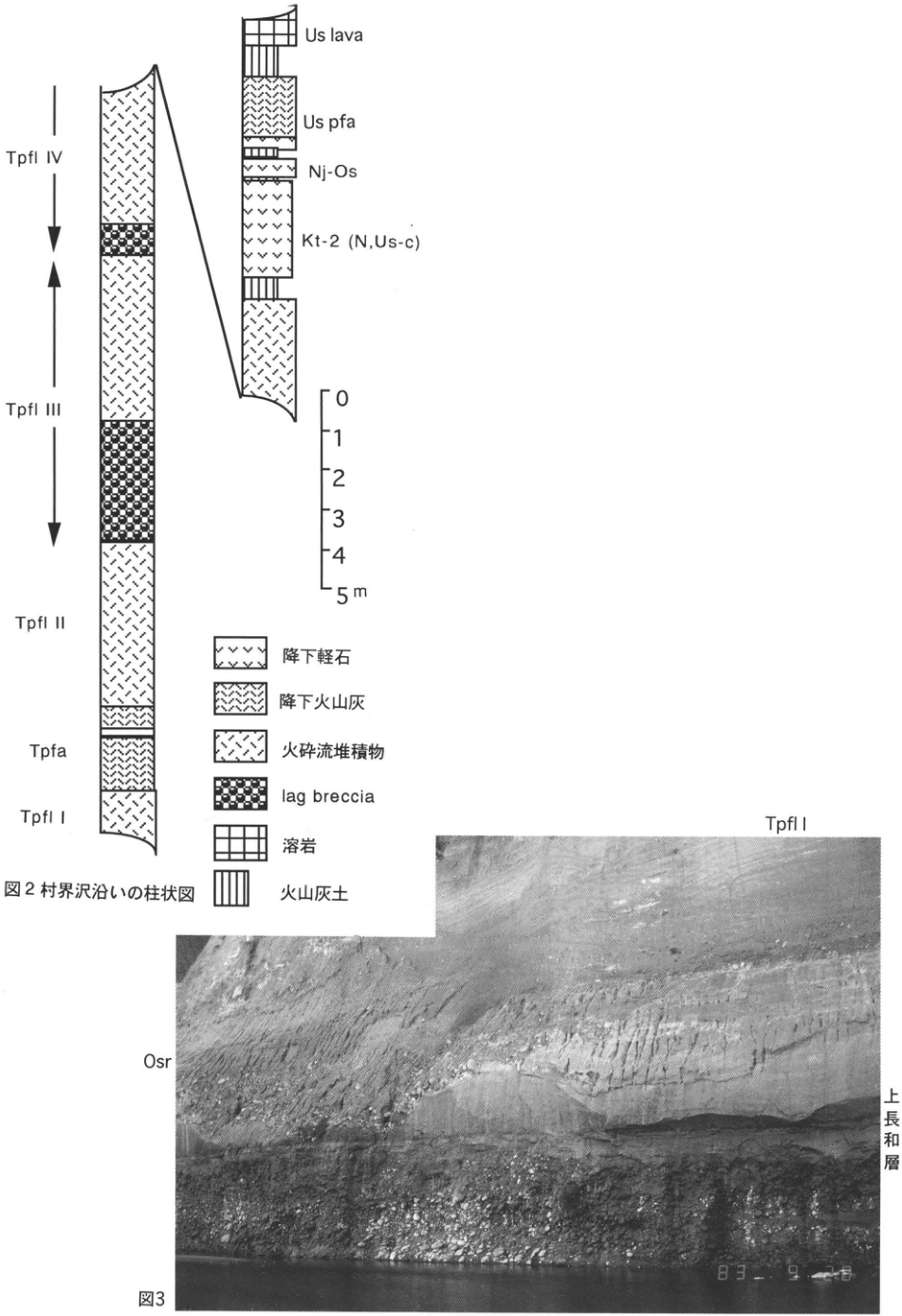
Original Japanese lettering
図2柱状図の上から:Us lava,Us pfa,Nj-Os,Kt-2 (N,Us-c),Tpfl IV,Tpfl III,Tpfl II,Tpfa,Tpfl I。スケール0,1,2,3,4,5m。凡例:降下軽石,降下火山灰,火砕流堆積物,lag breccia,溶岩,火山灰土。図3写真:Tpfl I,Osr,上長和層。日付の可読部分:83 9。
English translation
Figure 2 column, from top: Us lava, Us pfa, Nj-Os, Kt-2 (N,Us-c), Tpfl IV, Tpfl III, Tpfl II, Tpfa, Tpfl I. Scale: 0, 1, 2, 3, 4, 5 m. Legend: pumice fall; ash fall; pyroclastic-flow deposit; lag breccia; lava; volcanic-ash soil. Figure 3 photograph: Tpfl I; Osr; Kaminagawa Formation. Legible date-stamp portion: 83 9.
写真右下の日付 — 末尾の数字が白くかすれ、完全な日付を確定できない。
p71_107.png
PDF 71 · Original p. 50
Map locating the exposure beside the national road in Tateyama Town, Date City.
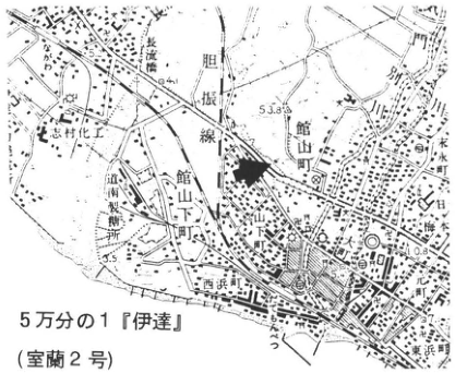
Original Japanese lettering
5万分の1『伊達』(室蘭2号)。館山町,旭町,長流橋,長流川,胆振線,志村化工,西浜町,水水町,日橋。可読数値53.8,4,3.5,0.8,5.2。
English translation
1:50,000 Date (Muroran sheet 2). Tateyama Town; Asahi Town; Osaru Bridge; Osaru River; Iburi railway line; Shimura Chemical Works; Nishihama Town; 水水町; 日橋. Legible numbers: 53.8, 4, 3.5, 0.8, 5.2.
右端の町名「水水町」と「日橋」 — 一部切れて不鮮明なため読める形を仮に転記し、地名読みは確定しない。
p71_108.png
PDF 71 · Original p. 50
Exposure sketch and stratigraphic column of beds above the Toya pyroclastic-flow deposit.
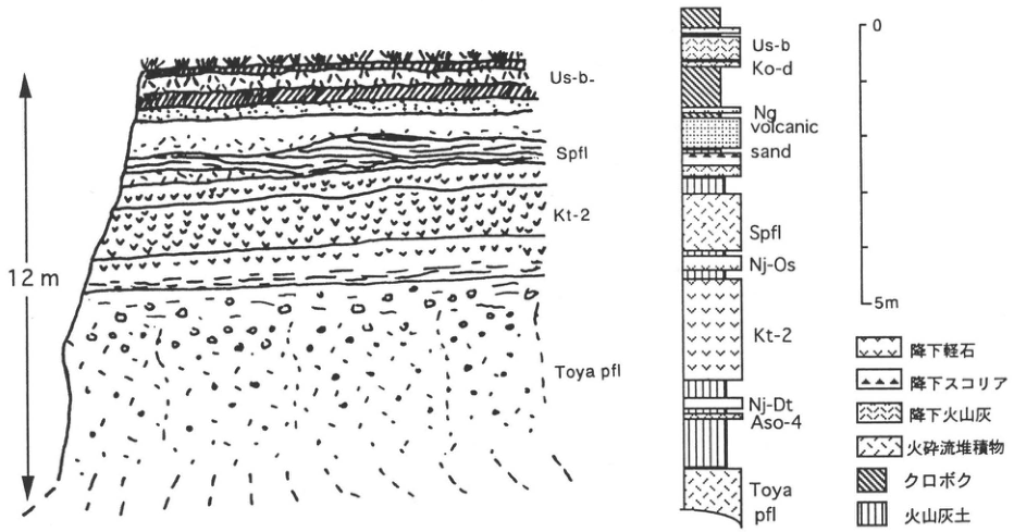
Original Japanese lettering
左スケッチ:Us-b-,Spfl,Kt-2,Toya pfl;全高12m。右柱状図上から:Us-b,Ko-d,Ng,volcanic sand,Spfl,Nj-Os,Kt-2,Nj-Dt,Aso-4,Toya pfl。スケール0~5m。凡例:降下軽石,降下スコリア,降下火山灰,火砕流堆積物,クロボク,火山灰土。
English translation
Left sketch: Us-b-, Spfl, Kt-2, Toya pfl; total height 12 m. Right column, from top: Us-b, Ko-d, Ng, volcanic sand, Spfl, Nj-Os, Kt-2, Nj-Dt, Aso-4, Toya pfl. Scale: 0–5 m. Legend: pumice fall; scoria fall; ash fall; pyroclastic-flow deposit; black humic soil; volcanic-ash soil.
p72_109.png
PDF 72 · Original p. 51
Topographic map locating the coastal-terrace exposure near 甲 southeast of Shimofuro.
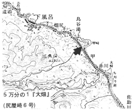
Original Japanese lettering
5万分の1『大畑』(尻屋崎6号)。下風呂,畑尻,鳥谷湯上,甲,甲崎,赤川,大崎,ちぢり浜,佐助川,三角山,道添,岩角。可読数値6.6,5.4,282.0,73,7.2。
English translation
1:50,000 Ohata (Shiriyazaki sheet 6). Shimofuro; Hatajiri; 鳥谷湯上; 甲; 甲崎; Akagawa; Osaki; Chijiri Beach; Sasuke River; 三角山; 道添; 岩角. Legible numbers: 6.6, 5.4, 282.0, 73, 7.2.
地名甲・鳥谷湯上等 — 独立した読みを確認できず、英訳で日本語を保持。
p72_110.png
PDF 72 · Original p. 51
Photograph of Toya on a terrace and a column distinguishing its coarse basal pumice.
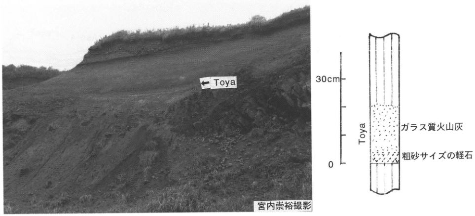
Original Japanese lettering
写真:←Toya;宮内崇裕撮影。柱状図:Toya,ガラス質火山灰,粗砂サイズの軽石。スケール0~30cm。
English translation
Photograph: ← Toya; photograph by Takahiro Miyauchi. Column: Toya; glassy ash; coarse-sand-sized pumice. Scale: 0–30 cm.
p73_111.png
PDF 73 · Original p. 52
Map marking the sea-cliff exposure west of Anden village.
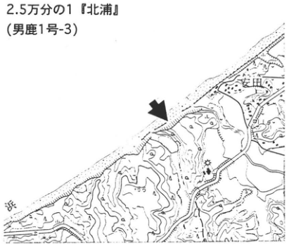
Original Japanese lettering
2.5万分の1『北浦』(男鹿1号-3)。安田。
English translation
1:25,000 Kitaura (Oga sheet 1-3). Anden.
p73_112.png
PDF 73 · Original p. 52
Coastal exposure profile at Anden correlated with a column containing Aso-4 and Toya.
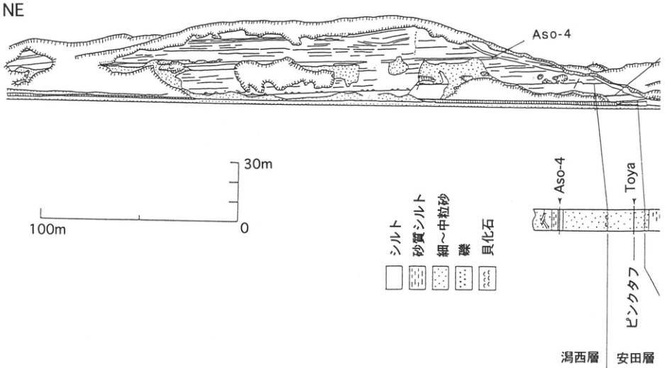
Original Japanese lettering
方位NE。露頭:Aso-4。柱状図:Aso-4,Toya,ピンクタフ;潟西層,安田層。凡例:シルト,砂質シルト,細~中粒砂,礫,貝化石。水平スケール100m、0;垂直スケール0~30m。
English translation
Direction: NE. Exposure label: Aso-4. Column labels: Aso-4, Toya, pink tuff; Katanishi Formation; Anden Formation. Legend: silt; sandy silt; fine- to medium-grained sand; gravel; shell fossils. Horizontal scale: 100 m, 0; vertical scale: 0–30 m.
p74_113.png
PDF 74 · Original p. 53
Exposure profile and column showing Aso-1, B-Og, Oga, and lignite in the lower Anden coastal section.
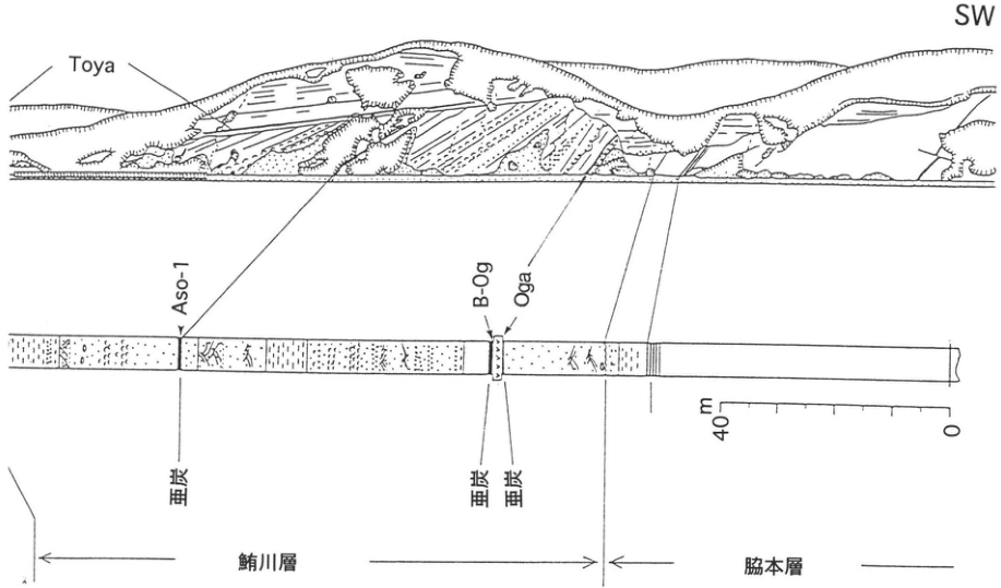
Original Japanese lettering
方位SW。Toya,Aso-1,B-Og,Oga;亜炭(3か所);鮪川層,脇本層。スケール0,40m。
English translation
Direction: SW. Toya; Aso-1; B-Og; Oga; lignite (three occurrences); Shibikawa Formation; Wakimoto Formation. Scale: 0, 40 m.
p75_114.png
PDF 75 · Original p. 54
Topographic map locating the valley-floor exposure south of 野尻野 in Nejime Town.
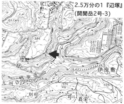
Original Japanese lettering
2.5万分の1『辺塚』(開聞岳2号-3)。野尻野,郡,伊座敷,別府,唐栄。可読数値542,384,387,396,370。
English translation
1:25,000 Hetsuka (Kaimondake sheet 2-3). 野尻野; Kori; Izashiki; 別府; 唐栄. Legible numbers: 542, 384, 387, 396, 370.
p75_115.png
PDF 75 · Original p. 54
Overview and enlarged exposure sketch of the Ata pyroclastic flow and preceding fallout tephras.
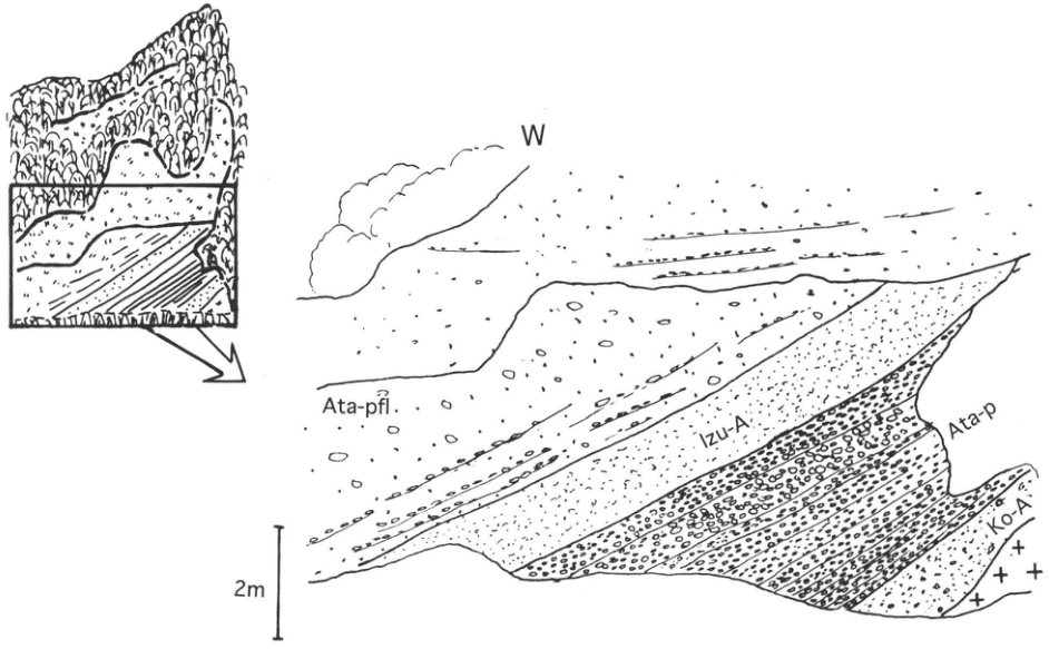
Original Japanese lettering
方位W。Ata-pfl,Izu-A,Ata-p,Ko-A。スケール2m。
English translation
Direction: W. Ata-pfl; Izu-A; Ata-p; Ko-A. Scale: 2 m.
Izu-A — 図中はIzu-A、本文はIz-Aと印刷されているため、それぞれ保持。
p76_116.png
PDF 76 · Original p. 55
Map locating the excavation exposure at Yamashita, Nishiki Town.
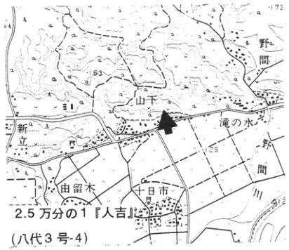
Original Japanese lettering
2.5万分の1『人吉』(八代3号-4)。山下,野間,新立,滝の水,由留木,十日市,錦町,球磨川。可読数値172,163,125,134.4。
English translation
1:25,000 Hitoyoshi (Yatsushiro sheet 3-4). Yamashita; 野間; 新立; 滝の水; 由留木; 十日市; Nishiki Town; Kuma River. Legible numbers: 172, 163, 125, 134.4.
p76_117.png
PDF 76 · Original p. 55
Conceptual exposure sketch of superposed A-Ito, Aso-4, Ata, and Aso-3 at Yamashita.
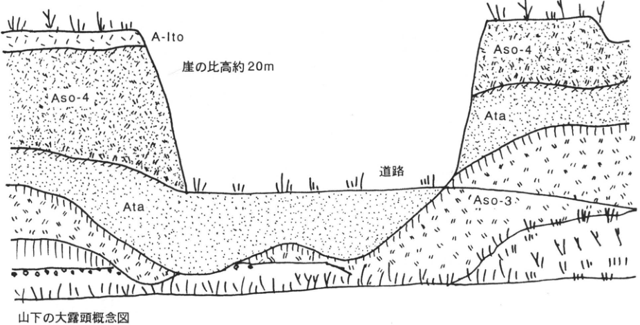
Original Japanese lettering
山下の大露頭概念図。A-Ito;Aso-4(2か所);Ata(2か所);Aso-3;道路;崖の比高約20m。
English translation
Conceptual sketch of the large Yamashita exposure. A-Ito; Aso-4 (twice); Ata (twice); Aso-3; road; cliff relief approximately 20 m.
p77_118.png
PDF 77 · Original p. 56
Map locating the tunnel exposure near 野鹿.
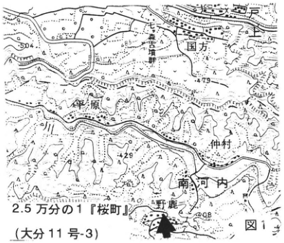
Original Japanese lettering
図1。2.5万分の1『桜町』(大分11号-3)。国方,荻原,仲村,南河内,野鹿。可読数値504,465,479,429,408。
English translation
Figure 1. 1:25,000 Sakuramachi (Oita sheet 11-3). 国方; 荻原; 仲村; 南河内; 野鹿. Legible numbers: 504, 465, 479, 429, 408.
地図の細字注記 — 縦書きの小注記の一部が解像度により判読できない。
p77_119.png
PDF 77 · Original p. 56
Composite column showing units A–N and Ata and K-Tz between Aso-4 and Aso-3.
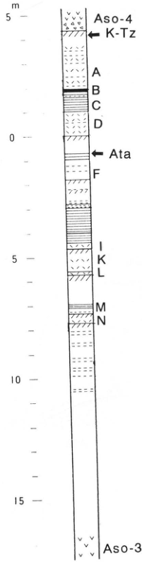
Original Japanese lettering
Aso-4,K-Tz,A,B,C,D,Ata,F,I,K,L,M,N,Aso-3。スケールm:5,0,5,10,15。
English translation
Aso-4; K-Tz; A; B; C; D; Ata; F; I; K; L; M; N; Aso-3. Scale, m: 5, 0, 5, 10, 15.
p78_120.png
PDF 78 · Original p. 57
Photograph showing the Aso-4 base, K-Tz, and Aso-ABCD in the tunnel.
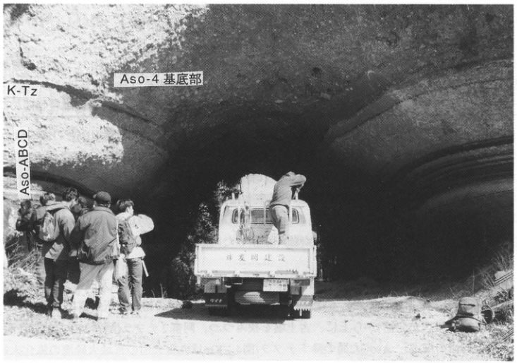
Original Japanese lettering
Aso-4基底部,K-Tz,Aso-ABCD。車両荷台の文字は判読不明。
English translation
Aso-4 basal portion; K-Tz; Aso-ABCD. Lettering on the vehicle tailgate is illegible.
p78_121.png
PDF 78 · Original p. 57
Photograph showing the thin Ata bed below Aso-ABCD.
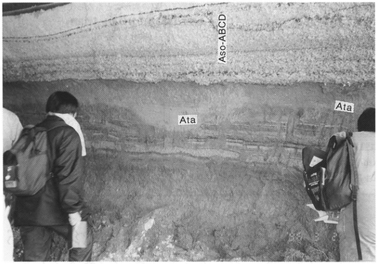
Original Japanese lettering
Aso-ABCD,Ata(2か所)。
English translation
Aso-ABCD; Ata (twice).
p79_122.png
PDF 79 · Original p. 58
Topographic map marking the tunnel-entrance exposure at Shichiri, Taketa.
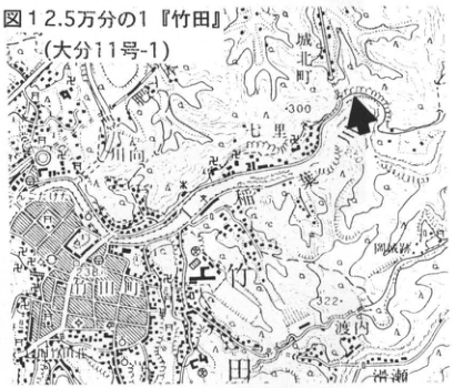
Original Japanese lettering
図1。2.5万分の1『竹田』(大分11号-1)。城町,七里,稲葉川,竹田川,竹田市,竹田町,岡城跡,渡辺。可読数値300,238,322。
English translation
Figure 1. 1:25,000 Taketa (Oita sheet 11-1). 城町; Shichiri; Inaba River; Taketa River; Taketa City; Taketa Town; Oka Castle ruins; 渡辺. Legible numbers: 300, 238, 322.
p79_123.png
PDF 79 · Original p. 58
Section showing Aso-4 covering the Aso-3 plateau and the Inaba River valley.
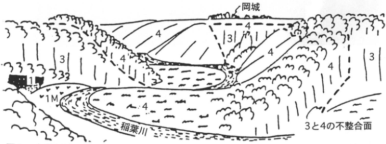
Original Japanese lettering
岡城,稲葉川,3と4の不整合面。1,1M,3,4(複数箇所)。
English translation
Oka Castle; Inaba River; unconformity between 3 and 4. 1; 1M; 3; 4 (repeated).
p80_124.png
PDF 80 · Original p. 59
Exposure sketch showing 3A, 3W, P, and Q at the Aso-3 base.
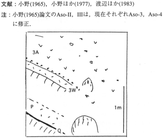
Original Japanese lettering
3A,3W,P,Q,1m。
English translation
3A; 3W; P; Q; 1 m.
p80_125.png
PDF 80 · Original p. 59
Column identifying units, grain sizes, and components between Aso-2 and Aso-3.
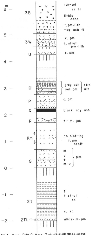
Original Japanese lettering
スケールm:−2,−1,0,1,2,3,4,5,6。上から3B:non-wd sc fl;lithic conc;f. pm·lith -bg ash fl。3W:c. pm;f. strat pm·lith。U:c. pm。O:grey ash/yel pm,strat alt。P:c. pm。Q:black sdy ash。R:f–m. pm。Km:hb. biot-bg f. pm scatt。S:m/c/f/m–c,pm。2T:↑ f. strat sc;c. sc。2TL:white·m·pm。
English translation
Scale in m: −2, −1, 0, 1, 2, 3, 4, 5, 6. From top: 3B: non-wd sc fl [unwelded scoria flow]; lithic conc [lithic concentration]; f. pm·lith -bg ash fl [fine pumice- and lithic-bearing ash flow]. 3W: c. pm [coarse pumice]; f. strat pm·lith [finely stratified pumice and lithics]. U: c. pm. O: grey ash/yel pm [yellow pumice], strat alt [stratified alternation]. P: c. pm. Q: black sdy ash [black sandy ash]. R: f–m. pm [fine to medium pumice]. Km: hb. biot-bg f. pm scatt [scattered hornblende- and biotite-bearing fine pumice]. S: m/c/f/m–c, pm [medium/coarse/fine/medium to coarse pumice]. 2T: ↑ f. strat sc [finely stratified scoria]; c. sc [coarse scoria]. 2TL: white·m·pm [white medium pumice].
p80_126.png
PDF 80 · Original p. 59
Eastern exposure sketch showing Aso-3A and 3B and their erosional contact with Aso-4.
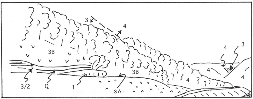
Original Japanese lettering
3,4(複数箇所);3B(2か所);3A;3/2;Q;1。
English translation
3 and 4 (repeated); 3B (twice); 3A; 3/2; Q; 1.
p81_127.png
PDF 81 · Original p. 60
Terrace relationships with Kakuto, Ata, Aso-3, Aso-4, and other tephras in the northern Miyazaki Plain.
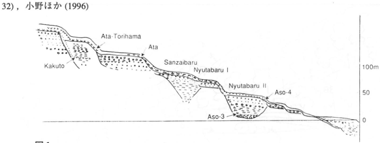
Original Japanese lettering
Kakuto,Ata-Torihama,Ata,Sanzaibaru,Nyutabaru I,Nyutabaru II,Aso-4,Aso-3。標高スケール100m,50,0。
English translation
Kakuto; Ata-Torihama; Ata; Sanzaibaru; Nyutabaru I; Nyutabaru II; Aso-4; Aso-3. Elevation scale: 100 m, 50, 0.
p82_128.png
PDF 82 · Original p. 61
Map marking the Toriyama exposure in Kawaminami Town.
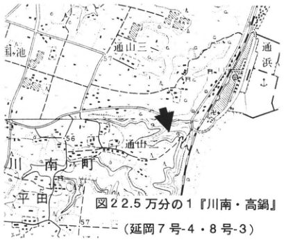
Original Japanese lettering
図2。2.5万分の1『川南・高鍋』(延岡7号-4・8号-3)。針池,通山二,通浜,通山,川南町,平田。可読数値57,56,57。
English translation
Figure 2. 1:25,000 Kawaminami and Takanabe (Nobeoka sheets 7-4 and 8-3). 針池; Toriyama 2; Torihama; Toriyama; Kawaminami Town; Hirata. Legible numbers: 57, 56, 57.
p82_129.png
PDF 82 · Original p. 61
Columns correlating the Aso-3 interval at Miyazaki, Hitoyoshi, Taketa, Takano, and the eastern foot of Fuji.
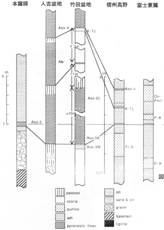
Original Japanese lettering
左から:本露頭,人吉盆地,竹田盆地,信州高野,富士東麓。対比線・単位:Aso-4,Ata,K-Tz(2か所),Aso-3(2か所),Aso-3C,Aso-3A,Aso-3W,Tt-D,On-Pm1,P-A,P-B。厚さ:4.3m,11m,>10m。左スケールm:0,5;高野スケールcm:0,500。凡例:paleosol,scoria,pumice,ash,pyroclastic flows,silt,sand & silt,gravel,basement,lignite。
English translation
From left: this exposure; Hitoyoshi Basin; Taketa Basin; Takano, Shinshu; eastern foot of Fuji. Correlations and units: Aso-4; Ata; K-Tz (twice); Aso-3 (twice); Aso-3C; Aso-3A; Aso-3W; Tt-D; On-Pm1; P-A; P-B. Thicknesses: 4.3 m, 11 m, >10 m. Left scale in m: 0, 5; Takano scale in cm: 0, 500. Legend: paleosol; scoria; pumice; ash; pyroclastic flows; silt; sand & silt; gravel; basement; lignite.
p82_130.png
PDF 82 · Original p. 61
Curves of sea-level change and tephra ages over 130,000 years.
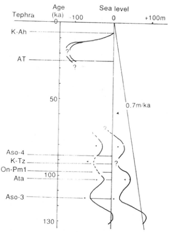
Original Japanese lettering
Tephra:K-Ah,AT,Aso-4,K-Tz,On-Pm1,Ata,Aso-3。Age (ka):0,50,100,130。Sea level:−100,0,+100m。0.7m/ka。?(複数箇所)。
English translation
Tephra: K-Ah, AT, Aso-4, K-Tz, On-Pm1, Ata, Aso-3. Age (ka): 0, 50, 100, 130. Sea level: −100, 0, +100 m. 0.7 m/ka. ? (repeated).
p83_131.png
PDF 83 · Original p. 62
Location of the Kutcharo pyroclastic-flow exposure on the upper Onnenai River.
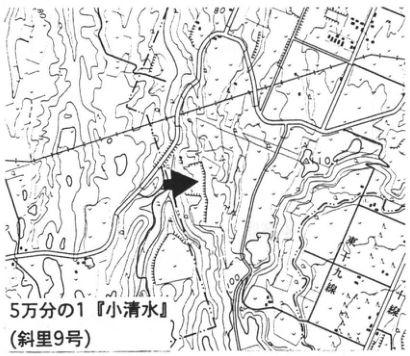
Original Japanese lettering
5万分の1『小清水』(斜里9号)。可読数値80,100。
English translation
1:50,000 Koshimizu (Shari sheet 9). Legible numbers: 80, 100.
p83_132.png
PDF 83 · Original p. 62
Column from KP I to KP V and the intercalated fallout tephras.
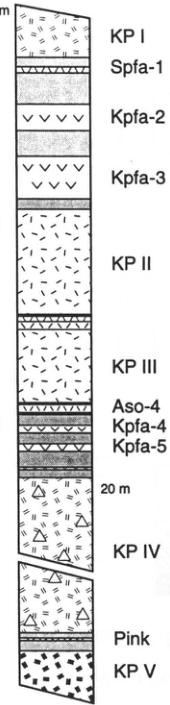
Original Japanese lettering
KP I,Spfa-1,Kpfa-2,Kpfa-3,KP II,KP III,Aso-4,Kpfa-4,Kpfa-5,20m,KP IV,Pink,KP V。左スケールは原PDF側に2m,1,0。
English translation
KP I; Spfa-1; Kpfa-2; Kpfa-3; KP II; KP III; Aso-4; Kpfa-4; Kpfa-5; 20 m; KP IV; Pink; KP V. Left-hand scale visible on the original PDF: 2 m, 1, 0.
p83_133.png
PDF 83 · Original p. 62
Onnenai River exposure photograph identifying KP I, II, III, and IV.
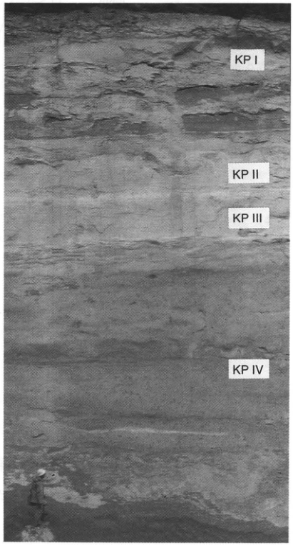
Original Japanese lettering
KP I,KP II,KP III,KP IV。
English translation
KP I; KP II; KP III; KP IV.
p84_134.png
PDF 84 · Original p. 63
Map locating the Nakanotaki sea-cliff exposure, Haboro Town.
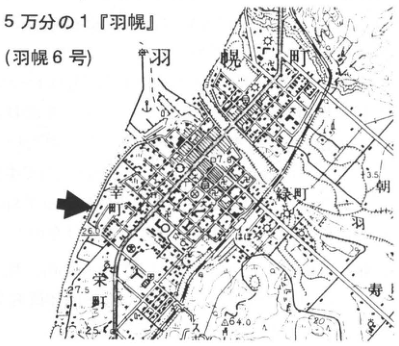
Original Japanese lettering
5万分の1『羽幌』(羽幌6号)。羽幌町,幸町,緑町,朝羽,栄町,寿。可読数値7.0,3.5,26.6,27.5,25,64.0,40。
English translation
1:50,000 Haboro (Haboro sheet 6). Haboro Town; Saiwai Town; Midori Town; 朝羽; Sakae Town; 寿. Legible numbers: 7.0, 3.5, 26.6, 27.5, 25, 64.0, 40.
p84_135.png
PDF 84 · Original p. 63
Sections showing Kc-Hb, Toya, and Aso-4 in peat and the terrace structure.
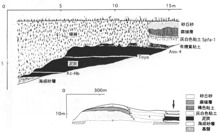
Original Japanese lettering
上図:植被,砂丘砂,腐植層,灰白色粘土 Spfa-1,有機質粘土,Aso-4,Toya,泥炭,Kc-Hb,海成砂層。水平0,5,10,15m;垂直0,5。下図:水平0,300m;垂直10m。凡例:砂丘砂,腐植層,褐色粘土,灰白色粘土,泥炭,海成砂層,基盤。疑問符2か所。
English translation
Upper section: vegetation cover; dune sand; humic layer; grayish-white clay, Spfa-1; organic clay; Aso-4; Toya; peat; Kc-Hb; marine sand. Horizontal scale: 0, 5, 10, 15 m; vertical: 0, 5. Lower section: horizontal 0, 300 m; vertical 10 m. Legend: dune sand; humic layer; brown clay; grayish-white clay; peat; marine sand; basement. Two question marks.
p85_136.png
PDF 85 · Original p. 64
Karumai locality map and tephra column from Spfa1 to Aafa4.
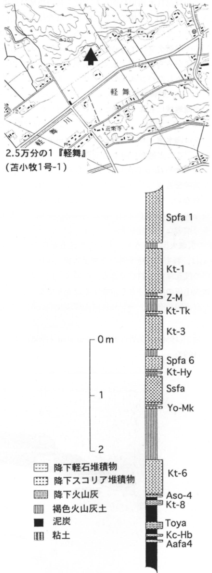
Original Japanese lettering
地図:2.5万分の1『軽舞』(苫小牧1号-1);軽舞,軽舞川,正楽寺;可読数値30.0,21,1.5,2。柱状図上から:Spfa1,Kt-1,Z-M,Kt-Tk,Kt-3,Spfa6,Kt-Hy,Ssfa,Yo-Mk,Kt-6,Aso-4,Kt-8,Toya,Kc-Hb,Aafa4。スケール0m,1,2。凡例:降下軽石堆積物,降下スコリア堆積物,降下火山灰,褐色火山灰土,泥炭,粘土。
English translation
Map: 1:25,000 Karumai (Tomakomai sheet 1-1); Karumai; Karumai River; 正楽寺; legible numbers 30.0, 21, 1.5, 2. Column from top: Spfa1, Kt-1, Z-M, Kt-Tk, Kt-3, Spfa6, Kt-Hy, Ssfa, Yo-Mk, Kt-6, Aso-4, Kt-8, Toya, Kc-Hb, Aafa4. Scale: 0 m, 1, 2. Legend: pumice-fall deposit; scoria-fall deposit; ash fall; brown volcanic-ash soil; peat; clay.
p86_137.png
PDF 86 · Original p. 65
Onejime locality map, Ata-Torihama exposure photograph, and pumice-fall/pyroclastic-flow column.
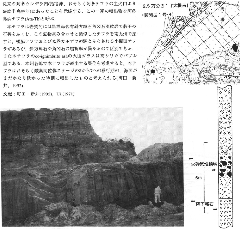
Original Japanese lettering
地図:2.5万分の1『大根占』(開聞岳1号-4);木場,木原,馬場,山口;可読数値40,61.0,93。柱状図:火砕流堆積物,降下軽石,5m。写真自体に可読注記なし。
English translation
Map: 1:25,000 Onejime (Kaimondake sheet 1-4); 木場; 木原; 馬場; 山口; legible numbers 40, 61.0, 93. Column: pyroclastic-flow deposit; pumice fall; 5 m. No legible annotations within the photograph.
p87_138.png
PDF 87 · Original p. 66
Location of the road-cutting exposure at Kamamuta, Aya Town.
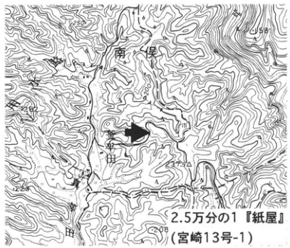
Original Japanese lettering
2.5万分の1『紙屋』(宮崎13号-1)。南俣,釜牟田,米田。可読数値202,258,225,208。
English translation
1:25,000 Kamiya (Miyazaki sheet 13-1). 南俣; Kamamuta; 米田. Legible numbers: 202, 258, 225, 208.
p87_139.png
PDF 87 · Original p. 66
Section of Ata-Th, Kamamuta I–III, Ata, Aira, and other tephras above the Kukino Gravel.
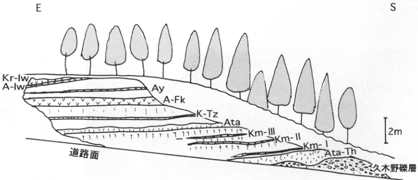
Original Japanese lettering
方位E,S。Kr-Iw,A-Iw,Ay,A-Fk,K-Tz,Ata,Km-III,Km-II,Km-I,Ata-Th,久木野礫層,道路面。2m。
English translation
Directions: E, S. Kr-Iw; A-Iw; Ay; A-Fk; K-Tz; Ata; Km-III; Km-II; Km-I; Ata-Th; Kukino Gravel; road surface. 2 m.
p88_140.png
PDF 88 · Original p. 67
Map showing Ata-Th exposures at Soga-Osawa and a Kiku River tributary.
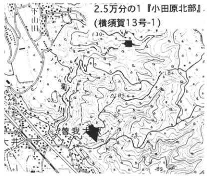
Original Japanese lettering
2.5万分の1『小田原北部』(横須賀13号-1)。川原,曽我大沢,井窪。可読数値130,184,193.4,105,83。
English translation
1:25,000 Northern Odawara (Yokosuka sheet 13-1). 川原; Soga-Osawa; 井窪. Legible numbers: 130, 184, 193.4, 105, 83.
p88_141.png
PDF 88 · Original p. 67
A Stream sketch showing Ata-Th, a fault, and fluvial gravel.
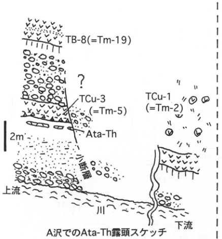
Original Japanese lettering
TB-8 (=Tm-19),?,TCu-3 (=Tm-5),Ata-Th,TCu-1 (=Tm-2),断層,上流,川,下流,2m。A沢でのAta-Th露頭スケッチ。
English translation
TB-8 (=Tm-19); ?; TCu-3 (=Tm-5); Ata-Th; TCu-1 (=Tm-2); fault; upstream; river; downstream; 2 m. Sketch of the Ata-Th exposure at A Stream.
p88_142.png
PDF 88 · Original p. 67
TCu-1–4 and the position of Ata-Th in a Kiku River tributary.
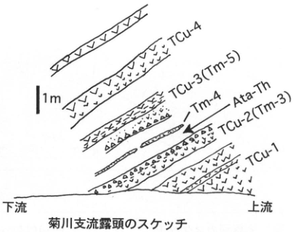
Original Japanese lettering
TCu-4,TCu-3 (Tm-5),Tm-4,Ata-Th,TCu-2 (Tm-3),TCu-1,下流,上流,1m。菊川支流露頭のスケッチ。
English translation
TCu-4; TCu-3 (Tm-5); Tm-4; Ata-Th; TCu-2 (Tm-3); TCu-1; downstream; upstream; 1 m. Sketch of the Kiku River tributary exposure.
p89_143.png
PDF 89 · Original p. 68
Map of site G at Taketa High School and other flow-exposure sites T, K, and U.
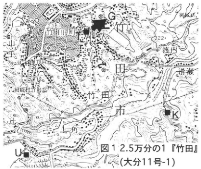
Original Japanese lettering
図1。2.5万分の1『竹田』(大分11号-1)。G,T,K,U;竹田町,竹田市,渡辺,稲葉川,竹田川。可読数値238,322,250。
English translation
Figure 1. 1:25,000 Taketa (Oita sheet 11-1). G, T, K, U; Taketa Town; Taketa City; 渡辺; Inaba River; Taketa River. Legible numbers: 238, 322, 250.
p89_144.png
PDF 89 · Original p. 68
Exposure sketch of contacts among Imaichi and Aso-1–4.
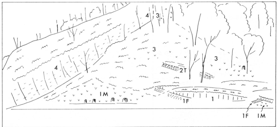
Original Japanese lettering
1,3(複数箇所),4(2か所),2T,IM(2か所),1F(2か所)。
English translation
1; 3 (repeated); 4 (twice); 2T; IM (twice); 1F (twice).
p90_145.png
PDF 90 · Original p. 69
Column of fallout, pyroclastic-flow units, and welding changes in Aso-1 cycle A–D.
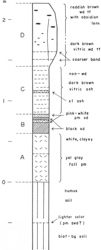
Original Japanese lettering
m:0,1,2。D:reddish brown wd tf with obsidian lens;dark brown vitric wd tf;coarser band。C:non-wd dark brown vitric ash;xl ash。B:pink-white pm sd;black sd。A:white, clayey;yel gray fall pm。下位:humus soil;lighter color (pm bed?);biot-bg soil。
English translation
m: 0, 1, 2. D: reddish brown wd tf with obsidian lens [reddish-brown welded tuff with obsidian lenses]; dark brown vitric wd tf [dark-brown glassy welded tuff]; coarser band. C: non-wd dark brown vitric ash [unwelded dark-brown glassy ash]; xl ash [crystal ash]. B: pink-white pm sd [pinkish-white pumice sand]; black sd [black sand]. A: white, clayey; yel gray fall pm [yellowish-gray pumice fall]. Below: humus soil; lighter color (pm bed?) [pumice bed?]; biot-bg soil [biotite-bearing soil].
p90_146.png
PDF 90 · Original p. 69
Large exposure behind Taketa High School of superposed Imaichi and Aso pyroclastic flows.
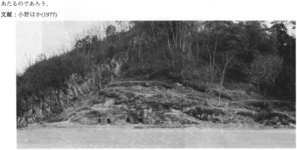
Original Japanese lettering
No lettering
English translation
No lettering
p91_147.png
PDF 91 · Original p. 70
Topographic map locating the natural exposure west of Kawadaira.
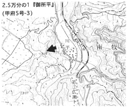
Original Japanese lettering
2.5万分の1『御所平』(甲府5号-3)。川平,南牧村,広瀬。可読数値1156,1150,1207。
English translation
1:25,000 Goshodaira (Kofu sheet 5-3). Kawadaira; Minamimaki Village; Hirose. Legible numbers: 1156, 1150, 1207.
p91_148.png
PDF 91 · Original p. 70
Exposure photograph of Nuka 4 immediately below Lw.O.P and Nuka 3 farther below.
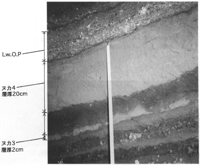
Original Japanese lettering
Lw.O.P,ヌカ4 層厚20cm,ヌカ3 層厚2cm。
English translation
Lw.O.P; Nuka 4, thickness 20 cm; Nuka 3, thickness 2 cm.
p92_149.png
PDF 92 · Original p. 71
Map locating the Ng-1 exposure north of Ago.
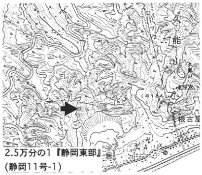
Original Japanese lettering
2.5万分の1『静岡東部』(静岡11号-1)。久能山,根古屋,安居,東照宮。可読数値246,250,50,11.9,12。
English translation
1:25,000 Eastern Shizuoka (Shizuoka sheet 11-1). Kunozan; Negoya; Ago; Toshogu Shrine. Legible numbers: 246, 250, 50, 11.9, 12.
p92_150.png
PDF 92 · Original p. 71
Photograph with arrows marking the Ng-1 ash bed in the valley wall.
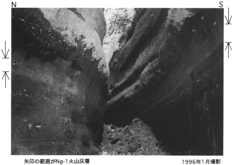
Original Japanese lettering
N,S。矢印の範囲がNg-1火山灰層。1996年1月撮影。
English translation
N; S. The interval between the arrows is the Ng-1 ash bed. Photographed in January 1996.
p93_151.png
PDF 93 · Original p. 72
Map locating the Ng-1 and Kakuto exposure at Ota, Nomura Town.
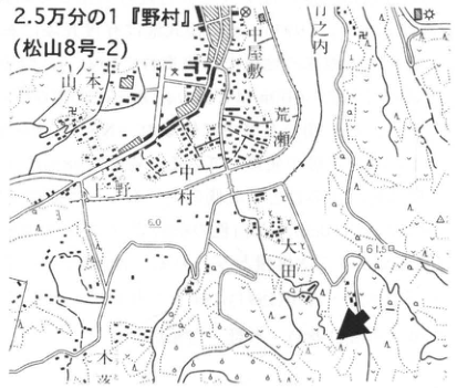
Original Japanese lettering
2.5万分の1『野村』(松山8号-2)。山本,中屋敷,荒瀬,中ノ村,野村,大田。可読数値60,61.5。
English translation
1:25,000 Nomura (Matsuyama sheet 8-2). 山本; 中屋敷; 荒瀬; 中ノ村; Nomura; Ota. Legible numbers: 60, 61.5.
p93_152.png
PDF 93 · Original p. 72
Columns correlating Nomura 1 (Kkt), Nomura 2 (Ng-1), and carbonaceous silt/peat.
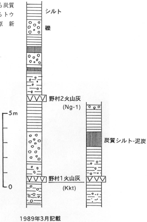
Original Japanese lettering
シルト,礫,野村2火山灰(Ng-1),炭質シルト-泥炭,野村1火山灰(Kkt)。スケール5m,0。1989年3月記載。
English translation
Silt; gravel; Nomura 2 ash (Ng-1); carbonaceous silt–peat; Nomura 1 ash (Kkt). Scale: 5 m, 0. Described in March 1989.
p94_153.png
PDF 94 · Original p. 73
Topographic map of the Kakuto pyroclastic-flow exposure at Yamashita, Nishiki Town.
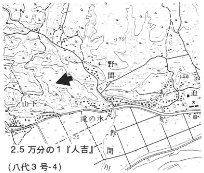
Original Japanese lettering
2.5万分の1『人吉』(八代3号-4)。野間,山下,滝の水,一野間,山川。可読数値172,156,125。
English translation
1:25,000 Hitoyoshi (Yatsushiro sheet 3-4). 野間; Yamashita; 滝の水; 一野間; 山川. Legible numbers: 172, 156, 125.
p94_154.png
PDF 94 · Original p. 73
Exposure sketch showing the erosional surface above Kkt and overlying Aso-4 and A-Ito.
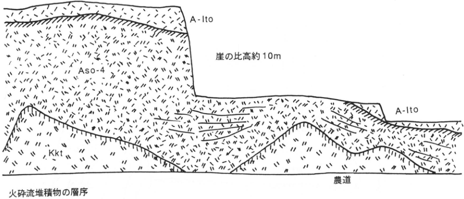
Original Japanese lettering
A-Ito(2か所),Aso-4,Kkt,崖の比高約10m,農道。火砕流堆積物の層序。
English translation
A-Ito (twice); Aso-4; Kkt; cliff relief approximately 10 m; farm road. Stratigraphy of the pyroclastic-flow deposits.
p95_155.png
PDF 95 · Original p. 74
Map marking the quarry exposure at Kogashira and a separate exposure to the north.
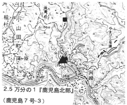
Original Japanese lettering
2.5万分の1『鹿児島北部』(鹿児島7号-3)。小山田町,稲村,川田,柿原,柳瀬。可読数値186.6,100,200。
English translation
1:25,000 Northern Kagoshima (Kagoshima sheet 7-3). Oyamada Town; 稲村; 川田; 柿原; 柳瀬. Legible numbers: 186.6, 100, 200.
p95_156.png
PDF 95 · Original p. 74
Relationships among Kkt, an unnamed pyroclastic flow, Hw, and their welded zones.
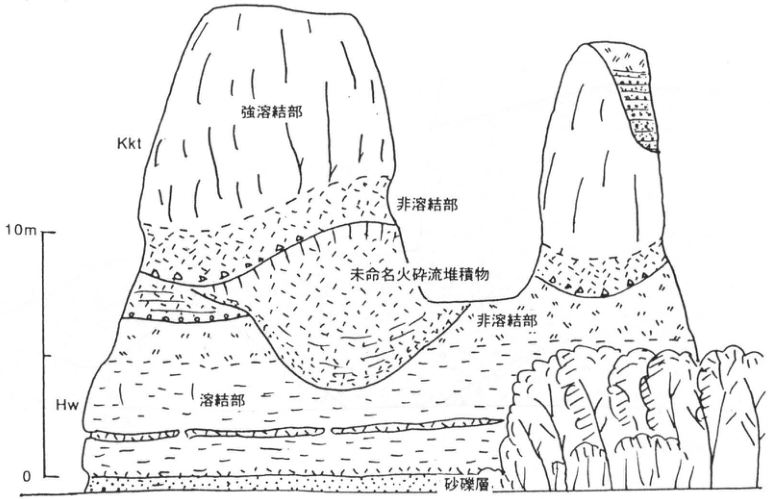
Original Japanese lettering
Kkt,強溶結部,非溶結部(2か所),未命名火砕流堆積物,Hw,溶結部,砂礫層。スケール10m,0。
English translation
Kkt; strongly welded portion; unwelded portion (twice); unnamed pyroclastic-flow deposit; Hw; welded portion; sand and gravel. Scale: 10 m, 0.
p96_157.png
PDF 96 · Original p. 75
Map locating the exposure at the top of the terrace at Tanegu, Nyu.
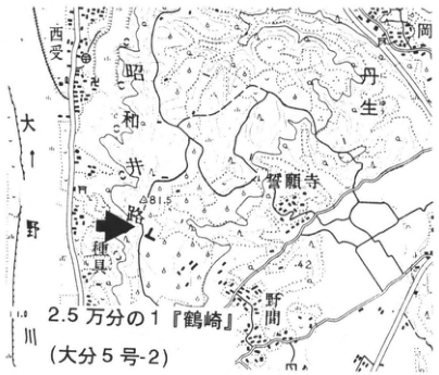
Original Japanese lettering
2.5万分の1『鶴崎』(大分5号-2)。西受,大野川,昭和井,丹生,野田岡,浄願寺,種具,野間。可読数値81.5,42。
English translation
1:25,000 Tsurusaki (Oita sheet 5-2). 西受; Ono River; 昭和井; Nyu; 野田岡; 浄願寺; Tanegu; 野間. Legible numbers: 81.5, 42.
p96_158.png
PDF 96 · Original p. 75
Sketch of Kkt-bearing sand and gravel beneath shell-bearing silt, with an ash-bed photograph.
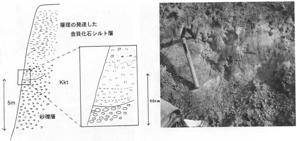
Original Japanese lettering
層理の発達した含貝化石シルト層,Kkt,砂礫層。全体5m;拡大50cm。写真に可読文字なし。
English translation
Well-stratified shell-fossil-bearing silt; Kkt; sand and gravel. Overall scale 5 m; enlarged interval 50 cm. No legible lettering within the photograph.
p97_159.png
PDF 97 · Original p. 76
Joined map sheets locating the exposure south of Hirose.
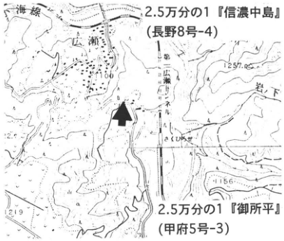
Original Japanese lettering
2.5万分の1『信濃中島』(長野8号-4);2.5万分の1『御所平』(甲府5号-3)。小海線,広瀬,岩下,さくひろせ。可読数値1100,1257,1156,1219。
English translation
1:25,000 Shinano-Nakajima (Nagano sheet 8-4); 1:25,000 Goshodaira (Kofu sheet 5-3). Koumi railway line; Hirose; Iwashita; Saku-Hirose. Legible numbers: 1100, 1257, 1156, 1219.
p97_160.png
PDF 97 · Original p. 76
Exposure overview showing Kkt and underlying B2 (A3Pm).
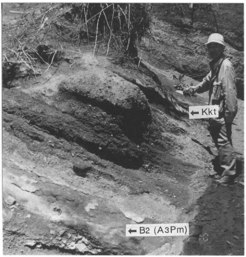
Original Japanese lettering
←Kkt;←B2 (A3Pm)。
English translation
←Kkt; ←B2 (A3Pm).
p97_161.png
PDF 97 · Original p. 76
Close-up of the thin Kkt fine-ash bed.
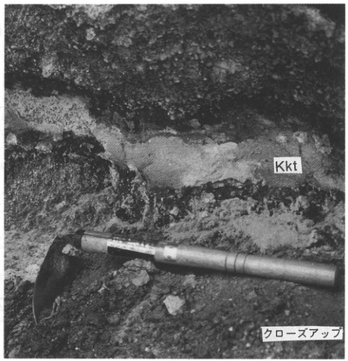
Original Japanese lettering
Kkt,クローズアップ。
English translation
Kkt; close-up.
p98_162.png
PDF 98 · Original p. 77
Location of the APm reference exposure at Kambadaira, Ooka Village.
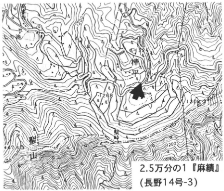
Original Japanese lettering
2.5万分の1『麻績』(長野14号-3)。樺平,聖山。可読数値1288,1032,1100,1200。
English translation
1:25,000 Omi (Nagano sheet 14-3). Kambadaira; Hijiriyama. Legible numbers: 1288, 1032, 1100, 1200.
p98_163.png
PDF 98 · Original p. 77
Joined exposure photographs identifying A1Pm–A4Pm at Kambadaira.
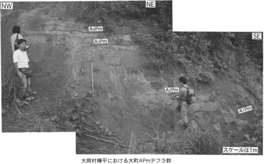
Original Japanese lettering
NW,NE,SE;A4Pm,A3Pm,A2Pm,A1Pm;スケールは1m。大岡村樺平における大町APmテフラ群。
English translation
NW, NE, SE; A4Pm, A3Pm, A2Pm, A1Pm; scale is 1 m. Omachi APm tephra group at Kambadaira, Ooka Village.
p99_164.png
PDF 99 · Original p. 78
Map across two sheets locating the 水鉛谷 conduit.
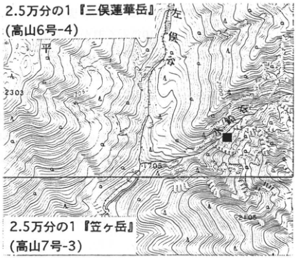
Original Japanese lettering
2.5万分の1『三俣蓮華岳』(高山6号-4);2.5万分の1『笠ヶ岳』(高山7号-3)。左俣谷。可読数値2303,205,2105。
English translation
1:25,000 Mitsumata-Rengedake (Takayama sheet 6-4); 1:25,000 Kasagatake (Takayama sheet 7-3). Hidari-mata Valley. Legible numbers: 2303, 205, 2105.
205 — 数値の一部が不鮮明で、全標高値は確定できない。
p99_165.png
PDF 99 · Original p. 78
Map and A–B section of tuff and granite porphyry in the 水鉛谷 conduit.
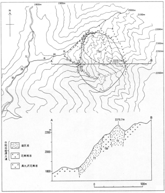
Original Japanese lettering
N;左俣谷,水鉛谷;A,B;Tf,Gp(平面図・断面図)。等高線1800m,1900m,2000m,2100m,2200m,2300m,2350m(2か所);山頂2270.7m;走向傾斜75,60。断面標高m:1800,2000,2200。水平0,500m。凡例:水鉛谷熔結火道―凝灰岩,花崗斑岩;奥丸沢花崗岩。
English translation
N; Hidari-mata Valley; 水鉛谷; A, B; Tf, Gp (map and section). Contours: 1800 m, 1900 m, 2000 m, 2100 m, 2200 m, 2300 m, 2350 m (twice); summit 2270.7 m; dip values 75, 60. Section elevation, m: 1800, 2000, 2200. Horizontal scale: 0, 500 m. Legend: 水鉛谷熔結火道 [printed conduit designation]—tuff, granite porphyry; 奥丸沢 granite.
凡例の水鉛谷熔結火道 — 細字の中央2字は不鮮明。英訳では印刷形を保持し、通常の地質用語への置換を避けた。
p100_166.png
PDF 100 · Original p. 79
Pyroclastic-flow observation sites 1–3 around Kumonotaira.
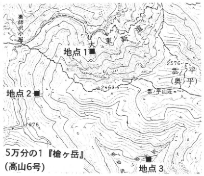
Original Japanese lettering
5万分の1『槍ヶ岳』(高山6号)。地点1,地点2,地点3;薬師沢小屋,A沢,雲ノ平(奥ノ平),雲ノ平山荘,祖父沢。可読数値2576,2463.9,1976。
English translation
1:50,000 Yarigatake (Takayama sheet 6). Sites 1, 2, 3; Yakushizawa hut; A Stream; Kumonotaira (Okunotaira); Kumonotaira mountain lodge; Jiji Stream. Legible numbers: 2576, 2463.9, 1976.
p100_167.png
PDF 100 · Original p. 79
Three columns correlating pumice-flow deposits within the Kumonotaira Gravel.
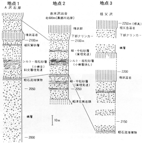
Original Japanese lettering
地点1 A沢右岸:塊状溶岩;2100m;凝灰質砂層;シルト-粗粒砂層(小礫含),斜交層理発達;軽石流堆積物;2050;礫層;2000。地点2 赤木沢出合北600m(黒部川右岸):塊状部,下部クリンカー,2100m;細-中粒砂層(葉理発達);シルト-粗粒砂層(小礫層挟む);細-中粒砂層(葉理発達);2050;船津花崗岩類。地点3 祖父沢:2250m(標高);祖父岳溶岩;下部クリンカー;礫層;2200;塊状溶岩;2150;軽石流堆積物。スケール10m。
English translation
Site 1, right bank of A Stream: massive lava; 2100 m; tuffaceous sand; silt–coarse sand containing small gravel, with developed cross-stratification; pumice-flow deposit; 2050; gravel; 2000. Site 2, 600 m north of the Akagizawa confluence (right bank of the Kurobe River): massive portion; basal clinker; 2100 m; fine–medium sand with developed lamination; silt–coarse sand intercalated with small-gravel beds; fine–medium sand with developed lamination; 2050; Funatsu granitic rocks. Site 3, Jiji Stream: 2250 m (elevation); Jijidake lava; basal clinker; gravel; 2200; massive lava; 2150; pumice-flow deposit. Scale: 10 m.
p101_168.png
PDF 101 · Original p. 80
Map locating the widespread-tephra exposure at Nishigumi, Sugadaira.
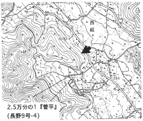
Original Japanese lettering
2.5万分の1『菅平』(長野9号-4)。西組。可読数値1252,1282,1242,1255,1350。
English translation
1:25,000 Sugadaira (Nagano sheet 9-4). Nishigumi. Legible numbers: 1252, 1282, 1242, 1255, 1350.
p101_169.png
PDF 101 · Original p. 80
Joined panorama identifying APms, Kkt, Ata-Th, and other tephras at Sugadaira.
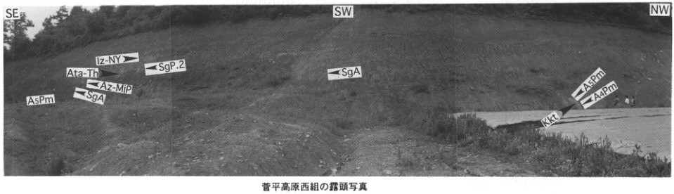
Original Japanese lettering
SE,SW,NW。左部:Iz-NY,Ata-Th,SgP.2,Az-MiP,SgA,A5Pm。中央:SgA。右部:A5Pm,A4Pm,Kkt。菅平高原西組の露頭写真。
English translation
SE, SW, NW. Left: Iz-NY, Ata-Th, SgP.2, Az-MiP, SgA, A5Pm. Center: SgA. Right: A5Pm, A4Pm, Kkt. Exposure photograph at Nishigumi, Sugadaira Plateau.
p102_170.png
PDF 102 · Original p. 81
Map locating the roadside outcrop at Kukino with an arrow
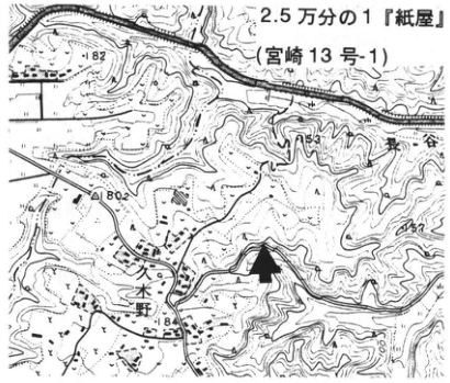
Original Japanese lettering
2.5万分の1「紙屋」(宮崎13号-1)。久木野;東ヶ谷。標高・等高線数字:82,80.2,84,130。
English translation
1:25,000 “Kamiya” (Miyazaki 13-1). Kukino; 東ヶ谷. Elevation and contour figures: 82, 80.2, 84, 130.
p102_171.png
PDF 102 · Original p. 81
Column showing pumice fall with a rounded-gravel bed and nonwelded pyroclastic-flow deposits
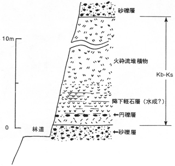
Original Japanese lettering
上から:砂礫層;火砕流堆積物;降下軽石層(水成?);←円礫層;←砂礫層。Kb-Ksの範囲は上部砂礫層の下から下部砂礫層の上まで。林道;目盛0,10m。
English translation
From top: sand and gravel; pyroclastic-flow deposits; pumice-fall bed (water-laid?); ←rounded-gravel bed; ←sand and gravel. Kb-Ks extends from below the upper sand and gravel to above the lower sand and gravel. Forest road; scale 0, 10 m.
p103_172.png
PDF 103 · Original p. 82
Topographic map of Katata marking the Kamiogi outcrop with an arrow
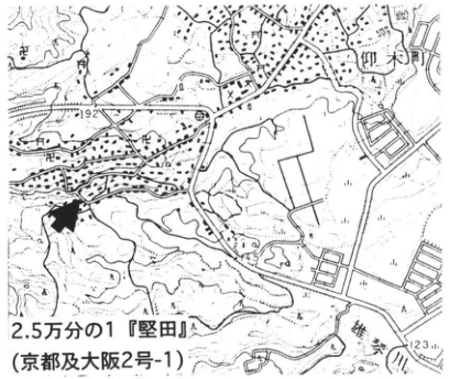
Original Japanese lettering
2.5万分の1「堅田」(京都及大阪2号-1)。仰木町;192;123。
English translation
1:25,000 “Katata” (Kyoto and Osaka 2-1). Ogi Town; 192; 123.
p103_173.png
PDF 103 · Original p. 82
Kamiogi Sakura volcanic-ash bed with a scale
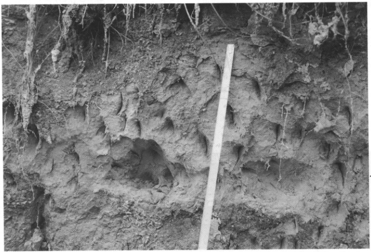
Original Japanese lettering
No lettering
English translation
No lettering
p104_174.png
PDF 104 · Original p. 83
Two topographic maps locating the Totsuka and Futtsu 上 outcrops
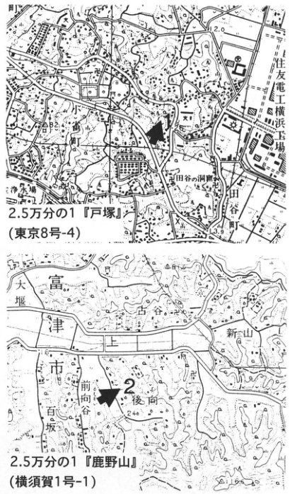
Original Japanese lettering
上図:2.5万分の1「戸塚」(東京8号-4);小雀町,住友電工横浜工場,田谷の洞窟,田谷町,永勝寺。標高2.0,3.9;一部の小字は判読不明。下図:地点2;2.5万分の1「鹿野山」(横須賀1号-1);富津市,大堰,上,古谷,新山,前向谷,後向,百坂;標高24.0,31.6。
English translation
Upper map: 1:25,000 “Totsuka” (Tokyo 8-4); Kosuzume Town, Sumitomo Electric Yokohama Works, Taya Caves, Taya Town, Eishoji Temple. Elevations 2.0, 3.9; some small locality names are illegible. Lower map: locality 2; 1:25,000 “Kanozan” (Yokosuka 1-1); Futtsu City, 大堰, 上, 古谷, 新山, 前向谷, 後向, 百坂; elevations 24.0, 31.6.
地図の細字地名 — 原画像でも一部は読み切れないため判読不明とした。
p104_175.png
PDF 104 · Original p. 83
Correlation of By2 and By1 at Totsuka with the standard Futtsu succession
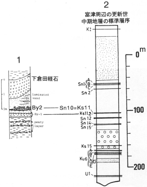
Original Japanese lettering
1:下倉田軽石;laminated sand;By2;By-1;peaty layer;目盛0,1,2m。2:富津周辺の更新世中期地層の標準層序。上からK2;Sn1 A・B・C;Sn2;Sn10=Ks11(By2と対比線);Ks11.2(By-1と対比線);Sn12;Sn14;Sn15;Ks15;Ku6 A・B・C・D・D′・E(D付近の重なりは不鮮明);U1。尺度0,100,200m。
English translation
1: Shimokurata pumice; laminated sand; By2; By-1; peaty layer; scale 0, 1, 2 m. 2: Standard Middle Pleistocene stratigraphy around Futtsu. From top: K2; Sn1 A, B, C; Sn2; Sn10=Ks11 (correlation line to By2); Ks11.2 (correlation line to By-1); Sn12; Sn14; Sn15; Ks15; Ku6 A, B, C, D, D′, E (overlapping lettering near D is indistinct); U1. Scale 0, 100, 200 m.
Ku6のD付近の枝番号 — 細字が重なりD・D′の並びは不鮮明。
p105_176.png
PDF 105 · Original p. 84
Topographic map showing outcrops 1–4 at Seiganji, Nyu
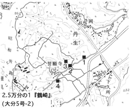
Original Japanese lettering
1,2,3,4;2.5万分の1「鶴崎」(大分5号-2);誓願寺,丹生,下岡,昭和井路,丹生出張所;標高86.5,48.3,81.5,52。
English translation
1, 2, 3, 4; 1:25,000 “Tsurusaki” (Oita 5-2); Seiganji, Nyu, 下岡, Showa irrigation channel, Nyu branch office; elevations 86.5, 48.3, 81.5, 52.
p105_177.png
PDF 105 · Original p. 84
Outcrop photograph of finely alternating beds from SW to NE
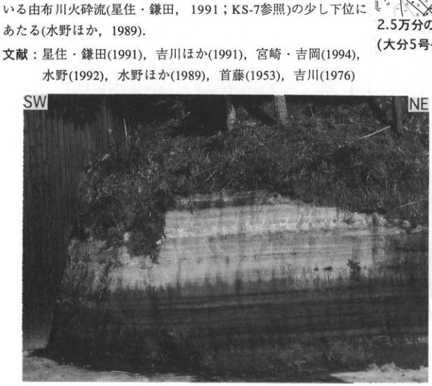
Original Japanese lettering
SW;NE。画像上部の本文と文献は本文に復元済。
English translation
SW; NE. Prose and references embedded above the photograph have been restored in the main text.
p106_178.png
PDF 106 · Original p. 85
Topographic map locating the type outcrop south of Okago
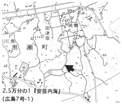
Original Japanese lettering
2.5万分の1「安芸内海」(広島7号-1)。岡郷,黒瀬町,田津原,川角。標高161,186,160.9,26。
English translation
1:25,000 “Aki-Uchinoumi” (Hiroshima 7-1). Okago, Kurose Town, 田津原, 川角. Elevations 161, 186, 160.9, 26.
p106_179.png
PDF 106 · Original p. 85
Column showing peat immediately below the Okago volcanic ash
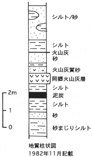
Original Japanese lettering
地質柱状図;1982年11月記載。上から:シルト/砂;シルト;火山灰;砂;火山灰質砂;岡郷火山灰層;シルト;泥炭;シルト;砂;砂まじりシルト。尺度0,1,2m。
English translation
Geological column; described in November 1982. From top: silt/sand; silt; volcanic ash; sand; ashy sand; Okago volcanic-ash bed; silt; peat; silt; sand; sandy silt. Scale 0, 1, 2 m.
p106_180.png
PDF 106 · Original p. 85
Thinly bedded Okago volcanic ash with a hammer for scale
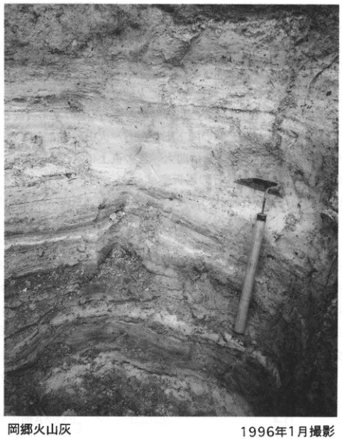
Original Japanese lettering
岡郷火山灰;1996年1月撮影。
English translation
Okago volcanic ash; photographed in January 1996.
p108_181.png
PDF 108 · Original p. 87
Outcrop map and seven columns with correlation lines for Magari, Mera, and Hogawara A–C
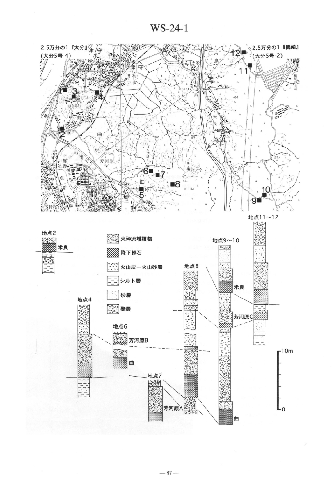
Original Japanese lettering
WS-24-1。地図:2.5万分の1「大分」(大分5号-4);2.5万分の1「鶴崎」(大分5号-2)。地点1~12(1付近の番号は他記号と重なり不鮮明);曲,米良,芳河原,津守,片島,椎迫山,下郡,和台団地,大道,米竹新川井路,ゴルフ場,横尾浄水場,公衆衛生看護学院。標高等:51.5,68,52,97,62,90,118.4,129.4,17,33,63。
柱状図:地点2,地点4,地点6,地点7,地点8,地点9~10,地点11~12。凡例:火砕流堆積物;降下軽石;火山灰-火山砂層;シルト層;砂層;礫層。テフラ名:米良;芳河原C;芳河原B;芳河原A;曲。下位から曲、芳河原B、芳河原C、米良の対比線、曲より下位の芳河原Aの対比線。目盛0,10m。印刷ページ87。
English translation
WS-24-1. Maps: 1:25,000 “Oita” (Oita 5-4); 1:25,000 “Tsurusaki” (Oita 5-2). Localities 1–12 (the numeral near locality 1 overlaps another symbol and is indistinct); Magari, Mera, Hogawara, Tsumori, Katashima, 椎迫山, Shimogori, 和台 housing estate, Oomichi, 米竹新川 irrigation channel, golf course, Yokoo Waterworks, public-health nursing school. Elevation and other figures: 51.5, 68, 52, 97, 62, 90, 118.4, 129.4, 17, 33, 63.
Columns: localities 2, 4, 6, 7, 8, 9–10, 11–12. Legend: pyroclastic-flow deposits; pumice fall; volcanic-ash to volcanic-sand beds; silt; sand; gravel. Tephra labels: Mera; Hogawara C; Hogawara B; Hogawara A; Magari. Correlation lines link Magari, Hogawara B, Hogawara C, and Mera in ascending order, and Hogawara A below Magari. Scale 0, 10 m. Printed page 87.
地図内の地点1と一部細字 — 記号重なりと低解像度により一部は読み切れない。
p109_182.png
PDF 109 · Original p. 88
Four joined topographic sheets marking Imaichi outcrops 1–12 around Kagonodai
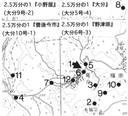
Original Japanese lettering
2.5万分の1「小野屋」(大分9号-2);「大分」(大分5号-4);「豊後今市」(大分10号-1);「野津原」(大分6号-3)。地点1~12。籠ノ台,福宗,本福宗。標高219,240,266,24。
English translation
1:25,000 “Onoya” (Oita 9-2); “Oita” (Oita 5-4); “Bungo-Imaichi” (Oita 10-1); “Notsuharu” (Oita 6-3). Localities 1–12. Kagonodai, Fukuso, Motofukuso. Elevations 219, 240, 266, 24.
p109_183.png
PDF 109 · Original p. 88
Welded Imaichi pyroclastic-flow deposits exposed in a road cut
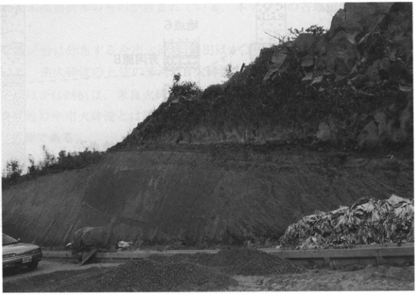
Original Japanese lettering
No lettering
English translation
No lettering
p110_184.png
PDF 110 · Original p. 89
Columns showing welding variations and basal pumice fall of Imaichi, with underlying Yabakei and overlying Yufugawa deposits
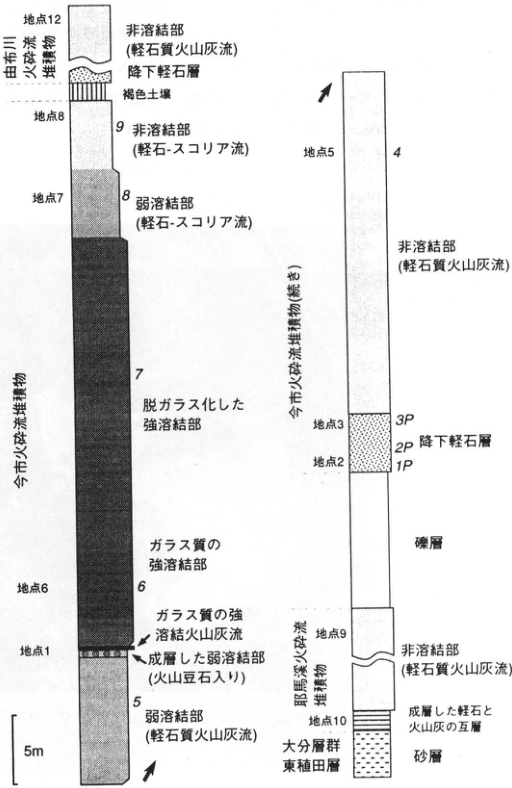
Original Japanese lettering
左柱上から:由布川火砕流堆積物:地点12,非溶結部(軽石質火山灰流);降下軽石層;褐色土壌。今市火砕流堆積物:地点8,試料9,非溶結部(軽石-スコリア流);地点7,8,弱溶結部(軽石-スコリア流);7,脱ガラス化した強溶結部;ガラス質の強溶結部,地点6,6;地点1,ガラス質の強溶結火山灰流;成層した弱溶結部(火山豆石入り);5,弱溶結部(軽石質火山灰流)。尺度5m。 右柱上から:今市火砕流堆積物(続き);地点5,4,非溶結部(軽石質火山灰流);地点3,3P;2P,降下軽石層;地点2,1P;礫層。耶馬溪火砕流堆積物:地点9,非溶結部(軽石質火山灰流);地点10,成層した軽石と火山灰の互層。大分層群東植田層;砂層。
English translation
Left column, from top: Yufugawa pyroclastic-flow deposits: locality 12, nonwelded part (pumiceous ash flow); pumice-fall bed; brown soil. Imaichi pyroclastic-flow deposits: locality 8, sample 9, nonwelded part (pumice–scoria flow); locality 7, 8, weakly welded part (pumice–scoria flow); 7, devitrified strongly welded part; glassy strongly welded part, locality 6, 6; locality 1, glassy strongly welded ash flow; stratified weakly welded part (with accretionary lapilli); 5, weakly welded part (pumiceous ash flow). Scale 5 m. Right column, from top: Imaichi pyroclastic-flow deposits (continued); locality 5, 4, nonwelded part (pumiceous ash flow); locality 3, 3P; 2P, pumice-fall bed; locality 2, 1P; gravel. Yabakei pyroclastic-flow deposits: locality 9, nonwelded part (pumiceous ash flow); locality 10, stratified alternating pumice and volcanic-ash beds. Oita Group, Wasada (東植田) Formation; sand. Italic numerals designate samples. Arabic locality numerals designate outcrops.
p111_185.png
PDF 111 · Original p. 90
Topographic map marking the Kisen ash reference outcrop on the middle Kisen River
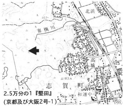
Original Japanese lettering
2.5万分の1「堅田」(京都及び大阪2号-1)。喜撰川,北浜,高城,志賀町,和邇中。標高87,162,183.9。
English translation
1:25,000 “Katata” (Kyoto and Osaka 2-1). Kisen River, Kitahama, 高城, Shiga Town, Waninaka. Elevations 87, 162, 183.9.
p111_186.png
PDF 111 · Original p. 90
SW–NE exposure of Kisen volcanic ash with a 1 m scale
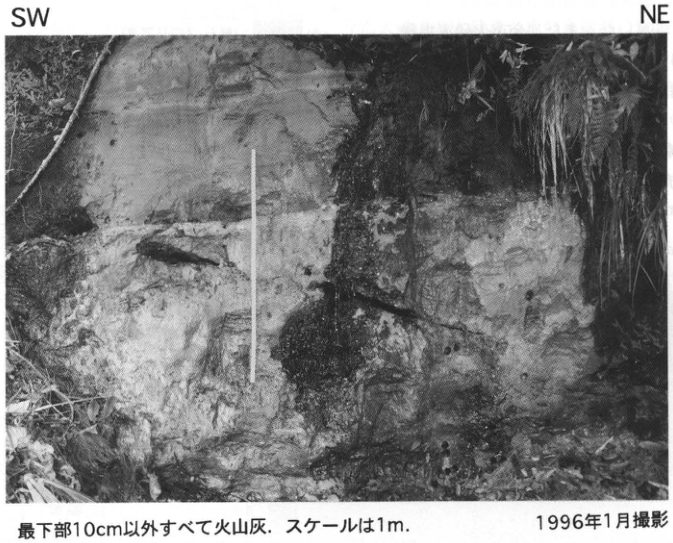
Original Japanese lettering
SW;NE。最下部10cm以外すべて火山灰.スケールは1m.1996年1月撮影。
English translation
SW; NE. All material except the lowermost 10 cm is volcanic ash. Scale 1 m. Photographed in January 1996.
p112_187.png
PDF 112 · Original p. 91
Topographic map marking the forest-road exposure north of Umegase
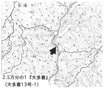
Original Japanese lettering
2.5万分の1「大多喜」(大多喜13号-1)。石塚。標高194,239.3,172,188,220。
English translation
1:25,000 “Otaki” (Otaki 13-1). Ishizuka. Elevations 194, 239.3, 172, 188, 220.
p112_188.png
PDF 112 · Original p. 91
Photograph labelling Ku6A, B, C, D, and E downward through Kokumoto mudstone
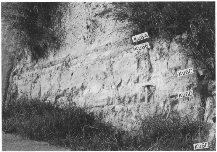
Original Japanese lettering
上から:Ku6A,Ku6B,Ku6C,Ku6D,Ku6E。
English translation
From top: Ku6A, Ku6B, Ku6C, Ku6D, Ku6E.
p113_189.png
PDF 113 · Original p. 92
Map of western Yabakei locating outcrops 1–3
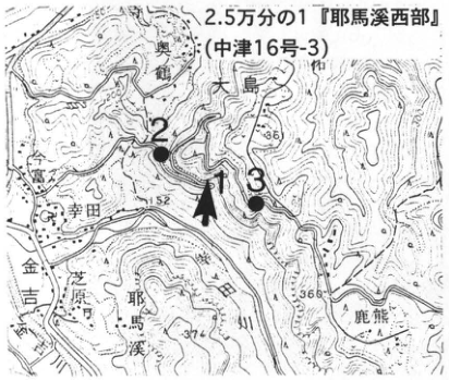
Original Japanese lettering
地点1,2,3;2.5万分の1「耶馬溪西部」(中津16号-3)。大島,奥鶴,幸田,金吉,芝原,鹿熊,耶馬溪。標高152,366,374;等高線200。
English translation
Localities 1, 2, 3; 1:25,000 “Western Yabakei” (Nakatsu 16-3). Oshima, 奥鶴, 幸田, 金吉, 芝原, 鹿熊, Yabakei. Elevations 152, 366, 374; contour 200.
p113_190.png
PDF 113 · Original p. 92
Map locating outcrops 4–5 at Kasagihara, Hijudai
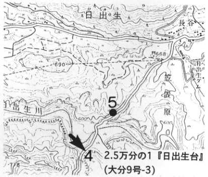
Original Japanese lettering
地点4,5;2.5万分の1「日出生台」(大分9号-3)。日出生,長谷,笠置原,日出生川。標高690,668,678;等高線500,600。
English translation
Localities 4, 5; 1:25,000 “Hijudai” (Oita 9-3). 日出生, 長谷, Kasagiharu, 日出生 River. Elevations 690, 668, 678; contours 500, 600.
p114_191.png
PDF 114 · Original p. 93
Accretionary lapilli no larger than 1 cm shown beside a tape measure
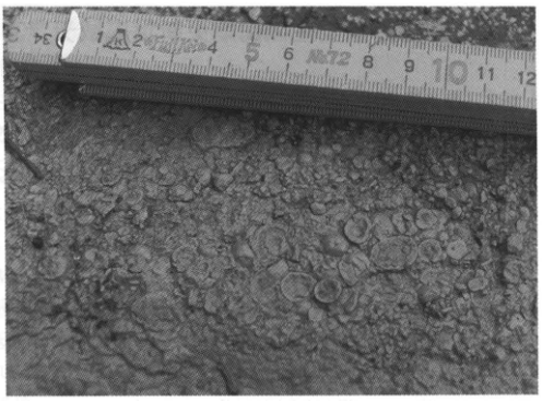
Original Japanese lettering
巻尺の可読目盛:1,2,4,5,6,7,8,9,10,11,12。
English translation
Legible tape-measure numerals: 1, 2, 4, 5, 6, 7, 8, 9, 10, 11, 12.
p114_192.png
PDF 114 · Original p. 93
Two columns showing welded Yabakei deposits at Kaguma and basal fallout ash with underlying strata at Hijudai
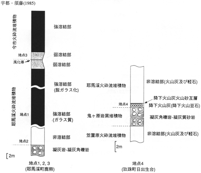
Original Japanese lettering
左柱:地点1,2,3(耶馬溪町鹿熊)。上から今市火砕流堆積物:強溶結部;弱溶結部;地点3,風化帯。耶馬溪火砕流堆積物:弱溶結部;強溶結部(脱ガラス化);地点1,強溶結部(ガラス質);非溶結部;地点2;凝灰岩-凝灰角礫岩。尺度2m。 右柱:地点4(玖珠町日出生台)。上から耶馬溪火砕流堆積物:非溶結部(火山灰及び軽石);降下火山灰火山砂互層;地点4,降下火山灰(降下火山豆石)。鬼ヶ原岩屑堆積物:凝灰角礫岩-凝灰質砂岩。笠置原火砕流堆積物:非溶結部(火山灰及び軽石)。尺度2m。画像上端の宇都・須藤(1985)は本文文献に復元済。
English translation
Left column: localities 1, 2, 3 (Kaguma, Yabakei Town). From top: Imaichi pyroclastic-flow deposits: strongly welded part; weakly welded part; locality 3, weathered zone. Yabakei pyroclastic-flow deposits: weakly welded part; strongly welded part (devitrified); locality 1, strongly welded part (glassy); nonwelded part; locality 2; tuff–tuff breccia. Scale 2 m. Right column: locality 4 (Hijudai, Kusu Town). From top: Yabakei pyroclastic-flow deposits: nonwelded part (volcanic ash and pumice); alternating volcanic-ash and volcanic-sand fallout beds; locality 4, volcanic-ash fall (accretionary-lapilli fall). Onigahara debris deposits: tuff breccia–tuffaceous sandstone. Kasagiharu pyroclastic-flow deposits: nonwelded part (volcanic ash and pumice). Scale 2 m. Uto and Suto (1985) at the image top has been restored in the main references.
p115_193.png
PDF 115 · Original p. 94
Reference section of fifteen beds and named earth pillars at Hatodake, with a location map at upper right
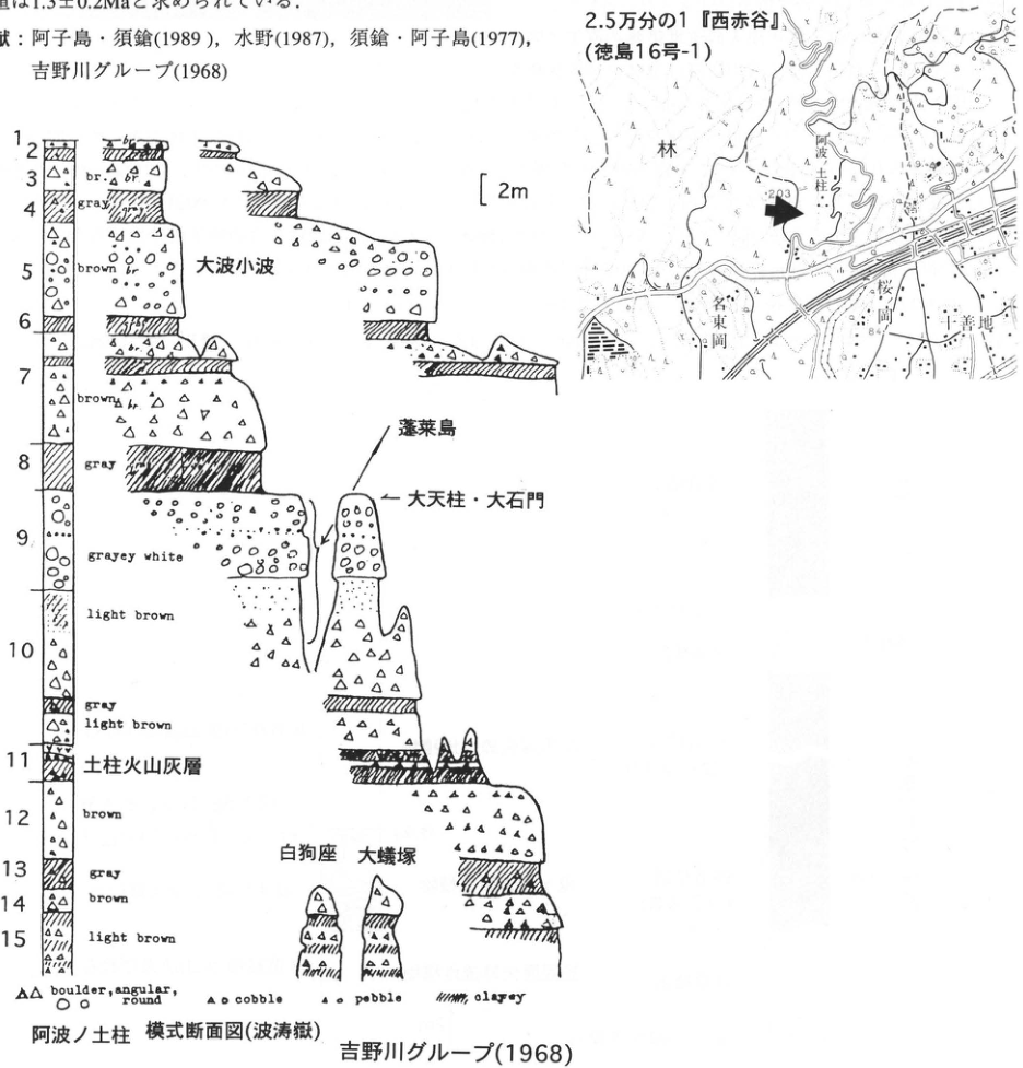
Original Japanese lettering
地図:2.5万分の1「西赤谷」(徳島16号-1);阿波ノ土柱,林,桜ノ岡,名東岡,十善地;標高203,149.9,84。 阿波ノ土柱 模式断面図(波涛嶽);吉野川グループ(1968);尺度2m。地形名:大波小波,蓬莱島,大天柱・大石門,白狗座,大蟻塚。凡例:boulder, angular, round;cobble;pebble;clayey。層番号と原図色調:
| 番号 | 可読色調・ラベル |
|---|---|
| 1 | br. |
| 2 | 判読不明 |
| 3 | br. |
| 4 | gray |
| 5 | brown br. |
| 6 | 色調文字なし |
| 7 | brown br. |
| 8 | gray |
| 9 | grayey white |
| 10 | light brown;gray;light brown |
| 11 | 土柱火山灰層 |
| 12 | brown |
| 13 | gray |
| 14 | brown |
| 15 | light brown |
English translation
Map: 1:25,000 “Nishi-Akadani” (Tokushima 16-1); Awa-no-Dochu, Hayashi, Sakuranooka, 名東岡, 十善地; elevations 203, 149.9, 84. Reference cross-section of Awa-no-Dochu (Hatodake); Yoshinogawa Group (1968); scale 2 m. Named landforms: Onami-Konami, Horaijima, Daitenchu–Daisekimon, Hakukuza, Oarizuka. Legend, retaining original English: boulder, angular, round; cobble; pebble; clayey. Bed numbers and original colour lettering:
| Number | Legible colour or label |
|---|---|
| 1 | br. |
| 2 | illegible |
| 3 | br. |
| 4 | gray |
| 5 | brown br. |
| 6 | no colour lettering |
| 7 | brown br. |
| 8 | gray |
| 9 | grayey white |
| 10 | light brown; gray; light brown |
| 11 | Dochu volcanic-ash bed |
| 12 | brown |
| 13 | gray |
| 14 | brown |
| 15 | light brown |
第2層の細字 — 原図上端の文字が重なり判読できない。br.とgrayey whiteは原図表記を保持。
p116_194.png
PDF 116 · Original p. 95
Map showing the principal outcrop east of 富蔵 and observation sites to its southeast
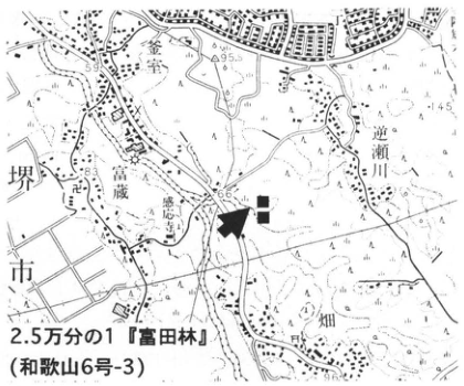
Original Japanese lettering
2.5万分の1「富田林」(和歌山6号-3)。堺市,富蔵,逆瀬川,釜室,畑,感応寺。標高59,95.5,145,83,66,96.2。
English translation
1:25,000 “Tondabayashi” (Wakayama 6-3). Sakai City, 富蔵, Sakasegawa, Kamamuro, Hata, Kannoji Temple. Elevations 59, 95.5, 145, 83, 66, 96.2.
p116_195.png
PDF 116 · Original p. 95
NW–SE exposure showing the volcanic-ash bed and underlying marine clay Ma1
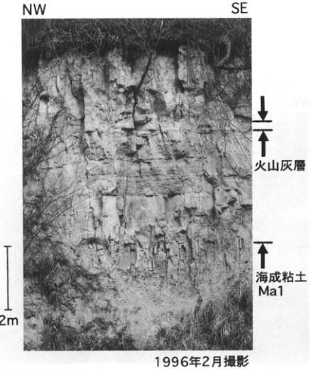
Original Japanese lettering
NW;SE;火山灰層;海成粘土Ma1;2m;1996年2月撮影。
English translation
NW; SE; volcanic-ash bed; marine clay Ma1; 2 m; photographed in February 1996.
p116_196.png
PDF 116 · Original p. 95
Close-up of finely stratified Pink volcanic ash
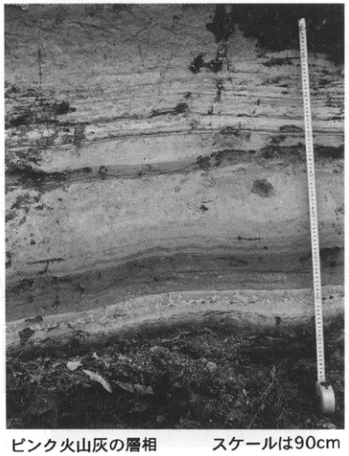
Original Japanese lettering
ピンク火山灰の層相;スケールは90cm。
English translation
Facies of the Pink volcanic ash; scale 90 cm.
p117_197.png
PDF 117 · Original p. 96
Map marking the Fukuda ash type outcrop in Mikeyama Town with a black square
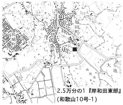
Original Japanese lettering
2.5万分の1「岸和田東部」(和歌山10号-1)。福田町,葛城町,大池。標高69,73.0,74。
English translation
1:25,000 “Eastern Kishiwada” (Wakayama 10-1). Fukuda Town, Katsuragi Town, Oike. Elevations 69, 73.0, 74.
p117_198.png
PDF 117 · Original p. 96
Paired photographs showing units A1, B, C of Fukuda ash and a thin underlying ash bed
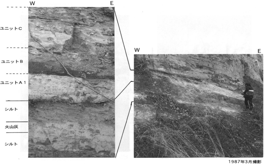
Original Japanese lettering
左右ともW,E。左写真上から:ユニットC;ユニットB;ユニットA1;シルト;火山灰;シルト。1987年3月撮影。
English translation
W, E on both photographs. Left photograph, from top: unit C; unit B; unit A1; silt; volcanic ash; silt. Photographed in March 1987.
p118_199.png
PDF 118 · Original p. 97
Map of the east-bank Tsujimata River outcrop and photograph of units A1, A2, B, C
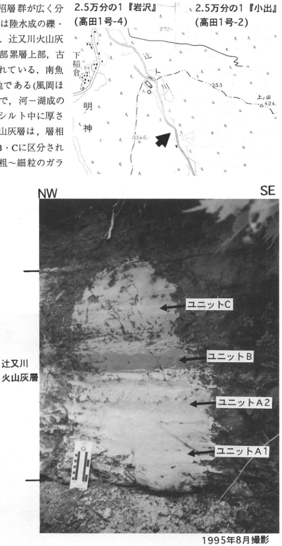
Original Japanese lettering
地図:2.5万分の1「岩沢」(高田1号-4);2.5万分の1「小出」(高田1号-2)。下稲倉,明神,上山;標高272,194,353,424,234.6。写真:NW,SE;辻又川火山灰層;上からユニットC,B,A2,A1;1995年8月撮影。画像左縁の本文断片は本文に収録済。
English translation
Map: 1:25,000 “Iwasawa” (Takada 1-4); 1:25,000 “Koide” (Takada 1-2). 下稲倉, Myojin, 上山; elevations 272, 194, 353, 424, 234.6. Photograph: NW, SE; Tsujimatagawa volcanic-ash bed; from top, units C, B, A2, A1; photographed in August 1995. Text fragments at the left edge are included in the main text.
p119_200.png
PDF 119 · Original p. 98
Map marking the Kd38 outcrop in the valley southwest of 加勢
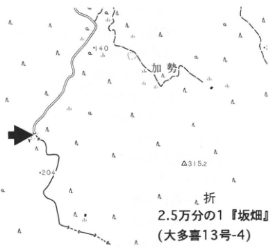
Original Japanese lettering
2.5万分の1「坂畑」(大多喜13号-4)。加勢;折〔地名の残りは切れている〕。標高140,204,315.2。
English translation
1:25,000 “Sakahata” (Otaki 13-4). 加勢; 折 [remainder of locality name cropped]. Elevations 140, 204, 315.2.
p119_201.png
PDF 119 · Original p. 98
N–S outcrop photograph of Kd38 units A1, A2, and B
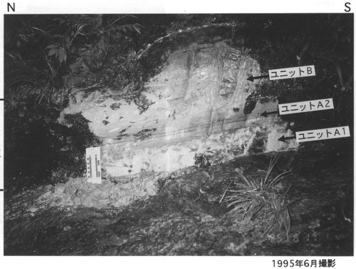
Original Japanese lettering
N;S;kd38火山灰;上からユニットB,ユニットA2,ユニットA1;1995年6月撮影。
English translation
N; S; kd38 volcanic ash; from top, unit B, unit A2, unit A1; photographed in June 1995.
p121_202.png
PDF 121 · Original p. 100
Map of the Wakasakanai sheet marking the artificial outcrop at 豊徳
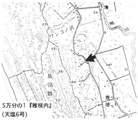
Original Japanese lettering
5万分の1「稚咲内」(天塩6号)。ワンコノ沢,長沼群,豊徳,清明川。標高5,5.5,57,45,56,48.8,8.7,3.5,51.5,23,55.2。
English translation
1:50,000 “Wakasakanai” (Teshio 6). Wankonosawa, Naganuma lake group, 豊徳, Seimei River. Elevations 5, 5.5, 57, 45, 56, 48.8, 8.7, 3.5, 51.5, 23, 55.2.
p121_203.png
PDF 121 · Original p. 100
S–N exposure labelling seven Rishiri tephras above marine sand and gravel
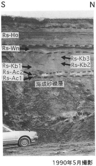
Original Japanese lettering
S;N;Rs-Ho;Rs-Wn;Rs-Kb3;Rs-Kb2;Rs-Kb1;Rs-Ac2;Rs-Ac1;海成砂礫層;1990年5月撮影。
English translation
S; N; Rs-Ho; Rs-Wn; Rs-Kb3; Rs-Kb2; Rs-Kb1; Rs-Ac2; Rs-Ac1; marine sand and gravel; photographed in May 1990.
p121_204.png
PDF 121 · Original p. 100
Column relating Rishiri and widespread tephras to age determinations
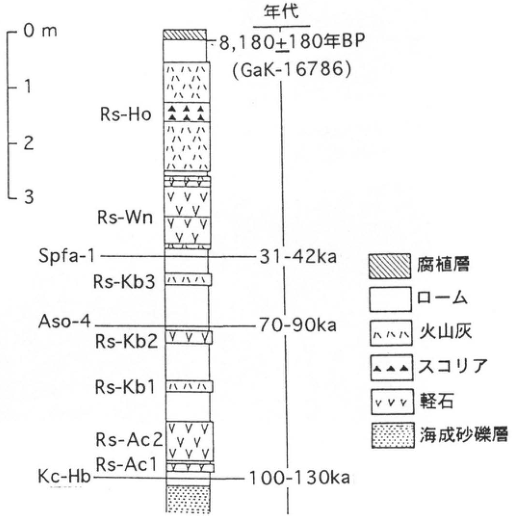
Original Japanese lettering
尺度0,1,2,3m。年代:8,180±180年BP(GaK-16786);31–42ka;70–90ka;100–130ka。上からRs-Ho;Rs-Wn;Spfa-1(31–42ka);Rs-Kb3;Aso-4(70–90ka);Rs-Kb2;Rs-Kb1;Rs-Ac2;Rs-Ac1;Kc-Hb(100–130ka)。凡例:腐植層;ローム;火山灰;スコリア;軽石;海成砂礫層。
English translation
Scale 0, 1, 2, 3 m. Ages: 8,180±180 yr BP (GaK-16786); 31–42 ka; 70–90 ka; 100–130 ka. From top: Rs-Ho; Rs-Wn; Spfa-1 (31–42 ka); Rs-Kb3; Aso-4 (70–90 ka); Rs-Kb2; Rs-Kb1; Rs-Ac2; Rs-Ac1; Kc-Hb (100–130 ka). Legend: humic layer; loam; volcanic ash; scoria; pumice; marine sand and gravel.
p122_205.png
PDF 122 · Original p. 101
Map showing the Ashino borrow pit and surrounding wetlands
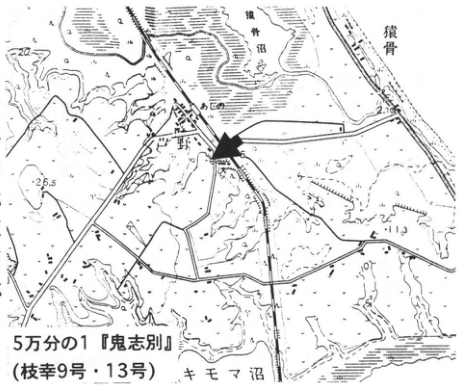
Original Japanese lettering
5万分の1「鬼志別」(枝幸9号・13号)。芦野,猿骨,猿骨沼,キモマ沼。標高20,26.5,11.3,2.16,6。
English translation
1:50,000 “Onishibetsu” (Esashi 9 and 13). Ashino, Sarukotsu, Lake Sarukotsu, Lake Kimoma. Elevations 20, 26.5, 11.3, 2.16, 6.
p122_206.png
PDF 122 · Original p. 101
Southern crack extending below Rs-Wn and northern crack with an iron-oxide pan
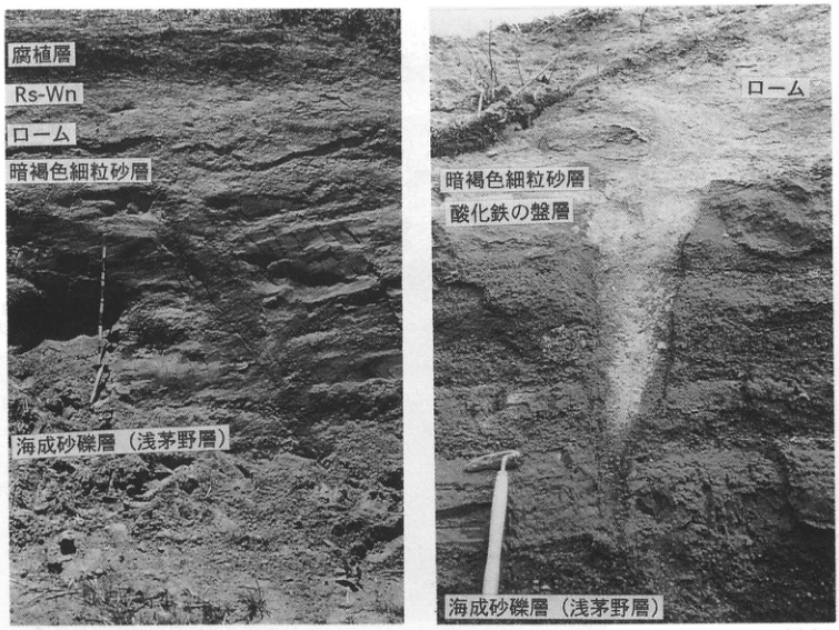
Original Japanese lettering
左:腐植層;Rs-Wn;ローム;暗褐色細粒砂層;海成砂礫層(浅茅野層)。右:ローム;暗褐色細粒砂層;酸化鉄の盤層;海成砂礫層(浅茅野層)。
English translation
Left: humic layer; Rs-Wn; loam; dark brown fine sand; marine sand and gravel (Asachino Formation). Right: loam; dark brown fine sand; iron-oxide pan; marine sand and gravel (Asachino Formation).
p123_207.png
PDF 123 · Original p. 102
Map marking the exposure west of Horoiwa Farm
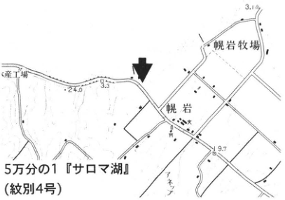
Original Japanese lettering
5万分の1「サロマ湖」(紋別4号)。幌岩,幌岩牧場;標高3.1,24.0,3.3,9.7。左縁の工場名は切れている。
English translation
1:50,000 “Lake Saroma” (Mombetsu 4). Horoiwa, Horoiwa Farm; elevations 3.1, 24.0, 3.3, 9.7. Factory name at left edge is cropped.
p123_208.png
PDF 123 · Original p. 102
Exposure with dark peat and pale pyroclastic-flow deposits above marine sand and silt
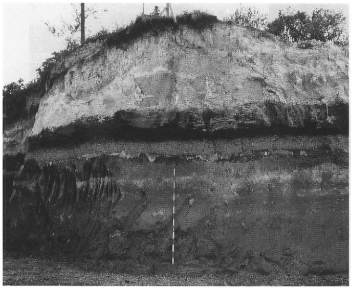
Original Japanese lettering
No lettering
English translation
No lettering
p123_209.png
PDF 123 · Original p. 102
Column of tephras and peat from Kussharo IV down to marine deposits
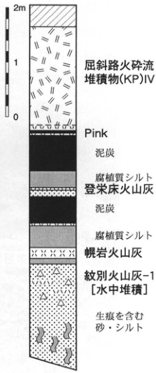
Original Japanese lettering
尺度0,1,2m。上から:屈斜路火砕流堆積物(KP)IV;Pink;泥炭;腐植質シルト;登栄床火山灰;泥炭;腐植質シルト;幌岩火山灰;紋別火山灰-1[水中堆積];生痕を含む砂・シルト。
English translation
Scale 0, 1, 2 m. From top: Kussharo pyroclastic-flow deposits (KP) IV; Pink; peat; humic silt; Toetoko volcanic ash; peat; humic silt; Horoiwa volcanic ash; Mombetsu volcanic ash-1 [deposited under water]; sand and silt containing trace fossils.
p124_210.png
PDF 124 · Original p. 103
Map locating the exposure at Kaisei, Kitami City
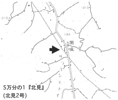
Original Japanese lettering
5万分の1「北見」(北見2号)。開成,サントンエイ〔地図原表記〕;標高210.8,215,189。
English translation
1:50,000 “Kitami” (Kitami 2). Kaisei, サントンエイ [original map lettering]; elevations 210.8, 215, 189.
p124_211.png
PDF 124 · Original p. 103
Column of AWT, AUP, KP V, KP IV with photograph of KP V over AUP
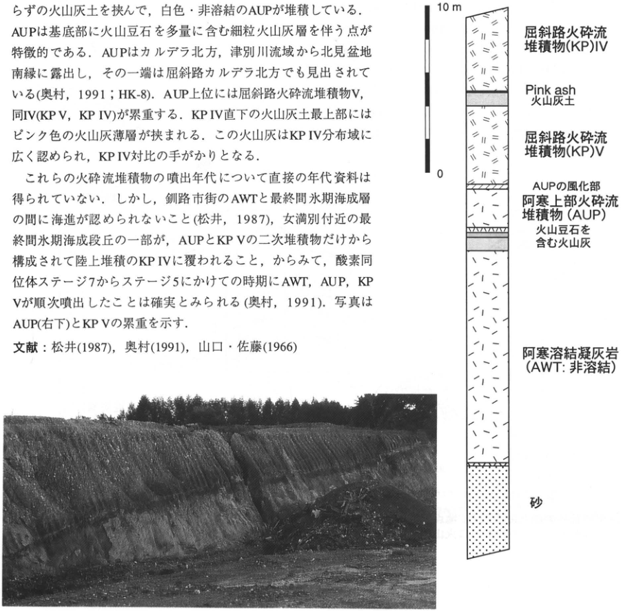
Original Japanese lettering
尺度0,10m。上から:屈斜路火砕流堆積物(KP)IV;Pink ash;火山灰土;屈斜路火砕流堆積物(KP)V;AUPの風化部;阿寒上部火砕流堆積物(AUP);火山豆石を含む火山灰;阿寒溶結凝灰岩(AWT:非溶結);砂。画像内本文と文献は本文に収録済。
English translation
Scale 0, 10 m. From top: Kussharo pyroclastic-flow deposits (KP) IV; Pink ash; volcanic-ash soil; Kussharo pyroclastic-flow deposits (KP) V; weathered part of AUP; Akan Upper Pyroclastic-flow Deposits (AUP); volcanic ash containing accretionary lapilli; Akan Welded Tuff (AWT: nonwelded); sand. Embedded prose and references are included in the main text.
p125_212.png
PDF 125 · Original p. 104
Older and younger dune sections and a peat tephra column using Tokoro I–IV, with two location maps at upper right
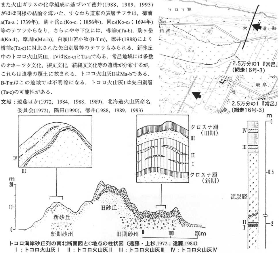
Original Japanese lettering
二地図とも2.5万分の1「常呂」(網走16号-3)。上図:サロマ湖,常呂遺跡,鐺沸;標高1.8,1.6。下図:岐阜;標高等5,5,6。 トコロ海岸砂丘列の南北断面図とC地点の柱状図(遠藤・上杉,1972;遠藤,1984)。凡例I:トコロ火山灰I;II:同II;III:同III;IV:同IV。左挿図:III,IV。中央挿図上から:クロスナ層(旧期);III;II;I;クロスナ層(新期)。断面:新砂丘;旧砂丘;新期砂州;旧期砂州。標高0,10,20m;水平尺度0,100,200m。右柱:IV;III;泥炭層;II;I。深度0,0.5,2m(中間省略記号)。画像上部の本文・文献は本文に復元済。
English translation
Both maps: 1:25,000 “Tokoro” (Abashiri 16-3). Upper map: Lake Saroma, Tokoro archaeological site, Tofutsu; elevations 1.8, 1.6. Lower map: Gifu; elevation and other figures 5, 5, 6. North–south cross-section of the Tokoro coastal dune belt and column at locality C (Endo and Uesugi, 1972; Endo, 1984). Key: I, Tokoro volcanic ash I; II, ash II; III, ash III; IV, ash IV. Left inset: III, IV. Central inset, from top: kurosuna (black-sand) layer (older); III; II; I; kurosuna layer (younger). Section: younger dunes; older dunes; younger sandbar; older sandbar. Elevation 0, 10, 20 m; horizontal scale 0, 100, 200 m. Right column: IV; III; peat; II; I. Depth 0, 0.5, 2 m (break symbol in between). Embedded prose and references above have been restored in the main text.
p126_213.png
PDF 126 · Original p. 105
Map locating ridge-top outcrop A and valley-facing outcrop B at Konan
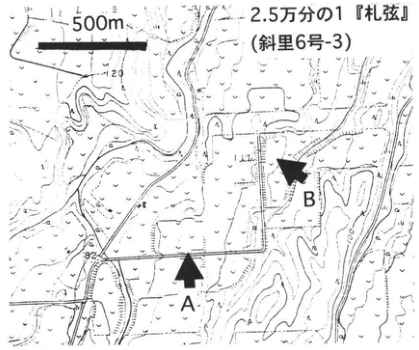
Original Japanese lettering
A;B;500m;2.5万分の1「札弦」(斜里6号-3)。等高線数字120,100,80。
English translation
A; B; 500 m; 1:25,000 “Sattsuru” (Shari 6-3). Contour figures 120, 100, 80.
p126_214.png
PDF 126 · Original p. 105
Composite column with Kussharo and Mashu sources on opposite sides, ages, and widespread-tephra markers
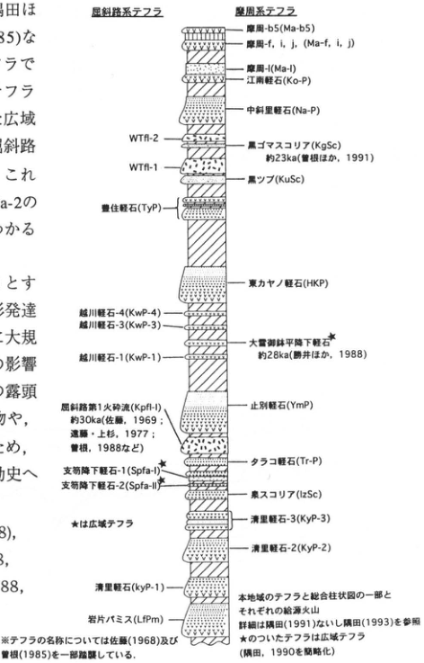
Original Japanese lettering
屈斜路系テフラ/摩周系テフラ。上から順に、右=摩周系・左=屈斜路系:
| 順序 | 区分 | 原図名・符号・年代 |
|---|---|---|
| 1 | 右 | 摩周-b5(Ma-b5) |
| 2 | 右 | 摩周-f,i,j(Ma-f,i,j) |
| 3 | 右 | 摩周-l(Ma-l) |
| 4 | 右 | 江南軽石(Ko-P) |
| 5 | 右 | 中斜里軽石(Na-P) |
| 6 | 左 | WTfl-2 |
| 7 | 右 | 黒ゴマスコリア(KgSc),約23ka(曽根ほか,1991) |
| 8 | 左 | WTfl-1 |
| 9 | 右 | 黒ップ(KuSc) |
| 10 | 左 | 豊住軽石(TyP) |
| 11 | 右 | 東カヤノ軽石(HKP) |
| 12 | 左 | 越川軽石-4(KwP-4) |
| 13 | 左 | 越川軽石-3(KwP-3) |
| 14 | 右・★ | 大雪御鉢平降下軽石,約28ka(勝井ほか,1988) |
| 15 | 左 | 越川軽石-1(KwP-1) |
| 16 | 左 | 屈斜路第1火砕流(Kpfl-I),約30ka(佐藤,1969;遠藤・上杉,1977;曽根,1988など) |
| 17 | 右 | 止別軽石(YmP) |
| 18 | 右 | タラコ軽石(Tr-P) |
| 19 | 左・★ | 支笏降下軽石-1(Spfa-I) |
| 20 | 左・★ | 支笏降下軽石-2(Spfa-II) |
| 21 | 右 | 泉スコリア(IzSc) |
| 22 | 右 | 清里軽石-3(KyP-3) |
| 23 | 右 | 清里軽石-2(KyP-2) |
| 24 | 左 | 清里軽石(KyP-1) |
| 25 | 左 | 岩片パミス(LfPm) |
| ★は広域テフラ。※テフラの名称については佐藤(1968)及び曽根(1985)を一部踏襲している。本地域のテフラと総合柱状図の一部とそれぞれの給源火山。詳細は隅田(1991)ないし隅田(1993)を参照。★のついたテフラは広域テフラ。(隅田,1990を簡略化)。画像左縁の本文断片は本文に収録済。 |
English translation
Kussharo-derived tephras / Mashu-derived tephras. In descending order, right=Mashu-derived and left=Kussharo-derived:
| Order | Side | Original name, code, and age |
|---|---|---|
| 1 | Right | Mashu-b5 (Ma-b5) |
| 2 | Right | Mashu-f, i, j (Ma-f, i, j) |
| 3 | Right | Mashu-l (Ma-l) |
| 4 | Right | Konan pumice (Ko-P) |
| 5 | Right | Nakashari pumice (Na-P) |
| 6 | Left | WTfl-2 |
| 7 | Right | Kurogoma scoria (KgSc), approximately 23 ka (Sone et al., 1991) |
| 8 | Left | WTfl-1 |
| 9 | Right | Kuroppu (KuSc) |
| 10 | Left | Toyozumi pumice (TyP) |
| 11 | Right | 東カヤノ pumice (HKP) |
| 12 | Left | Koshikawa pumice-4 (KwP-4) |
| 13 | Left | Koshikawa pumice-3 (KwP-3) |
| 14 | Right, ★ | Daisetsu–Ohachidaira pumice fall, approximately 28 ka (Katsui et al., 1988) |
| 15 | Left | Koshikawa pumice-1 (KwP-1) |
| 16 | Left | Kussharo pyroclastic flow 1 (Kpfl-I), approximately 30 ka (Sato, 1969; Endo and Uesugi, 1977; Sone, 1988, and others) |
| 17 | Right | Yambetsu pumice (YmP) |
| 18 | Right | Tarako pumice (Tr-P) |
| 19 | Left, ★ | Shikotsu pumice fall-1 (Spfa-I) |
| 20 | Left, ★ | Shikotsu pumice fall-2 (Spfa-II) |
| 21 | Right | Izumi scoria (IzSc) |
| 22 | Right | Kiyosato pumice-3 (KyP-3) |
| 23 | Right | Kiyosato pumice-2 (KyP-2) |
| 24 | Left | Kiyosato pumice (KyP-1) |
| 25 | Left | Lithic-fragment pumice (LfPm) |
| ★ denotes widespread tephra. Note: the tephra nomenclature partly follows Sato (1968) and Sone (1985). Tephras of this region, part of the composite stratigraphic column, and their respective source volcanoes. For details, see Sumita (1991) or Sumita (1993). Tephras marked ★ are widespread tephras. (Simplified from Sumita, 1990.) Text fragments at the left edge are included in the main text. |
WTfl-1・WTfl-2、Kpfl-I — 末尾の細字lとIの字形が紛らわしいため原図に近い表記を保持。本文はSpfa-1/2、図はSpfa-I/II。
p127_215.png
PDF 127 · Original p. 106
Map locating the roadside ditch west of Kaiyo
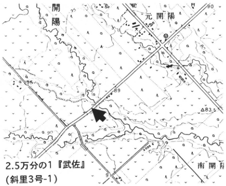
Original Japanese lettering
2.5万分の1「武佐」(斜里3号-1)。開陽,元開陽,南開陽。標高95,90,89,83.5,91。
English translation
1:25,000 “Musa” (Shari 3-1). Kaiyo, Motokaiyo, Minamikaiyo. Elevations 95, 90, 89, 83.5, 91.
p127_216.png
PDF 127 · Original p. 106
Section of Ma-k frost-heave hummocks and a small gully overlain by Ma-g, h, i and Ma-f
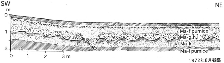
Original Japanese lettering
SW;NE。深度0,1,2m;水平距離0,1,2,3m。上から:Ma-f pumice;Ma-g,h,i;Ma-k;Ma-l pumice。1972年8月観察。
English translation
SW; NE. Depth 0, 1, 2 m; horizontal distance 0, 1, 2, 3 m. From top, original lettering: Ma-f pumice; Ma-g,h,i; Ma-k; Ma-l pumice. Observed in August 1972.
p128_217.png
PDF 128 · Original p. 107
Location map near Higashimokoto and correlated columns of the Kutcharo and Akan pyroclastic-flow deposits
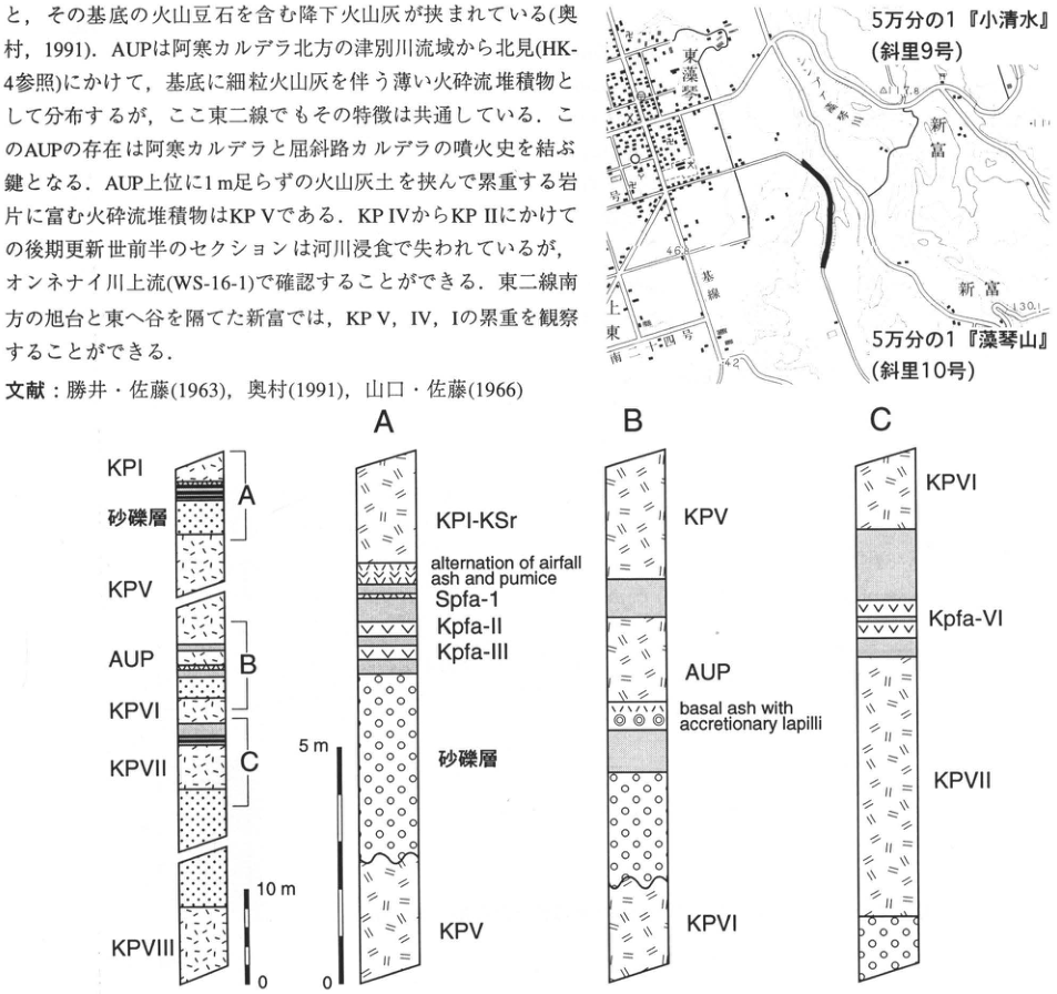
Original Japanese lettering
位置図:5万分の1『小清水』(斜里9号);5万分の1『藻琴山』(斜里10号);東藻琴,新富,上東,東一号,東二号,東三号,東四号,東基線;46.8,42,130.1.全体柱状図(上から):KP I,砂礫層,A,KP V,AUP,B,KP VI,KP VII,C,KP VIII;スケール10m,0.A(上から):KP I-KSr;alternation of airfall ash and pumice;Spfa-1;Kpfa-II;Kpfa-III;砂礫層;KP V;スケール5m,0.B(上から):KP V;AUP;basal ash with accretionary lapilli;KP VI.C(上から):KP VI;Kpfa-VI;KP VII.
English translation
Map: 1:50,000 ‘Koshimizu’ (Shari sheet 9); 1:50,000 ‘Mokotoyama’ (Shari sheet 10); Higashimokoto, Shintomi (新富), Kamihigashi (上東), Higashi-Ichigo (東一号), Higashi-Nigo (東二号), Higashi-Sango (東三号), Higashi-Yongo (東四号), Higashi-Kisen (東基線); 46.8, 42, 130.1. General column, from top: KP I, sand and gravel bed, A, KP V, AUP, B, KP VI, KP VII, C, KP VIII; scale 10m, 0. A, from top: KP I-KSr; alternation of airfall ash and pumice; Spfa-1; Kpfa-II; Kpfa-III; sand and gravel bed; KP V; scale 5m, 0. B, from top: KP V; AUP; basal ash with accretionary lapilli; KP VI. C, from top: KP VI; Kpfa-VI; KP VII.
位置図の微小な一部地形図文字と標高は判読不明。本文を含む切り出し画像の本文はページ本文に清書済み。
p129_218.png
PDF 129 · Original p. 108
Barasan coastal location map, section of valley-filling peat and tephra, and stratigraphic column with radiocarbon ages
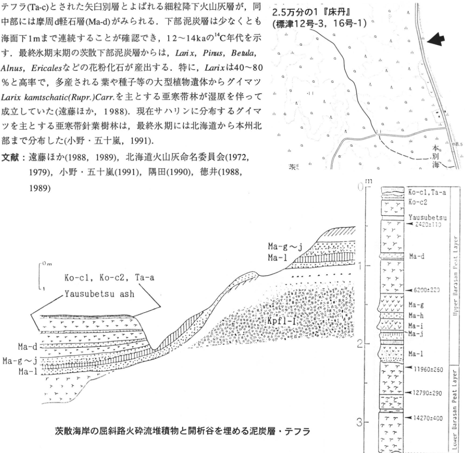
Original Japanese lettering
地図:2.5万分の1『床丹』(標津12号-3,16号-1);本別海;茨;8.5.断面図:0m,1;Ko-c1,Ko-c2,Ta-a;Yausubetsu ash;Ma-d;Ma-g~j;Ma-l;Kpfl-I.柱状図:m,0,1,2,3;Ko-c1,Ta-a;Ko-c2;Yausubetsu;2420±110;Ma-d;6200±220;Ma-g;Ma-h;Ma-i;Ma-j;Ma-l;11960±250;12790±290;14270±400;Upper Barasan Peat Layer;Lower Barasan Peat Layer.
English translation
Map: 1:25,000 ‘Tokotan’ (Shibetsu sheets 12-3 and 16-1); Honbetsukai (本別海); 茨 [partial place label]; 8.5. Section: 0m, 1; Ko-c1, Ko-c2, Ta-a; Yausubetsu ash; Ma-d; Ma-g–j; Ma-l; Kpfl-I. Column: m, 0, 1, 2, 3; Ko-c1, Ta-a; Ko-c2; Yausubetsu; 2420±110; Ma-d; 6200±220; Ma-g; Ma-h; Ma-i; Ma-j; Ma-l; 11960±250; 12790±290; 14270±400; Upper Barasan Peat Layer; Lower Barasan Peat Layer.
地図の微小文字には判読不明箇所がある。
p130_219.png
PDF 130 · Original p. 109
Location map of Biruwa-genya and the comparison exposure to the north-northwest
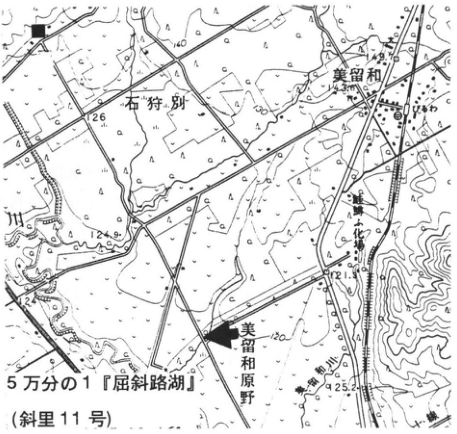
Original Japanese lettering
5万分の1『屈斜路湖』(斜里11号);石狩別;美留和;びるわ;美留和原野;釧網本線;釧路川;140,126,124.9,121.9,125.2,120;■;矢印.
English translation
1:50,000 ‘Kutcharoko’ (Shari sheet 11); Ishikaribetsu (石狩別); Biruwa; Biruwa-genya; Senmo Main Line; Kushiro River; 140, 126, 124.9, 121.9, 125.2, 120; ■; arrow.
一部の地図内微小文字は判読不明。
p130_220.png
PDF 130 · Original p. 109
Column showing Ta-a, Ko-c₂, Ma-b, and B-Tm in peat
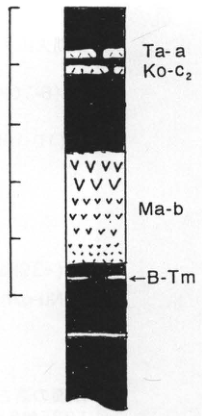
Original Japanese lettering
Ta-a;Ko-c₂;Ma-b;←B-Tm.左側の目盛に数値表記なし.
English translation
Ta-a; Ko-c₂; Ma-b; ←B-Tm. The scale ticks on the left have no numerical labels.
p130_221.png
PDF 130 · Original p. 109
Outcrop sketch of Mashu and Atosanupuri pyroclastic-flow deposits at the north-northwestern ■ site
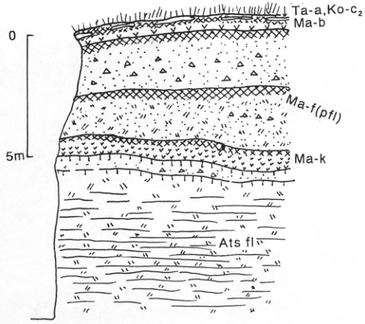
Original Japanese lettering
0;5m;Ta-a,Ko-c₂;Ma-b;Ma-f (pfl);Ma-k;Ats fl.
English translation
0; 5m; Ta-a, Ko-c₂; Ma-b; Ma-f (pfl); Ma-k; Ats fl.
p131_222.png
PDF 131 · Original p. 110
Location map of the road-cut exposure at Kikusui, Nakashunbetsu
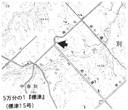
Original Japanese lettering
5万分の1『標津』(標津15号);中春別;西十三線;西十四線;南十一号;南十二号;南十三号;39,44.3,40.5,38.2;矢印.
English translation
1:50,000 ‘Shibetsu’ (Shibetsu sheet 15); Nakashunbetsu; Nishi-Jusan-sen; Nishi-Juyon-sen; Minami-Juichi-go; Minami-Juni-go; Minami-Jusan-go; 39, 44.3, 40.5, 38.2; arrow.
地図の微小文字の一部は判読不明。
p131_223.png
PDF 131 · Original p. 110
Nakashunbetsu, Chanai, and Mashu tephra groups and ancient dune deposits exposed along a southwest-to-northeast road-cut slope
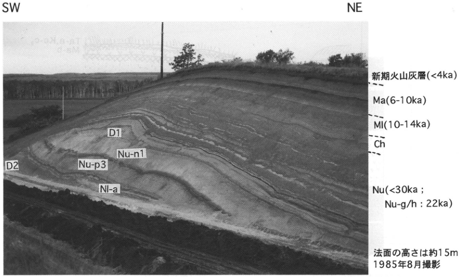
Original Japanese lettering
SW;NE;新期火山灰層(<4ka);Ma(6-10ka);Ml(10-14ka);Ch;Nu(<30ka;Nu-g/h:22ka);D1;D2;Nu-n1;Nu-p3;Nl-a;法面の高さは約15m;1985年8月撮影.
English translation
SW; NE; younger volcanic-ash beds (<4ka); Ma (6-10ka); Ml (10-14ka); Ch; Nu (<30ka; Nu-g/h: 22ka); D1; D2; Nu-n1; Nu-p3; Nl-a; cut-slope height approximately 15m; photographed in August 1985.
p132_224.png
PDF 132 · Original p. 111
Location map of the Izumikawa exposure
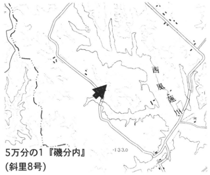
Original Japanese lettering
5万分の1『磯分内』(斜里8号);西風連川;133.0;矢印.
English translation
1:50,000 ‘Isobunnai’ (磯分内; Shari sheet 8); Nishi-Furen River (西風連川); 133.0; arrow.
地図の一部の微小文字は判読不明。
p132_225.png
PDF 132 · Original p. 111
Photograph of the Izumikawa tephra outcrop and stratigraphic column from Kutcharo Pyroclastic-flow Deposit IV to Mashu tephras
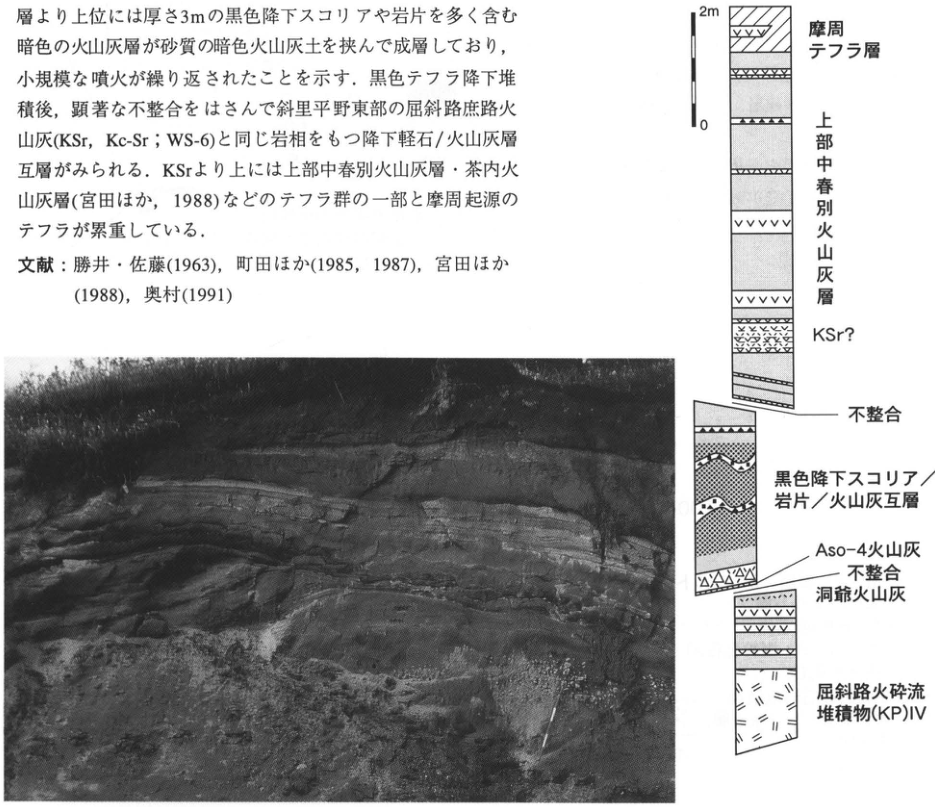
Original Japanese lettering
柱状図(上から):2m,0;摩周テフラ層;上部中春別火山灰層;KSr?;不整合;黒色降下スコリア/岩片/火山灰互層;Aso-4火山灰;不整合;洞爺火山灰;屈斜路火砕流堆積物(KP)IV.写真に文字注記なし.
English translation
Column, from top: 2m, 0; Mashu tephra beds; Upper Nakashunbetsu ash beds; KSr?; unconformity; alternating black scoria-fall/lithic-fragment/ash beds; Aso-4 ash; unconformity; Toya ash; Kutcharo Pyroclastic-flow Deposit (KP) IV. The photograph has no textual annotations.
p133_226.png
PDF 133 · Original p. 112
Location map of Zaimokucho and geological map of eastern Kushiro City
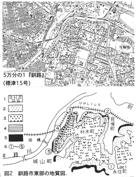
Original Japanese lettering
地形図:5万分の1『釧路』(標津15号);釧路市;釧路大橋;松浦町;共栄大通;旭橋;旭町;材木町;貝塚;東釧路貝塚;ひがしくしろ;春採;武佐;錦町;北大通;末広町;幣舞橋;幣舞町;春採川;太平洋炭鉱;32.7.地質図:図2 釧路市東部の地質図;ひがしくしろ;別;貝塚町;材木町;城山町;永住町;釧路川;旭橋;① Loc1,②,③,④,⑤;凡例1,2,3,4,5,6:①~⑤.
English translation
Topographic map: 1:50,000 ‘Kushiro’ (Shibetsu sheet 15); Kushiro City; Kushiro Ohashi; Matsuuracho; Kyoei-odori; Asahibashi; Asahicho; Zaimokucho; Kaizuka; Higashi-Kushiro shell mound; Higashi-Kushiro; Harutori; Musa; Nishikicho; Kita-odori; Suehirocho; Nusamaibashi; Nusamaicho; Harutori River; Taiheiyo coal mine; 32.7. Geological map: Fig. 2, geological map of eastern Kushiro City; Higashi-Kushiro; 別 [partial label]; Kaizukacho; Zaimokucho; Shiroyamacho; 永住町 [place name]; Kushiro River; Asahibashi; ① Loc1, ②, ③, ④, ⑤; legend 1, 2, 3, 4, 5, 6: ①–⑤.
地形図内の微小文字には判読不明箇所がある。永住町の読みは未確認のため日本語保持。
p133_227.png
PDF 133 · Original p. 112
Sketch of stratigraphy and unconformities at Zaimokucho exposure ③
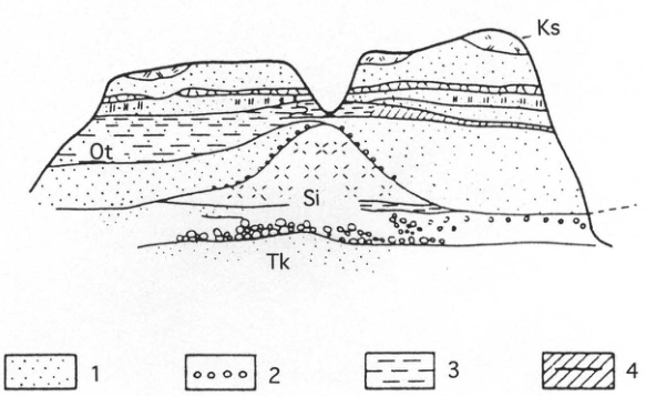
Original Japanese lettering
③;Ks;Ot;Si;Tk;1,2,3,4.凡例は本文に収録.
English translation
③; Ks; Ot; Si; Tk; 1, 2, 3, 4. The legend is reproduced in the page text.
p134_228.png
PDF 134 · Original p. 113
Sketch showing the stratigraphy of exposures ④ and ⑤ and ages exceeding 45,400 B.P. and 44,010 B.P.
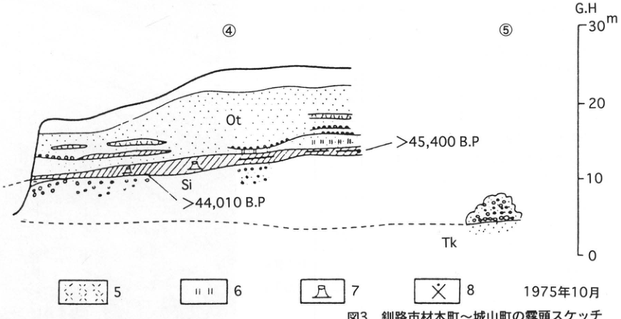
Original Japanese lettering
④;⑤;Ot;Si;Tk;>45,400 B.P;>44,010 B.P;G.H;m;30,20,10,0;凡例5,6,7,8;1975年10月.
English translation
④; ⑤; Ot; Si; Tk; >45,400 B.P; >44,010 B.P; G.H; m; 30, 20, 10, 0; legend 5, 6, 7, 8; October 1975.
p135_229.png
PDF 135 · Original p. 114
Location map of the Kuchoro ash-bed exposure on the upper Osotsubetsu River
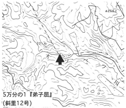
Original Japanese lettering
5万分の1『弟子屈』(斜里12号);オソツベツ川;256.2;221.9;200;矢印.
English translation
1:50,000 ‘Teshikaga’ (Shari sheet 12); Osotsubetsu River; 256.2; 221.9; 200; arrow.
地図の微小数字の一部は判読不明。
p135_230.png
PDF 135 · Original p. 114
Column of the upper Kuchoro ash beds and outcrop photograph indicating R1 and R2 ash beds
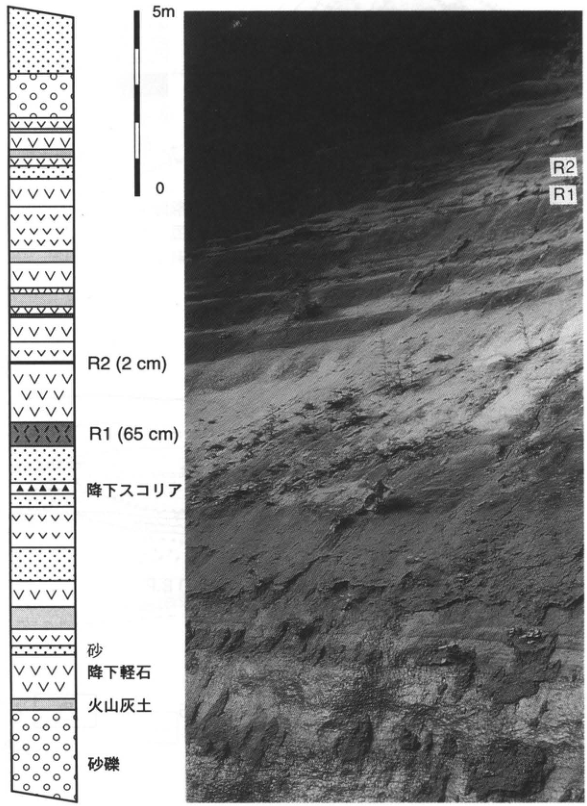
Original Japanese lettering
5m;0;R2(2cm);R1(65cm);降下スコリア;砂;降下軽石;火山灰土;砂礫;写真:R2,R1.
English translation
5m; 0; R2 (2cm); R1 (65cm); scoria-fall deposit; sand; pumice-fall deposit; volcanic-ash soil; sand and gravel; photograph: R2, R1.
p136_231.png
PDF 136 · Original p. 115
Location map of Takanegahara and column indicating Ta-a, possible B-Tm beds, and a possible Ohachidaira-derived tephra
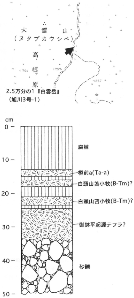
Original Japanese lettering
位置図:2.5万分の1『白雲岳』(旭川3号-1);大雪山(ヌタプカウシペ);高根ケ原;1704;1757;1567;矢印.柱状図:cm;0,10,20,30,40,50;腐植;樽前a(Ta-a);白頭山苫小牧(B-Tm)?;白頭山苫小牧(B-Tm)?;御鉢平起源テフラ?;砂礫.
English translation
Location map: 1:25,000 ‘Hakuundake’ (Asahikawa sheet 3-1); Daisetsuzan (Nutapkaushipe); Takanegahara; 1704; 1757; 1567; arrow. Column: cm; 0, 10, 20, 30, 40, 50; humus; Tarumai-a (Ta-a); Baitoushan–Tomakomai (B-Tm)?; Baitoushan–Tomakomai (B-Tm)?; Ohachidaira-derived tephra?; sand and gravel.
p137_232.png
PDF 137 · Original p. 116
Location map of the exposure at Kyowa, Shimosahoro
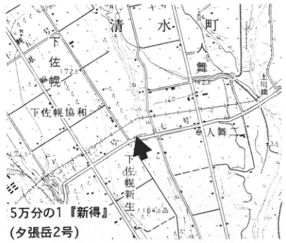
Original Japanese lettering
5万分の1『新得』(夕張岳2号);清水町;下佐幌;下佐幌協和;下佐幌新生;人舞;人舞川橋;172.5;142.8;175.1;164.3;140;矢印.
English translation
1:50,000 ‘Shintoku’ (Yubaridake sheet 2); Shimizu Town; Shimosahoro; Shimosahoro Kyowa; Shimosahoro Shinsei; Hitomai; Hitomai River bridge; 172.5; 142.8; 175.1; 164.3; 140; arrow.
地図の微小文字の一部は判読不明。
p137_233.png
PDF 137 · Original p. 116
Section of relict gravelly patterned ground and Tarumai tephras along the Nissho Road
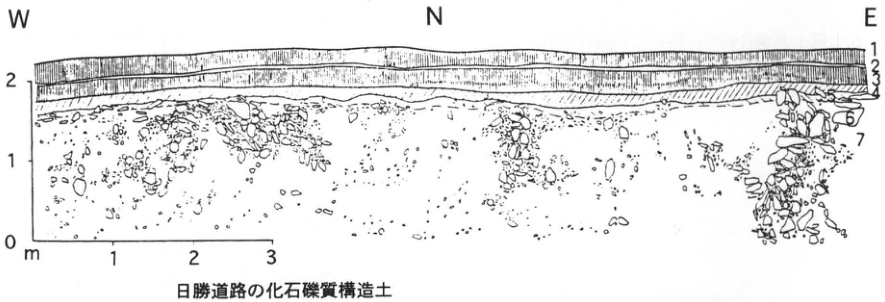
Original Japanese lettering
W;N;E;縦目盛0,1,2m;横目盛1,2,3;層番号1,2,3,4,6,7;日勝道路の化石礫質構造土.
English translation
W; N; E; vertical scale 0, 1, 2m; horizontal scale 1, 2, 3; unit numbers 1, 2, 3, 4, 6, 7; relict gravelly patterned ground along the Nissho Road.
p138_234.png
PDF 138 · Original p. 117
Location map of the exposure below the first viewpoint on the Nissho Road
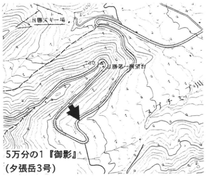
Original Japanese lettering
5万分の1『御影』(夕張岳3号);日勝スキー場;日勝第一展望台;パンケヌーシ川;500;700;矢印.
English translation
1:50,000 ‘Mikage’ (Yubaridake sheet 3); Nissho ski area; first Nissho viewpoint; Pankenushi River (パンケヌーシ川); 500; 700; arrow.
地図内の一部微小文字は判読不明。
p138_235.png
PDF 138 · Original p. 117
Two sections of wedge-shaped structures and involutions in tephra beds at Shimosahoro
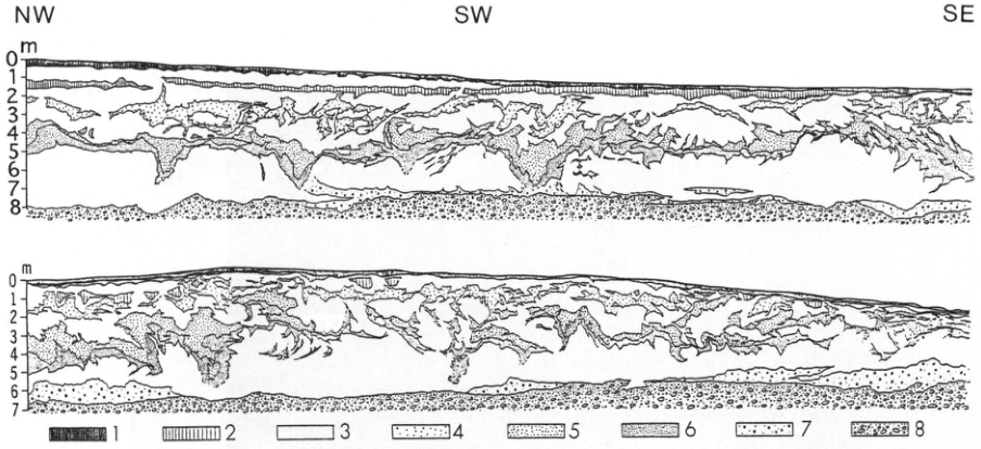
Original Japanese lettering
NW;SW;SE;上図の縦目盛m,0~8;下図の縦目盛m,0~7;凡例1,2,3,4,5,6,7,8.
English translation
NW; SW; SE; upper section vertical scale m, 0–8; lower section vertical scale m, 0–7; legend 1, 2, 3, 4, 5, 6, 7, 8.
p139_236.png
PDF 139 · Original p. 118
Location map of the exposure on the Kamisarabetsu III surface at Takushin
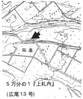
Original Japanese lettering
5万分の1『上札内』(広尾13号);拓進;267;248;200;矢印.
English translation
1:50,000 ‘Kamisatsunai’ (Hiroo sheet 13); Takushin (拓進); 267; 248; 200; arrow.
地図内の微小な一部文字は判読不明。
p139_237.png
PDF 139 · Original p. 118
Stratigraphic column showing tephras from Toya through Shikotsu-1
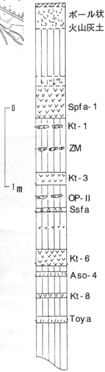
Original Japanese lettering
上から:ボール状火山灰土;Spfa-1;Kt-1;ZM;Kt-3;OP-II;Ssfa;Kt-6;Aso-4;Kt-8;Toya.スケール0,1m.
English translation
From top: ball-shaped volcanic-ash soil; Spfa-1; Kt-1; ZM; Kt-3; OP-II; Ssfa; Kt-6; Aso-4; Kt-8; Toya. Scale 0, 1m.
p139_238.png
PDF 139 · Original p. 118
Takushin outcrop photograph showing terrace gravel and overlying tephra beds
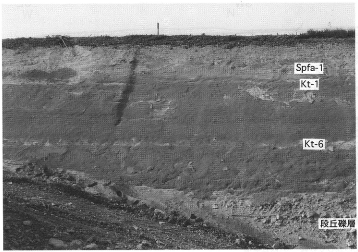
Original Japanese lettering
Spfa-1;Kt-1;Kt-6;段丘礫層.
English translation
Spfa-1; Kt-1; Kt-6; terrace gravel.
p140_239.png
PDF 140 · Original p. 119
Location map of the Naumann's elephant fossil exposure at Bansei, Churui Village
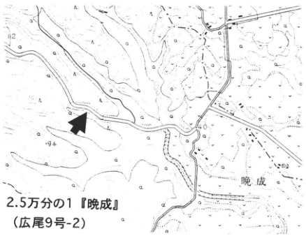
Original Japanese lettering
2.5万分の1『晩成』(広尾9号-2);晩成;94;40;矢印.
English translation
1:25,000 ‘Bansei’ (Hiroo sheet 9-2); Bansei; 94; 40; arrow.
地図の一部微小文字は判読不明。
p140_240.png
PDF 140 · Original p. 119
Outcrop photographed in May 1990, showing Kc-Hb, sand and gravel, and bluish-grey silt
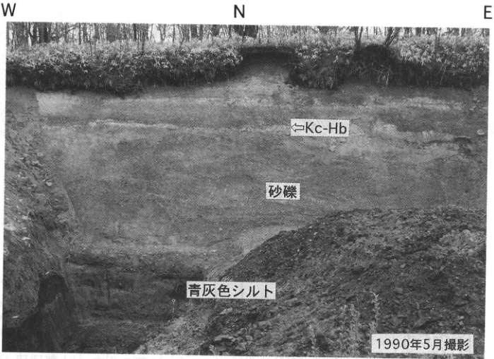
Original Japanese lettering
W;N;E;←Kc-Hb;砂礫;青灰色シルト;1990年5月撮影.
English translation
W; N; E; ←Kc-Hb; sand and gravel; bluish-grey silt; photographed in May 1990.
p141_241.png
PDF 141 · Original p. 120
Hiroo location map, column of thick terrace gravel with intercalated tephras, and distribution map of the ビラオトリ Formation
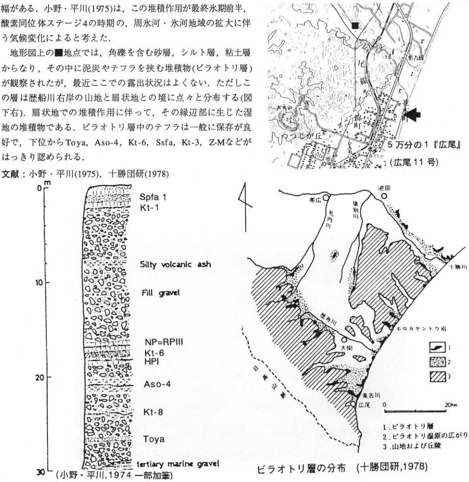
Original Japanese lettering
位置図:5万分の1『広尾』(広尾11号);楽古橋;十勝港;大丸山;丸山丘;楽古川;35.9;■;矢印.柱状図:m;0,10,20,30;Spfa 1;Kt-1;Silty volcanic ash;Fill gravel;NP=RPIII;Kt-6;HPI;Aso-4;Kt-8;Toya;tertiary marine gravel.分布図:帯広;池田;札内川;猿別川;十勝川;歴舟川;大樹;ホロカヤントウ沼;楽古川;広尾;日高山脈;0,20km;凡例1,2,3.
English translation
Location map: 1:50,000 ‘Hiroo’ (Hiroo sheet 11); Rakko Bridge; Tokachi Port; Daimaruyama; Maruyama hill; Rakko River; 35.9; ■; arrow. Column: m; 0, 10, 20, 30; Spfa 1; Kt-1; Silty volcanic ash; Fill gravel; NP=RPIII; Kt-6; HPI; Aso-4; Kt-8; Toya; tertiary marine gravel. Distribution map: Obihiro; Ikeda; Satsunai River; Sarubetsu River; Tokachi River; Rekifune River (printed 歴舟川); Taiki; Lake Horokayanto; Rakko River; Hiroo; Hidaka Mountains; 0, 20km; legend 1, 2, 3.
地形図内の一部微小文字は判読不明。
p142_242.png
PDF 142 · Original p. 121
Location map of the exposure on the upper valley-side slope of the Pankezawa River
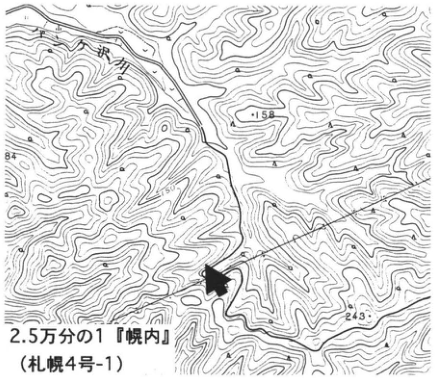
Original Japanese lettering
2.5万分の1『幌内』(札幌4号-1);パンケ沢川;158;243;矢印.
English translation
1:25,000 ‘Horonai’ (Sapporo sheet 4-1); Pankezawa River; 158; 243; arrow.
端部の標高数字と一部微小文字は判読不明。
p142_243.png
PDF 142 · Original p. 121
Outcrop section showing drag structures in the Kawabata Formation and overlying ash with En-a grains and Ta-d
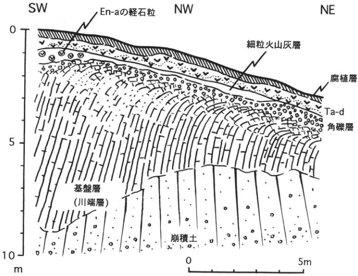
Original Japanese lettering
SW;NW;NE;En-aの軽石粒;細粒火山灰層;腐植層;Ta-d;角礫層;基盤層(川端層);崩積土;縦目盛0,5,10m;横スケール0,5m.
English translation
SW; NW; NE; En-a pumice grains; fine ash bed; humic bed; Ta-d; angular gravel bed; basement (Kawabata Formation); colluvium; vertical scale 0, 5, 10m; horizontal scale 0, 5m.
p143_244.png
PDF 143 · Original p. 122
Location map of the exposure at 源武, Hayakita Town
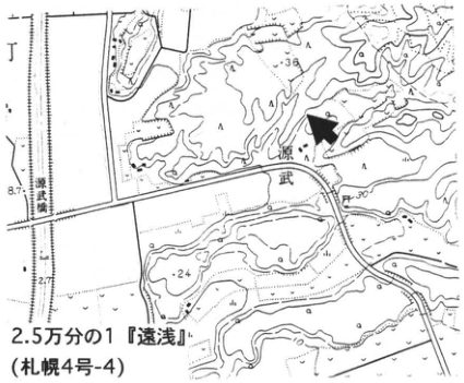
Original Japanese lettering
2.5万分の1『遠浅』(札幌4号-4);源武;源武踏切;36;24;30;8.7;2.7;矢印.
English translation
1:25,000 ‘Toasa’ (Sapporo sheet 4-4); 源武; 源武 railway crossing; 36; 24; 30; 8.7; 2.7; arrow.
源武の読みは未確認。一部微小文字は判読不明。
p143_245.png
PDF 143 · Original p. 122
Sketch of Shikotsu- and Kuttara-derived tephras overlying the Atsuma and Hongo formations
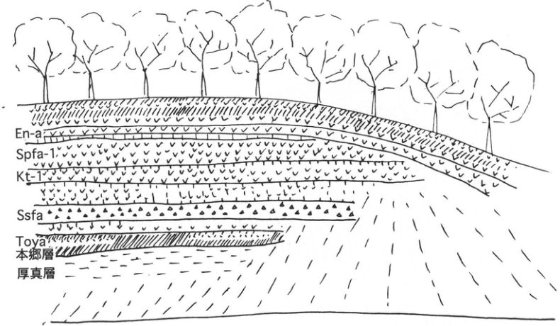
Original Japanese lettering
En-a;Spfa-1;Kt-1;Ssfa;Toya;本郷層;厚真層.
English translation
En-a; Spfa-1; Kt-1; Ssfa; Toya; Hongo Formation; Atsuma Formation.
p144_246.png
PDF 144 · Original p. 123
Tephra column at 源武 comparing the bed names of 山縣 (1994) and 春日井 et al. (1980)
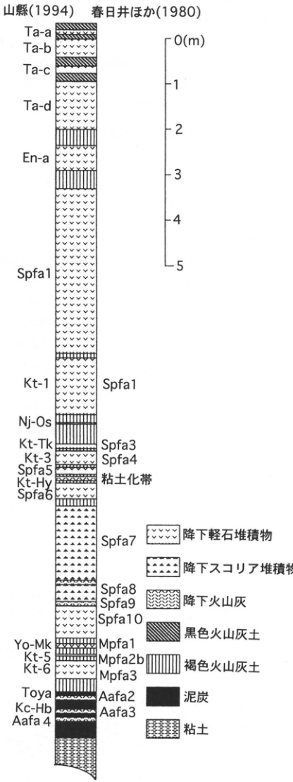
Original Japanese lettering
山縣(1994);春日井ほか(1980).上から:Ta-a;Ta-b;Ta-c;Ta-d;En-a;Spfa1;Kt-1(Spfa1);Nj-Os;Kt-Tk(Spfa3);Kt-3(Spfa4);Spfa5;Kt-Hy(粘土化帯);Spfa6;Spfa7;Spfa8;Spfa9;Spfa10;Yo-Mk(Mpfa1);Kt-5(Mpfa2b);Kt-6(Mpfa3);Toya(Aafa2);Kc-Hb(Aafa3);Aafa4.目盛:0(m),1,2,3,4,5.凡例:降下軽石堆積物;降下スコリア堆積物;降下火山灰;黒色火山灰土;褐色火山灰土;泥炭;粘土.
English translation
山縣 (1994); 春日井 et al. (1980). From top: Ta-a; Ta-b; Ta-c; Ta-d; En-a; Spfa1; Kt-1 (Spfa1); Nj-Os; Kt-Tk (Spfa3); Kt-3 (Spfa4); Spfa5; Kt-Hy (argillized zone); Spfa6; Spfa7; Spfa8; Spfa9; Spfa10; Yo-Mk (Mpfa1); Kt-5 (Mpfa2b); Kt-6 (Mpfa3); Toya (Aafa2); Kc-Hb (Aafa3); Aafa4. Scale: 0 (m), 1, 2, 3, 4, 5. Legend: pumice-fall deposit; scoria-fall deposit; ash-fall deposit; black volcanic-ash soil; brown volcanic-ash soil; peat; clay.
図のKt-1右側はSpfa1と印刷されているように見える。翌ページ本文の対照Spfa2=Kt-1とは異なるが原著表記を保持。
p145_247.png
PDF 145 · Original p. 124
Location map of the exposure in Shiomi Third District
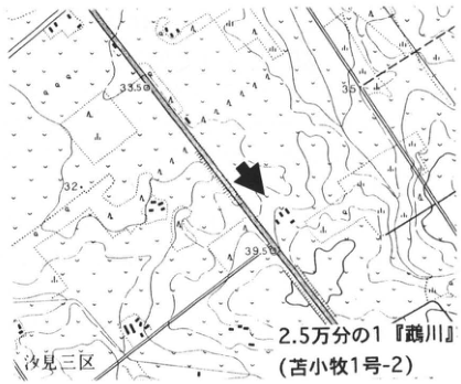
Original Japanese lettering
2.5万分の1『鵡川』(苫小牧1号-2);汐見三区;33.5;35;32;39.5;矢印.
English translation
1:25,000 ‘Mukawa’ (Tomakomai sheet 1-2); Shiomi Third District; 33.5; 35; 32; 39.5; arrow.
一部の地図内微小文字は判読不明。
p145_249.png
PDF 145 · Original p. 124
Shiomi Third District outcrop sketch showing tephras from Shikotsu-1 through Kuttara-7
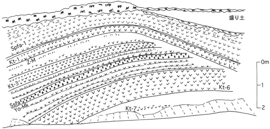
Original Japanese lettering
盛り土;Spfa-1;Kt-1;Z-M;Kt-3;Ssfa;Yo-Mk;Kt-6;Kt-7;0m,1,2.
English translation
Artificial fill; Spfa-1; Kt-1; Z-M; Kt-3; Ssfa; Yo-Mk; Kt-6; Kt-7; 0m, 1, 2.
p146_250.png
PDF 146 · Original p. 125
Location map of the E9 archaeological-site exposure on the left bank of the Yukanboshi River
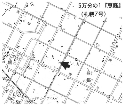
Original Japanese lettering
5万分の1『恵庭』(札幌7号);ユカンボシ川;長都;大島居;サッポロビールていえん;南十四号;南十五号;東五線;17.5;13.5;19.3;14.4;24;13;矢印.
English translation
1:50,000 ‘Eniwa’ (Sapporo sheet 7); Yukanboshi River; Osatsu (長都); 大島居 [place label]; Sapporo Beer Teien; Minami-Juyon-go; Minami-Jugo-go; Higashi-Gosen; 17.5; 13.5; 19.3; 14.4; 24; 13; arrow.
大島居の読みは未確認。一部微小地図文字は判読不明。
p146_251.png
PDF 146 · Original p. 125
Yukanboshi E9 section with composite column, radiocarbon ages, archaeological periods, and tephras
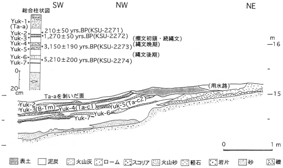
Original Japanese lettering
SW;NW;NE;総合柱状図:Yuk-1(Ta-a);Yuk-2;Yuk-3;Yuk-4;Yuk-5;Yuk-6;Yuk-7;210±50yrs.BP(KSU-2271);1,270±50yrs.BP(KSU-2272);3,150±190yrs.BP(KSU-2273);5,210±200yrs.BP(KSU-2274);(擦文初頭・続縄文);(縄文晩期);(縄文後期);0,20cm.断面:Ta-aを剥いだ面;Yuk-2;Yuk-3(B-Tm);Yuk-4(Ta-c1);Yuk-5(Ta-c2);Yuk-6;Yuk-7;(用水路);m,16,15;横スケール0,1m.凡例:表土;泥炭;火山灰;ローム;スコリア;火山砂;軽石;岩片;砂;礫.
English translation
SW; NW; NE; composite column: Yuk-1 (Ta-a); Yuk-2; Yuk-3; Yuk-4; Yuk-5; Yuk-6; Yuk-7; 210±50yrs.BP (KSU-2271); 1,270±50yrs.BP (KSU-2272); 3,150±190yrs.BP (KSU-2273); 5,210±200yrs.BP (KSU-2274); (earliest Satsumon/Epi-Jomon); (Final Jomon); (Late Jomon); 0, 20cm. Section: surface with Ta-a removed; Yuk-2; Yuk-3 (B-Tm); Yuk-4 (Ta-c1); Yuk-5 (Ta-c2); Yuk-6; Yuk-7; (irrigation channel); m, 16, 15; horizontal scale 0, 1m. Legend: topsoil; peat; volcanic ash; loam; scoria; volcanic sand; pumice; lithic fragments; sand; gravel.
p147_252.png
PDF 147 · Original p. 126
Location map of exposures A and B near Cape Ranpoge
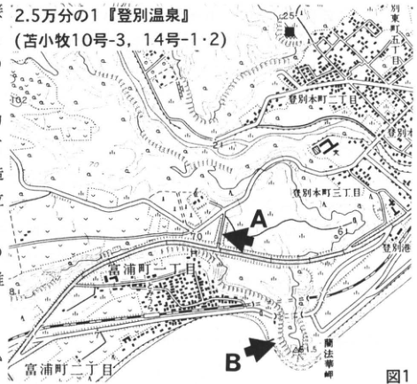
Original Japanese lettering
2.5万分の1『登別温泉』(苫小牧10号-3,14号-1・2);登別東町五丁目;登別本町二丁目;登別本町三丁目;登別;登別港;富浦町二丁目;富浦町一丁目;蘭法華岬;125.1;102;70;65;61.5;8.1;A;B.
English translation
1:25,000 ‘Noboribetsu Onsen’ (Tomakomai sheets 10-3, 14-1 and 14-2); Noboribetsu-Higashicho 5-chome; Noboribetsu-Honcho 2-chome; Noboribetsu-Honcho 3-chome; Noboribetsu; Noboribetsu Port; Tomiuracho 2-chome; Tomiuracho 1-chome; Cape Ranpoge (蘭法華岬); 125.1; 102; 70; 65; 61.5; 8.1; A; B.
地図内の一部微小文字は判読不明。
p147_253.png
PDF 147 · Original p. 126
Cape Ranpoge outcrop sketch showing tephras and welded portions from Kuttara-6 through Shikotsu
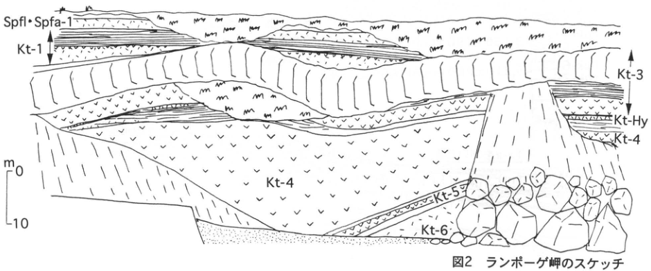
Original Japanese lettering
Spfl・Spfa-1;Kt-1;Kt-3;Kt-Hy;Kt-4;Kt-5;Kt-6;スケールm,0,10.
English translation
Spfl・Spfa-1; Kt-1; Kt-3; Kt-Hy; Kt-4; Kt-5; Kt-6; scale m, 0, 10.
p148_254.png
PDF 148 · Original p. 127
Correlated stratigraphic columns of Cape Ranpoge exposures A and B with a depositional-facies legend
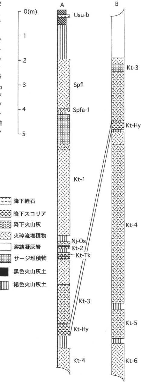
Original Japanese lettering
A(上から):Usu-b;Spfl;Spfa-1;Kt-1;Nj-Os;Kt-2;Kt-Tk;Kt-3;Kt-Hy;Kt-4.B(上から):Kt-3;Kt-Hy;Kt-4;Kt-5;Kt-6.スケール0(m),1,2,3,4,5.凡例:降下軽石;降下スコリア;降下火山灰;火砕流堆積物;溶結凝灰岩;サージ堆積物;黒色火山灰土;褐色火山灰土.
English translation
A, from top: Usu-b; Spfl; Spfa-1; Kt-1; Nj-Os; Kt-2; Kt-Tk; Kt-3; Kt-Hy; Kt-4. B, from top: Kt-3; Kt-Hy; Kt-4; Kt-5; Kt-6. Scale 0 (m), 1, 2, 3, 4, 5. Legend: pumice fall; scoria fall; ash fall; pyroclastic-flow deposit; welded tuff; surge deposit; black volcanic-ash soil; brown volcanic-ash soil.
p149_255.png
PDF 149 · Original p. 128
Location map of the exposure at 更進, Kyogoku Town
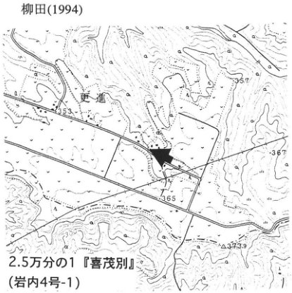
Original Japanese lettering
2.5万分の1『喜茂別』(岩内4号-1);更進;353;357;367;365;373.9;320;300;矢印.
English translation
1:25,000 ‘Kimobetsu’ (Iwanai sheet 4-1); 更進; 353; 357; 367; 365; 373.9; 320; 300; arrow.
更進の読みは未検証。一部微小地図文字は判読不明。
p149_256.png
PDF 149 · Original p. 128
Column showing younger and older Yotei tephras, tephras from other volcanoes, and age determinations
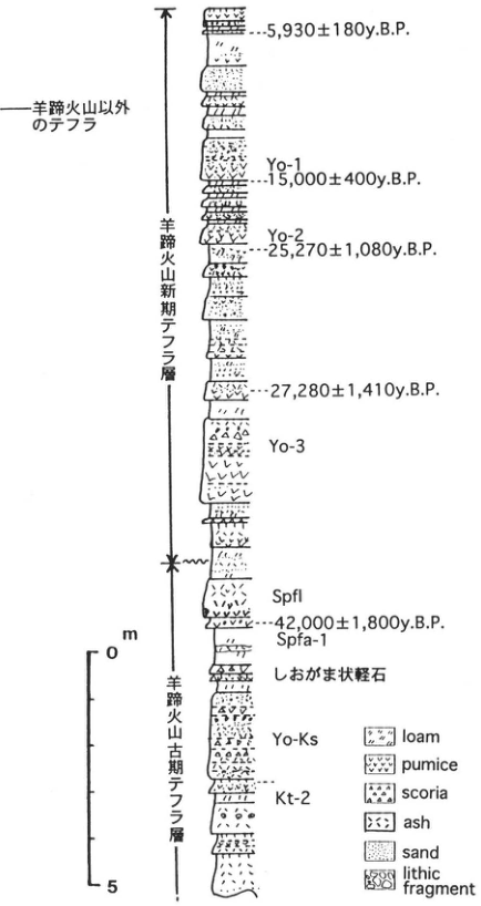
Original Japanese lettering
羊蹄火山以外のテフラ;羊蹄火山新期テフラ層;羊蹄火山古期テフラ層;5,930±180y.B.P.;Yo-1;15,000±400y.B.P.;Yo-2;25,270±1,080y.B.P.;27,280±1,410y.B.P.;Yo-3;Spfl;42,000±1,800y.B.P.;Spfa-1;しおがま状軽石;Yo-Ks;Kt-2;m,0,5.凡例:loam;pumice;scoria;ash;sand;lithic fragment.
English translation
Tephra from volcanoes other than Yotei; younger Yotei tephra beds; older Yotei tephra beds; 5,930±180y.B.P.; Yo-1; 15,000±400y.B.P.; Yo-2; 25,270±1,080y.B.P.; 27,280±1,410y.B.P.; Yo-3; Spfl; 42,000±1,800y.B.P.; Spfa-1; shiogama-like pumice (しおがま状軽石); Yo-Ks; Kt-2; m, 0, 5. Legend: loam; pumice; scoria; ash; sand; lithic fragment.
p150_257.png
PDF 150 · Original p. 129
Location map of the quarry ■ site at 若生町 and tsunami-deposit ▲ site on the Minami-Usu coast

Original Japanese lettering
5万分の1『伊達』(室蘭2号-3);アルトリ岬;南有珠町;若生町;27.5;5;▲;■.
English translation
1:50,000 ‘Date’ (Muroran sheet 2-3); Cape Arutori; Minami-Usucho; 若生町; 27.5; 5; ▲; ■.
若生町の読みは未検証。一部地図内微小文字は判読不明。
p150_258.png
PDF 150 · Original p. 129
Quarry photograph showing jigsaw cracks in the Zenkoji debris-avalanche deposit
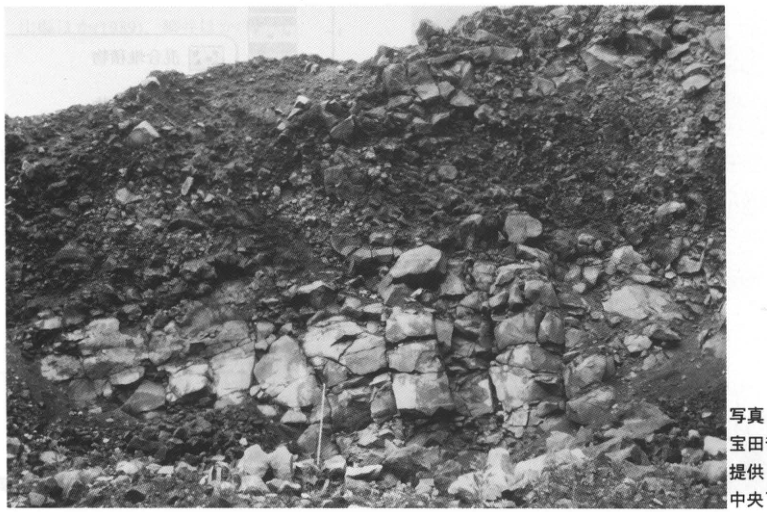
Original Japanese lettering
画像右端に写真クレジットの一部が切り込む。完全な記載は原PDFのキャプションとして本文に収録。岩塊に文字注記なし。
English translation
Part of the photographic credit enters the right edge of the extracted image. The complete credit is reproduced in the page caption from the original PDF. The rock blocks carry no textual annotations.
p151_259.png
PDF 151 · Original p. 130
Location map of Crater 4, Ginnuma crater, and the photographed exposure at Usu summit
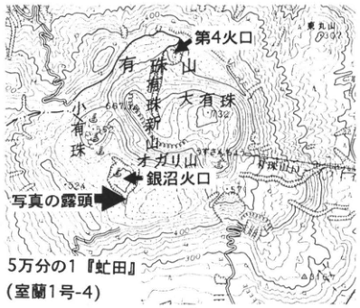
Original Japanese lettering
5万分の1『虻田』(室蘭1号-4);有珠山;有珠新山;小有珠;大有珠(732);オガリ山;第4火口;銀沼火口;写真の露頭;東丸山;693;400;300.
English translation
1:50,000 ‘Abuta’ (Muroran sheet 1-4); Usu volcano; Usu-Shinzan; Ko-Usu; O-Usu (732); Ogariyama (オガリ山); Crater 4; Ginnuma crater; photographed exposure; Higashi-Maruyama; 693; 400; 300.
地形図内の一部微小文字は判読不明。
p151_260.png
PDF 151 · Original p. 130
Photograph of a gully exposure 50m from Ginnuma crater and column of the 1977–1978 eruptive products
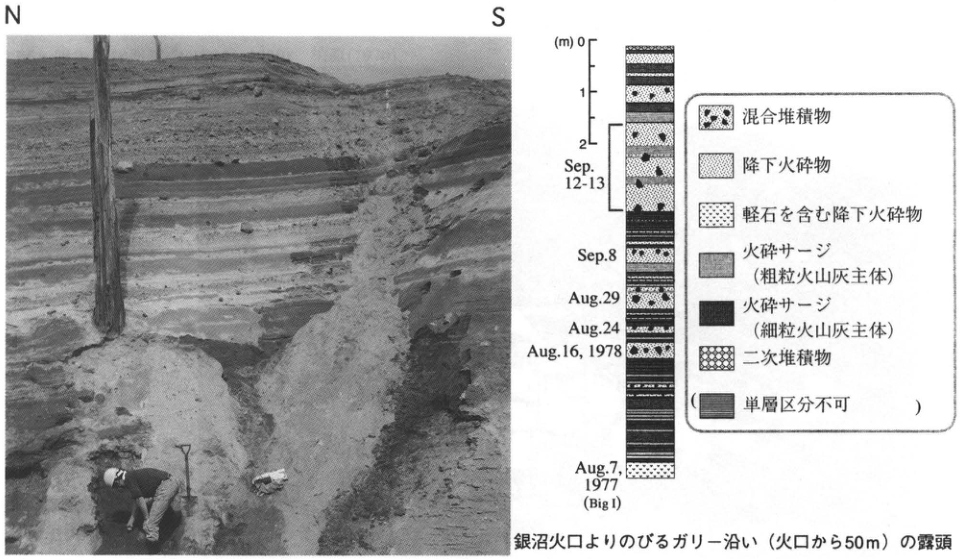
Original Japanese lettering
写真:N,S.柱状図:(m)0,1,2;Sep.12-13;Sep.8;Aug.29;Aug.24;Aug.16, 1978;Aug.7, 1977(Big I).凡例:混合堆積物;降下火砕物;軽石を含む降下火砕物;火砕サージ(粗粒火山灰主体);火砕サージ(細粒火山灰主体);二次堆積物;(単層区分不可).
English translation
Photograph: N, S. Column: (m) 0, 1, 2; Sep.12-13; Sep.8; Aug.29; Aug.24; Aug.16, 1978; Aug.7, 1977 (Big I). Legend: mixed deposits; pyroclastic fallout; pumice-bearing pyroclastic fallout; pyroclastic surge (chiefly coarse ash); pyroclastic surge (chiefly fine ash); reworked deposits; (individual beds cannot be distinguished).
p152_261.png
PDF 152 · Original p. 131
Washinoki location map, photograph of the 1640 Ko-d pumice fall and tsunami gravel, and stratigraphic sketch of the sea cliff
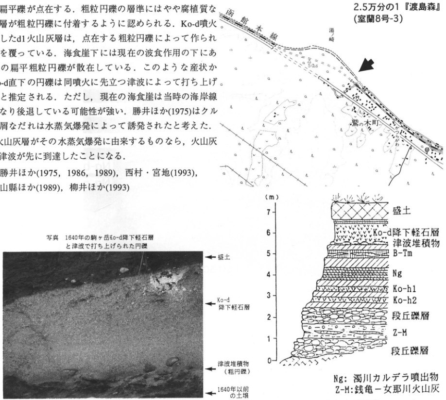
Original Japanese lettering
位置図:2.5万分の1『渡島森』(室蘭8号-3);函館本線,湯崎,鷲の木町,50.6,25.8。写真注記(上から):盛土;Ko-d降下軽石層;津波堆積物(粗円礫);1640年以前の土壌。層序スケッチ:標尺(m)0,1,2,3,4,5,6,7。上から盛土,Ko-d降下軽石層,津波堆積物,B-Tm,Ng,Ko-h1,Ko-h2,段丘礫層,Z-M,段丘礫層。Ng:濁川カルデラ噴出物。Z-M:銭亀-女那川火山灰。画像に含まれる本文片は本文に収録。
English translation
Location map: 1:25,000 ‘Oshima-Mori’ (Muroran sheet 8-3); Hakodate Main Line, 湯崎, Washinoki Town, 50.6, 25.8. Photograph annotations, top to bottom: Artificial fill; Ko-d pumice-fall bed; tsunami deposit (coarse rounded gravel); soil predating 1640. Stratigraphic sketch: Scale (m) 0, 1, 2, 3, 4, 5, 6, 7. Top to bottom: Artificial fill; Ko-d pumice-fall bed; tsunami deposit; B-Tm; Ng; Ko-h1; Ko-h2; terrace gravel; Z-M; terrace gravel. Ng: Nigorikawa caldera eruptive products. Z-M: 銭亀-女那川 volcanic ash. The body-text fragment included in this image is transcribed and translated in the main text.
位置図の微小文字の一部は判読不明。
p153_262.png
PDF 153 · Original p. 132
Location map of the Nigorikawa tephra exposure in Fujimi Town, Mori
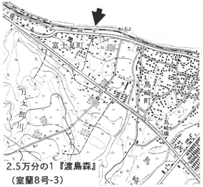
Original Japanese lettering
2.5万分の1『渡島森』(室蘭8号-3)。富士見町,万太郎川,鳥崎町,鳥崎橋。16.2,50,20。
English translation
1:25,000 ‘Oshima-Mori’ (Muroran sheet 8-3). Fujimi Town; Mantaro River (万太郎川); Torisaki Town (鳥崎町); Torisaki Bridge (鳥崎橋). 16.2, 50, 20.
位置図のその他の微小文字は判読不明。
p153_263.png
PDF 153 · Original p. 132
Ko-i, Ko-h, Ng-c, Ng-b, Ng-a fall, and Ng-a flow overlying terrace deposits
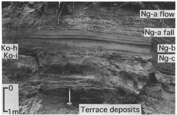
Original Japanese lettering
原図英文:Ng-a flow; Ng-a fall; Ng-b; Ng-c; Ko-h; Ko-i; Terrace deposits。標尺:0,1m。
English translation
Original English lettering: Ng-a flow; Ng-a fall; Ng-b; Ng-c; Ko-h; Ko-i; Terrace deposits. Scale: 0, 1m.
p154_264.png
PDF 154 · Original p. 133
Location map of the sea cliffs near the Shirinashi River mouth
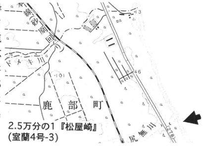
Original Japanese lettering
2.5万分の1『松屋崎』(室蘭4号-3);鹿部町,尻無川,砂原町。1.3,4.6,10。
English translation
1:25,000 ‘Matsuya Cape’ (Muroran sheet 4-3); Shikabe Town, Shirinashi River, Sawara Town. 1.3, 4.6, 10.
地図のその他の微小文字は判読不明。
p154_265.png
PDF 154 · Original p. 133
Outcrop sketch at the Shirinashi River mouth and charred tree trunk within Ko-h2 pumice fall
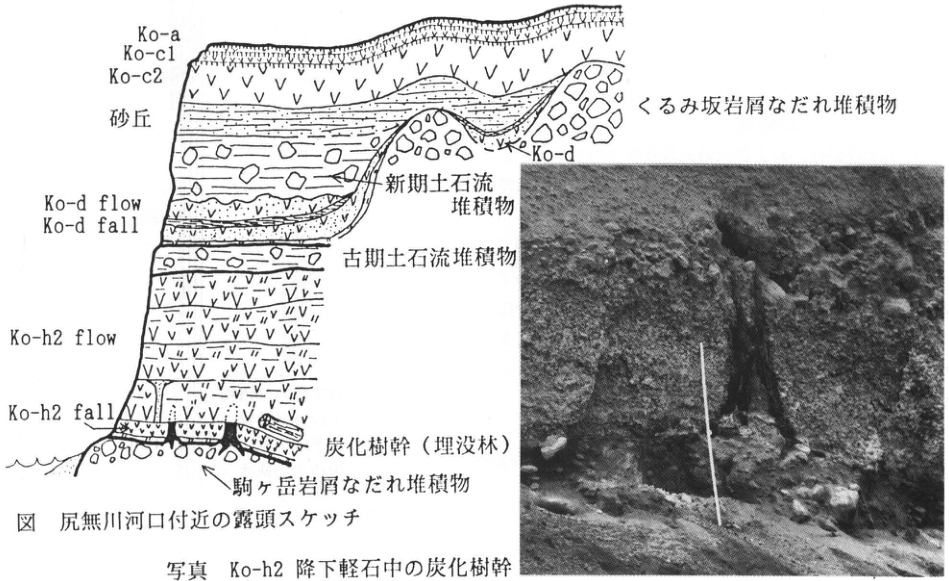
Original Japanese lettering
Ko-a,Ko-c1,Ko-c2,砂丘,くるみ坂岩屑なだれ堆積物,Ko-d,新期土石流堆積物,Ko-d flow,Ko-d fall,古期土石流堆積物,Ko-h2 flow,Ko-h2 fall,炭化樹幹(埋没林),駒ヶ岳岩屑なだれ堆積物。写真内に文字なし。
English translation
Ko-a; Ko-c1; Ko-c2; dune; Kurumizaka debris-avalanche deposits; Ko-d; younger debris-flow deposits; Ko-d flow; Ko-d fall; older debris-flow deposits; Ko-h2 flow; Ko-h2 fall; charred tree trunks (buried forest); Komagatake debris-avalanche deposits. No lettering within the photograph.
p155_266.png
PDF 155 · Original p. 134
Location map at 小安 and tephra correlation columns for 子安 and 女那川
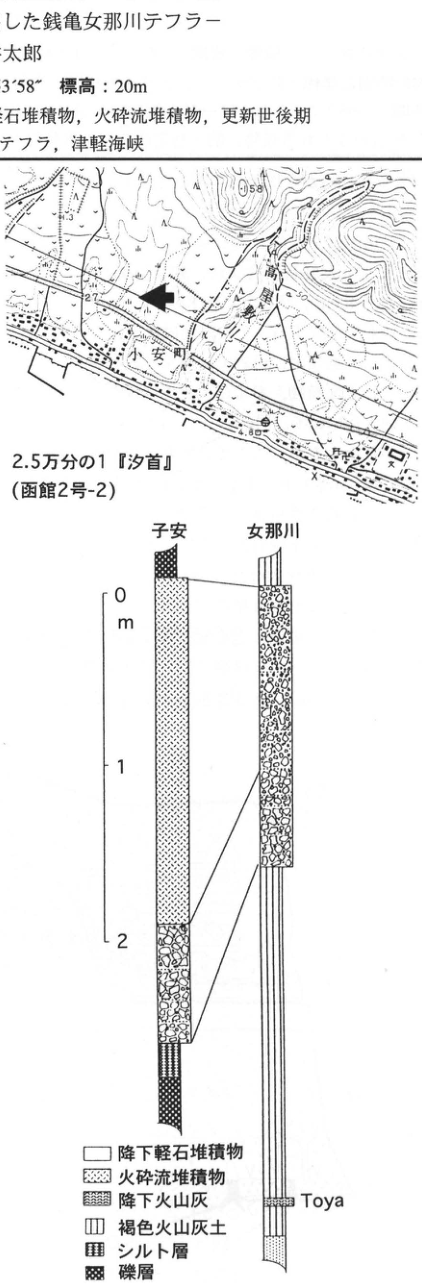
Original Japanese lettering
位置図:2.5万分の1『汐首』(函館2号-2),小安町,高屋川,58,27,4.8。柱状図の地点名:子安,女那川。標尺:0,1,2m。層名:Toya。凡例:降下軽石堆積物;火砕流堆積物;降下火山灰;褐色火山灰土;シルト層;礫層。画像の本文片は本文に収録。
English translation
Location map: 1:25,000 ‘Shiokubi’ (Hakodate sheet 2-2); 小安 Town; 高屋 River; 58, 27, 4.8. Column localities: 子安, 女那川. Scale: 0, 1, 2m. Bed label: Toya. Legend: Pumice-fall deposits; pyroclastic-flow deposits; ash fall; brown volcanic-ash soil; silt bed; gravel bed. The body-text fragment included in the image is transcribed and translated in the main text.
位置図のその他の微小文字は判読不明。
本文の地名は小安,柱状図は子安と印刷されている。
p156_267.png
PDF 156 · Original p. 135
Location map of the sand pit at Tazawa, Esashi
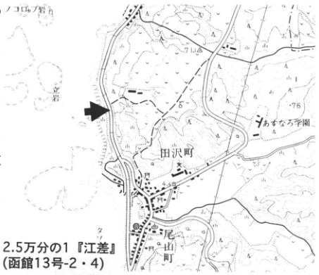
Original Japanese lettering
2.5万分の1『江差』(函館13号-2・4);田沢町,尾山町,おみなろ学園,岩,7.1,76,4.8。
English translation
1:25,000 ‘Esashi’ (Hakodate sheets 13-2 and 13-4); Tazawa Town, Oyama Town (尾山町), Ominaro School (おみなろ学園), rock, 7.1, 76, 4.8.
地図のその他の微小文字は判読不明。
p156_268.png
PDF 156 · Original p. 135
Sketch and photograph of Holocene dunes, kurosuna beds, B-Tm, Ko-d, and Os-a on the Oma surface
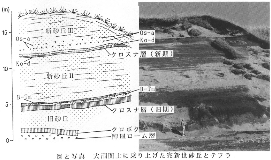
Original Japanese lettering
標尺(m):0,5,10,15。層名(上から):新砂丘III,Os-a,Ko-d,クロスナ層(新期),新砂丘II,B-Tm,クロスナ層(旧期),旧砂丘,クロボク,陣屋ローム層。図と写真両方にOs-a,Ko-d,B-Tmの対応線。
English translation
Scale (m): 0, 5, 10, 15. Bed labels, top to bottom: Younger dune III; Os-a; Ko-d; kurosuna bed (younger); younger dune II; B-Tm; kurosuna bed (older); older dune; kuroboku soil; Jinya Loam. Os-a, Ko-d, and B-Tm are linked between the sketch and photograph.
p157_269.png
PDF 157 · Original p. 136
Location map of the Nanatsunuma Cirque exposure
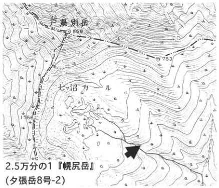
Original Japanese lettering
2.5万分の1『幌尻岳』(夕張岳8号-2);戸蔦別岳,七ッ沼カール,1959,1753,1766。
English translation
1:25,000 ‘Poroshiri-dake’ (Yubari-dake sheet 8-2); Tottabetsu-dake (戸蔦別岳); Nanatsunuma Cirque; 1959, 1753, 1766.
位置図のその他の微小文字は判読不明。
p157_270.png
PDF 157 · Original p. 136
Overall exposure showing upper outwash A, lower ground moraine B, and an arrow indicating En-a
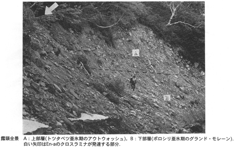
Original Japanese lettering
写真内:A,B。白矢印:En-aのクロスラミナが発達する部分。破線:上部層と下部層の境界。
English translation
Within photograph: A, B. White arrow: Area of developed En-a cross-lamination. Dashed line: Boundary between the upper and lower beds.
p159_271.png
PDF 159 · Original p. 138
Shariki location map, dune column and enlarged detail containing B-Tm, and photograph of younger and ancient dunes
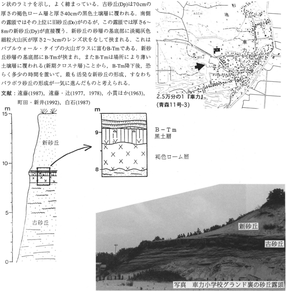
Original Japanese lettering
地図:2.5万分の1『車力』(青森11号-3);車力,形池,32.6,55.2,7.3。柱状図:標尺m,0,5,10,15;新砂丘,古砂丘。拡大図:標尺m,8,9;B-Tm,黒土層,褐色ローム層。写真注記:新砂丘,古砂丘。画像中の本文片は本文に収録。
English translation
Map: 1:25,000 ‘Shariki’ (Aomori sheet 11-3); Shariki; 形 Pond; 32.6, 55.2, 7.3. Column: Scale m, 0, 5, 10, 15; younger dunes; ancient dunes. Enlarged detail: Scale m, 8, 9; B-Tm; black soil bed; brown loam. Photograph annotations: Younger dunes; ancient dunes. The body-text fragment within the image is transcribed and translated in the main text.
位置図のその他の微小文字は判読不明。
p160_272.png
PDF 160 · Original p. 139
Location map of the peat exposure north of Dekijima
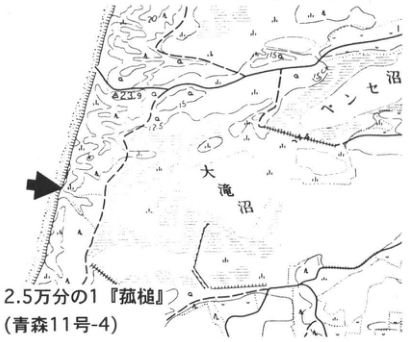
Original Japanese lettering
2.5万分の1『菰槌』(青森11号-4);大滝沼,ベンセ沼,23.9,12.5,20,15。
English translation
1:25,000 ‘菰槌’ (Aomori sheet 11-4); Otaki Pond (大滝沼); Bense Pond (ベンセ沼); 23.9, 12.5, 20, 15.
位置図のその他の微小文字は判読不明。
p160_273.png
PDF 160 · Original p. 139
Sea-cliff exposure of peat and buried forest, labeled Dekijima Formation and Tateoka Formation
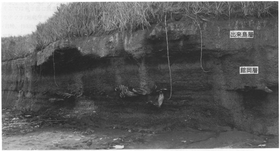
Original Japanese lettering
出来島層;館岡層。
English translation
Dekijima Formation; Tateoka Formation.
p161_274.png
PDF 161 · Original p. 140
Location map of the Sannai-Maruyama site
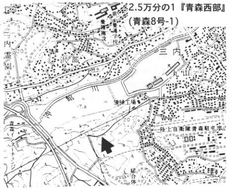
Original Japanese lettering
2.5万分の1『青森西部』(青森8号-1);三内,沢部,沖館川,三内霊園,青森養護学校,資材工場,陸上自衛隊青森駐屯地,7.8,20。
English translation
1:25,000 ‘Western Aomori’ (Aomori sheet 8-1); Sannai; 沢部; Okidate River; Sannai Cemetery; Aomori special-needs school; materials factory; Japan Ground Self-Defense Force Aomori camp; 7.8, 20.
位置図のその他の微小文字は判読不明。
p161_275.png
PDF 161 · Original p. 140
Central Valley trench showing pre-development woody peat, sand containing beech, post-development refuse, and a chestnut mound
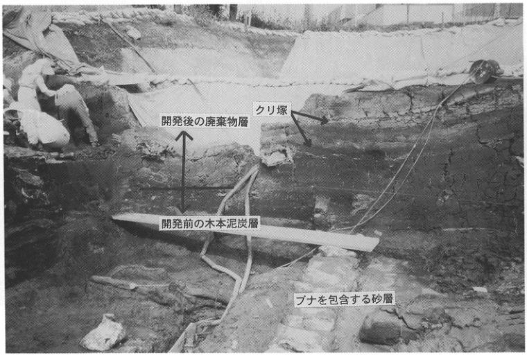
Original Japanese lettering
開発後の廃棄物層;クリ塚;開発前の木本泥炭層;ブナを包含する砂層。
English translation
Refuse layer after development; chestnut mound; woody peat bed before development; sand bed containing beech.
p162_276.png
PDF 162 · Original p. 141
Location map around Mitateyama and photograph of Towada tephras above Takadate terrace deposits
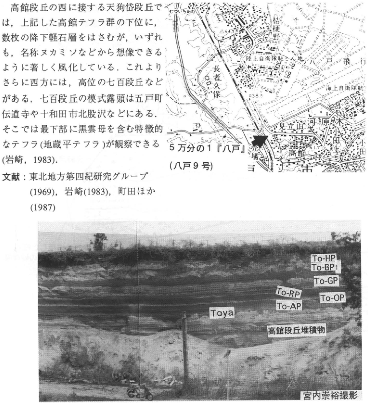
Original Japanese lettering
地図:5万分の1『八戸』(八戸9号);桔梗野,長者久保,陸上自衛隊駐とん地,八戸飛行場,海上自衛隊航空隊,見立山,河原木,高館,38.5,38.4,44.3,11.7。写真:To-HP,To-BP1,To-GP,To-RP,To-OP,To-AP,Toya,高館段丘堆積物,宮内崇裕撮影。画像の本文片は本文に収録。
English translation
Map: 1:50,000 ‘Hachinohe’ (Hachinohe sheet 9); Kikyonohara (桔梗野); 長者久保; Ground Self-Defense Force camp; Hachinohe airfield; Maritime Self-Defense Force air unit; Mitateyama; Kawaragi; Takadate; 38.5, 38.4, 44.3, 11.7. Photograph: To-HP; To-BP1; To-GP; To-RP; To-OP; To-AP; Toya; Takadate terrace deposits; photograph by 宮内崇裕. The body-text fragment within the image is transcribed and translated in the main text.
位置図のその他の微小文字は判読不明。
p162_277.png
PDF 162 · Original p. 141
Tephra column from Holocene deposits down to the 天久岱 surface
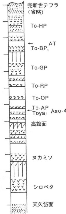
Original Japanese lettering
上から:完新世テフラ(省略),To-HP,AT,To-BP1,To-GP,To-RP,To-OP,To-AP,Toya・Aso-4,高館面,ヌカミソ,シロベタ,天久岱面。数値標尺なし。
English translation
Top to bottom: Holocene tephras (omitted); To-HP; AT; To-BP1; To-GP; To-RP; To-OP; To-AP; Toya · Aso-4; Takadate surface; Nukamiso; Shirobeta; 天久岱 surface. No numerical scale.
p163_278.png
PDF 163 · Original p. 142
Location map of the quarry above the Shin-Daishaka Tunnel
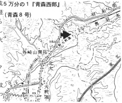
Original Japanese lettering
5万分の1『青森西部』(青森8号);奥羽本線,新大釈迦トンネル,大釈迦川,大釈迦,外崎山開拓,98.5,74.0,55.9。
English translation
1:50,000 ‘Western Aomori’ (Aomori sheet 8); Ou Main Line; Shin-Daishaka Tunnel; Daishaka River; Daishaka; 外崎山 settlement; 98.5, 74.0, 55.9.
位置図のその他の微小文字は判読不明。
p163_279.png
PDF 163 · Original p. 142
Outcrop sketch of stratified pumice and ash and two Hakkoda pyroclastic-flow deposits above shell-bearing sand
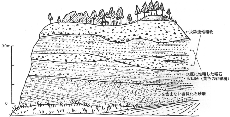
Original Japanese lettering
標尺:0,30m。火砕流堆積物;水底に堆積した軽石・火山灰(黄色の砂礫層);テフラを含まない含貝化石砂層。
English translation
Scale: 0, 30m. Pyroclastic-flow deposits; pumice and volcanic ash deposited on the water bottom (yellow sand-and-gravel beds); shell-bearing sand without tephra.
p164_280.png
PDF 164 · Original p. 143
Location map of the slope-deposit exposure at the 川内蝦夷窪 archaeological site
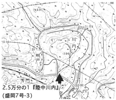
Original Japanese lettering
2.5万分の1『陸中川内』(盛岡7号-3);川内,閉伊川,芳門,453,310.2,317.30,396,309.2,513,56。
English translation
1:25,000 ‘Rikuchu-川内’ (Morioka sheet 7-3); 川内; Hei River; 芳門; 453, 310.2, 317.30, 396, 309.2, 513, 56.
位置図のその他の微小文字は判読不明。
p164_281.png
PDF 164 · Original p. 143
East–west section showing beds I–III, Ak-K, and terrace gravel of the 川内 Terrace and gentle piedmont slope
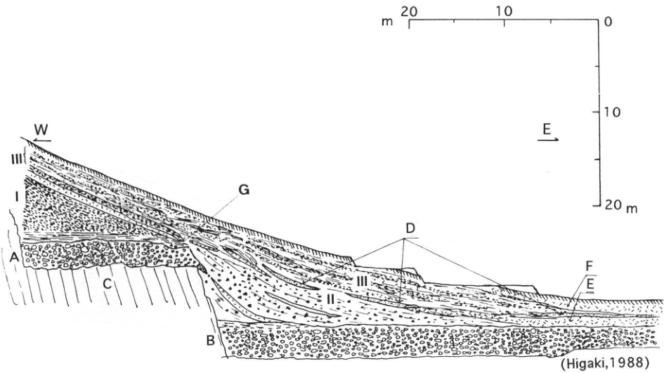
Original Japanese lettering
W,E;I,II,III;A,B,C,D,E,F,G。水平標尺:20,10,0m。垂直標尺:0,10,20m。(Higaki,1988)。本文による対応:A=川内段丘より一段高い段丘砂礫層,B=川内段丘堆積物,D=Ak-K,G=I層末端。C,E,Fの説明は原著本文にない。
English translation
W, E; I, II, III; A, B, C, D, E, F, G. Horizontal scale: 20, 10, 0m. Vertical scale: 0, 10, 20m. (Higaki, 1988). Correspondences stated in the text: A, terrace sand and gravel one level above the 川内 Terrace; B, 川内 terrace deposits; D, Ak-K; G, toe of bed I. C, E, and F are not defined in the original body text.
p165_282.png
PDF 165 · Original p. 144
Location map near Hinoto and Yokomichizawa
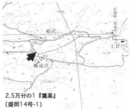
Original Japanese lettering
2.5万分の1『鷹高』(盛岡14号-1);桂沢,横道沢,上日戸,岩洞第一発電所,465,519,404.2。
English translation
1:25,000 ‘鷹高’ (Morioka sheet 14-1); Katsurazawa; Yokomichizawa; Upper Hinoto; Gandō No. 1 power station; 465, 519, 404.2.
地図のその他の微小文字は判読不明。
p165_283.png
PDF 165 · Original p. 144
Outcrop sketch showing solifluction lobes in T2S and BS2 and deformed beds beneath Toya
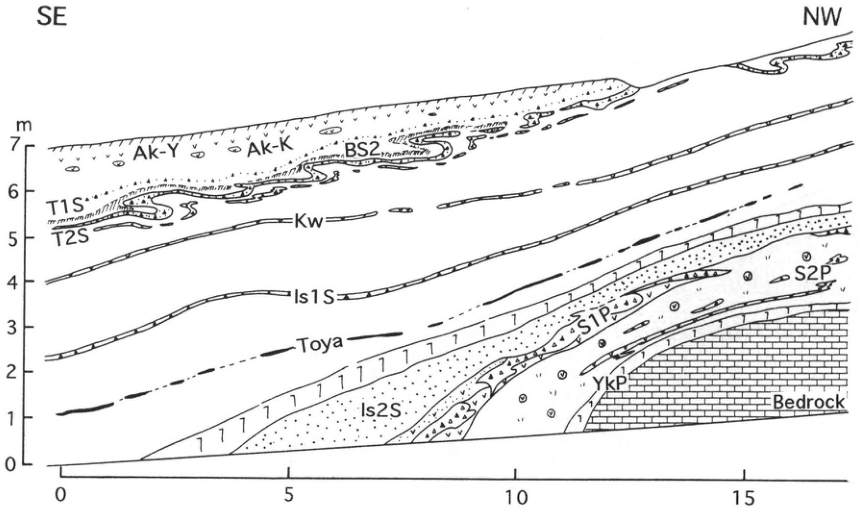
Original Japanese lettering
SE,NW;Ak-Y,Ak-K,BS2,T1S,T2S,Kw,Is1S,Toya,Is2S,S1P,S2P,YkP,Bedrock。垂直標尺m:0,1,2,3,4,5,6,7。水平標尺:0,5,10,15。
English translation
Original lettering: SE, NW; Ak-Y; Ak-K; BS2; T1S; T2S; Kw; Is1S; Toya; Is2S; S1P; S2P; YkP; Bedrock. Vertical scale m: 0, 1, 2, 3, 4, 5, 6, 7. Horizontal scale: 0, 5, 10, 15.
p166_284.png
PDF 166 · Original p. 145
Location maps around 外野沢, 雌子, and 大渡 where stage 6 involutions remain exposed
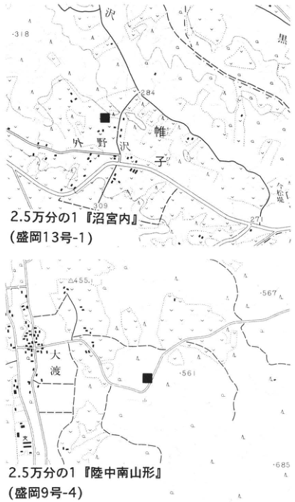
Original Japanese lettering
上図:2.5万分の1『沼宮内』(盛岡13号-1);外野沢,雌子,318,284,309,271。下図:2.5万分の1『陸中南山形』(盛岡9号-4);大渡,455,567,561,685。黒四角で露頭を表示。
English translation
Upper map: 1:25,000 ‘Numakunai’ (Morioka sheet 13-1); 外野沢; 雌子; 318, 284, 309, 271. Lower map: 1:25,000 ‘Rikuchu-Minami-Yamagata’ (Morioka sheet 9-4); 大渡; 455, 567, 561, 685. Black squares indicate exposures.
位置図のその他の微小文字は判読不明。
p166_285.png
PDF 166 · Original p. 145
Continuation of the outcrop sketch showing large deformation in S1P, S2P, and the dark band
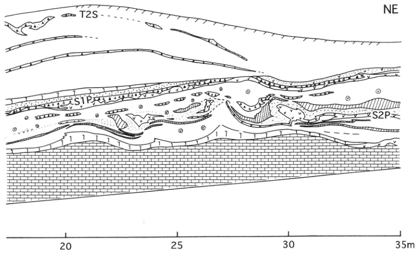
Original Japanese lettering
NE;T2S;S1P;S2P。水平標尺:20,25,30,35m。
English translation
NE; T2S; S1P; S2P. Horizontal scale: 20, 25, 30, 35m.
p167_286.png
PDF 167 · Original p. 146
Location map of the reverse-fault exposure in Ishidoriya Town
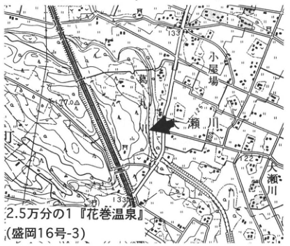
Original Japanese lettering
2.5万分の1『花巻温泉』(盛岡16号-3);小屋場,瀬川,大瀬川,133,133.8,122,170。
English translation
1:25,000 ‘Hanamaki Hot Springs’ (Morioka sheet 16-3); 小屋場; Segawa; Osegawa; 133, 133.8, 122, 170.
地図のその他の微小文字は判読不明。
p167_287.png
PDF 167 · Original p. 146
Northern outcrop sketch showing thrusting of the Shiwa Formation and the age of the humic layer
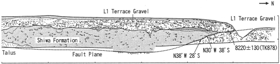
Original Japanese lettering
原図英文:L1 Terrace Gravel(2か所),Shiwa Formation,Talus,Fault Plane,N。N38°W 28°S;N30°W 38°S;8220±130(TK878)。原PDFの水平目盛:60,40,20。
English translation
Original English lettering: L1 Terrace Gravel (twice); Shiwa Formation; Talus; Fault Plane; N. N38°W 28°S; N30°W 38°S; 8220±130 (TK878). Horizontal ticks visible in the original PDF: 60, 40, 20.
p167_288.png
PDF 167 · Original p. 146
Southern outcrop sketch showing the Shiwa Formation above L1 terrace gravel and the fault plane
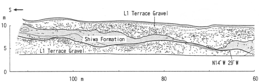
Original Japanese lettering
原図英文:S,L1 Terrace Gravel(2か所),Shiwa Formation。N14°W 29°W。垂直標尺m:0,5,10。水平標尺:100m,80,60。
English translation
Original English lettering: S; L1 Terrace Gravel (twice); Shiwa Formation. N14°W 29°W. Vertical scale m: 0, 5, 10. Horizontal scale: 100m, 80, 60.
p168_289.png
PDF 168 · Original p. 147
Location map of the Iwate tephra reference exposure at Koma-Shinden
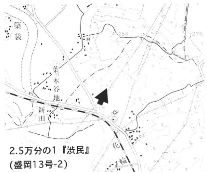
Original Japanese lettering
2.5万分の1『渋民』(盛岡13号-2);葉ノ木谷地,新田,花,袋,256,276,217。
English translation
1:25,000 ‘Shibutami’ (Morioka sheet 13-2); 葉ノ木谷地; Shinden; 花; 袋; 256, 276, 217.
地図のその他の微小文字は判読不明。
p168_290.png
PDF 168 · Original p. 147
1978 outcrop sketch showing numerous marker tephras and debris-avalanche deposits within the 外山, Shibutami, and Wakare volcanic ashes
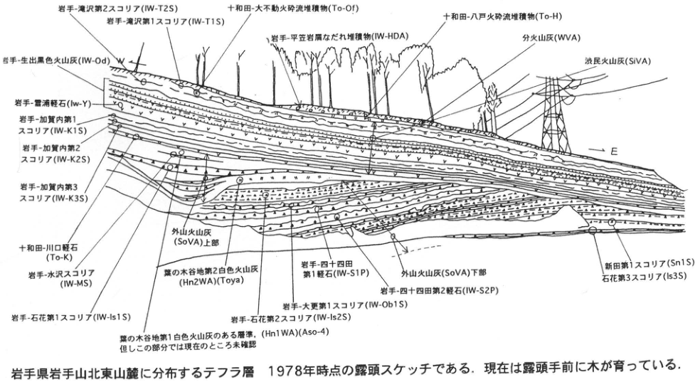
Original Japanese lettering
W,E。岩手-滝沢第2スコリア(IW-T2S);岩手-滝沢第1スコリア(IW-T1S);十和田-大不動火砕流堆積物(To-Of);岩手-平笠岩屑なだれ堆積物(IW-HDA);十和田-八戸火砕流堆積物(To-H);分火山灰(WVA);渋民火山灰(SiVA);岩手-生出黒色火山灰(IW-Od);岩手-雪浦軽石(Iw-Y);岩手-加賀内第1スコリア(IW-K1S);同第2(IW-K2S);同第3(IW-K3S);十和田-川口軽石(To-K);岩手-水沢スコリア(IW-MS);岩手-石花第1スコリア(IW-Is1S);葉の木谷地第1白色火山灰のある層準(Hn1WA)(Aso-4),但しこの部分では現在のところ未確認;外山火山灰(SoVA)上部;葉の木谷地第2白色火山灰(Hn2WA)(Toya);岩手-石花第2スコリア(IW-Is2S);岩手-大更第1スコリア(IW-Ob1S);岩手-四十四田第1軽石(IW-S1P);岩手-四十四田第2軽石(IW-S2P);外山火山灰(SoVA)下部;新田第1スコリア(Sn1S);石花第3スコリア(Is3S)。
English translation
W, E. Iwate-Takizawa No. 2 scoria (IW-T2S); Iwate-Takizawa No. 1 scoria (IW-T1S); Towada-Ofudo pyroclastic-flow deposits (To-Of); Iwate-Hirakasa debris-avalanche deposits (IW-HDA); Towada-Hachinohe pyroclastic-flow deposits (To-H); Wakare volcanic ash (WVA); Shibutami volcanic ash (SiVA); Iwate-Oide black volcanic ash (IW-Od); Iwate-雪浦 Pumice (Iw-Y); Iwate-加賀内 No. 1 scoria (IW-K1S), No. 2 (IW-K2S), and No. 3 (IW-K3S); Towada-Kawaguchi Pumice (To-K); Iwate-Mizusawa scoria (IW-MS); Iwate-石花 No. 1 scoria (IW-Is1S); horizon containing 葉の木谷地 No. 1 white ash (Hn1WA) (Aso-4), but not yet confirmed in this part; upper 外山 volcanic ash (SoVA); 葉の木谷地 No. 2 white ash (Hn2WA) (Toya); Iwate-石花 No. 2 scoria (IW-Is2S); Iwate-Obuke No. 1 scoria (IW-Ob1S); Iwate-Shijushida No. 1 pumice (IW-S1P); Iwate-Shijushida No. 2 pumice (IW-S2P); lower 外山 volcanic ash (SoVA); Shinden No. 1 scoria (Sn1S); 石花 No. 3 scoria (Is3S).
p169_291.png
PDF 169 · Original p. 148
Location map of the solifluction-lobe exposure near Oide
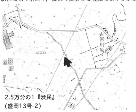
Original Japanese lettering
2.5万分の1『渋民』(盛岡13号-2);古河川原,244,323.3,272。画像の本文片は本文に収録。
English translation
1:25,000 ‘Shibutami’ (Morioka sheet 13-2); 古河川原; 244, 323.3, 272. The body-text fragment included in the image is transcribed and translated in the main text.
位置図のその他の微小文字は判読不明。
p169_292.png
PDF 169 · Original p. 148
Solifluction-lobe section showing folds in T1S, T2S, and dark bands
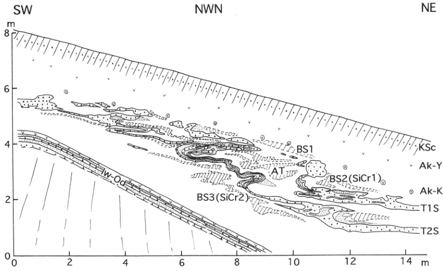
Original Japanese lettering
SW,NWN,NE;KSc,Ak-Y,Ak-K,T1S,T2S,BS1,AT,BS2(SiCr1),BS3(SiCr2),Iw-Od。垂直標尺m:0,2,4,6,8。水平標尺m:0,2,4,6,8,10,12,14。
English translation
SW, NWN, NE; KSc; Ak-Y; Ak-K; T1S; T2S; BS1; AT; BS2 (SiCr1); BS3 (SiCr2); Iw-Od. Vertical scale m: 0, 2, 4, 6, 8. Horizontal scale m: 0, 2, 4, 6, 8, 10, 12, 14.
p170_293.png
PDF 170 · Original p. 149
Location map of the Middle Pleistocene tephra exposure in Koromogawa Village
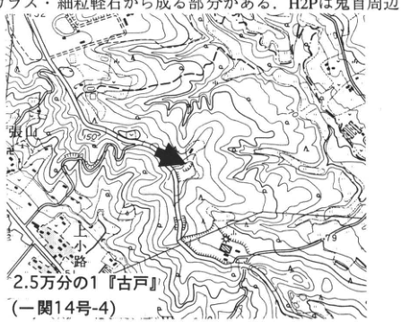
Original Japanese lettering
2.5万分の1『古戸』(一関14号-4);張山,小路,150,79。画像の本文片は本文に収録。
English translation
1:25,000 ‘古戸’ (Ichinoseki sheet 14-4); 張山; 小路; 150, 79. The body-text fragment included in the image is transcribed and translated in the main text.
位置図のその他の微小文字は判読不明。
p170_294.png
PDF 170 · Original p. 149
Photograph of Hn1P, H2P, A1P, A2P, and terrace gravel
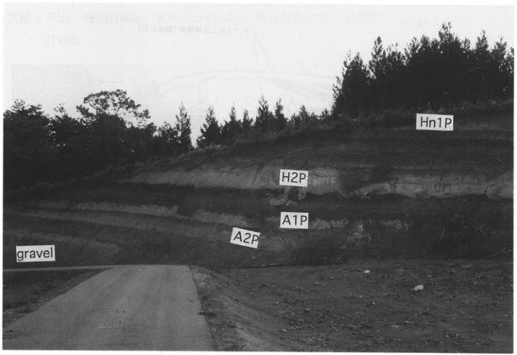
Original Japanese lettering
Hn1P,H2P,A1P,A2P,gravel。
English translation
Original English lettering: Hn1P; H2P; A1P; A2P; gravel.
p170_295.png
PDF 170 · Original p. 149
Column showing T2 terrace gravel and nine marker pumice beds
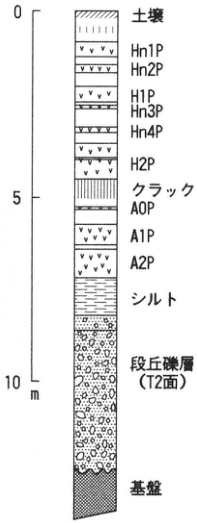
Original Japanese lettering
標尺:0,5,10m。上から:土壌,Hn1P,Hn2P,H1P,Hn3P,Hn4P,H2P,クラック,A0P,A1P,A2P,シルト,段丘礫層(T2面),基盤。
English translation
Scale: 0, 5, 10m. Top to bottom: Soil; Hn1P; Hn2P; H1P; Hn3P; Hn4P; H2P; cracks; A0P; A1P; A2P; silt; terrace gravel (T2 surface); substrate.
p171_296.png
PDF 171 · Original p. 150
Location map of the Akita-Komagatake tephra reference exposure in 下シズノ沢
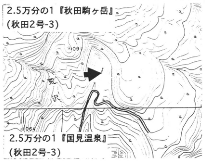
Original Japanese lettering
2.5万分の1『秋田駒ヶ岳』(秋田2号-3);2.5万分の1『国見温泉』(秋田2号-3);荒沢,1064,109[判読不明]。
English translation
1:25,000 ‘Akita-Komagatake’ (Akita sheet 2-3); 1:25,000 ‘Kunimi Hot Springs’ (Akita sheet 2-3); Arasawa; 1064; 109[illegible].
上側の標高109…の末尾とその他の微小文字は判読不明。
原図の二つの地図名の号番号はともに秋田2号-3と印刷。
p171_297.png
PDF 171 · Original p. 150
Outcrop sketch of pumice, scoria, white phreatic-explosion deposits, and reworked beds in 下シズノ沢
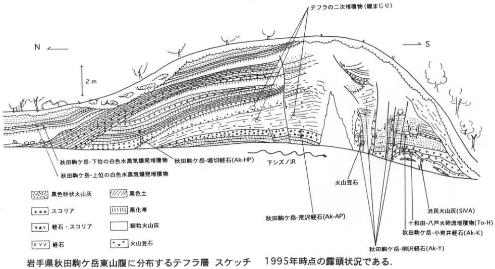
Original Japanese lettering
N,S;2m。テフラの二次堆積物(礫まじり);秋田駒ケ岳-下位の白色水蒸気爆発堆積物;秋田駒ケ岳-上位の白色水蒸気爆発堆積物;秋田駒ケ岳-堀切軽石(Ak-HP);下シズノ沢;秋田駒ケ岳-荒沢軽石(Ak-AP);火山豆石;渋民火山灰(SiVA);十和田-八戸火砕流堆積物(To-H);秋田駒ケ岳-小岩井軽石(Ak-K);秋田駒ケ岳-柳沢軽石(Ak-Y)。凡例:黒色砂状火山灰,スコリア,軽石・スコリア,軽石,黒色土,風化帯,細粒火山灰,火山豆石。
English translation
N, S; 2m. Reworked tephra deposits (with gravel); Akita-Komagatake lower white phreatic-explosion deposits; Akita-Komagatake upper white phreatic-explosion deposits; Akita-Komagatake-Horikiri Pumice (Ak-HP); 下シズノ沢; Akita-Komagatake-Arasawa Pumice (Ak-AP); accretionary lapilli; Shibutami volcanic ash (SiVA); Towada-Hachinohe pyroclastic-flow deposits (To-H); Akita-Komagatake-Koiwai Pumice (Ak-K); Akita-Komagatake-Yanagisawa Pumice (Ak-Y). Legend: Black sandy volcanic ash; scoria; pumice and scoria; pumice; black soil; weathered zone; fine ash; accretionary lapilli.
p172_298.png
PDF 172 · Original p. 151
Location map of the Oyu site and riverbank exposure, photograph of Kemanai pyroclastic-flow deposits, and section showing To-a draping the cliff
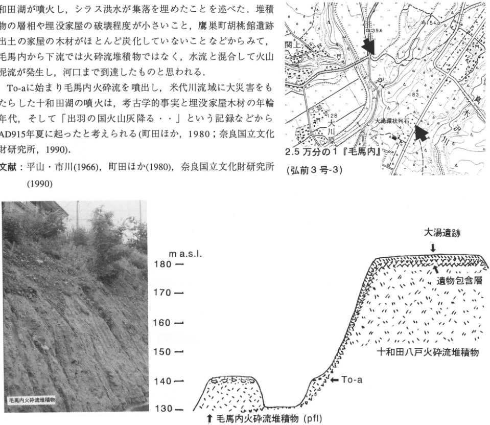
Original Japanese lettering
位置図:2.5万分の1『毛馬内』(弘前3号-3);関上,大川原,大湯環状列石,大湯川,139.6,154.0,183,128。写真注記:毛馬内火砕流堆積物。断面図:m a.s.l.,130,140,150,160,170,180;大湯遺跡,遺物包含層,十和田八戸火砕流堆積物,To-a,毛馬内火砕流堆積物(pfl)。画像の本文片は本文に収録。
English translation
Location map: 1:25,000 ‘Kemanai’ (Hirosaki sheet 3-3); 関上; Okawara; Oyu Stone Circles; Oyu River; 139.6, 154.0, 183, 128. Photograph annotation: Kemanai pyroclastic-flow deposits. Section: m a.s.l.; 130, 140, 150, 160, 170, 180; Oyu site; artifact-bearing layer; Towada-Hachinohe pyroclastic-flow deposits; To-a; Kemanai pyroclastic-flow deposits (pfl). The body-text fragment in the image is transcribed and translated in the main text.
位置図のその他の微小文字は判読不明。
p173_299.png
PDF 173 · Original p. 152
Location map of the sea cliffs west of Oibana Cape
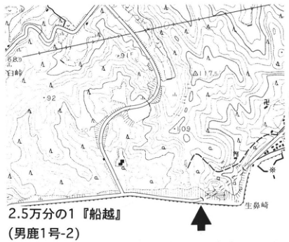
Original Japanese lettering
2.5万分の1『船越』(男鹿1号-2);生鼻崎,百崎,68.9,91,117.5,92,109。
English translation
1:25,000 ‘Funakoshi’ (Oga sheet 1-2); Oibana Cape; 百崎; 68.9, 91, 117.5, 92, 109.
地図のその他の微小文字は判読不明。
p173_300.png
PDF 173 · Original p. 152
Western portion of the Kitaura–Wakimoto sea-cliff section, ash-marker beds, and paleomagnetic and foraminiferal records
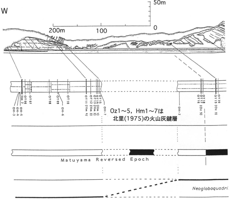
Original Japanese lettering
W。水平標尺:200m,100,0。垂直標尺:0,50m。火山灰鍵層:OH-3,OH-4,OH-5,Hm1,OT06,OT07,OT08,OT09,OH-6,OT10,OT11(Hm4),OT12(Hm3),OT13(Hm2),OT14(Hm1),OT15,OH-7,OH-1,OH-2,OT16,OT17,OT18(Oz5),OT19(Oz3),OT20。注:Oz1~5,Hm1~7は北里(1975)の火山灰鍵層。原図英文:Matuyama Reversed Epoch。下段の学名はNeogloboquadri…で次頁に続く。
English translation
W. Horizontal scale: 200m, 100, 0. Vertical scale: 0, 50m. Ash-marker beds: OH-3; OH-4; OH-5; Hm1; OT06; OT07; OT08; OT09; OH-6; OT10; OT11 (Hm4); OT12 (Hm3); OT13 (Hm2); OT14 (Hm1); OT15; OH-7; OH-1; OH-2; OT16; OT17; OT18 (Oz5); OT19 (Oz3); OT20. Note: Oz1–5 and Hm1–7 are the ash-marker beds of 北里 (1975). Original English: Matuyama Reversed Epoch. The genus at the bottom ends ‘Neogloboquadri…’ and continues on the next page.
図は次頁の東側断面・凡例・学名へ続く。
p174_301.png
PDF 174 · Original p. 153
Eastern section at Oibana Cape showing the Kitaura–Wakimoto boundary, Brunhes normal polarity, and foraminiferal coiling direction
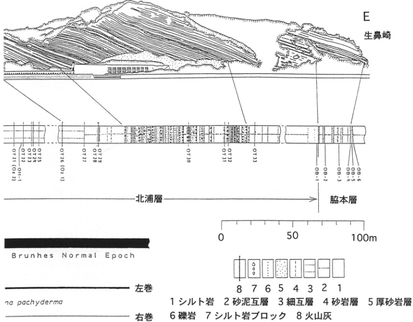
Original Japanese lettering
E,生鼻崎;OT21(Oz2),OT22,OH-1,OT23,OT24,OT25,OT26(Oz1),OT27,OT28,OT29,OT30,OT31,OT32,OT33,OB-1,OB-2,OB-3,OB-4,OB-5,OB-6。北浦層;脇本層。標尺:0,50,100m。原図英文:Brunhes Normal Epoch。学名の右側部分:…na pachyderma(前頁のNeogloboquadri…に続く)。左巻;右巻。凡例:1シルト岩,2砂泥互層,3細互層,4砂岩層,5厚砂岩層,6礫岩,7シルト岩ブロック,8火山灰。
English translation
E; Oibana Cape; OT21 (Oz2); OT22; OH-1; OT23; OT24; OT25; OT26 (Oz1); OT27; OT28; OT29; OT30; OT31; OT32; OT33; OB-1; OB-2; OB-3; OB-4; OB-5; OB-6. Kitaura Formation; Wakimoto Formation. Scale: 0, 50, 100m. Original English: Brunhes Normal Epoch. Right-hand portion of the scientific name: ‘…na pachyderma,’ continuing ‘Neogloboquadri…’ on the preceding page. Sinistral coiling; dextral coiling. Legend: 1 siltstone; 2 sand–mud alternations; 3 thin alternations; 4 sandstone beds; 5 thick sandstone beds; 6 conglomerate; 7 siltstone blocks; 8 volcanic ash.
図はPDF173ページの西側部分から続く。
p175_302.png
PDF 175 · Original p. 154
Location maps and columns at 樽沢 and 福米沢, and stratigraphic diagram of Katanishi members, Toya, and SK rafted pumice
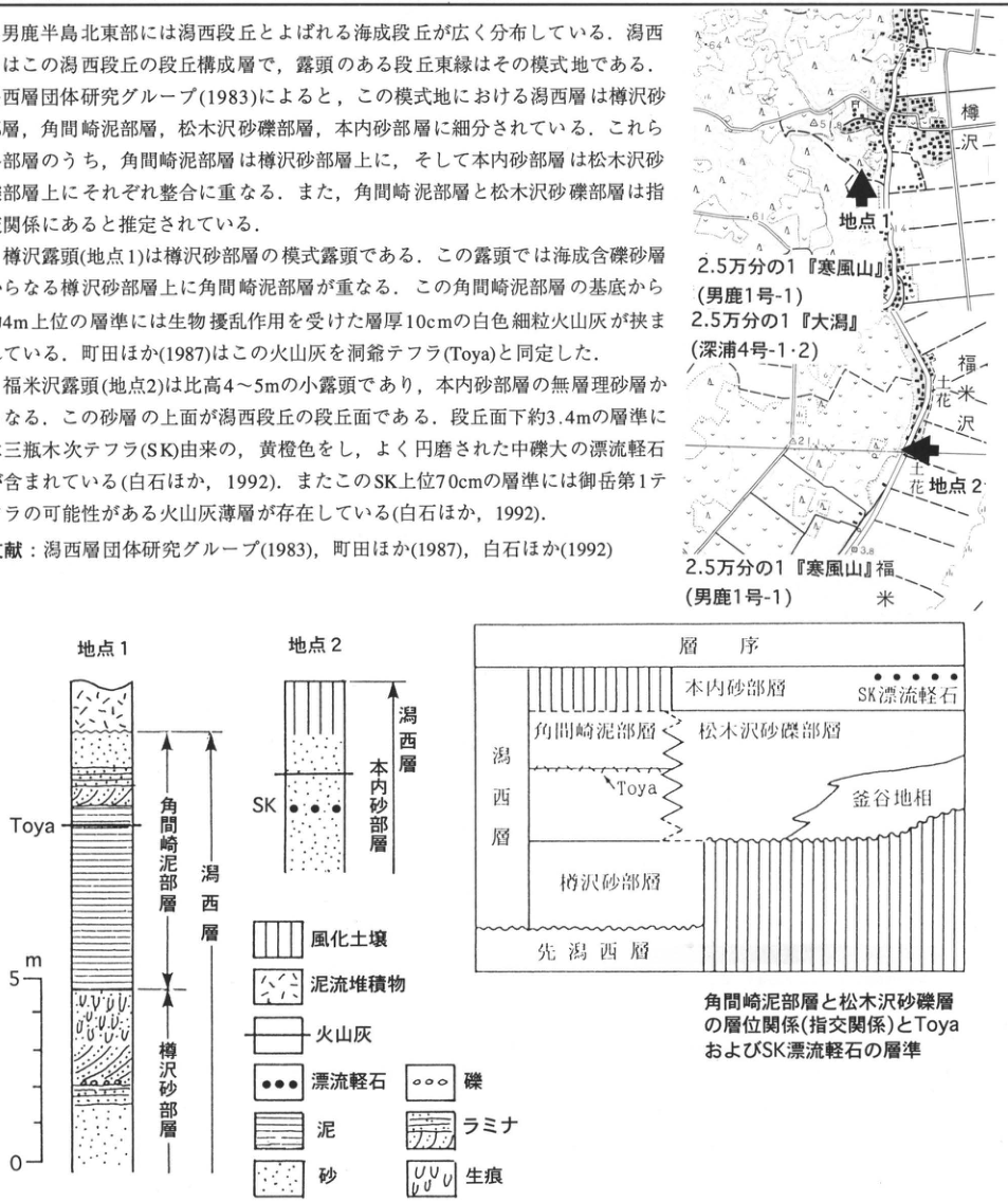
Original Japanese lettering
位置図:地点1,地点2,樽沢,福米沢,花。2.5万分の1『寒風山』(男鹿1号-1)(上下2回);2.5万分の1『大潟』(深浦4号-1・2)。数値64,12,51.8,61,21,3.8。柱状図:地点1,Toya,角間崎泥部層,潟西層,樽沢砂部層;地点2,SK,本内砂部層,潟西層。標尺m:0,5。層序図:層序,潟西層,本内砂部層,SK漂流軽石,角間崎泥部層,松木沢砂礫部層,Toya,釜谷地相,樽沢砂部層,先潟西層。凡例:風化土壌,泥流堆積物,火山灰,漂流軽石,泥,砂,礫,ラミナ,生痕。画像の本文片は本文に収録。
English translation
Location maps: Site 1; site 2; 樽沢; 福米沢; 花. 1:25,000 ‘Kanpuzan’ (Oga sheet 1-1), shown twice; 1:25,000 ‘Ogata’ (Fukaura sheets 4-1 and 4-2). Values: 64, 12, 51.8, 61, 21, 3.8. Columns: Site 1; Toya; Kakumazaki Mud Member; Katanishi Formation; 樽沢 Sand Member. Site 2; SK; 本内 Sand Member; Katanishi Formation. Scale m: 0, 5. Stratigraphic diagram: Stratigraphy; Katanishi Formation; 本内 Sand Member; SK rafted pumice; Kakumazaki Mud Member; Matsukizawa Sand and Gravel Member; Toya; 釜谷地 facies; 樽沢 Sand Member; pre-Katanishi deposits. Legend: Weathered soil; mudflow deposits; volcanic ash; rafted pumice; mud; sand; gravel; laminae; trace fossils. The body-text fragment in the image is transcribed and translated in the main text.
位置図のその他の微小文字は判読不明。
p176_303.png
PDF 176 · Original p. 155
Map locating the outcrop southwest of Kitataki at Onikobe
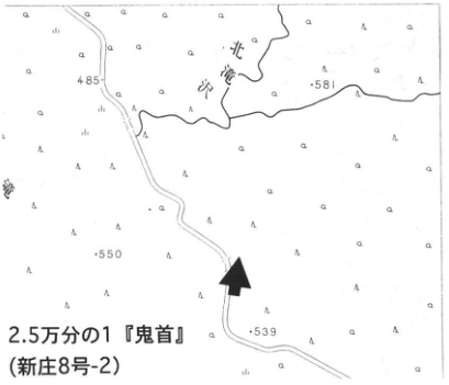
Original Japanese lettering
北滝沢;485;581;550;539。2.5万分の1『鬼首』(新庄8号-2)。黒矢印は露頭位置。
English translation
Kitataki-sawa (北滝沢); 485; 581; 550; 539. 1:25,000 ‘Onikobe’ (Shinjō sheet 8-2). The black arrow marks the outcrop.
p176_304.png
PDF 176 · Original p. 155
Outcrop photograph showing subaqueously deposited Toya, On-Pm 1, Nr-N, and Aso-4
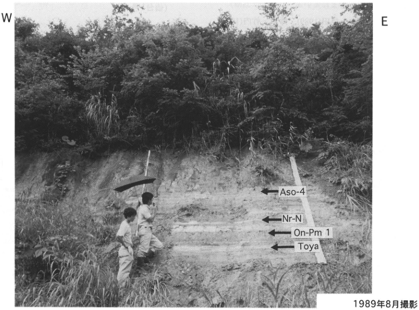
Original Japanese lettering
W;E。上からAso-4,Nr-N,On-Pm 1,Toya。1989年8月撮影。
English translation
W; E. From top to bottom: Aso-4, Nr-N, On-Pm 1, Toya. Photographed in August 1989.
p177_305.png
PDF 177 · Original p. 156
Map locating the 安沢 outcrop and the observation site for Naruko-Yanagisawa tephra
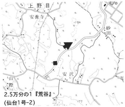
Original Japanese lettering
上野目;安養寺;砂田;安沢;山際;104;118;86;77。2.5万分の1『荒谷』(仙台1号-2)。黒矢印:本露頭。■:本文に記載するNr-Yの観察地点。
English translation
上野目; 安養寺; 砂田; 安沢; 山際; 104; 118; 86; 77. 1:25,000 ‘荒谷’ (Sendai sheet 1-2). Black arrow: the present outcrop. ■: the Nr-Y observation site described in the text.
p177_306.png
PDF 177 · Original p. 156
Outcrop sketch showing the relationships among Smfl, N₃P, MgA, IwP, N₂, and N₃
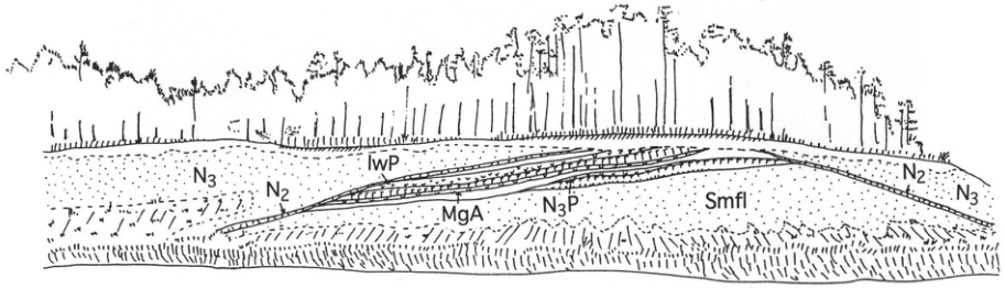
Original Japanese lettering
左部:N₃,N₂。中央:IwP,MgA,N₃P,Smfl。右部:N₂,N₃。
English translation
Left: N₃, N₂. Center: IwP, MgA, N₃P, Smfl. Right: N₂, N₃.
p178_307.png
PDF 178 · Original p. 160
Location map of 土浮山 and columnar section of the Zao-Togatta Volcanic Sand Bed Group
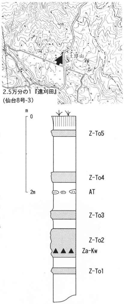
Original Japanese lettering
位置図:土浮山;309;313。2.5万分の1『遠刈田』(仙台8号-3)。柱状図:m;0;2m。上からZ-To5,Z-To4,AT,Z-To3,Z-To2,Za-Kw,Z-To1。観察地点柱状図(原PDFの図直下)。
English translation
Location map: 土浮山; 309; 313. 1:25,000 ‘Togatta’ (Sendai sheet 8-3). Columnar section: m; 0; 2 m. From top to bottom: Z-To5, Z-To4, AT, Z-To3, Z-To2, Za-Kw, Z-To1. Columnar section at the observation site (printed immediately below the figure in the source PDF).
p179_308.png
PDF 179 · Original p. 161
Map locating the outcrop and the Asama-tephra detection site on the southeastern slope of Gassan
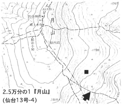
Original Japanese lettering
月山;月山神社;頂上小屋;胎内岩;鍛冶小屋;1979.5;1767;1798;1816;1650。2.5万分の1『月山』(仙台13号-4)。矢印:本露頭。■:本文の浅間テフラ検出地点。
English translation
Gassan; Gassan Shrine (月山神社); summit hut; 胎内岩; 鍛冶小屋; 1979.5; 1767; 1798; 1816; 1650. 1:25,000 ‘Gassan’ (Sendai sheet 13-4). Arrow: the present outcrop. ■: the Asama-tephra detection site described in the text.
p179_309.png
PDF 179 · Original p. 161
Section showing To-a, To-Cu, K-Ah, and calibrated ages in alpine soils on Gassan
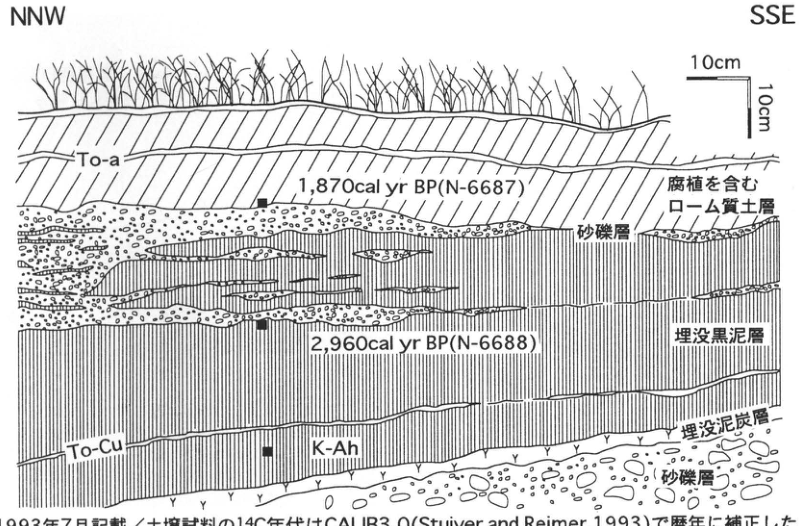
Original Japanese lettering
NNW;SSE;縦横各10cm。To-a;1,870cal yr BP (N-6687);腐植を含むローム質土層;砂礫層;2,960cal yr BP (N-6688);埋没黒泥層;To-Cu;K-Ah;埋没泥炭層;砂礫層。図下注の下縁は抽出画像で切れるが原PDFでは全文を確認:1993年7月記載/土壌試料の¹⁴C年代はCALIB3.0 (Stuiver and Reimer, 1993)で暦年に補正した。
English translation
NNW; SSE; horizontal and vertical scales each 10 cm. To-a; 1,870 cal yr BP (N-6687); humus-bearing loamy soil layer; sand and gravel; 2,960 cal yr BP (N-6688); buried muck horizon; To-Cu; K-Ah; buried peat horizon; sand and gravel. The lower edge of the note is clipped in the extracted image, but the full text is confirmed in the PDF: described in July 1993; the ¹⁴C ages of soil samples were calibrated to calendar years using CALIB3.0 (Stuiver and Reimer, 1993).
p180_310.png
PDF 180 · Original p. 162
Tephra column at Naganeyama and outcrop location map in the Obanazawa Basin
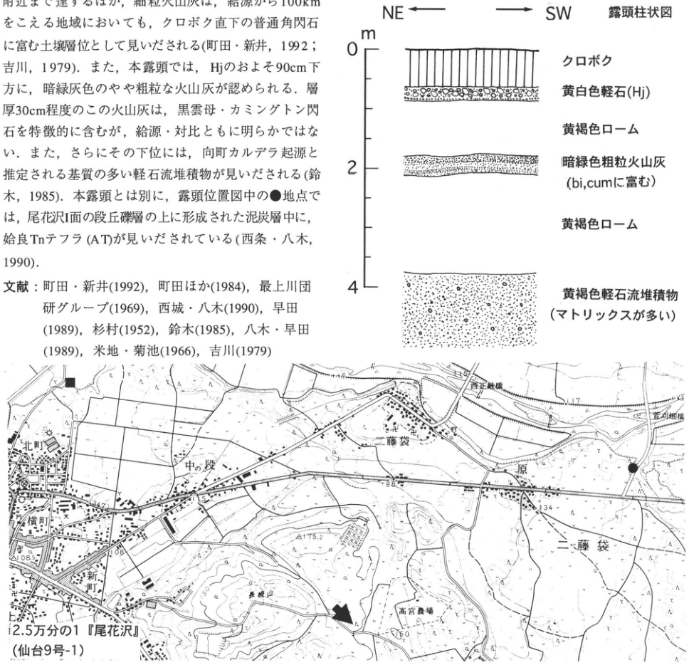
Original Japanese lettering
柱状図:NE←,→SW;露頭柱状図;m;0,2,4。上からクロボク;黄白色軽石(Hj);黄褐色ローム;暗緑色粗粒火山灰(bi, cumに富む);黄褐色ローム;黄褐色軽石流堆積物(マトリックスが多い)。位置図:北町;横町;新町;中の段;藤袋;原;二藤袋;長根山;高宮農場;108.5;115.4;117;128;134;175.2;150。2.5万分の1『尾花沢』(仙台9号-1)。矢印は本露頭,■と●は本文記載の地点。地図内の橋名2箇所は[判読不明]。画像左上の本文と文献片は本文に収録。
English translation
Column: NE ←, → SW; outcrop columnar section; m; 0, 2, 4. From top to bottom: kuroboku soil; yellowish-white pumice (Hj); yellowish-brown loam; dark green coarse ash (rich in bi, cum); yellowish-brown loam; yellowish-brown pumice-flow deposit (matrix-rich). Map: 北町; 横町; 新町; 中の段; 藤袋; 原; 二藤袋; Naganeyama (長根山); 高宮農場; 108.5; 115.4; 117; 128; 134; 175.2; 150. 1:25,000 ‘Obanazawa’ (Sendai sheet 9-1). The arrow marks the present outcrop; ■ and ● mark the sites described in the text. Two bridge names on the map are [illegible]. Fragments of body text and references at upper left are included in the main text.
位置図の橋名2箇所 — 文字が細かく一部潰れていて全名の確定が困難。
p181_311.png
PDF 181 · Original p. 163
Map locating the outcrop on the southern slope of Mount Iide
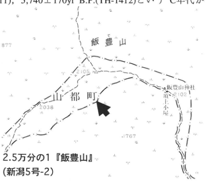
Original Japanese lettering
飯豊山;山都町;飯豊山神社;御室小屋;877;2105;2038;2102;1767。2.5万分の1『飯豊山』(新潟5号-2)。矢印は露頭位置。上端の本文片は本文に収録。
English translation
Mount Iide; Yamato Town; Iide Shrine; 御室小屋; 877; 2105; 2038; 2102; 1767. 1:25,000 ‘Mount Iide’ (Niigata sheet 5-2). Arrow: outcrop location. The body-text fragment along the top edge is included in the main text.
p181_312.png
PDF 181 · Original p. 163
Photograph of peaty and muck-rich soil on Mount Iide, with To-Cu and K-Ah marked
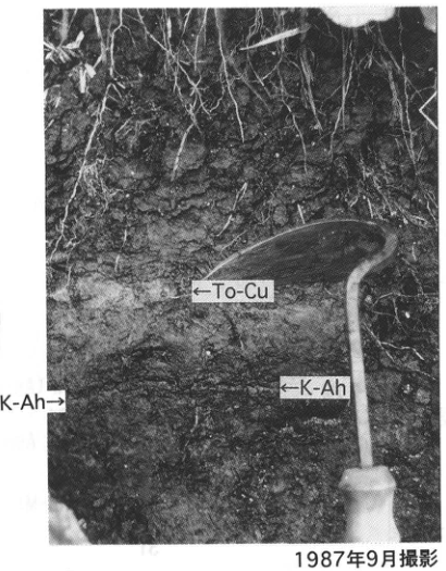
Original Japanese lettering
←To-Cu;←K-Ah;K-Ah→。1987年9月撮影。
English translation
←To-Cu; ←K-Ah; K-Ah→. Photographed in September 1987.
p181_313.png
PDF 181 · Original p. 163
Column showing mineral soil, peaty to muck-rich soil, To-Cu, K-Ah, and angular gravel
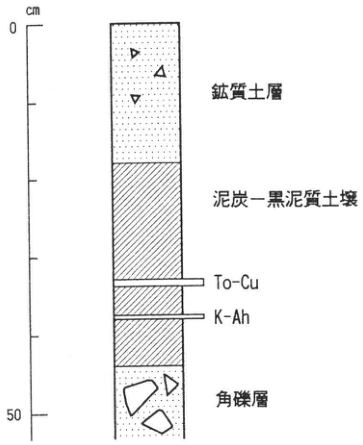
Original Japanese lettering
cm;0;50。上から鉱質土層;泥炭―黒泥質土壌;To-Cu;K-Ah;角礫層。図直下に柱状図(西条・小松原,1988を改変)。
English translation
cm; 0; 50. From top to bottom: mineral soil layer; peaty to muck-rich soil; To-Cu; K-Ah; angular gravel. Caption immediately below: columnar section (modified from 西条・小松原, 1988).
p182_314.png
PDF 182 · Original p. 165
Hayama location map and outcrop sketch, with a schematic tephra column for the Bandai area
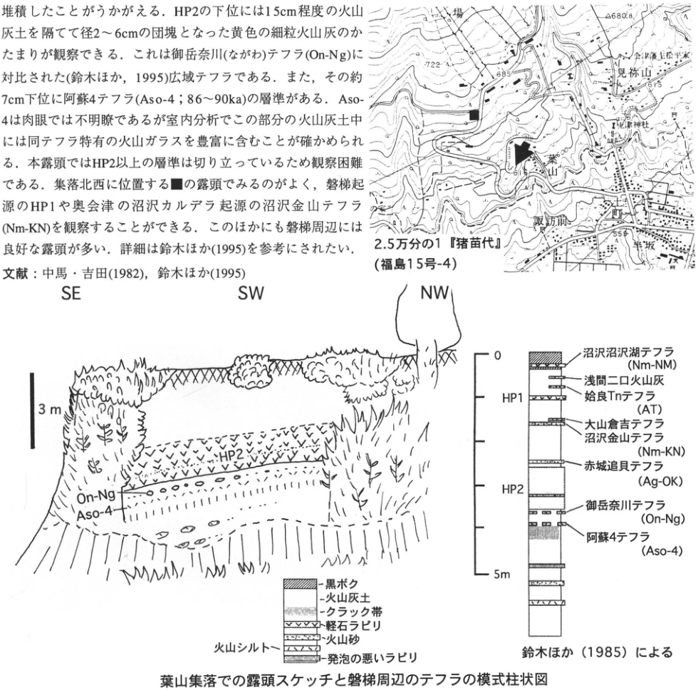
Original Japanese lettering
位置図:牧場;見祢山;会津藩主松平家;土津神社;葉山;諏訪前;町;葉坂;722;685;680.8;675;559。2.5万分の1『猪苗代』(福島15号-4)。矢印と■は本文記載の露頭。地図の微小な注記の一部は[判読不明]。スケッチ:SE,SW,NW;3m;HP2;On-Ng;Aso-4。模式柱状図:0,5m;HP1,HP2。上から沼沢沼沢湖テフラ(Nm-NM);浅間二口火山灰;姶良Tnテフラ(AT);大山倉吉テフラ;沼沢金山テフラ(Nm-KN);赤城追貝テフラ(Ag-OK);御岳奈川テフラ(On-Ng);阿蘇4テフラ(Aso-4)。凡例:黒ボク;火山灰土;クラック帯;軽石ラピリ;火山砂;火山シルト;発泡の悪いラピリ。鈴木ほか(1985)による。葉山集落での露頭スケッチと磐梯周辺のテフラの模式柱状図。左上に含まれる本文・文献片は本文に収録。
English translation
Map: pasture; 見祢山; Matsudaira family, lords of the Aizu domain; Hanitsu Shrine (土津神社); Hayama; 諏訪前; 町; 葉坂; 722; 685; 680.8; 675; 559. 1:25,000 ‘Inawashiro’ (Fukushima sheet 15-4). The arrow and ■ mark the outcrops described in the text. Some very small map annotations are [illegible]. Sketch: SE, SW, NW; 3 m; HP2; On-Ng; Aso-4. Schematic column: 0, 5 m; HP1, HP2. From top to bottom: Numazawa-Numazawako tephra (Nm-NM); Asama-Futakuchi Ash; Aira-Tn tephra (AT); Daisen-Kurayoshi tephra; Numazawa-Kanayama tephra (Nm-KN); Akagi-Okkai tephra (Ag-OK); Ontake-Nagawa tephra (On-Ng); Aso-4 tephra (Aso-4). Legend: kuroboku soil; volcanic-ash soil; cracked zone; pumice lapilli; volcanic sand; volcanic silt; poorly vesiculated lapilli. After 鈴木 et al. (1985). Outcrop sketch at Hayama village and schematic column of tephras around Bandai. The body-text and reference fragments at upper left are included in the main text.
微小な地図注記の一部 — 画素が潰れており判読困難。
p183_315.png
PDF 183 · Original p. 166
Map locating the 金勝寺 and Nagasaka outcrops in Shirakawa City
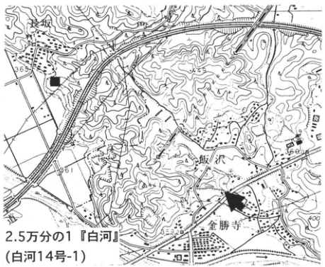
Original Japanese lettering
長坂;飯沢;金勝寺;365;361;360.0;400;353.2。2.5万分の1『白河』(白河14号-1)。矢印:金勝寺露頭。■:長坂の模式地。
English translation
Nagasaka (長坂); 飯沢; 金勝寺; 365; 361; 360.0; 400; 353.2. 1:25,000 ‘Shirakawa’ (Shirakawa sheet 14-1). Arrow: 金勝寺 outcrop. ■: Nagasaka type locality.
p183_316.png
PDF 183 · Original p. 166
Outcrop photograph of the Nishigō and Ashino pyroclastic-flow deposits and intervening 金勝寺 fallout pyroclastic deposits
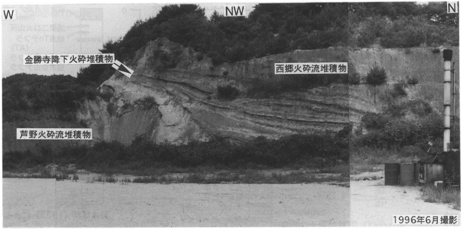
Original Japanese lettering
W;NW;N。金勝寺降下火砕堆積物;西郷火砕流堆積物;芦野火砕流堆積物。1996年6月撮影。
English translation
W; NW; N. 金勝寺 fallout pyroclastic deposits; Nishigō pyroclastic-flow deposit; Ashino pyroclastic-flow deposit. Photographed in June 1996.
p185_317.png
PDF 185 · Original p. 168
Chifuri outcrop location map and sketch showing the Ofuji debris-avalanche deposit and tephras
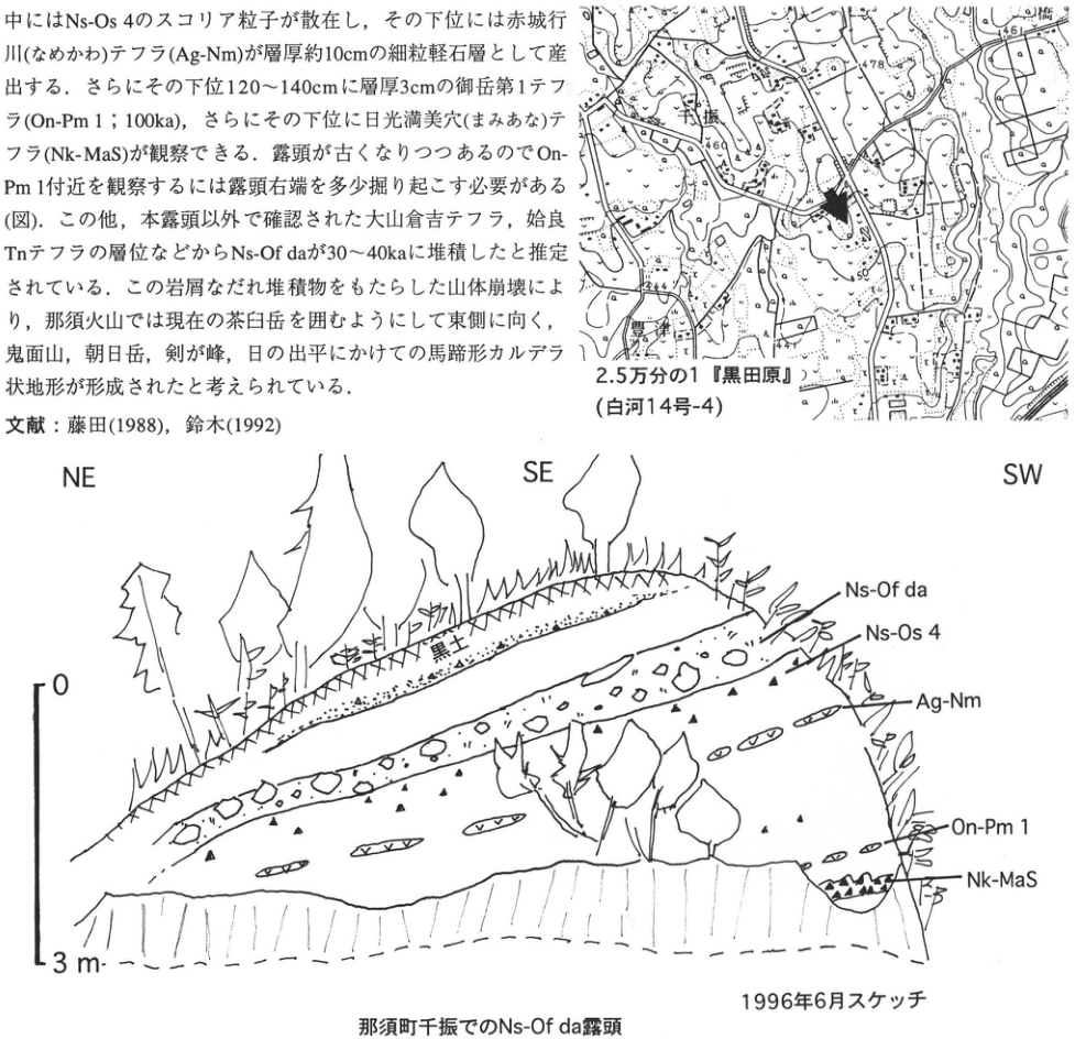
Original Japanese lettering
位置図:千振;豊津;小橋;461;478;469;450;444。2.5万分の1『黒田原』(白河14号-4)。矢印は露頭位置。スケッチ:NE,SE,SW;0,3m;黒土;Ns-Of da;Ns-Os 4;Ag-Nm;On-Pm 1;Nk-MaS。1996年6月スケッチ。那須町千振でのNs-Of da露頭。画像左上の本文・文献片は本文に収録。
English translation
Map: Chifuri; 豊津; 小橋; 461; 478; 469; 450; 444. 1:25,000 ‘Kurodahara’ (Shirakawa sheet 14-4). Arrow: outcrop location. Sketch: NE, SE, SW; 0, 3 m; black soil; Ns-Of da; Ns-Os 4; Ag-Nm; On-Pm 1; Nk-MaS. Sketched in June 1996. Ns-Of da outcrop at Chifuri, Nasu Town. The body-text and reference fragments at upper left are included in the main text.
p186_318.png
PDF 186 · Original p. 169
Location map showing the main Higashiakada outcrop (arrow) and supplementary outcrop near Horihara-machi (■)
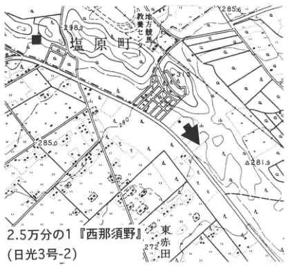
Original Japanese lettering
2.5万分の1「西那須野」(日光3号-2)。堀原町、東赤田、地方競馬教養センター。標高・等高線の可読値:298、285.6、285.0、280、281.9、272。矢印:主露頭;■:補完露頭。
English translation
1:25,000 Nishinasuno sheet (Nikko sheet 3-2). Horihara-machi (堀原町); Higashiakada; Regional Horse-Racing Training Center. Legible elevations and contours: 298, 285.6, 285.0, 280, 281.9, 272. Arrow: main outcrop; ■: supplementary outcrop.
p186_319.png
PDF 186 · Original p. 169
Several-metre section with labeled tephras from Nikko, Ontake, Aso, Akagi, and Daisen
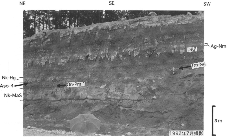
Original Japanese lettering
方位:NE、SE、SW。層名:Ag-Nm、DKP、On-Ng、Nk-Hg、Aso-4、On-Pm 1、Nk-MaS。スケール:3 m。1992年7月撮影。
English translation
Directions: NE, SE, SW. Layer labels: Ag-Nm, DKP, On-Ng, Nk-Hg, Aso-4, On-Pm 1, Nk-MaS. Scale: 3 m. Photographed in July 1992.
p187_320.png
PDF 187 · Original p. 170
Figure 1, with an arrow locating the outcrop in the hills at Yoshii
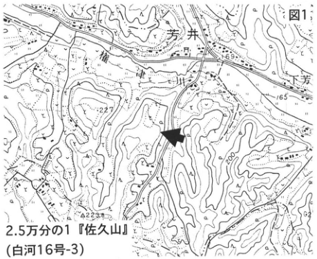
Original Japanese lettering
図1。2.5万分の1「佐久山」(白河16号-3)。芳井、下芳井(右端は一部切れる)、権現山。標高・等高線:169、165、227、200、223.8。
English translation
Figure 1. 1:25,000 Sakuyama sheet (Shirakawa sheet 16-3). Yoshii (芳井); Shimo-Yoshii (下芳井; partly cropped at right); Gongen-yama (権現山). Elevations and contours: 169, 165, 227, 200, 223.8.
p187_321.png
PDF 187 · Original p. 170
Plan of the borrow pit showing sections 1–6, tephra outcrop traces, a house, and roads
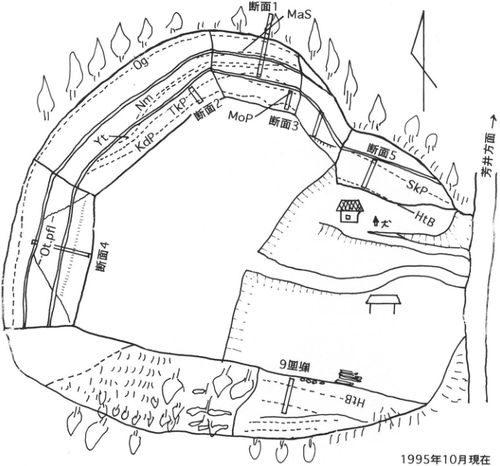
Original Japanese lettering
断面1:MaS。断面2付近:Og、Nm、TkP、Yt、KdP。断面3:MoP。断面4:Ot.pfl。断面5:SkP、HtB。断面6:HtB。芳井方面(矢印)、犬(民家脇)、方位矢印。1995年10月現在。
English translation
Section 1: MaS. Around section 2: Og, Nm, TkP, Yt, KdP. Section 3: MoP. Section 4: Ot.pfl. Section 5: SkP, HtB. Section 6: HtB. Arrow: toward Yoshii (芳井). Dog beside house; orientation arrow. As of October 1995.
p188_322.png
PDF 188 · Original p. 171
Correlated tephra columns from six sections in the Kitsuregawa Hills, spanning a sequence on the order of 40 m
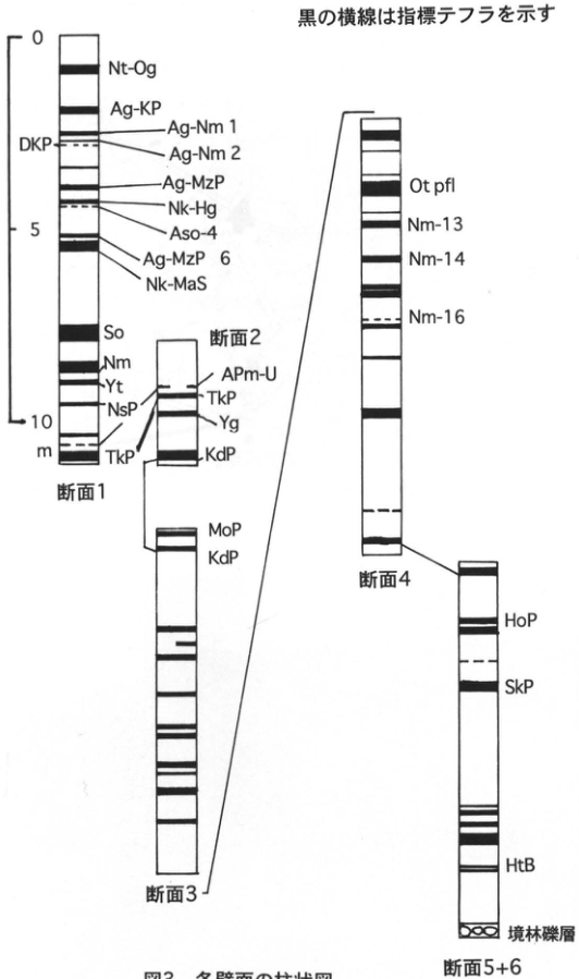
Original Japanese lettering
黒の横線は指標テフラを示す。左側スケール:0、5、10 m。
| 断面 | 上から下への可読層名 |
|---|---|
| 断面1 | Nt-Og、Ag-KP、Ag-Nm 1、Ag-Nm 2、DKP、Ag-MzP、Nk-Hg、Aso-4、Ag-MzP 6、Nk-MaS、So、Nm、Yt、NsP、TkP |
| 断面2 | APm-U、TkP、Yg、KdP |
| 断面3 | MoP、KdP |
| 断面4 | Ot pfl、Nm-13、Nm-14、Nm-16 |
| 断面5+6 | HoP、SkP、HtB、境林礫層 |
断面1と2、2と3、3と4、4と5+6の対応層準を線で接続。
English translation
Black horizontal bars indicate marker tephras. Left-hand scale: 0, 5, 10 m.
| Section | Legible layer labels, top to bottom |
|---|---|
| Section 1 | Nt-Og, Ag-KP, Ag-Nm 1, Ag-Nm 2, DKP, Ag-MzP, Nk-Hg, Aso-4, Ag-MzP 6, Nk-MaS, So, Nm, Yt, NsP, TkP |
| Section 2 | APm-U, TkP, Yg, KdP |
| Section 3 | MoP, KdP |
| Section 4 | Ot pfl, Nm-13, Nm-14, Nm-16 |
| Sections 5+6 | HoP, SkP, HtB, Sakaibayashi Gravel (境林礫層) |
Lines connect corresponding horizons between sections 1 and 2, 2 and 3, 3 and 4, and 4 and 5+6.
p189_323.png
PDF 189 · Original p. 172
Topographic map of western Utsunomiya, with an arrow marking the Kamikake outcrop and ■ marking the supplementary locality
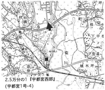
Original Japanese lettering
2.5万分の1「宇都宮西部」(宇都宮1号-4)。上欠町、下中村、植木坪、根、亀岡、下街道、姿川、上欠、沓掛、荒針街道(左縁は一部切れる)。標高・等高線:143、140、126、148.2、120、114、110、105。矢印:主露頭;■:補完露頭。
English translation
1:25,000 Utsunomiya-Seibu sheet (Utsunomiya sheet 1-4). Kamikake-machi (上欠町), Shimo-Nakamura (下中村), 植木坪, 根, 亀岡, 下街道, Sugata River (姿川), 上欠, 沓掛, 荒針街道 (partly cropped at left). Elevations and contours: 143, 140, 126, 148.2, 120, 114, 110, 105. Arrow: main outcrop; ■: supplementary outcrop.
p189_324.png
PDF 189 · Original p. 172
Kamikake-machi tephra exposure labeled with Ag-KP, Nk-MaS, and Ag-MzP9 and 10
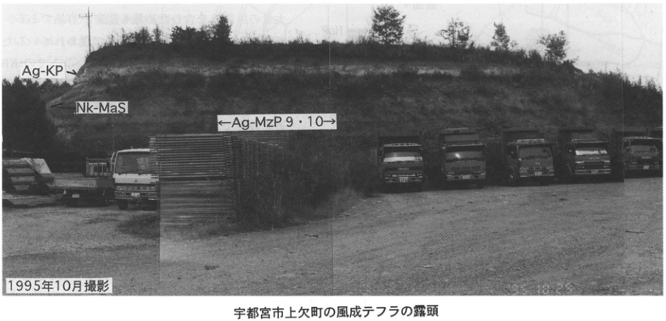
Original Japanese lettering
Ag-KP(矢印)、Nk-MaS、←Ag-MzP 9・10→。1995年10月撮影。
English translation
Ag-KP (arrow); Nk-MaS; ←Ag-MzP 9 and 10→. Photographed in October 1995.
p190_325.png
PDF 190 · Original p. 173
Topographic map with an arrow locating the type outcrop at Nagasuna on the Naka Upland
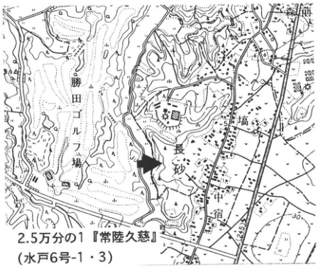
Original Japanese lettering
2.5万分の1「常陸久慈」(水戸6号-1・3)。長砂、勝田ゴルフ場、宿、高場(地図表記「高」付近)、新原(右上、一部切れる)。等高線・標高の可読値:30、42.5。
English translation
1:25,000 Hitachi-Kuji sheet (Mito sheets 6-1 and 6-3). Nagasuna; Katsuta Golf Course; 宿; 高場 (around the map label 高); 新原 (partly cropped at upper right). Legible contour and elevation values: 30, 42.5.
高場、新原 — 小さな地名文字の一部が図縁で切れており、読みに不確実性がある。
p190_326.png
PDF 190 · Original p. 173
Overview and two close-ups of the Miwa upper, middle, and lower pumice beds
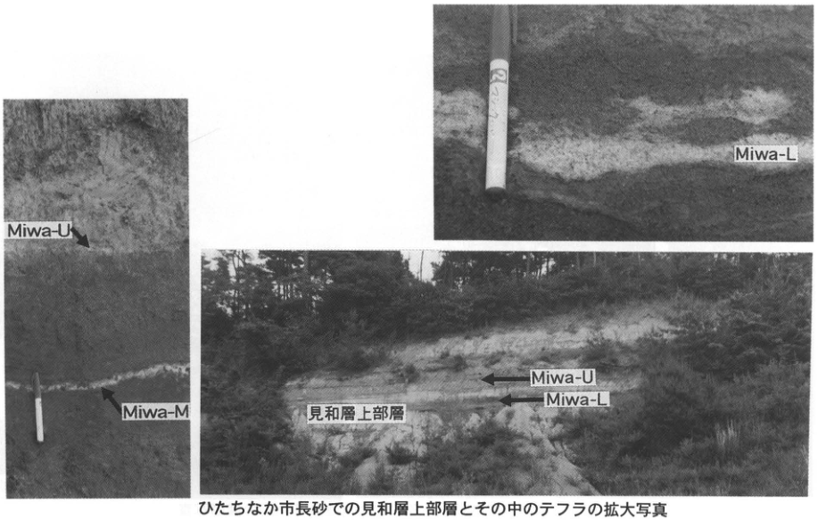
Original Japanese lettering
左拡大像:Miwa-U、Miwa-M(矢印)。右上拡大像:Miwa-L。右下全景:見和層上部層、Miwa-U、Miwa-L(矢印)。
English translation
Left close-up: Miwa-U and Miwa-M (arrows). Upper-right close-up: Miwa-L. Lower-right overview: upper member of the Miwa Formation; Miwa-U and Miwa-L (arrows).
p191_327.png
PDF 191 · Original p. 174
Topographic map with ■ marking the former gravel-quarry exposure south of Yugoya hot spring
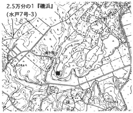
Original Japanese lettering
2.5万分の1「磯浜」(水戸7号-3)。下入野、湯小屋、後谷。標高・等高線:30、28.8、25、26、28.5。■:露頭。
English translation
1:25,000 Isohama sheet (Mito sheet 7-3). Shimo-Irino; Yugoya; 後谷. Elevations and contours: 30, 28.8, 25, 26, 28.5. ■: outcrop.
p191_328.png
PDF 191 · Original p. 174
Thin MoP layer within gravel, with people providing scale
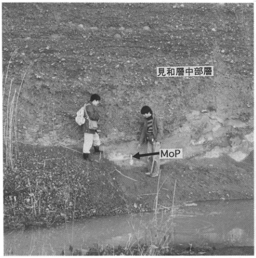
Original Japanese lettering
見和層中部層。MoP(矢印)。
English translation
Middle member of the Miwa Formation. MoP (arrow).
p191_329.png
PDF 191 · Original p. 174
Close-up of MoP in a sand lens, with a shovel for scale
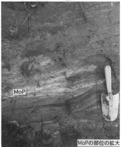
Original Japanese lettering
MoP。MoPの部位の拡大。
English translation
MoP. Enlargement of the part containing MoP.
p192_330.png
PDF 192 · Original p. 175
Topographic map locating the artificial exposure at Shimo-Oshima in the left-bank Sakuragawa Lowland
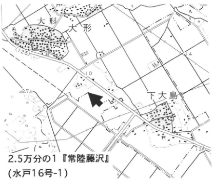
Original Japanese lettering
2.5万分の1「常陸藤沢」(水戸16号-1)。大形(2箇所)、下大島。標高・等高線:12.5、10、7.6、14、13。矢印:露頭。
English translation
1:25,000 Hitachi-Fujisawa sheet (Mito sheet 16-1). 大形 (two labels); Shimo-Oshima. Elevations and contours: 12.5, 10, 7.6, 14, 13. Arrow: outcrop.
p192_331.png
PDF 192 · Original p. 175
Column of the Shimo-Oshima Formation with eight tephras, geological cross-section of the Sakuragawa Lowland, and ten dated samples
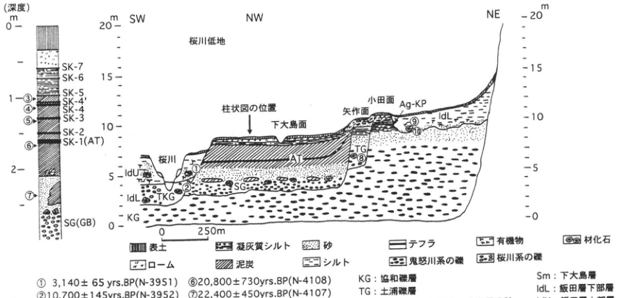
Original Japanese lettering
柱状図(深度m):0、1、2。上から:SK-7、SK-6、SK-5、SK-4′、SK-4、SK-3、SK-2、SK-1(AT)、SG(BG)。年代採取番号③~⑦を図示。 断面方位:SW、NW、NE。標高目盛m:0、5、10、15、20(左右)。水平スケール:0–250m。桜川低地、柱状図の位置(矢印)、下大島面、矢作面、小田面、桜川。層符号:AT、Ag-KP、Sm、IdU、IdL、SG、TKG、TG、KG。年代採取番号①、②、⑧、⑨、⑩。 凡例:表土、ローム、凝灰質シルト、泥炭、砂、シルト、テフラ、鬼怒川系の礫、有機物、桜川系の礫、材化石。
| 番号 | 年代値(yrs.BP) | 試料番号 |
|---|---|---|
| ① | 3,140±65 | N-3951 |
| ② | 10,700±145 | N-3952 |
| ③ | 16,700±255 | N-4111 |
| ④ | 18,100±340 | N-4110 |
| ⑤ | 20,300±345 | N-4109 |
| ⑥ | 20,800±730 | N-4108 |
| ⑦ | 22,400±450 | N-4107 |
| ⑧ | 28,400±680 | N-3953 |
| ⑨ | 5,550±170 | Gak-10030 |
| ⑩ | 6,860±180 | Gak-10031 |
KG:協和礫層。TG:土浦礫層。SG:下大島礫層(沖積層基底礫層:BG)。TKG:塚田砂礫層(完新統基底礫層:HBG)。Sm:下大島層。IdL:飯田層下部層。IdU:飯田層上部層。AT:姶良Tn火山灰。Ag-KP:赤城鹿沼軽石。鈴木ほか(1993)。
English translation
Column (depth in m): 0, 1, 2. From top downward: SK-7, SK-6, SK-5, SK-4′, SK-4, SK-3, SK-2, SK-1 (AT), SG (BG). Dated-sample positions ③–⑦ are shown. Section directions: SW, NW, NE. Elevation scales, m: 0, 5, 10, 15, 20 on both sides. Horizontal scale: 0–250 m. Sakuragawa Lowland; position of column (arrow); Shimo-Oshima surface; Yahagi surface (矢作面); Oda surface; Sakuragawa River. Unit codes: AT, Ag-KP, Sm, IdU, IdL, SG, TKG, TG, KG. Dated-sample positions ①, ②, ⑧, ⑨, ⑩. Legend: topsoil; loam; tuffaceous silt; peat; sand; silt; tephra; gravel of the Kinugawa system; organic matter; gravel of the Sakuragawa system; fossil wood.
| Number | Age (yrs.BP) | Sample number |
|---|---|---|
| ① | 3,140±65 | N-3951 |
| ② | 10,700±145 | N-3952 |
| ③ | 16,700±255 | N-4111 |
| ④ | 18,100±340 | N-4110 |
| ⑤ | 20,300±345 | N-4109 |
| ⑥ | 20,800±730 | N-4108 |
| ⑦ | 22,400±450 | N-4107 |
| ⑧ | 28,400±680 | N-3953 |
| ⑨ | 5,550±170 | Gak-10030 |
| ⑩ | 6,860±180 | Gak-10031 |
KG: Kyowa Gravel (協和礫層). TG: Tsuchiura Gravel. SG: Shimo-Oshima Gravel (basal gravel of the alluvial deposits: BG). TKG: Tsukada Sand and Gravel (basal gravel of the Holocene deposits: HBG). Sm: Shimo-Oshima Formation. IdL: lower member of the Iida Formation. IdU: upper member of the Iida Formation. AT: Aira-Tn volcanic ash. Ag-KP: Akagi-Kanuma Pumice. Suzuki et al. (1993).
抽出画像下端で切れる年代表・凡例 — 原PDFレンダーの下部を拡大実見し、全10年代値と全地層凡例を補完した。
p193_332.png
PDF 193 · Original p. 176
Figure 1 showing the topography and two outcrops north and south of Mizunuma
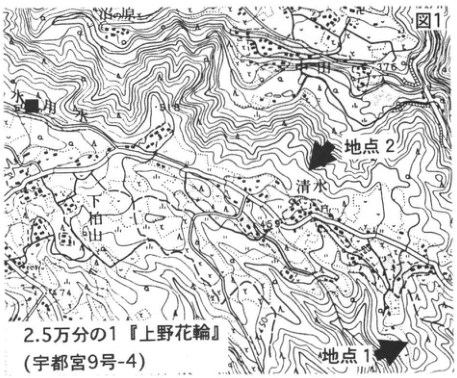
Original Japanese lettering
図1。2.5万分の1「上野花輪」(宇都宮9号-4)。地点1、地点2(矢印)、水沼、清水、下神山。可読標高・等高線:376、450、400、500、700、600、744。
English translation
Figure 1. 1:25,000 Kozuke-Hanawa sheet (Utsunomiya sheet 9-4). Localities 1 and 2 (arrows); Mizunuma; Shimizu; 下神山. Legible elevations and contours: 376, 450, 400, 500, 700, 600, 744.
p193_333.png
PDF 193 · Original p. 176
Figure 2, a section along an irrigation channel showing layers from Ag-KP to Ag-MzP5
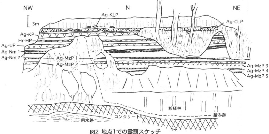
Original Japanese lettering
方位:NW、N、NE。スケール:3m。層名:Ag-KLP、Ag-CLP、Ag-KP、Hr-HP、Ag-UP、Ag-Nm 1、Ag-Nm 2、Ag-MzP 1、Ag-MzP 2、Ag-MzP 3、Ag-MzP 4、Ag-MzP 5。地物:用水路、コンクリート、杉植林、踏み跡。
English translation
Directions: NW, N, NE. Scale: 3 m. Layer labels: Ag-KLP, Ag-CLP, Ag-KP, Hr-HP, Ag-UP, Ag-Nm 1, Ag-Nm 2, Ag-MzP 1, Ag-MzP 2, Ag-MzP 3, Ag-MzP 4, Ag-MzP 5. Features: irrigation channel; concrete; Japanese cedar plantation; footpath.
p194_334.png
PDF 194 · Original p. 177
Stratigraphic columns of two exposures showing Akagi-Mizunuma tephras 1–16 and widespread tephras
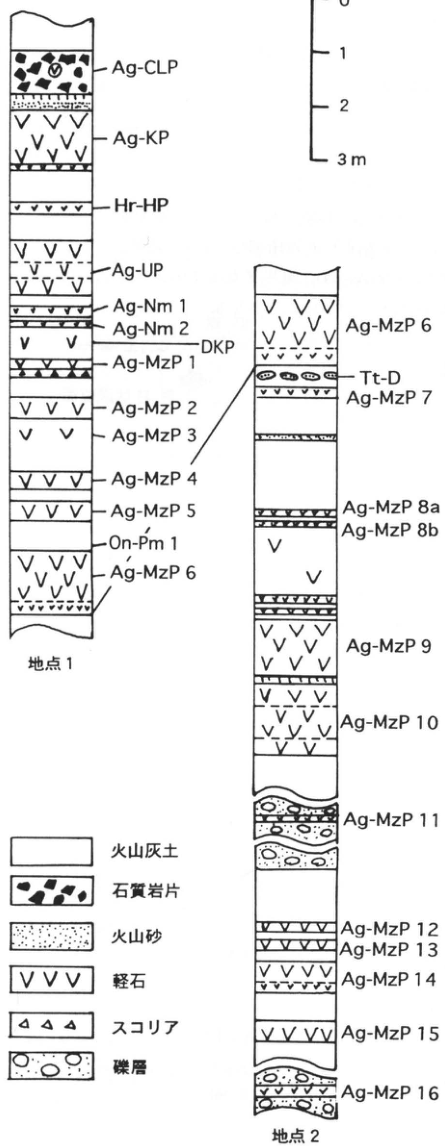
Original Japanese lettering
スケール:0、1、2、3 m。
| 地点 | 上から下への可読層名 |
|---|---|
| 地点1 | Ag-CLP、Ag-KP、Hr-HP、Ag-UP、Ag-Nm 1、Ag-Nm 2、DKP、Ag-MzP 1、Ag-MzP 2、Ag-MzP 3、Ag-MzP 4、Ag-MzP 5、On-Pm 1、Ag-MzP 6 |
| 地点2 | Ag-MzP 6、Tt-D、Ag-MzP 7、Ag-MzP 8a、Ag-MzP 8b、Ag-MzP 9、Ag-MzP 10、Ag-MzP 11、Ag-MzP 12、Ag-MzP 13、Ag-MzP 14、Ag-MzP 15、Ag-MzP 16 |
地点1のAg-MzP6下部と地点2のAg-MzP6下部を線で接続。凡例:火山灰土、石質岩片、火山砂、軽石、スコリア、礫層。
English translation
Scale: 0, 1, 2, 3 m.
| Locality | Legible layer labels, top to bottom |
|---|---|
| Locality 1 | Ag-CLP, Ag-KP, Hr-HP, Ag-UP, Ag-Nm 1, Ag-Nm 2, DKP, Ag-MzP 1, Ag-MzP 2, Ag-MzP 3, Ag-MzP 4, Ag-MzP 5, On-Pm 1, Ag-MzP 6 |
| Locality 2 | Ag-MzP 6, Tt-D, Ag-MzP 7, Ag-MzP 8a, Ag-MzP 8b, Ag-MzP 9, Ag-MzP 10, Ag-MzP 11, Ag-MzP 12, Ag-MzP 13, Ag-MzP 14, Ag-MzP 15, Ag-MzP 16 |
A line connects the lower part of Ag-MzP6 at localities 1 and 2. Legend: volcanic-ash soil; lithic fragments; volcanic sand; pumice; scoria; gravel.
p195_335.png
PDF 195 · Original p. 178
Topographic map showing the summit of Mount Tairappyo, the exposure arrow, and the supplementary column locality (■)
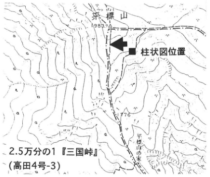
Original Japanese lettering
2.5万分の1「三国峠」(高田4号-3)。平標山、標高1983.7。柱状図位置(■)。1776、平標山の家。
English translation
1:25,000 Mikuni-toge sheet (Takada sheet 4-3). Mount Tairappyo, elevation 1983.7. Position of stratigraphic column (■). 1776; Tairappyo mountain hut.
p195_336.png
PDF 195 · Original p. 178
Section correlating seven tephras in peat with My-Ot and As-T2 at the supplementary locality
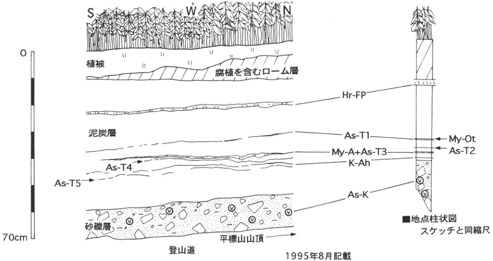
Original Japanese lettering
方位:S、W、N。スケール:0–70cm。地層:植被、腐植を含むローム層、泥炭層、砂礫層。テフラ:Hr-FP、As-T1、My-A+As-T3、As-T4、K-Ah、As-T5、As-K。■地点柱状図:My-Ot、As-T2、スケッチと同縮尺。登山道、平標山山頂(右向き矢印)。1995年8月記載。
English translation
Directions: S, W, N. Scale: 0–70 cm. Units: vegetation cover; humus-bearing loam; peat; sand and gravel. Tephras: Hr-FP, As-T1, My-A+As-T3, As-T4, K-Ah, As-T5, As-K. Column at the ■ locality: My-Ot, As-T2; same scale as the sketch. Mountain trail; summit of Mount Tairappyo (rightward arrow). Recorded in August 1995.
p196_337.png
PDF 196 · Original p. 179
Tephra layers I–XI and correlations within roughly 4.5 m of continuous peat
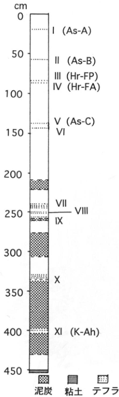
Original Japanese lettering
深度cm:0、50、100、150、200、250、300、350、400、450。テフラ層(上から):I(As-A)、II(As-B)、III(Hr-FP)、IV(Hr-FA)、V(As-C)、VI、VII、VIII、IX、X、XI(K-Ah)。凡例:泥炭、粘土、テフラ。
English translation
Depth in cm: 0, 50, 100, 150, 200, 250, 300, 350, 400, 450. Tephra layers, top to bottom: I (As-A), II (As-B), III (Hr-FP), IV (Hr-FA), V (As-C), VI, VII, VIII, IX, X, XI (K-Ah). Legend: peat; clay; tephra.
p196_338.png
PDF 196 · Original p. 179
Sampling-location map at Nakata-shiro, Ozegahara, and a pool photograph looking toward Mount Hiuchigatake
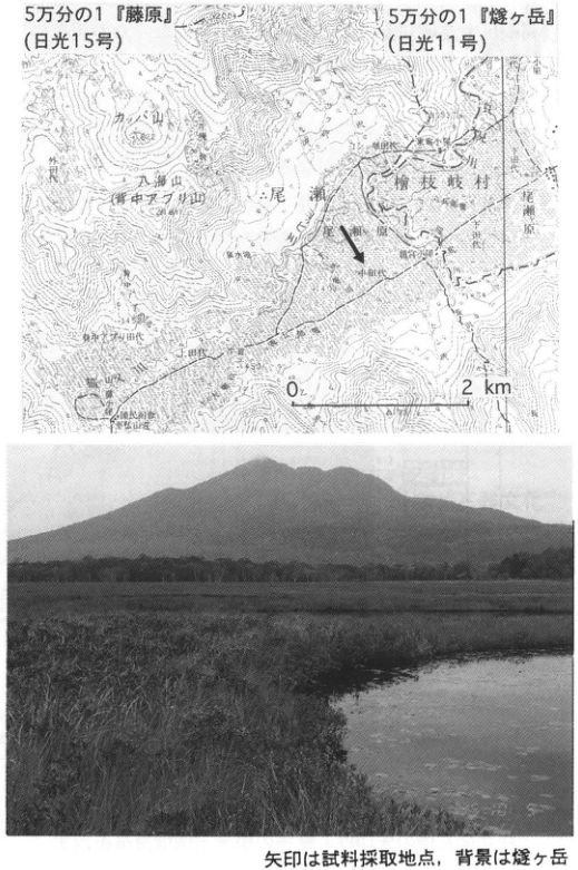
Original Japanese lettering
5万分の1「藤原」(日光15号)、5万分の1「燧ヶ岳」(日光11号)。スケール0–2km。矢印:試料採取地点。可読地名:尾瀬、檜枝岐村、尾瀬原、中田代、上田代、下田代、カッパ山、八海山(背中アブリ山)、外ノ沢、竜宮小屋、山ノ鼻、至仏山荘。小さい地名・標高の一部:[判読不明]。写真:文字注記なし。
English translation
1:50,000 Fujiwara sheet (Nikko sheet 15); 1:50,000 Hiuchigatake sheet (Nikko sheet 11). Scale: 0–2 km. Arrow: sampling locality. Legible place names: Oze; Hinoemata Village; Ozegahara; Nakata-shiro; Kamita-shiro; Shimota-shiro; カッパ山; 八海山 (背中アブリ山); 外ノ沢; Ryugu hut; Yamanohana; Shibutsu mountain lodge. Some small place names and elevations: [illegible]. Photograph: no internal lettering.
小さい地形図地名と標高値 — 原PDFレンダーも拡大したが、細字の一部は印刷自体が不鮮明で確定できない。
八海山(背中アブリ山) — 図の山名は薄く、一部の字に読みに不確実性が残る。
p197_339.png
PDF 197 · Original p. 180
Location map and plan of the burned building at Nakasuji, with an Hr-FA column marking the destruction horizon
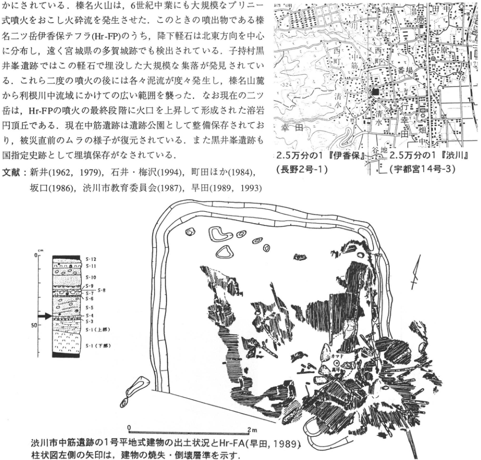
Original Japanese lettering
上部の画像化本文は本文欄に復元し、ここでは重複転記しない。 地図:2.5万分の1「伊香保」(長野2号-1)、2.5万分の1「渋川」(宇都宮14号-3)。中筋、行幸田、清水、西町(2箇所)、番場、石原、田中、相原、諏訪木、谷地、畑中。可読標高・等高線:222.6、324、200。矢印:中筋遺跡。 柱状図:深度cm、0、50。上からS-12、S-11、S-10、S-9、S-8、S-7、S-6、S-5、S-4、S-3、S-1(上部)、S-1(下部)。左側矢印:建物の焼失・倒壊層準。 遺構図:方位矢印。スケール:0–2m。カマド。高坏[読み不確実]。
English translation
The upper image contains article text, restored in the main text and not transcribed again here. Map: 1:25,000 Ikaho sheet (Nagano sheet 2-1); 1:25,000 Shibukawa sheet (Utsunomiya sheet 14-3). Nakasuji; Miyukida; Shimizu; Nishi-machi (two labels); Banba; Ishihara; 田中; 相原; 諏訪木; 谷地; 畑中. Legible elevations and contours: 222.6, 324, 200. Arrow: Nakasuji site. Column: depth in cm; 0, 50. From top downward: S-12, S-11, S-10, S-9, S-8, S-7, S-6, S-5, S-4, S-3, S-1 (upper part), S-1 (lower part). Arrow at left: horizon of the building's burning and collapse. Excavation plan: orientation arrow. Scale: 0–2 m. Cooking hearth. 高坏 [uncertain reading; possibly a pedestal cup].
高坏 — 遺構内の小字を原PDFから6倍レンダーし確認したが、完全には確定できない。カマド下方の円形遺物の注記。
p198_340.png
PDF 198 · Original p. 181
Topographic map with arrows marking the Iwajuku archaeological site and Kasakeno Iwajuku Culture Museum.
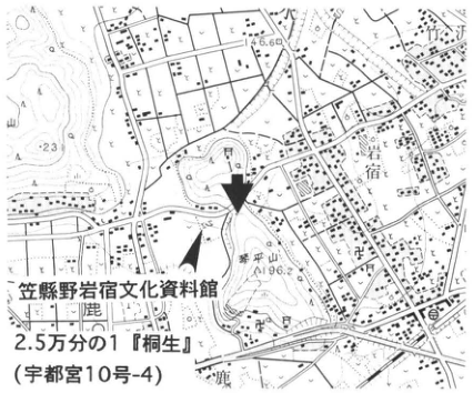
Original Japanese lettering
笠懸野岩宿文化資料館;2.5万分の1「桐生」(宇都宮10号-4);岩宿;琴平山;196.2;146.6;鹿;[判読不明]山。
English translation
Kasakeno Iwajuku Culture Museum; 1:25,000 “Kiryu” (Utsunomiya sheet 10-4); Iwajuku; Kotohirayama; 196.2; 146.6; 鹿; [illegible]yama.
地形図の端で切れた地名と細かな背景文字は判読不能。
p198_341.png
PDF 198 · Original p. 181
Iwajuku outcrop before preservation work, with tephra and stone-tool cultural horizons annotated at right.
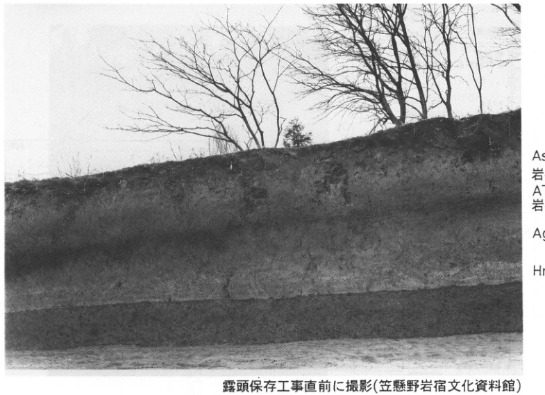
Original Japanese lettering
上から:As-BP;岩宿II石器文化;AT;岩宿I石器文化;Ag-KP;Hr-HP。
English translation
From top to bottom: As-BP; Iwajuku II stone-tool culture; AT; Iwajuku I stone-tool culture; Ag-KP; Hr-HP.
抽出画像の右側注記は切れている。全文は原PDFページで確認し収録。
p199_342.png
PDF 199 · Original p. 182
Topographic map with an arrow marking the outcrop near Asama Otaki waterfall in Kuridaira.
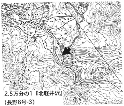
Original Japanese lettering
2.5万分の1「北軽井沢」(長野6号-3);栗平;浅間大滝;小沢;1085;1200;1197。
English translation
1:25,000 “Kita-Karuizawa” (Nagano sheet 6-3); Kuridaira; Asama Otaki waterfall; 小沢; 1085; 1200; 1197.
地形図の一部細かな背景文字と端で切れた文字は判読不能。
p199_343.png
PDF 199 · Original p. 182
Fourteen-metre stratigraphic column showing the Okuwa debris avalanche at 23–24ka and the overlying Asama tephra units and ages.
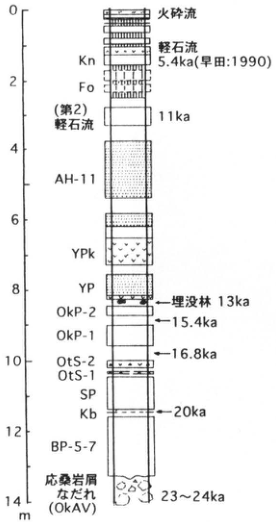
Original Japanese lettering
深度目盛:0,2,4,6,8,10,12,14m。上から:火砕流;軽石流;Kn;5.4ka(早田:1990);Fo;(第2)軽石流,11ka;AH-11;YPk;YP;埋没林13ka;OkP-2;15.4ka;OkP-1;16.8ka;OtS-2;OtS-1;SP;Kb;20ka;BP-5-7;応桑岩屑なだれ(OkAV),23~24ka。
English translation
Depth scale: 0, 2, 4, 6, 8, 10, 12, 14m. From top to bottom: pyroclastic flow; pumice flow; Kn; 5.4ka (早田: 1990); Fo; Pumice Flow (2), 11ka; AH-11; YPk; YP; buried forest, 13ka; OkP-2; 15.4ka; OkP-1; 16.8ka; OtS-2; OtS-1; SP; Kb; 20ka; BP-5-7; Okuwa debris avalanche (OkAV), 23–24ka.
p199_344.png
PDF 199 · Original p. 182
Southeast–northwest sketch of Asama tephra overlying the Okuwa debris avalanche, with the buried-forest horizon.
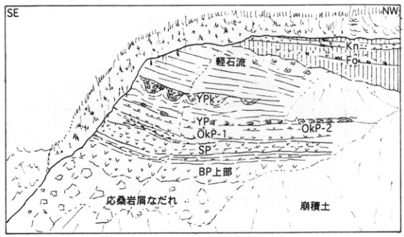
Original Japanese lettering
SE;NW;Kn;Fo;軽石流;YPk;YP;OkP-2;OkP-1;SP;BP上部;応桑岩屑なだれ;崩積土。
English translation
SE; NW; Kn; Fo; pumice flow; YPk; YP; OkP-2; OkP-1; SP; upper BP; Okuwa debris avalanche; colluvium.
p200_345.png
PDF 200 · Original p. 183
Topographic map with an arrow marking the outcrop at a valley head on the eastern margin of the Minohara Upland.
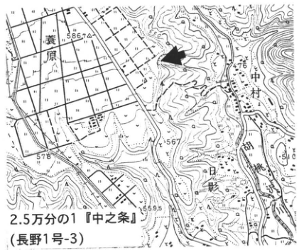
Original Japanese lettering
2.5万分の1「中之条」(長野1号-3);蓑原;中村;日影;四万川;586.7;578;567;559.5;476。
English translation
1:25,000 “Nakanojo” (Nagano sheet 1-3); Minohara; Nakamura; Hikage; Shima River; 586.7; 578; 567; 559.5; 476.
背景の小さな地名の一部は判読不能。
p200_346.png
PDF 200 · Original p. 183
Photograph of pumice overlying the Minohara Gravel Bed, with a column spanning the lacustrine beds and near-surface tephra.
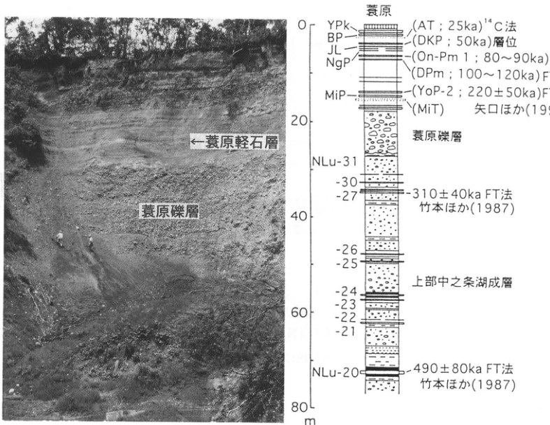
Original Japanese lettering
写真:蓑原軽石層;蓑原礫層。柱状図:蓑原。深度0,20,40,60,80m。上から:YPk;BP;JL;NgP;MiP;(AT;25ka)¹⁴C法;(DKP;50ka)層位;(On-Pm 1;80~90ka)FT法;(DPm;100~120ka)FT法;(YoP-2;220±50ka)FT法;(MiT)矢口ほか(1993);蓑原礫層;NLu-31;-30;-27,310±40ka FT法,竹本ほか(1987);-26;-25;-24;-23;-22;-21;NLu-20,490±80ka FT法,竹本ほか(1987);上部中之条湖成層。
English translation
Photograph: Minohara Pumice Bed; Minohara Gravel Bed. Column: Minohara. Depths 0, 20, 40, 60, 80m. From top to bottom: YPk; BP; JL; NgP; MiP; (AT; 25ka), ¹⁴C method; (DKP; 50ka), stratigraphic position; (On-Pm 1; 80–90ka), FT method; (DPm; 100–120ka), FT method; (YoP-2; 220±50ka), FT method; (MiT), 矢口 et al. (1993); Minohara Gravel Bed; NLu-31; -30; -27, 310±40ka, FT method, 竹本 et al. (1987); -26; -25; -24; -23; -22; -21; NLu-20, 490±80ka, FT method, 竹本 et al. (1987); Upper Nakanojo Lacustrine Beds.
抽出画像の右端の年代・方法・出典は切れているため、原PDF全ページから補完。
p201_347.png
PDF 201 · Original p. 184
Topographic map marking the outcrop on the west bank of the Tone River in Soja Town with an arrow.
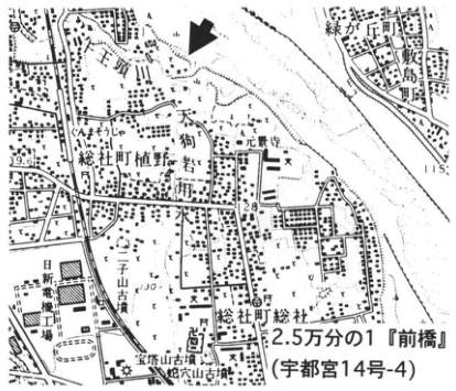
Original Japanese lettering
2.5万分の1「前橋」(宇都宮14号-4);総社町植野;総社町総社;敷島町;緑が丘町;天狗岩;元景寺;山王;出山古墳;日新電機工場;宝塔山古墳;蛇穴山古墳;39.6;28.9;115。
English translation
1:25,000 “Maebashi” (Utsunomiya sheet 14-4); Ueno, Soja Town; Soja, Soja Town; Shikishima Town; Midorigaoka Town; Tengu Rock; Genkeiji Temple; Sanno; 出山 burial mound; Nissin Electric factory; Hotoyama burial mound; 蛇穴山 burial mound; 39.6; 28.9; 115.
小さな背景文字の一部は判読不能。出山・蛇穴山の読みは確定せず日本語保持。
p201_348.png
PDF 201 · Original p. 184
Cross-section across rivers, uplands, and volcanic slopes showing the relationships of the Maebashi Peat Bed to mudflow and gravel deposits.
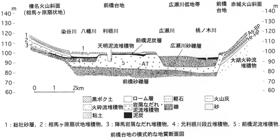
Original Japanese lettering
標高:60~140m(10m刻み);距離:0,1,2km。榛名火山斜面(相馬ヶ原扇状地);前橋台地;広瀬川低地帯;前橋台地;赤城火山斜面。染谷川;八幡川;利根川;広瀬川;桃ノ木川。天明泥流堆積物;前橋泥炭層;広瀬川砂礫層;前橋砂礫層;大胡火砕流堆積物;AT;As-BP;Hr-HP。凡例:黒ボク土;ローム層;軽石;火山灰;火砕流堆積物;岩屑なだれ・泥流堆積物;礫;砂;粘土;泥炭。1:総社砂層,2:相馬ヶ原扇状地堆積物,3:陣馬岩屑なだれ堆積物,4:元利根川段丘堆積物,5:前橋泥流堆積物。
English translation
Elevations: 60–140m at 10m intervals; distance: 0, 1, 2km. Haruna volcanic slope (Somagahara alluvial fan); Maebashi Upland; Hirose River Lowland; Maebashi Upland; Akagi volcanic slope. Someya River; Yahata River; Tone River; Hirose River; Momonoki River. Tenmei mudflow deposit; Maebashi Peat Bed; Hirose River Sand and Gravel Bed; Maebashi Sand and Gravel Bed; Ogo pyroclastic-flow deposit; AT; As-BP; Hr-HP. Legend: black volcanic-ash soil; loam; pumice; volcanic ash; pyroclastic-flow deposit; debris-avalanche and mudflow deposits; gravel; sand; clay; peat. 1: Soja Sand Bed; 2: Somagahara alluvial-fan deposits; 3: Jinba debris-avalanche deposit; 4: Moto-Tone River terrace deposits; 5: Maebashi mudflow deposit.
p202_349.png
PDF 202 · Original p. 185
Photograph showing Asama–Soja Pumice and Asama–Itahana Yellow Pumice within the Maebashi Peat Bed.
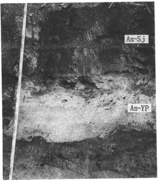
Original Japanese lettering
As-Sj;As-YP。
English translation
As-Sj; As-YP.
p202_350.png
PDF 202 · Original p. 185
Diagram of changes in woody and herbaceous pollen and fern-spore composition across the peat sequence.
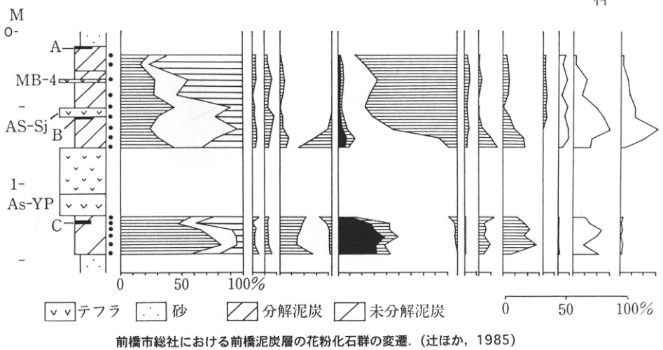
Original Japanese lettering
木本花粉;草本花粉;シダ類胞子;モミ属;ツガ属;トウヒ属;カラマツ属;マツ属;黒塗りは単維管束亜属;コナラ属;コナラ亜属;スギ;カバノキ属;ハンノキ属;ブナ属;イネ科;カヤツリグサ科;ヨモギ属。深度:M,0,1。A;MB-4;As-Sj;B;As-YP;C。百分率目盛:0,50,100%。凡例:テフラ;砂;分解泥炭;未分解泥炭。
English translation
Woody pollen; herbaceous pollen; fern spores; Abies; Tsuga; Picea; Larix; Pinus; solid black indicates the single-vascular-bundle subgenus; Quercus; deciduous oak subgenus (コナラ亜属); Japanese cedar; Betula; Alnus; Fagus; Poaceae; Cyperaceae; Artemisia. Depth: M, 0, 1. A; MB-4; As-Sj; B; As-YP; C. Percentage scales: 0, 50, 100%. Legend: tephra; sand; decomposed peat; undecomposed peat.
抽出画像の上端で花粉分類名が欠落しているため原PDFから復元。百分率は曲線の図示値で、個別測定数値は印刷されていない。
p203_351.png
PDF 203 · Original p. 186
Topographic map with an arrow marking the slope outcrop upstream of Mameyaki Bridge.
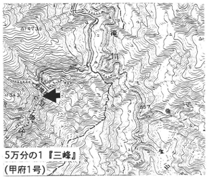
Original Japanese lettering
5万分の1「三峰」(甲府1号);滝川;豆焼沢;1736;857;1000;1200。
English translation
1:50,000 “Mitsumine” (Kofu sheet 1); Takigawa; Mameyakisawa; 1736; 857; 1000; 1200.
背景の地名・等高線数値の一部は判読不能。
p203_352.png
PDF 203 · Original p. 186
Section sketch of Ontake-1 and Yatsugatake–Kawakami tephra intercalated in angular-gravel slope deposits.
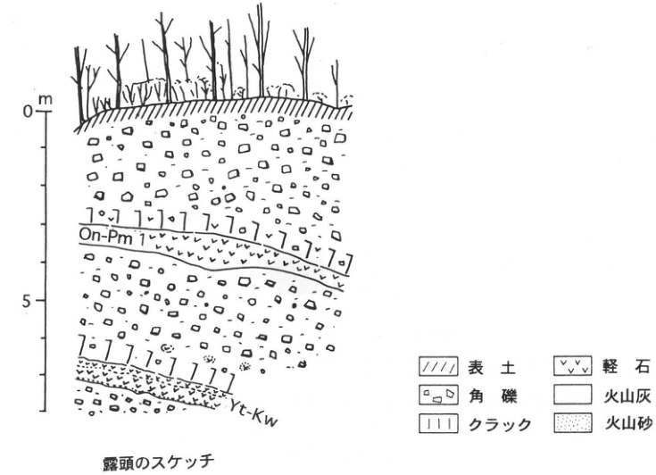
Original Japanese lettering
深度:0,5m;On-Pm 1;Yt-Kw。凡例:表土;角礫;クラック;軽石;火山灰;火山砂。
English translation
Depth: 0, 5m; On-Pm 1; Yt-Kw. Legend: topsoil; angular gravel; cracks; pumice; volcanic ash; volcanic sand.
p204_353.png
PDF 204 · Original p. 187
Topographic map with an arrow marking the Hanno Gravel Bed outcrop at Kinchakuda.
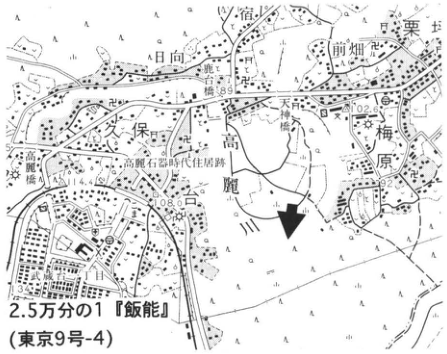
Original Japanese lettering
2.5万分の1「飯能」(東京9号-4);日向;栗坪;前畑;天神橋;高麗川;久保;梅原;高麗石器時代住居跡;69;102.6;108.0;144.5。
English translation
1:25,000 “Hanno” (Tokyo sheet 9-4); 日向; Kuritsubo; Maehata; Tenjin Bridge; Koma River; Kubo; Umehara; Koma Stone Age dwelling site; 69; 102.6; 108.0; 144.5.
背景の小さな地名の一部は判読不能。
p204_354.png
PDF 204 · Original p. 187
Outcrop of the upper gravel and lower silt of the Hanno Gravel Bed, with a close-up photograph of the clasts.
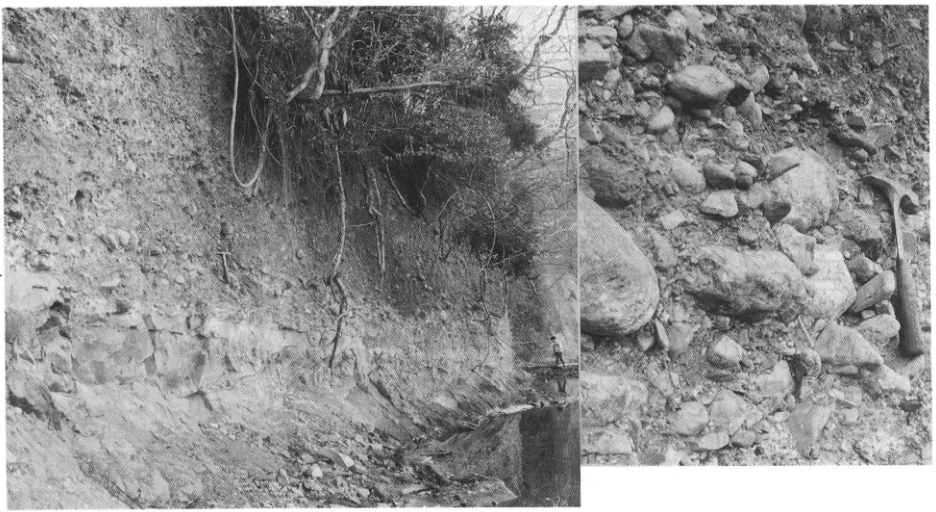
Original Japanese lettering
飯能礫層上部層;飯能礫層下部層。
English translation
Upper part of the Hanno Gravel Bed; lower part of the Hanno Gravel Bed.
左側の層位注記は抽出画像外にあるため原PDFから復元。
p205_355.png
PDF 205 · Original p. 188
Topographic map marking the vicinity of the excavated area of the Akayama Jinya-ato archaeological site.
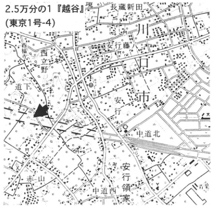
Original Japanese lettering
2.5万分の1「越谷」(東京1号-4);長蔵新田;安行藤八;西立野;道下;安行;中道北;安行領家;中道西;赤山;市。
English translation
1:25,000 “Koshigaya” (Tokyo sheet 1-4); 長蔵新田; 安行藤八; Nishitateno; 道下; Angyo; 中道北; Angyo Ryoke; 中道西; Akayama; city.
背景の小さな地名の一部は判読不能。確証のない地名の読みは日本語保持。
p205_356.png
PDF 205 · Original p. 188
Two sections of the valley-fill deposits in the West Moat at Akayama, showing herbaceous and woody peat and landslide blocks.
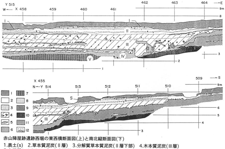
Original Japanese lettering
上:Y515;W→E;X458,459,460,461,462,463,464;9m,8,3,2,1;I,II,III,IV,V。下:X455;N→S;Y514,513,512,511,510,509;9m,6,5,4,3;S,I,II,III。凡例番号1~12(各説明は本文の凡例表に収録)。
English translation
Upper section: Y515; W→E; X458, 459, 460, 461, 462, 463, 464; 9m, 8, 3, 2, 1; I, II, III, IV, V. Lower section: X455; N→S; Y514, 513, 512, 511, 510, 509; 9m, 6, 5, 4, 3; S, I, II, III. Legend numbers 1–12 (descriptions are transcribed in the legend table in the main text).
抽出画像は凡例説明の第4項以後が切れている。全12項は原PDFで確認して本文表へ収録。
p206_357.png
PDF 206 · Original p. 189
Table relating sediments and plant remains from Sa to Layer V to thickness and tephra horizons at Akayama.
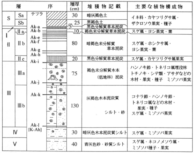
Original Japanese lettering
層序;テフラ;層厚(cm);堆積物記載;主要な植物構成物。S:Sa,Sb;I;II:IIa,IIb,IIc;III:IIIa,IIIb;IV;V。図中テフラ:Ak-a,Ak-b,Ak-e,Ak-f,Ak-g,Ak-h,Ak-i,Ak-j,Ak-k,Ak-l[K-Ah]。各行の層厚・堆積物・植物構成物は本文の表へ全文転記。
English translation
Stratigraphy; tephra; thickness (cm); sediment description; principal plant constituents. S: Sa, Sb; I; II: IIa, IIb, IIc; III: IIIa, IIIb; IV; V. Tephra shown: Ak-a, Ak-b, Ak-e, Ak-f, Ak-g, Ak-h, Ak-i, Ak-j, Ak-k, Ak-l [K-Ah]. The thicknesses, sediments, and plant constituents of all rows are fully transcribed in the main-text table.
p206_358.png
PDF 206 · Original p. 189
Diagram relating vegetation, the transition from seawater to freshwater, and rice-field development since 7000yr B.P. to boundaries E1–E5 and tephra.
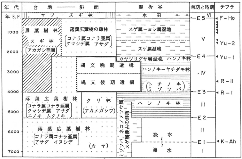
Original Japanese lettering
年代:年B.P.,1000,2000,3000,4000,5000,6000,7000。列:台地―斜面;開析谷;画期と時期;テフラ。台地―斜面:マツ―スギ林;照葉樹林;スギ林[アカガシ亜属];落葉広葉樹の疎林[コナラ属コナラ亜属,クマシデ属,アサダ];落葉広葉樹林[コナラ属コナラ亜属,クマシデ属,アサダ,エノキ,ムクノキ];クリ林(アカメガシワ);落葉広葉樹林[コナラ属コナラ亜属,アサダ,イヌシデ](カヤ)。開析谷:水田;スゲ属―ヨシ属湿地;スゲ属湿地;カヤツリグサ属湿地,ハンノキ林;ハンノキ―ヤチダモ林;(トチノキ),(ミゾソバ);ハンノキ林;ミゾソバ・ネコノメソウ属・スゲ属優占の群落;淡水;海水。縄文晩期遺構;縄文後期遺構。時期I,II,III,IV,V,VI。画期E1,E2,E3,E4,E5。テフラ:K-Ah,R-I,R-II,Yu-1,Yu-2,F-Ho。
English translation
Age: yr B.P., 1000, 2000, 3000, 4000, 5000, 6000, 7000. Columns: upland–slope; dissected valley; transition boundaries and periods; tephra. Upland–slope: pine–Japanese cedar forest; evergreen broadleaved forest; Japanese cedar forest [evergreen oak subgenus]; open deciduous broadleaved forest [deciduous oak subgenus of Quercus, Carpinus, Japanese hop-hornbeam]; deciduous broadleaved forest [deciduous oak subgenus of Quercus, Carpinus, Japanese hop-hornbeam, Japanese hackberry, muku tree]; chestnut forest (akamegashiwa, アカメガシワ); deciduous broadleaved forest [deciduous oak subgenus of Quercus, Japanese hop-hornbeam, Japanese hornbeam] (Japanese torreya). Dissected valley: rice fields; Carex–Phragmites wetland; Carex wetland; Cyperus wetland, alder forest; alder–Japanese ash forest; (Japanese horse chestnut), (mizosoba); alder forest; communities dominated by mizosoba, Chrysosplenium, and Carex; freshwater; seawater. Final Jomon structures; Late Jomon structures. Periods I, II, III, IV, V, VI. Boundaries E1, E2, E3, E4, E5. Tephra: K-Ah, R-I, R-II, Yu-1, Yu-2, F-Ho.
p207_359.png
PDF 207 · Original p. 190
Columns correlating the Tama I and II Loam formations at three sites using Go, HBP, Mitsugumi, and Nisemitsu.
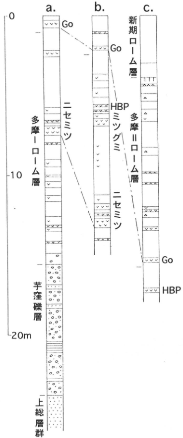
Original Japanese lettering
a,b,c;0,10,20m;多摩Iローム層;多摩IIローム層;新期ローム層;芋窪礫層;上総層群;Go;HBP;ミツグミ;ニセミツ。
English translation
a, b, c; 0, 10, 20m; Tama I Loam Formation; Tama II Loam Formation; younger loam formation; Imokubo Gravel Bed; Kazusa Group; Go; HBP; Mitsugumi; Nisemitsu.
p207_360.png
PDF 207 · Original p. 190
Three topographic maps with arrows marking exposures a in Mizuho, b at 南矢萩 in Miyadera, and c at Yamaguchi.
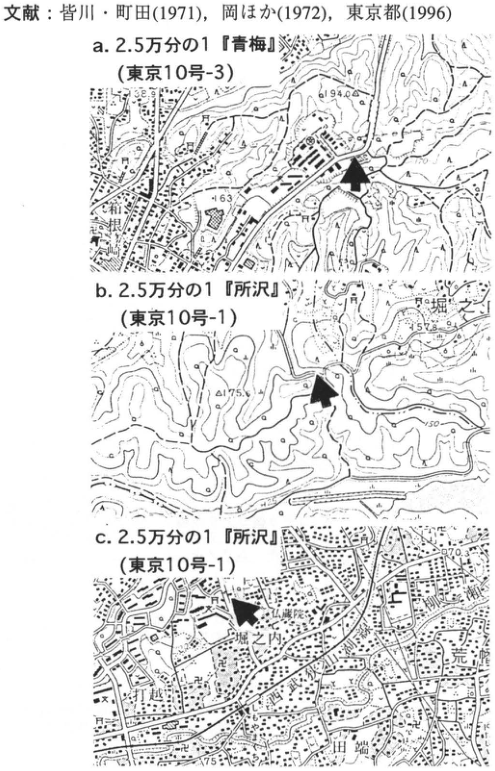
Original Japanese lettering
a.2.5万分の1「青梅」(東京10号-3);瑞穂;194.0;163。b.2.5万分の1「所沢」(東京10号-1);堀之内;175.6;157.8;150。c.2.5万分の1「所沢」(東京10号-1);仏蔵院;堀之内;打越;田端;荒幡;170.3;75。図の上に付随した文献文字は本文文献欄へ収録。
English translation
a: 1:25,000 “Ome” (Tokyo sheet 10-3); Mizuho; 194.0; 163. b: 1:25,000 “Tokorozawa” (Tokyo sheet 10-1); Horinouchi; 175.6; 157.8; 150. c: 1:25,000 “Tokorozawa” (Tokyo sheet 10-1); 仏蔵院; Horinouchi; Uchikoshi; Tabata; Arahata; 170.3; 75. The reference text attached above the maps is included in the main reference list.
背景の小さな地名・地図端で切れた文字の一部は判読不能。
p208_361.png
PDF 208 · Original p. 191
Topographic map marking the road-cut outcrop and the comparison-column locality to the northeast.
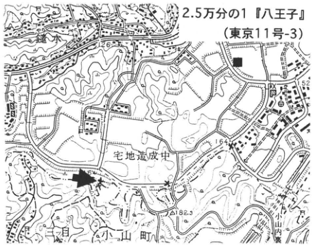
Original Japanese lettering
2.5万分の1「八王子」(東京11号-3);宅地造成中;三ツ目;小山町;182.3;164;126;■。
English translation
1:25,000 “Hachioji” (Tokyo sheet 11-3); residential development under construction; Mitsume; Oyama Town; 182.3; 164; 126; ■.
地図の小さな背景文字の一部は判読不能。
p208_362.png
PDF 208 · Original p. 191
Sketch showing GoP1, GoP2, and HBP exposures on the vegetated road-cut slope, with a comparison column down to gravel.
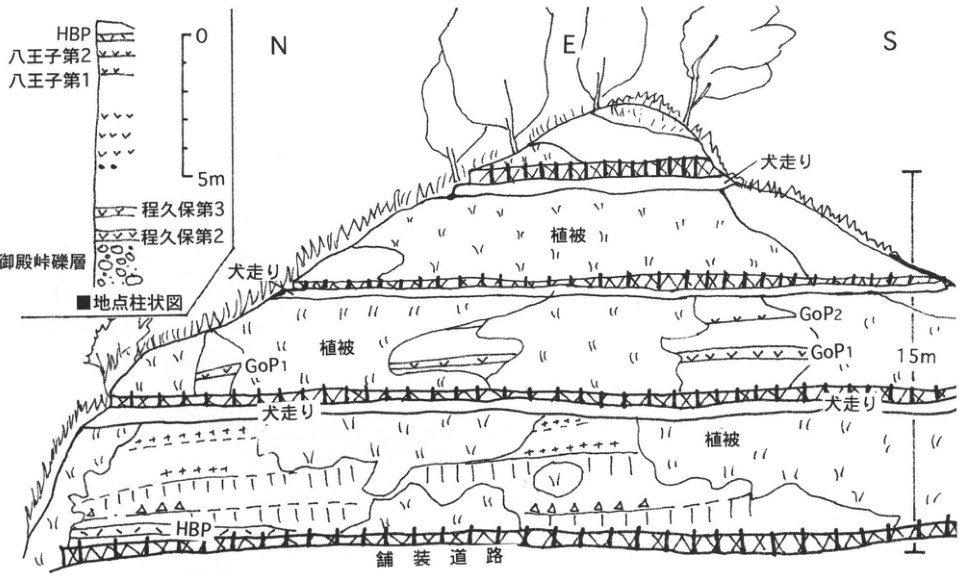
Original Japanese lettering
露頭:N;E;S;植被(3箇所);犬走り(4箇所);舗装道路;GoP1(2箇所);GoP2;HBP;15m。■地点柱状図:0,5m;HBP;八王子第2;八王子第1;程久保第3;程久保第2;御殿峠礫層。
English translation
Outcrop: N; E; S; vegetation cover (three occurrences); berm (犬走り, four occurrences); paved road; GoP1 (two occurrences); GoP2; HBP; 15m. Column at the ■ locality: 0, 5m; HBP; Hachioji-2; Hachioji-1; Hodokubo-3; Hodokubo-2; Gotentoge Gravel Bed.
p209_363.png
PDF 209 · Original p. 192
Topographic map with an arrow marking the Narimasu outcrop in Akatsuka 4-chome.
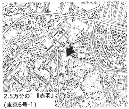
Original Japanese lettering
2.5万分の1「赤羽」(東京6号-1);赤塚;松月院;新町工科学[判読不明];浄水場;上赤塚町;田柄町;21.8;20。
English translation
1:25,000 “Akabane” (Tokyo sheet 6-1); Akatsuka; Shogetsuin; 新町工科学[illegible]; water purification plant; Kami-Akatsuka Town; Tagara Town; 21.8; 20.
学校等の小さな背景文字と一部地図端の文字は判読不能。
p209_364.png
PDF 209 · Original p. 192
Forty-metre section of the Narimasu outcrop, showing strata from the Tokyo Formation to the Tachikawa Loam Formation and marker tephra.
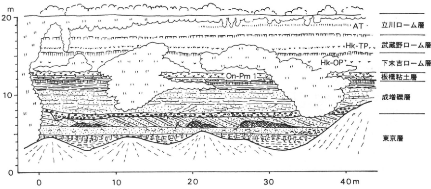
Original Japanese lettering
縦軸:0,10,20m。横軸:0,10,20,30,40m。上から:立川ローム層,AT;武蔵野ローム層,Hk-TP;下末吉ローム層,Hk-OP;板橋粘土層,On-Pm 1;成増礫層;東京層。
English translation
Vertical axis: 0, 10, 20m. Horizontal axis: 0, 10, 20, 30, 40m. From top to bottom: Tachikawa Loam Formation, AT; Musashino Loam Formation, Hk-TP; Shimosueyoshi Loam Formation, Hk-OP; Itabashi Clay Bed, On-Pm 1; Narimasu Gravel Bed; Tokyo Formation.
p210_365.png
PDF 210 · Original p. 193
Location map of the Kita-Ekoda site, showing Ekoda, Eharacho, hospitals, and schools.
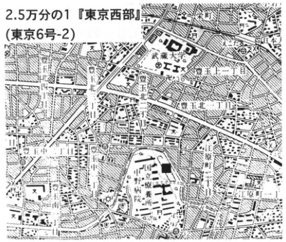
Original Japanese lettering
2.5万分の1「東京西部」(東京6号-2)。米町、江古田一丁目・二丁目、沼袋一丁目・二丁目、江原町一丁目・二丁目、豊玉南、養護学校、病院、武蔵大学、江古田川。黒四角=地点。
English translation
1:25,000 “Tokyo Seibu” (Tokyo 6-2). 米町; Ekoda 1-/2-chome; Numabukuro 1-/2-chome; Eharacho 1-/2-chome; Toyotama-Minami; special-needs school; hospital; Musashi University; Ekodagawa. Black square: locality.
地図の微小注記 — 学校名や細い街区の一部字形は原画像でも不鮮明。
p210_366.png
PDF 210 · Original p. 193
Correlation of six Kita-Ekoda sections with radiocarbon ages.
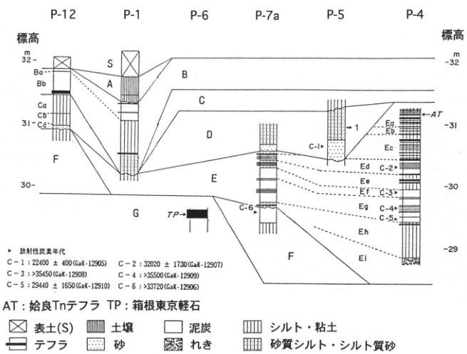
Original Japanese lettering
地点P-12、P-1、P-6、P-7a、P-5、P-4。標高m:29、30、31、32。層S、A、B(Ba、Bb)、C(Ca、Cb、Cc)、D、E(Ea、Eb、Ec、Ed、Ee、Ef、Eg、Eh、Ei)、F、G。47、1。AT:姶良Tnテフラ。TP:箱根東京軽石。放射性炭素年代:C-1 22400±400(GaK-12905);C-2 32020±1730(GaK-12907);C-3 >35450(GaK-12908);C-4 >35500(GaK-12909);C-5 29440±1650(GaK-12910);C-6 >33720(GaK-12906)。凡例:表土(S)、土壌、泥炭、シルト・粘土、テフラ、砂、れき、砂質シルト・シルト質砂。
English translation
Localities P-12, P-1, P-6, P-7a, P-5, P-4. Elevation (m): 29, 30, 31, 32. Units S, A, B (Ba, Bb), C (Ca, Cb, Cc), D, E (Ea, Eb, Ec, Ed, Ee, Ef, Eg, Eh, Ei), F, G. 47, 1. AT: Aira-Tn tephra. TP: Hakone-Tokyo pumice. Radiocarbon ages: C-1 22400±400 (GaK-12905); C-2 32020±1730 (GaK-12907); C-3 >35450 (GaK-12908); C-4 >35500 (GaK-12909); C-5 29440±1650 (GaK-12910); C-6 >33720 (GaK-12906). Legend: topsoil (S), soil, peat, silt/clay, tephra, sand, gravel, sandy silt/silty sand.
p211_367.png
PDF 211 · Original p. 194
Complete Meguro-Ohashi tephra column with artifacts, dark bands, and the standard Musashino succession.
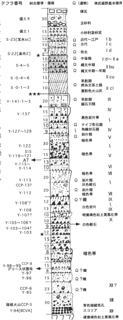
Original Japanese lettering
テフラ番号/斜交層準・層厚/Ω(遺物)/準武蔵野基本層序。上→下:煉瓦、盛土II 30、玉砂利、盛土I 15、小砂利混砂泥;S-25[宝永sc]10、近代~江戸 Ib;10、古代 Ic;8、弥生 Id;S-22[湯舟2]5★;10、中後期 Id~IIa;S-4~5 12・10、縄文中期 IIbu;S-0-4~6 15、縄文中期~早期 IIcu;S-0-1~3 10、草創期・撚糸文系土器・黄粉色火山灰 IIcl;★★★;Y-141-1~3 20、草創期・細石刃類 III;★;IV;Y-137 15・10・10、黒色岩片帯;Y-127~129 9、Ωナイフ形石器・角錐状石器 IV、Ω剥片類 V;Y-122 30、暗色帯;S1S;Y-119~121 15、暗色帯 V;AT;Y-115~Y-114 13・10、VI;VII暗色帯;Y-113 20、CCP-13?、Ω剥片類・灰色軽石;Y-112 20、Ω剥片類・暗色帯 VII・VIII;Y-108′? 12、Ω?礫 IX;Y-108 13、白色岩片 IX;Y-107? 10、明黄褐色粘土質風化帯 X;Y-105~106? 10、白色軽石;Y-103~104? 9;Y-103 12★;15・10・8・15、暗色帯;Y-98~99 CCP-8 15、グリース状雲母;Y-97 8、Ω?礫;Y-96 15、Ω?礫;CCP-6 Y-95 23、Ω?礫 XII?;30、XII;箱根火山CCP-5;Y-94[BCVA]、青色微細気孔スコリア XIV;硬黄褐色粘土質風化帯。
English translation
Tephra number / cross-cutting horizon and thickness / Ω (artifacts) / quasi-Musashino standard succession. Top to bottom: brick, fill II 30, rounded gravel, fill I 15, fine gravel mixed with sandy mud; S-25 [Hoei sc] 10, modern–Edo Ib; 10, ancient Ic; 8, Yayoi Id; S-22 [Yufune 2] 5★; 10, Middle/Late Id–IIa; S-4–5 12, 10, Middle Jomon IIbu; S-0-4–6 15, Middle–Early Jomon IIcu; S-0-1–3 10, Incipient Jomon, twisted-cord pottery, yellow powdery volcanic ash IIcl; ★★★; Y-141-1–3 20, Incipient Jomon, microblades III; ★; IV; Y-137 15,10,10, black lithic-fragment band; Y-127–129 9, Ω backed knives and pyramidal tools IV, Ω flakes V; Y-122 30, dark band; S1S; Y-119–121 15, dark band V; AT; Y-115–Y-114 13,10, VI; VII dark band; Y-113 20, CCP-13?, Ω flakes, gray pumice; Y-112 20, Ω flakes, dark band VII/VIII; Y-108′? 12, Ω? gravel IX; Y-108 13, white lithics IX; Y-107? 10, bright yellow-brown clayey weathered zone X; Y-105–106? 10, white pumice; Y-103–104? 9; Y-103 12★; 15,10,8,15, dark band; Y-98–99 CCP-8 15, greasy mica; Y-97 8, Ω? gravel; Y-96 15, Ω? gravel; CCP-6 Y-95 23, Ω? gravel XII?; 30, XII; Hakone Volcano CCP-5; Y-94 [BCVA], blue scoria with fine vesicles XIV; hard yellow-brown clayey weathered zone.
p211_368.png
PDF 211 · Original p. 194
Tokyo Seinan location map of Meguro-Ohashi; the crop also includes the reference list.
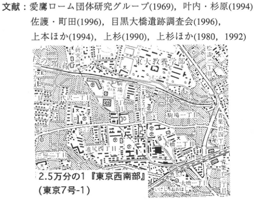
Original Japanese lettering
文献:愛鷹ローム団体研究グループ(1969)、叶内・杉原(1994)、佐護・町田(1996)、目黒大橋遺跡調査会(1996)、上本ほか(1994)、上杉(1990)、上杉ほか(1980、1992)。2.5万分の1「東京西南部」(東京7号-1)。東京大学教養学部、駒場一丁目・二丁目・四丁目、大橋一丁目・二丁目、池尻二丁目・四丁目、世田谷公園、目黒川。
English translation
References: 愛鷹ローム団体研究グループ (1969), 叶内・杉原 (1994), 佐護・町田 (1996), 目黒大橋遺跡調査会 (1996), 上本 et al. (1994), 上杉 (1990), 上杉 et al. (1980,1992). 1:25,000 “Tokyo Seinan” (Tokyo 7-1). College of Arts and Sciences, University of Tokyo; Komaba 1-/2-/4-chome; Ohashi 1-/2-chome; Ikejiri 2-/4-chome; Setagaya Park; Megurogawa.
p212_369.png
PDF 212 · Original p. 195
Location map of the Nogawa site and International Christian University.
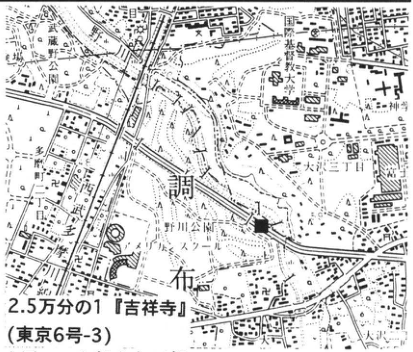
Original Japanese lettering
2.5万分の1「吉祥寺」(東京6号-3)。国際基督教大学、大学院、野川、大沢一丁目・二丁目・四丁目、野水一丁目・二丁目、調布、天文台、神明。
English translation
1:25,000 “Kichijoji” (Tokyo 6-3). International Christian University; graduate school; Nogawa; Osawa 1-/2-/4-chome; Nomizu 1-/2-chome; Chofu; observatory; Shinmei.
p212_370.png
PDF 212 · Original p. 195
Nogawa column of 13 natural layers, BB0, BBI, AT, BBII, and Tachikawa gravel.
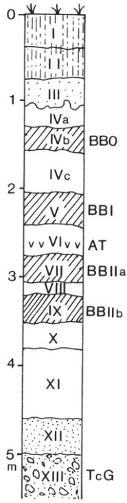
Original Japanese lettering
深度0、1、2、3、4、5m。上→下:I、II、III、IVa、IVb(BB0)、IVc、V(BBI)、VI(AT)、VII(BBIIa)、VIII、IX(BBIIb)、X、XI、XII、XIII(TcG)。
English translation
Depth: 0,1,2,3,4,5 m. Top to bottom: I,II,III,IVa,IVb (BB0),IVc,V (BBI),VI (AT),VII (BBIIa),VIII,IX (BBIIb),X,XI,XII,XIII (TcG).
p213_371.png
PDF 213 · Original p. 196
Haramachida map showing Tsukimino sites I–IV.
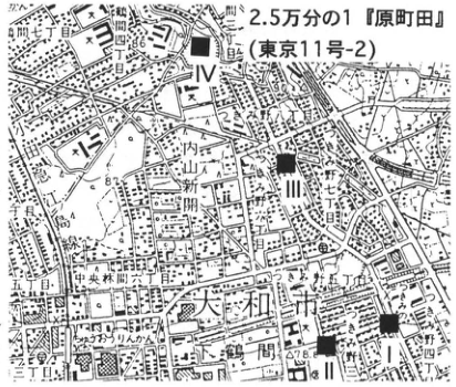
Original Japanese lettering
2.5万分の1「原町田」(東京11号-2)。I、II、III、IV。町田七丁目・八丁目、南つくし野、南成瀬、南町田、中央林間六丁目・七丁目、つきみ野一丁目・四丁目・五丁目・六丁目・七丁目・八丁目、大和市、黒目川、78.6。
English translation
1:25,000 “Haramachida” (Tokyo 11-2). I,II,III,IV. Machida 7-/8-chome; Minami-Tsukushino; Minami-Naruse; Minami-Machida; Chuo-Rinkan 6-/7-chome; Tsukimino 1-/4-/5-/6-/7-/8-chome; Yamato City; Kuromegawa; 78.6.
p213_372.png
PDF 213 · Original p. 196
Tsukimino loam and dark-band column showing S1S, AT, and S2S.
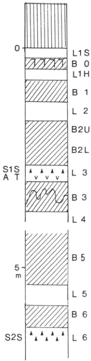
Original Japanese lettering
深度0、5m。上→下:L1S、B0、L1H、B1、L2、B2U、B2L、L3(S1S、AT)、B3、L4、[中略された区間]、B5、L5、B6、L6(S2S)。
English translation
Depth: 0,5 m. Top to bottom: L1S,B0,L1H,B1,L2,B2U,B2L,L3 (S1S,AT),B3,L4,[omitted interval in the column],B5,L5,B6,L6 (S2S).
p214_373.png
PDF 214 · Original p. 197
Hadano map locating the type exposure of the Hadano fault along the Kuzuhagawa.
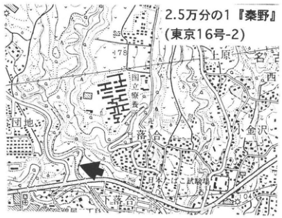
Original Japanese lettering
2.5万分の1「秦野」(東京16号-2)。上原、西、名古木、小金沢、落合、秦野、団地、国道246、78、104。太矢印=露頭。
English translation
1:25,000 “Hadano” (Tokyo 16-2). Uehara, Nishi, Nagoki, Koganezawa, Ochiai, Hadano, housing estate, National Route 246, 78,104. Thick arrow: exposure.
p214_374.png
PDF 214 · Original p. 197
Sketch of tilting and faults along the Hadano fault, with 22 observation points.
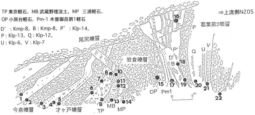
Original Japanese lettering
⇒上流側N20S。今泉礫層、才ヶ戸礫層、尾尻礫層、岩倉礫層、葛葉第2礫層。TP 東京軽石;MB 武蔵野埋没土;MP 三浦軽石;OP 小原台軽石;Pm-1 木曽御岳第1軽石。D′:Kmp-8;B:Kmp-8;P′:Klp-14;P:Klp-13;Q:Klp-12;U:Klp-6;V:Klp-7。地点1–22、尺度0–2m。
English translation
⇒Upstream N20S [as printed]. Imaizumi, Saigato, Ojiri, Iwakura, and Kuzuhagawa-2 gravel. TP: Tokyo pumice; MB: Musashino buried soil; MP: Miura pumice; OP: Obaradai pumice; Pm-1: Kiso-Ontake-1 pumice. D′: Kmp-8; B: Kmp-8; P′: Klp-14; P: Klp-13; Q: Klp-12; U: Klp-6; V: Klp-7. Points 1–22; scale 0–2 m.
p215_375.png
PDF 215 · Original p. 198
Location map of Godo-Kamijuku in Isehara, with references at the top.
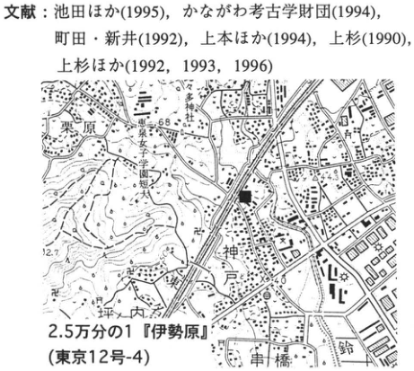
Original Japanese lettering
文献:池田ほか(1995),かながわ考古学財団(1994),町田・新井(1992),上本ほか(1994),上杉(1990),上杉ほか(1992,1993,1996)。2.5万分の1「伊勢原」(東京12号-4)。栗原、神戸、坪内、串橋、鈴川、68、44.3、40、12.7。
English translation
References: 池田 et al. (1995), かながわ考古学財団 (1994), 町田・新井 (1992), 上本 et al. (1994), 上杉 (1990), 上杉 et al. (1992,1993,1996). 1:25,000 “Isehara” (Tokyo 12-4). Kurihara, Godo, Tsubouchi, Kushihashi, Suzukawa; 68,44.3,40,12.7.
p215_376.png
PDF 215 · Original p. 198
Godo-Kamijuku tephra column: all thicknesses, artifacts, and correlations from AT to Hoei scoria.
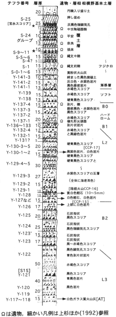
Original Japanese lettering
テフラ番号/層厚/遺物・層相/相模野基本土層。Ω=遺物。
| 層・番号 | 層厚(原図数字) | 記述 | 対比 |
|---|---|---|---|
| 最上部 | 20 | 円礫入り盛り土 | |
| S-25 宝永 | 25;12;8 | 押し固め、灰黒色微細気孔、Ω中世陶磁器類 | |
| S-24グループ | 10;13 | Ω平安覆土層、Ω奈良覆土層 | |
| S-9~11 | 10★ | Ω竪床 | |
| S-5~6 | 15 | Ω縄文中期 | |
| S-4? | 5 | [注記なし] | |
| S-1 | 15 | Ω縄文前期 | フジクロ |
| S-0-1~6 | 13 | 黄粉状火山灰 | |
| Y-141-3 | 10 | 締まった黒色腐植土 | 漸移層 |
| Y-141-2 | 15 | 灰白色・赤紫色岩片 | 漸移層 |
| Y-141-1 | 13 | 黒色微密岩片、赤褐色スコリア | 漸移層 |
| Y-139 | 15 | 赤褐色スコリア | ソフト |
| Y-138 | 13 | 硬青黒色スコリア | ソフト |
| Y-137-4 | 15 | Ω剥片、礫;緑密黒色・赤紫色岩片 | B0 |
| Y-137-3 | 15 | 黒色スコリア | ハードローム |
| Y-137-2 | 20 | 赤褐色スコリア | ハードローム |
| Y-137-1 | 20 | Ω槍先形尖頭器 | ハードローム |
| Y-136~133 | 10 | 剥片状岩片 | B1 |
| Y-132-4 | 12 | 赤褐色スコリア | L2 |
| Y-132-1 | 15 | 黒緑色岩片 | L2 |
| Y-131? | 5 | [注記なし] | L2 |
| Y-130-3~5 | 20 | 硬青黒色スコリア[CCP-17] | L2 |
| Y-130-1~2 | 15 | 黒紫色岩片・白色岩片、硬青黒色スコリア | L2 |
| Y-129-4~5 | 30 | 硬青黒色スコリアと[続く記号] | L2 |
| Y-129-3 | 27 | 赤紫色スコリアの互層(全体に海老茶色) | L2 |
| Y-129-2 | 15 | [同互層] | L2 |
| Y-129-1 | 10 | [箱根火山CCP-16]黄白色軽石(10~5mm) | L2 |
| Y-128 | 10 | 白色軽石、白色岩片 | L2 |
| Y-127など | 15 | [CCP-15]上部に白色岩片 | L2 |
| Y-126 | 17 | [注記なし] | B2 |
| Y-125 | 20 | 石炭殻状、黒色スコリア | B2 |
| Y-124 | 25 | 石炭殻状、黒色微細気孔スコリア | B2 |
| Y-123′ | 15 | 石炭殻状 | B2 |
| Y-123 | 17 | 石炭殻状、黒~赤褐色スコリア | B2 |
| Y-122 | 50 | 黒色細気孔スコリア、青色剥片状岩片、赤褐色スコリア | L3 |
| Y-121[S1S] | 40 | 黒色スコリア、青黒色岩片 | L3 |
| Y-120 | 20 | 黒色岩片 | L3 |
| Y-119 | [なし] | [注記なし] | L3 |
| Y-117~118 | 15 | 白色ガラス質火山灰[AT] | L3 |
English translation
Tephra number / thickness / artifacts and facies / standard Sagamino soil succession. Ω: artifacts. フジクロ: Fuji Black Soil; ソフト: soft loam; ハードローム: hard loam; 漸移層: transition layer.
| Layer / number | Thickness (numbers as printed) | Description | Correlation |
|---|---|---|---|
| 最上部 | 20 | Fill containing rounded gravel | |
| S-25 宝永 | 25;12;8 | Compacted; gray-black with fine vesicles; Ω medieval ceramics | |
| S-24グループ | 10;13 | Ω Heian and Nara dwelling-fill layers | |
| S-9~11 | 10★ | Ω pit-dwelling floor | |
| S-5~6 | 15 | Ω Middle Jomon | |
| S-4? | 5 | [No annotation] | |
| S-1 | 15 | Ω Early Jomon | フジクロ |
| S-0-1~6 | 13 | Yellow powdery volcanic ash | |
| Y-141-3 | 10 | Compact black humic soil | 漸移層 |
| Y-141-2 | 15 | Gray-white and reddish-purple lithics | 漸移層 |
| Y-141-1 | 13 | Black fine dense lithics; reddish-brown scoria | 漸移層 |
| Y-139 | 15 | Reddish-brown scoria | ソフト |
| Y-138 | 13 | Hard blue-black scoria | ソフト |
| Y-137-4 | 15 | Ω flakes and gravel; green dense black and reddish-purple lithics | B0 |
| Y-137-3 | 15 | Black scoria | ハードローム |
| Y-137-2 | 20 | Reddish-brown scoria | ハードローム |
| Y-137-1 | 20 | Ω lanceolate projectile points | ハードローム |
| Y-136~133 | 10 | Flaky lithics | B1 |
| Y-132-4 | 12 | Reddish-brown scoria | L2 |
| Y-132-1 | 15 | Black-green lithics | L2 |
| Y-131? | 5 | [No annotation] | L2 |
| Y-130-3~5 | 20 | Hard blue-black scoria [CCP-17] | L2 |
| Y-130-1~2 | 15 | Black-purple and white lithics; hard blue-black scoria | L2 |
| Y-129-4~5 | 30 | Hard blue-black scoria and [continuation mark] | L2 |
| Y-129-3 | 27 | Alternating reddish-purple scoria beds (overall shrimp-brown) | L2 |
| Y-129-2 | 15 | [Same alternating beds] | L2 |
| Y-129-1 | 10 | [Hakone Volcano CCP-16] yellow-white pumice (10–5 mm) | L2 |
| Y-128 | 10 | White pumice and white lithics | L2 |
| Y-127など | 15 | [CCP-15] white lithics above | L2 |
| Y-126 | 17 | [No annotation] | B2 |
| Y-125 | 20 | Coal-cinder-like; black scoria | B2 |
| Y-124 | 25 | Coal-cinder-like; black scoria with fine vesicles | B2 |
| Y-123′ | 15 | Coal-cinder-like | B2 |
| Y-123 | 17 | Coal-cinder-like; black to reddish-brown scoria | B2 |
| Y-122 | 50 | Black finely vesicular scoria, blue flaky lithics, reddish-brown scoria | L3 |
| Y-121[S1S] | 40 | Black scoria; blue-black lithics | L3 |
| Y-120 | 20 | Black lithics | L3 |
| Y-119 | [なし] | [No annotation] | L3 |
| Y-117~118 | 15 | White glassy volcanic ash [AT] | L3 |
p216_377.png
PDF 216 · Original p. 199
Yoshioka column through number 65, with visual characteristics, all thicknesses, artifacts, tephra correlations, and a Zama map.
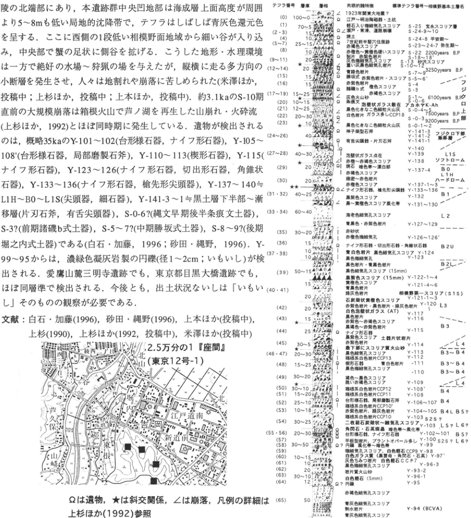
Original Japanese lettering
テフラ番号/層厚/層相/肉眼的特徴/標準テフラ番号~相模野基本土層名。Ω遺物、★斜交関係、∠崩落。地図:2.5万分の1「座間」(東京12号-1)。学校、中学校、八次谷、芦久保、城山、江戸道南、内込、吉岡、根、新道、48.3、49.6。画像左上の本文・文献は本文欄に全文復元。
| 層・番号 | 層厚(原図数字) | 記述 | 対比 |
|---|---|---|---|
| 0 | 100~0 | 1923年関東大地震?、Ω江戸~明治陶磁器・土坑 | |
| 1 | 70~5 | 軽石入り微細気孔スコリア | S-25 |
| 2・3 | 15 | Ω近現・崩落・道路崩壊 | S-24-9~10 |
| 4 | 10 | 焼土 | S-24-8 |
| 5~7 | 25~15 | Ω7世紀前半竪穴住居跡、赤褐色スコリア | S-23~24-7 |
| 8 | 10 | 赤褐色~紫褐色硬いスコリア、Ω剥片・赤紫色岩片 | S-22 2200 years B.P. |
| 9~11 | 20★ | 灰色微細気孔スコリア、重い灰黒色細気孔岩片 | S-18~18′;S-13′?;S-10~12? |
| 12~14 | 20 | 青緑色岩片 | S-7~9 3250 years B.P. |
| 15 | 15 | 緑塊・赤紫色岩片・スコリア | S-5~6′ |
| 16 | 15 | 赤紫色岩片 | S-4 |
| 17~19 | 15~25 | 暗褐b式 褐色スコリア、赤褐色スコリア、∠灰色火山砂 | S-3;S-1~ 6100 years B.P. |
| 20 | 10~15 | Ω条痕文、泡壁状ガラス散在 | S-0-6′;アカホヤK-Ah |
| 21 | 12~25 | 黒色化をなした色細粒火山灰 | S-0-4~5 7500 years B.P. |
| 22 | 20~30 | Ω白色岩片、ガラス多しCCP18 | S-0-3 9200 years B.P. |
| 23 | 10★ | ∠黒色化をなした色細粒火山灰 | S-0-1~2 |
| 24~26 | 40 | Ω神子柴型石斧、Ω有舌尖頭器・片刃石斧 | Y-141-3~1;フジクロ下部・漸移層 |
| 27~28 | 40~30★ | ∠泡壁状ガラス点在、赤褐~赤紫褐色スコリア | Y-140;Y-139 L1S;Y-138ソフトローム |
| 29 | 20 | Ω?礫、褐石、暗色帯~漂白帯、赤褐色スコリア | Y-137-4 B0;L1H |
| 30 | 20 | 緑密~赤色岩片、赤褐色スコリア | Y-137-1~3ハードローム |
| 31・32 | 40~25★★ | Ωナイフ形石器、槍先形尖頭器、黒紫色スコリア、∠黒~黄褐色スコリア風化帯 | Y-133~136;Y-132B1;Y-131~130 |
| 33・34 | 60~40 | 海老色細気孔スコリア、青黒色・赤紫色岩片 | L2;Y-127~129 |
| 35 | 30~20 | 赤砂状、赤褐色微細気孔 | Y-126~126′ |
| 36 | 15 | Ωナイフ形石器・切出形石器・角錐状石器 | B2U |
| 37・38 | 10 | 青白色岩片、黒色細気孔スコリア、黒色微細気孔、黒色岩片・青黒色岩片 | Y-124;Y-123 |
| 39 | 50~15 | 黒色細気孔スコリア(15mm)、黒紫色スコリア(15mm) | B2L;Y-122-1~4 |
| 40・41 | 15;20 | 黄褐色スコリア、青黒色岩片、緑灰色岩片、石炭殻状黄褐色スコリア | Y-121-4~6;相模野第一スコリア(S1S);Y-121-1~3 |
| 42 | 20 | 赤紫色岩片・黒色岩片・緑灰色岩片、白色泡壁状ガラス(AT)、黒色岩片 | Y-120 L3;Y-117;Y-116 |
| 43 | 15★ | 赤褐色~赤紫褐色スコリア、黒褐色~赤紫色岩片 | B3 |
| 44 | 25 | Ωナイフ形石器、黒紫色スコリア、土器片状岩片、赤紫色岩片 | Y-115 |
| 45 | 30~5★★ | 最下部にスコリア質火山砂、黒色細気孔スコリア | Y-114 L4 |
| 46・47 | 20~30 | 箱根系白色岩片CCP13 | Y-113 B3~B4 |
| 48 | 15~25 | 楔形石器、青白色岩片、黒色微細気孔スコリア | Y-111 B3~B4;Y-110 B3~B4 |
| 49 | 30~20 | 褐色~黒色スコリア、脆い赤褐色スコリア | Y-109 L4 |
| 50 | 30~10★ | 箱根系白色岩片CCP12 | Y-108′ B4 |
| 51 | 15~20 | 箱根系白色岩片CCP11 | Y-108 B4 |
| 52 | 25~10 | Ω台形様石器、局部磨製石斧、箱根系白色岩片CCP10′ | Y-106~107 B4 |
| 53 | 10~18 | 赤紫色岩片、緑灰色岩片、箱根系白色岩片CCP10 | Y-104~105 B4 L5? |
| 54 | 30~25 | 二枚組石炭殻状~細気孔スコリア | Y-103 S2S? |
| 55・56 | 20~30 | 角閃石・石英斑晶、暗色帯~風化帯、Ω台形様石器・ナイフ形石器 | Y-103′ L5?L6?;Y-102~101 B5? |
| 57 | [なし] | 平板型岩片、プラントオパール多し | Y-100 S2S?L6? |
| 58 | 30~50 | Ω?円礫、風化帯~暗色帯 | Y-99 |
| 59 | [なし] | 微細気孔スコリア、白色軽石CCP9 | Y-98 |
| 60 | 10~15 | 白色ガラス質(黒雲母・角閃石・石英) | Y-97′ |
| 61 | 10 | 灰色ちみつ岩片、白色軽石CCP7、黒色微細気孔スコリア | Y-96-3 |
| 62 | 20 | 岩片質火山砂 | Y-93-2 |
| 63 | 30~10 | 白色軽石(5mm) | Y-96-1 |
| 64 | 12 | Ω?円礫 | Y-95 |
| 65 | 50 | 赤褐色細気孔スコリア、青灰色細気孔スコリア、熱水岩片、青灰色細気孔スコリア | Y-94(BCVA) |
English translation
Tephra number / thickness / facies / visual characteristics / standard tephra number and Sagamino soil-unit name. Ω: artifacts; ★: cross-cutting relation; ∠: collapse. Map: 1:25,000 “Zama” (Tokyo 12-1). School; junior high school; 八次谷; 芦久保; Shiroyama; Edo-Michiminami; Uchikomi; Yoshioka; Ne; Shindo; 48.3,49.6. Body prose and references in the upper-left of the crop are reproduced fully in the body text. フジクロ下部: lower Fuji Black Soil; 漸移層: transition layer; ソフトローム: soft loam; ハードローム: hard loam; 相模野第一スコリア: Sagamino-1 Scoria; アカホヤ: Akahoya.
| Layer / number | Thickness (numbers as printed) | Description | Correlation |
|---|---|---|---|
| 0 | 100~0 | 1923 Great Kanto earthquake?; Ω Edo–Meiji ceramics and pits | |
| 1 | 70~5 | Finely vesicular scoria containing pumice | S-25 |
| 2・3 | 15 | Ω modern; collapse; road collapse | S-24-9~10 |
| 4 | 10 | Burnt soil | S-24-8 |
| 5~7 | 25~15 | Ω pit dwelling of first half of 7th century; reddish-brown scoria | S-23~24-7 |
| 8 | 10 | Hard reddish-brown–purple-brown scoria; Ω flakes and reddish-purple lithics | S-22 2200 years B.P. |
| 9~11 | 20★ | Gray scoria with fine vesicles; heavy gray-black finely vesicular lithics | S-18~18′;S-13′?;S-10~12? |
| 12~14 | 20 | Blue-green lithics | S-7~9 3250 years B.P. |
| 15 | 15 | Green clasts, reddish-purple lithics and scoria | S-5~6′ |
| 16 | 15 | Reddish-purple lithics | S-4 |
| 17~19 | 15~25 | Dark-brown b type; brown and reddish-brown scoria; ∠ gray volcanic sand | S-3;S-1~ 6100 years B.P. |
| 20 | 10~15 | Ω scratched pottery; scattered bubble-wall glass | S-0-6′;アカホヤK-Ah |
| 21 | 12~25 | Fine ash that has become black [wording as printed] | S-0-4~5 7500 years B.P. |
| 22 | 20~30 | Ω white lithics; abundant glass CCP18 | S-0-3 9200 years B.P. |
| 23 | 10★ | ∠ fine ash that has become black | S-0-1~2 |
| 24~26 | 40 | Ω Mikoshiba-type stone axe; Ω tanged points and single-beveled axes | Y-141-3~1;フジクロ下部・漸移層 |
| 27~28 | 40~30★ | ∠ scattered bubble-wall glass; reddish-brown–reddish-purple-brown scoria | Y-140;Y-139 L1S;Y-138ソフトローム |
| 29 | 20 | Ω? gravel; brown stones; dark–bleached zone; reddish-brown scoria | Y-137-4 B0;L1H |
| 30 | 20 | Green dense–red lithics; reddish-brown scoria | Y-137-1~3ハードローム |
| 31・32 | 40~25★★ | Ω backed knives and lanceolate points; black-purple scoria; ∠ black–yellow-brown weathered scoria | Y-133~136;Y-132B1;Y-131~130 |
| 33・34 | 60~40 | Shrimp-colored finely vesicular scoria; blue-black and reddish-purple lithics | L2;Y-127~129 |
| 35 | 30~20 | Red-sand-like; reddish-brown with fine vesicles | Y-126~126′ |
| 36 | 15 | Ω backed knives, kiridashi tools, pyramidal tools | B2U |
| 37・38 | 10 | Blue-white lithics; black finely vesicular scoria; black with fine vesicles; black and blue-black lithics | Y-124;Y-123 |
| 39 | 50~15 | Black finely vesicular scoria (15 mm); black-purple scoria (15 mm) | B2L;Y-122-1~4 |
| 40・41 | 15;20 | Yellow-brown scoria; blue-black and green-gray lithics; coal-cinder-like yellow-brown scoria | Y-121-4~6;相模野第一スコリア(S1S);Y-121-1~3 |
| 42 | 20 | Reddish-purple, black, and green-gray lithics; white bubble-wall glass (AT); black lithics | Y-120 L3;Y-117;Y-116 |
| 43 | 15★ | Reddish-brown–reddish-purple-brown scoria; black-brown–reddish-purple lithics | B3 |
| 44 | 25 | Ω backed knives; black-purple scoria; sherd-like lithics; reddish-purple lithics | Y-115 |
| 45 | 30~5★★ | Scoriaceous volcanic sand at base; black finely vesicular scoria | Y-114 L4 |
| 46・47 | 20~30 | Hakone white lithics CCP13 | Y-113 B3~B4 |
| 48 | 15~25 | Wedge-shaped tools; blue-white lithics; black scoria with fine vesicles | Y-111 B3~B4;Y-110 B3~B4 |
| 49 | 30~20 | Brown–black scoria; fragile reddish-brown scoria | Y-109 L4 |
| 50 | 30~10★ | Hakone white lithics CCP12 | Y-108′ B4 |
| 51 | 15~20 | Hakone white lithics CCP11 | Y-108 B4 |
| 52 | 25~10 | Ω trapezoid-like tools and partly polished axes; Hakone white lithics CCP10′ | Y-106~107 B4 |
| 53 | 10~18 | Reddish-purple and green-gray lithics; Hakone white lithics CCP10 | Y-104~105 B4 L5? |
| 54 | 30~25 | Pair of coal-cinder-like–finely vesicular scoria beds | Y-103 S2S? |
| 55・56 | 20~30 | Hornblende and quartz phenocrysts; dark–weathered zone; Ω trapezoid-like tools and backed knives | Y-103′ L5?L6?;Y-102~101 B5? |
| 57 | [なし] | Platy lithics; abundant plant opal | Y-100 S2S?L6? |
| 58 | 30~50 | Ω? rounded gravel; weathered–dark zone | Y-99 |
| 59 | [なし] | Scoria with fine vesicles; white pumice CCP9 | Y-98 |
| 60 | 10~15 | White glassy material (biotite, hornblende, quartz) | Y-97′ |
| 61 | 10 | Dense gray lithics; white pumice CCP7; black scoria with fine vesicles | Y-96-3 |
| 62 | 20 | Lithic-rich volcanic sand | Y-93-2 |
| 63 | 30~10 | White pumice (5 mm) | Y-96-1 |
| 64 | 12 | Ω? rounded gravel | Y-95 |
| 65 | 50 | Reddish-brown and blue-gray finely vesicular scoria; hydrothermal lithics; blue-gray finely vesicular scoria | Y-94(BCVA) |
p217_379.png
PDF 217 · Original p. 200
Totsuka map locating Tamanawa Castle in Kamakura City.
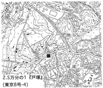
Original Japanese lettering
2.5万分の1「戸塚」(東京8号-4)。服部、関谷、城廻、35、50。黒四角=地点。
English translation
1:25,000 “Totsuka” (Tokyo 8-4). Hattori, Sekiya, Shiromeguri; 35,50. Black square: locality.
p217_380.png
PDF 217 · Original p. 200
Complete Tamanawa Castle tephra column correlated with Sagamino archaeological soil units.
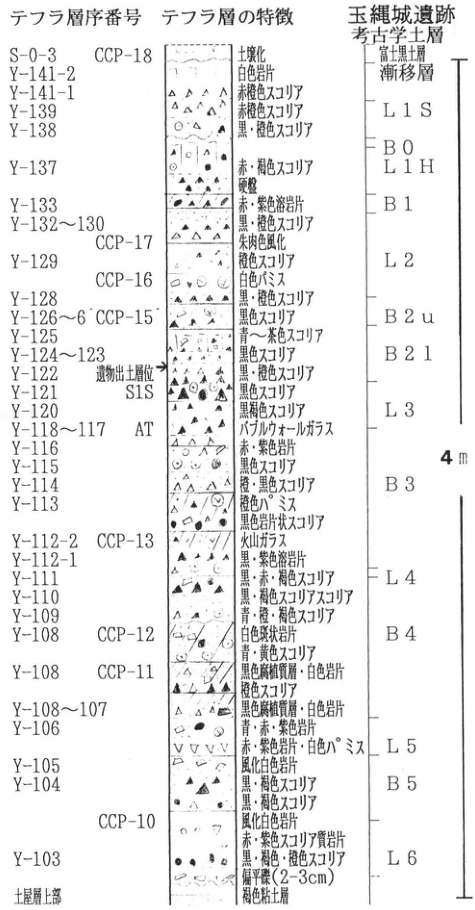
Original Japanese lettering
テフラ層序番号/テフラ層の特徴/玉縄城遺跡考古学土層。尺度4m。図の最下位注記は「土層最上部」。
| 層・番号 | 層厚(原図数字) | 記述 | 対比 |
|---|---|---|---|
| S-0-3 CCP-18 | [なし] | 土壌化 | 富士黒土層漸移層 |
| Y-141-2 | [なし] | 白色岩片 | 富士黒土層漸移層 |
| Y-141-1 | [なし] | 赤褐色スコリア | L1S |
| Y-139 | [なし] | 赤褐色スコリア | L1S |
| Y-138 | [なし] | 黒・褐色スコリア | B0 |
| Y-137 | [なし] | 赤・褐色スコリア、硬盤 | L1H |
| Y-133 | [なし] | 赤・紫色溶岩片 | B1 |
| Y-132~130 | [なし] | 黒・褐色スコリア | L2 |
| CCP-17 | [なし] | 朱肉色風化 | L2 |
| Y-129 | [なし] | 褐色スコリア | L2 |
| CCP-16 | [なし] | 白色パミス | L2 |
| Y-128 | [なし] | 黒・褐色スコリア | L2 |
| Y-126~6′ CCP-15 | [なし] | 黒色スコリア | B2u |
| Y-125 | [なし] | 青~茶色スコリア | B2l |
| Y-124~123 | [なし] | 黒色スコリア | B2l |
| Y-122 | [なし] | 黒・褐色スコリア、遺物出土層位→ | B2l |
| Y-121 S1S | [なし] | 黒色スコリア | L3 |
| Y-120 | [なし] | 黒褐色スコリア | L3 |
| Y-118~117 AT | [なし] | バブルウォールガラス | L3 |
| Y-116 | [なし] | 赤・紫色岩片 | L3 |
| Y-115 | [なし] | 黒色スコリア | B3 |
| Y-114 | [なし] | 橙・黒色スコリア | B3 |
| Y-113 | [なし] | 橙色パミス、黒色岩片状スコリア | B3 |
| Y-112-2 CCP-13 | [なし] | 火山ガラス | L4 |
| Y-112-1 | [なし] | 黒・紫色溶岩片 | L4 |
| Y-111 | [なし] | 黒・赤・褐色スコリア | L4 |
| Y-110 | [なし] | 黒・褐色スコリア質スコリア | L4 |
| Y-109 | [なし] | 青・褐・褐色スコリア | L4 |
| Y-108 CCP-12 | [なし] | 白色斑状岩片、青・黄色スコリア | B4 |
| Y-108 CCP-11 | [なし] | 黒色高密度層・白色岩片、褐色スコリア | B4 |
| Y-108~107 | [なし] | 黒色高密度層・白色岩片 | L5 |
| Y-106 | [なし] | 青・赤・紫色岩片、赤・紫色岩片・白色パミス | L5 |
| Y-105 | [なし] | 風化白色岩片 | L5 |
| Y-104 | [なし] | 黒・褐色スコリア、黒・褐色スコリア | B5 |
| CCP-10 | [なし] | 風化白色岩片、赤・紫色スコリア質岩片 | L6 |
| Y-103 | [なし] | 黒・褐色・褐色スコリア、偏平礫(2~3cm) | L6 |
| 土層最上部 | [なし] | 褐色粘土層 |
English translation
Tephra stratigraphic number / characteristics / Tamanawa Castle archaeological soil succession. Scale: 4 m. Bottom annotation: “uppermost part of soil layer.” 富士黒土層漸移層: Fuji Black Soil transition layer.
| Layer / number | Thickness (numbers as printed) | Description | Correlation |
|---|---|---|---|
| S-0-3 CCP-18 | [なし] | Soil formation | 富士黒土層漸移層 |
| Y-141-2 | [なし] | White lithics | 富士黒土層漸移層 |
| Y-141-1 | [なし] | Reddish-brown scoria | L1S |
| Y-139 | [なし] | Reddish-brown scoria | L1S |
| Y-138 | [なし] | Black/brown scoria | B0 |
| Y-137 | [なし] | Red/brown scoria; hardpan | L1H |
| Y-133 | [なし] | Red/purple lava fragments | B1 |
| Y-132~130 | [なし] | Black/brown scoria | L2 |
| CCP-17 | [なし] | Vermilion weathering | L2 |
| Y-129 | [なし] | Brown scoria | L2 |
| CCP-16 | [なし] | White pumice | L2 |
| Y-128 | [なし] | Black/brown scoria | L2 |
| Y-126~6′ CCP-15 | [なし] | Black scoria | B2u |
| Y-125 | [なし] | Blue–brown scoria | B2l |
| Y-124~123 | [なし] | Black scoria | B2l |
| Y-122 | [なし] | Black/brown scoria; artifact-bearing level → | B2l |
| Y-121 S1S | [なし] | Black scoria | L3 |
| Y-120 | [なし] | Black-brown scoria | L3 |
| Y-118~117 AT | [なし] | Bubble-wall glass | L3 |
| Y-116 | [なし] | Red/purple lithics | L3 |
| Y-115 | [なし] | Black scoria | B3 |
| Y-114 | [なし] | Orange/black scoria | B3 |
| Y-113 | [なし] | Orange pumice; black lithic-like scoria | B3 |
| Y-112-2 CCP-13 | [なし] | Volcanic glass | L4 |
| Y-112-1 | [なし] | Black/purple lava fragments | L4 |
| Y-111 | [なし] | Black/red/brown scoria | L4 |
| Y-110 | [なし] | Black/brown scoriaceous scoria [wording retained] | L4 |
| Y-109 | [なし] | Blue/brown/brown scoria [wording retained] | L4 |
| Y-108 CCP-12 | [なし] | White porphyritic lithics; blue/yellow scoria | B4 |
| Y-108 CCP-11 | [なし] | Black dense layer and white lithics; brown scoria | B4 |
| Y-108~107 | [なし] | Black dense layer and white lithics | L5 |
| Y-106 | [なし] | Blue/red/purple lithics; red/purple lithics and white pumice | L5 |
| Y-105 | [なし] | Weathered white lithics | L5 |
| Y-104 | [なし] | Black/brown scoria; black/brown scoria | B5 |
| CCP-10 | [なし] | Weathered white lithics; red/purple scoriaceous lithics | L6 |
| Y-103 | [なし] | Black/brown/brown scoria; flattened gravel (2–3 cm) | L6 |
| 土層最上部 | [なし] | Brown clay bed |
p218_381.png
PDF 218 · Original p. 201
Hadano map and detailed Y-76 Tokyo pumice / Y-77 Tokyo pumice-flow columns.
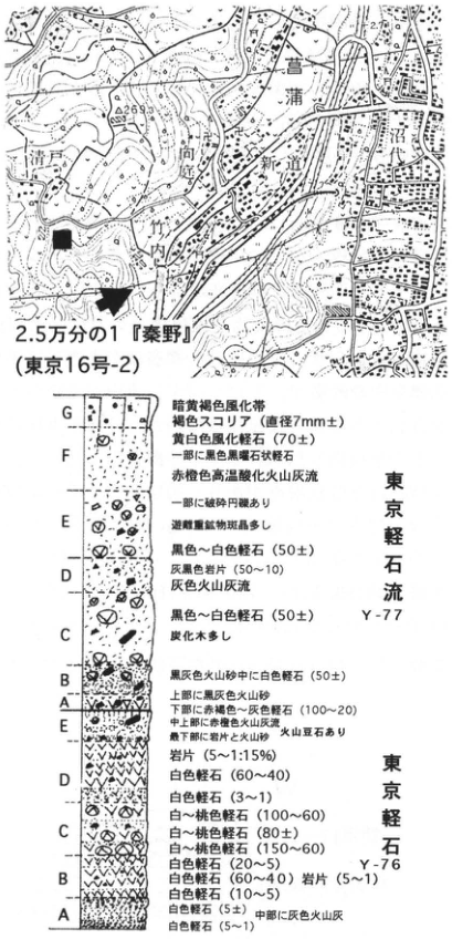
Original Japanese lettering
地図:2.5万分の1「秦野」(東京16号-2)。菖蒲、沼代、新道、向原、竹ノ内、清戸、269.3。■模式地,矢印露頭。柱状図の括弧内数字は原図の粒径・含有量を保持。
| 層・番号 | 層厚(原図数字) | 記述 | 対比 |
|---|---|---|---|
| Y-77 G | [なし] | 暗黄褐色風化帯、褐色スコリア(直径7mm±) | |
| Y-77 F | 70± | 黄白色風化軽石、一部に黒色黒雲石状軽石、赤橙色高温酸化火山灰流 | |
| Y-77 E | [なし] | 一部に破砕円礫あり、遊離重鉱物斑晶多し | |
| Y-77 D | 50±;50~10 | 黒色~白色軽石、灰黒色岩片、灰色火山灰流 | |
| Y-77 C | 50± | 黒色~白色軽石、炭化木多し | |
| Y-77 B | 50± | 黒灰色火山砂中に白色軽石 | |
| Y-77 A | 100~20 | 上部に黒灰色火山砂、下部に赤褐色~灰色軽石、中上部に赤橙色火山灰流、最下部に紫色火山砂、火山豆石あり | |
| Y-76 E | 5~1:15% | 岩片 | |
| Y-76 D | 60~40;3~1 | 白色軽石、白色軽石 | |
| Y-76 C | 100~60;80±;150~60 | 白~桃色軽石、白~桃色軽石、白~桃色軽石 | |
| Y-76 B | 20~5;60~40;5~1;10~5 | 白色軽石、白色軽石 岩片、白色軽石 | |
| Y-76 A | 5±;5~1 | 白色軽石、中部に灰色火山灰、白色軽石 |
English translation
Map: 1:25,000 “Hadano” (Tokyo 16-2). Shobu, Numashiro, Shindo, Mukohara, Takenouchi, Kiyoto,269.3. ■ type locality; arrow: exposure. Parenthesized figures retain the original grain-size/content annotations; the table numeric column is not a thickness measurement for this figure.
| Layer / number | Thickness (numbers as printed) | Description | Correlation |
|---|---|---|---|
| Y-77 G | [なし] | Dark yellow-brown weathered zone; brown scoria (diameter 7 mm±) | |
| Y-77 F | 70± | Yellow-white weathered pumice; some black mica-like pumice; red-orange high-temperature-oxidized ash flow | |
| Y-77 E | [なし] | Some broken rounded gravel; abundant free heavy-mineral phenocrysts | |
| Y-77 D | 50±;50~10 | Black–white pumice; gray-black lithics; gray ash flow | |
| Y-77 C | 50± | Black–white pumice; abundant charcoal wood | |
| Y-77 B | 50± | White pumice in black-gray volcanic sand | |
| Y-77 A | 100~20 | Black-gray volcanic sand above; reddish-brown–gray pumice below; red-orange ash flow in middle-upper part; purple volcanic sand at base; accretionary lapilli | |
| Y-76 E | 5~1:15% | Lithic fragments | |
| Y-76 D | 60~40;3~1 | White pumice; white pumice | |
| Y-76 C | 100~60;80±;150~60 | White–pink pumice; white–pink pumice; white–pink pumice | |
| Y-76 B | 20~5;60~40;5~1;10~5 | White pumice; white pumice and lithics; white pumice | |
| Y-76 A | 5±;5~1 | White pumice, gray volcanic ash in middle, white pumice |
p218_plan_original.png
PDF 218 · Original p. 201
Plan-view sketch of tephras and gravels filling the Shobu-Takenouchi valley.
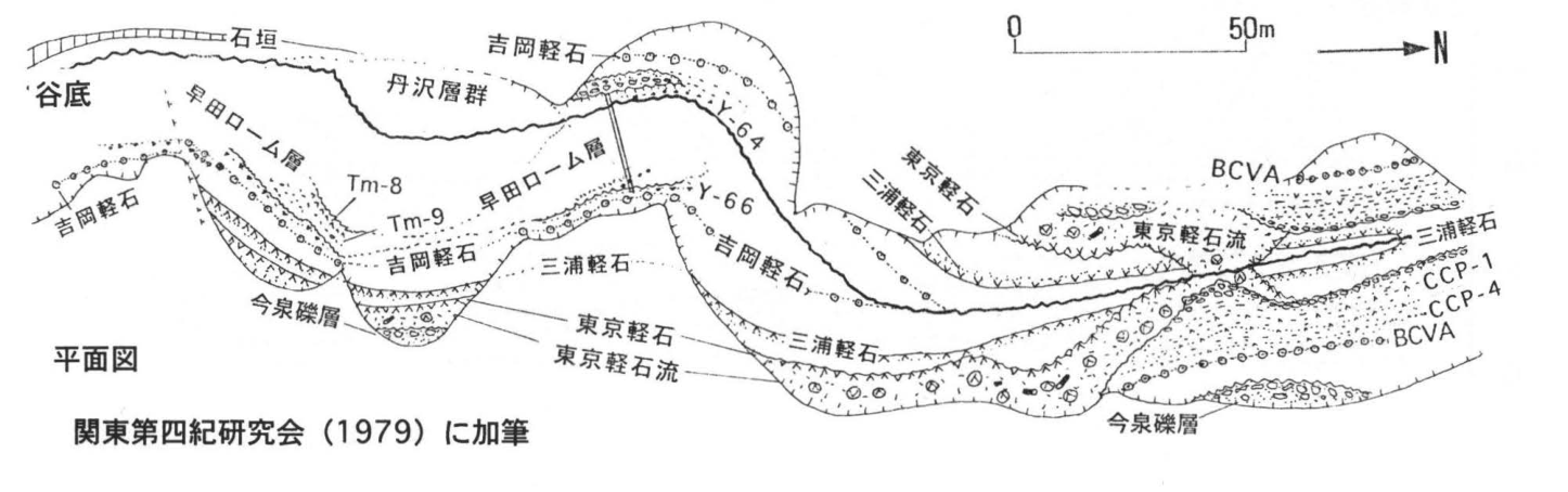
Original Japanese lettering
平面図:石垣,谷底,丹沢層群,早田ローム層,Tm-8,Tm-9,吉岡軽石,三浦軽石,東京軽石,東京軽石流,今泉礫層,Y-64,Y-66,BCVA,CCP-1,CCP-4。尺度0–50m,N。関東第四紀研究会(1979)に加筆。
English translation
Plan-view sketch: stone wall; valley bottom; Tanzawa Group; Soda Loam; Tm-8,Tm-9; Yoshioka pumice; Miura pumice; Tokyo pumice; Tokyo pumice flow; Imaizumi gravel; Y-64,Y-66,BCVA,CCP-1,CCP-4. Scale: 0–50 m; N. Supplemented from 関東第四紀研究会 (1979).
p219_382.png
PDF 219 · Original p. 202
Joined Yokosuka/Uraga map locating the Obaradai type exposure.
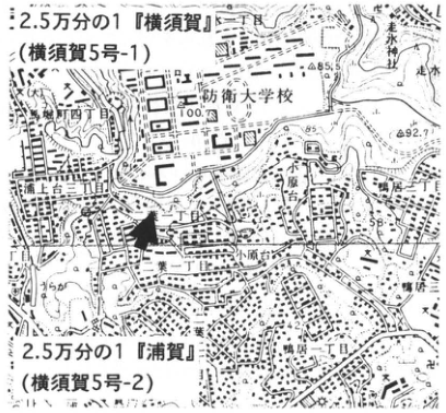
Original Japanese lettering
2.5万分の1「横須賀」(横須賀5号-1),2.5万分の1「浦賀」(横須賀5号-2)。防衛大学校、小原台、浦上台二丁目・三丁目、二葉一丁目・二丁目、鴨居二丁目、走水、走水神社、85.5、100.7、92.7、58。
English translation
1:25,000 “Yokosuka” (Yokosuka 5-1) and “Uraga” (Yokosuka 5-2). National Defense Academy; Obaradai; Uragami-dai 2-/3-chome; Futaba 1-/2-chome; Kamoi 2-chome; Hashirimizu; Hashirimizu Shrine;85.5,100.7,92.7,58.
p219_383.png
PDF 219 · Original p. 202
Outcrop sketch showing cross-bedded Hashirimizu gravel beneath Obaradai sand/gravel and Kanto Loam.
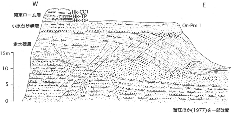
Original Japanese lettering
W、E。関東ローム層:Hk-CC1、Hk-TP、Hk-OP。小原台砂礫層:On-Pm1。走水礫層。尺度0、5、10、15m。蟹江ほか(1977)を一部改変。
English translation
W,E. Kanto Loam: Hk-CC1,Hk-TP,Hk-OP. Obaradai sand and gravel: On-Pm1. Hashirimizu gravel. Scale:0,5,10,15 m. Partly modified from 蟹江 et al. (1977).
p220_384.png
PDF 220 · Original p. 203
Morooka type exposure on the Kawasaki sheet published in 1967.
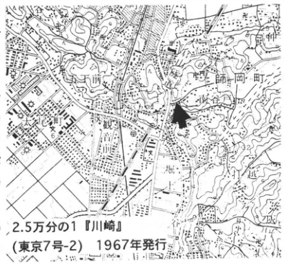
Original Japanese lettering
2.5万分の1「川崎」(東京7号-2),1967年発行。師岡町、大曽根町、菊名町、大倉山、観音川、13.1、42.6。
English translation
1:25,000 “Kawasaki” (Tokyo 7-2), published 1967. Morookacho, Ozonecho, Kikunacho, Okurayama, Kannon-gawa;13.1,42.6.
p220_385.png
PDF 220 · Original p. 203
Western/eastern Tsurumi–Shimosueyoshi–Loam section and 1982 map after removal.
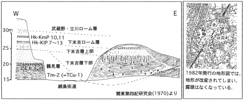
Original Japanese lettering
W、E。標高15、20、25、30m。武蔵野・立川ローム層、下末吉ローム層、Hk-KmP10,11、Hk-KlP7~13、下末吉層上部、下末吉層下部、鶴見層、Tm-2(=TCu-1)、綱島街道。関東第四紀研究会(1970)より。右図:師岡町、大倉山、42.6。1982年発行の地形図では,地形が改変されてしまい,露頭はなくなっている。
English translation
W,E. Elevation:15,20,25,30 m. Musashino/Tachikawa Loam, Shimosueyoshi Loam, Hk-KmP10,11, Hk-KlP7–13, upper/lower Shimosueyoshi Formation, Tsurumi Formation, Tm-2 (=TCu-1), Tsunashima Kaido. From 関東第四紀研究会 (1970). Right map: Morookacho, Okurayama,42.6. On the topographic map published in 1982 the terrain has been altered and the exposure has disappeared.
p221_386.png
PDF 221 · Original p. 204
Yokohama Seibu map of the former Nagatacho type exposure.
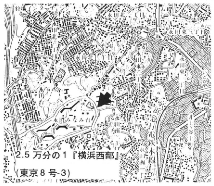
Original Japanese lettering
2.5万分の1「横浜西部」(東京8号-3)。永田町、川島町、永田みなみ台、六ツ川一丁目・二丁目・三丁目、63、91.7。
English translation
1:25,000 “Yokohama Seibu” (Tokyo 8-3). Nagatacho, Kawashimacho, Nagata-Minamidai, Mutsukawa 1-/2-/3-chome;63,91.7.
p221_387.png
PDF 221 · Original p. 204
Composite section of Konan Formation, two valley fills, and associated tephras.
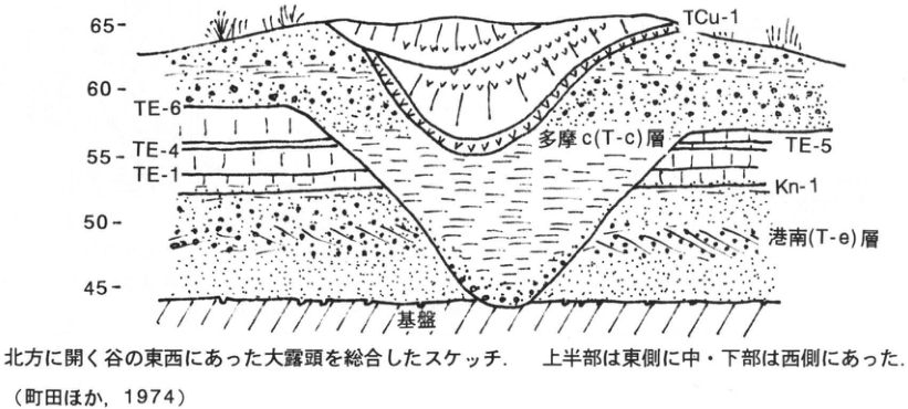
Original Japanese lettering
標高45、50、55、60、65。TCu-1、多摩c(T-c)層、TE-6、TE-4、TE-1、TE-5、Kn-1、港南(T-e)層、基盤。北方に開く谷の東西にあった大露頭を総合したスケッチ.上半部は東側に中・下部は西側にあった.(町田ほか,1974)
English translation
Elevation:45,50,55,60,65. TCu-1, Tama c (T-c) Formation, TE-6,TE-4,TE-1,TE-5,Kn-1, Konan (T-e) Formation, basement. Composite sketch of large exposures on both sides of a north-opening valley; upper half on the east, middle/lower parts on the west (町田 et al.,1974).
p222_388.png
PDF 222 · Original p. 205
Mizonokuchi map locating the Oshinuma type exposure at Ikuta Ryokuchi.
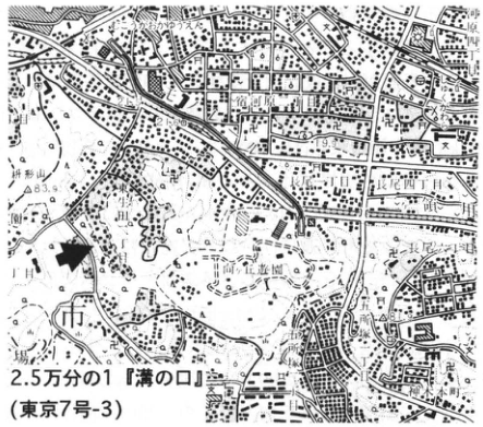
Original Japanese lettering
2.5万分の1「溝の口」(東京7号-3)。登戸、枡形山、83.9、青少年科学館、生田緑地、はなぞ四丁目、長尾、東高根。
English translation
1:25,000 “Mizonokuchi” (Tokyo 7-3). Noborito; Masugatayama;83.9; Youth Science Museum; Ikuta Ryokuchi; はなぞ 4-chome [small characters uncertain]; Nagao; Higashi-Takane.
はなぞ四丁目 — 地図の微小文字が不鮮明。日本語字形を保持。
p222_389.png
PDF 222 · Original p. 205
Standard column of Tsuchihashi/Tama Loam and Oshinuma sand and gravel.
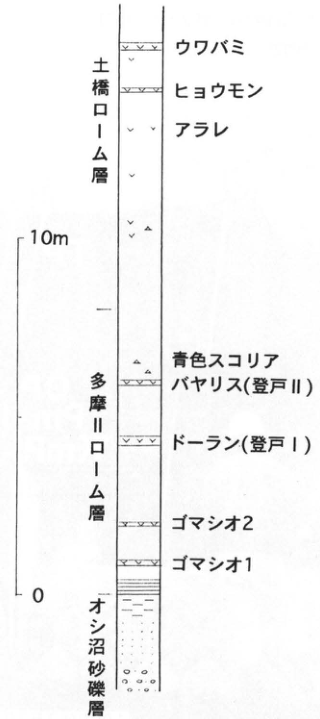
Original Japanese lettering
尺度0–10m。上→下:土橋ローム層(ウワバミ、ヒョウモン、アラレ);多摩ローム層(青色スコリア、バヤリス[登戸II]、ドーラン[登戸I]、ゴマシオ2、ゴマシオ1);オシ沼砂礫層。
English translation
Scale:0–10 m. Top to bottom: Tsuchihashi Loam (Uwabami,Hyomon,Arare); Tama Loam (blue scoria, Bireley’s [Noborito II], Doran [Noborito I], Gomashio-2, Gomashio-1); Oshinuma sand and gravel.
p223_390.png
PDF 223 · Original p. 206
Joined Uraga/Miura-Misaki map locating the Hikibashi terrace exposure at Takayama.
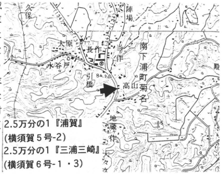
Original Japanese lettering
2.5万分の1「浦賀」(横須賀5号-2),2.5万分の1「三浦三崎」(横須賀6号-1・3)。久保、陣場、大原、水谷戸、長作、引橋、高山、菊名、地蔵作、坂、77.1、84.9、85。
English translation
1:25,000 “Uraga” (Yokosuka 5-2) and “Miura Misaki” (Yokosuka 6-1/3). Kubo,Jinba,Ohara,Mizuyato,Nagasaku,Hikibashi,Takayama,Kikuna,Jizozaku,Saka;77.1,84.9,85.
p223_391.png
PDF 223 · Original p. 206
Hikibashi exposure photograph and column showing TP,OP,Pm-I,KmP-7, and marine sand.
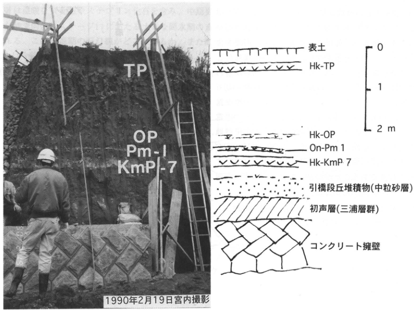
Original Japanese lettering
写真:TP、OP、Pm-I、KmP-7。1990年2月19日宮内撮影。柱状図:表土、Hk-TP、Hk-OP、On-Pm1、Hk-KmP7、引橋段丘堆積物(中粒砂層)、初声層(三浦層群)、コンクリート擁壁。尺度0、1、2m。
English translation
Photograph:TP,OP,Pm-I,KmP-7. Photograph by 宮内,19 February 1990. Column:topsoil,Hk-TP,Hk-OP,On-Pm1,Hk-KmP7,Hikibashi terrace deposit (medium sand),Hatsuse Formation (Miura Group),concrete retaining wall. Scale:0,1,2 m.
p224_392.png
PDF 224 · Original p. 207
Uraga map locating the Misaki terrace exposure at Uchikomi.
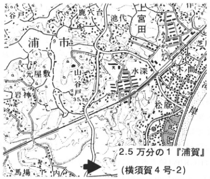
Original Japanese lettering
2.5万分の1「浦賀」(横須賀4号-2)。鹿穴台、池代、上宮田、元屋敷、岩神、水深、木間、松原、馬場、内込、浦市、4.3、35.9。
English translation
1:25,000 “Uraga” (Yokosuka 4-2). 鹿穴台,池代,Kami-Miyada,Motoyashiki,Iwagami,Mizufuka,木間,Matsubara,Baba,Uchikomi,浦市;4.3,35.9.
p224_393.png
PDF 224 · Original p. 207
Column showing transition from marine Misaki terrace deposits to dune sand and fallout tephra.
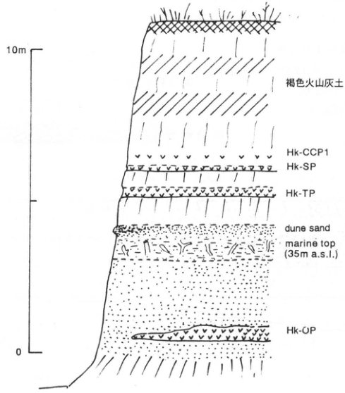
Original Japanese lettering
尺度0–10m。上→下:褐色火山灰土、Hk-CCP1、Hk-SP、Hk-TP、dune sand、marine top(35m a.s.l.)、Hk-OP。
English translation
Scale:0–10 m. Top to bottom:brown volcanic-ash soil,Hk-CCP1,Hk-SP,Hk-TP,dune sand,marine top (35m a.s.l.),Hk-OP.
p225_394.png
PDF 225 · Original p. 208
Hadano map and right-bank valley-wall sketch of Shinokubo loams, gravel, and erosion boundaries.
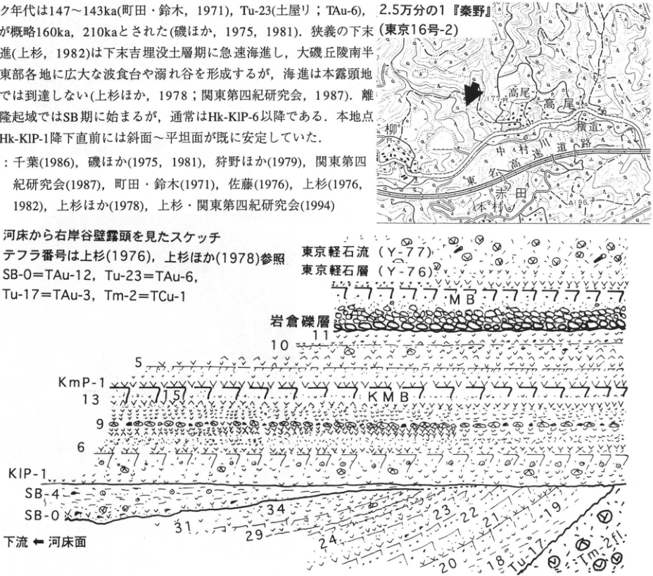
Original Japanese lettering
画像左上の本文と文献は本文欄に全文復元。地図:2.5万分の1「秦野」(東京16号-2)。高尾、横道、中村川、道路、柳、赤田、本村、77.7、86.7。図:河床から右岸谷壁露頭を見たスケッチ.テフラ番号は上杉(1976),上杉ほか(1978)参照.SB-0=TAu-12,Tu-23=TAu-6,Tu-17=TAu-3,Tm-2=TCu-1.東京軽石流(Y-77)、東京軽石層(Y-76)、MB、岩倉礫層、KmP-1、5、10、11、KMB、KlP-1、6、9、13、15、SB-4、SB-0、Tu-17、18、19、20、21、22、23、24、29、31、34、Tm-2fl。下流←河床面。
English translation
Prose and references in the upper-left crop are reproduced fully in the body. Map:1:25,000 “Hadano” (Tokyo16-2). Takao,Yokomichi,Nakamuragawa,road,Yanagi,Akada,Motomura;77.7,86.7. Sketch: right-bank valley wall viewed from river bed; tephra numbers after 上杉 (1976),上杉 et al.(1978). SB-0=TAu-12,Tu-23=TAu-6,Tu-17=TAu-3,Tm-2=TCu-1. Tokyo pumice flow (Y-77),Tokyo pumice (Y-76),MB,Iwakura gravel,KmP-1,5,10,11,KMB,KlP-1,6,9,13,15,SB-4,SB-0,Tu-17,18,19,20,21,22,23,24,29,31,34,Tm-2fl. Downstream ← river-bed surface.
p226_395.png
PDF 226 · Original p. 209
Hakone map locating the quarry beside the Shirogane forestry road.
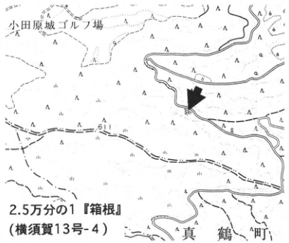
Original Japanese lettering
2.5万分の1「箱根」(横須賀13号-4)。小田原城ゴルフ場、真鶴町、61。矢印=採石場。
English translation
1:25,000 “Hakone” (Yokosuka13-4). Odawara Castle golf course,Manazuru Town,61. Arrow:quarry.
p226_396.png
PDF 226 · Original p. 209
Exposure sketch of columnar-jointed Hakone Old Somma lava beneath Beige Tuffs and Tama tephras.
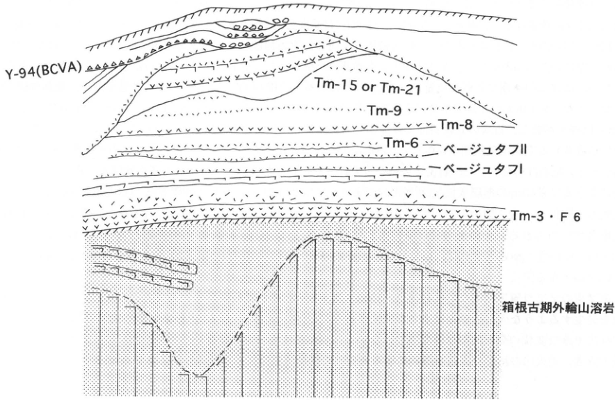
Original Japanese lettering
上→下:Y-94(BCVA)、Tm-15 or Tm-21、Tm-9、Tm-8、Tm-6、ベージュタフII、ベージュタフI、Tm-3・F6、箱根古期外輪山溶岩。
English translation
Top to bottom:Y-94(BCVA),Tm-15 or Tm-21,Tm-9,Tm-8,Tm-6,Beige Tuff II,Beige Tuff I,Tm-3/F6,Hakone Old Somma lava.
p227_397.png
PDF 227 · Original p. 210
Yamakita map locating the Hirayama fault exposure, with Ashigara Station and the Sakawagawa.
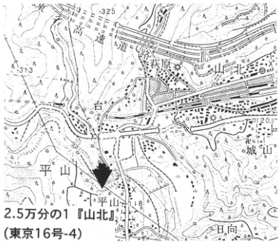
Original Japanese lettering
2.5万分の1「山北」(東京16号-4)。東名高速道路、足柄駅、山北、酒匂川、台、平山、平山橋、城山、日向、325、313、120.5、118。
English translation
1:25,000 “Yamakita” (Tokyo16-4). Tomei Expressway,Ashigara Station,Yamakita,Sakawagawa,Dai,Hirayama,Hirayama Bridge,Shiroyama,Hinata;325,313,120.5,118.
p228_398.png
PDF 228 · Original p. 211
Outcrop sketch at Yamakita showing relationships among the Ashigara Group, riverbed gravel, riverside sand, talus, inclined tephras, faults, and erosion surfaces.
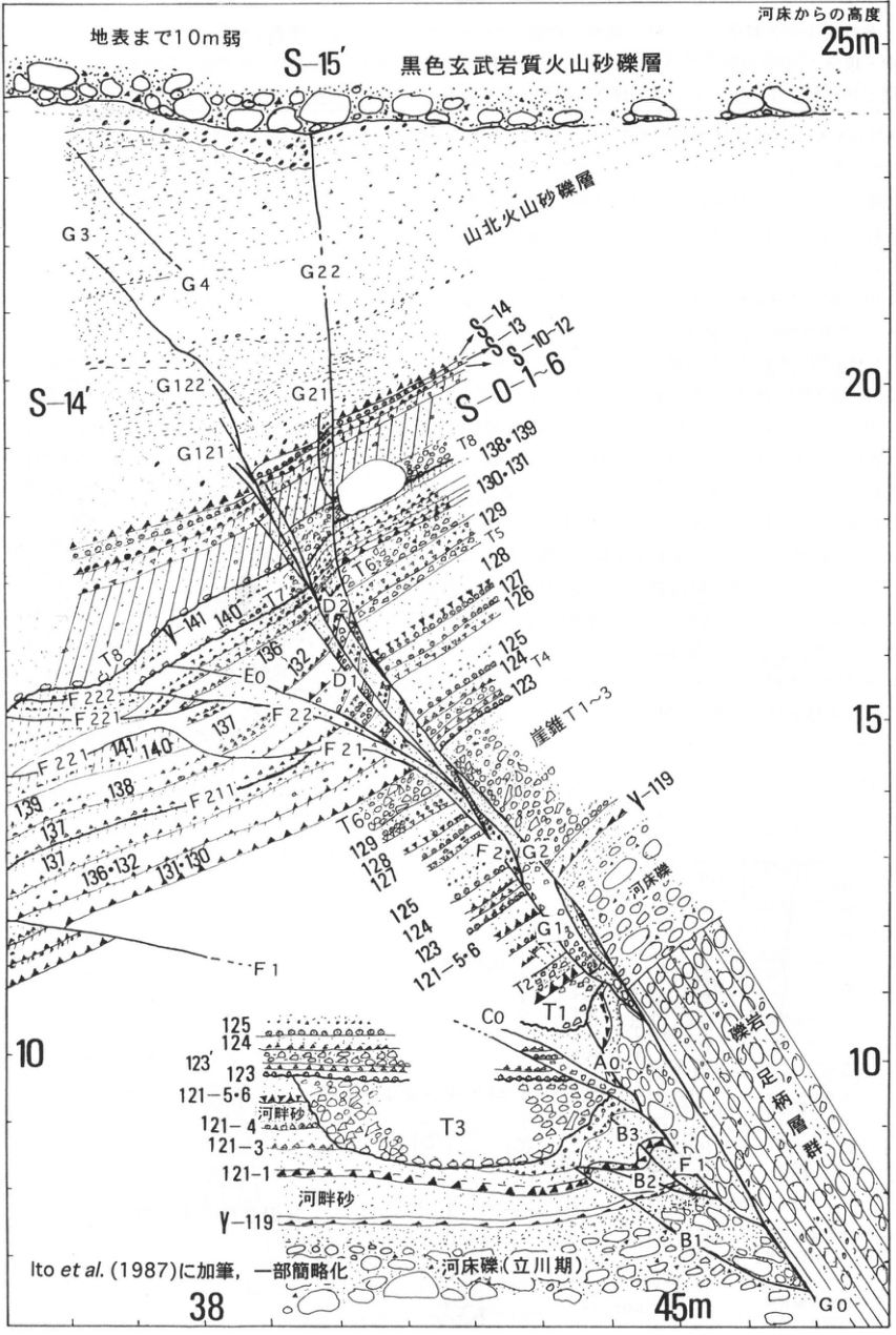
Original Japanese lettering
地表まで10m弱。河床からの高度:10,15,20,25m。横軸の表示:38,45m。 S-15′,黒色玄武岩質火山砂礫層。山北火山砂礫層。S-14′,S-14,S-13,S-10~12,S-0-1~6。崖錐T1~3。河床礫(立川期),河床礫,河畔砂。足柄層群(礫岩)。 層・構造のラベル(図内の反復を含む):G0,G1a,G2,G3,G4,G21,G22,G121,G122;A0,B1,B2,B3,C0,D1,D2,E0;F1,F2,F21,F22,F211,F221,F222;T1,T2,T3,T4,T5,T6,T7,T8。 テフラのラベル:Y-119,121-1,121-3,121-4,121-5・6,123,123′,124,125,126,127,128,129,130・131,131,131・130,132,136,136・132,137,138,138・139,139,140,141。 Ito et al.(1987)に加筆,一部簡略化。
English translation
Less than 10 m to the ground surface. Height above the riverbed: 10, 15, 20, 25 m. Horizontal-axis labels: 38 and 45 m. S-15′; black basaltic volcanic sand and gravel. Yamakita volcanic sand and gravel. S-14′, S-14, S-13, S-10–12, S-0-1–6. Talus T1–3. Riverbed gravel (Tachikawa stage), riverbed gravel, riverside sand. Ashigara Group (conglomerate). Unit and structural labels (also repeated in the drawing): G0, G1a, G2, G3, G4, G21, G22, G121, G122; A0, B1, B2, B3, C0, D1, D2, E0; F1, F2, F21, F22, F211, F221, F222; T1, T2, T3, T4, T5, T6, T7, T8. Tephra labels: Y-119, 121-1, 121-3, 121-4, 121-5·6, 123, 123′, 124, 125, 126, 127, 128, 129, 130·131, 131, 131·130, 132, 136, 136·132, 137, 138, 138·139, 139, 140, 141. Modified from Ito et al. (1987), partly simplified.
p229_399.png
PDF 229 · Original p. 212
Location map and riverbank section of the Sakagawa near Nazukari, showing an oyster reef, shelly sand, brackish-water deposits, peat, eight tephras, and radiocarbon ages.
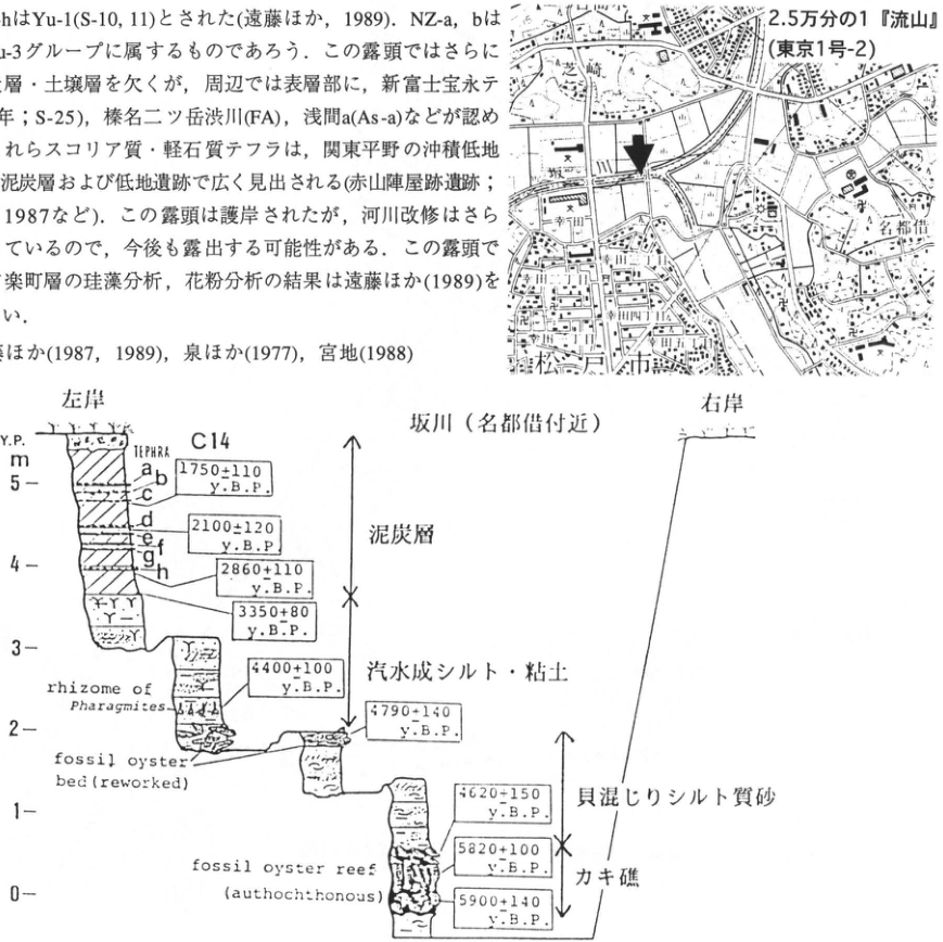
Original Japanese lettering
上部に混入した本文・文献は本文に収録。地図:2.5万分の1『流山』(東京1号-2),名都借,松戸市,坂川,幸町,×,矢印。 坂川(名都借付近)。左岸,右岸。縦軸Y.P.,m:0,1,2,3,4,5。TEPHRA:a,b,c,d,e,f,g,h。C14。 泥炭層,汽水成シルト・粘土,貝混じりシルト質砂,カキ礁。rhizome of Phragmites;fossil oyster bed (reworked);fossil oyster reef (autochthonous)。 年代値(図の上から;y. B. P.):1750±110,2100±120,2860±110,3350±80,4400±100,4790±140,4620±150,5820±100,5900±140。
English translation
Body text and references included in the upper crop are reproduced in the main text. Map: 1:25,000 “Nagareyama” (Tokyo 1-2); Nazukari, Matsudo City, Sakagawa, Saiwaicho, ×, arrow. Sakagawa (near Nazukari). Left bank; right bank. Vertical axis: Y.P., m; 0, 1, 2, 3, 4, 5. TEPHRA: a, b, c, d, e, f, g, h. C14. Peat; brackish-water silt and clay; shelly silty sand; oyster reef. Original English lettering: “rhizome of Phragmites”; “fossil oyster bed (reworked)”; “fossil oyster reef (autochthonous)”. Ages, from the top of the drawing (y. B. P.): 1750±110, 2100±120, 2860±110, 3350±80, 4400±100, 4790±140, 4620±150, 5820±100, 5900±140.
4620±150 — 図の先頭数字はやや不鮮明。原PDFの拡大では4と読み取れるが、年代の前後関係から別数字へ修正しない。
p230_400.png
PDF 230 · Original p. 213
Stratigraphic column of 21 soil layers at Ushiomasu, showing thicknesses, facies, levels of archaeological features and tools, and inferred tephra correlations.
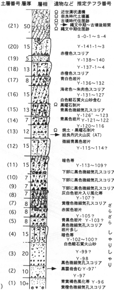
Original Japanese lettering
土層番号/層厚/層相/遺物など/推定テフラ番号。厚さの単位は図に明記なし。Ωは遺物。
| 土層 | 層厚 | 図の特徴・対比 |
|---|---|---|
| 21 | 50 | Ω近世溝状遺構,Ω奈良時代土壙墓,Ω古墳時代住居跡,▽縄文中期~古墳後期間,Ω縄文中期住居跡;S-0-1~S-4 |
| 20 | 15 | Y-141-1~3 |
| 19 | 5 | 赤橙色スコリア;Y-138~140 |
| 18 | 13 | Y-137-1~4 |
| 17 | 8 | 赤橙色スコリア,青白色岩片;Y-136~132 |
| 16 | 15 | 海老色~朱肉色スコリア;Y-131~127;白色軽石質火山砂含む |
| 15 | 13 | Ω黒曜石剥片,青黒色微細気孔スコリア;Y-126′~123 |
| 14 | 7 | 青黒色岩片;Y-121~122;Y-120~116 |
| 13 | 12 | Ω焼土・黒曜石剥片;姶良丹沢火山灰(AT) |
| 12 | 15 | 微細青黒色岩片;Y-115~114? |
| 11 | 15 | 暗色帯;Y-113~109?;下部に黒色微細気孔スコリア |
| 10 | 7 | 下部に黒色微細気孔スコリア |
| 9 | 7 | 下部に黒色微細気孔スコリア |
| 8 | 7 | 灰白色岩片入り風化帯;Y-107? |
| 7 | 8 | 黄橙色微細気孔スコリア |
| 6 | 8 | 赤紫色岩片;Y-105? |
| 5 | 8 | 青黒色岩片;Y-103? |
| 4 | 15 | 黒色微細気孔スコリア,岩片多し,暗色帯;Y-102~100?;白色軽石質火山砂 |
| 3 | 20 | Y-99?,Y-98;黒色微細気孔スコリア |
| 2 | 10 | 黒雲母含むY-97′;Y-97 |
| 1 | 10+ | 青黄褐色風化帯;Y-96;黄橙色微細気孔スコリア |
右側の感触表示:さらさら,しゃりしゃり。
English translation
Soil-layer number / thickness / facies / artifacts, etc. / inferred tephra number. The thickness unit is not specified in the drawing. Ω denotes artifacts.
| Soil layer | Thickness | Characteristics and correlations in the figure |
|---|---|---|
| 21 | 50 | Ω early modern ditch, Ω Nara-period pit burial, Ω Kofun dwelling, ▽ interval from Middle Jomon to Late Kofun, Ω Middle Jomon dwelling; S-0-1–S-4 |
| 20 | 15 | Y-141-1–3 |
| 19 | 5 | Reddish-orange scoria; Y-138–140 |
| 18 | 13 | Y-137-1–4 |
| 17 | 8 | Reddish-orange scoria, bluish-white lithics; Y-136–132 |
| 16 | 15 | Shrimp-colored to vermilion scoria; Y-131–127; contains white pumiceous volcanic sand |
| 15 | 13 | Ω obsidian flakes, bluish-black scoria with fine vesicles; Y-126′–123 |
| 14 | 7 | Bluish-black lithics; Y-121–122; Y-120–116 |
| 13 | 12 | Ω burnt soil and obsidian flakes; Aira-Tanzawa ash (AT) |
| 12 | 15 | Very fine bluish-black lithics; Y-115–114? |
| 11 | 15 | Dark band; Y-113–109?; black scoria with fine vesicles in the lower part |
| 10 | 7 | Black scoria with fine vesicles in the lower part |
| 9 | 7 | Black scoria with fine vesicles in the lower part |
| 8 | 7 | Weathered band containing grayish-white lithics; Y-107? |
| 7 | 8 | Yellowish-orange scoria with fine vesicles |
| 6 | 8 | Reddish-purple lithics; Y-105? |
| 5 | 8 | Bluish-black lithics; Y-103? |
| 4 | 15 | Black scoria with fine vesicles, abundant lithics, dark band; Y-102–100?; white pumiceous volcanic sand |
| 3 | 20 | Y-99?, Y-98; black scoria with fine vesicles |
| 2 | 10 | Biotite-bearing Y-97′; Y-97 |
| 1 | 10+ | Blue-yellow-brown weathered band; Y-96; yellowish-orange scoria with fine vesicles |
Texture descriptions at the right: free-flowing (さらさら), gritty (しゃりしゃり).
p230_401.png
PDF 230 · Original p. 213
Topographic map of western Chiba marking the Ushiomasu site with a black square.
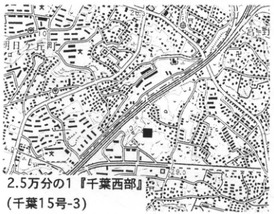
Original Japanese lettering
2.5万分の1『千葉西部』(千葉15号-3)。黒四角:遺跡。稲毛,検見川,宮野木,小中台町,園生。
English translation
1:25,000 “Chiba-Seibu” (Chiba 15-3). Black square: site. Inage, Kemigawa, Miyanogi, Konakadai-cho (小中台町), Sonno (園生).
p231_402.png
PDF 231 · Original p. 214
Topographic map marking the exposure at 一ヶ谷, Misaki Town, with an arrow, at the junction of the Kazusa-Ichinomiya, Kuniyoshi, and Kazusa-Choja sheets.
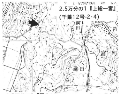
Original Japanese lettering
2.5万分の1『上総一宮』(千葉12号-2・4)。原著で図の下にある接合図幅の表示:2.5万分の1『国吉』(大多喜9号-3),2.5万分の1『上総長者』(大多喜9号-1)。岬町,網田,一ヶ谷。数値表示:30.5,33.4,42,26。矢印:露頭。
English translation
1:25,000 “Kazusa-Ichinomiya” (Chiba 12-2·4). Labels of adjoining sheets printed beneath the map in the original: 1:25,000 “Kuniyoshi” (Otaki 9-3) and 1:25,000 “Kazusa-Choja” (Otaki 9-1). Misaki Town, 網田, 一ヶ谷. Numerical labels: 30.5, 33.4, 42, 26. Arrow: exposure.
p231_403.png
PDF 231 · Original p. 214
Perspective outcrop diagram of Yoshitsuke terrace deposits and Kanto Loam, with three radiocarbon determinations and the underlying Otadai Formation of the Kazusa Group.
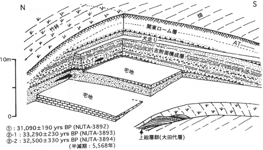
Original Japanese lettering
N,S。竹林,畑,関東ローム層,AT,大走り,吉附面構成層,宅地,①,②。上総層群(大田代層)。高さ目盛:0,10m。 ①:31,090±190 yrs BP (NUTA-3892) ②-1:33,290±230 yrs BP (NUTA-3893) ②-2:32,500±330 yrs BP (NUTA-3894) 半減期:5,568年。
English translation
N, S. Bamboo grove; cultivated field; Kanto Loam; AT; 大走り (original label); deposits forming the Yoshitsuke surface; residential lots; ①, ②. Kazusa Group (Otadai Formation). Height scale: 0, 10 m. ①: 31,090±190 yrs BP (NUTA-3892) ②-1: 33,290±230 yrs BP (NUTA-3893) ②-2: 32,500±330 yrs BP (NUTA-3894) Half-life: 5,568 years.
p232_404.png
PDF 232 · Original p. 215
Kisarazu topographic map with an arrow marking the tephra exposure at 三光路.
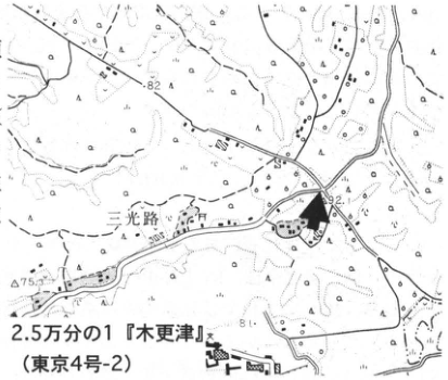
Original Japanese lettering
2.5万分の1『木更津』(東京4号-2)。三光路。標高点:82,92.1,75.7。矢印:露頭。
English translation
1:25,000 “Kisarazu” (Tokyo 4-2). 三光路. Spot heights: 82, 92.1, 75.7. Arrow: exposure.
p232_405.png
PDF 232 · Original p. 215
Photograph of four Hakone-derived pumice beds exposed in a road cutting at Kisarazu, labeled upward as Hk-OP, Hk-MP, Hk-TP, and Hk-CCP1.
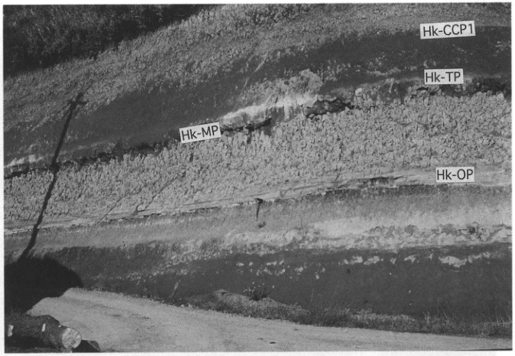
Original Japanese lettering
Hk-CCP1,Hk-TP,Hk-MP,Hk-OP。
English translation
Hk-CCP1: Hakone Central Cone 1; Hk-TP: Hakone-Tokyo; Hk-MP: Hakone-Miura; Hk-OP: Hakone-Obaradai.
p233_406.png
PDF 233 · Original p. 216
Soga topographic map marking the fossil-bearing Yabu Formation exposure at Semata with an arrow.
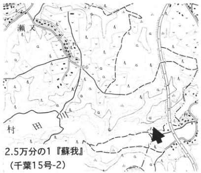
Original Japanese lettering
2.5万分の1『蘇我』(千葉15号-2)。瀬又,村田川。数値表示:42,66。矢印:露頭。
English translation
1:25,000 “Soga” (Chiba 15-2). Semata, Muratagawa. Numerical labels: 42, 66. Arrow: exposure.
p233_407.png
PDF 233 · Original p. 216
Photograph of the cliff at Semata, showing the Yabu Formation exposed between vegetation and the positions of upper GoP1 and lower SY.
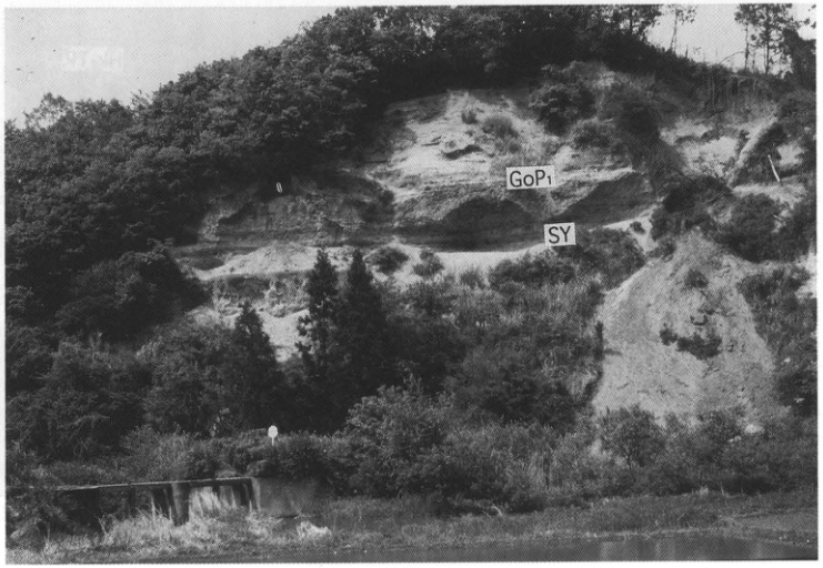
Original Japanese lettering
GoP1,SY。
English translation
GoP1: Gomashio-1 tephra; SY: Semata–Yabu tephra.
p234_408.png
PDF 234 · Original p. 217
Topographic location map of the Jizodo outcrop
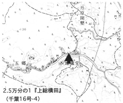
Original Japanese lettering
丹原開墾;五郷;地蔵堂;136;△137.3;40;56;2.5万分の1『上総横田』(千葉16号-4)
English translation
丹原開墾 (place name, reading unverified); 五郷 (place name); Jizodo; 136; △137.3; 40; 56; 1:25,000 “Kazusa-Yokota” (Chiba sheet 16-4).
地形図の微小な標高・地名 — 原画像でも一部の微小文字は判読困難。
p234_409.png
PDF 234 · Original p. 217
Photograph of the Jizodo Formation with Kn-1 and TE-5 marked
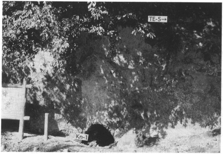
Original Japanese lettering
TE-5→;Kn-1
English translation
TE-5→; Kn-1
p235_410.png
PDF 235 · Original p. 218
Location maps of Numa coral-bed exposures A–E near Tateyama
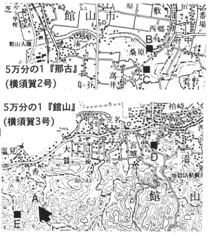
Original Japanese lettering
B;C;A;D;E;館山市;館山大橋;桑原;西郷;府中;古;大社;館山;城山;塩見;5万分の1『那古』(横須賀2号);5万分の1『館山』(横須賀3号)
English translation
B; C; A; D; E; Tateyama City; Tateyama Bridge; 桑原; 西郷; 府中; 古; 大社; Tateyama; Shiroyama; 塩見; 1:50,000 “Nago” (Yokosuka sheet 2); 1:50,000 “Tateyama” (Yokosuka sheet 3).
地形図微小地名・標高 — 一部は原図解像度でも判読困難。
p235_411.png
PDF 235 · Original p. 218
Section of the Numa coral bed and upper limit of molluscan borings at Koyatsu site A
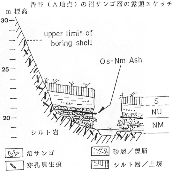
Original Japanese lettering
香谷(A地点)の沼サンゴ層の露頭スケッチ;m 標高;30;25;20;upper limit of boring shell;Os-Nm Ash;S;NU;NM;シルト岩;沼サンゴ;穿孔貝生痕;砂層/礫層;シルト層/土壌
English translation
Outcrop sketch of the Numa coral bed at Koyatsu (site A); elevation, m; 30; 25; 20; upper limit of boring shell; Os-Nm Ash; S; NU; NM; siltstone; Numa coral; traces of boring molluscs; sand bed / gravel bed; silt bed / soil.
p236_412.png
PDF 236 · Original p. 219
Senbazaki location map and tephra section at 500–530 m, including an embedded text fragment
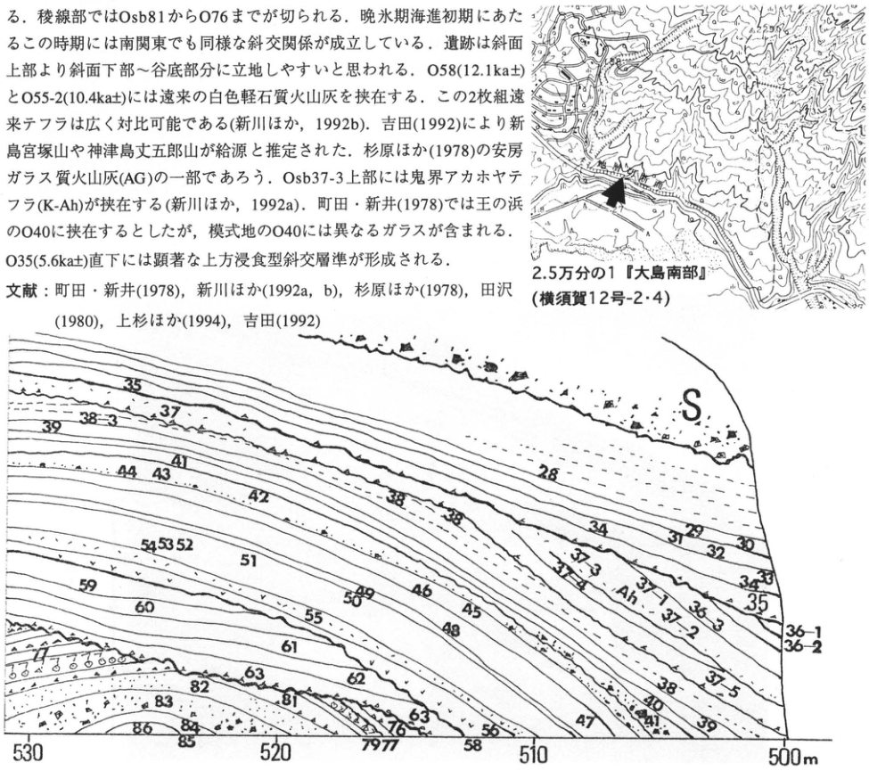
Original Japanese lettering
2.5万分の1『大島南部』(横須賀12号-2・4);S;Ah;28;29;30;31;32;33;34;35;36-1;36-2;36-3;37-1;37-2;37-3;37-5;38;38-3;39;40;41;42;43;44;45;46;47;48;49;50;51;52;53;54;55;58;59;60;61;62;63;76;77;79;81;82;83;84;85;86;530;520;510;500m。画像中の本文断片は本文に復元。
English translation
1:25,000 “Southern Oshima” (Yokosuka sheet 12-2/4); S; Ah; 28; 29; 30; 31; 32; 33; 34; 35; 36-1; 36-2; 36-3; 37-1; 37-2; 37-3; 37-5; 38; 38-3; 39; 40; 41; 42; 43; 44; 45; 46; 47; 48; 49; 50; 51; 52; 53; 54; 55; 58; 59; 60; 61; 62; 63; 76; 77; 79; 81; 82; 83; 84; 85; 86; 530; 520; 510; 500 m. The embedded prose fragment has been restored in the main text.
地形図微小文字および重なる断面ラベル — 微小文字の一部は完全には判読できない。
p237_413.png
PDF 237 · Original p. 220
Location map of the Daisanyama exposure on Niijima
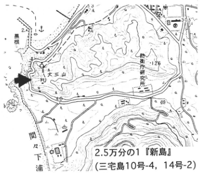
Original Japanese lettering
黒根;大三山;妙京寺研究所;間下浦;30.5;126;40;2.5万分の1『新島』(三宅島10号-4,14号-2)
English translation
黒根; Daisanyama; 妙京寺研究所 [reading unverified]; 間下浦; 30.5; 126; 40; 1:25,000 “Niijima” (Miyakejima sheet 10-4, 14-2).
妙京寺研究所 — 地形図の細字、読取りは暫定。
p237_414.png
PDF 237 · Original p. 220
Daisanyama exposure showing Niijima and Kozushima tephras and AT
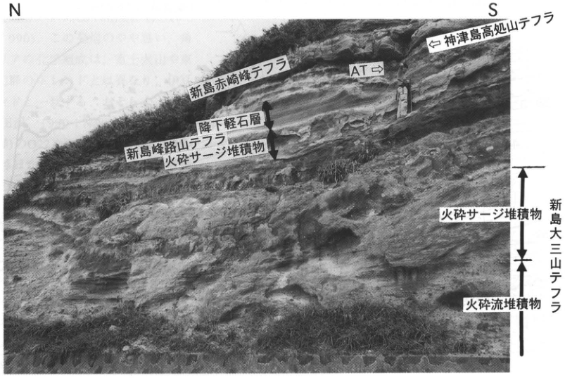
Original Japanese lettering
N;S;新島赤崎峰テフラ;神津島高処山テフラ;AT;降下軽石層;新島峰路山テフラ;火砕サージ堆積物;新島大三山テフラ;火砕流堆積物
English translation
N; S; Niijima Akazakimine tephra; Kozushima Takoudoyama tephra; AT; pumice-fall bed; Niijima Minejidoyama tephra; pyroclastic-surge deposits; Niijima Daisanyama tephra; pyroclastic-flow deposits.
p238_415.png
PDF 238 · Original p. 221
Niijima topographic map showing the Fujimi Pass outcrop
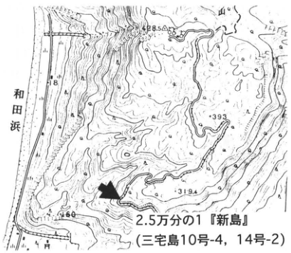
Original Japanese lettering
和田浜;393;319.4;460;428.5;2.5万分の1『新島』(三宅島10号-4,14号-2)
English translation
Wada Beach; 393; 319.4; 460; 428.5; 1:25,000 “Niijima” (Miyakejima sheet 10-4, 14-2).
p238_416.png
PDF 238 · Original p. 221
Exposure of Niijima Mukaiyama, Niijima Atchiyama, and Kozushima Tenjosan tephras
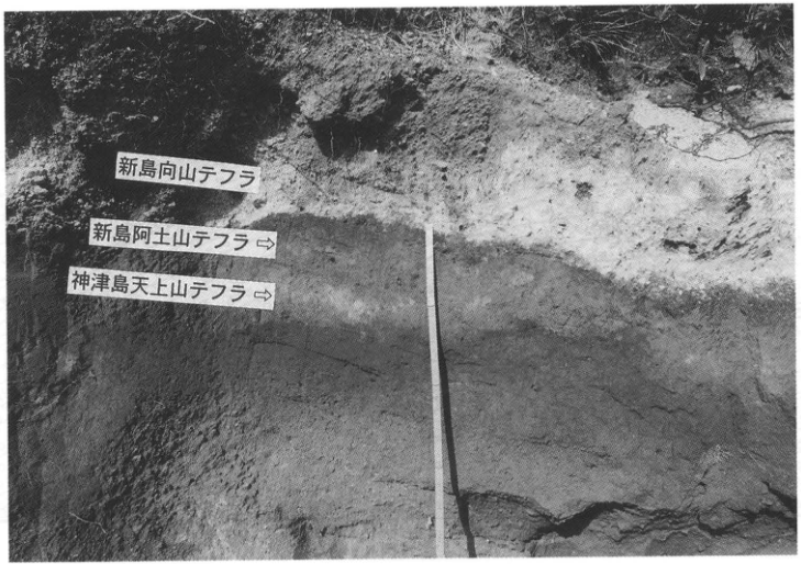
Original Japanese lettering
新島向山テフラ;新島阿土山テフラ⇒;神津島天上山テフラ⇒
English translation
Niijima Mukaiyama tephra; Niijima Atchiyama tephra ⇒; Kozushima Tenjosan tephra ⇒.
p239_417.png
PDF 239 · Original p. 222
Location map of the Sueyoshi exposure and the AT locality at Ishizumigahana
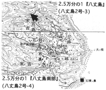
Original Japanese lettering
2.5万分の1『八丈島』(八丈島2号-3);2.5万分の1『八丈島南部』(八丈島2号-4);高路;宮路;末吉;大根;尾越;石積ヶ鼻;172;82.6
English translation
1:25,000 “Hachijojima” (Hachijojima sheet 2-3); 1:25,000 “Southern Hachijojima” (Hachijojima sheet 2-4); 高路; 宮路; Sueyoshi; 大根; 尾越; Ishizumigahana; 172; 82.6.
地図の微小地名 — 読みが確かでない固有名は日本語で保持。
p239_418.png
PDF 239 · Original p. 222
Section of Sueyoshi I pumice-fall beds containing AT and valley-fill deposits
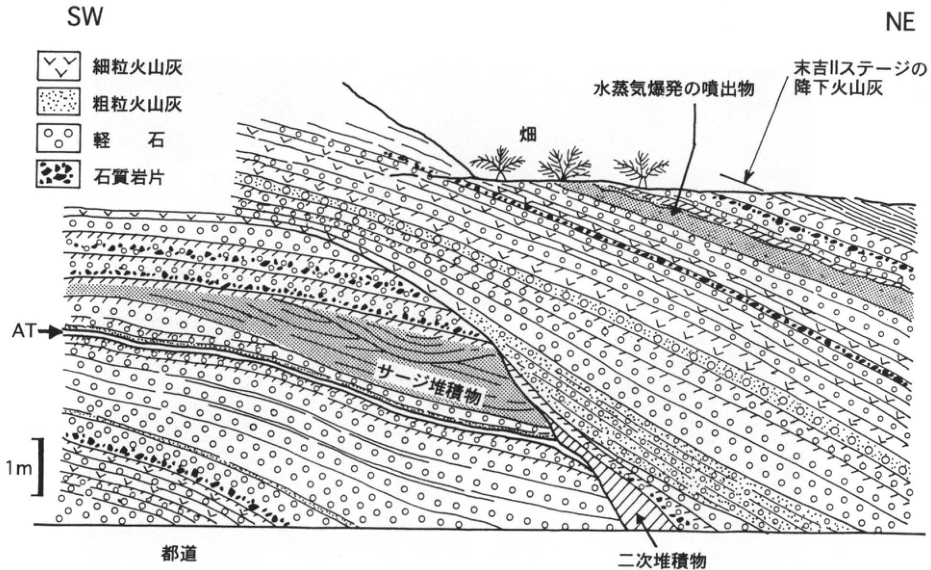
Original Japanese lettering
SW;NE;細粒火山灰;粗粒火山灰;軽石;石質岩片;畑;水蒸気爆発の噴出物;末吉IIステージの降下火山灰;AT;サージ堆積物;1m;都道;二次堆積物
English translation
SW; NE; fine ash; coarse ash; pumice; lithic fragments; cultivated field; ejecta from a phreatic explosion; fallout ash of the Sueyoshi II stage; AT; surge deposits; 1 m; Tokyo road; secondary deposits.
p241_419.png
PDF 241 · Original p. 224
Location map of the Myoko volcanic exposure at Sekigawa
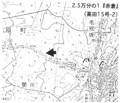
Original Japanese lettering
2.5万分の1『赤倉』(高田15号-2);原町;毛祝坂;関川;611;634;546;585;663;■
English translation
1:25,000 “Akakura” (Takada sheet 15-2); 原町; 毛祝坂; Sekigawa; 611; 634; 546; 585; 663; ■.
毛祝坂等の微小地名 — 読取り暫定、読み不明の地名は日本語で保持。
p241_420.png
PDF 241 · Original p. 224
Section of Myoko pyroclastic-flow and debris-avalanche deposits and DKP
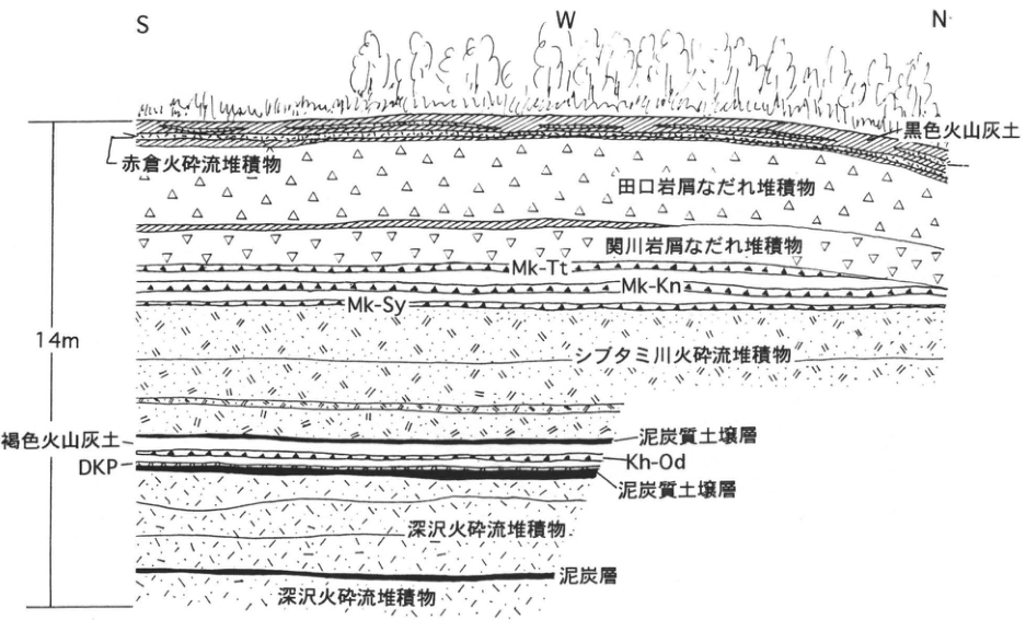
Original Japanese lettering
S;W;N;14m;黒色火山灰土;赤倉火砕流堆積物;田口岩屑なだれ堆積物;関川岩屑なだれ堆積物;Mk-Tt;Mk-Kn;Mk-Sy;シブタミ川火砕流堆積物;褐色火山灰土;DKP;Kh-Od;泥炭質土壌層;深沢火砕流堆積物;泥炭層
English translation
S; W; N; 14 m; black volcanic-ash soil; Akakura pyroclastic-flow deposits; Taguchi debris-avalanche deposits; Sekigawa debris-avalanche deposits; Mk-Tt; Mk-Kn; Mk-Sy; Shibutamigawa pyroclastic-flow deposits; brown volcanic-ash soil; DKP; Kh-Od; peaty soil bed; Fukazawa pyroclastic-flow deposits; peat bed.
p242_421.png
PDF 242 · Original p. 225
Location map of the Taniage terrace roadcuts
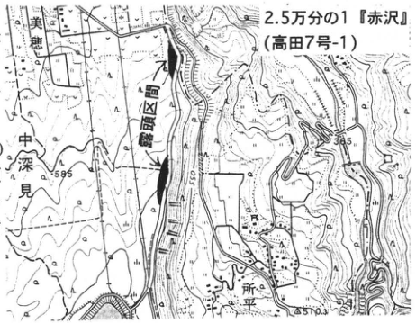
Original Japanese lettering
美穂;豊田堰取入口;中深見;所平;598;585;510.3;2.5万分の1『赤沢』(高田7号-1)
English translation
Miho; 豊田堰取入口 [Toyoda weir intake, reading unverified]; 中深見; Tokodaira; 598; 585; 510.3; 1:25,000 “Akazawa” (Takada sheet 7-1).
p242_422.png
PDF 242 · Original p. 225
Distribution of tephra exposures on both sides of the road and marker beds
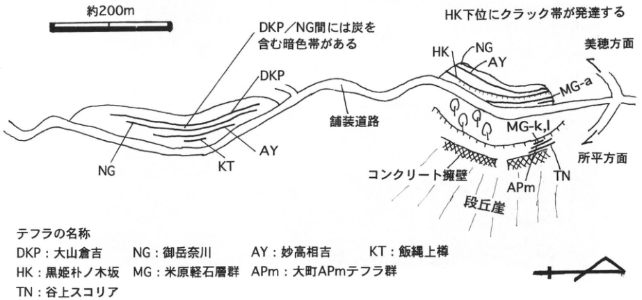
Original Japanese lettering
約200m;DKP/NG間には炭を含む暗色帯がある;HK下位にクラック帯が発達する;DKP;NG;KT;AY;HK;MG-a;MG-k,l;APm;TN;美穂方面;所平方面;舗装道路;コンクリート擁壁;段丘崖;テフラの名称:DKP:大山倉吉;NG:御岳奈川;AY:妙高相吉;KT:飯縄上樽;HK:黒姫朴ノ木坂;MG:米原軽石層群;APm:大町APmテフラ群;TN:谷上スコリア
English translation
Approximately 200 m; a dark zone containing charcoal occurs between DKP and NG; a cracked zone is developed below HK; DKP; NG; KT; AY; HK; MG-a; MG-k,l; APm; TN; toward Miho; toward Tokodaira; paved road; concrete retaining wall; terrace scarp; tephra names: DKP, Daisen-Kurayoshi; NG, Ontake-Nagawa; AY, Myoko-Aiyoshi (相吉); KT, Iizuna-Kamitaru; HK, Kurohime-Honokizaka (朴ノ木坂); MG, Yonehara pumice-bed group; APm, Omachi APm tephra group; TN, Taniage scoria.
p243_423.png
PDF 243 · Original p. 226
Location map of the Kannoki type exposure of the Nojiri Loam Formation
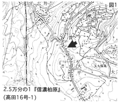
Original Japanese lettering
図1;神山;大久保池;大;650;673.35;701;714;2.5万分の1『信濃柏原』(高田16号-1)
English translation
Figure 1; Kamiyama; Okubo Pond; 大; 650; 673.35; 701; 714; 1:25,000 “Shinano-Kashiwabara” (Takada sheet 16-1).
p243_424.png
PDF 243 · Original p. 226
Kannoki exposure with the three-piece set, Breccia Zone, and AT horizon
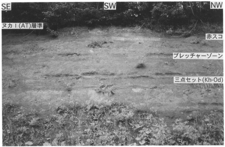
Original Japanese lettering
SE;SW;NW;ヌカI(AT)層準;赤スコ;ブレッチャーゾーン;三点セット(Kh-Od);1m;図2
English translation
SE; SW; NW; Nuka I (AT) horizon; Aka-suko; Breccia Zone; three-piece set (Kh-Od); 1 m; Figure 2.
p244_425.png
PDF 244 · Original p. 227
Kannoki section showing Nojiri Loam subdivisions and the photographed area
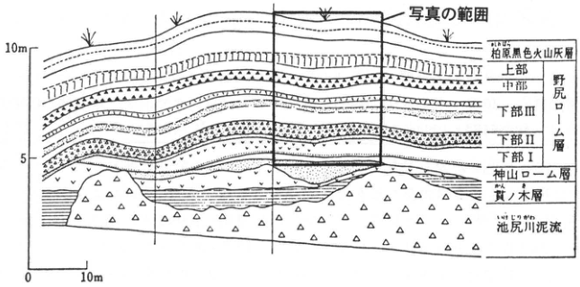
Original Japanese lettering
写真の範囲;10m;5;0;10m;柏原黒色火山灰層;上部;中部;下部III;下部II;下部I;野尻ローム層;神山ローム層;貫ノ木層;池尻川泥流;図3 貫ノ木の露頭スケッチ(野尻湖発掘調査団地質グループ,1975)
English translation
Photograph coverage; 10 m; 5; 0; 10 m; Kashiwabara black ash bed; upper; middle; lower III; lower II; lower I; Nojiri Loam Formation; Kamiyama Loam Formation; Kannoki Formation; Ikejiri River mudflow; Figure 3, sketch of the Kannoki exposure (野尻湖発掘調査団地質グループ, 1975).
p244_426.png
PDF 244 · Original p. 227
Correlation of the Nojiri-ko Formation at Tategahana with cultural horizons in the Nojiri Loam Formation
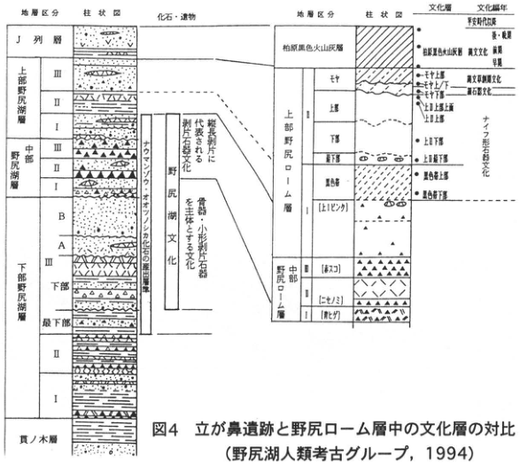
Original Japanese lettering
地層区分;柱状図;化石・遺物;J列層;上部野尻湖層III,II,I;中部野尻湖層III,II,I;下部野尻湖層III(B,A,下部,最下部),II,I;貫ノ木層;ナウマンゾウ・オオツノシカ化石の産出層準;野尻湖文化;縦長剥片に代表される剥片石器文化;骨器・小形剥片石器を主体とする文化;文化層;文化編年;柏原黒色火山灰層;上部野尻ローム層II(モヤ,上部,下部,最下部),I(黒色帯,上[ヒビワレ]);中部野尻ローム層II[赤スコ],I[ニセノミ][青ヒゲ];モヤ上部;モヤ上/下;モヤ下部;上II上部上面;上II上部;上II下部;上II最下部;黒色帯上部;黒色帯下部;平安時代以降;弥・縄;縄文文化:晩期,早期;縄文草創期文化;細石器文化;ナイフ形石器文化;図4 立が鼻遺跡と野尻ローム層中の文化層の対比(野尻湖人類考古グループ,1994)
English translation
Stratigraphic subdivisions; columnar section; fossils and artifacts; J-row bed; Upper Nojiri-ko Formation III, II, I; Middle Nojiri-ko Formation III, II, I; Lower Nojiri-ko Formation III (B, A, lower, lowermost), II, I; Kannoki Formation; horizons yielding Naumann elephant and giant deer fossils; Nojiri-ko culture; flake-tool culture represented by elongated flakes; culture dominated by bone implements and small flake tools; cultural horizon; cultural chronology; Kashiwabara black ash bed; Upper Nojiri Loam II (Moya, upper, lower, lowermost), I (black band, upper [Hibiware]); Middle Nojiri Loam II [Aka-suko], I [Nise-nomi] [Ao-hige]; upper Moya; Moya upper/lower; lower Moya; upper surface of upper Upper II; upper Upper II; lower Upper II; lowermost Upper II; upper black band; lower black band; Heian period and later; Yayoi / Jomon; Jomon culture: Late, Initial; Incipient Jomon culture; microblade culture; knife-shaped stone-tool culture; Figure 4, correlation of cultural horizons at Tategahana and in the Nojiri Loam Formation (野尻湖人類考古グループ, 1994).
中部Iの細字ラベル[ニセノミ][青ヒゲ] — 画像が小さく読取りは暫定。
p245_427.png
PDF 245 · Original p. 228
Location map of the Yagasaki exposure
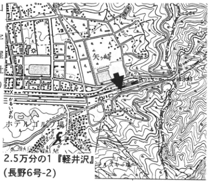
Original Japanese lettering
矢ケ崎;御前町;市村堤;943;950;955;2.5万分の1『軽井沢』(長野6号-2)
English translation
Yagasaki; 御前町; 市村堤; 943; 950; 955; 1:25,000 “Karuizawa” (Nagano sheet 6-2).
p245_428.png
PDF 245 · Original p. 228
Columnar section of Asama tephras and cross-section of the Okuwa debris avalanche
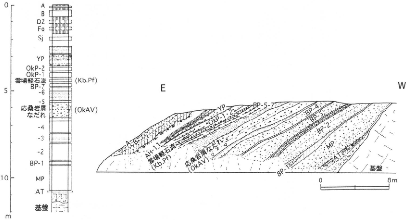
Original Japanese lettering
0;5;10;m;A;B;D2;Fo;Sj;YP;OkP-2;OkP-1;雲場軽石流(Kb.Pf);BP-7;-6;-5;応桑岩屑なだれ(OkAV);-4;-3;-2;BP-1;MP;AT;基盤;E;W;AH-1;BP-5-7;BP-4;BP-3;BP-2;BP-1;0;8m
English translation
0; 5; 10; m; A; B; D2; Fo; Sj; YP; OkP-2; OkP-1; Kumoba pumice flow (Kb.Pf); BP-7; -6; -5; Okuwa debris avalanche (OkAV); -4; -3; -2; BP-1; MP; AT; basement; E; W; AH-1; BP-5-7; BP-4; BP-3; BP-2; BP-1; 0; 8 m.
p246_429.png
PDF 246 · Original p. 229
Map of the Takatoya-zawa exposure and periglacial debris locality on Ogawayama
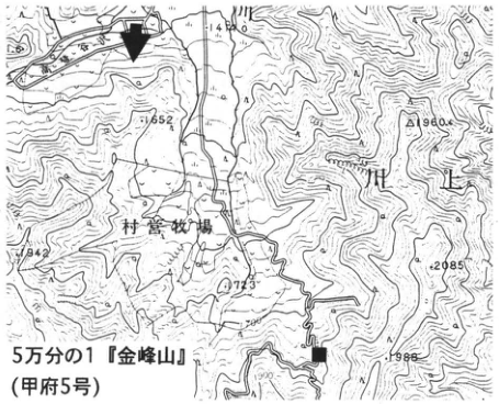
Original Japanese lettering
村営牧場;1552;1960;1742;2085;2273;1988;5万分の1『金峰山』(甲府5号)
English translation
Village-operated pasture; 1552; 1960; 1742; 2085; 2273; 1988; 1:50,000 “Kinpusan” (Kofu sheet 5).
p246_430.png
PDF 246 · Original p. 229
Section showing alternating angular gravel and tephra and east-dipping On-Pm1
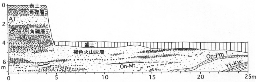
Original Japanese lettering
E;S;W;0;2;4;6m;0;5;10;15;20;25m;表土;角礫層;AT;盛土;褐色火山灰層;On-Mt;On-Pm1;Yt-Kw
English translation
E; S; W; 0; 2; 4; 6 m; 0; 5; 10; 15; 20; 25 m; topsoil; angular gravel bed; AT; fill; brown volcanic-ash bed; On-Mt; On-Pm1; Yt-Kw.
p247_431.png
PDF 247 · Original p. 230
Map of the exposure east of Osakada Park
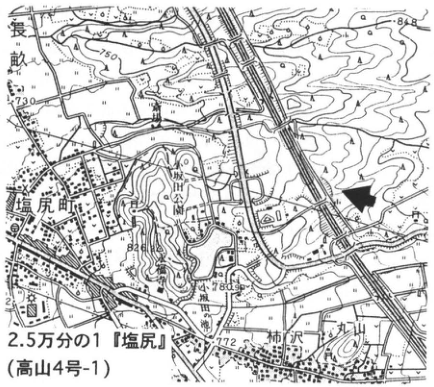
Original Japanese lettering
長畝;塩尻町;柿沢;丸山;730;771;781;772;2.5万分の1『塩尻』(高山4号-1)
English translation
長畝; Shiojiri-machi; Kakizawa; Maruyama; 730; 771; 781; 772; 1:25,000 “Shiojiri” (Takayama sheet 4-1).
p247_432.png
PDF 247 · Original p. 230
Overview of On-Pm1 and On-Ng at Osakada
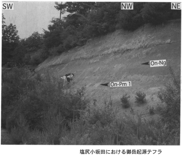
Original Japanese lettering
SW;NW;NE;On-Ng;On-Pm1;塩尻小坂田における御岳起源テフラ
English translation
SW; NW; NE; On-Ng; On-Pm1; Ontake-derived tephras at Osakada, Shiojiri.
p247_433.png
PDF 247 · Original p. 230
Close view of On-Pm1, SoP, On-Kt, and On-Ng
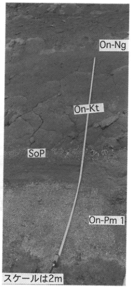
Original Japanese lettering
On-Ng;On-Kt;SoP;On-Pm1;スケールは2m
English translation
On-Ng; On-Kt; SoP; On-Pm1; scale is 2 m.
p248_434.png
PDF 248 · Original p. 231
Map of the Nashinoki exposure and additional On-Pm1 locality
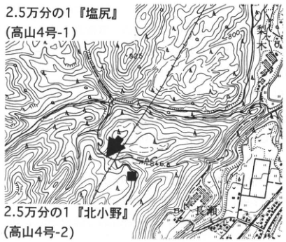
Original Japanese lettering
梨ノ木;善知鳥峠;848.8;800;2.5万分の1『塩尻』(高山4号-1);2.5万分の1『北小野』(高山4号-2)
English translation
Nashinoki; Uto Pass (善知鳥峠); 848.8; 800; 1:25,000 “Shiojiri” (Takayama sheet 4-1); 1:25,000 “Kita-Ono” (Takayama sheet 4-2).
p248_435.png
PDF 248 · Original p. 231
Section of C1 Crystal Ash and varicolored lapilli overlying the Nashinoki Gravel
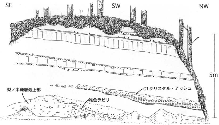
Original Japanese lettering
SE;SW;NW;5m;梨ノ木礫層最上部;雑色ラピリ;C1クリスタル・アッシュ
English translation
SE; SW; NW; 5 m; uppermost Nashinoki Gravel; varicolored lapilli; C1 Crystal Ash.
p249_436.png
PDF 249 · Original p. 232
Map of the Rokudobara quarry and Tobu Junior High School exposure
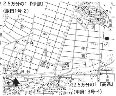
Original Japanese lettering
2.5万分の1『伊那』(飯田1号-2);2.5万分の1『高遠』(甲府13号-4);六道原;美原区;美篶;上原;下川手;上川手;六道原機場;707;703;724.8
English translation
1:25,000 “Ina” (Iida sheet 1-2); 1:25,000 “Takato” (Kofu sheet 13-4); Rokudobara; Mihara district; Misuzu; Uehara; Shimo-Kawate; Kami-Kawate; 六道原機場 [facility label, reading unverified]; 707; 703; 724.8.
p249_437.png
PDF 249 · Original p. 232
Quarry face with marker tephras from On-Pm1 to K-Ah
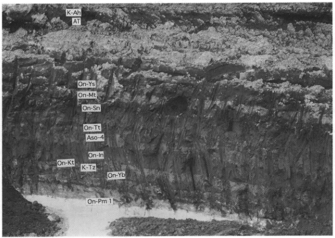
Original Japanese lettering
K-Ah;AT;On-Ys;On-Mt;On-Sn;On-Tt;Aso-4;On-In;On-Kt;K-Tz;On-Yb;On-Pm1
English translation
K-Ah; AT; On-Ys; On-Mt; On-Sn; On-Tt; Aso-4; On-In; On-Kt; K-Tz; On-Yb; On-Pm1.
p250_438.png
PDF 250 · Original p. 233
Map of the Nentsuji Fault exposure in the Kegasawa River
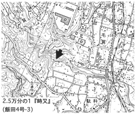
Original Japanese lettering
毛賀;駄科;437.9;488.7;2.5万分の1『時又』(飯田4号-3)
English translation
Kega; Dashina; 437.9; 488.7; 1:25,000 “Tokimata” (Iida sheet 4-3).
p250_439.png
PDF 250 · Original p. 233
Exposure of the Nentsuji Fault with granite thrust over gravel
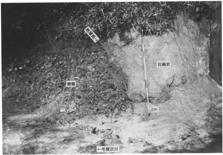
Original Japanese lettering
断層面→;花崗岩;礫層;2m;←毛賀沢川
English translation
Fault surface →; granite; gravel bed; 2 m; ← Kegasawa River.
p251_440.png
PDF 251 · Original p. 234
Map of Kiso River mudflow exposures along the Suekawa
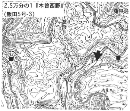
Original Japanese lettering
2.5万分の1『木曽西野』(飯田5号-3);末川;越;木曽カントリー;1158;1150;1100
English translation
1:25,000 “Kiso-Nishino” (Iida sheet 5-3); Suekawa; 越; Kiso Country Club; 1158; 1150; 1100.
p251_441.png
PDF 251 · Original p. 234
Debris-avalanche section showing andesite blocks, clinker block, and matrix
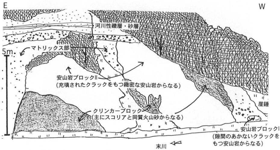
Original Japanese lettering
E;W;5m;河川性礫層・砂層;マトリックス部;安山岩ブロックII(充填されたクラックをもつ緻密な安山岩からなる);クリンカーブロック(主にスコリアと同質火山砂からなる);崖錐;安山岩ブロックI(隙間のあかないクラックをもつ安山岩からなる);末川
English translation
E; W; 5 m; fluvial gravel and sand beds; matrix facies; andesite block II (dense andesite with filled cracks); clinker block (mainly scoria and volcanic sand of the same composition); talus; andesite block I (andesite with cracks that are not open); Suekawa River.
p252_442.png
PDF 252 · Original p. 235
Map of the large right-bank exposure along the Jingugawa
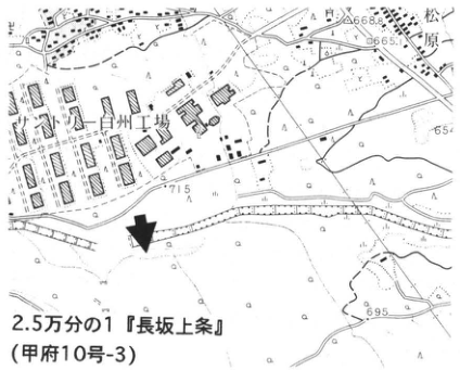
Original Japanese lettering
白州工場;松原;668.8;665.1;695;2.5万分の1『長坂上条』(甲府10号-3)
English translation
Hakushu plant; Matsubara; 668.8; 665.1; 695; 1:25,000 “Nagasaka-Kamijo” (Kofu sheet 10-3).
p252_443.png
PDF 252 · Original p. 235
Geological section showing two buried valleys and tephras along the Jingugawa
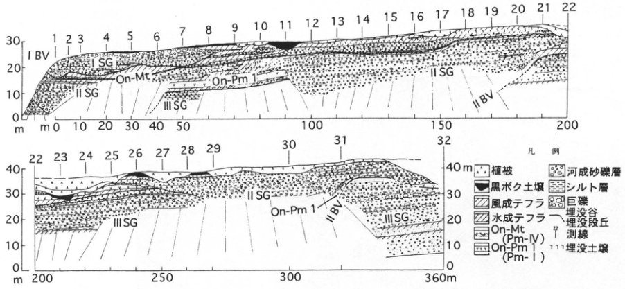
Original Japanese lettering
測線1~32;IBV;IIBV;ISG;IISG;IIISG;On-Mt;On-Pm1;縦軸0,10,20,30,40m;横軸0,10,20,30,40,50,100,150,200,250,300,360m;凡例:植被;黒ボク土壌;風成テフラ;水成テフラ;On-Mt(Pm-IV);On-Pm1(Pm-I);河成砂礫層;シルト層;巨礫;埋没谷;埋没段丘;測線;埋没土壌
English translation
Survey lines 1–32; IBV; IIBV; ISG; IISG; IIISG; On-Mt; On-Pm1; vertical axes 0, 10, 20, 30, 40 m; horizontal axes 0, 10, 20, 30, 40, 50, 100, 150, 200, 250, 300, 360 m; legend: vegetation cover; kuroboku soil; aeolian tephra; water-laid tephra; On-Mt (Pm-IV); On-Pm1 (Pm-I); fluvial sand and gravel; silt bed; boulders; buried valley; buried terrace; survey line; buried soil.
p253_444.png
PDF 253 · Original p. 236
Map of the Shimotsutaki Fault exposures and trench
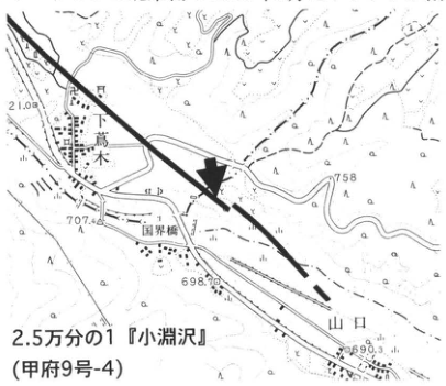
Original Japanese lettering
下蔦木;国界橋;山口;710.8;758;707.4;698.6;690.3;2.5万分の1『小淵沢』(甲府9号-4)
English translation
Shimotsutaki; Kokkaibashi; Yamaguchi; 710.8; 758; 707.4; 698.6; 690.3; 1:25,000 “Kobuchizawa” (Kofu sheet 9-4).
p253_445.png
PDF 253 · Original p. 236
Natural fault-exposure section and photograph of trench B in 1995
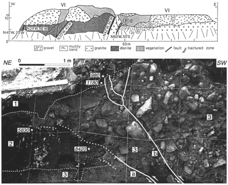
Original Japanese lettering
W;E;VI;0;10m;50m;N40°W,20°W;N24°W,56°W;N20°W,40°W;N42°W,50°W;N60°W,50°S;A;B;C;⑧d;gravel;muddy sand;granite;diorite;vegetation;fault;fractured zone;NE;SW;0;1m;surface;980;1180;5830;8420;1;2;3;a;b
English translation
W; E; VI; 0; 10 m; 50 m; N40°W, 20°W; N24°W, 56°W; N20°W, 40°W; N42°W, 50°W; N60°W, 50°S; A; B; C; ⑧d; gravel; muddy sand; granite; diorite; vegetation; fault; fractured zone; NE; SW; 0; 1 m; surface; 980; 1180; 5830; 8420; 1; 2; 3; a; b.
p254_446.png
PDF 254 · Original p. 237
Map of the debris-avalanche exposure north of Anayama Bridge and hummocks
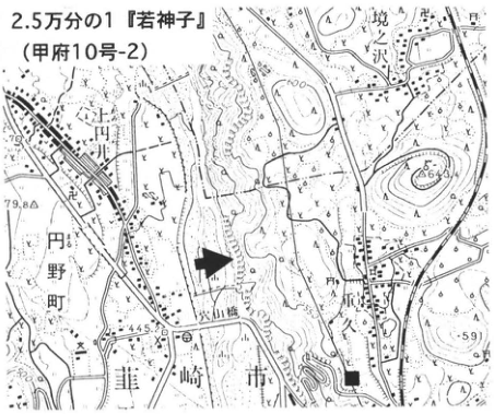
Original Japanese lettering
2.5万分の1『若神子』(甲府10号-2);境沢;花ノ久保;穴山橋;韮崎市;上円井;円野町;664.3;479.8;445.8;591
English translation
1:25,000 “Wakamiko” (Kofu sheet 10-2); Sakaizawa; 花ノ久保; Anayama Bridge; Nirasaki City; Kami-Tsuburai; Maruno Town; 664.3; 479.8; 445.8; 591.
p254_447.png
PDF 254 · Original p. 237
Megablock retaining stratified lava layers in the Nirasaki debris avalanche
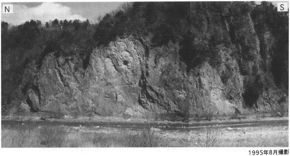
Original Japanese lettering
N;S;1995年8月撮影
English translation
N; S; photographed in August 1995.
p255_448.png
PDF 255 · Original p. 238
Location map of the flexure exposure at Fuefuki Service Area
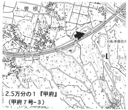
Original Japanese lettering
上曽根;塚原;小林;坊;境川;4268.8[判読不明の一部を含む];317.6;自転車競技場;2.5万分の1『甲府』(甲府7号-3)
English translation
Kami-Sone; Tsukahara; Kobayashi; 坊; Sakaigawa; 4268.8 [partly illegible]; 317.6; cycling track; 1:25,000 “Kofu” (Kofu sheet 7-3).
4268.8 — 地名と標高が重なるため確定不能。
p255_449.png
PDF 255 · Original p. 238
Flexural section of alluvial-fan and lacustrine deposits and Nirasaki debris-avalanche deposits
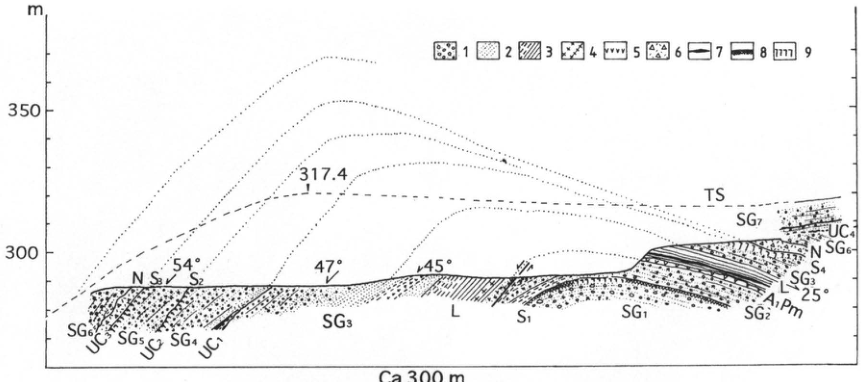
Original Japanese lettering
m;350;300;317.4;54°;47°;45°;25°;Ca 300m;1~9;TS;SG1;SG2;SG3;SG4;SG5;SG6;SG7;L;N;A1Pm;S1;S2;S3;S4;UC1;UC2;UC3;UC4。凡例説明は本文に保持。
English translation
m; 350; 300; 317.4; 54°; 47°; 45°; 25°; ca. 300 m; 1–9; TS; SG1; SG2; SG3; SG4; SG5; SG6; SG7; L; N; A1Pm; S1; S2; S3; S4; UC1; UC2; UC3; UC4. Legend definitions are retained in the main text.
p256_450.png
PDF 256 · Original p. 239
Otsuki site stratigraphic column, artifact horizons, and location map, with prose fragment
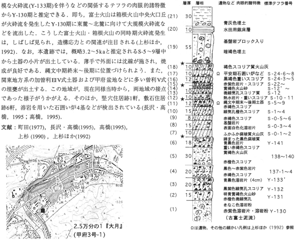
Original Japanese lettering
層厚・層相・遺物など肉眼的諸特徴・標準テフラ番号
| 層番号 | 層厚(原図の数値) | 記載・テフラ番号 |
|---|---|---|
| 21 | 30 | 青灰色埋土 |
| 20 | 10 | 水田用鍬床層 |
| 19 | 55 | 基盤岩ブロック入り暗褐色埋土 |
| 18 | 10 | 褐色スコリア質火山灰 |
| 17 | 10 | Ω 平安期石囲い炉など;S-24-6~8 |
| 16 | 12 | 黒褐色重いスコリア;S-24-3~5 |
| 15 | 4 | 赤紫色岩片・スコリア;S-22~ |
| 14 | 10 | 黄褐色火山砂;S-12′~ |
| 13 | 10 | 微細気孔スコリア質;S-12 |
| 12 | 10 | 熱水岩片・重いスコリア;S-10・11 |
| 11 | 12 | Ω 縄文中期末~後期土器;S-5~9;赤褐色スコリア |
| 10 | 15 | 細気孔橙色スコリア;S-1~4 |
| 9 | 8 | 赤褐色スコリア;S-0-5~6 |
| 8 | 15 | 基盤岩片;表面白色化溶岩片;S-0-3~4 |
| 7 | 10 | ふかふか腐植質火山灰;S-0-1~2 |
| 6 | 18 | 締まった黒色腐植質;青黒色岩片;重い赤褐色スコリア;Y-141 |
| 5 | 30 | 黄褐色火山灰;赤橙色スコリア;138~140 |
| 4 | 20 | 黒色~赤紫色岩片;赤橙色スコリア;137-1~4 |
| 3 | 20 | 青黒色溶岩片(4cm);Y-133′;黒紫色細気孔スコリア;Y-132 |
| 2 | 15 | 明青黄褐色火山砂;赤橙色微細気孔;Y-131 |
| 1 | 記載なし | きなこ色溶岩粉;赤紫色溶岩片・溶岩粉;Y-130(古富士泥流) |
Ωは遺物,その他の細かい凡例は上杉ほか(1992)参照.★印が18上,15,7下付近に付される.2.5万分の1『大月』(甲府3号-1);大月二丁目;都留高;大月一丁目;御太刀一丁目;御太刀二丁目;月見台;猿橋;525;526;362.1;361.画像中の本文断片は本文に復元.
English translation
Bed thickness; lithology; macroscopic characteristics including artifacts; standard tephra number.
| Bed | Thickness (printed value) | Description and tephra number |
|---|---|---|
| 21 | 30 | Blue-gray fill |
| 20 | 10 | Paddy-field plow pan |
| 19 | 55 | Dark-brown fill containing basement-rock blocks |
| 18 | 10 | Brown scoriaceous ash |
| 17 | 10 | Ω Heian-period stone-lined hearths, etc.; S-24-6–8 |
| 16 | 12 | Blackish-brown dense scoria; S-24-3–5 |
| 15 | 4 | Reddish-purple rock fragments and scoria; S-22 and above |
| 14 | 10 | Yellowish-brown volcanic sand; S-12′ and above |
| 13 | 10 | Finely vesicular scoriaceous material; S-12 |
| 12 | 10 | Hydrothermally altered rock fragments and dense scoria; S-10, 11 |
| 11 | 12 | Ω End-Middle to Late Jomon pottery; S-5–9; reddish-brown scoria |
| 10 | 15 | Finely vesicular orange scoria; S-1–4 |
| 9 | 8 | Reddish-brown scoria; S-0-5–6 |
| 8 | 15 | Basement-rock fragments; lava fragments with whitened surfaces; S-0-3–4 |
| 7 | 10 | Loose humic ash; S-0-1–2 |
| 6 | 18 | Compact black humic material; blue-black rock fragments; dense reddish-brown scoria; Y-141 |
| 5 | 30 | Yellowish-brown ash; reddish-orange scoria; 138–140 |
| 4 | 20 | Black to reddish-purple rock fragments; reddish-orange scoria; 137-1–4 |
| 3 | 20 | Blue-black lava fragments (4 cm); Y-133′; blackish-purple finely vesicular scoria; Y-132 |
| 2 | 15 | Light bluish-yellowish-brown volcanic sand; reddish-orange finely vesicular material; Y-131 |
| 1 | Not stated | Roasted-soybean-flour-colored lava powder; reddish-purple lava fragments and lava powder; Y-130 (Older Fuji mudflow) |
Ω denotes artifacts; for other detailed legend symbols, see 上杉 et al. (1992). Stars occur near the top of 18, at 15, and near the base of 7. 1:25,000 “Otsuki” (Kofu sheet 3-1); Otsuki 2-chome; Tsuru High School; Otsuki 1-chome; 御太刀 1-chome and 2-chome; Tsukimidai; Saruhashi; 525; 526; 362.1; 361. Embedded prose is restored in the main text.
p257_451.png
PDF 257 · Original p. 240
Map of the Kamishibanta exposure
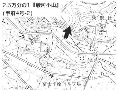
Original Japanese lettering
2.5万分の1『駿河小山』(甲府4号-2);柴怒田;富士平原ゴルフ場;666.3;637;718
English translation
1:25,000 “Suruga-Oyama” (Kofu sheet 4-2); Shibanta; Fuji-Heigen golf course; 666.3; 637; 718.
p257_452.png
PDF 257 · Original p. 240
Continuous section of Y-97–130 tephras at Kamishibanta
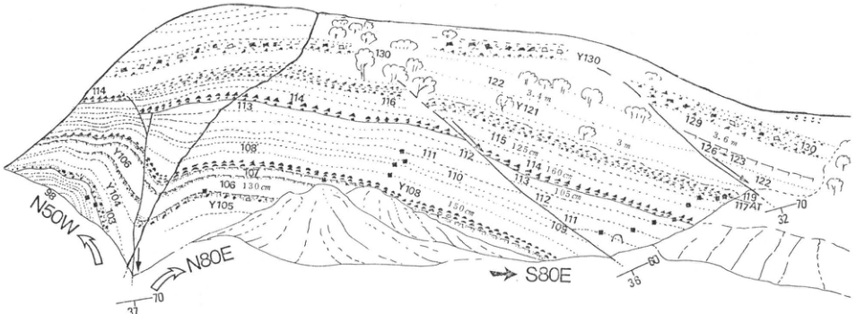
Original Japanese lettering
N50W;N80E;S80E;Y130;Y121;Y105;98;100;103;106 130cm;107;108;108 150cm;109;110;111;112;113;113 105cm;114;114 160cm;115 125cm;116;117AT;119;122;123;126;129;130;3.4m;3m;3.6m;37;70;38;60;32
English translation
N50W; N80E; S80E; Y130; Y121; Y105; 98; 100; 103; 106, 130 cm; 107; 108; 108, 150 cm; 109; 110; 111; 112; 113; 113, 105 cm; 114; 114, 160 cm; 115, 125 cm; 116; 117AT; 119; 122; 123; 126; 129; 130; 3.4 m; 3 m; 3.6 m; 37; 70; 38; 60; 32.
断面の微小数値 — 重なる数字の一部は判読不明。
p258_453.png
PDF 258 · Original p. 241
Suginazawa overview and enlarged black-soil section with location map and prose fragment
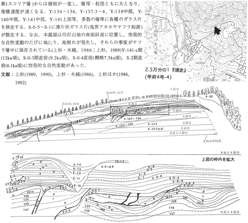
Original Japanese lettering
2.5万分の1『須走』(甲府4号-4);須走馬場;882.0;上図:N60E,20S;N80W,35S;7段目;6段目;5段目;4段目;3段目;2段目;犬走り1段目;方向はN85E;S-25;S15;141;140;137~140;141~137;Y-127~136;Y-123~126;Y-122;Y-121(S1S);下図:犬走り6段目;上図の枠内を拡大;犬走り5段目;S-18;13~14;12;10~11;5~6;7;9;3;4;S-14;S-13;S-12;S-11;S-10;S-5~S-9;S-3~4;S-3;S-2;S-1;S-0-6;S-0-5;S-0-4;S-0-3;S-0-2;S-0-1;141a;141b;141c;141d;140;139;138;137;a;b;c;d。本文断片は本文に復元。
English translation
1:25,000 “Subashiri” (Kofu sheet 4-4); 須走馬場; 882.0; overview: N60E, 20S; N80W, 35S; bench 7; bench 6; bench 5; bench 4; bench 3; bench 2; bench 1; direction N85E; S-25; S15; 141; 140; 137–140; 141–137; Y-127–136; Y-123–126; Y-122; Y-121 (S1S); detail: bench 6; enlargement of the boxed area above; bench 5; S-18; 13–14; 12; 10–11; 5–6; 7; 9; 3; 4; S-14; S-13; S-12; S-11; S-10; S-5–S-9; S-3–4; S-3; S-2; S-1; S-0-6; S-0-5; S-0-4; S-0-3; S-0-2; S-0-1; 141a; 141b; 141c; 141d; 140; 139; 138; 137; a; b; c; d. Embedded prose is restored in the main text.
Y-121(S1S)および微小ラベル — 微小な括弧内文字の読取りは暫定。
p259_454.png
PDF 259 · Original p. 242
Tarobo location map and section of Younger Fuji tephras and Mishima lava, with prose fragment
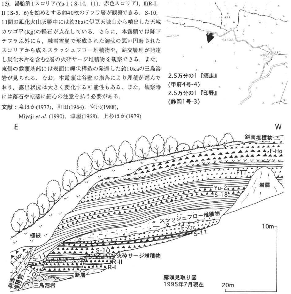
Original Japanese lettering
1414;1547;△1402.4;太郎坊;1282;2.5万分の1『須走』(甲府4号-4);2.5万分の1『印野』(静岡1号-3);E;W;斜面堆積物;F-Ho;FTT;Yu-2;S-18;岩屑;スラッシュフロー堆積物;F-Zn;S-11;植被;S-10;火砕サージ堆積物;R-II;R-I;断層;三島溶岩;露頭見取り図 1995年7月現在;10m;20m。画像中本文・文献は本文に復元。
English translation
1414; 1547; △1402.4; Tarobo; 1282; 1:25,000 “Subashiri” (Kofu sheet 4-4); 1:25,000 “Inno” (Shizuoka sheet 1-3); E; W; slope deposits; F-Ho; FTT; Yu-2; S-18; rock debris; slush-flow deposits; F-Zn; S-11; vegetation cover; S-10; pyroclastic-surge deposits; R-II; R-I; fault; Mishima lava; sketch map of the exposure, as of July 1995; 10 m; 20 m. Embedded prose and references are restored in the main text.
p260_455.png
PDF 260 · Original p. 243
Northern wall of the Myoga trench, event column, and location map, with prose fragment
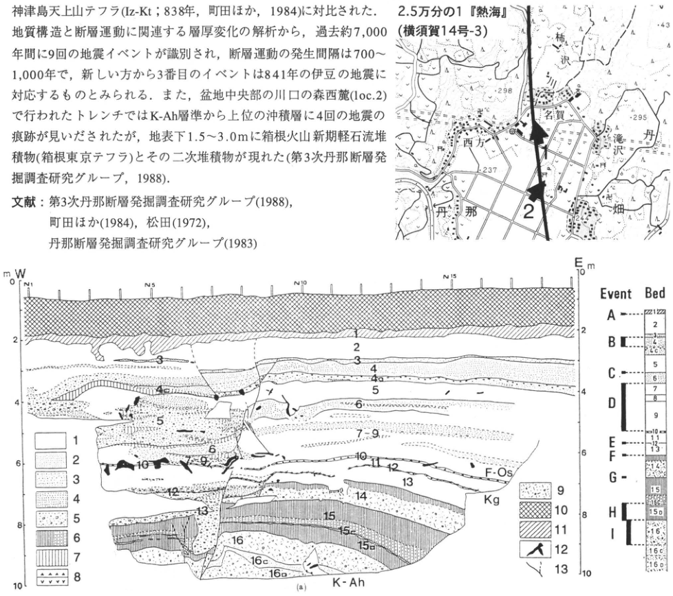
Original Japanese lettering
2.5万分の1『熱海』(横須賀14号-3);柿沢;名賀;西方;滝沢;丹那;畑;1;2;298;295;237;43;W;E;m;0,2,4,6,8,10;N1;N5;N10;N15;地層番号:1,2,3,4,4a,4c,5,6,7,7-9,10,11,12,13,14,15,15a,15b,15c,16,16c,16D;F-Os;Kg;K-Ah;Event Bed;A,B,C,D,E,F,G,H,I;凡例1~13は本文説明。画像中本文・文献は本文に復元。
English translation
1:25,000 “Atami” (Yokosuka sheet 14-3); Kakizawa; Myoga; Nishikata; Takizawa; Tanna; Hata; 1; 2; 298; 295; 237; 43; W; E; m; 0, 2, 4, 6, 8, 10; N1; N5; N10; N15; bed labels 1, 2, 3, 4, 4a, 4c, 5, 6, 7, 7-9, 10, 11, 12, 13, 14, 15, 15a, 15b, 15c, 16, 16c, 16D; F-Os; Kg; K-Ah; Event Bed; A, B, C, D, E, F, G, H, I; legend 1–13 is defined in the main text. Embedded prose and references are restored in the main text.
イベント柱状図の細字部層記号 — 微小ラベルの一部は読み取り困難。
p261_456.png
PDF 261 · Original p. 244
Map of the Akazawa municipal cemetery exposure
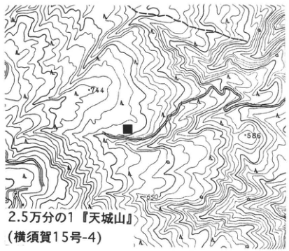
Original Japanese lettering
744;586;650;2.5万分の1『天城山』(横須賀15号-4)
English translation
744; 586; 650; 1:25,000 “Amagiyama” (Yokosuka sheet 15-4).
p261_457.png
PDF 261 · Original p. 244
Tephra–loess stratigraphic column and legend at Akazawa
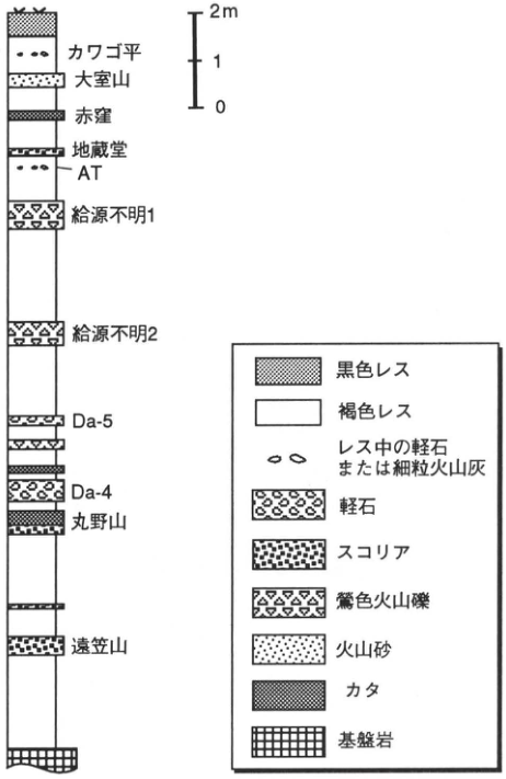
Original Japanese lettering
2m;1;0;カワゴ平;大室山;赤窪;地蔵堂;AT;給源不明1;給源不明2;Da-5;Da-4;丸野山;遠笠山;黒色レス;褐色レス;レス中の軽石または細粒火山灰;軽石;スコリア;鶯色火山礫;火山砂;カタ;基盤岩
English translation
2 m; 1; 0; Kawagodaira; Omuroyama; Akakubo; Jizodo; AT; unknown source 1; unknown source 2; Da-5; Da-4; Maruno-yama; Togasayama; black loess; brown loess; pumice or fine ash in loess; pumice; scoria; olive-colored lapilli; volcanic sand; Kata; basement rock.
p262_458.png
PDF 262 · Original p. 245
Forty-eight-bed Sanmyoji column correlating archaeological soil units, eastern-Fuji tephras, artifacts, and ages
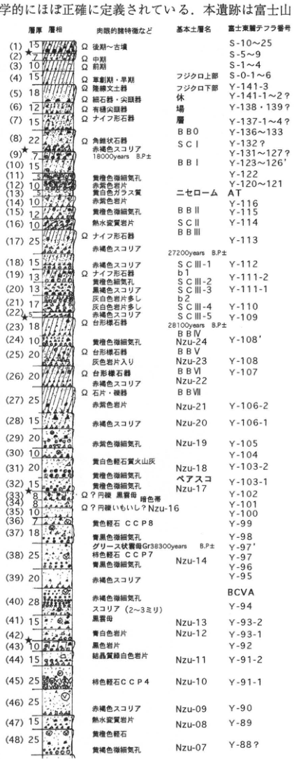
Original Japanese lettering
| 図中番号 | 層厚(単位の印字なし) | 肉眼的諸特徴など | 基本土層名 | 富士東麓テフラ番号 |
|---|---|---|---|---|
| 1 | 15 | Ω 後期~古墳 | — | S-10~25 |
| 2 | 7 | Ω 中期 | — | S-5~9 |
| 3 | 10 | Ω 前期 | — | S-1~4 |
| 4 | 15 | Ω 草創期・早期 | フジクロ上部 | S-0-1~6 |
| 5 | 18 | Ω 隆線文土器 | フジクロ下部 | Y-141-3 |
| 6 | 12 | Ω 細石器・尖頭器 | 休場層 | Y-141-1~2? |
| 7 | 15 | Ω 有樋尖頭器;Ω ナイフ形石器 | 休場層 | Y-138・139?;Y-137-1~4? |
| 8 | 22 | Ω 角錐状石器;赤褐色スコリア | BB0;SC I | Y-136~133;Y-132? |
| 9★ | 7 | 18000 years B.P. ± | — | Y-131~127? |
| 10 | 15 | — | BB I | Y-123~126′ |
| 11 | 5 | 黄橙色微細気孔 | — | Y-122 |
| 12 | 10 | 赤紫色岩片 | — | Y-120~121 |
| 13 | 10 | 黄白色ガラス質 | ニセローム | AT |
| 14 | 10 | 赤紫色岩片 | — | Y-116 |
| 15 | 12 | 黄橙色微細気孔 | BB II | Y-115 |
| 16 | 10 | 熱水変質岩片 | SC II;BB III | Y-114 |
| 17 | 25 | Ω ナイフ形石器;赤褐色スコリア;27200 years B.P. ± | BB III | Y-113 |
| 18 | 15 | 赤褐色スコリア | SC III-1 | Y-112 |
| 19 | 13 | Ω ナイフ形石器;黄橙色細気孔 | b1;SC III-2 | Y-111-2 |
| 20 | 13 | 黒褐色スコリア;灰白色岩片多し | SC III-3 | Y-111-1 |
| 21 | 17 | 灰白色岩片多し | b2;SC III-4 | Y-110 |
| 22★ | 5 | 赤褐色スコリア | SC III-5 | Y-109 |
| 23 | 18 | Ω 台形様石器;28100 years B.P. ± | BB IV | — |
| 24 | 10 | 黄橙色微細気孔 | Nzu-24 | Y-108′ |
| 25 | 20 | Ω 台形様石器;灰色岩片入り | BB V;Nzu-23 | Y-108 |
| 26 | 20 | Ω 台形様石器;赤褐色スコリア | BB VI;Nzu-22 | Y-107 |
| 27 | 25 | Ω 石片・礫器;赤紫色岩片 | BB VII;Nzu-21 | Y-106-2 |
| 28 | 15 | 赤褐色スコリア | Nzu-20 | Y-106-1 |
| 29 | 20 | 赤褐色微細気孔 | Nzu-19 | Y-105 |
| 30 | 10 | 黄白色軽石質火山灰 | — | Y-104 |
| 31 | 20 | 黄橙色微細気孔 | Nzu-18 | Y-103-2 |
| 32 | 15 | 黄橙色微細気孔 | ペアスコ;Nzu-17 | Y-103-1 |
| 33★ | 8 | Ω? 円礫;黒雲母;暗色帯 | — | Y-102 |
| 34 | 8 | Ω? 円礫いもいし? | Nzu-16 | Y-101 |
| 35 | 10 | — | Nzu-16 | Y-100 |
| 36 | 7 | 黄色軽石 CCP8 | — | Y-99 |
| 37 | 18 | 青黒色微細気孔 | — | Y-98 |
| 38 | 25 | グリース状雲母Gr;38300 years B.P. ±;柿色軽石 CCP7;青黒色微細気孔 | Nzu-14 | Y-97′;Y-97;Y-96 |
| 39 | 20 | 赤褐色スコリア | — | Y-95 |
| 39–40間 | — | — | — | BCVA |
| 40 | 28 | 赤褐色微細気孔;スコリア(2~3ミリ) | — | Y-94 |
| 41 | 15 | 黒雲母 | Nzu-13 | Y-93-2 |
| 42★ | — | 青白色岩片 | Nzu-12 | Y-93-1 |
| 43 | 10 | 黒色岩片 | — | Y-92 |
| 44 | 15 | 結晶質緑白色岩片 | Nzu-11 | Y-91-2 |
| 45 | 25 | 柿色軽石 CCP4 | Nzu-10 | Y-91-1 |
| 46 | 25 | 赤褐色スコリア | Nzu-09 | Y-90 |
| 47 | 15 | 熱水変質岩片 | Nzu-08 | Y-89 |
| 48 | 25 | 黄褐色軽石;黄橙色微細気孔 | Nzu-07 | Y-88? |
層相は柱状図の模様で表示.Ωは遺物.★は(9)(22)(33)(42)に付される.
English translation
| Diagram number | Thickness (unit unprinted) | Macroscopic characteristics, etc. | Basic soil-unit name | Tephra number, eastern foot of Fuji |
|---|---|---|---|---|
| 1 | 15 | Ω Late Jomon–Kofun | — | S-10–25 |
| 2 | 7 | Ω Middle Jomon | — | S-5–9 |
| 3 | 10 | Ω Early Jomon | — | S-1–4 |
| 4 | 15 | Ω Incipient and Initial Jomon | upper Fujikuro | S-0-1–6 |
| 5 | 18 | Ω ridged-pattern pottery | lower Fujikuro | Y-141-3 |
| 6 | 12 | Ω microliths and points | Yasumiba bed | Y-141-1–2? |
| 7 | 15 | Ω fluted points; Ω knife-shaped stone implements | Yasumiba bed | Y-138・139?; Y-137-1–4? |
| 8 | 22 | Ω pyramidal stone implements; reddish-brown scoria | BB0; SC I | Y-136–133; Y-132? |
| 9★ | 7 | 18000 years B.P. ± | — | Y-131–127? |
| 10 | 15 | — | BB I | Y-123–126′ |
| 11 | 5 | yellow-orange, very fine vesicles | — | Y-122 |
| 12 | 10 | reddish-purple lithic fragments | — | Y-120–121 |
| 13 | 10 | yellowish-white glassy material | Nise Loam | AT |
| 14 | 10 | reddish-purple lithic fragments | — | Y-116 |
| 15 | 12 | yellow-orange, very fine vesicles | BB II | Y-115 |
| 16 | 10 | hydrothermally altered lithic fragments | SC II; BB III | Y-114 |
| 17 | 25 | Ω knife-shaped stone implements; reddish-brown scoria; 27200 years B.P. ± | BB III | Y-113 |
| 18 | 15 | reddish-brown scoria | SC III-1 | Y-112 |
| 19 | 13 | Ω knife-shaped stone implements; yellow-orange, fine vesicles | b1; SC III-2 | Y-111-2 |
| 20 | 13 | blackish-brown scoria; abundant grayish-white lithic fragments | SC III-3 | Y-111-1 |
| 21 | 17 | abundant grayish-white lithic fragments | b2; SC III-4 | Y-110 |
| 22★ | 5 | reddish-brown scoria | SC III-5 | Y-109 |
| 23 | 18 | Ω trapezoidal stone implements; 28100 years B.P. ± | BB IV | — |
| 24 | 10 | yellow-orange, very fine vesicles | Nzu-24 | Y-108′ |
| 25 | 20 | Ω trapezoidal stone implements; containing gray lithic fragments | BB V; Nzu-23 | Y-108 |
| 26 | 20 | Ω trapezoidal stone implements; reddish-brown scoria | BB VI; Nzu-22 | Y-107 |
| 27 | 25 | Ω stone flakes and pebble tools; reddish-purple lithic fragments | BB VII; Nzu-21 | Y-106-2 |
| 28 | 15 | reddish-brown scoria | Nzu-20 | Y-106-1 |
| 29 | 20 | reddish-brown, very fine vesicles | Nzu-19 | Y-105 |
| 30 | 10 | yellowish-white pumiceous ash | — | Y-104 |
| 31 | 20 | yellow-orange, very fine vesicles | Nzu-18 | Y-103-2 |
| 32 | 15 | yellow-orange, very fine vesicles | paired scoria; Nzu-17 | Y-103-1 |
| 33★ | 8 | Ω? rounded pebbles; biotite; dark band | — | Y-102 |
| 34 | 8 | Ω? rounded pebbles, imoishi? | Nzu-16 | Y-101 |
| 35 | 10 | — | Nzu-16 | Y-100 |
| 36 | 7 | yellow pumice CCP8 | — | Y-99 |
| 37 | 18 | bluish-black, very fine vesicles | — | Y-98 |
| 38 | 25 | greasy mica-bearing ash Gr; 38300 years B.P. ±; persimmon-colored pumice CCP7; bluish-black, very fine vesicles | Nzu-14 | Y-97′; Y-97; Y-96 |
| 39 | 20 | reddish-brown scoria | — | Y-95 |
| 39–40間 | — | — | — | BCVA |
| 40 | 28 | reddish-brown, very fine vesicles; scoria (2–3 mm) | — | Y-94 |
| 41 | 15 | biotite | Nzu-13 | Y-93-2 |
| 42★ | — | bluish-white lithic fragments | Nzu-12 | Y-93-1 |
| 43 | 10 | black lithic fragments | — | Y-92 |
| 44 | 15 | crystalline greenish-white lithic fragments | Nzu-11 | Y-91-2 |
| 45 | 25 | persimmon-colored pumice CCP4 | Nzu-10 | Y-91-1 |
| 46 | 25 | reddish-brown scoria | Nzu-09 | Y-90 |
| 47 | 15 | hydrothermally altered lithic fragments | Nzu-08 | Y-89 |
| 48 | 25 | yellowish-brown pumice; yellow-orange, very fine vesicles | Nzu-07 | Y-88? |
Lithofacies are shown by column patterns. Ω denotes artifacts. Stars mark (9), (22), (33), and (42).
図の行間に配置された休場層・BB0・SC I・b1・b2など — 連続する名称や一部境界線は層厚番号の区切りと一致しない。表では該当する近傍行へ順序を保って配置し、厳密な境界は原図を参照。
年代値後の± — 原図は誤差数値を記さず±のみ印字。補完しない。
p262_459.png
PDF 262 · Original p. 245
Topographic locality map around Kitaobayashi, Minamiobayashi, and Kadoike, showing the Sanmyoji site
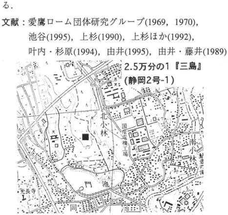
Original Japanese lettering
2.5万分の1『三島』(静岡2号-1);北小林;南小林;光長寺;門池;岡;東海道新幹線;66.0;64.7;25;■(地点)。上の文献・文末断片は本文に収録。
English translation
1:25,000 Mishima (Shizuoka sheet 2-1); Kitaobayashi (北小林); Minamiobayashi (南小林); Kochoji (光長寺); Kadoike (門池); Oka (岡); Tokaido Shinkansen; 66.0; 64.7; 25; solid square (site). The references and sentence fragment above the map are retained in the main text.
その他の極小の地図文字 — 解像度不足で確実に読めない。
p263_461.png
PDF 263 · Original p. 246
Location map of the On-Pm1 exposure south of Shizuoka University
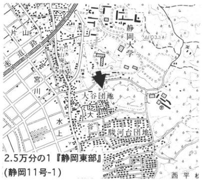
Original Japanese lettering
静岡大学;宮川;大谷団地;大谷;水上;駿河台団地;西平松;103.3;93;2.5万分の1『静岡東部』(静岡11号-1)
English translation
Shizuoka University; Miyagawa; Oya housing estate; Oya; Mizukami; Surugadai housing estate; Nishi-Hiramatsu; 103.3; 93; 1:25,000 “Eastern Shizuoka” (Shizuoka sheet 11-1).
p263_462.png
PDF 263 · Original p. 246
Sketch of the On-Pm1 exposure behind Showa Foundation Construction as of 1986
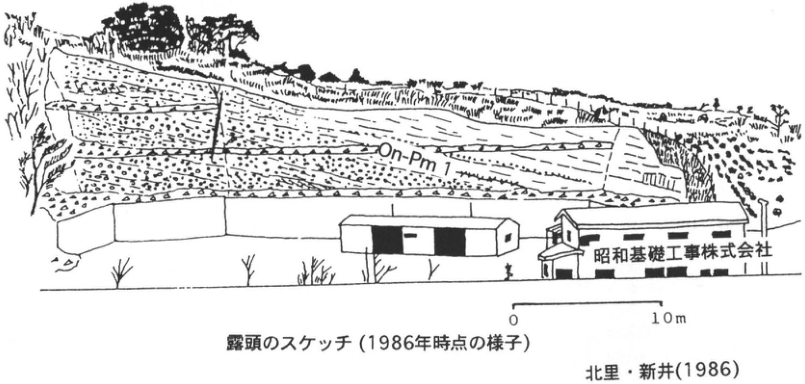
Original Japanese lettering
On-Pm1;昭和基礎工事株式会社;0;10m;露頭のスケッチ(1986年時点の様子);北里・新井(1986)
English translation
On-Pm1; Showa Foundation Construction Co., Ltd.; 0; 10 m; sketch of the exposure (conditions in 1986); 北里・新井 (1986).
p264_463.png
PDF 264 · Original p. 247
Map of the Ng-2 exposure northwest of Negoya
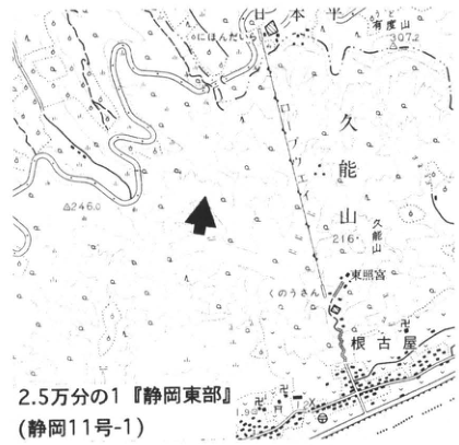
Original Japanese lettering
日本平;有度山;307.2;久能山;216;根古屋;東照宮;246.0;きさんじ;2.5万分の1『静岡東部』(静岡11号-1)
English translation
Nihondaira; Udoyama; 307.2; Kunozan; 216; Negoya; Toshogu; 246.0; きさんじ; 1:25,000 “Eastern Shizuoka” (Shizuoka sheet 11-1).
p264_464.png
PDF 264 · Original p. 247
Exposure of the upper and lower Ng-2 ash beds
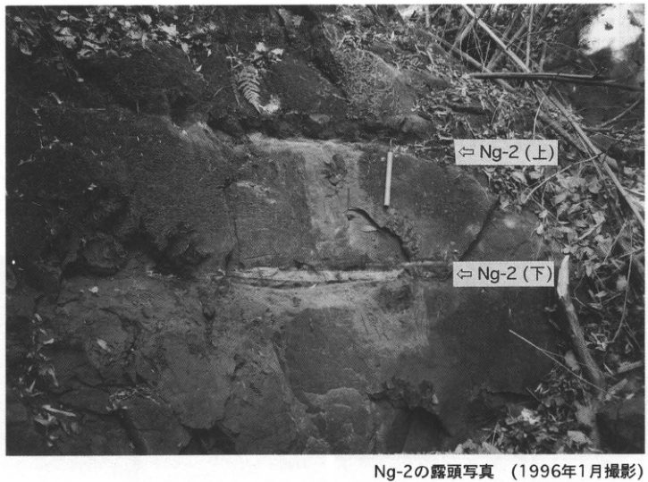
Original Japanese lettering
⇐Ng-2(上);⇐Ng-2(下);Ng-2の露頭写真(1996年1月撮影)
English translation
⇐ Ng-2 (upper); ⇐ Ng-2 (lower); photograph of the Ng-2 exposure (January 1996).
p265_465.png
PDF 265 · Original p. 248
Columnar sections, location map, and photographs of Ka-1 and Ka-2
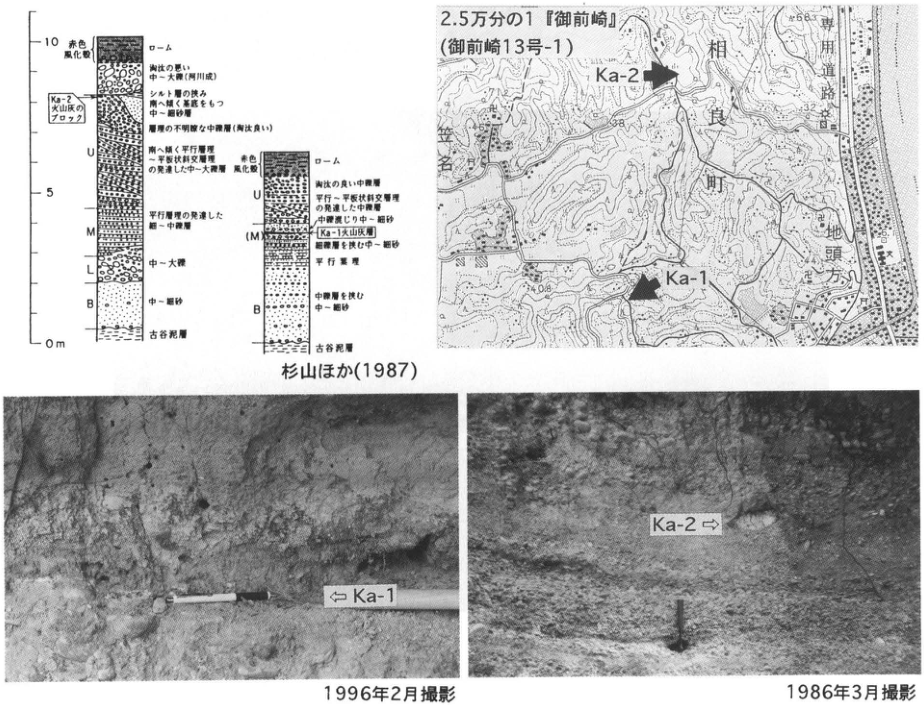
Original Japanese lettering
0m;5;10;赤色風化殻;ローム;淘汰の悪い中~大礫(河川成);Ka-2火山灰のブロック;シルト層の挟み;南へ緩く傾斜をもつ中~細砂層;礫質の不明瞭な中礫層(淘汰良い);U:南へ緩く平行層理~平板状斜交層理の発達した中~大礫層;M:平行層理の発達した細~中礫層;L:中~大礫;B:中~細砂;古谷泥層;右柱:淘汰の良い中礫層;平行~平板状斜交層理の発達した中礫層;中礫混じり中~細砂;Ka-1火山灰層;細礫層を挟む中~細砂;平行層理;中礫層を挟む中~細砂;古谷泥層;杉山ほか(1987);2.5万分の1『御前崎』(御前崎13号-1);相良町;地頭方;専用道路;Ka-2;Ka-1;38;32;25;108;63;⇐Ka-1;Ka-2⇒;1996年2月撮影;1986年3月撮影
English translation
0 m; 5; 10; red weathering crust; loam; poorly sorted pebble-to-cobble gravel (fluvial); block of Ka-2 ash; silt interbed; gently south-dipping medium- to fine-sand beds; indistinct gravelly pebble bed (well sorted); U: gently south-dipping pebble-to-cobble beds with parallel to planar cross-stratification; M: granule-to-pebble bed with parallel stratification; L: pebble-to-cobble gravel; B: medium to fine sand; Furuya Mud; right column: well-sorted pebble bed; pebble bed with parallel to planar cross-stratification; pebble-bearing medium to fine sand; Ka-1 ash bed; medium to fine sand with granule beds; parallel stratification; medium to fine sand with pebble beds; Furuya Mud; 杉山 et al. (1987); 1:25,000 “Omaezaki” (Omaezaki sheet 13-1); Sagara Town; Jitogata; dedicated road; Ka-2; Ka-1; 38; 32; 25; 108; 63; ⇐ Ka-1; Ka-2 ⇒; photographed February 1996; photographed March 1986.
柱状図の微小岩相文字 — 一部の字が粗く、最小限の判読不明が残る。
p266_466.png
PDF 266 · Original p. 249
Location maps, Ha-3 site sketch, and photograph of Ha-6 and Ha-7
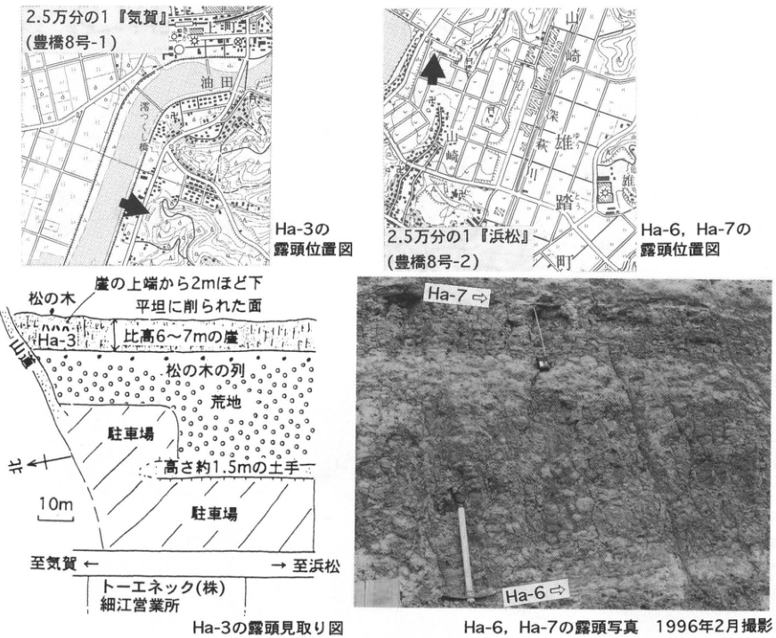
Original Japanese lettering
2.5万分の1『気賀』(豊橋8号-1);油田;澪つくし橋;Ha-3の露頭位置図;2.5万分の1『浜松』(豊橋8号-2);山崎;梵杭川;雄踏町;Ha-6,Ha-7の露頭位置図;松の木;崖の上端から2mほど下;平坦に削られた面;Ha-3;比高6~7mの崖;松の木の列;荒地;駐車場;高さ約1.5mの土手;北←;10m;至気賀←;→至浜松;トーエネック(株)細江営業所;Ha-3の露頭見取り図;Ha-7⇒;Ha-6⇒;Ha-6,Ha-7の露頭写真 1996年2月撮影
English translation
1:25,000 “Kiga” (Toyohashi sheet 8-1); Yuden; Miotsukushi Bridge; Ha-3 location map; 1:25,000 “Hamamatsu” (Toyohashi sheet 8-2); Yamazaki; 梵杭川; Yuto Town; Ha-6/Ha-7 location map; pine tree; approximately 2 m below cliff top; leveled surface; Ha-3; cliff 6–7 m high; row of pine trees; waste ground; parking lot; bank approximately 1.5 m high; north ←; 10 m; toward Kiga ←; → toward Hamamatsu; Toeneck Co., Ltd., Hosoe office; Ha-3 exposure sketch; Ha-7 ⇒; Ha-6 ⇒; Ha-6/Ha-7 exposure photograph, February 1996.
p267_467.png
PDF 267 · Original p. 250
Map of Akakabe at Murododaira and the Tateyama area
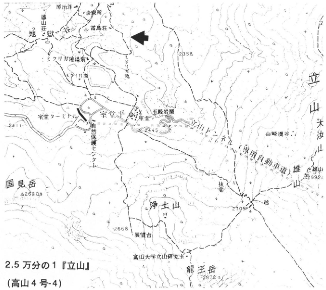
Original Japanese lettering
2.5万分の1『立山』(高山4号-4);地獄谷;雷鳥荘;立山荘宿;雷鳥沢;みくりが池温泉;室堂ターミナル;室堂平;玉殿岩屋;浄土山;山崎圏谷;立山;大汝山;雄山;国見岳;龍王岳;富山大学立山研究室;自然保護センター;2345;2358;2628;2668;2705;2872;2992
English translation
1:25,000 “Tateyama” (Takayama sheet 4-4); Jigokudani; Raichoso; 立山荘宿; Raichozawa; Mikurigaike hot spring; Murodo terminal; Murododaira; Tamadono Iwaya; Jodosan; Yamazaki cirque; Tateyama; Onanjiyama; Oyama; Kunimidake; Ryuo-dake; Toyama University Tateyama research station; nature conservation center; 2345; 2358; 2628; 2668; 2705; 2872; 2992.
立山荘宿等の微小地図文字 — 一部の文字は原解像度でも判読しにくい。
p268_468.png
PDF 268 · Original p. 251
General section of glacial deposits, Tamadono lava, and Raichodai Sand and Gravel at Akakabe
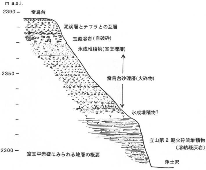
Original Japanese lettering
m a.s.l.;2390;2350;2300;雷鳥台;泥炭層とテフラとの互層;玉殿溶岩(自破砕);氷成堆積物(室堂礫層);雷鳥台砂礫層(火砕物);氷成堆積物?;立山第2期火砕流堆積物(溶結凝灰岩);浄土沢;室堂平赤壁にみられる地層の概要
English translation
m a.s.l.; 2390; 2350; 2300; Raichodai; alternating peat and tephra; Tamadono lava (autobrecciated); glacial deposits (Murodo Gravel); Raichodai Sand and Gravel (pyroclastic material); glacial deposits?; Tateyama stage-2 pyroclastic-flow deposits (welded tuff); Jodozawa; outline of strata at Akakabe, Murododaira.
p268_469.png
PDF 268 · Original p. 251
Photograph of autobrecciated lava, pyroclastic deposits, and welded tuff at Akakabe
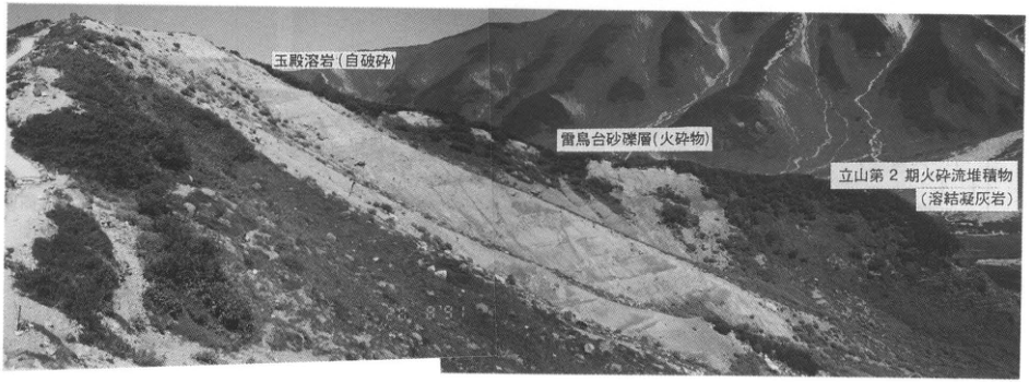
Original Japanese lettering
玉殿溶岩(自破砕);雷鳥台砂礫層(火砕物);立山第2期火砕流堆積物(溶結凝灰岩)
English translation
Tamadono lava (autobrecciated); Raichodai Sand and Gravel (pyroclastic material); Tateyama stage-2 pyroclastic-flow deposits (welded tuff).
p269_470.png
PDF 269 · Original p. 252
Photograph, schematic diagram, and location map of the large Magawa exposure of the Atotsugawa Fault
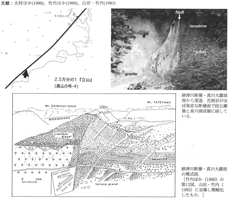
Original Japanese lettering
水力取入口;1348;1230;1091;2.5万分の1『立山』(高山9号-4);fault;lacustrine;gravel;granite;road;Mt. DAINICHI-DAKE;MIDAGAHARA;Mt. TATEYAMA;1230m;27.3ka(¹⁴C);terrace gravel;lacustrine;0;10m;Just contact N50°E80°S;fault striation pitch 30°
English translation
Hydropower intake; 1348; 1230; 1091; 1:25,000 “Tateyama” (Takayama sheet 9-4); fault; lacustrine; gravel; granite; road; Mt. DAINICHI-DAKE; MIDAGAHARA; Mt. TATEYAMA; 1230 m; 27.3 ka (¹⁴C); terrace gravel; lacustrine; 0; 10 m; Just contact N50°E80°S; fault striation pitch 30°.
p270_471.png
PDF 270 · Original p. 253
Map locating the Uji shell bed, SK exposure, and diatomite quarry
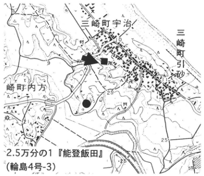
Original Japanese lettering
2.5万分の1『能登飯田』(輪島4号-3);三崎町宇治;三崎町引砂;箭田;25;■;●;矢印。
English translation
1:25,000 Noto-Iida (Wajima sheet 4-3); Uji, Misaki-machi; Hikisuna (引砂), Misaki-machi; 箭田 (name reading unverified); 25; solid square; solid circle; arrow.
その他の極小地図文字 — 解像度不足。
p270_472.png
PDF 270 · Original p. 253
Terrace exposure labeled with the positions of SK, K-Tz, and Aso-4
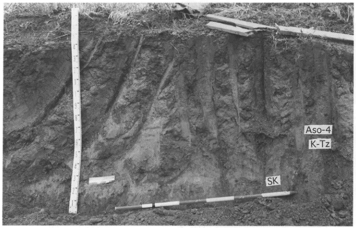
Original Japanese lettering
NE;SW;Aso-4;K-Tz;SK.測尺目盛の数字1~9等。
English translation
NE; SW; Aso-4; K-Tz; SK. Measuring-rod numerals including 1–9.
p271_473.png
PDF 271 · Original p. 254
Map locating the Midagahara peat exposure on Hakusan
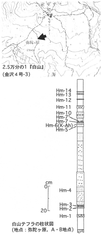
Original Japanese lettering
2.5万分の1『白山』(金沢4号-3);弥陀ヶ原;2448;2345;矢印。
English translation
1:25,000 Hakusan (Kanazawa sheet 4-3); Midagahara; 2448; 2345; arrow.
その他の極小文字 — 解像度不足。
p271_474.png
PDF 271 · Original p. 254
Peat-exposure photograph and Hakusan tephra column, Hm-1 through Hm-14
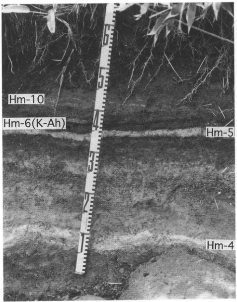
Original Japanese lettering
写真:Hm-10,Hm-6(K-Ah),Hm-5,Hm-4.柱状図(上から):Hm-14,Hm-13,Hm-12,Hm-11,Hm-10,Hm-7′,Hm-7,Hm-6(K-Ah),Hm-5,Hm-4,Hm-3,Hm-2,Hm-1.尺度cm:0,20.白山テフラの柱状図(地点:弥陀ヶ原,A・B地点).
English translation
Photograph: Hm-10, Hm-6 (K-Ah), Hm-5, Hm-4. Column, top to bottom: Hm-14, Hm-13, Hm-12, Hm-11, Hm-10, Hm-7′, Hm-7, Hm-6 (K-Ah), Hm-5, Hm-4, Hm-3, Hm-2, Hm-1. Scale in cm: 0, 20. Column of Hakusan tephras (locality: Midagahara, sites A and B).
p272_475.png
PDF 272 · Original p. 255
Map locating the coastal Aso-4 exposure at Kurosaki-machi
Original Japanese lettering
2.5万分の1『片山津温泉』(金沢10号-4);2.5万分の1『大聖寺』(金沢11号-3);黒崎町;67.2;23;24.9;50;矢印。
English translation
1:25,000 Katayamazu-Onsen (Kanazawa sheet 10-4); 1:25,000 Daishoji (Kanazawa sheet 11-3); Kurosaki-machi; 67.2; 23; 24.9; 50; arrow.
極小地図文字 — 一部判読不明。
p272_476.png
PDF 272 · Original p. 255
Sea-cliff section through Aso-4-bearing marine beds and old dune sand
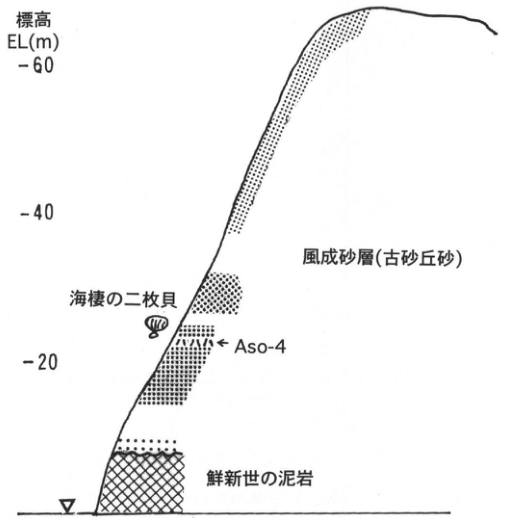
Original Japanese lettering
標高 EL(m):20,40,60.上から:風成砂層(古砂丘砂);海棲の二枚貝;Aso-4;鮮新世の泥岩.
English translation
Elevation EL(m): 20, 40, 60. From top: aeolian sand (old dune sand); marine bivalves; Aso-4; Pliocene mudstone.
p273_477.png
PDF 273 · Original p. 256
Map locating the Osobu Valley pyroclastic-flow cliff and basal conglomerate site
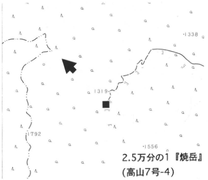
Original Japanese lettering
2.5万分の1『焼岳』(高山7号-4);1338;1319;1792;1556;矢印;■.
English translation
1:25,000 Yakedake (Takayama sheet 7-4); 1338; 1319; 1792; 1556; arrow; solid square.
p273_478.png
PDF 273 · Original p. 256
Column through the Kamitakara pyroclastic-flow deposit, Fukuji Tuff Breccia, and Kiriyama gravel
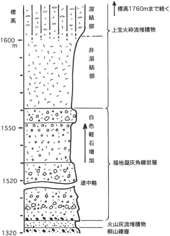
Original Japanese lettering
標高:1600m,1550,1520,1320.標高1760mまで続く.上から:上宝火砕流堆積物(溶結部,非溶結部);福地凝灰角礫岩層(上方へ白色軽石増加;途中略);火山灰流堆積物;桐山礫層.
English translation
Elevation: 1600 m, 1550, 1520, 1320. Continues upward to 1760 m elevation. Top to bottom: Kamitakara pyroclastic-flow deposit (welded and nonwelded zones); Fukuji Tuff Breccia Formation (white pumice increases upward; intervening interval omitted); volcanic-ash-flow deposit; Kiriyama gravel.
p274_479.png
PDF 274 · Original p. 257
Map locating the Kamitakara pyroclastic-flow exposure at 数河, Takayama
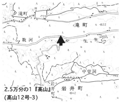
Original Japanese lettering
2.5万分の1『高山』(高山12号-3);滝町;数河;中曽洞;岩井町;岩井;川上;778;822;842;矢印。
English translation
1:25,000 Takayama (Takayama sheet 12-3); Takimachi; 数河 (reading unverified); Nakazobora (中曽洞); Iwai-machi; Iwai; Kawakami; 778; 822; 842; arrow.
固有名の読み・極小文字 — 未確認の地名は日本語併記。
p274_480.png
PDF 274 · Original p. 257
Exposure photograph of the Kamitakara pyroclastic-flow deposit, showing columnar joints and upper flow-unit boundaries
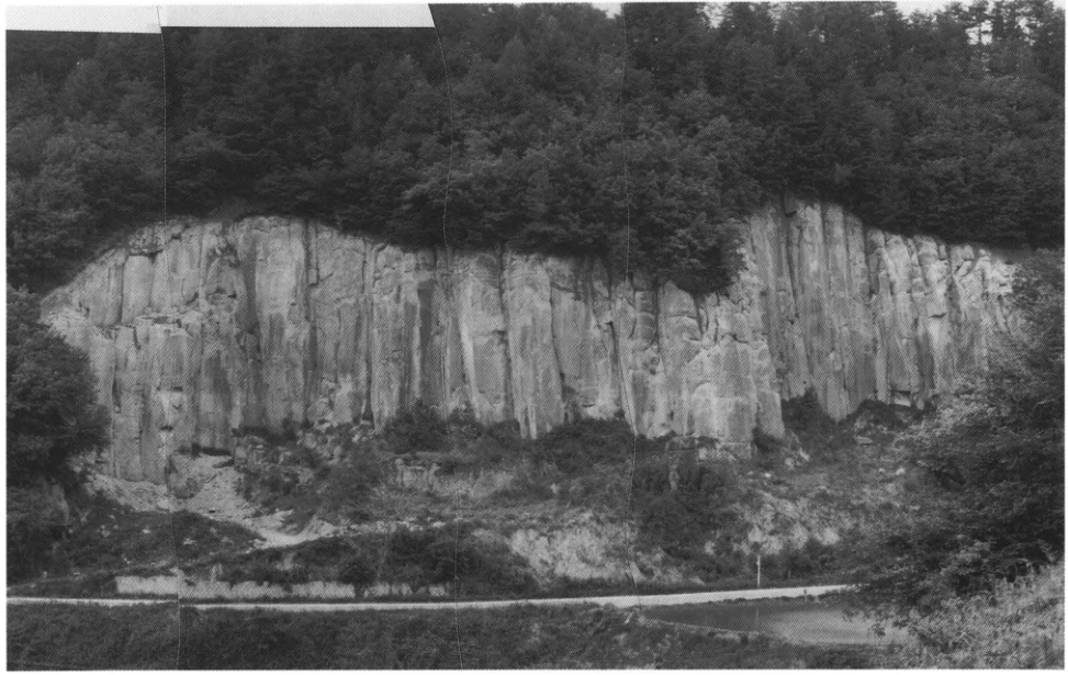
Original Japanese lettering
No lettering
English translation
No lettering
p275_481.png
PDF 275 · Original p. 258
Map locating the pyroclastic-flow exposure in Name-dani (滑谷)
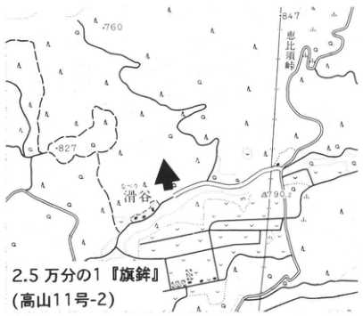
Original Japanese lettering
2.5万分の1『旗鉾』(高山11号-2);滑谷;恵比須峠;760;847;827;790.2;矢印。
English translation
1:25,000 Hatahoko (旗鉾; Takayama sheet 11-2); Name-dani (滑谷); Ebisutoge; 760; 847; 827; 790.2; arrow.
地名の読み — 滑谷・旗鉾は推定読みに日本語を併記。
p275_482.png
PDF 275 · Original p. 258
Exposure showing the transition from nonwelded to welded Ebisutoge pyroclastic deposits
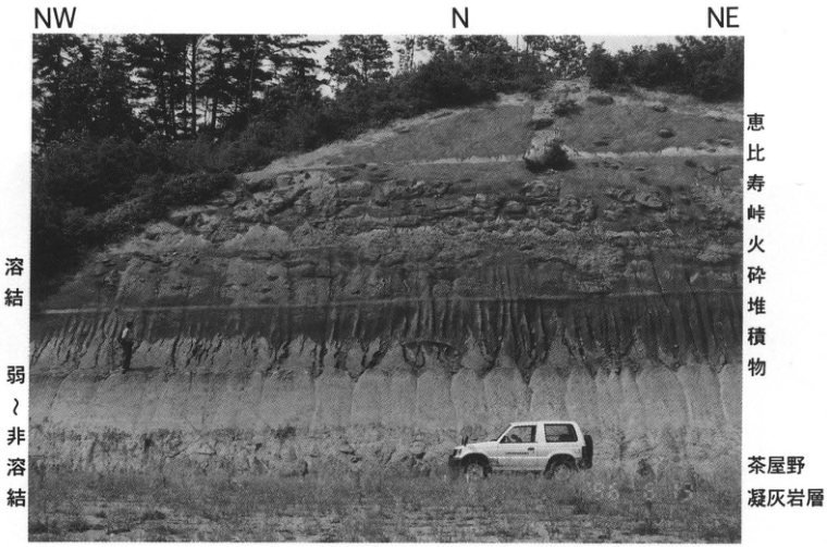
Original Japanese lettering
NW;N;NE;溶結;弱~非溶結;恵比寿峠火砕堆積物;茶屋野凝灰岩層。
English translation
NW; N; NE; welded; weakly welded to nonwelded; Ebisutoge pyroclastic deposit; Chayano Tuff Formation.
p276_483.png
PDF 276 · Original p. 259
Map locating the Nokubi trench and Atotsugawa fault
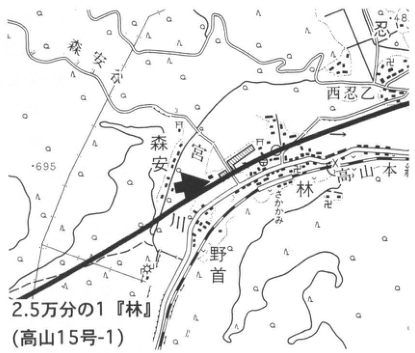
Original Japanese lettering
2.5万分の1『林』(高山15号-1);野首;森安;林;高山本線;宮川;西忍;695;648;矢印。
English translation
1:25,000 Hayashi (Takayama sheet 15-1); Nokubi; Moriyasu; Hayashi; Takayama Main Line; Miyagawa; 西忍 (reading unverified); 695; 648; arrow.
p276_484.png
PDF 276 · Original p. 259
Nokubi west-wall trench log and chronology of ten fault events
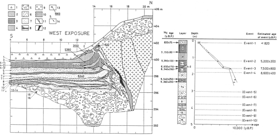
Original Japanese lettering
WEST EXPOSURE;S,N.水平距離4,6,8,10,12,14,16,18,20m;標高392~406m(2m間隔).壁面年代3150,5390,6650,8340.ユニット1,3,4-1,4-2,4-3,5,6,7u,7l,8,9,10,11,12-14,15,16.凡例記号1~14(説明は本文).
| ¹⁴C Age (y.B.P.) | Layer |
|---|---|
| 820±75 | 1 |
| 3,150±90 | 2 |
| 5,390±120 | 3/4-1付近 |
| 6,650±170 | 4-2付近 |
| 8,340±260 | 4-3付近 |
| 9,540±250 | 6 |
| 9,360±290 | 6 |
Depth(m):0,1,2,3,4,5.Event/Estimated age of event (y.B.P.):Event-1 <820;Event-2 5,200±200;Event-3 7,500±800;Event-4 8,600±400;(Event-5)~(Event-10).age:0,10,000(y.B.P.).
English translation
WEST EXPOSURE; S, N. Horizontal distances 4, 6, 8, 10, 12, 14, 16, 18, 20 m; elevations 392–406 m at 2 m intervals. Wall ages: 3150, 5390, 6650, 8340. Units: 1, 3, 4-1, 4-2, 4-3, 5, 6, 7u, 7l, 8, 9, 10, 11, 12-14, 15, 16. Legend symbols 1–14 are explained in the main text.
| ¹⁴C Age (y.B.P.) | Layer |
|---|---|
| 820±75 | 1 |
| 3,150±90 | 2 |
| 5,390±120 | near 3/4-1 |
| 6,650±170 | near 4-2 |
| 8,340±260 | near 4-3 |
| 9,540±250 | 6 |
| 9,360±290 | 6 |
Depth(m): 0, 1, 2, 3, 4, 5. Event / Estimated age of event (y.B.P.): Event-1 <820; Event-2 5,200±200; Event-3 7,500±800; Event-4 8,600±400; (Event-5) through (Event-10). Age axis: 0, 10,000 (y.B.P.).
放射性炭素試料と細かなユニット境界 — 矢印先が境界近くにあるので年代とユニットの厳密な対応は原図参照。
p277_485.png
PDF 277 · Original p. 260
Mitsuishi fault locality map, detailed topography, and northwest-wall trench log
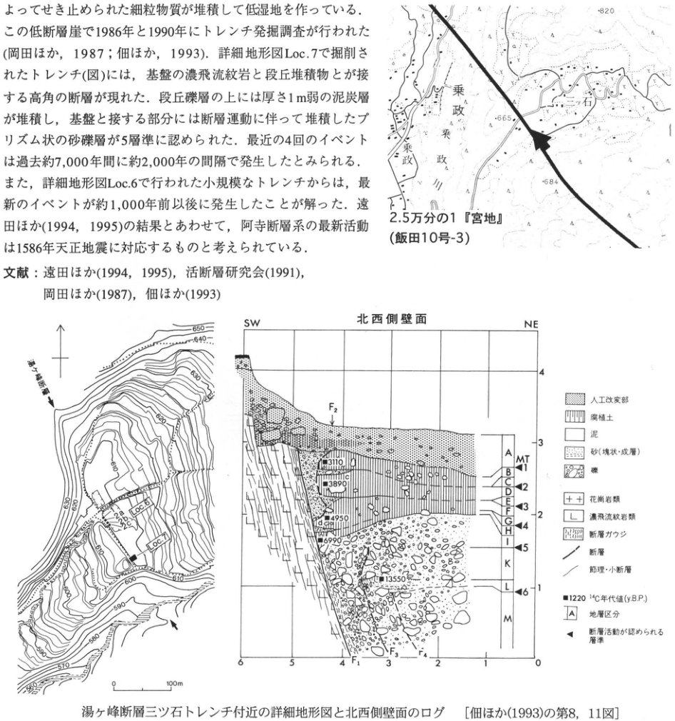
Original Japanese lettering
地図:2.5万分の1『宮地』(飯田10号-3);三ツ石;乗政;乗政川;820;665;684.詳細図:湯ヶ峰断層;Loc.6;Loc.7;28a;28b;28c;等高線550~650(10m間隔);0,100m.北西側壁面:SW,NE;水平0~6;縦1~4;F1,F2,F3,F4;地層A,B,C,D,E,F,G,H,I,K,L,M;MT;イベント1~6.年代:3110,3890,4950,6990,13550.凡例:人工改変部;腐植土;泥;砂(塊状・成層);礫;花崗岩類;濃飛流紋岩類;断層ガウジ;断層;節理・小断層;■1220 ¹⁴C年代値(y.B.P.);A 地層区分;◀ 断層活動が認められる層準.本文・文献断片は本文に収録。
English translation
Map: 1:25,000 Miyaji (Iida sheet 10-3); Mitsuishi; Norimasa; Norimasa River; 820; 665; 684. Detailed map: Yugamine fault; Loc.6; Loc.7; 28a; 28b; 28c; contours 550–650 at 10 m intervals; 0, 100 m. Northwest wall: SW, NE; horizontal 0–6; vertical 1–4; F1, F2, F3, F4; units A, B, C, D, E, F, G, H, I, K, L, M; MT; events 1–6. Ages: 3110, 3890, 4950, 6990, 13550. Legend: artificially modified material; humic soil; mud; sand (massive/stratified); gravel; granitic rocks; Nohi rhyolitic rocks; fault gouge; fault; joint/minor fault; solid square 1220, radiocarbon age (y.B.P.); A, stratigraphic division; left triangle, horizon showing fault activity. Text and reference fragments are retained in the main text.
p278_486.png
PDF 278 · Original p. 261
Umehara fault locality map and west-wall log of the Takada trench
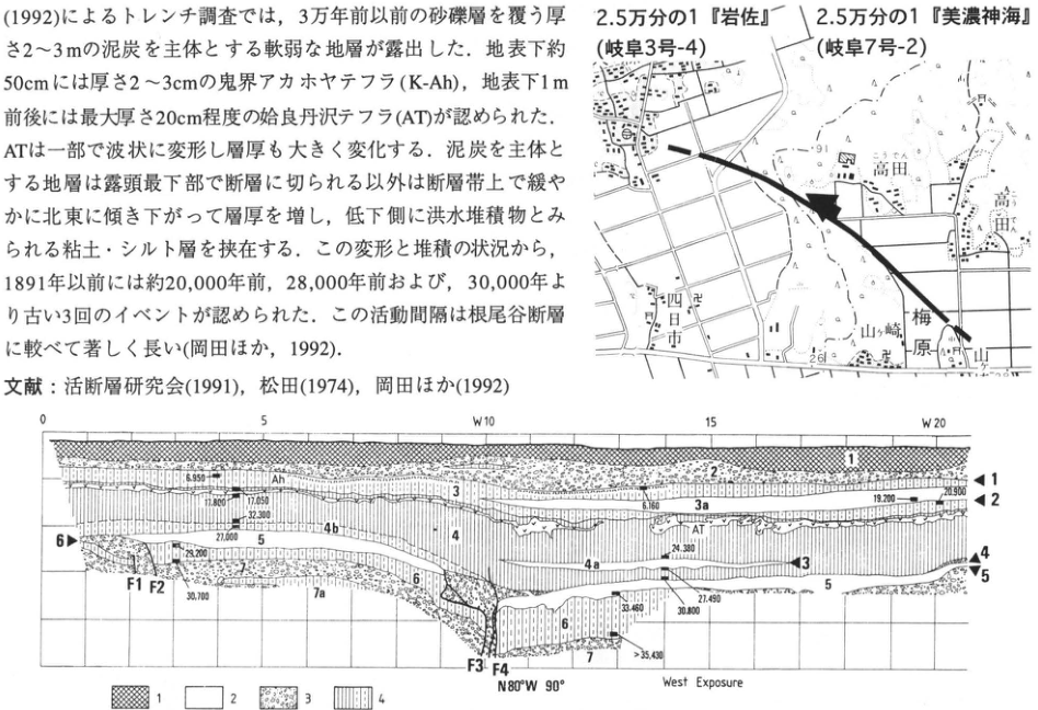
Original Japanese lettering
地図:2.5万分の1『岩佐』(岐阜3号-4);2.5万分の1『美濃神海』(岐阜7号-2);高田;梅原;山崎;四日市;91;26.西壁:West Exposure;N80°W 90°;距離0,5,W10,15,W20;F1,F2,F3,F4;ユニット1,2,3,3a,4,4a,4b,5,6,7,7a;Ah;AT;イベント1~6.年代:6,950;17,800;17,050;32,300;27,000;29,200;30,700;6,160;19,200;20,900;24,380;27,490;30,800;33,460;>35,430.凡例1~9は本文.本文・文献断片も本文に復元。
English translation
Map: 1:25,000 Iwasa (Gifu sheet 3-4); 1:25,000 Mino-Komi (美濃神海; Gifu sheet 7-2); Takada; Umehara; Yamazaki; Yokkaichi; 91; 26. West wall: West Exposure; N80°W 90°; distances 0, 5, W10, 15, W20; F1, F2, F3, F4; units 1, 2, 3, 3a, 4, 4a, 4b, 5, 6, 7, 7a; Ah; AT; events 1–6. Ages: 6,950; 17,800; 17,050; 32,300; 27,000; 29,200; 30,700; 6,160; 19,200; 20,900; 24,380; 27,490; 30,800; 33,460; >35,430. Legend 1–9 is in the main text. Text and reference fragments are restored there.
p278_487.png
PDF 278 · Original p. 261
Takada trench east-wall log, printed upside down
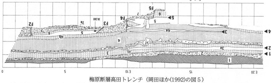
Original Japanese lettering
East Exposure;距離0,5,E10,15,E20;F2,F3,F4,F5;ユニット1,2,3,3a,4,4a,4b,5,6,7,7a;AT;イベント1~5;年代30,300.
English translation
East Exposure; distances 0, 5, E10, 15, E20; F2, F3, F4, F5; units 1, 2, 3, 3a, 4, 4a, 4b, 5, 6, 7, 7a; AT; events 1–5; age 30,300.
p279_488.png
PDF 279 · Original p. 262
At-3 locality map and photograph showing its paired ash beds
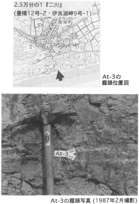
Original Japanese lettering
2.5万分の1『二川』(豊橋12号-2・伊良湖岬9号-1);高塚町;At-3;矢印2本.
English translation
1:25,000 Futagawa (Toyohashi sheet 12-2 / Irago-Misaki sheet 9-1); Takatsuka-machi; At-3; two arrows.
極小地図文字 — 一部判読不明。
p279_489.png
PDF 279 · Original p. 262
Hosoya-machi locality map and roadside-cliff photograph of At-2
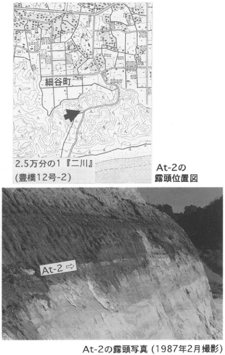
Original Japanese lettering
2.5万分の1『二川』(豊橋12号-2);細谷町;At-2;矢印。
English translation
1:25,000 Futagawa (Toyohashi sheet 12-2); Hosoya-machi; At-2; arrow.
p281_490.png
PDF 281 · Original p. 264
Lake Biwa map locating the Takashima-oki, 200 m, and 1,400 m boreholes
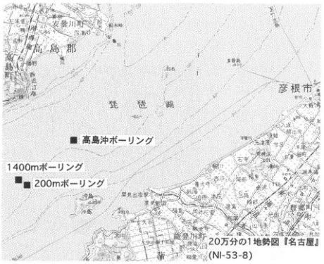
Original Japanese lettering
20万分の1地勢図『名古屋』(NI-53-8);■高島沖ボーリング;■1400mボーリング;■200mボーリング;琵琶湖;高島郡;彦根市;八幡;沖島;65;86.
English translation
1:200,000 Nagoya regional topographic map (NI-53-8); solid squares: Takashima-oki borehole, 1,400 m borehole, 200 m borehole; Lake Biwa; Takashima District; Hikone City; Hachiman; Okishima; 65; 86.
地勢図の極小地名 — 解像度不足により一部判読不明。
p281_491.png
PDF 281 · Original p. 264
Takashima-oki borehole drilling from a vessel on the lake
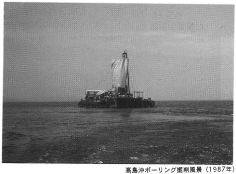
Original Japanese lettering
No lettering
English translation
No lettering
p282_492.png
PDF 282 · Original p. 265
Takashima-oki core: 76 ash horizons, lithologic and sand-content columns, depth–age model, and stratigraphic correlations
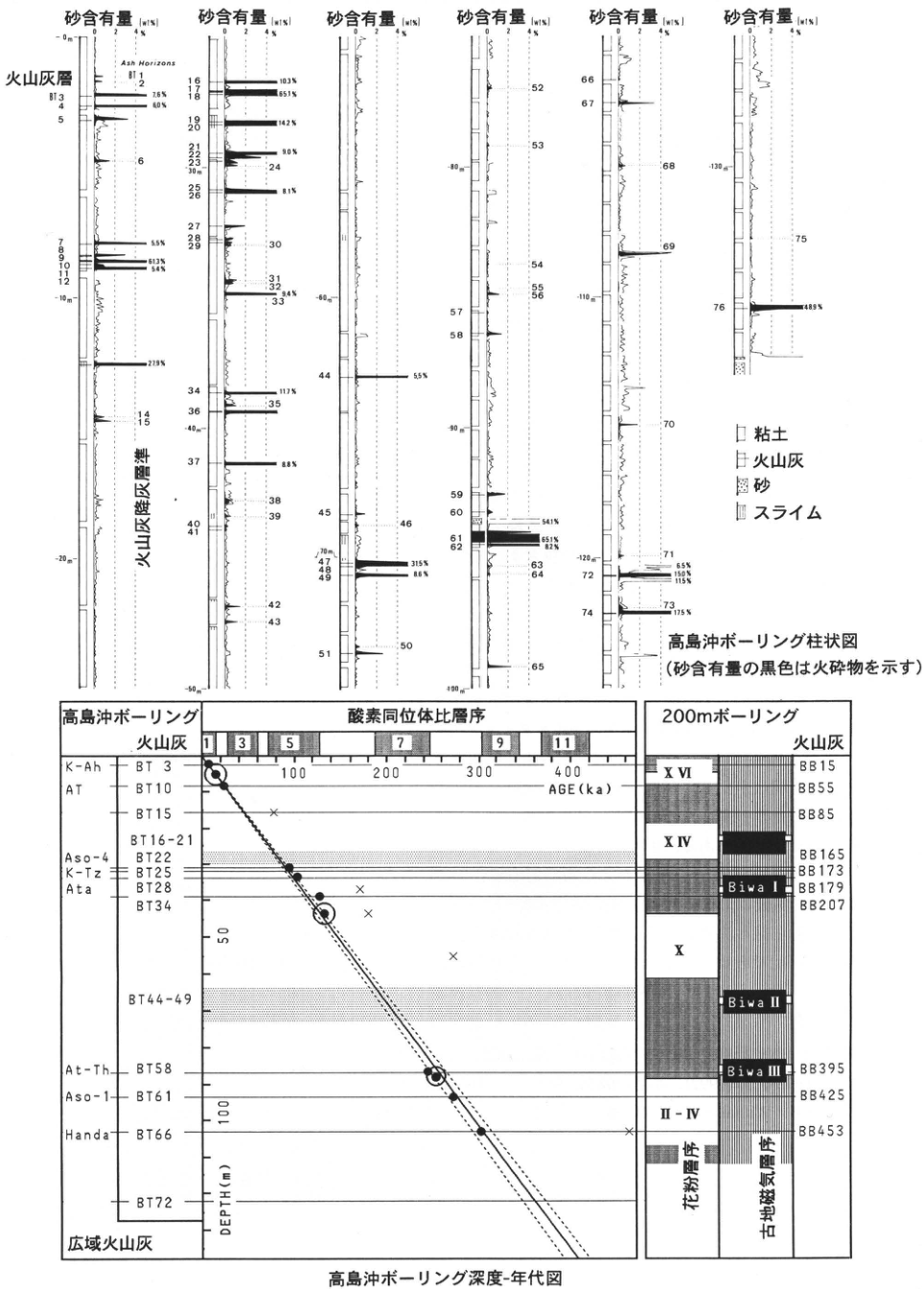
Original Japanese lettering
高島沖ボーリング柱状図(砂含有量の黒色は火砕物を示す).砂含有量(wt%):0,2,4%(6列).火山灰層:BT3,4,5,7,8,9,10,11,12,16,17,18,19,20,21,22,23,25,26,27,28,29,34,36,37,40,41,44,45,47,48,49,51,57,58,59,60,61,62,66,67,71,72,74,76.Ash Horizons:BT1,2,6,14,15,24,30,31,32,33,35,38,39,42,43,46,50,52,53,54,55,56,63,64,65,68,69,70,73,75.火山灰降灰層準.深度目盛:0,−10,−20,−30,−40,−50,−60,−70,−80,−90,−100,−110,−120,−130m.
| 図の含有量注記(上から) | 数値 |
|---|---|
| BT3 | 7.6% |
| BT4 | 6.0% |
| BT7 | 5.5% |
| BT9 | 61.3% |
| BT10 | 5.4% |
| BT12と14の間 | 27.9% |
| BT16~18付近 | 10.3%;65.1% |
| BT19~20付近 | 14.2% |
| BT22~23付近 | 9.0% |
| BT25~26付近 | 8.1% |
| BT32付近 | 9.4% |
| BT34 | 11.7% |
| BT37 | 8.8% |
| BT44 | 5.5% |
| BT47 | 31.5% |
| BT49 | 8.6% |
| BT60直下 | 54.1% |
| BT61 | 65.1% |
| BT62 | 8.2% |
| BT71~72付近 | 6.5%;15.0%;11.5% |
| BT74 | 17.5% |
| BT76 | 48.9% |
凡例:粘土,火山灰,砂,スライム.
高島沖ボーリング深度-年代図.高島沖ボーリング/火山灰/広域火山灰.酸素同位体比層序:1,3,5,7,9,11.AGE(ka):100,200,300,400.DEPTH(m):0,50,100.広域火山灰と番号:K-Ah=BT3,AT=BT10,BT15,BT16-21,Aso-4=BT22,K-Tz=BT25,Ata=BT28,BT34,BT44-49,At-Th=BT58,Aso-1=BT61,Handa=BT66,BT72.200mボーリング/火山灰:BB15,BB55,BB85,BB165,BB173,BB179,BB207,BB395,BB425,BB453.花粉層序:XVI,XIV,X,II–IV.古地磁気層序:Biwa I,Biwa II,Biwa III.
English translation
Takashima-oki borehole column (black areas in the sand-content curves indicate pyroclastic material). Sand content (wt%): 0, 2, 4% in six panels. Ash beds: BT3, 4, 5, 7, 8, 9, 10, 11, 12, 16, 17, 18, 19, 20, 21, 22, 23, 25, 26, 27, 28, 29, 34, 36, 37, 40, 41, 44, 45, 47, 48, 49, 51, 57, 58, 59, 60, 61, 62, 66, 67, 71, 72, 74, 76. Ash-fall horizons (Ash Horizons): BT1, 2, 6, 14, 15, 24, 30, 31, 32, 33, 35, 38, 39, 42, 43, 46, 50, 52, 53, 54, 55, 56, 63, 64, 65, 68, 69, 70, 73, 75. Depth ticks: 0, −10, −20, −30, −40, −50, −60, −70, −80, −90, −100, −110, −120, −130 m.
| Content annotation in diagram (downward) | Value |
|---|---|
| BT3 | 7.6% |
| BT4 | 6.0% |
| BT7 | 5.5% |
| BT9 | 61.3% |
| BT10 | 5.4% |
| Between BT12 and 14 | 27.9% |
| Near BT16–18 | 10.3%; 65.1% |
| Near BT19–20 | 14.2% |
| Near BT22–23 | 9.0% |
| Near BT25–26 | 8.1% |
| Near BT32 | 9.4% |
| BT34 | 11.7% |
| BT37 | 8.8% |
| BT44 | 5.5% |
| BT47 | 31.5% |
| BT49 | 8.6% |
| Immediately below BT60 | 54.1% |
| BT61 | 65.1% |
| BT62 | 8.2% |
| Near BT71–72 | 6.5%; 15.0%; 11.5% |
| BT74 | 17.5% |
| BT76 | 48.9% |
Legend: clay; volcanic ash; sand; slime.
Takashima-oki borehole depth–age diagram. Takashima-oki borehole / volcanic ash / widespread volcanic ash. Oxygen-isotope stratigraphy: 1, 3, 5, 7, 9, 11. AGE (ka): 100, 200, 300, 400. DEPTH (m): 0, 50, 100. Widespread ashes and numbers: K-Ah = BT3; AT = BT10; BT15; BT16-21; Aso-4 = BT22; K-Tz = BT25; Ata = BT28; BT34; BT44-49; At-Th = BT58; Aso-1 = BT61; Handa = BT66; BT72. 200 m borehole / volcanic ash: BB15, BB55, BB85, BB165, BB173, BB179, BB207, BB395, BB425, BB453. Pollen stratigraphy: XVI, XIV, X, II–IV. Paleomagnetic stratigraphy: Biwa I, Biwa II, Biwa III.
含有量注記と隣接する火山灰番号 — 密接したラベル・矢印の厳密な対応が一部曖昧なため近傍番号として記載。BT13番号は図で明瞭でないが27.9%値は保持。
p283_493.png
PDF 283 · Original p. 266
Map of five Kisen River exposures and the paleomagnetic-boundary sampling site
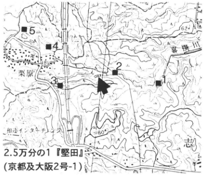
Original Japanese lettering
2.5万分の1『堅田』(京都及大阪2号-1);喜撰川;栗原;和迩タケラ;地点1~5(■);矢印;62;150;180.
English translation
1:25,000 Katata (Kyoto and Osaka sheet 2-1); Kisen River; Kurihara; Wani-Takera (和迩タケラ); sites 1–5 (solid squares); arrow; 62; 150; 180.
極小の地図文字 — 一部判読不明。
p283_494.png
PDF 283 · Original p. 266
Lower Katata Formation column containing Kisen, Biotite I and II, and Kurihara I and II ashes
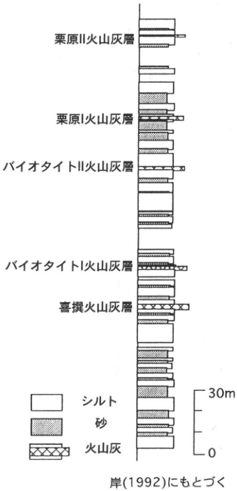
Original Japanese lettering
上から:栗原II火山灰層;栗原I火山灰層;バイオタイトII火山灰層;バイオタイトI火山灰層;喜撰火山灰層.凡例:シルト,砂,火山灰.尺度0~30m.岸(1992)にもとづく.
English translation
Top to bottom: Kurihara II ash; Kurihara I ash; Biotite II ash; Biotite I ash; Kisen ash. Legend: silt; sand; volcanic ash. Scale 0–30 m. Based on 岸 (1992).
p284_495.png
PDF 284 · Original p. 267
Map locating the Kuwahata slope-deposit exposure along the Nakagawa
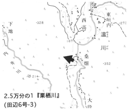
Original Japanese lettering
2.5万分の1『栗栖川』(田辺6号-3);桑畑;中川;東垣内;西高;温川;下地;167;328;273;352;214;矢印。
English translation
1:25,000 Kurisugawa (Tanabe sheet 6-3); Kuwahata; Nakagawa; 東垣内; 西高; Nukugawa (温川); 下地; 167; 328; 273; 352; 214; arrow. Unverified minor place-name readings are retained in Japanese.
p284_496.png
PDF 284 · Original p. 267
Section and photograph of slope and terrace deposits containing AT and K-Ah
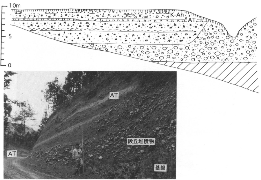
Original Japanese lettering
断面:0,5,10m;K-Ah;AT.写真:AT(2ヶ所);段丘堆積物;基盤。
English translation
Section: 0, 5, 10 m; K-Ah; AT. Photograph: AT at two positions; terrace deposits; basement.
p285_497.png
PDF 285 · Original p. 268
Map locating the high marine terrace exposure at Inji, Iwaoka-machi, Kobe
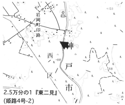
Original Japanese lettering
2.5万分の1『東二見』(姫路4号-2);岩岡町;印路;神戸市;西区;103;91;88(2ヶ所);矢印。
English translation
1:25,000 Higashi-Futami (Himeji sheet 4-2); Iwaoka-machi; Inji (印路); Kobe City; Nishi Ward; 103; 91; 88 at two points; arrow.
p285_498.png
PDF 285 · Original p. 268
Exposure beneath the Meimi I surface showing gravel, coarse sand, marine clay, and sand
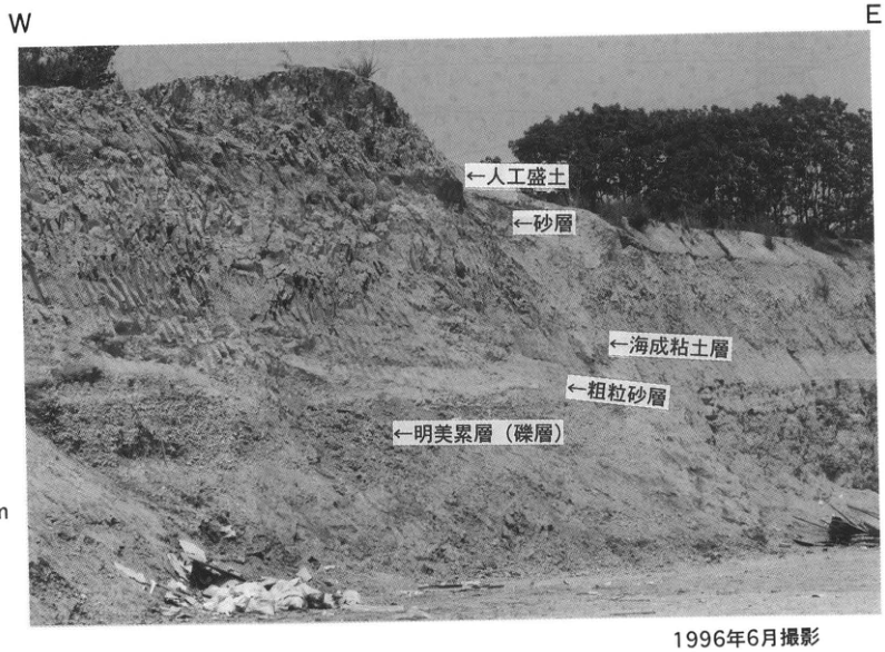
Original Japanese lettering
W;E;1m.上から:人工盛土;砂層;海成粘土層;粗粒砂層;明美累層(礫層).
English translation
W; E; 1 m. Top to bottom: artificial fill; sand; marine clay; coarse sand; Meimi Formation (gravel).
p286_499.png
PDF 286 · Original p. 269
Map locating the Gobodani debris-foot slope exposure
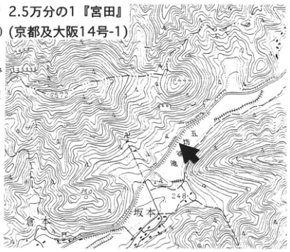
Original Japanese lettering
2.5万分の1『宮田』(京都及大阪14号-1);五坊谷;五坊池;坂本;248;557.2;350;450;矢印。
English translation
1:25,000 Miyata (Kyoto and Osaka sheet 14-1); Gobodani; Gobo Pond; Sakamoto; 248; 557.2; 350; 450; arrow.
p286_500.png
PDF 286 · Original p. 269
Exposure sketch of angular footslope gravel containing AT
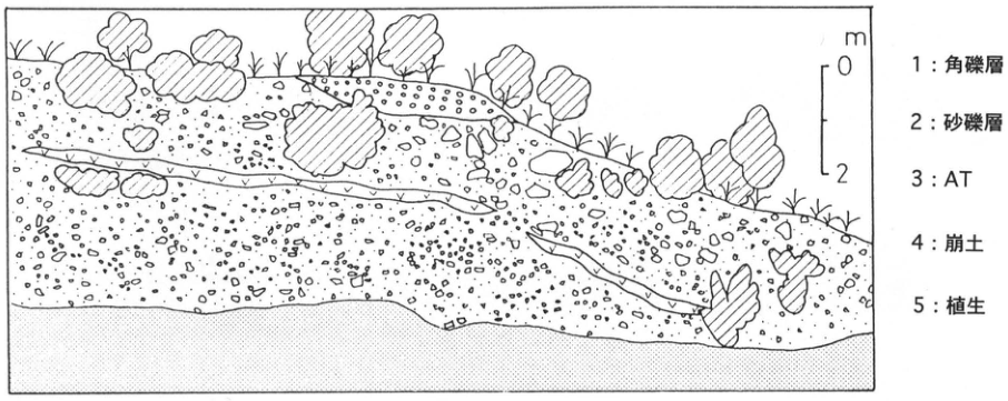
Original Japanese lettering
尺度m:0,2.1:角礫層;2:砂礫層;3:AT;4:崩土;5:植生.
English translation
Scale in m: 0, 2. 1: angular-gravel deposits; 2: sand and gravel; 3: AT; 4: collapsed material; 5: vegetation.
p287_501.png
PDF 287 · Original p. 270
Map locating the Ota Pond block-stream exposure
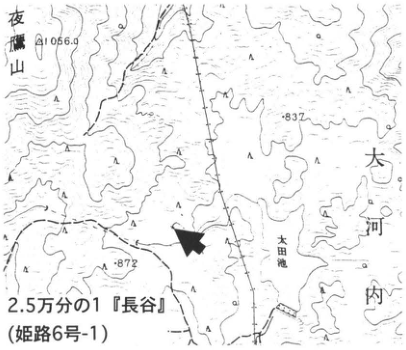
Original Japanese lettering
2.5万分の1『長谷』(姫路6号-1);太田池;大河内;夜鷹山;1056.9;837;872;矢印。
English translation
1:25,000 Hase (姫路6号-1); Ota Pond; Okawachi; Yotakayama (夜鷹山); 1056.9; 837; 872; arrow.
p287_502.png
PDF 287 · Original p. 270
Continuous transverse exposure sketch of a block stream over approximately 95 m
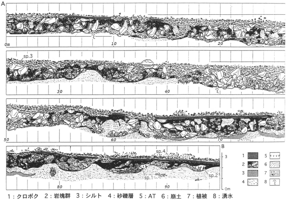
Original Japanese lettering
A,B;水平目盛0m,10,20,30,40,50,60,70,80,90;垂直0m,3;sp.1,sp.2,sp.3,sp.4;凡例1~8(説明は本文).
English translation
A, B; horizontal ticks 0 m, 10, 20, 30, 40, 50, 60, 70, 80, 90; vertical 0 m, 3; sp.1, sp.2, sp.3, sp.4; legend 1–8 (explained in the main text).
p288_503.png
PDF 288 · Original p. 271
Map locating the Nojima fault trench at Nashimoto, Awaji Island
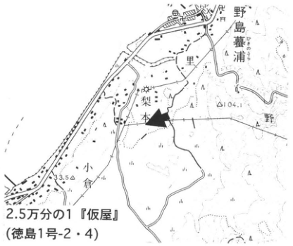
Original Japanese lettering
2.5万分の1『仮屋』(徳島1号-2・4);梨本;里;野島墓浦;向道;小倉;野;104;3.5;矢印。
English translation
1:25,000 Kariya (Tokushima sheet 1-2/4); Nashimoto; Sato; Nojima-Hikinoura (野島墓浦); 向道; Ogura; 野; 104; 3.5; arrow. Minor unverified names retained in Japanese.
p288_504.png
PDF 288 · Original p. 271
Trench-wall photograph showing F1, F2, and deformation and unconformity between BU and BL
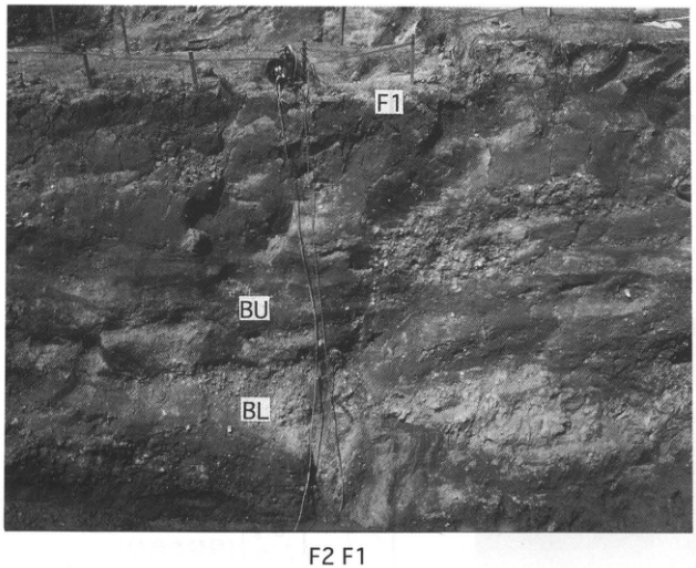
Original Japanese lettering
F1(上部と下部);F2;BU;BL.
English translation
F1 at upper and lower positions; F2; BU; BL.
p288_505.png
PDF 288 · Original p. 271
Another trench-wall photograph of Nojima fault F1 and unit BU
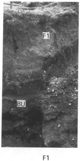
Original Japanese lettering
F1(写真中および下);BU.
English translation
F1 within and below photograph; BU.
p289_506.png
PDF 289 · Original p. 272
Map locating the exposure at Tokiwa-machi on the southern Yamato River bank
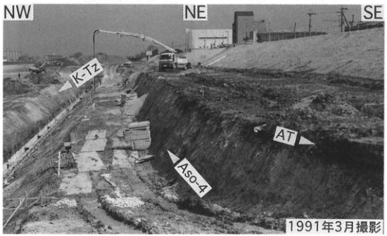
Original Japanese lettering
2.5万分の1『大阪東南部』(和歌山5号-3);堺市;常磐町;大和川;大和川町;杉本町;浅香山駅;北花田町二丁目;9.5;8.9;矢印。
English translation
1:25,000 Osaka-Tonanbu (Wakayama sheet 5-3); Sakai City; Tokiwa-machi; Yamato River; Yamatogawa-machi; Sugimoto-machi; Asakayama Station; Kitahanada-machi 2-chome; 9.5; 8.9; arrow.
多数の極小市街地文字 — 可読範囲を抽出、一部判読不明。
p289_507.png
PDF 289 · Original p. 272
Column of K-Tz, Aso-4, and AT in the Uemachi and Tokiwa formations, with ages
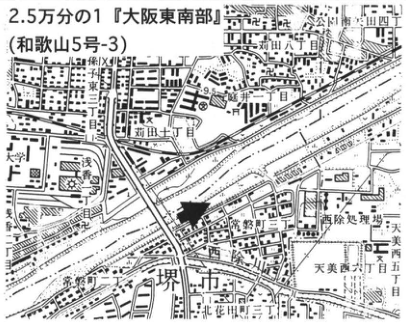
Original Japanese lettering
T.P.(m):0,5,10.地表面;常磐層;AT;23,400±370yr B.P.;不整合面;>44,100yr B.P.;上町層;Aso-4;K-Tz;材;腐植;海成砂層(貝殻を含む).1991年3月記載;小倉ほか(1992)より.
English translation
T.P. (m): 0, 5, 10. Ground surface; Tokiwa Formation; AT; 23,400±370 yr B.P.; unconformity; >44,100 yr B.P.; Uemachi Formation; Aso-4; K-Tz; wood; humic material; marine sand (containing shells). Described March 1991; after 小倉 et al. (1992).
p289_508.png
PDF 289 · Original p. 272
Overview during bank-protection construction, with K-Tz, Aso-4, and AT labeled
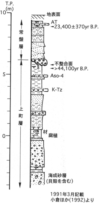
Original Japanese lettering
NW;NE;SE;K-Tz;Aso-4;AT.
English translation
NW; NE; SE; K-Tz; Aso-4; AT.
p290_509.png
PDF 290 · Original p. 273
Komyo Pond Osaka Group distribution and ash-locality map, with Ma1–Ma8 column
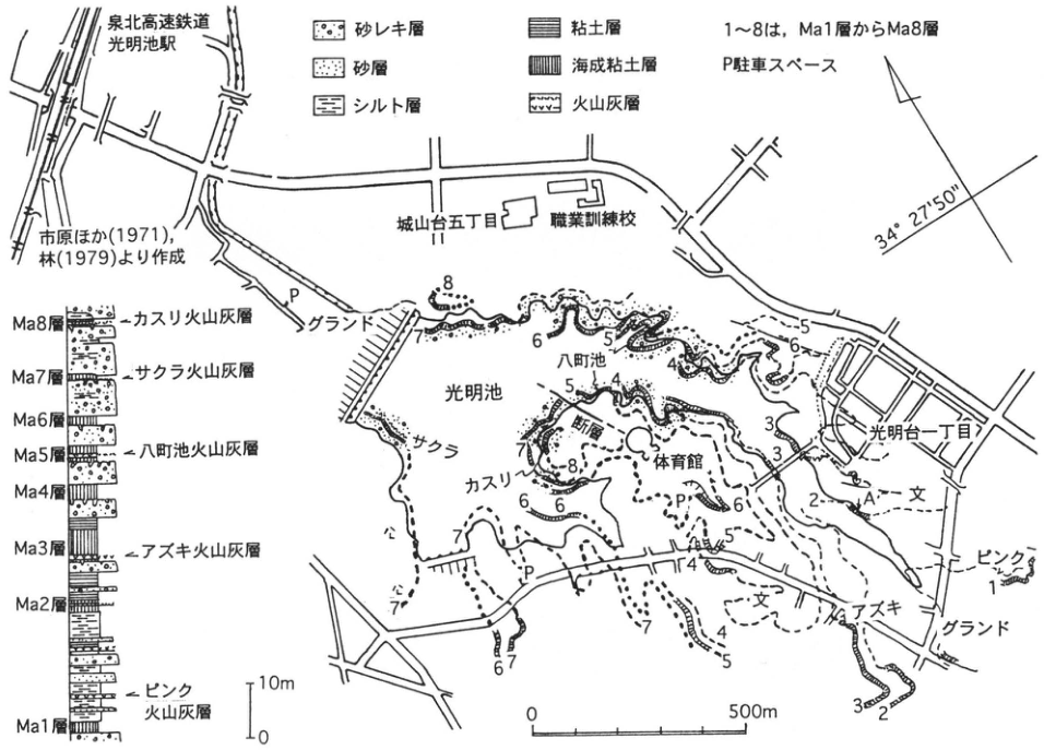
Original Japanese lettering
泉北高速鉄道;光明池駅;城山台五丁目;職業訓練校;光明台一丁目;グランド(2ヶ所);体育館;断層;八町池;光明池;A;P駐車スペース;1~8はMa1層からMa8層;34°27′50″;0~500m.市原ほか(1971),林(1979)より作成.凡例:砂レキ層,砂層,シルト層,粘土層,海成粘土層,火山灰層.柱状(上から):Ma8層・カスリ火山灰層,Ma7層・サクラ火山灰層,Ma6層,Ma5層・八町池火山灰層,Ma4層,Ma3層・アズキ火山灰層,Ma2層,ピンク火山灰層,Ma1層.10m尺度(0,10m).地図上:サクラ,カスリ,アズキ,ピンク,文(学校記号).
English translation
Senboku Rapid Railway; Komyoike Station; Shiroyamadai 5-chome; vocational training school; Komyodai 1-chome; sports grounds at two locations; gymnasium; fault; Hatcho Pond; Komyo Pond; A; P, parking space; 1–8 denote Ma1–Ma8; 34°27′50″; 0–500 m. Compiled from 市原 et al. (1971) and 林 (1979). Legend: sand and gravel; sand; silt; clay; marine clay; volcanic ash. Column downward: Ma8 and Kasuri ash; Ma7 and Sakura ash; Ma6; Ma5 and Hatchoike ash; Ma4; Ma3 and Azuki ash; Ma2; Pink ash; Ma1. 10 m scale (0, 10 m). Map ash labels: Sakura, Kasuri, Azuki, Pink; 文 (school symbol).
p291_510.png
PDF 291 · Original p. 274
Map locating the Kizugawa riverbed archaeological site
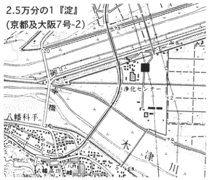
Original Japanese lettering
2.5万分の1『淀』(京都及大阪7号-2);木津川;八幡;浄化センター;8.8;5;20;■.
English translation
1:25,000 Yodo (Kyoto and Osaka sheet 7-2); Kizu River; Yawata; treatment center; 8.8; 5; 20; solid square.
市街図極小文字 — 一部判読不明。
p291_511.png
PDF 291 · Original p. 274
Section of liquefaction sand dikes cutting ditch fills and sedimentary beds
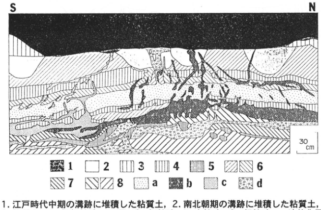
Original Japanese lettering
S;N;30cm.凡例1~8,a~d(全説明は本文).
English translation
S; N; 30 cm. Legend 1–8 and a–d (fully explained in the main text).
p293_512.png
PDF 293 · Original p. 276
Map locating exposures A and B at Hamayuyama
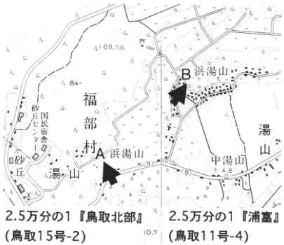
Original Japanese lettering
2.5万分の1『鳥取北部』(鳥取15号-2);2.5万分の1『浦富』(鳥取11号-4);A,B;浜湯山;中湯山;湯山;福部村;西田農業協同組合;砂丘;109.7;84;4.8;10.7.
English translation
1:25,000 Tottori-Hokubu (Tottori sheet 15-2); 1:25,000 Uradome (Tottori sheet 11-4); A, B; Hamayuyama; Nakayuyama; Yuyama; Fukube Village; Nishida agricultural cooperative; dunes; 109.7; 84; 4.8; 10.7.
p293_513.png
PDF 293 · Original p. 276
Exposure A section through younger dunes, ash, Yuyama sand, and basement
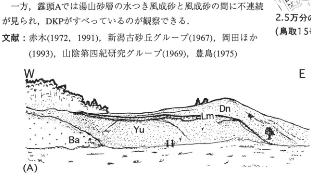
Original Japanese lettering
W,E;(A);Dn,Lm,Yu,Ba.説明は本文キャプション.
English translation
W, E; (A); Dn, Lm, Yu, Ba. Explanations are in the main-text caption.
p293_514.png
PDF 293 · Original p. 276
Exposure B section with eight units from younger dunes to water-laid sand
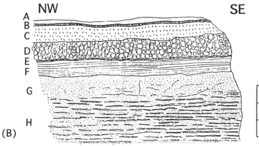
Original Japanese lettering
NW,SE;(B);A,B,C,D,E,F,G,H;尺度0,1,2,3m.各層説明は本文キャプション.
English translation
NW, SE; (B); A, B, C, D, E, F, G, H; scale 0, 1, 2, 3 m. Unit descriptions are in the main-text caption.
p294_515.png
PDF 294 · Original p. 277
Shikano fault locality map and overview/detail sketches of faults cutting Hakuto gravel and granite
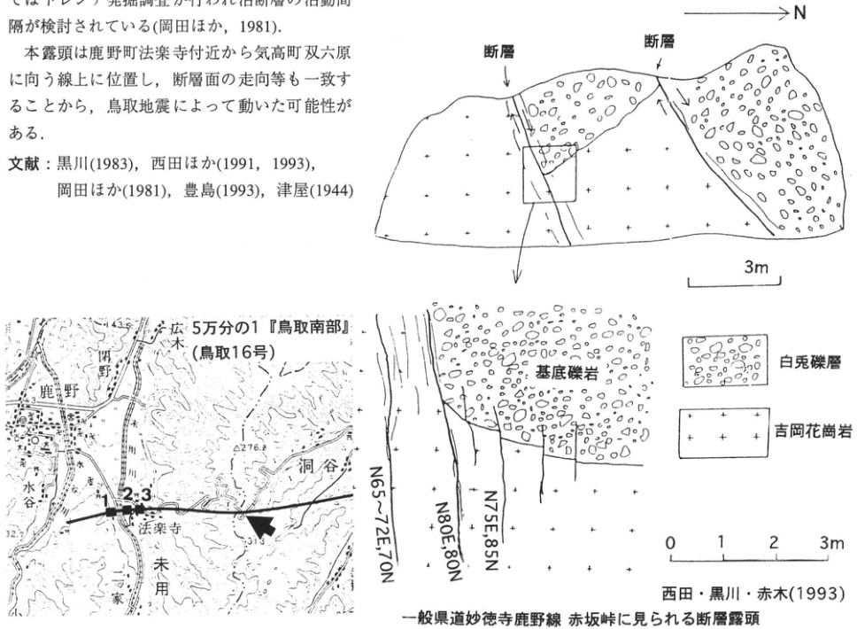
Original Japanese lettering
N;断層(2ヶ所);3m尺度.詳細:基底礫岩;白兎礫層;吉岡花崗岩;N65~72E,70N;N80E,80N;N75E,85N;0,1,2,3m.地図:5万分の1『鳥取南部』(鳥取16号);鹿野;末用;法楽寺;洞谷;広木;小川;水谷;家原;1,2,3;2276(印字の小数点判読不明);32.7;143.3;矢印。
English translation
N; fault at two positions; 3 m scale. Detail: basal conglomerate; Hakuto gravel; Yoshioka Granite; N65–72E, 70N; N80E, 80N; N75E, 85N; 0, 1, 2, 3 m. Map: 1:50,000 Tottori-Nanbu (Tottori sheet 16); Shikano; Sueyo; Horakuji; 洞谷; Hiroki; Ogawa; Mizutani; 家原; 1, 2, 3; 2276 (decimal point illegible); 32.7; 143.3; arrow. Unverified minor place-name readings retained in Japanese.
極小地図数字2276 — 小数点の位置を確定できない。
p295_516.png
PDF 295 · Original p. 278
Map locating the Oda fault and Fukumoto exposures A and B
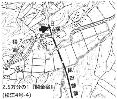
Original Japanese lettering
2.5万分の1『関金宿』(松江4号-4);尾田断層;福本;光丘;明見;東;A,B;79.6;46;矢印。
English translation
1:25,000 Sekigane-Shuku (Matsue sheet 4-4); Oda fault; Fukumoto; 光丘; Myoken (明見); Higashi; A, B; 79.6; 46; arrow. Unverified names retained in Japanese.
p295_517.png
PDF 295 · Original p. 278
Two north–south exposure sketches showing deformation of DKP and AT and sand dikes
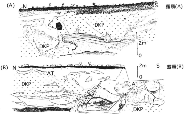
Original Japanese lettering
(A)N,S;露頭(A);DKP(2ヶ所);尺度0,2m.(B)N,S;露頭(B);AT(2ヶ所);DKP(2ヶ所);尺度0,2m.
English translation
(A) N, S; exposure (A); DKP at two positions; scale 0, 2 m. (B) N, S; exposure (B); AT at two positions; DKP at two positions; scale 0, 2 m.
p296_518.png
PDF 296 · Original p. 279
Map locating the lowermost Daisen tephra exposure at Okawachi
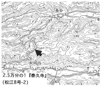
Original Japanese lettering
2.5万分の1『泰久寺』(松江8号-2);長谷;大河内;217;矢印。
English translation
1:25,000 Taikyuji (Matsue sheet 8-2); Nagatani (長谷); Okawachi; 217; arrow.
p296_519.png
PDF 296 · Original p. 279
Exposure sketch of fifteen lowermost Daisen tephra beds, DNP, and Mz
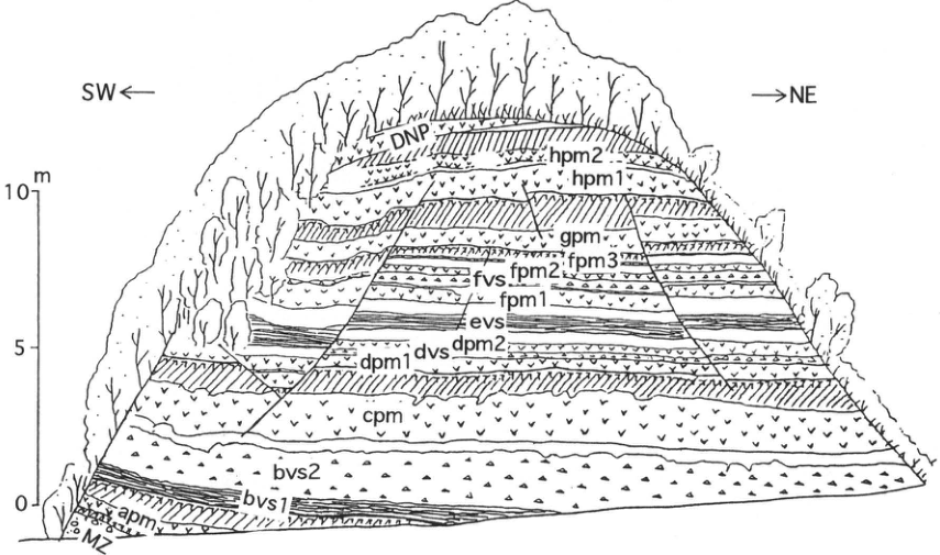
Original Japanese lettering
SW←,→NE;尺度0,5,10m.下から:Mz,apm,bvs1,bvs2,cpm,dpm1,dvs,dpm2,evs,fpm1,fvs,fpm2,fpm3,gpm,hpm1,hpm2,DNP.
English translation
SW left, NE right; scale 0, 5, 10 m. Upward: Mz, apm, bvs1, bvs2, cpm, dpm1, dvs, dpm2, evs, fpm1, fvs, fpm2, fpm3, gpm, hpm1, hpm2, DNP.
p297_520.png
PDF 297 · Original p. 280
Dune stratigraphic section and locality map west of Myokenyama
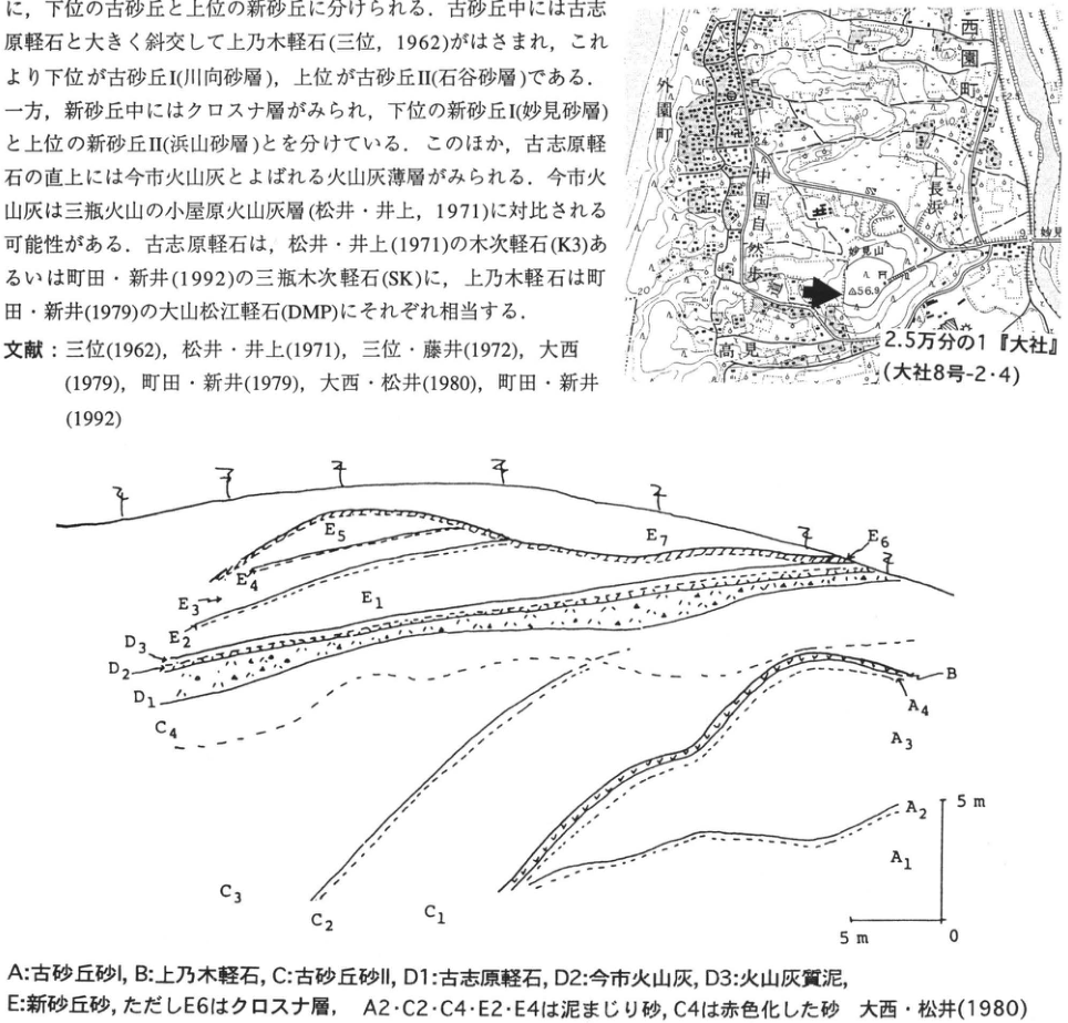
Original Japanese lettering
地図:2.5万分の1『大社』(大社8号-2・4);外園町;西園町;長浜;妙見山;56.9;35;矢印.断面ラベル:A1~A4,B,C1~C4,D1~D3,E1~E7.水平・垂直尺度5m,原点0.各記号説明は本文.
English translation
Map: 1:25,000 Taisha (Taisha sheet 8-2/4); Sotozono-machi (外園町); Nishizono-machi; Nagahama; Myokenyama; 56.9; 35; arrow. Section labels: A1–A4, B, C1–C4, D1–D3, E1–E7. Horizontal and vertical scales 5 m, origin 0. Symbol explanations are in the main text.
p298_521.png
PDF 298 · Original p. 281
Map locating the SOh exposure at Midorigaoka, Shigaku, Sambe-machi
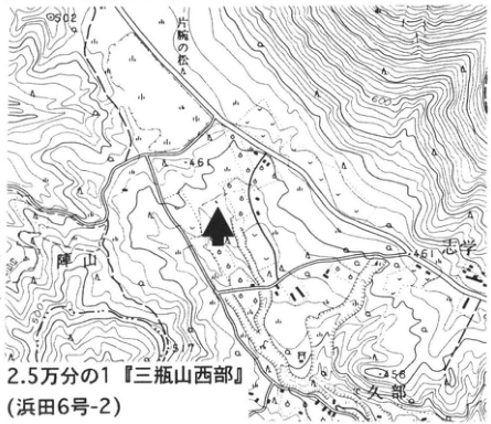
Original Japanese lettering
2.5万分の1『三瓶山西部』(浜田6号-2);片腕の松;角井;46;461;612;矢印。
English translation
1:25,000 Sanbesan-Seibu (Hamada sheet 6-2); Kataude-no-matsu (片腕の松); 角井 (reading unverified); 46; 461; 612; arrow.
小数字・地名 — 一部は印字が小さく読み未確認。
p298_522.png
PDF 298 · Original p. 281
SOh exposure showing fallout, surge and pyroclastic-flow beds, and a ballistic sag
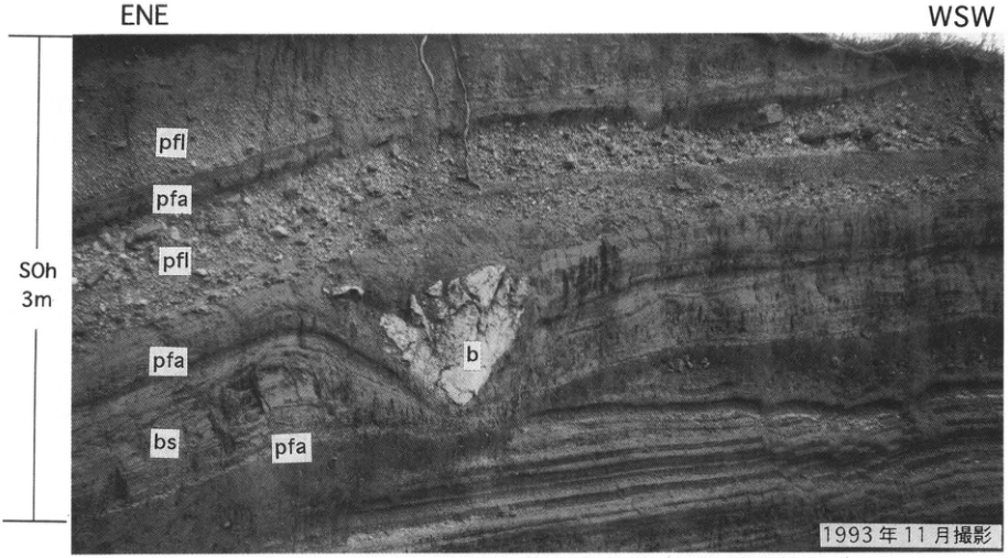
Original Japanese lettering
ENE,WSW;SOh,3m.下からpfa,bs,pfa,b(サグ),pfl,pfa,pfl.
English translation
ENE, WSW; SOh, 3 m. Upward: pfa (fallout), bs (base surge), pfa, b (sag), pfl (pyroclastic flow), pfa, pfl.
p299_523.png
PDF 299 · Original p. 282
Map locating sites 1 and 2 east of Sambe
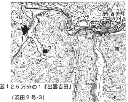
Original Japanese lettering
図1:2.5万分の1『出雲吉田』(浜田2号-3);1,2;吉田町;445;453;400;矢印。
English translation
Fig. 1: 1:25,000 Izumo-Yoshida (Hamada sheet 2-3); 1, 2; Yoshida-machi; 445; 453; 400; arrow.
p299_524.png
PDF 299 · Original p. 282
Site 1 and 2 columns of SK, Aso-4, SYP, SUn, SI, AT, and SUP
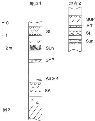
Original Japanese lettering
図2;尺度0,1,2m.地点1(下から):SK,Aso-4,SYP,SUn,SI.地点2(下から):Sun,SI,AT,SUP.
English translation
Fig. 2; scale 0, 1, 2 m. Site 1 upward: SK, Aso-4, SYP, SUn, SI. Site 2 upward: Sun, SI, AT, SUP. The original site-2 capitalization “Sun” is retained.
p300_525.png
PDF 300 · Original p. 283
Site-1 exposure sketch of tephras from SK through SI
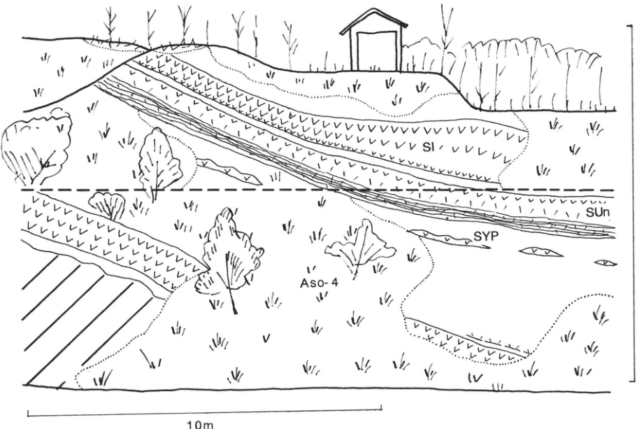
Original Japanese lettering
図3;SI,SUn,SYP,Aso-4;10m.
English translation
Fig. 3; SI, SUn, SYP, Aso-4; 10 m.
p300_526.png
PDF 300 · Original p. 283
Map locating site 3 southeast of Sambe
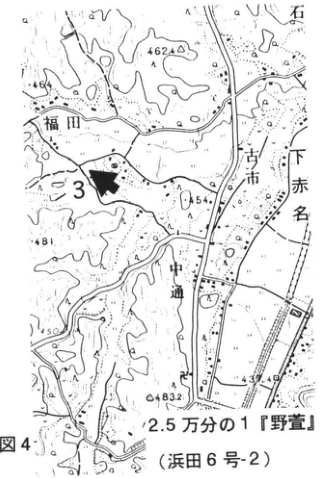
Original Japanese lettering
図4;2.5万分の1『野萱』(浜田6号-2);3;福田;古市;下赤名;中通;462.4;454;483.2;矢印。
English translation
Fig. 4; 1:25,000 Nogaya (野萱; Hamada sheet 6-2); 3; Fukuda; Furuichi; Shimo-Akana; Nakadori; 462.4; 454; 483.2; arrow.
p300_527.png
PDF 300 · Original p. 283
Site-3 photograph of thick SI overlying SUn and SK
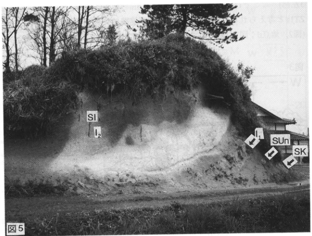
Original Japanese lettering
図5;SI;I2;I1;SUn;SK;矢印。
English translation
Fig. 5; SI; I2; I1; SUn; SK; arrows.
p301_528.png
PDF 301 · Original p. 284
Map locating the Tsunozu Formation type exposure
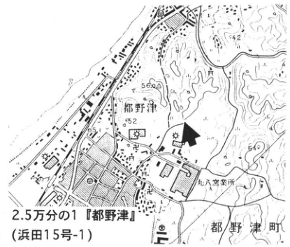
Original Japanese lettering
図1;2.5万分の1『都野津』(浜田15号-1);都野津;都野津町;丸八窯業所;42;56;52;60;矢印。
English translation
Fig. 1; 1:25,000 Tsunozu (Hamada sheet 15-1); Tsunozu; Tsunozu-machi; Maruhachi pottery works; 42; 56; 52; 60; arrow.
p301_529.png
PDF 301 · Original p. 284
Exposure sketch of M2–M3 and ZT1a during the 1995 excavation
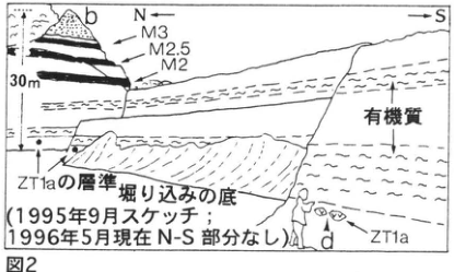
Original Japanese lettering
図2;b;d;N←,→S;M3,M2.5,M2;有機質;30m;ZT1aの層準;掘り込みの底;ZT1a.1995年9月スケッチ;1996年5月現在N-S部分なし.
English translation
Fig. 2; b; d; N left, S right; M3, M2.5, M2; organic-rich; 30 m; ZT1a horizon; excavation floor; ZT1a. Sketched September 1995; N–S portion absent in May 1996.
p301_530.png
PDF 301 · Original p. 284
Overview sketch of M2–M3 and basement at the Tsunozu type exposure
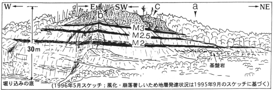
Original Japanese lettering
図3;W←,→E;SW←,→NE;a,b,c;M3,M2.5,M2;基盤岩;30m;掘り込みの底.1996年5月スケッチ;風化・崩落著しいため地層発達状況は1995年9月のスケッチに基づく.
English translation
Fig. 3; W left, E right; SW left, NE right; a, b, c; M3, M2.5, M2; basement; 30 m; excavation floor. Sketched May 1996; because weathering and collapse were severe, the distribution of strata follows the September 1995 sketch.
p302_531.png
PDF 302 · Original p. 285
Narrow left-edge text fragment erroneously extracted as a figure

Original Japanese lettering
本文左端の数文字のみ切り出されている(本露頭,M2,M3,文献などの断片)。全文は主本文に収録。
English translation
Only a few characters at the left edge of the body are present (fragments of “this exposure,” M2, M3, references, etc.). The complete text is retained in the main body.
34px幅の本文断片 — 独立図ではなく切り出し不良。
p302_532.png
PDF 302 · Original p. 285
Regional stratigraphy of the Tsunozu, Shimanohoshi, and Murokamiyama formations
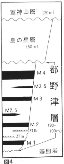
Original Japanese lettering
図4.上から:室神山層(20m);島の星層(50m);都野津層(90~100m):M4,M3.5,M3,M2.5,M2,ZT1b,ZT1a,M1;基盤岩.
English translation
Fig. 4. Downward: Murokamiyama Formation (20 m); Shimanohoshi Formation (50 m); Tsunozu Formation (90–100 m): M4, M3.5, M3, M2.5, M2, ZT1b, ZT1a, M1; basement.
p302_533.png
PDF 302 · Original p. 285
Tsunozu Formation correlation of paleomagnetism, lithofacies, and paleoenvironments
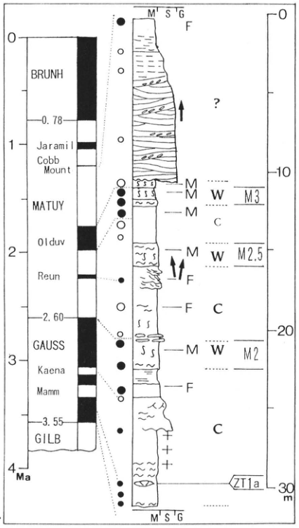
Original Japanese lettering
古地磁気尺度:0,1,2,3,4Ma;0.78,2.60,3.55;BRUNH,Jaramill,Cobb Mount,MATUY,Olduv,Reun,GAUSS,Kaena,Mamm,GILB.岩相粒度記号M′,S′,G.標高方向の厚さ目盛0,10,20,30m.M3,M2.5,M2,ZT1a.環境記号M,F,W,C;?;北向き矢印(3本);●,○.図例の意味は主本文。
English translation
Paleomagnetic scale: 0, 1, 2, 3, 4 Ma; 0.78, 2.60, 3.55; original abbreviated labels BRUNH, Jaramill, Cobb Mount, MATUY, Olduv, Reun, GAUSS, Kaena, Mamm, GILB. Lithologic grain-size symbols M′, S′, G. Thickness ticks 0, 10, 20, 30 m. M3, M2.5, M2, ZT1a. Environmental symbols M, F, W, C; question mark; three northward arrows; filled and open circles. Legend meanings are in the main text.
p303_534.png
PDF 303 · Original p. 286
Map locating the Saijo Formation exposure at Minokoshi (箕越)
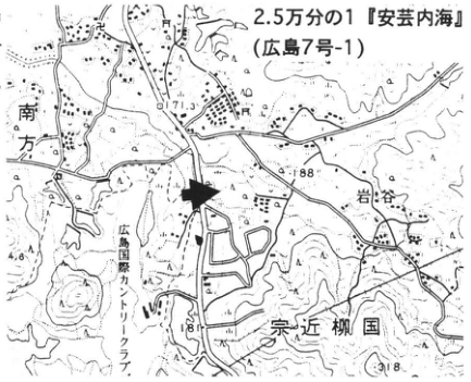
Original Japanese lettering
2.5万分の1『安芸内海』(広島7号-1);宗近柳国;南方;岩谷;広島国際カントリークラブ;171.3;188;181;318;矢印。
English translation
1:25,000 Aki-Uchinoumi (広島7号-1); Munachika-Yanagikuni; Minamigata; Iwatani; Hiroshima Kokusai Country Club; 171.3; 188; 181; 318; arrow.
細かい固有地名の読み — 未確認の固有名は日本語を併記。
p304_535.png
PDF 304 · Original p. 287
Plan sketch of the Minokoshi exposure and Okago ash distribution
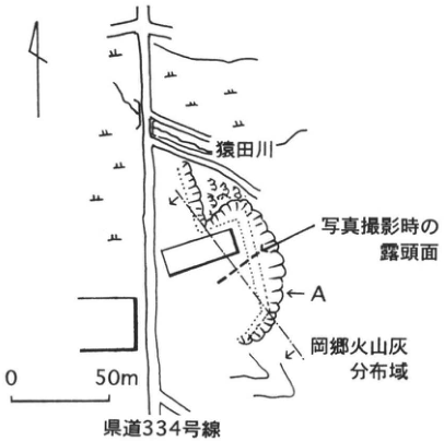
Original Japanese lettering
猿田川;県道334号線;写真撮影時の露頭面;A;岡郷火山灰分布域;0,50m;北矢印。
English translation
Sarutagawa; prefectural road 334; exposure face when photographed; A; Okago ash distribution area; 0, 50 m; north arrow.
p304_536.png
PDF 304 · Original p. 287
Exposure photograph of Okago ash A, lower ash B, and peat C
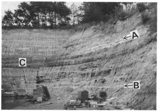
Original Japanese lettering
A;B;C.
English translation
A; B; C.
p304_537.png
PDF 304 · Original p. 287
Two columns correlating seven tephras in the Saijo Formation
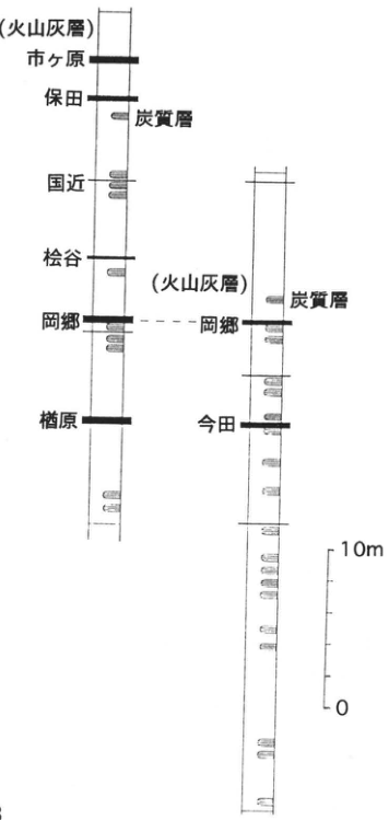
Original Japanese lettering
左柱(下から):楢原;岡郷;松谷;国近;保田;市ヶ原(火山灰層).右柱(下から):今田;岡郷(火山灰層).両柱:炭質層.尺度0,10m.
English translation
Left column upward: Narahara; Okago; Matsutani; Kunichika; Yasuda; Ichigahara (ash beds). Right column upward: Imada; Okago (ash beds). Both columns: carbonaceous beds. Scale 0, 10 m.
p304_538.png
PDF 304 · Original p. 287
Exposure sketch of Okago ash and lignite in cyclic sand–silt deposits
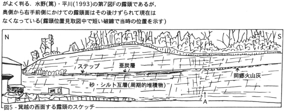
Original Japanese lettering
N,S;ステップ;亜炭層;岡郷火山灰;砂・シルト互層(周期的堆積物);A;建物のドア枠内の文字[判読不明].
English translation
N, S; step; lignite; Okago ash; alternating sand and silt (cyclic deposits); A; writing inside the building door frame [illegible].
左下の建物内文字 — 小さく判読不明。
p305_539.png
PDF 305 · Original p. 288
Map locating the diatomite mine at Hanazono, Hiruzenbara
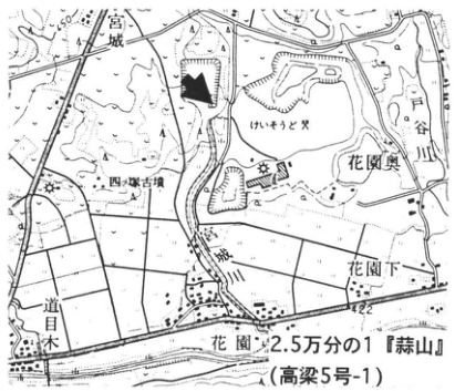
Original Japanese lettering
2.5万分の1『蒜山』(高梁5号-1);花園;花園奥;花園下;宮城;道目木;戸谷川;砂レキと犬;446;422;矢印。
English translation
1:25,000 Hiruzen (Takahashi sheet 5-1); Hanazono; Hanazono-Oku; Hanazono-Shimo; 宮城; 道目木; Toyagawa (戸谷川); map text “砂レキと犬” (sand/gravel and dog, as read); 446; 422; arrow.
砂レキと犬 — 地図の小文字はそのように見えるが末字が不明確。
p305_540.png
PDF 305 · Original p. 288
Mine-pit plan and three deformation sketches of diatomite walls
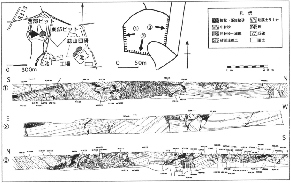
Original Japanese lettering
西部ピット;東部ピット;蒜山団研;R313;池(2ヶ所);工場;0~300m.詳細ピット図①②③,0~50m.壁面①S–N,②E–W,③N–S;0~20m尺度.凡例:細粒~極細粒砂;中粒砂;粗粒砂~細礫;砂質珪藻土;珪藻土ラミナ;礫;巨礫;崩土.各壁に多数の走向傾斜数字[微小印字は判読不明].
English translation
Western pit; eastern pit; Hiruzenbara joint research group; R313; two ponds; plant; 0–300 m. Detailed pit plan ①②③, 0–50 m. Wall ① S–N, ② E–W, ③ N–S; 0–20 m scale. Legend: fine to very fine sand; medium sand; coarse sand to fine gravel; sandy diatomite; diatomite laminae; gravel; boulders; collapsed material. Numerous strike/dip measurements occur on each wall [minute printing illegible].
多数の走向傾斜の小数字 — 原PDFも同じ解像度で、確実な数字列を判読できない。
p306_541.png
PDF 306 · Original p. 289
Map locating the Ideguchi ash exposure
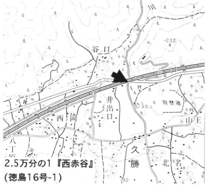
Original Japanese lettering
2.5万分の1『西赤谷』(徳島16号-1);井出口;谷口;西岡;勝命;北久保;山王;232;130.3;92;矢印。
English translation
1:25,000 Nishi-Akadani (徳島16号-1); Ideguchi; Taniguchi; Nishioka; 勝命; Kitakubo; Sanno; 232; 130.3; 92; arrow. Unverified local name retained in Japanese.
p306_542.png
PDF 306 · Original p. 289
Exposure overview showing Ideguchi ash and the northern fault
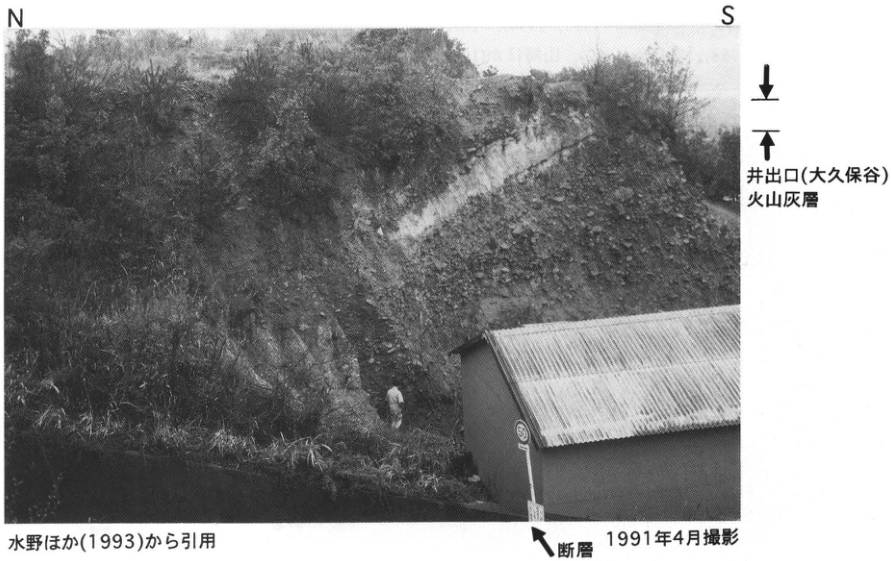
Original Japanese lettering
N;S;井出口(大久保谷)火山灰層;断層;50(道路標識).
English translation
N; S; Ideguchi (Okubodani) ash; fault; 50 (road sign).
p307_543.png
PDF 307 · Original p. 290
Map locating the Okamura fault trenches at Iioka
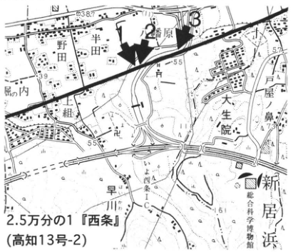
Original Japanese lettering
2.5万分の1『西条』(高知13号-2);岡村;野田;舟内;水生院;新居浜;早川;1,2,3;37;39;55;57;矢印。
English translation
1:25,000 Saijo (Kochi sheet 13-2); Okamura; Noda; 舟内; 水生院; Niihama; Hayakawa; 1, 2, 3; 37; 39; 55; 57; arrow. Unverified minor names retained in Japanese.
p307_544.png
PDF 307 · Original p. 290
Okamura trench-3 layout and trench-B west wall with strata, fault, and ages
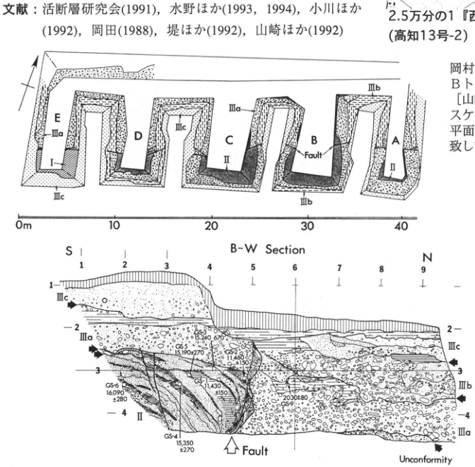
Original Japanese lettering
平面:A,B,C,D,E;I,II,IIIa,IIIb,IIIc;Fault;0,10,20,30,40m.壁面:B-W Section;S,N;水平1~9;縦1~4;II,IIIa,IIIb,IIIc;Fault;Unconformity.年代:GS-1 11,430±150;GS-2 11,480±150;GS-3 15,240±670;GS-4 15,350±270;GS-5 15,190±270;GS-6 16,090±280;GS-9 2030±80.凡例(原文英語):Artificial,Peat,Silt,Silty sand,Fine sand,Sand & Gravel.周囲の文献・説明断片は主本文。
English translation
Plan: A, B, C, D, E; I, II, IIIa, IIIb, IIIc; Fault; 0, 10, 20, 30, 40 m. Wall: B-W Section; S, N; horizontal 1–9; vertical 1–4; II, IIIa, IIIb, IIIc; Fault; Unconformity. Ages: GS-1 11,430±150; GS-2 11,480±150; GS-3 15,240±670; GS-4 15,350±270; GS-5 15,190±270; GS-6 16,090±280; GS-9 2030±80. Original English legend: Artificial, Peat, Silt, Silty sand, Fine sand, Sand & Gravel. Surrounding reference and explanatory fragments are retained in the main text.
p308_545.png
PDF 308 · Original p. 291
Geological map of the Gunchu Formation and T1–T6 ashes near Mori, Iyo
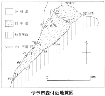
Original Japanese lettering
伊予市森付近地質図;沖積層;郡中層;和泉層群;火山灰層;T1,T4,T5,T6;132°41′E;33°44′N;30,90,60,66,74,76,88,66,82;0~1km;北矢印。
English translation
Geological map near Mori, Iyo City; alluvium; Gunchu Formation; Izumi Group; ash beds; T1, T4, T5, T6; 132°41′E; 33°44′N; dip figures 30, 90, 60, 66, 74, 76, 88, 66, 82; 0–1 km; north arrow.
p308_546.png
PDF 308 · Original p. 291
Map locating the exposure range southwest of Mori
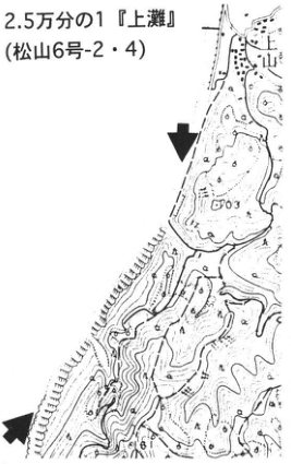
Original Japanese lettering
2.5万分の1『上灘』(松山6号-2・4);上山;103;矢印2本。
English translation
1:25,000 Kaminada (Matsuyama sheet 6-2/4); Kamiyama (上山); 103; two arrows.
p308_547.png
PDF 308 · Original p. 291
Northern sea-cliff exposure of steeply inclined Gunchu Formation
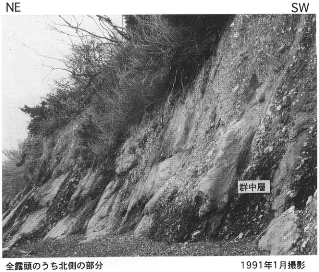
Original Japanese lettering
NE;SW;群中層(写真の原著ラベル).
English translation
NE; SW; 群中層 (the original photograph uses 群, unlike 郡 in the text; Gunchu Formation).
p309_548.png
PDF 309 · Original p. 292
Map locating the marine terrace exposure on the left bank of the Yasudagawa mouth
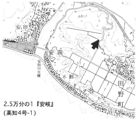
Original Japanese lettering
2.5万分の1『安岐[字形不明確]』(高知4号-1);安田;安田川;不動;大野;田野町;81.7;3.5;2.5;57;75.9;9.3;矢印。
English translation
1:25,000 安岐 [sheet-title glyphs uncertain] (Kochi sheet 4-1); Yasuda; Yasudagawa; Fudo; Ono; Tano Town; 81.7; 3.5; 2.5; 57; 75.9; 9.3; arrow.
図幅名「安岐」 — 原図字形が不明確。正確な図幅名称・読みは未確定。
p309_549.png
PDF 309 · Original p. 292
Marine sand-and-gravel column and overview photograph of the Muroto-misaki I surface
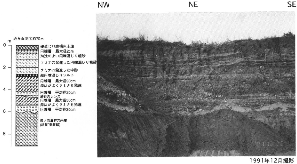
Original Japanese lettering
写真:NW,NE,SE;日付91.12.26.柱状:段丘面高度約70m;深度0,2,4,6,8m.下から:唐ノ浜層群穴内層(鮮新~更新統);巨礫層 平均径30cm;円礫層 最大径30cm,淘汰がよくラミナも発達;細砂のレンズ;円礫層 平均径20cm;円礫層 最大径30cm,淘汰がよくラミナも発達;細円礫混じりシルト;ラミナの発達した中砂;ラミナの発達した円礫混じり粗砂;淘汰のよい円礫混じり粗砂;円礫層 最大径2cm;礫混じり赤褐色土壌.
English translation
Photograph: NW, NE, SE; date 91.12.26. Column: terrace elevation approximately 70 m; depths 0, 2, 4, 6, 8 m. Upward: Ananai Formation, Tonohama Group (Pliocene–Pleistocene); boulder bed, mean diameter 30 cm; rounded gravel, maximum diameter 30 cm, well sorted with laminae; fine-sand lens; rounded gravel, mean diameter 20 cm; rounded gravel, maximum diameter 30 cm, well sorted with laminae; silt with fine rounded gravel; laminated medium sand; laminated coarse sand with rounded gravel; well-sorted coarse sand with rounded gravel; rounded gravel, maximum diameter 2 cm; reddish-brown gravelly soil.
p311_550.png
PDF 311 · Original p. 294
Location map of the old-dune exposures near Nata and Gannosu
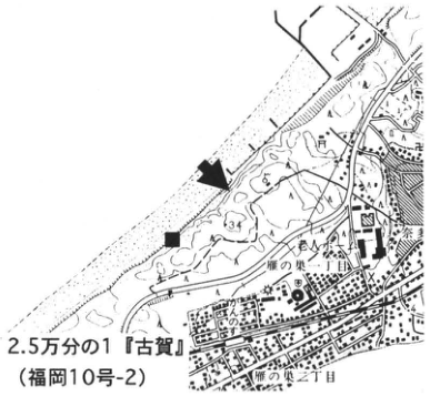
Original Japanese lettering
2.5万分の1『古賀』(福岡10号-2)。奈多、雁ノ巣、雁の巣一丁目、雁の巣二丁目。■、露頭矢印。34。
English translation
1:25,000 Koga sheet (Fukuoka sheet 10-2). Nata; Gannosu; Gannosu 1-chome and 2-chome. ■ and exposure-location arrow. 34.
p311_551.png
PDF 311 · Original p. 294
Sea-cliff photograph and dune stratigraphy showing Ata, Aso-4, and K-Ah
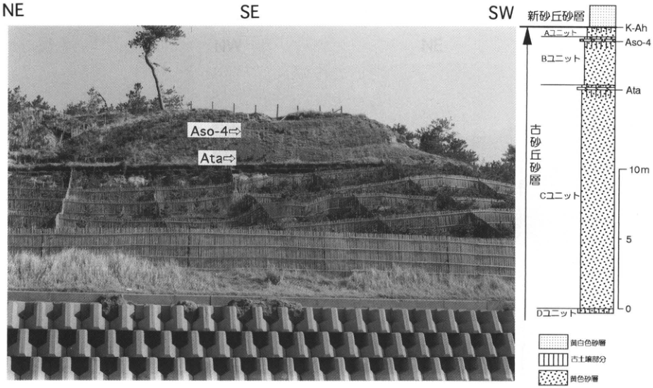
Original Japanese lettering
写真:NE、SE、SW、Aso-4、Ata。柱状図(上から):新砂丘砂層、K-Ah、Aユニット、Aso-4、Bユニット、Ata、Cユニット、Dユニット。古砂丘砂層。目盛:0、5、10m。凡例:黄白色砂層、古土壌部分、黄色砂層。
English translation
Photograph: NE, SE, SW, Aso-4, Ata. Column, top downward: young dune sand; K-Ah; Unit A; Aso-4; Unit B; Ata; Unit C; Unit D. Old dune sand. Scale: 0, 5, 10m. Legend: yellowish-white sand; paleosol portions; yellow sand.
p312_552.png
PDF 312 · Original p. 295
Location map of the Nanatsugama sea-cliff exposure
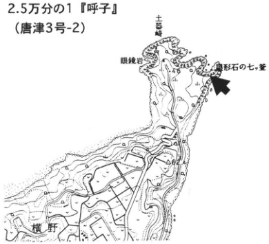
Original Japanese lettering
2.5万分の1『呼子』(唐津3号-2)。眼鏡岩、三吉島、福形石の七ツ釜、横野。露頭矢印。
English translation
1:25,000 Yobuko sheet (Karatsu sheet 3-2). Megane-iwa; 三吉島; 福形石の七ツ釜; Yokono. Exposure arrow.
p312_553.png
PDF 312 · Original p. 295
Aeolian-dust soil with K-Ah and AT above a basalt weathering crust
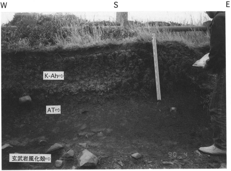
Original Japanese lettering
W、S、E。K-Ah、AT、玄武岩風化殻。90.4。1990年4月撮影。
English translation
W, S, E. K-Ah; AT; basalt weathering crust. 90.4. Photographed in April 1990.
p313_554.png
PDF 313 · Original p. 296
Location map of the Tsutsumi buried forest and low-terrace exposure
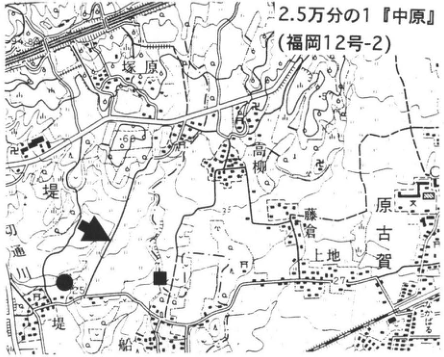
Original Japanese lettering
2.5万分の1『中原』(福岡12号-2)。堤、坊原、高柳、原古賀、上地、中原。■、●、矢印。29、25、27、60。
English translation
1:25,000 Nakabaru sheet (Fukuoka sheet 12-2). Tsutsumi; 坊原; 高柳; Harakoga; 上地; Nakabaru. ■, ●, arrows. 29, 25, 27, 60.
p313_555.png
PDF 313 · Original p. 296
Geological section of the Aso-4 buried forest, paleosols, Mitagawa Formation and Nakabaru Formation
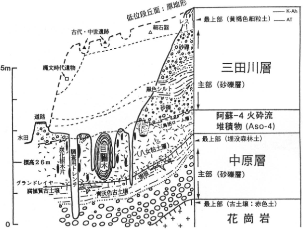
Original Japanese lettering
低位段丘面:原地形。古代・中世遺跡、縄文時代遺物、細石器、道路、水田、標高26m、炭化樹木片、調査用トレンチ、埋没樹木、グランドサージ、腐植質古土壌、青灰色古土壌、[判読不明]土層。三田川層:最上部(黄褐色細粒土)、K-Ah、AT、レス;主部(砂礫層)、砂礫、黒色シルト。阿蘇-4火砕流堆積物(Aso-4)。中原層:最上部(埋没森林土);主部(砂礫層)。花崗岩:最上部(古土壌:赤色土)。目盛0、5m。
English translation
Low-terrace surface: original topography. Ancient and medieval sites; Jomon-period artifacts; microblades; road; paddy field; elevation 26m; charcoal tree fragments; investigation trench; buried trees; ground surge; humic paleosol; bluish-gray paleosol; [illegible] soil layer. Mitagawa Formation: uppermost part (yellowish-brown fine-grained soil), K-Ah, AT, loess; main part (sand and gravel), sand and gravel, black silt. Aso-4 pyroclastic-flow deposit (Aso-4). Nakabaru Formation: uppermost part (buried forest soil); main part (sand and gravel). Granite: uppermost part (paleosol: red soil). Scale 0, 5m.
断面図の「[判読不明]土層」 — 埋没林の右側の斜めラベルは原画像でも先頭字を確定できない。
p314_556.png
PDF 314 · Original p. 297
Shimabara location maps and photographs of Mutsugi, Kureishibaru, Mizunashigawa and post-1991 pyroclastic-flow deposits
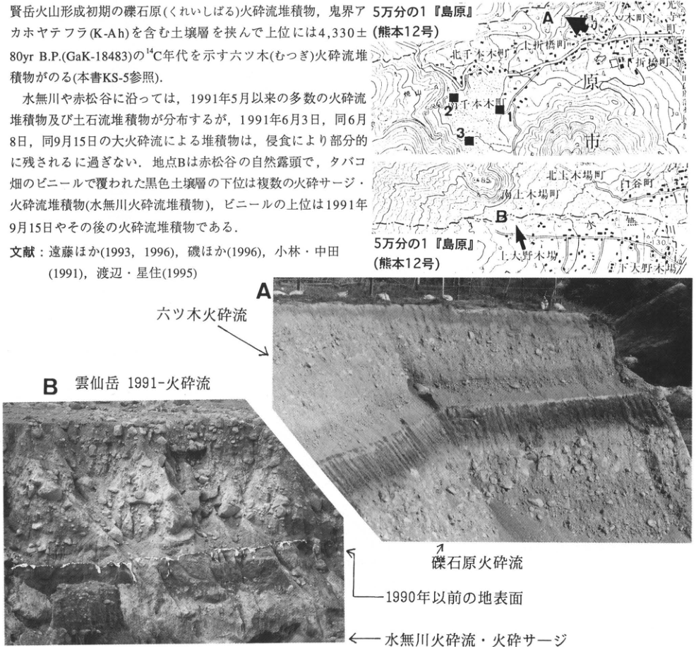
Original Japanese lettering
地図2図:5万分の1『島原』(熊本12号)。A、B、1、2、3。宇土町、北千本木町、南千本木町、北上木場町、南上木場町、白谷町、北大野木場、南大野木場。85、30.3。写真A:六ツ木火砕流、礫石原火砕流。写真B:雲仙岳1991-火砕流、1990年以前の地表面、水無川火砕流・火砕サージ。切出し内の本文は本文欄に収録。
English translation
Two maps: 1:50,000 Shimabara sheet (Kumamoto sheet 12). A, B, 1, 2, 3. Uto-machi; Kita-Senbongi-machi; Minami-Senbongi-machi; Kita-Kamikoba-machi; Minami-Kamikoba-machi; Shiratani-machi; Kita-Onokoba; Minami-Onokoba. 85, 30.3. Photograph A: Mutsugi pyroclastic flow; Kureishibaru pyroclastic flow. Photograph B: Unzen 1991– pyroclastic flow; ground surface before 1990; Mizunashigawa pyroclastic flow and pyroclastic surge. Prose included in the crop is transcribed and translated in the body.
p315_557.png
PDF 315 · Original p. 298
Correlation columns for Unzen pyroclastic flows and widespread tephra at Uto-machi west and Tateno-machi
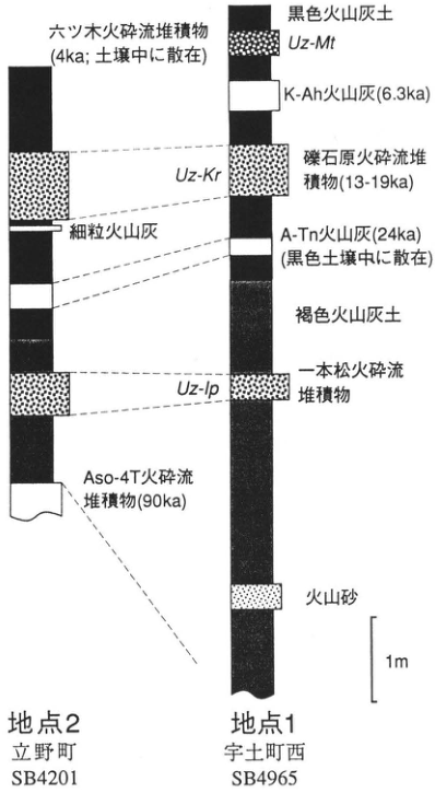
Original Japanese lettering
地点2:立野町、SB4201。地点1:宇土町西、SB4965。黒色火山灰土、褐色火山灰土、火山砂、細粒火山灰。Uz-Mt:六ツ木火砕流堆積物(4ka;土壌中に散在)。K-Ah火山灰(6.3ka)。Uz-Kr:礫石原火砕流堆積物(13-19ka)。A-Tn火山灰(24ka)(黒色土壌中に散在)。Uz-Ip:一本松火砕流堆積物。Aso-4T火砕流堆積物(90ka)。1m。
English translation
Site 2: Tateno-machi, SB4201. Site 1: Uto-machi west, SB4965. Black volcanic-ash soil; brown volcanic-ash soil; volcanic sand; fine volcanic ash. Uz-Mt: Mutsugi pyroclastic-flow deposit (4ka; scattered in soil). K-Ah ash (6.3ka). Uz-Kr: Kureishibaru pyroclastic-flow deposit (13–19ka). A-Tn ash (24ka; scattered in black soil). Uz-Ip: Ipponmatsu pyroclastic-flow deposit. Aso-4T pyroclastic-flow deposit (90ka). 1m.
p315_558.png
PDF 315 · Original p. 298
Sites 1–6 on the northeastern flank of Unzen
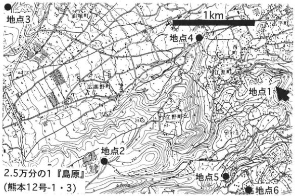
Original Japanese lettering
2.5万分の1『島原』(熊本12号-1・3)。地点1、地点2、地点3、地点4、地点5、地点6。1km。油堀町、広高野町、立野町。250、300、97.2。
English translation
1:25,000 Shimabara sheet (Kumamoto sheets 12-1 and 12-3). Sites 1, 2, 3, 4, 5, 6. 1km. 油堀町; 広高野町; Tateno-machi. 250, 300, 97.2.
p316_559.png
PDF 316 · Original p. 299
Road exposure at Sakaigawa in Kuju Town
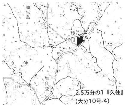
Original Japanese lettering
2.5万分の1『久住』(大分10号-4)。加生島、境川、久住、川良登。585、618、548。露頭矢印。
English translation
1:25,000 Kuju sheet (Oita sheet 10-4). 加生島; Sakaigawa; Kuju; 川良登. 585, 618, 548. Exposure arrow.
p316_560.png
PDF 316 · Original p. 299
Southern Kuju tephra column from Kj-D to Kj-A1
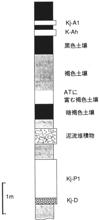
Original Japanese lettering
上から:Kj-A1、K-Ah、黒色土壌、褐色土壌、ATに富む褐色土壌、暗褐色土壌、泥流堆積物、Kj-P1、Kj-D。1m。
English translation
Top downward: Kj-A1; K-Ah; black soil; brown soil; AT-rich brown soil; dark-brown soil; mudflow deposit; Kj-P1; Kj-D. 1m.
p317_561.png
PDF 317 · Original p. 300
Yufugawa exposure sites 1, 2, 5 and 6 near Shimoichigi and Harunodan
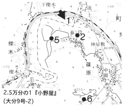
Original Japanese lettering
2.5万分の1『小野屋』(大分9号-2)。1、2、5、6。下櫟木、春ノ段、神屋敷、篠原、中園、櫟木。108、103.7、253.4、168、172。
English translation
1:25,000 Onoya sheet (Oita sheet 9-2). 1, 2, 5, 6. Shimoichigi; Harunodan; Kamiyashiki; Shinohara; Nakazono; 櫟木. 108, 103.7, 253.4, 168, 172.
p317_562.png
PDF 317 · Original p. 300
Sites 3 and 4 in the Yufugawa gorge
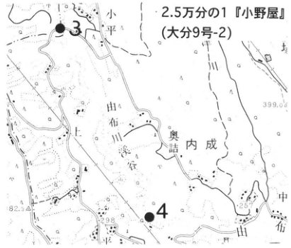
Original Japanese lettering
2.5万分の1『小野屋』(大分9号-2)。3、4。小平、由布、奥詰、内成、中畑。399.0、257、298、82.3。
English translation
1:25,000 Onoya sheet (Oita sheet 9-2). 3, 4. 小平; Yufu; 奥詰; Uchinari; Nakahata. 399.0, 257, 298, 82.3.
p318_563.png
PDF 318 · Original p. 301
Sheer walls of weakly welded pyroclastic-flow deposit in Yufugawa Gorge
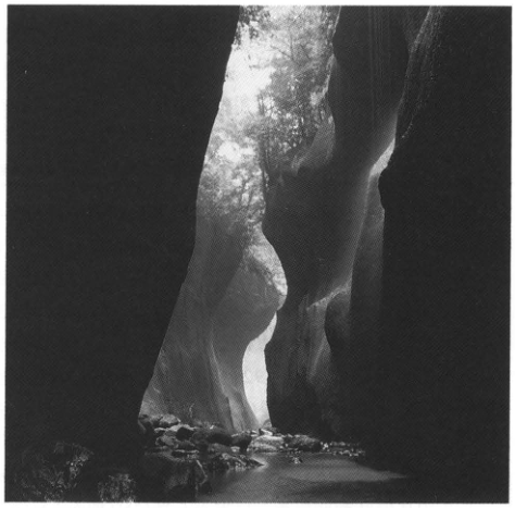
Original Japanese lettering
No lettering
English translation
No lettering
p318_564.png
PDF 318 · Original p. 301
Charcoal-tree cross-section in pumice-bearing Yufugawa deposit
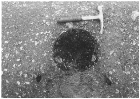
Original Japanese lettering
No lettering
English translation
No lettering
p319_565.png
PDF 319 · Original p. 302
Aso Youth Center exposure location and column of N1–N19 tephras and radiocarbon dates
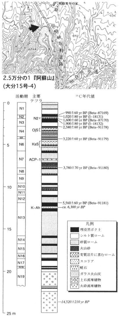
Original Japanese lettering
位置図:2.5万分の1『阿蘇山』(大分15号-4)。阿蘇青年の家、吹上、645、634、672、714、695、露頭矢印。 柱状図:活動期N1、N2、N3、N4、N5、N6、N7、N8、N9、N10、N11、N12、N13、N14、N15、N16、N17、N18、N19。主要テフラ:N2 c、OjS、KsS、ACP-1、K-Ah。目盛0、5、10、15、20、25m。 ¹⁴C年代値:990±60yr BP(Beta-87169);1,020±80yr BP(I-18131);1,600±60yr BP(Beta-87170);1,900±80yr BP(I-18132);2,580±60yr BP(Beta-91178);3,220±60yr BP(Beta-91179);3,780±70yr BP(Beta-91180);5,560±60yr BP(Beta-91181);ca. 6,300yr BP;14,520±210yr BP。 凡例:埋没黒ボク土、シルト質ローム、砂質ローム、火山砂、変質岩片に富むローム、スコリア、軽石、ガラス火山灰、土石流堆積物、火砕流堆積物。
English translation
Map: 1:25,000 Asosan sheet (Oita sheet 15-4). Aso Youth Center; Fukiage; 645, 634, 672, 714, 695; exposure arrow. Column: activity phases N1, N2, N3, N4, N5, N6, N7, N8, N9, N10, N11, N12, N13, N14, N15, N16, N17, N18, N19. Principal tephras: N2 c, OjS, KsS, ACP-1, K-Ah. Scale 0, 5, 10, 15, 20, 25m. ¹⁴C dates: 990±60yr BP (Beta-87169); 1,020±80yr BP (I-18131); 1,600±60yr BP (Beta-87170); 1,900±80yr BP (I-18132); 2,580±60yr BP (Beta-91178); 3,220±60yr BP (Beta-91179); 3,780±70yr BP (Beta-91180); 5,560±60yr BP (Beta-91181); ca. 6,300yr BP; 14,520±210yr BP. Legend: buried kuroboku soil; silty loam; sandy loam; volcanic sand; loam rich in altered rock fragments; scoria; pumice; glassy ash; debris-flow deposit; pyroclastic-flow deposit.
p320_566.png
PDF 320 · Original p. 303
Exposure locations east of Daianji, Tonokori, and farther west
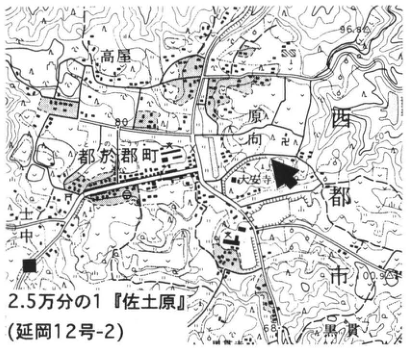
Original Japanese lettering
2.5万分の1『佐土原』(延岡12号-2)。都於郡町、高屋、大安寺、土中、黒ノ貫。■、露頭矢印。96.8、100.9。
English translation
1:25,000 Sadowara sheet (Nobeoka sheet 12-2). Tonokori-machi; Takaya; Daianji; 土中; 黒ノ貫. ■, exposure arrow. 96.8, 100.9.
p320_567.png
PDF 320 · Original p. 303
Exposure sketch of Sanzaibaru sand, Ata, Aso-4 and Kirishima tephra
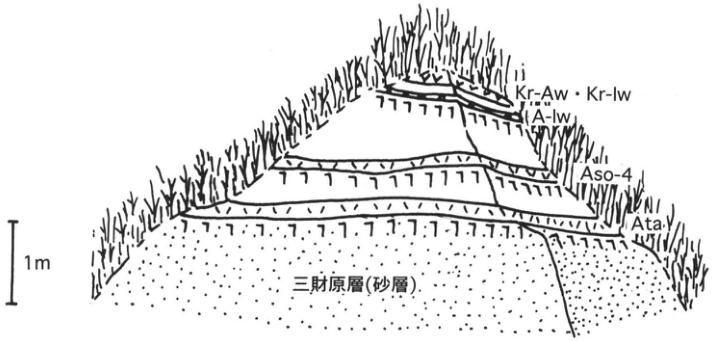
Original Japanese lettering
上から:Kr-Aw・Kr-Iw、A-Iw、Aso-4、Ata、三財原層(砂層)。1m。
English translation
Top downward: Kr-Aw and Kr-Iw; A-Iw; Aso-4; Ata; Sanzaibaru Formation (sand). 1m.
p321_568.png
PDF 321 · Original p. 304
Deformed pyroclastic-flow exposure north of Momogasako, Ura
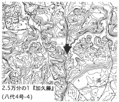
Original Japanese lettering
2.5万分の1『加久藤』(八代4号-4)。浦。299、250、330。露頭矢印。
English translation
1:25,000 Kakuto sheet (Yatsushiro sheet 4-4). Ura. 299, 250, 330. Exposure arrow.
p321_569.png
PDF 321 · Original p. 304
Section of deformed Ikemure, lacustrine and Kyomachi strata
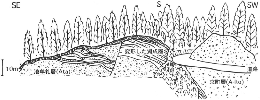
Original Japanese lettering
SE、S、SW。池牟礼層(Ata)、変形した湖成層、道路、京町層(A-Ito)。10m。
English translation
SE, S, SW. Ikemure Formation (Ata); deformed lacustrine strata; road; Kyomachi Formation (A-Ito). 10m.
p322_570.png
PDF 322 · Original p. 305
Road-cut exposure at Kamamuta
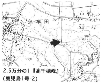
Original Japanese lettering
2.5万分の1『高千穂峰』(鹿児島1号-2)。蒲牟田、前野。223、228。露頭矢印。
English translation
1:25,000 Takachihonomine sheet (Kagoshima sheet 1-2). Kamamuta; Maeno. 223, 228. Exposure arrow.
p322_571.png
PDF 322 · Original p. 305
Column from Kirishima-Shinmoe-Kyoho to lower Ushinosune ash
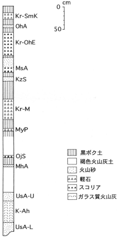
Original Japanese lettering
上から:Kr-SmK、OhA、Kr-OhE、MsA、KzS、Kr-M、MyP、OjS、MhA、UsA-U、K-Ah、UsA-L。目盛0、50cm。凡例:黒ボク土、褐色火山灰土、火山砂、軽石、スコリア、ガラス質火山灰。
English translation
Top downward: Kr-SmK, OhA, Kr-OhE, MsA, KzS, Kr-M, MyP, OjS, MhA, UsA-U, K-Ah, UsA-L. Scale 0, 50cm. Legend: kuroboku soil; brown volcanic-ash soil; volcanic sand; pumice; scoria; glassy ash.
p323_572.png
PDF 323 · Original p. 306
Hummock exposure at Serikawa, Kobayashi City
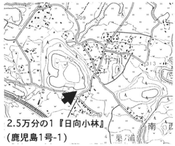
Original Japanese lettering
2.5万分の1『日向小林』(鹿児島1号-1)。309、313。東浦、南ケ口。露頭矢印。
English translation
1:25,000 Hyuga-Kobayashi sheet (Kagoshima sheet 1-1). 309, 313. 東浦; 南ケ口. Exposure arrow.
p323_573.png
PDF 323 · Original p. 306
Hinamori debris-avalanche hummock overlain by HnrbS II, A-Os, A-Ito, Kr-Kb and K-Ah
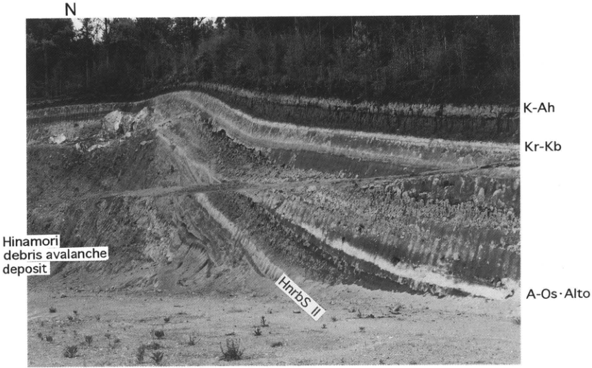
Original Japanese lettering
N。K-Ah、Kr-Kb、A-Os・AIto、HnrbS II。Hinamori debris avalanche deposit。
English translation
N. K-Ah; Kr-Kb; A-Os・AIto; HnrbS II. Hinamori debris avalanche deposit.
p324_574.png
PDF 324 · Original p. 307
Tephra exposure at Nitanno, Aya Town
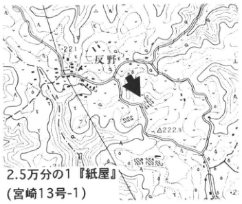
Original Japanese lettering
2.5万分の1『紙屋』(宮崎13号-1)。二反野。221、222.9。露頭矢印。
English translation
1:25,000 Kamiya sheet (Miyazaki sheet 13-1). Nitanno. 221, 222.9. Exposure arrow.
p324_575.png
PDF 324 · Original p. 307
Kkt, A-Fk, A-Iw, A-Os and A-Ito in the Nitanno exposure
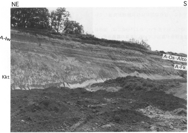
Original Japanese lettering
NE、S。A-Iw、Kkt、A-Os・AIto、A-Fk。
English translation
NE, S. A-Iw; Kkt; A-Os・AIto; A-Fk.
p325_576.png
PDF 325 · Original p. 308
Pyroclastic-flow observation routes 1–3 north of Aira
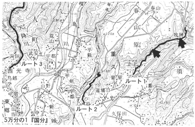
Original Japanese lettering
5万分の1『国分』。ルート1、ルート2、ルート3。国分城、降川、花山、霧島川、春山原、牧神、武安、宇都、西光寺、熊重、下久保、妻屋、道場口、止上、平剣、山野、七社、新中、郷田、久保田、須川。237、220.8、215.8、160。太いルート線と露頭矢印。
English translation
1:50,000 Kokubu sheet. Routes 1, 2, 3. 国分城; Amorigawa; 花山; Kirishimagawa; Haruyamabaru; 牧神; 武安; 宇都; Saikoji; 熊重; Shimokubo; Tsumaya; 道場口; Togami; 平剣; Yamano; 七社; 新中; 郷田; Kubota; 須川. 237, 220.8, 215.8, 160. Heavy route lines and exposure arrows.
p325_577.png
PDF 325 · Original p. 308
Columnar joints in strongly welded Ito pyroclastic-flow deposit on route 1
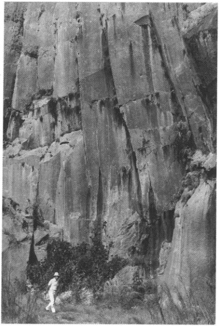
Original Japanese lettering
No lettering
English translation
No lettering
p326_578.png
PDF 326 · Original p. 309
Exposure in the western cliff of the Hakamagoshi plateau
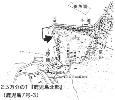
Original Japanese lettering
2.5万分の1『鹿児島北部』(鹿児島7号-3)。袴腰、小池、横山町、国民宿舎、桜島火山観測所、養魚場、方荷。露頭矢印。
English translation
1:25,000 Kagoshima-Hokubu sheet (Kagoshima sheet 7-3). Hakamagoshi; Koike; Yokoyama-machi; public lodging; Sakurajima Volcano Observatory; fish farm; 方荷. Exposure arrow.
p326_579.png
PDF 326 · Original p. 309
Hakamagoshi section from Torihama pyroclastic flow to Sakurajima-Satsuma tephra
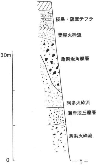
Original Japanese lettering
上から:桜島・薩摩テフラ、妻屋火砕流、亀割坂角礫層、阿多火砕流、海岸段丘礫層、鳥浜火砕流。目盛0、30m。
English translation
Top downward: Sakurajima-Satsuma tephra; Tsumaya pyroclastic flow; Kamewarizaka breccia; Ata pyroclastic flow; marine-terrace gravel; Torihama pyroclastic flow. Scale 0, 30m.
p327_580.png
PDF 327 · Original p. 310
Tephra exposure at Horikiri–Takatoge, Tarumizu City
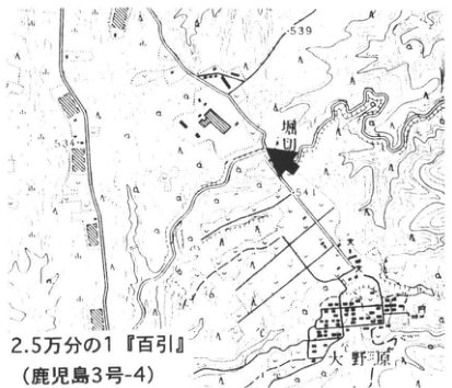
Original Japanese lettering
2.5万分の1『百引』(鹿児島3号-4)。堀切、矢野原。539、541、534。露頭矢印。
English translation
1:25,000 Hyakuhiki sheet (Kagoshima sheet 3-4). Horikiri; Yanohara. 539, 541, 534. Exposure arrow.
p327_581.png
PDF 327 · Original p. 310
K-Ah, Tk3, Sz-S, Tk4 and Tk6 in the Takatoge exposure
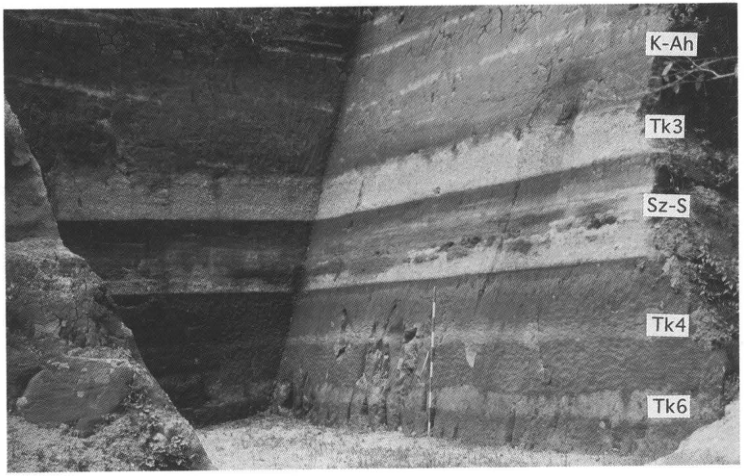
Original Japanese lettering
K-Ah、Tk3、Sz-S、Tk4、Tk6。
English translation
K-Ah, Tk3, Sz-S, Tk4, Tk6.
p328_582.png
PDF 328 · Original p. 311
Haraguchioka site and nearby liquefaction exposures
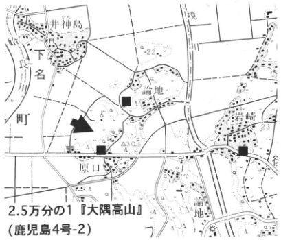
Original Japanese lettering
2.5万分の1『大隅高山』(鹿児島4号-2)。井神島、境川、下名町、論地、岩崎、原口。■、露頭矢印。26、22、23、30.5。
English translation
1:25,000 Osumi-Koyama sheet (Kagoshima sheet 4-2). 井神島; Sakaigawa; Shimomyo-machi; 論地; Iwasaki; Haraguchi. ■, exposure arrow. 26, 22, 23, 30.5.
p328_583.png
PDF 328 · Original p. 311
Sand dike and ejected sand cutting an Early Jomon layer
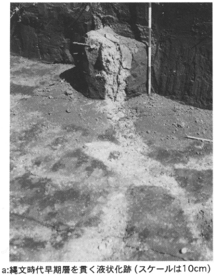
Original Japanese lettering
No lettering
English translation
No lettering
p328_584.png
PDF 328 · Original p. 311
Liquefaction sand dike cutting Osumi pumice fall
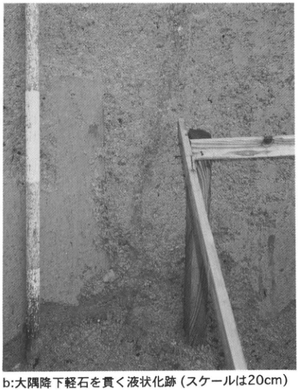
Original Japanese lettering
No lettering
English translation
No lettering
p329_585.png
PDF 329 · Original p. 312
Exposures A and B on the Kagoshima University medical campus
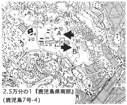
Original Japanese lettering
2.5万分の1『鹿児島県南部』(鹿児島7号-4)。A、B、宇宿町、中山町、小原、笹貫。88、57。
English translation
1:25,000 Kagoshima-Kennanbu sheet (printed title 鹿児島県南部; Kagoshima sheet 7-4). A, B. Usuki-machi; Chuzan-machi; Obara; Sasanuki. 88, 57.
p329_586.png
PDF 329 · Original p. 312
Column of Sakurajima-Satsuma units I–X, K-Ah, Tk-6 and Ito pfl
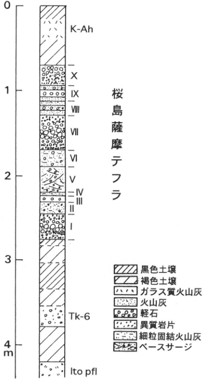
Original Japanese lettering
上からK-Ah、桜島薩摩テフラX・IX・VIII・VII・VI・V・IV・III・II・I、Tk-6、Ito pfl。目盛0、1、2、3、4m。凡例:黒色土壌、褐色土壌、ガラス質火山灰、火山灰、軽石、異質岩片、細粒固結火山灰、ベースサージ。
English translation
Top downward: K-Ah; Sakurajima-Satsuma tephra X, IX, VIII, VII, VI, V, IV, III, II, I; Tk-6; Ito pfl. Scale 0, 1, 2, 3, 4m. Legend: black soil; brown soil; glassy ash; ash; pumice; accidental lithic fragments; fine indurated ash; base surge.
p330_587.png
PDF 330 · Original p. 313
Exposure locations at Yadoribaru and 厚ヶ瀬
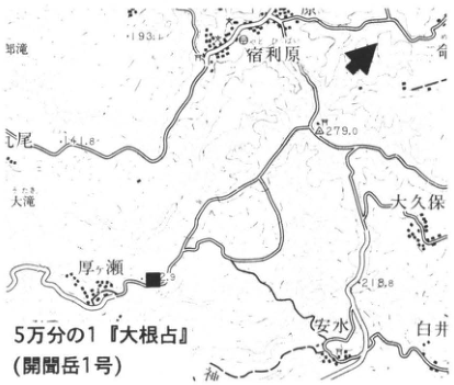
Original Japanese lettering
5万分の1『大根占』(開聞岳1号)。宿利原、厚ヶ瀬、安水、大久保、白井、耳池、上尾、大濱。193.4、141.8、279.0、218.8。■、露頭矢印。
English translation
1:50,000 Onejime sheet (Kaimondake sheet 1). Yadoribaru; 厚ヶ瀬; 安水; Okubo; Shirai; 耳池; 上尾; 大濱. 193.4, 141.8, 279.0, 218.8. ■, exposure arrow.
p330_588.png
PDF 330 · Original p. 313
Accumulated tephra from Ata to Os at Yadoribaru
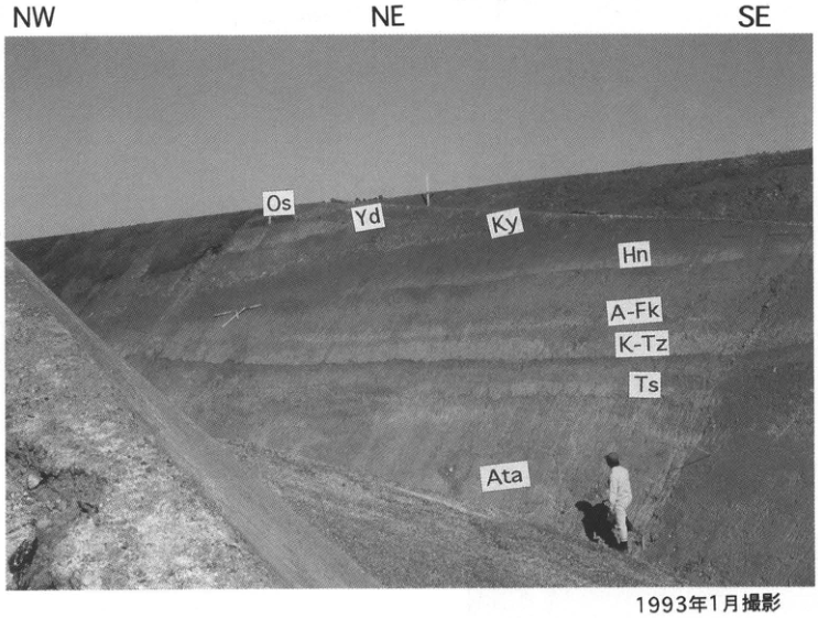
Original Japanese lettering
NW、NE、SE。Os、Yd、Ky、Hn、A-Fk、K-Tz、Ts、Ata。1993年1月撮影。
English translation
NW, NE, SE. Os, Yd, Ky, Hn, A-Fk, K-Tz, Ts, Ata. Photographed in January 1993.
p331_589.png
PDF 331 · Original p. 314
Location map of the Hashimuregawa site, Ibusuki
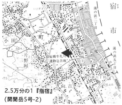
Original Japanese lettering
2.5万分の1『指宿』(開聞岳5号-2)。指宿橋牟礼川遺跡包含地、小田、十町、片野田、向吉、湯の浜一丁目・二丁目・四丁目・五丁目・六丁目、指宿。54、75、32、2.5、26.6。露頭矢印。
English translation
1:25,000 Ibusuki sheet (Kaimondake sheet 5-2). Area containing the Hashimuregawa site; Oda; Jutcho; 片野田; Mukoyoshi; Yunohama 1-, 2-, 4-, 5- and 6-chome; Ibusuki. 54, 75, 32, 2.5, 26.6. Exposure arrow.
p331_590.png
PDF 331 · Original p. 314
Figure 1, exposure of blue kora, purple kora and overlying mudflow
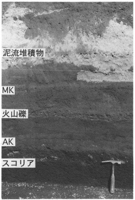
Original Japanese lettering
泥流堆積物、MK、火山礫、AK、スコリア。
English translation
Mudflow deposit; MK; lapilli; AK; scoria.
p331_591.png
PDF 331 · Original p. 314
Figure 2, house rafters and Haji ware buried in purple kora
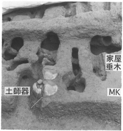
Original Japanese lettering
家屋垂木、土師器、MK。
English translation
House rafters; Haji ware; MK.
p332_592.png
PDF 332 · Original p. 315
Exposure on the marine terrace north of Tsubakiyama
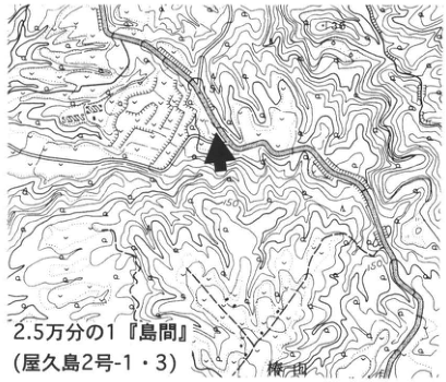
Original Japanese lettering
2.5万分の1『島間』(屋久島2号-1・3)。椿山。100、150、露頭矢印。
English translation
1:25,000 Shimama sheet (Yakushima sheets 2-1 and 2-3). Tsubakiyama. 100, 150; exposure arrow.
p332_593.png
PDF 332 · Original p. 315
Ata, K-Tz and AT overlying high marine-terrace gravel
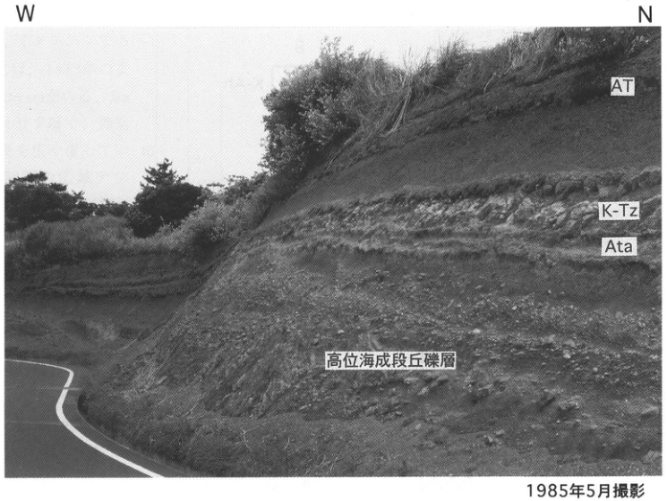
Original Japanese lettering
W、N。AT、K-Tz、Ata、高位海成段丘礫層。1m。1985年5月撮影。
English translation
W, N. AT; K-Tz; Ata; high marine-terrace gravel. 1m. Photographed in May 1985.
p333_594.png
PDF 333 · Original p. 316
Exposures A and B on opposite sides of Takami Bridge
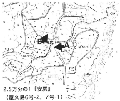
Original Japanese lettering
2.5万分の1『安房』(屋久島6号-2、7号-1)。A、B、高見橋。66、85.7、39、69。
English translation
1:25,000 Anbo sheet (Yakushima sheets 6-2 and 7-1). A, B, Takami Bridge. 66, 85.7, 39, 69.
p333_595.png
PDF 333 · Original p. 316
Correlation columns for Ata and K-Tz at A and K-Tz and K-Ah at B
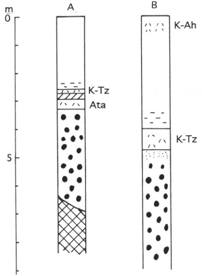
Original Japanese lettering
A、B。A:K-Tz、Ata。B:K-Ah、K-Tz。目盛0、5m。
English translation
A, B. A: K-Tz, Ata. B: K-Ah, K-Tz. Scale 0, 5m.
p334_596.png
PDF 334 · Original p. 317
Large exposure north of Suwanosejima village
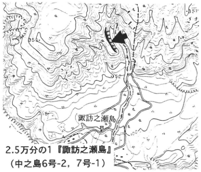
Original Japanese lettering
2.5万分の1『諏訪之瀬島』(中之島6号-2、7号-1)。諏訪之瀬島。55、56、100、200。露頭矢印。
English translation
1:25,000 Suwanosejima sheet (Nakanoshima sheets 6-2 and 7-1). Suwanosejima. 55, 56, 100, 200. Exposure arrow.
p334_597.png
PDF 334 · Original p. 317
Approximately 60m of Suwanosejima Quaternary tephra stratigraphy and eight legend symbols
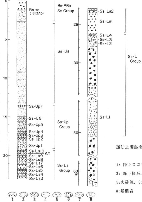
Original Japanese lettering
2列柱状図。Bn sc(1813AD)、Bn-PBn Sc Group、Ss-Us、Ss-Up Group、Ss-Ls Group、Ss-L Group。 Ss-Up7、Ss-U6[原図表記]、Ss-Up5、Ss-Up4、Ss-Up3、Ss-Up2、Ss-Up1。Ss-Ls10、AT、Ss-Ls9、Ss-Ls8、Ss-Ls7、Ss-Ls6、Ss-Ls5、Ss-Ls4、Ss-Ls3、Ss-Ls2、Ss-Ls1。Ss-L4、Ss-L3、Ss-L2、Ss-L1。目盛0、5、10、15、20、25、30、50、60m。凡例1~8の意味は図説明に収録。
English translation
Two-column stratigraphy. Bn sc (1813AD); Bn-PBn Sc Group; Ss-Us; Ss-Up Group; Ss-Ls Group; Ss-L Group. Ss-Up7; Ss-U6 [as printed]; Ss-Up5; Ss-Up4; Ss-Up3; Ss-Up2; Ss-Up1. Ss-Ls10; AT; Ss-Ls9; Ss-Ls8; Ss-Ls7; Ss-Ls6; Ss-Ls5; Ss-Ls4; Ss-Ls3; Ss-Ls2; Ss-Ls1. Ss-L4; Ss-L3; Ss-L2; Ss-L1. Scale 0, 5, 10, 15, 20, 25, 30, 50, 60m. The meanings of legend symbols 1–8 are transcribed in the caption.
p335_598.png
PDF 335 · Original p. 318
Kikaijima terrace locations and Shitooke geological section with high-precision U-series ages
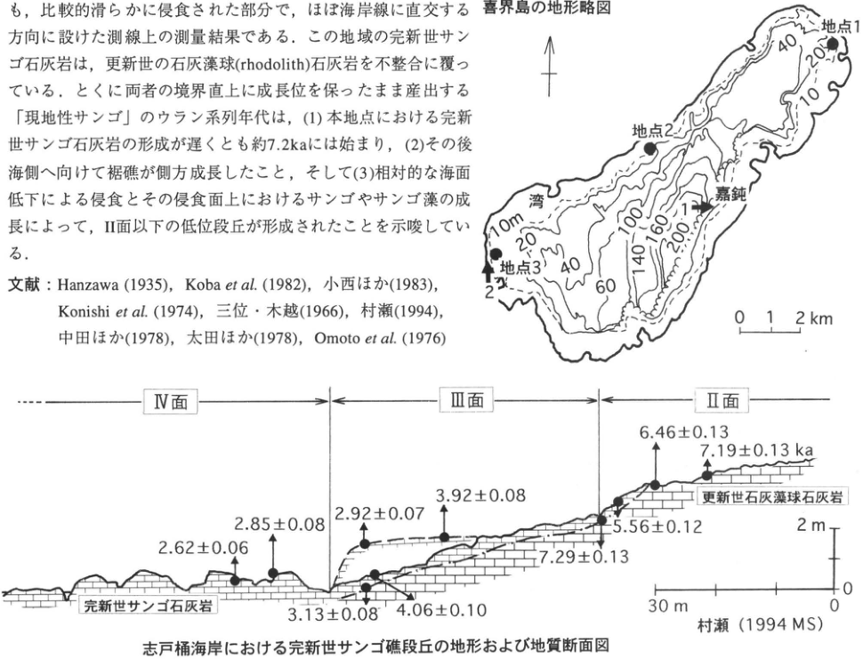
Original Japanese lettering
喜界島の地形略図:地点1、地点2、地点3、湾、嘉鈍、写真方向1・2。等高線10、20、40、60、100、140、160、200。縮尺0、1、2km、北矢印。 断面:IV面、III面、II面。完新世サンゴ石灰岩、更新世石灰藻球石灰岩。ウラン系列年代(ka):2.62±0.06、2.85±0.08、2.92±0.07、3.13±0.08、4.06±0.10、3.92±0.08、7.29±0.13、5.56±0.12、6.46±0.13、7.19±0.13。縦尺度0~2m、横尺度0~30m。村瀬(1994 MS)。切出し中の本文・文献は本文欄に収録。
English translation
Schematic topographic map of Kikaijima: sites 1, 2, 3; Wan; Kadon; photograph directions 1 and 2. Contours 10, 20, 40, 60, 100, 140, 160, 200. Scale 0, 1, 2km; north arrow. Section: surfaces IV, III, II. Holocene coral limestone; Pleistocene rhodolith limestone. Uranium-series ages (ka): 2.62±0.06, 2.85±0.08, 2.92±0.07, 3.13±0.08, 4.06±0.10, 3.92±0.08, 7.29±0.13, 5.56±0.12, 6.46±0.13, 7.19±0.13. Vertical scale 0–2m; horizontal scale 0–30m. 村瀬 (1994 MS). Prose and references included in the crop are transcribed and translated in the body.
p336_599.png
PDF 336 · Original p. 319
View of Holocene coral-reef terraces on the Kadon coast from Hyakunodai
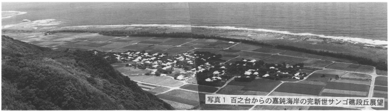
Original Japanese lettering
No lettering
English translation
No lettering
p336_600.png
PDF 336 · Original p. 319
Terrace surfaces I–IV on the Araki coast
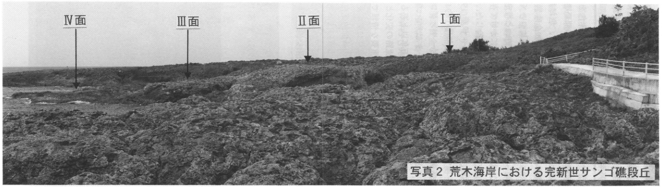
Original Japanese lettering
IV面、III面、II面、I面、各面を示す矢印。
English translation
Surfaces IV, III, II, I; arrows identify each surface.
p337_601.png
PDF 337 · Original p. 320
Red-limestone exposure at Yamashiro, Itoman City
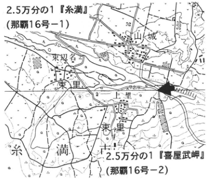
Original Japanese lettering
2.5万分の1『糸満』(那覇16号-1)、2.5万分の1『喜屋武岬』(那覇16号-2)。山城、東双名、上里、東里、糸満。露頭矢印。
English translation
1:25,000 Itoman sheet (Naha sheet 16-1) and Kyanmisaki sheet (Naha sheet 16-2). Yamashiro; 東双名; Uezato; 東里; Itoman. Exposure arrow.
p337_602.png
PDF 337 · Original p. 320
Red-limestone exposure and stratigraphy of Shinzato, basal Ryukyu and Naha strata
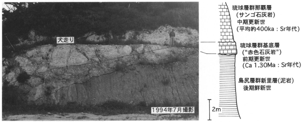
Original Japanese lettering
写真:犬走り、1994年7月撮影。柱状図:琉球層群那覇層(サンゴ石灰岩)、中期更新世(平均約400ka:Sr年代);琉球層群基底層(“赤色石灰岩”)、前期更新世(Ca 1.30Ma:Sr年代);島尻層群新里層(泥岩)、後期鮮新世。2m。
English translation
Photograph: berm; photographed in July 1994. Column: Naha Formation, Ryukyu Group (coral limestone), Middle Pleistocene (mean approximately 400ka: Sr age); basal Ryukyu Group (“red limestone”), Early Pleistocene (Ca 1.30Ma: Sr age); Shinzato Formation, Shimajiri Group (mudstone), Late Pliocene. 2m.
p338_603.png
PDF 338 · Original p. 321
Aerial photograph of Shiraho reef and four reef-lagoon and reef-flat photographs
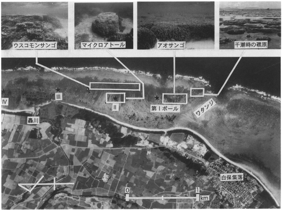
Original Japanese lettering
ウスコモンサンゴ、マイクロアトール、アオサンゴ、干潮時の礁原。IV、III、II、第Iポール、轟川、ワタンジ、白保集落。縮尺0~1km、北矢印、群落位置を示す囲みと連結線。
English translation
Montipora foliosa; microatoll; blue coral; reef flat at low tide. IV, III, II, pole I; Todorokigawa; Watanji; Shiraho village. Scale 0–1km, north arrow, boxes and connecting lines identifying colony locations.
p371_604.png
PDF 371 · Original p. —
Back-cover photograph of a layered tephra exposure with curved yellow-brown, dark, and white beds.
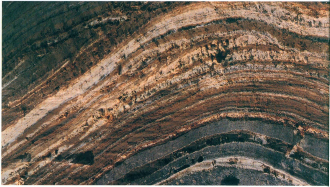
Original Japanese lettering
No lettering
English translation
No lettering
p145_248.png
PDF 145 · Original p. 124
Clipped prose listing correlations between Mashu Mpfa and Kuttara Kt tephras

Original Japanese lettering
Mpfa 2a=Kt-4, Mpfa 2b=Kt-5, Mpfa 3=Kt-6.
English translation
Mpfa 2a = Kt-4; Mpfa 2b = Kt-5; Mpfa 3 = Kt-6.
p216_378.png
PDF 216 · Original p. 199
Clipped prose identifying tool types in Y-133–136; the right edge is incomplete

Original Japanese lettering
石器)、Y-133~136(ナイフ形石器、槍先形尖頭器)、Y-137~140[末尾切れ]
English translation
tools), Y-133–136 (knife-shaped tools and lanceolate points), Y-137–140 [right edge clipped]
右端のY-137~140に続く文字・記号 — 切り抜きの範囲外に続きがあり、この補助画像だけでは判読できない。本文は元PDFで確認する。
p262_460.png
PDF 262 · Original p. 245
Clipped legend explaining that Ω denotes archaeological artifacts
Original Japanese lettering
Ωは遺物
English translation
Ω denotes archaeological artifacts.