Corrected edition · JAPAN ASSOCIATION FOR QUATERNARY RESEARCH
Inventory of Quaternary Outcrops —Tephras in Japan—
About this corrected and translated edition
This unofficial corrected and translated edition was prepared by Fumihiko Ikegami, who reformatted the OCR text and adjusted the layout based on the publicly distributed PDF of Inventory of Quaternary Outcrops—Tephras in Japan (edited by the volume’s editorial committee and published by the Japan Association for Quaternary Research in 1996). The English text was produced using automated translation with GPT-6.1 Sol. The corrections, translation, figure alt text and lettering transcriptions, and additional editorial notes in this edition were prepared after the original publication.Ages, place and stratigraphic names, interpretations, and outcrop conditions retain their historical context. Automated processing and the low resolution of the source material may leave transcription or translation errors; please also consult the Association’s original PDF when using or citing this work for research. Unreadable passages and inconsistencies in the original are documented in the editorial review notes.
Four entries on original pp. 157–159 and 164 were removed from the public edition following the Association’s assessment of material associated with the Paleolithic fabrication scandal; editorial notes explain their absence at the corresponding locations. See the Association’s distribution page for the public-edition policy.
All four documents share an external image folder. Expand the panel below a figure in the HTML to read its extracted lettering and translation. Separate data include Japanese figure text, English figure text, bilingual alt and figure-text JSON, and the terminology glossary.
Cover
Inventory of Quaternary Outcrops —Tephras in Japan—
Special publication commemorating the 40th anniversary of the Japan Association for Quaternary Research
Japan Association for Quaternary Research
40th Anniversary Special Publication

日本第四紀学会 — Japan Association for Quaternary Research
Color plates: 1–3
Show extracted lettering and translation
English translation of figure lettering
-
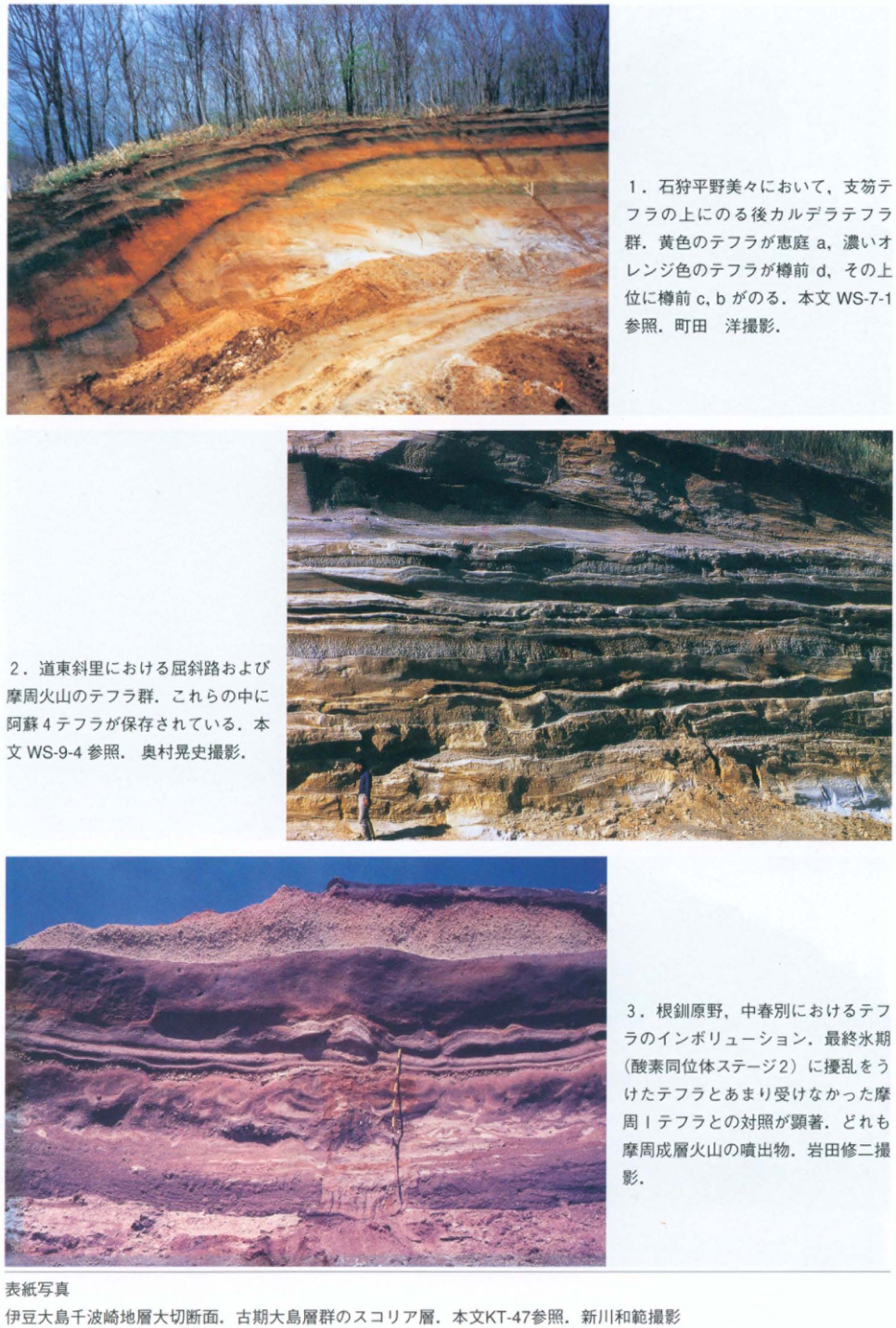
Post-caldera tephras overlying the Shikotsu tephra at Bibi on the Ishikari Plain. The yellow tephra is Eniwa-a, and the dark orange tephra is Tarumae-d; Tarumae-c and -b overlie them. See WS-7-1. Photograph: 町田洋 (Hiroshi Machida).
-
Tephras from Kutcharo and Mashu volcanoes at Shari in eastern Hokkaido. The Aso-4 tephra is preserved within this succession. See WS-9-4. Photograph: 奥村晃史 (Koji Okumura).
-
Tephra involutions at Nakashunbetsu on the Konsen Plain. There is a marked contrast between tephras disturbed during the last glacial period (oxygen isotope stage 2) and the Mashu-1 tephra, which was affected relatively little. All are products of Mashu stratovolcano. Photograph: 岩田修二 (Shuji Iwata).
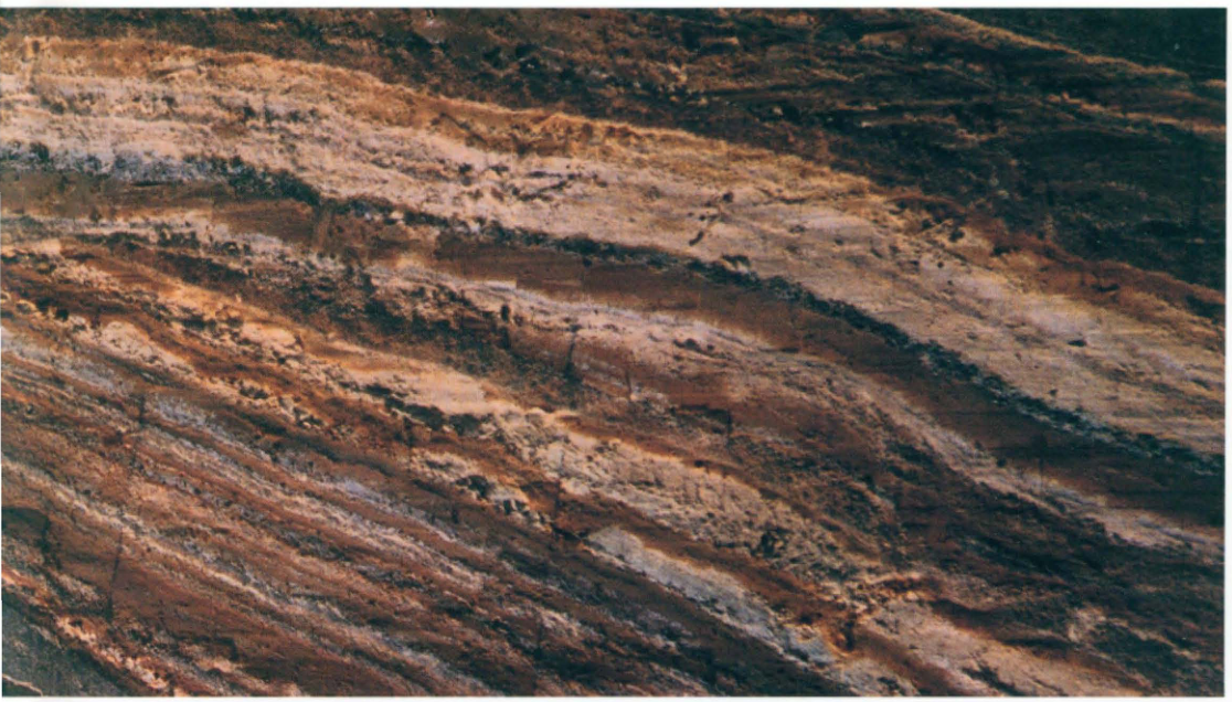
Cover photograph: The Great Geological Section at Senbazaki, Izu-Oshima. Scoria beds of the Older Oshima Group. See KT-47. Photograph: 新川和範.
Original Japanese lettering
-
石狩平野美々において、支笏テフラの上にのる後カルデラテフラ群。黄色のテフラが恵庭a、濃いオレンジ色のテフラが樽前d、その上位に樽前c、bがのる。本文WS-7-1参照。町田洋撮影。
-
道東斜里における屈斜路および摩周火山のテフラ群。これらの中に阿蘇4テフラが保存されている。本文WS-9-4参照。奥村晃史撮影。
-
根釧原野、中春別におけるテフラのインボリューション。最終氷期(酸素同位体ステージ2)に擾乱をうけたテフラとあまり受けなかった摩周1テフラとの対照が顕著。どれも摩周成層火山の噴出物。岩田修二撮影。
表紙写真:伊豆大島千波崎地層大切断面。古期大島層群のスコリア層。本文KT-47参照。新川和範撮影。
1. Post-caldera tephras overlying the Shikotsu tephra at Bibi on the Ishikari Plain. The yellow tephra is Eniwa-a, and the dark orange tephra is Tarumae-d; Tarumae-c and -b overlie them. See WS-7-1. Photograph: 町田洋 (Hiroshi Machida).
2. Tephras from Kutcharo and Mashu volcanoes at Shari in eastern Hokkaido. The Aso-4 tephra is preserved within this succession. See WS-9-4. Photograph: 奥村晃史 (Koji Okumura).
3. Tephra involutions at Nakashunbetsu on the Konsen Plain. There is a marked contrast between tephras disturbed during the last glacial period (oxygen isotope stage 2) and the Mashu-1 tephra, which was affected relatively little. All are products of Mashu stratovolcano. Photograph: 岩田修二 (Shuji Iwata).
Cover photograph: The Great Geological Section at Senbazaki, Izu-Oshima. Scoria beds of the Older Oshima Group. See KT-47. Photograph: 新川和範.
Color plates: 4–6
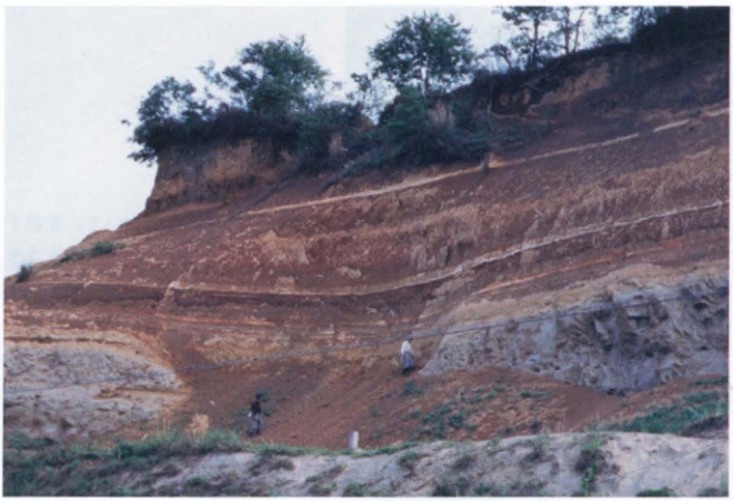
4. The Shimosueyoshi Formation and tephras at Chitose, Kawasaki. This has been one of the reference outcrops since the early studies of the Kanto Loam. Although urbanization has advanced, part of the outcrop survives. The basement consists of sandstone and mudstone of the Kazusa Group. Apart from valley-filling sediments, the Shimosueyoshi Formation consists of very thin wave-cut platform deposits, overlain by the Shimosueyoshi Loam and younger layers. The tephras appearing white are derived from Hakone volcano. Photograph: 貝塚爽平 (Sohei Kaizuka).
Show extracted lettering and translation
English translation of figure lettering
Signs appear near the top of the photograph; part of their lettering is illegible.
Original Japanese lettering
写真上部に札があるが、文字の一部は判読不明。
Reading notes
写真中の札の全字は低解像度のため確定できない。
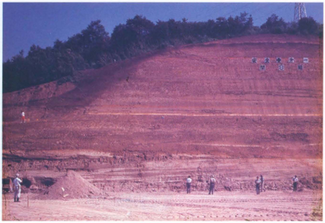
5. A section through the Tama Loam exposed during construction of the Kawasaki interchange of the Tomei Expressway. The Oshinuma sand and gravel bed is visible at the foot of the cliff, overlain by marker tephras including Gomashio, Doran, and Baya-rees (バヤリース). Photograph: 貝塚爽平 (Sohei Kaizuka).
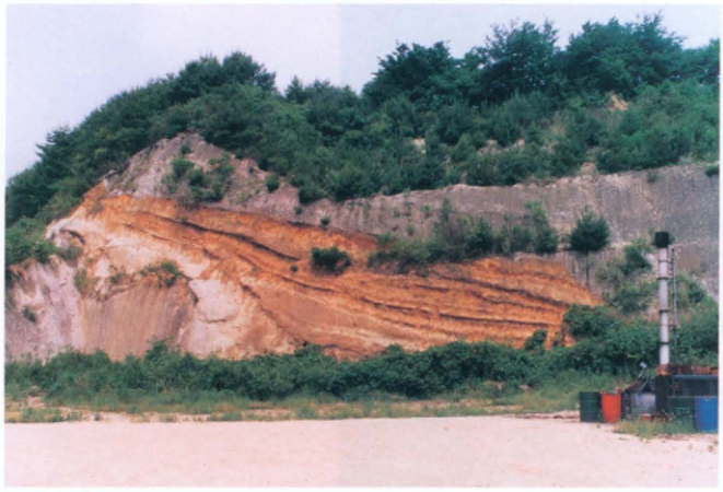
6. Early Pleistocene Shirakawa pyroclastic-flow deposits, widely distributed in southern Tohoku. Above the intervening alternation of fallout tephra and soil is the Saigo pyroclastic-flow deposit; below it is the Ashino pyroclastic-flow deposit. The Saigo deposit is weakly welded. See TH-27. Photograph: 鈴木毅彦 (Takehiko Suzuki).
Color plates: 7–9
Show extracted lettering and translation
English translation of figure lettering
Numerals indicating a photographic date occur at lower right; some digits are illegible.
Original Japanese lettering
右下に撮影日を示す数字がある。一部判読不明。
Reading notes
撮影日の年は確定せず。
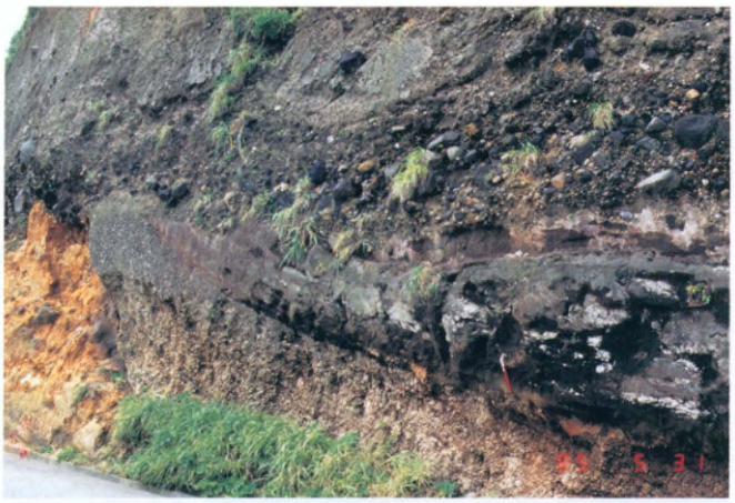
7. Products of the large eruption that generated the Kikai-Akahoya tephra: a pumice-fall deposit and two pyroclastic-flow deposits (Takeshima, Kikai caldera, southern Kyushu). At the far left is the Nagase pyroclastic-flow deposit, the proximal pyroclastic-flow deposit associated with the Kikai-Tozurahara tephra. See WS-2-1. Photograph: 町田洋 (Hiroshi Machida).
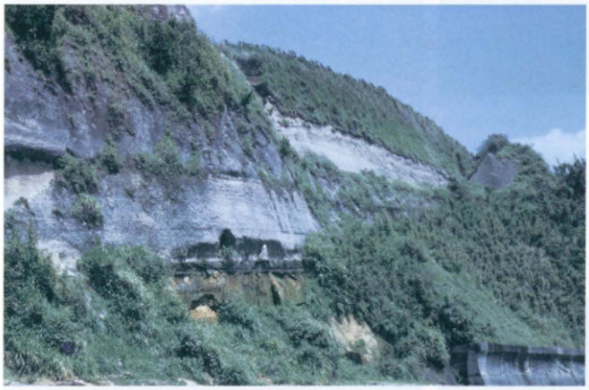
8. The large-scale tephra deposits that produced the Aira-Tn tephra (Shibushi coast, southern Kyushu): the Osumi pumice-fall deposit and the Ito pyroclastic-flow deposit. Beneath them occur various slightly pedogenically altered Late Pleistocene tephras. See WS-5-1. Photograph: 町田洋 (Hiroshi Machida).
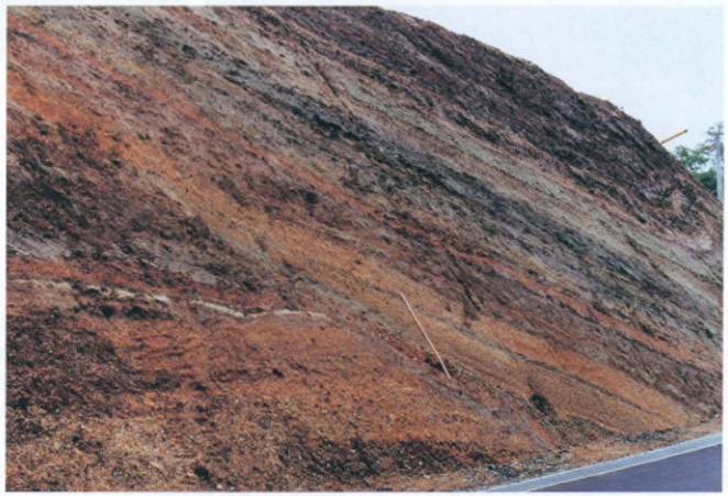
9. Sueyoshi stage I tephras of Higashiyama volcano on Hachijojima and the intercalated Aira-Tn tephra (the white volcanic-ash layer on the left). See KT-50. Photograph: 菅香世子.
Color plates: 10–12
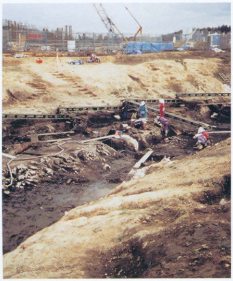
10. The Sannai-Maruyama archaeological site in Aomori. An embankment constructed during the Early Jomon period stands in the center of the valley and is covered by deposits consisting mainly of abundant pottery. See TH-3. Photograph: 辻誠一郎 (Seiichiro Tsuji).
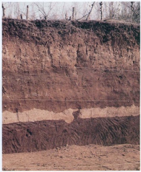
11. Tephras at the Iwajuku archaeological site, Gunma Prefecture. The Paleolithic artifacts first excavated here were recovered from volcanic-ash soil approximately halfway between the ground surface and the Haruna-Hassaki tephra (the white pumice layer), approximately at the stratigraphic horizon of the Aira-Tn tephra. See KT-12. Photograph: 町田洋 (Hiroshi Machida).
Show extracted lettering and translation
English translation of figure lettering
Numerals indicating a photographic date appear at lower left, but the complete date is illegible.
Original Japanese lettering
左下に撮影日を示す数字があるが、全桁は判読不明。
Reading notes
写真中の撮影日全桁は判読不明。
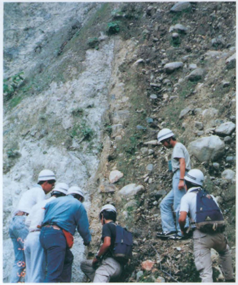
12. The Atotsugawa fault in the upper Makawa valley, Toyama Prefecture. Granite lies on the left (northwestern) side and terrace gravel on the right (southeastern) side. See CB-27. Photograph: 町田洋 (Hiroshi Machida).
Contents
| Section | Original page |
|---|---|
| Color plates | — |
| Preface | viii |
| I. Explanatory notes | x |
| II. Guide to using this book | xvi |
III. Individual entries
Four entries on original pp. 157–159 and 164 were removed from the Association’s public edition. Their contents links lead to explanatory editorial notes.
1. Widespread tephras throughout Japan
1. Widespread tephras throughout Japan
2. Hokkaido
2. Hokkaido
3. Tohoku
3. Tohoku
4. Kanto
4. Kanto
5. Chubu
5. Chubu
6. Kinki
7. Chugoku and Shikoku
7. Chugoku and Shikoku
| Entry | Title | Author(s) | Original page |
|---|---|---|---|
| SK-4 | Marine terrace deposits forming the Muroto-misaki surface, Kochi Prefecture | 前杢英明 | 292 |
8. Kyushu and the Nansei Islands
| Section | Original page |
|---|---|
| References | 323 |
| Index | 341 |
| List of authors | 350 |
Preface
Research concerning the Quaternary has become increasingly integrated in recent years and has expanded to encompass a broad range of subjects, including the reconstruction of former land–sea distributions, sea levels, vegetation, climate, and other aspects of past environments; the activity histories of active faults; and archaeological excavations and changes in human culture. Strata, landforms, and soils record in detail the histories of these terrestrial ecosystems and human activities. Outcrops enable us to encounter strata, landforms, and soils of many different ages, and the significance of outcrops and boreholes is therefore increasing. The outcrops that constitute the main subject of this book are the most readily accessible places where anyone can observe, collect samples, and unravel the record of the Earth's activity at any time. Borehole cores become important in settings where outcrops are intrinsically scarce, including sea floors, lake beds, embayments, plains, basins, and wetlands. The importance of research using borehole cores from land, sea floors, and lake beds needs no emphasis, but only a small selection is included here. We hope to compile these materials on another occasion.
Outcrops that provide such important information are precious assets for humanity and a combined natural and cultural heritage. There is consequently an extremely strong need to preserve them. Many Japanese Quaternary outcrops, however, are artificial exposures, including those created by archaeological excavations, and often disappear very quickly. The situation is particularly serious in urban areas. Even exposures of the Shimosueyoshi Formation and Shimosueyoshi Loam, which document the Shimosueyoshi transgression 125,000 years ago, have become almost impossible to see in the Yokohama–Kawasaki area. It is no exaggeration to describe the loss of these precious records in the course of “development” as a modern form of “book burning.”
There are, on the other hand, a few examples of outcrops being used for tourism, education, and research. At the “Great Geological Section” on Izu-Oshima (cover photograph), the town has installed explanatory signs and continually manages and conserves the exposure, which attracts many visitors. Various ways of preserving archaeological and active-fault exposures have also begun to be considered. At present, however, only a very small number of Quaternary exposures, such as lava caves and coral reefs, have been designated natural monuments. There is an urgent need to preserve particularly valuable reference outcrops of Quaternary strata. A variety of approaches will be necessary according to the value and condition of each exposure: preserving the site itself, taking and preserving an outcrop peel, and preserving samples, including borehole cores. Consideration should also be given to a system of emergency investigation of outcrops exposed by construction and similar activities, analogous to rescue excavations at archaeological sites, so that at least a description is made. Cooperation from museums and other public institutions will be indispensable for preserving peels and samples. For conservation in the field, it is important to secure the understanding of the Agency for Cultural Affairs, local authorities, and other relevant bodies regarding designation as cultural properties or natural monuments. Installing appropriate explanatory signs at outcrops with the cooperation of local boards of education would also be highly significant.
This book selects and describes 274 sites, principally terrestrial outcrops containing tephra in the Japanese archipelago. It introduces a variety of exposures: representative widespread tephras and their characteristics in source regions and at distant localities; regional tephra stratigraphies; relationships between regional and widespread tephras; exposures bearing on past environments to which tephra provides a chronological framework, including glacial and periglacial features, Jomon transgression deposits, and peat; active-fault exposures; and exposures associated with archaeological sites. It also includes a considerable number of important exposures in which no tephra has so far been found, for example those associated with active faults, archaeological sites, and coral reefs. Some of the selected outcrops have already disappeared. One purpose of the book is to preserve descriptive records of type localities and other important exposures that can serve in their place.
We have focused on tephra-bearing outcrops because tephra is the most effective means in the Japanese archipelago of providing a time axis for the various records that outcrops reveal. In general, a tephra is an excellent time-marker bed that covers extensive land and water areas at a geologically instantaneous moment. If its eruption age is known, it has a significance equivalent to an absolute age.
A major characteristic of the Japanese archipelago is that very many strata contain tephra—volcaniclastic material such as volcanic ash—and many landforms are mantled by it. Regional tephra stratigraphies have long been studied in Japan. Tephra has been used to correlate and establish chronologies for strata, landforms, and soils, and to provide a chronological framework for environmental changes, geological events, and human activities. Together with the accumulation of age determinations by various methods, these developments have made the account of the Quaternary drama unfolding in and around the Japanese archipelago far more detailed, and are making it possible to place it within global environmental change. In this sense, research on tephra and tephrochronology, alongside research on dating methods, is among the most fundamental and broadly applicable areas of Quaternary research.
At the general meeting of the Japan Association for Quaternary Research held at Tokyo Metropolitan University in August 1994, publication of an inventory of Quaternary outcrops was approved as a project commemorating the Association's 40th anniversary. Against the background of advances in tephrochronology, its purpose is, above all, to give young researchers, graduate students, and students who will carry the field forward an opportunity to learn how to examine outcrops: to pass on existing knowledge in front of surviving exposures, to identify what information should be obtained from them, and to discern what has been established and what problems remain. It also aims to make the wider public aware of the importance of outcrops and the significance of conserving them. We hope that this book will be widely used in these ways.
The contents of this book are not necessarily complete, and there will undoubtedly be many corrections and additions. In that sense, it is a starting point for further research. We hope readers will take it into the field and use it to deepen discussion.
Building on the history and tradition of tephrochronology developed in Japan, continuing efforts will be needed to describe outcrops accurately—including those that have disappeared—to preserve their records, and to pass them on to the next generation. Unremitting efforts will also be needed to conserve outcrops of great significance to Quaternary research. We therefore hope that this project will continue.
During the editing of this book, 貝塚爽平 (Sohei Kaizuka) initially contributed to the formulation of the project as chair of the Planning and Editorial Committee, the predecessor of the present committee. He, 新井房夫 (Fusao Arai), and 新川和範 also supplied the color plates and cover photograph. 吉田浩, 小林淳, and 是枝若奈 assisted with the editorial work. Over two terms, the Executive Board of the Japan Association for Quaternary Research delegated three executive members to the committee and provided extensive assistance throughout the planning and editing process. We express our sincere thanks to all these individuals and organizations.
1 July 1996
Editorial Committee for the Inventory of Quaternary Outcrops
遠藤邦彦、熊井久雄、町田洋、奥村晃史、清水長正
鈴木毅彦、渡辺満久、上杉陽、池田安隆、辻誠一郎
I. Explanatory chapters
1. Tephra research in Japan and Quaternary science
Today, whatever the subject, no discussion of the Quaternary in the Japanese archipelago can dispense with tephra or the methods of tephrochronology. The late 小林国夫 (Kunio Kobayashi), formerly a professor at Shinshu University, established a Commission on Tephrochronology within the International Union for Quaternary Research (INQUA) and became its first chair. The commission was active from 1961 to 1983. It was revived in 1988, and 町田洋 (Hiroshi Machida) has chaired it since 1992; Japanese researchers have thus also played central roles internationally. One reason for this is the long history of vigorous tephra research throughout Japan and the major role of tephra in establishing regional Quaternary stratigraphies. The Japan Association for Quaternary Research has held three symposia on tephrochronology, publishing special issues in The Quaternary Research, volume 3, numbers 1–2; volume 11, number 4; and volume 30, number 5 (1992).
In 1976, a thin white ash bed within the Kanto Loam mantling slopes across the Tanzawa Mountains—the Tanzawa Pumice (Machida et al., 1971)—was named the Aira-Tn tephra (AT). When it was shown to derive from the great eruption about 24,000 years ago that discharged the Ito pyroclastic flow from Aira caldera and formed the extensive Shirasu plateaus (Machida and Arai, 1976), the Japanese earth-science community was profoundly surprised and took considerable time to accept this interpretation. The advances in tephrochronology initiated by the discovery of this widespread tephra are nevertheless clearly evident in the course of research during the ensuing 20 years. Following the discovery of AT in 1976, widespread tephras were identified one after another, and the field advanced to a qualitatively higher level. Thirty years have now passed since the special issue on tephrochronology appeared in volume 3, numbers 1–2 of The Quaternary Research, and 20 years since the discovery of AT. The tephra symposium held at Meiji University in 1990 (published as a special issue in volume 30, number 5 of The Quaternary Research) and the Atlas of Tephra (Machida and Arai, 1992), which brings together the work of those two researchers, have documented the present state of knowledge concerning the characteristics, distributions, and ages of major tephras, particularly widespread tephras, and have demonstrated their substantial usefulness and potential for application.
2. Fundamentals of tephra research
a. What is tephra?
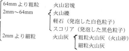
Tephra comprises pyroclastic (volcaniclastic) material, such as pumice and scoria of various sizes (Table 1), generated by explosive volcanic eruptions. It is synonymous with volcanic ash in the broad sense.
During an explosive volcanic eruption, magma rising through the conduit is fragmented and ejected upward as it cools and solidifies. An eruption column forms above the crater, consisting of magma fragments, volcanic gases, and air entrained from the surroundings. As particles of various sizes within the column are transported by wind, coarse particles fall to the ground near the crater and progressively finer particles fall farther away. In this way, fallout tephra that is size-sorted according to distance from the crater is deposited.
Pyroclastic-flow and pyroclastic-surge deposits, on the other hand, form when material containing particles of various sizes flows downslope during partial collapse of an eruption column, overflow of the eruption cloud from the crater, or the formation of an inclined eruption column from the outset. Pyroclastic flows can also be generated by collapse of a lava dome. Pyroclastic-surge deposits associated with laterally directed eruption clouds produced by phreatomagmatic explosions are called base-surge deposits. Debris-avalanche deposits generated by collapse of a volcanic edifice and deposits of water-bearing mudflows or debris flows often consist of pyroclastic material and are included in tephra in the broad sense (Table 2).
The term “volcanic ash,” often used synonymously with tephra, properly refers to particles finer than 2 mm. Using it to include coarse pumice or scoria therefore remains somewhat incongruous. For this reason, “tephra” has increasingly been used as the collective term for volcaniclastic (pyroclastic) material. With some exceptions, Machida and Arai (1992) replaced “ash” with “tephra” in tephra names. Although a distal tephra may be fine-grained and appropriately called ash, near its source volcano it commonly occurs as fallout tephra rich in coarse particles or as a pyroclastic-flow deposit. Accordingly, this book uses “tephra” as the general term for pyroclastic material and indicates correspondence with the tephra names (“… tephra”) of Machida and Arai (1992). Where the name “ash” is already well established, however, especially for units named and defined regionally as “… volcanic-ash bed,” the original term has sometimes been retained.
Table 1. Classification of tephra by grain size and other characteristics
Show extracted lettering and translation
English translation of figure lettering
| Grain size | Classification and characteristics |
|---|---|
| Coarser than 64 mm | Volcanic blocks |
| 2–64 mm | Lapilli; pumice (vesiculated white particles); scoria (vesiculated black particles) |
| Finer than 2 mm | Volcanic ash: coarse ash (volcanic sand) and fine ash |
Original Japanese lettering
| 粒径 | 分類・性状 |
|---|---|
| 64 mmより粗粒 | 火山岩塊 |
| 2–64 mm | 火山礫;軽石(発泡した白色粒子);スコリア(発泡した黒色粒子) |
| 2 mmより細粒 | 火山灰:粗粒火山灰(火山砂)、細粒火山灰 |
| Grain size | Classification and characteristics |
|---|---|
| Coarser than 64 mm | Volcanic blocks |
| 2–64 mm | Lapilli; pumice (vesiculated white particles); scoria (vesiculated black particles) |
| Finer than 2 mm | Volcanic ash: coarse ash (volcanic sand) and fine ash |
Table 2. Classification of tephra by transport process
| Classification by transport process | Subdivisions |
|---|---|
| Fallout tephra | Pumice fall, scoria fall, ash fall (volcanic sand) |
| Pyroclastic-flow deposits | — |
| Pyroclastic-surge deposits | — |
| Ballistically ejected material | — |
| Debris-avalanche deposits | — |
| Mudflows, debris flows, and slushflows | — |
Show extracted lettering and translation
English translation of figure lettering
| Classification by transport process | Subdivisions |
|---|---|
| Fallout tephra | Pumice fall, scoria fall, ash fall (volcanic sand) |
| Pyroclastic-flow deposits | — |
| Pyroclastic-surge deposits | — |
| Ballistically ejected material | — |
| Debris-avalanche deposits | — |
| Mudflows, debris flows, and slushflows | — |
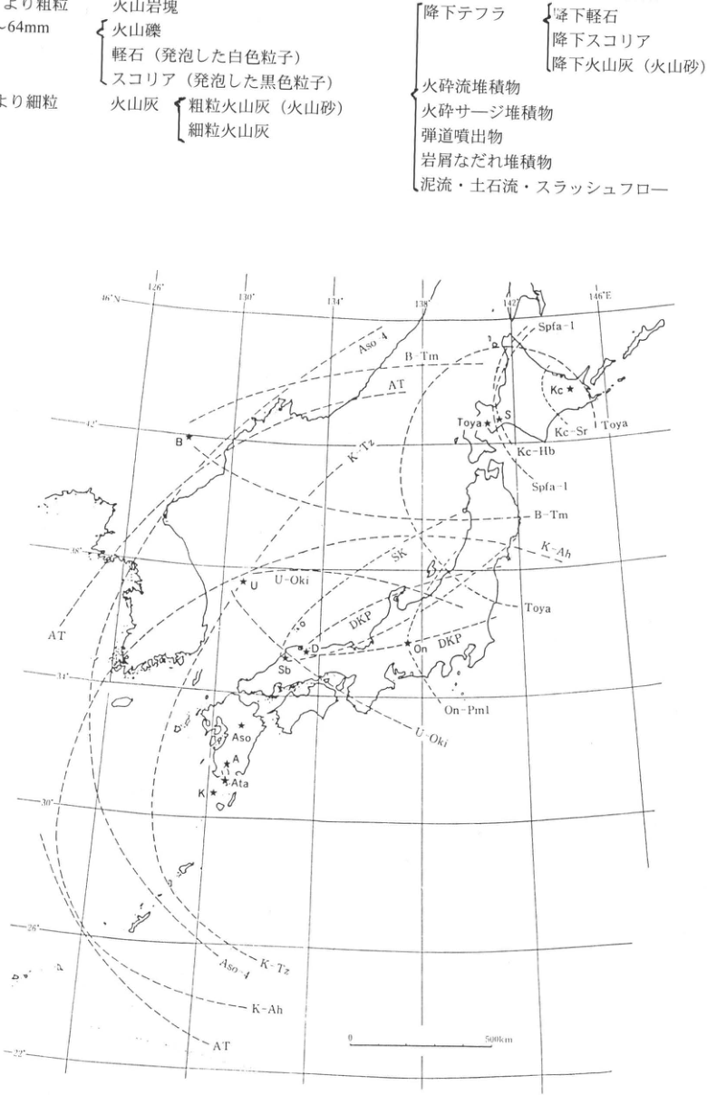
Figure 1. Distribution limits of representative Late Pleistocene widespread tephras in Japan and adjacent regions (Machida and Arai, 1992). Volcanoes (stars): Kc, Kutcharo; S, Toya; On, Ontake; D, Daisen; Sb, Sambe; Aso, Aso; A, Aira; Ata, Ata; K, Kikai; B, Baitoushan; U, Ulleung.
Tephra abbreviations in the map: Aso-4, B-Tm, AT, K-Tz, Spfa-1, Kc-Sr, Kc-Hb, Toya, SK, K-Ah, U-Oki, DKP, On-Pm1. Longitude ticks: 126°, 130°, 134°, 138°, 142°, 146°E. Latitude ticks: 46°N, 42°, 38°, 34°, 30°, 26°, 22°. Scale: 0–500 km.
Original Japanese lettering
| 運搬過程による分類 | 細分 |
|---|---|
| 降下テフラ | 降下軽石、降下スコリア、降下火山灰(火山砂) |
| 火砕流堆積物 | — |
| 火砕サージ堆積物 | — |
| 弾道噴出物 | — |
| 岩屑なだれ堆積物 | — |
| 泥流・土石流・スラッシュフロー | — |
図1. 日本とその周辺地域における更新世後期の代表的広域テフラの分布範囲(町田・新井、1992)。火山(星印):Kc(屈斜路)、S(洞爺)、On(御岳)、D(大山)、Sb(三瓶)、Aso(阿蘇)、A(姶良)、Ata(阿多)、K(鬼界)、B(白頭山)、U(鬱陵)。
図中のテフラ略号:Aso-4、B-Tm、AT、K-Tz、Spfa-1、Kc-Sr、Kc-Hb、Toya、SK、K-Ah、U-Oki、DKP、On-Pm1。経度目盛:126°、130°、134°、138°、142°、146°E。緯度目盛:46°N、42°、38°、34°、30°、26°、22°。縮尺:0–500 km。
Figure 1. Distribution limits of representative Late Pleistocene widespread tephras in Japan and adjacent regions (Machida and Arai, 1992). Volcanoes (stars): Kc, Kutcharo; S, Toya; On, Ontake; D, Daisen; Sb, Sambe; Aso, Aso; A, Aira; Ata, Ata; K, Kikai; B, Baitoushan; U, Ulleung.
Tephra abbreviations in the map: Aso-4, B-Tm, AT, K-Tz, Spfa-1, Kc-Sr, Kc-Hb, Toya, SK, K-Ah, U-Oki, DKP, On-Pm1. Longitude ticks: 126°, 130°, 134°, 138°, 142°, 146°E. Latitude ticks: 46°N, 42°, 38°, 34°, 30°, 26°, 22°. Scale: 0–500 km.
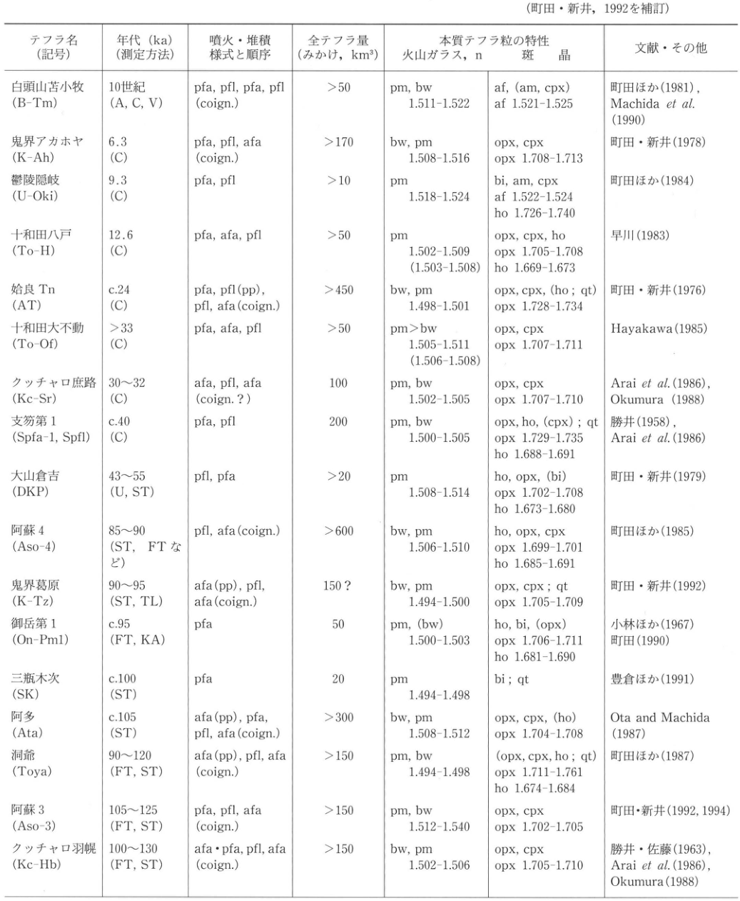
Table 3. Widespread tephras from giant eruptions in Japan and adjacent regions during the late Quaternary (approximately the past 130,000 years)
(Revised and supplemented from Machida and Arai, 1992.)
Show extracted lettering and translation
English translation of figure lettering
| Tephra (symbol) | Age, ka (dating method) | Eruption/deposition modes and sequence | Total tephra volume (bulk, km³) | Juvenile tephra: volcanic glass, n | Juvenile tephra: phenocrysts | References and other information |
|---|---|---|---|---|---|---|
| Baitoushan–Tomakomai (B-Tm) | 10th century (A, C, V) | pfa, pfl, pfa, pfl (coign.) | >50 | pm, bw; 1.511–1.522 | af, (am, cpx); af 1.521–1.525 | Machida et al. (1981); Machida et al. (1990) |
| Kikai-Akahoya (K-Ah) | 6.3 (C) | pfa, pfl, afa (coign.) | >170 | bw, pm; 1.508–1.516 | opx, cpx; opx 1.708–1.713 | Machida and Arai (1978) |
| Ulleung-Oki (U-Oki) | 9.3 (C) | pfa, pfl | >10 | pm; 1.518–1.524 | bi, am, cpx; af 1.522–1.524; ho 1.726–1.740 | Machida et al. (1984) |
| Towada-Hachinohe (To-H) | 12.6 (C) | pfa, afa, pfl | >50 | pm; 1.502–1.509 (1.503–1.508) | opx, cpx, ho; opx 1.705–1.708; ho 1.669–1.673 | Hayakawa (1983) |
| Aira-Tn (AT) | c.24 (C) | pfa, pfl (pp), pfl, afa (coign.) | >450 | bw, pm; 1.498–1.501 | opx, cpx, (ho; qt); opx 1.728–1.734 | Machida and Arai (1976) |
| Towada-Ofudo (To-Of) | >33 (C) | pfa, afa, pfl | >50 | pm>bw; 1.505–1.511 (1.506–1.508) | opx, cpx; opx 1.707–1.711 | Hayakawa (1985) |
| Kutcharo-Shoro (Kc-Sr) | 30–32 (C) | afa, pfl, afa (coign.?) | 100 | pm, bw; 1.502–1.505 | opx, cpx; opx 1.707–1.710 | Arai et al. (1986); Okumura (1988) |
| Shikotsu-1 (Spfa-1, Spfl) | c.40 (C) | pfa, pfl | 200 | pm, bw; 1.500–1.505 | opx, ho, (cpx); qt; opx 1.729–1.735; ho 1.688–1.691 | Katsui (1958); Arai et al. (1986) |
| Daisen-Kurayoshi (DKP) | 43–55 (U, ST) | pfl, pfa | >20 | pm; 1.508–1.514 | ho, opx, (bi); opx 1.702–1.708; ho 1.673–1.680 | Machida and Arai (1979) |
| Aso-4 (Aso-4) | 85–90 (ST, FT, etc.) | pfl, afa (coign.) | >600 | bw, pm; 1.506–1.510 | ho, opx, cpx; opx 1.699–1.701; ho 1.685–1.691 | Machida et al. (1985) |
| Kikai-Tozurahara (K-Tz) | 90–95 (ST, TL) | afa (pp), pfl, afa (coign.) | 150? | bw, pm; 1.494–1.500 | opx, cpx; qt; opx 1.705–1.709 | Machida and Arai (1992) |
| Ontake-1 (On-Pm1) | c.95 (FT, KA) | pfa | 50 | pm, (bw); 1.500–1.503 | ho, bi, (opx); opx 1.706–1.711; ho 1.681–1.690 | Kobayashi et al. (1967); Machida (1990) |
| Sambe-Kisuki (SK) | c.100 (ST) | pfa | 20 | pm; 1.494–1.498 | bi; qt | 豊倉 et al. (1991) |
| Ata (Ata) | c.105 (ST) | afa (pp), pfa, pfl, afa (coign.) | >300 | bw, pm; 1.508–1.512 | opx, cpx, (ho); opx 1.704–1.708 | Ota and Machida (1987) |
| Toya (Toya) | 90–120 (FT, ST) | afa (pp), pfl, afa (coign.) | >150 | pm, bw; 1.494–1.498 | (opx, cpx, ho; qt); opx 1.711–1.761; ho 1.674–1.684 | Machida et al. (1987) |
| Aso-3 (Aso-3) | 105–125 (FT, ST) | pfa, pfl, afa (coign.) | >150 | pm, bw; 1.512–1.540 | opx, cpx; opx 1.702–1.705 | Machida and Arai (1992, 1994) |
| Kutcharo-Haboro (Kc-Hb) | 100–130 (FT, ST) | afa·pfa, pfl, afa (coign.) | >150 | bw, pm; 1.502–1.506 | opx, cpx; opx 1.705–1.710 | Katsui and Sato (1963); Arai et al. (1986); Okumura (1988) |
Original Japanese lettering
| テフラ名(記号) | 年代 ka(測定方法) | 噴火・堆積様式と順序 | 全テフラ量(みかけ、km³) | 本質テフラ粒:火山ガラス、n | 本質テフラ粒:斑晶 | 文献・その他 |
|---|---|---|---|---|---|---|
| 白頭山苫小牧 (B-Tm) | 10世紀 (A, C, V) | pfa, pfl, pfa, pfl (coign.) | >50 | pm, bw; 1.511–1.522 | af, (am, cpx); af 1.521–1.525 | 町田ほか (1981); Machida et al. (1990) |
| 鬼界アカホヤ (K-Ah) | 6.3 (C) | pfa, pfl, afa (coign.) | >170 | bw, pm; 1.508–1.516 | opx, cpx; opx 1.708–1.713 | 町田・新井 (1978) |
| 鬱陵隠岐 (U-Oki) | 9.3 (C) | pfa, pfl | >10 | pm; 1.518–1.524 | bi, am, cpx; af 1.522–1.524; ho 1.726–1.740 | 町田ほか (1984) |
| 十和田八戸 (To-H) | 12.6 (C) | pfa, afa, pfl | >50 | pm; 1.502–1.509 (1.503–1.508) | opx, cpx, ho; opx 1.705–1.708; ho 1.669–1.673 | 早川 (1983) |
| 姶良Tn (AT) | c.24 (C) | pfa, pfl (pp), pfl, afa (coign.) | >450 | bw, pm; 1.498–1.501 | opx, cpx, (ho; qt); opx 1.728–1.734 | 町田・新井 (1976) |
| 十和田大不動 (To-Of) | >33 (C) | pfa, afa, pfl | >50 | pm>bw; 1.505–1.511 (1.506–1.508) | opx, cpx; opx 1.707–1.711 | Hayakawa (1985) |
| クッチャロ庶路 (Kc-Sr) | 30–32 (C) | afa, pfl, afa (coign.?) | 100 | pm, bw; 1.502–1.505 | opx, cpx; opx 1.707–1.710 | Arai et al. (1986); Okumura (1988) |
| 支笏第1 (Spfa-1, Spfl) | c.40 (C) | pfa, pfl | 200 | pm, bw; 1.500–1.505 | opx, ho, (cpx); qt; opx 1.729–1.735; ho 1.688–1.691 | 勝井 (1958); Arai et al. (1986) |
| 大山倉吉 (DKP) | 43–55 (U, ST) | pfl, pfa | >20 | pm; 1.508–1.514 | ho, opx, (bi); opx 1.702–1.708; ho 1.673–1.680 | 町田・新井 (1979) |
| 阿蘇4 (Aso-4) | 85–90 (ST, FTなど) | pfl, afa (coign.) | >600 | bw, pm; 1.506–1.510 | ho, opx, cpx; opx 1.699–1.701; ho 1.685–1.691 | 町田ほか (1985) |
| 鬼界葛原 (K-Tz) | 90–95 (ST, TL) | afa (pp), pfl, afa (coign.) | 150? | bw, pm; 1.494–1.500 | opx, cpx; qt; opx 1.705–1.709 | 町田・新井 (1992) |
| 御岳第1 (On-Pm1) | c.95 (FT, KA) | pfa | 50 | pm, (bw); 1.500–1.503 | ho, bi, (opx); opx 1.706–1.711; ho 1.681–1.690 | 小林ほか (1967); 町田 (1990) |
| 三瓶木次 (SK) | c.100 (ST) | pfa | 20 | pm; 1.494–1.498 | bi; qt | 豊倉ほか (1991) |
| 阿多 (Ata) | c.105 (ST) | afa (pp), pfa, pfl, afa (coign.) | >300 | bw, pm; 1.508–1.512 | opx, cpx, (ho); opx 1.704–1.708 | Ota and Machida (1987) |
| 洞爺 (Toya) | 90–120 (FT, ST) | afa (pp), pfl, afa (coign.) | >150 | pm, bw; 1.494–1.498 | (opx, cpx, ho; qt); opx 1.711–1.761; ho 1.674–1.684 | 町田ほか (1987) |
| 阿蘇3 (Aso-3) | 105–125 (FT, ST) | pfa, pfl, afa (coign.) | >150 | pm, bw; 1.512–1.540 | opx, cpx; opx 1.702–1.705 | 町田・新井 (1992, 1994) |
| クッチャロ羽幌 (Kc-Hb) | 100–130 (FT, ST) | afa·pfa, pfl, afa (coign.) | >150 | bw, pm; 1.502–1.506 | opx, cpx; opx 1.705–1.710 | 勝井・佐藤 (1963); Arai et al. (1986); Okumura (1988) |
| Tephra (symbol) | Age, ka (dating method) | Eruption/deposition modes and sequence | Total tephra volume (bulk, km³) | Juvenile tephra: volcanic glass, n | Juvenile tephra: phenocrysts | References and other information |
|---|---|---|---|---|---|---|
| Baitoushan–Tomakomai (B-Tm) | 10th century (A, C, V) | pfa, pfl, pfa, pfl (coign.) | >50 | pm, bw; 1.511–1.522 | af, (am, cpx); af 1.521–1.525 | Machida et al. (1981); Machida et al. (1990) |
| Kikai-Akahoya (K-Ah) | 6.3 (C) | pfa, pfl, afa (coign.) | >170 | bw, pm; 1.508–1.516 | opx, cpx; opx 1.708–1.713 | Machida and Arai (1978) |
| Ulleung-Oki (U-Oki) | 9.3 (C) | pfa, pfl | >10 | pm; 1.518–1.524 | bi, am, cpx; af 1.522–1.524; ho 1.726–1.740 | Machida et al. (1984) |
| Towada-Hachinohe (To-H) | 12.6 (C) | pfa, afa, pfl | >50 | pm; 1.502–1.509 (1.503–1.508) | opx, cpx, ho; opx 1.705–1.708; ho 1.669–1.673 | Hayakawa (1983) |
| Aira-Tn (AT) | c.24 (C) | pfa, pfl (pp), pfl, afa (coign.) | >450 | bw, pm; 1.498–1.501 | opx, cpx, (ho; qt); opx 1.728–1.734 | Machida and Arai (1976) |
| Towada-Ofudo (To-Of) | >33 (C) | pfa, afa, pfl | >50 | pm>bw; 1.505–1.511 (1.506–1.508) | opx, cpx; opx 1.707–1.711 | Hayakawa (1985) |
| Kutcharo-Shoro (Kc-Sr) | 30–32 (C) | afa, pfl, afa (coign.?) | 100 | pm, bw; 1.502–1.505 | opx, cpx; opx 1.707–1.710 | Arai et al. (1986); Okumura (1988) |
| Shikotsu-1 (Spfa-1, Spfl) | c.40 (C) | pfa, pfl | 200 | pm, bw; 1.500–1.505 | opx, ho, (cpx); qt; opx 1.729–1.735; ho 1.688–1.691 | Katsui (1958); Arai et al. (1986) |
| Daisen-Kurayoshi (DKP) | 43–55 (U, ST) | pfl, pfa | >20 | pm; 1.508–1.514 | ho, opx, (bi); opx 1.702–1.708; ho 1.673–1.680 | Machida and Arai (1979) |
| Aso-4 (Aso-4) | 85–90 (ST, FT, etc.) | pfl, afa (coign.) | >600 | bw, pm; 1.506–1.510 | ho, opx, cpx; opx 1.699–1.701; ho 1.685–1.691 | Machida et al. (1985) |
| Kikai-Tozurahara (K-Tz) | 90–95 (ST, TL) | afa (pp), pfl, afa (coign.) | 150? | bw, pm; 1.494–1.500 | opx, cpx; qt; opx 1.705–1.709 | Machida and Arai (1992) |
| Ontake-1 (On-Pm1) | c.95 (FT, KA) | pfa | 50 | pm, (bw); 1.500–1.503 | ho, bi, (opx); opx 1.706–1.711; ho 1.681–1.690 | Kobayashi et al. (1967); Machida (1990) |
| Sambe-Kisuki (SK) | c.100 (ST) | pfa | 20 | pm; 1.494–1.498 | bi; qt | 豊倉 et al. (1991) |
| Ata (Ata) | c.105 (ST) | afa (pp), pfa, pfl, afa (coign.) | >300 | bw, pm; 1.508–1.512 | opx, cpx, (ho); opx 1.704–1.708 | Ota and Machida (1987) |
| Toya (Toya) | 90–120 (FT, ST) | afa (pp), pfl, afa (coign.) | >150 | pm, bw; 1.494–1.498 | (opx, cpx, ho; qt); opx 1.711–1.761; ho 1.674–1.684 | Machida et al. (1987) |
| Aso-3 (Aso-3) | 105–125 (FT, ST) | pfa, pfl, afa (coign.) | >150 | pm, bw; 1.512–1.540 | opx, cpx; opx 1.702–1.705 | Machida and Arai (1992, 1994) |
| Kutcharo-Haboro (Kc-Hb) | 100–130 (FT, ST) | afa·pfa, pfl, afa (coign.) | >150 | bw, pm; 1.502–1.506 | opx, cpx; opx 1.705–1.710 | Katsui and Sato (1963); Arai et al. (1986); Okumura (1988) |
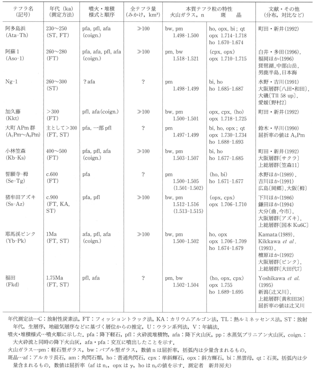
Table 4. Widespread tephras from giant eruptions in Japan during the middle and early Quaternary
(Revised and supplemented from Machida and Arai, 1992.)
Show extracted lettering and translation
English translation of figure lettering
| Tephra (symbol) | Age, ka (dating method) | Eruption/deposition modes and sequence | Total tephra volume (bulk, km³) | Juvenile tephra: volcanic glass, n | Juvenile tephra: phenocrysts | References and other information |
|---|---|---|---|---|---|---|
| Ata-Torihama (Ata-Th) | 230–250 (ST, FT) | pfa, pfl, afa (coign.) | ≫100 | bw, pm; 1.498–1.500 | ho, opx, bi; qt; opx 1.714–1.718; ho 1.670–1.674 | Machida and Arai (1992) |
| Aso-1 (Aso-1) | 260–280 (FT) | pfa, afa, pfl, afa (coign.) | ≫100 | pm, bw; 1.518–1.521 | (cpx, opx); opx 1.710–1.715 | Shirai and Tada (1996); Fukuoka et al. (1996). Lake Biwa, mountains of central Japan, Oga Peninsula, Sea of Japan |
| Ng-1 (Ng-1) | 260–300 (ST) | ? afa | ? | pm; 1.498–1.499 | bi, ho; ho 1.685–1.687 | Mizuno and Yoshikawa (1991). Osaka Group [Hatta and Wada], Oiso [Tl1 58 up], Ehime [Nomura 2] |
| Kakuto (Kkt) | >300 (FT) | pfl, afa (coign.) | ≫100 | bw, pm; 1.500–1.501 | opx, cpx, (ho); opx 1.718–1.725 | Machida and Arai (1992) |
| Omachi APm tephra group (A₁Pm–A₅Pm) | Mainly >300 (FT, ST) | pfa, partlypfl | ? | pm; 1.497–1.499 | bi, ho, opx; qt; opx 1.730–1.734; ho 1.688–1.693 | Suzuki and Hayakawa (1990). Refractive-index values are for A₃Pm |
| Kobayashi-Kasamori (Kb-Ks) | 400–500 (FT) | pfa, pfl, afa (coign.) | ≫100 | bw, pm; 1.503–1.507 | bi, ho; ho 1.677–1.685 | Machida and Arai (1992). Osaka Group [Sakura], Kazusa Group [Kasamori 11] |
| Seiganji–Toga (Se-Tg) | c.600 (FT) | pfa | ? | pm; 1.500–1.505 (1.501–1.502) | (ho, bi); ho 1.671–1.677 | Mizuno et al. (1989); Yoshikawa et al. (1991). Hiroshima [Okago (岡郷)], Osaka [Toga] |
| Shishimuta-Azuki (Ss-Az) | c.900 (FT, KA, ST) | pfa, pfl | ≫100 | bw, pm; 1.512–1.516 (1.513–1.515) | (opx, cpx); opx 1.706–1.710 | Shimokawa et al. (1986); Kamata et al. (1994). Oita [Magari, Imaichi], Osaka Group [Azuki], Kazusa Group [Kokumoto Ku6C] |
| Yabakei-Pink (Yb-Pk) | 1 Ma (FT, ST) | afa, pfl, afa (coign.) | ≫100 | bw, pm; 1.500–1.502 | ho, opx; opx 1.706–1.709; ho 1.674–1.679 | Kamata (1989); Kikkawa et al. (1993); Danhara et al. (1992). Osaka Group [Pink], Kazusa Group [Otadai 7] |
| Fukuda (Fkd) | 1.75 Ma (FT, ST) | pfl, afa | ? | pm, bw; 1.502–1.504 | (ho, opx, cpx); opx 1.755; ho 1.689–1.695 | Yoshikawa et al. (1995). Niigata [Tsujimatagawa], Kazusa Group [Kiwada 38]. Refractive-index values are for Tsujimatagawa |
Abbreviations for Tables 3 and 4
- Dating methods: C, radiocarbon; FT, fission track; KA, potassium–argon; TL, thermoluminescence; ST, age inferred from stratigraphic position based on radiometric ages, biostratigraphy, magnetostratigraphy, etc.; U, uranium series; V, varve chronology.
- Eruption/deposition modes are listed in eruption order: pfa, pumice fall; pfl, pyroclastic-flow deposit; afa, ash fall; pp, phreatoplinian ash; coign., ash fall contemporaneous with a large pyroclastic flow; afa·pfa, alternating eruptions of the two types.
- Volcanic glass: pm, pumice-type glass; bw, bubble-type glass. Numerical n values are refractive indices. Parentheses indicate minor components.
- Phenocrysts: af, alkali feldspar; am, amphiboles; ho, hornblende; cpx, clinopyroxene; opx, orthopyroxene; bi, biotite; qt, quartz. Parentheses indicate minor components. Numerical values are refractive indices (n₁ for af, γ for opx, and n₂ for ho; measured by Fusao Arai).
Original Japanese lettering
| テフラ名(記号) | 年代 ka(測定方法) | 噴火・堆積様式と順序 | 全テフラ量(みかけ、km³) | 本質テフラ粒:火山ガラス、n | 本質テフラ粒:斑晶 | 文献・その他 |
|---|---|---|---|---|---|---|
| 阿多鳥浜 (Ata-Th) | 230–250 (ST, FT) | pfa, pfl, afa (coign.) | ≫100 | bw, pm; 1.498–1.500 | ho, opx, bi; qt; opx 1.714–1.718; ho 1.670–1.674 | 町田・新井 (1992) |
| 阿蘇1 (Aso-1) | 260–280 (FT) | pfa, afa, pfl, afa (coign.) | ≫100 | pm, bw; 1.518–1.521 | (cpx, opx); opx 1.710–1.715 | 白井・多田 (1996); 福岡ほか (1996)。琵琶湖、中部山岳、男鹿半島、日本海 |
| Ng-1 (Ng-1) | 260–300 (ST) | ? afa | ? | pm; 1.498–1.499 | bi, ho; ho 1.685–1.687 | 水野・吉川 (1991)。大阪層群〔八田・和田〕、大磯〔Tl1 58 up〕、愛媛〔野村2〕 |
| 加久藤 (Kkt) | >300 (FT) | pfl, afa (coign.) | ≫100 | bw, pm; 1.500–1.501 | opx, cpx, (ho); opx 1.718–1.725 | 町田・新井 (1992) |
| 大町APm群 (A₁Pm–A₅Pm) | 主として>300 (FT, ST) | pfa, 一部pfl | ? | pm; 1.497–1.499 | bi, ho, opx; qt; opx 1.730–1.734; ho 1.688–1.693 | 鈴木・早川 (1990)。屈折率の値はA₃Pm |
| 小林笠森 (Kb-Ks) | 400–500 (FT) | pfa, pfl, afa (coign.) | ≫100 | bw, pm; 1.503–1.507 | bi, ho; ho 1.677–1.685 | 町田・新井 (1992)。大阪層群〔サクラ〕、上総層群〔笠森11〕 |
| 誓願寺–栂 (Se-Tg) | c.600 (FT) | pfa | ? | pm; 1.500–1.505 (1.501–1.502) | (ho, bi); ho 1.671–1.677 | 水野ほか (1989); 吉川ほか (1991)。広島〔岡郷〕、大阪〔栂〕 |
| 猪牟田アズキ (Ss-Az) | c.900 (FT, KA, ST) | pfa, pfl | ≫100 | bw, pm; 1.512–1.516 (1.513–1.515) | (opx, cpx); opx 1.706–1.710 | 下川ほか (1986); 鎌田ほか (1994)。大分〔曲、今市〕、大阪層群〔アズキ〕、上総層群〔国本 Ku6C〕 |
| 耶馬渓ピンク (Yb-Pk) | 1 Ma (FT, ST) | afa, pfl, afa (coign.) | ≫100 | bw, pm; 1.500–1.502 | ho, opx; opx 1.706–1.709; ho 1.674–1.679 | Kamata (1989); Kikkawa et al. (1993); 檀原ほか (1992)。大阪層群〔ピンク〕、上総層群〔大田代7〕 |
| 福田 (Fkd) | 1.75 Ma (FT, ST) | pfl, afa | ? | pm, bw; 1.502–1.504 | (ho, opx, cpx); opx 1.755; ho 1.689–1.695 | Yoshikawa et al. (1995)。新潟〔辻又川〕、上総層群〔黄和田38〕。屈折率の値は辻又川 |
表3・4の略記
- 年代測定法:C=放射性炭素法;FT=フィッショントラック法;KA=カリウムアルゴン法;TL=熱ルミネッセンス法;ST=放射年代、生層序、地磁気層序などに基づく層位からの推定;U=ウラン系列法;V=年縞法。
- 噴火・堆積様式:噴火順に示した。pfa=降下軽石;pfl=火砕流堆積物;afa=降下火山灰;pp=水蒸気プリニアン火山灰;coign.=大火砕流と同時の降下火山灰;afa·pfa=交互に噴出したことを示す。
- 火山ガラス:pm=軽石型ガラス;bw=バブル型ガラス。数値nは屈折率。括弧内は少量含まれるもの。
- 斑晶:af=アルカリ長石;am=角閃石類;ho=普通角閃石;cpx=単斜輝石;opx=斜方輝石;bi=黒雲母;qt=石英。括弧内は少量含まれるもの。数値は屈折率(afはn₁、opxはγ、hoはn₂の値を示す。測定者:新井房夫)。
Reading notes
Ng-1の対比欄、大磯[Tl1 58 up] — 細い縦画が判別しづらく、Tl1の末尾は数字1/小文字lの可能性が残る。原図も併載し、符号の読みを確定していない。
| Tephra (symbol) | Age, ka (dating method) | Eruption/deposition modes and sequence | Total tephra volume (bulk, km³) | Juvenile tephra: volcanic glass, n | Juvenile tephra: phenocrysts | References and other information |
|---|---|---|---|---|---|---|
| Ata-Torihama (Ata-Th) | 230–250 (ST, FT) | pfa, pfl, afa (coign.) | ≫100 | bw, pm; 1.498–1.500 | ho, opx, bi; qt; opx 1.714–1.718; ho 1.670–1.674 | Machida and Arai (1992) |
| Aso-1 (Aso-1) | 260–280 (FT) | pfa, afa, pfl, afa (coign.) | ≫100 | pm, bw; 1.518–1.521 | (cpx, opx); opx 1.710–1.715 | Shirai and Tada (1996); Fukuoka et al. (1996). Lake Biwa, mountains of central Japan, Oga Peninsula, Sea of Japan |
| Ng-1 (Ng-1) | 260–300 (ST) | ? afa | ? | pm; 1.498–1.499 | bi, ho; ho 1.685–1.687 | Mizuno and Yoshikawa (1991). Osaka Group [Hatta and Wada], Oiso [Tl1 58 up], Ehime [Nomura 2] |
| Kakuto (Kkt) | >300 (FT) | pfl, afa (coign.) | ≫100 | bw, pm; 1.500–1.501 | opx, cpx, (ho); opx 1.718–1.725 | Machida and Arai (1992) |
| Omachi APm tephra group (A₁Pm–A₅Pm) | Mainly >300 (FT, ST) | pfa, partlypfl | ? | pm; 1.497–1.499 | bi, ho, opx; qt; opx 1.730–1.734; ho 1.688–1.693 | Suzuki and Hayakawa (1990). Refractive-index values are for A₃Pm |
| Kobayashi-Kasamori (Kb-Ks) | 400–500 (FT) | pfa, pfl, afa (coign.) | ≫100 | bw, pm; 1.503–1.507 | bi, ho; ho 1.677–1.685 | Machida and Arai (1992). Osaka Group [Sakura], Kazusa Group [Kasamori 11] |
| Seiganji–Toga (Se-Tg) | c.600 (FT) | pfa | ? | pm; 1.500–1.505 (1.501–1.502) | (ho, bi); ho 1.671–1.677 | Mizuno et al. (1989); Yoshikawa et al. (1991). Hiroshima [Okago (岡郷)], Osaka [Toga] |
| Shishimuta-Azuki (Ss-Az) | c.900 (FT, KA, ST) | pfa, pfl | ≫100 | bw, pm; 1.512–1.516 (1.513–1.515) | (opx, cpx); opx 1.706–1.710 | Shimokawa et al. (1986); Kamata et al. (1994). Oita [Magari, Imaichi], Osaka Group [Azuki], Kazusa Group [Kokumoto Ku6C] |
| Yabakei-Pink (Yb-Pk) | 1 Ma (FT, ST) | afa, pfl, afa (coign.) | ≫100 | bw, pm; 1.500–1.502 | ho, opx; opx 1.706–1.709; ho 1.674–1.679 | Kamata (1989); Kikkawa et al. (1993); Danhara et al. (1992). Osaka Group [Pink], Kazusa Group [Otadai 7] |
| Fukuda (Fkd) | 1.75 Ma (FT, ST) | pfl, afa | ? | pm, bw; 1.502–1.504 | (ho, opx, cpx); opx 1.755; ho 1.689–1.695 | Yoshikawa et al. (1995). Niigata [Tsujimatagawa], Kazusa Group [Kiwada 38]. Refractive-index values are for Tsujimatagawa |
Abbreviations for Tables 3 and 4
- Dating methods: C, radiocarbon; FT, fission track; KA, potassium–argon; TL, thermoluminescence; ST, age inferred from stratigraphic position based on radiometric ages, biostratigraphy, magnetostratigraphy, etc.; U, uranium series; V, varve chronology.
- Eruption/deposition modes are listed in eruption order: pfa, pumice fall; pfl, pyroclastic-flow deposit; afa, ash fall; pp, phreatoplinian ash; coign., ash fall contemporaneous with a large pyroclastic flow; afa·pfa, alternating eruptions of the two types.
- Volcanic glass: pm, pumice-type glass; bw, bubble-type glass. Numerical n values are refractive indices. Parentheses indicate minor components.
- Phenocrysts: af, alkali feldspar; am, amphiboles; ho, hornblende; cpx, clinopyroxene; opx, orthopyroxene; bi, biotite; qt, quartz. Parentheses indicate minor components. Numerical values are refractive indices (n₁ for af, γ for opx, and n₂ for ho; measured by Fusao Arai).
b. Widespread tephras
Widespread tephras are deposits from extremely large eruptions, with total erupted tephra volumes reaching 10–1,000 km³, and commonly extend over an area larger than a single region. Because many tephras are dispersed eastward by westerly winds, however, even a large deposit may extend predominantly over the sea rather than across several land regions. Figure 1 shows the distribution of late Quaternary widespread tephras in Japan and adjacent regions.
As shown in Table 3, 17 widespread tephras that fell during the past 125,000 years (the late Quaternary) have now been identified. In recent years, tephras long known in the Osaka and Kazusa groups, such as Kobayashi-Kasamori (Kb-Ks), Shishimuta-Azuki (Ss-Az), and Yabakei-Pink (Yb-Pk), have been traced as far as Kyushu (Table 4). Nearly 30 widespread tephras are known for the Quaternary as a whole. Detailed tephra-based time scales combining widespread tephras with local tephra stratigraphies of various scales, and the application of tephrochronology based on regional “standard tephra stratigraphies,” have become indispensable.
c. Modes of tephra deposition
Matsuda and Nakamura (1966) classified the processes from volcanic eruption to tephra deposition according to where the material was erupted, how it was transported, and the type of setting in which it was deposited. Eruption sites are divided into terrestrial (A) and subaqueous (W). Transport is divided into travel through the air from an eruption column (A) and transport through water (W). Deposition is divided into deposition on dry land (A) and in water (W). These three elements are expressed by arranging their symbols in this order. Thus, material erupted on land, transported through the air, and deposited on dry land is type AAA. A subaqueous eruption followed by airborne (wind) transport and deposition in water is type WAW.
Frequently, only the transport and deposition processes are expressed, omitting the eruption site. In that usage, type AA means airborne transport and deposition on land, while type WW means transport through water and deposition in water.
Stranded pumice (drift pumice) is described in WS-12-2, WS-13-4, and TH-15. These are examples of AWW and AAW tephras. Tephra is well preserved in peat, and this book presents many examples. Tephra falls into damp settings such as wetlands or shallow water and is deposited there without further transport. This may be considered intermediate between AA and AW, and is sometimes called “water-associated tephra” (mizutsuki tephra, 水つきテフラ). Identifying the depositional environment helps reveal the processes of emergence and conversion to land following a rise in sea level.
The environment in which tephra is deposited produces large differences in its weathering conditions. Depositional settings favorable for preservation include (1) quiet-water environments (swamps and peatlands, lake beds, and deep-sea floors), (2) places where material covering the tephra accumulates rapidly (near volcanoes, in dunes, and elsewhere), and (3) cold regions, where weathering proceeds slowly. Poor preservation occurs in (1) terrestrial settings generally, especially projecting features such as ridges, cliff edges, steep slopes, and windward slopes; (2) tropical and subtropical regions, where weathering is rapid; and (3) urban areas, where material is removed by human activities. On land, weathering may destroy the volcanic glass that constitutes the main component of tephra, leaving only minerals. Conversely, particular minerals may dissolve, destroying the original mineral assemblage. Care is therefore necessary. Tephra deposited under water is also strongly affected by sorting according to particle density and size; coarse, low-density pumice does not necessarily accumulate together with fine volcanic ash.
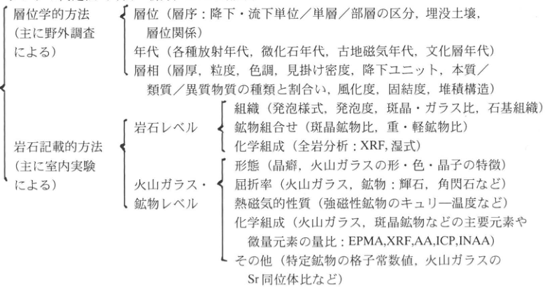
Table 5. Methods of tephra identification (expanded from Machida and Arai, 1992)
Show extracted lettering and translation
English translation of figure lettering
| Method | Level or criterion | Features observed or analyzed |
|---|---|---|
| Stratigraphic methods (mainly field investigation) | Stratigraphic position | Stratigraphy: distinction of fall and flow units, beds, and members; buried soils; stratigraphic relationships |
| Same | Age | Various radiometric ages, microfossil ages, paleomagnetic ages, and ages of cultural horizons |
| Same | Facies | Thickness, grain size, color, apparent density, fallout units, types and proportions of juvenile/accessory/accidental material, weathering, induration, and sedimentary structures |
| Petrographic methods (mainly laboratory investigation) | Rock level: texture | Vesiculation style, vesicularity, phenocryst/glass ratio, and groundmass texture |
| Same | Rock level: mineral assemblage | Ratios of phenocryst minerals and of heavy to light minerals |
| Same | Rock level: chemical composition | Whole-rock analysis: XRF and wet-chemical methods |
| Same | Volcanic-glass and mineral level: morphology | Crystal habit; shape, color, and crystallite characteristics of volcanic glass |
| Same | Volcanic-glass and mineral level: refractive index | Volcanic glass and minerals, including pyroxenes and amphiboles |
| Same | Volcanic-glass and mineral level: thermomagnetic properties | Curie temperatures of ferromagnetic minerals, etc. |
| Same | Volcanic-glass and mineral level: chemical composition | Relative abundances of major and trace elements in volcanic glass and phenocryst minerals: EPMA, XRF, AA, ICP, INAA |
| Same | Volcanic-glass and mineral level: other properties | Lattice constants of particular minerals, Sr isotope ratios of volcanic glass, etc. |
Original Japanese lettering
| 方法 | レベル・項目 | 観察・分析する特徴 |
|---|---|---|
| 層位学的方法(主に野外調査による) | 層位 | 層序:降下・流下単位/単層/部層の区分、埋没土壌、層位関係 |
| 同上 | 年代 | 各種放射年代、微化石年代、古地磁気年代、文化層年代 |
| 同上 | 層相 | 層厚、粒度、色調、見掛け密度、降下ユニット、本質/類質/異質物質の種類と割合い、風化度、固結度、堆積構造 |
| 岩石記載的方法(主に室内実験による) | 岩石レベル:組織 | 発泡様式、発泡度、斑晶・ガラス比、石基組織 |
| 同上 | 岩石レベル:鉱物組合せ | 斑晶鉱物比、重・軽鉱物比 |
| 同上 | 岩石レベル:化学組成 | 全岩分析:XRF、湿式 |
| 同上 | 火山ガラス・鉱物レベル:形態 | 晶癖、火山ガラスの形・色・晶子の特徴 |
| 同上 | 火山ガラス・鉱物レベル:屈折率 | 火山ガラス、鉱物:輝石、角閃石など |
| 同上 | 火山ガラス・鉱物レベル:熱磁気的性質 | 強磁性鉱物のキュリー温度など |
| 同上 | 火山ガラス・鉱物レベル:化学組成 | 火山ガラス、斑晶鉱物などの主要元素や微量元素の量比:EPMA、XRF、AA、ICP、INAA |
| 同上 | 火山ガラス・鉱物レベル:その他 | 特定鉱物の格子常数値、火山ガラスのSr同位体比など |
| Method | Level or criterion | Features observed or analyzed |
|---|---|---|
| Stratigraphic methods (mainly field investigation) | Stratigraphic position | Stratigraphy: distinction of fall and flow units, beds, and members; buried soils; stratigraphic relationships |
| Same | Age | Various radiometric ages, microfossil ages, paleomagnetic ages, and ages of cultural horizons |
| Same | Facies | Thickness, grain size, color, apparent density, fallout units, types and proportions of juvenile/accessory/accidental material, weathering, induration, and sedimentary structures |
| Petrographic methods (mainly laboratory investigation) | Rock level: texture | Vesiculation style, vesicularity, phenocryst/glass ratio, and groundmass texture |
| Same | Rock level: mineral assemblage | Ratios of phenocryst minerals and of heavy to light minerals |
| Same | Rock level: chemical composition | Whole-rock analysis: XRF and wet-chemical methods |
| Same | Volcanic-glass and mineral level: morphology | Crystal habit; shape, color, and crystallite characteristics of volcanic glass |
| Same | Volcanic-glass and mineral level: refractive index | Volcanic glass and minerals, including pyroxenes and amphiboles |
| Same | Volcanic-glass and mineral level: thermomagnetic properties | Curie temperatures of ferromagnetic minerals, etc. |
| Same | Volcanic-glass and mineral level: chemical composition | Relative abundances of major and trace elements in volcanic glass and phenocryst minerals: EPMA, XRF, AA, ICP, INAA |
| Same | Volcanic-glass and mineral level: other properties | Lattice constants of particular minerals, Sr isotope ratios of volcanic glass, etc. |
d. Tephra identification
Identification of tephra requires an integrated examination, beginning with the characteristics of the stratigraphic unit, proceeding to the various properties of individual pumice, scoria, and ash particles, and extending to the properties of their constituent volcanic glass and phenocryst and microphenocryst minerals (Table 5). We wish to emphasize the importance of thoroughly establishing the tephra stratigraphy and all characteristics observable in the field before undertaking laboratory analysis. For details of analytical methods, see Methods for the Analysis of Quaternary Samples (Editorial Committee for Methods for the Analysis of Quaternary Samples, 1993a).
e. Dating methods
Tephras whose stratigraphy is established serve as marker beds and key beds for correlating landforms and strata and assigning ages to them. This is because many tephras have been dated and checked directly or indirectly by radiometric methods—including radiocarbon (14C), fission-track (FT), thermoluminescence (TL), and uranium-series methods—as well as paleomagnetic chronology, archaeological methods, and their positions within oxygen isotope stratigraphy. For details, see Methods for the Analysis of Quaternary Samples (Editorial Committee, 1993b).
3. Future research issues
With the successive recognition of widespread tephras of the early and middle Quaternary and the identification of tephra in marine sediments, Japanese tephrochronology may be said to have begun ascending to its next stage (Machida and Arai, 1992). This book describes a considerable number of such tephras, including Ata-Torihama (Ata-Th; 230–250 ka), Seiganji–Toga (Se-Tg; approximately 0.6 Ma), and Shishimuta-Azuki (Ss-Az; approximately 1 Ma). These nevertheless represent only a small fraction of the tephras described, and further discoveries are awaited.
Although tephra research has advanced greatly, many problems and tasks remain: tephras with unknown sources, unknown ages, or poorly understood distributions and eruption styles, among others. Only a very small number are well understood in terms of their effects on people and their lives. The older the period, the more unresolved questions accumulate. We hope readers will learn from this book both what has become known and what remains unknown.
Future work will need to focus on tephras in marine areas such as the Pacific Ocean, the Sea of Japan, and the Sea of Okhotsk, and in lake sediments. Large-scale volcanism and global upper-atmospheric winds must have transported and deposited tephra on a hemispheric scale. Research on these exceptionally widespread tephras is another task. It is also necessary to establish how such volcanic activity affected the Earth's environment, vegetation, and human life, and what benefits and disasters it brought. At the global scale, tephra in ice-sheet cores is a further subject for future work. Moreover, a succession of tephras directly records the activity history of a volcano, leaving substantial scope for volcanological research. Another issue concerns the brown loam layers widely distributed on the Sea of Japan side of the archipelago, which recent research has suggested are derived from loess. The stratigraphy of this loess (loam) is being elucidated by intercalated tephras and paleosols. The establishment of a new time scale combining loess and tephra is anticipated.
References
- Machida, H. (町田洋) (1971). Tephrochronology of southern Kanto I: Sources and stratigraphic ages of tephras since the Shimosueyoshi period. The Quaternary Research, 10: 1–20.
- Machida, H., and Arai, F. (町田洋・新井房夫) (1976). Widespread volcanic ash: Discovery of the Aira-Tn ash and its significance. Kagaku (科学), 46: 339–347.
- Machida, H., and Arai, F. (1992). Atlas of Tephra: The Japanese Archipelago and Its Surroundings (火山灰アトラス―日本列島とその周辺). University of Tokyo Press, 276 pp.
- Matsuda, T., and Nakamura, K. (松田時彦・中村一明) (1966). Characteristics and classification of volcanic deposits accumulated under water. Mining Geology (鉱山地質), 20: 129–142.
- Editorial Committee for Methods for the Analysis of Quaternary Samples (第四紀試料分析法編集委員会) (1993a). Tephra. In Japan Association for Quaternary Research (ed.), Methods for the Analysis of Quaternary Samples 2 (第四紀試料分析法2). University of Tokyo Press, pp. 136–224.
- Editorial Committee for Methods for the Analysis of Quaternary Samples (1993b). Dating methods. In Japan Association for Quaternary Research (ed.), Methods for the Analysis of Quaternary Samples 1 (第四紀試料分析法1). University of Tokyo Press, pp. 51–68.
II. A guide to using this book
The 274 outcrops included in this book extend throughout the Japanese archipelago, from Hokkaido in the north to Ishigakijima in the southwestern islands in the south. They include both surviving and vanished exposures. Although the focus is on tephra-bearing outcrops, some contain no tephra. This section explains the tephra names, age notation, and citation practices used in the book.
1. Tephra names
It is not uncommon for a single tephra to have several names. In particular, the recent discovery of widespread tephras in regions with a long history of Quaternary stratigraphic research has created circumstances in which established local names and new widespread-tephra names must be used together. Regional differences in names and informal names, and differences in tephra numbering between researchers, have their respective histories and are in some respects unavoidable. Nevertheless, it is preferable for the same tephra to bear the same name; at the very least, failure to clarify the relationships between names causes inconvenience to those using them. In their Atlas of Tephra, Machida and Arai (1992) presented a standardized naming scheme. In principle, a tephra name combines the name of its source volcano with the locality name of its reference exposure or discovery site. Abbreviations are given on the same basis: for example, the Aira AT tephra (AT) and Kikai-Tozurahara tephra (K-Tz). Many tephras, however, have unknown source volcanoes, and efforts to identify them are needed. At the same time, with some exceptions, “… ash” was expressed as “… tephra.” Since the names proposed in the Atlas currently provide a common standard for the largest number of tephras, this book gives both established tephra names and those used in that volume. Treatment of tephras described regionally under well-established names is not straightforward. Standardization should be sought, but further consideration is needed.
2. Age notation
Radiocarbon (14C) ages are expressed, for example, as 2,980 ± 150 yr B.P. (GaK-55555). This gives the number of years before AD 1950. The parenthetical expression is the laboratory's sample code. In general, it is impossible to list every available age determination, so an appropriate representative value or a range is often given. In these cases, and also for other dating methods, ages on the scale of tens to hundreds of thousands of years are expressed in ka. One ka means 1,000 years; 25 ka means 25,000 years ago, and 175 ka means 175,000 years ago. Ma is used for units of one million years. Where ages are given in Ma, some ages of several hundred thousand years are also expressed in Ma for comparison.
The dating method used is indicated as far as possible. In addition to radiometric methods, these include paleomagnetic dating, archaeological chronology, and loess chronometry. Radiocarbon ages are based on Libby's half-life and are generally given without calibration. Where calibration has been applied, this is stated.
3. Citing this book
The nature of the description varies between outcrops, ranging from reviews based on previously published work to original accounts first published here. Even in the former case, the original description may have been expanded or revised, and photographs, sketches, or stratigraphic columns may be original. In all cases, responsibility for the content rests with the author of the individual outcrop description. Citations to this book must therefore be made at the level of the individual outcrop entry. Where an original description is cited, readers should consult and cite the original source.
Precautions for outcrop investigations and visits
In general, the outcrops described in this book are not places where readers may freely enter or collect samples. Before visiting, obtain permission from the landowner or manager. Explain the purpose of the visit, including the information you hope to obtain, and help them understand the importance of outcrop investigation. In every case, treat the exposure with care, keep cleaning and sampling to the necessary minimum, restore the site by backfilling where appropriate after the investigation, leave it tidy, and express your thanks. At localities yielding rare fossils in particular, avoid purposeless collection or destruction of finite research material. Conduct that might lead to visits being prohibited because of a few inconsiderate individuals must be strictly avoided.
Outcrops are places where danger is close at hand: investigators may slip and fall, encounter falling rocks, or enter habitats of poisonous plants or animals. The exposures introduced in this book are not necessarily safe. Investigations and visits should be undertaken at your own responsibility and with due attention to safety. When organizing group visits, give careful consideration to safety measures and encourage participants to take out accident insurance in advance.
1. Widespread Tephras in Japan
WS-1-1 Baitoushan–Tomakomai Tephra on the Eastern Foot of Changbai Mountain, China
Hiroshi Machida
- Locality: Yuanchi (圓池), southern Antu County, Jilin Province, People's Republic of China
- Latitude and longitude: N42°1′30″ E128°27′30″
- Elevation: approximately 1,250m
- Outcrop type and current condition: pumice extraction site; extant
- Deposit types and age: pumice fall and pyroclastic-flow deposits; first half of the 10th century
- Date of description: 1994
- Keywords: Changbai Mountain; Baitoushan; Baitoushan pumice fall; Changbai pyroclastic-flow deposit; Baitoushan–Tomakomai tephra (白頭山苫小牧テフラ)
Changbai Mountain volcano (Korean name: Baekdusan (白頭山)) is the volcanic cone forming the highest peak in a major volcanic region straddling the border between northeastern China and North Korea. Its summit contains a caldera (Tianchi) 4–5km in diameter, and the highest peak on the caldera rim reaches 2,749m. The volcano has extensive lower slopes, passing into a vast basalt lava plateau 30–50km from the summit. Volcanic activity in this region began in the early Miocene or later and formed a lava plateau consisting of numerous shield volcanoes. With time, however, explosive eruptions of trachyte and rhyolite became more frequent, forming several volcanic cones. Baitoushan is the youngest of these large volcanoes. Records suggest eruptions in 1597, 1668, and 1702, but before these it produced an enormous eruption in the first half of the 10th century, ejecting pumice fall and large-scale pyroclastic flows. The co-ignimbrite ash from that eruption is widely distributed on the floor of the northern Sea of Japan and in northern Japan.
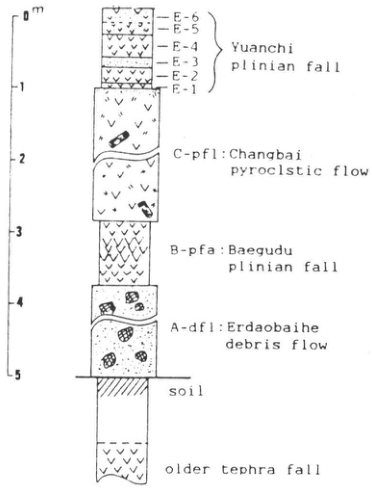
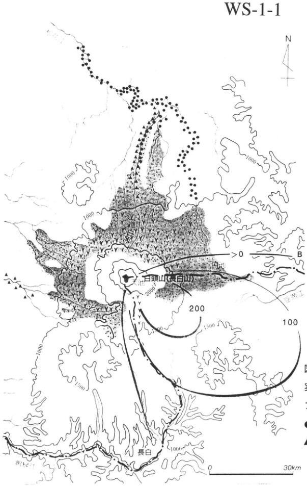
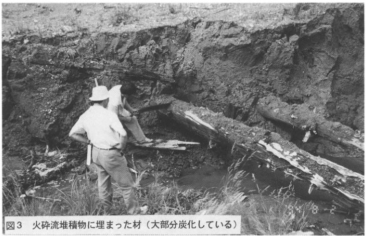
The extensive volcanic slopes and foot are covered by this young pyroclastic-flow deposit. Near Yuanchi on the China–North Korea border at the eastern foot, approximately 30km east of the summit of Changbai Mountain, several outcrops permit a comprehensive observation of the stratigraphy of these tephra layers. Figure 2 shows the distribution of these tephras and the outcrop locations. There, the Changbai pyroclastic-flow deposit (unit C), the preceding Baitoushan Plinian pumice-fall deposit (unit B), and pumice-fall and scoria layers (unit E) separated from them by a thin soil can be observed (Fig. 1). B is the first product of the series of major eruptions and is a pure white, alkali-rhyolitic pumice-fall deposit. Its principal distribution axis extends southeastward, and it is thick within North Korean territory. At this outcrop the pyroclastic-flow deposit is thin because it lies at the edge of its distribution, but on the mountain foot farther west and northwest it is several tens of metres thick. The lower part of the Changbai pyroclastic-flow deposit is a pumice-flow deposit containing abundant grayish-white felsic pumice clasts; upward it grades into a scoria-flow deposit consisting mainly of dark glassy volcanic ash. Both are nonwelded and fill the upper valleys of rivers such as the Yalu (鴨緑江) and Songhua (松花江), developing terrace landforms and badlands (Fig. 2). Meanwhile, large volumes of volcanic mudflow material generated from the pyroclastic flows (unit D) travelled farther down these valleys. These deposits can be traced even more than 100km from the volcano, indicating that the disaster extended along rivers to distant lowlands. The Changbai pyroclastic-flow deposit also contains abundant charred wood (Fig. 3), and the region east of Changbai Mountain is now an extensive area of pure larch forest. This suggests that destruction of vegetation by the eruption affected a vast area.
The tephra of unit E shown in Figure 1 consists of 2–4 pumice-fall and volcanic-ash layers. They are probably products of the eruptions recorded in historical documents. Their distribution is confined to the eastern side of Changbai Mountain and is not very extensive.
References: 町田・新井 (1992); 町田ほか (1981); Machida et al. (1990); 町田・新井 (1992)
Show extracted lettering and translation
English translation of figure lettering
0m; 1; 2; 3; 4; 5 E-6; E-5; E-4; E-3; E-2; E-1 — Yuanchi plinian fall C-pfl: Changbai pyroclstic flow B-pfa: Baegudu plinian fall A-dfl: Erdaobaihe debris flow soil; older tephra fall
Original Japanese lettering
0m; 1; 2; 3; 4; 5 E-6; E-5; E-4; E-3; E-2; E-1 — Yuanchi plinian fall C-pfl: Changbai pyroclstic flow B-pfa: Baegudu plinian fall A-dfl: Erdaobaihe debris flow soil; older tephra fall
Figure 1. Stratigraphy of products of the major Baitoushan eruption approximately 1000 years ago (partly modified from Machida et al., 1990).
Unit E probably represents products of the eruptions of 1597, 1668, and 1702.
[Original printed page: 2]
WS-1-1 (continued)
Show extracted lettering and translation
English translation of figure lettering
WS-1-1; N; Baitoushan (Changbai Mountain); Yuanchi (圓池); Changbai; Yalu River; Tumen River; B; >0; 100; 200; 1000; 1500; 2000; 0; 30km
Original Japanese lettering
WS-1-1; N; 白頭山(長白山); 圓池; 長白; 鴨緑江; 豆満江; B; >0; 100; 200; 1000; 1500; 2000; 0; 30km
Reading notes
豆満江 — 地図の薄い河川名は低コントラストで一部不鮮明;読みは暫定。
Figure 2. Distribution of products of the major Baitoushan eruption approximately 1000 years ago.
Solid lines are isopachs (cm) of the preceding fallout tephra. The screened area represents the Changbai pyroclastic-flow deposit. ● indicates the distribution of mudflow deposits. ▲ indicates deposits of the rock avalanche that occurred immediately before the eruption.
Show extracted lettering and translation
English translation of figure lettering
Figure 3. Wood buried in the pyroclastic-flow deposit (mostly charred).
Original Japanese lettering
図3 火砕流堆積物に埋まった材(大部分炭化している)
Figure 3. Wood buried in the pyroclastic-flow deposit (mostly charred).
[Original printed page: 3]
WS-1-2 Baitoushan–Tomakomai Tephra in the Alluvial Deposits of Tomakomai Port
Hiroshi Machida
- Locality: Tomakomai Port, Tomakomai City, Hokkaido
- Latitude and longitude: N42°39′8″ E141°42′3″
- Elevation: 1–2m
- Outcrop type and current condition: cliff exposed during quay construction; unknown
- Deposit types and age: volcanic ash, pumice, and peat; first half of the 10th century
- Date of description: 1979–1980
- Keywords: Baitoushan–Tomakomai tephra; Tarumae-b tephra; Tarumae-c tephra
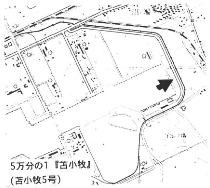
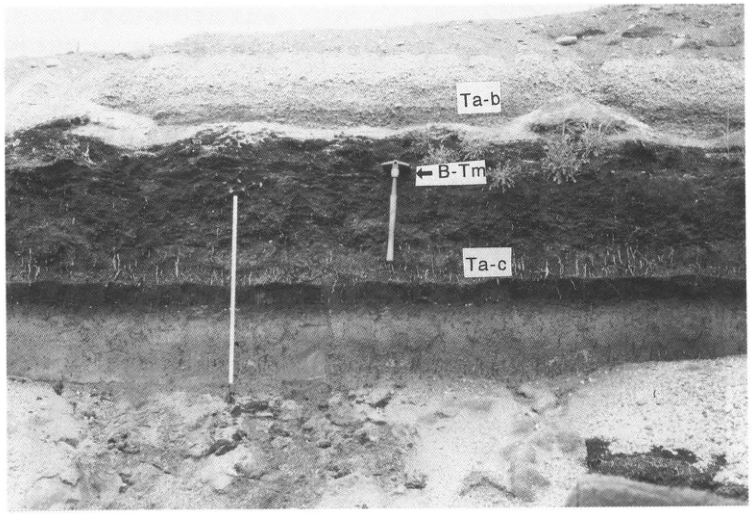
This outcrop is the type locality from which the tephra takes its name. It lies at the innermost (eastern) part of Tomakomai Port and exposes a section through the alluvial deposits of the Yufutsu Plain. The uppermost pumice layer is Tarumae-b (Ta-b) of AD1667; the lower pumice layer enclosed within thick peat is Tarumae-c (Ta-c), erupted at 2.5–3ka. Baitoushan–Tomakomai tephra (B-Tm) can be observed somewhat discontinuously as a white volcanic-ash layer 2–3cm thick in the upper part of the thick peat layer in the photograph, where the shovel has been inserted. In the alluvial lowlands of Hokkaido it commonly occurs well preserved within peat, as at this outcrop (see Biruwa, HK-10); on uplands it can also commonly be found as a yellowish-white volcanic-ash layer. Its foremost petrographic characteristic is the alkali-rich volcanic glass; under the microscope it is characterized by fine-grained glass with few phenocrysts, strong curvature, and abundant striations. This tephra occurs in Satsumon pottery cultural layers in Hokkaido and in Haji pottery cultural layers in northern Honshu. It is therefore also important for correlating the two cultures.
References: 町田ほか (1980); Machida et al. (1987)
Show extracted lettering and translation
English translation of figure lettering
1:50,000 “Tomakomai” map sheet (Tomakomai No. 5); golf course
Original Japanese lettering
5万分の1『苫小牧』(苫小牧5号); ゴルフ場
1:50,000 “Tomakomai” map sheet (Tomakomai No. 5).
Show extracted lettering and translation
English translation of figure lettering
Ta-b; ←B-Tm; Ta-c
Original Japanese lettering
Ta-b; ←B-Tm; Ta-c
[Original printed page: 4]
WS-1-3 Baitoushan–Tomakomai Tephra and Towada-a Tephra in the Tashirotai Wetland, Hakkoda
Hiroshi Machida
- Locality: Tashirotai, Aomori City
- Latitude and longitude: N40°38′30″ E140°55′17″
- Elevation: 570m
- Outcrop type and current condition: along a small stream in peatland and in a roadside ditch; extant
- Deposit types and age: glassy volcanic ash; first half of the 10th century
- Date of description: 1980 onward
- Keywords: Baitoushan–Tomakomai tephra; Towada-a tephra; peat layer
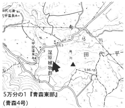
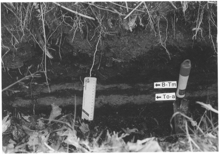
The Tashirotai Wetland at the northeastern foot of Hakkoda volcano developed within the Tashirotai caldera and preserves useful paleoenvironmental records, including tephra (八甲田湿原研究グループ, 1969). In the raised peatland here, two extremely thin volcanic-ash layers occur one above the other at the top of strongly decomposed deposits (black mud). In the low-lying peatland, however, peat deposition continues today, so these ashes can be observed clearly separated. The upper yellowish-white volcanic-ash layer is Baitoushan–Tomakomai tephra (B-Tm), and the lower white volcanic-ash layer is Towada-a ash (To-a) (町田ほか, 1981). The characteristics of the former differ little from those in Hokkaido (see Tomakomai Port, WS-1-2). The latter is somewhat coarser than the former, contains phenocrysts such as pyroxene, is somewhat colored, and consists of thick volcanic-glass shards.
To-a is a tephra that widely covers the six prefectures of Tohoku. It occurs within Heian-period cultural layers or overlying artifacts of that period, as at the Tagajo archaeological site. At Mutsu Kokubunji in particular it intervenes between artifact-bearing layers thought to date to 870 and 934 (白鳥, 1980). Moreover, wood from houses buried by the pyroclastic-flow and mudflow deposits accompanying To-a (see Kemanai, TH-13) is known to yield a tree-ring date of >903AD (奈良文化財研究所, 1990). The tephra eruption is therefore considered to correspond to the account in the Fusō Ryakki reporting from Dewa Province in Engi 15 (915) that ash fell to a depth of 2 sun, and so forth. If To-a is an AD915 eruptive product, the eruption of B-Tm immediately above it is considered to have occurred several to ten-odd years after To-a. The two tephras occur superposed with an observable stratigraphic relationship in the field mainly within Aomori Prefecture.
References: 八甲田湿原研究グループ (1969); 町田ほか (1981); 奈良文化財研究所 (1990); 白鳥 (1980)
Show extracted lettering and translation
English translation of figure lettering
Tashiro Motoyu; Tashirotai hot spring; Hakkoda hot spring; wetland plant community; Tashirotai; Koma River (駒川); 563; 596.1; 1:50,000 “Aomori Tobu” (Aomori No. 4)
Original Japanese lettering
田代元湯; 田代平温泉; 八甲田温泉; 湿原植物群; 田代平; 駒川; 563; 596.1; 5万分の1『青森東部』(青森4号)
1:50,000 “Aomori Tobu” map sheet (Aomori No. 4).
Show extracted lettering and translation
English translation of figure lettering
←B-Tm; ←To-a
Original Japanese lettering
←B-Tm; ←To-a
[Original printed page: 5]
WS-2-1 Kikai-Akahoya Tephra on Takeshima, Kikai Caldera, Southern Kyushu
Hiroshi Machida
- Locality: Takeshima, Mishima Village, Kagoshima Prefecture
- Latitude and longitude: N30°48′25″ E130°24′54″
- Elevation: 80m
- Outcrop type and current condition: sea cliff and roadside; extant
- Deposit types and age: fallout tephra and pyroclastic-flow deposits; 6.3ka
- Date of description: 1976
- Keywords: Kikai-Akahoya tephra; Funakura pumice fall; Funakura pyroclastic-flow deposit; Takeshima pyroclastic-flow deposit; Nagase pyroclastic-flow deposit
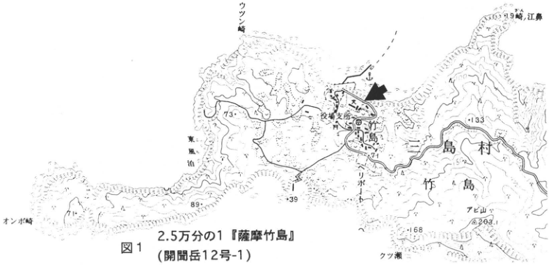
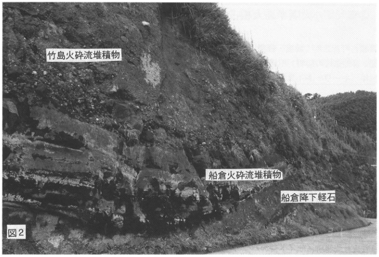
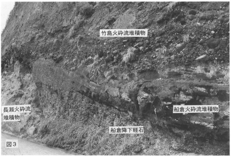
Around Kikai caldera, the source of Kikai-Akahoya tephra, the stratigraphy and facies of this tephra can be observed best on Takeshima. These have been described in detail by 小野ほか (1982). Although this tephra can be observed at various places on the island, the outcrop facing Funakura Port on its northern side is described here (Fig. 1). As shown in Figure 2, the tephra overlying the kuroboku (black humic soil) layer comprises, from bottom to top, Plinian pumice fall (Funakura pumice fall), welded tuff (Funakura pyroclastic flow), and a nonwelded pyroclastic-flow deposit (Takeshima pyroclastic flow). A glassy volcanic-ash layer can sometimes be seen above the pyroclastic-flow deposit, but it is rather discontinuous. Pumice at every horizon is extremely well vesiculated and light. The total thickness at this outcrop is slightly more than 10m, but the thickness of the pyroclastic-flow deposit varies with the terrain and exceeds 30m in places. In some places the Takeshima pyroclastic-flow deposit also truncates protruding parts of the underlying beds and overlies them unconformably (Fig. 3). The principal distribution axis of the Plinian pumice fall is east-southeastward; it also occurs on the Osumi Peninsula (see Onejime, WS-2-2). Rather than all of the material identified as the Funakura pyroclastic-flow deposit having been deposited by pyroclastic flow, some portions are welded pumice fall.
The Takeshima pyroclastic flow was the product of an enormous eruption. Many lithic fragments within it are rounded (Figs. 2, 3). This suggests that the eruption occurred on a shallow seabed and entrained deposits from submarine wave-cut platforms. This pyroclastic flow crossed the sea, travelling to and depositing on Yakushima as well as the Osumi and Satsuma peninsulas. In Osumi and Satsuma it corresponds to what was called the Koya pyroclastic-flow deposit (宇井, 1973). Characteristics of these eruptive deposits include a small aspect ratio and the release of large quantities of glassy volcanic ash into the atmosphere, forming ash fall. This fallout ash is the Kikai-Akahoya tephra (K-Ah), which widely covered the Japanese archipelago and surrounding seabed (町田・新井, 1978).
The tephra labeled Nagase pyroclastic flow below the Funakura pumice fall in Figure 3 is a large-scale white rhyolitic tephra and the source of Kikai-Tozurahara ash (K-Tz), described later. Several fallout tephras are also recognized in the kuroboku layer overlying the Takeshima pyroclastic-flow deposit. These are thickly developed on Satsuma Iwojima and are eruptive products of Iwojima volcano. The numerous tephras below the Funakura pumice fall are likewise considered to be mainly products of the central-cone group of Kikai caldera. This caldera formed through the cumulative effects of several enormous eruptions since the Middle Pleistocene, rather than solely through the eruption of Kikai-Akahoya tephra.
References: 町田・新井 (1978); 小野ほか (1982); 宇井 (1973)
Show extracted lettering and translation
English translation of figure lettering
Figure 1; 1:25,000 “Satsuma Takeshima” (Kaimondake No. 12-1); Mishima Village; Takeshima; village office branch; heliport; Abi-yama (アビ山); Onbo Point (オンボ崎); Utsun Point (ウツン崎); 東風泊 [reading uncertain]; Kutsu-se (クツ瀬); 71; 73; 89; 39; 133; 168; 203.1
Original Japanese lettering
図1; 2.5万分の1『薩摩竹島』(開聞岳12号-1); 三島村; 竹島; 役場支所; ヘリポート; アビ山; オンボ崎; ウツン崎; 東風泊; クツ瀬; 71; 73; 89; 39; 133; 168; 203.1
Reading notes
島東北端の小地名 — 小さい文字が不鮮明で全字を確定できない。(未確定候補 / Unconfirmed candidate: [判読不明]崎,江鼻)
Figure 1. 1:25,000 “Satsuma Takeshima” map sheet (Kaimondake No. 12-1).
[Original printed page: 6]
WS-2-1 (continued)
Show extracted lettering and translation
English translation of figure lettering
Figure 2; Takeshima pyroclastic-flow deposit; Funakura pyroclastic-flow deposit; Funakura pumice fall
Original Japanese lettering
図2; 竹島火砕流堆積物; 船倉火砕流堆積物; 船倉降下軽石
Figure 2.
Show extracted lettering and translation
English translation of figure lettering
Figure 3; Takeshima pyroclastic-flow deposit; Nagase pyroclastic-flow deposit; Funakura pyroclastic-flow deposit; Funakura pumice fall
Original Japanese lettering
図3; 竹島火砕流堆積物; 長瀬火砕流堆積物; 船倉火砕流堆積物; 船倉降下軽石
Figure 3.
[Original printed page: 7]
WS-2-2 Kikai-Akahoya Tephra near Onejime, Osumi Peninsula
Hiroshi Machida
- Locality: Hananomoto (花之本), Nejime Town, Kagoshima Prefecture
- Latitude and longitude: N31°13′28″ E130°48′43″
- Elevation: 180m
- Outcrop type and current condition: cutting for farmland development; unknown
- Deposit types and age: pumice-fall and pyroclastic-flow deposits
- Date of description: 1984
- Keywords: Kikai-Akahoya tephra; Aira-Ito pyroclastic flow; Aira-Osumi pumice fall; Kikai-Tozurahara tephra; Ata tephra
Throughout southern Kyushu, yellowish-red, volcanic-glass-rich Kikai-Akahoya tephra (K-Ah), locally called Akahoya or Imogo, can be observed near the ground surface. Whereas the coarse-grained tephra layers above and below it pinch out in different regions, K-Ah remains well continuous, although its degree of preservation varies with its cover.
On the Osumi Peninsula south of a line running east–west near Kanoya, Kikai-Akahoya tephra can be divided into three units. At this outcrop, from below, Koya pumice fall (the Funakura pumice fall on Takeshima), the Koya pyroclastic-flow deposit (the Takeshima pyroclastic-flow deposit), and Kikai-Akahoya ash are seen. The Koya pyroclastic-flow deposit is thin and continuous irrespective of topographic irregularities, as though it were fallout tephra. Its components, however, are more poorly sorted than those of the other units, with pumice clasts coexisting with fine volcanic ash, showing the characteristics of a pyroclastic-flow deposit. There are parts at the base where fine lithic fragments and phenocryst minerals are concentrated. The pyroclastic flow is considered to have been extremely gas-rich and highly mobile (宇井, 1973). Above this pyroclastic-flow deposit lies a normally graded volcanic-ash layer with a layer of accretionary lapilli at its base. This is the widespread K-Ah. The ash consists of bubble-type and pumice-type volcanic glass of pyroxene-rhyolitic to dacitic composition. It is generally yellowish-red in the field, but is pale yellowish-white where covered by thick tephra or intercalated in water-laid strata.
The tephra above K-Ah at this outcrop, separated from it by a thin kuroboku layer, is the Ikedako fallout tephra erupted from the Ikedako caldera at approximately 5.7ka (pumice fall with volcanic ash and scoria at its base; 成尾・小林, 1984). At the site marked ■, members of the Aira-Tn tephra (mainly the Ito pyroclastic flow, A-Ito, or the Osumi pumice fall, A-Os), Kikai-Tozurahara tephra (K-Tz), and Ata tephra (Ata) can be observed below K-Ah, separated by thick volcanic-ash soil. On the upland formed by the Ata pyroclastic flow near Onejime and Nejime, there are many other outcrops where K-Ah and associated tephras can be seen in almost the same mode of occurrence, although these exposures repeatedly appear and disappear.
In southern Kyushu, it is known that the types of Jomon pottery excavated from volcanic-ash soils above and below K-Ah differ across this boundary (新東, 1978). This major eruption probably greatly changed the landforms and ecosystems, including vegetation and fauna, of Kyushu, Shikoku, and Chugoku. It is anticipated that Jomon culture in this region suffered a severe blow and that cultural replacement occurred (Machida, 1984).
References: 宇井 (1973); Machida (1984); 町田・新井 (1978); 新東 (1978); 成尾・小林 (1984)
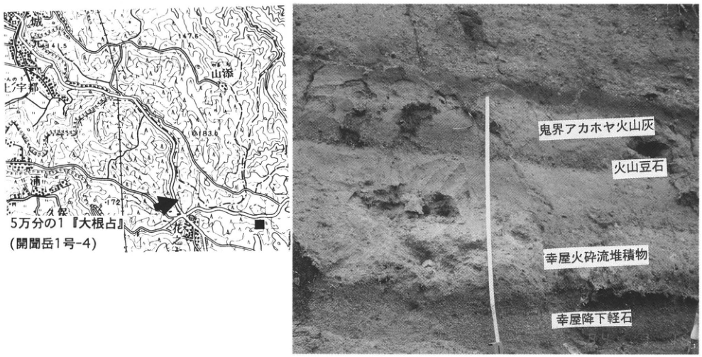
Show extracted lettering and translation
English translation of figure lettering
1:50,000 “Onejime” (Kaimondake No. 1-4); 城; 上宇都; 山添; Hananomoto (花之本); 浦; 久保 [small place-name readings unverified]; 41.5; 77.6; 83.6; 172; Kikai-Akahoya ash; accretionary lapilli; Koya pyroclastic-flow deposit; Koya pumice fall
Original Japanese lettering
5万分の1『大根占』(開聞岳1号-4); 城; 上宇都; 山添; 花之本; 浦; 久保; 41.5; 77.6; 83.6; 172; 鬼界アカホヤ火山灰; 火山豆石; 幸屋火砕流堆積物; 幸屋降下軽石
1:50,000 “Onejime” map sheet (Kaimondake No. 1-4).
[Original printed page: 8]
WS-2-3 Kikai-Akahoya Tephra in Holocene Marine-Terrace Deposits of the Miyazaki Plain
長岡信治
- Locality: bank of the 鬼付女 River at Minashiro (三納代), Shintomi Town, Miyazaki Prefecture, in front of the Koyu Poultry Agricultural Cooperative
- Latitude and longitude: N32°4′8″ E131°29′38″
- Elevation: 6m
- Outcrop type and current condition: river-improvement works; now covered with concrete
- Deposit types and age: water-laid tephra; Holocene
- Date of description: February 1993
- Keywords: Kikai-Akahoya tephra; Shimotajima I surface; Miyazaki Plain; 鬼付女 River
Because the Miyazaki Plain is uplifting, at least four levels of Holocene terraces have developed (長岡ほか, 1991). Of these, the highest, Shimotajima I surface, is a marine terrace that emerged at approximately 5–6ka (長岡ほか, 1991). The Shimotajima I terrace consists of more than 50m of transgressive deposits and contains Kikai-Akahoya tephra (K-Ah), deposited on the seabed, in its upper part. At this outcrop, K-Ah and the marine strata of the Shimotajima I surface can be observed. Below K-Ah lies a marine clay layer containing abundant inner-bay molluscan fossils. K-Ah reaches a maximum thickness of 5m and, unlike its terrestrial counterpart, consists of fresh, translucent grayish-white, glassy coarse volcanic ash with well-developed cross-lamination and trace fossils. K-Ah pinches out upstream, toward the former shoreline. Above K-Ah is a cover of marine and fluvial sand approximately 1m thick. The fluvial sand often contains fragments of Yayoi pottery. Although most of the outcrop here is now covered, some portions remain visible. Similar outcrops also occur on the Ishizaki River. Confirmation with a hand auger or similar equipment should be possible.
Reference: 長岡ほか (1991)
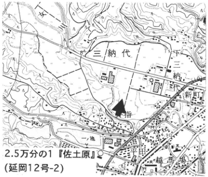
Show extracted lettering and translation
English translation of figure lettering
1:25,000 “Sadowara” (Nobeoka No. 12-2); Minashiro (三納代); 一丁田; 二丁田; 新町; 鬼付女; 一池; 下城島 [place-name readings unverified]; 84; 4.90
Original Japanese lettering
2.5万分の1『佐土原』(延岡12号-2); 三納代; 一丁田; 二丁田; 新町; 鬼付女; 一池; 下城島; 84; 4.90
1:25,000 “Sadowara” map sheet (Nobeoka No. 12-2).
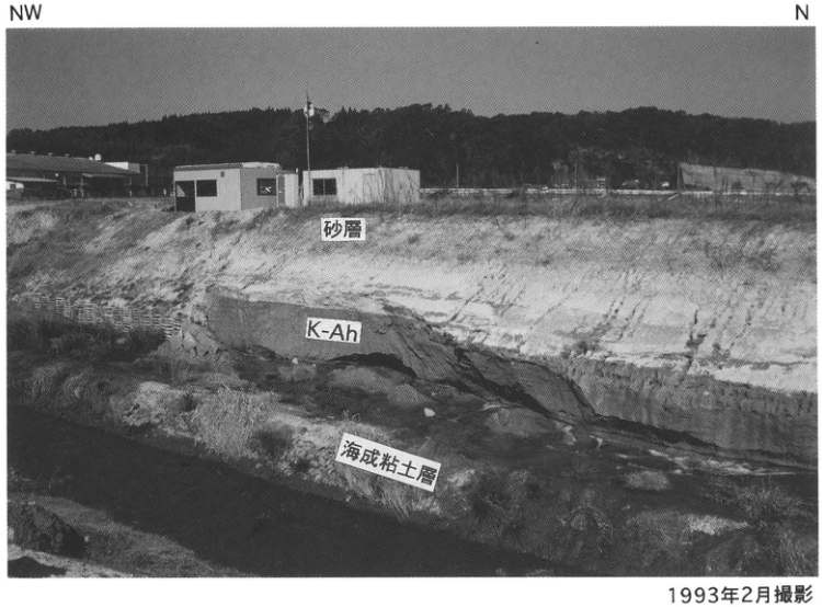
Show extracted lettering and translation
English translation of figure lettering
NW; N; sand layer; K-Ah; marine clay layer; 1m; photographed in February 1993
Original Japanese lettering
NW; N; 砂層; K-Ah; 海成粘土層; 1m; 1993年2月撮影
Photographed in February 1993.
[Original printed page: 9]
WS-2-4 Kikai-Akahoya Tephra in Uplifted Holocene Terrace Deposits — Nakamurahara, Kanagawa Prefecture
Hiroshi Machida and 松島義章
- Locality: Obune, Odawara City, beneath the Tokaido Shinkansen bridge
- Latitude and longitude: N35°17′54″ E139°14′0″
- Elevation: 19–25m
- Outcrop type and current condition: riverbank cliff; extant, but difficult to approach in summer because of vegetation in the riverbed
- Deposit types and age: marine strata, marine molluscan fossils, and volcanic ash; Holocene
- Date of description: 1979
- Keywords: marine alluvial deposits; marine molluscan fossils; Kikai-Akahoya tephra
The coastal zone from Oiso to Kozu in Kanagawa Prefecture is known as one of Japan's greatest areas of seismic uplift. Holocene marine strata reach elevations above 20m and form terraces. At this outcrop the upper part of these alluvial deposits can be observed, and a thin layer of Kikai-Akahoya tephra (K-Ah) is recognized within it. Below 19m above sea level, alternating sand and silt containing fossils of inner-bay molluscs (Anadara subclenata, Anomalocardea squamosa, etc.) are observed. Above them lie sand containing wood fragments, wetland silt, and fluvial sand and gravel. Detailed examination of the silt near 20.5m above sea level reveals a white volcanic-ash layer several mm thick. It consists of bubble-type volcanic glass and is identified as Kikai-Akahoya tephra (K-Ah) from its characteristics and stratigraphic position (松島, 1980; Machida et al., 1984; 遠藤ほか, 1979). Because K-Ah here occurs within terrestrial rather than marine strata, it must have been deposited as fallout when the coast had begun to pass from transgression to regression. In contrast, in coastal areas of central Honshu and farther west, K-Ah was generally deposited slightly before the peak of transgression (see, for example, the Miyazaki Plain, WS-2-3). This difference is explained by regional differences in uplift rate (町田・新井, 1980).
References: 遠藤ほか (1979); 松島 (1980); 町田・新井 (1980); Machida et al. (1980)
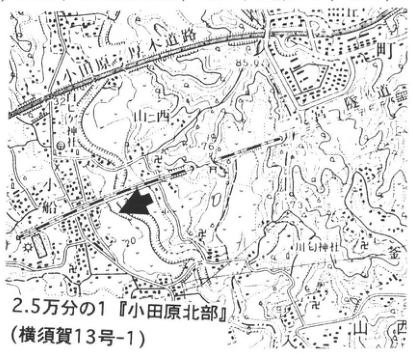
Show extracted lettering and translation
English translation of figure lettering
1:25,000 “Odawara Hokubu” (Yokosuka No. 13-1); Tokaido; Odawara–Atsugi Road; Nakamura River; Yamanishi; Obune; Ninomiya; mountain shrine (山神社); 32.11; 85.9; 76; 20; 73.1
Original Japanese lettering
2.5万分の1『小田原北部』(横須賀13号-1); 東海道; 小田原厚木道路; 中村川; 山西; 小船; 二宮; 山神社; 32.11; 85.9; 76; 20; 73.1
1:25,000 “Odawara Hokubu” map sheet (Yokosuka No. 13-1).
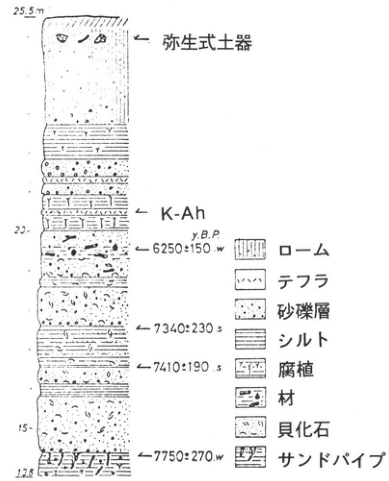
Show extracted lettering and translation
English translation of figure lettering
25.5m; 20; 15; 13.8; Yayoi pottery; K-Ah; y.B.P.; 6250±150 w; 7340±230 s; 7410±190 s; 7750±270 w; loam; tephra; sand and gravel layer; silt; humus; wood; molluscan fossils; sand pipes
Original Japanese lettering
25.5m; 20; 15; 13.8; 弥生式土器; K-Ah; y.B.P.; 6250±150 w; 7340±230 s; 7410±190 s; 7750±270 w; ローム; テフラ; 砂礫層; シルト; 腐植; 材; 貝化石; サンドパイプ
Outcrop stratigraphic column (松島, 1980).
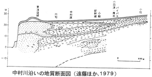
Show extracted lettering and translation
English translation of figure lettering
M; 30; 20; 10; 0; -10; Tokaido railway; Kawawa (川勾); Nakamurahara; Shinkansen; Obune; Odawara–Atsugi bypass; Odake (小竹); 0; 500m; geological section along the Nakamura River (遠藤ほか, 1979)
Original Japanese lettering
M; 30; 20; 10; 0; -10; 東海道線; 川勾; 中村原; 新幹線; 小船; 小田原・厚木バイパス; 小竹; 0; 500m; 中村川沿いの地質断面図(遠藤ほか,1979)
Reading notes
断面内の斜体地層略号 — 小さく低解像度で一部の文字を確定できない。(未確定候補 / Unconfirmed candidate: [判読不明])
Geological section along the Nakamura River (遠藤ほか, 1979).
[Original printed page: 10]
WS-2-5 Kikai-Akahoya Tephra and Aira-Tn Tephra on the Kasari Peninsula, Amami Oshima
成尾英仁
- Locality: 喜子川 archaeological site, Tomori, Kasari Town, Kagoshima Prefecture, on the west side of the prefectural Akakina road
- Latitude and longitude: N28°27′33″ E129°43′14″
- Elevation: 12m
- Outcrop type and current condition: excavated exposure; only the western exposure remains as of 1996
- Deposit types and age: aeolian tephra; Late Pleistocene–Holocene
- Date of description: August 1988
- Keywords: Amami Oshima; Kasari Peninsula; Kikai-Akahoya tephra; Aira-Tn tephra; fingernail-impressed pottery
This is a good outcrop for confirming Kikai-Akahoya tephra (K-Ah; 6.3ka) in the Amami Islands. It lies at the edge of a low terrace facing the Pacific Ocean. Here the lower dune sand is hard and grayish-black, consisting mainly of foraminiferal sand, while the upper dune sand is unconsolidated and likewise mainly foraminiferal. Archaeological excavation has continued here since 1987, and the sequence has been divided into eight layers from the surficial black sand to the clayey weathered soil (maji layer). Unconsolidated brown sand forms the artifact-bearing layer and yields fingernail-impressed pottery. Below it is consolidated sand, the lower dune sand. Farther below, separated by black sand, K-Ah is deposited. It contains some foraminiferal sand but is a vivid yellowish-orange glassy volcanic ash. It occurs in blocks approximately 5cm thick and has good lateral continuity. Underlying it is reddish-orange clayey soil called the maji layer, containing abundant medium to large shale gravel derived from the bedrock. Although not distinguishable to the naked eye, Aira-Tn tephra (AT; 25ka) is scattered within this layer. K-Ah glass is light brown to dark brown, has a refractive index of 1.510–1.512, and has an average SiO₂ content of 76%. AT glass is colorless, transparent, and platy, with a refractive index of 1.497–1.498. Fingernail-impressed pottery in the Ryukyu Islands was formerly assigned to the Incipient Jomon period, approximately 10ka, as on the main islands. The recovery of this pottery above K-Ah, however, led to its assignment to the Initial Jomon period.
References: 成尾 (1988); 田村ほか (1988)
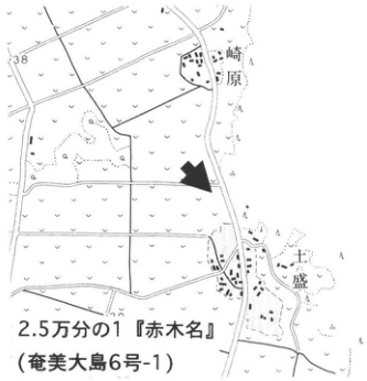
Show extracted lettering and translation
English translation of figure lettering
Sakibaru (崎原); Tomori; 38; 1:25,000 “Akakina” (Amami Oshima No. 6-1)
Original Japanese lettering
崎原; 土盛; 38; 2.5万分の1『赤木名』(奄美大島6号-1)
1:25,000 “Akakina” map sheet (Amami Oshima No. 6-1).
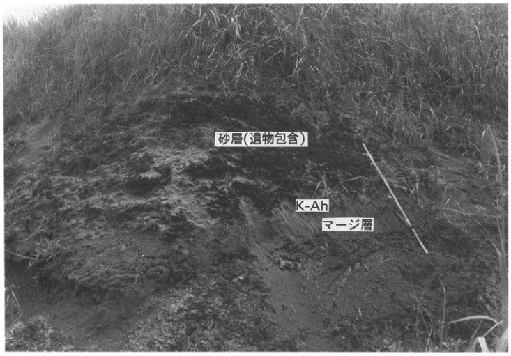
Show extracted lettering and translation
English translation of figure lettering
sand layer (artifact-bearing); K-Ah; maji layer
Original Japanese lettering
砂層(遺物包含); K-Ah; マージ層
[Original printed page: 11]
WS-3-1 Late Pleistocene–Holocene Tephras of Ulleung Island, Korea
森脇 広
- Locality: Sokpo-dong (石圃洞), Ulleung Island, Korea
- Latitude and longitude: N37°32′28″ E130°54′18″
- Elevation: 270m
- Outcrop type and current condition: artificial; preserved as of July 1982
- Deposit types and age: aeolian tephra; Late Pleistocene and Holocene
- Date of description: July 1982
- Keywords: Korea; Ulleung Island; Ulleung-Oki tephra
Ulleung Island (Ururundo) is a Quaternary volcanic island in the Sea of Japan, 140km from the Korean Peninsula. Attention was drawn to Quaternary tephra from this volcano by the discovery, in Kansai and Chubu on the Japanese archipelago and on the floor of the southern Sea of Japan, of an early Holocene tephra thought to originate on Ulleung Island: Ulleung-Oki ash (U-Oki), an alkaline-rock tephra rare among tephras of the Japanese archipelago (町田ほか, 1981). A detailed tephra chronology for the island was established by 町田ほか (1984). The island is nearly circular, 12km east–west and 9km north–south. In its north-central part is a caldera 3.5km in diameter, with the central cone Al-bong (卵峰) in its northern part. The tephra stratigraphy can be established at Sokpo-dong in the northeastern part of the island, where a lava plateau remains (82.7-2 in Fig. 1), and on the small island Chuk-do (竹島; 82.7-1), 2km off its northeastern coast (Figs. 1, 3). At outcrop 82.7-2, seven tephra layers originating from Ulleung volcano are recognized and named U-1, U-2, …, U-7 from top downward (Fig. 2; 町田ほか, 1984). All are alkaline-rock tephras and differ greatly from the subalkaline-rock tephras originating in the Japanese archipelago.
The uppermost U-1 is a product of the latest eruptive stage of Ulleung volcano, recognized as a thin scoriaceous volcanic-ash layer. Its lower part is cement-like and consolidated; it is a product of a phreatomagmatic eruption of the central cone Al-bong. U-2 and the lower units are fallout tephras from Plinian eruptions, consisting of trachytic pumice and volcanic ash. U-5–U-7 are strongly weathered and differ in their mode of occurrence from the overlying U-2–U-4, which consist of fresh pumice. U-2 and U-3 are accompanied by pyroclastic flows in addition to pumice-fall layers. The U-3 pyroclastic-flow deposit also contains abundant accretionary lapilli. U-2, U-3, and U-4 show no significant differences in petrography or chemical composition; their eruption sizes are also similar. Their properties likewise resemble those of U-Oki, and they cannot be clearly distinguished on petrographic or chemical grounds. Nevertheless, U-2, which has the widest distribution, a southeastward distribution axis, and a distribution corresponding to that of U-Oki in Honshu, is correlated with U-Oki. Steep slopes are widespread on this island, and tephra preservation is poor, but U-2, a product of the latest caldera eruption, is relatively well preserved on slopes. The thick deposits on slopes around To-dong (道洞), the island's main settlement, are this U-2. The widespread tephras originating in southern Kyushu, Aira-Tn tephra (AT) and Kikai-Akahoya tephra (K-Ah), have been detected within kuroboku soil between U-4 and U-5 and between U-1 and U-2, respectively.
References: 町田ほか (1981, 1984)
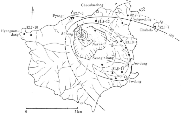
Show extracted lettering and translation
English translation of figure lettering
Cheonbu-dong; Pyongri; Hyangnamu-dong; Al-bong; Nari-kol; Seongin-bong; Sokpo-dong; Chuk-do; Jeo-dong; To-dong; 82.7-10; 82.7-5; 81.8-12; 82.7-2; 82.7-1; 83.10-4; 81.8-11; 300; 100; 10; 20; 0; 5km
Original Japanese lettering
Cheonbu-dong; Pyongri; Hyangnamu-dong; Al-bong; Nari-kol; Seongin-bong; Sokpo-dong; Chuk-do; Jeo-dong; To-dong; 82.7-10; 82.7-5; 81.8-12; 82.7-2; 82.7-1; 83.10-4; 81.8-11; 300; 100; 10; 20; 0; 5km
Figure 1. Outcrop locations on Ulleung Island, U-2 isopachs (heavy solid and dashed lines), and isopleths of grain size (dotted lines for pumice; dash-dot lines for lithic fragments).
[Original printed page: 12]
WS-3-1 (continued)
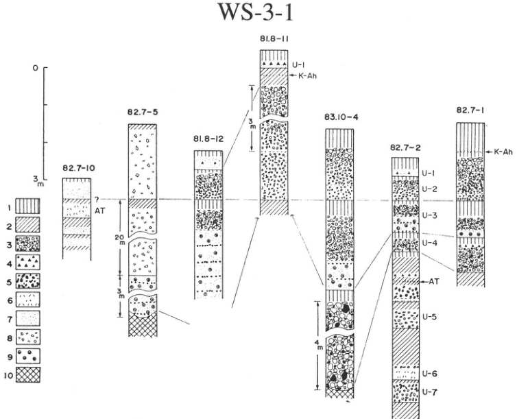
Show extracted lettering and translation
English translation of figure lettering
WS-3-1; 82.7-10; 82.7-5; 81.8-12; 81.8-11; 83.10-4; 82.7-2; 82.7-1; U-1; U-2; U-3; U-4; U-5; U-6; U-7; K-Ah; AT; ?; 0; 3m; 20m; 3m; 4m; 1; 2; 3; 4; 5; 6; 7; 8; 9; 10
Original Japanese lettering
WS-3-1; 82.7-10; 82.7-5; 81.8-12; 81.8-11; 83.10-4; 82.7-2; 82.7-1; U-1; U-2; U-3; U-4; U-5; U-6; U-7; K-Ah; AT; ?; 0; 3m; 20m; 3m; 4m; 1; 2; 3; 4; 5; 6; 7; 8; 9; 10
Figure 2. Tephra stratigraphic columns on Ulleung Island (locations in Fig. 1). The two sites on the right are the type outcrops.
| Number | Legend |
|---|---|
| 1 | Kuroboku soil |
| 2 | Brown soil |
| 3 | Pumice fall |
| 4 | Scoria fall |
| 5 | Lithic fragments |
| 6 | Glassy volcanic ash |
| 7 | Pumiceous volcanic ash containing lithic fragments |
| 8 | Pyroclastic-flow deposit |
| 9 | Accretionary lapilli |
| 10 | Basement |
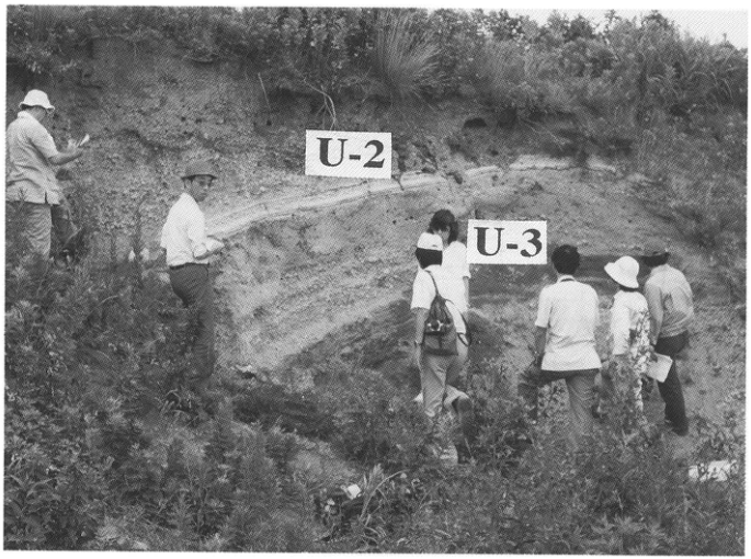
Show extracted lettering and translation
English translation of figure lettering
U-2; U-3
Original Japanese lettering
U-2; U-3
Figure 3. Tephra outcrop on Chuk-do (竹島), Ulleung Island.
[Original printed page: 13]
WS-3-2 Ulleung-Oki Tephra at the Torihama Shell Midden and Lake Suigetsu, Fukui Prefecture
Hiroshi Machida
- Locality: Torihama, Mikata Town, Fukui Prefecture
- Latitude and longitude: N35°33′3″ E135°54′16″
- Elevation: -2–2m
- Outcrop type and current condition: excavation; disappeared; a peel specimen is preserved at the Wakasa Museum of History and Folklore
- Deposit types and age: alkaline-rock volcanic ash and mud; early Holocene
- Date of description: 1981
- Keywords: Ulleung-Oki tephra; early Holocene; Torihama Shell Midden; Lake Suigetsu
The Torihama Shell Midden near Lake Mikata is a representative Early Jomon lowland archaeological site, but also contains artifacts from the Incipient to Initial Jomon periods. Abundant human artifacts and clues to the natural environment of the time are well preserved here. Figure 2 is a composite geological column for Section 4 of the midden's 80L area and the western wall of Section 80L2 (町田, 1981). In wetland mud containing impressed-pattern pottery at 2.2m below sea level, there is a well-continuous grayish-white volcanic-ash layer 2–3cm thick (Figs. 2, 3). This is Ulleung-Oki tephra (U-Oki). Under the microscope it is seen to consist mainly of white to grayish-brown pumice-type volcanic glass with sponge-like vesiculation (mean maximum grain size 0.3mm), containing very small quantities of microphenocrysts of alkali feldspar, brown biotite, amphibole, and clinopyroxene. Correlative tephra has been found at several sites in Kinki and Tokai on Honshu. In the Sea of Japan it is intercalated in seabed deposits from Oki Bank to waters southeast of Ulleung Island. On Ulleung Island the second tephra from the top, U-2, corresponds to it (町田ほか, 1984). This tephra has a radiocarbon age of approximately 9.3ka and is an extremely important marker bed for resolving questions concerning early Holocene sea level, paleoclimate, and the inflow of the Tsushima Warm Current (新井ほか, 1981). K-Ah in the upper part of Figure 4 is not very well preserved, but lies below the layers containing Early Jomon Hashima Lower II-type and Kitashirakawa Lower II-type pottery.
It has also been reported that this tephra is intercalated at 11–12m below the lake floor in a drill core from Lake Suigetsu, one of the Mikata Five Lakes approximately 3km north of Torihama. Varves are recognized in these sediments, and counting them yielded an age of 10,738 years before AD1995 (福沢, 1995; Fig. 5).
References: 新井ほか (1981); 福沢 (1995); 町田 (1981); 町田ほか (1984)
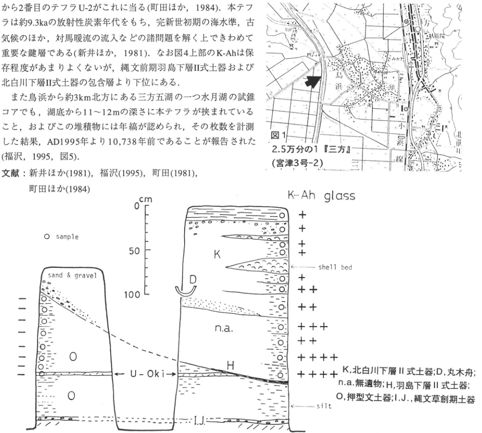
Show extracted lettering and translation
English translation of figure lettering
Figure 1; 1:25,000 “Mikata” (Miyazu No. 3-2); Torihama; Mikata; Mishima; 北前川 [reading unverified]; Obama railway; 2; 9 cm; 0; 50; 100; K-Ah glass; ○ sample; sand & gravel; shell bed; silt; U-Oki; K; D; n.a.; H; O; I.J. K, Kitashirakawa Lower II-type pottery; D, dugout canoe; n.a., no artifacts; H, Hashima Lower II-type pottery; O, impressed-pattern pottery; I.J., Incipient Jomon pottery Left column, top downward: −, −, −, −, −, −, −, − (8 points). Right column, top downward: +, +, +, +, +, ++, ++, +++, ++, ++++, ++++ (11 points).
Original Japanese lettering
図1; 2.5万分の1『三方』(宮津3号-2); 鳥浜; 三方; 三島; 北前川; 小浜線; 2; 9 cm; 0; 50; 100; K-Ah glass; ○ sample; sand & gravel; shell bed; silt; U-Oki; K; D; n.a.; H; O; I.J. K,北白川下層Ⅱ式土器;D,丸木舟;n.a.,無遺物;H,羽島下層Ⅱ式土器;O,押型文土器;I.J.,縄文草創期土器 左柱状図:上から-,-,-,-,-,-,-,-(8点) 右柱状図:上から+,+,+,+,+,++,++,+++,++,++++,++++(11点)
Figure 1. 1:25,000 “Mikata” map sheet (Miyazu No. 3-2).
Figure 2. Schematic section showing the stratigraphic relationships between Jomon pottery and tephras (U-Oki, K-Ah) (町田ほか, 1984). The abundance of K-Ah volcanic glass is indicated by + and −.
[Original printed page: 14]
WS-3-2 (continued)
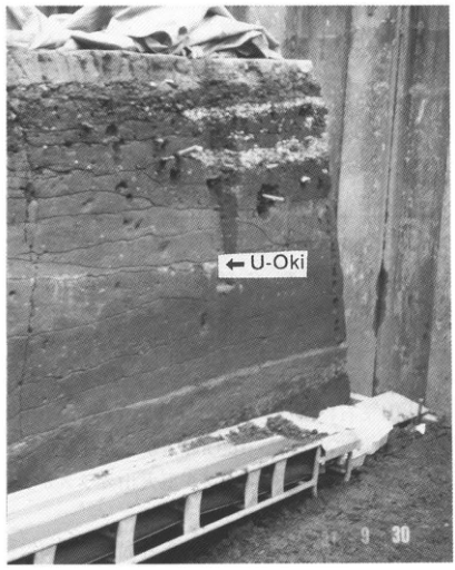
Show extracted lettering and translation
English translation of figure lettering
←U-Oki; 9 30
Original Japanese lettering
←U-Oki; 9 30
Reading notes
写真右下の日付 — 左側の年・月部分は不鮮明で読み切れない。
Figure 3. U-Oki at the Torihama Shell Midden.
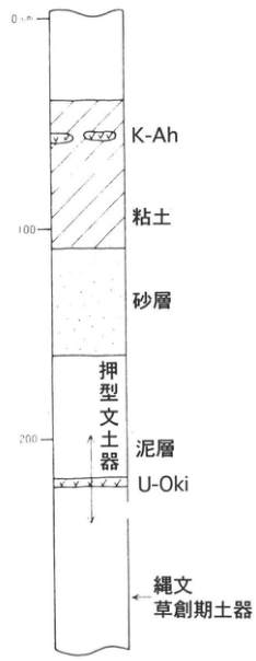
Show extracted lettering and translation
English translation of figure lettering
0cm; 100; 200; K-Ah; clay; sand layer; impressed-pattern pottery; mud layer; U-Oki; Incipient Jomon pottery
Original Japanese lettering
0cm; 100; 200; K-Ah; 粘土; 砂層; 押型文土器; 泥層; U-Oki; 縄文草創期土器
Figure 4. Composite stratigraphic column at the Torihama Shell Midden.
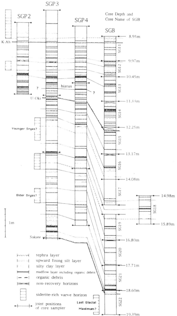
Show extracted lettering and translation
English translation of figure lettering
SGP2; SGP3; SGP4; SGB; Core Depth and Core Name of SGB K-Ah; U-Oki; Sakate; hiatus; ?; Younger Dryas?; Older Dryas?; Last Glacial Maximum?; 1m SG11: 8.95m–9.97m; SG12: 9.97m–10.45m; SG13: 10.45m–11.33m; SG14: 11.33m–12.25m; SG15: 12.25m–13.17m; SG16: 13.17m–14.08m; SG17: 14.08m–14.98m; SG18: 14.98m–15.89m; SG19: 15.89m–16.80m; SG20: 16.80m–17.71m; SG21: 17.71m–18.60m; SG22: 18.60m–19.39m tephra layer; upward fining silt layer; silty clay layer; mudflow layer including organic debris; organic debris; non-recovery horizons; siderite-rich varve horizon; joint positions of core sampler
Original Japanese lettering
SGP2; SGP3; SGP4; SGB; Core Depth and Core Name of SGB K-Ah; U-Oki; Sakate; hiatus; ?; Younger Dryas?; Older Dryas?; Last Glacial Maximum?; 1m SG11: 8.95m–9.97m; SG12: 9.97m–10.45m; SG13: 10.45m–11.33m; SG14: 11.33m–12.25m; SG15: 12.25m–13.17m; SG16: 13.17m–14.08m; SG17: 14.08m–14.98m; SG18: 14.98m–15.89m; SG19: 15.89m–16.80m; SG20: 16.80m–17.71m; SG21: 17.71m–18.60m; SG22: 18.60m–19.39m tephra layer; upward fining silt layer; silty clay layer; mudflow layer including organic debris; organic debris; non-recovery horizons; siderite-rich varve horizon; joint positions of core sampler
Figure 5. Stratigraphic columns of lake-floor sediment cores from Lake Suigetsu (福沢, 1995).
[Original printed page: 15]
WS-4-1 Towada-Hachinohe and Ofudo Pyroclastic-Flow Deposits around Ninokura Dam, Aomori Prefecture
Hiroshi Machida
- Locality: Ninokura Dam, Shingo Village, Aomori Prefecture
- Latitude and longitude: A: N40°25′9″ E141°3′53″; B: N40°25′34″ E141°4′59″
- Elevation: 300–340m
- Outcrop type and current condition: roadside cliffs; hidden by retaining walls
- Deposit types and age: pyroclastic-flow deposits and pumice fall; 12ka and 35ka
- Date of description: 1980
- Keywords: Towada-Ofudo tephra; Towada-Hachinohe tephra; Ninokura tephra group; Towada-Nanbu tephra; Towada-Chuseri tephra; Towada-b tephra; Towada-a tephra; Towada caldera; Ninokura Dam
Towada-Hachinohe tephra (To-H) and Ofudo tephra (To-Of) are considered to have been principally involved in the formation of Towada caldera. Both are large tephras of similar size, approximately 50km³ in volume, comprising pyroclastic-flow deposits accompanied by pumice fall. The pyroclastic-flow plateau in this area formed through their combination. Towada caldera also erupted numerous other large-scale tephras. At this outcrop, both the upper To-H and lower To-Of have preceding pumice-fall layers, respectively 250cm and 55cm thick, immediately beneath the pyroclastic-flow deposits that fill valleys thickly and form uplands (Fig. 2). On the upland north of Hachinohe, including Takadate, the type area of the Towada tephra group, these pumice-fall layers correspond to the tephras called Hachinohe Pumice (HP) and Biscuit 1 (BP1). HP is rich in volcanic ash and accretionary lapilli (早川, 1983). BP1 likewise has a pumice layer in its lower part but a fallout-ash layer above. To-H and To-Of are lithologically similar but can be distinguished by the more felsic composition of To-Of and the amphibole phenocrysts in To-H that are absent in To-Of. To-Of also contains a small amount of bubble-type volcanic glass.
The abundant charred wood in pyroclastic-flow deposits in this area clearly shows that To-H buried and destroyed a subarctic coniferous forest. Previous radiocarbon dates on this wood range from 10.4 to 14ka. Recent accelerator mass spectrometry, however, yielded 12.65ka and showed that the eruption occurred between autumn and spring (寺田ほか, 1994). In piston core KH77-1-6 off Sanriku, 300km east of Miyako, tephra identified as To-Of co-ignimbrite ash occurs 72cm above tephra identified as Shikotsu-1 (青木, 1996). Near Hachinohe, volcanic glass identified as AT also occurs in volcanic-ash soil between BP1 and BP2. Thus To-Of lies between AT and Spfa-1, nearer to the latter. Previous radiocarbon dates for this tephra range from 20ka to >33ka and are difficult to settle (町田・新井, 1992), but its age is probably closer to the older values.
Tephra layers from the latest Pleistocene through the Heian period overlie the depositional surface of To-H (Fig. 3). Unlike the other tephras, the lowest is not the product of a single eruption but consists of numerous scoria and volcanic-ash layers (To-Nk). These are thought to have been erupted during formation of the small Goshikiiwa stratovolcano in the southwestern part of the Nakako crater of Towada caldera. Their eruption ages are 10–13ka, and they are overlain by Initial Jomon cultural layers. Above them, separated by soils, lie Towada-Nanbu tephra (To-Nb), Towada-Chuseri tephra (To-Cu), Towada-b tephra (To-b), and Towada-a tephra (To-a), in that order. To-Nb is a marker tephra for the Initial Jomon period and To-Cu for the Early Jomon period. The latter is widely distributed throughout Tohoku, much like To-a.
References: 青木 (1996); 早川 (1983); Hayakawa (1985); 町田・新井 (1992); 寺田ほか (1994)
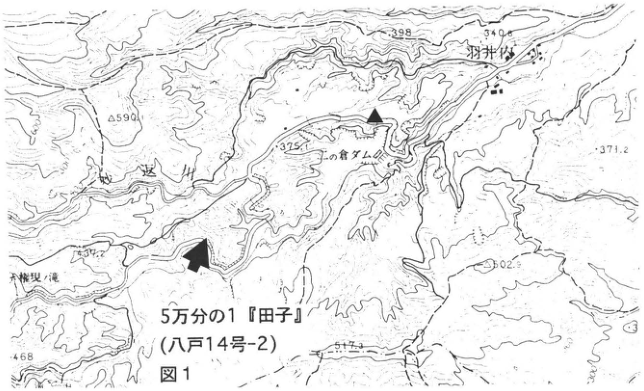
Show extracted lettering and translation
English translation of figure lettering
Figure 1; 1:50,000 “Takko” (Hachinohe No. 14-2); Ninokura Dam; 羽井内; 迷川 [readings unverified]; 590; 398; 340.0; 375.1; 371.2; 502.9; 517.3; 468
Original Japanese lettering
図1; 5万分の1『田子』(八戸14号-2); 二ノ倉ダム; 羽井内; 迷川; 590; 398; 340.0; 375.1; 371.2; 502.9; 517.3; 468
Figure 1. 1:50,000 “Takko” map sheet (Hachinohe No. 14-2).
[Original printed page: 16]
WS-4-1 (continued)
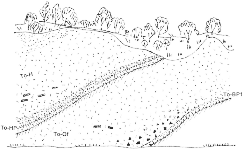
Show extracted lettering and translation
English translation of figure lettering
To-H; To-HP; To-Of; To-BP1
Original Japanese lettering
To-H; To-HP; To-Of; To-BP1
Figure 2. Two large-scale Towada tephras.
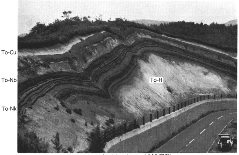
Show extracted lettering and translation
English translation of figure lettering
To-Cu; To-Nb; To-Nk; To-H
Original Japanese lettering
To-Cu; To-Nb; To-Nk; To-H
Figure 3. Outcrop photograph at the site marked ▲ (published in Hayakawa, 1985).
[Original printed page: 17]
WS-5-1 Large-Scale Tephras Erupted from Aira Caldera at Shibushi Port
Hiroshi Machida
- Locality: sea cliff east of Shibushi Port, Shibushi Town, Kagoshima Prefecture
- Latitude and longitude: N31°28′14″ E131°6′58″
- Elevation: 0–50m
- Outcrop type and current condition: sea cliff; extant
- Deposit types and age: pumice-fall and pyroclastic-flow deposits
- Date of description: 1983
- Keywords: Aira-Osumi pumice fall; Aira-Ito pyroclastic-flow deposit; Aira-Tn tephra; Aira-Iwato tephra; Aira-Fukuyama tephra; Kikai-Tozurahara tephra; Ata tephra
The large-scale tephras erupted from Aira caldera at approximately 24ka form most of the shirasu uplands throughout southern Kyushu. The type locality differs for each member, but here the cliff east of Shibushi Port has been selected because the basic members have long been exposed there and are thought unlikely to disappear in the future (Figs. 1, 2). The lower stratified pumice layer is the Osumi pumice fall (A-Os); the inversely graded pyroclastic-flow deposit in the middle and upper parts is the Ito pyroclastic-flow deposit (A-Ito). Their distributions are shown in Figure 3. A-Os is one of Japan's largest pumice falls, with a volume of approximately 100km³ and a principal distribution axis extending southeast to east-southeast from near present-day Sakurajima. Its distribution on the upwind side as well suggests formation of a gigantic umbrella cloud. After the A-Os eruption, the Tsumaya pyroclastic flow (A-Ts) was erupted, a tephra consisting of fine-grained material produced by a phreatomagmatic eruption. A-Ito is the deposit of an immense pyroclastic flow with a volume of approximately 200km³. It widely covers southern Kyushu and forms most of the shirasu uplands. All these deposits are pyroxene-rhyolitic and extremely homogeneous regardless of member.
Volcanic ash consisting mainly of bubble-type volcanic glass, erupted into the atmosphere during the A-Ito eruption, is widely distributed over the Japanese archipelago and surrounding regions. Called Aira-Tn tephra (AT), it is frequently used as a marker bed in studies of Late Pleistocene questions (町田・新井, 1976). In Kyushu this tephra is recognized from near the edge of the A-Ito distribution outward, where it can be traced continuously as a glassy volcanic-ash layer slightly less than 1m thick. Around Shibushi, too, the uppermost part of A-Ito contains a volcanic-ash layer, locally with accretionary lapilli, that may be part of fallout AT.
East of this outcrop, various tephra layers beneath A-Os can be observed (Fig. 4). From the top downward they are Aira-Iwato tephra (A-Iw; a thin layer that is a clear marker bed on the Miyazaki Plain), Aira-Fukuyama tephra (A-Fk; rich in amphibole), Kikai-Tozurahara tephra (K-Tz; glassy volcanic ash weathered pink), and Ata tephra (Ata). Of these, the main body of Ata is welded tuff, overlain by weathered tephra consisting of accretionary lapilli, probably Ata co-ignimbrite ash.
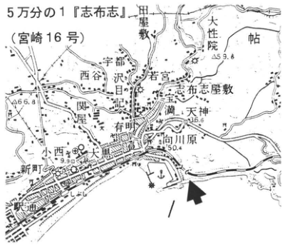
Show extracted lettering and translation
English translation of figure lettering
1:50,000 “Shibushi” (Miyazaki No. 16); 田畦敷; 大性院; 帖; 宇都; 西谷; 沢目; 若宮; 宝満; 志布志屋敷; 天神; 向川原; 有明; 関屋; 小西; 大黒; 新町; 内田 [local place-name readings unverified]; 59.6; 66.8; 36.6; 50.4; 9.9
Original Japanese lettering
5万分の1『志布志』(宮崎16号); 田畦敷; 大性院; 帖; 宇都; 西谷; 沢目; 若宮; 宝満; 志布志屋敷; 天神; 向川原; 有明; 関屋; 小西; 大黒; 新町; 内田; 59.6; 66.8; 36.6; 50.4; 9.9
Figure 1. 1:50,000 “Shibushi” map sheet (Miyazaki No. 16).
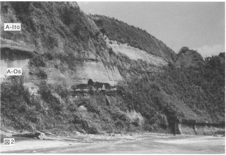
Show extracted lettering and translation
English translation of figure lettering
Figure 2; A-Ito; A-Os
Original Japanese lettering
図2; A-Ito; A-Os
Figure 2.
[Original printed page: 18]
WS-5-1 (continued)
References: Aramaki and Ui (1966); 町田・新井 (1976, 1992)
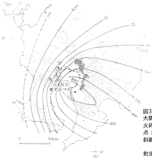
Show extracted lettering and translation
English translation of figure lettering
6cm; 12; 25; 50; 100; 200; 400; 400; 800; >0; Kagoshima; Sakurajima; Miyazaki; 32°; 31°; 131°; 0; 30km
Original Japanese lettering
6cm; 12; 25; 50; 100; 200; 400; 400; 800; >0; 鹿児島; 桜島; 宮崎; 32°; 31°; 131°; 0; 30km
Figure 3. Isopachs of Osumi pumice fall (A-Os) and distributions of Tsumaya and Ito pyroclastic-flow deposits (A-Tm, A-Ito), etc.
Dots: Ito pyroclastic flow (A-Ito); horizontal lines: Tsumaya pyroclastic flow (A-Tm); diagonal lines: pyroclastic-flow deposits contemporaneous with Osumi pumice fall (A-Os).
町田・新井 (1992).
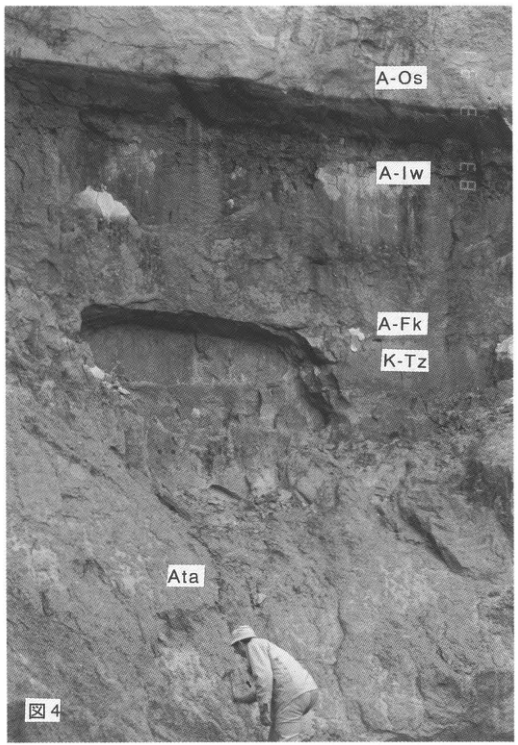
Show extracted lettering and translation
English translation of figure lettering
Figure 4; A-Os; A-Iw; A-Fk; K-Tz; Ata
Original Japanese lettering
図4; A-Os; A-Iw; A-Fk; K-Tz; Ata
Figure 4.
[Original printed page: 19]
WS-5-2 Aira-Tn Tephra and Kikai-Akahoya Tephra in Southwestern Shikoku
Hiroshi Machida
- Locality: Ogawa (小川), Sukumo City, Kochi Prefecture, at the Kochi–Ehime prefectural boundary
- Latitude and longitude: N32°58′03″ E132°41′37″
- Elevation: 50–80m
- Outcrop type and current condition: farm-road cutting; unknown
- Deposit types and age: glassy volcanic ash; 6.3ka and 24ka
- Date of description: 1975
- Keywords: Aira-Tn tephra; Kikai-Akahoya tephra
Aira-Tn tephra (AT) and Kikai-Akahoya tephra (K-Ah) can be found throughout western Japan as representative widespread tephras of the Late Pleistocene and Holocene. Places where both layers occur together in a typical exposure, however, are not very numerous. This is a good outcrop 5km northwest of Sukumo City. The upper K-Ah is yellowish-red and the lower AT bright yellow. In Shikoku these were formerly called red onji (onji) and yellow onji. Talus deposits intervene between them. Detailed observation of AT shows that its lowermost 11cm consists of extremely fine volcanic ash, whereas the thick bright-yellow volcanic-ash layer above is normally graded. The base of the latter in particular consists of phenocrysts and coarse-sand-sized volcanic ash, with pumice fragments also present. From the middle to the top it becomes compact fine volcanic ash. This stratified structure can be observed from southern Kyushu to the Chugoku region. Various explanations had been proposed for the origin of the basal fine volcanic ash, but 町田・新井 (1992) interpreted it as fallout ash contemporaneous with the Tsumaya pyroclastic flow. The overlying normally graded volcanic ash is co-ignimbrite ash of the Ito pyroclastic flow.
References: 町田・新井 (1976, 1992)
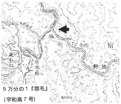
Show extracted lettering and translation
English translation of figure lettering
1:50,000 “Sukumo” (Uwajima No. 7); Ogawa; 野地; 東台地; 草木藪 [readings unverified]; 63; 62.12; 38.0; 25; 302.8
Original Japanese lettering
5万分の1『宿毛』(宇和島7号); 小川; 野地; 東台地; 草木藪; 63; 62.12; 38.0; 25; 302.8
1:50,000 “Sukumo” map sheet (Uwajima No. 7).
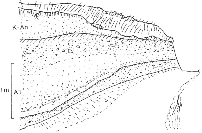
Show extracted lettering and translation
English translation of figure lettering
K-Ah; AT; 1m; P
Original Japanese lettering
K-Ah; AT; 1m; P
[Original printed page: 20]
WS-5-3 Aira-Tn Tephra within Mount Fuji Tephras — Along the Sakawa River, Kanagawa Prefecture
Hiroshi Machida
- Locality: Koichi (小市), Minamiashigara City, Kanagawa Prefecture (Oguchi Bridge)
- Latitude and longitude: N35°20′35″ E139°6′5″
- Elevation: 75–90m
- Outcrop type and current condition: riverbank; extant, but becoming covered by vegetation
- Deposit types and age: scoria fall and glassy volcanic ash; Late Pleistocene
- Date of description: 1992
- Keywords: Kanto Loam; Mount Fuji scoria layers; Aira-Tn tephra; Gotemba mudflow deposit
It is well known that thick Pleistocene tephras from Fuji and Hakone volcanoes have accumulated in the southwestern Kanto Plain. Scoria fall from Fuji volcano in particular appears to have been erupted and deposited quite frequently, preserving many tephras arriving from distant sources between its layers (see Kamishibanuta, Gotemba City, CB-16, and Ikudo Nishizawa, Oyama Town, WS-9-3). This outcrop is another such example. Because it lies approximately 30km east of Mount Fuji, it is important for connecting the stratified tephra sequences near their source at the foot of Fuji with the unstratified facies of the so-called Kanto Loam around Tokyo, approximately 100km away. As illustrated, approximately 10m of scoria fall overlies an erosion surface cut into the Hakone younger pyroclastic-flow deposit. Although the scoria layers show broad stratification, there are fewer conspicuous scoria beds than at Fuji's eastern foot. AT serves as a marker bed within them: a yellowish-white glassy volcanic-ash layer 5–10cm thick. Eastward from here, the scoriaceous volcanic-ash soils (Musashino Loam and Tachikawa Loam) gradually become thinner, but AT can be confirmed everywhere. In the Tanzawa Mountains and Oiso Hills the AT layer can be seen with the naked eye. Farther east, however, it generally forms a light-brown part mixed with scoria, requiring laboratory sample treatment and identification of its characteristic volcanic glass using a hand lens or microscope. When intercalated in water-laid strata, it can be observed in the field as a glassy volcanic-ash layer more than 5cm thick. The top of this outcrop contains stratified scoriaceous sand and gravel. This is the Gotemba mudflow deposit that flowed down following a major collapse of Mount Fuji at 2.4–2.5ka.
Reference: 町田・山崎 (1995)
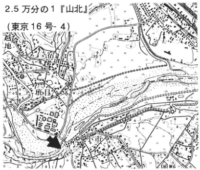
Show extracted lettering and translation
English translation of figure lettering
1:25,000 “Yamakita” (Tokyo No. 16-4); 行沢; 班目 [readings unverified]; 75; 110
Original Japanese lettering
2.5万分の1『山北』(東京16号-4); 行沢; 班目; 75; 110
1:25,000 “Yamakita” map sheet (Tokyo No. 16-4).
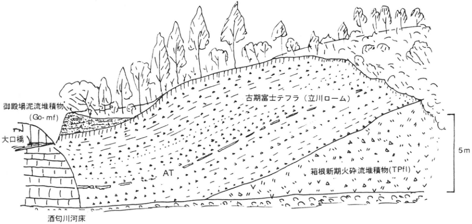
Show extracted lettering and translation
English translation of figure lettering
Gotemba mudflow deposit (Go-mf); Oguchi Bridge; Older Fuji tephra (Tachikawa Loam); AT; Hakone younger pyroclastic-flow deposit (TPfl); Sakawa River bed; 5m
Original Japanese lettering
御殿場泥流堆積物(Go-mf); 大口橋; 古期富士テフラ(立川ローム); AT; 箱根新期火砕流堆積物(TPfl); 酒匂川河床; 5m
[Original printed page: 21]
WS-5-4 Vegetation Changes before and after Aira-Tn Tephra in the Kanto Plain
辻 誠一郎
- Localities: Irima-cho, Chofu City, Tokyo (site A); Shimo-oshima, Tsukuba City, Ibaraki Prefecture (site B)
- Latitude and longitude: N35°38′42″ E139°35′05″ (site A); N36°07′58″ E140°08′04″ (site B)
- Elevation: 27m (site A); 9m (site B)
- Outcrop type and current condition: artificial exposures; both artificially covered after completion of construction
- Deposit types and age: terrace-forming strata and water-laid strata; Late Pleistocene
- Date of description: November 1981 (site A); December 1980 (site B)
- Keywords: Aira-Tn tephra; fossil pollen assemblages; vegetation change; Kanto Plain
Recent radiocarbon dates for Aira-Tn tephra (AT) obtained using tandem accelerator mass spectrometry (AMS) cluster around 24ka. Pollen analyses of borehole samples from lake and wetland sediments throughout Japan are revealing that at this time ecosystems changed greatly, from deciduous broadleaved-tree dominance to conifer dominance. Surprisingly few sites, however, have provided outcrop confirmation of water-laid strata containing AT together with paleoenvironmental records. The two exposures at sites A and B in the central and southern Kanto Plain discussed here both appeared during riverbank protection works. As described below, 辻 (1992) reported pollen analyses for site A, and 遠藤ほか (1983) and 鈴木ほか (1993) for site B. They were valuable outcrops clearly recording substantial vegetation changes (Fig. 2). For the location map and tephra layers at site B, see KT-7 in this book.
Site A appeared during bank-protection works near Nogawa Bridge. At this exposure a sequence approximately 4m thick, comprising peat, peaty deposits, silt, and clay, overlies the Tachikawa Gravel. From bottom to top it indicates a change in depositional environment from riverbed to wetland. 千葉ほか (1982) called it the Nogawa Peat. AT intervenes in the lower part of the peat and peaty deposits in the middle of the Nogawa Peat, and a total of 36 fallout tephra layers, including AT, were distinguished. Most were approximately 3cm thick and consisted mainly of black scoria.
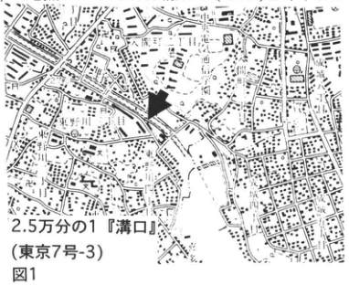
Show extracted lettering and translation
English translation of figure lettering
Figure 1; 1:25,000 “Mizonokuchi” (Tokyo No. 7-3)
Original Japanese lettering
図1; 2.5万分の1『溝口』(東京7号-3)
Figure 1. 1:25,000 “Mizonokuchi” map sheet (Tokyo No. 7-3).
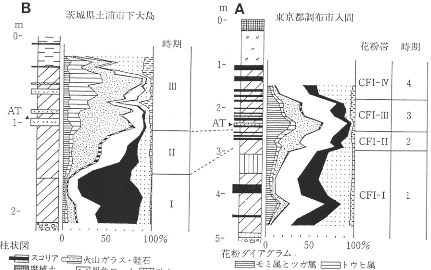
Show extracted lettering and translation
English translation of figure lettering
B: Shimo-oshima, Tsuchiura City, Ibaraki Prefecture; m; 0; 1; 2; AT; phases: III, II, I; 0, 50, 100% A: Irima, Chofu City, Tokyo; m; 0; 1; 2; 3; 4; 5; AT; pollen zones and phases: CFI-IV—4, CFI-III—3, CFI-II—2, CFI-I—1; 0, 50, 100% Stratigraphic column: scoria; volcanic glass and pumice; humic soil; brown loam; clay; peaty deposits; sand; gravel; tuffaceous silt Pollen diagram: Abies and Tsuga; Picea; Pinus; Larix or Pseudotsuga; Quercus subgenus Quercus; Alnus; Betula; other woody pollen
Original Japanese lettering
B:茨城県土浦市下大島; m; 0; 1; 2; AT; 時期:Ⅲ,Ⅱ,Ⅰ; 0,50,100% A:東京都調布市入間; m; 0; 1; 2; 3; 4; 5; AT; 花粉帯・時期:CFI-Ⅳ—4,CFI-Ⅲ—3,CFI-Ⅱ—2,CFI-Ⅰ—1; 0,50,100% 柱状図:スコリア,火山ガラス・軽石,腐植土,褐色ローム,粘土,泥炭質堆積物,砂,礫,凝灰質シルト 花粉ダイアグラム:モミ属とツガ属,トウヒ属,マツ属,カラマツ属かトガサワラ属,コナラ属コナラ亜属,ハンノキ属,カバノキ属,その他の木本花粉
Figure 2. Composite pollen-analysis diagrams and correlation of sites A and B.
Column legend: scoria; volcanic glass and pumice; humic soil; brown loam; clay; peaty deposits; sand; gravel; tuffaceous silt.
Pollen-diagram legend: Abies and Tsuga; Picea; Pinus; Larix or Pseudotsuga; Quercus subgenus Quercus; Alnus; Betula; other woody pollen.
辻 (1992).
[Original printed page: 22]
WS-5-4 (continued)
Changes in fossil pollen assemblages at the two sites are broadly similar, but a typical succession can be seen at Shimo-oshima, site B (遠藤ほか, 1983). It is divided into a deciduous broadleaved-forest phase dominated by Quercus subgenus Quercus (phase ②), a coniferous-forest phase dominated by Pinus, Picea, and others (phase ④), and a mixed-forest phase transitional from ② to ④ (phase ③). Ecosystem changes in response to a cooler and colder climate can be clearly discerned (Fig. 2). Although there are some differences in the quantitative changes of deciduous broadleaved trees and conifers at Chofu, site A, the pattern of change is almost identical. What deserves attention is the recognition of two stages of increasing conifer dominance: gradual conversion to coniferous forest began before AT, followed by rapid conversion with the AT ash fall. Together with the abrupt changes also recognized in aquatic fossil diatom assemblages (Fig. 3), this suggests that the enormous eruption producing AT disturbed ecosystems and accelerated the direction of change expressed as increasing coniferous-forest dominance (Fig. 4; 辻・小杉, 1991).
References: 千葉ほか (1982); 遠藤ほか (1983); 鈴木ほか (1993); 辻 (1992); 辻・小杉 (1991)
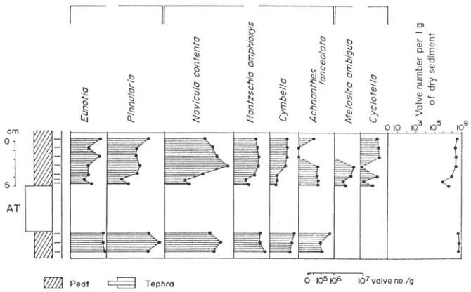
Show extracted lettering and translation
English translation of figure lettering
Eunotia; Pinnularia; Navicula contenta; Hantzschia amphioxys; Cymbella; Achnanthes lanceolata; Melosira ambigua; Cyclotella; Valve number per 1g of dry sediment; 0; 10; 10³; 10⁵; 10⁸; cm; 0; 5; AT; Peat; Tephra; 0; 10⁵; 10⁶; 10⁷ valve no./g
Original Japanese lettering
Eunotia; Pinnularia; Navicula contenta; Hantzschia amphioxys; Cymbella; Achnanthes lanceolata; Melosira ambigua; Cyclotella; Valve number per 1g of dry sediment; 0; 10; 10³; 10⁵; 10⁸; cm; 0; 5; AT; Peat; Tephra; 0; 10⁵; 10⁶; 10⁷ valve no./g
Figure 3. Changes in fossil diatom assemblages at site B. A: acidophilous benthic species; B: alkaliphilous benthic species; C: planktonic species. 辻・小杉 (1991).
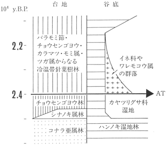
Show extracted lettering and translation
English translation of figure lettering
10⁴ y.B.P.; upland; valley floor; 2.2; 2.4; AT Cool-temperate coniferous forest comprising Baramomi-section spruce (バラモミ節), Korean pine, larch, Abies, and Tsuga. Communities of Poaceae and Sanguisorba; Korean-pine forest; Tilia forest; Quercus-subgenus forest; Cyperaceae wetland; Alnus wetland forest.
Original Japanese lettering
10⁴ y.B.P.; 台地; 谷底; 2.2; 2.4; AT バラモミ節・チョウセンゴヨウ・カラマツ・モミ属・ツガ属からなる冷温帯針葉樹林 イネ科やワレモコウ属の群落; チョウセンゴヨウ林; シナノキ属林; コナラ亜属林; カヤツリグサ科湿地; ハンノキ湿地林
Figure 4. Vegetation changes before and after AT fallout. 辻・小杉 (1991).
[Original printed page: 23]
WS-6-1 Kutcharo-Shoro Tephra at Shiranuka, Hokkaido
Hiroshi Machida
- Locality: Shoro, Shiranuka Town, Hokkaido
- Latitude and longitude: N43°59′30″ E144°10′05″
- Elevation: 45m
- Outcrop type and current condition: earth and sand quarry; probably extant
- Deposit types and age: marine-terrace deposits, pyroclastic-flow deposits, and volcanic ash; Late Pleistocene
- Date of description: 1984
- Keywords: Aso-4 tephra; Kutcharo-Shoro tephra; Shikotsu-1 tephra; Kuttara-8 tephra; Kutcharo-4 pyroclastic-flow deposit
One tephra widely distributed in eastern Hokkaido was named Kutcharo-Shoro tephra (Kc-Sr). It comprises the previously recognized Kutcharo-1 pyroclastic-flow deposit (勝井・佐藤, 1963) and its associated fallout ash. Many exposures of this tephra occur in eastern Hokkaido, but this outcrop has value as a type locality because the fallout ash can be recognized independently and its relationships with underlying tephras are clear.
Here approximately 4.5m of tephra overlies marine-terrace deposits of the Last Interglacial. The principal marker tephras, from below, are the Kutcharo-4 pyroclastic-flow deposit (Kc-4; the main component of Kc-Hb tephra), Aso-4 tephra (Aso-4), Kuttara-8 tephra (Kt-8), Shikotsu-1 tephra (Spfa-1), and Kutcharo-Shoro tephra. Kc-Sr is yellowish-white and consists mainly of pumice-type volcanic glass of pyroxene-rhyolitic to dacitic composition, with a small amount of bubble-type glass. It is probably co-ignimbrite ash of the Kutcharo-1 pyroclastic-flow deposit, but may be a product of a phreatomagmatic eruption early in the eruptive sequence. Its eruption age is considered to be 30–32ka from radiocarbon dates of charred wood fragments in the pyroclastic-flow deposit and its stratigraphic relationship with Spfa-1, but it may be slightly older. Generally it has undergone intense involution together with Spfa-1. At this outcrop, however, involution in this tephra is less conspicuous than in the underlying Spfa-1. For the Kutcharo-1 pyroclastic-flow deposit, refer to descriptions of outcrops at Koshimizu and Shari (WS-6-2, WS-9-4, HK-6, etc.).
References: 勝井・佐藤 (1963); Arai et al. (1986)
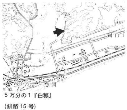
Show extracted lettering and translation
English translation of figure lettering
1:50,000 “Shiranuka” (Kushiro No. 15); Nemuro Main Line; Shoro; 65; 54
Original Japanese lettering
5万分の1『白糠』(釧路15号); 根室本線; 庶路; 65; 54
1:50,000 “Shiranuka” map sheet (Kushiro No. 15).
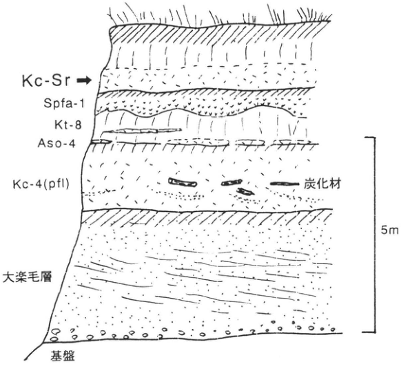
Show extracted lettering and translation
English translation of figure lettering
Kc-Sr; Spfa-1; Kt-8; Aso-4; Kc-4(pfl); charred wood; Otanoshike Formation; basement; 5m
Original Japanese lettering
Kc-Sr; Spfa-1; Kt-8; Aso-4; Kc-4(pfl); 炭化材; 大楽毛層; 基盤; 5m
[Original printed page: 24]
WS-6-2 Kutcharo Pyroclastic-Flow Deposit I around Koshimizu, Hokkaido
奥村晃史
- Locality: left bank of the Ponyanbetsu River, Koshimizu Town, Hokkaido
- Latitude and longitude: N43°50′26″ E144°27′14″
- Elevation: 40m
- Outcrop type and current condition: artificial exposure; unknown
- Deposit types and age: pyroclastic-flow deposits and fallout tephra; Late Pleistocene
- Date of description: June 1984
- Keywords: Shari Plain; Kutcharo pyroclastic flow I; Kutcharo-Shoro tephra; eastern Hokkaido
Kutcharo pyroclastic-flow deposit I (KP I) is a large-scale felsic pyroclastic-flow deposit erupted contemporaneously with Kutcharo-Shoro tephra (KSr or Kc-Sr). It occurs mainly within approximately 50km west and north of Kutcharo caldera, with part reaching the Nemuro Strait [abbreviations follow 奥村 (1991); K.P. flow I: 勝井・佐藤 (1963); Kutcharo I, Kc-1: 町田・新井 (1992)]. At an outcrop 1km west of central Koshimizu (Loc. 1), KP I–KSr occupies a dissected valley in hills composed of tephras ranging from KP IV (WS-16-1) to Kpfa-2 (Kutcharo pumice fall II: 勝井・佐藤, 1963). Here an alternating sequence of fallout ash and pumice approximately 20cm thick covers an unconformity before emplacement of the pyroclastic flow, which then filled the valley. At this outcrop, the lowermost pyroclastic-flow deposit, more than 5m thick, is overlain successively by coarse pumice (15cm), well-sorted volcanic ash containing accretionary lapilli (approximately 1m), and a pyroclastic-flow deposit. At Minami 11-go, 8–9-sen, 5km east of Koshimizu (Loc. 2), a pyroclastic-flow deposit more than 5m thick is overlain by 3–5m of alternating coarse pumice, with grain sizes of 10–20cm, and well-sorted volcanic ash locally containing accretionary lapilli. Of these tephra units, the initially erupted alternating ash and pumice fall is ubiquitous around Koshimizu and Shari and shows the characteristics of fallout tephra, increasing in thickness eastward (WS-7-3). The mechanisms and distributions of eruption and deposition of the ash and pumice intercalated in the pyroclastic-flow deposits are unknown. These facies changes, however, suggest that the KP I–KSr eruption probably involved repeated violent phreatomagmatic explosions generating co-ignimbrite ash. KSr is considered to comprise fallout tephra immediately below the pyroclastic-flow deposit together with co-ignimbrite ash.
References: 勝井・佐藤 (1963); 町田・新井 (1992); 奥村 (1991)
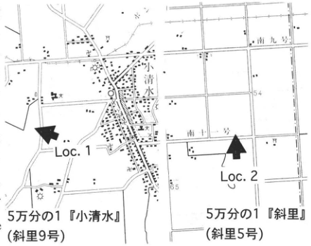
Show extracted lettering and translation
English translation of figure lettering
Loc.1; Loc.2; Koshimizu; Minami 9-go; Minami 11-go; 54; 65; 1:50,000 “Koshimizu” (Shari No. 9); 1:50,000 “Shari” (Shari No. 5)
Original Japanese lettering
Loc.1; Loc.2; 小清水; 南九号; 南十一号; 54; 65; 5万分の1『小清水』(斜里9号); 5万分の1『斜里』(斜里5号)
1:50,000 “Koshimizu” (Shari No. 9); 1:50,000 “Shari” (Shari No. 5).
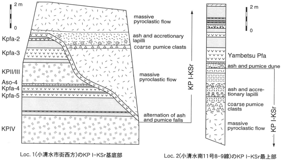
Show extracted lettering and translation
English translation of figure lettering
Loc.1: 2m; 0; Kpfa-2; Kpfa-3; KPII/III; Aso-4; Kpfa-4; Kpfa-5; KPIV; KP I-KSr; massive pyroclastic flow; ash and accretionary lapilli; coarse pumice clasts; massive pyroclastic flow; alternation of ash and pumice falls. Loc.2: 2m; 0; Yambetsu Pfa; ash and pumice dune; ash and accretionary lapilli; coarse pumice clasts; massive pyroclastic flow; KP I-KSr. Basal KP I–KSr at Loc. 1 west of central Koshimizu; uppermost KP I–KSr at Loc. 2, Koshimizu Minami 11-go, 8–9-sen.
Original Japanese lettering
Loc.1: 2m; 0; Kpfa-2; Kpfa-3; KPII/III; Aso-4; Kpfa-4; Kpfa-5; KPIV; KP I-KSr; massive pyroclastic flow; ash and accretionary lapilli; coarse pumice clasts; massive pyroclastic flow; alternation of ash and pumice falls. Loc.2: 2m; 0; Yambetsu Pfa; ash and pumice dune; ash and accretionary lapilli; coarse pumice clasts; massive pyroclastic flow; KP I-KSr. Loc.1(小清水市街西方)のKPⅠ-KSr基底部;Loc.2(小清水南11号8–9線)のKPⅠ-KSr最上部
Basal KP I–KSr at Loc. 1, west of central Koshimizu.
Uppermost KP I–KSr at Loc. 2, Koshimizu Minami 11-go, 8–9-sen.
[Original printed page: 25]
WS-7-1 Shikotsu-1 Tephra and Overlying Tephra Layers at Bibi, Hayakita Town, Hokkaido
Hiroshi Machida and 山縣耕太郎
- Locality: Bibi, Hayakita Town, Hokkaido
- Latitude and longitude: N42°45′30″ E141°43′30″
- Elevation: 25m
- Outcrop type and current condition: cliff on factory premises; planted with vegetation
- Deposit types and age: fallout tephra and pyroclastic-flow deposits; Late Pleistocene–Holocene
- Date of description: 1990
- Keywords: Shikotsu-1 tephra; Eniwa-a tephra; Shikotsu caldera; fossil forest; Tarumae tephra group; Bibi
Shikotsu-1 tephra consists mainly of a large-scale pyroclastic-flow deposit (Spfl) and its preceding pumice fall (Shikotsu-1 Pumice; Spfa-1). The latter covers central to eastern Hokkaido and has been useful in chronology as a widespread marker tephra. This outcrop lies on an upland composed mainly of tephra, 25km east of the rim of Shikotsu caldera. This tephra and the overlying tephras erupted from Eniwa and Tarumae volcanoes form beautiful stripes. Shallow valleys dissect the upland, and the Bibi shell midden lies at a nearby valley head. Most of the exposure has now been planted, but several similar outcrops occur nearby. The basal pumice fall reaches 6m in thickness and is one of Japan's largest Plinian pumice tephras. It is an amphibole–pyroxene-rhyolitic tephra consisting of well-vesiculated, silky-lustered white and pink pumice. Both amphibole and orthopyroxene are iron-rich and have characteristically high refractive indices. Most of the pyroclastic-flow deposit has the same composition as the pumice fall, but its upper part becomes somewhat more mafic and locally changes to a scoria-flow deposit. A forest buried and charred by this tephra was reported nearby (勝井, 1958). Tree trunks stood upright in Spfa-1, as they also do at this outcrop, but were broken and fallen in Spfl. Repeated radiocarbon dating of charred wood fragments yielded a wide range of 31–40ka. The age is probably near 40ka (加藤ほか, 1995). A cold climate during and after the eruption is indicated not only by the buried vegetation but also by intense cryoturbation of Spfa-1 in many places. Whether its eruption age extends back to stage 4 of the marine-isotope chronology, however, requires evidence from marine-floor sediments containing this tephra.
Among the tephras above Shikotsu-1, Eniwa-a (En-a) is a marker tephra for the Last Glacial Maximum (stage 2), with radiocarbon dates of 15–17ka. It has been useful in studies of glacial landforms and deposits in the Hidaka Mountains and fluvial terraces on the Tokachi Plain. Tarumae-d (Ta-d) and Tarumae-c (Ta-c) are marker beds for the Initial and Final Jomon periods, respectively. Tarumae-b and -a (Ta-b, a) are fallout tephras of 1667 and 1739, respectively. All were accompanied by pyroclastic flows, but those flows did not reach this locality. Baitoushan–Tomakomai tephra (B-Tm) is recognized in patches in the volcanic-ash soil between Ta-c and Ta-b.
References: 勝井 (1958, 1959); 加藤ほか (1995)
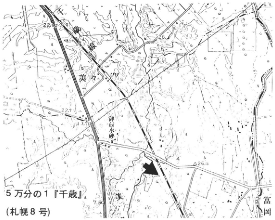
Show extracted lettering and translation
English translation of figure lettering
1:50,000 “Chitose” (Sapporo No. 8); Bibi; Bibi River; Gozen-sui (御前水); Tomioka; Chitose railway; 22.60; 22.7; 3.76; 7.80; 26.5
Original Japanese lettering
5万分の1『千歳』(札幌8号); 美々; 美々川; 御前水; 富岡; 千歳線; 22.60; 22.7; 3.76; 7.80; 26.5
1:50,000 “Chitose” map sheet (Sapporo No. 8).
[Original printed page: 26]
WS-7-1 (continued)
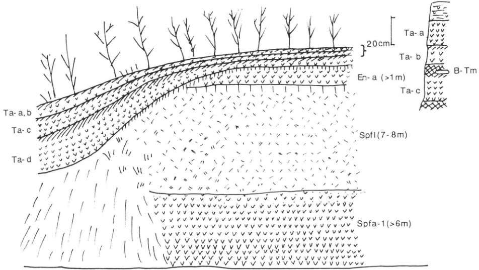
Show extracted lettering and translation
English translation of figure lettering
Ta-a,b; Ta-c; Ta-d; En-a (>1m); Spfl (7–8m); Spfa-1 (>6m); 20cm; Ta-a; Ta-b; B-Tm; Ta-c
Original Japanese lettering
Ta-a,b; Ta-c; Ta-d; En-a (>1m); Spfl (7–8m); Spfa-1 (>6m); 20cm; Ta-a; Ta-b; B-Tm; Ta-c
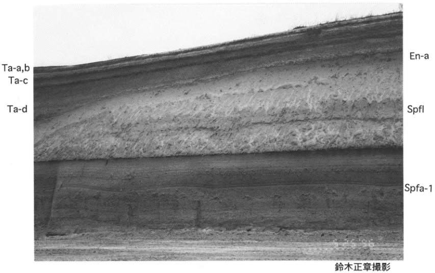
Show extracted lettering and translation
English translation of figure lettering
Ta-a,b; Ta-c; Ta-d; En-a; Spfl; Spfa-1; photograph by 鈴木正章
Original Japanese lettering
Ta-a,b; Ta-c; Ta-d; En-a; Spfl; Spfa-1; 鈴木正章撮影
Photograph by 鈴木正章.
[Original printed page: 27]
WS-7-2 Relict Periglacial Features and Shikotsu-1 Tephra on the Tokachi Plain
平川一臣
- Locality: Sakae 8-go, 2-sen, Memuro Town, Kawanishi District (川西郡), Hokkaido
- Latitude and longitude: N42°49′24″ E143°05′00″
- Elevation: 280m
- Outcrop type and current condition: artificial exposure; disappeared
- Deposit types and age: aeolian tephra; Late Pleistocene
- Date of description: August 1980
- Keywords: Tokachi Plain; relict periglacial features; Shikotsu-1 tephra; Eniwa-a tephra
Tephra layers covering terrace landforms on the Tokachi Plain are known to have undergone disturbance related to freezing and thawing. These structures are called involutions, cryoturbation, or collectively relict periglacial features. Fresh exposures, such as slopes exposed during road construction, are needed to observe them. At this outcrop Shikotsu-1 tephra (Spfa-1), Eniwa-a tephra (En-a), and Tarumae-d tephra (Ta-d) are seen, with the first two disturbed. Disturbance in Spfa-1 is a typical example, showing various forms of deformation. En-a, by contrast, shows little intrusion into the overlying layer; the bed as a whole is flexed. Regarding the timing of disturbance, the Spfa-1 layer almost reaches the En-a horizon. Its disturbance therefore either continued until around the En-a fallout or occurred at about that time, rather than at the time of Spfa-1 fallout. Recent C-14 dates of 42ka for Spfa-1 (柳田, 1992) and 18ka for En-a (加藤, 1994) have been obtained. On the Tokachi Plain, underlying tephras down to Kuttara-1 (Kt-1), Kuttara-3 (Kt-3), and Shikotsu-7–10 (Spfa-7–10) also show conspicuous relict periglacial features similar to those in Spfa-1. These features do not provide direct evidence, but together with other types of relict periglacial features they suggest that permafrost developed on the Tokachi Plain during the coldest part of the Last Glacial.
References: 平川 (1984); 加藤 (1994); 柳田 (1992)
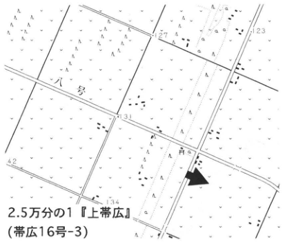
Show extracted lettering and translation
English translation of figure lettering
1:25,000 “Kamiobihiro” (Obihiro No. 16-3); 8-go; 9-go; 127; 123; 131; 134; 142
Original Japanese lettering
2.5万分の1『上帯広』(帯広16号-3); 八号; 九号; 127; 123; 131; 134; 142
1:25,000 “Kamiobihiro” map sheet (Obihiro No. 16-3).
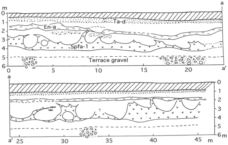
Show extracted lettering and translation
English translation of figure lettering
Ta-d; En-a; Spfa-1; Terrace gravel; m; 0; 1; 2; 3; 4; 5; 6; 0; 5; 10; 15; 20; 25; 30; 35; 40; 45; a; a′; ?
Original Japanese lettering
Ta-d; En-a; Spfa-1; Terrace gravel; m; 0; 1; 2; 3; 4; 5; 6; 0; 5; 10; 15; 20; 25; 30; 35; 40; 45; a; a′; ?
[Original printed page: 28]
WS-7-3 Shikotsu tephra 1 and Kutcharo pyroclastic-flow deposit I in the eastern Shari Plain
Koji Okumura
Locality: Shuen, Shari Town, Hokkaido. Coordinates: N43°53′34″ E144°45′08″. Elevation: 25 m. Exposure and present condition: artificial exposure; condition unknown. Deposit and age: tephra fall; Late Pleistocene. Date described: August 1985. Keywords: Shari Plain; Kutcharo pyroclastic-flow deposit I; involution.
Since the 1970s, Shikotsu tephra 1 (Spfa-1) had been correlated as a widespread tephra between the Ishikari Lowland and the Tokachi Plain. Okumura et al. (1985) and Arai et al. (1986) showed that it could be traced into eastern Hokkaido, where it lies immediately below Kutcharo pyroclastic-flow deposit I–Kutcharo-Shoro ash (KP I–Kc-Sr; WS-6). The abbreviations follow Okumura (1991). Spfa-1 in eastern Hokkaido consists of pumice-type volcanic glass resembling a finer-grained version of the pumice produced by the Plinian eruption farther west. This distinguishes it from other widespread tephras dominated by bubble-wall glass with a spherical-shell form. It contains almost none of the amphibole phenocrysts characteristic of Spfa-1 near its source, and the refractive indices of its orthopyroxene resemble those of Kutcharo-derived tephras. Nevertheless, its volcanic-glass chemistry differs from that of eastern Hokkaido tephras and agrees completely with Spfa-1 at the type locality (Okumura, 1991).
In the lower half of the Shuen exposure in Shari Town, alternating pumice- and scoria-fall layers, apparently derived from Kutcharo volcano, and volcanic-ash soil have been severely disturbed by periglacial processes. Spfa-1 is a yellowish-white, loose ash in the upper part of these disturbed tephra beds, deformed into pronounced undulations; its thickness varies from 0 to 20 cm. The ash-soil layer is overlain by alternating ash and pumice emitted during the early stage of the KP I eruption. The ash consists mainly of finely fragmented volcanic glass and contains abundant accretionary lapilli, indicating a large phreatomagmatic explosion preceding the emplacement of KP I (WS-6). Above this is volcanic-ash soil consisting chiefly of KP I glass and pumice fragments, with cross-lamination indicating secondary aeolian deposition. The KP I horizon and the overlying Yambetsu pumice fall (Sato, 1968) have undergone almost no disturbance since deposition, in contrast to the intense disturbance at the Spfa-1 horizon.
References: Arai et al. (1986); Okumura (1991); Okumura et al. (1985); Sato (1968).
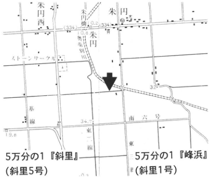
Show extracted lettering and translation
English translation of figure lettering
1:50,000 Shari (Shari sheet 5); 1:50,000 Minehama (Shari sheet 1). Shuen West; Shuen; Shuen East; stone circle; trunk line; Road No. 6; East Line 1; East Line 2. Legible numerical labels: 33.4, 34.7, 32, 19.8.
Original Japanese lettering
5万分の1『斜里』(斜里5号);5万分の1『峰浜』(斜里1号)。朱円西,朱円,朱円東,ストーンサークル,幹線,道六号,東一線,東二線。可読数値:33.4,34.7,32,19.8。
Reading notes
地図内の微細な文字と数値 — 一部は解像度が低く確実に読めない。
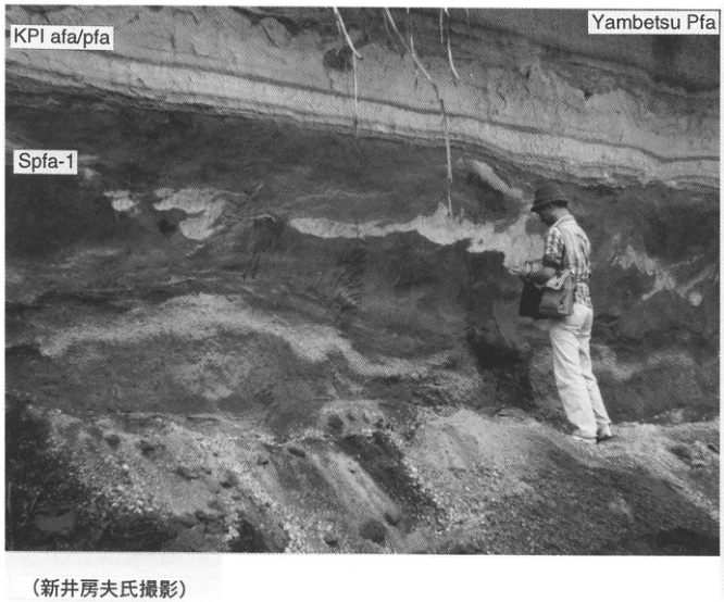
Show extracted lettering and translation
English translation of figure lettering
KPI afa/pfa; Spfa-1; Yambetsu Pfa. Photograph by Fusao Arai.
Original Japanese lettering
KPI afa/pfa;Spfa-1;Yambetsu Pfa;(新井房夫氏撮影)。
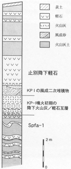
Show extracted lettering and translation
English translation of figure lettering
Legend: topsoil; pumice; ash; aeolian sand; volcanic-ash soil. From top: Yambetsu pumice fall; secondary aeolian deposits of KP I; alternating ash and pumice falls from the early KP-I eruption; Spfa-1. Scale: 2 m, 0.
Original Japanese lettering
凡例:表土,軽石,火山灰,風成砂,火山灰土。上から:止別降下軽石;KP Iの風成二次堆積物;KP-I噴火初期の降下火山灰/軽石互層;Spfa-1。スケール:2m,0。
[Original printed page: 29]
WS-8-1 Daisen-Kurayoshi tephra and the tephra beds above and below it at Daisen Pond, Sekigane Town, on the eastern foot of Daisen
Hiroshi Machida
Locality: Daisen Pond, Sekigane Town, Tottori Prefecture. Coordinates: N35°22′21″ E133°43′33″. Elevation: 200 m. Exposure and present condition: reservoir cliff; extant. Deposit and age: pumice fall; Late Pleistocene. Date described: 1981. Keywords: Daisen-Kurayoshi tephra; Daisen-Sekigane tephra; Daisen-Namatake tephra; Aira-Tn tephra; Daisen-Hiruzen tephra; Daisen-Matsue tephra; Sambe-Kisuki tephra; Daisen-Sasaganaru tephra (笹ヶ平); Daisen-Higashidaisen tephra; Daisen volcano.
Daisen-Kurayoshi tephra was first described from a single thick pumice-fall bed seen at Dakeiji (駄経寺), Akiki (秋喜), and other localities in Kurayoshi City. Farther south, in Sekigane Town, however, several thick, weathered pumice-fall beds of similar appearance occur and must be distinguished. The exposure at Daisen Pond in Sekigane Town is therefore chosen here as the type locality. As this is an irrigation reservoir, the exposure can be examined only when the water level is low. Many similar exposures occur nearby. Three closely similar yellow-orange pumice beds occur below Aira-Tn tephra (AT), a yellowish-white glassy ash 20 cm thick. The uppermost is Daisen-Kurayoshi tephra (DKP). It is a biotite-bearing pyroxene–amphibole dacitic tephra. Although the pumice retains its grain shapes, it is almost completely weathered, so volcanic glass cannot be recovered. In distal areas from Hokuriku onward, DKP forms a vivid yellow, fine-grained pumice bed rich in phenocrysts as a result of weathering. Its names in Shinshu, such as “white sesame” and “yellow sesame,” likewise reflect these compositional characteristics. Orthopyroxene has a tabular habit with well-developed (100) faces. The underlying Daisen-Sekigane tephra (DSP) and Daisen-Namatake tephra (DNP) have similar phenocryst assemblages, but are distinguished by the refractive indices and crystal habits of orthopyroxene and amphibole (Machida and Arai, 1979). Few direct ages have been obtained for the DKP eruption; its stratigraphic relationships with other dated tephras suggest an age of approximately 50 ka. See, for example, the exposures in eastern Kanto and at Takano in Shinshu (WS-8-3, WS-9-2).
Tephras above AT are not well preserved at this exposure. Immediately above AT, however, are Daisen-Sasaganaru tephra (DSs), including a thin but widely distributed pyroclastic-flow deposit, and stratified Daisen-Higashidaisen tephra (DHg). Below DKP, Sambe-Kisuki tephra (SK), with marbled white pumice and quartz phenocrysts, can be identified with the naked eye between DNP and the Daisen-Hiruzen (DHP) and Daisen-Matsue (DMP) tephras (Tsukui and Sakuyama, 1981). Volcanic glass from K-Tz and Aso-4 can also be detected in weathered volcanic-ash soil above SK. This exposure thus establishes the stratigraphic relationships of Daisen-derived tephras to widespread tephras from Sambe and Kyushu.
References: Machida and Arai (1979); Tsukui (1984); Tsukui and Sakuyama (1981).
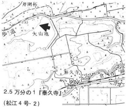
Show extracted lettering and translation
English translation of figure lettering
1:25,000 Taikyuji (Matsue sheet 4-2). Daisen Pond; Taikyuji; Kurayoshi railway line; footpath; Daimyojin (大明神). 233.
Original Japanese lettering
2.5万分の1『泰久寺』(松江4号-2)。大山池,泰久寺,倉吉線,歩道,大明神。233。
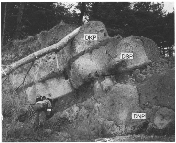
Show extracted lettering and translation
English translation of figure lettering
DKP; DSP; DNP.
Original Japanese lettering
DKP;DSP;DNP。
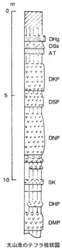
Show extracted lettering and translation
English translation of figure lettering
Tephra stratigraphic column at Daisen Pond. Depth: 0, 5, 10 m. From top: DHg, DSs, AT, DKP, DSP, DNP, SK, DHP, DMP.
Original Japanese lettering
大山池のテフラ柱状図。深度:0,5,10 m。上から:DHg,DSs,AT,DKP,DSP,DNP,SK,DHP,DMP。
[Original printed page: 30]
WS-8-2 Daisen-Kurayoshi and Aira-Tn tephras on fluvial terraces of the Joganji River, Toyama Prefecture
Hiroshi Machida
Localities: 天林, Tateyama Town, Toyama Prefecture (site 1); Chigaki, Tateyama Town, Toyama Prefecture (site 2). Coordinates: N36°35′37″ E137°20′03″ (site 1); N36°34′23″ E137°22′28″ (site 2). Elevations: 260 m (site 1), 350 m (site 2). Exposure and present condition: roadside; extant. Deposits and age: volcanic-ash soil, pumice, and ash; Late Pleistocene. Date described: July 1995. Keywords: Daisen-Kurayoshi tephra; Aira-Tn tephra; Uwadann terrace; Awasuno terrace; Joganji River.
The Joganji River, which flows down from the Tateyama Range in the Northern Alps, has long been studied as a type area for fluvial terrace development (e.g., Fujii et al., 1966). In addition to landforms and sediments, widespread marker tephras assist research into the river's development. Of the Late Pleistocene terraces, the Uwadann (うわだん) and Awasuno (あわすの) terraces are well developed. Both are prominent aggradational terraces: the former occurs on the downstream alluvial fan, whereas the latter forms steeply sloping terraces in the upstream mountains. Site 1, in woodland a short distance from the road, shows Daisen-Kurayoshi tephra (DKP) and younger deposits resting on the Uwadann terrace at 天林. By pushing aside vegetation and carefully examining the brown volcanic-ash soil about 50 cm above the gravel, DKP can be recognized as a reddish-brown, patchy, fine-grained pumice bed 5 cm thick. The 60 cm of unstratified volcanic-ash soil above it is derived from DKP and contains orthopyroxene with a characteristic crystal habit, amphibole, and biotite. Above this is soil containing abundant volcanic glass derived from Aira-Tn tephra (AT). Site 2 is suitable for observing an unmixed AT bed. As shown in Figure 2, it occurs there as a striking white glassy ash bed between fine sand and gravel beds.
The deposits at site 2 represent the uppermost terrace sediments extending from Awasuno to Ashikuraji (芦峅寺). Farther upstream, on the Awasuno terrace, AT is deposited as a fairly thick brown ash layer over sand and gravel. These observations make clear that the Uwadann terrace formed before the DKP eruption and the Awasuno terrace before AT, in association with the downstream transport of large amounts of sand and gravel. An important question is whether these aggradational terraces formed through regionally shared causes related to climate and vegetation changes, or through local causes such as volcanic activity and frequent mountain-slope failures.
References: Fujii et al. (1966); Machida (1992).
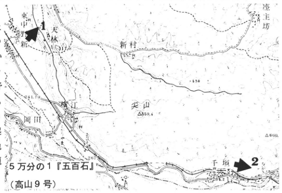
Show extracted lettering and translation
English translation of figure lettering
1:50,000 Gohyakukoku (Takayama sheet 9). Sites 1 and 2. Map place labels: 東中野, 新, 天林, 新村, 横江, 岡田, 尖山, Chigaki (千垣), 座主坊. Legible elevations and other numbers: 434, 559.4, 860, 263, 284.2.
Original Japanese lettering
5万分の1『五百石』(高山9号)。地点1,2。東中野,新,天林,新村,横江,岡田,尖山,千垣,座主坊。可読標高等:434,559.4,860,263,284.2。
Reading notes
地図内の天林付近の標高と微細な注記 — 小さく不鮮明で確定できない。
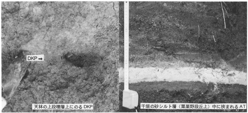
Show extracted lettering and translation
English translation of figure lettering
DKP →; DKP resting on the Uwadann gravel bed at 天林; AT interbedded in sand and silt at Chigaki, on the Awasuno terrace.
Original Japanese lettering
DKP→;天林の上段礫層上にのるDKP;千垣の砂シルト層(粟巣野段丘上)中に挟まれるAT。
[Original printed page: 31]
WS-8-3 Stratigraphic position of Daisen-Kurayoshi tephra in Kanto: Daisen-Kurayoshi tephra immediately above Hakone-Tokyo tephra
Takehiko Suzuki
Locality: 房中, Dejima Village, Ibaraki Prefecture. Coordinates: N36°3′57″ E140°19′28″. Elevation: 22 m. Exposure and present condition: artificial exposure; extant. Deposit and age: aeolian tephra; Late Pleistocene. Date described: June 1996. Keywords: Lake Kasumigaura; Daisen-Kurayoshi tephra; Hakone-Tokyo tephra; Akagi-derived tephras.
Establishing the stratigraphic position of Daisen-Kurayoshi tephra (DKP) in Kanto was extremely important for determining its eruption age. The process of establishing that position was somewhat complicated. Initially, DKP at the foot of Akagi volcano in northern Kanto was placed below Haruna-Hassaki tephra and above Akagi-Yunokuchi tephra (Ag-UP) (Machida and Arai, 1979). Takemoto (1984) subsequently revised its position to below Ag-UP. Suzuki (1990a) then confirmed around Akagi volcano that DKP lies below Akagi-Namekawa tephra 2, itself below Ag-UP, and above Akagi-Mizunuma tephra 1. Although its stratigraphic position in northern Kanto had thus been defined in detail, its relationships with tephras distributed principally in southern Kanto remained unknown, because the southern limit of DKP passes through the southern parts of Gunma, Tochigi, and Ibaraki prefectures. Takemoto (1991), however, showed that DKP is mixed into the matrix in the uppermost part of Hakone-Tokyo tephra (Hk-TP), an important marker bed in southern Kanto.
At the present exposure near the shore of Lake Kasumigaura, both DKP and Hk-TP can be clearly identified in the field with the naked eye, making their relationship readily apparent. DKP occurs in patches 1–2 cm thick approximately 260 cm below the ground surface. Below it, separated by 8 cm of volcanic-ash soil, is Hk-TP, consisting of fine pumice 5 cm thick. Places where both can be clearly identified are limited, however. Radiometric ages for Hk-TP include the fission-track age of 49 ± 9 ka reported by Machida and Suzuki (1971) and, more recently, the ¹⁴C ages of 50–55 ka reported by Nakamura et al. (1992). Combining the latter measurements with ¹⁴C ages for the Kiso River mudflow deposit, Nakamura et al. (1992) placed the DKP fall at 50–52 ka.
References: Machida and Arai (1979); Machida and Suzuki (1971); Nakamura et al. (1992); Suzuki (1990a); Takemoto (1984, 1991).
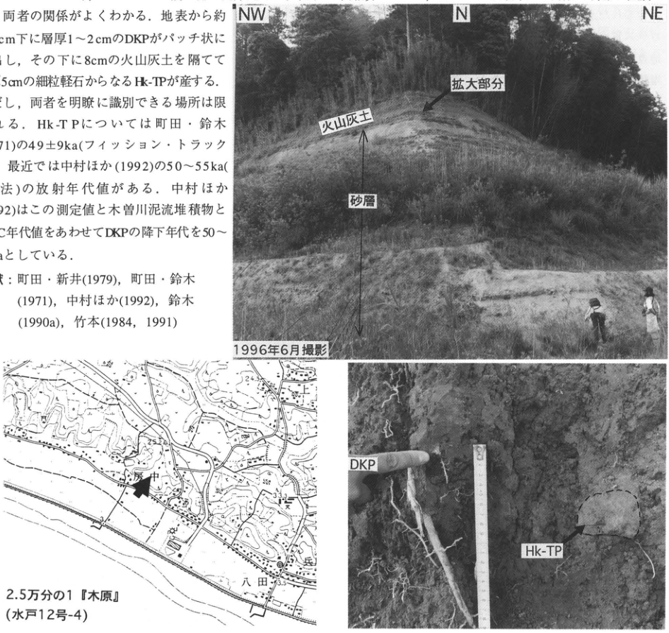
Show extracted lettering and translation
English translation of figure lettering
Overview: NW, N, NE; enlarged area; volcanic-ash soil; sand bed; photographed June 1996. Close-up: DKP, Hk-TP. Map: 1:25,000 Kihara (Mito sheet 12-4); 房中, 八田. Legible numbers: 24.3, 25.2, 33.3, 23.5. The cropped prose at upper left is included in the main text.
Original Japanese lettering
全景:NW,N,NE;拡大部分;火山灰土;砂層;1996年6月撮影。接写:DKP,Hk-TP。位置図:2.5万分の1『木原』(水戸12号-4);房中,八田;可読数値24.3,25.2,33.3,23.5。画像左上の本文断片は本文欄に収録済み。
Reading notes
地形図の小さな文字・数値 — 不鮮明な箇所は読取りを確定できない。
[Original printed page: 32]
WS-9-1 Aso-4 pyroclastic-flow deposit southeast of Kuju volcano, Oita Prefecture
Koji Ono
Locality: cliff beside the prefectural road south of Nagayu, Naoiri Town, Naoiri District, Oita Prefecture. Coordinates: N33°03′48″ E131°23′03″. Elevation: 460 m. Exposure and present condition: artificial exposure; extant. Deposit and age: pyroclastic-flow deposit; Late Pleistocene. Date described: March 1996. Keywords: Imaichi pyroclastic-flow deposit; Aso-4 pyroclastic-flow deposit.
This exposure is beside a prefectural road 300 m south of Nagayu hot spring, southeast of Kuju volcano. A fault scarp cutting welded tuff of the Imaichi pyroclastic-flow deposit (“deposit” is omitted below in the original) extends for more than 10 km along the southern bank of the northeast-flowing Seri River, a tributary of the Oita River. The Aso-4 pyroclastic-flow deposit unconformably covers the base of this scarp and forms a surface along the Seri River about 100 m below the surface of the Imaichi pyroclastic-flow plateau to the south. Although the unconformity is not exposed here, the strongly welded zone near the base of Aso-4 and the upper weakly welded to nonwelded zone can be observed continuously over a distance of about 100 m.
In fact, this exposure lies below the base of the Imaichi pyroclastic-flow deposit. Aso-4 covers the weathered surface of pyroxene andesite underlying Imaichi, on a surface sloping gently toward the pre-Aso-4 Seri River. Consequently, foliation in the welded tuff consistently dips northwest toward the river. Along the road, progressively higher stratigraphic levels are exposed from south to north, continuously from the strongly welded zone at the southern end to the weakly welded zone at the northern end. Hardness changes with the degree of welding, as indicated by changes in the pitch produced by hammer blows. The welded tuff is largely glassy throughout the exposure. In its weakly welded part, flattened pumice stands out from the matrix on weathered surfaces (photograph). A small interval near the northern end is devitrified and has become pale grayish white overall. There, pumice weakened by vapor-phase crystallization is instead recessed below the matrix on weathered surfaces. At the northern end of the roadside exposure, the degree of welding falls to the very earliest stage of welding; the very weakly welded to nonwelded part forms a sand-extraction pit behind it. This exposure corresponds to Aso-4A of the Aso-4A and Aso-4B units of Ono et al. (1977). Watanabe (1978) divided Aso-4 west of the caldera into eight subunits. A unified re-examination of the entire Aso-4 pyroclastic-flow deposit is needed.
References: Ono (1963); Ono et al. (1977); Watanabe (1978).
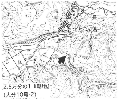
Show extracted lettering and translation
English translation of figure lettering
1:25,000 Asaji (Oita sheet 10-2). Nagayu; 栃原; public lodge; 田原. Legible numbers: 523, 587.3, 684.
Original Japanese lettering
2.5万分の1『朝地』(大分10号-2)。長湯,栃原,国民宿舎,田原。可読数値:523,587.3,684。
Reading notes
地図内の微細な標高・地名 — 一部が不鮮明で確実には読めない。
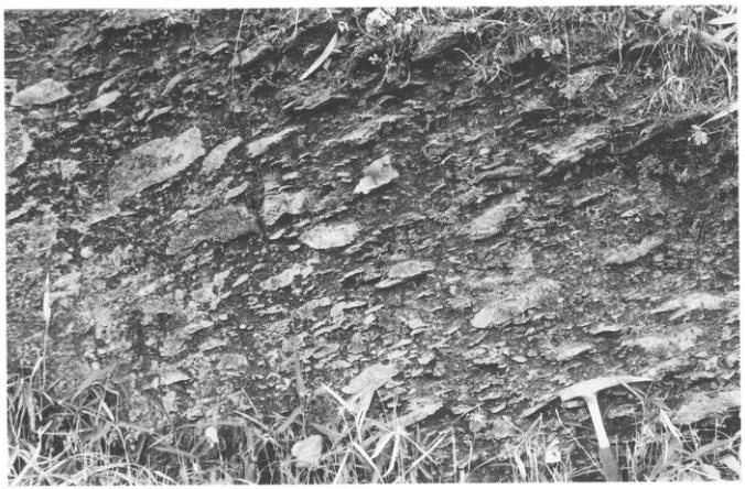
[Original printed page: 33]
WS-9-2 The lacustrine Takano Formation at Takano, Shinko Town, Nagano City: a host succession for widespread marker tephras spanning approximately 130,000 years
Jun-ichi Kimura
Locality: Takano area, Shinko Town, Nagano City. Coordinates: N36°32′35″–45″ E138°02′10″–20″. Elevation: 720–730 m. Exposure and present condition: cliffs along a small river; extant in August 1995, but generally poor except in a few places. Deposits and age: lacustrine clay and silt beds; Late Pleistocene. Date described: August 1986. Keywords: Takano Formation; Ontake-derived tephras; Tateyama-derived tephras; widespread tephras.
The Takano Formation accumulated through almost the entire Late Pleistocene in a narrow lake within the Saigawa Hills. It is one of the most valuable sources of information in central Japan. The formation consists predominantly of fine-grained silt and clay. Pumiceous tephras from Kiso-Ontake and Tateyama volcanoes, together with widespread tephras, are well preserved, allowing their stratigraphic relationships to be established clearly. By combining several small exposures, nearly the entire stratigraphy of the Takano Formation can be observed without gaps (Kimura, 1987a). Unfortunately, exposure conditions deteriorate each year, and some parts can now be observed only by excavating through collapsed material. Because the exposures are in walls of cultivated land, the landowner must be identified and permission obtained before excavation. The widespread and subregional tephras interbedded in the formation were correlated by Takemoto et al. (1987) and Kimura (1987b). The principal exposures are as follows (Figure 3).
Exposure 18: pumice thought to be derived from Tateyama (SyPm, possibly Omachi C scoria?) and an overlying gravel bed. Exposure 16: in ascending order, Tateyama D (Tt-D, the thickest tephra, composed of coarse pumice), Aso-3, Ontake tephra 1 (On-Pm1, Pm-1A/B), Kikai-Tozurahara (K-Tz), Ontake-Katamachi (On-Kt, Pm-2B), and Aso-4. Exposure 14: Aso-4 and Ontake-Nagawa (On-Ng, Pm-3C), with Tateyama E (Tt-E) at the top. Exposures 7–11: Daisen-Kurayoshi tephra (DKP) and thin basaltic-andesitic volcanic-sand beds. Exposure 12: above two thin basaltic-andesitic volcanic-sand beds are two further volcanic-sand beds, OL.S.; Aira-Tn tephra (AT) is interbedded at the top. The numerous basaltic-andesitic volcanic-sand beds from around Tt-E through OL.S. are regarded as scoria from Kiso-Ontake volcano. These tephras are well preserved because they are enclosed in fine-grained sediments.
The Takano Formation fills a small fault-angle depression bounded to the northwest by the east-downthrown Takanogawa Fault and to the southwest by the north-downthrown Karuizawa Flexure. The depositional surface lies at 730–740 m elevation and curves gently downward toward the center. The Takano River, flowing through the center of the basin, has incised gullies into this surface. Although the depositional area is small, approximately 1.5 × 1 km, drilling and electrical surveys show a maximum thickness of nearly 50 m (a cross-section is given in Kimura, 1987a). Minor nonsequences at the margins of the depositional basin provide the basis for dividing the formation into lower, middle, upper, and uppermost members. Apart from gravel beds at the base, its facies consist almost entirely of clay to silt, relatively rich in humic material, with plant fossils and precipitated vivianite. Interbeds of fine sand increase toward the margins, and at the outermost margins the succession consists entirely of fine sand. No pronounced erosion is recognized at the basin center, suggesting that the water body persisted. The cumulative thickness confirmed in exposures is about 25 m.
Taking Tt-D to be approximately 120 ka and AT approximately 25 ka, deposition of the Takano Formation is considered to span about 130,000 years, approximately 150–20 ka. The roughly 20 m between below Tt-D and AT records nearly continuous fine-sediment accumulation and is particularly suitable for analyzing paleoenvironmental change. Sakai (1988) reported changes in the formation's fossil pollen assemblages. The interval from below Tt-D to above On-Ng is considered to correspond to oxygen-isotope stages 5d–5a; Tt-E to early to middle stage 4; the interval around OL.S. to middle stage 3; and the beds above AT to stage 2.
References: Kimura (1987a, b); Sakai (1988); Takemoto et al. (1987).
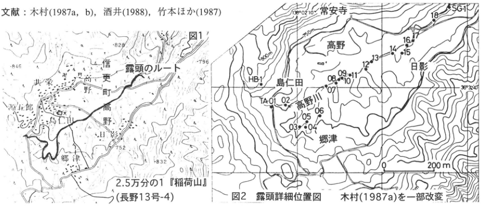
Show extracted lettering and translation
English translation of figure lettering
Figure 1. Route to the exposures. 1:25,000 Inariyama (Nagano sheet 13-4). Shinko Town; Takano; 島仁田; 郷津; 平条; Hikage. Numbers: 846, 828, 796, 752, 832. Figure 2. Detailed exposure-location map, modified from Kimura (1987a). 常安寺; Takano; Hikage; 島仁田; Takano River; 郷津. Sites: HB-1, TA-01, 02, 03, 04, 05, 06, 07, 08, 09, 10, 11, 12, 13, 14, 15, 16, 17, 18, SG-1. Contours: 800 m, 750 m. Coordinates: 138°02′10″, 36°32′40″. Distance: 0–200 m. The reference line at upper left is included in the main text.
Original Japanese lettering
図1。露頭のルート。2.5万分の1『稲荷山』(長野13号-4)。信更町,高野,島仁田,郷津,平条,日影。数値846,828,796,752,832。図2 露頭詳細位置図 木村(1987a)を一部改変。常安寺,高野,日影,島仁田,高野川,郷津。地点HB-1,TA-01,02,03,04,05,06,07,08,09,10,11,12,13,14,15,16,17,18,SG-1。等高線800m,750m。座標138°02′10″,36°32′40″。距離0~200m。画像左上の文献行は本文に収録済み。
[Original printed page: 34]
WS-9-2 (continued)
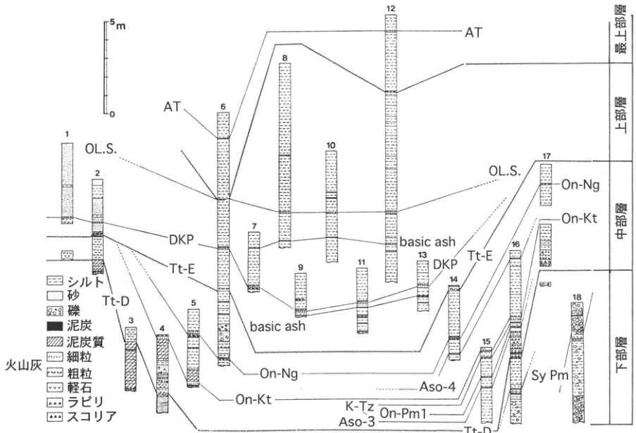
Show extracted lettering and translation
English translation of figure lettering
Exposure numbers: 1–18. Scale: 0, 5 m. Legend: silt; sand; gravel; peat; peaty sediment. Volcanic-ash symbols: fine-grained; coarse-grained; pumice; lapilli; scoria. Correlation labels: AT, OL.S., DKP, Tt-E, Tt-D, basic ash, On-Ng, On-Kt, Aso-4, K-Tz, On-Pm1, Aso-3, Sy Pm. Members, from top: uppermost; upper; middle; lower. Correlation lines link equivalent horizons between columns; some are dotted.
Original Japanese lettering
露頭番号:1,2,3,4,5,6,7,8,9,10,11,12,13,14,15,16,17,18。スケール:0,5m。凡例:シルト,砂,礫,泥炭,泥炭質;火山灰:細粒,粗粒,軽石,ラピリ,スコリア。相関ラベル:AT,OL.S.,DKP,Tt-E,Tt-D,basic ash,On-Ng,On-Kt,Aso-4,K-Tz,On-Pm1,Aso-3,Sy Pm。部層(上から):最上部層,上部層,中部層,下部層。相関線は各列間の同一層準を結び、一部は点線。
Figure 3. Stratigraphic columns of the exposures. Modified from Kimura (1987a); correlations after Takemoto et al. (1987).
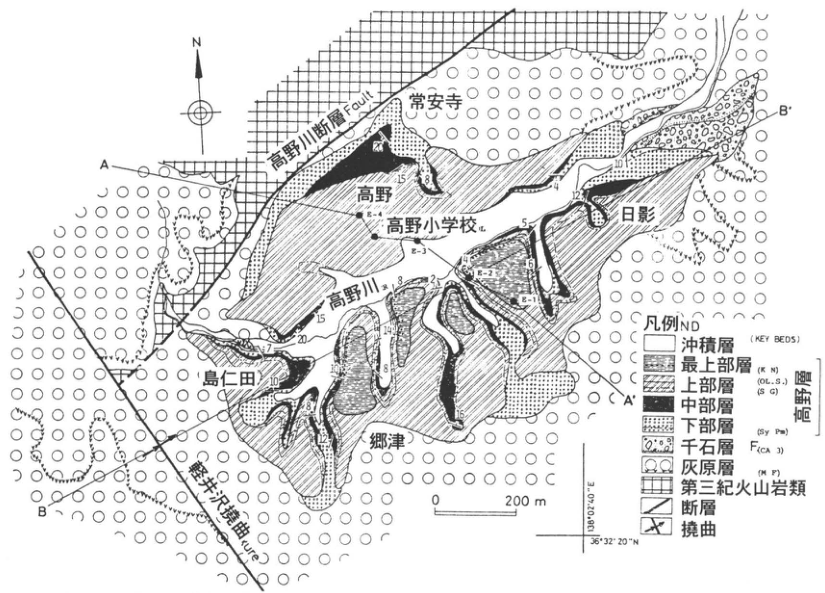
Show extracted lettering and translation
English translation of figure lettering
North arrow: N. Section lines: A–A′, B–B′. Takanogawa Fault; Karuizawa Flexure; Takano River. Place labels: 常安寺; Takano; Takano Elementary School; Hikage; 島仁田; 郷津. Survey points: E-1, E-2, E-3, E-4. Geological legend: alluvium; uppermost member (K N), upper member (OL.S.) (S G), middle member, lower member (Sy Pm), collectively the Takano Formation; 千石 Formation (CA 3); 灰原 Formation (M F); Tertiary volcanic rocks; fault; flexure. KEY BEDS. Distance: 0–200 m. Coordinates: 138°02′40″E, 36°32′20″N. Legible strike-and-dip and other numbers: 2, 4, 5, 7, 8, 10, 12, 14, 15, 16, 18, 20.
Original Japanese lettering
方位N。断面線A–A′,B–B′。高野川断層 Fault;軽井沢撓曲 flexure;高野川。常安寺,高野,高野小学校,日影,島仁田,郷津。測点E-1,E-2,E-3,E-4。地層凡例:沖積層;最上部層(K N),上部層(OL.S.)(S G),中部層,下部層(Sy Pm)〔以上高野層〕;千石層(CA 3);灰原層(M F);第三紀火山岩類;断層;撓曲。KEY BEDS。距離0~200m。座標138°02′40″E,36°32′20″N。可読の走向傾斜等数値:2,4,5,7,8,10,12,14,15,16,18,20。
Reading notes
地図の微細な数値とKEY BEDSの略記 — 多くが小さく、一部は数字・文字の区切りを確定できない。可読形を保持。
Figure 4. Geological map of the Takano Formation. From Kimura (1987a).
[Original printed page: 35]
WS-9-3 Aso-4 and other widespread tephras in the lower Fuji tephra succession on the eastern foot of Mount Fuji
Hiroshi Machida
Locality: upper Nishizawa, Ikido, Oyama Town, Shizuoka Prefecture. Coordinates: N35°22′33″ E139°00′34″. Elevation: approximately 450 m. Exposure and present condition: roadside cliffs and streamside exposures; extant. Deposits and age: ash, scoria beds, and sand and gravel beds; Late Pleistocene. Date described: 1983–1985. Keywords: Fuji-Yoshioka tephra; Hakone-Obaradai tephra; Daisen-Namatake tephra; Aso-4 tephra; Ontake-Ina tephra; Kikai-Tozurahara tephra; Ontake tephra 1; Aso-3 tephra.
Where the eastern edge of Mount Fuji's eastern foot meets the Tanzawa Mountains, a group of exposures provides one of Japan's richest records of volcanic activity, crustal deformation, climatic change, and related phenomena. From the settlement of Ikido in Oyama Town, across the river from JR Suruga-Oyama Station, a forest road follows the stream northward uphill. After about 2 km, an exposure of the southern branch of the Kannawa Fault occurs on the right (Machida et al., 1975). This area lies at the boundary between the alluvial fan of the Suruga Gravel and the Tanzawa Mountains. Sediments accumulated in a wetland dammed by the main stream are well preserved beneath Fuji tephras. Another 200 m uphill, a cliff on the left side of the road exposes the Suruga Gravel and tephras. This was the first locality where detailed stratigraphic relationships between the widespread Aso-4 ash and tephras from Fuji and Hakone were established (Machida et al., 1985). Examining the exposures from A to B in Figure 2, one can recognize, in descending order between brown scoria and sand and gravel beds, Fuji-Yoshioka tephra (F-YP), Hakone-Obaradai tephra (Hk-OP), Daisen-Namatake tephra (DNP), and Aso-4 (Figures 3 and 4). The first two are more distinct than the latter two. Aso-4 is a milky-white, sand-sized ash (Figure 4) containing characteristic bubble-type volcanic glass, brown amphibole, and orthopyroxene phenocrysts. Of the Kyushu-derived widespread tephras seen nearby, it is the coarsest and richest in phenocrysts.
To examine tephras below Aso-4, descend into the stream on the right, where erosion-control structures have been built, and walk along the valley floor upstream of the dam, near C in Figure 2. The orange pumice bed 1 m thick, exposed from the valley floor to the slope, is Ontake tephra 1 (On-Pm1). A peat bed at approximately the same horizon contains fossil trunks and roots of Hime-baramomi (Picea maximowiczii). Beneath this tephra are two pumice beds, as shown in Figure 3. Careful examination reveals a discontinuous white ash only a few millimeters thick immediately below the upper pumice bed (P-A). This is Aso-3 tephra (Machida and Arai, 1995). Recent sediment accumulation behind the dam has made it extremely difficult to observe. Aso-3 is also observed immediately below On-Pm1 at several places in Shinshu (see WS-9-2, for example).
To examine tephras above On-Pm1 and below Aso-4, climb the slope on the right bank or the small stream at D in Figure 2 and scrutinize the surfaces closely. The terrain is steep, wet, slippery, and dangerous. White ash rich in bubble-type volcanic glass is Kikai-Tozurahara tephra (K-Tz). If a fine-grained pumice bed resembling white ant eggs lies above it, that is Ontake-Ina tephra (On-In). Between On-In and Aso-4 is a glassy ash of unknown volcanic source.
References: Machida (1992, 1996); Machida and Arai (1995); Machida et al. (1975, 1985).
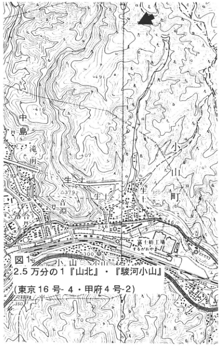
Show extracted lettering and translation
English translation of figure lettering
Figure 1. 1:25,000 Yamakita and Suruga-Oyama (Tokyo sheet 16-4; Kofu sheet 4-2). Ikido; Oyama Town; Nakajima Falls; Ochiai; 三淵; Oyama; river. Fuji spinning factory (Kanegafuchi). Legible elevations and other numbers: 449.1, 416, 407, 293, 379.2, 350, 246, 300, 370.
Original Japanese lettering
図1。2.5万分の1『山北』・『駿河小山』(東京16号-4・甲府4号-2)。生土,小山町,中島滝,落合,三淵,小山,川。富士紡工場(かねがふち)。可読標高・数値:449.1,416,407,293,379.2,350,246,300,370。
Reading notes
富士紡工場の括弧内文字と地図の微細な注記 — 括弧内は「かねがふち」と読めるが解像度が低く、他の小文字も一部は確定不能。
[Original printed page: 36]
WS-9-3 (continued)
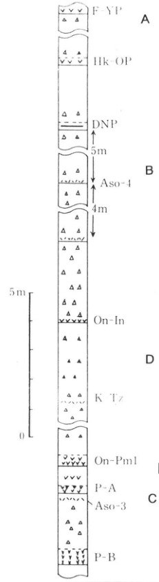
Show extracted lettering and translation
English translation of figure lettering
From top: F-YP, Hk-OP, DNP, Aso-4, On-In, K-Tz, On-Pm1, P-A, Aso-3, P-B. Sites: A, B, D, C. Stratigraphic intervals: DNP to Aso-4, 5 m; Aso-4 to the indicated lower horizon, 4 m. Scale at left: 0–5 m.
Original Japanese lettering
上からF-YP,Hk-OP,DNP,Aso-4,On-In,K-Tz,On-Pm1,P-A,Aso-3,P-B。地点A,B,D,C。層位間隔:DNPからAso-4まで5m;Aso-4から下の指示層準まで4m。左のスケール0~5m。
Figure 3. Tephra stratigraphic column in upper Nishizawa, Ikido.
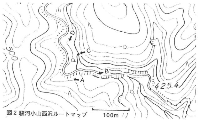
Show extracted lettering and translation
English translation of figure lettering
Sites A, B, C, D; 500; 425.4; 100 m.
Original Japanese lettering
地点A,B,C,D;500;425.4;100m。
Figure 2. Route map of Nishizawa, Suruga-Oyama.
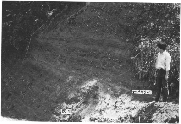
Show extracted lettering and translation
English translation of figure lettering
← Aso-4.
Original Japanese lettering
←Aso-4。
Figure 4.
[Original printed page: 37]
WS-9-4 Kutcharo pyroclastic-flow deposits and Aso-4 tephra in the Shari Plain
Koji Okumura
Locality: Raiun, Shari Town, Hokkaido. Coordinates: N43°51′0″ E144°38′50″. Elevation: 40 m. Exposure and present condition: artificial exposure; extant. Deposits and age: pyroclastic-flow deposits and tephra fall; Late Pleistocene. Date described: June 1994. Keywords: Shari Plain; Kutcharo IV tephra; Kutcharo II/III tephra; Kutcharo I tephra; Aso-4 tephra; Toya tephra; Shikotsu tephra 1.
Aso-4 tephra (Machida et al., 1985) is well preserved at a thickness of about 15 cm around the Shari Plain in eastern Hokkaido, more than 1,500 km from its source at Aso caldera. This is attributed to deposition of Kutcharo pyroclastic-flow deposit (KP) II/III after only a short interval following the Aso-4 fall, protecting Aso-4 against erosion and weathering. [Abbreviations for Kutcharo tephras follow Okumura (1991). This unit is K.P. flow II or III of Katsui and Sato (1963); the two are written together because they are difficult to distinguish. It is Kutcharo 2–3 (Kc-2-3) of Machida and Arai (1992).] Consequently, the Shari Plain area provides the thickest unweathered Aso-4 outside central and southern Kyushu. The fine ash correlated with Aso-4 had been recognized by Katsui and Sato (1963) as the basal fine-grained part of KP II. Aso-4, however, contains small amounts of amphibole absent from Kutcharo volcanic tephras, which are mostly two-pyroxene andesitic to rhyolitic. Its volcanic-glass refractive indices and major- and trace-element compositions also differ markedly from Kutcharo-derived tephras (Machida et al., 1985). Discovery of Aso-4 and Toya ash (WS-13; Machida et al., 1987) made it possible for the first time to correlate the Late Pleistocene tephrochronology of eastern Hokkaido with that of central and western Hokkaido and then with the rest of Japan.
At the southern end of the Shari Plain, the end of a ridge-like pyroclastic-flow plateau extending south from Kawakami Bridge over the Shari River preserves a flat depositional surface of KP IV approximately 10 m above the alluvial surface. [This is the Kutcharo debris-flow deposit, K.S. flow, of Katsui and Sato (1963); see WS16-1 for the relationship between KP IV and K.S. flow.] More than 20 m of Late Pleistocene tephras overlie this surface. The exposure at Loc. 1 (Raiun) still exists, but its steep wall has prevented detailed description. Large exposures of KP IV through KP I are scattered south of Loc. 1 (Figure 1). Loc. 2, now lost, at the northern end of the plateau south of Kawakami Bridge, was the most thoroughly described nearby exposure and the subject of various analyses. Its stratigraphy is presented here (Figure 2).
Above KP IV, exposed at the base, lies 1.5 m of weathered volcanic-ash soil containing three reddish-brown pumice-fall beds, Nishiki pumices 1–3 (Sumita, 1988). Toya volcanic glass is concentrated in the upper part of this weathered ash soil, where a yellowish layer can be recognized within the reddish-brown soil. Above it, in ascending order, are a white pumice-fall bed about 1 m thick, 50 cm of volcanic-ash soil, and Aso-4.
Aso-4 is a loose beige ash that has undergone almost no weathering. Another characteristic is the glitter produced when its volcanic glass, shaped like spherical shells with low curvature, reflects light.
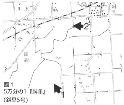
Show extracted lettering and translation
English translation of figure lettering
1:50,000 Shari (Shari sheet 5). Sites 1, 2. Kawakami; Shari; Shari River; 羅萌; Raiun; 水無沢. Legible numbers: 45.8, 52.
Original Japanese lettering
5万分の1『斜里』(斜里5号)。地点1,2。川上,斜里,斜里川,羅萌,来運,水無沢。可読数値45.8,52。
Reading notes
地図内の微細な地名 — 一部は解像度が低い。
Figure 1.
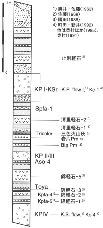
Show extracted lettering and translation
English translation of figure lettering
Scale: 0–5 m. From top: Yambetsu pumice²⁾; KP I-KSr—K.P. flow I¹⁾, Kc-1⁴⁾; Spfa-1; Kiyosato pumice 2³⁾; Kiyosato pumice 1³⁾; Tricolor—three-color ash³⁾; lithic Pm³⁾; Big Pm³⁾; KP II/III; Aso-4; Nishiki pumice 5³⁾; Toya; Nishiki pumice 3³⁾; Kpfa-4¹⁾—Nishiki pumice 2³⁾; Kpfa-5¹⁾—Nishiki pumice 1³⁾; KP IV—K.S. flow¹⁾, Kc-4⁴⁾. Sources: 1) Katsui and Sato (1963); 2) Sato (1968); 3) Sumita (1988); 4) Machida and Arai (1992); others from Okumura et al. (1985) and Okumura (1991).
Original Japanese lettering
スケール0~5m。上から:止別軽石²⁾;KP I-KSr―K.P. flow I¹⁾ Kc-1⁴⁾;Spfa-1;清里軽石-2³⁾;清里軽石-1³⁾;Tricolor―三色火山灰³⁾;岩片Pm³⁾;Big Pm³⁾;KP II/III;Aso-4;錦軽石-5³⁾;Toya;錦軽石-3³⁾;Kpfa-4¹⁾―錦軽石-2³⁾;Kpfa-5¹⁾―錦軽石-1³⁾;KP IV―K.S. flow¹⁾ Kc-4⁴⁾。出典:1)勝井・佐藤(1963),2)佐藤(1968),3)隅田(1988),4)町田・新井(1992),他は奥村ほか(1985),奥村(1991)。
Figure 2.
[Original printed page: 38]
WS-9-4 (continued)
A soil layer approximately 1 cm thick separates Aso-4 from the overlying KP II/III, indicating a time interval between them. KP II/III is a somewhat firm, compact, gray pyroclastic-flow deposit containing abundant lithic fragments. At 130 cm above KP II/III is a distinctive ash with a combination of white, reddish-brown, and gray, called Tricolor (Okumura et al., 1985). Tricolor fell when the alluvial-fan surface forming most of the Koshimizu Plateau—the Bihoro surface of Sato (1968)—was becoming abandoned by water. The white tephra common to the upper parts of the exposures described here is KP I–Kc-Sr (WS-6). It is divided into a lower interval several tens of centimeters thick of striped alternating pumice and ash falls, and an overlying white pyroclastic-flow deposit. Yellowish-white Shikotsu pumice fall 1 (Spfa-1; WS-7) occurs approximately 30 cm below KP I–Kc-Sr. The subdivision and naming of tephra-fall beds in this region are described in detail in WS-6.
References: Katsui and Sato (1963); Machida and Arai (1992); Machida et al. (1985, 1987); Okumura (1991); Okumura et al. (1985); Sato (1968).
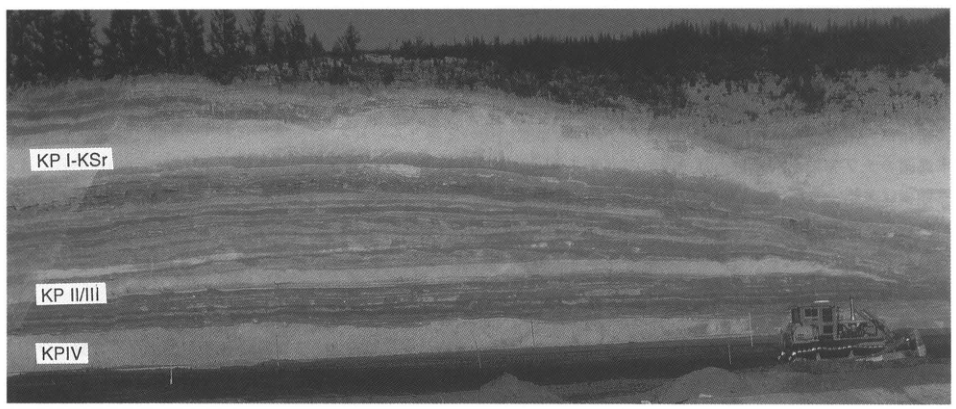
Show extracted lettering and translation
English translation of figure lettering
KP I-KSr; KP II/III; KP IV.
Original Japanese lettering
KP I-KSr;KP II/III;KP IV。
Figure 3. Exposure south of Raiun. Its stratigraphy is nearly the same as at sites 1 and 2.
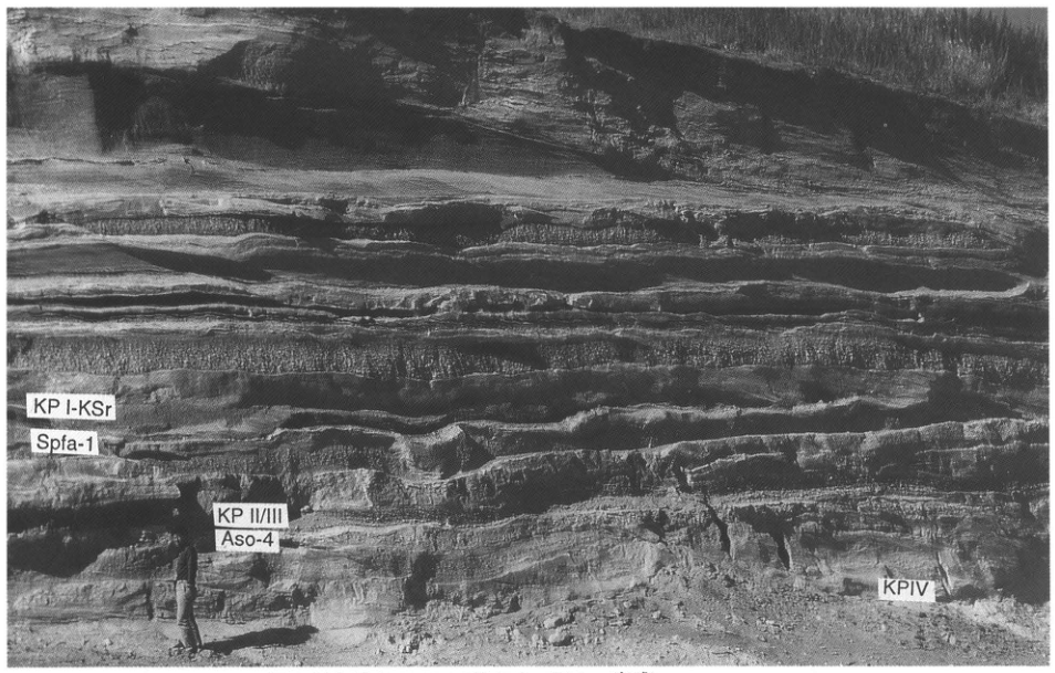
Show extracted lettering and translation
English translation of figure lettering
KP I-KSr; Spfa-1; KP II/III; Aso-4; KP IV.
Original Japanese lettering
KP I-KSr;Spfa-1;KP II/III;Aso-4;KP IV。
Figure 4. Exposure south of Kawakami Bridge (site 2 in Figure 1; now lost).
[Original printed page: 39]
WS-10-1 Kikai-Tozurahara tephra and marine terraces on Tanegashima
Hiroshi Machida
Locality: Noma, Nakatane Town, Kagoshima Prefecture. Coordinates: N30°31′51″ E130°58′32″. Elevation: 110 m. Exposure and present condition: cliff at the Noma Junior High School playing field; extant? Deposits and age: marine-terrace sediments and ash; Late Pleistocene. Date described: 1983. Keywords: Kikai-Tozurahara tephra; Ata tephra; Tanegashima.
The most proximal deposit of Kikai-Tozurahara tephra (K-Tz) is the Nagase pyroclastic-flow deposit on Takeshima in Kikai caldera (see Takeshima, WS-2-1). Deposits indicating its widespread distribution can be readily observed on marine terraces of Yakushima and Tanegashima. The present exposure is at Noma in central Tanegashima. The tephras above the terrace sediments reach a total thickness of 6–7 m. K-Tz is the thickest of them: a vivid yellow-orange, pyroxene-rhyolitic glassy ash (Figure 2). This tephra, 1.7 m thick, is divided into a lower half consisting of finely stratified ash and coarse phenocryst minerals—feldspar and quartz—and an upper half of unstratified glassy ash. The lower half may be regarded as a type of pyroclastic surge lofted from the pyroclastic flow, and the upper half as co-ignimbrite ash. No Plinian pumice-fall unit occurs in this tephra. Its abundance of accretionary lapilli throughout suggests that it was produced by a large phreatomagmatic eruption.
In the upper part of the tephra succession here are vivid yellow-orange glassy ashes of Aira-Tn tephra (AT) and Kikai-Akahoya tephra (K-Ah). Although absent at this exposure, Ata pyroclastic-flow deposit, no more than 1 m thick, occurs below K-Tz on the western coast of central and southern Tanegashima and at Kaminaka in Minamitane Town. K-Tz is correlated with Tozurahara pumice I, described at Tozurahara in Uenohara Town, Yamanashi Prefecture (Minagawa, 1968, 1969; see the next entry, WS-10-2). It is an important marker bed for identifying marine terraces and other sediments of oxygen-isotope stage 5c throughout western and central Japan (Machida and Arai, 1992).
Tanegashima is an island of tilted, uplifted marine terraces and, together with the Miyazaki Plain, may be regarded as a type area for marine-terrace chronology in Kyushu. Marine terrace M1, corresponding to isotope stage 5e, and younger terraces are well developed. Their relationships with tephras are particularly clear between Hamatsuwaki and Fukagawa on the western coast of Nakatane Town, and between Sunasaka and Nishime on the southwestern coast of Minamitane Town (arrows in Figure 3). Based on these localities, Figure 4 schematically shows the relationships between marine terraces and tephras (Ota and Machida, 1987). Ata covers the M1 and M2 terrace surfaces and is interbedded in M3 terrace gravel. K-Tz, in contrast, also covers the scarp between M2 and M3. These observations suggest that M3 correlates with the Obaradai terrace in southern Kanto and formed in stage 5c, whereas M4 correlates with the Misaki terrace and formed in stage 5a. This leaves the question of what M2 represents; for the present, it is regarded as dating to an interval within stage 5e.
References: Machida and Arai (1992); Minagawa (1968, 1969); Ota and Machida (1987).
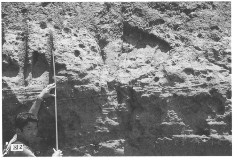
Show extracted lettering and translation
English translation of figure lettering
Figure 2; photographic date stamp: 83 6 14.
Original Japanese lettering
図2;写真の日付表示:83 6 14。
[Original printed page: 40]
WS-10-1 (continued)
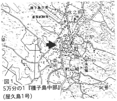
Show extracted lettering and translation
English translation of figure lettering
1:50,000 Central Tanegashima (Yakushima sheet 1). Tanegashima Airport; equestrian training ground; 伏之前; 上方; Noma; Masuda; 野山崎; Central Park; 阿曽. Legible numbers: 142, 83, 6.
Original Japanese lettering
5万分の1『種子島中部』(屋久島1号)。種子島空港,乗馬訓練場,伏之前,上方,野間,増田,野山崎,中央公園,阿曽。可読数値:142,83,6。
Reading notes
地図の細かな地名・数値 — 一部不鮮明。読みの確認ができない地名は英訳でも日本語保持。
Figure 1.
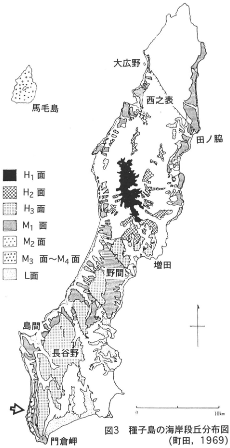
Show extracted lettering and translation
English translation of figure lettering
Legend: H₁ surface; H₂ surface; H₃ surface; M₁ surface; M₂ surface; M₃–M₄ surfaces; L surface. Place labels: Mageshima; 大広野; Nishinoomote; 田ノ脇; Masuda; Noma; Shimama; 長谷野; Cape Kadokura. Scale: 0–10 km. An arrow marks the southwestern coast.
Original Japanese lettering
凡例:H₁面,H₂面,H₃面,M₁面,M₂面,M₃面~M₄面,L面。地名:馬毛島,大広野,西之表,田ノ脇,増田,野間,島間,長谷野,門倉岬。スケール:0~10km。南西岸を矢印で示す。
Figure 3. Distribution of coastal terraces on Tanegashima (Machida, 1969).
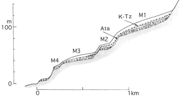
Show extracted lettering and translation
English translation of figure lettering
From landward to seaward: M1, M2, M3, M4. Tephras: K-Tz, Ata. Vertical scale: 0, 100 m. Horizontal scale: 0–1 km.
Original Japanese lettering
陸側から海側:M1,M2,M3,M4。テフラ:K-Tz,Ata。垂直スケール:0,100 m;水平スケール:0~1km。
Figure 4. Relationships between terraces and tephras in southern Tanegashima (Ota and Machida, 1987).
[Original printed page: 41]
WS-10-2 Kikai-Tozurahara and Aso-4 tephras around Tozurahara, Fujino Town, Kanagawa Prefecture
Hiroshi Yonezawa; Yo Uesugi; Kanto Quaternary Research Group
Locality: Shibata–Tozurahara, Fujino Town, Kanagawa Prefecture. Coordinates: N35°36′0″ E139°9′0″. Elevation: 180–230 m. Exposure and present condition: natural exposures; partly extant. Deposits and age: fluvial to lacustrine sediments; Late Pleistocene. Date described: December 1980. Keywords: Ontake tephra 1; Kikai-Tozurahara tephra; Aso-4 tephra.
Small bodies of standing water associated with deposition in the main channels occur at various places along rivers around the Tanzawa Mountains. Lacustrine to fluvial sediments of this period contain numerous tephras from the Fuji and Hakone volcanic systems, as well as many Late Pleistocene widespread tephras (e.g., Minagawa, 1969; Yonezawa, 1981; Uesugi and the Kanto Quaternary Research Group, 1994). On the right bank of Maedo Stream between Shibata and Tozurahara in Fujino Town, a thick succession of deposits forming the Sagamihara surface unconformably overlies basement rock (Yonezawa, 1981). This succession approximately corresponds to the Tozurahara Formation of Minagawa (1969). Around Tozurahara it comprises lower gravel about 8–9 m thick, middle alternating sand and mud about 35 m thick, and upper gravel about 8 m thick.
The middle alternating sand and mud contains Late Pleistocene widespread tephras in the following ascending order: Ontake tephra 1 (On-Pm1; tephra Y-1 of Uesugi et al., 1980, 1983; 80–90 ka); Kikai-Tozurahara tephra (K-Tz; Machida et al., 1985; tephra Y-19 of Uesugi et al., 1980, 1983; Migakizuna 1, or polishing sand 1; TzP-I of Minagawa, 1969; 75 ka); Ontake-Ina tephra (On-In; Machida et al., 1985; tephra Y-26 of Uesugi et al., 1980, 1983; “poppy-seed pumice”; TzP-II of Minagawa, 1969); Migakizuna 2 (tephra Y-36 of Uesugi et al., 1980, 1983; TzP-III of Minagawa, 1969); and Aso-4 tephra (Machida et al., 1985; Sagamihara City Geomorphology and Geology Research Group, 1986; 70 ka).
At the site marked ■ on the exposure-location map, at Tsurushima in Uenohara Town, Yamanashi Prefecture, two fine-grained glassy tephras are interbedded in peat (Kanto Quaternary Research Group, 1979). The lower, approximately 10 cm thick, has been correlated with Aso-4 (Sagamihara City Geomorphology and Geology Research Group, 1986; Machida and Arai, 1992). Pollen analysis of the peat indicates that coniferous forest comprising Picea, Pinus, Tsuga, Abies, and other taxa was widespread at the time of the Aso-4 ash fall (Kanto Quaternary Research Group, 1979; Sagamihara City Geomorphology and Geology Research Group, 1986).
References: Kanto Quaternary Research Group (1979); Machida et al. (1985); Machida and Arai (1992); Minagawa (1969); Sagamihara City Geomorphology and Geology Research Group (1986); Uesugi and the Kanto Quaternary Research Group (1994); Uesugi (1994); Uesugi et al. (1980, 1983); Yonezawa (1981).
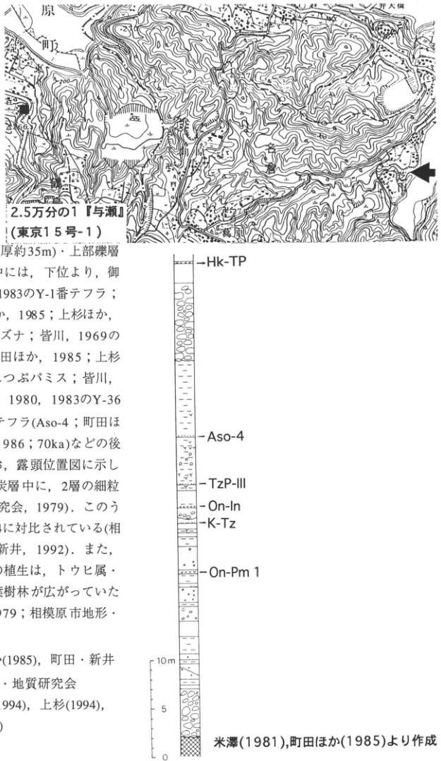
Show extracted lettering and translation
English translation of figure lettering
Map: 1:25,000 Yose (Tokyo sheet 15-1). Tozurahara; Shibata; Tsurushima; Uenohara Town; Sagami River; Uenohara Bridge (partly cropped at top). Legible numbers: 200, 250, 266.5. Column, from top: Hk-TP, Aso-4, TzP-III, On-In, K-Tz, On-Pm1. Scale: 0, 5, 10 m. Compiled from Yonezawa (1981) and Machida et al. (1985). The prose fragment at left is included in the main text.
Original Japanese lettering
位置図:2.5万分の1『与瀬』(東京15号-1);葛原,芝田,鶴島,上野原町,相模川;上野原大橋(上部で一部切れる)。可読数値200,250,266.5。柱状図上から:Hk-TP,Aso-4,TzP-III,On-In,K-Tz,On-Pm1。スケール0,5,10m。米澤(1981),町田ほか(1985)より作成。画像左側の本文断片は本文欄に収録済み。
Reading notes
地図中の小さな標高・地名 — 一部不鮮明で確定できない。
[Original printed page: 42]
WS-10-3 Kikai-Tozurahara tephra in marine sand forming the Naka Plateau, Joban coast
Takehiko Suzuki
Locality: Hetano, Hitachinaka City, Ibaraki Prefecture. Coordinates: N36°22′5″ E140°35′11″. Elevation: 30 m. Exposure and present condition: artificial exposure beside a paddy field; extant. Deposits and age: marine sand, AW-type tephra, and aeolian tephra; Late Pleistocene. Date described: June 1996. Keywords: Naka Plateau; Naka Plateau Sand and Gravel; upper member of the Miwa Formation; Kikai-Tozurahara tephra; Joban coast.
The exposure described here is presently the easternmost known terrestrial occurrence of Kikai-Tozurahara tephra (K-Tz). It lies on the Naka Plateau at the northeastern end of the Kanto Plain. This extensive plateau stretches northwest–southeast between the Kuji and Naka rivers at elevations of 25–55 m. Sakamoto (1972) called its marine sand the upper member of the Miwa Formation, interpreted it as deposits of the culmination of the Shimosueyoshi transgression, and correlated the plateau surface itself with the Shimosueyoshi surface in southern Kanto. Suzuki (1989) subsequently interpreted the Naka Plateau as a partly fluvial surface rather than a marine surface simply correlatable with Shimosueyoshi, and considered its emergence to have proceeded over a relatively long period from the peak of the last interglacial, the Shimosueyoshi period, to 75–80 ka. The strongest evidence for this timing was the discovery of K-Tz as AW-type tephra—wind-transported ash deposited on the bottom of a water body—in the uppermost terrace-forming sediments in the southeastern plateau.
At that time, the K-Tz fall was assigned an age of 75–80 ka. It is now considered somewhat older, 90–100 ka, and assigned to oxygen-isotope stages 5c–5b (Machida and Arai, 1994). Consequently, the Naka Plateau is considered to have formed during stages 5e–5c. The exposure shows approximately 3.6 m of volcanic-ash soil containing Akagi-Kanuma tephra (Ag-KP), overlying more than 1 m of sand. Their boundary is transitional; K-Tz occurs 60–100 cm below it. Rather than forming a bed, it occurs as lumps of fine ash several centimeters in diameter. At first glance, these resemble pumice pieces lined up in the sand. The characteristics of K-Tz at this site are described by Suzuki (1989, 1990b).
References: Machida and Arai (1994); Sakamoto (1972); Suzuki (1989, 1990b).
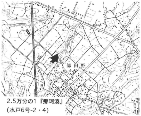
Show extracted lettering and translation
English translation of figure lettering
1:25,000 Nakaminato (Mito sheets 6-2 and 6-4). Hetano; 原. Legible numbers: 36.6, 27.7, 30, 24.2.
Original Japanese lettering
2.5万分の1『那珂湊』(水戸6号-2・4)。部田野,原。可読数値:36.6,27.7,30,24.2。
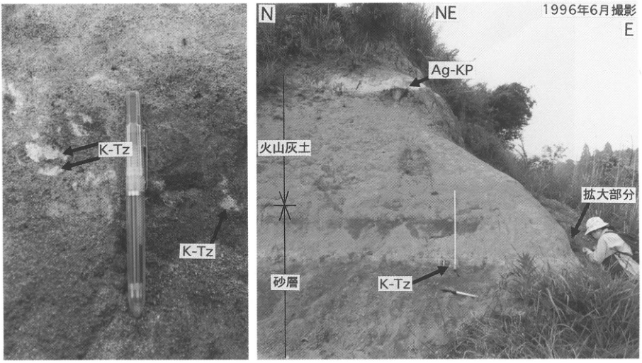
Show extracted lettering and translation
English translation of figure lettering
K-Tz (two labels at left, one at right); N, NE, E; photographed June 1996; Ag-KP; volcanic-ash soil; sand bed; enlarged area.
Original Japanese lettering
K-Tz(左に2箇所、右に1箇所);N,NE,E;1996年6月撮影;Ag-KP;火山灰土;砂層;拡大部分。
[Original printed page: 43]
WS-11-1 Ontake tephra 1 on the eastern foot of Mount Fuji
Hiroshi Machida
Locality: upper Nakajima Stream, Oyama Town, Shizuoka Prefecture. Coordinates: N35°22′33″ E138°59′34″. Elevation: 390 m. Exposure and present condition: forest-road cutting; extant. Deposit and age: pumice-fall bed; Late Pleistocene. Date described: 1990. Keywords: Ontake tephra 1; Suruga-Oyama.
Proximal type exposures of Ontake tephra 1 (On-Pm1) occur at Kiso-Fukushima and Ina. They are generally strongly weathered, however, making the original character difficult to discern. The exposure considered here lies on Fuji's eastern foot. Burial beneath more than 100 m of tephras and other sediments has preserved this tephra exceptionally well, while its location provides evidence of the tephra's widespread extent. Its occurrence nearby in upper Nishizawa at Ikido, Oyama Town, is described separately (WS-9-3); preservation is better here. To reach the site, leave central Oyama northward and ascend the forest road along Nakajima valley. The landmark is the eastern wall of the forest road east of the reservoir, near the high-voltage power line.
The deposit consists chiefly of well-sorted pumice with a maximum grain size of 8 mm. It becomes finer in the middle to upper part, then coarsens again. The fine-grained interval suggests the possibility of pyroclastic-flow activity at that stage. Total thickness reaches 1 m. The pumice is pyroxene-bearing biotite–amphibole dacitic and highly vesicular, with a silky fibrous texture. It attracted attention as an unusual tephra in southern Kanto, where basaltic and andesitic tephras are abundant. Beneath it is a thick pumice bed identical to that labeled P-B at Ikido Nishizawa. Its source may be Komitake volcano. Kikai-Tozurahara and other tephras occur above (WS-9-3).
References: Machida (1990, 1996).
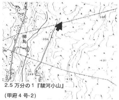
Show extracted lettering and translation
English translation of figure lettering
1:25,000 Suruga-Oyama (Kofu sheet 4-2). Yanagishima. Legible elevations: 500, 394, 491, 359, 416.
Original Japanese lettering
2.5万分の1『駿河小山』(甲府4号-2)。柳島。可読標高:500,394,491,359,416。
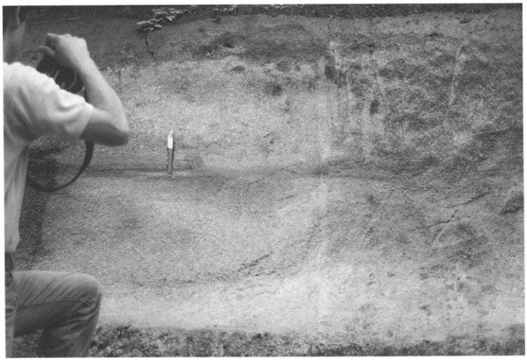
[Original printed page: 44]
WS-11-2 Widespread tephras of the Isawa Plateau
Mitsuhisa Watanabe
Locality: Wakayanagi, Isawa Town, Isawa District, Iwate Prefecture. Coordinates: N39°7′6″ E140°58′47″. Elevation: 215 m. Exposure and present condition: artificial roadside exposure; extant. Deposits and age: fluvial sediments and tephras; Middle to Late Pleistocene. Date described: May 1987. Keywords: Isawa Plateau; Aso-4 tephra; Kitahara tephra; Ontake tephra 1; Sambe-Kisuki tephra; Toya tephra.
At this exposure, several widespread tephras overlying terrace gravel, the deposits forming the M1 surface, can be observed with the naked eye (Watanabe, 1991; Soda and Yagi, 1991; Machida and Arai, 1992). At the top is coarse Yakeishi-Yamagata tephra (Yk-Y; Yamagata pumice; Okami and Yoshida, 1984), derived from Yakeishidake, with slight involution on its upper surface. Below Yk-Y occur Aso-4, Kitahara (Kth), Atago (Atg), Ontake tephra 1 (On-Pm1), Sambe-Kisuki (SK), and Toya tephras. Each is only a few centimeters thick; the sketch exaggerates their thicknesses. These widespread ashes are clearly important for studying Late Quaternary landform development. Recognition of On-Pm1 at this exposure, near its currently known northern distribution limit, is especially significant. Together with Aso-4, it assists in establishing stratigraphic relationships with tephras in Chubu, Kanto, and Tohoku, and in correlating and dating landforms formed since the culmination of the last interglacial.
On-Pm1 is recognized as a yellow to yellowish-white, fine-grained glassy ash bed. Aso-4 is reddish orange, SK yellow, and Toya yellow to orange glassy ash. Kth is greenish gray and mixed with Atg, which contains abundant, relatively coarse high-temperature quartz.
The terrace gravel in the lower part of the exposure is buried by talus, but all the widespread ashes remain observable. They are easier to examine in the left half of the exposure. Because they commonly occur as scattered patches, however, collecting large quantities of samples will make them invisible unless the exposure is extensively cut back again. Care is needed to protect this exposure.
References: Machida and Arai (1992); Okami and Yoshida (1984); Soda and Yagi (1991); Watanabe (1991).
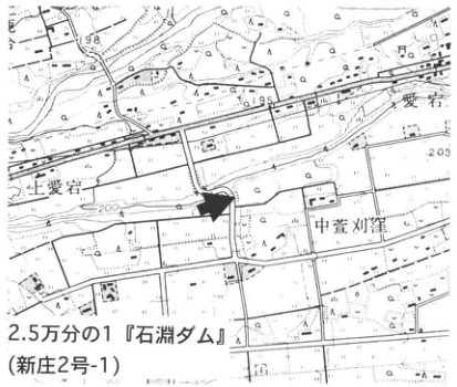
Show extracted lettering and translation
English translation of figure lettering
1:25,000 Ishibuchi Dam (Shinjo sheet 2-1). 上愛宕; Atago; 中萱刈窪. Legible numbers: 198, 195, 203, 200.
Original Japanese lettering
2.5万分の1『石淵ダム』(新庄2号-1)。上愛宕,愛宕,中萱刈窪。可読数値:198,195,203,200。
Reading notes
小さな地名・数値 — 一部は不鮮明。
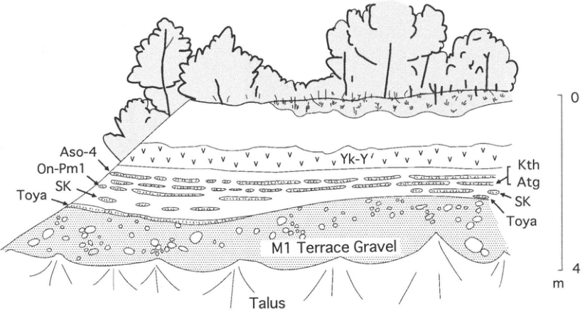
Show extracted lettering and translation
English translation of figure lettering
Yk-Y′; Aso-4; On-Pm1; SK (left and right); Toya (left and right); Kth; Atg; M1 Terrace Gravel; Talus. Right-hand scale: 0–4 m.
Original Japanese lettering
Yk-Y′;Aso-4;On-Pm1;SK(左右);Toya(左右);Kth;Atg;M1 Terrace Gravel;Talus。右スケール0~4m。
[Original printed page: 45]
WS-12-1 Sambe-Kisuki tephra at Matsue
Hiroshi Machida
Locality: in front of the vehicle testing center, Yamashiro Town, Matsue City. Coordinates: N35°26′12″ E133°5′40″. Elevation: 20 m. Exposure and present condition: cutting; lost. Deposit and age: pumice-fall beds; Late Pleistocene. Date described: 1975. Keywords: Sambe-Kisuki tephra; Daisen-Matsue tephra; Matsue.
Sambe-Kisuki tephra, which extends over a broad area from Mount Sambe along the Sea of Japan to Tohoku, was formerly called Koshihara pumice (San'in Quaternary Research Group, 1969). The former type exposures at both Kisuki and Koshihara have now disappeared. New exposures are more likely to occur near Koshihara in southern Matsue, however, and Daisen-derived tephras can also be observed there; the former exposure is therefore described here. See also CG-8.
Two weathered pumice beds overlie red soil at this exposure. The lower, yellowish-brown bed was once described as Daisen-Kurayoshi pumice, but is actually the much older Daisen-Matsue tephra (DMP; Machida and Arai, 1979). The grayish-white to grayish-brown pumice bed above it, separated by soil, is Sambe-Kisuki tephra (SK). Whereas DMP is rich in mafic minerals, SK is biotite-rhyolitic, has few mafic minerals other than biotite, and is rich in quartz and feldspar. The unusually low refractive indices of its pumice-type volcanic glass, 1.494–1.498, are another distinguishing feature useful for regional correlation (Toyokura et al., 1991). In Tohoku, SK occurs between Ontake tephra 1 and Toya tephra (WS-11-2), suggesting an eruption age of 100–110 ka. DMP occurs immediately above Sashimi (差海) terrace deposits west of Lake Shinji [printed 穴道湖 in the original], considered to date to oxygen-isotope stage 5e, and is therefore thought to have erupted at 120–125 ka.
Among Sambe volcanic products, SK represents the largest Plinian eruption. An associated pyroclastic flow may have erupted, but this is uncertain near Mount Sambe because younger tephras cover the deposits. DMP is distributed both west and east of its source, Daisen volcano, and together with SK is an effective marker bed.
References: Machida and Arai (1979); San'in Quaternary Research Group (1969); Toyokura et al. (1991).
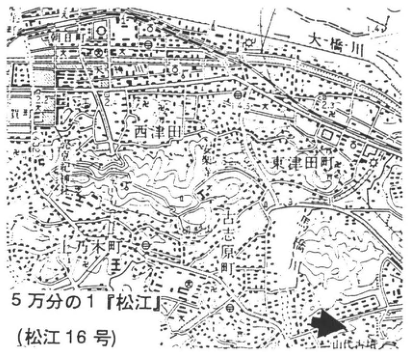
Show extracted lettering and translation
English translation of figure lettering
1:50,000 Matsue (Matsue sheet 16). Asahi Town; Ohashi River; Nishitsuda; Higashitsuda Town; Agenogi Town; Koshihara Town. Legible numbers: 1.4, 2.2, 4.5, 2.3, 31.
Original Japanese lettering
5万分の1『松江』(松江16号)。朝日町,大橋川,西津田,東津田町,上乃木町,古志原町。可読数値:1.4,2.2,4.5,2.3,31。
Reading notes
地図の小さい数値・施設名 — 一部は解像度が低く確定できない。
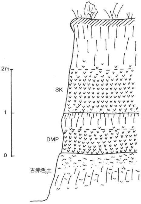
Show extracted lettering and translation
English translation of figure lettering
SK; DMP; old red soil. Scale: 0, 1, 2 m.
Original Japanese lettering
SK;DMP;古赤色土。スケール0,1,2m。
[Original printed page: 46]
WS-12-2 Sambe-Kisuki tephra washed ashore on the Echizen coast
Hiroshi Machida; Isamu Toyokura
Locality: Hamaji, Mikuni Town, Fukui Prefecture, on the shore at Midori-no-Hiroba. Coordinates: N36°15′8″ E136°10′57″. Elevation: 8.5 m. Exposure and present condition: sea cliff; extant. Deposits and age: beach sediments and water-deposited tephra; Late Pleistocene. Date described: 1989. Keywords: Sambe-Kisuki tephra; drift pumice; Echizen coast.
Sambe-Kisuki tephra (SK), whose distribution axis extends northeast to east-northeast from Mount Sambe, is an important marker linking Quaternary deposits of western and northern Japan. Material washed ashore is also found in water-laid beds on the Hokuriku coast and the Oga Peninsula (Toyokura et al., 1991). At this exposure, a yellowish-white ash bed and rounded pumice gravel immediately above it can be observed within coarse beach sand. The ash is a tephra-fall deposit; the pumice drifted with ocean currents and accumulated on the shore. Although both are strongly weathered, they can be identified by their characteristic biotite-rhyolitic composition. The ash bed has been disturbed by organisms.
Based on the eruption age of SK, the marine-terrace sediments are considered to correspond to oxygen-isotope stage 5c. The drift pumice suggests that a northward current along the Sea of Japan coast existed then, as it does today. Similar exposures of SK in marine sediments also occur on the Noto Peninsula (CB-28; Toyokura et al., 1991).
Reference: Toyokura et al. (1991).
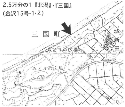
Show extracted lettering and translation
English translation of figure lettering
1:25,000 Kitagata and Mikuni (Kanazawa sheets 15-1 and 15-2). Mikuni Town; 城新田; Midori-no-Hiroba (two labels). Legible numbers: 33, 39.3.
Original Japanese lettering
2.5万分の1『北潟』・『三国』(金沢15号-1・2)。三国町,城新田,みどりの広場(2箇所)。可読数値33,39.3。
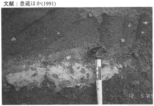
Show extracted lettering and translation
English translation of figure lettering
Legible date stamp: 12 5 89. The reference line at the top is included in the main text.
Original Japanese lettering
日付表示の可読部分:12 5 89。上端の文献行は本文に収録済み。
Reading notes
12 5 89 — 日付表示の左側が不鮮明。順序・完全な日付は確定しない。
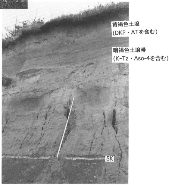
Show extracted lettering and translation
English translation of figure lettering
Yellowish-brown soil (containing DKP and AT); dark-brown soil zone (containing K-Tz and Aso-4); SK. The cropped numbers at upper left belong to the adjacent photograph.
Original Japanese lettering
黄褐色土壌(DKP・ATを含む);暗褐色土壌帯(K-Tz・Aso-4を含む);SK。左上の数字断片は隣の写真の端部。
[Original printed page: 47]
WS-13-1 Stratigraphy of Toya tephra at the foot of Mount Usu
Hiroshi Machida; Kotaro Yamagata
Localities: village-boundary stream at Kaminagawa, Date City, Hokkaido (site 1); left bank of the Osaru River in the same area (site 2). Coordinates: N42°31′10″ E140°51′40″ (site 1); N42°31′10″ E140°52′24″ (site 2). Elevation: 80–120 m. Exposure and present condition: valley walls; extant. Deposits and age: pyroclastic-flow deposits, ash fall, pumice fall, and lava; Late Pleistocene. Date described: 1990. Keywords: Toya caldera; Toya tephra; Mount Usu.
The large pyroclastic-flow deposits forming plateaus around Toya caldera are the source deposits of Toya tephra, approximately 110 ka old and widespread throughout northern Japan. Their stratigraphy is fairly complex and has been studied mainly at the foot of Mount Usu south of the caldera. Site 1 is a valley wall along a steep small stream incising the Toya pyroclastic-flow depositional surface. Several units comprising Toya tephra can be readily observed here. Figure 2 is a stratigraphic column compiled by combining several exposures along this stream. Suzuki (1970) and Ikeda and Katsui (1986) divided Toya tephra into Toya pyroclastic-flow deposits Tpfl I–IV and Toya pyroclastic-fall deposits Tpfa. At this exposure, the following occur in ascending order: ash-rich pink to beige pyroclastic-flow deposit Tpfl II; ash fall containing abundant accretionary lapilli, Tpfa, with a pyroclastic-flow deposit interbedded within it; pink pyroclastic-flow deposit Tpfl III; and pumice-rich pyroclastic-flow deposit Tpfl IV, divided into several units. Tpfl IV has a basal concentration of lithic fragments, a lithic breccia. Of the four pyroclastic-flow units, Tpfl IV is the largest and most widely distributed. The widespread northern Japan Toya tephra is considered chiefly co-ignimbrite ash from this unit (Machida et al., 1987). It is a fairly homogeneous, glass-rich ash of amphibole-bearing pyroxene-rhyolitic composition. The glass is markedly felsic and predominantly pumice-type. The presence of orthopyroxene of eulite composition is also highly distinctive.
Toya tephra is overlain by its reworked deposits and then by Kuttara tephra 2 (Kt-2), a pumice fall dispersed west of its source at Kuttara volcano, formerly called N,Us-c; Nakajima-Osarugawa tephra (Nj-Os), derived from Nakajima, a post-caldera volcano of Toya; and ash and scoria falls from Usu volcano. These are covered by lava of the Usu stratovolcano.
At site 2 on the opposite bank of the Osaru River, beneath Tpfl II occupying the upper cliff, is Tpfl I, a unit consisting chiefly of beige ash with accretionary lapilli (Figure 3). This is the product of the initial phreatomagmatic eruption in the Toya caldera eruption sequence and resembles a pyroclastic-surge deposit. Below it, separated by soil, Osarugawa tephra (Osr), consisting mainly of another pyroclastic-flow deposit, the Osarugawa pyroclastic flow, rests on fluvial sand and gravel. From its stratigraphic position and elevation of about 15 m, this sand and gravel, the Kaminagawa Formation, is inferred to be terrace deposits of oxygen-isotope stage 5e.
References: Ikeda and Katsui (1986); Machida et al. (1987); Suzuki (1970).
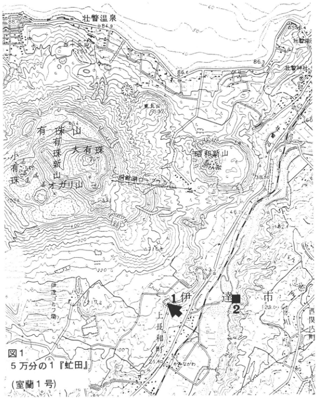
Show extracted lettering and translation
English translation of figure lettering
Figure 1. 1:50,000 Abuta (Muroran sheet 1). Sites 1, 2. Mount Usu; Usu-Shinzan; O-Usu; Ko-Usu; 有珠山方; Higashi-Maruyama; Showa-Shinzan; Sobetsu hot spring; Sobetsu Falls; Sobetsu Shrine; Date City; Kaminagawa Town; Kaminagawa post office; 西関内町; Osaru River. Legible numbers: 88.5, 84.9, 263, 86.6, 86.3, 60, 398, 38.50, 46.2, 82.6, 43, 29.0, 17.2, 80, 100, 200, 220, 300, 400, 500, 600.
Original Japanese lettering
図1。5万分の1『虻田』(室蘭1号)。地点1,2。有珠山,有珠新山,大有珠,小有珠,有珠山方,東丸山,昭和新山,壮瞥温泉,壮瞥滝,壮瞥神社,伊達市,上長和町,上長和郵,西関内町,長流川。可読数値:88.5,84.9,263,86.6,86.3,60,398,38.50,46.2,82.6,43,29.0,17.2,80,100,200,220,300,400,500,600。
Reading notes
地形図中の一部山名・微細な数値 — 不鮮明な文字は原図で確定できない。「有珠山方」は図上の可読形を保持。
[Original printed page: 48]
WS-13-1 (continued)
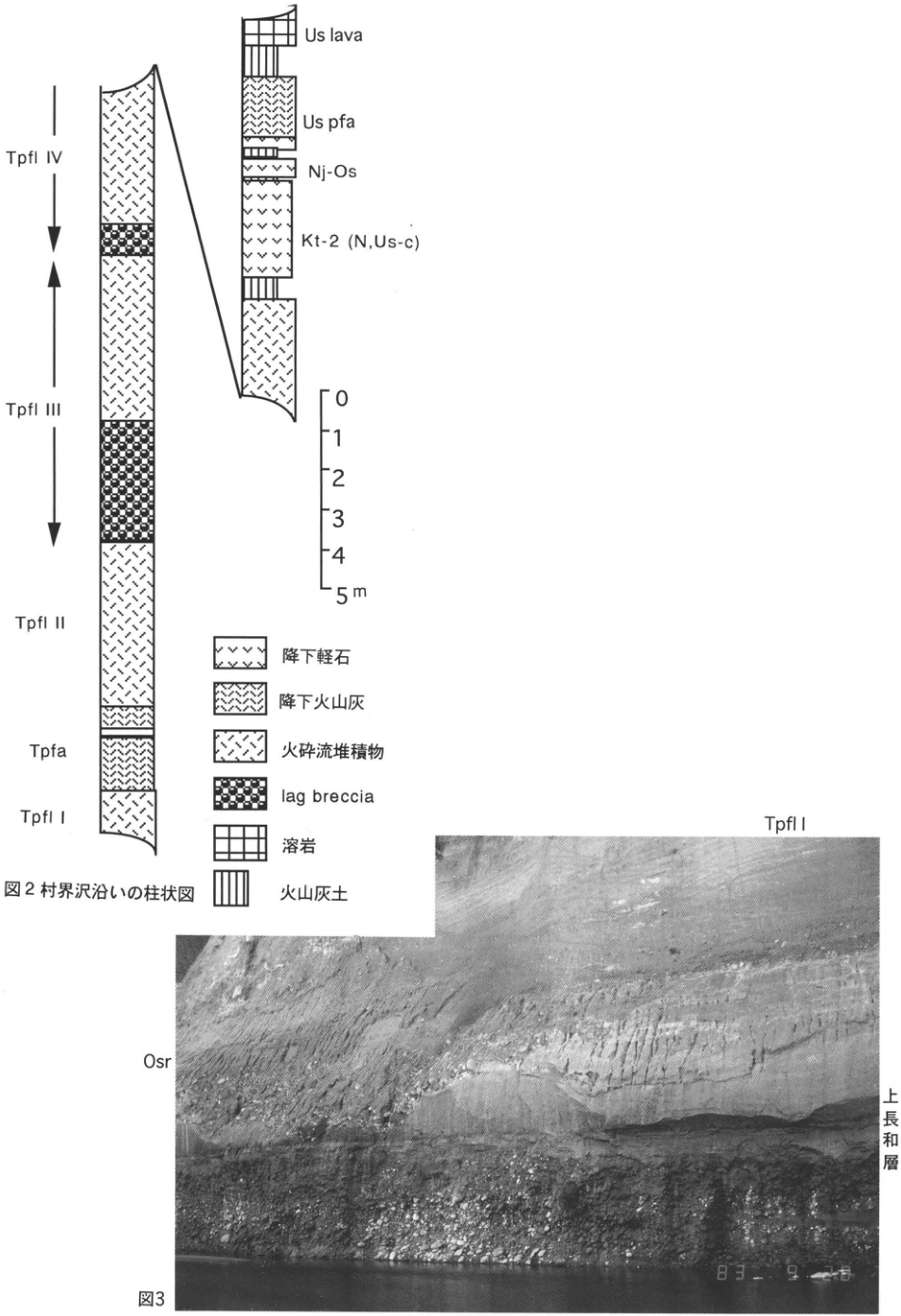
Show extracted lettering and translation
English translation of figure lettering
Figure 2 column, from top: Us lava, Us pfa, Nj-Os, Kt-2 (N,Us-c), Tpfl IV, Tpfl III, Tpfl II, Tpfa, Tpfl I. Scale: 0, 1, 2, 3, 4, 5 m. Legend: pumice fall; ash fall; pyroclastic-flow deposit; lag breccia; lava; volcanic-ash soil. Figure 3 photograph: Tpfl I; Osr; Kaminagawa Formation. Legible date-stamp portion: 83 9.
Original Japanese lettering
図2柱状図の上から:Us lava,Us pfa,Nj-Os,Kt-2 (N,Us-c),Tpfl IV,Tpfl III,Tpfl II,Tpfa,Tpfl I。スケール0,1,2,3,4,5m。凡例:降下軽石,降下火山灰,火砕流堆積物,lag breccia,溶岩,火山灰土。図3写真:Tpfl I,Osr,上長和層。日付の可読部分:83 9。
Reading notes
写真右下の日付 — 末尾の数字が白くかすれ、完全な日付を確定できない。
Figure 2. Stratigraphic column along the village-boundary stream.
Figure 3.
[Original printed page: 49]
WS-13-2 Toya tephra and overlying tephras at Date, Hokkaido
Kotaro Yamagata; Hiroshi Machida
Locality: along National Route 37, Tateyama Town, Date City, Hokkaido. Coordinates: N42°28′40″ E140°51′30″. Elevation: 45 m. Exposure and present condition: artificial exposure; extant. Deposits and age: pyroclastic-flow deposits and tephra fall; Late Pleistocene. Date described: August 1993. Keywords: Toya pyroclastic-flow deposit; Shikotsu pyroclastic-flow deposit; Usu volcano.
This exposure lies approximately 8 km southeast of Toya caldera on the depositional surface of the Toya pyroclastic flow (Toya pfl), erupted at about 110 ka. It is readily accessible and is the most suitable exposure for observing tephra beds younger than the Toya pyroclastic-flow deposit. The upper part of that deposit is exposed at a thickness of 4 m in the lower section. Overlying tephras occur in ascending order as follows: Aso-4 tephra and Nakajima-Date tephra (Nj-Dt) from Nakajima volcano in Toya caldera, neither particularly distinct to the naked eye; Kuttara tephra 2 (Kt-2, corresponding to N,Us-c), forming a thick pumice-fall bed; Nakajima-Osarugawa tephra (Nj-Os); grayish-white, laminated Shikotsu pyroclastic-flow deposit (Spfl); Usu-Kaminagawa tephra (Us-Ka) from Usu volcano; a group of volcanic-sand beds thought to have erupted during formation of the Usu stratovolcano; Nigorikawa tephra (Ng) from Nigorikawa volcano; and, in the uppermost black humic soil, Baitoushan–Tomakomai tephra (B-Tm), Komagatake d tephra (Ko-d), Usu b tephra (Us-b), and others. Spfl flowed down along the Osaru River; pronounced cross-lamination occurs in part of its upper interval. Thus, the eruption history of the Toya volcanic group can be read at this exposure from stratigraphic relationships established by widespread marker tephras.
Reference: Machida et al. (1987).
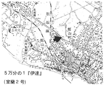
Show extracted lettering and translation
English translation of figure lettering
1:50,000 Date (Muroran sheet 2). Tateyama Town; Asahi Town; Osaru Bridge; Osaru River; Iburi railway line; Shimura Chemical Works; Nishihama Town; 水水町; 日橋. Legible numbers: 53.8, 4, 3.5, 0.8, 5.2.
Original Japanese lettering
5万分の1『伊達』(室蘭2号)。館山町,旭町,長流橋,長流川,胆振線,志村化工,西浜町,水水町,日橋。可読数値53.8,4,3.5,0.8,5.2。
Reading notes
右端の町名「水水町」と「日橋」 — 一部切れて不鮮明なため読める形を仮に転記し、地名読みは確定しない。
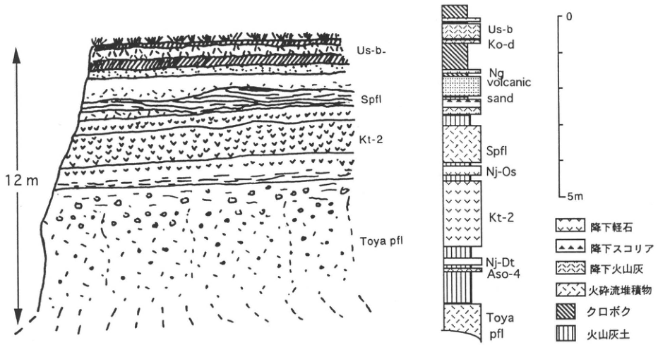
Show extracted lettering and translation
English translation of figure lettering
Left sketch: Us-b-, Spfl, Kt-2, Toya pfl; total height 12 m. Right column, from top: Us-b, Ko-d, Ng, volcanic sand, Spfl, Nj-Os, Kt-2, Nj-Dt, Aso-4, Toya pfl. Scale: 0–5 m. Legend: pumice fall; scoria fall; ash fall; pyroclastic-flow deposit; black humic soil; volcanic-ash soil.
Original Japanese lettering
左スケッチ:Us-b-,Spfl,Kt-2,Toya pfl;全高12m。右柱状図上から:Us-b,Ko-d,Ng,volcanic sand,Spfl,Nj-Os,Kt-2,Nj-Dt,Aso-4,Toya pfl。スケール0~5m。凡例:降下軽石,降下スコリア,降下火山灰,火砕流堆積物,クロボク,火山灰土。
[Original printed page: 50]
WS-13-3 Toya tephra as a terrace marker on the Shimokita Peninsula
Hiroshi Machida
Locality: 甲, Kazamaura Village, Aomori Prefecture. Coordinates: N41°27′28″ E141°6′47″. Elevation: 40 m. Exposure: road cutting. Deposits and age: terrace sand and gravel and ash fall; Late Pleistocene. Date described: August 1983. Keywords: Toya tephra; Hatajiri terrace; Shimokita Peninsula.
Of the marine terraces on the Shimokita Peninsula, the Hatajiri terrace, 40–60 m in elevation, is the most widely distributed. This exposure lies on its surface. A thin sand and gravel bed associated with a wave-cut platform is overlain by 3.5–4 m of brown volcanic-ash soil. The yellow tephra low in this soil frequently occurs on terraces from the Hachinohe area to this region. It was called “white tuff” at Hachinohe and “yellow pumice” near Misawa and Noheji (Tohoku Quaternary Research Group, 1969). Overall it is a fine-sand-sized glassy tephra. Tracing it northward from the south into Shimokita, one finds that grain size at its base increases. At this exposure the tephra is 18 cm thick, with a very clearly observable basal layer 2–3 cm thick of yellowish-white pumice ranging from coarse-sand size to several millimeters in diameter. This suggested a source farther north, in Hokkaido, and was strong evidence leading to the inference of a Toya caldera source (Machida et al., 1987). Here, 10–20 cm of volcanic-ash soil separates the terrace sand and gravel from Toya tephra, indicating that a substantial time elapsed after terrace emergence before the Toya ash fall.
References: Machida et al. (1987); Tohoku Quaternary Research Group (1969).
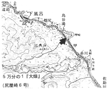
Show extracted lettering and translation
English translation of figure lettering
1:50,000 Ohata (Shiriyazaki sheet 6). Shimofuro; Hatajiri; 鳥谷湯上; 甲; 甲崎; Akagawa; Osaki; Chijiri Beach; Sasuke River; 三角山; 道添; 岩角. Legible numbers: 6.6, 5.4, 282.0, 73, 7.2.
Original Japanese lettering
5万分の1『大畑』(尻屋崎6号)。下風呂,畑尻,鳥谷湯上,甲,甲崎,赤川,大崎,ちぢり浜,佐助川,三角山,道添,岩角。可読数値6.6,5.4,282.0,73,7.2。
Reading notes
地名甲・鳥谷湯上等 — 独立した読みを確認できず、英訳で日本語を保持。
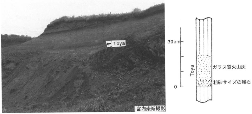
Show extracted lettering and translation
English translation of figure lettering
Photograph: ← Toya; photograph by Takahiro Miyauchi. Column: Toya; glassy ash; coarse-sand-sized pumice. Scale: 0–30 cm.
Original Japanese lettering
写真:←Toya;宮内崇裕撮影。柱状図:Toya,ガラス質火山灰,粗砂サイズの軽石。スケール0~30cm。
[Original printed page: 51]
WS-13-4 Marine Middle and Upper Pleistocene strata and widespread tephras, including Toya, on the Oga Peninsula, Akita Prefecture
Takeo Shiraishi (白石建雄); 的場保望
Locality: Anden, Oga City, Akita Prefecture. Coordinates: N39°58′10″ E139°51′00″. Elevation: 0–20 m. Exposure and present condition: sea cliff; extant. Deposits and age: chiefly coastal shallow-marine sediments; Middle to Late Pleistocene. Date described: May 1996. Keywords: Oga Peninsula; Shibikawa Formation; Anden Formation; Aso-4 tephra; Toya tephra; Aso-1 tephra; Baitoushan-Oga tephra.
The Oga Peninsula is one of the reference areas for the Neogene of the Sea of Japan coastal region and has long been the subject of numerous geological investigations. Marine terraces are also prominent, and studies of their landforms have a long history. Research on the Quaternary lagged somewhat, but since the 1970s advances combining magnetostratigraphy and microfossil stratigraphy have led to revised ages and established the presence of a thick marine Quaternary succession. More recently, successive discoveries of widespread tephras have also made the area important for Quaternary stratigraphy.
The present locality is a large sea-cliff exposure west of Anden village on the northern Oga coast. It is an important exposure where the stratigraphy and sedimentary facies of marine Middle and Upper Pleistocene strata, and their interbedded tephras, can be observed continuously. The formations seen here are, in ascending order, Wakimoto, Shibikawa, Anden, and Katanishi. Each formation from Shibikawa upward has been considered to overlie the underlying formation unconformably. New evidence has emerged concerning these divisions and stratigraphic relationships. Identification of widespread tephras, including Toya, has led to the view that the Anden Formation of Kitazato (1975) is part of the Katanishi Formation at its type locality (Katanishi Formation Collaborative Research Group, 1983; Machida et al., 1987; Miyauchi, 1988; Shiraishi et al., 1992). It has also been pointed out that the Anden and Katanishi formations at this exposure are conformable (Shiraishi et al., 1992). Re-examination is therefore underway, but the work is not yet complete; the conventional interpretation is presented here.
Because the beds dip eastward at this exposure, the succession described above can be observed starting from Anden village and proceeding west along the coast, continuously from the upper beds downward. The shore is sandy, the tidal range is small, and observations are possible at any time except during rough weather.
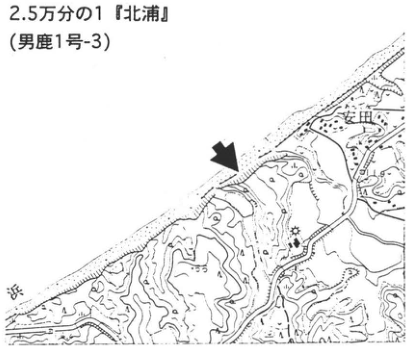
Show extracted lettering and translation
English translation of figure lettering
1:25,000 Kitaura (Oga sheet 1-3). Anden.
Original Japanese lettering
2.5万分の1『北浦』(男鹿1号-3)。安田。
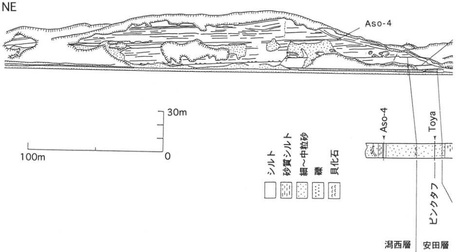
Show extracted lettering and translation
English translation of figure lettering
Direction: NE. Exposure label: Aso-4. Column labels: Aso-4, Toya, pink tuff; Katanishi Formation; Anden Formation. Legend: silt; sandy silt; fine- to medium-grained sand; gravel; shell fossils. Horizontal scale: 100 m, 0; vertical scale: 0–30 m.
Original Japanese lettering
方位NE。露頭:Aso-4。柱状図:Aso-4,Toya,ピンクタフ;潟西層,安田層。凡例:シルト,砂質シルト,細~中粒砂,礫,貝化石。水平スケール100m、0;垂直スケール0~30m。
[Original printed page: 52]
WS-13-4 (continued)
The tephras identified at this exposure, in descending order, are Aso-4 (Shiraishi et al., 1992), Toya (Machida et al., 1987), Aso-1 (Shirai and Tada, 1996), Baitoushan-Oga (B-Og; Machida and Arai, 1992), and Oga pumice tuff (Oga; Kitazato, 1975). Aso-4 is 15 cm thick, at a horizon 1.8 m below a black silt bed in the middle Katanishi Formation. Although mixed with silt, a concentration of glass is visible to the naked eye near its center, and it is clearly primary ash fall. Immediately above it is drift pumice derived from the Aso-4 pyroclastic flow (Shiraishi et al., 1992). Toya is the thickest and most conspicuous tephra here: a 37 cm glassy ash bed intercalated in the lower Anden Formation, formerly called pink tuff. Aso-1 is a beige glassy ash bed about 10 cm thick intercalated in lignite in the middle Shibikawa Formation. This ash was briefly identified as Aso-3 (Machida and Arai, 1994), but Shirai and Tada (1996) revised the identification to Aso-1. B-Og (Machida and Arai, 1992, 1994) is a 2.5 cm bed of alkali-rhyolitic glassy ash intercalated near the base of a lignite bed immediately above Oga in the lower Shibikawa Formation. Unlike these widespread tephras, Oga is thick (1.5 m) and comprises alternating beds of coarse white pumice and ash. Its source is thought to be very close, and it has been correlated with the Toga Pumice Formation distributed around Toga Bay on the peninsula’s west coast (Fujioka, 1959). Machida and Arai (1994) express the same view. According to Shirai and Tada (1996), chronology based on Sea of Japan seafloor cores suggests eruption ages of about 250 ka for Aso-1 and about 440 ka for B-Og.
References: Fujioka (1959); Katanishi Formation Collaborative Research Group (1983); Kitazato (1975); Machida and Arai (1992, 1994); Machida et al. (1987); Miyauchi (1988); Shirai and Tada (1996); Shiraishi et al. (1992).
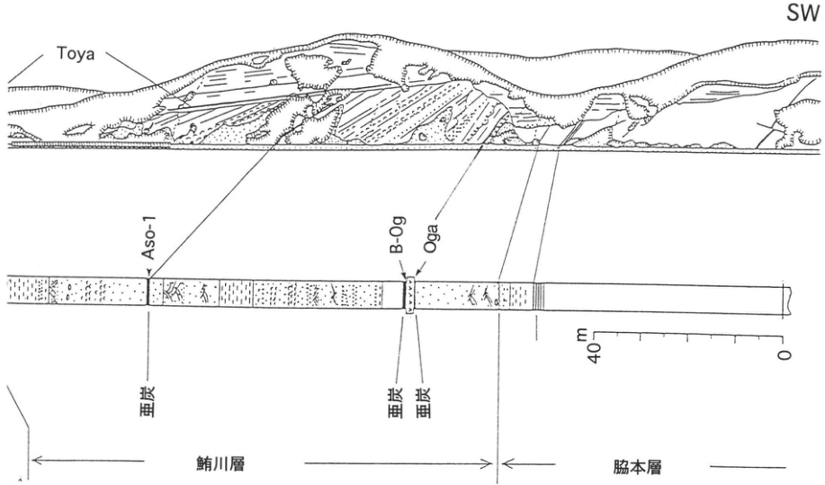
Show extracted lettering and translation
English translation of figure lettering
Direction: SW. Toya; Aso-1; B-Og; Oga; lignite (three occurrences); Shibikawa Formation; Wakimoto Formation. Scale: 0, 40 m.
Original Japanese lettering
方位SW。Toya,Aso-1,B-Og,Oga;亜炭(3か所);鮪川層,脇本層。スケール0,40m。
[Original printed page: 53]
WS-14-1 Ata tephra in the southern Osumi Peninsula
Shinji Nagaoka
Locality: valley floor south of 野尻野, Nejime Town, Kagoshima Prefecture. Coordinates: N31°6′36″ E130°45′29″. Elevation: 280 m. Exposure and present condition: artificial exposure; extant. Deposits and age: tephra fall and pyroclastic-flow deposits; Late Pleistocene. Date described: January 1996. Keywords: Ata pyroclastic-flow deposit; Kori ash fall; Ata pumice fall; Izashiki ash fall; Osumi Peninsula.
In the southern Osumi Peninsula, plateaus are developed on deposits of the Ata pyroclastic flow (Ata-pfl; 90–110 ka), one of southern Kyushu’s enormous pyroclastic flows. Strongly welded pyroclastic-flow deposits are exposed through most of the cliffs, which exceed 100 m in height. Earlier tephra-fall deposits occur at their base, but most are concealed by collapse debris and dense evergreen broadleaved forest. This is one of the few exposures where fallout tephras associated with the Ata eruption can be seen. Above the granite basement, the succession comprises 240 cm of Kori ash fall (Ko-A), 430 cm of Ata pumice fall (Ata-p; Aramaki and Ui, 1966), 95 cm of Izashiki ash fall (Iz-A), and more than 50 m of Ata pyroclastic-flow deposit (Ata-pfl) (Nagaoka, 1988). The Kori ash fall is poorly sorted ash containing pumice and occasionally accretionary lapilli. The Izashiki ash is rich in accretionary lapilli. Around Sata Town farther south, Sata pumice fall (St-p) is sometimes intercalated above the Izashiki ash fall. These fallout tephras indicate repeated Plinian and phreatomagmatic (phreatoplinian) eruptions preceding the Ata pyroclastic-flow eruption, suggesting that the sequence of the Ata eruption cycle took place under water (Nagaoka, 1988).
References: Aramaki and Ui (1966); Nagaoka (1988).
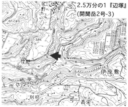
Show extracted lettering and translation
English translation of figure lettering
1:25,000 Hetsuka (Kaimondake sheet 2-3). 野尻野; Kori; Izashiki; 別府; 唐栄. Legible numbers: 542, 384, 387, 396, 370.
Original Japanese lettering
2.5万分の1『辺塚』(開聞岳2号-3)。野尻野,郡,伊座敷,別府,唐栄。可読数値542,384,387,396,370。
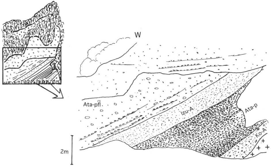
Show extracted lettering and translation
English translation of figure lettering
Direction: W. Ata-pfl; Izu-A; Ata-p; Ko-A. Scale: 2 m.
Original Japanese lettering
方位W。Ata-pfl,Izu-A,Ata-p,Ko-A。スケール2m。
Reading notes
Izu-A — 図中はIzu-A、本文はIz-Aと印刷されているため、それぞれ保持。
[Original printed page: 54]
WS-14-2 Pyroclastic-flow deposits from Aso, Ata, and other sources in the Hitoyoshi Basin
Hiroshi Machida
Locality: Yamashita, Nishiki Town, Kumamoto Prefecture. Coordinates: N32°13′17″ E130°49′44″. Elevation: 130–150 m. Exposure and present condition: excavation for earth and gravel; extant, but vegetation has begun to cover it. Deposits and age: pyroclastic-flow deposits; Late Pleistocene. Date described: 1987–1994. Keywords: Aso-3 pyroclastic-flow deposit; Ata pyroclastic-flow deposit; Aso-4 pyroclastic-flow deposit; Aira-Ito pyroclastic-flow deposit; Hitoyoshi Basin.
The Hitoyoshi Basin, opening within the Kyushu Mountains, received large pyroclastic flows from Aso caldera to the north and from Kakuto, Kobayashi, Aira, Ata, and other calderas to the south (all producing widespread tephras). It is consequently an excellent area for clarifying their relative stratigraphic positions. These pyroclastic-flow deposits are stacked in complex fashion throughout the hills on the right bank of the Kuma River in the northern basin. At this exposure one can observe the Aso-3, Ata, Aso-4, and Aira-Ito (A-Ito) pyroclastic-flow deposits.
Aso-3 at the bottom of the cliff contains large pumice clasts like Aso-4 but is somewhat more weathered. A thick soil developed between it and overlying Ata. Aso-3 identified in central Honshu and Pacific seafloor sediments occurs close to Ata stratigraphically and is considered to occupy isotope stage 5d (Machida and Arai, 1994).
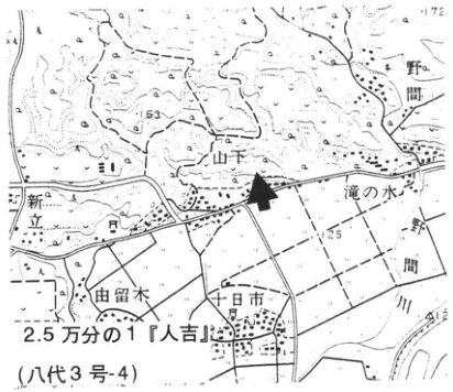
Show extracted lettering and translation
English translation of figure lettering
1:25,000 Hitoyoshi (Yatsushiro sheet 3-4). Yamashita; 野間; 新立; 滝の水; 由留木; 十日市; Nishiki Town; Kuma River. Legible numbers: 172, 163, 125, 134.4.
Original Japanese lettering
2.5万分の1『人吉』(八代3号-4)。山下,野間,新立,滝の水,由留木,十日市,錦町,球磨川。可読数値172,163,125,134.4。
Ata is the finest-grained of the four pyroclastic-flow deposits, rich in glassy ash containing accretionary lapilli. Its thickness exceeding 10 m at this distant locality, more than 100 km from its source, suggests that it was an eruption deposit of the largest class. Its basal portion contains abundant charcoal fragments.
Aso-4 here is an unwelded pyroclastic-flow deposit containing coarse pumice, but elsewhere it commonly forms grayish-black welded tuff. In some places its glass-rich basal portion can be seen.
The uppermost A-Ito is the whitest of the pyroclastic-flow deposits here and has stratification, resembling secondary shirasu. Elsewhere in the Hitoyoshi Basin it fills valleys and locally has a weakly welded facies.
References: Machida and Arai (1994); Machida et al. (1985).
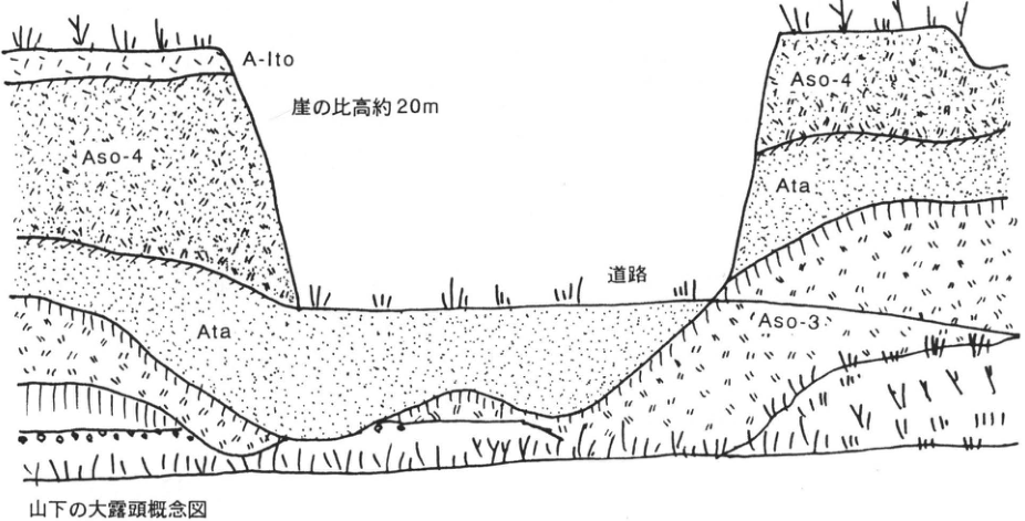
Show extracted lettering and translation
English translation of figure lettering
Conceptual sketch of the large Yamashita exposure. A-Ito; Aso-4 (twice); Ata (twice); Aso-3; road; cliff relief approximately 20 m.
Original Japanese lettering
山下の大露頭概念図。A-Ito;Aso-4(2か所);Ata(2か所);Aso-3;道路;崖の比高約20m。
[Original printed page: 55]
WS-14-3 Aso-4 and Ata tephras at the eastern foot of Aso
Hiroshi Machida
Locality: 野鹿, Ogi Town, Kumamoto Prefecture [as printed]. Coordinates: N38°56′17″ E131°18′48″ [as printed]. Elevation: 430 m. Exposure and present condition: tunnel walls, behind houses, and elsewhere; extant. Deposits and age: pyroclastic-flow deposits and tephra fall; Late Pleistocene. Date described: 1983–1996. Keywords: Aso-4 tephra; Kikai-Tozurahara tephra; Aso ABCD tephra; Ata tephra; Aso-3 tephra; 野鹿.
The stratigraphic relationships between Aso-4, Ata, and other large tephras representing Kyushu’s large pyroclastic-flow eruptions were unclear before widespread tephras were understood. At this exposure the problem can be solved using Aso-4 as a reference. Tephras from Aso-4 down to Aso-3 can be observed around the old-road tunnel and from there behind the settlement to the valley floor. The base of the Aso-4 pyroclastic-flow deposit is rich in coarse foreign lithic fragments. In places it erodes underlying tephras and often contains blocks of those tephras and volcanic-ash soil.
The tephra group between Aso-4 and Aso-3 is about 20 m thick, with more than ten units of scoria, pumice, and ash. Units with visibly different facies have been designated A–N (Ono et al., 1972). Between unit N and Aso-3C, where exposure is poor, there is more than 3 m of massive brown volcanic-ash soil with developed cracks. Units I–N cannot be observed in the tunnel exposure. Units ABCD form the largest continuous eruption sequence among the tephras between Aso-4 and Aso-3 and can be traced widely eastward. Where the volcanic-ash soil between Aso-4 and ABCD is well preserved, Kikai-Tozurahara tephra (K-Tz) can be identified as a concentration zone of bubble-wall glass shards.
About 20 cm below the ABCD tephra is an 11 cm bed of beige glassy ash. This is Ata co-ignimbrite ash, composed principally of bubble-wall glass shards. Its correlation and identification with Ata tephra (pumice-fall and pyroclastic-flow deposits) distributed across southern Kyushu are based on heavy-mineral assemblages, refractive-index characteristics, and other properties. Ata has few known terrestrial occurrences in the Japanese archipelago and is distributed chiefly in the sea south of Honshu. In Quaternary stratigraphy, Aso-4 and Ata lie after the culmination of the last interglacial, respectively in marine isotope stages 5b and 5c (Oba, 1991).
References: Machida et al. (1985); Oba (1991); Ono et al. (1972).
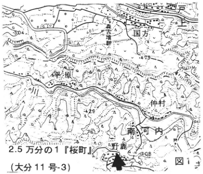
Show extracted lettering and translation
English translation of figure lettering
Figure 1. 1:25,000 Sakuramachi (Oita sheet 11-3). 国方; 荻原; 仲村; 南河内; 野鹿. Legible numbers: 504, 465, 479, 429, 408.
Original Japanese lettering
図1。2.5万分の1『桜町』(大分11号-3)。国方,荻原,仲村,南河内,野鹿。可読数値504,465,479,429,408。
Reading notes
地図の細字注記 — 縦書きの小注記の一部が解像度により判読できない。
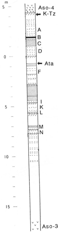
Show extracted lettering and translation
English translation of figure lettering
Aso-4; K-Tz; A; B; C; D; Ata; F; I; K; L; M; N; Aso-3. Scale, m: 5, 0, 5, 10, 15.
Original Japanese lettering
Aso-4,K-Tz,A,B,C,D,Ata,F,I,K,L,M,N,Aso-3。スケールm:5,0,5,10,15。
Figure 2. Composite stratigraphic column (Ono et al., 1972).
[Original printed page: 56]
WS-14-3 (continued)
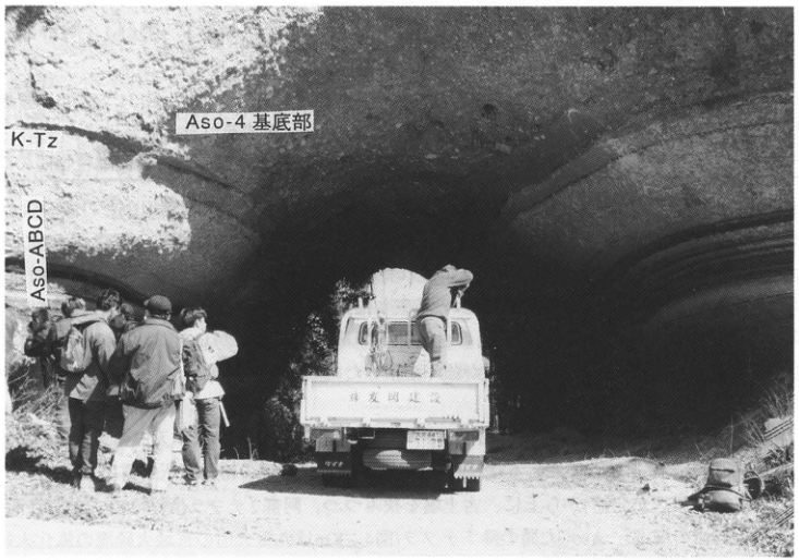
Show extracted lettering and translation
English translation of figure lettering
Aso-4 basal portion; K-Tz; Aso-ABCD. Lettering on the vehicle tailgate is illegible.
Original Japanese lettering
Aso-4基底部,K-Tz,Aso-ABCD。車両荷台の文字は判読不明。
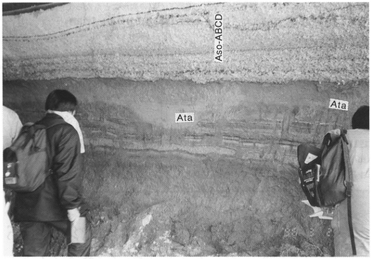
Show extracted lettering and translation
English translation of figure lettering
Aso-ABCD; Ata (twice).
Original Japanese lettering
Aso-ABCD,Ata(2か所)。
[Original printed page: 57]
WS-15-1 Aso-3 pyroclastic-flow deposits along the Inaba River, Taketa City, Oita Prefecture—The Imaichi, Aso-1, Aso-3, and Aso-4 pyroclastic flows
Koji Ono
Locality: beside the entrance to the old national-road tunnel, north bank of the Inaba River, Shichiri, Taketa City, Oita Prefecture. Coordinates: N32°58′14″ E131°24′27″. Elevation: 250 m. Exposure and present condition: riverbank cliff; extant. Deposits and age: pyroclastic-flow deposits and wind-deposited tephra; Middle to Late Pleistocene. Date described: January 1996. Keywords: Imaichi pyroclastic flow; Aso-1 pyroclastic flow; Aso-3 pyroclastic flow; Aso-4 pyroclastic flow; fallout tephras between the pyroclastic-flow deposits.
Central Taketa lies near the eastern end of the pyroclastic plateau east of Aso caldera. The plateau is dissected by deep gorges of the Ono and Inaba rivers and others. Its principal component here is the Aso-3 pyroclastic-flow deposit (hereafter “deposit” is omitted); Aso-4 covers the plateau surface, but its base descends to the beds of the Inaba and other rivers (Figure 2). Aso-4 on the plateau is unwelded to weakly welded, whereas that on valley slopes and floors is strongly welded. The elevation difference between the base of Aso-4 on the plateau and the gorge floors of the Inaba and Ono rivers exceeds 80 m. At the time of Aso-4 emplacement, the terrain, much like that today, consisted of an Aso-3 pyroclastic plateau and deep, box-shaped gorges. Aso-4 filled the valleys and then covered the plateau, but strong welding of the thick valley-fill sections caused their surfaces to subside, accurately reproducing the pre-Aso-4 river courses.
This exposure is north of Oka Castle, east of the entrance to the tunnel through which former National Route 57 leaves the north bank of the Inaba River toward the north. A continuous section from Aso-1 to Aso-4 welded tuff is visible (Imaichi welded tuff was formerly exposed at the bottom but was buried during river improvement works). Above Aso-1, which is weakly welded and well laminated, successive beds separated by paleosols are Aso-2 tephra (Aso-2TL and 2T pumice- and scoria-fall beds; the Aso-2 pyroclastic-flow horizon lies between them), fallout tephras between Aso-3 and Aso-2 (Figure 4; Km is the weathered distal part of the Miyagi pyroclastic flow from Kuju volcano), the basal Aso-3W pumice fall, and the Aso-3A and B pyroclastic flows described below (Figures 3, 4). Aso-4 further covers the end of Aso-3B descending rightward toward the Inaba River, forming the valley wall (Figure 5). Aso-4 is strongly welded; locally even its matrix is dense black glass, making juvenile lenses difficult to see. Tensional joints formed through deformation during welding of the deep valley fill are observable in Aso-4. These precede columnar cooling joints; juvenile lenses protrude on the joint surfaces as a result of squeezing out (Watanabe et al., 1983).
On the eastern side of Aso caldera, Aso-3 can be divided, from bottom to top, into the Aso-3A, 3B, and 3C pyroclastic-flow subunits. Aso-3A is a white to brown dacitic pumice flow, strongly welded near the caldera; near Taketa it occurs only along valleys and is unwelded. Aso-3B is an aphyric andesitic scoria flow. It is absent from the caldera walls but is most voluminous west of Taketa, forming the main part of the pyroclastic plateau. It includes strongly welded portions west of Taketa and is weakly welded to unwelded around central Taketa. Aso-3C is an unwelded scoria-flow deposit of porphyritic andesite with abundant phenocrysts. Subunit distribution is not the same in every direction around the caldera; for example, Aso-3B has not yet been found on the western side of the caldera.
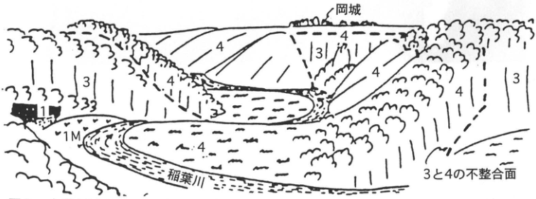
Show extracted lettering and translation
English translation of figure lettering
Oka Castle; Inaba River; unconformity between 3 and 4. 1; 1M; 3; 4 (repeated).
Original Japanese lettering
岡城,稲葉川,3と4の不整合面。1,1M,3,4(複数箇所)。
Figure 2. Landform and constituents of the pyroclastic plateau at this exposure (left end, as in Figure 5) and across the Inaba River. Numbers identify the Aso pyroclastic flows, as in subsequent figures.
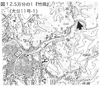
Show extracted lettering and translation
English translation of figure lettering
Figure 1. 1:25,000 Taketa (Oita sheet 11-1). 城町; Shichiri; Inaba River; Taketa River; Taketa City; Taketa Town; Oka Castle ruins; 渡辺. Legible numbers: 300, 238, 322.
Original Japanese lettering
図1。2.5万分の1『竹田』(大分11号-1)。城町,七里,稲葉川,竹田川,竹田市,竹田町,岡城跡,渡辺。可読数値300,238,322。
[Original printed page: 58]
WS-15-1 (continued)
The Aso-3 pyroclastic flows at this exposure are Aso-3A and 3B. Aso-3A forms the lowermost several meters of the right half, where the beds descend toward the river (Figures 3, 5); Aso-3B occupies the left half and upper right part. Aso-3A here is a brown dacitic pumice flow composed of well-vesiculated pumice with elongated pores and glassy ash of the same composition (Figure 3). The lower part of Aso-3B is unwelded, with a dark-brown matrix containing abundant juvenile andesitic scoria, dense black andesitic glass nodules (juvenile?), brown pumice derived from Aso-3A, and foreign lithic fragments. It becomes weakly welded upward, with thick columnar joints.
In the valley wall descending from the plateau across the river, topped by Oka Castle, gentle slopes consist of Aso-4 welded tuff parallel to its lamination. Vertical cliffs expose the inner Aso-3B where the valley-wall Aso-4 has peeled away (Figure 2; Ono, 1965).
References: Ono (1965); Ono et al. (1977); Watanabe et al. (1983).
Note: Aso-II and III in Ono (1965) have now been revised to Aso-3 and Aso-4, respectively.
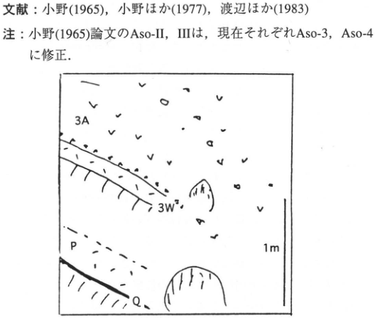
Show extracted lettering and translation
English translation of figure lettering
3A; 3W; P; Q; 1 m.
Original Japanese lettering
3A,3W,P,Q,1m。
Extracted lettering and translation Figure 3. Sketch of the basal portion of the Aso-3 tephra.
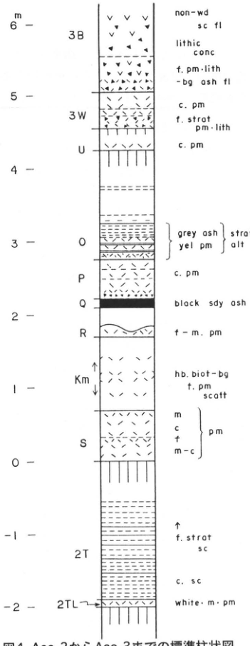
Show extracted lettering and translation
English translation of figure lettering
Scale in m: −2, −1, 0, 1, 2, 3, 4, 5, 6. From top: 3B: non-wd sc fl [unwelded scoria flow]; lithic conc [lithic concentration]; f. pm·lith -bg ash fl [fine pumice- and lithic-bearing ash flow]. 3W: c. pm [coarse pumice]; f. strat pm·lith [finely stratified pumice and lithics]. U: c. pm. O: grey ash/yel pm [yellow pumice], strat alt [stratified alternation]. P: c. pm. Q: black sdy ash [black sandy ash]. R: f–m. pm [fine to medium pumice]. Km: hb. biot-bg f. pm scatt [scattered hornblende- and biotite-bearing fine pumice]. S: m/c/f/m–c, pm [medium/coarse/fine/medium to coarse pumice]. 2T: ↑ f. strat sc [finely stratified scoria]; c. sc [coarse scoria]. 2TL: white·m·pm [white medium pumice].
Original Japanese lettering
スケールm:−2,−1,0,1,2,3,4,5,6。上から3B:non-wd sc fl;lithic conc;f. pm·lith -bg ash fl。3W:c. pm;f. strat pm·lith。U:c. pm。O:grey ash/yel pm,strat alt。P:c. pm。Q:black sdy ash。R:f–m. pm。Km:hb. biot-bg f. pm scatt。S:m/c/f/m–c,pm。2T:↑ f. strat sc;c. sc。2TL:white·m·pm。
Extracted lettering and translation Figure 4. Standard stratigraphic column from Aso-2 to Aso-3.
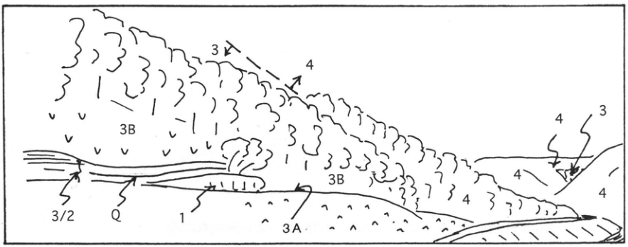
Show extracted lettering and translation
English translation of figure lettering
3 and 4 (repeated); 3B (twice); 3A; 3/2; Q; 1.
Original Japanese lettering
3,4(複数箇所);3B(2か所);3A;3/2;Q;1。
Extracted lettering and translation Figure 5. Sketch of the eastern side of this exposure.
[Original printed page: 59]
WS-15-2 Aso-3 tephra intercalated in the Toriyamahama Formation at Kawaminami in the northern Miyazaki Plain
Hiroshi Machida
Locality: Toriyama 2 (通山二), Kawaminami Town, Miyazaki Prefecture. Coordinates: N32°9′3″ E131°32′45″. Elevation: 21 m. Exposure and present condition: valley wall; extant. Deposits and age: ash and sand-silt beds; Late Pleistocene. Date described: March 1994. Keywords: Aso-3 tephra; Toriyamahama Formation; Kawaminami; Miyazaki Plain.
Quaternary valley-fill deposits have long been known in the Miyazaki Plain. Otsuka (1930, 1932) described transgressive deposits overlain by the Chausubaru terrace deposits and named them the Toriyamahama Formation. The surroundings of this exposure are its type area. Many subsequent interpretations of its stratigraphic position have been reported, some placing it below and others above the last-interglacial Sanzaibaru terrace. Identification of its tephras provides the key to this question. It may contribute not only to regional stratigraphic chronology but also to the history of glacio-eustatic sea-level change. Figure 1 schematically illustrates the relationships between terraces and tephras in the northern plain. This exposure is at the base of valley-fill deposits underlying the deposits forming the Nyutabaru II surface.
To approach the exposure, enter a small valley from the coast. A basal gravel of boulders cutting into the Miyazaki Group can first be observed on the left. This is thought to be a steep-gradient river deposit formed during regression. Above it, sand and gravel continue for about 4 m. Following the valley on the left upstream, the sand and gravel soon change abruptly to silt, containing a yellowish-brown ash bed about 50 cm thick. Nagaoka (1986) and Endo and Suzuki (1986) described this as the Torihama Pumice and Torihama Tuff Bed, respectively. Machida and Arai (1992, 1994) correlated it with Aso-3 on petrographic characteristics (Figure 3). Because Aso-3 erupted during oxygen isotope stage 5d (Machida and Arai, 1994), its identification means that the Toriyamahama Formation represents transgressive deposits from stage 5d to 5c. This suggests both a major regression during 5d and a major transgression during 5c (Figure 4). The elevation difference between the former Sanzaibaru terrace shoreline and the base of the Toriyamahama Formation (Figure 1) implies a sea-level fall of as much as 70 m from stage 5e to 5d (Machida and Arai, 1994).
Marine beds between Aso-3 and Aso-4 have recently been reported in the Kumamoto Plain, in a situation similar to this locality (Ishizaka et al., 1995). Marine beds have also been observed between Aso-3 and K-Tz in the Oita Plain (Ono et al., 1996). All are considered products of the last interglacial. Globally, however, the last interglacial is often restricted to oxygen isotope stage 5e, with 5c regarded as an interstadial. Many researchers consider the last glacial to have begun in 5d, because warming and sea-level rise in 5c were smaller than in 5e, and a cold interval is thought to have occurred in 5d. Such chronological interpretations are nevertheless not without problems. Future research must improve precision by rechecking the position of Aso-3 within oxygen isotope stratigraphy in marine cores and collecting more data on identification and environments of stage 5e marine beds in Kyushu. Although the distribution of widespread Aso-3 was described in Machida and Arai (1992, 1994), it has since been found that Aso-1 was incorrectly identified as Aso-3 at several localities on the Oga Peninsula and in the Sea of Japan.
References: Endo and Suzuki (1986); Ishizaka et al. (1995); Machida and Arai (1992, 1994); Machida et al. (1993); Nagaoka (1986); Otsuka (1930, 1932); Ono et al. (1996).
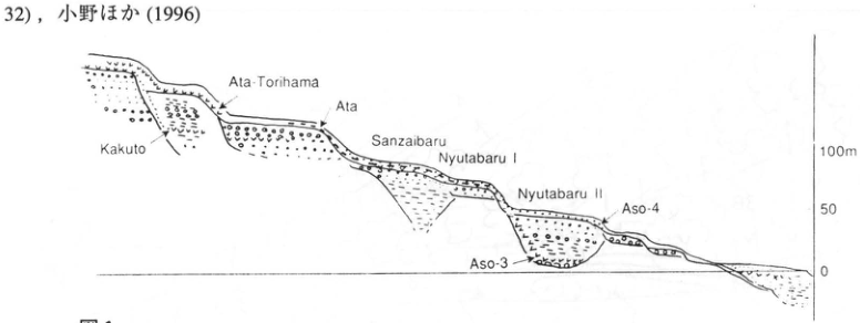
Show extracted lettering and translation
English translation of figure lettering
Kakuto; Ata-Torihama; Ata; Sanzaibaru; Nyutabaru I; Nyutabaru II; Aso-4; Aso-3. Elevation scale: 100 m, 50, 0.
Original Japanese lettering
Kakuto,Ata-Torihama,Ata,Sanzaibaru,Nyutabaru I,Nyutabaru II,Aso-4,Aso-3。標高スケール100m,50,0。
Extracted lettering and translation Figure 1. Relationships between terraces and marker tephras in the northern Miyazaki Plain (Kawaminami–Chausubaru), schematic (Machida and Arai, 1994).
[Original printed page: 60]
WS-15-2 (continued)
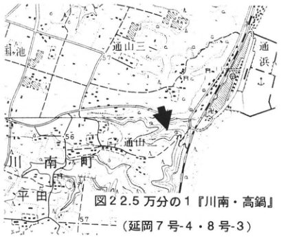
Show extracted lettering and translation
English translation of figure lettering
Figure 2. 1:25,000 Kawaminami and Takanabe (Nobeoka sheets 7-4 and 8-3). 針池; Toriyama 2; Torihama; Toriyama; Kawaminami Town; Hirata. Legible numbers: 57, 56, 57.
Original Japanese lettering
図2。2.5万分の1『川南・高鍋』(延岡7号-4・8号-3)。針池,通山二,通浜,通山,川南町,平田。可読数値57,56,57。
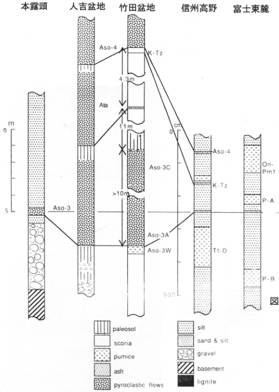
Show extracted lettering and translation
English translation of figure lettering
From left: this exposure; Hitoyoshi Basin; Taketa Basin; Takano, Shinshu; eastern foot of Fuji. Correlations and units: Aso-4; Ata; K-Tz (twice); Aso-3 (twice); Aso-3C; Aso-3A; Aso-3W; Tt-D; On-Pm1; P-A; P-B. Thicknesses: 4.3 m, 11 m, >10 m. Left scale in m: 0, 5; Takano scale in cm: 0, 500. Legend: paleosol; scoria; pumice; ash; pyroclastic flows; silt; sand & silt; gravel; basement; lignite.
Original Japanese lettering
左から:本露頭,人吉盆地,竹田盆地,信州高野,富士東麓。対比線・単位:Aso-4,Ata,K-Tz(2か所),Aso-3(2か所),Aso-3C,Aso-3A,Aso-3W,Tt-D,On-Pm1,P-A,P-B。厚さ:4.3m,11m,>10m。左スケールm:0,5;高野スケールcm:0,500。凡例:paleosol,scoria,pumice,ash,pyroclastic flows,silt,sand & silt,gravel,basement,lignite。
Extracted lettering and translation Figure 3. Stratigraphic columns centered on Aso-3 (partly modified from Machida and Arai, 1994).
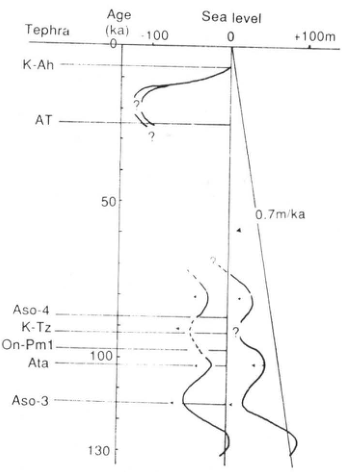
Show extracted lettering and translation
English translation of figure lettering
Tephra: K-Ah, AT, Aso-4, K-Tz, On-Pm1, Ata, Aso-3. Age (ka): 0, 50, 100, 130. Sea level: −100, 0, +100 m. 0.7 m/ka. ? (repeated).
Original Japanese lettering
Tephra:K-Ah,AT,Aso-4,K-Tz,On-Pm1,Ata,Aso-3。Age (ka):0,50,100,130。Sea level:−100,0,+100m。0.7m/ka。?(複数箇所)。
Extracted lettering and translation Figure 4. Sea-level change over the last 130,000 years reconstructed from tephra and terrace stratigraphy in the Miyazaki Plain.
[Original printed page: 61]
WS-16-1 Kutcharo pyroclastic-flow deposit IV south of Abashiri—The source area of Kutcharo-Haboro tephra
Koji Okumura
Locality: upper Onnenai River, Abashiri City, Hokkaido. Coordinates: N43°55′6″ E144°23′6″. Elevation: 90 m. Exposure and present condition: artificial exposure; extant. Deposits and age: pyroclastic-flow deposits and tephra fall; Late Pleistocene. Date described: June 1994. Keywords: Kutcharo pyroclastic-flow deposit IV; eastern Hokkaido; Kutcharo-Haboro tephra; Abashiri.
Kutcharo pyroclastic-flow deposit IV (KP IV) is the largest of ten pyroclastic-flow deposits originating from Kutcharo caldera. It extends across an area about 70 km in diameter centered on the caldera [abbreviations follow Okumura, 1991; K.P. flow IV: Katsui and Sato, 1963; Kutcharo 4, Kc-4: Machida and Arai, 1992]. Kutcharo-Haboro ash (Kc-Hb), widely distributed in central and eastern Hokkaido, is considered the co-ignimbrite ash of KP IV on the basis of its petrographic characteristics and stratigraphy (Okumura et al., 1985; Okumura, 1991). At the upper Onnenai River exposure one can observe KP IV, the subsequent Late Pleistocene KP III, II, and I eruptions, and intercalated fallout tephras. Light-gray KP IV in the lower half overlies KP V and pink ash as a single flow unit more than 15 m thick. Its basal 1–2 m often lack coarse pumice clasts, but are considered part of the pyroclastic flow; no fallout tephra unit is recognized. In their description of KP IV, Katsui and Sato (1969) placed it west of a line connecting Higashimokoto Village and Abashiri, with a separate Kutcharo debris-flow deposit (KS) to the east. One reason was that KP IV is white to orange-white and contains no scoria, whereas KS is generally grayish-white to grayish-purple, occasionally black on the Konsen Plain, and contains small amounts of scoria and banded pumice. However, their superpositional relationship has not been confirmed, and changes in facies and color are gradual. Their petrographic characteristics also agree closely. Thus, although parts may have been deposited as different flow units, KP IV and KS are considered products of a continuous eruption sequence (Okumura et al., 1985).
A soil bed 1–2 cm thick between KP II and KP III indicates that the two pyroclastic flows erupted with a brief time interval between them. Aso-4 ash, 15 cm thick, occurs below KP III. Fine ash containing accretionary lapilli also occurs at the base of KP II; comparing the two provides a useful understanding of the characteristics of distant widespread ash.
References: Katsui and Sato (1963); Machida and Arai (1992); Okumura (1991); Okumura et al. (1985).
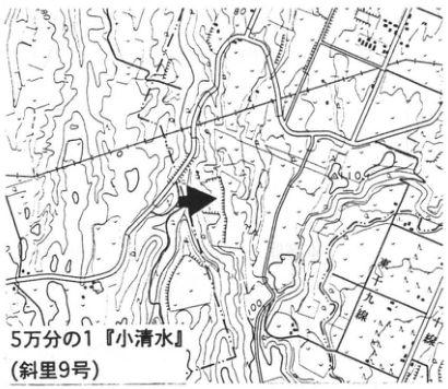
Show extracted lettering and translation
English translation of figure lettering
1:50,000 Koshimizu (Shari sheet 9). Legible numbers: 80, 100.
Original Japanese lettering
5万分の1『小清水』(斜里9号)。可読数値80,100。
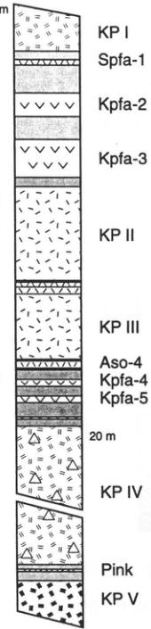
Show extracted lettering and translation
English translation of figure lettering
KP I; Spfa-1; Kpfa-2; Kpfa-3; KP II; KP III; Aso-4; Kpfa-4; Kpfa-5; 20 m; KP IV; Pink; KP V. Left-hand scale visible on the original PDF: 2 m, 1, 0.
Original Japanese lettering
KP I,Spfa-1,Kpfa-2,Kpfa-3,KP II,KP III,Aso-4,Kpfa-4,Kpfa-5,20m,KP IV,Pink,KP V。左スケールは原PDF側に2m,1,0。
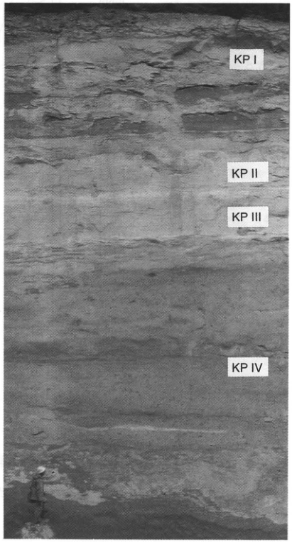
Show extracted lettering and translation
English translation of figure lettering
KP I; KP II; KP III; KP IV.
Original Japanese lettering
KP I,KP II,KP III,KP IV。
[Original printed page: 62]
WS-16-2 Kutcharo-Haboro and other marker tephras at Haboro, Hokkaido
Hiroshi Machida; Hideki Miura; Koji Okumura
Locality: Nakanotaki, Haboro Town, Hokkaido. Coordinates: N44°21′30″ E141°41′48″. Elevation: 20 m. Exposure and present condition: sea cliff; extant. Deposits: marine sand and gravel, ash, and peat. Date described: May 1984. Keywords: Kutcharo-Haboro tephra; Toya tephra; Aso-4 tephra; Tomamae terrace; Haboro.
The Haboro–Tomamae area on the Sea of Japan coast of northwestern Hokkaido has well-developed marine terraces and was formerly considered a reference area for Hokkaido’s marine terraces (Sakaguchi, 1959). This exposure lies at the top of the sea cliff of the Tomamae terrace. On this terrace, wave-cut-platform sand and gravel truncating Neogene basement are overlain by peat and then Holocene dune sand. Three widespread ash beds are intercalated in the peat. All are thin, but the middle one, Toya, is most conspicuous: 10 cm of grayish-white glassy ash. Coarse sand at the top of the sand and gravel bed occurs 170 cm below it. Close examination reveals patchy coarse grayish-white ash less than 5 cm thick within this sand. It comprises slightly colored bubble-wall glass and phenocrysts. Refractive indices of glass and orthopyroxene permit correlation with Kutcharo 4 pyroclastic flow (Kc-4), Kutcharo caldera’s largest Quaternary pyroclastic-flow deposit. Recognition that ash fall was produced during this eruption and also deposited west of the source led to naming it Kutcharo-Haboro tephra (Kc-Hb) after this exposure (Arai et al., 1986). Here it lies approximately at the emergence horizon. Since the former shoreline of the Tomamae terrace is about 35 m above sea level, this tephra erupted and accumulated after sea level had fallen more than 15 m from its maximum. Likewise, on the Kushiro terrace in eastern Hokkaido, Kc-4 flowed and accumulated after the marine terrace surface had emerged over a substantial area. Yano (1970) reported remains of Larix Gmelini from mud below Toya and inferred a cold climate 2–5 degrees cooler than today. This may correspond to oxygen isotope stage 5d. It is unclear whether this horizon lies between Toya and Kc-Hb or below Kc-Hb, but the peat below Kc-Hb is thin, so the former is probably the case.
Of the three widespread ashes, Aso-4 came from the greatest distance. It is glassy ash with a characteristic brownish coloration and can also be observed in the terrace cliff at the entrance to Tomamae Port. Thus, this exposure both suggests the widespread distribution of these glassy ashes and provides information on environmental change since oxygen isotope stage 5e, when the Tomamae terrace formed.
References: Sakaguchi (1959); Yano (1970); Arai et al. (1986); Machida and Arai (1992).
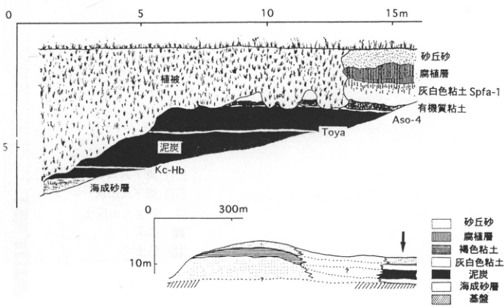
Show extracted lettering and translation
English translation of figure lettering
Upper section: vegetation cover; dune sand; humic layer; grayish-white clay, Spfa-1; organic clay; Aso-4; Toya; peat; Kc-Hb; marine sand. Horizontal scale: 0, 5, 10, 15 m; vertical: 0, 5. Lower section: horizontal 0, 300 m; vertical 10 m. Legend: dune sand; humic layer; brown clay; grayish-white clay; peat; marine sand; basement. Two question marks.
Original Japanese lettering
上図:植被,砂丘砂,腐植層,灰白色粘土 Spfa-1,有機質粘土,Aso-4,Toya,泥炭,Kc-Hb,海成砂層。水平0,5,10,15m;垂直0,5。下図:水平0,300m;垂直10m。凡例:砂丘砂,腐植層,褐色粘土,灰白色粘土,泥炭,海成砂層,基盤。疑問符2か所。
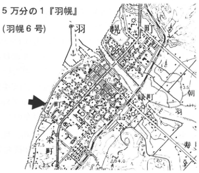
Show extracted lettering and translation
English translation of figure lettering
1:50,000 Haboro (Haboro sheet 6). Haboro Town; Saiwai Town; Midori Town; 朝羽; Sakae Town; 寿. Legible numbers: 7.0, 3.5, 26.6, 27.5, 25, 64.0, 40.
Original Japanese lettering
5万分の1『羽幌』(羽幌6号)。羽幌町,幸町,緑町,朝羽,栄町,寿。可読数値7.0,3.5,26.6,27.5,25,64.0,40。
[Original printed page: 63]
WS-16-3 Late Pleistocene widespread tephras at Atsuma, Hokkaido—Widespread tephras from Aso, Toya, and Kutcharo
Kotaro Yamagata
Locality: Karumai, Atsuma Town, Hokkaido. Coordinates: N42°39′48″ E141°54′00″. Elevation: 15 m. Exposure and present condition: artificial exposure; mostly covered by talus. Deposits and age: tephra fall; Late Pleistocene. Date described: June 1987. Keywords: Aso-4 tephra; Toya tephra; Kutcharo-Haboro tephra; Atsuma Formation.
This exposure lies in a terrace cliff. At its bottom is a silt bed named the Atsuma Formation by the Umaoi Collaborative Research Group (1983) and considered a last-interglacial deposit. Several fine-grained tephra beds are intercalated in the lower peat. These include three particularly important Late Pleistocene widespread tephras in Hokkaido: Aso-4, Toya, and Kutcharo-Haboro (Kc-Hb). Kc-Hb and Toya correspond to Atsuma ash-fall deposits 3 and 2 of Kasugai et al. (1980). All are fine-grained glassy ashes; Kc-Hb and Aso-4 contain abundant bubble-wall glass. Atsuma ash-fall deposit 1 (Aafa1) is correlated with Kuttara tephra 8 (Kt-8) from Kuttara volcano. Aso-4 is recognizable as orange fine ash immediately below the thick Kt-6 pumice-fall bed (Mpfa3).
For the overlying Mukawa pumice-fall deposits (Mpfa1–3) and Shikotsu pumice-fall deposits (Spfa1–10), see the Genbu and Shiomi Sanku entries (HK-22, HK-23) and Yamagata (1994). Similar sections can currently be seen at several nearby localities, including Genbu, Ninomiya, and Toyoshiro, but exposure conditions mean that no exposure presently allows all of Spfa1, Aso-4, Toya, and Kc-Hb to be observed.
References: Arai et al. (1986); Kasugai et al. (1980); Machida and Arai (1992); Machida et al. (1987); Umaoi Collaborative Research Group (1983); Yamagata (1994).
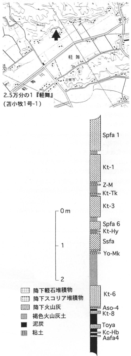
Show extracted lettering and translation
English translation of figure lettering
Map: 1:25,000 Karumai (Tomakomai sheet 1-1); Karumai; Karumai River; 正楽寺; legible numbers 30.0, 21, 1.5, 2. Column from top: Spfa1, Kt-1, Z-M, Kt-Tk, Kt-3, Spfa6, Kt-Hy, Ssfa, Yo-Mk, Kt-6, Aso-4, Kt-8, Toya, Kc-Hb, Aafa4. Scale: 0 m, 1, 2. Legend: pumice-fall deposit; scoria-fall deposit; ash fall; brown volcanic-ash soil; peat; clay.
Original Japanese lettering
地図:2.5万分の1『軽舞』(苫小牧1号-1);軽舞,軽舞川,正楽寺;可読数値30.0,21,1.5,2。柱状図上から:Spfa1,Kt-1,Z-M,Kt-Tk,Kt-3,Spfa6,Kt-Hy,Ssfa,Yo-Mk,Kt-6,Aso-4,Kt-8,Toya,Kc-Hb,Aafa4。スケール0m,1,2。凡例:降下軽石堆積物,降下スコリア堆積物,降下火山灰,褐色火山灰土,泥炭,粘土。
[Original printed page: 64]
WS-17-1 Ata-Torihama tephra at Onejime on the Osumi Peninsula
Hiroshi Machida
Locality: Nakanishi, Onejime Town, Kagoshima Prefecture. Coordinates: N31°13′42″ E130°47′19″. Elevation: 30 m. Exposure and present condition: former excavation for earth and gravel; probably extant. Deposits and age: pumice fall and pyroclastic-flow deposits; 230–250 ka. Date described: March 1993. Keywords: Ata-Torihama tephra; Onejime.
The Torihama pyroclastic-flow deposit described on the Satsuma and Osumi peninsulas (Ui, 1971) is one of the large pyroclastic flows recognized at various localities in southern Kyushu. Its co-ignimbrite ash has also come to be identified throughout Honshu (Machida and Arai, 1992). This is one of the exposures closest to the source vent, where pumice fall and pyroclastic-flow deposits divided into several units can be observed. The middle flow unit contains andesite boulders, particularly somewhat rounded ones, at its base, suggesting that the eruption occurred on the nearby seafloor. At the ■ locality in Figure 1, the pyroclastic flow erodes the pumice fall and has basal rounded gravel thought to have lain on a shallow seafloor, with pyroclastic-surge deposits in its upper portion. Huge pumice clasts also occur in the pyroclastic-flow deposit across the bay on the Satsuma Peninsula. This distribution suggests a source within the conventionally defined Ata caldera, offshore Ibusuki, probably closer to the Satsuma Peninsula than the principal Ata tephra vent. This eruption sequence is called Ata-Torihama tephra (Ata-Th).
The tephra is biotite-bearing orthopyroxene-hornblende rhyolite containing some quartz. Southern Kyushu tephras with similar mineral assemblages include Hiwaki and Koseda, the latter considered to originate from Kikai caldera. They can be distinguished by differing refractive indices of orthopyroxene and hornblende. Glass in the co-ignimbrite ash is high-silica and of bubble-wall type. Considering its stratigraphic occurrences across Honshu, this tephra probably erupted during the transition from oxygen isotope stage 8 to 7, while sea level was still considerably low (Machida and Arai, 1992).
References: Machida and Arai (1992); Ui (1971).
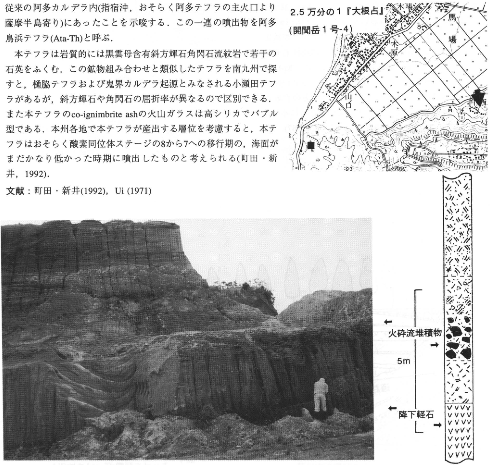
Show extracted lettering and translation
English translation of figure lettering
Map: 1:25,000 Onejime (Kaimondake sheet 1-4); 木場; 木原; 馬場; 山口; legible numbers 40, 61.0, 93. Column: pyroclastic-flow deposit; pumice fall; 5 m. No legible annotations within the photograph.
Original Japanese lettering
地図:2.5万分の1『大根占』(開聞岳1号-4);木場,木原,馬場,山口;可読数値40,61.0,93。柱状図:火砕流堆積物,降下軽石,5m。写真自体に可読注記なし。
[Original printed page: 65]
WS-17-2 Ata-Torihama tephra and overlying tephras in the southwestern Miyazaki Plain
Shinji Nagaoka
Locality: Kamamuta, Aya Town, Miyazaki Prefecture. Coordinates: N31°59′17″ E131°11′43″. Elevation: 210 m. Exposure: road cutting. Deposits and age: wind-deposited tephra; Middle to Late Pleistocene. Date described: January 1996. Keywords: Kukino Gravel; Ata-Torihama tephra; Miyazaki Plain.
Middle Pleistocene fluvial terraces, including Chausubaru, Kukino, Higashibaru, and Shiibaru, are developed along the western and southwestern margins of the Miyazaki Plain (Nagaoka, 1986). Of these, the Kukino terrace in the southwestern plain is thickly covered by Middle Pleistocene to Holocene tephras deposited since the Kakuto pyroclastic-flow deposit (Nagaoka, 1984), providing a locality for confirming stratigraphic relationships among the principal southern Kyushu tephras. Here one can observe the tephras covering the Kukino Gravel (high-level terrace deposits; Noi, 1987). The lowermost Ata-Torihama tephra (Ata-Th; 230–250 ka) is a grayish-white, weathered, unwelded pyroclastic-flow deposit. Above it, the following can be identified: Kamamuta tephra (scoria) I (Km-I), II (Km-II), and III (Km-III); Ata; Kikai-Tozurahara (K-Tz); Aira-Fukuyama (A-Fk); Aya (Ay); Aira-Iwato (A-Iw); and Kirishima-Iwaokoshi (Kr-Iw). All except Ata are fallout tephras. Most are weathered and somewhat difficult to recognize, but Ata-Th and A-Fk, the latter yellowish-white fine-grained pumice containing hornblende, are conspicuous and serve as good marker beds. Tephras above Kr-Iw have been eroded here but can be seen where flat plateau surfaces are developed nearby. In the central part of the plateau south of the exposure, Kakuto tephra (Kkt), and also Kobayashi tephra (Kb-Ks; pyroclastic flow and pumice fall), can be identified within the Kukino Gravel (Noi, 1987).
References: Nagaoka (1984, 1986); Noi (1987).
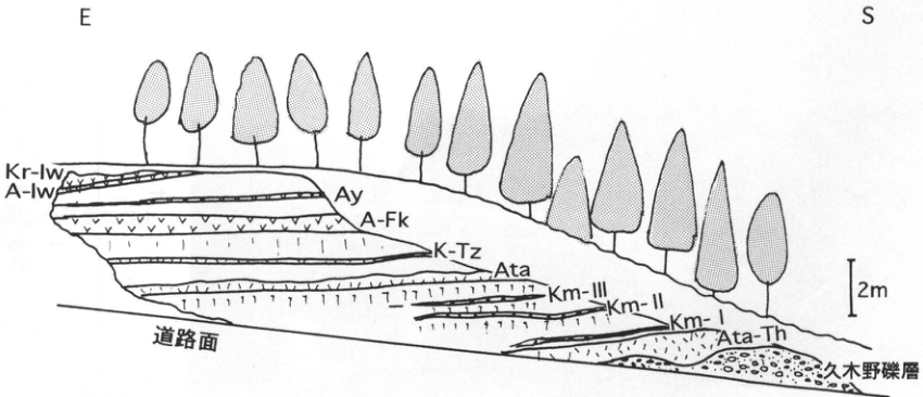
Show extracted lettering and translation
English translation of figure lettering
Directions: E, S. Kr-Iw; A-Iw; Ay; A-Fk; K-Tz; Ata; Km-III; Km-II; Km-I; Ata-Th; Kukino Gravel; road surface. 2 m.
Original Japanese lettering
方位E,S。Kr-Iw,A-Iw,Ay,A-Fk,K-Tz,Ata,Km-III,Km-II,Km-I,Ata-Th,久木野礫層,道路面。2m。
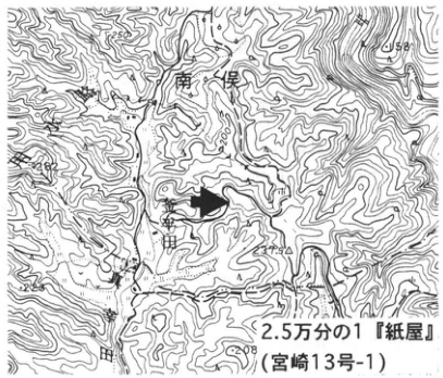
Show extracted lettering and translation
English translation of figure lettering
1:25,000 Kamiya (Miyazaki sheet 13-1). 南俣; Kamamuta; 米田. Legible numbers: 202, 258, 225, 208.
Original Japanese lettering
2.5万分の1『紙屋』(宮崎13号-1)。南俣,釜牟田,米田。可読数値202,258,225,208。
[Original printed page: 66]
WS-17-3 Stratigraphic position of Ata-Torihama tephra in the Oiso Hills, southern Kanto
Takehiko Suzuki
Locality: Soga-Osawa, Odawara City, Kanagawa Prefecture. Coordinates: N36°58′53″ E139°10′35″ [as printed]. Elevation: 75 m. Exposure: natural exposure along a stream. Deposits and age: tephra fall and fine-grained glassy ash bed; Middle Pleistocene. Date described: March 1990. Keywords: Oiso Hills; Ata-Torihama tephra; beige tuff; upper Tama C tephra group; Tama Loam Formation.
Clarifying the stratigraphic position of Ata-Torihama tephra (Ata-Th) in the Oiso Hills was extremely important in determining its eruption age. The corresponding tephra was initially called beige tuff by Mori et al. (1982), who described it as a concentration zone of bubble-wall glass immediately below Tm-5 (Uesugi, 1976) in two small streams in the western Oiso Hills, A Stream and Magassawa (曲沢). Suzuki and Hayatsu (1991) established the petrographic characteristics of beige tuff and used these to show its correlation with Ata-Th from Ata caldera, southern Kyushu. At Oiso, Ata-Th lies below Tm-5, or TCu-3 (Machida et al., 1974), and above TCu-2. These relationships with Hakone-derived tephras and fission-track ages of other tephras suggested an Ata-Th eruption age of about 240 ka, around oxygen isotope stage 7 (Suzuki and Hayatsu, 1991). The lower-left figure shows the A Stream exposure. Both there and at Magassawa, it is a glassy fine ash bed 8–10 cm thick that can clearly be recognized in the field. At both sites, however, faults and fluvial gravel obscure its relationships with adjacent tephras. In contrast, tephras from TCu-1 to around TCu-4 are exposed in orderly succession in a tributary stream of the Kiku River to the north (■ locality). Volcanic-ash soil concentrated with Ata-Th glass has been confirmed between TCu-2 and TCu-3, between Tm-3 and Tm-4 of Uesugi (1976) (lower-right figure). Ata-Th here does not form a bed and is difficult to identify visually. In the classical Tama Loam stratigraphy of the Tama Hills, Ata-Th occupies an intermediate position between TCu-1 (Doran Pumice) and TB-1 (Bireley’s Pumice) within the Tama Loam above the Oshinuma Sand and Gravel.
References: Machida et al. (1974); Mori et al. (1982); Suzuki and Hayatsu (1991); Uesugi (1976).
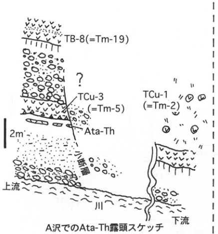
Show extracted lettering and translation
English translation of figure lettering
TB-8 (=Tm-19); ?; TCu-3 (=Tm-5); Ata-Th; TCu-1 (=Tm-2); fault; upstream; river; downstream; 2 m. Sketch of the Ata-Th exposure at A Stream.
Original Japanese lettering
TB-8 (=Tm-19),?,TCu-3 (=Tm-5),Ata-Th,TCu-1 (=Tm-2),断層,上流,川,下流,2m。A沢でのAta-Th露頭スケッチ。
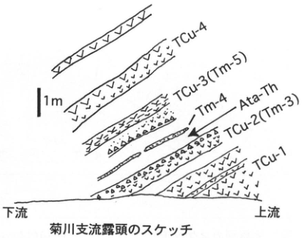
Show extracted lettering and translation
English translation of figure lettering
TCu-4; TCu-3 (Tm-5); Tm-4; Ata-Th; TCu-2 (Tm-3); TCu-1; downstream; upstream; 1 m. Sketch of the Kiku River tributary exposure.
Original Japanese lettering
TCu-4,TCu-3 (Tm-5),Tm-4,Ata-Th,TCu-2 (Tm-3),TCu-1,下流,上流,1m。菊川支流露頭のスケッチ。
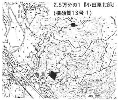
Show extracted lettering and translation
English translation of figure lettering
1:25,000 Northern Odawara (Yokosuka sheet 13-1). 川原; Soga-Osawa; 井窪. Legible numbers: 130, 184, 193.4, 105, 83.
Original Japanese lettering
2.5万分の1『小田原北部』(横須賀13号-1)。川原,曽我大沢,井窪。可読数値130,184,193.4,105,83。
[Original printed page: 67]
WS-18-1 Aso-1 pyroclastic flow in central Taketa, Oita Prefecture—Aso-1, Aso-3/4 tephras, Imaichi, Takajomachi, and other pyroclastic flows
Koji Ono
Locality: cliff behind the martial-arts hall of Prefectural Taketa High School, Taketa, Taketa City, Oita Prefecture. Coordinates: N32°57′56″ E131°24′02″. Elevation: 250 m. Exposure and present condition: artificial exposure; extant, partly covered. Deposits and age: chiefly pyroclastic-flow deposits; Early to Late Pleistocene. Date described: February 1996. Keywords: Imaichi; Takajomachi; Aso-1; Aso-3; and Aso-4 pyroclastic flows.
Central Taketa lies near the eastern end of the pyroclastic plateau east of Aso caldera, where the Inaba, Tamara, and main Ono rivers and others converge in a fan-shaped pattern from the west. Thus many pyroclastic-flow deposits, including Imaichi, Aso-1, Aso-3, and Aso-4, here of valley-fill type, can be observed in a concentrated area. This exposure lies behind the former Taketa High School playing field, with the Inaba River on the left (site G in Figure 1). Much is covered by bamboo grass, obscuring most contacts, but the relative positions of the units are clear (Figure 2). At the bottom is the Imaichi pyroclastic-flow deposit (hereafter “deposit” is omitted), an unwelded pale-brown pumice flow, an unusual facies for Imaichi. Above and to its right are right-dipping Aso-1 welded tuff (described below) and the Aso-2T scoria-fall bed. Above these, Aso-3 extends to the summit on the right. Aso-4 welded tuff covers the left slope; at the summit its contact with Aso-3 is nearly vertical. Welding increases abruptly leftward from about 10 cm of yellow unwelded glassy ash, and the lamination changes from vertical to gently dipping. Going around behind the right side leads to the school playing field. A cutting on its eastern side provides a good section of Aso-3 from its base. The unwelded basal scoria flow forms a smooth slope, while the welded upper portion forms a vertical wall with columnar joints. The Aso-4/Aso-3 contact in Figure 2 is clearly controlled by the shape of this weathered Aso-3 surface. The Aso-4 welded tuff dipping toward the present valley here is a section through its cover of the pre-Aso-4 valley wall.
A small pedestrian tunnel is across the road in front of the school’s main gate. Passing through it leads to a Takajomachi pyroclastic-flow exposure on the right (site T on the map). It is white unwelded biotite-rhyolite pumice flow, between the Imaichi and Aso-1 flows. The nearby Inaba riverbed is chiefly red welded tuff in the vapor-phase crystallization zone of Imaichi. Aso-4 welded tuff is exposed at some points where the river crosses old channels filled by Aso-4. Here it is harder than Imaichi welded tuff, making the riverbed slightly higher.
The Aso-1 pyroclastic flow forms the lower part of the pyroclastic plateau around Aso caldera, and central Taketa is near the eastern margin of its present exposure. The facies of its strongly welded portion closely resemble those of underlying Imaichi, and sometimes it can be distinguished from reversely magnetized Imaichi only by the direction of magnetization.
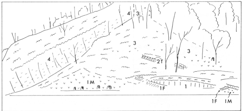
Show extracted lettering and translation
English translation of figure lettering
1; 3 (repeated); 4 (twice); 2T; IM (twice); 1F (twice).
Original Japanese lettering
1,3(複数箇所),4(2か所),2T,IM(2か所),1F(2か所)。
Extracted lettering and translation Figure 2. Sketch of this exposure. 1–4: Aso-1–Aso-4; IM: Imaichi tephra; 1F: Aso-1 fallout tephra; 2T: Aso-2 scoria fall.
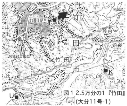
Show extracted lettering and translation
English translation of figure lettering
Figure 1. 1:25,000 Taketa (Oita sheet 11-1). G, T, K, U; Taketa Town; Taketa City; 渡辺; Inaba River; Taketa River. Legible numbers: 238, 322, 250.
Original Japanese lettering
図1。2.5万分の1『竹田』(大分11号-1)。G,T,K,U;竹田町,竹田市,渡辺,稲葉川,竹田川。可読数値238,322,250。
[Original printed page: 68]
WS-18-1 (continued)
Aso-1 welded tuff is thin but strongly welded, pinching out as a lens toward the upper left and accompanied below by white to pink Plinian pumice and ash. Most Aso-1 exposed in central Taketa has a facies similar to that here. Figure 3 shows a column of the exposure in front of the service gate south of Taketa High School, now concealed by concrete. Products of the Aso-1 cycle (A–D) are 2 m+ thick, with the upper surface unexposed; an upper unwelded portion, if present, was probably thin. A is yellowish-gray pumice fall. B also appears to be fallout, alternating black sandy ash with pinkish-white sand-sized pumice. C and D are pyroclastic-flow deposits. C is probably a surge deposit: unwelded, composed almost entirely of dark-brown sandy glassy ash, indistinctly stratified, with thin crystal-rich beds. D becomes abruptly welded above C, grading within about 30 cm into dark-brown dense glassy welded tuff. Its upper portion is reddish-brown from high-temperature oxidation, a color characteristic of the Aso-1 surface. Ellipsoidal black glassy juvenile lenses are small in the lower welded tuff but large and conspicuous above. Below Aso-1, separated by weathered soil, is the weathered surface portion of the Takajomachi pyroclastic flow. Exposures of this Aso-1 facies are distributed throughout the town, including localities south of Namese Bridge (site K on the map), as much as 50 m above the Ono riverbed, where they overlie Imaichi.
Aso-1 forms bedrock in the riverbed downstream on the right bank of Uozumi Dam (site U on the map). Valley-filling Aso-4 welded tuff overlies it across a clay bed containing gravel from riverbed deposits. Aso-1 here and nearby differs markedly in facies from the thin sections described above. It is several meters or more thick, with the lower part unexposed: dense, devitrified, purplish dark-gray welded tuff, extremely hard, probably owing to devitrification. It conspicuously contains flattened juvenile lenses and foreign lithic fragments. From the relative positions and facies, Aso-1 near site U is a thick deposit in the principal channel, filling a valley more than 50 m deep cut into Imaichi. The thin, often inclined, lens-shaped deposits that pinch out probably represent the wings along the valley walls.
Reference: Ono et al. (1977).
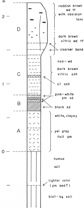
Show extracted lettering and translation
English translation of figure lettering
m: 0, 1, 2. D: reddish brown wd tf with obsidian lens [reddish-brown welded tuff with obsidian lenses]; dark brown vitric wd tf [dark-brown glassy welded tuff]; coarser band. C: non-wd dark brown vitric ash [unwelded dark-brown glassy ash]; xl ash [crystal ash]. B: pink-white pm sd [pinkish-white pumice sand]; black sd [black sand]. A: white, clayey; yel gray fall pm [yellowish-gray pumice fall]. Below: humus soil; lighter color (pm bed?) [pumice bed?]; biot-bg soil [biotite-bearing soil].
Original Japanese lettering
m:0,1,2。D:reddish brown wd tf with obsidian lens;dark brown vitric wd tf;coarser band。C:non-wd dark brown vitric ash;xl ash。B:pink-white pm sd;black sd。A:white, clayey;yel gray fall pm。下位:humus soil;lighter color (pm bed?);biot-bg soil。
Extracted lettering and translation Figure 3. Standard stratigraphic column showing the Aso-1 horizon.
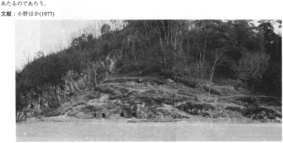
[Original printed page: 69]
WS-18-2 Fine-grained glassy tephra at the eastern foot of Yatsugatake potentially correlatable with Aso-1
Takehiko Suzuki
Locality: Kawadaira, Minamimaki Village, Nagano Prefecture. Coordinates: N36°1′27″ E138°31′10″. Elevation: 1,150 m. Exposure: natural exposure on a terrace-cliff slope. Deposits and age: wind-deposited tephra and fine-grained glassy ash bed; Middle Pleistocene. Date described: July 1995. Keywords: eastern foot of Yatsugatake; Aso-1 tephra; Nuka 4.
Numerous wind-deposited tephra beds from Yatsugatake volcano accumulated at its eastern foot in central Japan. Several intercalated tephras consist principally of fine glass and appear to have arrived from distant volcanoes rather than Yatsugatake. These glassy ash beds were described by the Yatsugatake Collaborative Research Group (1988), Suzuki and Hayakawa (1990), Yoshikawa et al. (1990), and others. Nuka 4 of Suzuki and Hayakawa (1990) is a fine-grained glassy ash bed 20 cm thick, somewhat above Kakuto tephra (Kkt; ca. 300 ka; Machida and Arai, 1992; see WS-19-4) and the Omachi APm tephra group (300–350 ka; Suzuki and Hayakawa, 1990). Yoshikawa (1990) correlated it with Aso-1 (Ono et al., 1977). Exposures also occur around Kawadaira and in Kawakami Village farther upstream on the Chikuma River, but conditions are deteriorating as they become buried by talus and so forth. The exposure introduced here is difficult to find on a terrace-cliff slope, but should remain preserved for some time.
It is on a forest-covered mountain slope about 250 m west of Kawadaira village, at the top of a natural exposure about 3.5 m high. It is immediately overlain by Lw.O.P (Yatsugatake Research Group, 1988). Nuka 3, a glassy ash bed 2 cm thick, occurs 10.5 cm below it. Nuka 3 has characteristics closely resembling Nuka 4, including the refractive index of glass, leaving interesting questions about their relationship.
References: Yoshikawa (1990); Suzuki and Hayakawa (1990); Machida and Arai (1992); Ono et al. (1977); Yatsugatake Research Group (1988).
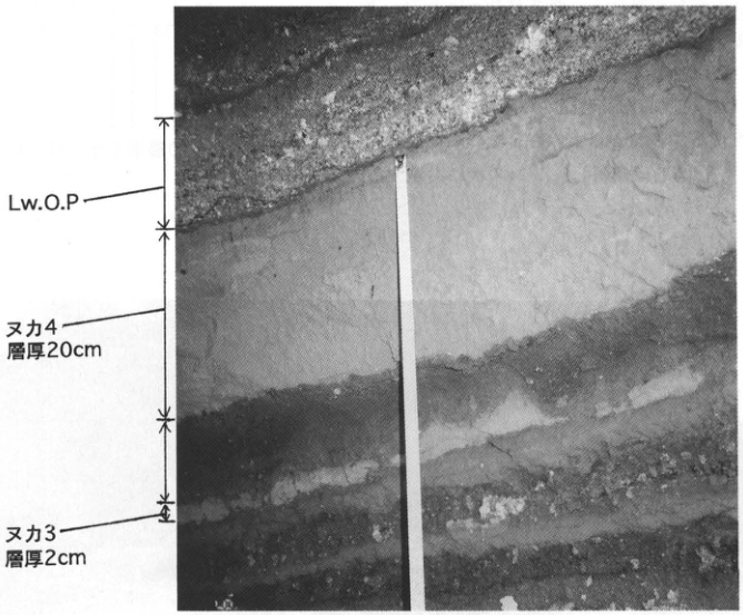
Show extracted lettering and translation
English translation of figure lettering
Lw.O.P; Nuka 4, thickness 20 cm; Nuka 3, thickness 2 cm.
Original Japanese lettering
Lw.O.P,ヌカ4 層厚20cm,ヌカ3 層厚2cm。
Extracted lettering and translation Photographed in May 1995.
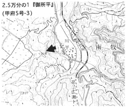
Show extracted lettering and translation
English translation of figure lettering
1:25,000 Goshodaira (Kofu sheet 5-3). Kawadaira; Minamimaki Village; Hirose. Legible numbers: 1156, 1150, 1207.
Original Japanese lettering
2.5万分の1『御所平』(甲府5号-3)。川平,南牧村,広瀬。可読数値1156,1150,1207。
[Original printed page: 70]
WS-19-1 Ng-1 ash, a Middle Pleistocene widespread tephra in the Udo Hills, Shizuoka Prefecture
Kiyohide Mizuno
Locality: north of Ago (安居), Shizuoka City. Coordinates: N34°57′36″ E138°27′40″. Elevation: 50 m. Exposure and present condition: valley wall; extant. Deposits and age: marine beds; Middle Pleistocene, about 300 ka. Date described: January 1996. Keywords: Ng-1 ash; Negoya Formation; Udo Hills.
Ng-1 ash is a widespread tephra distributed in southwestern Japan, thought to have erupted from a volcano near the Northern Alps about 300 ka (Mizuno and Yoshikawa, 1991). Its type locality is in the Udo Hills, and it was named by Kondo (1985). The tephra is intercalated in marine to alluvial-fan deposits called the Negoya Formation, whose stratigraphy was described in detail by Kondo (1985). To reach this exposure, follow the stream west of Ago village northward for about 600 m, then enter an eastern tributary stream for about 50 m; a small check dam lies before the branch. Ng-1 is intercalated in alternating silt, sand, and gravel. Thick gravel is developed from about 5 m above the ash upward. The type locality of Kondo (1985) lies in the next stream to the north. Here Ng-1 is about 30 cm thick, consisting of grayish-white fine-grained glassy ash; the upper approximately 20 cm appears reworked. Petrographic characteristics are described in detail by Mizuno and Yoshikawa (1991).
References: Kondo (1985); Mizuno and Yoshikawa (1991).
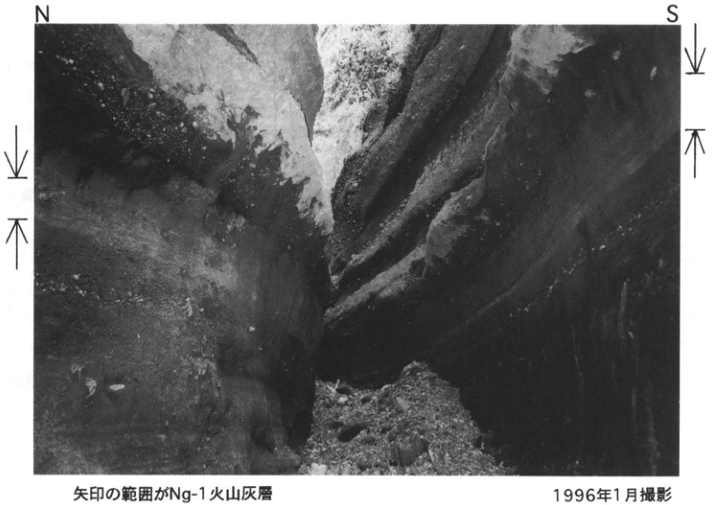
Show extracted lettering and translation
English translation of figure lettering
N; S. The interval between the arrows is the Ng-1 ash bed. Photographed in January 1996.
Original Japanese lettering
N,S。矢印の範囲がNg-1火山灰層。1996年1月撮影。
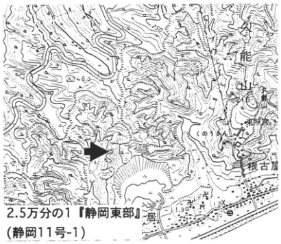
Show extracted lettering and translation
English translation of figure lettering
1:25,000 Eastern Shizuoka (Shizuoka sheet 11-1). Kunozan; Negoya; Ago; Toshogu Shrine. Legible numbers: 246, 250, 50, 11.9, 12.
Original Japanese lettering
2.5万分の1『静岡東部』(静岡11号-1)。久能山,根古屋,安居,東照宮。可読数値246,250,50,11.9,12。
[Original printed page: 71]
WS-19-2 Ng-1 (Nomura 2) ash, a widespread tephra in high-level terrace deposits of the Nomura Basin, Ehime Prefecture
Kiyohide Mizuno
Locality: Ota, Nomura Town, Higashiuwa District, Ehime Prefecture. Coordinates: N33°21′36″ E132°39′4″. Elevation: 160 m. Exposure and present condition: artificial exposure; extant? Deposits and age: freshwater beds; Middle Pleistocene. Keywords: Nomura Basin; Ng-1 ash; high-level terrace.
Kashima et al. (1982) reported two tephras intercalated in the highest terrace deposits along the Uwa River at Nomura, Ehime Prefecture. Mizuno and Yoshikawa (1991) named them Nomura 1 and Nomura 2 in ascending order and correlated the lower tephra with Kakuto and the upper with Ng-1. Ng-1 is a widespread tephra thought to have erupted near the Northern Alps about 300 ka (Mizuno and Yoshikawa, 1991); this exposure is at the western end of its known distribution. The Nomura 2 ash bed, correlated with Ng-1, lies midway up the exposure and consists of about 50 cm of grayish-white glassy ash. Detailed examination distinguishes about six layers, possibly including portions reworked by water flow. Fine heavy-mineral grains can be seen scattered through it. About 5 m below is the glassy Nomura 1 ash bed, approximately 40 cm thick. An exposure slightly farther north contains peat with fossil wood at a horizon between the two tephras. Warm-climate taxa such as the evergreen-oak subgenus and the tung-tree genus occur mixed with Sawara cypress and the fir genus. About two carbonaceous silt beds also occur above Nomura 2; a spruce-genus cone, inferred to have fallen from them, was found nearby. All identifications are by 百原新 of Chiba University.
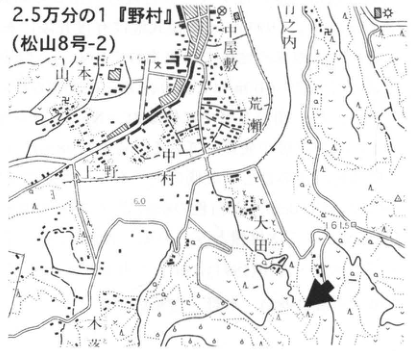
Show extracted lettering and translation
English translation of figure lettering
1:25,000 Nomura (Matsuyama sheet 8-2). 山本; 中屋敷; 荒瀬; 中ノ村; Nomura; Ota. Legible numbers: 60, 61.5.
Original Japanese lettering
2.5万分の1『野村』(松山8号-2)。山本,中屋敷,荒瀬,中ノ村,野村,大田。可読数値60,61.5。
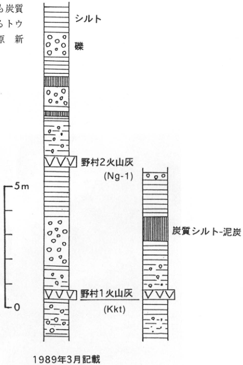
Show extracted lettering and translation
English translation of figure lettering
Silt; gravel; Nomura 2 ash (Ng-1); carbonaceous silt–peat; Nomura 1 ash (Kkt). Scale: 5 m, 0. Described in March 1989.
Original Japanese lettering
シルト,礫,野村2火山灰(Ng-1),炭質シルト-泥炭,野村1火山灰(Kkt)。スケール5m,0。1989年3月記載。
References: Kashima et al. (1982); Mizuno and Yoshikawa (1991).
[Original printed page: 72]
WS-20-1 Kakuto tephra in the Hitoyoshi Basin
Hiroshi Machida
Locality: Yamashita, Nishiki Town, Kumamoto Prefecture. Coordinates: N32°13′20″ E130°49′45″. Elevation: 150 m. Exposure and present condition: cliff cut for farmland development; probably extant. Deposits: wind-deposited tephra and pyroclastic-flow deposits. Date described: March 1993. Keywords: Kakuto tephra; Kakuto pyroclastic-flow deposit; Hitoyoshi Basin.
Pyroclastic-flow deposits formerly called Upper Kakuto, Shinkawa, Inuzako, Haginomoto, Chikuri, and other names according to locality and researcher across southern Kyushu are the same bed: a large Middle Pleistocene pyroclastic flow originating from Kakuto caldera (Machida and Arai, 1992). Kakuto tephra (Kkt) has no associated pumice fall and consists of pyroclastic-flow deposits and their co-ignimbrite ash. It commonly forms welded tuff in the Hitoyoshi Basin, but here is a weathered, unwelded pyroclastic-flow deposit. At this exposure Aso-4 and Aira-Ito (A-Ito) overlie it across a major erosional surface. At another nearby exposure, now destroyed, Ata and Aso-3 deposits also overlie it. In the Kogashira area of northern Kagoshima City, it lies below the Ata-Torihama pyroclastic-flow deposit (WS-20-2).
This tephra is pyroxene rhyolite, characterized by bubble-wall glass with a refractive index of 1.500–1.502, darkly colored here perhaps by high-temperature oxidation, and orthopyroxene with a somewhat high refractive index. Glassy ash with these characteristics has come to be recognized widely in Kyushu and Honshu, establishing that this eruption produced co-ignimbrite ash (Machida and Arai, 1992). Its stratigraphic occurrence clearly corresponds to the transgression of the major interglacial two cycles before oxygen isotope stage 5e. Considering radiometric ages and relationships with other tephras in central Japan, at the eastern foot of Yatsugatake, its eruption age is thought to be slightly older than about 300 ka, within oxygen isotope stage 9.
Reference: Machida and Arai (1992).
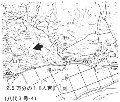
Show extracted lettering and translation
English translation of figure lettering
1:25,000 Hitoyoshi (Yatsushiro sheet 3-4). 野間; Yamashita; 滝の水; 一野間; 山川. Legible numbers: 172, 156, 125.
Original Japanese lettering
2.5万分の1『人吉』(八代3号-4)。野間,山下,滝の水,一野間,山川。可読数値172,156,125。
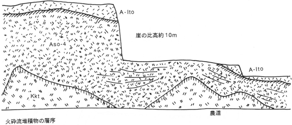
Show extracted lettering and translation
English translation of figure lettering
A-Ito (twice); Aso-4; Kkt; cliff relief approximately 10 m; farm road. Stratigraphy of the pyroclastic-flow deposits.
Original Japanese lettering
A-Ito(2か所),Aso-4,Kkt,崖の比高約10m,農道。火砕流堆積物の層序。
[Original printed page: 73]
WS-20-2 Large pyroclastic-flow deposits, including Kakuto and Hiwaki, at Kogashira, Kagoshima City
Hiroshi Machida
Locality: Kogashira, Kagoshima City. Coordinates: N31°39′03″ E130°30′40″. Elevation: 80–100 m. Exposure and present condition: quarry; extant. Deposits and age: pyroclastic-flow deposits and pumice fall; Middle Pleistocene. Date described: March 1969; 1994. Keywords: Kakuto tephra; Hiwaki tephra; Kogashira.
Around Kogashira in northern Kagoshima City, Early to Middle Pleistocene pyroclastic-flow deposits have been described together with marine beds (Oki and Hayasaka, 1970; Oki, 1974; and others). Their upper beds can be observed together at this exposure. Since this is an active quarry, the exposure changes continually. As shown, conspicuous welded tuffs occur in its upper and lower parts. Formerly called Inuzako above and Shimokado below, these correspond respectively to Kakuto (Kkt) and Hiwaki (Hw) pyroclastic-flow deposits. Valley-filling Kkt is a pyroxene-rhyolite deposit with basal breccia and an unwelded portion, truncated above by sand and gravel. At the ■ locality on the topographic map, Ata-Torihama overlies Kkt.
Hw overlies sand and gravel and is pyroxene-hornblende rhyolite; its strongly welded portion is used as building stone. Between Hw and Kkt are reworked Hw and another unnamed pyroclastic-flow deposit bounded above and below by red soils now unexposed. The intervening time was therefore probably considerable. Horizontal joints in strongly welded Hw are filled with unwelded ash. This ash differs lithologically from Hw and resembles the unnamed deposit above, so it probably entered the joints during that eruption.
Hw is also called the Lower Kakuto pyroclastic-flow deposit (Miyachi, 1987). Like Kkt, it erupted from Kakuto caldera and covers southern Kyushu widely. Its eruption age has been measured at 500–600 ka by fission-track dating. Finding ash fall formed during this eruption would clarify its chronological significance further.
Pyroclastic-flow deposits below Hw, including Kamagahara and Keno, and the marine Kogashira Formation can be observed in the Oyamada district to the west and at Kenoguchi to the south.
References: Machida and Arai (1992); Miyachi (1987); Oki (1974); Oki and Hayasaka (1970).
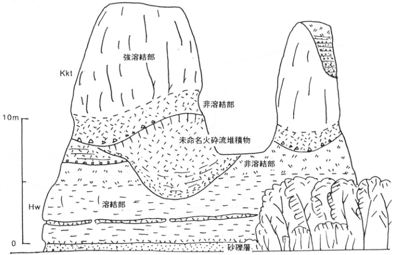
Show extracted lettering and translation
English translation of figure lettering
Kkt; strongly welded portion; unwelded portion (twice); unnamed pyroclastic-flow deposit; Hw; welded portion; sand and gravel. Scale: 10 m, 0.
Original Japanese lettering
Kkt,強溶結部,非溶結部(2か所),未命名火砕流堆積物,Hw,溶結部,砂礫層。スケール10m,0。
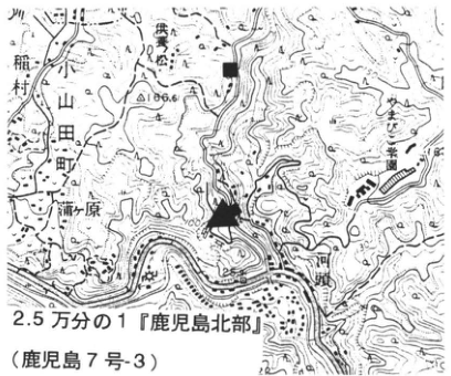
Show extracted lettering and translation
English translation of figure lettering
1:25,000 Northern Kagoshima (Kagoshima sheet 7-3). Oyamada Town; 稲村; 川田; 柿原; 柳瀬. Legible numbers: 186.6, 100, 200.
Original Japanese lettering
2.5万分の1『鹿児島北部』(鹿児島7号-3)。小山田町,稲村,川田,柿原,柳瀬。可読数値186.6,100,200。
[Original printed page: 74]
WS-20-3 High-level terrace and Kakuto tephra on the Nyu Plateau, Oita City
Hiroshi Machida
Locality: Tanegu, Nyu, Oita City, in front of Midorigaoka Hoyōen (緑が丘保養園). Coordinates: N33°12′30″ E131°42′15″. Elevation: 80 m. Exposure and present condition: excavation for earth and gravel; extant. Deposits: ash, sand and gravel, and silt. Date described: November 1990. Keywords: Kakuto tephra; Ozai Formation; Nyu Plateau.
At this exposure, ash fall (Kkt) contemporaneous with the Kakuto pyroclastic-flow deposit can be observed within high-level terrace deposits of the Nyu Plateau, Oita (Ozai Formation). This is a grayish-white ash bed around 40 cm thick within sand and gravel. At Sakotani, 1 km north, where housing development was underway in 1981, a 1 m thickness could be observed. Close examination reveals inverse grading. The bottom 3–4 cm is very fine-grained; above it lies about 10 cm of coarse ash containing pumice 2 mm in diameter, followed again by fine ash. Overall, it consists principally of transparent rhyolitic bubble-wall glass, with pyroxene phenocrysts and minor hornblende. Overlying silt has developed lamination and contains plant and shell fossils. This is the upper Ozai Formation, truncating the Oita Group and forming the high terrace of the Nyu Plateau. Intercalation of Kkt suggests correlation with oxygen isotope stage 9, that is, the Oshinuma Sand and Gravel of southern Kanto. The highest former shoreline of this age on the plateau is above 80 m elevation.
This exposure is at the top of a large cliff facing the Ono River lowland and is extremely dangerous.
Reference: Machida and Arai (1992).
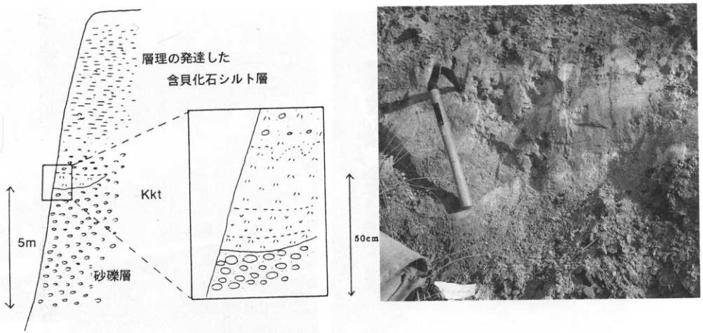
Show extracted lettering and translation
English translation of figure lettering
Well-stratified shell-fossil-bearing silt; Kkt; sand and gravel. Overall scale 5 m; enlarged interval 50 cm. No legible lettering within the photograph.
Original Japanese lettering
層理の発達した含貝化石シルト層,Kkt,砂礫層。全体5m;拡大50cm。写真に可読文字なし。
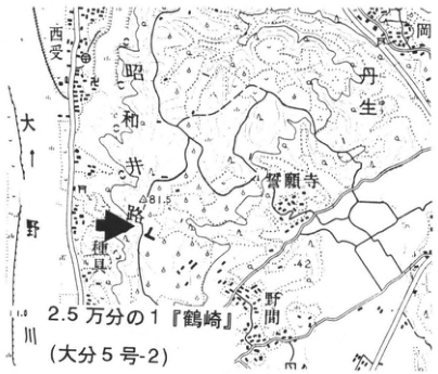
Show extracted lettering and translation
English translation of figure lettering
1:25,000 Tsurusaki (Oita sheet 5-2). 西受; Ono River; 昭和井; Nyu; 野田岡; 浄願寺; Tanegu; 野間. Legible numbers: 81.5, 42.
Original Japanese lettering
2.5万分の1『鶴崎』(大分5号-2)。西受,大野川,昭和井,丹生,野田岡,浄願寺,種具,野間。可読数値81.5,42。
[Original printed page: 75]
WS-20-4 Kakuto tephra and marker tephras of Shinshu at the eastern foot of Yatsugatake
Hiroshi Machida
Locality: Hirose, Minamimaki Village, Nagano Prefecture. Coordinates: N36°0′0″ E138°31′13″. Elevation: 1,130 m. Exposure and present condition: cliff at a civil-engineering materials yard; extant. Deposits and age: ash fall, pumice fall, and scoria fall; Middle Pleistocene. Date described: May 1995. Keywords: Kakuto tephra; Omachi APm group; eastern foot of Yatsugatake.
Because tephras from Yatsugatake are thickly developed at its eastern foot (Yatsugatake Collaborative Research Group, 1988), intercalated Middle Pleistocene tephras arriving from distant sources are well preserved there (see WS-18-2). At this exposure, among Yatsugatake mudflow (debris-flow) deposits, scoria beds, and pumice beds, one can observe beige fine ash (Kakuto tephra; Kkt) and, below it, a pumice bed of the Omachi APm (crystal-ash) group and coarse pumice thought to originate from Yatsugatake. Kkt consists principally of bubble-wall glass slightly clouded by weathering, with sparse pyroxene phenocrysts. The underlying 30 cm pumice bed contains 1 cm pumice rich in biotite, hornblende, feldspar, and other phenocrysts. It corresponds to B2 of the three biotite-pumice beds distributed around Yatsugatake (Yatsugatake Collaborative Research Group, 1988) and is correlated with Omachi A3Pm (Suzuki and Hayakawa, 1990). Immediately beneath it, 1.2 m of coarse pumice characteristically contains abundant hornblende and corresponds to the hornblende-bearing white pumice described by the same group (1988). Immediately below that, one can also observe fine, phenocryst-rich pumice resembling B2, namely B1 of the group (1988). According to Suzuki and Hayakawa (1990), these tephras occur above Tama E-5 (TE-5) in the western Kanto Plain, for example at 安立, Chichibu City, linking the Middle Pleistocene of the central mountains and Kanto Plain. The pumice bed called BBP at the eastern foot of Yatsugatake (Iijima, 1967), correlated with Gomashio Pumice in southern Kanto (Arai, 1972), lies considerably above the horizons exposed here.
Kkt reaches 10 cm thickness, suggesting an extremely large eruption. It should therefore also be found farther east and is important for clarifying environmental changes during Middle Pleistocene oxygen isotope stage 9. Through Kkt, this exposure links the Middle Pleistocene tephras of Kyushu and central Honshu and has important significance for interpreting geological history.
References: Arai (1972); Iijima (1967); Suzuki and Hayakawa (1990); Yatsugatake Collaborative Research Group (1988).
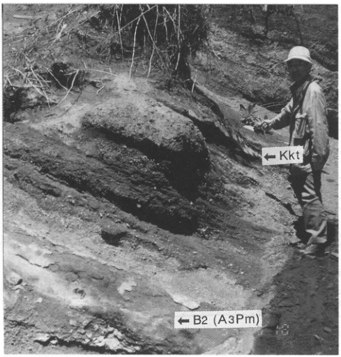
Show extracted lettering and translation
English translation of figure lettering
←Kkt; ←B2 (A3Pm).
Original Japanese lettering
←Kkt;←B2 (A3Pm)。
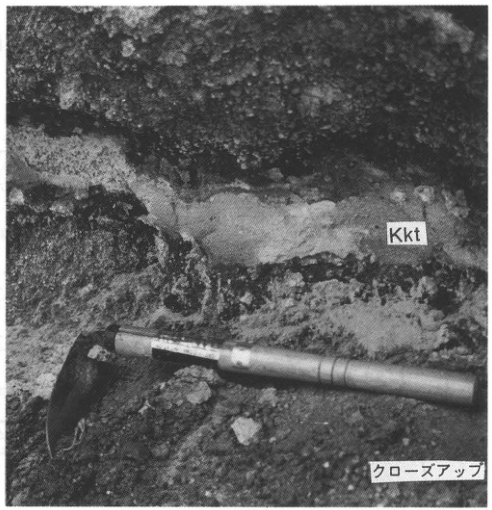
Show extracted lettering and translation
English translation of figure lettering
Kkt; close-up.
Original Japanese lettering
Kkt,クローズアップ。
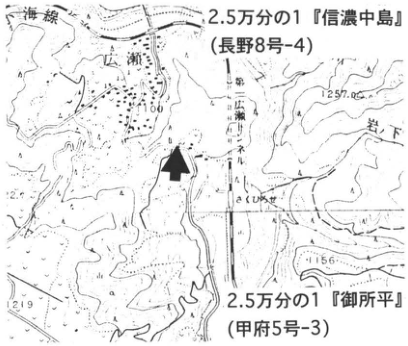
Show extracted lettering and translation
English translation of figure lettering
1:25,000 Shinano-Nakajima (Nagano sheet 8-4); 1:25,000 Goshodaira (Kofu sheet 5-3). Koumi railway line; Hirose; Iwashita; Saku-Hirose. Legible numbers: 1100, 1257, 1156, 1219.
Original Japanese lettering
2.5万分の1『信濃中島』(長野8号-4);2.5万分の1『御所平』(甲府5号-3)。小海線,広瀬,岩下,さくひろせ。可読数値1100,1257,1156,1219。
[Original printed page: 76]
WS-21-1 The Omachi APm tephra group, important Middle Pleistocene markers in central Japan
Takehiko Suzuki
Locality: Kambadaira (樺平), Ooka Village, Nagano Prefecture. Coordinates: N36°29′11″ E138°2′14″. Elevation: 1,230 m. Exposure and present condition: artificial exposure; extant. Deposits and age: tephra fall; Middle Pleistocene. Date described: September 1990. Keywords: Omachi APm tephra group; crystal ash; Kakuto tephra; central Japan; 水鉛谷 conduit; Momisawadake volcano.
The Omachi APm tephra group (APms), also called crystal ash for its characteristics, has attracted attention in central Japan for nearly 30 years as distinctive fallout tephras rich in biotite and quartz. Many researchers have investigated the group, and related reports continue to appear. Despite this long research history, its full nature cannot be said to be established. The group consists of a collection of deposits representing one eruption cycle; researchers disagree on individual distributions and local stratigraphic positions, and even on the number of beds. Under these circumstances, it is important to establish a well-exposed reference locality and proceed with correlations outward from it. Kambadaira is ideally suited to this role. It lies 50 km east-northeast of the 水鉛谷 conduit of Momisawadake volcano in the Northern Alps, considered the APms source (Harayama et al., 1991; see WS-21-2). Five Omachi APm beds are exposed here, named in ascending order A1Pm, A2Pm, …, A5Pm, or CA1, CA2, …, CA5 (Suzuki, 1992; Kimura, 1987). All are highly distinctive, biotite- and quartz-rich crystal tephras, with printed thicknesses of 30–106 m [unit as printed], separated by volcanic-ash soils indicating time intervals. Kakuto tephra from Kyushu (Kkt; see WS-19) is recognized between A4Pm and A5Pm here (Suzuki and Hayatsu, 1991).
Relationships with other tephras (see WS-21-4) and their stratigraphic horizons suggest that APms erupted during oxygen isotope stages 10 to 9, making them important Middle Pleistocene marker beds in central Japan.
References: Harayama et al. (1991); Kimura (1987); Suzuki (1992); Suzuki and Hayakawa (1990); Suzuki and Hayatsu (1991).
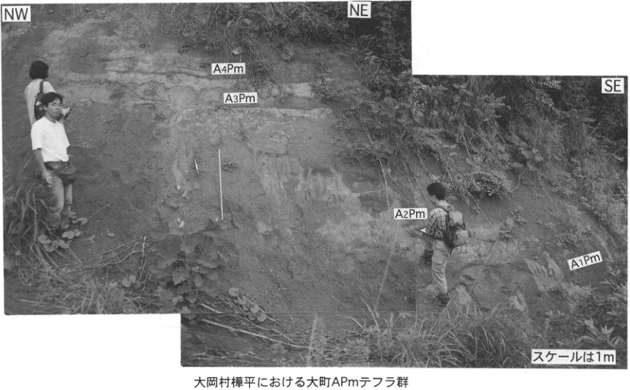
Show extracted lettering and translation
English translation of figure lettering
NW, NE, SE; A4Pm, A3Pm, A2Pm, A1Pm; scale is 1 m. Omachi APm tephra group at Kambadaira, Ooka Village.
Original Japanese lettering
NW,NE,SE;A4Pm,A3Pm,A2Pm,A1Pm;スケールは1m。大岡村樺平における大町APmテフラ群。
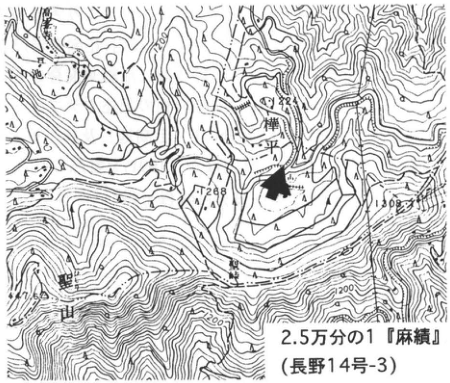
Show extracted lettering and translation
English translation of figure lettering
1:25,000 Omi (Nagano sheet 14-3). Kambadaira; Hijiriyama. Legible numbers: 1288, 1032, 1100, 1200.
Original Japanese lettering
2.5万分の1『麻績』(長野14号-3)。樺平,聖山。可読数値1288,1032,1100,1200。
[Original printed page: 77]
WS-21-2 Source conduit of the Omachi APm tephra group, widespread tephras from the Hida Range—The 水鉛谷 conduit
Satoru Harayama
Locality: 水鉛谷, a tributary of the Hidari-mata Valley of the Gamata River, Kamitakara Village, Yoshiki District, Gifu Prefecture. Coordinates: N36°20′17″ E137°37′13″. Elevation: 1,815 m. Exposure and present condition: natural exposure; extant as of October 1995. Rocks and age: conduit volcanic rocks; Middle Pleistocene. Date described: 1990. Keywords: Hida Range; Omachi APm tephras; Okuhida pyroclastic-flow deposit; 水鉛谷 conduit.
This exposure is the conduit that supplied the Omachi APm tephra group and Okuhida pyroclastic-flow deposits, an extremely rare example of a source conduit for widespread tephras and large pyroclastic flows exposed at the surface. It lies on the conduit’s northern margin, 1.3 km west-southwest of Yarigatake, along 水鉛谷, a tributary in the uppermost Hidari-mata Valley of the Gamata River. The conduit is elliptical, 600 m north–south and 500 m east–west, intruding Paleogene granite. It forms a volcanic neck rising above its surroundings in a pointed spire. Its principal rocks are pyroxene-hornblende-biotite rhyolitic tuff and compositionally equivalent granite porphyry; more mafic andesite, lava and tuff, is exposed only along the margin. Rhyolite (granite porphyry) and andesite have complex, interwoven relationships, interpreted as evidence for contemporaneous activity and mixing. For descriptions of the facies and discussion of correlations with tephras and pyroclastic-flow deposits, see the 1:50,000 Kamikochi and Yarigatake geological map sheets (Harayama, 1990; Harayama et al., 1991).
References: Harayama (1990); Harayama et al. (1991).
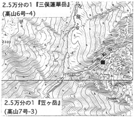
Show extracted lettering and translation
English translation of figure lettering
1:25,000 Mitsumata-Rengedake (Takayama sheet 6-4); 1:25,000 Kasagatake (Takayama sheet 7-3). Hidari-mata Valley. Legible numbers: 2303, 205, 2105.
Original Japanese lettering
2.5万分の1『三俣蓮華岳』(高山6号-4);2.5万分の1『笠ヶ岳』(高山7号-3)。左俣谷。可読数値2303,205,2105。
Reading notes
205 — 数値の一部が不鮮明で、全標高値は確定できない。
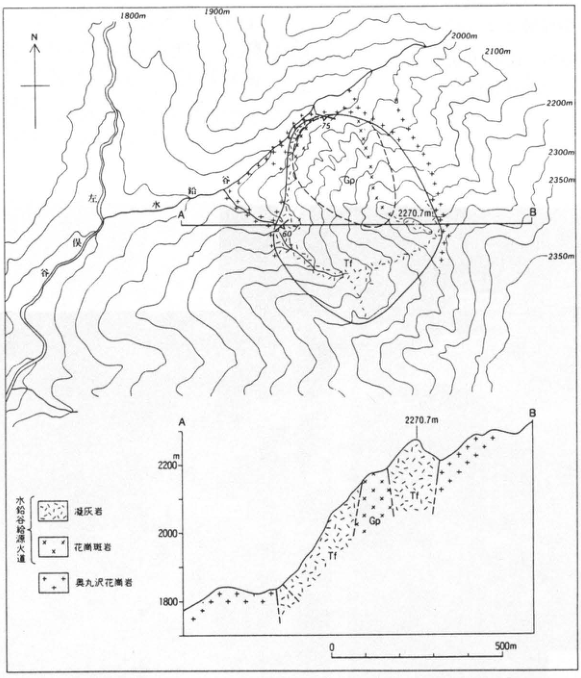
Show extracted lettering and translation
English translation of figure lettering
N; Hidari-mata Valley; 水鉛谷; A, B; Tf, Gp (map and section). Contours: 1800 m, 1900 m, 2000 m, 2100 m, 2200 m, 2300 m, 2350 m (twice); summit 2270.7 m; dip values 75, 60. Section elevation, m: 1800, 2000, 2200. Horizontal scale: 0, 500 m. Legend: 水鉛谷熔結火道 [printed conduit designation]—tuff, granite porphyry; 奥丸沢 granite.
Original Japanese lettering
N;左俣谷,水鉛谷;A,B;Tf,Gp(平面図・断面図)。等高線1800m,1900m,2000m,2100m,2200m,2300m,2350m(2か所);山頂2270.7m;走向傾斜75,60。断面標高m:1800,2000,2200。水平0,500m。凡例:水鉛谷熔結火道―凝灰岩,花崗斑岩;奥丸沢花崗岩。
Reading notes
凡例の水鉛谷熔結火道 — 細字の中央2字は不鮮明。英訳では印刷形を保持し、通常の地質用語への置換を避けた。
Extracted lettering and translation From Figure 68 of Harayama et al. (1991).
[Original printed page: 78]
WS-21-3 Okuhida pyroclastic-flow deposits at Kumonotaira, deep in the Northern Alps—Pyroclastic-flow deposits intercalated in the Kumonotaira Gravel
Shun Nakano
Locality: A Stream and elsewhere, Kumonotaira, Oyama Town, Toyama Prefecture. Coordinates: N36°25′28″ E138°33′46″ [as printed]. Elevation: 2,060 m. Exposure: natural exposure. Deposits and age: gravel and pyroclastic-flow deposits; Middle Pleistocene, 300–350 ka. Keywords: Kumonotaira Gravel; Okuhida pyroclastic-flow deposits; Omachi APm tephra group; crystal ash; Momisawadake volcano; Kumonotaira volcano.
The Kumonotaira Gravel, forming the lower part of Kumonotaira volcano, reaches about 200 m maximum thickness. Rounded gravel and sand derived from basement predominate, but lava and pyroclastic material from Kumonotaira volcano are occasionally intercalated. This gravel also contains about 2 m of unwelded pyroclastic-flow deposit, confirmed at three exposures, dominated by pumice fragments no larger than 3 cm rich in quartz, biotite, plagioclase crystals, and other minerals (Nakano, 1989). It is not a product of Kumonotaira volcano, but is correlated with the Okuhida pyroclastic-flow deposit (Okh). Near Momisawadake, about 6 km south-southeast of Kumonotaira, this deposit forms welded tuff about 200 m thick. Its source conduit has been discovered in 水鉛谷, about 10 km south-southeast of Kumonotaira (Momisawadake volcano). Erupted volume is estimated to exceed 10 km³. On its constituent minerals, this flow is correlated with one of the Omachi APm tephras (crystal ash). If so, its eruption age is estimated at 300–350 ka (Suzuki and Hayakawa, 1990).
References: Harayama et al. (1991); Nakano (1989); Suzuki and Hayakawa (1990).
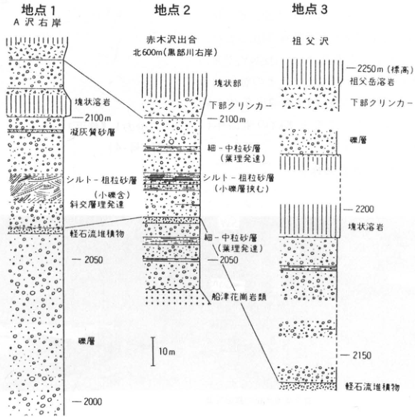
Show extracted lettering and translation
English translation of figure lettering
Site 1, right bank of A Stream: massive lava; 2100 m; tuffaceous sand; silt–coarse sand containing small gravel, with developed cross-stratification; pumice-flow deposit; 2050; gravel; 2000. Site 2, 600 m north of the Akagizawa confluence (right bank of the Kurobe River): massive portion; basal clinker; 2100 m; fine–medium sand with developed lamination; silt–coarse sand intercalated with small-gravel beds; fine–medium sand with developed lamination; 2050; Funatsu granitic rocks. Site 3, Jiji Stream: 2250 m (elevation); Jijidake lava; basal clinker; gravel; 2200; massive lava; 2150; pumice-flow deposit. Scale: 10 m.
Original Japanese lettering
地点1 A沢右岸:塊状溶岩;2100m;凝灰質砂層;シルト-粗粒砂層(小礫含),斜交層理発達;軽石流堆積物;2050;礫層;2000。地点2 赤木沢出合北600m(黒部川右岸):塊状部,下部クリンカー,2100m;細-中粒砂層(葉理発達);シルト-粗粒砂層(小礫層挟む);細-中粒砂層(葉理発達);2050;船津花崗岩類。地点3 祖父沢:2250m(標高);祖父岳溶岩;下部クリンカー;礫層;2200;塊状溶岩;2150;軽石流堆積物。スケール10m。
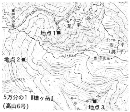
Show extracted lettering and translation
English translation of figure lettering
1:50,000 Yarigatake (Takayama sheet 6). Sites 1, 2, 3; Yakushizawa hut; A Stream; Kumonotaira (Okunotaira); Kumonotaira mountain lodge; Jiji Stream. Legible numbers: 2576, 2463.9, 1976.
Original Japanese lettering
5万分の1『槍ヶ岳』(高山6号)。地点1,地点2,地点3;薬師沢小屋,A沢,雲ノ平(奥ノ平),雲ノ平山荘,祖父沢。可読数値2576,2463.9,1976。
[Original printed page: 79]
WS-21-4 Omachi APm tephras and widespread tephras from Kyushu at Sugadaira, Shinshu
Stratigraphic relationships with Kakuto and Ata-Torihama tephras
Takehiko Suzuki
Locality: Nishigumi, Sugadaira, Sanada Town, Nagano Prefecture. Coordinates: N36°36′45″ E138°18′53″. Elevation: 1,270 m. Exposure and present condition: artificial exposure; extant. Deposits and age: tephra fall and fine-grained glassy ash beds; Middle Pleistocene. Date described: September 1989–May 1990. Keywords: Sugadaira Plateau; Omachi APm tephra group; Kakuto tephra; Sugadaira ash; Azumaya-蓑原 tephra; Ata-Torihama tephra; Azumaya volcano.
Gentle slopes are widely developed in the Sugadaira Basin, about 10 km west of Azumaya volcano. In places these slopes have remained stable since some time in the Middle Pleistocene and are covered by thick volcanic-ash soil. This Nishigumi exposure is in such an area. Tephras from the central mountains, including the Omachi APm group (APms; Suzuki and Hayakawa, 1990), and Middle Pleistocene widespread tephras are well preserved in the soil. It is therefore probably the most useful exposure for clarifying central Japan’s Middle Pleistocene tephra stratigraphy, including APms. It was discussed in detail by Suzuki and Hayakawa (1990) and Suzuki and Hayatsu (1991).
APms can be observed slightly right (west) of the exposure’s center. The two upper beds, A4Pm and A5Pm, are exposed, deposited above weathered basement across thin volcanic-ash soil. Their occurrence resembles that at the Kambadaira type locality, Ooka Village (WS-21-1), with a distinctive facies rich in biotite, quartz, and hornblende phenocrysts. Between them is orange fine-grained glassy ash of the Kyushu-derived Kakuto tephra (Kkt; see WS-19). The lower-middle part of the exposure, from the center leftward, contains a vivid vermilion fine tephra, Sugadaira ash (SgA). It apparently was originally glassy, suggesting a distant source, but loss of glass through weathering leaves its details unknown. Slightly above SgA is Azumaya-蓑原 tephra (Az-MiP), a Plinian fallout deposit. Coarse pumice and lithic fragments as large as 10 cm imply a nearby source, Azumaya volcano. At 1–1.5 m above Az-MiP is about 60 cm of yellow Plinian pumice, Sugadaira pumice 2 (SgP.2). Its pumice reaches 4 cm maximum diameter, likewise suggesting a nearby source, though no volcano has yet been identified. About 5 cm of volcanic-ash soil separates SgP.2 from an underlying olive-colored fine glassy ash bed about 6 cm thick. Initially called Sanada ash, it was later correlated with southern Kyushu’s Ata-Torihama tephra (Ata-Th; see WS-17). Iizuna-Nishiyama tephra (Iz-NY) also occurs above SgP.2. These relationships with widespread tephras show that APms erupted at least earlier than the approximately 240 ka Ata-Th eruption, within several tens of thousands of years before and after Kkt, whose eruption age is somewhat older than 300 ka (WS-19-1).
References: Suzuki and Hayakawa (1990); Suzuki and Hayatsu (1991).
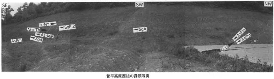
Show extracted lettering and translation
English translation of figure lettering
SE, SW, NW. Left: Iz-NY, Ata-Th, SgP.2, Az-MiP, SgA, A5Pm. Center: SgA. Right: A5Pm, A4Pm, Kkt. Exposure photograph at Nishigumi, Sugadaira Plateau.
Original Japanese lettering
SE,SW,NW。左部:Iz-NY,Ata-Th,SgP.2,Az-MiP,SgA,A5Pm。中央:SgA。右部:A5Pm,A4Pm,Kkt。菅平高原西組の露頭写真。
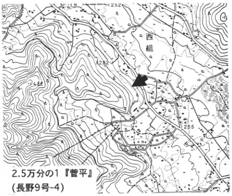
Show extracted lettering and translation
English translation of figure lettering
1:25,000 Sugadaira (Nagano sheet 9-4). Nishigumi. Legible numbers: 1252, 1282, 1242, 1255, 1350.
Original Japanese lettering
2.5万分の1『菅平』(長野9号-4)。西組。可読数値1252,1282,1242,1255,1350。
[Original printed page: 80]
WS-22-1 Kobayashi–Kasamori tephra at Kukino, Miyazaki Prefecture—the home of the Sakura volcanic ash
Hiroshi Machida
Locality: Kukino, Takaoka Town, Miyazaki Prefecture. Coordinates: N37°57′23″ E131°13′38″. Elevation: 150 m.
Outcrop type and condition: roadside cliff; extant. Deposits and age: pumice fall, pyroclastic-flow deposits, and sand and gravel; Middle Pleistocene.
Date described: March 1995. Keywords: Kobayashi–Kasamori tephra; Kukino Formation.
High Middle Pleistocene terraces are well developed along the margins of the Miyazaki Plain. Among them, the hilly plateau around Kukino in Takaoka Town consists of thick sand and gravel reaching several tens to 100 m in thickness (Kino and Ota, 1976). These sand and gravel deposits contain several marker tephras composed chiefly of pyroclastic-flow deposits. One is the Kobayashi–Kasamori tephra (Kb-Ks). It consists chiefly of nonwelded pyroclastic-flow deposits containing pumice fall in their lower part, and its distinctive feature is the presence of biotite and hornblende phenocrysts. Outcrops at which this tephra can be observed at Kukino extend discontinuously for several tens of metres along the road. In the lower part, stratified pumice with a fallout facies overlies material with a pyroclastic-flow-like facies, with a single rounded-gravel bed between them. It is probably pumice fall deposited in a flowing-water environment. The middle and upper parts consist of nonwelded pyroclastic-flow deposits. Since their top is truncated by sand and gravel, the original deposit must have exceeded 30 m in thickness. From its distribution, the source of this tephra was considered to be Kobayashi caldera, and it was named the Kobayashi pyroclastic flow (Kino and Ota, 1976). However, it is difficult to identify the source volcano specifically as Kobayashi caldera, Kakuto caldera, or the Kirishima volcanic area. Around Kukino, sand and gravel separate this tephra from the overlying Kakuto pyroclastic-flow deposits (Kkt) and from the underlying Hiwaki pyroclastic-flow deposits (Hw).
The contemporaneous fallout tephra is called the Sakura volcanic ash in the Kinki region and Byobugaura 2 or Kasamori 11 in the Kanto region, and has been described as an important marker bed (Machida and Arai, 1992).
References: Kino and Ota (1976); Machida and Arai (1992).
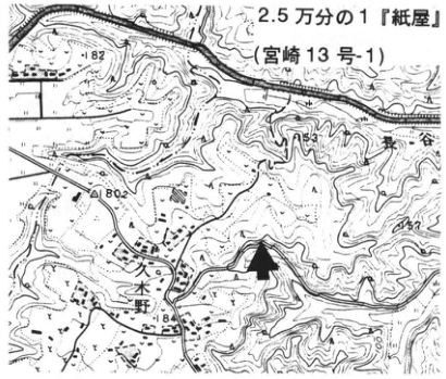
Show extracted lettering and translation
English translation of figure lettering
1:25,000 “Kamiya” (Miyazaki 13-1). Kukino; 東ヶ谷. Elevation and contour figures: 82, 80.2, 84, 130.
Original Japanese lettering
2.5万分の1「紙屋」(宮崎13号-1)。久木野;東ヶ谷。標高・等高線数字:82,80.2,84,130。
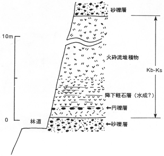
Show extracted lettering and translation
English translation of figure lettering
From top: sand and gravel; pyroclastic-flow deposits; pumice-fall bed (water-laid?); ←rounded-gravel bed; ←sand and gravel. Kb-Ks extends from below the upper sand and gravel to above the lower sand and gravel. Forest road; scale 0, 10 m.
Original Japanese lettering
上から:砂礫層;火砕流堆積物;降下軽石層(水成?);←円礫層;←砂礫層。Kb-Ksの範囲は上部砂礫層の下から下部砂礫層の上まで。林道;目盛0,10m。
WS-22-2 Kamiogi (Sakura) volcanic ash in the Katata Hills west of Lake Biwa—Kobayashi–Kasamori tephra
Hiroshi Machida
Locality: Kamiogi, Otsu City, Shiga Prefecture. Coordinates: N35°6′10″ E135°52′12″. Elevation: 180 m.
Outcrop type and condition: roadside; condition unknown. Deposit: volcanic ash. Date described: March 1978.
Keywords: Kamiogi volcanic ash; Sakura volcanic ash; Kobayashi–Kasamori tephra; Kobiwako Formation; Kamiogi; Katata Hills.
The Kobiwako Group, distributed in the Katata Hills west of Lake Biwa, is correlated with the Osaka Group and contains numerous Middle to Early Pleistocene tephras. Among them, the ash described as the Kamiogi volcanic ash (Yokoyama, 1975) is a marker tephra correlated with the Sakura volcanic ash of the Osaka Group (Hayashi, 1974; Machida et al., 1980, and others). At this outcrop, this 25-cm-thick volcanic-ash bed, with its characteristic cherry-blossom pink colour, can be observed between sand and silt beds. It is rich in bubble-type volcanic glass and contains small amounts of biotite, hornblende, and orthopyroxene. In both the Kinki region and southern Kanto, several tephras resemble this one in the refractive index of their volcanic glass (Sakura N and S in Kinki, and Kasamori 5 and 11 in Kanto). Because they also contain few phenocryst minerals, correlating and identifying these similar tephras requires combining major- and trace-element characteristics with the refractive index of volcanic glass. Sakura S and Kasamori 11 are correlated with this tephra (Machida and Arai, 1992). In the Kobiwako Group of the Katata Hills, this bed overlies the Kinugawa volcanic ash. In the Osaka Group, it occupies the horizon immediately below marine clay bed Ma7.
References: Hayashi (1974); Machida et al. (1980); Machida and Arai (1992); Yokoyama (1975).
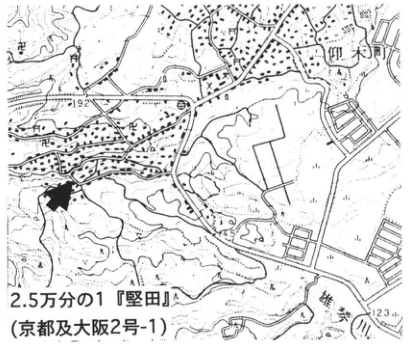
Show extracted lettering and translation
English translation of figure lettering
1:25,000 “Katata” (Kyoto and Osaka 2-1). Ogi Town; 192; 123.
Original Japanese lettering
2.5万分の1「堅田」(京都及大阪2号-1)。仰木町;192;123。
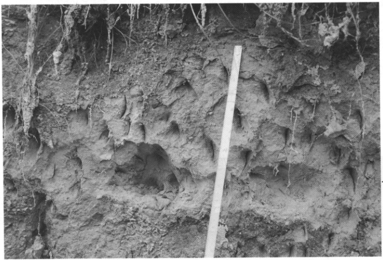
Sakura volcanic-ash bed
WS-22-3 Kobayashi–Kasamori tephra at Totsuka, Yokohama, and Futtsu on the Boso Peninsula
Hiroshi Machida
Localities: near Senshu Elementary School, Kosuzume Town, Totsuka Ward, Yokohama City; 上, Futtsu City, Chiba Prefecture.
Coordinates: N35°22′0″ E139°31′18″; N35°16′48″ E139°54′0″. Elevations: 26 and 30 m.
Outcrop type and condition: artificial exposures; condition unknown, probably destroyed. Deposits and age: volcanic ash, sand and gravel, and peat; Middle Pleistocene. Date described: 1979. Keywords: Kobayashi–Kasamori tephra; Byobugaura 2 tephra; Kasamori 11 tephra; Totsuka, Yokohama; Futtsu, Boso Peninsula.
At the Totsuka outcrop, peat and sand and gravel unconformably overlying the Taya Sand and Gravel (middle to upper part of the Naganuma Formation; Otsuka, 1937), together with several tephras including the Shimokurata pumice (Mitsunashi and Kikuchi, 1982), were observed. Among them, a pale pink glassy volcanic ash (10–15 cm thick) about 1.3 m below the Shimokurata pumice is correlated with the Kobayashi–Kasamori tephra (Kb-Ks; the Sakura volcanic ash in Kinki). Machida et al. (1980) described it here as the Byobugaura 2 volcanic ash (By2). It consists chiefly of bubble-type volcanic glass, with very small amounts of biotite and hornblende. Its correlation with the Kasamori 11 tephra (Ks11), a marker tephra within the Kasamori Formation on the Boso Peninsula, is evident from the characteristics of the tephra itself and from the occurrence of the complete set of tephras above and below it in both regions. In particular, the tephra immediately below By2 is a distinctive hornblende-rich tephra with a salt-and-pepper appearance (Byobugaura 1 volcanic ash; By1). It was also found in the Shunan–Sanuki Formation about 1.5 m below Ks11 at the outcrop at 上, Futtsu City, on the Boso Peninsula. These tephras aid correlation of the lower Byobugaura Formation in the Yokohama area with the upper Kasamori Formation and the Shunan–Sanuki Formation on the Boso Peninsula. They are considered to be tephras of the transition from oxygen-isotope stage 14 to 13.
References: Machida et al. (1980); Mitsunashi and Kikuchi (1982); Otsuka (1937).
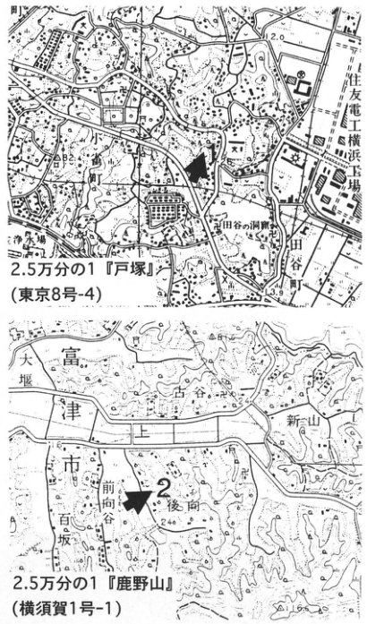
Show extracted lettering and translation
English translation of figure lettering
Upper map: 1:25,000 “Totsuka” (Tokyo 8-4); Kosuzume Town, Sumitomo Electric Yokohama Works, Taya Caves, Taya Town, Eishoji Temple. Elevations 2.0, 3.9; some small locality names are illegible. Lower map: locality 2; 1:25,000 “Kanozan” (Yokosuka 1-1); Futtsu City, 大堰, 上, 古谷, 新山, 前向谷, 後向, 百坂; elevations 24.0, 31.6.
Original Japanese lettering
上図:2.5万分の1「戸塚」(東京8号-4);小雀町,住友電工横浜工場,田谷の洞窟,田谷町,永勝寺。標高2.0,3.9;一部の小字は判読不明。下図:地点2;2.5万分の1「鹿野山」(横須賀1号-1);富津市,大堰,上,古谷,新山,前向谷,後向,百坂;標高24.0,31.6。
Reading notes
地図の細字地名 — 原画像でも一部は読み切れないため判読不明とした。
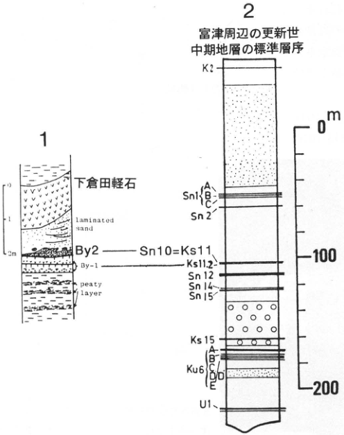
Show extracted lettering and translation
English translation of figure lettering
1: Shimokurata pumice; laminated sand; By2; By-1; peaty layer; scale 0, 1, 2 m. 2: Standard Middle Pleistocene stratigraphy around Futtsu. From top: K2; Sn1 A, B, C; Sn2; Sn10=Ks11 (correlation line to By2); Ks11.2 (correlation line to By-1); Sn12; Sn14; Sn15; Ks15; Ku6 A, B, C, D, D′, E (overlapping lettering near D is indistinct); U1. Scale 0, 100, 200 m.
Original Japanese lettering
1:下倉田軽石;laminated sand;By2;By-1;peaty layer;目盛0,1,2m。2:富津周辺の更新世中期地層の標準層序。上からK2;Sn1 A・B・C;Sn2;Sn10=Ks11(By2と対比線);Ks11.2(By-1と対比線);Sn12;Sn14;Sn15;Ks15;Ku6 A・B・C・D・D′・E(D付近の重なりは不鮮明);U1。尺度0,100,200m。
Reading notes
Ku6のD付近の枝番号 — 細字が重なりD・D′の並びは不鮮明。
WS-23-1 Seiganji Pumice Bed, a widespread tephra intercalated in the upper Oita Group
Kiyohide Mizuno, Hideo Hoshizumi, and Toshikazu Yoshioka
Locality: Seiganji, Nyu, Oita City, Oita Prefecture. Coordinates: N33°12′38″ E131°42′50″. Elevation: 20 m.
Outcrop type and condition: artificial exposure; extant in March 1996, partly vegetated. Deposits and age: freshwater deposits; approximately 0.6–0.7 Ma. Keywords: Seiganji Pumice Bed; Toga volcanic ash; Oita Group; Nyu, Oita.
The Seiganji Pumice Bed (Mizuno et al., 1989) is a tephra intercalated in the upper part of the Middle and Lower Pleistocene Oita Group (Shuto, 1953), which forms the hills around Oita City. It is a widespread tephra correlated with the Toga volcanic-ash bed of the Osaka Group (Yoshikawa, 1976) and other beds (Yoshikawa et al., 1991; Mizuno, 1992). However, the Seiganji Pumice Bed has been defined only in a conference abstract (Mizuno et al., 1989), so it is described here in detail. Its type exposures are at Seiganji, Nyu, Oita City (localities 1, 2, and 3 in the map), and it is distributed in the hills on both sides of the Ono River. At the type locality it is intercalated in freshwater deposits consisting chiefly of silt, whereas around Furushiroyama, about 7 km southwest of the type locality, and elsewhere, it is a terrestrial deposit. At locality 1, most of it is grass-covered and difficult to discern, but its entire facies can be observed by connecting the exposures along the road and watercourse toward localities 2 and 3 to the west. At locality 4, the lower part is easy to observe, but the upper part has been eroded away by terrace gravel. The lowermost approximately 50 cm consists of greyish-white to white pumice with grain sizes of 1 cm or less. This is overlain by approximately 20 cm of coarse volcanic ash containing pumice, and 20–40 cm of pumice with grain sizes of a few millimetres or less. Above these is an approximately 2-m-thick alternation of fine pumice and volcanic-ash beds, each 1–20 cm thick, with greyish-white, yellowish-brown, pale pink, and other colours. This alternation looks like “baumkuchen” and is the most distinctive feature of this tephra (photograph, locality 2). The uppermost approximately 2 m consists of massive grey to greyish-white fine pumice to volcanic ash. It contains two or three fine volcanic-ash beds 10–20 cm thick, possibly representing reworked material deposited under water. At the outcrop south of Sakanoichi, about 4 km northeast of this exposure, pumice-bearing volcanic ash overlies stratified pumice sand (Miyazaki and Yoshioka, 1994). This massive part looks like a pyroclastic-flow deposit. A characteristic of the volcanic glass forming this tephra is its abundance of brown blocky to granular types, which provides the most decisive evidence for widespread correlation. Orthopyroxene is the principal heavy mineral, with hornblende also present. Biotite is also visible to the naked eye. The tephra has normal paleomagnetic polarity. It lies slightly below the Yufugawa pyroclastic flow, whose age is estimated at approximately 0.6 Ma (Hoshizumi and Kamata, 1991; see KS-7) (Mizuno et al., 1989).
References: Hoshizumi and Kamata (1991); Yoshikawa et al. (1991); Miyazaki and Yoshioka (1994); Mizuno (1992); Mizuno et al. (1989); Shuto (1953); Yoshikawa (1976).
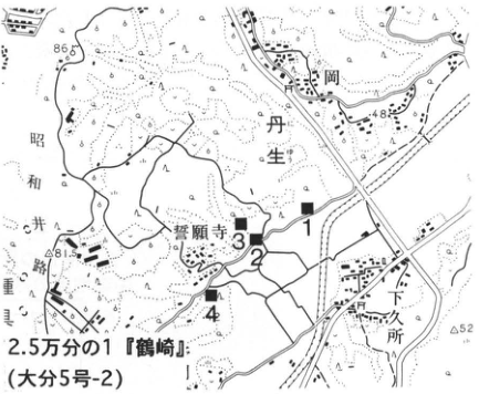
Show extracted lettering and translation
English translation of figure lettering
1, 2, 3, 4; 1:25,000 “Tsurusaki” (Oita 5-2); Seiganji, Nyu, 下岡, Showa irrigation channel, Nyu branch office; elevations 86.5, 48.3, 81.5, 52.
Original Japanese lettering
1,2,3,4;2.5万分の1「鶴崎」(大分5号-2);誓願寺,丹生,下岡,昭和井路,丹生出張所;標高86.5,48.3,81.5,52。
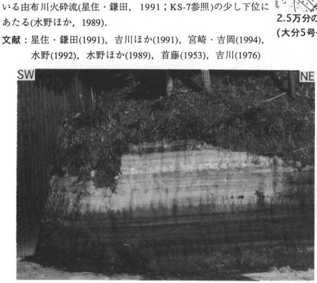
Show extracted lettering and translation
English translation of figure lettering
SW; NE. Prose and references embedded above the photograph have been restored in the main text.
Original Japanese lettering
SW;NE。画像上部の本文と文献は本文に復元済。
The “baumkuchen-like” part in the middle of the Seiganji Pumice Bed. Cliff height approximately 1.5 m. Photographed in September 1985.
WS-23-2 Okago volcanic-ash bed intercalated in the Middle Pleistocene Saijo Formation, Hiroshima Prefecture—the widespread Seiganji–Toga tephra
Kiyohide Mizuno
Locality: south of Okago, Kurose Town, Kamo District, Hiroshima Prefecture. Coordinates: N34°18′48″ E132°41′30″. Elevation: 160 m.
Outcrop type and condition: artificial exposure; only a small part exposed because of vegetation in January 1996. Deposits and age: freshwater deposits; Middle Pleistocene, approximately 0.6 Ma. Date described: January 1996. Keywords: Okago volcanic ash; Saijo Formation; Seiganji–Toga tephra.
The Saijo Formation is a fluvial succession deposited approximately 0.7–0.5 Ma in the area centred on the Saijo and Kurose basins in Hiroshima Prefecture, and contains at least seven volcanic-ash beds. Of these, the Okago volcanic-ash bed in the middle of the succession is the most continuous and serves as a key bed (Higashimoto et al., 1985). This tephra is correlated with the Seiganji Pumice Bed of the Oita Group and the Toga volcanic-ash bed of the Osaka Group, and is recognized as a widespread tephra (Yoshikawa et al., 1991; Mizuno, 1992). This outcrop is the type locality of the Okago volcanic-ash bed. In 1982, 3–4 m of silt and sand could be observed both above and below the volcanic ash, but in January 1996 only an area about 1 m square around the ash bed was exposed. The tephra is an approximately 60-cm-thick, greyish-white glassy volcanic-ash bed composed chiefly of alternating thin beds a few centimetres thick. A fission-track age of 0.57±0.09 Ma was obtained from a sample at this outcrop (Higashimoto et al., 1985). Thin peat beds or carbonaceous silt are often developed immediately below the Okago volcanic-ash bed and have yielded plant fossils, including Korean pine and bogbean, indicating a cold to cool climate (Higashimoto et al., 1985).
References: Yoshikawa et al. (1991); Mizuno (1992); Higashimoto et al. (1985).
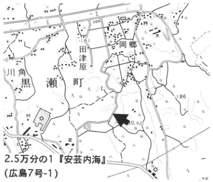
Show extracted lettering and translation
English translation of figure lettering
1:25,000 “Aki-Uchinoumi” (Hiroshima 7-1). Okago, Kurose Town, 田津原, 川角. Elevations 161, 186, 160.9, 26.
Original Japanese lettering
2.5万分の1「安芸内海」(広島7号-1)。岡郷,黒瀬町,田津原,川角。標高161,186,160.9,26。
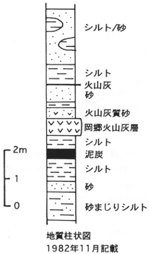
Show extracted lettering and translation
English translation of figure lettering
Geological column; described in November 1982. From top: silt/sand; silt; volcanic ash; sand; ashy sand; Okago volcanic-ash bed; silt; peat; silt; sand; sandy silt. Scale 0, 1, 2 m.
Original Japanese lettering
地質柱状図;1982年11月記載。上から:シルト/砂;シルト;火山灰;砂;火山灰質砂;岡郷火山灰層;シルト;泥炭;シルト;砂;砂まじりシルト。尺度0,1,2m。
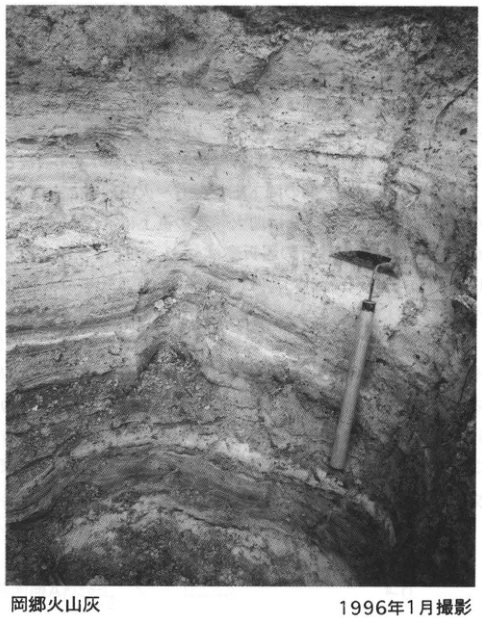
Show extracted lettering and translation
English translation of figure lettering
Okago volcanic ash; photographed in January 1996.
Original Japanese lettering
岡郷火山灰;1996年1月撮影。
WS-24-1 Tephras in the lower Oita Group—with emphasis on the Magari pyroclastic-flow deposits correlated with the Azuki volcanic ash
Kiyohide Mizuno, Hideo Hoshizumi, and Toshikazu Yoshioka
Locality: Magari to Mera, Oita City, Oita Prefecture. Coordinates: N33°11′18″–N33°12′35″ E131°36′56″–E131°38′48″.
Elevation: 20–100 m. Outcrop type and condition: artificial and natural exposures; extant in March 1996. Deposits and age: freshwater deposits, partly eolian deposits; approximately 0.8–0.9 Ma. Keywords: Magari pyroclastic-flow deposits; Mera pyroclastic flow; Azuki volcanic ash; Oita Group.
The Oita Group is a Middle and Lower Pleistocene succession forming the hills around Oita City (Shuto, 1953), and contains numerous tephras. Among them, the deposits called the Magari pyroclastic-flow deposits (hereafter simply “pyroclastic flow”) were correlated with the Azuki volcanic ash, a representative tephra of the Osaka Group (Ichihara, 1993; approximately 0.85 Ma) (Shimokawa et al., 1986). Subsequently, the Magari pyroclastic flow was identified with the Imaichi pyroclastic flow erupted from Shishimuta caldera in Oita Prefecture, which is correlated with the Azuki volcanic ash (Kamata et al., 1994a, b). Since the tephras of the Oita Group have been discussed only in conference abstracts (Shimokawa et al., 1986; Mizuno et al., 1989), they are described here in detail, with some discussion of their correlation.
The Magari pyroclastic flow occurs between gravel and silt beds and is distributed from Magari to Mera in Oita City. It probably accumulated in a floodplain-like setting. Its type locality is the artificial exposure at locality 4. It is also continuously exposed in the valley near locality 8, where it is considered unlikely to disappear for some time. It consists of a lower greyish-white pumice-fall bed (2–4 m thick, divided into about ten fallout units) and upper dark brown pumice-bearing pyroclastic-flow deposits (approximately 4 m thick). Volcanic glass is the principal constituent, and the heavy minerals consist chiefly of orthopyroxene and clinopyroxene. This tephra has reversed paleomagnetic polarity, and a fission-track age of 1.3±0.2 Ma has been obtained for a pyroclastic-flow sample at locality 4 (Mizuno et al., 1989). Plant fossils are sometimes found in silt below the Magari pyroclastic flow, but they do not include elements of the so-called “Metasequoia flora” (Ichihara, 1960).
Tephras resembling the Magari pyroclastic flow include the Aso-4 pyroclastic flow (locality 3) and the Mera pyroclastic flow (Shimokawa et al., 1986). The type locality of the Mera pyroclastic flow is at localities 11–12; it is also seen at localities 1, 2, 10, and elsewhere. It lies approximately 20 m above the Magari pyroclastic flow. The Mera pyroclastic flow consists of a lower greyish-white pumice-fall bed (approximately 2 m thick, comprising four or five fallout units) and upper dark brown pumice-bearing pyroclastic-flow deposits (2–5 m thick). Its reversed paleomagnetic polarity and heavy-mineral composition, dominated by orthopyroxene and clinopyroxene, also resemble those of the Magari pyroclastic flow. However, they can be distinguished by the lower refractive indices of both volcanic glass and orthopyroxene in the Mera pyroclastic flow: n=1.508–1.512 and γ=1.700–1.707, respectively, compared with n=1.511–1.515 and γ=1.703–1.715 in the Magari pyroclastic flow. In addition, three pyroclastic flows occur above and below the Magari pyroclastic flow in the Hogawara area (localities 5–8). These are provisionally named Hogawara A, B, and C, in ascending order (see stratigraphic columns). Hogawara A and C consist chiefly of greyish-brown pyroclastic-flow deposits accompanied by pumice-fall beds in their lower parts. Their pyroclastic-flow colour and the low refractive index of volcanic glass, approximately n=1.500 in both, readily distinguish them from the Magari pyroclastic flow. The Hogawara B pyroclastic flow consists of lower dark brown fine-pumice to volcanic-sand fallout beds and an upper ashy pyroclastic-flow deposit. The flow deposit is compact and slightly welded. Its horizon is inferred to be immediately above the Magari pyroclastic flow, and it can be observed at localities 5 and 6. Its heavy minerals are chiefly orthopyroxene and clinopyroxene; the orthopyroxene refractive index is γ=1.699–1.712. Its volcanic glass consists chiefly of material with refractive indices of n=1.511–1.517, very similar to the Magari pyroclastic flow, but also includes high-index material reaching n=1.550. This tephra has reversed paleomagnetic polarity.
The petrographic characteristics of the Magari pyroclastic flow closely resemble those of the pumice-fall bed in the lower part of the Imaichi pyroclastic flow (Kamata et al., 1994a, b) at Kagonodai, Notsuharu Town, and of the nonwelded to weakly welded pyroclastic-flow deposits immediately above it. The Hogawara B pyroclastic flow above the Magari pyroclastic flow may also correlate with part of the Imaichi pyroclastic flow, but this remains a subject for future study. Shimokawa et al. (1986) correlated the Mera pyroclastic flow with the Imaichi pyroclastic flow. However, the sample they identified as Imaichi is from an exposure in Taketa City and has refractive indices different from those of the Imaichi pyroclastic flow at its type locality. Petrographic and stratigraphic investigation is also required for deposits collectively assigned to the Imaichi pyroclastic flow.
References: Ichihara (1960, 1993); Kamata et al. (1994a, b); Mizuno et al. (1989); Shimokawa et al. (1986); Shuto (1953).
WS-24-1 (illustrations, continued)
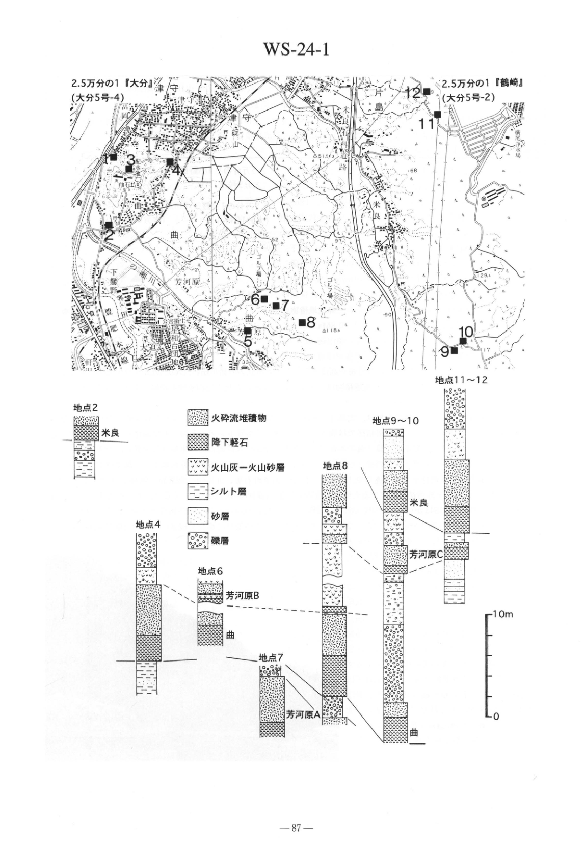
Show extracted lettering and translation
English translation of figure lettering
WS-24-1. Maps: 1:25,000 “Oita” (Oita 5-4); 1:25,000 “Tsurusaki” (Oita 5-2). Localities 1–12 (the numeral near locality 1 overlaps another symbol and is indistinct); Magari, Mera, Hogawara, Tsumori, Katashima, 椎迫山, Shimogori, 和台 housing estate, Oomichi, 米竹新川 irrigation channel, golf course, Yokoo Waterworks, public-health nursing school. Elevation and other figures: 51.5, 68, 52, 97, 62, 90, 118.4, 129.4, 17, 33, 63.
Columns: localities 2, 4, 6, 7, 8, 9–10, 11–12. Legend: pyroclastic-flow deposits; pumice fall; volcanic-ash to volcanic-sand beds; silt; sand; gravel. Tephra labels: Mera; Hogawara C; Hogawara B; Hogawara A; Magari. Correlation lines link Magari, Hogawara B, Hogawara C, and Mera in ascending order, and Hogawara A below Magari. Scale 0, 10 m. Printed page 87.
Original Japanese lettering
WS-24-1。地図:2.5万分の1「大分」(大分5号-4);2.5万分の1「鶴崎」(大分5号-2)。地点1~12(1付近の番号は他記号と重なり不鮮明);曲,米良,芳河原,津守,片島,椎迫山,下郡,和台団地,大道,米竹新川井路,ゴルフ場,横尾浄水場,公衆衛生看護学院。標高等:51.5,68,52,97,62,90,118.4,129.4,17,33,63。
柱状図:地点2,地点4,地点6,地点7,地点8,地点9~10,地点11~12。凡例:火砕流堆積物;降下軽石;火山灰-火山砂層;シルト層;砂層;礫層。テフラ名:米良;芳河原C;芳河原B;芳河原A;曲。下位から曲、芳河原B、芳河原C、米良の対比線、曲より下位の芳河原Aの対比線。目盛0,10m。印刷ページ87。
Reading notes
地図内の地点1と一部細字 — 記号重なりと低解像度により一部は読み切れない。
WS-24-2 Imaichi pyroclastic-flow deposits in central Kyushu—the source pyroclastic flow of the Azuki volcanic ash of the Osaka Group
Hideo Hoshizumi and Hiroki Kamata
Locality: Kagonodai, Notsuharu Town, Oita Prefecture. Coordinates: N33°9′36″ E131°30′14″. Elevation: 210 m. Outcrop type and condition: artificial exposure revealed by road construction. Deposits and age: pyroclastic-flow deposits and pumice-fall beds; Early Pleistocene.
Date described: March 1996. Keywords: Imaichi pyroclastic-flow deposits; Shishimuta caldera; Azuki volcanic ash.
The Imaichi pyroclastic-flow deposits are large-volume pyroxene dacitic to pyroxene andesitic pyroclastic-flow deposits widely distributed from Oita to Kumamoto prefectures. Most form strongly welded pyroclastic-flow plateaus (Ono, 1963; Ono et al., 1977; Kamata et al., 1994a). K–Ar ages obtained for the deposits include 0.76±0.17 Ma (Uto and Suto, 1985) and several NEDO determinations ranging from 0.84±0.02 to 0.96±0.03 Ma (Hoshizumi and Morishita, 1993; p. 70, Appendix Table A-1). Three observations place the eruption of the Imaichi pyroclastic flow at approximately 0.9 Ma, in the reversed-polarity interval at the end of the Matuyama polarity chron (after the Jaramillo subchron): the deposits consistently have reversed polarity (Ono, 1963; Hoshizumi et al., 1988; Hayashida et al., 1996); the underlying Yabakei pyroclastic-flow deposits were erupted during the Jaramillo subchron (Uto and Suto, 1985); and the volcanic rocks above the Imaichi pyroclastic-flow deposits (Tokiyama andesite) erupted approximately 0.7–0.8 Ma (Hoshizumi and Kamata, 1991). The overall distribution and elevation of the flow suggest that its source was Shishimuta caldera north of Kuju volcano (Kamata et al., 1994a). The Imaichi pyroclastic-flow deposits are also correlated with the Azuki volcanic ash, an important key bed of the latest Early Pleistocene in the Osaka Group (discussed below) (Kamata et al., 1994b).
In most areas of the pyroclastic-flow plateau formed by the Imaichi deposits, erosion has removed the upper nonwelded part that must originally have been present, leaving only the welded part. Devitrification has also progressed in the welded part, crystallizing both juvenile lenses and matrix, so fresh glass samples are often unobtainable. This outcrop at Kagonodai, Notsuharu Town, is at the eastern edge of the Imaichi pyroclastic-flow plateau. Perhaps because it is near the distal limit of the distribution, glassy portions survive even within the welded part. The upper nonwelded part can also be identified locally on the plateau. The succession of eruptive products including the Imaichi pyroclastic-flow deposits in this area consists, in ascending order, of pumice fall and pyroclastic-flow deposits changing from nonwelded to weakly welded, strongly welded (glassy), strongly welded (devitrified), weakly welded, and nonwelded (Kamata et al., 1994b). Here the stratigraphic column of Kamata et al. (1994b) has been partly revised using information from a subsequently exposed new outcrop (locality 1). The revision adds a stratified part containing accretionary lapilli (55 cm thick) between the lower weakly welded part and the overlying strongly welded part. However, no weathering or erosional hiatus or soil is recognized in this interval, and the Imaichi pyroclastic-flow deposits as a whole are the product of one continuous episode of eruptive activity.
The pumice-fall bed at the base of the Imaichi pyroclastic flow has a total thickness of approximately 4–5 m and is divided into several fallout units, each several tens of centimetres to 1 m thick. Between the fallout units are fine volcanic-ash beds, approximately 1–4 cm thick, with greyish-black to reddish-purple-grey colours (locality 2; Hoshizumi et al., 1992; p. 106, Fig. 81) (locality 3). The phenocryst assemblage of the pumice is identical to that of the main pyroclastic-flow deposit. From its scale, this pumice fall is considered a deposit of a Plinian eruption from a high eruption column (Kamata et al., 1994b). Another exposure of the pumice-fall bed can be observed west of Motofukuso, Notsuharu Town (locality 4). Pumice fall has also been confirmed at the base of the pyroclastic flow at Sozu, Ajimu Town, approximately 25 km to the northwest (Hoshizumi, 1993; p. 33, Fig. 24), but that outcrop no longer survives. The pumice fall was followed by deposition of a nonwelded pumiceous ash flow (locality 5). The degree of welding increases upward in the pumiceous ash flow, forming a weakly welded part. The interval from this weakly welded part to the devitrified strongly welded part can be observed at locality 1. The uppermost 55 cm of the weakly welded part is faintly stratified and contains a small quantity of accretionary lapilli no larger than 1 cm. Strongly welded glassy pyroclastic-flow deposits overlie it, containing abundant black glassy lenses no larger than 10 cm and exhibiting a conspicuous eutaxitic texture. However, the basal 30 cm is strongly welded black glassy rock consisting solely of fine volcanic ash. Upward, devitrification gradually progresses in both matrix and juvenile lenses, with the matrix in particular becoming grey. The interval from weakly welded material through glassy strongly welded material to devitrified strongly welded material can also be observed near locality 6 beside the old road. Throughout the strongly welded part, columnar joints approximately 20–100 cm wide are developed. In the uppermost weakly welded part (locality 7) and nonwelded part (locality 8), the grey ash matrix contains, in addition to grey pumice, greyish-black scoria and banded scoria in which pumice and scoria glass are mixed.
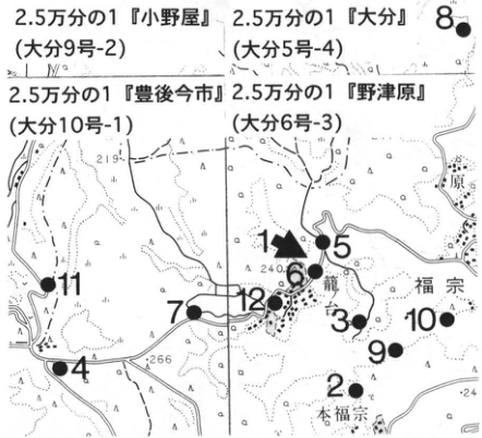
Show extracted lettering and translation
English translation of figure lettering
1:25,000 “Onoya” (Oita 9-2); “Oita” (Oita 5-4); “Bungo-Imaichi” (Oita 10-1); “Notsuharu” (Oita 6-3). Localities 1–12. Kagonodai, Fukuso, Motofukuso. Elevations 219, 240, 266, 24.
Original Japanese lettering
2.5万分の1「小野屋」(大分9号-2);「大分」(大分5号-4);「豊後今市」(大分10号-1);「野津原」(大分6号-3)。地点1~12。籠ノ台,福宗,本福宗。標高219,240,266,24。
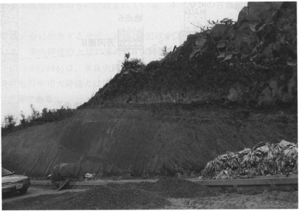
WS-24-2 (continued)
In this area, the stratigraphic relationships between the Imaichi pyroclastic-flow deposits and the Yabakei and Yufugawa pyroclastic-flow deposits, other large-volume deposits of central Kyushu, can be observed. A rounded-gravel bed lies immediately below the Imaichi deposits (locality 2), with nonwelded Yabakei pyroclastic-flow deposits below it (locality 9). The base of the Yabakei deposits includes a stratified part that conformably overlies sand beds of the underlying Wasada (東植田) Formation of the Oita Group (locality 10; Yoshioka and Hoshizumi, 1992; p. 101, Fig. 76). The welded part of the Yabakei deposits can be observed at locality 11 in Kaminakao, Hasama Town. Pumice fall of the Yufugawa pyroclastic flow also overlies the Imaichi deposits, with brown soil between them (locality 8; Yoshioka et al., 1997). At locality 12 on the plateau of the Imaichi deposits, a nonwelded part of the Yufugawa pyroclastic-flow deposits was confirmed.
Kamata et al. (1994b) measured, for the Imaichi pyroclastic-flow deposits (samples numbered in italics in the columns), the Azuki volcanic ash of the Osaka Group, and the Ku6C volcanic ash of the Kazusa Group: (1) the proportions of glass, plagioclase, and heavy minerals; (2) the proportions of orthopyroxene, clinopyroxene, and green common hornblende among the heavy minerals; and (3) the refractive indices of glass, orthopyroxene, and clinopyroxene. The results show systematic, matching compositional changes from felsic below to mafic above in the Imaichi deposits and in both the Azuki and Ku6C ashes, establishing their correlation. Thus, the Imaichi pyroclastic-flow deposits–Azuki volcanic ash–Ku6C volcanic ash were shown to constitute a widespread volcanic ash (Shishimuta–Azuki, Ss-Az) extending as far as 900 km from the source. Many similarities were also recognized between the basal pumice fall of the Imaichi deposits and the white fine volcanic ash (the so-called hakama) at the base of the Azuki and Ku-6C volcanic ashes. These results demonstrate that the Azuki and Ku6C ashes consist of both the distal facies of the main Imaichi pyroclastic flow (co-ignimbrite ash) and the distal facies of the pumice fall (distal plinian ash).
References: Hayashida et al. (1996); Hoshizumi (1993); Hoshizumi and Kamata (1991); Hoshizumi and Morishita (1993); Hoshizumi et al. (1988, 1992); Kamata et al. (1994a, b); Ono (1963); Ono et al. (1977); Uto and Suto (1985); Yoshioka and Hoshizumi (1992); Yoshioka et al. (1997).
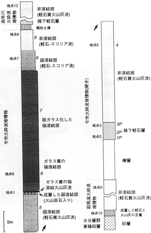
Show extracted lettering and translation
English translation of figure lettering
Left column, from top: Yufugawa pyroclastic-flow deposits: locality 12, nonwelded part (pumiceous ash flow); pumice-fall bed; brown soil. Imaichi pyroclastic-flow deposits: locality 8, sample 9, nonwelded part (pumice–scoria flow); locality 7, 8, weakly welded part (pumice–scoria flow); 7, devitrified strongly welded part; glassy strongly welded part, locality 6, 6; locality 1, glassy strongly welded ash flow; stratified weakly welded part (with accretionary lapilli); 5, weakly welded part (pumiceous ash flow). Scale 5 m. Right column, from top: Imaichi pyroclastic-flow deposits (continued); locality 5, 4, nonwelded part (pumiceous ash flow); locality 3, 3P; 2P, pumice-fall bed; locality 2, 1P; gravel. Yabakei pyroclastic-flow deposits: locality 9, nonwelded part (pumiceous ash flow); locality 10, stratified alternating pumice and volcanic-ash beds. Oita Group, Wasada (東植田) Formation; sand. Italic numerals designate samples. Arabic locality numerals designate outcrops.
Original Japanese lettering
左柱上から:由布川火砕流堆積物:地点12,非溶結部(軽石質火山灰流);降下軽石層;褐色土壌。今市火砕流堆積物:地点8,試料9,非溶結部(軽石-スコリア流);地点7,8,弱溶結部(軽石-スコリア流);7,脱ガラス化した強溶結部;ガラス質の強溶結部,地点6,6;地点1,ガラス質の強溶結火山灰流;成層した弱溶結部(火山豆石入り);5,弱溶結部(軽石質火山灰流)。尺度5m。 右柱上から:今市火砕流堆積物(続き);地点5,4,非溶結部(軽石質火山灰流);地点3,3P;2P,降下軽石層;地点2,1P;礫層。耶馬溪火砕流堆積物:地点9,非溶結部(軽石質火山灰流);地点10,成層した軽石と火山灰の互層。大分層群東植田層;砂層。
WS-24-3 Kisen volcanic-ash bed in the Katata Hills west of Lake Biwa—the widely distributed Azuki volcanic ash
Kiyohide Mizuno
Locality: middle reaches of the Kisen River west of 高城, Shiga Town, Shiga District, Shiga Prefecture. Coordinates: N35°09′36″ E135°54′42″. Elevation: 120 m. Outcrop type and condition: artificial exposure; extant. Deposits and age: freshwater deposits; Early Pleistocene, approximately 0.85 Ma.
Date described: January 1996. Keywords: Kisen volcanic-ash bed; Azuki volcanic ash; Kobiwako Group; Katata Hills.
An outcrop of the Kisen volcanic-ash bed (Hayashi, 1974), correlated with the Azuki volcanic-ash bed, a representative tephra of the Osaka Group, occurs in the middle reaches of the Kisen River in the Katata Hills west of Lake Biwa. Yokoyama and Kusunoki (1967) had already identified it as the Azuki volcanic-ash bed, but here the local name Kisen volcanic-ash bed is used. The hills in this area consist of freshwater deposits of latest Early to Middle Pleistocene age called the Katata Formation of the Kobiwako Group (Hayashi, 1974; Yokoyama, 1975). This outcrop is a small cliff approximately 3 m high on the near right side when viewed from downstream of the Kisen River check dam, and the tephra is intercalated in silt.
The tephra should also be present in the cliff on the opposite bank, but it is difficult to observe. Its characteristics have been described in detail by Yokoyama and Kusunoki (1967), Yoshikawa (1983), Ito et al. (1989), Nishida and Wada (1991), and others. It is a glassy volcanic ash approximately 200 cm thick. The lowermost approximately 10 cm is greyish-white and, on close inspection, is divided into about five beds. This is overlain by a grey to dark grey part 10–25 cm thick. Above it are alternating grey to greyish-white beds, most likely representing secondary deposition. Excluding the secondarily deposited part, an upward change in chemical composition and other characteristics from dacitic to andesitic has been pointed out (Nishida and Wada, 1991, and others).
References: Hayashi (1974); Ito et al. (1989); Nishida and Wada (1991); Yokoyama (1975); Yokoyama and Kusunoki (1967); Yoshikawa (1983).
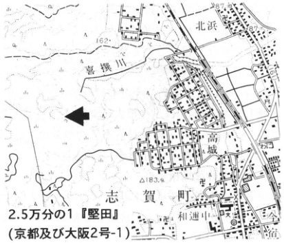
Show extracted lettering and translation
English translation of figure lettering
1:25,000 “Katata” (Kyoto and Osaka 2-1). Kisen River, Kitahama, 高城, Shiga Town, Waninaka. Elevations 87, 162, 183.9.
Original Japanese lettering
2.5万分の1「堅田」(京都及び大阪2号-1)。喜撰川,北浜,高城,志賀町,和邇中。標高87,162,183.9。
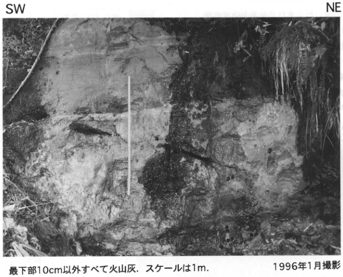
Show extracted lettering and translation
English translation of figure lettering
SW; NE. All material except the lowermost 10 cm is volcanic ash. Scale 1 m. Photographed in January 1996.
Original Japanese lettering
SW;NE。最下部10cm以外すべて火山灰.スケールは1m.1996年1月撮影。
WS-24-4 Ku6C tephra in the Kokumoto Formation of the Kazusa Group—a representative Early Pleistocene widespread tephra
Shigeo Sugihara
Locality: north of Umegase, Ichihara City, Chiba Prefecture (Umegase–Tsukizaki/Okubo forest road). Coordinates: N35°15′55″ E140°08′09″.
Elevation: 210 m. Outcrop type and condition: artificial exposure along a forest road; extant in June 1996. Deposits and age: marine deposits and fine glassy tephra; Early Pleistocene. Date described: June 1996. Keywords: Boso Peninsula; Kazusa Group; Kokumoto Formation; Ku6C tephra; Magari–Azuki tephra; Matuyama–Brunhes geomagnetic boundary.
Early to Middle Pleistocene strata (with a Pliocene lower part), called the Kazusa Group, are widely distributed in the central and northern Boso Peninsula. This locality is along a forest road approximately 2 km southwest of Kazusa-Okubo Station on the Kominato Railway. (Recently, portions of forest roads in this area have been closed owing to landownership issues; care is required when visiting the outcrop.) Among the widespread tephras intercalated in the Kazusa Group, this outcrop exposes the Ku6C tephra of the Kokumoto Formation, correlated with the Azuki volcanic ash of the Osaka Group. Most of the cliff face is covered with concrete, but fortunately the part containing the Ku6 tephra group in the mudstone (siltstone) of the Kokumoto Formation is exposed above the road surface. Five tephras, Ku6A through Ku6E, can be distinguished within the interval from the outcrop base to 2.5 m above it. Ku6C is the third bed from the top, a greyish-white fine glassy tephra less than or equal to 10 cm thick, and can be sampled at the outcrop. The significance of Azuki and Ku6C in Kansai and Kanto is that both lie just below the Matuyama–Brunhes geomagnetic boundary and occupy the lower parts of warm-water marine deposits indicating an interglacial (Ma3 and the lower Kokumoto Formation). A fission-track age of 870±20 ka is available for the Ku6C–Azuki volcanic ash (many other ages are also available). Recently, the Ku6C–Azuki ash has also been shown to correlate with the Magari tephra and the Imaichi pyroclastic-flow deposits and pumice fall of central Kyushu (WS-24-1, WS-24-2). This tephra is a first-class marker of the end of the Early Pleistocene.
References: Kamata et al. (1994); Machida et al. (1980); Mitsunashi et al. (1959); Niitsuma (1976).
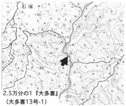
Show extracted lettering and translation
English translation of figure lettering
1:25,000 “Otaki” (Otaki 13-1). Ishizuka. Elevations 194, 239.3, 172, 188, 220.
Original Japanese lettering
2.5万分の1「大多喜」(大多喜13号-1)。石塚。標高194,239.3,172,188,220。
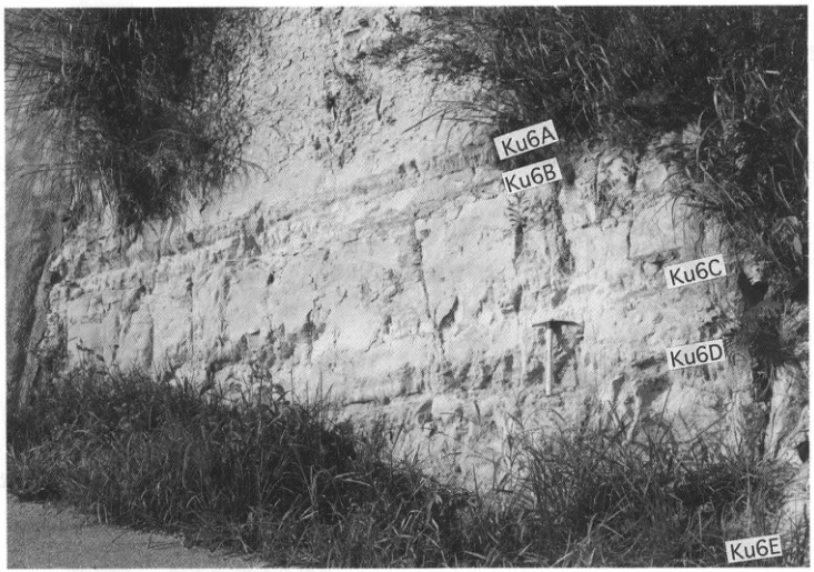
Show extracted lettering and translation
English translation of figure lettering
From top: Ku6A, Ku6B, Ku6C, Ku6D, Ku6E.
Original Japanese lettering
上から:Ku6A,Ku6B,Ku6C,Ku6D,Ku6E。
WS-25-1 Yabakei pyroclastic-flow deposits in central Kyushu—the source pyroclastic flow of the Pink volcanic ash of the Osaka Group
Hiroki Kamata and Hideo Hoshizumi
Localities: Kaguma (鹿熊), Yabakei Town, Oita Prefecture (locality 2); Kasagiharu, Hijudai, Kusu Town, in the same prefecture (Self-Defense Forces Hijudai Training Area) (locality 4). Coordinates: N33°25′33″ E131°6′44″ (locality 2); N33°18′47″ E131°15′28″ (locality 4). Elevation: 230 m (locality 2); 600 m (locality 4). Outcrop type and condition: artificial exposure (locality 2); natural exposure (locality 4). Deposits and age: pyroclastic-flow deposits; latest Early Pleistocene. Dates described: March 1995 (locality 2); March 1987 (locality 4). Keywords: Yabakei pyroclastic-flow deposits; Pink volcanic ash; Shishimuta caldera; O7 volcanic ash; accretionary lapilli.
The Yabakei pyroclastic-flow deposits extend over a vast area spanning Kumamoto and Oita prefectures and are among the largest pyroclastic-flow deposits in central Kyushu. A K–Ar age of 0.99±0.03 Ma (Uto and Suto, 1985) and a fission-track age of 1.04±0.05 Ma (Danhara et al., 1994) have been obtained, and their magnetic polarity is normal. Because the overlying Imaichi pyroclastic-flow deposits have reversed polarity, the Yabakei eruption is considered to have occurred during the Jaramillo subchron (0.99–1.07 Ma). The surviving deposits cover approximately 480 km², have a maximum thickness of approximately 150 m, and have a surviving volume of approximately 40 km³ and an estimated volume of approximately 110 km³ (Kamata, 1989a). No crater landform or caldera corresponding to the source is presently identifiable at the surface. However, from the surface distribution and elevations of the deposits, drill-core samples, gravity anomalies, and other data, Kamata (1989a) postulated Shishimuta caldera near Shishimuta, Kokonoe Town, north of Kuju volcano, as the source of the Yabakei pyroclastic flow. The Yabakei deposits are correlated with the Pink volcanic ash of the Osaka Group and the O7 volcanic ash of the Kazusa Group, important key beds of the latest Early Pleistocene (Danhara et al., 1992; Hayashida et al., 1996). The evidence is as follows. In the Yabakei deposits and Pink ash: (1) the refractive indices of volcanic glass agree closely, with modal values of n=1.498–1.502; (2) phenocrysts of green common hornblende, orthopyroxene, clinopyroxene, zircon, apatite, and opaque minerals occur in approximately the same proportions, respectively about 40–70, 5–30, 1–10, 0–1, 1–2, and 10–30%; and (3) the refractive indices of green common hornblende and clinopyroxene agree closely, with modal values of n₂=1.673–1.679 and γ=1.706–1.710, respectively (Danhara et al., 1992). The Yabakei deposits, Pink ash, and O7 ash are also all characterized by normal polarity with a shallow inclination of approximately 30° (Hayashida et al., 1996).
The Yabakei pyroclastic-flow deposits consist chiefly of welded material, forming an extensive pyroclastic-flow plateau. Except for some black glassy facies, the welded part is extensively devitrified and grey. Columnar joints 0.5–2 m wide are developed. At devitrified outcrops, both matrix and juvenile lenses are grey and difficult to distinguish. Nonwelded parts occur at the base and top of the pyroclastic-flow deposits, but the upper nonwelded part has often been lost to erosion. The nonwelded part contains pale greyish-brown pumice, usually no larger than 10 cm but sometimes reaching 20 cm, in a greyish-white ash matrix. A characteristic of both welded and nonwelded deposits is the abundance of approximately 1–3 mm crystal fragments of plagioclase, common hornblende, and orthopyroxene in the matrix and juvenile lenses or pumice.
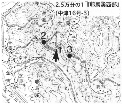
Show extracted lettering and translation
English translation of figure lettering
Localities 1, 2, 3; 1:25,000 “Western Yabakei” (Nakatsu 16-3). Oshima, 奥鶴, 幸田, 金吉, 芝原, 鹿熊, Yabakei. Elevations 152, 366, 374; contour 200.
Original Japanese lettering
地点1,2,3;2.5万分の1「耶馬溪西部」(中津16号-3)。大島,奥鶴,幸田,金吉,芝原,鹿熊,耶馬溪。標高152,366,374;等高線200。
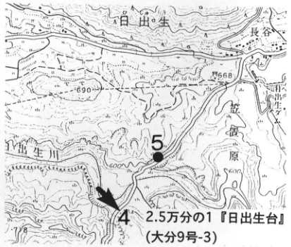
Show extracted lettering and translation
English translation of figure lettering
Localities 4, 5; 1:25,000 “Hijudai” (Oita 9-3). 日出生, 長谷, Kasagiharu, 日出生 River. Elevations 690, 668, 678; contours 500, 600.
Original Japanese lettering
地点4,5;2.5万分の1「日出生台」(大分9号-3)。日出生,長谷,笠置原,日出生川。標高690,668,678;等高線500,600。
WS-25-1 (continued)
The exposures at localities 1, 2, and 3 (Kaguma, Yabakei Town) lie partway up the road ascending the plateau of the Yabakei pyroclastic-flow deposits. At locality 1, the nonwelded part directly overlies the underlying strata, with no basal fallout pyroclasts recognized. Locality 2 consists of black glassy strongly welded material, from which fresh, nondevitrified samples can be collected. Continuing up the road, successively higher facies can be observed continuously: a thick grey devitrified strongly welded part and a pale brown weakly welded to nonwelded part (left column). At locality 3, the uppermost nonwelded part of the Yabakei deposits has been lost, leaving the succession terminating in weakly welded material. The Imaichi pyroclastic-flow deposits overlie it with a weathered zone between (Kamata et al., 1994a).
At locality 4, in the Ground Self-Defense Force training area at Hijudai Kasagiharu, Kusu Town, a volcanic-ash fallout bed is recognized immediately below the Yabakei pyroclastic-flow deposits. The bed is pale greyish-brown throughout, approximately 60 cm thick, and composed chiefly of accretionary lapilli no larger than 1 cm (photograph) (Hoshizumi et al., 1988). Its uppermost part includes alternating volcanic-ash and volcanic-sand beds a few centimetres thick. The main nonwelded pyroclastic-flow deposit lies immediately above, with no weathering or erosional hiatus between them (right column). North of the road at this outcrop, nonwelded Kasagiharu pyroclastic-flow deposits occur below the Yabakei deposits, separated from them by the Onigahara debris deposits (stratified tuff breccia and other material). The Kasagiharu deposits originated from the rhyolitic lava plateau 2 km to the west (Komatsudai rhyolites, approximately 1.2 Ma) (Hoshizumi et al., 1988). Other exposures of fallout pyroclasts at the base of the Yabakei deposits have been confirmed along the national highway 100 m southeast of the 620 m elevation point southwest of Ishitobi, Kusu Town, and along a forest road 2.5 km east-southeast of Matsuki Dam (both within the 1:25,000 “Bungo-Mori” sheet). However, vegetation and other factors make the exposures rather poor.
References: Danhara et al. (1992, 1994); Hayashida et al. (1996); Hoshizumi et al. (1988); Kamata (1989a); Kamata et al. (1994a); Uto and Suto (1985).
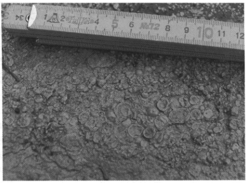
Show extracted lettering and translation
English translation of figure lettering
Legible tape-measure numerals: 1, 2, 4, 5, 6, 7, 8, 9, 10, 11, 12.
Original Japanese lettering
巻尺の可読目盛:1,2,4,5,6,7,8,9,10,11,12。
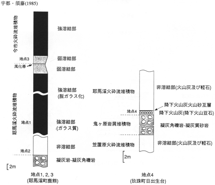
Show extracted lettering and translation
English translation of figure lettering
Left column: localities 1, 2, 3 (Kaguma, Yabakei Town). From top: Imaichi pyroclastic-flow deposits: strongly welded part; weakly welded part; locality 3, weathered zone. Yabakei pyroclastic-flow deposits: weakly welded part; strongly welded part (devitrified); locality 1, strongly welded part (glassy); nonwelded part; locality 2; tuff–tuff breccia. Scale 2 m. Right column: locality 4 (Hijudai, Kusu Town). From top: Yabakei pyroclastic-flow deposits: nonwelded part (volcanic ash and pumice); alternating volcanic-ash and volcanic-sand fallout beds; locality 4, volcanic-ash fall (accretionary-lapilli fall). Onigahara debris deposits: tuff breccia–tuffaceous sandstone. Kasagiharu pyroclastic-flow deposits: nonwelded part (volcanic ash and pumice). Scale 2 m. Uto and Suto (1985) at the image top has been restored in the main references.
Original Japanese lettering
左柱:地点1,2,3(耶馬溪町鹿熊)。上から今市火砕流堆積物:強溶結部;弱溶結部;地点3,風化帯。耶馬溪火砕流堆積物:弱溶結部;強溶結部(脱ガラス化);地点1,強溶結部(ガラス質);非溶結部;地点2;凝灰岩-凝灰角礫岩。尺度2m。 右柱:地点4(玖珠町日出生台)。上から耶馬溪火砕流堆積物:非溶結部(火山灰及び軽石);降下火山灰火山砂互層;地点4,降下火山灰(降下火山豆石)。鬼ヶ原岩屑堆積物:凝灰角礫岩-凝灰質砂岩。笠置原火砕流堆積物:非溶結部(火山灰及び軽石)。尺度2m。画像上端の宇都・須藤(1985)は本文文献に復元済。
WS-25-2 Dochu volcanic-ash bed, an Early Pleistocene widespread tephra at the earth pillars of Tokushima Prefecture—Osaka Pink volcanic ash
Kiyohide Mizuno
Locality: Awa-no-Dochu Natural Monument north of Sakuranooka, Awa Town, Awa District, Tokushima Prefecture. Coordinates: N34°05′20″ E134°12′34″.
Elevation: 120 m. Outcrop type and condition: natural exposure; extant. Deposits and age: freshwater deposits; Early Pleistocene, approximately 1.0 Ma. Date described: January 1996. Keywords: Dochu volcanic ash; Osaka Pink volcanic ash; Awa-no-Dochu.
Awa Town, Tokushima Prefecture, has “earth pillars” formed by erosion of strata consisting chiefly of fluvial gravel, and these have been designated a national natural monument. These strata are called the Dochu Formation. The intercalated Dochu volcanic-ash bed (Akoshima and Suyari, 1989) is correlated with the Pink volcanic-ash bed, one of the representative tephras of the Osaka Group erupted approximately 1.0 Ma (Mizuno, 1987). A column of the Dochu Formation by Suyari and Akoshima (1977) is presented here. The Dochu volcanic-ash bed in the middle of the succession consists of glassy volcanic ash approximately 40–100 cm thick, described in detail by Mizuno (1987) and Akoshima and Suyari (1989). Its paleomagnetic polarity is normal, and a fission-track age of 1.3±0.2 Ma has been obtained.
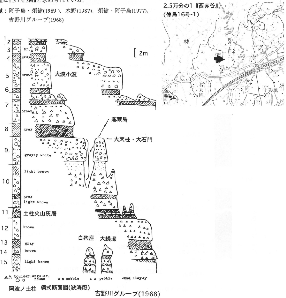
Show extracted lettering and translation
English translation of figure lettering
Map: 1:25,000 “Nishi-Akadani” (Tokushima 16-1); Awa-no-Dochu, Hayashi, Sakuranooka, 名東岡, 十善地; elevations 203, 149.9, 84. Reference cross-section of Awa-no-Dochu (Hatodake); Yoshinogawa Group (1968); scale 2 m. Named landforms: Onami-Konami, Horaijima, Daitenchu–Daisekimon, Hakukuza, Oarizuka. Legend, retaining original English: boulder, angular, round; cobble; pebble; clayey. Bed numbers and original colour lettering:
| Number | Legible colour or label |
|---|---|
| 1 | br. |
| 2 | illegible |
| 3 | br. |
| 4 | gray |
| 5 | brown br. |
| 6 | no colour lettering |
| 7 | brown br. |
| 8 | gray |
| 9 | grayey white |
| 10 | light brown; gray; light brown |
| 11 | Dochu volcanic-ash bed |
| 12 | brown |
| 13 | gray |
| 14 | brown |
| 15 | light brown |
Original Japanese lettering
地図:2.5万分の1「西赤谷」(徳島16号-1);阿波ノ土柱,林,桜ノ岡,名東岡,十善地;標高203,149.9,84。 阿波ノ土柱 模式断面図(波涛嶽);吉野川グループ(1968);尺度2m。地形名:大波小波,蓬莱島,大天柱・大石門,白狗座,大蟻塚。凡例:boulder, angular, round;cobble;pebble;clayey。層番号と原図色調:
| 番号 | 可読色調・ラベル |
|---|---|
| 1 | br. |
| 2 | 判読不明 |
| 3 | br. |
| 4 | gray |
| 5 | brown br. |
| 6 | 色調文字なし |
| 7 | brown br. |
| 8 | gray |
| 9 | grayey white |
| 10 | light brown;gray;light brown |
| 11 | 土柱火山灰層 |
| 12 | brown |
| 13 | gray |
| 14 | brown |
| 15 | light brown |
Reading notes
第2層の細字 — 原図上端の文字が重なり判読できない。br.とgrayey whiteは原図表記を保持。
References: Akoshima and Suyari (1989); Mizuno (1987); Suyari and Akoshima (1977); Yoshinogawa Group (1968).
WS-25-3 Pink volcanic ash, a representative widespread tephra of the lower Osaka Group
Kiyohide Mizuno
Locality: east of 富蔵, Sakai City, Osaka Prefecture. Coordinates: N34°28′18″ E135°31′42″. Elevation: 70 m.
Outcrop type and condition: natural exposure; extant in February 1996. Deposits and age: freshwater deposits, partly marine deposits; approximately 1.0 Ma. Keywords: Pink volcanic ash; Osaka Group; Sakai.
The Pink volcanic-ash bed is one of the representative tephras of the lower Osaka Group. Its horizon lies within the Jaramillo event, and numerous age determinations indicate approximately 1.0 Ma (Ishida et al., 1969; Danhara et al., 1992; Ichihara, 1993, and others). Widespread correlations of this tephra have also progressed. The name Pink volcanic ash was first used by Itihara (1953), and its type locality is in the Senri Hills. However, as development destroyed outcrops, the type area of the Osaka Group shifted to the Sennan and Senboku regions (Itihara et al., 1975; Yoshikawa, 1973). This outcrop forms part of that area, and its surroundings are expected to remain unaffected by development for some time. The exposure is approximately 10 m high, and the Pink volcanic-ash bed is intercalated in freshwater silt in its upper part. Below it lies the marine clay bed called Ma1, containing one extremely thin volcanic-ash bed. The geology around the outcrop is described by Yoshikawa (1973) and Itihara et al. (1975). Detailed features of the Pink ash can be observed in the valley to the southeast (the ■ locality on the map). The bed is approximately 70 cm thick, consists of greyish-white to pale pink glassy volcanic ash, and is divided into about six beds (Yoshikawa, 1984). In particular, coarse sandy beds occur at two middle horizons. Its petrographic characteristics are described in detail by Yokoyama and Kusunoki (1969), Yoshikawa (1976), Yoshikawa (1984), and others.
References: Danhara et al. (1992); Ishida et al. (1969); Itihara (1953); Ichihara (1993); Itihara et al. (1975); Yokoyama and Kusunoki (1969); Yoshikawa (1973); Yoshikawa (1976); Yoshikawa (1984).
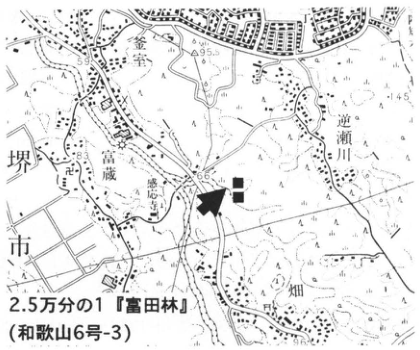
Show extracted lettering and translation
English translation of figure lettering
1:25,000 “Tondabayashi” (Wakayama 6-3). Sakai City, 富蔵, Sakasegawa, Kamamuro, Hata, Kannoji Temple. Elevations 59, 95.5, 145, 83, 66, 96.2.
Original Japanese lettering
2.5万分の1「富田林」(和歌山6号-3)。堺市,富蔵,逆瀬川,釜室,畑,感応寺。標高59,95.5,145,83,66,96.2。
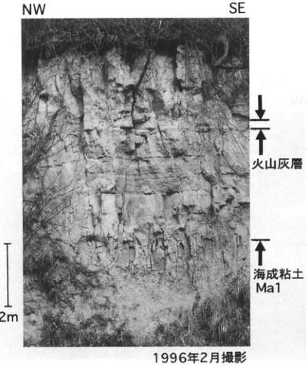
Show extracted lettering and translation
English translation of figure lettering
NW; SE; volcanic-ash bed; marine clay Ma1; 2 m; photographed in February 1996.
Original Japanese lettering
NW;SE;火山灰層;海成粘土Ma1;2m;1996年2月撮影。
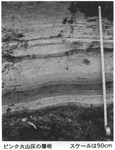
Show extracted lettering and translation
English translation of figure lettering
Facies of the Pink volcanic ash; scale 90 cm.
Original Japanese lettering
ピンク火山灰の層相;スケールは90cm。
WS-26-1 Fukuda volcanic-ash bed of the Osaka Group marking the Tertiary–Quaternary boundary horizon
Shusaku Yoshikawa
Locality: Mikeyama Town, Kishiwada City, Osaka Prefecture. Coordinates: N34°25′52″ E135°25′09″. Elevation: 60 m.
Outcrop type and condition: artificial exposure; destroyed by land development in 1992. Deposits and age: fluvial-lacustrine silt and sand, and volcanic ash; Pliocene and Early Pleistocene, 1.75 Ma. Date described: 1987. Keywords: Osaka Group; Fukuda volcanic-ash bed.
The most complete succession of the Osaka Group is developed in the Sennan and Senboku Hills of southern Osaka Prefecture. On the basis of plant-fossil occurrences, the group is divided into three parts: the lowermost part, representing the flourishing phase of the Metasequoia flora; the lower part, representing its disappearance phase; and the upper part. Their boundaries are placed at the top of the Fukuda volcanic-ash bed and the base of the Azuki volcanic-ash bed, respectively. The Fukuda horizon is considered the Tertiary–Quaternary boundary, with the Olduvai subchron of the paleomagnetic stratigraphy immediately below it (Ichihara, 1960; Yoshikawa, 1983; Ichihara, 1993). The exposure in Mikeyama Town, Kishiwada City, is the type locality of the Fukuda volcanic-ash bed. Fluvial-lacustrine silt and sand beds, locally sand and gravel, were present, and the Fukuda ash, 100–60 cm thick, was exposed within silt. An unnamed white fine volcanic-ash bed, 5–10 cm thick, could also be observed 10 cm below it. The Fukuda ash here consists of unit A, 14 cm of white to yellowish-white fine- to medium-grained glassy volcanic ash; unit B, 10 cm of reddish-purple fine- to medium-grained glassy volcanic ash; and unit C, 25–100 cm of yellowish-white to white fine glassy volcanic ash containing pumice. The Fukuda bed is continuously distributed in southern Osaka, and its equivalents have been found in the Kinki and Tokai regions, and farther afield in Niigata and on the Boso Peninsula. In Niigata it corresponds to the Tsujimatagawa volcanic-ash bed of the Uonuma Group, and in Boso to the Kd38 volcanic-ash bed of the Kazusa Group (Yoshikawa et al., 1995).
References: Ichihara (1960, 1993); Yoshikawa (1983); Yoshikawa et al. (1995).
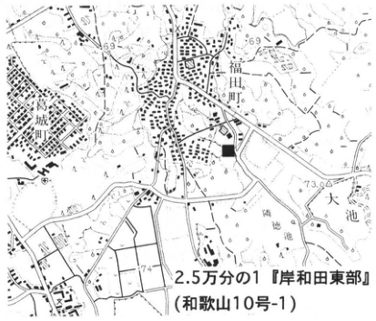
Show extracted lettering and translation
English translation of figure lettering
1:25,000 “Eastern Kishiwada” (Wakayama 10-1). Fukuda Town, Katsuragi Town, Oike. Elevations 69, 73.0, 74.
Original Japanese lettering
2.5万分の1「岸和田東部」(和歌山10号-1)。福田町,葛城町,大池。標高69,73.0,74。
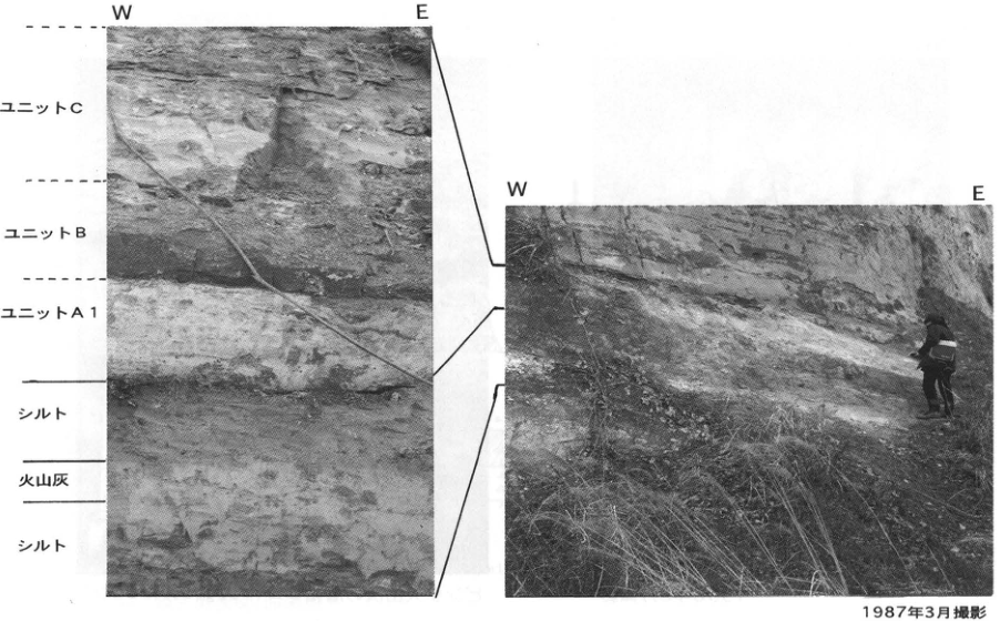
Show extracted lettering and translation
English translation of figure lettering
W, E on both photographs. Left photograph, from top: unit C; unit B; unit A1; silt; volcanic ash; silt. Photographed in March 1987.
Original Japanese lettering
左右ともW,E。左写真上から:ユニットC;ユニットB;ユニットA1;シルト;火山灰;シルト。1987年3月撮影。
WS-26-2 Tsujimatagawa volcanic-ash bed of the Uonuma Group marking the Tertiary–Quaternary boundary horizon
Shusaku Yoshikawa
Locality: Tsujimata, Yamato Town, Minamiuonuma District, Niigata Prefecture. Coordinates: N37°11′01″ E138°52′29″. Elevation: 210 m.
Outcrop type and condition: natural exposure; extant in September 1995. Deposits and age: fluvial-lacustrine silt, sand, sand and gravel, and volcanic ash; Pliocene to Early Pleistocene, 1.75 Ma. Date described: October 1989. Keywords: Uonuma Group; Tsujimatagawa volcanic ash; Fukuda volcanic ash.
The Pliocene–Pleistocene Uonuma Group is widely distributed in the Uonuma and Higashikubiki Hills of Niigata Prefecture. With a maximum thickness of approximately 3,000 m, it consists of marine or inland-water gravel, sand, and silt and contains approximately fifty volcanic-ash beds. The Tsujimatagawa volcanic-ash bed (Tzc) is intercalated in the upper part of the lower formation of the Uonuma Group, somewhat below the SK120 volcanic-ash bed and immediately above the Olduvai subchron in the paleomagnetic stratigraphy. The outcrop at Tsujimata, Yamato Town, Minamiuonuma District, is its type locality (Kazaoka et al., 1986). This is an approximately 3-m-high cliff on the east bank of the Tsujimata River, exposing fluvial-lacustrine silt, sand, and sand and gravel, locally with peat. The Tsujimatagawa ash, 120–100 cm thick, is exposed within this silt. Facies differences divide it, in ascending order, into units A1, A2, B, and C. Unit A1 is 16–23 cm of yellowish-white to white coarse- to fine-grained glassy volcanic ash. Unit A2 is 23 cm of white, salt-and-pepper-like, coarse- to medium-grained, somewhat crystal-rich volcanic ash. Unit B is 10 cm of reddish-purple fine- to medium-grained glassy volcanic ash. Unit C is 50–70 cm of yellowish-white to greyish-white to white fine- to coarse-grained glassy volcanic ash. The Tsujimatagawa bed is correlated with the Fukuda volcanic-ash bed of the Osaka Group (WS-26-1) and the Kd38 volcanic-ash bed of the Kazusa Group (WS-26-3) (Yoshikawa et al., 1994; Kurokawa and Tomita, 1995; Yoshikawa et al., 1996).
References: Kazaoka et al. (1986); Kurokawa and Tomita (1995); Yoshikawa et al. (1994, 1996).
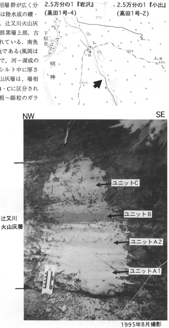
Show extracted lettering and translation
English translation of figure lettering
Map: 1:25,000 “Iwasawa” (Takada 1-4); 1:25,000 “Koide” (Takada 1-2). 下稲倉, Myojin, 上山; elevations 272, 194, 353, 424, 234.6. Photograph: NW, SE; Tsujimatagawa volcanic-ash bed; from top, units C, B, A2, A1; photographed in August 1995. Text fragments at the left edge are included in the main text.
Original Japanese lettering
地図:2.5万分の1「岩沢」(高田1号-4);2.5万分の1「小出」(高田1号-2)。下稲倉,明神,上山;標高272,194,353,424,234.6。写真:NW,SE;辻又川火山灰層;上からユニットC,B,A2,A1;1995年8月撮影。画像左縁の本文断片は本文に収録済。
WS-26-3 Kd38 volcanic-ash bed of the Kazusa Group marking the Tertiary–Quaternary boundary horizon
Shusaku Yoshikawa
Locality: 加勢, Kimitsu City, Chiba Prefecture. Coordinates: N35°12′24″ E140°06′21″. Elevation: 100 m.
Outcrop type and condition: natural exposure; extant in June 1995. Deposits and age: marine silt and sand beds, and volcanic ash; Pliocene and Early Pleistocene, 1.75 Ma. Date described: June 1995. Keywords: Kazusa Group; Kiwada Formation; Kd38 volcanic-ash bed; Boso Peninsula.
The Pliocene and Lower Pleistocene Kazusa Group is widely distributed in the Kazusa Hills of the Boso Peninsula, Chiba Prefecture. It exceeds 3,000 m in maximum thickness and consists of alternating marine clay, sand, and silt beds, containing more than approximately 200 volcanic-ash beds. The Kd38 volcanic-ash bed is intercalated in the lower Kiwada Formation or the Kurotaki Formation of the Kazusa Group (Mitsunashi et al., 1959). It is an important key bed marking the Tertiary–Quaternary boundary horizon because it lies immediately below the FAD of Gephyrocapsa caribbeanica in the calcareous nannofossil stratigraphy (Takayama et al., 1995) and immediately above the Olduvai subchron in the paleomagnetic stratigraphy (Niitsuma, 1976). The outcrop at 加勢, Kimitsu City, is a cliff on the east bank of a tributary of the Obitsu River, just below the tunnel near the entrance to the University of Tokyo experimental forest at Orikizawa. Marine sand beds, locally silt, are exposed. An approximately 40-cm-thick Kd38 volcanic-ash bed is seen within this sand. Facies differences divide the ash, in ascending order, into units A1, A2, and B. Unit A1 is 12 cm of white medium- to fine-grained glassy volcanic ash containing 2–3 mm accretionary lapilli in its middle part. Unit A2 is 12 cm of greyish-white, salt-and-pepper-like, medium- to fine-grained, somewhat crystal-rich volcanic ash with developed parallel and cross-lamination. Unit B is 10–20 cm of reddish-purple fine- to medium-grained glassy volcanic ash. The Kd38 bed is correlated with the Fukuda volcanic-ash bed of the Osaka Group (WS-26-1) and the Tsujimatagawa volcanic-ash bed of the Uonuma Group (WS-26-2) (Yoshikawa et al., 1994; Kurokawa and Tomita, 1995; Yoshikawa et al., 1996).
References: Kurokawa and Tomita (1995); Mitsunashi et al. (1959); Niitsuma (1976); Takayama et al. (1995); Yoshikawa et al. (1994, 1996).
Show extracted lettering and translation
English translation of figure lettering
1:25,000 “Sakahata” (Otaki 13-4). 加勢; 折 [remainder of locality name cropped]. Elevations 140, 204, 315.2.
Original Japanese lettering
2.5万分の1「坂畑」(大多喜13号-4)。加勢;折〔地名の残りは切れている〕。標高140,204,315.2。
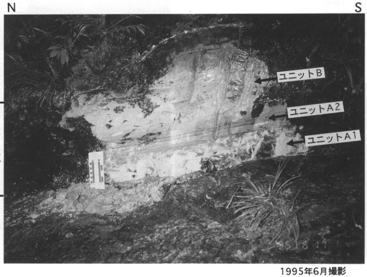
Show extracted lettering and translation
English translation of figure lettering
N; S; kd38 volcanic ash; from top, unit B, unit A2, unit A1; photographed in June 1995.
Original Japanese lettering
N;S;kd38火山灰;上からユニットB,ユニットA2,ユニットA1;1995年6月撮影。
2. Hokkaido region
HK-1 Late Pleistocene tephra beds from Rishiri volcano on plateaus around the Sarobetsu Plain, northern Hokkaido
Hideki Miura
Locality: 豊徳, Toyotomi Town, Hokkaido. Coordinates: N45°7′28″ E141°38′23″. Elevation: 26 m. Outcrop type and condition: artificial exposure; extant.
Deposits and age: eolian tephra and marine deposits; Late Pleistocene. Date described: May 1990.
Keywords: Rishiri-derived tephras; Rishiri–Wankonosawa tephra; Rishiri–豊徳 tephra; Sarobetsu Plain; cryoturbation.
All Late Pleistocene tephras derived from Rishiri volcano and distributed around the Sarobetsu Plain can be observed at this outcrop. Seven tephras are recognized directly above marine sand and gravel: Rishiri–Acharu 1 (Rs-Ac1), Acharu 2 (Rs-Ac2), Rishiri–Kabutonuma 1 (Rs-Kb1), Kabutonuma 2 (Rs-Kb2), Kabutonuma 3 (Rs-Kb3), Rishiri–Wankonosawa (Rs-Wn), and 豊徳 (Rs-Ho). At Kabutonuma on the Sarobetsu Plain, Rs-Ac1 lies above the 100–130 ka Kussharo–Haboro tephra (Kc-Hb), and Rs-Kb2 immediately below the 70–90 ka Aso-4 tephra. On the Tonbetsu Plain, Rs-Wn lies above the 31–42 ka Shikotsu-1 tephra (Spfa-1) (see Miura, 1995a, for outcrop locations and columns). The lowermost marine sand and gravel forming the plateau is called the Keihoku Formation (Sarabetsu Group et al., 1966) and has hitherto been regarded as Middle Pleistocene. However, because Rs-Ac1, Rs-Ac2, or Aso-4 directly overlies this sand and gravel at some sites, the traditionally defined Keihoku Formation is considered to include strata of differing Middle to Late Pleistocene ages (Miura, 1995b). The main distribution axis of Rs-Wn suggests a submerged depression offshore from Oniwaki, Rishiri Island (approximately 90 m below present sea level), as its crater. However, because no water-contact eruptive products are recognized in the tephra, it is expected to have erupted during a low-sea-level interval of the last glacial period. Rs-Ho is estimated to be latest Pleistocene (Miura, 1995a), rather than Holocene as previously considered (Sasaki et al., 1973; Tomioka and Otowa, 1973), because an approximately 8 ka radiocarbon age was obtained from acid-insoluble humus in the lower part of the overlying humic layer and its horizon is close to Rs-Wn. Cryoturbation is recognized at the Rs-Ho and Rs-Wn horizons, suggesting a cold environment after their deposition. This alone, however, does not directly demonstrate a permafrost environment at that time.
References: Sarabetsu Group et al. (1966); Sasaki et al. (1973); Tomioka and Otowa (1973); Miura (1995a, b).
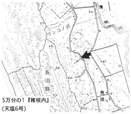
Show extracted lettering and translation
English translation of figure lettering
1:50,000 “Wakasakanai” (Teshio 6). Wankonosawa, Naganuma lake group, 豊徳, Seimei River. Elevations 5, 5.5, 57, 45, 56, 48.8, 8.7, 3.5, 51.5, 23, 55.2.
Original Japanese lettering
5万分の1「稚咲内」(天塩6号)。ワンコノ沢,長沼群,豊徳,清明川。標高5,5.5,57,45,56,48.8,8.7,3.5,51.5,23,55.2。
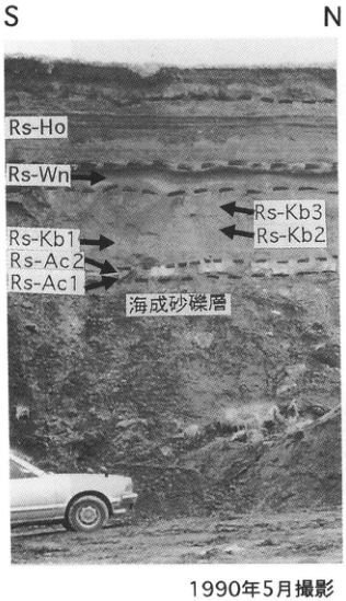
Show extracted lettering and translation
English translation of figure lettering
S; N; Rs-Ho; Rs-Wn; Rs-Kb3; Rs-Kb2; Rs-Kb1; Rs-Ac2; Rs-Ac1; marine sand and gravel; photographed in May 1990.
Original Japanese lettering
S;N;Rs-Ho;Rs-Wn;Rs-Kb3;Rs-Kb2;Rs-Kb1;Rs-Ac2;Rs-Ac1;海成砂礫層;1990年5月撮影。
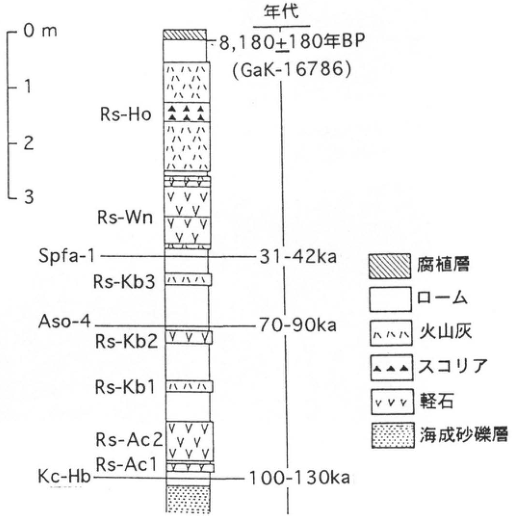
Show extracted lettering and translation
English translation of figure lettering
Scale 0, 1, 2, 3 m. Ages: 8,180±180 yr BP (GaK-16786); 31–42 ka; 70–90 ka; 100–130 ka. From top: Rs-Ho; Rs-Wn; Spfa-1 (31–42 ka); Rs-Kb3; Aso-4 (70–90 ka); Rs-Kb2; Rs-Kb1; Rs-Ac2; Rs-Ac1; Kc-Hb (100–130 ka). Legend: humic layer; loam; volcanic ash; scoria; pumice; marine sand and gravel.
Original Japanese lettering
尺度0,1,2,3m。年代:8,180±180年BP(GaK-16786);31–42ka;70–90ka;100–130ka。上からRs-Ho;Rs-Wn;Spfa-1(31–42ka);Rs-Kb3;Aso-4(70–90ka);Rs-Kb2;Rs-Kb1;Rs-Ac2;Rs-Ac1;Kc-Hb(100–130ka)。凡例:腐植層;ローム;火山灰;スコリア;軽石;海成砂礫層。
HK-2 Fossil frost-crack structures on the Tonbetsu Plain, northern Hokkaido—evidence of markedly low winter temperatures during the last glacial period
Hideki Miura
Locality: Ashino, Sarufutsu Village, Hokkaido (borrow pit near Ashino Elementary School). Coordinates: N45°17′50″ E142°11′05″. Elevation: 12 m.
Outcrop type and condition: artificial exposure; partly extant. Deposits and age: loam, eolian tephra, and marine deposits; Late Pleistocene.
Date described: December 1990. Keywords: Tonbetsu Plain; fossil frost-crack structures; Rishiri–Wankonosawa tephra; permafrost environment.
Strong winter cooling of the ground surface produces a temperature gradient within frozen ground, with greater contraction nearer the surface. Frost cracks form when the resulting tension exceeds the mechanical strength of the frozen ground. Numerous fossil frost-crack structures with this origin occur on plateaus around the Tonbetsu Plain in northern Hokkaido (outcrop maps and sketches are provided by Miura and Hirakawa, 1995). This outcrop contains the marine sand and gravel forming the Asachino surface (Asachino Formation; Heavy-Clay Land Group, 1964), overlain by dark brown fine sand with indistinct bedding, loam, and humic layers. Four frost-crack structures were confirmed in the approximately 30-m-wide southern exposure (extant; the left photograph shows one, 254 cm long from immediately below the humic layer to the crack tip). Five were confirmed in the adjacent approximately 40-m-wide northern exposure (the right photograph shows one, 238 cm long from immediately below the humic layer to the crack tip; this exposure has now disappeared). In the southern exposure, 1–2 mm pumice grains of the Rishiri–Wankonosawa tephra (Rs-Wn) form a continuous horizon approximately 40 cm below the humic layer, but are absent above the frost crack.
This indicates that the crack formed after the Rs-Wn fallout. Comparison of the theoretically calculated thickness of the contemporary freeze–thaw layer with the crack depth suggests that the photographed cracks are definite ice-wedge casts that extended below the permafrost table, implying a permafrost environment in this area during the latter half of the last glacial period. The approximately 1–2-cm-thick iron-oxide pan at the boundary between marine sand and gravel and loam in the right photograph may represent iron accumulated at a former permafrost table. Most exposures of fossil frost-crack structures around the Tonbetsu Plain have now disappeared, but the appearance of new outcrops should allow many more such structures to be discovered in this area.
References: Heavy-Clay Land Group (重粘地グループ) (1964); Miura (1995a); Miura and Hirakawa (1995).
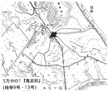
Show extracted lettering and translation
English translation of figure lettering
1:50,000 “Onishibetsu” (Esashi 9 and 13). Ashino, Sarukotsu, Lake Sarukotsu, Lake Kimoma. Elevations 20, 26.5, 11.3, 2.16, 6.
Original Japanese lettering
5万分の1「鬼志別」(枝幸9号・13号)。芦野,猿骨,猿骨沼,キモマ沼。標高20,26.5,11.3,2.16,6。
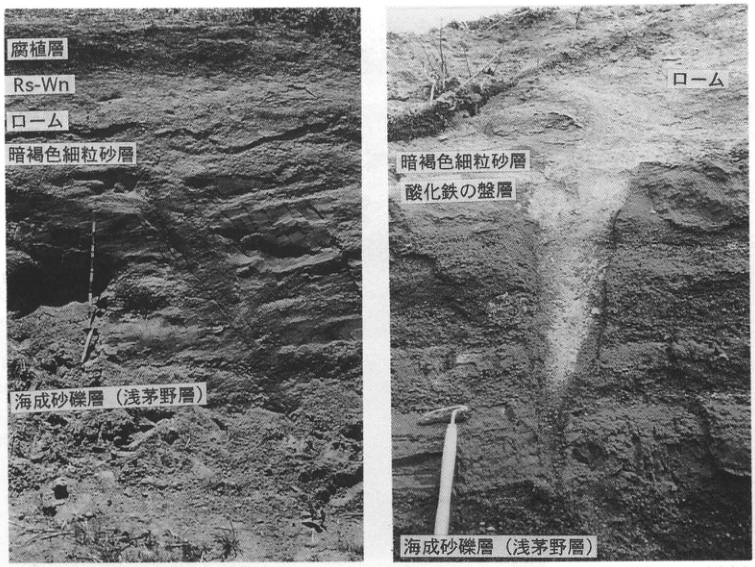
Show extracted lettering and translation
English translation of figure lettering
Left: humic layer; Rs-Wn; loam; dark brown fine sand; marine sand and gravel (Asachino Formation). Right: loam; dark brown fine sand; iron-oxide pan; marine sand and gravel (Asachino Formation).
Original Japanese lettering
左:腐植層;Rs-Wn;ローム;暗褐色細粒砂層;海成砂礫層(浅茅野層)。右:ローム;暗褐色細粒砂層;酸化鉄の盤層;海成砂礫層(浅茅野層)。
Photographed in May 1991
HK-3 Middle Pleistocene marine terraces and tephras on the shores of Lake Saroma, southern coast of the Sea of Okhotsk
Koji Okumura
Locality: Horoiwa, Saroma Town, Hokkaido. Coordinates: N44°05′45″ E143°53′25″. Elevation: 5 m.
Outcrop type and condition: artificial exposure; condition unknown. Deposits and age: pyroclastic-flow deposits and fallout tephra; Middle Pleistocene.
Date described: August 1985. Keywords: Lake Saroma; tephras from Kussharo caldera; Mombetsu volcanic ash-1; Horoiwa volcanic ash; pollen analysis.
Around southeastern Lake Saroma lie the Horoiwa terrace observed at this outcrop, the Gifu Plateau at Tokoro, and a sandbar-like plateau separating the lake from the Sea of Okhotsk. All are Middle Pleistocene marine terraces one level above the last-interglacial marine terrace, with former shorelines at elevations of 10–30 m. Around Lake Saroma, the last-interglacial marine terrace identified by Kussharo pyroclastic-flow deposits IV (KP IV) occurs only locally along the northern and western margins of the Gifu Plateau (Okumura, 1996). This outcrop exposes the reference tephra succession of this area from the Middle Pleistocene to the last interglacial (Sakaguchi and Okumura, 1986; Okumura, 1991). Mombetsu volcanic ash-1 (Mb-1) and Toetoko volcanic ash (TT), contained in the upper marine deposits, are both rich in K₂O (approximately 4 wt%) and share petrographic characteristics with tephras originating in central Hokkaido. The intervening Horoiwa volcanic ash consists of glass with major-element compositions matching KP VII and is considered tephra erupted from Kussharo volcano contemporaneously with KP VII. Similar tephra has also been found above the terrace-forming deposits of the Gifu Plateau. Glass resembling KP VI has been found in the ash overlying humic silt above the Horoiwa ash. KP IV and its co-ignimbrite ash, the Kussharo–Haboro volcanic ash, are widely distributed in central and eastern Hokkaido and identify last-interglacial terrace surfaces (see WS-16). This outcrop is at the northern limit of the pyroclastic-flow deposits. Pollen analysis of the peat and humic-silt beds indicates that a period somewhat warmer than the present followed marine deposition, after which a cooler-than-present climate persisted. However, since no pronounced warm or cold period is recognized below KP IV, this section apparently lacks deposits of the cold interval of oxygen-isotope stage 6 and the warm interval of stage 5e (Sakaguchi and Okumura, 1986).
References: Okumura (1991); Okumura (1996); Sakaguchi and Okumura (1986).
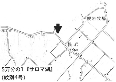
Show extracted lettering and translation
English translation of figure lettering
1:50,000 “Lake Saroma” (Mombetsu 4). Horoiwa, Horoiwa Farm; elevations 3.1, 24.0, 3.3, 9.7. Factory name at left edge is cropped.
Original Japanese lettering
5万分の1「サロマ湖」(紋別4号)。幌岩,幌岩牧場;標高3.1,24.0,3.3,9.7。左縁の工場名は切れている。
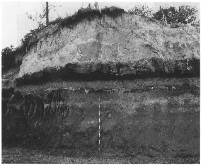
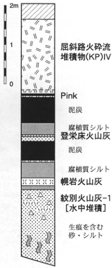
Show extracted lettering and translation
English translation of figure lettering
Scale 0, 1, 2 m. From top: Kussharo pyroclastic-flow deposits (KP) IV; Pink; peat; humic silt; Toetoko volcanic ash; peat; humic silt; Horoiwa volcanic ash; Mombetsu volcanic ash-1 [deposited under water]; sand and silt containing trace fossils.
Original Japanese lettering
尺度0,1,2m。上から:屈斜路火砕流堆積物(KP)IV;Pink;泥炭;腐植質シルト;登栄床火山灰;泥炭;腐植質シルト;幌岩火山灰;紋別火山灰-1[水中堆積];生痕を含む砂・シルト。
HK-4 Stratigraphy of Akan pyroclastic-flow deposits north of Akan caldera
Koji Okumura
Locality: Kaisei, Kitami City, Hokkaido. Coordinates: N43°44′15″ E143°53′04″. Elevation: 120 m. Outcrop type and condition: artificial exposure; condition unknown. Deposits and age: pyroclastic-flow deposits; Middle Pleistocene. Date described: September 1984. Keywords: Akan Upper Pyroclastic-flow Deposits; Akan Welded Tuff; Akan Lower Pyroclastic-flow Deposits; Kussharo pyroclastic-flow deposits; eastern Hokkaido; Kitami Basin.
Large-volume pyroclastic flows erupted from Akan caldera on three occasions during the Middle Pleistocene are divided into the Akan Lower Pyroclastic-flow Deposits (ALP), Akan Welded Tuff (AWT), and Akan Upper Pyroclastic-flow Deposits (AUP) (Yamaguchi and Sato, 1966; Okumura, 1991). ALP is thickly deposited around Kitami-Aioi north of Akan caldera, but its distribution elsewhere has not yet been confirmed. AWT is distributed widely as welded tuff chiefly around the Kushiro Wetland south of the caldera. One distal occurrence has been found within sand and gravel below the deposits forming the Kushiro terrace (Matsui et al., 1987; see HK-13). At this outcrop at Kaisei, Kitami, an approximately 20-m-thick dark brown nonwelded part of AWT can be observed overlying pumiceous sand and gravel. AWT consists of blackish-brown volcanic glass with highly vesicular bubble-wall forms and contains orthopyroxene, clinopyroxene, and quartz phenocrysts. White nonwelded AUP overlies AWT, separated by a weathered zone in the upper AWT and less than 1 m of volcanic-ash soil. AUP is characterized by a basal fine volcanic-ash bed containing abundant accretionary lapilli. It is exposed north of the caldera from the Tsubetsu River basin to the southern margin of the Kitami Basin, with a distal occurrence also found north of Kussharo caldera (Okumura, 1991; HK-8). Kussharo pyroclastic-flow deposits V and IV (KP V, KP IV) successively overlie AUP. A thin pink volcanic-ash bed occurs in the uppermost volcanic-ash soil immediately below KP IV. This ash is recognized widely throughout the distribution of KP IV and provides a clue for its correlation.
No direct age evidence is available for these pyroclastic-flow eruptions. However, no marine transgression is recognized between AWT and last-interglacial marine deposits in urban Kushiro (Matsui, 1987), and some last-interglacial marine terraces near Memanbetsu consist solely of reworked AUP and KP V deposits overlain by terrestrially deposited KP IV. These observations indicate that AWT, AUP, and KP V certainly erupted successively during the interval from oxygen-isotope stage 7 to stage 5 (Okumura, 1991). The photograph shows AUP (lower right) overlain by KP V.
References: Matsui (1987); Okumura (1991); Yamaguchi and Sato (1966).
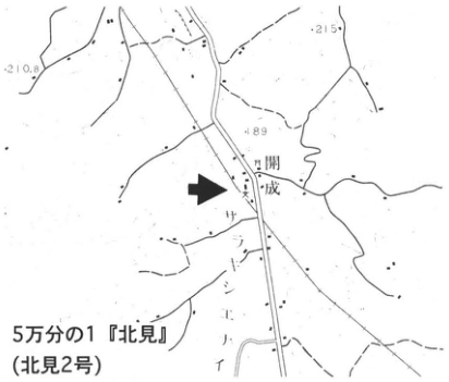
Show extracted lettering and translation
English translation of figure lettering
1:50,000 “Kitami” (Kitami 2). Kaisei, サントンエイ [original map lettering]; elevations 210.8, 215, 189.
Original Japanese lettering
5万分の1「北見」(北見2号)。開成,サントンエイ〔地図原表記〕;標高210.8,215,189。
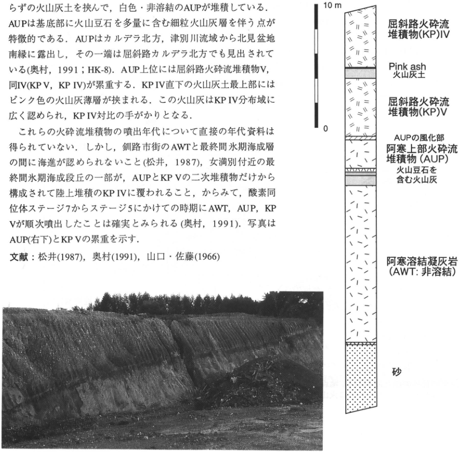
Show extracted lettering and translation
English translation of figure lettering
Scale 0, 10 m. From top: Kussharo pyroclastic-flow deposits (KP) IV; Pink ash; volcanic-ash soil; Kussharo pyroclastic-flow deposits (KP) V; weathered part of AUP; Akan Upper Pyroclastic-flow Deposits (AUP); volcanic ash containing accretionary lapilli; Akan Welded Tuff (AWT: nonwelded); sand. Embedded prose and references are included in the main text.
Original Japanese lettering
尺度0,10m。上から:屈斜路火砕流堆積物(KP)IV;Pink ash;火山灰土;屈斜路火砕流堆積物(KP)V;AUPの風化部;阿寒上部火砕流堆積物(AUP);火山豆石を含む火山灰;阿寒溶結凝灰岩(AWT:非溶結);砂。画像内本文と文献は本文に収録済。
HK-5 Tokoro volcanic ash along the Sea of Okhotsk coast, eastern Hokkaido
Kunihiko Endo, Mari Sumita, and 星住リベカ
Locality: Tokoro Town, Tokoro District, Abashiri Subprefecture, Hokkaido. Coordinates: N44°7′38″ E144°1′3″. Elevation: 5–20 m.
Outcrop type and condition: boreholes and artificial exposures; partly extant. Deposits and age: fallout tephra and coastal-dune deposits; Late Holocene.
Dates described: 1970–1988. Keywords: Tokoro volcanic ash; Tarumae-a tephra; Komagatake-c₂ tephra; Mashu-b tephra; Tarumae-c tephra.
Several thin beds of white to pale brownish-grey fine volcanic ash occur in surficial deposits and soils along the Sea of Okhotsk coast of Hokkaido. They were named Tokoro volcanic ashes I, II, III, and IV in ascending order (Endo et al., 1972; Endo et al., 1984). They were used to classify and correlate Holocene terrace I of the Jomon transgression (5–6 m elevation) and Holocene terrace II (3 m elevation) on the Tokoro Plain, and, within the coastal dune belt, the older dunes covering older sandbars corresponding to the former terrace and the younger dunes covering younger sandbars corresponding to the latter. All four ashes, I–IV, are found together in peat in low-lying wetlands; a borehole column is shown at the lower right. Tokoro ashes I and II are intercalated in soil layers at Late Jomon, Epi-Jomon, and Satsumon horizons. Tokoro ashes III and IV are widely recognized in the younger kurosuna (black-sand) layer and younger dunes, and near the surface of peat in valleys dissecting the plateau. Similar thin white fine-ash beds in the Konsen region were called Me-a₁ and Me-a₂ and attributed to Meakan-dake (Hokkaido Volcanic Ash Nomenclature Committee, 1972). In recent years, however, their thickness distributions and other features had suggested more distant source volcanoes. These surficial tephras were re-examined in the late 1980s. Endo et al. (1988, 1989) and Sumita (1990), working mainly from Konsen through Shari, Abashiri, and Tokoro, based their conclusions on distribution and glass refractive indices; Tokui (1988, 1989, 1993) used glass chemical compositions. They reached essentially the same conclusions. Thus, the surficial tephras of eastern Hokkaido comprise Tarumae-a (Ta-a; 1739), Komagatake-c₁ (Ko-c₁; 1856), Komagatake-c₂ (Ko-c₂; 1694), and other tephras. Somewhat lower lie Tarumae-b (Ta-b), Komagatake-d (Ko-d), Mashu-b (Ma-b), Baitoushan–Tomakomai (白頭山苫小牧, B-Tm), and the Yausubetsu bed, correlated with Tarumae-c (Ta-c) by Tokui (1988), among others. Tokoro ashes III and IV in the younger dunes are Ko-c₂ and Ta-a. Numerous archaeological remains of the Okhotsk, Satsumon, Epi-Jomon, and other cultures occur in the Tokoro area, and these tephras are intercalated in their fill. Tokoro ash II is Ma-b. B-Tm becomes indistinct in this region. Tokoro ash I may be the Yausubetsu bed (Ta-c).
References: Endo et al. (1972, 1984, 1988, 1989); Hokkaido Volcanic Ash Nomenclature Committee (1972); Sumita (1990); Tokui (1988, 1989, 1993).
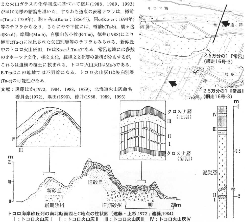
Show extracted lettering and translation
English translation of figure lettering
Both maps: 1:25,000 “Tokoro” (Abashiri 16-3). Upper map: Lake Saroma, Tokoro archaeological site, Tofutsu; elevations 1.8, 1.6. Lower map: Gifu; elevation and other figures 5, 5, 6. North–south cross-section of the Tokoro coastal dune belt and column at locality C (Endo and Uesugi, 1972; Endo, 1984). Key: I, Tokoro volcanic ash I; II, ash II; III, ash III; IV, ash IV. Left inset: III, IV. Central inset, from top: kurosuna (black-sand) layer (older); III; II; I; kurosuna layer (younger). Section: younger dunes; older dunes; younger sandbar; older sandbar. Elevation 0, 10, 20 m; horizontal scale 0, 100, 200 m. Right column: IV; III; peat; II; I. Depth 0, 0.5, 2 m (break symbol in between). Embedded prose and references above have been restored in the main text.
Original Japanese lettering
二地図とも2.5万分の1「常呂」(網走16号-3)。上図:サロマ湖,常呂遺跡,鐺沸;標高1.8,1.6。下図:岐阜;標高等5,5,6。 トコロ海岸砂丘列の南北断面図とC地点の柱状図(遠藤・上杉,1972;遠藤,1984)。凡例I:トコロ火山灰I;II:同II;III:同III;IV:同IV。左挿図:III,IV。中央挿図上から:クロスナ層(旧期);III;II;I;クロスナ層(新期)。断面:新砂丘;旧砂丘;新期砂州;旧期砂州。標高0,10,20m;水平尺度0,100,200m。右柱:IV;III;泥炭層;II;I。深度0,0.5,2m(中間省略記号)。画像上部の本文・文献は本文に復元済。
HK-6 Late Pleistocene tephra beds in the Kiyosato–Shari area—Kussharo- and Mashu-derived tephras and widespread tephras
Mari Sumita
Locality: Konan, Kiyosato Town, Hokkaido (South No. 26, Line 5). Coordinates: N43°46′44″ E144°34′59″ (locality A); N43°46′57″ E144°35′17″ (locality B). Elevation: 80–110 m. Outcrop type and condition: artificial exposures; extant in 1992. Deposits and age: fallout tephra and pyroclastic-flow deposits; Late Pleistocene. Date described: September 1986. Keywords: Kussharo volcano; Mashu volcano; Shikotsu-1 tephra; Daisetsu–Ohachidaira tephra.
This outcrop is along an agricultural road cutting the pyroclastic-flow plateau at the northern foot of Mt. Etombi, north of Mashu caldera. It is a valuable exposure where the Late Pleistocene pyroclastic succession can be observed continuously from K.P. flow IV, erupted from Kussharo volcano approximately 120 ka (Katsui and Sato, 1963), onward. In practice, combining ridge-top outcrop A and valley-facing outcrop B reveals the tephra succession from approximately 120 ka to the present. The basic tephra stratigraphy of this area is described in detail by Sumita (1988) (the columns for these outcrops are No. 1 [outcrop A] and No. 2 [outcrop B] in her Fig. 2). Sumita (1990) classified the source volcanoes from tephra thickness distributions and whole-rock chemical compositions, re-examined the regional stratigraphy from the perspective of volcanic activity, and reconstructed the volcanic histories of Kussharo and Mashu. Furthermore, ICP analyses of volcanic glass undertaken to identify sources revealed widespread tephras in addition to those from these two volcanoes, including tephra from Daisetsu volcano (Daisetsu–Ohachidaira pumice fall) and Shikotsu pumice fall-2 (Spfa-2) (Sumita et al., 1989; Yoshikawa, 1990). The Aso-4 tephra, Shikotsu pumice fall-1 (Spfa-1), and Toya tephra, discovered by Okumura (1985), Okumura et al. (1985), and others and important as time-equivalent horizons in Hokkaido, can also be seen here (see WS-9-4, WS-7-3). The interleaved activity of Kussharo and Mashu, elucidated through these widespread-tephra identifications and source classifications, is shown in the figure at right. It indicates that Mashu activity began at least as early as Kiyosato pumice-2 (KyP-2), preceding the fallout of Spfa-2, whose age is considered approximately 32 ka (Sumita et al., 1989; Yoshikawa, 1990).
Regional stratigraphy often uses breaks in landform development as stratigraphic boundaries. From the perspective of volcanic activity, however, these breaks frequently do not coincide with boundaries in the eruption history. Particularly around caldera volcanoes producing large-volume pyroclastic flows, volcanic influences and climate-driven landform development are intricately interwoven. This outcrop contains scarcely any of the dune deposits derived from pyroclastic-flow material, river-terrace deposits, or alluvial-fan deposits common in this area. It therefore has good continuity and fresh pyroclastic material, making it a good exposure for observing the process of constructing a volcanic history from regional stratigraphy.
References: Endo and Uesugi (1977); Katsui and Sato (1963); Katsui et al. (1988); Yoshikawa (1990); Okumura (1985); Okumura et al. (1985); Sato (1968, 1969); Sone (1985, 1988); Sone et al. (1991); Sumita (1988, 1990, 1993); Sumita et al. (1989).
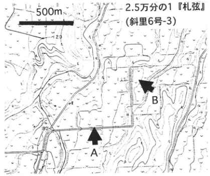
Show extracted lettering and translation
English translation of figure lettering
A; B; 500 m; 1:25,000 “Sattsuru” (Shari 6-3). Contour figures 120, 100, 80.
Original Japanese lettering
A;B;500m;2.5万分の1「札弦」(斜里6号-3)。等高線数字120,100,80。
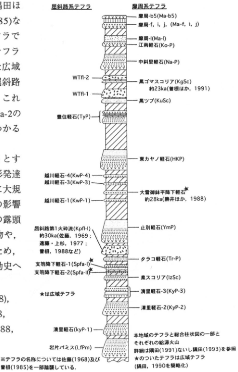
Show extracted lettering and translation
English translation of figure lettering
Kussharo-derived tephras / Mashu-derived tephras. In descending order, right=Mashu-derived and left=Kussharo-derived:
| Order | Side | Original name, code, and age |
|---|---|---|
| 1 | Right | Mashu-b5 (Ma-b5) |
| 2 | Right | Mashu-f, i, j (Ma-f, i, j) |
| 3 | Right | Mashu-l (Ma-l) |
| 4 | Right | Konan pumice (Ko-P) |
| 5 | Right | Nakashari pumice (Na-P) |
| 6 | Left | WTfl-2 |
| 7 | Right | Kurogoma scoria (KgSc), approximately 23 ka (Sone et al., 1991) |
| 8 | Left | WTfl-1 |
| 9 | Right | Kuroppu (KuSc) |
| 10 | Left | Toyozumi pumice (TyP) |
| 11 | Right | 東カヤノ pumice (HKP) |
| 12 | Left | Koshikawa pumice-4 (KwP-4) |
| 13 | Left | Koshikawa pumice-3 (KwP-3) |
| 14 | Right, ★ | Daisetsu–Ohachidaira pumice fall, approximately 28 ka (Katsui et al., 1988) |
| 15 | Left | Koshikawa pumice-1 (KwP-1) |
| 16 | Left | Kussharo pyroclastic flow 1 (Kpfl-I), approximately 30 ka (Sato, 1969; Endo and Uesugi, 1977; Sone, 1988, and others) |
| 17 | Right | Yambetsu pumice (YmP) |
| 18 | Right | Tarako pumice (Tr-P) |
| 19 | Left, ★ | Shikotsu pumice fall-1 (Spfa-I) |
| 20 | Left, ★ | Shikotsu pumice fall-2 (Spfa-II) |
| 21 | Right | Izumi scoria (IzSc) |
| 22 | Right | Kiyosato pumice-3 (KyP-3) |
| 23 | Right | Kiyosato pumice-2 (KyP-2) |
| 24 | Left | Kiyosato pumice (KyP-1) |
| 25 | Left | Lithic-fragment pumice (LfPm) |
| ★ denotes widespread tephra. Note: the tephra nomenclature partly follows Sato (1968) and Sone (1985). Tephras of this region, part of the composite stratigraphic column, and their respective source volcanoes. For details, see Sumita (1991) or Sumita (1993). Tephras marked ★ are widespread tephras. (Simplified from Sumita, 1990.) Text fragments at the left edge are included in the main text. |
Original Japanese lettering
屈斜路系テフラ/摩周系テフラ。上から順に、右=摩周系・左=屈斜路系:
| 順序 | 区分 | 原図名・符号・年代 |
|---|---|---|
| 1 | 右 | 摩周-b5(Ma-b5) |
| 2 | 右 | 摩周-f,i,j(Ma-f,i,j) |
| 3 | 右 | 摩周-l(Ma-l) |
| 4 | 右 | 江南軽石(Ko-P) |
| 5 | 右 | 中斜里軽石(Na-P) |
| 6 | 左 | WTfl-2 |
| 7 | 右 | 黒ゴマスコリア(KgSc),約23ka(曽根ほか,1991) |
| 8 | 左 | WTfl-1 |
| 9 | 右 | 黒ップ(KuSc) |
| 10 | 左 | 豊住軽石(TyP) |
| 11 | 右 | 東カヤノ軽石(HKP) |
| 12 | 左 | 越川軽石-4(KwP-4) |
| 13 | 左 | 越川軽石-3(KwP-3) |
| 14 | 右・★ | 大雪御鉢平降下軽石,約28ka(勝井ほか,1988) |
| 15 | 左 | 越川軽石-1(KwP-1) |
| 16 | 左 | 屈斜路第1火砕流(Kpfl-I),約30ka(佐藤,1969;遠藤・上杉,1977;曽根,1988など) |
| 17 | 右 | 止別軽石(YmP) |
| 18 | 右 | タラコ軽石(Tr-P) |
| 19 | 左・★ | 支笏降下軽石-1(Spfa-I) |
| 20 | 左・★ | 支笏降下軽石-2(Spfa-II) |
| 21 | 右 | 泉スコリア(IzSc) |
| 22 | 右 | 清里軽石-3(KyP-3) |
| 23 | 右 | 清里軽石-2(KyP-2) |
| 24 | 左 | 清里軽石(KyP-1) |
| 25 | 左 | 岩片パミス(LfPm) |
| ★は広域テフラ。※テフラの名称については佐藤(1968)及び曽根(1985)を一部踏襲している。本地域のテフラと総合柱状図の一部とそれぞれの給源火山。詳細は隅田(1991)ないし隅田(1993)を参照。★のついたテフラは広域テフラ。(隅田,1990を簡略化)。画像左縁の本文断片は本文に収録済。 |
Reading notes
WTfl-1・WTfl-2、Kpfl-I — 末尾の細字lとIの字形が紛らわしいため原図に近い表記を保持。本文はSpfa-1/2、図はSpfa-I/II。
HK-7 Periglacial features west of Kaiyo on the Konsen Plain—earth hummocks buried in Mashu loam
Shuji Iwata
Locality: Kaiyo, Nakashibetsu Town, Shibetsu District, Hokkaido. Coordinates: N43°35′23″ E144°52′37″. Elevation: approximately 87 m.
Outcrop type and condition: wall of a roadside ditch on North No. 14 Road; present condition unknown. Deposits and age: eolian tephra; Holocene, 6.5–13 ka. Date described: August 1972. Keywords: Konsen Plain; buried earth hummocks; Mashu loam; Mashu-derived tephra.
Earth hummocks are dome-shaped rises of fine soil, several tens of centimetres high and no larger than 1 m in diameter, covered by dense, mat-like herbs or dwarf shrubs and formed by seasonal soil freezing. They develop in wetlands and similar environments in polar, subpolar, and alpine zones, and are also called toketu-bozu (frost hummocks), Tokachi-bozu, or shibazuka (turf mounds). In present-day volcanic-ash terrain in Hokkaido, they occur densely on slight rises adjacent to yachi-bozu peatlands on floodplains, where the water table is high and soils are excessively wet. They also form on terrace and plateau shoulders where groundwater readily seeps out. Many were initiated by fallout of fine volcanic ash with high water-retention capacity. Undulating volcanic ash observed in a soil section along the side of a roadside drainage ditch west of Kaiyo, approximately 7 km northwest of Nakashibetsu Town, was identified as a fossil form because its shape and size match earth hummocks on the present ground surface. The hummocks here are small, 30 cm high and slightly less than 1 m wide (in diameter). They occur in the transition from the valley bottom to the surface beside a small stream, a tributary of the Musa River, incised into an alluvial-fan surface (Churui surface; Iwata, 1977). On the slope at the left of the diagram, they appear to grade into stepped ground. The central depression is probably a small gully. The earth hummocks formed through frost heave of Mashu-k volcanic ash (Ma-k; Hokkaido Volcanic Ash Nomenclature Committee, 1972), an eruptive product of Mashu volcano, and were buried by Ma-g, h, i pumice-fall beds. From the age of Ma-k forming the buried hummocks and the age of the overlying Ma-f, these hummocks are considered to have formed approximately 7–8 ka.
References: Hokkaido Volcanic Ash Nomenclature Committee (1972); Iwata (1977); Nogami et al. (1974).
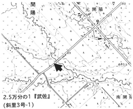
Show extracted lettering and translation
English translation of figure lettering
1:25,000 “Musa” (Shari 3-1). Kaiyo, Motokaiyo, Minamikaiyo. Elevations 95, 90, 89, 83.5, 91.
Original Japanese lettering
2.5万分の1「武佐」(斜里3号-1)。開陽,元開陽,南開陽。標高95,90,89,83.5,91。
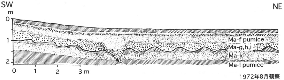
Show extracted lettering and translation
English translation of figure lettering
SW; NE. Depth 0, 1, 2 m; horizontal distance 0, 1, 2, 3 m. From top, original lettering: Ma-f pumice; Ma-g,h,i; Ma-k; Ma-l pumice. Observed in August 1972.
Original Japanese lettering
SW;NE。深度0,1,2m;水平距離0,1,2,3m。上から:Ma-f pumice;Ma-g,h,i;Ma-k;Ma-l pumice。1972年8月観察。
HK-8 Older Kutcharo pyroclastic-flow deposits at Higashimokoto, eastern Hokkaido
奥村晃史
- Locality: Higashi-Nisen (東二線), Higashimokoto Village, Hokkaido
- Latitude and longitude: N43°50′22″ E144°18′58″
- Elevation: 60m
- Outcrop type and condition: Artificial exposure; partly lost
- Deposit types and age: Pyroclastic-flow deposits and fallout tephra; Late Pleistocene
- Date of description: June 1994
- Keywords: Kutcharo pyroclastic-flow deposits; Akan Upper Pyroclastic-flow Deposit; eastern Hokkaido; Higashimokoto
The town of Higashimokoto occupies the floor of a valley deeply incised into the Kutcharo pyroclastic-flow plateau. Important exposures showing the stratigraphy of the Kutcharo pyroclastic-flow deposits repeatedly appeared and disappeared along nearby valley walls with relative heights of 70–80m. The Higashi-Nisen exposure, one of the type outcrops described by 勝井・佐藤 (1963), who first provided a detailed account of the Kutcharo pyroclastic-flow deposits (KP), survived until the late 1980s and played an important role in re-examining their stratigraphy; most of it is now covered by retaining walls. At this outcrop, KP VIII, VII, VI, the Akan Upper Pyroclastic-flow Deposit (AUP), V, and I occur in ascending order, with intervening fallout tephra and fluvial gravel beds (tephra abbreviations follow 奥村, 1991). The lowermost KP VIII remains exposed, but outside Higashi-Nisen it has been found only at Tentozan in Abashiri City. It is distinguished from the other Kutcharo pyroclastic-flow deposits by its higher K₂O content. KP VII contains relatively abundant phenocrysts and lithic fragments, and its volcanic glass is somewhat mafic. The lithology of KP VII resembles that of the Akan Lower Pyroclastic-flow Deposit at a similar stratigraphic level (山口・佐藤, 1966; HK-4) (奥村, 1991). Fallout tephras with properties matching KP VII and KP VI, respectively, have been found on the eastern shore of Lake Saroma (HK-3). Between KP V and KP VI lie approximately 2m of AUP and a basal ash-fall deposit containing accretionary lapilli (奥村, 1991). AUP is distributed from the Tsubetsu River basin north of Akan caldera to Kitami (see HK-4) as a thin pyroclastic-flow deposit with fine ash at its base; it has the same characteristics here at Higashi-Nisen. The presence of AUP provides a key link between the eruptive histories of Akan and Kutcharo calderas. The lithic-rich pyroclastic-flow deposit overlying AUP, separated from it by less than 1m of volcanic-ash soil, is KP V. The section from KP IV through KP II, representing the first half of the Late Pleistocene, has been removed by fluvial erosion, but can be confirmed upstream along the Onnenai River (WS-16-1). Superposed KP V, IV, and I can be observed at Asahidai (旭台), south of Higashi-Nisen, and at Shintomi (新富), across the valley to the east.
References: 勝井・佐藤 (1963); 奥村 (1991); 山口・佐藤 (1966).
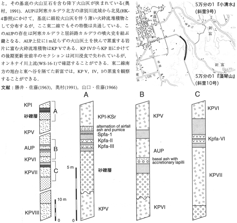
Show extracted lettering and translation
English translation of figure lettering
Map: 1:50,000 ‘Koshimizu’ (Shari sheet 9); 1:50,000 ‘Mokotoyama’ (Shari sheet 10); Higashimokoto, Shintomi (新富), Kamihigashi (上東), Higashi-Ichigo (東一号), Higashi-Nigo (東二号), Higashi-Sango (東三号), Higashi-Yongo (東四号), Higashi-Kisen (東基線); 46.8, 42, 130.1. General column, from top: KP I, sand and gravel bed, A, KP V, AUP, B, KP VI, KP VII, C, KP VIII; scale 10m, 0. A, from top: KP I-KSr; alternation of airfall ash and pumice; Spfa-1; Kpfa-II; Kpfa-III; sand and gravel bed; KP V; scale 5m, 0. B, from top: KP V; AUP; basal ash with accretionary lapilli; KP VI. C, from top: KP VI; Kpfa-VI; KP VII.
Original Japanese lettering
位置図:5万分の1『小清水』(斜里9号);5万分の1『藻琴山』(斜里10号);東藻琴,新富,上東,東一号,東二号,東三号,東四号,東基線;46.8,42,130.1.全体柱状図(上から):KP I,砂礫層,A,KP V,AUP,B,KP VI,KP VII,C,KP VIII;スケール10m,0.A(上から):KP I-KSr;alternation of airfall ash and pumice;Spfa-1;Kpfa-II;Kpfa-III;砂礫層;KP V;スケール5m,0.B(上から):KP V;AUP;basal ash with accretionary lapilli;KP VI.C(上から):KP VI;Kpfa-VI;KP VII.
Reading notes
位置図の微小な一部地形図文字と標高は判読不明。本文を含む切り出し画像の本文はページ本文に清書済み。
HK-9 Last-glacial peat beds at Barasan, eastern Hokkaido
遠藤邦彦・隅田まり
- Locality: Barasan, Betsukai Town, Notsuke District, Nemuro Subprefecture, Hokkaido
- Latitude and longitude: N43°26′0″ E145°16′2″
- Elevation: 0–3m
- Outcrop type and condition: Sea cliff; partly covered
- Deposit types and age: Aeolian tephra and peat; terminal Last Glacial to Holocene
- Date of description: 1989
- Keywords: Notsuke coast; Komagatake-c₁ tephra; Komagatake-c₂ tephra; Tarumai-a tephra; Kpfl-I; Mashu-derived tephra
Some sea cliffs along the Notsuke coast, at the eastern end of the Konsen Plateau, expose deposits filling valleys incised into a plateau composed of Kutcharo pyroclastic-flow deposits and other materials. Although most exposures have been concealed by tetrapods and similar structures, approximately ten tephra beds and peat beds dating from the end of the Last Glacial can be recognized in the sea cliff at Barasan.
The upper part of this outcrop comprises the Barasan Upper Peat Bed, deposited during the last 6,000 years; the middle part consists of a series of pumice-fall and ash beds derived from Mashu volcano (Ma-g, h, i, j, k, l); and the lower part comprises the Barasan Lower Peat Bed of terminal Last Glacial age (遠藤 et al., 1988). Two to three fine ash beds, locally three to four, are intercalated in the topsoil. Formerly called Me-a₁ and -a₂ (北海道火山灰命名委員会, 1972), they were subsequently assigned to ash falls derived from Komagatake-c₁ tephra (Ko-c₁; 1856), Komagatake-c₂ tephra (Koc₂; 1694), Komagatake-d tephra (Ko-d; 1640), Tarumai-a tephra (Ta-a; 1739), and others (遠藤 et al., 1989; 徳井, 1989; 隅田, 1990). A fine ash-fall bed known as the Yausubetsu Bed, identified as Tarumai-c tephra (Ta-c) by 徳井 (1988), occurs in the upper portion of the upper peat bed, while the Mashu-d pumice bed (Ma-d) occurs in its middle portion. The lower peat bed can be confirmed to extend to at least 1m below sea level and yields ¹⁴C ages of 12–14ka. The terminal Last Glacial Barasan Lower Peat Bed yields fossil pollen of Larix, Pinus, Betula, Alnus, Ericales, and other taxa. Larix is particularly abundant, accounting for 40–80%. Abundant plant macrofossils, including leaves and seeds, indicate that subarctic forest dominated by Guimatsu larch, Larix kamtschatic (Rupr.) Carr., existed together with wetlands (遠藤 et al., 1988). Subarctic coniferous forest dominated by this larch, now distributed in Sakhalin, extended from Hokkaido to northern Honshu during the Last Glacial (小野・五十嵐, 1991).
References: 遠藤 et al. (1988, 1989); 北海道火山灰命名委員会 (1972, 1979); 小野・五十嵐 (1991); 隅田 (1990); 徳井 (1988, 1989).
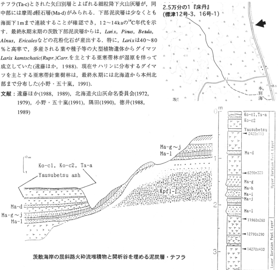
Show extracted lettering and translation
English translation of figure lettering
Map: 1:25,000 ‘Tokotan’ (Shibetsu sheets 12-3 and 16-1); Honbetsukai (本別海); 茨 [partial place label]; 8.5. Section: 0m, 1; Ko-c1, Ko-c2, Ta-a; Yausubetsu ash; Ma-d; Ma-g–j; Ma-l; Kpfl-I. Column: m, 0, 1, 2, 3; Ko-c1, Ta-a; Ko-c2; Yausubetsu; 2420±110; Ma-d; 6200±220; Ma-g; Ma-h; Ma-i; Ma-j; Ma-l; 11960±250; 12790±290; 14270±400; Upper Barasan Peat Layer; Lower Barasan Peat Layer.
Original Japanese lettering
地図:2.5万分の1『床丹』(標津12号-3,16号-1);本別海;茨;8.5.断面図:0m,1;Ko-c1,Ko-c2,Ta-a;Yausubetsu ash;Ma-d;Ma-g~j;Ma-l;Kpfl-I.柱状図:m,0,1,2,3;Ko-c1,Ta-a;Ko-c2;Yausubetsu;2420±110;Ma-d;6200±220;Ma-g;Ma-h;Ma-i;Ma-j;Ma-l;11960±250;12790±290;14270±400;Upper Barasan Peat Layer;Lower Barasan Peat Layer.
Reading notes
地図の微小文字には判読不明箇所がある。
Kutcharo pyroclastic-flow deposits and peat beds and tephra filling an incised valley on the Barasan coast.
HK-10 Tephra of the last 1000 years in a peatland—Biruwa, Kutcharo caldera
町田 洋
- Locality: Biruwa-genya, Teshikaga Town, Hokkaido
- Latitude and longitude: N43°32′8″ E144°25′9″
- Elevation: 115m
- Outcrop type and condition: Wall of a roadside ditch; extant
- Deposit types and age: Peat beds, volcanic ash, and pumice; Holocene, last 1000 years
- Date of description: June 1994
- Keywords: Tarumai-a tephra; Oshima-Komagatake-c₂ tephra; Mashu-b tephra; Baitoushan–Tomakomai (白頭山苫小牧) tephra; Mashu pyroclastic-flow deposit; Atosanupuri pyroclastic-flow deposit; Kutcharo caldera
Several thin ash beds transported from distant volcanoes are intercalated in the peatlands of eastern Hokkaido. Such tephras can also be observed in peatlands within Kutcharo caldera. At this exposure, removing part of the vegetation reveals four tephra beds in the surficial peat bed (Fig. 2). In descending order, these are Tarumai-a tephra (Ta-a), Oshima-Komagatake-c₂ tephra (Ko-c₂), Mashu-b tephra (Ma-b), and Baitoushan–Tomakomai tephra (B-Tm). Ta-a and Ko-c₂ lie very close together and were formerly called Meakan-a or Mashu-a. Based on major-element characteristics of volcanic glass, 徳井 (1989) succeeded in distinguishing and identifying these two beds. They are considered to be eruptive products of 1739 and 1694, respectively. Ma-b is an inversely graded pumice bed erupted from Kamuinupuri, the central cone of Mashu caldera. The ash bed several millimetres thick, lying several centimetres below it, has an alkaline composition and is B-Tm. As B-Tm erupted in the tenth century, Ma-b must have erupted in the tenth century or somewhat later.
A large outcrop occurs 3km north-northwest of this locality (the ■ site in Fig. 1), where Ta-a, Ko-c₂, and Ma-b can be recognized in the black humic surface soil. The pyroclastic-flow deposit known as Mashu-f (Ma-f), associated with formation of Mashu caldera, and the Atosanupuri pyroclastic-flow deposit (Ats fl) can also be observed there (Fig. 3).
References: 町田 et al. (1994); 徳井 (1989).
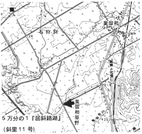
Show extracted lettering and translation
English translation of figure lettering
1:50,000 ‘Kutcharoko’ (Shari sheet 11); Ishikaribetsu (石狩別); Biruwa; Biruwa-genya; Senmo Main Line; Kushiro River; 140, 126, 124.9, 121.9, 125.2, 120; ■; arrow.
Original Japanese lettering
5万分の1『屈斜路湖』(斜里11号);石狩別;美留和;びるわ;美留和原野;釧網本線;釧路川;140,126,124.9,121.9,125.2,120;■;矢印.
Reading notes
一部の地図内微小文字は判読不明。
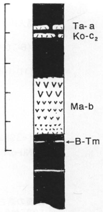
Show extracted lettering and translation
English translation of figure lettering
Ta-a; Ko-c₂; Ma-b; ←B-Tm. The scale ticks on the left have no numerical labels.
Original Japanese lettering
Ta-a;Ko-c₂;Ma-b;←B-Tm.左側の目盛に数値表記なし.
Fig. 2. Tephra in the Biruwa peatland.
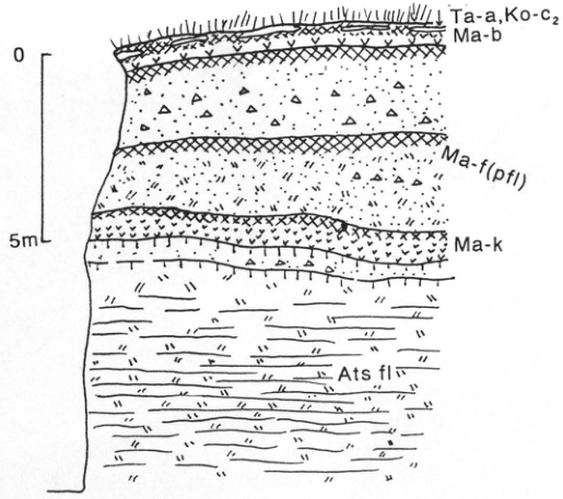
Show extracted lettering and translation
English translation of figure lettering
0; 5m; Ta-a, Ko-c₂; Ma-b; Ma-f (pfl); Ma-k; Ats fl.
Original Japanese lettering
0;5m;Ta-a,Ko-c₂;Ma-b;Ma-f (pfl);Ma-k;Ats fl.
Fig. 3. Outcrop at the ■ site.
HK-11 Tephra beds derived from Mashu and Kutcharo volcanoes in the Konsen wilderness
宮田雄一郎
- Locality: Kikusui, Nakashunbetsu (Nishi-Jusan-sen, Minami-Juni-go), Nakashibetsu Town, Notsuke District, Hokkaido
- Latitude and longitude: N43°32′8″ E145°5′38″
- Elevation: 40m
- Outcrop type and condition: Artificial exposure; current condition unknown
- Deposit types and age: Aeolian tephra; Late Pleistocene to Holocene
- Date of description: August 1985
- Keywords: Konsen wilderness; Mashu-derived tephra; Kutcharo-derived tephra; Nakashunbetsu tephra; Chanai tephra
This outcrop appeared during road construction in 1985 and is the most suitable exposure for observing the numerous Mashu- and Kutcharo-derived tephras distributed throughout the Konsen wilderness. A continuous stratigraphic succession can be observed in ascending order, beginning with the uppermost part of the Late Pleistocene Lower Nakashunbetsu tephra beds (Nl-a), passing through the Upper Nakashunbetsu tephra group (Nu-e–Nu-r), the Chanai tephra group (Ch), and the Lower Mashu tephra group (Ml), and continuing to the Holocene Upper Mashu tephra group (Ma-f–Ma-l) and the younger tephra group. In particular, it can be regarded as a type outcrop for the Upper Nakashunbetsu tephra beds. Outcrop columns for the Nl, Nu, and Ch stratigraphic intervals are presented in Fig. 14 (site 12), Fig. 17 (site 17), and Fig. 22 (site 17), respectively, of 宮田 et al. (1988a); age determinations are given in 宮田 et al. (1988b).
Many fallout tephras at and below the Ch stratigraphic level lack good exposures near their sources to the west. Moreover, this area and Mashu, Atosanupuri, and Kutcharo volcanoes lie in a line coinciding with the tephra distribution axis, so source volcanoes cannot be identified from tephra distribution. Most of the tephras are also two-pyroxene andesitic, making discrimination by major-element chemical composition difficult. Two horizons of ancient dune deposits (D1 and D2) are intercalated in this exposure. In an outcrop on the opposite side of the road, solifluction deposits and periglacial involutions can also be seen on a buried slope covered by the Ch interval. If the condition of the outcrop face has deteriorated markedly, it would be advisable to search nearby for exposures on plateaux higher than the Last Glacial ‘Kamishunbetsu surface’.
References: 宮田 et al. (1988a, b).
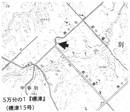
Show extracted lettering and translation
English translation of figure lettering
1:50,000 ‘Shibetsu’ (Shibetsu sheet 15); Nakashunbetsu; Nishi-Jusan-sen; Nishi-Juyon-sen; Minami-Juichi-go; Minami-Juni-go; Minami-Jusan-go; 39, 44.3, 40.5, 38.2; arrow.
Original Japanese lettering
5万分の1『標津』(標津15号);中春別;西十三線;西十四線;南十一号;南十二号;南十三号;39,44.3,40.5,38.2;矢印.
Reading notes
地図の微小文字の一部は判読不明。
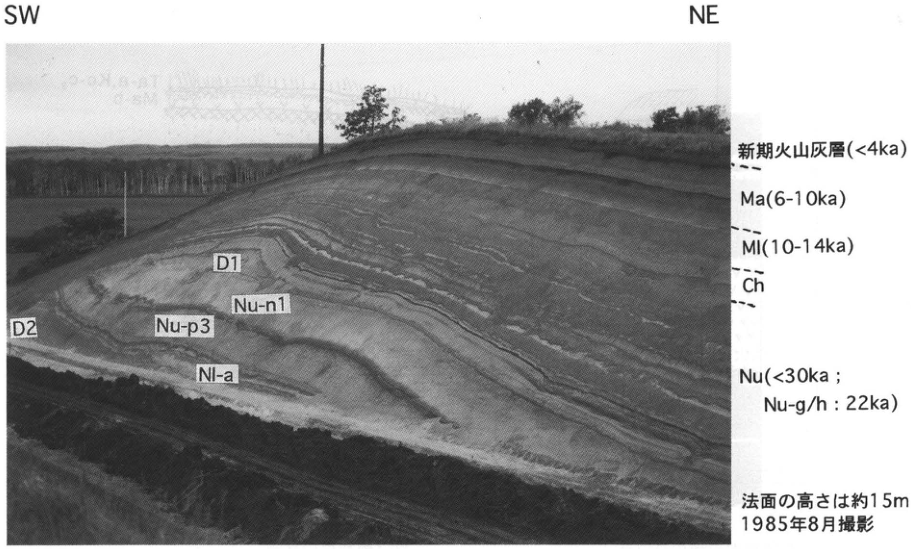
Show extracted lettering and translation
English translation of figure lettering
SW; NE; younger volcanic-ash beds (<4ka); Ma (6-10ka); Ml (10-14ka); Ch; Nu (<30ka; Nu-g/h: 22ka); D1; D2; Nu-n1; Nu-p3; Nl-a; cut-slope height approximately 15m; photographed in August 1985.
Original Japanese lettering
SW;NE;新期火山灰層(<4ka);Ma(6-10ka);Ml(10-14ka);Ch;Nu(<30ka;Nu-g/h:22ka);D1;D2;Nu-n1;Nu-p3;Nl-a;法面の高さは約15m;1985年8月撮影.
HK-12 Late Pleistocene tephra beds distributed in the western Konsen wilderness
奥村晃史
- Locality: Izumikawa, Betsukai Town, Hokkaido
- Latitude and longitude: N43°21′19″ E144°41′17″
- Elevation: 120m
- Outcrop type and condition: Artificial exposure; condition unknown
- Deposit types and age: Pyroclastic-flow deposits and fallout tephra; Late Pleistocene
- Date of description: September 1984
- Keywords: Konsen wilderness; tephra derived from Kutcharo caldera; Kutcharo Pyroclastic-flow Deposit IV; Toya tephra; Aso-4 tephra
Izumikawa lies somewhat south of the distribution axis of fallout tephras sourced from Kutcharo and Mashu volcanoes. Consequently, tephra beds are thinner than in the central and eastern Konsen wilderness, allowing observation of tephras of the first half of the Late Pleistocene. At this exposure, pumice-fall deposits resembling Kutcharo pumice falls -4 and 5 (KP fa) of the Shari area (勝井・佐藤, 1963) overlie the pale-orange Kutcharo Pyroclastic-flow Deposit IV (KP IV) (see WS-19-4 and WS-16; tephra abbreviations follow 奥村, 1991). Volcanic glass of Toya tephra (Toya; 町田 et al., 1987) is concentrated in the upper part of the overlying, strongly weathered brown volcanic-ash soil. Immediately above that soil, Aso-4 tephra (Aso-4; 町田 et al., 1985; WS-9), several millimetres thick, can be recognized with the naked eye. The poorly sorted pumice bed above Aso-4 corresponds to the KP II/III stratigraphic level, but its volcanic-glass major-element composition does not match (宮田 et al., 1988). Above this pumice bed, a 3m-thick succession of black scoria-fall deposits and dark ash beds rich in lithic fragments is stratified with intervening sandy, dark volcanic-ash soil, indicating repeated small eruptions. Following deposition of the black tephra falls, alternating pumice-fall and ash beds occur above a marked unconformity. They have the same lithofacies as Kutcharo-Shoro ash (KSr, Kc-Sr; WS-6) in the eastern Shari Plain. Above KSr, parts of tephra groups such as the Upper Nakashunbetsu and Chanai ash beds (宮田 et al., 1988), together with Mashu-derived tephras, are superposed.
References: 勝井・佐藤 (1963); 町田 et al. (1985, 1987); 宮田 et al. (1988); 奥村 (1991).
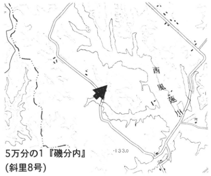
Show extracted lettering and translation
English translation of figure lettering
1:50,000 ‘Isobunnai’ (磯分内; Shari sheet 8); Nishi-Furen River (西風連川); 133.0; arrow.
Original Japanese lettering
5万分の1『磯分内』(斜里8号);西風連川;133.0;矢印.
Reading notes
地図の一部の微小文字は判読不明。
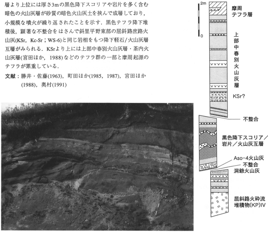
Show extracted lettering and translation
English translation of figure lettering
Column, from top: 2m, 0; Mashu tephra beds; Upper Nakashunbetsu ash beds; KSr?; unconformity; alternating black scoria-fall/lithic-fragment/ash beds; Aso-4 ash; unconformity; Toya ash; Kutcharo Pyroclastic-flow Deposit (KP) IV. The photograph has no textual annotations.
Original Japanese lettering
柱状図(上から):2m,0;摩周テフラ層;上部中春別火山灰層;KSr?;不整合;黒色降下スコリア/岩片/火山灰互層;Aso-4火山灰;不整合;洞爺火山灰;屈斜路火砕流堆積物(KP)IV.写真に文字注記なし.
HK-13 The Zaimokucho outcrop, Kushiro City
松井 愈
- Locality: Shiroyamacho to Zaimokucho, Kushiro City
- Latitude and longitude: N42°59′28″ E144°24′29″
- Elevation: 5–25m
- Outcrop type and condition: Terrace scarp; almost completely covered with concrete and turf
- Deposit types and age: Two pyroclastic-flow beds; fluvial and shallow-marine deposits
- Date of description: October 1975
- Keywords: Kushiro Series; Shiroyama Formation; Otanoshike Formation; Akan pumice flow; Kutcharo pumice-flow deposit
The ‘Zaimokucho outcrop’ is one of a series of exposures extending through Shiroyamacho, Zaimokucho, and Kaizukacho in Kushiro City (松井 et al., 1987; Figs. 2 and 3). These exposures have long been studied as the type locality of the Kushiro Series, or Kushiro Group, a representative Lower Pleistocene succession in Hokkaido (Otuka, 1934; 佐々, 1939; 岡崎 et al., 1960; 長浜, 1961). Most are now covered with concrete or vegetation as a result of slope-collapse prevention works. Before these works, however, 松井 et al. (1987) investigated the Quaternary deposits of the Kushiro area, including these outcrops, and presented the following interpretation of their stratigraphy and ages, differing considerably from earlier views. The following units are exposed in descending order in the series of exposures that includes the Zaimokucho outcrop.
1. Kutcharo pumice-flow deposit (Ks)
2. Otanoshike Formation (Ot)
The main part consists of sand and silt beds. Molluscan and foraminiferal fossils indicate an inner bay during a high-sea-level period (10–18m), with a stronger warm-current influence than at present (小林, 1987). Thickness: 4–8m. The basal part is a sand and gravel bed accompanied by thin peat beds containing pollen and cones indicative of a cold climate. Thickness: 1–3m.
3. Shiroyama Formation (Si)
The upper part is a dark-grey to grey-black, somewhat consolidated, fine-grained Akan pumice-flow deposit. It is 9m thick at the Kaizukacho (②) and Zaimokucho (③) exposures. The middle part comprises sand, silt, and sandy silt beds, 2–4m thick. The lower part consists of fluvial sand and gravel containing cobbles, 2–3m thick.
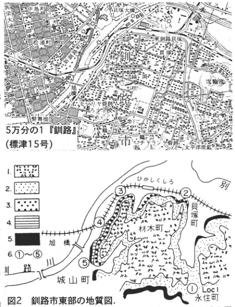
Show extracted lettering and translation
English translation of figure lettering
Topographic map: 1:50,000 ‘Kushiro’ (Shibetsu sheet 15); Kushiro City; Kushiro Ohashi; Matsuuracho; Kyoei-odori; Asahibashi; Asahicho; Zaimokucho; Kaizuka; Higashi-Kushiro shell mound; Higashi-Kushiro; Harutori; Musa; Nishikicho; Kita-odori; Suehirocho; Nusamaibashi; Nusamaicho; Harutori River; Taiheiyo coal mine; 32.7. Geological map: Fig. 2, geological map of eastern Kushiro City; Higashi-Kushiro; 別 [partial label]; Kaizukacho; Zaimokucho; Shiroyamacho; 永住町 [place name]; Kushiro River; Asahibashi; ① Loc1, ②, ③, ④, ⑤; legend 1, 2, 3, 4, 5, 6: ①–⑤.
Original Japanese lettering
地形図:5万分の1『釧路』(標津15号);釧路市;釧路大橋;松浦町;共栄大通;旭橋;旭町;材木町;貝塚;東釧路貝塚;ひがしくしろ;春採;武佐;錦町;北大通;末広町;幣舞橋;幣舞町;春採川;太平洋炭鉱;32.7.地質図:図2 釧路市東部の地質図;ひがしくしろ;別;貝塚町;材木町;城山町;永住町;釧路川;旭橋;① Loc1,②,③,④,⑤;凡例1,2,3,4,5,6:①~⑤.
Reading notes
地形図内の微小文字には判読不明箇所がある。永住町の読みは未確認のため日本語保持。
Fig. 2. Geological map of eastern Kushiro City. 1: Kutcharo pumice-flow deposit; 2: Otanoshike Formation; 3: Shiroyama Formation; 4: Tokotan Formation; 5: Urahoro Group; 6: outcrop number.
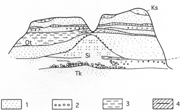
Show extracted lettering and translation
English translation of figure lettering
③; Ks; Ot; Si; Tk; 1, 2, 3, 4. The legend is reproduced in the page text.
Original Japanese lettering
③;Ks;Ot;Si;Tk;1,2,3,4.凡例は本文に収録.
Legend: 1: sand bed; 2: gravel bed; 3: silt bed; 4: silt bed with peat intercalations; 5: black (Akan) pumice flow; 6: fossil burrows; 7: fossil tree trunks; 8: molluscan fossils; Ks: Kutcharo pumice-flow deposit; Ot: Otanoshike Formation; Si: Shiroyama Formation; Tk: Tokotan Formation.
HK-13 (continued)
4. Tokotan Formation (Tk)
Distributed west of Shiroyamacho, unconformably overlying the Paleogene basement. It consists of poorly bedded silty sandstone, 5m thick. It yields Fortipecten takahashii in the Tenneru district to the north and is Pliocene (加藤 et al., 1981).
The unconformable relationships among the formations are clear in the outcrop sketches (Fig. 3). The two tephras—the Kutcharo pumice-flow deposit capping the succession and the Akan pumice-flow deposit associated with the Shiroyama Formation—place the Otanoshike and Shiroyama formations in the Middle Pleistocene.
References: 加藤 et al. (1981); 小林 (1987); 松井 et al. (1987); 長浜 (1961); 岡崎 et al. (1960); Otuka (1934); 佐々 (1939).
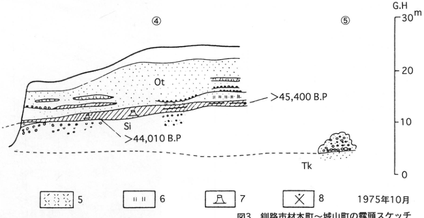
Show extracted lettering and translation
English translation of figure lettering
④; ⑤; Ot; Si; Tk; >45,400 B.P; >44,010 B.P; G.H; m; 30, 20, 10, 0; legend 5, 6, 7, 8; October 1975.
Original Japanese lettering
④;⑤;Ot;Si;Tk;>45,400 B.P;>44,010 B.P;G.H;m;30,20,10,0;凡例5,6,7,8;1975年10月.
Fig. 3. Outcrop sketches from Zaimokucho to Shiroyamacho, Kushiro City.
HK-14 Early Pleistocene eruptive products of Akan and Kutcharo volcanoes north of the Kushiro wetland—the Kuchoro ash beds
奥村晃史
- Locality: Upper Osotsubetsu River, Teshikaga Town, Hokkaido
- Latitude and longitude: N43°23′39″ E144°22′50″
- Elevation: 140m
- Outcrop type and condition: Natural riverbank exposure
- Deposit types and age: Fallout tephra; Early Pleistocene
- Date of description: August 1985
- Keywords: Konsen wilderness; Kushiro Group; tephra derived from Kutcharo caldera; Kuchoro ash beds; Tokachi pyroclastic-flow deposit
In the Kuchoro and Osotsubetsu River basins north of the Kushiro wetland, the marine Kushiro Group is distributed below an elevation of 120m, whereas terrestrial tephra beds with a total thickness of as much as 1,000m, including intercalated sand and gravel beds, occur above 120m (佐藤・垣見, 1967). This succession, called the Kuchoro ash beds, comprises numerous pumice-fall and pyroclastic-flow deposits of two-pyroxene andesitic to quartz-andesitic composition. Although petrographic investigation of all stratigraphic levels has yet to be undertaken, macroscopic features of phenocrysts and pumice, together with preliminary volcanic-glass chemical analyses, show petrographic characteristics resembling those of tephras from Akan and Kutcharo volcanoes. Exposures are confined to the area north of the Kushiro wetland, and the succession cannot be traced into the downwind Konsen wilderness; information on its distribution is therefore also presently unavailable. Many water-reworked tephras in the Kushiro Group resemble the Kuchoro ash beds.
Of particular interest at this outcrop, which exposes the upper Kuchoro ash beds, are two rhyolitic ash-fall beds containing hornblende and biotite (R1, R2; 佐藤・垣見, 1967; the column on the right was prepared by adding information to their Fig. 4, loc.21). Their phenocryst minerals indicate that they were not derived from Kutcharo volcano and require a distant source. Electron-probe microanalysis (EPMA) and ICP emission spectrometry of R1 and R2 and the Pliocene–Pleistocene pyroclastic-flow deposits of central Hokkaido by 奥村 (1991) and 吉川 et al. (1989) showed a high likelihood of correlating R1 and R2 with the Tokachi pyroclastic-flow deposit (池田・向山, 1983). The R1 age of 1.24±0.10Ma (fission-track method; 宮田 et al., 1988) also approximately matches the age of the Tokachi pyroclastic-flow deposit. At Namakoyama (ナマコ山), in the western Furano Basin, the main Tokachi pyroclastic flow, several tens of metres thick, was followed by a smaller pyroclastic flow, with several metres of intervening sand and gravel and lacustrine beds. This eruptive sequence accords with the fallout deposition of R1 and R2. Research on Early and Middle Pleistocene tephras in central and eastern Hokkaido remains largely untouched, and future progress is anticipated.
References: 池田・向山 (1983); 吉川 et al. (1989); 宮田 et al. (1988); 奥村 (1991); 佐藤・垣見 (1967).
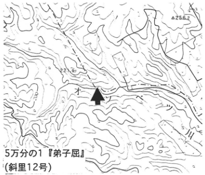
Show extracted lettering and translation
English translation of figure lettering
1:50,000 ‘Teshikaga’ (Shari sheet 12); Osotsubetsu River; 256.2; 221.9; 200; arrow.
Original Japanese lettering
5万分の1『弟子屈』(斜里12号);オソツベツ川;256.2;221.9;200;矢印.
Reading notes
地図の微小数字の一部は判読不明。
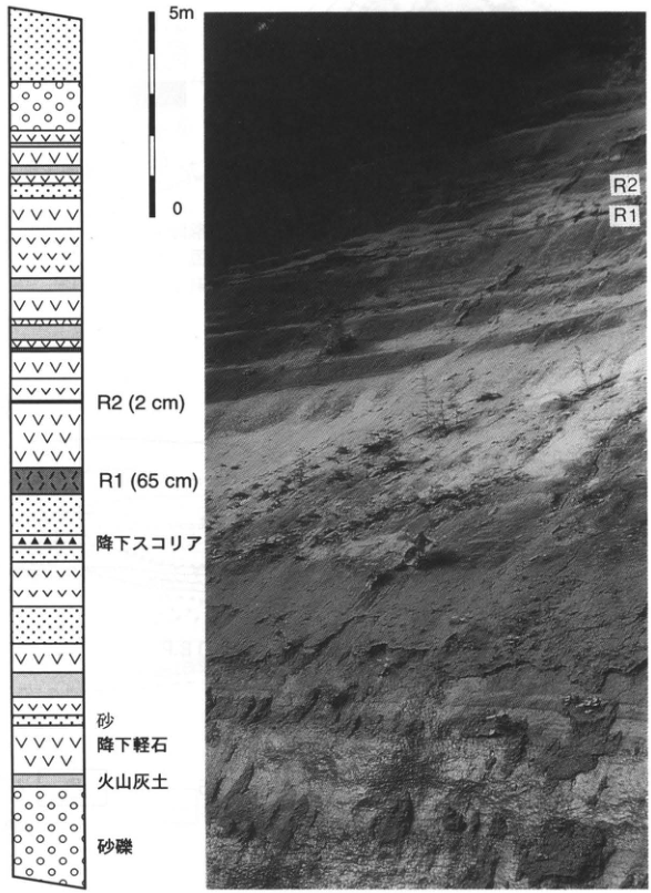
Show extracted lettering and translation
English translation of figure lettering
5m; 0; R2 (2cm); R1 (65cm); scoria-fall deposit; sand; pumice-fall deposit; volcanic-ash soil; sand and gravel; photograph: R2, R1.
Original Japanese lettering
5m;0;R2(2cm);R1(65cm);降下スコリア;砂;降下軽石;火山灰土;砂礫;写真:R2,R1.
HK-15 Tephra distributed in the Daisetsuzan Mountains
高橋伸幸
- Locality: Along the climbing trail approximately 40m north of the Kogen Onsen trail junction at Takanegahara, Kamikawa Town, Kamikawa District, Hokkaido
- Latitude and longitude: N43°38′10″ E142°54′39″
- Elevation: 1,790m
- Outcrop type and condition: Natural exposure approximately 50cm high; upper part covered by plants
- Deposit types and age: Aeolian tephra; Late Pleistocene to Holocene
- Date of description: July 1983
- Keywords: Daisetsuzan; Tarumai-a tephra; Baitoushan–Tomakomai (白頭山苫小牧) tephra; Daisetsu Ohachidaira caldera
The Daisetsuzan Mountains, composed of several volcanoes, have an overall lava-plateau-like form, with extensive flat surfaces along the ridges. In contrast, dissection by landsliding is advanced along the plateau margins. Wetlands formed during the Holocene occupy these flat surfaces and landslide depressions, and two to three intercalated tephra beds can be recognized in their peat. The tephra at depths of 10–20cm is considered to be Tarumai-a (Ta-a), erupted in 1739; it is sandy and white to yellowish white. Its thickness in the Daisetsuzan region is generally approximately 2–3cm, and it can also be observed at many places outside the wetlands, including this outcrop. Several centimetres below Ta-a is a fine-grained, grey to greyish-brown tephra bed no more than 1cm thick; a similar tephra is sometimes also present below it. Their ages and other evidence suggest that these beds may be Baitoushan–Tomakomai tephra (B-Tm), derived from the Korean Peninsula. They are often observed together with Ta-a at exposures along climbing trails. These tephras have sources outside Daisetsuzan, whereas a tephra believed to originate from Ohachidaira caldera in the northern part is distributed from central Takanegahara northward. It consists of coarse material, principally pumice and scoria. Its age is unknown, but the approximately 30ka formation age of Ohachidaira caldera suggests a Late Quaternary age. It is, however, absent from wetland deposits.
References: 五十嵐・高橋 (1985); 勝井・伊藤 (1979); 高橋・五十嵐 (1986); 高橋 et al. (1988).
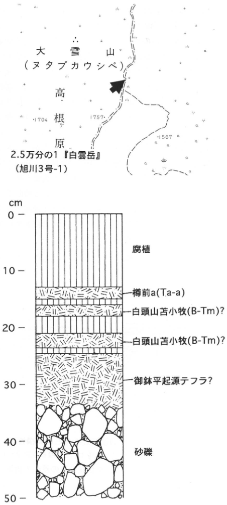
Show extracted lettering and translation
English translation of figure lettering
Location map: 1:25,000 ‘Hakuundake’ (Asahikawa sheet 3-1); Daisetsuzan (Nutapkaushipe); Takanegahara; 1704; 1757; 1567; arrow. Column: cm; 0, 10, 20, 30, 40, 50; humus; Tarumai-a (Ta-a); Baitoushan–Tomakomai (B-Tm)?; Baitoushan–Tomakomai (B-Tm)?; Ohachidaira-derived tephra?; sand and gravel.
Original Japanese lettering
位置図:2.5万分の1『白雲岳』(旭川3号-1);大雪山(ヌタプカウシペ);高根ケ原;1704;1757;1567;矢印.柱状図:cm;0,10,20,30,40,50;腐植;樽前a(Ta-a);白頭山苫小牧(B-Tm)?;白頭山苫小牧(B-Tm)?;御鉢平起源テフラ?;砂礫.
Outcrop stratigraphic column.
HK-16 Relict periglacial features in the northwestern Tokachi Plain—wedge-shaped depositional structures and involutions
小疇 尚
- Locality: Kyowa, Higashi-Ichisen, No. 12, Shimosahoro, Shimizu Town, Hokkaido
- Latitude and longitude: N43°01′40″ E142°55′10″
- Elevation: 169m
- Outcrop type and condition: Artificial exposure; vegetated after completion of works
- Deposit types and age: Aeolian tephra; Late Pleistocene
- Date of description: August 1972
- Keywords: Tokachi Plain; Shikotsu-1 tephra; Eniwa-a tephra; Tarumai-b tephra; Tarumai-d tephra; fossil ice wedges; permafrost
In eastern Hokkaido, especially the Tokachi Plain, Late Pleistocene tephra beds overlying terrace gravels commonly show complex structures produced by cryoturbation. At Shimosahoro, Shimizu Town, between the Tokachi and Sahoro rivers in the northwestern Tokachi Plain, reconstruction of the Shimizu–Shikaoi prefectural road created a 200m-long cutting through the terrace scarp of the Shimosahoro surface, a Last Glacial depositional terrace of sand and gravel. Large relict periglacial features preserving evidence of cryoturbation appeared on the cut face. They occur in the 6–8m-thick tephra beds covering the terrace gravels and at the boundary between the gravels and tephra. The two pumice beds, Eniwa-a tephra (En-a) and Shikotsu-1 tephra (Spfa-1), are particularly strongly deformed, and the structures as a whole may be called involutions. However, Spfa-1 at depths of 4–5m below the ground surface forms downward-pointing wedges approximately 2m both in upper width and height, extending into the underlying ash bed. Their morphological characteristics suggest fossil ice wedges (ice-wedge casts) formed under permafrost conditions. The overlying En-a does not extend down into them. Thus, the coldest phase of the Last Glacial, when the ice wedges formed, occurred after deposition of Spfa-1 and before the En-a fall. As ice wedges form in continuous permafrost zones with mean annual temperatures of −6℃ or below, the temperature depression at that time is estimated at approximately 11–12℃. Some, however, interpret these as soil wedges formed in discontinuous permafrost rather than ice wedges; in that case, the temperature depression during the coldest phase would be approximately 7–8℃.
References: 平川 (1984); 小疇 et al. (1974a, b); 三浦・平川 (1995).
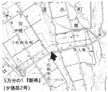
Show extracted lettering and translation
English translation of figure lettering
1:50,000 ‘Shintoku’ (Yubaridake sheet 2); Shimizu Town; Shimosahoro; Shimosahoro Kyowa; Shimosahoro Shinsei; Hitomai; Hitomai River bridge; 172.5; 142.8; 175.1; 164.3; 140; arrow.
Original Japanese lettering
5万分の1『新得』(夕張岳2号);清水町;下佐幌;下佐幌協和;下佐幌新生;人舞;人舞川橋;172.5;142.8;175.1;164.3;140;矢印.
Reading notes
地図の微小文字の一部は判読不明。
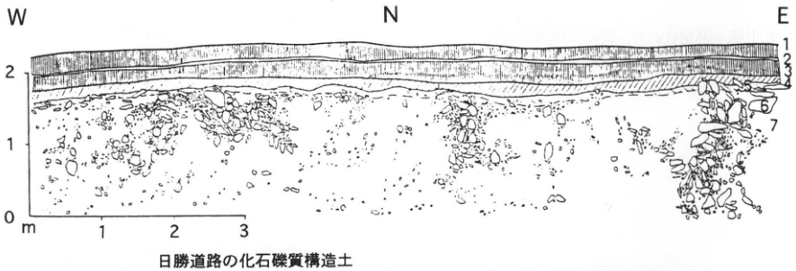
Show extracted lettering and translation
English translation of figure lettering
W; N; E; vertical scale 0, 1, 2m; horizontal scale 1, 2, 3; unit numbers 1, 2, 3, 4, 6, 7; relict gravelly patterned ground along the Nissho Road.
Original Japanese lettering
W;N;E;縦目盛0,1,2m;横目盛1,2,3;層番号1,2,3,4,6,7;日勝道路の化石礫質構造土.
Relict gravelly patterned ground along the Nissho Road.
- Humic soil; 2. Tarumai-b tephra (Ta-b); 3. humic soil; 4. Tarumai-d tephra (Ta-d); 5. weathered volcanic ash mixed with decomposed granite; 6. granite debris; 7. gravelly volcanic-ash soil.
HK-17 Relict gravelly patterned ground along the Nissho Road, Hokkaido—patterned ground on gentle piedmont slopes in the northeastern Hidaka Mountains
小疇 尚
- Locality: Below the first viewpoint on the Nissho Road, Shimizu Town, Hokkaido
- Latitude and longitude: N42°57′30″ E142°47′50″
- Elevation: 615m
- Outcrop type and condition: Artificial exposure; vegetated after completion of works
- Deposit types and age: Solifluction deposits and aeolian tephra; Late Pleistocene
- Date of description: August 1972
- Keywords: Tokachi Plain; gentle piedmont slopes; solifluction; gravelly patterned ground; Tarumai-d tephra; Eniwa-a tephra; Shikotsu-1 tephra
Gentle piedmont slopes are widespread along the northeastern foot of the Hidaka Mountains. During construction of the Nissho Road (National Route 274), crossing the northern mountains, from the late 1960s to the early 1970s, long continuous cut faces and roadside ditches were created across the mountain slopes east of Nissho Pass and the gentle piedmont slopes extending below them. Relict patterned ground was observed at numerous artificial exposures between elevations of 640 and 320m over a straight-line distance of slightly less than 5km. This exposure lies near the highest part of the series on the gentle slopes, faces north, and is slightly more than 2m high. Angular granite clasts ranging from several centimetres to a maximum of 1m in diameter are concentrated in wedge-shaped bodies, 0.5–2m wide and 0.5–1.5m deep, spaced 2–3m apart within a weathered soil bed mixed with volcanic ash. They are covered by Tarumai-d tephra (Ta-d) of earliest Holocene age and younger Holocene tephras. Their form was interpreted as a section through relict gravelly patterned ground covered by tephra beds. The patterned ground formed during the Last Glacial, when granite debris supplied by frost shattering on the mountain slopes behind was transported downslope by solifluction, developing gentle slopes at the mountain foot. Here, close to the mountains, its cover of Tarumai-d tephra suggests that formation continued into the Late Glacial. Similar relict gravelly patterned ground was frequently observed during civil engineering works cutting gentle piedmont slopes, hills, and terraces in eastern Hokkaido, including the Okhotsk coast, the central Hokkaido depression zone, and basins within the Kitami Mountains.
References: 小疇 et al. (1974a); 清水 (1989); 山本 (1989).
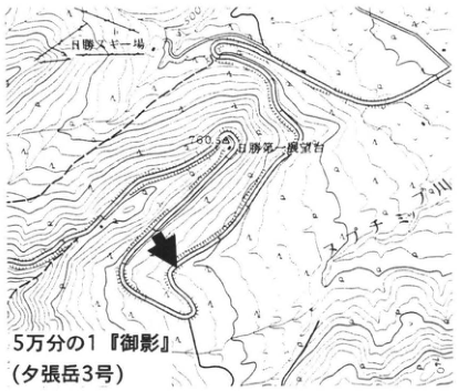
Show extracted lettering and translation
English translation of figure lettering
1:50,000 ‘Mikage’ (Yubaridake sheet 3); Nissho ski area; first Nissho viewpoint; Pankenushi River (パンケヌーシ川); 500; 700; arrow.
Original Japanese lettering
5万分の1『御影』(夕張岳3号);日勝スキー場;日勝第一展望台;パンケヌーシ川;500;700;矢印.
Reading notes
地図内の一部微小文字は判読不明。
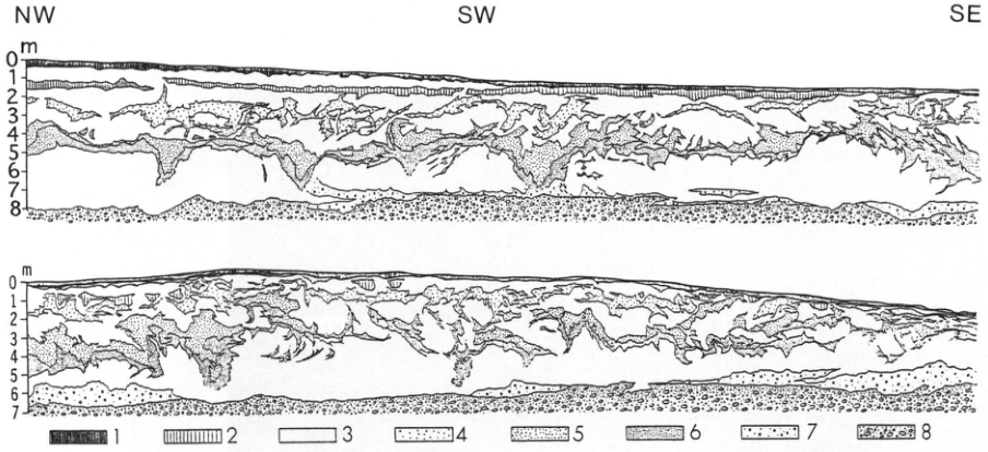
Show extracted lettering and translation
English translation of figure lettering
NW; SW; SE; upper section vertical scale m, 0–8; lower section vertical scale m, 0–7; legend 1, 2, 3, 4, 5, 6, 7, 8.
Original Japanese lettering
NW;SW;SE;上図の縦目盛m,0~8;下図の縦目盛m,0~7;凡例1,2,3,4,5,6,7,8.
Wedge-shaped depositional structures and involutions at Shimosahoro, Shimizu Town, Hokkaido.
- Humic soil; 2. buried humic soil; 3. volcanic ash; 4. Eniwa-a tephra (E-a); 5. Shikotsu-1 tephra (Spfa-1); 6. black volcanic sand; 7. sand and gravel mixed with volcanic sand; 8. terrace gravel.
HK-18 Fluvial terraces and tephra in the Tokachi Plain—the Kamisarabetsu III surface
町田 洋
- Locality: Takushin (拓進), Churui Village, Hokkaido
- Latitude and longitude: N42°34′8″ E143°7′51″
- Elevation: 240m
- Outcrop type and condition: Road-construction exposure; probably lost
- Deposit types and age: Tephra and terrace sand and gravel; Late Pleistocene
- Date of description: June 1994
- Keywords: Tokachi Plain; Kamisarabetsu III surface; Toya tephra; Aso-4 tephra
Among the alluvial-fan complexes in the southwestern Tokachi Plain, terraces are exceptionally well developed along the Rekifune River. This exposure lies on the Kamisarabetsu III surface, separated from the broad, higher Kamisarabetsu I surface by a scarp immediately to the north with a relative height of 60m. The pronounced incision of this river is attributed to a change in the course of the Rekifune River, which had joined the Tokachi River when the Kamisarabetsu I surface formed but subsequently began flowing directly into the Pacific Ocean (平川・小野, 1974). In the lower Tokachi River area, the Kamisarabetsu III surface continues into the base of transgressive deposits. Because these deposits are covered by Toya tephra (Toya) (Arai et al., 1986), the Kamisarabetsu III surface is considered to have formed during the low-sea-level phase of the glacial period preceding the Last Interglacial (oxygen isotope stage 6). Under this terrace chronology, the beginning of sand and gravel deposition for the higher terraces and the Kamiobihiro surface becomes older than previously thought.
Terrace sand and gravel and the overlying tephra beds and volcanic-ash soil at and above Toya can be observed here. The vivid reddish-orange ash immediately beneath Kuttara-6 tephra (Kt6) is Aso-4 tephra (Aso-4). Structures such as involutions and earth hummocks occur in the interval from Ssfa to Shikotsu-1 tephra (Spfa-1), and near Eniwa-a tephra (En-a). As this is a road-construction scarp, the exposure may already have disappeared. An alternative exposure occurs at Takuhoku (拓北), 2.6km east of this site.
References: Arai et al. (1986); 平川・小野 (1974); 町田 et al. (1994).
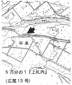
Show extracted lettering and translation
English translation of figure lettering
1:50,000 ‘Kamisatsunai’ (Hiroo sheet 13); Takushin (拓進); 267; 248; 200; arrow.
Original Japanese lettering
5万分の1『上札内』(広尾13号);拓進;267;248;200;矢印.
Reading notes
地図内の微小な一部文字は判読不明。
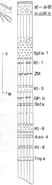
Show extracted lettering and translation
English translation of figure lettering
From top: ball-shaped volcanic-ash soil; Spfa-1; Kt-1; ZM; Kt-3; OP-II; Ssfa; Kt-6; Aso-4; Kt-8; Toya. Scale 0, 1m.
Original Japanese lettering
上から:ボール状火山灰土;Spfa-1;Kt-1;ZM;Kt-3;OP-II;Ssfa;Kt-6;Aso-4;Kt-8;Toya.スケール0,1m.
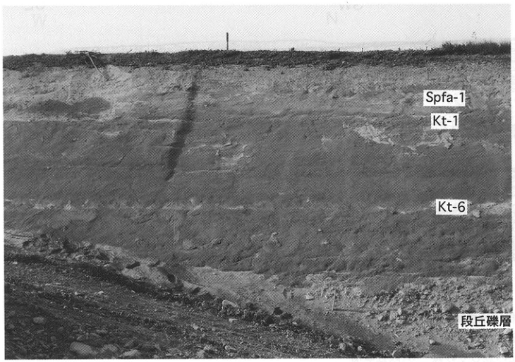
Show extracted lettering and translation
English translation of figure lettering
Spfa-1; Kt-1; Kt-6; terrace gravel.
Original Japanese lettering
Spfa-1;Kt-1;Kt-6;段丘礫層.
HK-19 Naumann's elephant fossil locality at Churui, Tokachi Plain
赤松守雄・奥村晃史
- Locality: Bansei (晩成), Churui Village, Hiroo District, Hokkaido
- Latitude and longitude: N42°32′05″ E143°26′00″
- Elevation: 40m
- Outcrop type and condition: Artificial exposure; extant as of December 1995
- Deposit types and age: Aeolian tephra and peat; Late Pleistocene
- Date of description: May 1990
- Keywords: Naumann's elephant; Kutcharo-Haboro tephra; Horokayanto Formation
The excavation of Naumann's elephant at this outcrop and the associated geological and archaeological investigations were noteworthy for proposing several new interpretations in Hokkaido Quaternary studies. Two different views nevertheless existed regarding the fossil-bearing stratigraphic horizon and its age. Although both called the unit the Horokayanto Formation, one assigned it to the latter part of the Riss–Würm Interglacial (Last Interglacial), approximately 100ka (十勝団体研究会, 1971, 1978), while the other assigned it to the Mindel–Riss Interglacial (Middle Pleistocene), approximately 300ka (小山内 et al., 1971). The area around this exposure lies at the southern end of the Toyokoro Hills, which reach elevations of approximately 300m. It is broadly divided into the Bansei surface at elevations of 50–80m, composed of well cross-laminated sand and gravel to coarse-sand deposits, and the Horokayanto surface at elevations of 10–40m, composed of bluish-grey silt with peat intercalations, sand and gravel consisting chiefly of hard shale, and coarse- to medium-grained sand deposits. The Naumann's elephant fossil was recovered from peat within the bluish-grey silt beneath the Horokayanto surface. Upward changes in the pollen composition of this peat, from dominance of Abies-Fagus-Quercus to dominance of Quercus-Juglans-Fraxinus, indicate a climatic change from humid to drier conditions. Moreover, Kutcharo-Haboro tephra (Kc-Hb; Okumura, 1988), erupted approximately 110ka, is extremely well preserved as a bed approximately 5cm thick in another peat bed, approximately 20cm thick, about 5m above the fossil-bearing peat. These observations suggest an age of approximately 120ka for the Naumann's elephant fossil (赤松 et al., 1990). Toya tephra (町田 et al., 1987) is also distributed on the 生花苗 IV surface (平川・小野, 1974), which lies above the Horokayanto surface.
References: 赤松 et al. (1990); 平川・小野 (1974); 町田 et al. (1987); Okumura (1988); 小山内 et al. (1971); 十勝団体研究会 (1971, 1978).
Show extracted lettering and translation
English translation of figure lettering
1:25,000 ‘Bansei’ (Hiroo sheet 9-2); Bansei; 94; 40; arrow.
Original Japanese lettering
2.5万分の1『晩成』(広尾9号-2);晩成;94;40;矢印.
Reading notes
地図の一部微小文字は判読不明。
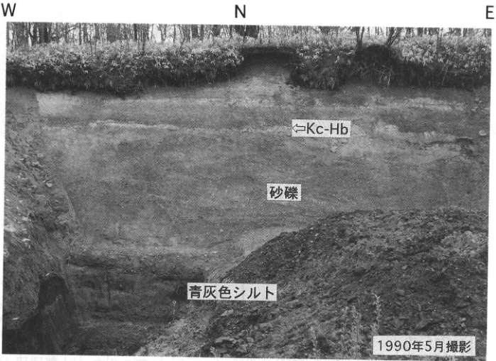
Show extracted lettering and translation
English translation of figure lettering
W; N; E; ←Kc-Hb; sand and gravel; bluish-grey silt; photographed in May 1990.
Original Japanese lettering
W;N;E;←Kc-Hb;砂礫;青灰色シルト;1990年5月撮影.
HK-20 Depositional terraces and tephra around Hiroo, Tokachi Plain
町田 洋
- Locality: Tokachi Port/right bank of the lower Rakko River, Hiroo Town, Hokkaido
- Latitude and longitude: N42°18′0″ E143°19′30″
- Elevation: 5–30m
- Outcrop type and condition: Originally a sea cliff; coastal reclamation has placed it beside a road; partly extant
- Deposit types and age: Sand and gravel beds, peat beds, and tephra
- Date of description: June 1984
- Keywords: Toya tephra; Kuttara-8 tephra; Aso-4 tephra; Kuttara-6 tephra; Kuttara-1 tephra; Shikotsu-1 tephra; Kamiobihiro I surface; ビラオトリ Formation
This exposure formed through marine erosion of the alluvial fan built by the Nishi-Hiroo River. Human modification has since made it somewhat different from the lower-left illustration. The thick gravel bed forms the Kamiobihiro I surface. Intercalated in the sand and gravel, in ascending order, are Toya (Toya), Kuttara-8 (Kt-8), Aso-4 (Aso-4), Kuttara-6 (Kt-6), Kuttara-1 (Kt-1), and other tephras. Tephras younger than 銭亀女那川 tephra (Z-M) overlie the gravel. This shows that deposition of the sand and gravel continued from before Toya deposition until immediately before the Z-M fall. The timing of emergence varies, however, as Shikotsu scoria fall (Ssfa) and Shikotsu-1 tephra (Spfa-1) separately overlie the sand and gravel at some localities. 小野・平川 (1975) attributed this deposition to climatic change accompanying expansion of periglacial and glacial regions during oxygen isotope stage 4 in the first half of the Last Glacial.
At the ■ site on the topographic map, deposits comprising sand with angular gravel, silt, and clay beds, with intercalated peat and tephra (the ビラオトリ Formation), were observed, although exposure conditions there have recently been poor. This unit nevertheless occurs sporadically along the boundary between the mountains and alluvial fan on the right bank of the Rekifune River (lower-right figure). It represents deposits of wetlands that formed along the fan margins during alluvial-fan deposition. Tephras in the ビラオトリ Formation are generally well preserved, and Toya, Aso-4, Kt-6, Ssfa, Kt-3, Z-M, and others can be clearly recognized in ascending order.
References: 小野・平川 (1975); 十勝団研 (1978).
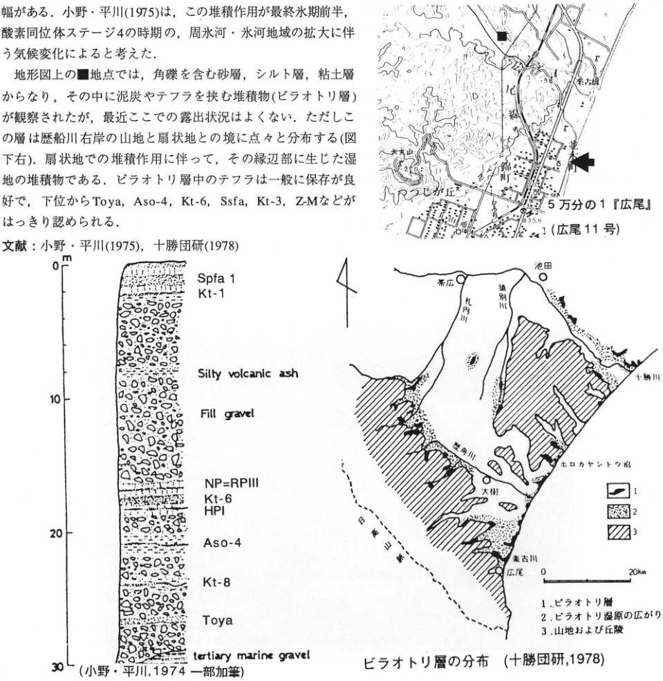
Show extracted lettering and translation
English translation of figure lettering
Location map: 1:50,000 ‘Hiroo’ (Hiroo sheet 11); Rakko Bridge; Tokachi Port; Daimaruyama; Maruyama hill; Rakko River; 35.9; ■; arrow. Column: m; 0, 10, 20, 30; Spfa 1; Kt-1; Silty volcanic ash; Fill gravel; NP=RPIII; Kt-6; HPI; Aso-4; Kt-8; Toya; tertiary marine gravel. Distribution map: Obihiro; Ikeda; Satsunai River; Sarubetsu River; Tokachi River; Rekifune River (printed 歴舟川); Taiki; Lake Horokayanto; Rakko River; Hiroo; Hidaka Mountains; 0, 20km; legend 1, 2, 3.
Original Japanese lettering
位置図:5万分の1『広尾』(広尾11号);楽古橋;十勝港;大丸山;丸山丘;楽古川;35.9;■;矢印.柱状図:m;0,10,20,30;Spfa 1;Kt-1;Silty volcanic ash;Fill gravel;NP=RPIII;Kt-6;HPI;Aso-4;Kt-8;Toya;tertiary marine gravel.分布図:帯広;池田;札内川;猿別川;十勝川;歴舟川;大樹;ホロカヤントウ沼;楽古川;広尾;日高山脈;0,20km;凡例1,2,3.
Reading notes
地形図内の一部微小文字は判読不明。
Column: 小野・平川, 1974, with additions.
Distribution of the ビラオトリ Formation (十勝団研, 1978).
- ビラオトリ Formation; 2. extent of the ビラオトリ wetlands; 3. mountains and hills.
HK-21 Last-glacial periglacial slope in the southern Yubari Mountains—tephra beds overlying drag structures
清水長正
- Locality: Pankezawa River, Atsuma Town, Hokkaido
- Latitude and longitude: N42°46′38″ E141°58′25″
- Elevation: 180m
- Outcrop type and condition: Artificial exposure; condition unknown
- Deposit types and age: Slope deposits and aeolian tephra; Last Glacial to Holocene
- Date of description: October 1988
- Keywords: Yubari Mountains; periglacial phenomena; Last Glacial; Eniwa-a tephra; Tarumai-d tephra
The area around this outcrop consists of hills with roughly concordant summit elevations of 200–300m, composed of the Tertiary Kawabata Formation in the Yubari Mountains. The exposure is approximately 9km northeast of Atsuma, on an upper valley-side slope of the Pankezawa River, which flows into the Habiu River, a tributary of the Atsuma River. It appears on the cut slope of the Horonai–Takaoka forest road. Alternating sandstone and mudstone beds of the Kawabata Formation basement dip steeply at approximately 80°. Their uppermost portion displays ‘drag structures’, curving in the downslope direction. Overlying the basement are an angular gravel bed derived from the Kawabata Formation, a fine ash bed containing scattered pumice grains of Eniwa-a tephra (En-a), aeolian Tarumai-d tephra (Ta-d), and other deposits. Drag structures show that strong near-surface mass movement affected not only slope deposits but also the uppermost bedrock; they develop particularly readily on periglacial slopes. Here, movement was active before the En-a fall at approximately 18ka. After En-a, movement was sufficient only to displace pumice grains, and the slope appears to have stabilized after the Ta-d fall at 8.6ka. These observations are interpreted as stabilization during the Holocene of a slope rendered unstable by periglacial creep during the Last Glacial. Numerous Last Glacial periglacial features have been described in northern and eastern Hokkaido. This exposure may provide evidence that even these low hills in central Hokkaido experienced periglacial activity sufficiently intense to modify the near-surface slope zone during the Last Glacial.
References: 清水 (1989).
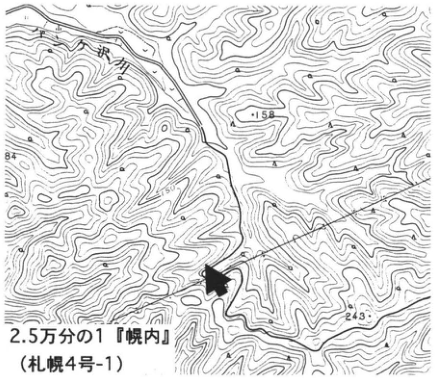
Show extracted lettering and translation
English translation of figure lettering
1:25,000 ‘Horonai’ (Sapporo sheet 4-1); Pankezawa River; 158; 243; arrow.
Original Japanese lettering
2.5万分の1『幌内』(札幌4号-1);パンケ沢川;158;243;矢印.
Reading notes
端部の標高数字と一部微小文字は判読不明。
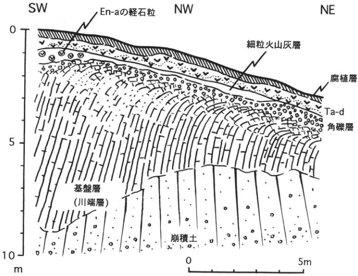
Show extracted lettering and translation
English translation of figure lettering
SW; NW; NE; En-a pumice grains; fine ash bed; humic bed; Ta-d; angular gravel bed; basement (Kawabata Formation); colluvium; vertical scale 0, 5, 10m; horizontal scale 0, 5m.
Original Japanese lettering
SW;NW;NE;En-aの軽石粒;細粒火山灰層;腐植層;Ta-d;角礫層;基盤層(川端層);崩積土;縦目盛0,5,10m;横スケール0,5m.
HK-22 Tephra beds from the Late Pleistocene onward in the Ishikari Lowland—tephra stratigraphy of Shikotsu and Kuttara volcanoes
山縣耕太郎
- Locality: 源武, Hayakita Town, Hokkaido
- Latitude and longitude: N42°43′42″ E141°49′14″
- Elevation: 20m
- Outcrop type and condition: Artificial exposure; extant as of November 1995
- Deposit types and age: Fallout tephra; Late Pleistocene
- Date of description: October 1990
- Keywords: Shikotsu volcano; Kuttara volcano; Toya tephra; Kutcharo-Haboro tephra
This outcrop lies immediately outside the distribution area of the Shikotsu pyroclastic-flow deposit (Spfl), erupted approximately 40ka, and is one of the closest exposures to Shikotsu volcano at which tephra beds below Spfl can be observed. It is therefore the most suitable exposure for observing Shikotsu-derived tephra beds erupted before Spfl. The exposure was created by cutting into a marine terrace. Its lower part contains the Atsuma Formation, considered to represent Last Interglacial deposits (馬追団体研究会, 1983). Above it are peaty deposits (Hongo Formation) containing intercalated Atsuma ash-fall deposits 1–4 (Aafa 1–4) (春日井 et al., 1980). Of these, Aafa 1, Aafa 2, and Aafa 3 correlate with Kuttara-8 tephra (Kt-8), Toya tephra (Toya), and Kutcharo-Haboro tephra (Kc-Hb), respectively (Arai et al., 1986; 山縣, 1994). Aeolian deposits comprising tephra beds sourced chiefly from Shikotsu and Kuttara volcanoes and brown volcanic-ash soil overlie the Hongo Formation. Both volcanoes have been active since the Late Pleistocene and deposited numerous tephra beds, raising the question of how these tephras should be subdivided.
Tephra, as an eruptive deposit, should be subdivided into units corresponding to individual eruptive cycles. This requires identifying indicators of eruptive pauses in the exposure and subdividing the tephra accordingly. Volcanic-ash soil, which accumulates slowly and is ubiquitous in terrestrial deposits, is considered the most suitable indicator of an eruptive pause. Unlike black volcanic-ash soil, however, thin brown volcanic-ash soil can sometimes be difficult to distinguish from weathered fine ash. At this exposure too, Spfa 9 and the fine-grained brown deposits between Spfa 6, 7, and 8, together with the interval described as an argillized zone by 春日井 et al. (1983), are difficult to distinguish as tephra beds or volcanic-ash soil. Organic carbon content, phytolith content, primary-mineral composition, and clay-mineral composition were therefore used to determine whether the deposits in these intervals are volcanic-ash soil or fine ash (Yamagata, 1995). The fine-grained bed between Spfa 6 and 7 was identified as volcanic-ash soil, whereas Spfa 9, the argillized zone, and the fine-grained bed between Spfa 7 and 8 were identified as fine ash. Consequently, the former Spfa 7–10 were shown to be products of a single eruptive sequence (the Shikotsu scoria-fall deposit; Ssfa), and the Late Pleistocene tephras at this exposure are subdivided into 17 tephra beds.
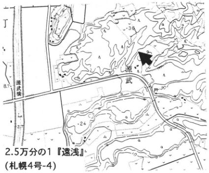
Show extracted lettering and translation
English translation of figure lettering
1:25,000 ‘Toasa’ (Sapporo sheet 4-4); 源武; 源武 railway crossing; 36; 24; 30; 8.7; 2.7; arrow.
Original Japanese lettering
2.5万分の1『遠浅』(札幌4号-4);源武;源武踏切;36;24;30;8.7;2.7;矢印.
Reading notes
源武の読みは未確認。一部微小文字は判読不明。
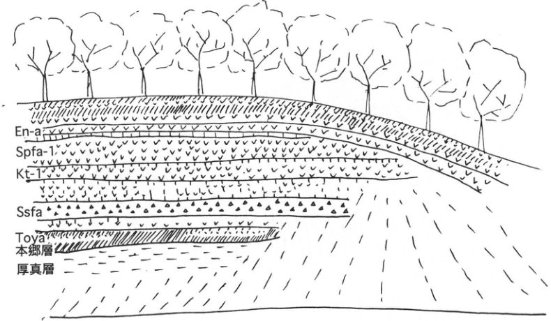
Show extracted lettering and translation
English translation of figure lettering
En-a; Spfa-1; Kt-1; Ssfa; Toya; Hongo Formation; Atsuma Formation.
Original Japanese lettering
En-a;Spfa-1;Kt-1;Ssfa;Toya;本郷層;厚真層.
HK-22 (continued)
Most tephra beds distributed in the Ishikari Lowland had been considered to originate from Shikotsu volcano, situated along the western margin of the lowland. Detailed distribution studies, however, confirmed the presence of Kuttara-derived beds such as Kt-1, 3, 6, 8, and Kuttara-Hayakita tephra (Kt-Dt), as well as Toya-derived beds such as Toya, Nakajima-Osarugawa tephra (Nj-Os), and Usu-b (Us-b). These can also be observed at this exposure (山縣, 1994). After excluding these tephras, Ssfa, Spfa 6, and Spfa 5 are the Shikotsu-derived tephras erupted before caldera formation.
Above Spfa 1, as at the 美美 exposure, Eniwa-a (En-a) and Tarumai-a, b, c, and d (Ta-a, b, c, d), produced by post-caldera activity of Shikotsu volcano, occur together with Usu-b and Baitoushan–Tomakomai ash.
References: Arai et al. (1986); 春日井 et al. (1980); 馬追団体研究会 (1983); 山縣 (1994); Yamagata (1995).
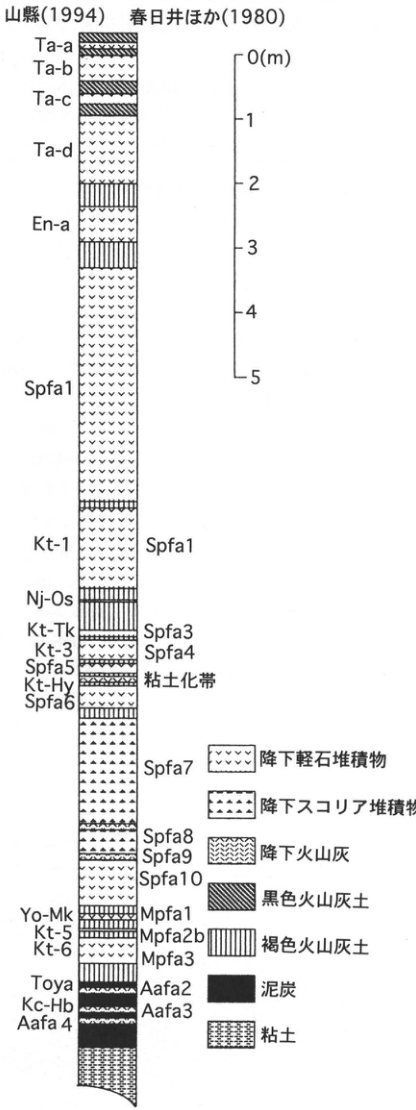
Show extracted lettering and translation
English translation of figure lettering
山縣 (1994); 春日井 et al. (1980). From top: Ta-a; Ta-b; Ta-c; Ta-d; En-a; Spfa1; Kt-1 (Spfa1); Nj-Os; Kt-Tk (Spfa3); Kt-3 (Spfa4); Spfa5; Kt-Hy (argillized zone); Spfa6; Spfa7; Spfa8; Spfa9; Spfa10; Yo-Mk (Mpfa1); Kt-5 (Mpfa2b); Kt-6 (Mpfa3); Toya (Aafa2); Kc-Hb (Aafa3); Aafa4. Scale: 0 (m), 1, 2, 3, 4, 5. Legend: pumice-fall deposit; scoria-fall deposit; ash-fall deposit; black volcanic-ash soil; brown volcanic-ash soil; peat; clay.
Original Japanese lettering
山縣(1994);春日井ほか(1980).上から:Ta-a;Ta-b;Ta-c;Ta-d;En-a;Spfa1;Kt-1(Spfa1);Nj-Os;Kt-Tk(Spfa3);Kt-3(Spfa4);Spfa5;Kt-Hy(粘土化帯);Spfa6;Spfa7;Spfa8;Spfa9;Spfa10;Yo-Mk(Mpfa1);Kt-5(Mpfa2b);Kt-6(Mpfa3);Toya(Aafa2);Kc-Hb(Aafa3);Aafa4.目盛:0(m),1,2,3,4,5.凡例:降下軽石堆積物;降下スコリア堆積物;降下火山灰;黒色火山灰土;褐色火山灰土;泥炭;粘土.
Reading notes
図のKt-1右側はSpfa1と印刷されているように見える。翌ページ本文の対照Spfa2=Kt-1とは異なるが原著表記を保持。
HK-23 Late Pleistocene tephra beds in the Hidaka coastal region—distal tephras derived from Kuttara volcano
山縣耕太郎
- Locality: Shiomi Third District, Mukawa Town, Hokkaido
- Latitude and longitude: N42°33′20″ E141°59′00″
- Elevation: 36m
- Outcrop type and condition: Artificial exposure; partly covered by talus
- Deposit types and age: Fallout tephra; Late Pleistocene
- Date of description: July 1991
- Keywords: Kuttara volcano; Shikotsu volcano; 銭亀女那川 tephra; Yotei-Mukawa tephra
Most tephras distributed in the Ishikari Lowland and called Shikotsu pumice-fall deposits (Spfa) or Mukawa pumice-fall deposits (Mpfa) were thought to have been supplied by Shikotsu volcano (春日井 et al., 1980). Subsequent distribution studies, however, showed that many of these tephra beds originated from Kuttara volcano (胆振団体研究会, 1990; 山縣, 1994). Around Mukawa, at the southern end of the Ishikari Lowland, Kuttara-derived tephras, whose distribution axes lie farther south than those of Shikotsu-derived tephras, can be readily observed. This outcrop lies on a Last Interglacial marine terrace, where tephra is well preserved. Tephras above Shikotsu Pumice-fall Deposit-1 (Spfa-1), erupted around 40ka, have been removed and cannot be observed here. Below it lies Kuttara-1 tephra (Kt-1), derived from Kuttara volcano, separated by approximately 10cm of volcanic-ash soil. The underlying volcanic-ash soil contains patchy intercalations of 銭亀女那川 tephra (Z-M), derived from Zenikame volcano, which erupted offshore of Hakodate in the Tsugaru Strait. Farther below can be observed Kuttara-Takeura tephra (Kt-Tk), Kt-3, Kuttara-Hayakita tephra (Kt-Hy), Spfa 6, Ssfa, Yotei-Mukawa tephra (Yo-Mk) from Yotei volcano, Kt-4, Kt-5, Kt-6, and Kt-7. The volcanic-ash soil intercalated between individual tephras from Kt-Tk through Kt-6 is thin, showing that eruptions occurred frequently with short intervening pauses during this period. Kt-1, Kt-3, and Kt-6 from Kuttara volcano can also be identified farther east in the Tokachi Plain. Correspondence with the former names (春日井 et al., 1980; 曽屋・佐藤, 1980) is as follows.
| Former name | Name in this article |
|---|---|
| Spfa 2 | Kt-1 |
| Hpfa | Z-M |
| Spfa 3 | Kt-Tk |
| Spfa 4 | Kt-3 |
| Spfa 7, 8, 9, 10 | Ssfa |
| Mpfa 1 | Y-Mk |
| Mpfa 2a | Kt-4 |
| Mpfa 2b | Kt-5 |
| Mpfa 3 | Kt-6 |
References: 胆振団体研究会 (1990); 春日井 et al. (1980); 山縣 (1994).
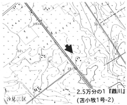
Show extracted lettering and translation
English translation of figure lettering
1:25,000 ‘Mukawa’ (Tomakomai sheet 1-2); Shiomi Third District; 33.5; 35; 32; 39.5; arrow.
Original Japanese lettering
2.5万分の1『鵡川』(苫小牧1号-2);汐見三区;33.5;35;32;39.5;矢印.
Reading notes
一部の地図内微小文字は判読不明。
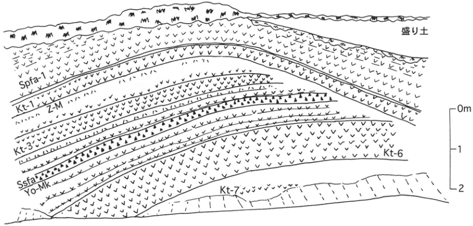
Show extracted lettering and translation
English translation of figure lettering
Artificial fill; Spfa-1; Kt-1; Z-M; Kt-3; Ssfa; Yo-Mk; Kt-6; Kt-7; 0m, 1, 2.
Original Japanese lettering
盛り土;Spfa-1;Kt-1;Z-M;Kt-3;Ssfa;Yo-Mk;Kt-6;Kt-7;0m,1,2.
HK-24 Late Holocene tephra beds at the Yukanboshi E9 archaeological site, Eniwa City, Hokkaido
鈴木正章・上屋真一
- Locality: Left bank of the Yukanboshi River, Eniwa City, Hokkaido [the original locality text contains an additional 戸]
- Latitude and longitude: N42°52′26″ E141°37′12″
- Elevation: 15m
- Outcrop type and condition: Artificial exposure; lost
- Deposit types and age: Aeolian tephra; Late Holocene
- Date of description: August 1992
- Keywords: Ishikari Lowland; Baitoushan–Tomakomai (白頭山苫小牧) tephra; Eniwa-derived tephra; Tarumai-derived tephra
This exposure lies on the left bank of the middle Yukanboshi River, south of central Eniwa City. It is a section through deposits filling a small valley incised into an alluvial-fan surface carrying aeolian Eniwa-a tephra (En-a), dated at 15–17ka. The valley was filled with peat considered continuous with the former Osatsu wetland. 鈴木 (1993) provisionally named the tephras observed at the exposure YuK-1 through YuK-7 in descending order. YuK-1 was correlated with Tarumai-a tephra (Ta-a) of AD 1739, YuK-3 with Baitoushan–Tomakomai tephra (B-Tm), considered 0.8–0.9ka, YuK-4 with Tarumai-c1 tephra (Ta-c1), and YuK-5 with Tarumai-c2 tephra (Ta-c2). The other beds, YuK-2, -6, and -7, are previously unknown tephras; all three consist almost entirely of volcanic glass with grain sizes around 0.1mm, suggesting that they may also have widespread distributions. At this exposure, a ¹⁴C age immediately above B-Tm, considered 0.8–0.9ka, yielded the older value of 1,210±50yr B.P. (KSU-2272). Ages obtained immediately below B-Tm in Hokkaido are 1.5–2.5ka. Ta-c, dated at 2.5–3.0ka, is subdivided into c1 and c2 and had been regarded as tephras produced during a continuous eruptive sequence without a pause. Here, however, a 2cm peat bed is intercalated between c1 and c2, and its mean accumulation rate gives an estimated pause of approximately 30 years. Archaeological finds include Teine-type pottery of the middle portion of the Late Jomon (BP3,500) from the bed between YuK-6 and Ta-c2 (bed IIIc), Tanneto-L-type pottery of the Final Jomon (BP2,300) from the Ta-c1 bed (bed IIIb), and Kohoku C2-D-type pottery of the early part of the Late Epi-Jomon (fourth century) and Hokudai III-type pottery of the closing part of that period (sixth century) from the bed between Ta-c1 and B-Tm (bed IIIa).
References: 遠藤 et al. (1989); 鈴木 (1993).
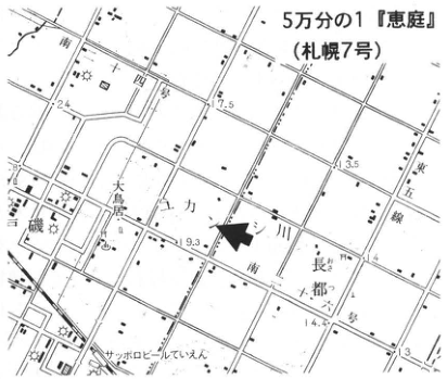
Show extracted lettering and translation
English translation of figure lettering
1:50,000 ‘Eniwa’ (Sapporo sheet 7); Yukanboshi River; Osatsu (長都); 大島居 [place label]; Sapporo Beer Teien; Minami-Juyon-go; Minami-Jugo-go; Higashi-Gosen; 17.5; 13.5; 19.3; 14.4; 24; 13; arrow.
Original Japanese lettering
5万分の1『恵庭』(札幌7号);ユカンボシ川;長都;大島居;サッポロビールていえん;南十四号;南十五号;東五線;17.5;13.5;19.3;14.4;24;13;矢印.
Reading notes
大島居の読みは未確認。一部微小地図文字は判読不明。
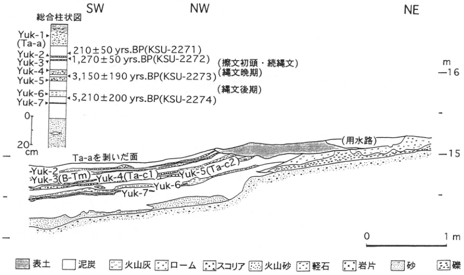
Show extracted lettering and translation
English translation of figure lettering
SW; NW; NE; composite column: Yuk-1 (Ta-a); Yuk-2; Yuk-3; Yuk-4; Yuk-5; Yuk-6; Yuk-7; 210±50yrs.BP (KSU-2271); 1,270±50yrs.BP (KSU-2272); 3,150±190yrs.BP (KSU-2273); 5,210±200yrs.BP (KSU-2274); (earliest Satsumon/Epi-Jomon); (Final Jomon); (Late Jomon); 0, 20cm. Section: surface with Ta-a removed; Yuk-2; Yuk-3 (B-Tm); Yuk-4 (Ta-c1); Yuk-5 (Ta-c2); Yuk-6; Yuk-7; (irrigation channel); m, 16, 15; horizontal scale 0, 1m. Legend: topsoil; peat; volcanic ash; loam; scoria; volcanic sand; pumice; lithic fragments; sand; gravel.
Original Japanese lettering
SW;NW;NE;総合柱状図:Yuk-1(Ta-a);Yuk-2;Yuk-3;Yuk-4;Yuk-5;Yuk-6;Yuk-7;210±50yrs.BP(KSU-2271);1,270±50yrs.BP(KSU-2272);3,150±190yrs.BP(KSU-2273);5,210±200yrs.BP(KSU-2274);(擦文初頭・続縄文);(縄文晩期);(縄文後期);0,20cm.断面:Ta-aを剥いだ面;Yuk-2;Yuk-3(B-Tm);Yuk-4(Ta-c1);Yuk-5(Ta-c2);Yuk-6;Yuk-7;(用水路);m,16,15;横スケール0,1m.凡例:表土;泥炭;火山灰;ローム;スコリア;火山砂;軽石;岩片;砂;礫.
HK-25 Tephra groups of Kuttara volcano at Cape Ranpoge, Noboribetsu
山縣耕太郎
- Locality: Cape Ranpoge (蘭法華), Noboribetsu City, Hokkaido
- Latitude and longitude: N42°26′15″ E141°10′10″
- Elevation: 0–70m
- Outcrop type and condition: Artificial and natural exposures; parts concealed by covering works
- Deposit types and age: Pumice-fall and pyroclastic-flow deposits; Late Pleistocene
- Date of description: August 1987
- Keywords: Kuttara volcano; Shikotsu-1 tephra; Kuttara-1 tephra; Kuttara-2 tephra; Kuttara-3 tephra; Kuttara-4 tephra; Kuttara-5 tephra; Kuttara-6 tephra
Kuttara volcano was active during the Late Pleistocene. Following seven large eruptions during the 40,000 years from approximately 90ka to 50ka—Kuttara-8, 7, 6, 5, and 4 (Kt-8, 7, 6, 5, 4), Kuttara-Hayakita (Kt-Hy), and Kuttara-3 (Kt-3), all VEI5–6—it repeatedly produced small eruptions (the Kuttara-Takeura tephra (Kt-Tk) group; VEI3 or less), building a stratovolcano. Subsequent large eruptions producing the two Kuttara-2 and Kuttara-1 tephras (Kt-2, 1) formed a summit caldera approximately 3km in diameter (山縣, 1994).
This locality lies approximately 5.5km southwest of Kuttara caldera. Together, two nearby exposures reveal tephras above Kt-6. Tephras above Kt-3 are visible along a narrow road branching north from the national highway at the western base of Cape Ranpoge (site A; Fig. 3A). At the top of the exposure, Usu-b occurs in black humic soil. Below it, separated by approximately 1m of brown volcanic-ash soil, are the Shikotsu pyroclastic-flow deposit (Spfl) and Shikotsu Pumice Fall 1 (Spfa 1). Charred wood and pipe structures can be observed in Spfl. Beneath Spfa 1, separated by thin volcanic-ash soil, is Kt-1, comprising, in descending order, units of base-surge deposit, pumice fall, and pyroclastic-flow deposit. The pumice-fall unit correlates with Spfa 2 in the Ishikari Lowland. Locally, Kt-1 includes an additional pyroclastic-flow unit between the base-surge and pumice-fall deposits, containing excellent relict rootless fumaroles (Kawachi et al., 1978; 河内 et al., 1988). Below Kt-1 lies the fine-grained, well-sorted Nakajima-Osarugawa tephra (Nj-Os), derived from Toya volcano. Immediately below it are scattered weathered coarse pumice of Kt-2. Scoria-fall deposits from the stratovolcano-building stage and Kt-3, comprising nonwelded pyroclastic-flow and pumice-fall units, can also be recognized. The portion below Kt-1 is now concealed by grass, but comparable stratigraphic intervals can be observed in quarries north of central Noboribetsu and elsewhere.
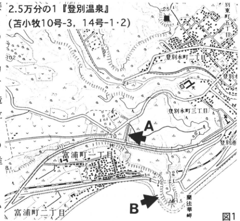
Show extracted lettering and translation
English translation of figure lettering
1:25,000 ‘Noboribetsu Onsen’ (Tomakomai sheets 10-3, 14-1 and 14-2); Noboribetsu-Higashicho 5-chome; Noboribetsu-Honcho 2-chome; Noboribetsu-Honcho 3-chome; Noboribetsu; Noboribetsu Port; Tomiuracho 2-chome; Tomiuracho 1-chome; Cape Ranpoge (蘭法華岬); 125.1; 102; 70; 65; 61.5; 8.1; A; B.
Original Japanese lettering
2.5万分の1『登別温泉』(苫小牧10号-3,14号-1・2);登別東町五丁目;登別本町二丁目;登別本町三丁目;登別;登別港;富浦町二丁目;富浦町一丁目;蘭法華岬;125.1;102;70;65;61.5;8.1;A;B.
Reading notes
地図内の一部微小文字は判読不明。
Fig. 1.
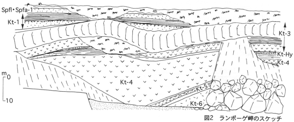
Show extracted lettering and translation
English translation of figure lettering
Spfl・Spfa-1; Kt-1; Kt-3; Kt-Hy; Kt-4; Kt-5; Kt-6; scale m, 0, 10.
Original Japanese lettering
Spfl・Spfa-1;Kt-1;Kt-3;Kt-Hy;Kt-4;Kt-5;Kt-6;スケールm,0,10.
Fig. 2. Sketch of Cape Ranpoge.
HK-25 (continued)
The interval below Kt-3 can be observed in the sea cliff at Cape Ranpoge (site B; Fig. 2; Fig. 3B). Moving from beside the tunnel exit on the western side of the cape toward its tip, one can observe, in order, the densely welded Kt-3 pyroclastic flow forming a steep cliff and Kt-3 pumice fall, dark-grey and poorly sorted Kuttara-Hayakita tephra (Kt-Hy), Kt-4 pyroclastic flow and pumice fall, Kt-5 pumice fall, and Kt-6 pyroclastic flow. The Kt-4 pumice-fall deposit is more than 10m thick and contains abundant charred wood and holes left by wood. Intervals below Kt-6 cannot be observed around Kuttara volcano because of the thick overlying deposits, but can be seen along the forest road from Morino to Shadai, more than 15km east of the volcano. Detailed descriptions of the stratigraphy, distribution, and petrographic properties of Kuttara-derived tephras are given by 山縣 (1994), 胆振団研 (1990), and 山崎 (1985).
References: 胆振団研 (1990); Kawachi et al. (1978); 河内 et al. (1988); 山縣 (1994); 山崎 (1985).
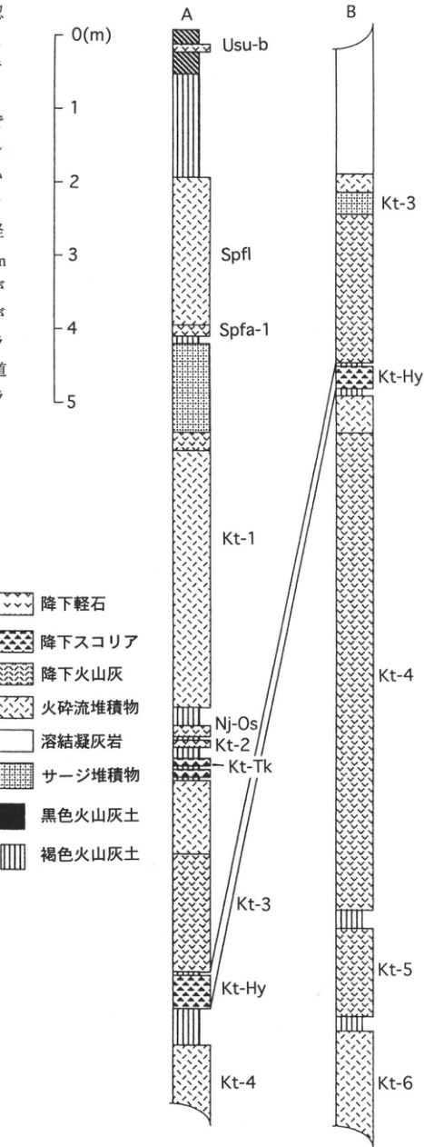
Show extracted lettering and translation
English translation of figure lettering
A, from top: Usu-b; Spfl; Spfa-1; Kt-1; Nj-Os; Kt-2; Kt-Tk; Kt-3; Kt-Hy; Kt-4. B, from top: Kt-3; Kt-Hy; Kt-4; Kt-5; Kt-6. Scale 0 (m), 1, 2, 3, 4, 5. Legend: pumice fall; scoria fall; ash fall; pyroclastic-flow deposit; welded tuff; surge deposit; black volcanic-ash soil; brown volcanic-ash soil.
Original Japanese lettering
A(上から):Usu-b;Spfl;Spfa-1;Kt-1;Nj-Os;Kt-2;Kt-Tk;Kt-3;Kt-Hy;Kt-4.B(上から):Kt-3;Kt-Hy;Kt-4;Kt-5;Kt-6.スケール0(m),1,2,3,4,5.凡例:降下軽石;降下スコリア;降下火山灰;火砕流堆積物;溶結凝灰岩;サージ堆積物;黒色火山灰土;褐色火山灰土.
Fig. 3. Stratigraphic columns at sites A and B.
HK-26 Tephra beds on the eastern foot of Yotei volcano
星住(宇野)リベカ
- Locality: 更進, Kyogoku Town, Abuta District, Hokkaido
- Latitude and longitude: N42°48′27″ E140°55′48″
- Elevation: 365m
- Outcrop type and condition: Artificial exposure
- Deposit types and age: Aeolian tephra; Late Pleistocene
- Date of description: August 1987
- Keywords: Yotei-derived tephra; Shikotsu pyroclastic-flow deposit; Shikotsu-1 tephra; Kuttara-2 tephra; Kyogoku Town
This exposure lies approximately 9km east of the summit of Yotei volcano and is approximately 15m high. Yotei tephra beds are divided into younger and older activity periods separated by an angular discordance. At least 26 Yotei-derived tephra beds and four beds from other volcanoes can be observed here. Scoriaceous sand and silty volcanic ash are mixed into the loam in the upper portion of the younger tephra succession, showing that Yotei also produced smaller eruptions during the younger activity period whose deposits cannot be recognized as individual beds.
The principal tephras at this exposure are described below in descending order. Yotei-1 tephra (Yo-1; 柏原 et al., 1976) comprises five fall units containing scoria and pumice 10–40mm in diameter and silty ash beds; the upper two units contain abundant lithic fragments. Yotei-2 tephra (Yo-2; 柏原 et al., 1976) comprises two fall units: the lower consists of scoria and pumice 2–20mm in diameter, and the upper is a purplish-grey ash bed. Yotei-3 tephra (Yo-3; 柏原 et al., 1976) is a pumice bed with clasts 10–30mm in diameter, comprising four fall units. Approximately 1.5m below Yo-3 lie the Shikotsu pyroclastic-flow deposit (Spfl) and Shikotsu-1 tephra (Spfa-1). Farther below, separated from their lower part by three Yotei tephra beds, is the ‘shiogama-like pumice’ (しおがま状軽石; 佐々木, 1972), whose source volcano is unknown. Kasuga ash (Yo-Ks; 宇野, 1989) comprises several fallout beds of scoria, volcanic sand, fine ash, and other materials, with two or more intercalated pyroclastic-flow deposits of pumice-bearing ash (Kasuga pyroclastic flow). Kuttara-2 tephra (Kt-2; 山縣, 1994; 胆振団体研究会, 1990) lies below Yo-Ks, separated by loam. Eight Yotei-derived tephra beds and the Kimobetsu pyroclastic flow (source unknown), stratigraphically below the succession at this exposure, can be observed at a roadside exposure 1.5km to the west. The Toya pyroclastic-flow deposit (Tp fl) lies still farther below them.
References: 胆振団体研究会 (1978, 1990); 柏原 (1970); 柏原 et al. (1976); 大貫 et al. (1977); 佐々木 (1972); 佐々木 et al. (1971); 宇野 (1989); 山縣 (1994); 柳田 (1994).
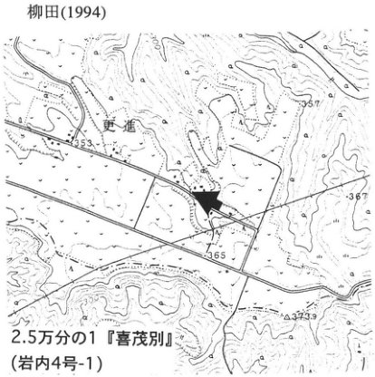
Show extracted lettering and translation
English translation of figure lettering
1:25,000 ‘Kimobetsu’ (Iwanai sheet 4-1); 更進; 353; 357; 367; 365; 373.9; 320; 300; arrow.
Original Japanese lettering
2.5万分の1『喜茂別』(岩内4号-1);更進;353;357;367;365;373.9;320;300;矢印.
Reading notes
更進の読みは未検証。一部微小地図文字は判読不明。
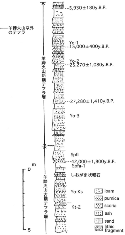
Show extracted lettering and translation
English translation of figure lettering
Tephra from volcanoes other than Yotei; younger Yotei tephra beds; older Yotei tephra beds; 5,930±180y.B.P.; Yo-1; 15,000±400y.B.P.; Yo-2; 25,270±1,080y.B.P.; 27,280±1,410y.B.P.; Yo-3; Spfl; 42,000±1,800y.B.P.; Spfa-1; shiogama-like pumice (しおがま状軽石); Yo-Ks; Kt-2; m, 0, 5. Legend: loam; pumice; scoria; ash; sand; lithic fragment.
Original Japanese lettering
羊蹄火山以外のテフラ;羊蹄火山新期テフラ層;羊蹄火山古期テフラ層;5,930±180y.B.P.;Yo-1;15,000±400y.B.P.;Yo-2;25,270±1,080y.B.P.;27,280±1,410y.B.P.;Yo-3;Spfl;42,000±1,800y.B.P.;Spfa-1;しおがま状軽石;Yo-Ks;Kt-2;m,0,5.凡例:loam;pumice;scoria;ash;sand;lithic fragment.
HK-27 Quarry exposure of the Zenkoji debris-avalanche deposit at the southern foot of Usu volcano
吉田真理夫
- Locality: 若生町, Date City, Hokkaido
- Latitude and longitude: N42°30′ E140°49′30″
- Elevation: 5–50m
- Outcrop type and condition: Artificial exposure; an operating quarry as of April 1996
- Deposit types and age: Debris-avalanche and tsunami deposits; 7–8ka
- Date of description: 1993–1995
- Keywords: Southern foot of Usu volcano; Zenkoji debris-avalanche deposit; tsunami deposit from the 1640 Oshima-Komagatake eruption
The summit of Usu volcano collapsed during a phreatic explosion 7,000–8,000 years ago, and a debris avalanche flowed down to the southern foot, forming hummocks of various sizes (横山 et al., 1971). The deposit is now called the Zenkoji debris-avalanche (flow) deposit (曽屋 et al., 1981). Quarrying is undertaken at many places in this deposit, exposing good sections. The ■ site is one such exposure, in a large quarry in northern 若生町. Blocks of Usu somma lava (Oba, 1966), transported from the source and forming one component of the debris-avalanche deposit, are exposed here. Depositional structures such as jigsaw cracks (宝田, 1994; Takarada, 1995) can be observed (photograph).
Several quarry exposures of the Zenkoji debris avalanche also occur along the coast of Minami-Usucho. At the ▲ site, another interesting deposit can be seen. Three whitish-grey to brown beds are intercalated with black soil at depths of 20–30cm immediately below the present ground surface. 西村・宮地 (1993) and Nishimura and Miyaji (1995) established that the upper two beds are respectively Us-b from the 1663 Usu eruption and Ko-d from the 1640 Komagatake eruption, and that the lowermost bed is a tsunami deposit associated with the 1640 Oshima-Komagatake eruption. Detailed lithofacies descriptions with photographs are given in those two references.
References: 西村・宮地 (1993); Nishimura and Miyaji (1995); Oba (1966); 曽屋 et al. (1981); 宝田 (1994); Takarada (1995); 横山 et al. (1971).

Show extracted lettering and translation
English translation of figure lettering
1:50,000 ‘Date’ (Muroran sheet 2-3); Cape Arutori; Minami-Usucho; 若生町; 27.5; 5; ▲; ■.
Original Japanese lettering
5万分の1『伊達』(室蘭2号-3);アルトリ岬;南有珠町;若生町;27.5;5;▲;■.
Reading notes
若生町の読みは未検証。一部地図内微小文字は判読不明。
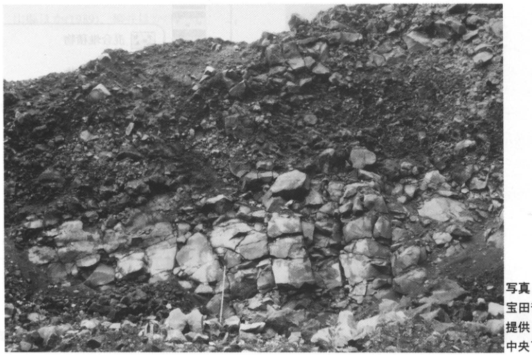
Show extracted lettering and translation
English translation of figure lettering
Part of the photographic credit enters the right edge of the extracted image. The complete credit is reproduced in the page caption from the original PDF. The rock blocks carry no textual annotations.
Original Japanese lettering
画像右端に写真クレジットの一部が切り込む。完全な記載は原PDFのキャプションとして本文に収録。岩塊に文字注記なし。
Photograph supplied by 宝田晋治, Geological Survey of Japan. Photographed in June 1994. The scale in the lower centre is 2m.
HK-28 Historically erupted tephra in the summit crater floor of Usu volcano
吉田真理夫
- Locality: Date City, Hokkaido
- Latitude and longitude: N42°32′ E140°50′
- Elevation: Approximately 500m
- Outcrop type and condition: Natural exposure; expected to remain preserved unless destroyed by new volcanic activity
- Deposit types and age: Fallout tephra, pyroclastic-flow deposits, pyroclastic-surge deposits, and mixed deposits; historical period
- Date of description: 1990–1995
- Keywords: 1977–1978 Usu eruptive products; 1822 Bunsei nuée ardente deposit
Within the crater floor enclosed by the Usu summit somma, the walls of Ginnuma crater (銀沼火口) and Crater 4, formed during the 1978 eruptive activity, preserve well the beds of 1977–1978 pyroclasts, the 1822 Bunsei nuée ardente deposit, and others. In the Ginnuma crater wall, a pumice-dominated fallout-tephra bed lies 20–25m below the top of the succession. A black soil bed occurs immediately beneath this tephra, and the bases of standing trees representing pre-eruption vegetation are scattered nearby. These observations identify the succession from this fallout tephra upward as deposits of the 1977–1978 eruptions. The deposits can also be observed in the sidewalls of gullies extending from the crater (photograph). For the stratigraphy and principal lithofacies around Ginnuma crater, see 吉田 (1995). In the wall of Crater 4, in the northern part of the crater floor, the Bunsei nuée ardente deposit from the 1822 eruption can be observed at a thickness of approximately 10m. It consists chiefly of bluish-grey to whitish-grey dacite fragments, but oxidation gives its upper part a pale-pink colour. Pumice-dominated fallout tephra from the 1977 eruption occurs at the top of the Crater 4 wall.
Deposits in either crater wall can be approached relatively easily by traversing the talus, although access is somewhat difficult after rain when sediment has been washed away. The somma can be reached by car, but there is a gate along the route, so permission and a key must be obtained from Date City.
References: 吉田 (1995).
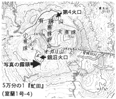
Show extracted lettering and translation
English translation of figure lettering
1:50,000 ‘Abuta’ (Muroran sheet 1-4); Usu volcano; Usu-Shinzan; Ko-Usu; O-Usu (732); Ogariyama (オガリ山); Crater 4; Ginnuma crater; photographed exposure; Higashi-Maruyama; 693; 400; 300.
Original Japanese lettering
5万分の1『虻田』(室蘭1号-4);有珠山;有珠新山;小有珠;大有珠(732);オガリ山;第4火口;銀沼火口;写真の露頭;東丸山;693;400;300.
Reading notes
地形図内の一部微小文字は判読不明。
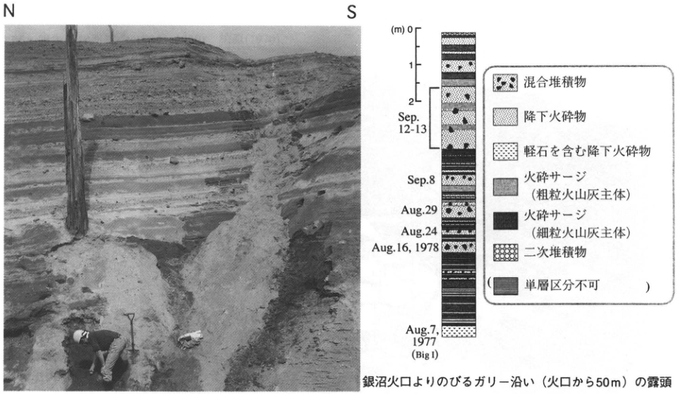
Show extracted lettering and translation
English translation of figure lettering
Photograph: N, S. Column: (m) 0, 1, 2; Sep.12-13; Sep.8; Aug.29; Aug.24; Aug.16, 1978; Aug.7, 1977 (Big I). Legend: mixed deposits; pyroclastic fallout; pumice-bearing pyroclastic fallout; pyroclastic surge (chiefly coarse ash); pyroclastic surge (chiefly fine ash); reworked deposits; (individual beds cannot be distinguished).
Original Japanese lettering
写真:N,S.柱状図:(m)0,1,2;Sep.12-13;Sep.8;Aug.29;Aug.24;Aug.16, 1978;Aug.7, 1977(Big I).凡例:混合堆積物;降下火砕物;軽石を含む降下火砕物;火砕サージ(粗粒火山灰主体);火砕サージ(細粒火山灰主体);二次堆積物;(単層区分不可).
Exposure along a gully extending from Ginnuma crater, 50m from the crater.
HK-29 Tsunami deposits from the 1640 eruption of Oshima-Komagatake at Washinoki, southern Hokkaido
遠藤邦彦・藤井亨
- Locality: Washinoki, Mori Town, Kayabe District, Hokkaido
- Latitude and longitude: N42°7′1″ E140°32′30″
- Elevation: 5–6m
- Outcrop type and condition: Sea cliff; extant
- Deposit types and age: Tephra; tsunami deposits
- Date of description: July 1995
- Keywords: Oshima-Komagatake; Komagatake-d tephra; tsunami deposits; Nigorikawa tephra; 銭亀女那川 tephra
The Komagatake-d eruption began on July 31, 1640, and intense eruptive activity continued for three days. Before the pumice and ash falls and pyroclastic flows were emitted, collapse of part of the summit generated the Kurumizaka debris avalanche. A large volume of debris entered Funka Bay, generating a tsunami and causing a major disaster with more than 700 fatalities (勝井, 1975). 西村・宮地 (1993) studied the deposits left on land by this tsunami.
This outcrop is a sea cliff east of the JR Washinoki Tunnel. At the top, a 70cm-thick Komagatake-d tephra (Ko-d; Ko-d2–10) is exposed, accompanied by 1cm of ash fall (d1) below and 10cm of ash fall (d11) above (the subdivision into Ko-d1–11 units follows 勝井 et al., 1986). Beneath Ko-d, separated by black soil containing Baitoushan–Tomakomai tephra (白頭山苫小牧, B-Tm), are 45cm of Nigorikawa caldera pyroclastic deposits (Ng; 柳井 et al., 1992). Farther below, separated by soil layers, are the pumice-fall beds of Komagatake-h1 (Ko-h1) and Komagatake-h2 (Ko-h2); two coarse rounded-gravel beds occur at the bottom. The sandy layer between these gravel beds contains a fine ash bed corresponding to 銭亀女那川 tephra (山縣 et al., 1989). Care is needed because landsliding repeats B-Tm and other units in part of this exposure. Scattered flat clasts occur immediately beneath the Ko-d products described above, about 5.5m above sea level. At the coarse rounded-gravel horizon, a slightly humic muddy sand layer appears to adhere to the coarse rounded clasts. The d1 ash bed that preceded the Ko-d eruption drapes the irregularities formed by the scattered coarse rounded clasts. Similar flat, coarse rounded clasts are scattered below the sea cliff, where they are subject to present wave erosion. This mode of occurrence suggests that the rounded clasts immediately beneath Ko-d were washed ashore by a tsunami preceding the eruption. However, the present sea cliff probably lies considerably inland of the shoreline at that time. 勝井 et al. (1975) considered the Kurumizaka debris avalanche to have been triggered by a phreatic explosion. If the Ko-d1 ash bed originated in that phreatic explosion, the tsunami must have arrived before the ash.
References: 勝井 et al. (1975, 1986, 1989); 西村・宮地 (1993); 山縣 et al. (1989); 柳井 et al. (1993).
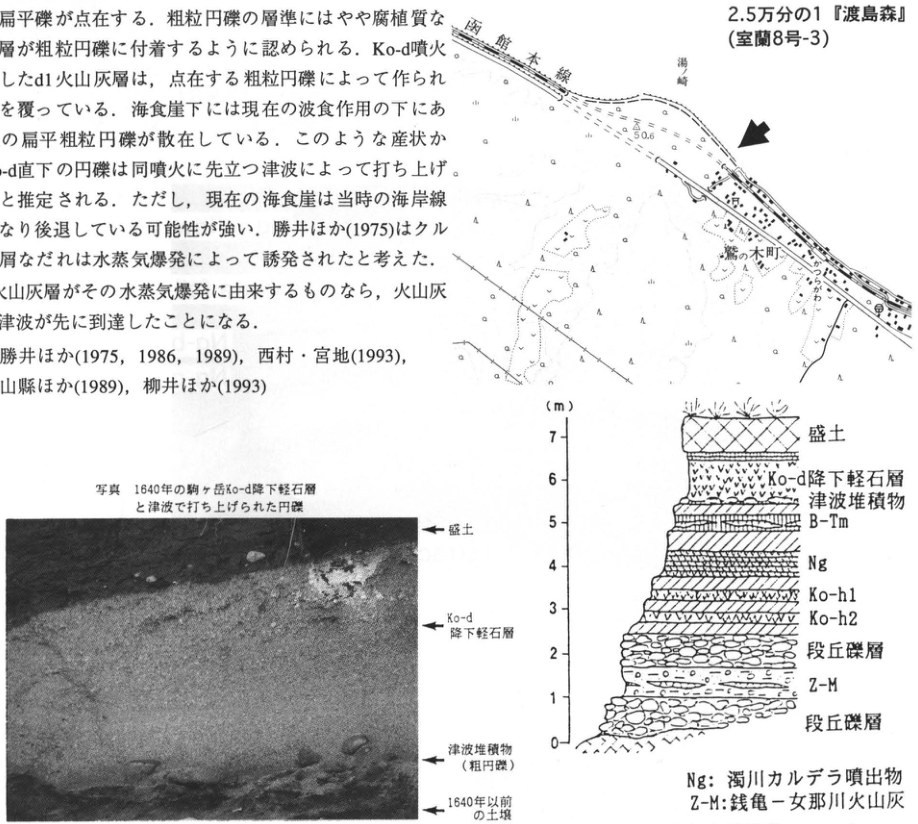
Show extracted lettering and translation
English translation of figure lettering
Location map: 1:25,000 ‘Oshima-Mori’ (Muroran sheet 8-3); Hakodate Main Line, 湯崎, Washinoki Town, 50.6, 25.8. Photograph annotations, top to bottom: Artificial fill; Ko-d pumice-fall bed; tsunami deposit (coarse rounded gravel); soil predating 1640. Stratigraphic sketch: Scale (m) 0, 1, 2, 3, 4, 5, 6, 7. Top to bottom: Artificial fill; Ko-d pumice-fall bed; tsunami deposit; B-Tm; Ng; Ko-h1; Ko-h2; terrace gravel; Z-M; terrace gravel. Ng: Nigorikawa caldera eruptive products. Z-M: 銭亀-女那川 volcanic ash. The body-text fragment included in this image is transcribed and translated in the main text.
Original Japanese lettering
位置図:2.5万分の1『渡島森』(室蘭8号-3);函館本線,湯崎,鷲の木町,50.6,25.8。写真注記(上から):盛土;Ko-d降下軽石層;津波堆積物(粗円礫);1640年以前の土壌。層序スケッチ:標尺(m)0,1,2,3,4,5,6,7。上から盛土,Ko-d降下軽石層,津波堆積物,B-Tm,Ng,Ko-h1,Ko-h2,段丘礫層,Z-M,段丘礫層。Ng:濁川カルデラ噴出物。Z-M:銭亀-女那川火山灰。画像に含まれる本文片は本文に収録。
Reading notes
位置図の微小文字の一部は判読不明。
Photograph: The 1640 Komagatake Ko-d pumice-fall bed and rounded clasts washed ashore by the tsunami.
Figure: Outcrop sketch of the Washinoki sea cliff.
HK-30 Nigorikawa tephra erupted at the end of the last glacial period and distributed across the Oshima Peninsula
柳井清治
- Locality: Fujimi Town, Mori Town, Kayabe District, Hokkaido
- Latitude and longitude: N42°6′30″ E140°33′30″
- Elevation: 16.2m
- Outcrop type and condition: Sea cliff; collapsing and retreating through marine erosion
- Deposit types and age: Aeolian tephra; pyroclastic-flow deposits; end of the last glacial period, around 12ka
- Date of description: November 1990
- Keywords: Nigorikawa tephra; Komagatake tephra; Nigorikawa caldera
The tephra at this outcrop provides the best opportunity to observe the relationship between Nigorikawa tephra, erupted at the end of the last glacial period, and Komagatake tephra. The observable sequence consists of yellowish-brown pumice-fall beds of Komagatake-i tephra (Ko-i; 32ka) and Komagatake-h tephra (Ko-h; 17ka) overlying terrace gravel, with Nigorikawa tephra farther above. The Nigorikawa tephra reaches 3m in thickness and is divided, from bottom to top, into three units: Ng-c, Ng-b, and Ng-a. Ng-c and Ng-b consist of base-surge deposits with well-developed parallel lamination. Ng-a comprises pumice-fall deposits, fine ash fall, and pyroclastic-flow deposits. The Ng-a pyroclastic-flow deposits are widely distributed along the Funka Bay coast from north of the map at right to Ishikura. The ash fall blankets much of the Oshima and Kameda peninsulas and reaches the coast of the Hidaka region. Above this tephra lie Holocene tephras from Komagatake, Komagatake-g (Ko-g) and Komagatake-d (Ko-d); the widespread Baitoushan–Tomakomai tephra (白頭山苫小牧, B-Tm) can also be observed. For details, consult the related literature listed below.
References: 雁沢 et al. (1992); 柳井 et al. (1992).
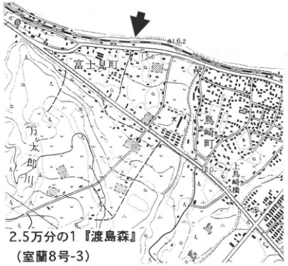
Show extracted lettering and translation
English translation of figure lettering
1:25,000 ‘Oshima-Mori’ (Muroran sheet 8-3). Fujimi Town; Mantaro River (万太郎川); Torisaki Town (鳥崎町); Torisaki Bridge (鳥崎橋). 16.2, 50, 20.
Original Japanese lettering
2.5万分の1『渡島森』(室蘭8号-3)。富士見町,万太郎川,鳥崎町,鳥崎橋。16.2,50,20。
Reading notes
位置図のその他の微小文字は判読不明。
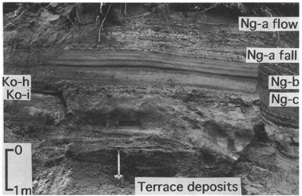
Show extracted lettering and translation
English translation of figure lettering
Original English lettering: Ng-a flow; Ng-a fall; Ng-b; Ng-c; Ko-h; Ko-i; Terrace deposits. Scale: 0, 1m.
Original Japanese lettering
原図英文:Ng-a flow; Ng-a fall; Ng-b; Ng-c; Ko-h; Ko-i; Terrace deposits。標尺:0,1m。
Photographed in November 1990.
HK-31 Tephras of Oshima-Komagatake, Hokkaido—sea cliffs near the mouth of the Shirinashi River on the eastern flank
遠藤邦彦
- Locality: Shikabe Town, Hokkaido
- Latitude and longitude: N42°5′10″ E140°46′30″
- Elevation: 0–45m
- Outcrop type and condition: Sea cliff; extant
- Deposit types and age: Fallout tephra; pyroclastic-flow, debris-avalanche, and debris-flow deposits; latest Pleistocene to Holocene
- Date of description: July 1995
- Keywords: Oshima-Komagatake; Komagatake-c2, Komagatake-d, and Komagatake-h2 tephras; Kurumizaka debris-avalanche deposits; Komagatake debris-avalanche deposits
The sea cliffs between Dekima Cape (出来澗崎) and Matsuya Cape (松屋崎) expose various deposits from Komagatake volcano, including pyroclastic flows, pyroclastic falls, debris avalanches, and debris flows. The coast thus records the principal history of activity from the Komagatake debris avalanche through the 1929 pumice fall. This exposure centers on the mouth of the Shirinashi River. The sea cliffs, reaching 40–45m in height, are continuously retreating, and their upper portions contain unstable enormous rock blocks and pumice clasts, so considerable care is required when observing them. In this area, Kurumizaka debris-avalanche deposits form uneven terrain mantled by thick pumice-fall beds of Komagatake-c1 tephra (Ko-c1; 1856; 40cm thick) and Komagatake-c2 tephra (Ko-c2; 1694; slightly more than 2m thick). Their cross section is exposed in the upper part of the sea cliffs. Komagatake-d tephra (Ko-d; 1640) is seen only in depressions between the avalanche hummocks. Near the river mouth, Kurumizaka debris-avalanche deposits overlie debris-flow deposits; above them lie Ko-d pumice-fall and pyroclastic-flow deposits, debris-flow deposits, and aeolian sand. Normally, soil containing Baitoushan–Tomakomai tephra (白頭山苫小牧, B-Tm) and fallout tephras including Komagatake-f (Ko-f), Komagatake-g (Ko-g), Nigorikawa (Ng), and Komagatake-h1 (Ko-h1) occur beneath Ko-d. Here these are absent across an unconformity. Below the debris flow covered by Ko-d, thick Ko-h2 pyroclastic-flow deposits comprising four flow units and pumice fall (Shikabe pumice-fall and pumice-flow deposits; 柳井 et al., 1988; 隅田 et al., 1987) are widely exposed. Charred standing trees occur from this pumice fall into the overlying pyroclastic flow. The charred wood yields ¹⁴C ages of 20–30ka. At the base of the sea cliff, projecting portions of the Komagatake debris-avalanche deposits are exposed. These deposits extend widely from the western to the northeastern foot of Komagatake and originated in the collapse of a large stratovolcano whose remnants survive at the present summit (勝井 et al., 1989).
References: 勝井 et al. (1989); 隅田 et al. (1987); 柳井 et al. (1988).
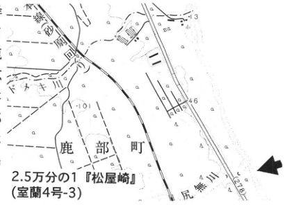
Show extracted lettering and translation
English translation of figure lettering
1:25,000 ‘Matsuya Cape’ (Muroran sheet 4-3); Shikabe Town, Shirinashi River, Sawara Town. 1.3, 4.6, 10.
Original Japanese lettering
2.5万分の1『松屋崎』(室蘭4号-3);鹿部町,尻無川,砂原町。1.3,4.6,10。
Reading notes
地図のその他の微小文字は判読不明。
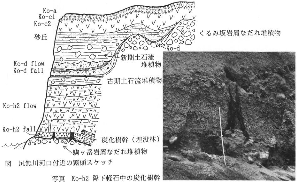
Show extracted lettering and translation
English translation of figure lettering
Ko-a; Ko-c1; Ko-c2; dune; Kurumizaka debris-avalanche deposits; Ko-d; younger debris-flow deposits; Ko-d flow; Ko-d fall; older debris-flow deposits; Ko-h2 flow; Ko-h2 fall; charred tree trunks (buried forest); Komagatake debris-avalanche deposits. No lettering within the photograph.
Original Japanese lettering
Ko-a,Ko-c1,Ko-c2,砂丘,くるみ坂岩屑なだれ堆積物,Ko-d,新期土石流堆積物,Ko-d flow,Ko-d fall,古期土石流堆積物,Ko-h2 flow,Ko-h2 fall,炭化樹幹(埋没林),駒ヶ岳岩屑なだれ堆積物。写真内に文字なし。
Figure: Outcrop sketch near the Shirinashi River mouth.
Photograph: Charred tree trunk within the Ko-h2 pumice-fall deposit.
HK-32 Late Pleistocene tephra beds around Hakodate—銭亀女那川 tephra erupted offshore of Hakodate in the Tsugaru Strait
山縣耕太郎
- Locality: 小安, Toi Town, Hokkaido
- Latitude and longitude: N41°44′40″ E141°53′58″
- Elevation: 20m
- Outcrop type and condition: Valley wall; extant
- Deposit types and age: Pumice-fall deposits; pyroclastic-flow deposits; Late Pleistocene
- Date of description: July 1985
- Keywords: Zenikame volcano; 銭亀女那川 tephra; Tsugaru Strait
The upland along the coast east of urban Hakodate in southern Hokkaido consists of white, nonwelded, hornblende-rich pyroclastic-flow deposits called the Zenikamezawa pyroclastic-flow deposits (瀬川, 1980). Around Esan volcano at the eastern tip of the Kameda Peninsula, meanwhile, 女那川 ash fall was described (中川, 1961). These were considered separate tephra beds, but 山縣 et al. (1989) established that they were tephras produced by a single eruptive sequence. They were further correlated with the Hidaka pumice-fall deposits (春日井 et al., 1978), distributed farther east from the Hidaka coastal region to the Tokachi Plain, and named 銭亀女那川 tephra (Z-M). This is one of the few outcrops where the relationship between the Zenikamezawa pyroclastic-flow deposits and 女那川 ash fall can be verified. An 80cm-thick, well-sorted coarse pumice-fall bed overlies gravel and clay beds and is directly overlain by pyroclastic-flow deposits. Neither soil nor evidence of erosion is recognized at the boundary between the two deposits. At this site, variations in pumice grain size divide the pumice fall into four units. These correlate with the lower four of seven units near Esan, where only the pumice fall is distributed. The upper three units are thus known to have been erupted concurrently with the pyroclastic flow. The seven units can be readily observed at the exposure in front of the fisheries cooperative in 女那川, Toi Town. At that exposure, Toya tephra (Toya), a grayish-white vitric ash, is recognized beneath Z-M, and Aso-4 glass has been detected in the volcanic-ash soil between Toya and Z-M. Variations in the thickness and grain size of the pumice-fall deposits, the sizes of lithic fragments in the pyroclastic-flow deposits, and submarine topography indicate that the source of Z-M lay on the floor of the Tsugaru Strait, approximately 2.5km offshore of the mouth of the Shiodomari River in eastern Hakodate. Its eruption age is considered to fall between 33 and 45ka, in the first half of the last glacial period, based on ¹⁴C dates, stratigraphic relationships with other tephras, and relationships with fluvial terraces. For detailed petrographic characteristics, evidence for correlation, distribution, and source, see 山縣 et al. (1989).
References: 春日井 et al. (1978); 中川 (1961); 瀬川 (1980); 山縣 et al. (1989).
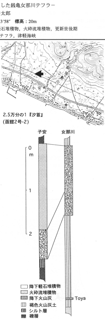
Show extracted lettering and translation
English translation of figure lettering
Location map: 1:25,000 ‘Shiokubi’ (Hakodate sheet 2-2); 小安 Town; 高屋 River; 58, 27, 4.8. Column localities: 子安, 女那川. Scale: 0, 1, 2m. Bed label: Toya. Legend: Pumice-fall deposits; pyroclastic-flow deposits; ash fall; brown volcanic-ash soil; silt bed; gravel bed. The body-text fragment included in the image is transcribed and translated in the main text.
Original Japanese lettering
位置図:2.5万分の1『汐首』(函館2号-2),小安町,高屋川,58,27,4.8。柱状図の地点名:子安,女那川。標尺:0,1,2m。層名:Toya。凡例:降下軽石堆積物;火砕流堆積物;降下火山灰;褐色火山灰土;シルト層;礫層。画像の本文片は本文に収録。
Reading notes
位置図のその他の微小文字は判読不明。
本文の地名は小安,柱状図は子安と印刷されている。
HK-33 Coastal dunes and tephras on the western coast of the Oshima Peninsula
遠藤邦彦・鈴木正章・藤井亨
- Locality: Tazawa, Esashi Town, Hiyama District, Hokkaido
- Latitude and longitude: N41°4′6″ E140°8′30″
- Elevation: 50–65m
- Outcrop type and condition: Sand pit; extant
- Deposit types and age: Tephra; dune deposits; Holocene
- Date of description: July 1995
- Keywords: Younger dunes; older dunes; Baitoushan–Tomakomai tephra (白頭山苫小牧); Komagatake-d tephra; Oshima-Oshima-a tephra; Oshima Peninsula
Coastal dunes are well developed on the Sea of Japan side of the Oshima Peninsula, particularly from the coastal lowlands onto marine terraces around Kaminokuni and from Esashi to the vicinity of the Assabu River. Younger, older, and, at some sites, ancient dunes can be distinguished (Endo, 1986). Together with kurosuna beds, tephras such as Baitoushan–Tomakomai (B-Tm), Komagatake-d (Ko-d), and Oshima-Oshima-a (Os-a) provide key markers.
In the area of this exposure, coastal dunes extending onto a marine terrace at approximately 50m elevation (the Oma surface of 大森, 1975) are well exposed. The dune deposits, reaching about 15m above road level, are subdivided by several intercalated black soils (kurosuna beds). At the base of the outcrop, brown loam (Jinya Loam) is overlain by kuroboku soil (dated to approximately 7ka at other sites; 遠藤 et al., 1989b). Relatively compact older dune deposits overlie the kuroboku and are covered by a 30cm-thick kurosuna bed (older; Ho). A nearly continuous, 4cm-thick bed of pale brownish-gray fine ash, B-Tm, is intercalated in the upper part of Ho. Above Ho, younger dunes (Dy-1, 2, 3) are 10m thick. Their middle part contains Ko-d, 5–8cm thick, accompanied by a thin soil (younger kurosuna bed). In the overlying younger dune deposits (Dy-3), small patches of dark-gray ash intermittently form two beds. These are very likely to be ash falls (Os-a; Katsui et al., 1981) from the 1741–1742 eruptions of Oshima-Oshima. Although 町田 et al. (1981) dated B-Tm to 800–900 years ago, ¹⁴C dates immediately above and below it in Hokkaido, including this region, place its age between 1,700 and 2,100 years ago (遠藤 et al., 1989a, b; 鈴木, 1992). Understanding this significant discrepancy remains a problem.
References: Endo (1986); 遠藤 et al. (1989a, b); Katsui et al. (1981); 町田 et al. (1981); 大森 (1975); 鈴木 (1992).
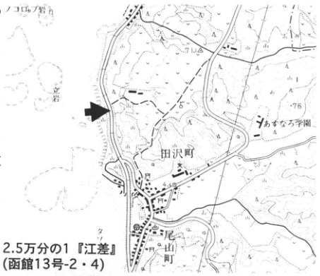
Show extracted lettering and translation
English translation of figure lettering
1:25,000 ‘Esashi’ (Hakodate sheets 13-2 and 13-4); Tazawa Town, Oyama Town (尾山町), Ominaro School (おみなろ学園), rock, 7.1, 76, 4.8.
Original Japanese lettering
2.5万分の1『江差』(函館13号-2・4);田沢町,尾山町,おみなろ学園,岩,7.1,76,4.8。
Reading notes
地図のその他の微小文字は判読不明。
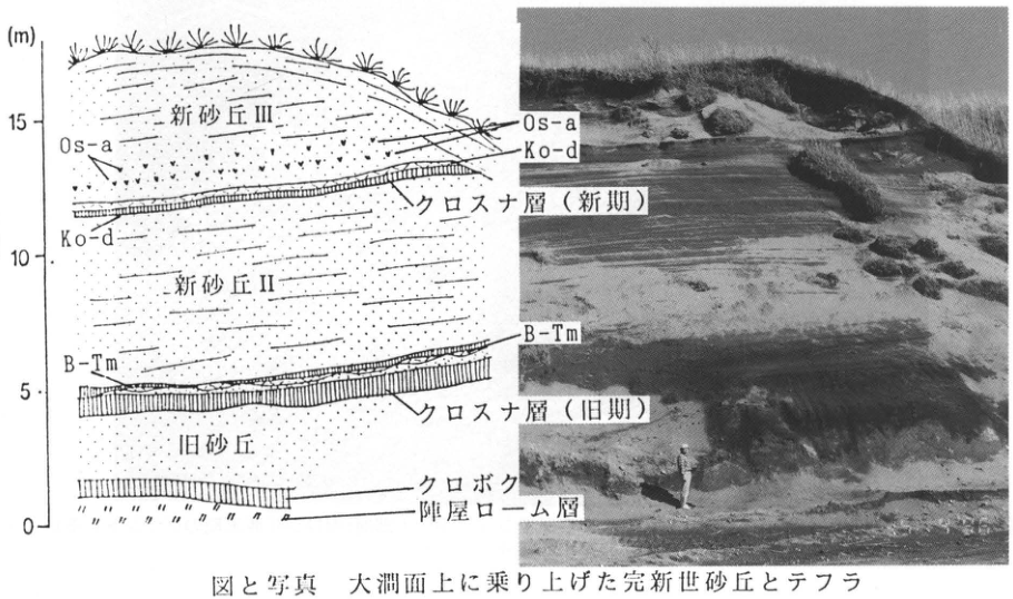
Show extracted lettering and translation
English translation of figure lettering
Scale (m): 0, 5, 10, 15. Bed labels, top to bottom: Younger dune III; Os-a; Ko-d; kurosuna bed (younger); younger dune II; B-Tm; kurosuna bed (older); older dune; kuroboku soil; Jinya Loam. Os-a, Ko-d, and B-Tm are linked between the sketch and photograph.
Original Japanese lettering
標尺(m):0,5,10,15。層名(上から):新砂丘III,Os-a,Ko-d,クロスナ層(新期),新砂丘II,B-Tm,クロスナ層(旧期),旧砂丘,クロボク,陣屋ローム層。図と写真両方にOs-a,Ko-d,B-Tmの対応線。
Figure and photograph: Holocene dunes and tephras extending onto the Oma surface.
HK-34 Eniwa-a tephra in outwash deposits of Nanatsunuma Cirque, Hidaka Mountains
小野有五
- Locality: Cliff on the left bank of the small stream (headwaters of the Niikappu River) issuing from the large northern pond of Nanatsunuma Cirque, Hidaka Mountains, Hokkaido
- Latitude and longitude: N45°43′40″ E142°42′15″
- Elevation: 1,550m
- Outcrop type and condition: Natural exposure; extant
- Deposit types and age: Water-laid tephra; Late Pleistocene; approximately 18ka
- Keywords: Hidaka Mountains; Tottabetsu Glaciation; Nanatsunuma Cirque; Eniwa-a tephra
This outcrop was discovered and described by 小野・平川 (1975a). It is an important exposure containing the first marker tephra found in glacial deposits of the Hidaka Mountains, which first established the timing of glacier advance during the Tottabetsu Glaciation. The northern cliff of the exposure rises approximately 15m above the stream bed. Deposit facies divide the sequence into upper (A) and lower (B) beds. The upper bed has a bluish-gray, sandy matrix and indistinct, nearly horizontal bedding; it was interpreted as outwash of the Tottabetsu Substage (小野・平川, 1975b). The lower bed has a more clay-rich matrix and was interpreted as ground moraine of the Poroshiri Substage. Approximately 3.5m above the base of the upper bed, Eniwa-a tephra (En-a), about 20cm thick, forms cross-lamination with the sand comprising that bed, indicating deposition in water. The En-a particles reach a maximum diameter of 2–3mm, have a yellowish-brown, salt-and-pepper appearance, and closely resemble the AW type (wind-transported, subaqueously deposited type) of En-a seen in the Tokachi Plain. When this outcrop was discovered, En-a was considered to be 15–20ka old (春日井 et al., 1968); 梅津 (1986) subsequently assigned it an age of approximately 18ka. Because the upper bed containing En-a appears to connect to the downstream side of the Tottabetsu Substage moraine, this age can reasonably be regarded as dating glacier expansion during that substage.
References: 春日井 et al. (1968); 小野・平川 (1975a, 1975b); 梅津 (1986).
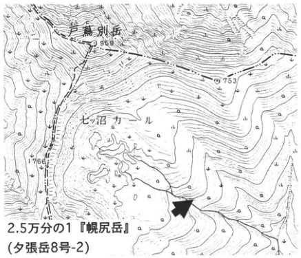
Show extracted lettering and translation
English translation of figure lettering
1:25,000 ‘Poroshiri-dake’ (Yubari-dake sheet 8-2); Tottabetsu-dake (戸蔦別岳); Nanatsunuma Cirque; 1959, 1753, 1766.
Original Japanese lettering
2.5万分の1『幌尻岳』(夕張岳8号-2);戸蔦別岳,七ッ沼カール,1959,1753,1766。
Reading notes
位置図のその他の微小文字は判読不明。
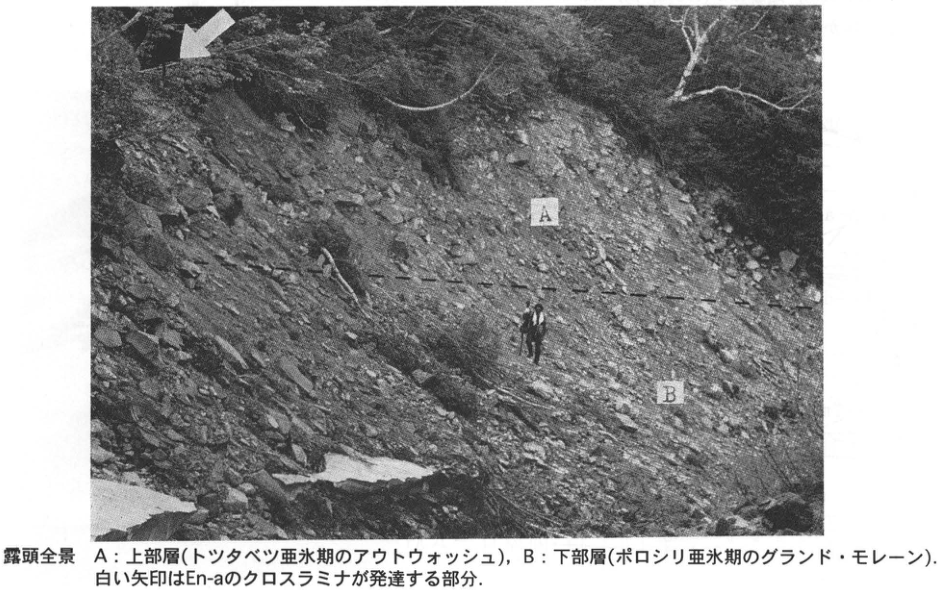
Show extracted lettering and translation
English translation of figure lettering
Within photograph: A, B. White arrow: Area of developed En-a cross-lamination. Dashed line: Boundary between the upper and lower beds.
Original Japanese lettering
写真内:A,B。白矢印:En-aのクロスラミナが発達する部分。破線:上部層と下部層の境界。
Overall view: A, upper bed (Tottabetsu Substage outwash); B, lower bed (Poroshiri Substage ground moraine). The white arrow marks the part with well-developed En-a cross-lamination.
3. Tohoku Region
TH-1 Parabolic dunes of the Byobuyama dune field, Tsugaru Peninsula
遠藤邦彦
- Locality: Shariki, Shariki Village, Nishitsugaru District, Aomori Prefecture
- Latitude and longitude: N40°6′51″ E140°1′19″
- Elevation: 20–30m
- Outcrop type and condition: Artificial cliff behind a school; extant
- Deposit types and age: Dune deposits; aeolian tephra; latest Pleistocene to Holocene
- Date of description: July 1985
- Keywords: Tsugaru Peninsula; Byobuyama dunes; parabolic dunes; ancient, older, and younger dunes; Baitoushan–Tomakomai tephra (白頭山苫小牧)
The Byobuyama dunes extend north–south along the western coast of the Tsugaru Peninsula and comprise the Yamadano, Tateoka, and Dekijima formations (小貫 et al., 1963; 遠藤・辻, 1977). Widespread tephras including Baitoushan–Tomakomai (B-Tm), Aira-Tn (AT), and Toya (Toya) have been found there (白石, 1987; 辻・遠藤, 1978; 町田・新井, 1992). Ancient dunes of the latest Pleistocene and older and younger Holocene dunes are developed in its central and northern parts, forming Japan's most conspicuous parabolic dunes. Under strong winter monsoon winds, hairpin-shaped parabolic dunes surround elongated east–west deflation hollows; they generally have a relief of 20–30m and reach 2–3km in length. Human modification has now reduced preservation of the original landforms. The parabolic dunes consist mainly of younger dunes, beneath which older and ancient dunes are buried.
This outcrop is an artificial cliff behind the playing field of Shariki Elementary School, where older and younger dunes overlie ancient dunes. The younger dunes correspond to the arm-to-head portions of a parabolic dune. The ancient dunes are 5–10m or more thick, well compacted, and have a brownish upper part displaying nearly parallel, crepe-like laminae. The ancient dunes (Dp) are covered by 70cm of brown loam and 40cm of black soil. Older dunes (Do) overlie these at the southern exposure, but at this exposure younger dunes (Dy), 6–8m thick, cover them directly. A 2–3cm-thick lens of pale brownish-gray fine ash occurs at the base of the younger dune sand. This is B-Tm, rich in bubble-wall volcanic glass. Its occurrence at the base of the younger dune sand and its local cover of thin soil (younger kurosuna bed) suggest that the most active formation of the younger dunes, namely the parabolic dunes, proceeded rapidly after B-Tm fell, probably following some intervening time.
References: 遠藤 (1987); 遠藤・辻 (1977, 1978); 小貫 et al. (1963); 町田・新井 (1992); 白石 (1987).
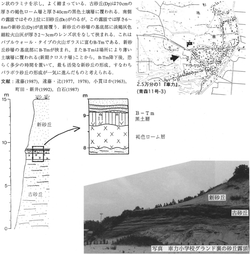
Show extracted lettering and translation
English translation of figure lettering
Map: 1:25,000 ‘Shariki’ (Aomori sheet 11-3); Shariki; 形 Pond; 32.6, 55.2, 7.3. Column: Scale m, 0, 5, 10, 15; younger dunes; ancient dunes. Enlarged detail: Scale m, 8, 9; B-Tm; black soil bed; brown loam. Photograph annotations: Younger dunes; ancient dunes. The body-text fragment within the image is transcribed and translated in the main text.
Original Japanese lettering
地図:2.5万分の1『車力』(青森11号-3);車力,形池,32.6,55.2,7.3。柱状図:標尺m,0,5,10,15;新砂丘,古砂丘。拡大図:標尺m,8,9;B-Tm,黒土層,褐色ローム層。写真注記:新砂丘,古砂丘。画像中の本文片は本文に収録。
Reading notes
位置図のその他の微小文字は判読不明。
Photograph: Dune exposure behind the playing field of Shariki Elementary School.
TH-2 Late Pleistocene to Holocene peat beds and tephras on the Dekijima coast, Nishitsugaru District, Aomori Prefecture
辻誠一郎
- Locality: Dekijima, Kizukuri Town, Nishitsugaru District, Aomori Prefecture
- Latitude and longitude: N40°51′30″ E140°17′15″
- Elevation: 2m
- Outcrop type and condition: Sea cliff; collapsing and retreating through marine erosion
- Deposit types and age: Peat beds; water-laid deposits; Late Pleistocene
- Date of description: May 1977
- Keywords: Aira-Tn tephra; buried forest; last glacial period; Dekijima coast
Passing through the Byobuyama dunes from Dekijima village to the western coast brings one to Shichiri-Nagahama Beach, which continues in gentle arcs both northward and southward. Large exposures occur at many sites. Toward Ajigasawa to the south, they range from light brown to bluish gray, whereas northward they are generally black. This reflects differences in facies: to the south, the Yamadano Formation, consisting of marine sand, and underlying Tertiary deposits are exposed, while to the north Late Pleistocene to Holocene peat beds are exposed. The deposits along this coast thus indicate tilting with the north down and south up.
About 1.7km north of Dekijima along the coast, jet-black peat exposures begin to appear. Clear differences in facies and constituents broadly divide the peat beds here into lower and upper parts, named the Tateoka and Dekijima formations, respectively (遠藤・辻, 1977; 辻・遠藤, 1978). The Tateoka Formation consists of brown peat containing abundant bogbean seeds resembling sesame seeds. Peat in the Dekijima Formation is black. Its lowermost part consists of viscous, decomposed peat, but the middle and upper parts usually contain sand and often interfinger with aeolian dune sand; the boundary between the two formations is therefore clear.
The lower brown peat of the Tateoka Formation contains abundant fossil wood, including standing stumps, which can be traced approximately another 1km northward. This is a large Late Pleistocene buried forest estimated by radiocarbon dating to be approximately 25ka old. According to 鈴木三男 and 能城修一, most specimens belong to Larix and Picea. Approximately 10–15m above it is an approximately 2cm-thick intercalation of Aira-Tn tephra (AT), consisting of white volcanic glass. This is the northernmost terrestrial locality where AT has been found.
References: 遠藤・辻 (1977); 辻・遠藤 (1978).
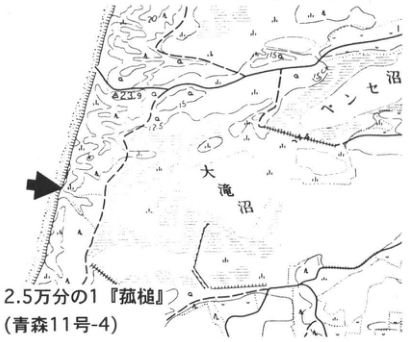
Show extracted lettering and translation
English translation of figure lettering
1:25,000 ‘菰槌’ (Aomori sheet 11-4); Otaki Pond (大滝沼); Bense Pond (ベンセ沼); 23.9, 12.5, 20, 15.
Original Japanese lettering
2.5万分の1『菰槌』(青森11号-4);大滝沼,ベンセ沼,23.9,12.5,20,15。
Reading notes
位置図のその他の微小文字は判読不明。
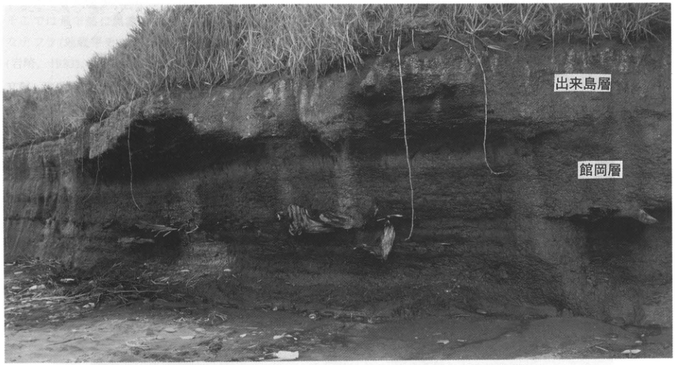
Show extracted lettering and translation
English translation of figure lettering
Dekijima Formation; Tateoka Formation.
Original Japanese lettering
出来島層;館岡層。
Peat exposure north of Dekijima on the western Tsugaru coast. A buried forest including Picea occurs in the middle part of the lower Tateoka Formation; AT overlies it approximately 10cm above.
TH-3 Sannai-Maruyama site, Aomori Prefecture—a huge settlement during the development of Jomon culture
辻誠一郎
- Locality: Sannai-Maruyama, Aomori City, Aomori Prefecture
- Latitude and longitude: N40°48′31″ E140°42′7″
- Elevation: 20m
- Outcrop type and condition: Artificial exposure from archaeological excavation; backfilled after investigation
- Deposit types and age: Peat and peaty deposits; Early to Middle Jomon period
- Date of description: May 1977
- Keywords: Jomon period; Towada-derived tephras; Baitoushan–Tomakomai tephra (白頭山苫小牧); Sannai-Maruyama site
Sannai-Maruyama lies approximately 3km southwest of urban Aomori, at the end of gently rolling hills and uplands extending from the Hakkoda Mountains and on a fluvial terrace of the Okidate River. It is a huge settlement site extending across the entire flat upland. The settlement is continuously attested through pottery types from the beginning of the Lower Ento sequence to the end of the Upper Ento sequence. It was therefore occupied for approximately 1,500 years, from about 5.5ka or 5ka to about 4ka or 3.5ka, a long interval spanning the beginning of the Early Jomon to the end of the Middle Jomon. Artifacts unearthed in two years are so numerous that their quantity rivals everything obtained by the Aomori Prefectural Archaeological Research Center through excavations over the preceding 20 years. Sannai-Maruyama's characteristics can thus be expressed by three simple keywords: ‘large,’ ‘long,’ and ‘many’ (岡田, 1995).
The site's significance for Quaternary studies lies in the large scale and diversity of development and land modification for settlement, diverse resource use, particularly plant resources, and vigorous movement of goods through trade in addition to development and resource use. These activities are evidenced by large-scale stripping, transport, and filling of soil, and by abundant animal and plant remains (or refuse) from the upland slopes to the valley floor. The site is thus a rich store of material for reconstructing concrete temporal and spatial changes in the history of human interaction with the environment during the Jomon period.
The photograph shows a trench section in a small valley in the northern part of the site called the Central Valley. Before people began living here in the Early Jomon, deciduous broadleaf forest extended down to the valley floor. The abrupt changes in deposits in this section show how forest vegetation disappeared when occupation began and the valley was filled with refuse and washed-out sediment. Excavation will continue under a long-term plan and will probably substantially alter existing views of Jomon culture and society.
References: 青森県埋蔵文化財調査センター (1994); 岡田 (1994, 1995); 岡田・伊藤 (1995); 辻 et al. (1994).
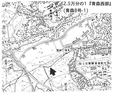
Show extracted lettering and translation
English translation of figure lettering
1:25,000 ‘Western Aomori’ (Aomori sheet 8-1); Sannai; 沢部; Okidate River; Sannai Cemetery; Aomori special-needs school; materials factory; Japan Ground Self-Defense Force Aomori camp; 7.8, 20.
Original Japanese lettering
2.5万分の1『青森西部』(青森8号-1);三内,沢部,沖館川,三内霊園,青森養護学校,資材工場,陸上自衛隊青森駐屯地,7.8,20。
Reading notes
位置図のその他の微小文字は判読不明。
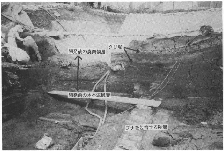
Show extracted lettering and translation
English translation of figure lettering
Refuse layer after development; chestnut mound; woody peat bed before development; sand bed containing beech.
Original Japanese lettering
開発後の廃棄物層;クリ塚;開発前の木本泥炭層;ブナを包含する砂層。
TH-4 Towada tephra sequence and terrace landforms around Hachinohe
町田洋
- Locality: Mitateyama, Hachinohe City
- Latitude and longitude: N40°32′24″ E141°27′18″
- Elevation: 38m
- Outcrop type and condition: Cliff behind a house; partly extant
- Deposit types and age: Wave-cut-platform deposits; pumice; tephra; Middle to Late Pleistocene
- Date of description: 1995
- Keywords: Takadate Terrace; Tengudai Terrace; Shichihyaku Terrace (七百段丘); Toya tephra; Shiro-tafu; Aosuji; Red; Godo; Biscuit-1; Ofudo tephra; Hachinohe tephra
The Takadate and Tengudai uplands north of Hachinohe are both marine terraces mantled by tephra sequences and were designated reference areas for Quaternary stratigraphic chronology in Tohoku (東北地方第四紀研究グループ, 1969). Their terrace deposits are thin, but each is overlain by thick tephra sequences. Takadate Terrace, with a former shoreline elevation of about 35m, is considered to have formed during the Last Interglacial transgression (oxygen-isotope stage 5e), whereas Tengudai Terrace, with a shoreline elevation of about 60m, may correspond to stage 7.
The type locality of Takadate Terrace is at Mitateyama near its former shoreline. Several other good exposures occur on the upland northward from here. The tephra overlying the terrace deposits reaches 7–8m in thickness and includes numerous marker beds. Particularly noteworthy Pleistocene tephras are, from bottom to top: Toya tephra (Toya; Shiro-tafu, described in detail in WS-13); Towada-Aosuji tephra (To-AP; Nejo Terrace carries this and younger beds); Towada-Okoshi tephra (To-Ok, correlated with Kawaguchi tephra near Morioka); Towada-Red tephra (To-RP; some fluvial terraces carry this and younger beds); Towada-Godo tephra (To-GP); Towada-Biscuit-1 tephra (To-BP1; Ofudo tephra); and Towada-Hachinohe tephra (To-HP; see WS-4-1 for the last two). The entire sequence also overlies the lower Tagadai Terrace, clearly indicating that sea level had already fallen considerably when the basal tephras (Zarame ZP, Toya, and others) erupted (町田 et al., 1987). Aira-Tn tephra (AT) and Aso-4 tephra (Aso-4) occur at the horizons indicated in the column. See WS-4-1 for Holocene tephras. Pronounced involutions also occur in the To-GP–BP1 interval of the sequence.
On Tengudai Terrace, adjoining Takadate Terrace to the west, several pumice-fall beds occur beneath the Takadate tephra sequence described above. All are severely weathered, as names such as Nukamiso (‘rice-bran paste’) suggest. Still farther west are higher terraces, including Shichihyaku Terrace. Type exposures of that terrace occur at 伝道寺 in Gonohe Town and Kitamatazawa in Towada City. A distinctive biotite-bearing tephra (Jizodaira tephra) can be observed at the bottom there (岩崎, 1983).
References: 東北地方第四紀研究グループ (1969); 岩崎 (1983); 町田 et al. (1987).
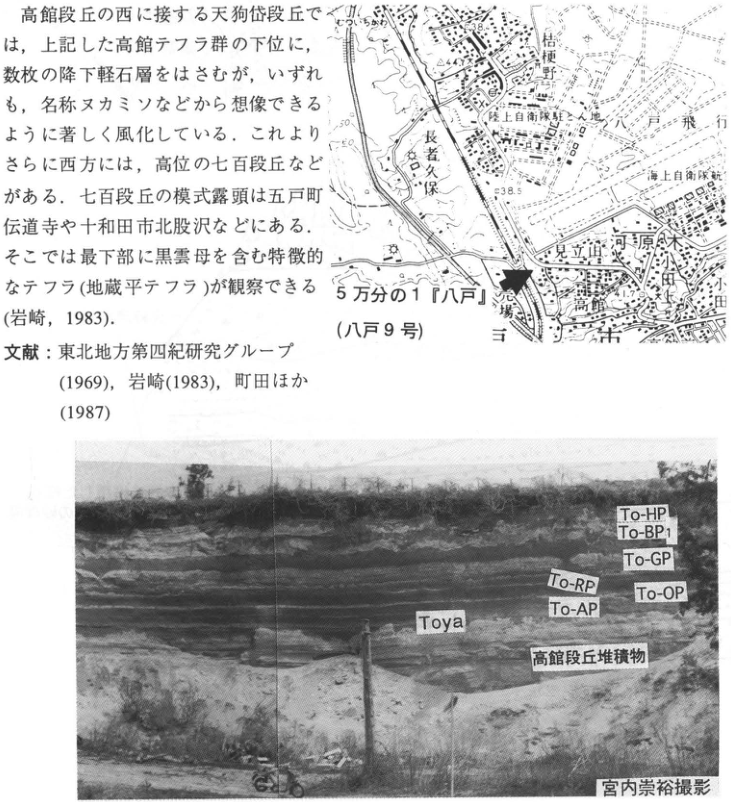
Show extracted lettering and translation
English translation of figure lettering
Map: 1:50,000 ‘Hachinohe’ (Hachinohe sheet 9); Kikyonohara (桔梗野); 長者久保; Ground Self-Defense Force camp; Hachinohe airfield; Maritime Self-Defense Force air unit; Mitateyama; Kawaragi; Takadate; 38.5, 38.4, 44.3, 11.7. Photograph: To-HP; To-BP1; To-GP; To-RP; To-OP; To-AP; Toya; Takadate terrace deposits; photograph by 宮内崇裕. The body-text fragment within the image is transcribed and translated in the main text.
Original Japanese lettering
地図:5万分の1『八戸』(八戸9号);桔梗野,長者久保,陸上自衛隊駐とん地,八戸飛行場,海上自衛隊航空隊,見立山,河原木,高館,38.5,38.4,44.3,11.7。写真:To-HP,To-BP1,To-GP,To-RP,To-OP,To-AP,Toya,高館段丘堆積物,宮内崇裕撮影。画像の本文片は本文に収録。
Reading notes
位置図のその他の微小文字は判読不明。
Photograph by 宮内崇裕.
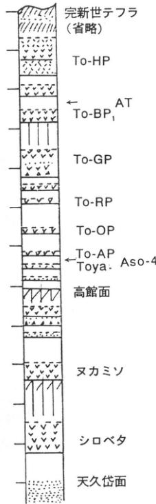
Show extracted lettering and translation
English translation of figure lettering
Top to bottom: Holocene tephras (omitted); To-HP; AT; To-BP1; To-GP; To-RP; To-OP; To-AP; Toya · Aso-4; Takadate surface; Nukamiso; Shirobeta; 天久岱 surface. No numerical scale.
Original Japanese lettering
上から:完新世テフラ(省略),To-HP,AT,To-BP1,To-GP,To-RP,To-OP,To-AP,Toya・Aso-4,高館面,ヌカミソ,シロベタ,天久岱面。数値標尺なし。
TH-5 Hakkoda pyroclastic flows deposited on the sea floor—Daishaka, Aomori Prefecture
町田洋
- Locality: Above the JR Shin-Daishaka Tunnel, Daishaka, Namioka Town, Aomori Prefecture
- Latitude and longitude: N40°46′8″ E140°36′22″
- Elevation: 140–160m
- Outcrop type and condition: Quarry; extant
- Deposit types and age: Pyroclastic-flow deposits; marine sand and gravel; Middle Pleistocene
- Date of description: April 1993
- Keywords: Hakkoda pyroclastic-flow deposits; Daishaka Formation; Daishaka
The Hakkoda pyroclastic-flow deposits, associated with the formation of Tashirodai caldera in the Hakkoda Mountains, are among the large pyroclastic-flow deposits of Tohoku. They are thought to have erupted in at least two periods during the Middle Pleistocene (村岡・高倉, 1988). Those at this exposure belong to the first, older period and display clear depositional structures of pyroclastic flows that entered the sea. This large exposure varies in appearance with direction, but its broad stratigraphy is as follows. Thick stratified beds of rounded pumice gravel and ash-derived sand conformably overlie shallow-marine deposits with large-scale cross-lamination in the lower cliff (mainly shell-bearing sand; Daishaka Formation). Nonwelded pyroclastic-flow deposits occur at two horizons within them. The stratified pumice deposits are considered to represent pyroclastic flows entering the sea on several occasions, or pumice fall transported by water currents. The units identified as pyroclastic-flow deposits resulted from high-density pyroclastic flows entering the water bottom; both have the distinctive facies of lacking fines. This characteristic also occurs in the pyroclastic-flow deposits at Tsurugasaka, Aomori City, to the northeast. The entire sequence dips southeastward, probably because it lies on the eastern limb of the anticline formed by the Daishaka Formation.
The pyroclastic-flow deposits have been dated by potassium–argon and fission-track methods to 0.5–0.7Ma (村岡・高倉, 1988; 高島 et al., 1990). Their petrographic characteristics are pyroxene-rhyolitic, as described in 町田・新井 (1992), but closely resemble those of the second-period Hakkoda pyroclastic-flow deposits, considered younger.
References: 町田・新井 (1992); 村岡・高倉 (1988); 高島 et al. (1990).
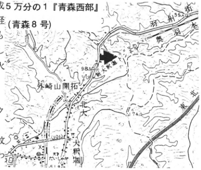
Show extracted lettering and translation
English translation of figure lettering
1:50,000 ‘Western Aomori’ (Aomori sheet 8); Ou Main Line; Shin-Daishaka Tunnel; Daishaka River; Daishaka; 外崎山 settlement; 98.5, 74.0, 55.9.
Original Japanese lettering
5万分の1『青森西部』(青森8号);奥羽本線,新大釈迦トンネル,大釈迦川,大釈迦,外崎山開拓,98.5,74.0,55.9。
Reading notes
位置図のその他の微小文字は判読不明。
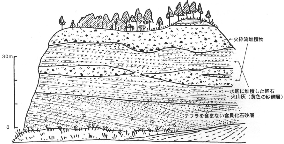
Show extracted lettering and translation
English translation of figure lettering
Scale: 0, 30m. Pyroclastic-flow deposits; pumice and volcanic ash deposited on the water bottom (yellow sand-and-gravel beds); shell-bearing sand without tephra.
Original Japanese lettering
標尺:0,30m。火砕流堆積物;水底に堆積した軽石・火山灰(黄色の砂礫層);テフラを含まない含貝化石砂層。
TH-6 Gentle piedmont-slope deposits in the Kitakami Mountains—slope formation in the central Kitakami Mountains during the last glacial period
檜垣大助
- Locality: 川内蝦夷窪 archaeological site, Kawai Village, Shimohei District, Iwate Prefecture
- Latitude and longitude: N39°38′40″ E141°35′34″
- Elevation: 340m
- Outcrop type and condition: Artificial exposure; disappeared by October 1978
- Deposit types and age: Angular-gravel slope deposits; Late Pleistocene
- Date of description: December 1977
- Keywords: Kitakami Mountains; gentle piedmont slopes; Akita-Komagatake-Koiwai tephra
Gentle piedmont slopes formed mainly under cold glacial climates are distributed through the central and northern Kitakami Mountains. This exposure appeared in a national-road cut. The formation period of the slopes was determined from the structure of a gentle piedmont slope continuing behind the 川内 terrace surface, formed during the first half of the last glacial period (Higaki, 1988). The slope deposits are divided into three beds, I, II, and III, shown in the figure. Bed I is angular slate gravel overlying terrace sand and gravel (A in the figure) one level above the 川内 Terrace. Its characteristic feature is good alignment of clast long axes with the direction of slope inclination. Its toe (G) coincides precisely with the valley-wall position when the depositional top of the 川内 Terrace (top of B) formed. Together with the interfingering slope deposits and fluvial gravel in the same terrace across the Hei River, this shows that piedmont-slope formation through hillslope debris supply and terrace-surface formation through river-bed aggradation occurred concurrently. Bed II is clay containing angular gravel, covered by Akita-Komagatake-Koiwai tephra (Ak-K; D in the figure), which fell at about 13ka (大上・土井, 1978). It was deposited during the latter half of the last glacial period. These two periods correspond to the formation of fossil periglacial features in volcanic-ash beds in the upper Kitakami River region. Bed III, meanwhile, is an alternation of weakly bedded thin angular-gravel beds and weathered volcanic ash overlying Ak-K. It is covered by black soil containing an archaeological site of approximately 3ka and was deposited before that time. Only a few meters or less thick, this bed is considered to have merely modified the surface of the gentle piedmont slope, whose general form had developed by the Late Glacial.
References: Higaki (1988); 大上・土井 (1978).
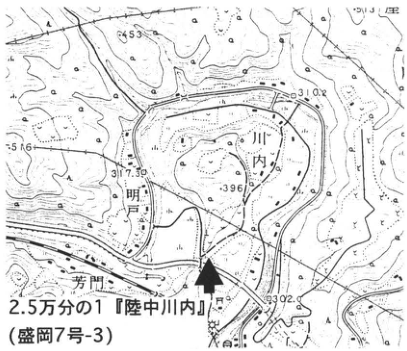
Show extracted lettering and translation
English translation of figure lettering
1:25,000 ‘Rikuchu-川内’ (Morioka sheet 7-3); 川内; Hei River; 芳門; 453, 310.2, 317.30, 396, 309.2, 513, 56.
Original Japanese lettering
2.5万分の1『陸中川内』(盛岡7号-3);川内,閉伊川,芳門,453,310.2,317.30,396,309.2,513,56。
Reading notes
位置図のその他の微小文字は判読不明。
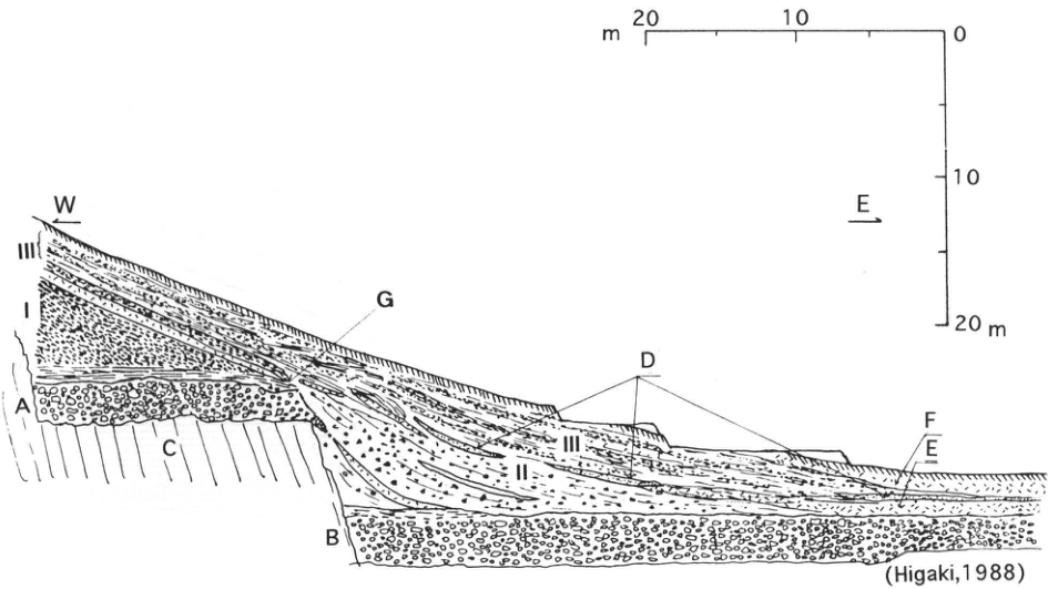
Show extracted lettering and translation
English translation of figure lettering
W, E; I, II, III; A, B, C, D, E, F, G. Horizontal scale: 20, 10, 0m. Vertical scale: 0, 10, 20m. (Higaki, 1988). Correspondences stated in the text: A, terrace sand and gravel one level above the 川内 Terrace; B, 川内 terrace deposits; D, Ak-K; G, toe of bed I. C, E, and F are not defined in the original body text.
Original Japanese lettering
W,E;I,II,III;A,B,C,D,E,F,G。水平標尺:20,10,0m。垂直標尺:0,10,20m。(Higaki,1988)。本文による対応:A=川内段丘より一段高い段丘砂礫層,B=川内段丘堆積物,D=Ak-K,G=I層末端。C,E,Fの説明は原著本文にない。
(Higaki, 1988)
TH-7 Fossil periglacial features in the upper Kitakami River region—involutions of oxygen-isotope stages 2 and 6
澤口晋一
- Locality: Hinoto, Tamayama Village, Iwate Prefecture
- Latitude and longitude: N39°47′50″ E141°14′00″
- Elevation: 380m
- Outcrop type and condition: Artificial exposure; entirely covered by vegetation as of October 1993
- Deposit types and age: Aeolian tephra; Late Pleistocene
- Date of description: August 1993
- Keywords: Upper Kitakami River region; fossil periglacial features; Iwate-derived tephras
Although the entire exposure was revegetated upon completion of road widening, the approximately 6–7m-thick tephra sequence overlying bedrock revealed marker beds, including widespread tephras, and fossil periglacial features formed at different times. From top to bottom, the marker beds include Akita-Komagatake-Yanagisawa (Ak-Y; 12ka), Akita-Komagatake-Koiwai (Ak-K; 13ka), Takizawa Nos. 1 and 2 scoria beds (T1S, T2S), Kawaguchi Pumice (Kw), 石花 No. 1 scoria (Is1S), Toya (Toya; 90–120ka), 石花 No. 2 scoria (Is2S), Shijushida Nos. 1 and 2 scoria (S1P, S2P), and Yokomichizawa Pumice (YkP). In the upper left of the outcrop, T1S consists only of scattered scoria particles, so disturbances cannot be recognized. The underlying T2S, however, develops recumbent-fold-like structures at several points, incorporating the overlying dark band (BS2; CiCr1). Their formation horizon and morphology are almost identical to those in the preceding entry's sketch, clearly indicating fossil solifluction lobes. Within the figure below, the T2S folds have steps about 30–40cm high; outside the sketch, farther downslope, some reach 1m. There is therefore no doubt that distinct lobate surface landforms developed around 20ka. Given fossil solifluction lobes in slope-deposited tephras and the frequent occurrence of involutions with wave heights reaching 1m on flat ground, this region probably had extensive bare ground and grassland at that time, with sparse forest established only under favorable conditions. Tephra beds corresponding to the first half of the last glacial period are absent. Meanwhile, in the middle part of the exposure, Toya is intercalated as a bed about 5cm thick. Beneath it, separated by a prominent crack zone 30–50cm thick, lie Is2S, S1P, S2P, and YkP. Involutions occur in S1P and S2P, with particularly large deformation in S2P and the dark band immediately above it (hatched area on the right side of the exposure); wave heights locally reach 1m. The deformation suggests that the S2P involutions may have formed shortly before S1P fell. Stratigraphic relationships indicate that the crack zone immediately beneath Toya is very likely a buried soil of the Last Interglacial (oxygen-isotope stage 5). These involutions are therefore considered to have formed during a glacial period preceding the last glacial period, probably stage 6. Few involutions of this stage have been described so far, and many questions remain. Elsewhere, however, deformation commonly occurs in several pumice and scoria beds thought to correspond to the S1P and S2P horizons. At some sites its scale rivals the largest involutions formed during the latter half of the last glacial period. For reference, maps show some extant exposures of stage 6 involutions observed by the author in the upper Kitakami River region.
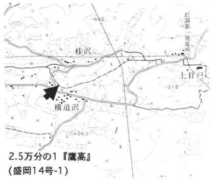
Show extracted lettering and translation
English translation of figure lettering
1:25,000 ‘鷹高’ (Morioka sheet 14-1); Katsurazawa; Yokomichizawa; Upper Hinoto; Gandō No. 1 power station; 465, 519, 404.2.
Original Japanese lettering
2.5万分の1『鷹高』(盛岡14号-1);桂沢,横道沢,上日戸,岩洞第一発電所,465,519,404.2。
Reading notes
地図のその他の微小文字は判読不明。
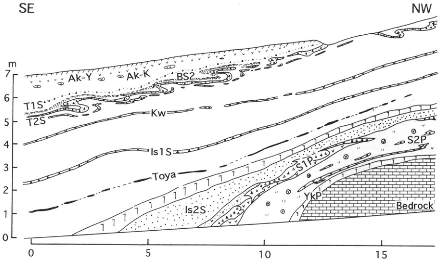
Show extracted lettering and translation
English translation of figure lettering
Original lettering: SE, NW; Ak-Y; Ak-K; BS2; T1S; T2S; Kw; Is1S; Toya; Is2S; S1P; S2P; YkP; Bedrock. Vertical scale m: 0, 1, 2, 3, 4, 5, 6, 7. Horizontal scale: 0, 5, 10, 15.
Original Japanese lettering
SE,NW;Ak-Y,Ak-K,BS2,T1S,T2S,Kw,Is1S,Toya,Is2S,S1P,S2P,YkP,Bedrock。垂直標尺m:0,1,2,3,4,5,6,7。水平標尺:0,5,10,15。
TH-7 (continued)
References: 遠藤 (1977); 井上 et al. (1981); 大上・土井 (1978); 大上 et al. (1980); 澤口 (1992).
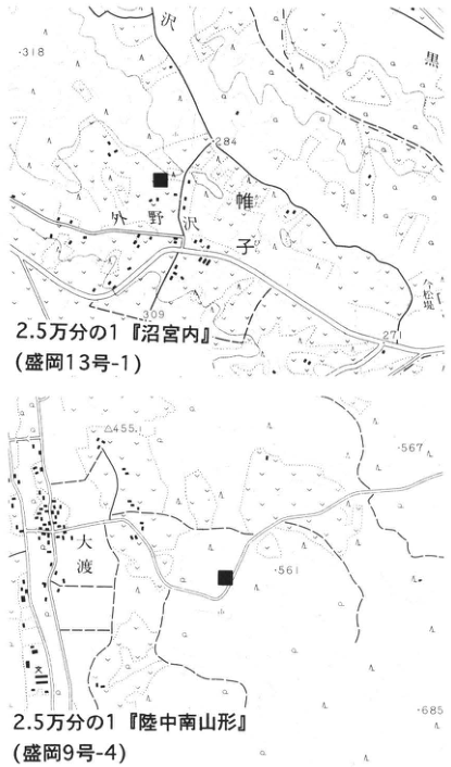
Show extracted lettering and translation
English translation of figure lettering
Upper map: 1:25,000 ‘Numakunai’ (Morioka sheet 13-1); 外野沢; 雌子; 318, 284, 309, 271. Lower map: 1:25,000 ‘Rikuchu-Minami-Yamagata’ (Morioka sheet 9-4); 大渡; 455, 567, 561, 685. Black squares indicate exposures.
Original Japanese lettering
上図:2.5万分の1『沼宮内』(盛岡13号-1);外野沢,雌子,318,284,309,271。下図:2.5万分の1『陸中南山形』(盛岡9号-4);大渡,455,567,561,685。黒四角で露頭を表示。
Reading notes
位置図のその他の微小文字は判読不明。
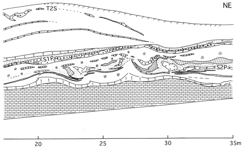
Show extracted lettering and translation
English translation of figure lettering
NE; T2S; S1P; S2P. Horizontal scale: 20, 25, 30, 35m.
Original Japanese lettering
NE;T2S;S1P;S2P。水平標尺:20,25,30,35m。
TH-8 Exposure of the active-fault system along the western margin of the Kitakami Lowland—an exposure along the strike of a reverse fault
渡辺満久
- Locality: Ishidoriya Town, Hienuki District, Iwate Prefecture
- Latitude and longitude: N39°29′36″ E141°6′49″
- Elevation: 130m
- Outcrop type and condition: Artificial exposure from river improvement; vegetated as of August 1993
- Deposit types and age: Fluvial deposits; Middle to Late Pleistocene
- Date of description: October 1990
- Keywords: Western margin of the Kitakami Lowland; reverse fault; Shiwa Formation; latter half of the last glacial period
At this outcrop, a reverse fault could be observed along its strike. Above the gently undulating fault plane are the Middle Pleistocene Shiwa Formation (Mitsusawagawa Formation) and unconformably overlying terrace gravel. The gravel is considered to have been deposited during the latter half of the last glacial period (deposits forming the L1 surface; 渡辺, 1991). Because the Shiwa Formation is thrust over the terrace gravel, gravel is also exposed beneath the fault plane. The fault plane dips approximately 30° west-southwestward.
On the right (north) of the exposure, the fault plane intersects the exposed face obliquely, allowing its displacement style to be seen as in a trench wall. Drag deformation is recognized in the Shiwa Formation. The humic layer immediately beneath the fault plane has a ¹⁴C age of 8,220±130yr B.P. (TK-878). It is considered to be soil developed on the terrace surface, over which the terrace gravel has been thrust. This active fault is therefore considered to have moved after approximately 8ka. Reverse faults along the western margin of the Kitakami Lowland around Hanamaki Hot Springs to Shiwa have been shown to have moved at least twice since the latter half of the last glacial period, with the latest event occurring after approximately 6,000 years ago (粟田, 1988; 渡辺 et al., 1993).
References: 粟田 (1988); 渡辺 (1991); 渡辺 et al. (1993).
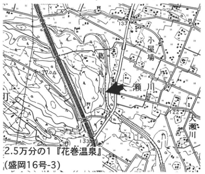
Show extracted lettering and translation
English translation of figure lettering
1:25,000 ‘Hanamaki Hot Springs’ (Morioka sheet 16-3); 小屋場; Segawa; Osegawa; 133, 133.8, 122, 170.
Original Japanese lettering
2.5万分の1『花巻温泉』(盛岡16号-3);小屋場,瀬川,大瀬川,133,133.8,122,170。
Reading notes
地図のその他の微小文字は判読不明。
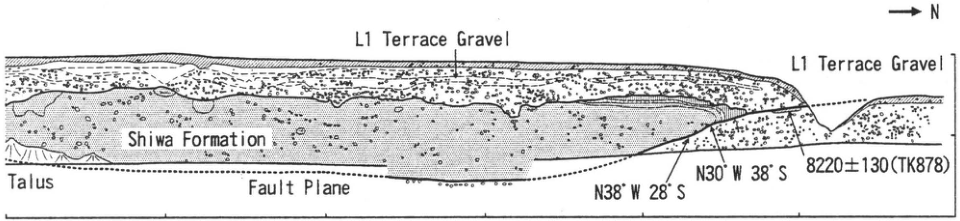
Show extracted lettering and translation
English translation of figure lettering
Original English lettering: L1 Terrace Gravel (twice); Shiwa Formation; Talus; Fault Plane; N. N38°W 28°S; N30°W 38°S; 8220±130 (TK878). Horizontal ticks visible in the original PDF: 60, 40, 20.
Original Japanese lettering
原図英文:L1 Terrace Gravel(2か所),Shiwa Formation,Talus,Fault Plane,N。N38°W 28°S;N30°W 38°S;8220±130(TK878)。原PDFの水平目盛:60,40,20。
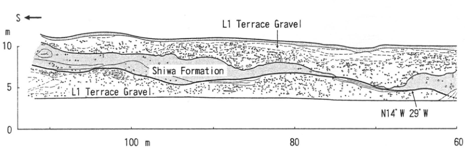
Show extracted lettering and translation
English translation of figure lettering
Original English lettering: S; L1 Terrace Gravel (twice); Shiwa Formation. N14°W 29°W. Vertical scale m: 0, 5, 10. Horizontal scale: 100m, 80, 60.
Original Japanese lettering
原図英文:S,L1 Terrace Gravel(2か所),Shiwa Formation。N14°W 29°W。垂直標尺m:0,5,10。水平標尺:100m,80,60。
TH-9 Tephra beds at the northeastern foot of Iwate volcano—Iwate- and Towada-derived tephras and widespread tephras
土井宣夫
- Locality: Koma-Shinden, Tamayama Village, Iwate Prefecture
- Latitude and longitude: N39°53′54″ E141°09′51″
- Elevation: 230m
- Outcrop type and condition: Artificial exposure; extant; vegetation gradually increasing since 1978
- Deposit types and age: Aeolian tephra; debris-avalanche deposits; Middle Pleistocene to Holocene
- Date of description: 1978
- Keywords: Iwate volcano; Iwate-derived tephras; Towada-derived tephras
This section through hills composed of tephra sequences is a type locality for Middle to Late Pleistocene tephras from Iwate volcano. From bottom to top, the 外山 (SoVA), Shibutami (SiVA), and Wakare (分; WVA) volcanic ashes can be observed. An oblique stratigraphic relationship in the middle of the exposure divides SoVA into lower and upper parts, containing numerous scoria and pumice beds (大上・土井, 1978; 大上 et al., 1980). Distinctive beds visible among these include 石花 No. 3 scoria (Is3S), Shinden No. 1 scoria (Sn1S), Iwate-Shijushida Nos. 2 and 1 pumice (IW-S2P, S1P), Iwate-Obuke No. 1 scoria (IW-Ob1S; 土井, 1990), Iwate-石花 Nos. 2 and 1 scoria (IW-Is2S, Is1S), and Iwate-Mizusawa scoria (IW-MS). 葉の木谷地 No. 2 white ash (Hn2WA, Toya tephra; Toya) occurs above Is2S within upper SoVA, and 葉の木谷地 No. 1 white ash (Hn1WA, Aso-4 tephra; Aso-4) occurs above IW-MS. In the center of the exposure are orange, equigranular Towada-Kawaguchi Pumice (To-K; 土井, 1990), approximately 30cm thick, and overlying Iwate-加賀内 Nos. 3–1 scoria (IW-K3S, K2S, K1S). Above them are white Iwate-雪浦 Pumice (Iw-Y), about 80cm thick, and Iwate-Oide black volcanic ash (IW-Od), comprising stratified black volcanic sand and orange pumice with Iw-Y intercalated (土井, 1991). Farther above lie Iwate-Takizawa Nos. 2 and 1 scoria (IW-T2S, T1S). Above IW-T2S are Towada-Ofudo pyroclastic-flow deposits (To-Of; 土井, 1993) and Aira-Tn tephra (AT). Above IW-T1S are Towada-Hachinohe pyroclastic-flow deposits (To-H), a thin part of Iwate-Hirakasa debris-avalanche deposits (IW-HDA; 土井, 1989), Towada-a ash (To-a), and Iwate-Kariya scoria (IW-KS; 土井, 1990). The sequence above To-K is SiVA, and that above To-H is WVA.
References: 土井 (1989, 1990, 1991, 1993); 土井・新井 (1987); 町田 et al. (1981, 1985, 1987); 大上・土井 (1978); 大上 et al. (1980); 佐瀬 et al. (1995); 早田 (1989); 張 et al. (1994).
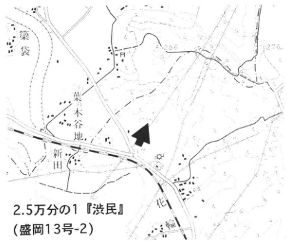
Show extracted lettering and translation
English translation of figure lettering
1:25,000 ‘Shibutami’ (Morioka sheet 13-2); 葉ノ木谷地; Shinden; 花; 袋; 256, 276, 217.
Original Japanese lettering
2.5万分の1『渋民』(盛岡13号-2);葉ノ木谷地,新田,花,袋,256,276,217。
Reading notes
地図のその他の微小文字は判読不明。
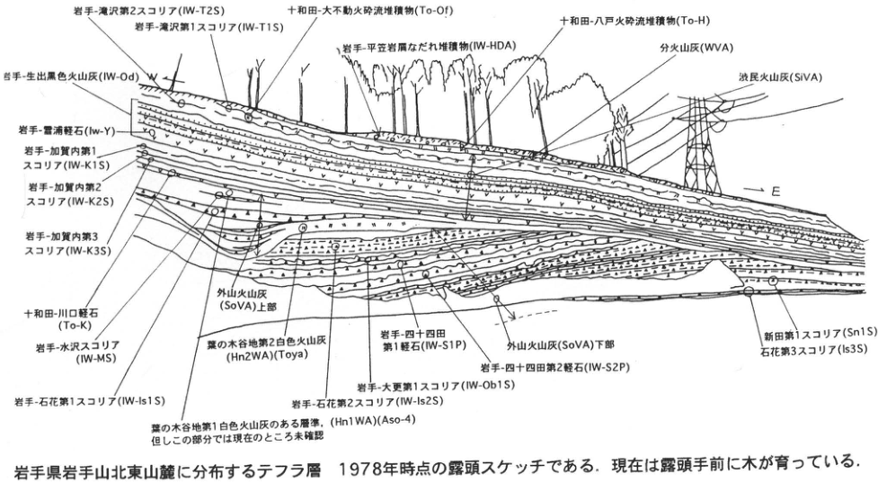
Show extracted lettering and translation
English translation of figure lettering
W, E. Iwate-Takizawa No. 2 scoria (IW-T2S); Iwate-Takizawa No. 1 scoria (IW-T1S); Towada-Ofudo pyroclastic-flow deposits (To-Of); Iwate-Hirakasa debris-avalanche deposits (IW-HDA); Towada-Hachinohe pyroclastic-flow deposits (To-H); Wakare volcanic ash (WVA); Shibutami volcanic ash (SiVA); Iwate-Oide black volcanic ash (IW-Od); Iwate-雪浦 Pumice (Iw-Y); Iwate-加賀内 No. 1 scoria (IW-K1S), No. 2 (IW-K2S), and No. 3 (IW-K3S); Towada-Kawaguchi Pumice (To-K); Iwate-Mizusawa scoria (IW-MS); Iwate-石花 No. 1 scoria (IW-Is1S); horizon containing 葉の木谷地 No. 1 white ash (Hn1WA) (Aso-4), but not yet confirmed in this part; upper 外山 volcanic ash (SoVA); 葉の木谷地 No. 2 white ash (Hn2WA) (Toya); Iwate-石花 No. 2 scoria (IW-Is2S); Iwate-Obuke No. 1 scoria (IW-Ob1S); Iwate-Shijushida No. 1 pumice (IW-S1P); Iwate-Shijushida No. 2 pumice (IW-S2P); lower 外山 volcanic ash (SoVA); Shinden No. 1 scoria (Sn1S); 石花 No. 3 scoria (Is3S).
Original Japanese lettering
W,E。岩手-滝沢第2スコリア(IW-T2S);岩手-滝沢第1スコリア(IW-T1S);十和田-大不動火砕流堆積物(To-Of);岩手-平笠岩屑なだれ堆積物(IW-HDA);十和田-八戸火砕流堆積物(To-H);分火山灰(WVA);渋民火山灰(SiVA);岩手-生出黒色火山灰(IW-Od);岩手-雪浦軽石(Iw-Y);岩手-加賀内第1スコリア(IW-K1S);同第2(IW-K2S);同第3(IW-K3S);十和田-川口軽石(To-K);岩手-水沢スコリア(IW-MS);岩手-石花第1スコリア(IW-Is1S);葉の木谷地第1白色火山灰のある層準(Hn1WA)(Aso-4),但しこの部分では現在のところ未確認;外山火山灰(SoVA)上部;葉の木谷地第2白色火山灰(Hn2WA)(Toya);岩手-石花第2スコリア(IW-Is2S);岩手-大更第1スコリア(IW-Ob1S);岩手-四十四田第1軽石(IW-S1P);岩手-四十四田第2軽石(IW-S2P);外山火山灰(SoVA)下部;新田第1スコリア(Sn1S);石花第3スコリア(Is3S)。
Tephra beds distributed at the northeastern foot of Iwate volcano, Iwate Prefecture. The exposure is sketched as it appeared in 1978. Trees now grow in front of it.
TH-10 Fossil periglacial features in the upper Kitakami River region—fossil solifluction lobes and paleoenvironment
澤口晋一
- Locality: Oide, Takizawa Village, Iwate Prefecture
- Latitude and longitude: N39°52′20″ E141°08′29″
- Elevation: 250m
- Outcrop type and condition: Artificial exposure; extant as of August 1995
- Deposit types and age: Aeolian tephra; Late Pleistocene to Holocene
- Date of description: May 1989
- Keywords: Upper Kitakami River region; fossil periglacial features; Akita-Komagatake-derived tephras; Iwate-derived tephras
These features occur in exposures of tephra beds derived mainly from Iwate and Akita-Komagatake volcanoes. The sequence contains marker tephras from Iwate-Oide (Iw-Od; 35ka) through Akita-Komagatake-Yanagisawa (Ak-Y; 12ka). Dark bands with cracks occur immediately below Akita-Komagatake-Koiwai (Ak-K) and Takizawa Nos. 1 and 2 scoria (T1S, T2S). Of these, BS1 has a ¹⁴C age of 14,730±280yr B.P., and BS2 (SiCr1) contains mixed Aira-Tn tephra (AT; 22–25ka). The figure shows Iw-Od deposited parallel to the slope at an inclination of 25°, but the 2–3m-thick interval from BS3 (SiCr2) up to BS1 is strongly disturbed. The scoria beds (T1S, T2S) in this interval display complex deformation, including recumbent-fold-like structures folded downslope over the underlying dark bands and wavy deformation. Individual folds are 1–2m long, with steps approximately 1m high or less. These disturbances indicate plastic flow of tephra as a mass over the slope while deposition continued. Their longitudinal profiles are identical to those of present solifluction lobes, so they are interpreted as fossil forms created under a past cold climate. Deformation of the individual tephra beds suggests that the main period of lobe formation extended from approximately 20ka, after BS2 developed, to around 15ka, immediately after BS1 developed. Because solifluction lobes form only on grassland or bare slopes, dense forest probably did not exist in this region during that interval.
References: 大上・土井 (1978); 澤口 (1992).
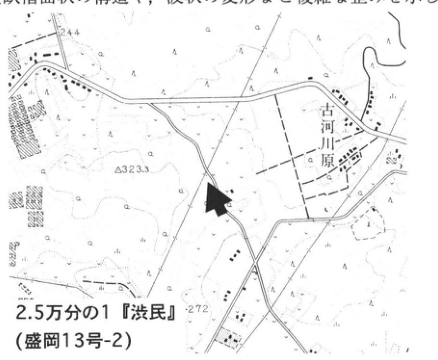
Show extracted lettering and translation
English translation of figure lettering
1:25,000 ‘Shibutami’ (Morioka sheet 13-2); 古河川原; 244, 323.3, 272. The body-text fragment included in the image is transcribed and translated in the main text.
Original Japanese lettering
2.5万分の1『渋民』(盛岡13号-2);古河川原,244,323.3,272。画像の本文片は本文に収録。
Reading notes
位置図のその他の微小文字は判読不明。
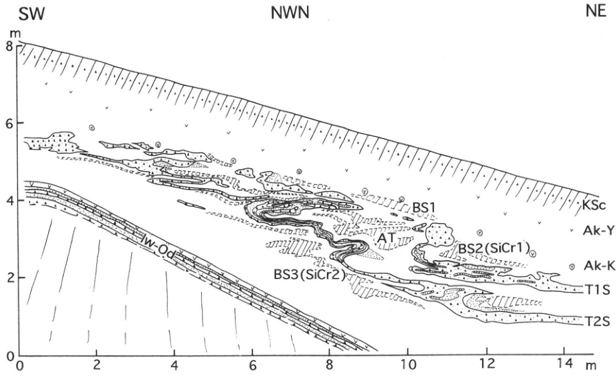
Show extracted lettering and translation
English translation of figure lettering
SW, NWN, NE; KSc; Ak-Y; Ak-K; T1S; T2S; BS1; AT; BS2 (SiCr1); BS3 (SiCr2); Iw-Od. Vertical scale m: 0, 2, 4, 6, 8. Horizontal scale m: 0, 2, 4, 6, 8, 10, 12, 14.
Original Japanese lettering
SW,NWN,NE;KSc,Ak-Y,Ak-K,T1S,T2S,BS1,AT,BS2(SiCr1),BS3(SiCr2),Iw-Od。垂直標尺m:0,2,4,6,8。水平標尺m:0,2,4,6,8,10,12,14。
TH-11 Middle Pleistocene tephras of the Isawa Upland
渡辺満久
- Locality: Koromogawa Village, Isawa District, Iwate Prefecture
- Latitude and longitude: N39°1′33″ E141°5′48″
- Elevation: 145m
- Outcrop type and condition: Artificial exposure at a materials-storage yard; extant
- Deposit types and age: Fluvial deposits; tephra; Middle Pleistocene
- Date of description: May 1987
- Keywords: Yakeishi-dake; Isawa Upland; Hagimori No. 2 pumice; 日向 No. 1 pumice
Fluvial terrace surfaces of the Isawa Upland are broadly divided, from highest to lowest, into the T, H, M, and L groups (渡辺, 1991). This outcrop exposes the deposits forming the T2 surface, the overlying tephras, and the strata forming the substrate beneath the terrace gravel. From bottom to top, the T2 surface is covered by marker tephras A2P (Arayashiki No. 2 pumice), A1P, A0P, H2P (Hagimori No. 2 pumice), Hn4P (日向 No. 4 pumice), Hn3P, H1P, Hn2P, and Hn1P (names follow 大上・吉田, 1984).
Among these marker tephras, H2P and Hn1P have relatively extensive distributions. H2P reaches 2m in thickness and is a sherbet-like pumice bed with few lithic fragments. A portion near its center consists of glass and fine pumice. H2P has been traced to the Onikobe area, where it is called the Hiraizumi Pumice bed (HrP; 早田, 1989); it is important for correlating Middle Pleistocene terrace surfaces. Hn1P is divided into several units and is widely distributed throughout the southern Kitakami Lowland. The upper unit contains obsidian several millimeters in size, from which a fission-track age of 122.9±15.1ka has been obtained (大上 et al., 1986). The Isawa marker tephras contain abundant high-temperature quartz; Hn4P in particular contains large quantities of crystals several millimeters across, resembling coarse sugar grains.
References: 大上・吉田 (1984); 大上 et al. (1986); 早田 (1989); 渡辺 (1991).
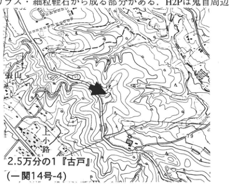
Show extracted lettering and translation
English translation of figure lettering
1:25,000 ‘古戸’ (Ichinoseki sheet 14-4); 張山; 小路; 150, 79. The body-text fragment included in the image is transcribed and translated in the main text.
Original Japanese lettering
2.5万分の1『古戸』(一関14号-4);張山,小路,150,79。画像の本文片は本文に収録。
Reading notes
位置図のその他の微小文字は判読不明。
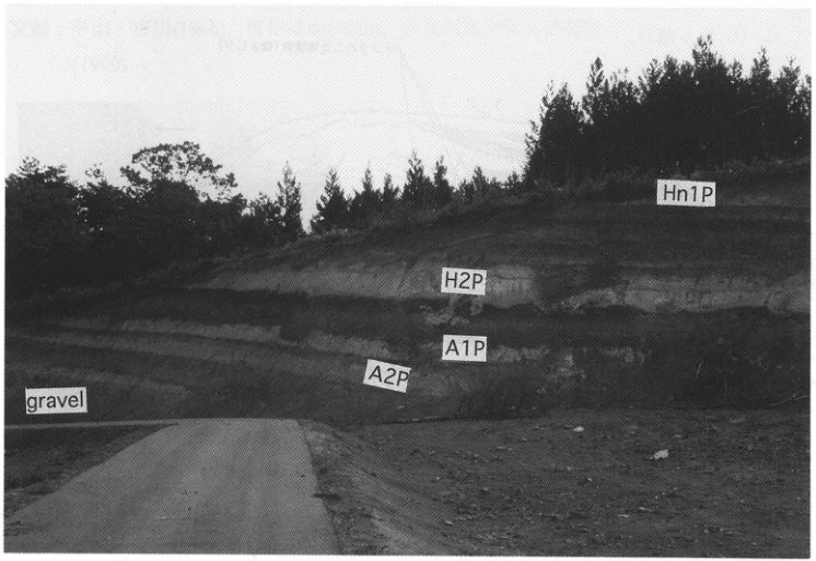
Show extracted lettering and translation
English translation of figure lettering
Original English lettering: Hn1P; H2P; A1P; A2P; gravel.
Original Japanese lettering
Hn1P,H2P,A1P,A2P,gravel。
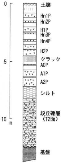
Show extracted lettering and translation
English translation of figure lettering
Scale: 0, 5, 10m. Top to bottom: Soil; Hn1P; Hn2P; H1P; Hn3P; Hn4P; H2P; cracks; A0P; A1P; A2P; silt; terrace gravel (T2 surface); substrate.
Original Japanese lettering
標尺:0,5,10m。上から:土壌,Hn1P,Hn2P,H1P,Hn3P,Hn4P,H2P,クラック,A0P,A1P,A2P,シルト,段丘礫層(T2面),基盤。
TH-12 Tephra beds on the eastern flank of Akita-Komagatake in Iwate Prefecture—tephras derived from Akita-Komagatake volcano
土井宣夫
- Locality: Within the upper 下シズノ沢 stream, a tributary of Kunimi-Arasawa, Shizukuishi Town, Iwate Prefecture
- Latitude and longitude: N39°45′10″ E140°50′20″
- Elevation: 960m
- Outcrop type and condition: Natural exposure; extant
- Deposit types and age: Aeolian tephra; Late Pleistocene to Holocene
- Date of description: 1995
- Keywords: Shizukuishi; Akita-Komagatake; Akita-Komagatake-derived tephras
Discovered in 1992 by 和知剛 (now with Asia Air Survey), this is a type exposure of Holocene Akita-Komagatake tephras (Wakare volcanic ash). To reach it, enter the former national road toward Kunimi Hot Springs from the junction of the 竜川 and Arasawa streams on National Route 46, then take the forestry road toward 小柳沢 before Arasawa Bridge. After crossing Akakurasawa, turn left at the forestry-road fork and continue uphill to the uppermost 下シズノ沢 (the 1:25,000 topographic map shows only part of this forestry road). The road ends approximately 500m beyond its crossing of 下シズノ沢. The exposure is on the right (east) about 150m upstream along 下シズノ沢 from the road. Lingering snow limits observation to July–October. The sequence visible extends from the uppermost Shibutami volcanic ash (SiVA) through most of the Wakare volcanic ash (WVA) above the Towada-Hachinohe pyroclastic-flow deposits (To-H). Because the tephra accumulated on a slope, reworked deposits are intercalated and landslide deformation also occurs. Above To-H are Akita-Komagatake-Koiwai Pumice (Ak-K; reworked), Yanagisawa Pumice (Ak-Y; deformed), Arasawa Pumice (Ak-AP), Horikiri Pumice (Ak-HP), and, farther above, three scoria beds and two white phreatic-explosion deposits from Akita-Komagatake. Small nearby exposures along the forestry road reveal two still higher Akita-Komagatake scoria beds and Towada-a tephra (To-a), completing the WVA succession. Accretionary lapilli occur at several horizons, including Ak-Y (和知 et al., 1993). The type exposure of Holocene Iwate tephras (WVA) is the cut at the parking area of the Iwate volcano Umagaeshi trailhead in Takizawa Village (N39°49′52″ E141°02′34″; 土井 et al., 1986). Names of the principal tephras follow 大上・土井 (1978), Inoue (1980), and 和知 et al. (1993).
References: 土井 et al. (1986); Inoue (1980); 大上・土井 (1978); 和知 et al. (1993).
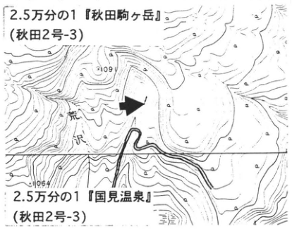
Show extracted lettering and translation
English translation of figure lettering
1:25,000 ‘Akita-Komagatake’ (Akita sheet 2-3); 1:25,000 ‘Kunimi Hot Springs’ (Akita sheet 2-3); Arasawa; 1064; 109[illegible].
Original Japanese lettering
2.5万分の1『秋田駒ヶ岳』(秋田2号-3);2.5万分の1『国見温泉』(秋田2号-3);荒沢,1064,109[判読不明]。
Reading notes
上側の標高109…の末尾とその他の微小文字は判読不明。
原図の二つの地図名の号番号はともに秋田2号-3と印刷。
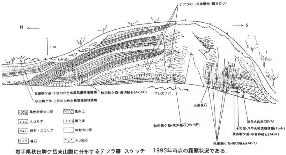
Show extracted lettering and translation
English translation of figure lettering
N, S; 2m. Reworked tephra deposits (with gravel); Akita-Komagatake lower white phreatic-explosion deposits; Akita-Komagatake upper white phreatic-explosion deposits; Akita-Komagatake-Horikiri Pumice (Ak-HP); 下シズノ沢; Akita-Komagatake-Arasawa Pumice (Ak-AP); accretionary lapilli; Shibutami volcanic ash (SiVA); Towada-Hachinohe pyroclastic-flow deposits (To-H); Akita-Komagatake-Koiwai Pumice (Ak-K); Akita-Komagatake-Yanagisawa Pumice (Ak-Y). Legend: Black sandy volcanic ash; scoria; pumice and scoria; pumice; black soil; weathered zone; fine ash; accretionary lapilli.
Original Japanese lettering
N,S;2m。テフラの二次堆積物(礫まじり);秋田駒ケ岳-下位の白色水蒸気爆発堆積物;秋田駒ケ岳-上位の白色水蒸気爆発堆積物;秋田駒ケ岳-堀切軽石(Ak-HP);下シズノ沢;秋田駒ケ岳-荒沢軽石(Ak-AP);火山豆石;渋民火山灰(SiVA);十和田-八戸火砕流堆積物(To-H);秋田駒ケ岳-小岩井軽石(Ak-K);秋田駒ケ岳-柳沢軽石(Ak-Y)。凡例:黒色砂状火山灰,スコリア,軽石・スコリア,軽石,黒色土,風化帯,細粒火山灰,火山豆石。
Tephra beds on the eastern flank of Akita-Komagatake in Iwate Prefecture: sketch showing the exposure as it appeared in 1995.
TH-13 Kemanai pyroclastic-flow deposits and Towada-a tephra at Oyu, Akita Prefecture—the Towada eruption disaster suggested by the Hachirotaro legend
町田洋
- Locality: Okawara and the Oyu Stone Circles site, Kazuno City, Akita Prefecture
- Latitude and longitude: N40°16′10–40″ E140°48′15–25″
- Elevation: 140–180m
- Outcrop type and condition: Excavation and riverbank; only partly extant
- Deposit types and age: Pumice fall; pyroclastic-flow deposits; 915
- Date of description: June 1979
- Keywords: Towada-a tephra; Kemanai pyroclastic-flow deposits; shirasu floods; Kurumidate site (胡桃館遺跡); Yoneshiro River; Hachirotaro legend
The site known for the Oyu Stone Circles in the Kazuno Basin, Akita Prefecture, lies on an upland of Towada-Hachinohe pyroclastic-flow deposits on the left bank of the Oyu River. Towada-a pumice fall (To-a) occurs in the upper part of volcanic-ash soil covering a Late Jomon artifact-bearing layer. From here it drapes the upland cliff and continues down to the base of a low terrace with 10m relief along the Oyu River (upper Yoneshiro River). The terrace consists of pyroclastic-flow deposits that overlie the pumice fall without a time gap. These are called the Kemanai pyroclastic-flow deposits and comprise grayish-white pumice and ash, covered by sand and gravel. Low terraces of such pumice- and ash-rich deposits continue along the Yoneshiro River for 80km through the Odate and Takanosu basins to the Noshiro Plain at the river mouth. The Towada eruption clearly filled the Yoneshiro river bed within a very short time. Ancient houses unearthed from these terrace deposits have long been known; nearly 50 have been found to date, chiefly in the Odate and Takanosu basins. 平山・市川 (1966) interpreted the local Hachirotaro legend geologically, stating that Towada erupted in the Heian period and shirasu floods buried settlements. The deposit facies, limited destruction of buried houses, and almost uncharred wood of houses excavated at the Kurumidate site in Takanosu Town suggest that downstream from Kemanai, mixing with water currents generated volcanic mudflows that reached the river mouth, rather than depositing pyroclastic flows.
The Towada eruption that began with To-a, emitted the Kemanai pyroclastic flow, and caused a major disaster in the Yoneshiro basin is considered to have occurred in summer AD 915, based on archaeological evidence, dendrochronology of buried-house timbers, and records such as ‘Volcanic ash fell in the province of Dewa…’ (町田 et al., 1980; 奈良国立文化財研究所, 1990).
References: 平山・市川 (1966); 町田 et al. (1980); 奈良国立文化財研究所 (1990).
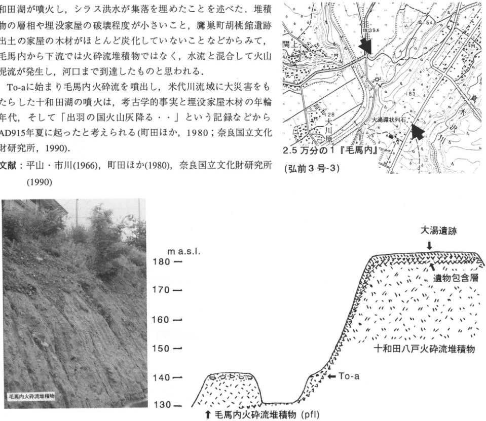
Show extracted lettering and translation
English translation of figure lettering
Location map: 1:25,000 ‘Kemanai’ (Hirosaki sheet 3-3); 関上; Okawara; Oyu Stone Circles; Oyu River; 139.6, 154.0, 183, 128. Photograph annotation: Kemanai pyroclastic-flow deposits. Section: m a.s.l.; 130, 140, 150, 160, 170, 180; Oyu site; artifact-bearing layer; Towada-Hachinohe pyroclastic-flow deposits; To-a; Kemanai pyroclastic-flow deposits (pfl). The body-text fragment in the image is transcribed and translated in the main text.
Original Japanese lettering
位置図:2.5万分の1『毛馬内』(弘前3号-3);関上,大川原,大湯環状列石,大湯川,139.6,154.0,183,128。写真注記:毛馬内火砕流堆積物。断面図:m a.s.l.,130,140,150,160,170,180;大湯遺跡,遺物包含層,十和田八戸火砕流堆積物,To-a,毛馬内火砕流堆積物(pfl)。画像の本文片は本文に収録。
Reading notes
位置図のその他の微小文字は判読不明。
TH-14 Marine Lower and Middle Pleistocene deposits of the Oga Peninsula, Akita Prefecture
白石建雄・的場保望
- Locality: Oga City, Akita Prefecture (coast west of Wakimoto on the southern Oga Peninsula)
- Latitude and longitude: N39°53′43″ E139°53′50″
- Elevation: 0–50m
- Outcrop type and condition: Sea cliff; extant
- Deposit types and age: Early to Middle Pleistocene marine sand–mud alternations, including the Brunhes–Matuyama chron boundary
- Date of description: May 1996
- Keywords: Oga Peninsula; Wakimoto Formation; Brunhes–Matuyama chron boundary
This large exposure in sea cliffs extending westward from Oibana Cape, west of Wakimoto on the southern Oga Peninsula, reveals the Kitaura Formation and the conformably overlying Wakimoto Formation. Both consist of sand–mud alternations containing numerous ash beds. The exposure includes the boundary between the Matuyama and Brunhes chrons and is of great importance for Quaternary stratigraphy. A paved road runs along its seaward side; concrete retaining walls and wire mesh preventing sediment runoff separate the road from the cliff. Talus buries the lower half of the exposure, but also makes it easier to approach the exposed face. The face is subject to frequent collapse, however, and considerable caution against falling rocks is needed.
Researchers place the boundary between the Kitaura and Wakimoto formations differently. Here, following 藤岡 and colleagues (藤岡, 1973; 藤岡 et al., 1973), it is placed at the top of a tuffaceous sandstone bed (北里, 1975). Specifically, sandstone beds in the Kitaura Formation are tuffaceous, whereas those in the Wakimoto Formation are nontuffaceous. Both formations were long considered Neogene. However, 北里 (1975), combining microfossil and paleomagnetic stratigraphy, showed that the main part of the Kitaura Formation, excluding its lowermost part, and the overlying sequence are Pleistocene. Stratigraphic studies using calcareous nannofossils also support this conclusion (佐藤 et al., 1988).
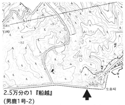
Show extracted lettering and translation
English translation of figure lettering
1:25,000 ‘Funakoshi’ (Oga sheet 1-2); Oibana Cape; 百崎; 68.9, 91, 117.5, 92, 109.
Original Japanese lettering
2.5万分の1『船越』(男鹿1号-2);生鼻崎,百崎,68.9,91,117.5,92,109。
Reading notes
地図のその他の微小文字は判読不明。
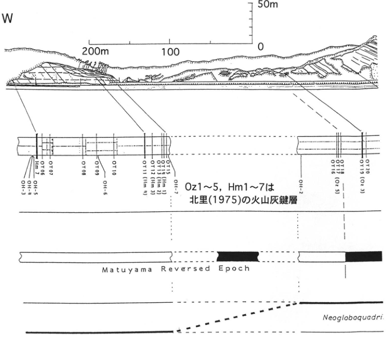
Show extracted lettering and translation
English translation of figure lettering
W. Horizontal scale: 200m, 100, 0. Vertical scale: 0, 50m. Ash-marker beds: OH-3; OH-4; OH-5; Hm1; OT06; OT07; OT08; OT09; OH-6; OT10; OT11 (Hm4); OT12 (Hm3); OT13 (Hm2); OT14 (Hm1); OT15; OH-7; OH-1; OH-2; OT16; OT17; OT18 (Oz5); OT19 (Oz3); OT20. Note: Oz1–5 and Hm1–7 are the ash-marker beds of 北里 (1975). Original English: Matuyama Reversed Epoch. The genus at the bottom ends ‘Neogloboquadri…’ and continues on the next page.
Original Japanese lettering
W。水平標尺:200m,100,0。垂直標尺:0,50m。火山灰鍵層:OH-3,OH-4,OH-5,Hm1,OT06,OT07,OT08,OT09,OH-6,OT10,OT11(Hm4),OT12(Hm3),OT13(Hm2),OT14(Hm1),OT15,OH-7,OH-1,OH-2,OT16,OT17,OT18(Oz5),OT19(Oz3),OT20。注:Oz1~5,Hm1~7は北里(1975)の火山灰鍵層。原図英文:Matuyama Reversed Epoch。下段の学名はNeogloboquadri…で次頁に続く。
Reading notes
図は次頁の東側断面・凡例・学名へ続く。
TH-14 (continued)
The Kitaura Formation is a thick marine unit, 700–1,400m thick, of which approximately the upper half is exposed here. Within this upper Kitaura sequence, paleomagnetic polarity changes upward from a reversed to a normal polarity zone. These are correlated with the Matuyama and Brunhes chrons, respectively (北里, 1975; 佐藤 et al., 1988). The normal polarity zone in the upper Matuyama zone had been correlated with the Jaramillo Subchron. Based on its stratigraphic relationship to calcareous nannofossil datum levels, however, 佐藤 et al. (1988) correlated it with the Cobb Mountain Subchron and considered the zone corresponding to the Jaramillo Subchron to be missing through faulting. Across this normal polarity zone, the planktonic foraminifer Neogloboquadrina pachyderma shows a marked quantitative change upward from the relatively warm-current, dextrally coiled type to the cold-current, sinistrally coiled type. Benthic foraminifera, including those in the Wakimoto Formation, comprise assemblages currently distributed in the upper bathyal zone of the Sea of Japan (200–1,000m water depth; 的場, 1992).
References: 藤岡 (1973); 藤岡 et al. (1973); 北里 (1975); 的場 (1992); 佐藤 et al. (1988).
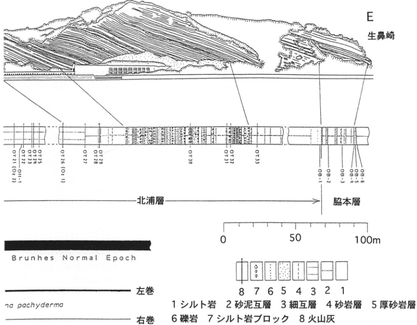
Show extracted lettering and translation
English translation of figure lettering
E; Oibana Cape; OT21 (Oz2); OT22; OH-1; OT23; OT24; OT25; OT26 (Oz1); OT27; OT28; OT29; OT30; OT31; OT32; OT33; OB-1; OB-2; OB-3; OB-4; OB-5; OB-6. Kitaura Formation; Wakimoto Formation. Scale: 0, 50, 100m. Original English: Brunhes Normal Epoch. Right-hand portion of the scientific name: ‘…na pachyderma,’ continuing ‘Neogloboquadri…’ on the preceding page. Sinistral coiling; dextral coiling. Legend: 1 siltstone; 2 sand–mud alternations; 3 thin alternations; 4 sandstone beds; 5 thick sandstone beds; 6 conglomerate; 7 siltstone blocks; 8 volcanic ash.
Original Japanese lettering
E,生鼻崎;OT21(Oz2),OT22,OH-1,OT23,OT24,OT25,OT26(Oz1),OT27,OT28,OT29,OT30,OT31,OT32,OT33,OB-1,OB-2,OB-3,OB-4,OB-5,OB-6。北浦層;脇本層。標尺:0,50,100m。原図英文:Brunhes Normal Epoch。学名の右側部分:…na pachyderma(前頁のNeogloboquadri…に続く)。左巻;右巻。凡例:1シルト岩,2砂泥互層,3細互層,4砂岩層,5厚砂岩層,6礫岩,7シルト岩ブロック,8火山灰。
Reading notes
図はPDF173ページの西側部分から続く。
Lithologic legend in the figure:
| Number | Lithology |
|---|---|
| 1 | Siltstone |
| 2 | Sand–mud alternations |
| 3 | Thin alternations |
| 4 | Sandstone beds |
| 5 | Thick sandstone beds |
| 6 | Conglomerate |
| 7 | Siltstone blocks |
| 8 | Volcanic ash |
TH-15 Marine Upper Pleistocene deposits (Katanishi Formation) and widespread tephras of the Oga Peninsula, Akita Prefecture
白石建雄・的場保望
- Localities: 樽沢, Oga City, Akita Prefecture (behind the kindergarten; site 1); 福米沢, Wakami Town, Akita Prefecture (former borrow pit north of Katanishi Junior High School; site 2)
- Latitude and longitude: N39°56′10″ E139°54′25″ (site 1); N40°00′00″ E139°56′16″ (site 2)
- Elevation: 30m (site 1); 5–10m (site 2)
- Outcrop type and condition: Both artificial exposures; extant
- Deposit types and age: Sand beds; mud beds; Late Pleistocene
- Date of description: May 1996
- Keywords: Oga Peninsula; Katanishi Formation; Toya tephra; Sambe-Kisuki tephra; Ontake-1 tephra
Marine terraces called the Katanishi Terrace are widely distributed in the northeastern Oga Peninsula. The Katanishi Formation forms these terraces, and their eastern margin, where the exposures lie, is its type area. According to 潟西層団体研究グループ (1983), the formation here is subdivided into the 樽沢 Sand, Kakumazaki Mud, Matsukizawa Sand and Gravel, and 本内 Sand members. The Kakumazaki Mud Member conformably overlies the 樽沢 Sand Member, and the 本内 Sand Member conformably overlies the Matsukizawa Sand and Gravel Member. The Kakumazaki Mud and Matsukizawa Sand and Gravel members are inferred to interfinger.
The 樽沢 exposure (site 1) is the type exposure of the 樽沢 Sand Member. Here the Kakumazaki Mud Member overlies the 樽沢 Sand Member, composed of marine gravelly sand. A bioturbated, 10cm-thick bed of white fine ash is intercalated approximately 4m above the base of the mud member. 町田 et al. (1987) identified it as Toya tephra (Toya).
The 福米沢 exposure (site 2) is a small outcrop, 4–5m high, consisting of unbedded sand of the 本内 Sand Member. Its upper surface forms the Katanishi terrace surface. Approximately 3.4m below that surface are yellow-orange, well-rounded, pebble-sized rafted pumice clasts derived from Sambe-Kisuki tephra (SK; 白石 et al., 1992). A thin ash bed that may be Ontake-1 tephra occurs 70cm above SK (白石 et al., 1992).
References: 潟西層団体研究グループ (1983); 町田 et al. (1987); 白石 et al. (1992).
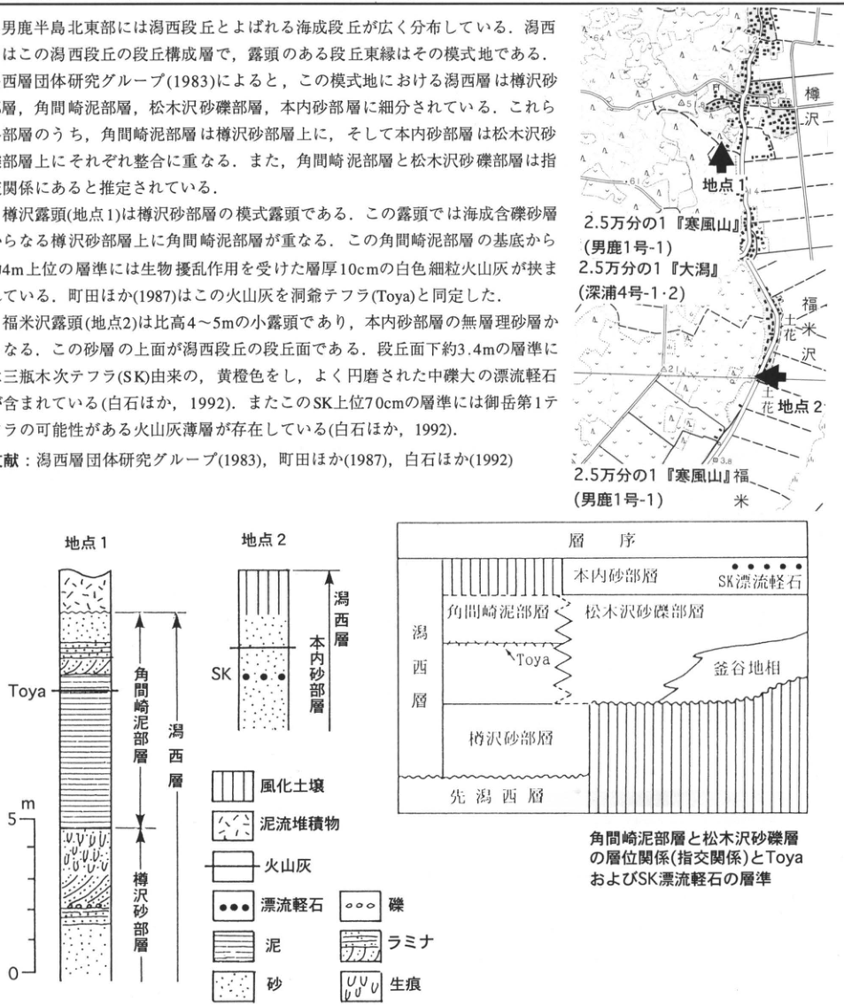
Show extracted lettering and translation
English translation of figure lettering
Location maps: Site 1; site 2; 樽沢; 福米沢; 花. 1:25,000 ‘Kanpuzan’ (Oga sheet 1-1), shown twice; 1:25,000 ‘Ogata’ (Fukaura sheets 4-1 and 4-2). Values: 64, 12, 51.8, 61, 21, 3.8. Columns: Site 1; Toya; Kakumazaki Mud Member; Katanishi Formation; 樽沢 Sand Member. Site 2; SK; 本内 Sand Member; Katanishi Formation. Scale m: 0, 5. Stratigraphic diagram: Stratigraphy; Katanishi Formation; 本内 Sand Member; SK rafted pumice; Kakumazaki Mud Member; Matsukizawa Sand and Gravel Member; Toya; 釜谷地 facies; 樽沢 Sand Member; pre-Katanishi deposits. Legend: Weathered soil; mudflow deposits; volcanic ash; rafted pumice; mud; sand; gravel; laminae; trace fossils. The body-text fragment in the image is transcribed and translated in the main text.
Original Japanese lettering
位置図:地点1,地点2,樽沢,福米沢,花。2.5万分の1『寒風山』(男鹿1号-1)(上下2回);2.5万分の1『大潟』(深浦4号-1・2)。数値64,12,51.8,61,21,3.8。柱状図:地点1,Toya,角間崎泥部層,潟西層,樽沢砂部層;地点2,SK,本内砂部層,潟西層。標尺m:0,5。層序図:層序,潟西層,本内砂部層,SK漂流軽石,角間崎泥部層,松木沢砂礫部層,Toya,釜谷地相,樽沢砂部層,先潟西層。凡例:風化土壌,泥流堆積物,火山灰,漂流軽石,泥,砂,礫,ラミナ,生痕。画像の本文片は本文に収録。
Reading notes
位置図のその他の微小文字は判読不明。
Stratigraphic relationship (interfingering) between the Kakumazaki Mud Member and Matsukizawa sand and gravel, with horizons of Toya and SK rafted pumice.
TH-16 Late Pleistocene tephra beds at Onikobe, Miyagi Prefecture: tephras from Naruko Volcano and widespread tephras
八木浩司
- Locality: southwest of Kitataki, Naruko Town, Tamatsukuri District, Miyagi Prefecture
- Coordinates: N38°49′26″ E140°44′25″
- Elevation: 520 m
- Outcrop type and condition: artificial exposure; the southern face remained exposed in August 1989
- Deposit type and age: subaqueously deposited tephra; Late Pleistocene
- Date of description: August 1989
- Keywords: Onikobe; tephras from Naruko; Toya tephra; Ontake-1 tephra; Aso-4 tephra
As of 1989, this was the best outcrop for observing Late Pleistocene tephras distributed in northwestern Miyagi Prefecture. At Onikobe, it cuts fine-grained deposits distributed in the uppermost reaches of the Eai River, which follows a counterclockwise course. Four vitreous tephra beds deposited under water are intercalated in fine-grained deposits consisting of fine sand to clay. The observable tephras are Toya (Toya), Ontake-1 (On-Pm 1), Naruko-Nizaka (鳴子荷坂; Nr-N), and Aso-4 (Aso-4). Toya is a white ash bed approximately 8 cm thick, situated about 4 m above the base of the exposure. On-Pm 1, approximately 4 cm thick, occurs about 80 cm above Toya. About 40 cm above On-Pm 1, Nr-N occurs as a white ash bed approximately 4 cm thick, with accretionary lapilli at its base. A further approximately 120 cm above it, pinkish-white Aso-4 can be observed as a bed approximately 5 cm thick. For detailed lithological descriptions, see 八木・早田 (1989). At that time, the outcrop formed a cut slope along a forestry road. Subsequently, however, the old road was abandoned when a new road was constructed, and the base of the exposure is gradually being buried by collapsed material.
Reference: 八木・早田 (1989)
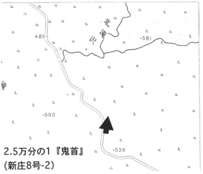
Show extracted lettering and translation
English translation of figure lettering
Kitataki-sawa (北滝沢); 485; 581; 550; 539. 1:25,000 ‘Onikobe’ (Shinjō sheet 8-2). The black arrow marks the outcrop.
Original Japanese lettering
北滝沢;485;581;550;539。2.5万分の1『鬼首』(新庄8号-2)。黒矢印は露頭位置。
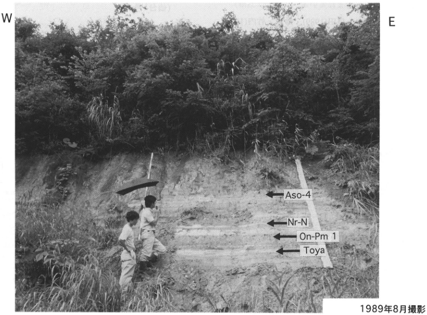
Show extracted lettering and translation
English translation of figure lettering
W; E. From top to bottom: Aso-4, Nr-N, On-Pm 1, Toya. Photographed in August 1989.
Original Japanese lettering
W;E。上からAso-4,Nr-N,On-Pm 1,Toya。1989年8月撮影。
TH-17 Moderate-volume pyroclastic-flow deposits and fallout tephras erupted from Naruko Caldera
早田勉
- Locality: 安沢, Iwadeyama Town, Miyagi Prefecture
- Coordinates: N38°40′24″ E140°54′6″
- Elevation: 100 m
- Outcrop type and condition: artificial exposure; extant
- Deposit type and age: pyroclastic-flow deposits and aeolian tephra; Middle to Late Pleistocene
- Date of description: May 1980
- Keywords: Sanuma Hills; pyroclastic-flow deposits from Naruko
The Eai River rises in the Onikobe Basin within the axial mountains of Tohoku, passes between the Sanuma and Iwadeyama hills, and waters the Ōsaki Plain before entering the Kitakami River. These hills consist mainly of numerous pyroclastic-flow deposits erupted from Quaternary calderas such as Naruko and Onikobe volcanoes (北村 et al., 1981; 早田, 1989). Between the pyroclastic-flow deposits are accumulations of volcanic-ash soil containing numerous fallout tephra beds. Around 安沢 in Iwadeyama Town, on the left bank of the Eai River, fallout tephra beds and pyroclastic-flow deposits accumulated since the latter part of the Middle Pleistocene can be observed particularly well. At this outcrop, the Naruko-Nizaka tephra (鳴子荷坂; Nr-N), erupted from Naruko Caldera approximately 64–73 ka ago, overlies the Middle Pleistocene 下山里 pyroclastic-flow deposit (Smfl), separated from it by volcanic-ash soil containing fallout tephras termed Iwadeyama Pumice (IwP) and 曲坂 Ash (MgA). Here, Nr-N consists of a lower ash-fall bed (N₂) and the overlying Nizaka pyroclastic-flow deposit (N₃). Toward the west of the exposure, a peat bed occurs immediately below N₂. Analyses of pollen and fossil wood from this peat have provided information on vegetation during the first half of the Late Pleistocene (鈴木・竹内, 1989). At the locality marked ■ on the location map, the Naruko-Yanagisawa tephra (Nr-Y), erupted from Naruko Volcano approximately 41–63 ka ago, can be observed particularly well. There, a lower milky-white fine ash bed contains abundant accretionary lapilli up to 29 mm in diameter and is overlain by a nonwelded pink pyroclastic-flow deposit. The uppermost part of this pyroclastic-flow deposit has weathered orange and, like its lower part, displays gas-escape pipe structures; it also contains brown accretionary lapilli.
References: 北村 et al. (1981); 早田 (1989); 鈴木・竹内 (1989)
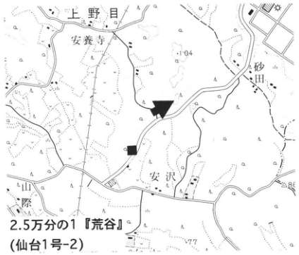
Show extracted lettering and translation
English translation of figure lettering
上野目; 安養寺; 砂田; 安沢; 山際; 104; 118; 86; 77. 1:25,000 ‘荒谷’ (Sendai sheet 1-2). Black arrow: the present outcrop. ■: the Nr-Y observation site described in the text.
Original Japanese lettering
上野目;安養寺;砂田;安沢;山際;104;118;86;77。2.5万分の1『荒谷』(仙台1号-2)。黒矢印:本露頭。■:本文に記載するNr-Yの観察地点。
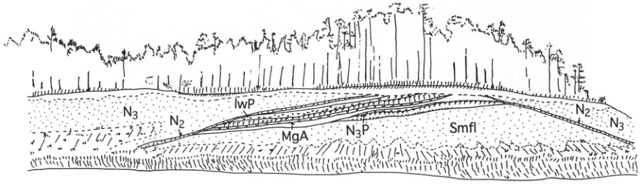
Show extracted lettering and translation
English translation of figure lettering
Left: N₃, N₂. Center: IwP, MgA, N₃P, Smfl. Right: N₂, N₃.
Original Japanese lettering
左部:N₃,N₂。中央:IwP,MgA,N₃P,Smfl。右部:N₂,N₃。
TH-18 The oldest stone-tool culture in the Japanese archipelago? —The Takamori site, Tsukidate Town, Miyagi Prefecture—
早田勉 Original p. 157
Editorial note: entry removed from the public edition
The Japan Association for Quaternary Research intentionally removed this entry from its public PDF. Its 2005 notice followed a review of publications associated with the Early and Middle Paleolithic fabrication scandal exposed in November 2000. The notice classified this entry as category B (closely connected analyses) and determined that the affected material must not be used as evidence for Paleolithic research. The public edition implements that decision. This corrected and translated edition retains the title and page number from the original contents and explains the omission; the deleted text has not been reconstructed.
Sources: the Association’s release statement, Quaternary Research Newsletter, vol. 12, no. 3 (2005), pp. 15–16. This note was added for the present edition and is not part of the 1996 text.
TH-19 Confirmation of an Early Paleolithic culture in Japan —The Zazaragi and Babadan A sites, Miyagi Prefecture—
早田勉 Original p. 158
Editorial note: entry removed from the public edition
The Japan Association for Quaternary Research intentionally removed this entry from its public PDF. Its 2005 notice followed a review of publications associated with the Early and Middle Paleolithic fabrication scandal exposed in November 2000. The notice classified this entry as category A (direct discussion of the affected content) and determined that the affected material must not be used as evidence for Paleolithic research. The public edition implements that decision. This corrected and translated edition retains the title and page number from the original contents and explains the omission; the deleted text has not been reconstructed.
Sources: the Association’s release statement, Quaternary Research Newsletter, vol. 12, no. 3 (2005), pp. 15–16. This note was added for the present edition and is not part of the 1996 text.
TH-20 A newly discovered monogenetic volcano —Adachi volcano, Miyagi Prefecture—
早田勉 Original p. 159
Editorial note: entry removed from the public edition
The Japan Association for Quaternary Research intentionally removed this entry from its public PDF. Its 2005 notice followed a review of publications associated with the Early and Middle Paleolithic fabrication scandal exposed in November 2000. The notice classified this entry as category C (indirect but related discussion) and determined that the affected material must not be used as evidence for Paleolithic research. The public edition implements that decision. This corrected and translated edition retains the title and page number from the original contents and explains the omission; the deleted text has not been reconstructed.
Sources: the Association’s release statement, Quaternary Research Newsletter, vol. 12, no. 3 (2005), pp. 15–16. This note was added for the present edition and is not part of the 1996 text.
TH-21 Eruptive products of Goshikidake, Zao Volcano
井村隆介
- Locality: 土浮山, Zao Town, Miyagi Prefecture
- Coordinates: N38°07′35″ E140°36′00″
- Elevation: 330 m
- Outcrop type and condition: artificial exposure; extant in November 1995, although in rather poor condition
- Deposit type and age: aeolian tephra; Late Pleistocene to Holocene
- Date of description: August 1989
- Keywords: Zao Volcano; Goshikidake; Zao-Togatta Volcanic Sand Bed Group; Zao-Kawasaki Scoria
Zao is an active volcano situated along the axial mountain range of northeastern Japan. Previous studies of tephras distributed around Zao Volcano include 中川 et al. (1960, 1961), 村山 (1966, 1972), 板垣 et al. (1981), 三枝・庄子 (1984), and 今田・大場 (1985).
The tephras of Zao Volcano contain little pumice or scoria suitable for use as marker beds; they consist largely of blue-gray to dark-gray volcanic sand beds. Because these volcanic sand beds are compact, they have long been regarded as obstacles to agriculture and have been called ‘青磐,’ ‘青石,’ ‘猿岩,’ ‘磐々,’ and other names. At the observation site, five volcanic sand beds occur, as shown in the columnar section. These beds frequently display indistinct stratification, and each is thought to have accumulated through repeated small eruptions. However, because no humic horizon occurs within any individual volcanic sand bed, each bed can be said to represent a single eruptive episode.
井村 (1994) termed these volcanic sand beds, previously subdivided at formation level, the Zao-Togatta Volcanic Sand Bed Group and named them Z-To1 through To5 in ascending stratigraphic order. Zao-Kawasaki Scoria (Za-Kw; 板垣 et al., 1981) accompanied a sub-Plinian eruption during the Z-To2 eruptive episode (井村, 1994). By investigating the relationship between the volcanic sand beds around this outcrop and summit geology, 井村 (1994) interpreted Z-To1–4 as eruptive products of Goshikidake and Z-To5 as products of Okama. Traced toward the volcanic edifice, Za-Kw becomes an agglutinate approximately 10 m thick around Komakusadaira on the Zao Echo Line (Umanose crater eruptive products; 千葉, 1961). Za-Kw had been assigned an age of 30–25 ka on the basis of ¹⁴C ages of wood fragments obtained from the underlying gravel bed (板垣 et al., 1981). At the observation site, however, Aira-Tn tephra (AT) is found above Z-To3, making it highly likely that Za-Kw is older than previously thought.
References: 千葉 (1961); 今田・大場 (1985); 井村 (1994); 板垣 et al. (1981); 村山 (1966, 1972); 中川 et al. (1960, 1961); 三枝・庄子 (1984)
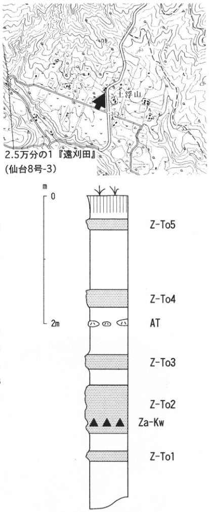
Show extracted lettering and translation
English translation of figure lettering
Location map: 土浮山; 309; 313. 1:25,000 ‘Togatta’ (Sendai sheet 8-3). Columnar section: m; 0; 2 m. From top to bottom: Z-To5, Z-To4, AT, Z-To3, Z-To2, Za-Kw, Z-To1. Columnar section at the observation site (printed immediately below the figure in the source PDF).
Original Japanese lettering
位置図:土浮山;309;313。2.5万分の1『遠刈田』(仙台8号-3)。柱状図:m;0;2m。上からZ-To5,Z-To4,AT,Z-To3,Z-To2,Za-Kw,Z-To1。観察地点柱状図(原PDFの図直下)。
Columnar section at the observation site
TH-22 Holocene widespread tephra beds intercalated in alpine soils on Mount Gassan, Yamagata Prefecture
苅谷愛彦
- Locality: headwaters of Honzawa, Tachikawa Town, Higashitagawa District, Yamagata Prefecture
- Coordinates: N38°32′17″ E140°32′07″
- Elevation: 1,720 m
- Outcrop type and condition: cut along a mountain trail; extant in August 1995
- Deposit type and age: aeolian tephra; Holocene
- Date of description: July 1993
- Keywords: Mount Gassan; alpine soils; Towada-a tephra; Towada-Chuseri tephra; Kikai-Akahoya tephra
Above the timberline on Mount Gassan, soils containing buried muck horizons—alpine wet-meadow soils and alpine grassland soils—are widespread. Vitreous tephra beds intercalated in these soils are useful for establishing the chronology of soil formation and slope development in the subalpine zone of Gassan (苅谷, 1994a, 1994b, 1995; Kariya et al., 1996). This outcrop lies below 大雪城雪渓北田 and is one of the sites where the tephra beds can be observed well. Both Towada-a (To-a) and Towada-Chuseri (To-Cu) are visible to the naked eye here. A horizon enriched in bubble-wall volcanic glass from Kikai-Akahoya tephra (K-Ah) also occurs approximately 5 cm below To-Cu. At the locality marked ■ (苅谷, 1994a, 1995; Kariya et al., 1996), volcanic glass shards thought to derive from Asama-Kusatsu tephra (As-K) or Asama-Itahana Yellow tephra (As-YP) were detected in the sand and gravel underlying the buried muck horizon. To-a and To-Cu are relatively easy to observe at other sites as well, but K-Ah can be distinguished with the naked eye only at favorable sites; As-K (As-YP) can be detected only after washing serially collected samples. For the occurrence and characteristics of tephras at other sites, consult the relevant literature. Pollen analysis of soil samples collected from this outcrop has also recently been attempted (宮本・苅谷, 1996). The outcrop and its surroundings can usually be observed from July through October, but care is needed because the trail is easily lost when snow remains or in dense fog. Sampling also requires prior permission from the relevant authorities.
References: 苅谷 (1994a, 1994b, 1995); Kariya et al. (1996); 宮本・苅谷 (1996); Stuiver and Reimer (1993)
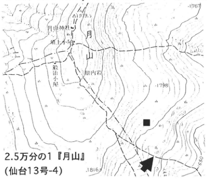
Show extracted lettering and translation
English translation of figure lettering
Gassan; Gassan Shrine (月山神社); summit hut; 胎内岩; 鍛冶小屋; 1979.5; 1767; 1798; 1816; 1650. 1:25,000 ‘Gassan’ (Sendai sheet 13-4). Arrow: the present outcrop. ■: the Asama-tephra detection site described in the text.
Original Japanese lettering
月山;月山神社;頂上小屋;胎内岩;鍛冶小屋;1979.5;1767;1798;1816;1650。2.5万分の1『月山』(仙台13号-4)。矢印:本露頭。■:本文の浅間テフラ検出地点。
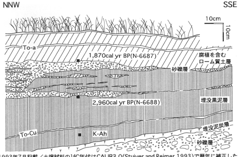
Show extracted lettering and translation
English translation of figure lettering
NNW; SSE; horizontal and vertical scales each 10 cm. To-a; 1,870 cal yr BP (N-6687); humus-bearing loamy soil layer; sand and gravel; 2,960 cal yr BP (N-6688); buried muck horizon; To-Cu; K-Ah; buried peat horizon; sand and gravel. The lower edge of the note is clipped in the extracted image, but the full text is confirmed in the PDF: described in July 1993; the ¹⁴C ages of soil samples were calibrated to calendar years using CALIB3.0 (Stuiver and Reimer, 1993).
Original Japanese lettering
NNW;SSE;縦横各10cm。To-a;1,870cal yr BP (N-6687);腐植を含むローム質土層;砂礫層;2,960cal yr BP (N-6688);埋没黒泥層;To-Cu;K-Ah;埋没泥炭層;砂礫層。図下注の下縁は抽出画像で切れるが原PDFでは全文を確認:1993年7月記載/土壌試料の¹⁴C年代はCALIB3.0 (Stuiver and Reimer, 1993)で暦年に補正した。
Described in July 1993. The ¹⁴C ages of soil samples were calibrated to calendar years using CALIB3.0 (Stuiver and Reimer, 1993).
TH-23 Hijiori-Obanazawa tephra and other tephras of the Obanazawa Basin, Yamagata Prefecture
北村繁
- Locality: Naganeyama, Obanazawa City, Yamagata Prefecture
- Coordinates: N38°35′58″ E140°25′58″
- Elevation: 150 m
- Outcrop type and condition: artificial exposure; condition unknown
- Deposit type and age: aeolian tephra; Late Pleistocene
- Date of description: September 1988
- Keywords: Hijiori Caldera; Hijiori-Obanazawa tephra; Obanazawa Basin; Sarubane surface group; Naganeyama surface
Well-developed terraces occur in the Obanazawa Basin in Yamagata Prefecture. However, detailed correlation and chronology using tephras have not been established for the high Sarubane surface group (最上川団研グループ, 1969; 鈴木, 1985), and much remains for future research. At this outcrop, several tephras deposited on the Naganeyama surface (Sarubane II′ surface) can be observed, including Hijiori-Obanazawa tephra (Hj; 米地・菊地, 1966; 早田, 1989; 八木・早田, 1989). Hj erupted from Hijiori Caldera (杉村, 1952) at 9.5–11 ka (町田 et al., 1984). Here, it occurs immediately beneath the surficial kuroboku soil as somewhat poorly sorted, yellowish-white coarse pumice. In the Obanazawa Basin, Hj blankets the Obanazawa I surface and higher land surfaces. At the locality marked ■ on the outcrop location map, Hj can be seen overlying terrace gravel of the Obanazawa I surface, with flood-deposited clay intervening. Hj has an elongated eastward distribution: pumice reaches approximately 70 km from the source, while fine ash is found even more than 100 km away as a hornblende-rich soil horizon immediately beneath the kuroboku soil (町田・新井, 1992; 吉川, 1979). At this outcrop, somewhat coarse, dark greenish-gray ash also occurs approximately 90 cm below Hj. This ash, approximately 30 cm thick, characteristically contains biotite and cummingtonite, but both its source and correlation remain unknown. Still lower is a matrix-rich pumice-flow deposit inferred to originate from Mukaimachi Caldera (鈴木, 1985). At a separate locality marked ● on the location map, Aira-Tn tephra (AT) has been found in a peat bed formed above the terrace gravel of the Obanazawa I surface (西条・八木, 1990).
References: 町田・新井 (1992); 町田 et al. (1984); 最上川団研グループ (1969); 西城・八木 (1990); 早田 (1989); 杉村 (1952); 鈴木 (1985); 八木・早田 (1989); 米地・菊池 (1966); 吉川 (1979)
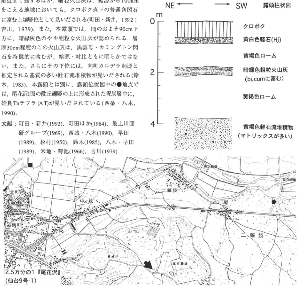
Show extracted lettering and translation
English translation of figure lettering
Column: NE ←, → SW; outcrop columnar section; m; 0, 2, 4. From top to bottom: kuroboku soil; yellowish-white pumice (Hj); yellowish-brown loam; dark green coarse ash (rich in bi, cum); yellowish-brown loam; yellowish-brown pumice-flow deposit (matrix-rich). Map: 北町; 横町; 新町; 中の段; 藤袋; 原; 二藤袋; Naganeyama (長根山); 高宮農場; 108.5; 115.4; 117; 128; 134; 175.2; 150. 1:25,000 ‘Obanazawa’ (Sendai sheet 9-1). The arrow marks the present outcrop; ■ and ● mark the sites described in the text. Two bridge names on the map are [illegible]. Fragments of body text and references at upper left are included in the main text.
Original Japanese lettering
柱状図:NE←,→SW;露頭柱状図;m;0,2,4。上からクロボク;黄白色軽石(Hj);黄褐色ローム;暗緑色粗粒火山灰(bi, cumに富む);黄褐色ローム;黄褐色軽石流堆積物(マトリックスが多い)。位置図:北町;横町;新町;中の段;藤袋;原;二藤袋;長根山;高宮農場;108.5;115.4;117;128;134;175.2;150。2.5万分の1『尾花沢』(仙台9号-1)。矢印は本露頭,■と●は本文記載の地点。地図内の橋名2箇所は[判読不明]。画像左上の本文と文献片は本文に収録。
Reading notes
位置図の橋名2箇所 — 文字が細かく一部潰れていて全名の確定が困難。
TH-24 Middle Holocene widespread tephras along the crest of the Iide Mountains
西城潔
- Locality: southern slope of Mount Iide, Yamato Town, Yama District, Fukushima Prefecture
- Coordinates: N37°50′58″ E139°42′37″
- Elevation: 1,990 m
- Outcrop type and condition: artificial exposure; extant in September 1987
- Deposit type and age: peaty soil and fallout tephra; Holocene
- Date of description: September 1987
- Keywords: Mount Iide; Azuma Ash; Kikai-Akahoya tephra; Towada-Chuseri tephra
Two vitreous tephras occur in peaty to muck-rich soil slightly less than 50 cm thick, exposed along a mountain trail on the southern slope of Mount Iide. The upper tephra is Azuma Ash (Az) of 早田 et al. (1988), and the lower one is Kikai-Akahoya tephra (K-Ah) (西城・小松原, 1988). The former was subsequently confirmed to be Towada-Chuseri tephra (To-Cu) (早田・八木, 1991). Thus, two Middle Holocene widespread tephras, To-Cu and K-Ah, can be observed here. At this outcrop, soil immediately above To-Cu and soil between To-Cu and K-Ah yielded ¹⁴C ages of 3,930±130 yr B.P. (TH-1411) and 5,740±170 yr B.P. (TH-1412), respectively, providing one line of evidence for identifying the tephras (西城・小松原, 1988).
To-Cu here is yellow-orange, slightly less than 1 cm thick, and laterally continuous, making it easy to find. In contrast, K-Ah, situated approximately 4 cm below it, is extremely thin at approximately 1 mm and requires careful observation for recognition. Because K-Ah is white, however, it should be relatively easy to find by first identifying To-Cu and then searching for a white streak in the underlying black soil. To-Cu occurs at many sites along the crest of the Iide Mountains in addition to this outcrop, whereas K-Ah has so far not been confirmed at other sites.
References: 西城・小松原 (1988); 早田・八木 (1991); 早田 et al. (1988)
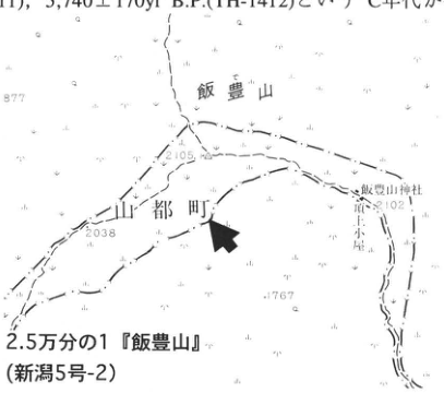
Show extracted lettering and translation
English translation of figure lettering
Mount Iide; Yamato Town; Iide Shrine; 御室小屋; 877; 2105; 2038; 2102; 1767. 1:25,000 ‘Mount Iide’ (Niigata sheet 5-2). Arrow: outcrop location. The body-text fragment along the top edge is included in the main text.
Original Japanese lettering
飯豊山;山都町;飯豊山神社;御室小屋;877;2105;2038;2102;1767。2.5万分の1『飯豊山』(新潟5号-2)。矢印は露頭位置。上端の本文片は本文に収録。
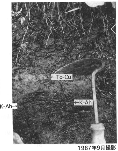
Show extracted lettering and translation
English translation of figure lettering
←To-Cu; ←K-Ah; K-Ah→. Photographed in September 1987.
Original Japanese lettering
←To-Cu;←K-Ah;K-Ah→。1987年9月撮影。
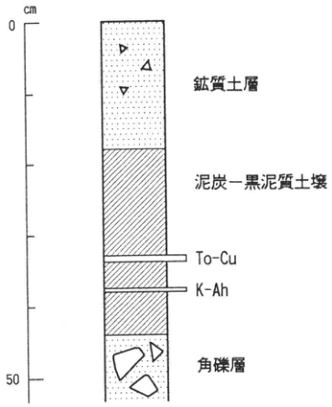
Show extracted lettering and translation
English translation of figure lettering
cm; 0; 50. From top to bottom: mineral soil layer; peaty to muck-rich soil; To-Cu; K-Ah; angular gravel. Caption immediately below: columnar section (modified from 西条・小松原, 1988).
Original Japanese lettering
cm;0;50。上から鉱質土層;泥炭―黒泥質土壌;To-Cu;K-Ah;角礫層。図直下に柱状図(西条・小松原,1988を改変)。
Columnar section (modified from 西条・小松原, 1988)
TH-25 Early Paleolithic artifacts discovered together with widespread tephra —The Takenomori site, Fukushima City—
早田勉 Original p. 164
Editorial note: entry removed from the public edition
The Japan Association for Quaternary Research intentionally removed this entry from its public PDF. Its 2005 notice followed a review of publications associated with the Early and Middle Paleolithic fabrication scandal exposed in November 2000. The notice classified this entry as category B (closely connected analyses) and determined that the affected material must not be used as evidence for Paleolithic research. The public edition implements that decision. This corrected and translated edition retains the title and page number from the original contents and explains the omission; the deleted text has not been reconstructed.
Sources: the Association’s release statement, Quaternary Research Newsletter, vol. 12, no. 3 (2005), pp. 15–16. This note was added for the present edition and is not part of the 1996 text.
TH-26 Tephra beds at the southeastern foot of Bandai Volcano: tephras from Bandai and widespread tephras
鈴木毅彦
- Locality: Hayama, 西猪苗代 Town, Fukushima Prefecture
- Coordinates: N37°33′57″ E140°5′50″
- Elevation: 616 m
- Outcrop type and condition: artificial exposure; extant in October 1995
- Deposit type and age: aeolian tephra; Late Pleistocene
- Date of description: October 1995
- Keywords: Bandai Volcano; tephras from Bandai; Ontake-Nagawa tephra; Aso-4 tephra
Tephras from Bandai Volcano and widespread tephras are well exposed around the volcano, which stands on the northern shore of Lake Inawashiro. These tephras are particularly well preserved on gentle slopes at the southeastern foot of the volcano, northwest of the built-up area of Inawashiro Town, and numerous exposures allow them to be observed. Most of the tephra beds can be seen by combining observations at the Hayama-village outcrop described here with those at the outcrop northwest of the village, marked ■ on the topographic map. The Hayama outcrop is beside a parking area facing an unpaved gravel road. Its most conspicuous tephra is a coarse pumice-fall deposit 120 cm thick in the middle of the face, corresponding to HP2 of 中馬・吉田 (1982). Locally, pink pumice affected by high-temperature oxidation indicates that the material fell and accumulated while still hot, relatively soon after being transported from its source at Bandai Volcano. Below HP2, separated from it by approximately 15 cm of volcanic-ash soil, are clumps of yellow fine ash forming nodules 2–6 cm in diameter. This is a widespread tephra correlated with Ontake-Nagawa tephra (On-Ng) (鈴木 et al., 1995). Approximately 7 cm below it is the horizon of Aso-4 tephra (Aso-4; 86–90 ka). Aso-4 is indistinct to the naked eye, but laboratory analysis confirms that volcanic-ash soil at this horizon contains abundant volcanic glass characteristic of that tephra. At the present exposure, horizons at and above HP2 are difficult to observe because the face is steep. They are better observed at the outcrop northwest of the village marked ■, where HP1 from Bandai and Numazawa-Kanayama tephra (Nm-KN) from Numazawa Caldera in Oku-Aizu can be seen. Many other good exposures occur around Bandai. For details, consult 鈴木 et al. (1995).
References: 中馬・吉田 (1982); 鈴木 et al. (1995)
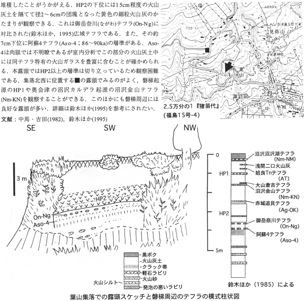
Show extracted lettering and translation
English translation of figure lettering
Map: pasture; 見祢山; Matsudaira family, lords of the Aizu domain; Hanitsu Shrine (土津神社); Hayama; 諏訪前; 町; 葉坂; 722; 685; 680.8; 675; 559. 1:25,000 ‘Inawashiro’ (Fukushima sheet 15-4). The arrow and ■ mark the outcrops described in the text. Some very small map annotations are [illegible]. Sketch: SE, SW, NW; 3 m; HP2; On-Ng; Aso-4. Schematic column: 0, 5 m; HP1, HP2. From top to bottom: Numazawa-Numazawako tephra (Nm-NM); Asama-Futakuchi Ash; Aira-Tn tephra (AT); Daisen-Kurayoshi tephra; Numazawa-Kanayama tephra (Nm-KN); Akagi-Okkai tephra (Ag-OK); Ontake-Nagawa tephra (On-Ng); Aso-4 tephra (Aso-4). Legend: kuroboku soil; volcanic-ash soil; cracked zone; pumice lapilli; volcanic sand; volcanic silt; poorly vesiculated lapilli. After 鈴木 et al. (1985). Outcrop sketch at Hayama village and schematic column of tephras around Bandai. The body-text and reference fragments at upper left are included in the main text.
Original Japanese lettering
位置図:牧場;見祢山;会津藩主松平家;土津神社;葉山;諏訪前;町;葉坂;722;685;680.8;675;559。2.5万分の1『猪苗代』(福島15号-4)。矢印と■は本文記載の露頭。地図の微小な注記の一部は[判読不明]。スケッチ:SE,SW,NW;3m;HP2;On-Ng;Aso-4。模式柱状図:0,5m;HP1,HP2。上から沼沢沼沢湖テフラ(Nm-NM);浅間二口火山灰;姶良Tnテフラ(AT);大山倉吉テフラ;沼沢金山テフラ(Nm-KN);赤城追貝テフラ(Ag-OK);御岳奈川テフラ(On-Ng);阿蘇4テフラ(Aso-4)。凡例:黒ボク;火山灰土;クラック帯;軽石ラピリ;火山砂;火山シルト;発泡の悪いラピリ。鈴木ほか(1985)による。葉山集落での露頭スケッチと磐梯周辺のテフラの模式柱状図。左上に含まれる本文・文献片は本文に収録。
Reading notes
微小な地図注記の一部 — 画素が潰れており判読困難。
Outcrop sketch at Hayama village and schematic column of tephras around Bandai
TH-27 Shirakawa pyroclastic-flow deposits and intercalated volcanic-ash soils: Nishigō and Ashino pyroclastic-flow deposits
鈴木毅彦
- Locality: 金勝寺, Shirakawa City, Fukushima Prefecture; vacant lot beside an Isuzu dealership along National Route 4
- Coordinates: N37°8′11″ E140°12′50″
- Elevation: 360 m
- Outcrop type and condition: artificial exposure; extant in June 1996
- Deposit type and age: pyroclastic-flow deposits and aeolian tephra; Early Pleistocene
- Date of description: June 1996
- Keywords: Shirakawa pyroclastic-flow deposits; Nishigō pyroclastic flow; Ashino pyroclastic flow; 金勝寺 fallout pyroclastic deposits
The Shirakawa pyroclastic-flow group comprises part of a series of large-scale silicic pyroclastic flows emplaced in southern Tohoku during the first half of the Quaternary. 吉田・高橋 (1991) identified five pyroclastic-flow deposits. These deposits form the hills around Shirakawa and can be observed throughout the area. The outcrop described here exposes the Nishigō and Ashino pyroclastic-flow deposits, the third and fourth beds from the top. Both are among the larger units in the Shirakawa pyroclastic-flow group. The gray welded pyroclastic-flow deposit on the right side of the outcrop is the Nishigō deposit, with a distinctive lithology characterized by conspicuous large high-temperature quartz crystals and hornblende. Because it is welded, it is unsuitable for sampling volcanic glass. If necessary, samples should be collected at Nagasaka, approximately 1 km to the northwest (■; the type locality of 吉田・高橋, 1991). The left part of the exposure is the Ashino pyroclastic-flow deposit, which is nonwelded to weakly welded. Both the Nishigō and Ashino deposits show reversed magnetization and are considered to have accumulated during the Early Pleistocene. They have recently also been found in the Kitsuregawa Hills in central Tochigi Prefecture (鈴木・小池, 1994) and are becoming important marker beds for Quaternary chronology in northern Kanto. At this site, volcanic-ash soil (loam) intercalated between the two deposits can also be observed. This layer contains several fallout tephras and is termed the 金勝寺 fallout pyroclastic deposits (吉田・高橋, 1991). Exposures of such Early Pleistocene volcanic-ash soil are rare in Japan. Although somewhat consolidated, it resembles Middle to Late Pleistocene volcanic-ash soil in appearance. It should provide valuable material for discussing the origin, depositional environment, and postdepositional weathering processes of ancient volcanic-ash soils. The welded part of the Ashino pyroclastic-flow deposit is quarried as a building stone called Shirakawa stone; numerous quarries occur around Yorii in Nasu Town, Tochigi Prefecture.
References: 鈴木・小池 (1994); 吉田・高橋 (1991)
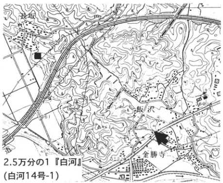
Show extracted lettering and translation
English translation of figure lettering
Nagasaka (長坂); 飯沢; 金勝寺; 365; 361; 360.0; 400; 353.2. 1:25,000 ‘Shirakawa’ (Shirakawa sheet 14-1). Arrow: 金勝寺 outcrop. ■: Nagasaka type locality.
Original Japanese lettering
長坂;飯沢;金勝寺;365;361;360.0;400;353.2。2.5万分の1『白河』(白河14号-1)。矢印:金勝寺露頭。■:長坂の模式地。
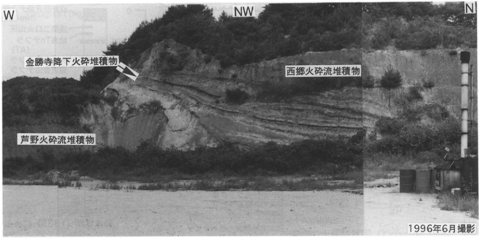
Show extracted lettering and translation
English translation of figure lettering
W; NW; N. 金勝寺 fallout pyroclastic deposits; Nishigō pyroclastic-flow deposit; Ashino pyroclastic-flow deposit. Photographed in June 1996.
Original Japanese lettering
W;NW;N。金勝寺降下火砕堆積物;西郷火砕流堆積物;芦野火砕流堆積物。1996年6月撮影。
4. Kanto Region
KT-1 Edifice-collapse deposits of Nasu Volcano and associated tephras: the Ofuji debris-avalanche deposit and tephras from other sources
鈴木毅彦
- Locality: Chifuri, Nasu Town, Tochigi Prefecture
- Coordinates: N37°4′21″ E140°43′20″
- Elevation: 462 m
- Outcrop type and condition: artificial exposure; extant in June 1996
- Deposit type and age: fallout tephra and debris-avalanche deposit; Late Pleistocene
- Date of description: June 1996
- Keywords: Nasu Volcano; Ofuji debris-avalanche deposit; tephras from Akagi; Ontake-1 tephra
From the Middle Pleistocene through the Holocene, Nasu Volcano repeatedly produced lava flows, fallout tephra and pyroclastic flows, and edifice collapses. At this outcrop in the Takaku Hills at the foot of Nasu Volcano, the Ofuji debris-avalanche deposit (御富士; Ns-Of da), resulting from an edifice collapse at 30–40 ka (藤田, 1988), and Nasu-Ōshima tephra 4 (Ns-Os 4; 30–40 ka; 鈴木, 1992), a product of a sub-Plinian eruption, can be observed along with tephras from other sources. Ns-Of da lies 1–2 m beneath the ground surface and is an unsorted, block-rich deposit approximately 60 cm thick. It extends from Lake Rindō to Kurodahara and forms several hundred hummocks of various sizes. A particularly conspicuous rise called Ofujiyama (御富士山) gives the deposit its name. Few places allow the stratigraphic position of Ns-Of da to be established, making this outcrop, where it can be observed within aeolian loam, especially valuable. Scoria grains of Ns-Os 4 are scattered in volcanic-ash soil several tens of centimeters below Ns-Of da. Beneath them, Akagi-Namekawa tephra (Ag-Nm) occurs as a fine pumice bed approximately 10 cm thick. A further 120–140 cm below it, Ontake-1 tephra (On-Pm 1; 100 ka), 3 cm thick, can be observed, with Nikkō-Mamiana tephra (Nk-MaS) still lower. Because the exposure is becoming weathered with age, the vicinity of On-Pm 1 requires some excavation at the right-hand end of the outcrop for observation (figure). The stratigraphic positions of Daisen-Kurayoshi and Aira-Tn tephras identified at other sites also indicate that Ns-Of da accumulated at 30–40 ka. The edifice collapse that produced this debris-avalanche deposit is thought to have formed an east-facing, horseshoe-shaped, caldera-like landform extending from Kimenzan through Asahidake and Kengamine to Hinodedaira, surrounding the present Chausudake of Nasu Volcano.
References: 藤田 (1988); 鈴木 (1992)
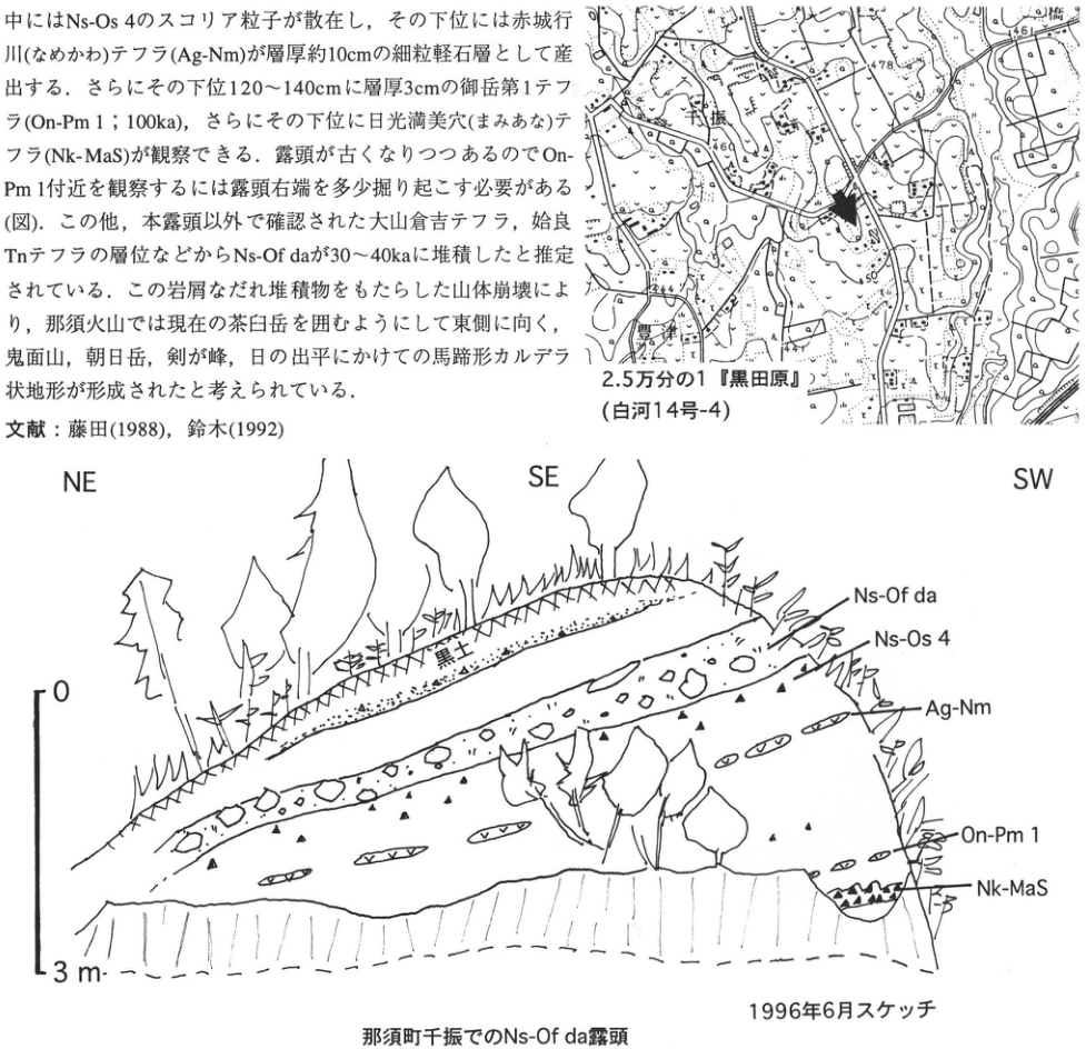
Show extracted lettering and translation
English translation of figure lettering
Map: Chifuri; 豊津; 小橋; 461; 478; 469; 450; 444. 1:25,000 ‘Kurodahara’ (Shirakawa sheet 14-4). Arrow: outcrop location. Sketch: NE, SE, SW; 0, 3 m; black soil; Ns-Of da; Ns-Os 4; Ag-Nm; On-Pm 1; Nk-MaS. Sketched in June 1996. Ns-Of da outcrop at Chifuri, Nasu Town. The body-text and reference fragments at upper left are included in the main text.
Original Japanese lettering
位置図:千振;豊津;小橋;461;478;469;450;444。2.5万分の1『黒田原』(白河14号-4)。矢印は露頭位置。スケッチ:NE,SE,SW;0,3m;黒土;Ns-Of da;Ns-Os 4;Ag-Nm;On-Pm 1;Nk-MaS。1996年6月スケッチ。那須町千振でのNs-Of da露頭。画像左上の本文・文献片は本文に収録。
Ns-Of da outcrop at Chifuri, Nasu Town
KT-2 Late Pleistocene tephras distributed across Nasunohara, Tochigi Prefecture—tephras from Nikko and Akagi volcanoes and widespread tephras
Takehiko Suzuki
- Locality: Higashiakada, Nishinasuno Town, Tochigi Prefecture (in front of Marronnier-en).
- Coordinates: N35°54′30″ E139°58′30″. Elevation: 280 m.
- Outcrop type and condition: artificial exposure; extant in June 1996.
- Deposit type and age: fallout tephras; Late Pleistocene.
- Date described: May 1992.
- Keywords: Nasunohara; tephras from Nikko; tephras from Akagi; Ontake-1 tephra; Aso-4 tephra.
At present this is the best outcrop for observing the Late Pleistocene tephras distributed across northern Tochigi Prefecture. It lies on an isolated remnant of a fluvial terrace in Nasunohara. The observable sequence begins with Nikko-Mamiana Scoria (Nk-MaS), immediately below Ontake-1 tephra (On-Pm1; 100 ka), and extends upward. Nk-MaS lies about 1 m above the base of the exposure and is a roughly 40 cm thick tephra layer of reddish-brown scoria. On-Pm1 immediately overlies MaS, and a roughly 10 cm thick Aso-4 tephra layer is exceptionally well preserved 60 cm above it. This was probably protected by the immediately overlying Nikko-Higashiakada tephra (Nk-Hg). Immediately above Nk-Hg, the thin Ontake-Nagawa tephra (On-Ng) can be observed in places. From this horizon toward the surface, widespread tephras can be observed, including Daisen-Kurayoshi (DKP), which has formed nodules, and Aira-Tn (AT), occurring as a concentration of volcanic glass in volcanic-ash soil. Tephras from Akagi volcano can also be observed, including Akagi-Okkai (Ag-OK), Akagi-Namekawa (Ag-Nm), and Akagi-Kanuma (Ag-KP). Thus the outcrop provides evidence of past volcanic eruptions in various parts of northern Kanto, and their approximate eruption ages can be determined from their stratigraphic relationships with widespread tephras. Civil engineering work has been active in the surrounding area since the late 1980s, so new exposures are likely to appear. Tephras below Nk-MaS can also be observed at the locality marked ■ on the location map (a column is given in Suzuki, 1993).
References: Suzuki (1993); Suzuki et al. (1995).
Show extracted lettering and translation
English translation of figure lettering
1:25,000 Nishinasuno sheet (Nikko sheet 3-2). Horihara-machi (堀原町); Higashiakada; Regional Horse-Racing Training Center. Legible elevations and contours: 298, 285.6, 285.0, 280, 281.9, 272. Arrow: main outcrop; ■: supplementary outcrop.
Original Japanese lettering
2.5万分の1「西那須野」(日光3号-2)。堀原町、東赤田、地方競馬教養センター。標高・等高線の可読値:298、285.6、285.0、280、281.9、272。矢印:主露頭;■:補完露頭。
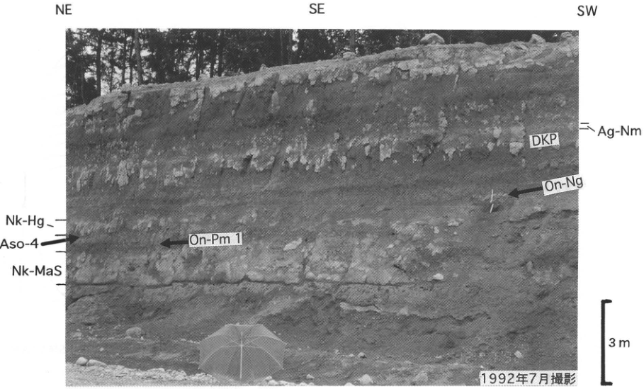
Show extracted lettering and translation
English translation of figure lettering
Directions: NE, SE, SW. Layer labels: Ag-Nm, DKP, On-Ng, Nk-Hg, Aso-4, On-Pm 1, Nk-MaS. Scale: 3 m. Photographed in July 1992.
Original Japanese lettering
方位:NE、SE、SW。層名:Ag-Nm、DKP、On-Ng、Nk-Hg、Aso-4、On-Pm 1、Nk-MaS。スケール:3 m。1992年7月撮影。
KT-3 Middle to Late Pleistocene tephras covering the Kitsuregawa Hills, northern Kanto—one of Japan's oldest eolian tephra sequences
Takehiko Suzuki
- Locality: Yoshii (芳井), Ogawa Town, Tochigi Prefecture.
- Coordinates: N36°46′30″ E140°3′40″. Elevation: 210 m.
- Outcrop type and condition: former large borrow pit; extant in December 1995.
- Deposit type and age: fallout tephras and volcanic-ash soil; Middle to Late Pleistocene.
- Date described: April 1994.
- Keywords: Kitsuregawa Hills; Sakaibayashi Gravel (境林礫層); tephras from Nikko; tephras from Akagi; Hoshitoge Biotite (法師峠黒雲母).
The Kitsuregawa Hills consist of alluvial-fan gravel called the Sakaibayashi Gravel (境林礫層), whose deposition ended in the early Middle Pleistocene or at the end of the Early Pleistocene, and more than 40 m of overlying eolian deposits. This outcrop, about 30 km northeast of Utsunomiya and about 40 km east of the Nikko volcanic group, is one of the few valuable exposures where most of this eolian sequence can be observed. The principal tephra layers visible to the naked eye are, from top downward, Nantai-Ogawa (Nt-Og; 20 ka), Akagi-Kanuma (Ag-KP; 31–32 ka), Akagi-Namekawa-1 (Ag-Nm1) and -2 (Ag-Nm2), Daisen-Kurayoshi (DKP; 50 ka), Aso-4 (87–90 ka), Akagi-Mizunuma-6 (Ag-MzP6), Nikko-Mamiana (Nk-MaS), Nikko-Saotome (Nk-So), Nikko-Namekawa (Nk-Nm), Nikko-Yaita (Nk-Yt), Nasuno (NsP), APm-U, Takaku (TkP), Moka (MoP), Kurodahara (KdP), the Otawara pyroclastic-flow deposit (Ot pfl), Nm-14, Nm-16, Hoshinomiya (HoP), Sakuyama (SkP), and Hoshitoge Biotite (法師峠黒雲母) (HtB). They range from tephras derived from volcanoes in northern Kanto to widespread tephras. Fission-track ages of 570±80, 500±90, and 830±70 ka have been obtained for Nm-14, Nm-16, and HtB, respectively (Koike et al., 1985). On the basis of these ages, an almost continuous eolian sequence from about 0.8 Ma to the present can be observed here. However, recently redetermined fission-track ages for Nm-14 and HtB are 0.29±0.05 ka and 0.65±0.07 ka, respectively, younger than the previous values (Suzuki et al., 1996). In any event, this exposure alone permits observation of eolian deposits spanning at least the past roughly 600,000 years, making it extremely valuable for Quaternary research.
There are many research topics associated with this outcrop. One is the geological circumstances under which this continuous eolian sequence extending back to such an early time has been preserved. The Kitsuregawa Hills lie inland: have they survived erosion through a balance between a moderate degree of crustal movement, river behavior, and other factors? This should provide a useful example for discussing the formation of Japan's hilly terrain. Another topic is the origin of volcanic-ash soil and the relationships between its various properties and paleoenvironmental changes. On China's Loess Plateau, paleoclimatic fluctuations throughout the Quaternary are known to be recorded in loess; is this also the case for volcanic-ash soil covering extensive parts of the Japanese archipelago? Testing this requires investigation in areas where volcanic-ash soil representing as long a period as possible has been preserved. This outcrop is suitable in that respect, and Yoshinaga et al. (1995) measured temporal changes in the amount of fine quartz deposited. In particular, at nearby Saotome in Kitsuregawa Town, a close relationship has been found between Late Pleistocene glacial–interglacial cycles and the accumulation rate of fine quartz in volcanic-ash soil (Yoshinaga, 1996). Such investigations also require greater precision and accuracy in the ages of individual tephra layers. As noted above, however, sufficiently precise ages are not yet available for the Middle Pleistocene. This remains an important task for advancing tephrochronology in northern Kanto.
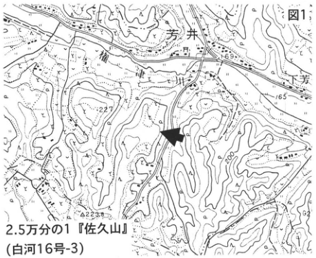
Show extracted lettering and translation
English translation of figure lettering
Figure 1. 1:25,000 Sakuyama sheet (Shirakawa sheet 16-3). Yoshii (芳井); Shimo-Yoshii (下芳井; partly cropped at right); Gongen-yama (権現山). Elevations and contours: 169, 165, 227, 200, 223.8.
Original Japanese lettering
図1。2.5万分の1「佐久山」(白河16号-3)。芳井、下芳井(右端は一部切れる)、権現山。標高・等高線:169、165、227、200、223.8。
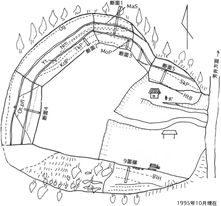
Show extracted lettering and translation
English translation of figure lettering
Section 1: MaS. Around section 2: Og, Nm, TkP, Yt, KdP. Section 3: MoP. Section 4: Ot.pfl. Section 5: SkP, HtB. Section 6: HtB. Arrow: toward Yoshii (芳井). Dog beside house; orientation arrow. As of October 1995.
Original Japanese lettering
断面1:MaS。断面2付近:Og、Nm、TkP、Yt、KdP。断面3:MoP。断面4:Ot.pfl。断面5:SkP、HtB。断面6:HtB。芳井方面(矢印)、犬(民家脇)、方位矢印。1995年10月現在。
Figure 2. Sketch plan of the outcrop.
KT-3 (continued)
The large size of the outcrop may make it difficult to decide where to begin, but the following order permits efficient observation from the upper to the lower horizons. The sequence from the surface down to KdP can be observed in section 1 on the northern wall. DKP, Aso-4, NsP, and APm-U are thin layers, so locating them may take some time. The sequence from MoP to a horizon slightly above Ot pfl can be observed on the eastern wall (section 3), but conditions are rather poor because these eolian deposits mantle a slope. An approximately 5 m gap appears to remain down to Ot pfl. This interval can be observed at Nemoto, Ujiie Town, 10 km south-southwest of the present outcrop, although vegetation is becoming dense with the passage of time.
The sequence from Ot pfl through Nm-14 and Nm-16 to 1–2 m above HoP can be observed on the southwestern wall (wall 4). No tephra layer in this interval stands out from a distance. In particular, its lower part consists of strongly clay-altered volcanic-ash soil with several dark bands. The sequence below HoP down to HtB can be observed on the wall near the house (section 5). Several characteristic, strongly weathered pumice layers occur. HtB is the easiest to identify because it contains abundant biotite. In section 5, HtB is covered by talus at the base of the exposure and requires some excavation. Here it is about 10 cm thick. The vicinity of HtB can also be observed on the southern wall (section 6), although the slightly inclined exposure face makes observation difficult. There the Sakaibayashi Gravel appears from about 150 cm below HtB. Detailed information on the tephras at and above KdP at this exposure is provided in Suzuki (1993); the columns in that paper are useful for reference. Petrographic characteristics are also described.
References: Suzuki (1993); Suzuki et al. (1996); Koike et al. (1985); Yoshinaga (1996); Yoshinaga et al. (1995).
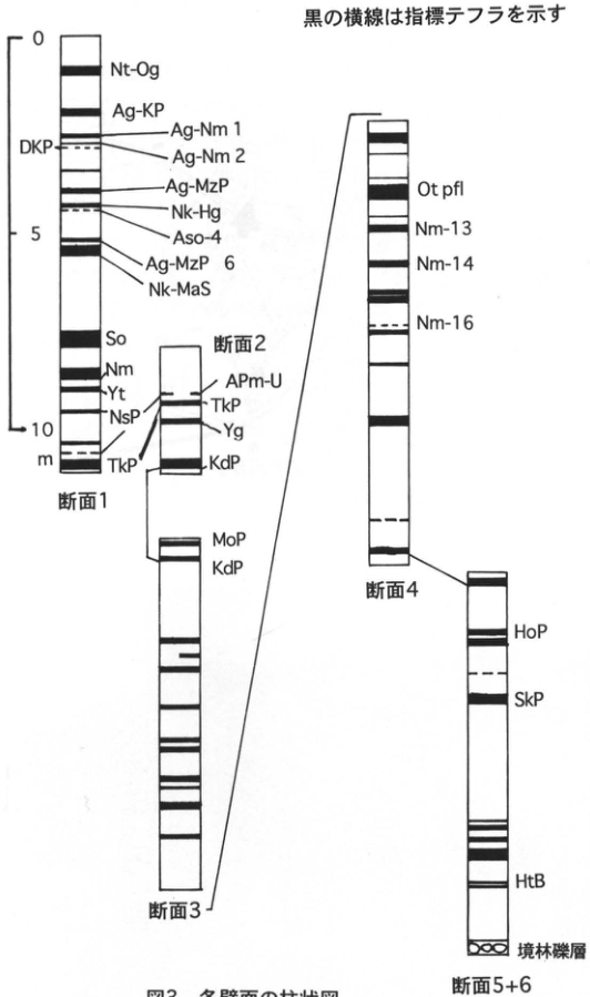
Show extracted lettering and translation
English translation of figure lettering
Black horizontal bars indicate marker tephras. Left-hand scale: 0, 5, 10 m.
| Section | Legible layer labels, top to bottom |
|---|---|
| Section 1 | Nt-Og, Ag-KP, Ag-Nm 1, Ag-Nm 2, DKP, Ag-MzP, Nk-Hg, Aso-4, Ag-MzP 6, Nk-MaS, So, Nm, Yt, NsP, TkP |
| Section 2 | APm-U, TkP, Yg, KdP |
| Section 3 | MoP, KdP |
| Section 4 | Ot pfl, Nm-13, Nm-14, Nm-16 |
| Sections 5+6 | HoP, SkP, HtB, Sakaibayashi Gravel (境林礫層) |
Lines connect corresponding horizons between sections 1 and 2, 2 and 3, 3 and 4, and 4 and 5+6.
Original Japanese lettering
黒の横線は指標テフラを示す。左側スケール:0、5、10 m。
| 断面 | 上から下への可読層名 |
|---|---|
| 断面1 | Nt-Og、Ag-KP、Ag-Nm 1、Ag-Nm 2、DKP、Ag-MzP、Nk-Hg、Aso-4、Ag-MzP 6、Nk-MaS、So、Nm、Yt、NsP、TkP |
| 断面2 | APm-U、TkP、Yg、KdP |
| 断面3 | MoP、KdP |
| 断面4 | Ot pfl、Nm-13、Nm-14、Nm-16 |
| 断面5+6 | HoP、SkP、HtB、境林礫層 |
断面1と2、2と3、3と4、4と5+6の対応層準を線で接続。
Figure 3. Stratigraphic columns of the exposure walls.
KT-4 Eolian tephra layers around Utsunomiya, Tochigi Prefecture—a reference section for tephras in eastern northern Kanto
Takehiko Suzuki
- Locality: Kamikake-machi, Utsunomiya City, Tochigi Prefecture.
- Coordinates: N36°32′40″ E139°50′7″. Elevation: 140 m.
- Outcrop type and condition: behind a materials depot; partly vegetated; may disappear.
- Deposit type and age: fallout tephras; Middle to Late Pleistocene.
- Date described: October 1995.
- Keywords: Utsunomiya; tephras from Akagi; Akagi-Kanuma tephra; Moka tephra; Tawara Loam; Takaragi Loam; Hoshakuji Loam.
In the tephra research in Kanto synthesized in Kanto Loam (Kanto Loam Research Group, 1965), the Utsunomiya area was one of the northern Kanto regions investigated intensively. Its eolian deposits were divided, from top downward, into the Tawara, Takaragi, and Hoshakuji Loam formations, which were correlated respectively with the Tachikawa, Musashino, and Shimosueyoshi Loam formations of southern Kanto. Each loam formation near Utsunomiya contains conspicuous marker tephras. Almost all of these principal layers can be observed at the Kamikake outcrop described here and at a nearby supplementary exposure. Kamikake was formerly a large outcrop, but its western half is now a collection and delivery center and its eastern half a materials depot. The observation point is along the sloping road beside the depot. Akagi-Kanuma tephra (Ag-KP; 32 ka), 1.5 m thick, is easily found 1.5 m below the ground surface. The underlying tephras are less well developed, so the columns in Suzuki (1990a) or Suzuki (1993) are useful for comparison. Useful markers are Nikko-Mamiana tephra (Nk-MaS), composed of reddish-brown scoria about 4 m below Ag-KP, and Akagi-Mizunuma-9 and -10 tephras (Ag-MzP9 and 10), composed of somewhat coarse pumice 170 cm below Nk-MaS. Representative tephras of northern Kanto, including Haruna-Hassaki (Hr-HP), Akagi-Yunokuchi (Ag-UP), and Akagi-Mizunuma-1 (Ag-MzP1), can be observed between Nk-MaS and Ag-KP. At the depot, observation extends only down to the vicinity of Nikko-Yaguchi tephra (Nk-YG). Lower horizons can be observed at the locality marked ■, where Moka tephra (MoP), about 100 cm thick, occurs in the middle of the exposure wall.
Note: As of late May 1996, the exposure at the materials depot has been cut away at and above Ag-KP, and the wall has retreated substantially.
References: Akutsu (1957); Kanto Loam Research Group (1965); Suzuki (1990a, 1993).
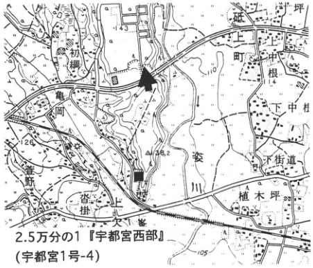
Show extracted lettering and translation
English translation of figure lettering
1:25,000 Utsunomiya-Seibu sheet (Utsunomiya sheet 1-4). Kamikake-machi (上欠町), Shimo-Nakamura (下中村), 植木坪, 根, 亀岡, 下街道, Sugata River (姿川), 上欠, 沓掛, 荒針街道 (partly cropped at left). Elevations and contours: 143, 140, 126, 148.2, 120, 114, 110, 105. Arrow: main outcrop; ■: supplementary outcrop.
Original Japanese lettering
2.5万分の1「宇都宮西部」(宇都宮1号-4)。上欠町、下中村、植木坪、根、亀岡、下街道、姿川、上欠、沓掛、荒針街道(左縁は一部切れる)。標高・等高線:143、140、126、148.2、120、114、110、105。矢印:主露頭;■:補完露頭。
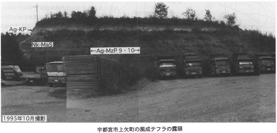
Show extracted lettering and translation
English translation of figure lettering
Ag-KP (arrow); Nk-MaS; ←Ag-MzP 9 and 10→. Photographed in October 1995.
Original Japanese lettering
Ag-KP(矢印)、Nk-MaS、←Ag-MzP 9・10→。1995年10月撮影。
Eolian tephra outcrop in Kamikake-machi, Utsunomiya City.
KT-5 Tephras in the upper member of the Miwa Formation forming the Naka Upland on the Joban coast—marker beds for the last interglacial
Takehiko Suzuki
- Locality: Nagasuna, Hitachinaka City, Ibaraki Prefecture.
- Coordinates: N36°0′21″ E140°35′13″. Elevation: 30 m.
- Outcrop type and condition: artificial exposure; extant.
- Deposit type and age: marine sand; AW-type tephras; Late Pleistocene.
- Date described: November 1986.
- Keywords: Joban coast; Naka Upland; upper member of the Miwa Formation; Miwa upper, middle, and lower pumice beds; Hakone-Kissawa lower tephra 7; tephras from Akagi.
At the northeastern extremity of the Kanto Plain, the Naka Upland is an extensive upland between the Kuji and Naka rivers, extending northwest–southeast at elevations of 25–55 m. Sakamoto (1972) called its constituent marine sand the upper member of the Miwa Formation, interpreted it as a deposit of the maximum Shimosueyoshi transgression, and correlated the upland surface itself with the Shimosueyoshi surface in southern Kanto. This correlation, however, was based on the continuity of land surfaces and marine deposits toward the Shimosa Upland rather than on marker beds such as tephra. Suzuki (1989) found three tephra layers in the upper part of the upper Miwa member and correlated one with Hakone-Kissawa lower tephra 7 (Hk-KlP7; Machida and Arai, 1992), erupted during the regression in the latter part of marine oxygen-isotope stage (MIS) 5c. On this basis, he regarded the upper member of the Miwa Formation as marine sand of the last interglacial maximum (MIS 5e). Named the Miwa middle pumice bed (Miwa-M), this tephra occurs at the present type outcrop as a 2 cm thick layer of white fine-grained pumice. Additional white fine-grained pumice layers, each 5 cm thick, occur above and below it. These were named the Miwa upper and lower pumice beds (Miwa-U and Miwa-L), respectively, and were subsequently correlated with tephras from Akagi volcano, Akagi-Mizunuma-8a and -9 and -10 (Ag-MzP8a and Ag-MzP9 and 10; Suzuki, 1990a). All are AW-type tephras within sand. Their preservation depends on subtle differences in depositional conditions, so finding all three together in this way is unusual. This makes the exposure valuable for determining the age of formation of the Naka Upland.
References: Machida and Arai (1992); Sakamoto (1972); Suzuki (1989, 1990a).
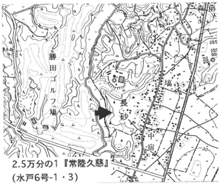
Show extracted lettering and translation
English translation of figure lettering
1:25,000 Hitachi-Kuji sheet (Mito sheets 6-1 and 6-3). Nagasuna; Katsuta Golf Course; 宿; 高場 (around the map label 高); 新原 (partly cropped at upper right). Legible contour and elevation values: 30, 42.5.
Original Japanese lettering
2.5万分の1「常陸久慈」(水戸6号-1・3)。長砂、勝田ゴルフ場、宿、高場(地図表記「高」付近)、新原(右上、一部切れる)。等高線・標高の可読値:30、42.5。
Reading notes
高場、新原 — 小さな地名文字の一部が図縁で切れており、読みに不確実性がある。
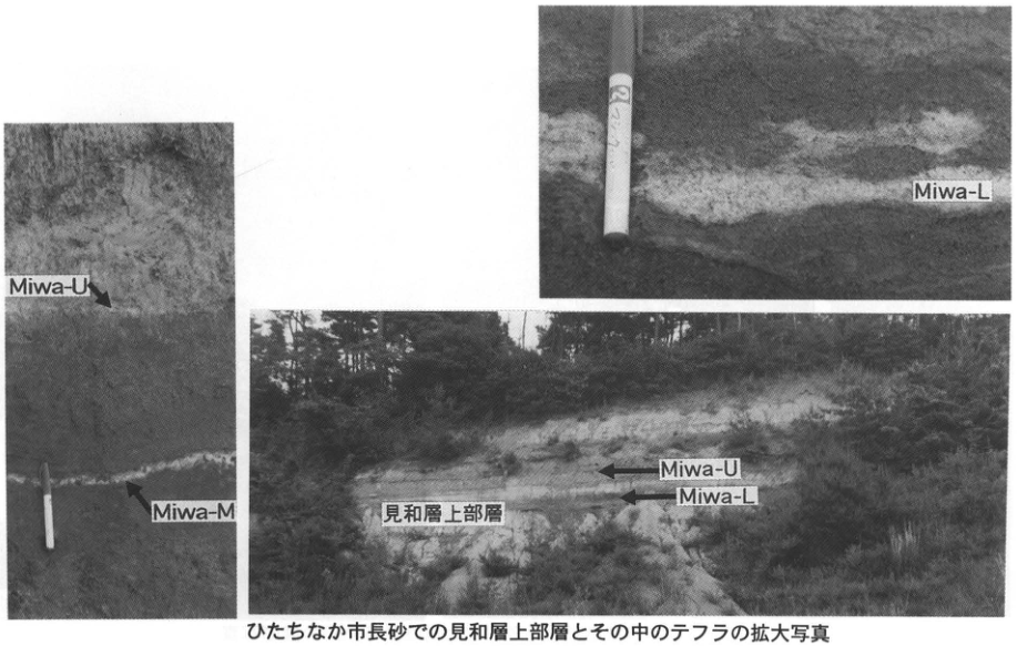
Show extracted lettering and translation
English translation of figure lettering
Left close-up: Miwa-U and Miwa-M (arrows). Upper-right close-up: Miwa-L. Lower-right overview: upper member of the Miwa Formation; Miwa-U and Miwa-L (arrows).
Original Japanese lettering
左拡大像:Miwa-U、Miwa-M(矢印)。右上拡大像:Miwa-L。右下全景:見和層上部層、Miwa-U、Miwa-L(矢印)。
Upper member of the Miwa Formation at Nagasuna, Hitachinaka City, and enlarged photographs of the tephras within it.
KT-6 Tephra in fluvial gravel filling a buried valley beneath the Higashi-Ibaraki Upland—Moka tephra intercalated in the middle member of the Miwa Formation
Takehiko Suzuki
- Locality: Shimo-Irino, Tsunezumi Village, Ibaraki Prefecture (south of Yugoya hot spring).
- Coordinates: N36°17′57″ E140°30′49″. Elevation: 15 m.
- Outcrop type and condition: gravel quarry; disappeared.
- Deposit type and age: fluvial gravel filling a buried valley; AW-type tephra; Middle Pleistocene.
- Date described: July 1987.
- Keywords: Joban coast; Higashi-Ibaraki Upland; middle member of the Miwa Formation; Moka tephra.
The Higashi-Ibaraki Upland, between the Naka and Hinuma rivers in the northeastern Kanto Plain, is regarded as a marine surface that emerged between the last interglacial maximum and 75–80 ka (Suzuki, 1989). Two buried valleys of different ages are known beneath this upland. Silt to mud filling the deeper, older valley was called the lower member of the Miwa Formation, while fluvial gravel filling the shallower, relatively younger valley was called the middle member (Sakamoto, 1972). The former valley was interpreted as having formed during the maximum low sea-level phase preceding the last interglacial, while the valley filled by the middle Miwa member formed during a temporary sea-level stillstand in the subsequent transgression. Tephras intercalated in these deposits should help add a time scale to this geomorphic history. Indeed, Suzuki (1989) found Moka tephra (MoP), widely distributed near Utsunomiya, in the middle member of the Miwa Formation. Its fallout age, however, is still poorly known. Based on Sakamoto's (1972) interpretation and the geomorphic development, Suzuki (1990a) estimated an age younger than 200 ka but older than the last interglacial. Another view gives MoP an older age (Suzuki, 1993), so its age cannot yet be regarded as settled. Determining the age of MoP is also an important future task for elucidating the Quaternary geological history of the northern Kanto coast. The outcrop photographs shown here were taken in July 1987; the exposure has now disappeared. Because MoP occurs within gravel, its probability of preservation is generally low. In this case it happened to survive as redeposited material in a sand lens within the gravel. However, gravel extraction has created extensive large exposures nearby, so new, good exposures may appear.
References: Sakamoto (1972); Suzuki (1989, 1990a, 1993).
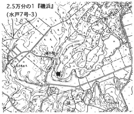
Show extracted lettering and translation
English translation of figure lettering
1:25,000 Isohama sheet (Mito sheet 7-3). Shimo-Irino; Yugoya; 後谷. Elevations and contours: 30, 28.8, 25, 26, 28.5. ■: outcrop.
Original Japanese lettering
2.5万分の1「磯浜」(水戸7号-3)。下入野、湯小屋、後谷。標高・等高線:30、28.8、25、26、28.5。■:露頭。
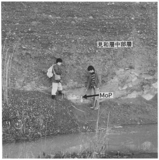
Show extracted lettering and translation
English translation of figure lettering
Middle member of the Miwa Formation. MoP (arrow).
Original Japanese lettering
見和層中部層。MoP(矢印)。
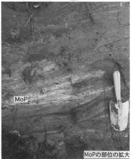
Show extracted lettering and translation
English translation of figure lettering
MoP. Enlargement of the part containing MoP.
Original Japanese lettering
MoP。MoPの部位の拡大。
Outcrop photographs of the middle member of the Miwa Formation and the MoP within it.
KT-7 Latest Pleistocene tephra layers in the Shimo-Oshima Formation of the Sakuragawa Lowland, Ibaraki Prefecture
Masaaki Suzuki
- Locality: left-bank lowland of the Sakuragawa River at Shimo-Oshima, Tsukuba City, Ibaraki Prefecture.
- Coordinates: N36°07′58″ E140°08′04″. Elevation: 9 m.
- Outcrop type and condition: artificial exposure; disappeared.
- Deposit type and age: eolian tephras; Late Pleistocene.
- Date described: December 1980.
- Keywords: Tsukuba; Sakuragawa Lowland; tephras from Asama; Asama-Itahana Brown tephra; Asama-Itahana Yellow tephra; Aira-Tn tephra; alluvial deposits.
This artificial exposure was created during drainage-channel construction associated with land improvement in fiscal 1980 at Shimo-Oshima, Tsukuba City, in the middle Sakuragawa Lowland, Ibaraki Prefecture. At its base was the Shimo-Oshima Gravel (SG), correlated with the basal gravel of the alluvial deposits (BG). This gravel accumulated on the floor of a valley incised into a terrace surface bearing eolian Tachikawa-stage loam containing Aira-Tn tephra (AT) and Akagi-Kanuma Pumice (Ag-KP). Above the gravel, the exposure showed fine sand with lenticular peat beds, then peat, tuffaceous silt, and a thin eolian tephra layer at the top. Endo et al. (1983) named this sequence the Shimo-Oshima Formation. Eight white fine-grained volcanic-ash layers were recognized in its peat and named SK-1 through SK-7, from bottom upward. SK-1 consists almost entirely of bubble-wall volcanic glass with refractive indices of 1.499–1.501 (1.500), and is therefore correlated with AT extending from the terrace surface. Orthopyroxene in SK-2 through SK-4 has refractive indices varying over 1.700–1.710, so these layers are correlated with members of the Asama-Itahana Brown tephra (As-BP) group, which Nakazawa et al. (1984) regarded as comprising several tephras. Similarly, SK-4′ through SK-7 are correlated with members of the Asama-Itahana Yellow tephra (As-YP) group because their orthopyroxene refractive indices range from 1.704 to 1.711. Pollen fossils indicating coniferous forest vegetation occur in horizons dated to 17–21 ka. The formation is therefore extremely important as a continuous record of environmental change during the coldest phase of the last glacial period and from the periods around it onward.
References: Endo et al. (1983); Nakazawa et al. (1984); Suzuki et al. (1993).
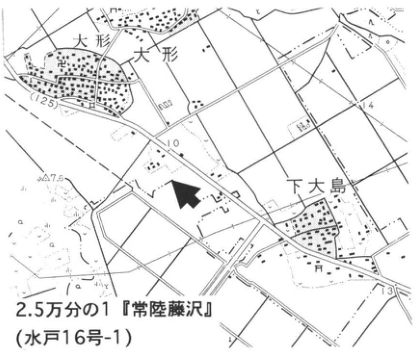
Show extracted lettering and translation
English translation of figure lettering
1:25,000 Hitachi-Fujisawa sheet (Mito sheet 16-1). 大形 (two labels); Shimo-Oshima. Elevations and contours: 12.5, 10, 7.6, 14, 13. Arrow: outcrop.
Original Japanese lettering
2.5万分の1「常陸藤沢」(水戸16号-1)。大形(2箇所)、下大島。標高・等高線:12.5、10、7.6、14、13。矢印:露頭。
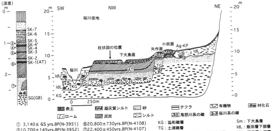
Show extracted lettering and translation
English translation of figure lettering
Column (depth in m): 0, 1, 2. From top downward: SK-7, SK-6, SK-5, SK-4′, SK-4, SK-3, SK-2, SK-1 (AT), SG (BG). Dated-sample positions ③–⑦ are shown. Section directions: SW, NW, NE. Elevation scales, m: 0, 5, 10, 15, 20 on both sides. Horizontal scale: 0–250 m. Sakuragawa Lowland; position of column (arrow); Shimo-Oshima surface; Yahagi surface (矢作面); Oda surface; Sakuragawa River. Unit codes: AT, Ag-KP, Sm, IdU, IdL, SG, TKG, TG, KG. Dated-sample positions ①, ②, ⑧, ⑨, ⑩. Legend: topsoil; loam; tuffaceous silt; peat; sand; silt; tephra; gravel of the Kinugawa system; organic matter; gravel of the Sakuragawa system; fossil wood.
| Number | Age (yrs.BP) | Sample number |
|---|---|---|
| ① | 3,140±65 | N-3951 |
| ② | 10,700±145 | N-3952 |
| ③ | 16,700±255 | N-4111 |
| ④ | 18,100±340 | N-4110 |
| ⑤ | 20,300±345 | N-4109 |
| ⑥ | 20,800±730 | N-4108 |
| ⑦ | 22,400±450 | N-4107 |
| ⑧ | 28,400±680 | N-3953 |
| ⑨ | 5,550±170 | Gak-10030 |
| ⑩ | 6,860±180 | Gak-10031 |
KG: Kyowa Gravel (協和礫層). TG: Tsuchiura Gravel. SG: Shimo-Oshima Gravel (basal gravel of the alluvial deposits: BG). TKG: Tsukada Sand and Gravel (basal gravel of the Holocene deposits: HBG). Sm: Shimo-Oshima Formation. IdL: lower member of the Iida Formation. IdU: upper member of the Iida Formation. AT: Aira-Tn volcanic ash. Ag-KP: Akagi-Kanuma Pumice. Suzuki et al. (1993).
Original Japanese lettering
柱状図(深度m):0、1、2。上から:SK-7、SK-6、SK-5、SK-4′、SK-4、SK-3、SK-2、SK-1(AT)、SG(BG)。年代採取番号③~⑦を図示。 断面方位:SW、NW、NE。標高目盛m:0、5、10、15、20(左右)。水平スケール:0–250m。桜川低地、柱状図の位置(矢印)、下大島面、矢作面、小田面、桜川。層符号:AT、Ag-KP、Sm、IdU、IdL、SG、TKG、TG、KG。年代採取番号①、②、⑧、⑨、⑩。 凡例:表土、ローム、凝灰質シルト、泥炭、砂、シルト、テフラ、鬼怒川系の礫、有機物、桜川系の礫、材化石。
| 番号 | 年代値(yrs.BP) | 試料番号 |
|---|---|---|
| ① | 3,140±65 | N-3951 |
| ② | 10,700±145 | N-3952 |
| ③ | 16,700±255 | N-4111 |
| ④ | 18,100±340 | N-4110 |
| ⑤ | 20,300±345 | N-4109 |
| ⑥ | 20,800±730 | N-4108 |
| ⑦ | 22,400±450 | N-4107 |
| ⑧ | 28,400±680 | N-3953 |
| ⑨ | 5,550±170 | Gak-10030 |
| ⑩ | 6,860±180 | Gak-10031 |
KG:協和礫層。TG:土浦礫層。SG:下大島礫層(沖積層基底礫層:BG)。TKG:塚田砂礫層(完新統基底礫層:HBG)。Sm:下大島層。IdL:飯田層下部層。IdU:飯田層上部層。AT:姶良Tn火山灰。Ag-KP:赤城鹿沼軽石。鈴木ほか(1993)。
Reading notes
抽出画像下端で切れる年代表・凡例 — 原PDFレンダーの下部を拡大実見し、全10年代値と全地層凡例を補完した。
KT-8 The eruption history of Akagi volcano revealed by tephras—Plinian pumice-fall deposits at Mizunuma on the southeastern foot
Takehiko Suzuki
- Locality: Shimizu, Mizunuma, Kurohone Village, Gunma Prefecture.
- Coordinates: N36°30′5″ E139°16′51″ (locality 1); N36°30′26″ E139°16′37″ (locality 2).
- Elevation: 440 m (locality 1); 470 m (locality 2).
- Outcrop type and condition: artificial exposure along an irrigation channel (locality 1); natural exposure (locality 2).
- Deposit type and age: fallout tephras; alluvial-fan deposits at the volcano's foot; Late Pleistocene.
- Date described: May 1996.
- Keywords: tephras from Akagi; Akagi-Kanuma tephra; Akagi-Yunokuchi tephra; Akagi-Mizunuma tephra group; Ontake-1 tephra.
Akagi, at the northwestern extremity of the Kanto Plain, is a large Quaternary stratovolcano. Gentle footslopes extending between the five-o'clock and eleven-o'clock directions around its central caldera give it a simple lower topography. From its middle slopes upward, however, the topography is complex, with a caldera, lava domes, and crater-floor lakes. These volcanic landforms were produced by prolonged activity of various styles, whose history was described in detail by Moriya (1968). Moriya (1979) subsequently discussed regularities in the geomorphic development of Japan's Quaternary stratovolcanoes, using the formation history of Akagi as a representative example. Although the volcano's development has thus long been studied, only an outline was known of its explosive eruption history, namely its tephras. Recently, however, stratigraphic relationships between tephras from Akagi and widespread tephras have gradually been clarified, allowing construction of an eruption history incorporating specific ages (Suzuki, 1990a). The uplands around Mizunuma, formed by terracing of alluvial fans on Akagi's southeastern foot, are suitable for compiling this history. More than 20 m of eolian deposits can be observed here, containing pumice-fall layers produced by numerous Plinian eruptions and tephra layers from other volcanoes. The principal layers, from top downward, are Akagi-Mizunuma lithic fallout pyroclastic deposit (Ag-CLP), Akagi-Kanuma tephra (Ag-KP; 31–32 ka), Haruna-Hassaki tephra (Hr-HP; 41–44 ka), Akagi-Yunokuchi tephra (Ag-UP), Akagi-Namekawa-1 and -2 tephras (Ag-Nm1–2), and the Akagi-Mizunuma tephra (pumice) group (Ag-MzP1–16). Widespread tephras including Daisen-Kurayoshi (DKP), Aso-4, Ontake-1 (On-Pm1), and Tateyama-D (Tt-D) occur between them. All these tephras cannot be observed together at a single locality. Here, two outcrops around Mizunuma and one supplementary outcrop are introduced.
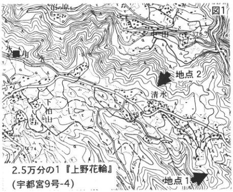
Show extracted lettering and translation
English translation of figure lettering
Figure 1. 1:25,000 Kozuke-Hanawa sheet (Utsunomiya sheet 9-4). Localities 1 and 2 (arrows); Mizunuma; Shimizu; 下神山. Legible elevations and contours: 376, 450, 400, 500, 700, 600, 744.
Original Japanese lettering
図1。2.5万分の1「上野花輪」(宇都宮9号-4)。地点1、地点2(矢印)、水沼、清水、下神山。可読標高・等高線:376、450、400、500、700、600、744。
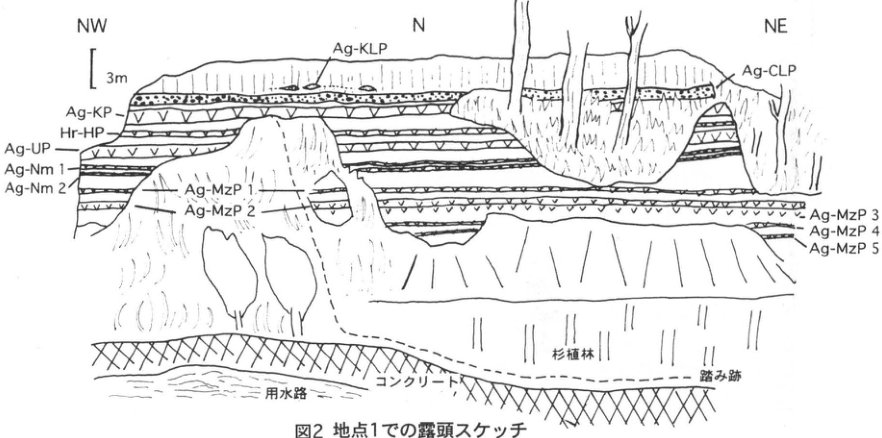
Show extracted lettering and translation
English translation of figure lettering
Directions: NW, N, NE. Scale: 3 m. Layer labels: Ag-KLP, Ag-CLP, Ag-KP, Hr-HP, Ag-UP, Ag-Nm 1, Ag-Nm 2, Ag-MzP 1, Ag-MzP 2, Ag-MzP 3, Ag-MzP 4, Ag-MzP 5. Features: irrigation channel; concrete; Japanese cedar plantation; footpath.
Original Japanese lettering
方位:NW、N、NE。スケール:3m。層名:Ag-KLP、Ag-CLP、Ag-KP、Hr-HP、Ag-UP、Ag-Nm 1、Ag-Nm 2、Ag-MzP 1、Ag-MzP 2、Ag-MzP 3、Ag-MzP 4、Ag-MzP 5。地物:用水路、コンクリート、杉植林、踏み跡。
Figure 2. Outcrop sketch at locality 1.
KT-8 (continued)
The first exposure (locality 1) lies southeast of the Shimizu settlement at Mizunuma, beside a branch of the Shimizu irrigation channel. It corresponds to Suzuki's (1990a) locality 7a and Moriya's (1968) locality AK315. Its general appearance is shown in the sketch. The tephras easily recognizable by eye extend from Ag-CLP at the top down to Akagi-Mizunuma-5 tephra (Ag-MzP5). Moriya's (1968) figure 8 gives a column extending down to Akagi-Mizunuma-10 tephra (Ag-MzP10), named P10 there; layers with the same number are the same tephra, so P10 denotes Ag-MzP10. The lower part is now covered by talus, however, and even after excavation only the upper part of Akagi-Mizunuma-6 tephra (Ag-MzP6) can barely be observed. Ag-CLP and Ag-KP are two closely spaced tephra layers in the upper exposure, both erupted during formation of the central cone. Ag-KP is the most conspicuous tephra here, consisting of well-vesiculated pumice with a thickness of about 130 cm and a mean maximum clast size of about 10 cm. It is also the largest Plinian deposit in Akagi's eruption history. Its volume reaches 25 km³, placing it among the ten largest Plinian deposits in Japan. Despite the size of this eruption, no evidence has been obtained for pyroclastic flows occurring before or after the Ag-KP eruption. Ag-CLP, immediately above Ag-KP, is an unusual fallout deposit composed mainly of fragments of shale, chert, and other rocks from the nearby Ashio Mesozoic strata forming Akagi's basement. It is unclear what eruption style or occurrence of basement rocks resulted in Ag-CLP. Thus many problems remain unresolved even for tephras of the relatively recent central-cone formation stage. The locality marked ■ is suitable for observing horizons at and above Ag-CLP, together with Ag-KP. Below Ag-KP, the deposits from Ag-UP down to Ag-MzP6 represent Plinian eruptions of relatively similar sizes. Their ages can be determined from their stratigraphic relationships with widespread tephras. Specifically, DKP (ca. 50 ka) is known to occur between Ag-Nm2 and Ag-MzP1, and On-Pm1 (ca. 100 ka) about 20 cm above Ag-MzP6. Neither is visible to the naked eye, however. The position of On-Pm1 is determined by abundant fibrous volcanic glass derived from that tephra in the volcanic-ash soil.
Tephras below Ag-MzP6 can be observed at locality 2 (Suzuki's, 1990a, 7b; Moriya's, 1968, AK329). This natural exposure lies on a river-eroded cliff north of the Shimizu settlement. It is difficult to locate and, being a steep cliff, requires care. Its stratigraphic column is shown. Ag-MzP6, 9, and 10 are conspicuous here, each more than 1 m thick. Ag-MzP6 has been found near Imaichi in Tochigi Prefecture, and Ag-MzP9 and 10 along the Ibaraki coast; these assist chronology in various parts of northern Kanto. A 10 cm thick layer of fine volcanic sand containing biotite and quartz lies 15 cm below Ag-MzP6 and is correlated with Tt-D (95–130 ka).
References: Moriya (1968, 1970, 1979); Suzuki (1990a); Takemoto (1991).
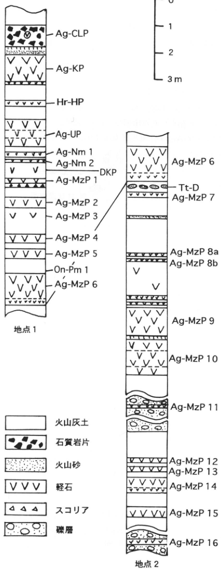
Show extracted lettering and translation
English translation of figure lettering
Scale: 0, 1, 2, 3 m.
| Locality | Legible layer labels, top to bottom |
|---|---|
| Locality 1 | Ag-CLP, Ag-KP, Hr-HP, Ag-UP, Ag-Nm 1, Ag-Nm 2, DKP, Ag-MzP 1, Ag-MzP 2, Ag-MzP 3, Ag-MzP 4, Ag-MzP 5, On-Pm 1, Ag-MzP 6 |
| Locality 2 | Ag-MzP 6, Tt-D, Ag-MzP 7, Ag-MzP 8a, Ag-MzP 8b, Ag-MzP 9, Ag-MzP 10, Ag-MzP 11, Ag-MzP 12, Ag-MzP 13, Ag-MzP 14, Ag-MzP 15, Ag-MzP 16 |
A line connects the lower part of Ag-MzP6 at localities 1 and 2. Legend: volcanic-ash soil; lithic fragments; volcanic sand; pumice; scoria; gravel.
Original Japanese lettering
スケール:0、1、2、3 m。
| 地点 | 上から下への可読層名 |
|---|---|
| 地点1 | Ag-CLP、Ag-KP、Hr-HP、Ag-UP、Ag-Nm 1、Ag-Nm 2、DKP、Ag-MzP 1、Ag-MzP 2、Ag-MzP 3、Ag-MzP 4、Ag-MzP 5、On-Pm 1、Ag-MzP 6 |
| 地点2 | Ag-MzP 6、Tt-D、Ag-MzP 7、Ag-MzP 8a、Ag-MzP 8b、Ag-MzP 9、Ag-MzP 10、Ag-MzP 11、Ag-MzP 12、Ag-MzP 13、Ag-MzP 14、Ag-MzP 15、Ag-MzP 16 |
地点1のAg-MzP6下部と地点2のAg-MzP6下部を線で接続。凡例:火山灰土、石質岩片、火山砂、軽石、スコリア、礫層。
Figure 3. Stratigraphic columns at localities 1 and 2.
KT-9 Latest Pleistocene and Holocene tephras on Mount Tairappyo in the Mikuni Mountains
Akihiko Sasaki; Yoshihiko Kariya; Fusao Arai
- Locality: 150 m south of the summit of Mount Tairappyo, Niiharu Village, Gunma Prefecture.
- Coordinates: N36°48′44″ E138°49′30″. Elevation: 1,935 m.
- Outcrop type and condition: cut along a mountain trail; extant in August 1995.
- Deposit type and age: eolian tephras and peat; latest Pleistocene to Holocene.
- Date described: August 1995.
- Keywords: Mount Tairappyo; Haruna-Futatsudake-Ikaho tephra; tephras from Asama; Myoko-Akakura tephra.
Peat is widely distributed on the southeastern slope of Mount Tairappyo (Koizumi et al., 1984). Tephras were already known to occur in the peat and underlying sand and gravel (Koizumi et al., 1984; Takada, 1986), but we have newly identified several Holocene tephras in the peat. Here we introduce an exposure along the mountain trail 160 m south of the summit. Seven milky-white to brown fine-grained volcanic-ash layers, 0.1–1.5 cm thick, can be observed intercalated in the peat. From top downward, these are Haruna-Futatsudake-Ikaho tephra (Hr-FP), Asama-Tairappyo-1 tephra (As-T1), Myoko-Akakura tephra (My-A), Asama-Tairappyo-3 tephra (As-T3), Asama-Tairappyo-4 tephra (As-T4), Kikai-Akahoya tephra (K-Ah), and Asama-Tairappyo-5 tephra (As-T5). The sand and gravel immediately below the peat contains Asama-Kusatsu tephra (As-K), consisting mainly of yellow pumice 0.2 cm in size. At the locality marked ■, Myoko-Otagirigawa tephra (My-Ot) and Asama-Tairappyo-2 tephra (As-T2) occur in the peat. For details of these tephras, see Kariya et al. (1996). As-T1–5 are provisional names assigned for convenience by the authors. It is not yet clear which tephras reported at the foot of Asama volcano (e.g., Takemoto et al., 1995) they can be correlated with. Exposures along the trail, including this one, may be protected with attached netting or other materials because of concerns about soil erosion, potentially making observation difficult.
References: Kariya et al. (1996); Koizumi et al. (1984); Takada (1986); Takemoto et al. (1995).
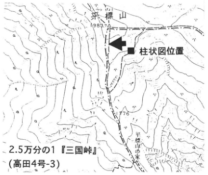
Show extracted lettering and translation
English translation of figure lettering
1:25,000 Mikuni-toge sheet (Takada sheet 4-3). Mount Tairappyo, elevation 1983.7. Position of stratigraphic column (■). 1776; Tairappyo mountain hut.
Original Japanese lettering
2.5万分の1「三国峠」(高田4号-3)。平標山、標高1983.7。柱状図位置(■)。1776、平標山の家。
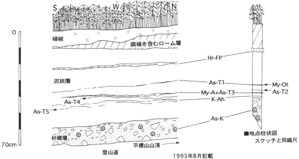
Show extracted lettering and translation
English translation of figure lettering
Directions: S, W, N. Scale: 0–70 cm. Units: vegetation cover; humus-bearing loam; peat; sand and gravel. Tephras: Hr-FP, As-T1, My-A+As-T3, As-T4, K-Ah, As-T5, As-K. Column at the ■ locality: My-Ot, As-T2; same scale as the sketch. Mountain trail; summit of Mount Tairappyo (rightward arrow). Recorded in August 1995.
Original Japanese lettering
方位:S、W、N。スケール:0–70cm。地層:植被、腐植を含むローム層、泥炭層、砂礫層。テフラ:Hr-FP、As-T1、My-A+As-T3、As-T4、K-Ah、As-T5、As-K。■地点柱状図:My-Ot、As-T2、スケッチと同縮尺。登山道、平標山山頂(右向き矢印)。1995年8月記載。
KT-10 Ozegahara, a time capsule of natural history—Holocene peat
Hidehiro Sohma (相馬秀廣)
- Locality: Nakata-shiro, Ozegahara, Katashina Village, Tone District, Gunma Prefecture.
- Coordinates: N36°56′4″ E139°14′56″. Elevation: 1,403 m.
- Outcrop type and condition: special protected area of a Natural Monument.
- Deposit type and age: peat; Holocene.
- Date described: October 1973.
- Keywords: Ozegahara; younger peat; Kikai-Akahoya tephra; tephras from Asama; tephras from Haruna.
Ozegahara (hereafter, the mire) straddles Gunma, Niigata, and Fukushima prefectures. It is one of Japan's representative mires, with extensive raised-bog areas, and is designated a special protected area of a Natural Monument. Because it is also a rich source of information on mire formation and development, samples were collected under special permission, with conservation in mind. The column shows peat deposited in a raised-bog area beside the deepest pool in the mire (3.3 m deep). This is continuously accumulated younger peat containing eleven tephra layers, numbered I–XI from top downward. Layers I, II, and V are tephras from Asama: Asama-A (As-A), Asama-B (As-B), and Asama-C (As-C), respectively. Layers III and IV are Haruna-Futatsudake-Ikaho tephra (Hr-FP) and Haruna-Futatsudake-Shibukawa tephra (Hr-FA), erupted from Haruna during the Kofun period. Layer XI is Kikai-Akahoya tephra (K-Ah), transported from the Kikai caldera near Yakushima in southern Kyushu. A radiocarbon age of about 7.8 ka was obtained from the base of the peat. Numerous red fruits of mitsugashiwa (ミツガシワ), a plant growing in shallow pools, were recovered near the bottom. These apparently fresh red fruits indicate that the peat in this vicinity began in shallow pools (backswamps), rather than in a lake. Radiocarbon ages and other evidence suggest that increased snowfall associated with the substantial inflow of the Tsushima Warm Current into the Sea of Japan caused paludification and initiated peat accumulation.
References: Sakaguchi (1974, 1989); Sakaguchi (1976); Sakaguchi et al. (1982).
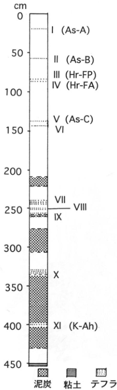
Show extracted lettering and translation
English translation of figure lettering
Depth in cm: 0, 50, 100, 150, 200, 250, 300, 350, 400, 450. Tephra layers, top to bottom: I (As-A), II (As-B), III (Hr-FP), IV (Hr-FA), V (As-C), VI, VII, VIII, IX, X, XI (K-Ah). Legend: peat; clay; tephra.
Original Japanese lettering
深度cm:0、50、100、150、200、250、300、350、400、450。テフラ層(上から):I(As-A)、II(As-B)、III(Hr-FP)、IV(Hr-FA)、V(As-C)、VI、VII、VIII、IX、X、XI(K-Ah)。凡例:泥炭、粘土、テフラ。
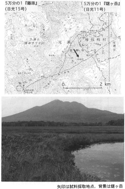
Show extracted lettering and translation
English translation of figure lettering
1:50,000 Fujiwara sheet (Nikko sheet 15); 1:50,000 Hiuchigatake sheet (Nikko sheet 11). Scale: 0–2 km. Arrow: sampling locality. Legible place names: Oze; Hinoemata Village; Ozegahara; Nakata-shiro; Kamita-shiro; Shimota-shiro; カッパ山; 八海山 (背中アブリ山); 外ノ沢; Ryugu hut; Yamanohana; Shibutsu mountain lodge. Some small place names and elevations: [illegible]. Photograph: no internal lettering.
Original Japanese lettering
5万分の1「藤原」(日光15号)、5万分の1「燧ヶ岳」(日光11号)。スケール0–2km。矢印:試料採取地点。可読地名:尾瀬、檜枝岐村、尾瀬原、中田代、上田代、下田代、カッパ山、八海山(背中アブリ山)、外ノ沢、竜宮小屋、山ノ鼻、至仏山荘。小さい地名・標高の一部:[判読不明]。写真:文字注記なし。
Reading notes
小さい地形図地名と標高値 — 原PDFレンダーも拡大したが、細字の一部は印刷自体が不鮮明で確定できない。
八海山(背中アブリ山) — 図の山名は薄く、一部の字に読みに不確実性が残る。
The arrow marks the sampling locality; Mount Hiuchigatake is in the background.
KT-11 The Nakasuji archaeological site in Shibukawa—a Kofun-period village site destroyed by a pyroclastic flow from Haruna volcano
Tsutomu Soda (早田勉)
- Locality: Miyukida, Shibukawa City, Gunma Prefecture.
- Coordinates: N36°28′39″ E139°0′0″. Elevation: 200 m.
- Outcrop type and condition: site preserved by burial (backfilled preservation).
- Deposit type and age: fallout tephras and pyroclastic-flow deposits; Kofun period.
- Keywords: Haruna volcano; volcanic disaster; Haruna-Futatsudake-Shibukawa tephra; Nakasuji site; Haruna-Futatsudake-Ikaho tephra; Kuroimine site.
Excavations of the Nakasuji site conducted by the Shibukawa City Board of Education in 1986 revealed a settlement buried by Haruna-Futatsudake-Shibukawa tephra (Hr-FA), produced by an eruption of Haruna volcano in the early sixth century. Particularly noteworthy is the catastrophic damage inflicted by a pyroclastic flow. The Hr-FA eruption occurred near the present Futatsudake, about 8 km west of the Nakasuji site. It began with phreatomagmatic explosions, initially depositing fine, wet volcanic ash (S-1), mainly to the east. Most buildings in the Nakasuji village collapsed under the weight of this ash or suffered damage to part of their roofs. A ground-level building that had retained its original form was then toppled in the flow direction by the highly mobile pyroclastic flow (S-5) that followed, and burned down from the flow's heat. Recent excavations have shown that pyroclastic flows from this eruption also knocked down trees on a fluvial terrace on the right bank of the Tone River, about 10 km east-northeast of the vent. Haruna also produced a large Plinian eruption and pyroclastic flows in the mid-sixth century. Of the deposits from that eruption, Haruna-Futatsudake-Ikaho tephra (Hr-FP), the pumice fall is distributed mainly northeastward and has been detected as far away as the Tagajo ruins in Miyagi Prefecture. A large settlement buried by this pumice has been found at the Kuroimine site in Komochi Village. Each of these two eruptions was followed by repeated mudflows that affected a broad area from the foot of Haruna to the middle Tone River region. The present Futatsudake is a lava dome formed by lava ascending through the vent during the final stage of the Hr-FP eruption. The Nakasuji site is now maintained and preserved as an archaeological park, with the village's appearance immediately before the disaster reconstructed. The Kuroimine site is also preserved by burial as a nationally designated Historic Site.
References: Arai (1962, 1979); Ishii and Umezawa (1994); Machida et al. (1984); Sakaguchi (1986); Shibukawa City Board of Education (1987); Soda (1989, 1993).
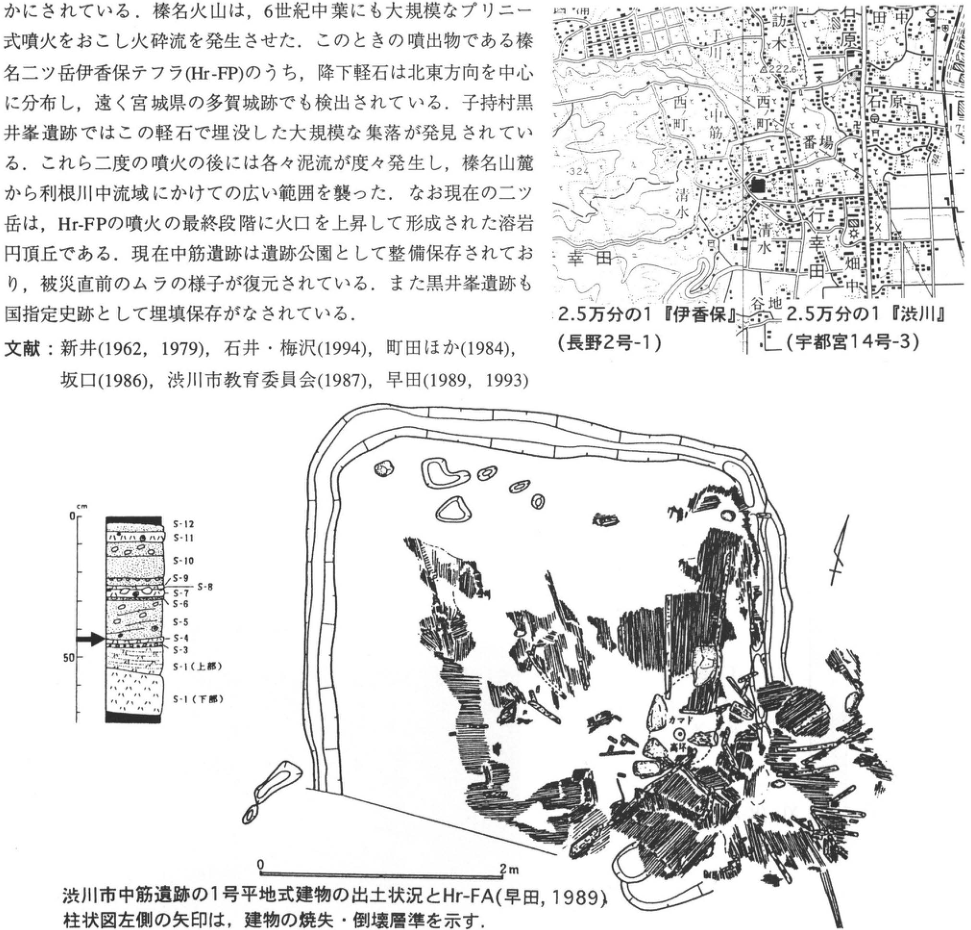
Show extracted lettering and translation
English translation of figure lettering
The upper image contains article text, restored in the main text and not transcribed again here. Map: 1:25,000 Ikaho sheet (Nagano sheet 2-1); 1:25,000 Shibukawa sheet (Utsunomiya sheet 14-3). Nakasuji; Miyukida; Shimizu; Nishi-machi (two labels); Banba; Ishihara; 田中; 相原; 諏訪木; 谷地; 畑中. Legible elevations and contours: 222.6, 324, 200. Arrow: Nakasuji site. Column: depth in cm; 0, 50. From top downward: S-12, S-11, S-10, S-9, S-8, S-7, S-6, S-5, S-4, S-3, S-1 (upper part), S-1 (lower part). Arrow at left: horizon of the building's burning and collapse. Excavation plan: orientation arrow. Scale: 0–2 m. Cooking hearth. 高坏 [uncertain reading; possibly a pedestal cup].
Original Japanese lettering
上部の画像化本文は本文欄に復元し、ここでは重複転記しない。 地図:2.5万分の1「伊香保」(長野2号-1)、2.5万分の1「渋川」(宇都宮14号-3)。中筋、行幸田、清水、西町(2箇所)、番場、石原、田中、相原、諏訪木、谷地、畑中。可読標高・等高線:222.6、324、200。矢印:中筋遺跡。 柱状図:深度cm、0、50。上からS-12、S-11、S-10、S-9、S-8、S-7、S-6、S-5、S-4、S-3、S-1(上部)、S-1(下部)。左側矢印:建物の焼失・倒壊層準。 遺構図:方位矢印。スケール:0–2m。カマド。高坏[読み不確実]。
Reading notes
高坏 — 遺構内の小字を原PDFから6倍レンダーし確認したが、完全には確定できない。カマド下方の円形遺物の注記。
Excavated remains of ground-level building 1 at the Nakasuji site, Shibukawa, and Hr-FA (Soda, 1989). The arrow to the left of the column marks the horizon at which the building burned and collapsed.
KT-12 Iwajuku archaeological site, Gunma Prefecture—the first locality in the Japanese archipelago where the presence of a Paleolithic culture was confirmed
早田勉
- Locality: Azami, Kasakake Town, Nitta District, Gunma Prefecture
- Latitude and longitude: N36°23′51″ E139°17′25″
- Elevation: 150m
- Outcrop type and present condition: preserved outcrop
- Deposit types and ages: eolian tephra and volcanic-ash soil (red soil); Late Pleistocene
- Keywords: Paleolithic culture; Paleolithic period; Kanto Loam; Iwajuku archaeological site
It is no exaggeration to say that systematic research on Paleolithic culture in Japan began with the discovery of the Iwajuku site. Indeed, to commemorate this discovery, some researchers now propose calling the Upper Paleolithic the “Iwajuku period.” In autumn 1946 (Showa 21), a young archaeology enthusiast, 相沢忠洋, discovered several stone tools in a cliff exposing red soil (Kanto Loam) on the north side of the road cut between Inariyama and Kotohirayama. This prompted an excavation in September 1949 (Showa 24) by the Archaeology Laboratory of Meiji University, led by 杉原荘介. The excavation confirmed that the tools occurred in the red soil below the black soil containing Jomon-period cord-twisted-pattern pottery, which at the time was considered the oldest pottery. A stone monument now stands at this locality. Across the road, inside a dome on its south side, the southern roadside outcrop (photograph), where the red soil of this site could be observed well, has been preserved. Although visitors cannot touch the soil section directly, audiovisual materials explain the strata, stone tools, and conditions at the time of excavation in front of a peel specimen of the soil profile displayed on the face of the outcrop. The nearby Kasakeno Iwajuku Culture Museum (笠懸野岩宿文化資料館) also explains the characteristics of Paleolithic cultures throughout the Japanese archipelago, as well as those of Iwajuku itself.
References: 相沢 (1969); 新井 (1962); 大島 (1986); 杉原 (1956); 鈴木 (1976).
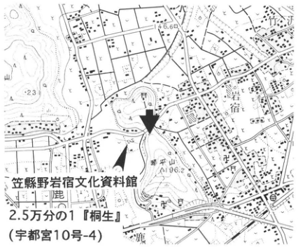
Show extracted lettering and translation
English translation of figure lettering
Kasakeno Iwajuku Culture Museum; 1:25,000 “Kiryu” (Utsunomiya sheet 10-4); Iwajuku; Kotohirayama; 196.2; 146.6; 鹿; [illegible]yama.
Original Japanese lettering
笠懸野岩宿文化資料館;2.5万分の1「桐生」(宇都宮10号-4);岩宿;琴平山;196.2;146.6;鹿;[判読不明]山。
Reading notes
地形図の端で切れた地名と細かな背景文字は判読不能。
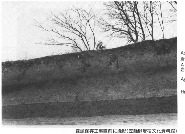
Show extracted lettering and translation
English translation of figure lettering
From top to bottom: As-BP; Iwajuku II stone-tool culture; AT; Iwajuku I stone-tool culture; Ag-KP; Hr-HP.
Original Japanese lettering
上から:As-BP;岩宿II石器文化;AT;岩宿I石器文化;Ag-KP;Hr-HP。
Reading notes
抽出画像の右側注記は切れている。全文は原PDFページで確認し収録。
Photographed immediately before work to preserve the outcrop (Kasakeno Iwajuku Culture Museum).
KT-13 Okuwa debris-avalanche deposit of Asama Volcano and the overlying tephra beds of the Hotokeiwa and Maekake stages
竹本弘幸
- Locality: Otaki, Kuridaira, Naganohara Town, Agatsuma District, Gunma Prefecture
- Latitude and longitude: N36°26′46″ E138°36′41″
- Elevation: 1,110m
- Outcrop type and present condition: artificial outcrop; extant
- Deposit types and ages: debris-avalanche deposit, traces of buried trees, and fallout tephra; Late Pleistocene to Holocene
- Date of description: October 1993
- Keywords: Asama Volcano; Okuwa debris-avalanche deposit; tephra derived from Asama
This outcrop is behind the car park for Asama Otaki waterfall at Kuridaira, Kita-Karuizawa, Naganohara Town. At this locality, the Okuwa debris-avalanche deposit (OkAV), generated at Mount Kurofu 23–24ka ago (新井, 1967; 樋口, 1989), and the overlying Hotokeiwa-stage tephra can be observed. OkAV contains enormous blocks of densely welded tuff deposited by fallout near the Kurofu crater, Kurofu lava units, pumice-flow deposits, and other materials. It is overlain by the upper half of the Asama–Itahana Brown Pumice Group, equivalent to the Minamigatake pumice of 辻 et al. (1984) and As-BP-h of 早田 (1995). During the Hotokeiwa stage, in ascending stratigraphic order, the Kumoba pumice (Kb), derived from Hanareyama, and the Shiraito-no-taki pumice (As-SP), thought to have preceded Koasamayama (荒牧, 1986), were erupted. They were immediately followed by basaltic scoria rich in olivine and banded pumice (Otaki Scoria 1 and 2; As-OtS-1 and -2; 竹本・久保, 1995). Above an angular unconformity, the sequence includes Okubosawa Pumice 1 and 2 (As-OkP-1 and -2), peat beds and traces of buried trees, followed by Itahana Yellow Pumice (As-YP) → interbedded volcanic ash → Kusatsu Yellow (Tsumagoi) Pumice (As-YPk; K) → interbedded volcanic ash (As-UG) → Pumice Flow 2. Within the black soil, Maekake-stage tephra such as the Fujioka pumice (As-Fo; 8.4ka) and Kuni pumice (As-Kn; 5.4ka) of 早田 (1990) can be observed. After passing through the approach to the waterfall, toilets stand on the right (southwest). The cliff behind them exposes enormous blocks of a pyroclastic-flow deposit originally deposited at the foot of Mount Kurofu, and loose blocks of densely welded tuff occur on the path.
References: 新井 (1967); 荒牧 (1986); 樋口 (1989); 早田 (1990, 1995); 竹本・久保 (1995); 辻 et al. (1984).
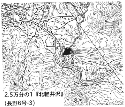
Show extracted lettering and translation
English translation of figure lettering
1:25,000 “Kita-Karuizawa” (Nagano sheet 6-3); Kuridaira; Asama Otaki waterfall; 小沢; 1085; 1200; 1197.
Original Japanese lettering
2.5万分の1「北軽井沢」(長野6号-3);栗平;浅間大滝;小沢;1085;1200;1197。
Reading notes
地形図の一部細かな背景文字と端で切れた文字は判読不能。
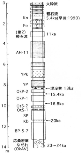
Show extracted lettering and translation
English translation of figure lettering
Depth scale: 0, 2, 4, 6, 8, 10, 12, 14m. From top to bottom: pyroclastic flow; pumice flow; Kn; 5.4ka (早田: 1990); Fo; Pumice Flow (2), 11ka; AH-11; YPk; YP; buried forest, 13ka; OkP-2; 15.4ka; OkP-1; 16.8ka; OtS-2; OtS-1; SP; Kb; 20ka; BP-5-7; Okuwa debris avalanche (OkAV), 23–24ka.
Original Japanese lettering
深度目盛:0,2,4,6,8,10,12,14m。上から:火砕流;軽石流;Kn;5.4ka(早田:1990);Fo;(第2)軽石流,11ka;AH-11;YPk;YP;埋没林13ka;OkP-2;15.4ka;OkP-1;16.8ka;OtS-2;OtS-1;SP;Kb;20ka;BP-5-7;応桑岩屑なだれ(OkAV),23~24ka。
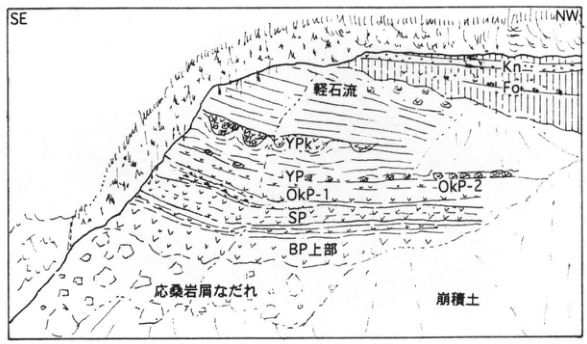
Show extracted lettering and translation
English translation of figure lettering
SE; NW; Kn; Fo; pumice flow; YPk; YP; OkP-2; OkP-1; SP; upper BP; Okuwa debris avalanche; colluvium.
Original Japanese lettering
SE;NW;Kn;Fo;軽石流;YPk;YP;OkP-2;OkP-1;SP;BP上部;応桑岩屑なだれ;崩積土。
KT-14 Middle to Late Pleistocene tephra beds in the Nakanojo Basin—tephra in the Upper Nakanojo Lacustrine Beds and covering the Minohara Upland
竹本弘幸
- Locality: Minohara, Nakanojo Town, Agatsuma District, Gunma Prefecture
- Latitude and longitude: N36°36′40″ E138°49′00″
- Elevation: 582.5m
- Outcrop type and present condition: natural outcrop; covered by vegetation as of 1995; lacustrine beds extant
- Deposit types and ages: lacustrine beds, peat beds, gravel beds, and water-laid and eolian tephra; Middle to Late Pleistocene
- Date of description: July 1984
- Keywords: Nakanojo Lacustrine Beds; Azumaya–Minohara tephra; Nakanojo Basin
This outcrop lies at the head of Okuzuresawa, on the eastern margin of the Minohara Upland northwest of Nakanojo Town. The Minohara surface, the highest terrace (新井, 1962), forms an upland composed of alluvial-fan gravel deposited by the Shima River, which flowed into ancient Lake Nakanojo. It is a depositional surface that interfingers with and overlies the Upper Nakanojo Lacustrine Beds. The lake bottom lay near the present Agatsuma River bed, at an elevation of 320m, and the depositional surface of the lacustrine beds lies at approximately 570m. A lake with a highly indented shoreline, extending 20km east–west and 16km north–south and covering 100km², is thought to have existed. Tephra such as NLu-1 to NLu-31 occurs in the lacustrine beds. NLu-20 is a widespread tephra dated to 400–500ka, intercalated in peat at an elevation of approximately 510m. The peat yields plant macrofossils (新井, 1965, and others) and insects indicating a paleoenvironment similar to that of the present. NLu-27 is intercalated in silt approximately 35m below the ground surface and has been correlated with the Omachi APm Tephra Group, dated to approximately 300ka (米澤 et al., 1984).
Approximately 16m of tephra overlies the Minohara Gravel Bed. It includes the Minohara Orange Volcanic Ash (MiT), a widespread tephra of unknown source, and pumice beds such as Azumaya–Minohara (Az-MiP), derived from Azumaya Volcano (矢口 et al., 1990), and Yokokawa-2 (YoP-2), dated to approximately 220ka (photograph). At approximately 8m below the surface, Tateyama-D (Tt-DPm), derived from Tateyama, and Ontake-1 (On-Pm-I), derived from Ontake, were observed. Tephra including Daisen–Kurayoshi (DKP; 竹本, 1991), dated to 50ka, occurred at approximately 5m depth, and Aira-Tn (AT) and tephra derived from Asama were observed higher in the sequence.
References: 新井 (1962, 1965); 川端 (1967); 守屋 (1968); 中山 (1978); 高橋・早川 (1994); 高橋 et al. (1995); 竹本 (1991); 竹本 et al. (1987); 矢口 et al. (1990, 1993); 山口 (1975); 米澤 et al. (1984).
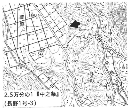
Show extracted lettering and translation
English translation of figure lettering
1:25,000 “Nakanojo” (Nagano sheet 1-3); Minohara; Nakamura; Hikage; Shima River; 586.7; 578; 567; 559.5; 476.
Original Japanese lettering
2.5万分の1「中之条」(長野1号-3);蓑原;中村;日影;四万川;586.7;578;567;559.5;476。
Reading notes
背景の小さな地名の一部は判読不能。
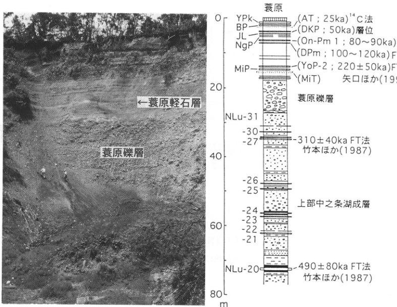
Show extracted lettering and translation
English translation of figure lettering
Photograph: Minohara Pumice Bed; Minohara Gravel Bed. Column: Minohara. Depths 0, 20, 40, 60, 80m. From top to bottom: YPk; BP; JL; NgP; MiP; (AT; 25ka), ¹⁴C method; (DKP; 50ka), stratigraphic position; (On-Pm 1; 80–90ka), FT method; (DPm; 100–120ka), FT method; (YoP-2; 220±50ka), FT method; (MiT), 矢口 et al. (1993); Minohara Gravel Bed; NLu-31; -30; -27, 310±40ka, FT method, 竹本 et al. (1987); -26; -25; -24; -23; -22; -21; NLu-20, 490±80ka, FT method, 竹本 et al. (1987); Upper Nakanojo Lacustrine Beds.
Original Japanese lettering
写真:蓑原軽石層;蓑原礫層。柱状図:蓑原。深度0,20,40,60,80m。上から:YPk;BP;JL;NgP;MiP;(AT;25ka)¹⁴C法;(DKP;50ka)層位;(On-Pm 1;80~90ka)FT法;(DPm;100~120ka)FT法;(YoP-2;220±50ka)FT法;(MiT)矢口ほか(1993);蓑原礫層;NLu-31;-30;-27,310±40ka FT法,竹本ほか(1987);-26;-25;-24;-23;-22;-21;NLu-20,490±80ka FT法,竹本ほか(1987);上部中之条湖成層。
Reading notes
抽出画像の右端の年代・方法・出典は切れているため、原PDF全ページから補完。
KT-15 The Maebashi Peat Bed on the Maebashi Upland—paleoenvironmental changes from the last glacial period to the postglacial period
辻誠一郎
- Locality: west bank of the Tone River, Soja Town, Maebashi City, Gunma Prefecture
- Latitude and longitude: N36°25′12″ E139°02′10″
- Elevation: 125m
- Outcrop type and present condition: riverbank and terrace scarp; extant
- Deposit types and ages: peat and peaty deposits; terminal Pleistocene to earliest Holocene
- Date of description: June 1983
- Keywords: tephra derived from Asama; paleovegetation; Maebashi Peat Bed; Asama–Itahana Yellow Pumice
The Maebashi Peat Bed (新井, 1962) consists of peat and peaty deposits distributed over a relatively extensive area around Soja Town, Maebashi City. Because it often contains abundant plant remains and intercalates tephra such as the Asama–Itahana Yellow Pumice (As-YP), derived from Asama Volcano and closely associated with Paleolithic artifacts, it has long attracted attention as a source of evidence for paleoenvironmental reconstruction and for the cultural chronology of the Paleolithic. The relationships between the Maebashi Peat Bed and the underlying and overlying strata can be observed in typical sections on the west bank of the Tone River in Soja Town and beneath the Tone River railway bridge of the JR Ryomo Line. The Maebashi Peat Bed conformably overlies fluvial terrace gravel, which unconformably overlies the Maebashi mudflow deposit derived from Asama Volcano (新井, 1967). A radiocarbon age of 24,000±650yr B.P. has been reported for charred wood in the Maebashi mudflow deposit.
In Soja Town, the Maebashi Peat Bed is approximately 80cm thick and intercalates 40cm of As-YP in its lower part. The peat facies differ distinctly across this tephra. The lower part consists of brown to dark-brown, undecomposed peat, with a particularly dense concentration of wood immediately below the tephra. In contrast, the upper part consists of dark-brown to black, decomposed peat. Two tephra beds occur within the upper peat; the lower of these was named Asama–Soja Pumice (As-Sj) by 早田 (1990). As-Sj has also been identified at the Motosoja Myojin archaeological site, where a radiocarbon age of 11,170±190yr B.P. was reported immediately beneath it (Palyno Survey Co., Ltd., 1990). The radiocarbon ages measured to date allow As-YP to be estimated at approximately 13ka and As-Sj at approximately 11.2ka, indicating that the Maebashi Peat Bed formed from the terminal Pleistocene to the earliest Pleistocene [as printed].
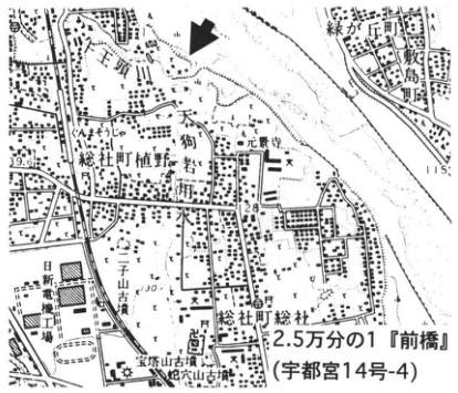
Show extracted lettering and translation
English translation of figure lettering
1:25,000 “Maebashi” (Utsunomiya sheet 14-4); Ueno, Soja Town; Soja, Soja Town; Shikishima Town; Midorigaoka Town; Tengu Rock; Genkeiji Temple; Sanno; 出山 burial mound; Nissin Electric factory; Hotoyama burial mound; 蛇穴山 burial mound; 39.6; 28.9; 115.
Original Japanese lettering
2.5万分の1「前橋」(宇都宮14号-4);総社町植野;総社町総社;敷島町;緑が丘町;天狗岩;元景寺;山王;出山古墳;日新電機工場;宝塔山古墳;蛇穴山古墳;39.6;28.9;115。
Reading notes
小さな背景文字の一部は判読不能。出山・蛇穴山の読みは確定せず日本語保持。
Show extracted lettering and translation
English translation of figure lettering
Elevations: 60–140m at 10m intervals; distance: 0, 1, 2km. Haruna volcanic slope (Somagahara alluvial fan); Maebashi Upland; Hirose River Lowland; Maebashi Upland; Akagi volcanic slope. Someya River; Yahata River; Tone River; Hirose River; Momonoki River. Tenmei mudflow deposit; Maebashi Peat Bed; Hirose River Sand and Gravel Bed; Maebashi Sand and Gravel Bed; Ogo pyroclastic-flow deposit; AT; As-BP; Hr-HP. Legend: black volcanic-ash soil; loam; pumice; volcanic ash; pyroclastic-flow deposit; debris-avalanche and mudflow deposits; gravel; sand; clay; peat. 1: Soja Sand Bed; 2: Somagahara alluvial-fan deposits; 3: Jinba debris-avalanche deposit; 4: Moto-Tone River terrace deposits; 5: Maebashi mudflow deposit.
Original Japanese lettering
標高:60~140m(10m刻み);距離:0,1,2km。榛名火山斜面(相馬ヶ原扇状地);前橋台地;広瀬川低地帯;前橋台地;赤城火山斜面。染谷川;八幡川;利根川;広瀬川;桃ノ木川。天明泥流堆積物;前橋泥炭層;広瀬川砂礫層;前橋砂礫層;大胡火砕流堆積物;AT;As-BP;Hr-HP。凡例:黒ボク土;ローム層;軽石;火山灰;火砕流堆積物;岩屑なだれ・泥流堆積物;礫;砂;粘土;泥炭。1:総社砂層,2:相馬ヶ原扇状地堆積物,3:陣馬岩屑なだれ堆積物,4:元利根川段丘堆積物,5:前橋泥流堆積物。
Schematic geological cross-section of the Maebashi Upland.
KT-15 The Maebashi Peat Bed on the Maebashi Upland (continued)
The plant fossil assemblages of the Maebashi Peat Bed were examined in detail by 辻 et al. (1985), including fossil pollen, plant macrofossils, and fossil wood. They record abrupt environmental and vegetational changes from the Pleistocene to the Holocene in considerable detail. Before As-YP, the vegetation was forest dominated by conifers—Korean pine, spruces of the Baramomi section (トウヒ属バラモミ節), and larches—with birches and alders. After the As-YP ash fall, vegetation changed rapidly: pines and spruces declined, whereas the deciduous oak subgenus (コナラ亜属) increased sharply, and beech, Japanese cedar, and other deciduous broadleaved trees also became common. This indicates that the climate became wetter as well as rapidly warmer.
References: 新井 (1962, 1964, 1967); Palyno Survey Co., Ltd. (1990); 早田 (1990); 辻・木越 (1992); 辻 et al. (1985).
Show extracted lettering and translation
English translation of figure lettering
As-Sj; As-YP.
Original Japanese lettering
As-Sj;As-YP。
Photograph: As-Sj and As-YP in the outcrop on the west bank of the Tone River, Soja Town, Maebashi City (the town name is printed as 総礼町).
Show extracted lettering and translation
English translation of figure lettering
Woody pollen; herbaceous pollen; fern spores; Abies; Tsuga; Picea; Larix; Pinus; solid black indicates the single-vascular-bundle subgenus; Quercus; deciduous oak subgenus (コナラ亜属); Japanese cedar; Betula; Alnus; Fagus; Poaceae; Cyperaceae; Artemisia. Depth: M, 0, 1. A; MB-4; As-Sj; B; As-YP; C. Percentage scales: 0, 50, 100%. Legend: tephra; sand; decomposed peat; undecomposed peat.
Original Japanese lettering
木本花粉;草本花粉;シダ類胞子;モミ属;ツガ属;トウヒ属;カラマツ属;マツ属;黒塗りは単維管束亜属;コナラ属;コナラ亜属;スギ;カバノキ属;ハンノキ属;ブナ属;イネ科;カヤツリグサ科;ヨモギ属。深度:M,0,1。A;MB-4;As-Sj;B;As-YP;C。百分率目盛:0,50,100%。凡例:テフラ;砂;分解泥炭;未分解泥炭。
Reading notes
抽出画像の上端で花粉分類名が欠落しているため原PDFから復元。百分率は曲線の図示値で、個別測定数値は印刷されていない。
Changes in the fossil pollen assemblages of the Maebashi Peat Bed at Soja, Maebashi City (辻 et al., 1985).
- A: 3,320±110yr B.P.
- B: 11,230±230yr B.P.
- C: 13,130±230yr B.P.
A and B: 辻・木越 (1992); C: 新井 (1964).
KT-16 Slope deposits in the upper Arakawa drainage, Kanto Mountains—Yatsugatake–Kawakami and Ontake-1 tephra
町田瑞男
- Locality: upstream of Mameyaki Bridge, Kawamata, Otaki Village, Chichibu District, Saitama Prefecture (printed as 埼王県)
- Latitude and longitude: N35°54′25″ E138°49′28″
- Elevation: 1,100m
- Outcrop type and present condition: artificial outcrop; extant as of December 1994
- Deposit types and ages: fallout tephra; Late Pleistocene
- Date of description: February 1985
- Keywords: Mameyaki Bridge; slope deposits; Yatsugatake–Kawakami tephra; Ontake-1 tephra; Kanto Mountains
This artificial outcrop faces Mameyakisawa, which flows into the Takigawa, a tributary of the Arakawa. Although artificial, it has been exposed for so long that it resembles a natural outcrop. National Route 140 passes immediately east of it. A tunnel connection to the Yamanashi side is planned for 1997, and construction is under way farther into the mountains. Thick pumice beds are intercalated in the lower part of the outcrop and somewhat above its middle. The lower bed is the Yatsugatake–Kawakami tephra (Yt-Kw) of 中谷 (1972), and the upper bed is the Ontake-1 tephra (On-Pm 1) of Kobayashi and Shimizu (1962). Both pumice beds are yellowish brown. Heavy minerals in the pumice are fresh in both beds and consist of euhedral to subhedral crystals. Zircon and magnetite in On-Pm 1 are so fresh that volcanic glass remains attached to their surfaces. The volcanic glass, abundant as separate fragments, contains few inclusions, is colorless and transparent, and has acicular to blocky and platy forms. Yt-Kw comprises four fall units, each with a cycle beginning with pumice and ending with volcanic sand. On-Pm 1 comprises only one fall unit. The interval between the two pumice beds is occupied by brown weathered volcanic ash, but it contains a considerable amount of angular gravel because it is a slope deposit. Yt-Kw, intercalated below On-Pm 1, is probably of the order of 100,000 years old. This suggests that the slopes around the outcrop have remained stable for more than 100,000 years. As more localities containing these tephra are discovered, the development of slope landforms in the Kanto Mountains should become clearer.
References: Kobayashi and Shimizu (1962); 町田 (1985); 中谷 (1972).
Show extracted lettering and translation
English translation of figure lettering
1:50,000 “Mitsumine” (Kofu sheet 1); Takigawa; Mameyakisawa; 1736; 857; 1000; 1200.
Original Japanese lettering
5万分の1「三峰」(甲府1号);滝川;豆焼沢;1736;857;1000;1200。
Reading notes
背景の地名・等高線数値の一部は判読不能。
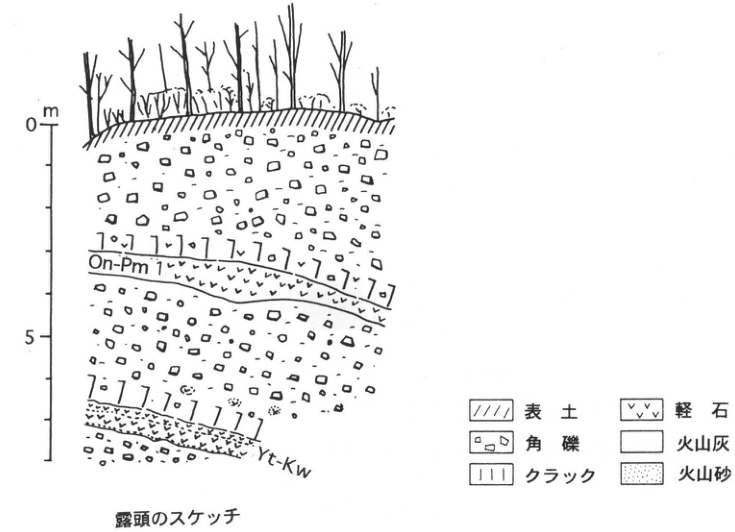
Show extracted lettering and translation
English translation of figure lettering
Depth: 0, 5m; On-Pm 1; Yt-Kw. Legend: topsoil; angular gravel; cracks; pumice; volcanic ash; volcanic sand.
Original Japanese lettering
深度:0,5m;On-Pm 1;Yt-Kw。凡例:表土;角礫;クラック;軽石;火山灰;火山砂。
Outcrop sketch.
KT-17 The Hanno Gravel Bed in the Koma Hills, Saitama Prefecture
久津間文隆 and the Collaborative Research Group on Hills along the Western Margin of the Kanto Plain (関東平野西縁丘陵団体研究グループ)
- Locality: Kinchakuda, Dai, Hidaka City, Saitama Prefecture
- Latitude and longitude: N35°52′36″ E139°19′55″
- Elevation: 90m
- Outcrop type and present condition: natural outcrop; extant
- Deposit types and ages: fluvial gravel; Late Pliocene
- Date of description: December 1995
- Keywords: Kaji Hills; Koma Hills; Hanno Gravel Bed; Yaoroshi Tuff
Among the hills along the western margin of the Kanto Plain, the Hanno Gravel Bed chiefly forms the Kaji and Koma hills. Its type locality is the area along the Iruma River northwest of the Kaji Hills. It was named by 福田・高野 (1951) and redefined by 竹越 et al. (1979). The unit is divided into lower and upper parts. The lower part consists chiefly of dark-gray to blue-gray silt beds and beds of angular to subangular gravel several centimetres in diameter. The upper part consists chiefly of subrounded to rounded gravel. The lower and upper parts correspond respectively to the Yaoroshi Tuff Bed and Hanno Gravel Bed of 新井 (1995). The unit is approximately 130m thick and has a uniform easterly dip of 3–5°. The locality presented here is suitable for observation and is not at risk of disappearing. Near the riverbed, the outcrop exposes blue-gray silt to tuffaceous sand of the lower part. It locally contains angular gravel and intercalates a 25cm bed of dark-gray peaty silt containing fossil wood. The gravel of the upper part conformably overlies it. The matrix is pale-brown muddy or tuffaceous medium- to coarse-grained sand. Clast long axes range from several centimetres to somewhat over 10cm; the largest clast is chert, 35cm across. The clasts consist of sandstone (58%), chert (35%), and slate and tuff (7%), all derived from the Chichibu Belt in the Kanto Mountains to the west. Clast composition varies regionally. Sandstone is more abundant in the southern half of the Koma Hills, at least 1km south of this locality, and in the Kaji Hills, where diorite clasts also occur. This unit has been correlated with the Kazusa Group. An FT age of 2.0±0.2Ma has also been obtained from the 三の谷 Volcanic Ash Bed in the lower part of the Kasumi Gravel Bed in the Kasumi Hills, a unit considered equivalent to this one (関東平野西縁丘陵研究グループ, 1995).
References: 新井 (1995); 福田・高野 (1951); 石垣・竹越 (1982); 関東平野西縁丘陵研究グループ (1995); 竹越 et al. (1979).
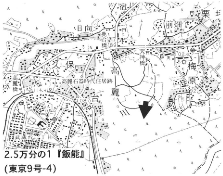
Show extracted lettering and translation
English translation of figure lettering
1:25,000 “Hanno” (Tokyo sheet 9-4); 日向; Kuritsubo; Maehata; Tenjin Bridge; Koma River; Kubo; Umehara; Koma Stone Age dwelling site; 69; 102.6; 108.0; 144.5.
Original Japanese lettering
2.5万分の1「飯能」(東京9号-4);日向;栗坪;前畑;天神橋;高麗川;久保;梅原;高麗石器時代住居跡;69;102.6;108.0;144.5。
Reading notes
背景の小さな地名の一部は判読不能。
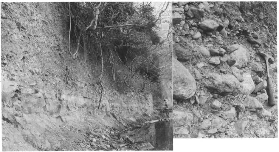
Show extracted lettering and translation
English translation of figure lettering
Upper part of the Hanno Gravel Bed; lower part of the Hanno Gravel Bed.
Original Japanese lettering
飯能礫層上部層;飯能礫層下部層。
Reading notes
左側の層位注記は抽出画像外にあるため原PDFから復元。
KT-18 Holocene tephra and paleoenvironmental changes at the Akayama Jinya-ato archaeological site, Kawaguchi City, Saitama Prefecture
辻誠一郎
- Locality: Akayama, Kawaguchi City, Saitama Prefecture
- Latitude and longitude: N35°50′55″ E139°45′10″
- Elevation: 5–15m
- Outcrop type and present condition: artificial outcrop produced by archaeological excavation; backfilled after investigation
- Deposit types and ages: peat and peaty deposits, landslide deposits, and loam; Early to Final Jomon period
- Date of description: November 1984
- Keywords: Jomon period; Akayama Jinya-ato archaeological site; tephra derived from Fuji; tephra derived from Haruna
The Akayama Jinya-ato archaeological site lies in the southeastern part of the Omiya Upland. Excavation was conducted for approximately one year and six months from August 1983 in connection with construction of National Route 298 (the Tokyo Gaikan Expressway). The excavation area included two dissected valleys, provisionally called the “East Moat” and “West Moat” during the investigation. Although the site chiefly comprises the remains of Akayama Jinya (Akayama Castle), dating to the early Edo period, the excavation area lay along its northern margin, and artifacts and structures associated with the jinya were rather scarce. In contrast, enormous numbers of artifacts and structures, chiefly from the Late and Final Jomon periods, were detected. Features such as facilities for processing Japanese horse-chestnut nuts were identified, providing important evidence for reconstructing Jomon livelihoods and the local environmental setting.
The deposits filling the dissected valleys include marine beds of the Jomon transgression and landslide deposits, woody (forest) peat that demonstrates the presence of forest vegetation, and herbaceous peat indicating herbaceous wetlands. A clear stratigraphic succession was established, with these deposits accumulating in that order from bottom to top.
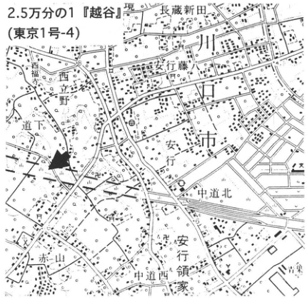
Show extracted lettering and translation
English translation of figure lettering
1:25,000 “Koshigaya” (Tokyo sheet 1-4); 長蔵新田; 安行藤八; Nishitateno; 道下; Angyo; 中道北; Angyo Ryoke; 中道西; Akayama; city.
Original Japanese lettering
2.5万分の1「越谷」(東京1号-4);長蔵新田;安行藤八;西立野;道下;安行;中道北;安行領家;中道西;赤山;市。
Reading notes
背景の小さな地名の一部は判読不能。確証のない地名の読みは日本語保持。
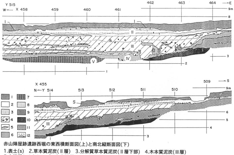
Show extracted lettering and translation
English translation of figure lettering
Upper section: Y515; W→E; X458, 459, 460, 461, 462, 463, 464; 9m, 8, 3, 2, 1; I, II, III, IV, V. Lower section: X455; N→S; Y514, 513, 512, 511, 510, 509; 9m, 6, 5, 4, 3; S, I, II, III. Legend numbers 1–12 (descriptions are transcribed in the legend table in the main text).
Original Japanese lettering
上:Y515;W→E;X458,459,460,461,462,463,464;9m,8,3,2,1;I,II,III,IV,V。下:X455;N→S;Y514,513,512,511,510,509;9m,6,5,4,3;S,I,II,III。凡例番号1~12(各説明は本文の凡例表に収録)。
Reading notes
抽出画像は凡例説明の第4項以後が切れている。全12項は原PDFで確認して本文表へ収録。
East–west transverse section (upper) and north–south longitudinal section (lower) through the West Moat at the Akayama Jinya-ato archaeological site.
| Legend number | Deposit |
|---|---|
| 1 | Topsoil (S) |
| 2 | Herbaceous peat (Layer II) |
| 3 | Decomposed herbaceous peat (lower part of Layer II) |
| 4 | Woody peat (Layer III) |
| 5 | Organic silt lenses |
| 6 | Organic silt (Layer IV) |
| 7 | Silty sand and sandy silt (Layer V) |
| 8 | Landslide and cliff-collapse blocks (indurated to semi-indurated sand) |
| 9 | Landslide and cliff-collapse blocks (indurated to semi-indurated silt and clay) |
| 10 | Buried soil |
| 11 | Loam (including landslide and cliff-collapse blocks) |
| 12 | Thin tephra beds |
Based on 遠藤 et al. (1987).
KT-18 Holocene tephra and paleoenvironmental changes at the Akayama Jinya-ato archaeological site (continued)
Because peat predominates, primary tephra deposits are well preserved, and a total of 14 beds, designated Ak-a to Ak-l from top to bottom, were identified. The lowest, Ak-l, was correlated with Kikai–Akahoya tephra (K-Ah), and Ak-c and Ak-a in the upper part were correlated with Haruna–Futatsudake Volcanic Ash (Hr-FA) and Fuji–Hoei Scoria (F-Ho), respectively. The scoriaceous tephra intercalated in the lower woody peat were all correlated with tephra derived from Fuji Volcano. Based on detailed descriptions of the constituents of these organic-rich peat and peaty deposits, together with the search for tephra, the deposits within the dissected valleys were divided into six principal layers: S and I–V, from top to bottom (遠藤 et al., 1987; 辻, 1989). The ecosystem changes revealed by these deposits are shown below.
References: 遠藤 et al. (1987); Kawaguchi City Archaeological Sites Investigation Association, ed. (川口市遺跡調査会編, 1987); 小杉 (1987); 辻 (1989).
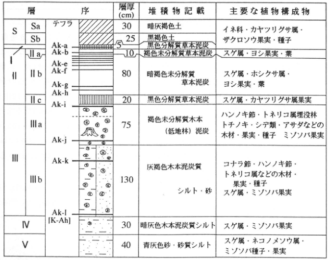
Show extracted lettering and translation
English translation of figure lettering
Stratigraphy; tephra; thickness (cm); sediment description; principal plant constituents. S: Sa, Sb; I; II: IIa, IIb, IIc; III: IIIa, IIIb; IV; V. Tephra shown: Ak-a, Ak-b, Ak-e, Ak-f, Ak-g, Ak-h, Ak-i, Ak-j, Ak-k, Ak-l [K-Ah]. The thicknesses, sediments, and plant constituents of all rows are fully transcribed in the main-text table.
Original Japanese lettering
層序;テフラ;層厚(cm);堆積物記載;主要な植物構成物。S:Sa,Sb;I;II:IIa,IIb,IIc;III:IIIa,IIIb;IV;V。図中テフラ:Ak-a,Ak-b,Ak-e,Ak-f,Ak-g,Ak-h,Ak-i,Ak-j,Ak-k,Ak-l[K-Ah]。各行の層厚・堆積物・植物構成物は本文の表へ全文転記。
| Stratigraphy | Thickness (cm) | Sediment description | Principal plant constituents |
|---|---|---|---|
| S: Sa | 30 | Dark gray-brown soil | Fruits and seeds of Poaceae, Cyperus, and zakuroso (ザクロソウ); shared cell for Sa, Sb, and I |
| S: Sb | 25 | Black-brown soil | Fruits and seeds of Poaceae, Cyperus, and zakuroso (ザクロソウ); shared cell for Sa, Sb, and I |
| I | 5 | Black decomposed herbaceous peat | Fruits and seeds of Poaceae, Cyperus, and zakuroso (ザクロソウ); shared cell for Sa, Sb, and I |
| IIa | 10 | Brown undecomposed herbaceous peat | Fruits and leaves of Carex and common reed |
| IIb | 80 | Dark-brown undecomposed herbaceous peat | Fruits and leaves of Carex, Eriocaulon, and common reed |
| IIc | 20 | Black decomposed herbaceous peat | Fruits of Carex and Cyperus |
| IIIa | 75 | Brown undecomposed woody (lowland-forest) peat | Buried forest of the alder section and Fraxinus; wood, fruits, and seeds of Japanese horse chestnut, hornbeams, Japanese hop-hornbeam, and others; fruits of mizosoba (ミゾソバ) |
| IIIb | 130 | Gray-brown woody peaty silt and sand | Wood, fruits, and seeds of the deciduous oak section, alder section, Fraxinus, and others; fruits of Carex and mizosoba |
| IV | 30 | Dark-gray woody peaty silt | Fruits of Carex and mizosoba |
| V | 40 | Blue-gray sand and sandy silt | Seeds and fruits of Carex, Chrysosplenium, and mizosoba |
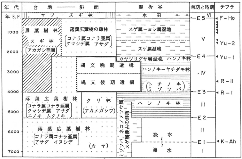
Show extracted lettering and translation
English translation of figure lettering
Age: yr B.P., 1000, 2000, 3000, 4000, 5000, 6000, 7000. Columns: upland–slope; dissected valley; transition boundaries and periods; tephra. Upland–slope: pine–Japanese cedar forest; evergreen broadleaved forest; Japanese cedar forest [evergreen oak subgenus]; open deciduous broadleaved forest [deciduous oak subgenus of Quercus, Carpinus, Japanese hop-hornbeam]; deciduous broadleaved forest [deciduous oak subgenus of Quercus, Carpinus, Japanese hop-hornbeam, Japanese hackberry, muku tree]; chestnut forest (akamegashiwa, アカメガシワ); deciduous broadleaved forest [deciduous oak subgenus of Quercus, Japanese hop-hornbeam, Japanese hornbeam] (Japanese torreya). Dissected valley: rice fields; Carex–Phragmites wetland; Carex wetland; Cyperus wetland, alder forest; alder–Japanese ash forest; (Japanese horse chestnut), (mizosoba); alder forest; communities dominated by mizosoba, Chrysosplenium, and Carex; freshwater; seawater. Final Jomon structures; Late Jomon structures. Periods I, II, III, IV, V, VI. Boundaries E1, E2, E3, E4, E5. Tephra: K-Ah, R-I, R-II, Yu-1, Yu-2, F-Ho.
Original Japanese lettering
年代:年B.P.,1000,2000,3000,4000,5000,6000,7000。列:台地―斜面;開析谷;画期と時期;テフラ。台地―斜面:マツ―スギ林;照葉樹林;スギ林[アカガシ亜属];落葉広葉樹の疎林[コナラ属コナラ亜属,クマシデ属,アサダ];落葉広葉樹林[コナラ属コナラ亜属,クマシデ属,アサダ,エノキ,ムクノキ];クリ林(アカメガシワ);落葉広葉樹林[コナラ属コナラ亜属,アサダ,イヌシデ](カヤ)。開析谷:水田;スゲ属―ヨシ属湿地;スゲ属湿地;カヤツリグサ属湿地,ハンノキ林;ハンノキ―ヤチダモ林;(トチノキ),(ミゾソバ);ハンノキ林;ミゾソバ・ネコノメソウ属・スゲ属優占の群落;淡水;海水。縄文晩期遺構;縄文後期遺構。時期I,II,III,IV,V,VI。画期E1,E2,E3,E4,E5。テフラ:K-Ah,R-I,R-II,Yu-1,Yu-2,F-Ho。
Vegetation changes since the Jomon transgression at the Akayama Jinya-ato archaeological site and surrounding uplands, Kawaguchi City, Saitama Prefecture; episodes of abrupt environmental change (transition boundaries) and period divisions in the history of environmental change; and tephra stratigraphy. Partly modified from 辻 (1989). Square brackets indicate principal elements; parentheses indicate local elements.
KT-19 Middle Pleistocene tephra beds in the Sayama Hills—a continuous section of the Tama Loam Formation
羽鳥謙三
| Site | Locality | Latitude and longitude | Elevation |
|---|---|---|---|
| a | Mizuho Town, Tokyo (near Mizuho Agricultural High School) | N35°46′26″ E139°21′58″ | 170m |
| b | 南矢萩, Miyadera, Iruma City, Saitama Prefecture (南方峠) | N35°46′54″ E139°23′22″ | 140m |
| c | Yamaguchi, Tokorozawa City, Saitama Prefecture (west of 仏蔵院) | N35°46′50″ E139°26′36″ | 100m |
- Outcrop type and present condition: all are construction exposures; none survives at present
- Deposit types and ages: eolian tephra; Middle Pleistocene
- Date of description: September 1969
- Keywords: Tama Loam Formation I; Hachioji Biotite tephra; Mitsugumi; Nisemitsu; Imokubo Gravel Bed
The Tama Loam Formation has its best-developed stratigraphic sequence in the Sayama Hills. The three localities in the figure provide an almost complete succession of the Tama Loam Formation in these hills. The Imokubo Gravel Bed lies at the base, and beneath an unconformity lies the Mitsugi Gravel Bed of the Kazusa Group. At some exposures of the Tama I Loam Formation, the Tama II Loam Formation, accompanied by the Gomashio (“salt-and-pepper”) pumice (Go), overlies its upper part; the contact generally appears conformable. Whereas the Tama II Loam Formation contains abundant scoria, particularly in its upper half, the Tama I Loam Formation intercalates many white pumice beds. The Hachioji Biotite tephra (HBP) is intercalated near its top. As working names, the author called the three-pumice group containing HBP “Mitsugumi” and collectively called three lower beds “Nisemitsu.” These names were subsequently used in descriptions of the Tama Loam Formation, including 岡 et al. (1972). 皆川・町田 (1971) attempted several ways of subdividing the pumice groups, and their divisions can broadly be matched to the individual beds in this figure.
References: 皆川・町田 (1971); 岡 et al. (1972); Tokyo Metropolitan Government (1996).
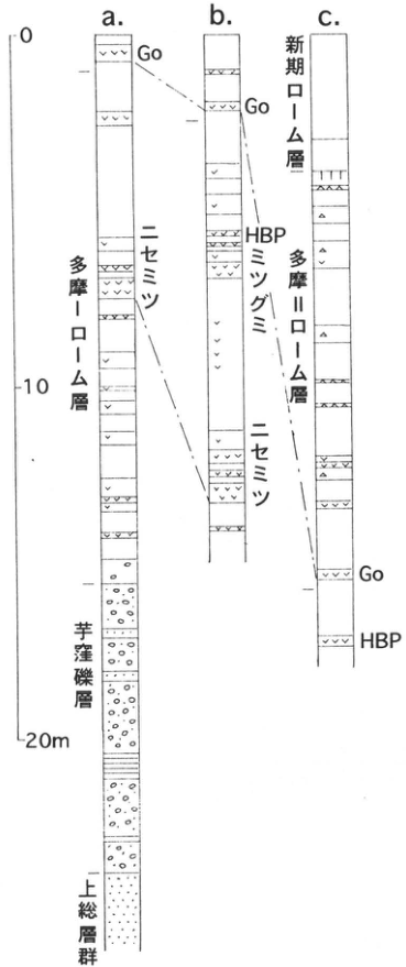
Show extracted lettering and translation
English translation of figure lettering
a, b, c; 0, 10, 20m; Tama I Loam Formation; Tama II Loam Formation; younger loam formation; Imokubo Gravel Bed; Kazusa Group; Go; HBP; Mitsugumi; Nisemitsu.
Original Japanese lettering
a,b,c;0,10,20m;多摩Iローム層;多摩IIローム層;新期ローム層;芋窪礫層;上総層群;Go;HBP;ミツグミ;ニセミツ。
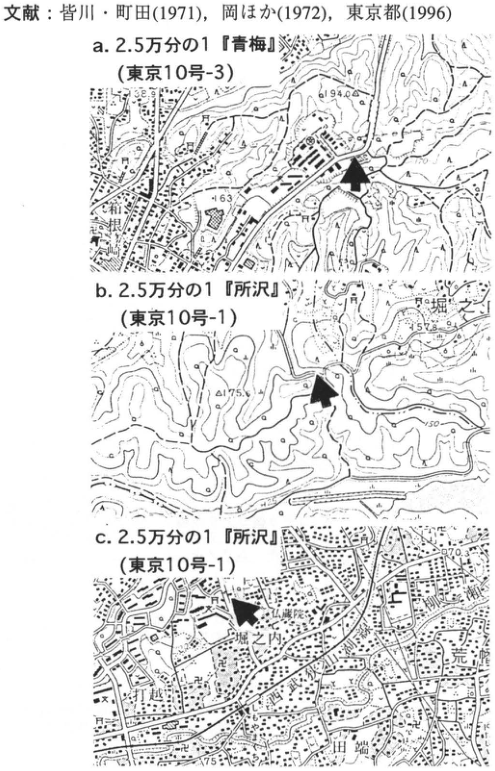
Show extracted lettering and translation
English translation of figure lettering
a: 1:25,000 “Ome” (Tokyo sheet 10-3); Mizuho; 194.0; 163. b: 1:25,000 “Tokorozawa” (Tokyo sheet 10-1); Horinouchi; 175.6; 157.8; 150. c: 1:25,000 “Tokorozawa” (Tokyo sheet 10-1); 仏蔵院; Horinouchi; Uchikoshi; Tabata; Arahata; 170.3; 75. The reference text attached above the maps is included in the main reference list.
Original Japanese lettering
a.2.5万分の1「青梅」(東京10号-3);瑞穂;194.0;163。b.2.5万分の1「所沢」(東京10号-1);堀之内;175.6;157.8;150。c.2.5万分の1「所沢」(東京10号-1);仏蔵院;堀之内;打越;田端;荒幡;170.3;75。図の上に付随した文献文字は本文文献欄へ収録。
Reading notes
背景の小さな地名・地図端で切れた文字の一部は判読不能。
KT-20 The Tama Loam Formation overlying the Gotentoge Gravel Bed in the Tama Hills
鈴木毅彦
- Locality: Mitsume, Oyama Town, Machida City, Tokyo
- Latitude and longitude: N35°36′15″ E135°21′31″
- Elevation: 165m
- Outcrop type and present condition: artificial outcrop; vegetated as of November 1995, but partly observable
- Deposit types and ages: eolian tephra; Middle Pleistocene
- Date of description: June 1995
- Keywords: Tama Hills; Gotentoge Gravel Bed; Gomashio tephra; Hachioji Biotite tephra
The Tama Hills, studied for many years, are a representative example in Japan of hills formed during the Middle Pleistocene. They comprise the T1 surface, the depositional surface of the Gotentoge Gravel Bed, an ancient alluvial-fan deposit of the Sagami River, and the T2 surface, a depositional surface of units including the Oshinuma Sand and Gravel Bed, a marine unit dated to approximately 300ka. Many outcrops exposing the overlying tephra appeared during earthworks for large residential developments and disappeared at the same time. Few can now be observed, and it is uncertain when they too will disappear. The outcrop introduced here is one of the few valuable examples that could still be observed as of June 1995. This area lies on the T1 surface formed by the Gotentoge Gravel Bed, specifically the lower Sakashita surface of its two subdivisions (皆川・町田, 1971). It is covered by eolian deposits comprising, in ascending order, the Tama, Shimosueyoshi, Musashino, and Tachikawa loam formations. At this outcrop, Gomashio-1 tephra (GoP1) and the Hachioji Biotite tephra (HBP), representative of the Tama Loam Formation, can be observed. The outcrop is a road cut on the drainage divide between the Oguri and Sakai river systems. Turf has now been planted, but has peeled away in places, allowing the section from above HBP to at least GoP2 to be observed. At the locality marked ■, approximately 1km northeast of this outcrop, the section from HBP down to the Gotentoge Gravel Bed could formerly be observed, but it is now covered by concrete and turf. A stratigraphic column for that locality is also presented for reference.
References: 町田 et al. (1974); 皆川・町田 (1971); 岡・宇野沢 (1989).
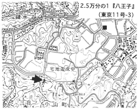
Show extracted lettering and translation
English translation of figure lettering
1:25,000 “Hachioji” (Tokyo sheet 11-3); residential development under construction; Mitsume; Oyama Town; 182.3; 164; 126; ■.
Original Japanese lettering
2.5万分の1「八王子」(東京11号-3);宅地造成中;三ツ目;小山町;182.3;164;126;■。
Reading notes
地図の小さな背景文字の一部は判読不能。
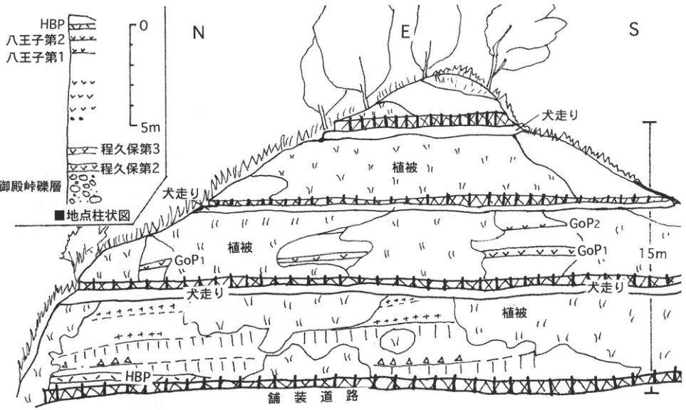
Show extracted lettering and translation
English translation of figure lettering
Outcrop: N; E; S; vegetation cover (three occurrences); berm (犬走り, four occurrences); paved road; GoP1 (two occurrences); GoP2; HBP; 15m. Column at the ■ locality: 0, 5m; HBP; Hachioji-2; Hachioji-1; Hodokubo-3; Hodokubo-2; Gotentoge Gravel Bed.
Original Japanese lettering
露頭:N;E;S;植被(3箇所);犬走り(4箇所);舗装道路;GoP1(2箇所);GoP2;HBP;15m。■地点柱状図:0,5m;HBP;八王子第2;八王子第1;程久保第3;程久保第2;御殿峠礫層。
KT-21 The Tokyo Formation and Narimasu Gravel Bed at Narimasu on the Yamanote Upland—deposits of oxygen-isotope stage 5c
菊地隆男
- Locality: Akatsuka 4-chome, Itabashi Ward, Tokyo
- Latitude and longitude: N35°47′04″ E139°38′33″
- Elevation: 30m
- Outcrop type and present condition: artificial outcrop; concrete retaining wall since 1989
- Deposit types and ages: marine and fluvial deposits; Middle to Late Pleistocene
- Date of description: August 1979
- Keywords: Tokyo Formation; Narimasu Shell Bed; Narimasu Gravel Bed; Itabashi Clay Bed; Ontake-1 tephra
This outcrop, commonly known as the Narimasu outcrop and noted for allowing observation of strata within central Tokyo, was covered with concrete during retaining-wall construction in 1979. Before this work, the Itabashi Ward Board of Education planned to preserve a record of the exposure. The Center for Environmental Information Science, represented by 松井健, organized a survey team led by 新堀友行. Specialists conducted investigations in geology (加藤定男 and 羽鳥謙三), soils (細野衛 and others), clay minerals (倉林三郎), fossils (菊地隆男 and others), specimen preparation (永塚鎮男), and other fields (Itabashi Ward Board of Education, 1980). The outcrop lies in the northern Yamanote Upland, on the Narimasu geomorphic surface. The observed sequence is as follows. At the base, the Tokyo Formation comprises, in ascending order, 190cm of silt densely containing tubular trace fossils, 90cm of medium-grained sand with lenticular concentrations of fossil shells, 80cm of alternating sand and silt containing plant fossils, and 90cm of silt. The shell-bearing unit is called the Narimasu Shell Bed and lies at the same stratigraphic level as the Tokumaru Shell Bed formerly exposed in Tokumaru, Itabashi Ward (福田・安藤, 1951). It yields abundant kagamigai (カガミガイ), onogai (オオノガイ), itayagai (イタヤガイ), goisagigai (ゴイサギガイ), mugigai (ムギガイ), and other mollusks inhabiting the intertidal to upper shallow-marine zones of inner bays in Japanese coastal waters. It also contains cold-current species, ezoishikagegai (エゾイシカゲガイ) and hotategai (ホタテガイ), and the warm-current species haigai (ハイガイ). Plant fossils include sawara cypress, fir leaves, alder fruits, and seeds of the warm-climate tree aburagiri (アブラギリ). The Narimasu Gravel Bed unconformably overlies the Tokyo Formation and comprises 90cm of sand and gravel containing subrounded pebble-size clasts, 50cm of medium-grained sand with trough cross-lamination, and 250cm of alternating sand and silt. It is conformably overlain by the Itabashi Clay Bed. The gravel is fluvial and indicates paleoflow from the north. Above the Narimasu Gravel Bed, the Itabashi Clay Bed consists of 130cm of gray-white to yellowish-brown, volcanic-ash-rich clay. Its upper 73cm consists of yellowish-white pumiceous clay containing mica and yellow pumice altered to clay (Ontake-1 tephra; On-Pm 1). Higher in the sequence are 260cm of the Shimosueyoshi Loam Formation, with scattered orange-yellow pumice in its middle part (Hakone–Obaradai tephra; Hk-OP); 350cm of the Musashino Loam Formation, intercalating a 20cm bed of Hakone–Tokyo tephra (Hk-TP) in its lower part; and 170cm of the Tachikawa Loam Formation, intercalating Aira-Tn tephra (AT).
References: 福田・安藤 (1951); Itabashi Ward Board of Education (1980).
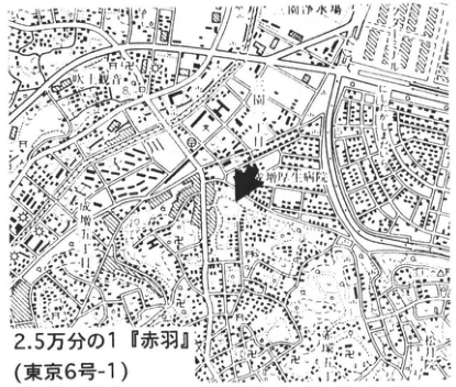
Show extracted lettering and translation
English translation of figure lettering
1:25,000 “Akabane” (Tokyo sheet 6-1); Akatsuka; Shogetsuin; 新町工科学[illegible]; water purification plant; Kami-Akatsuka Town; Tagara Town; 21.8; 20.
Original Japanese lettering
2.5万分の1「赤羽」(東京6号-1);赤塚;松月院;新町工科学[判読不明];浄水場;上赤塚町;田柄町;21.8;20。
Reading notes
学校等の小さな背景文字と一部地図端の文字は判読不能。
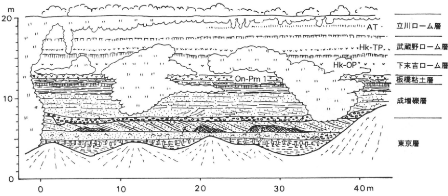
Show extracted lettering and translation
English translation of figure lettering
Vertical axis: 0, 10, 20m. Horizontal axis: 0, 10, 20, 30, 40m. From top to bottom: Tachikawa Loam Formation, AT; Musashino Loam Formation, Hk-TP; Shimosueyoshi Loam Formation, Hk-OP; Itabashi Clay Bed, On-Pm 1; Narimasu Gravel Bed; Tokyo Formation.
Original Japanese lettering
縦軸:0,10,20m。横軸:0,10,20,30,40m。上から:立川ローム層,AT;武蔵野ローム層,Hk-TP;下末吉ローム層,Hk-OP;板橋粘土層,On-Pm 1;成増礫層;東京層。
KT-22 Pleistocene and Holocene tephras at the Kita-Ekoda archaeological site, Nakano Ward, Tokyo
辻誠一郎
- Locality: Ekoda 3-chome, Nakano Ward, Tokyo
- Coordinates: N35°43′40″ E139°40′10″
- Elevation: 30 m
- Exposure and condition: Artificial exposure produced by excavation; backfilled after investigation
- Deposits and age: Marsh deposits consisting of peat, peaty sediment, silt, and sand; Pleistocene–Holocene
- Description date: November 1985
- Keywords: Paleolithic period, Jomon period, Ekoda Formation, Aira-Tn tephra, Fuji-derived tephra
The Kita-Ekoda site lies within metropolitan Kita-Ekoda Park in Ekoda 3-chome, Nakano Ward. Excavation accompanied construction of a river flood-regulation reservoir beneath the park. Peat beds rich in plant fossils suggesting a cold climate had long been known, through Naora (1954) and others, in the catchments of the Ekodagawa flowing east of the park and the Myoshojigawa farther south. Excavation of this site confirmed peat and peaty deposits containing numerous scoriaceous tephra beds, including Aira-Tn tephra (AT), providing new evidence for reassessing the stratigraphy and chronology of the so-called Ekoda Formation, regarded as one of the reference successions for the Tachikawa period. Construction began immediately after excavation, but some recognition of the formation's significance led to part of the section being covered with transparent plastic panels and explanatory information so that it could be viewed in the park.
The deposits were broadly divided, on the basis of unconformities, into nine units, S and A–H, from top to bottom. Radiocarbon ages and plant-fossil assemblages—pollen, plant macrofossils, and fossil wood—were then integrated to divide them into Pleistocene and Holocene deposits at the unconformity between units C and D. Their facies also differ markedly: unit D and underlying units generally comprise brown, ash-rich peat, whereas unit C and overlying units contain hardly any volcanic ash and consist of black to dark-gray silt and herbaceous peat. Units D and E were estimated to date from approximately 20–30 ka. AT occurs at the very top of unit E. Unit E contains a total of 50 primary tephra beds, including AT. Almost all are scoriaceous and are thought to derive from Fuji Volcano. Numerous artifact assemblages dating from the Jomon period onward were recovered from unit C and higher units.
References: 直良 (1954), 辻 et al. (1987).
Show extracted lettering and translation
English translation of figure lettering
1:25,000 “Tokyo Seibu” (Tokyo 6-2). 米町; Ekoda 1-/2-chome; Numabukuro 1-/2-chome; Eharacho 1-/2-chome; Toyotama-Minami; special-needs school; hospital; Musashi University; Ekodagawa. Black square: locality.
Original Japanese lettering
2.5万分の1「東京西部」(東京6号-2)。米町、江古田一丁目・二丁目、沼袋一丁目・二丁目、江原町一丁目・二丁目、豊玉南、養護学校、病院、武蔵大学、江古田川。黒四角=地点。
Reading notes
地図の微小注記 — 学校名や細い街区の一部字形は原画像でも不鮮明。
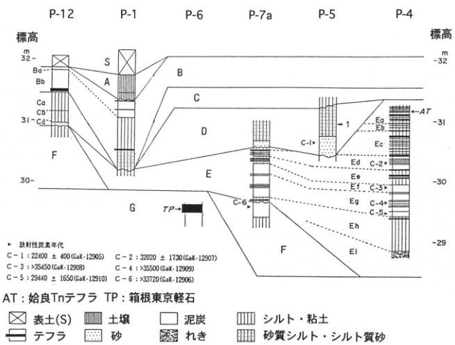
Show extracted lettering and translation
English translation of figure lettering
Localities P-12, P-1, P-6, P-7a, P-5, P-4. Elevation (m): 29, 30, 31, 32. Units S, A, B (Ba, Bb), C (Ca, Cb, Cc), D, E (Ea, Eb, Ec, Ed, Ee, Ef, Eg, Eh, Ei), F, G. 47, 1. AT: Aira-Tn tephra. TP: Hakone-Tokyo pumice. Radiocarbon ages: C-1 22400±400 (GaK-12905); C-2 32020±1730 (GaK-12907); C-3 >35450 (GaK-12908); C-4 >35500 (GaK-12909); C-5 29440±1650 (GaK-12910); C-6 >33720 (GaK-12906). Legend: topsoil (S), soil, peat, silt/clay, tephra, sand, gravel, sandy silt/silty sand.
Original Japanese lettering
地点P-12、P-1、P-6、P-7a、P-5、P-4。標高m:29、30、31、32。層S、A、B(Ba、Bb)、C(Ca、Cb、Cc)、D、E(Ea、Eb、Ec、Ed、Ee、Ef、Eg、Eh、Ei)、F、G。47、1。AT:姶良Tnテフラ。TP:箱根東京軽石。放射性炭素年代:C-1 22400±400(GaK-12905);C-2 32020±1730(GaK-12907);C-3 >35450(GaK-12908);C-4 >35500(GaK-12909);C-5 29440±1650(GaK-12910);C-6 >33720(GaK-12906)。凡例:表土(S)、土壌、泥炭、シルト・粘土、テフラ、砂、れき、砂質シルト・シルト質砂。
KT-23 Tephra stratigraphy at the Meguro-Ohashi site, eastern Musashino plateau
両角まり・建石徹・上杉陽・上本進二・松田隆夫
- Locality: 2-17 Ohashi, Meguro Ward, Tokyo
- Coordinates: N35°39′0″ E139°41′24″
- Elevation: 32 m
- Exposure and condition: Artificial exposure; disappeared
- Deposits and age: Aeolian tephra; since approximately 40 ka
- Description dates: July 1993–March 1996
- Keywords: Fuji-derived tephra, mica-bearing greasy ash, BCVA, microblades, backed knife-shaped tools, pyramidal tools, imoishi pebbles, Meguro-Ohashi site
This site (目黒大橋遺跡調査会, 1966 [as printed]) occupies the tip of a tongue-shaped Musashino-period plateau on the north bank of the Megurogawa, in the southeastern Musashino plateau, east of the Third Riot Police Unit compound. It was a falconry ground in the Edo period and military land from the Meiji period onward, so preservation from the topsoil downward is unusually good for the ward. It lies 92 km from Fuji's summit along N70°E. Although beds are only about 25–40% as thick as in the Miyagase site group 50 km from the summit, individual tephras can be distinguished visually with little difference. At 5 m below ground is mica-bearing greasy ash (Gr; 愛鷹ローム団体研究グループ, 1969), equivalent to Y-97′ (上杉 et al., 1980), which 佐護・町田 (1996) correlated with Sambe-Ikeda (SI). 叶内・杉原 (1994) dated it to approximately 38.3 ka. Y-94 (BCVA), white pumice fragments to lithic fragments from Hakone's central cone, is another subsidiary marker bed. A dark band occurs 15–40 cm above Y-97′; it is the Xb dark band of the standard Musashino archaeological soil succession, or an even older band. Flattened to ellipsoidal pebbles, mostly 1–2 cm across and called imoishi in Musashino, are scattered between Y-94 and Y-108′ (30–40 ka). Flakes occur in layer VII (27.5–28 ka?), while backed knives, pyramidal tools, and flakes occur from lower IV to upper V (27.5–28 ka?). Incipient Jomon cord-twisted pottery and stone tools occur in Y-141-1–3, the final Old Fuji phase (11.2–12.5 ka; 上杉, 1990). Abundant Kasori E pottery occurs mainly in S-5 of the New Fuji period (from 10.5 ka onward). Tephras from the latter half of Late Jomon through Final Jomon (S-10–S-21; 2.2–3.1 ka) have disappeared, and artifacts cannot be found. Tephras and artifacts of that period are often found beneath slopes and lowlands below the plateau. These stratigraphic relationships are common to the Sagamino–Musashino region; mineral analyses also permit detailed correlation between plateaus.
References: 愛鷹ローム団体研究グループ (1969), 叶内・杉原 (1994), 佐護・町田 (1996), 目黒大橋遺跡調査会 (1996), 上本 et al. (1994), 上杉 (1990), 上杉 et al. (1980, 1992).
Ω denotes artifacts; for details see 上杉 et al. (1992).
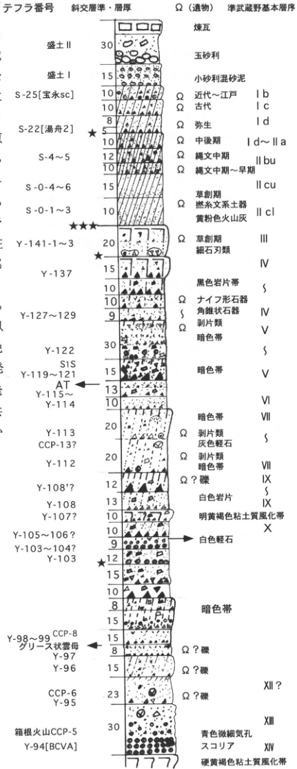
Show extracted lettering and translation
English translation of figure lettering
Tephra number / cross-cutting horizon and thickness / Ω (artifacts) / quasi-Musashino standard succession. Top to bottom: brick, fill II 30, rounded gravel, fill I 15, fine gravel mixed with sandy mud; S-25 [Hoei sc] 10, modern–Edo Ib; 10, ancient Ic; 8, Yayoi Id; S-22 [Yufune 2] 5★; 10, Middle/Late Id–IIa; S-4–5 12, 10, Middle Jomon IIbu; S-0-4–6 15, Middle–Early Jomon IIcu; S-0-1–3 10, Incipient Jomon, twisted-cord pottery, yellow powdery volcanic ash IIcl; ★★★; Y-141-1–3 20, Incipient Jomon, microblades III; ★; IV; Y-137 15,10,10, black lithic-fragment band; Y-127–129 9, Ω backed knives and pyramidal tools IV, Ω flakes V; Y-122 30, dark band; S1S; Y-119–121 15, dark band V; AT; Y-115–Y-114 13,10, VI; VII dark band; Y-113 20, CCP-13?, Ω flakes, gray pumice; Y-112 20, Ω flakes, dark band VII/VIII; Y-108′? 12, Ω? gravel IX; Y-108 13, white lithics IX; Y-107? 10, bright yellow-brown clayey weathered zone X; Y-105–106? 10, white pumice; Y-103–104? 9; Y-103 12★; 15,10,8,15, dark band; Y-98–99 CCP-8 15, greasy mica; Y-97 8, Ω? gravel; Y-96 15, Ω? gravel; CCP-6 Y-95 23, Ω? gravel XII?; 30, XII; Hakone Volcano CCP-5; Y-94 [BCVA], blue scoria with fine vesicles XIV; hard yellow-brown clayey weathered zone.
Original Japanese lettering
テフラ番号/斜交層準・層厚/Ω(遺物)/準武蔵野基本層序。上→下:煉瓦、盛土II 30、玉砂利、盛土I 15、小砂利混砂泥;S-25[宝永sc]10、近代~江戸 Ib;10、古代 Ic;8、弥生 Id;S-22[湯舟2]5★;10、中後期 Id~IIa;S-4~5 12・10、縄文中期 IIbu;S-0-4~6 15、縄文中期~早期 IIcu;S-0-1~3 10、草創期・撚糸文系土器・黄粉色火山灰 IIcl;★★★;Y-141-1~3 20、草創期・細石刃類 III;★;IV;Y-137 15・10・10、黒色岩片帯;Y-127~129 9、Ωナイフ形石器・角錐状石器 IV、Ω剥片類 V;Y-122 30、暗色帯;S1S;Y-119~121 15、暗色帯 V;AT;Y-115~Y-114 13・10、VI;VII暗色帯;Y-113 20、CCP-13?、Ω剥片類・灰色軽石;Y-112 20、Ω剥片類・暗色帯 VII・VIII;Y-108′? 12、Ω?礫 IX;Y-108 13、白色岩片 IX;Y-107? 10、明黄褐色粘土質風化帯 X;Y-105~106? 10、白色軽石;Y-103~104? 9;Y-103 12★;15・10・8・15、暗色帯;Y-98~99 CCP-8 15、グリース状雲母;Y-97 8、Ω?礫;Y-96 15、Ω?礫;CCP-6 Y-95 23、Ω?礫 XII?;30、XII;箱根火山CCP-5;Y-94[BCVA]、青色微細気孔スコリア XIV;硬黄褐色粘土質風化帯。
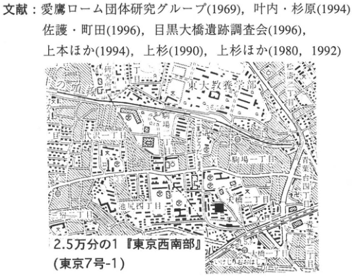
Show extracted lettering and translation
English translation of figure lettering
References: 愛鷹ローム団体研究グループ (1969), 叶内・杉原 (1994), 佐護・町田 (1996), 目黒大橋遺跡調査会 (1996), 上本 et al. (1994), 上杉 (1990), 上杉 et al. (1980,1992). 1:25,000 “Tokyo Seinan” (Tokyo 7-1). College of Arts and Sciences, University of Tokyo; Komaba 1-/2-/4-chome; Ohashi 1-/2-chome; Ikejiri 2-/4-chome; Setagaya Park; Megurogawa.
Original Japanese lettering
文献:愛鷹ローム団体研究グループ(1969)、叶内・杉原(1994)、佐護・町田(1996)、目黒大橋遺跡調査会(1996)、上本ほか(1994)、上杉(1990)、上杉ほか(1980、1992)。2.5万分の1「東京西南部」(東京7号-1)。東京大学教養学部、駒場一丁目・二丁目・四丁目、大橋一丁目・二丁目、池尻二丁目・四丁目、世田谷公園、目黒川。
KT-24 Tephra stratigraphy at the Nogawa site, Chofu City
小田静夫
- Locality: Nomizu 1-chome and vicinity, Chofu City, Tokyo
- Coordinates: N35°40′37″ E139°31′35″
- Elevation: 48 m
- Exposure and condition: Artificial exposure; disappeared
- Deposits and age: Aeolian tephra; 35 ka to the Common Era
- Description dates: June–August 1970
- Keywords: Reference stratigraphy of the Tachikawa Loam, Aira-Tn tephra, multilayer Paleolithic site, Musashino plateau, Nogawa site
The site lies on a south-facing tongue-shaped plateau overlooking the Nogawa along the Kokubunji scarp, on the Tachikawa terrace beside the Tamagawa at the southwestern margin of the Musashino plateau. The large emergency excavation accompanied river improvement and was Japan's first organized Paleolithic-site investigation combining archaeology and natural science. Ten Paleolithic cultural horizons were identified in the Tachikawa Loam. Together with the Tsukimino site group in Kanagawa investigated the previous year, this marked an epoch in Japanese Paleolithic research described as “before and after Tsukimino and Nogawa.” The land then formed part of the International Christian University golf course; it is now metropolitan Nogawa Park. Archaeologists divided the approximately 5 m of Holocene and Pleistocene tephra into 13 natural layers through experience-based visual identification.
Layer I is black topsoil; it thickens downslope and becomes strongly black and peaty in the valley bottom. Layer II is dark-brown soil, becoming browner, finer, and sandier downward. Jomon features and artifacts (approximately 3–12 ka) occur in it. It is the primary dark-brown soil generally recognized beneath the disturbed “topsoil/cultivated soil” of this region. The Holocene succession extends down to this level. The Pleistocene Tachikawa Loam begins with layer III, commonly termed soft loam: soft yellow-brown loam with a strongly uneven discontinuous basal boundary, interpreted as a reformed layer produced by secondary swelling and softening of the original hard loam (IV and below). It contains Paleolithic cultural horizon III. Layer IV is the brown hard-loam portion. A black band approximately 20 cm below its top divides it into IVa, IVb, and IVc. IVb was a newly recognized black band above the previously known black band 1, and was therefore named black band 0 (BB0). Five Paleolithic horizons (IV-1, IV-2, IV-3, IV-3b, IV-4) were found in IV. Layer V is dark-brown loam corresponding to black band 1 (BB1), and contains cultural horizon V. Layer VI is yellow-brown loam with Aira-Tn tephra (AT; 21–24 ka) in its lower half, and contains cultural horizon VI.
Dark-brown loam of black band 2 (BBII) begins at VII and is normally 70–80 cm thick. At this site, orange-brown loam approximately 40 cm below its top divides the band into VII (BBIIa), VIII, and IX (BBIIb). Cultural horizons VII and VIII were found in its upper half; none was confirmed at or below IX in its lower half. Layer X is somewhat soft brown loam. Small chert and sandstone pebbles called imoishi begin to occur around this level. They also occur at sites on the Musashino terrace and are natural river-bed gravel incorporated into the loam by some natural process. Layer XI is soft yellowish-white-brown loam, with a sandy lower half. Layer XII is blue-gray sand with scattered orange-brown mottled limonite coatings. Layer XIII consists mainly of fist-sized rounded gravel and corresponds to the Tachikawa gravel (TcL). Since this site was a reference area for Tachikawa Loam research, its succession has subsequently been widely used as the basic section for the Tachikawa Loam on the Musashino plateau.
References: キダー (1995), 小林 et al. (1971), 野川遺跡調査会 (1970), 小田 (1983).
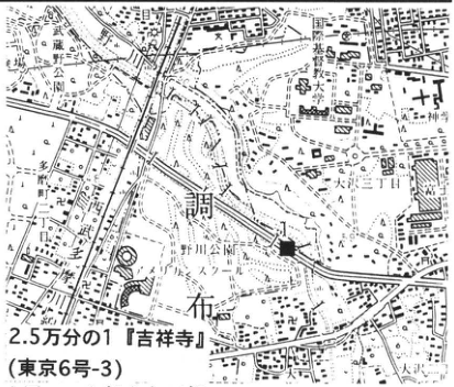
Show extracted lettering and translation
English translation of figure lettering
1:25,000 “Kichijoji” (Tokyo 6-3). International Christian University; graduate school; Nogawa; Osawa 1-/2-/4-chome; Nomizu 1-/2-chome; Chofu; observatory; Shinmei.
Original Japanese lettering
2.5万分の1「吉祥寺」(東京6号-3)。国際基督教大学、大学院、野川、大沢一丁目・二丁目・四丁目、野水一丁目・二丁目、調布、天文台、神明。
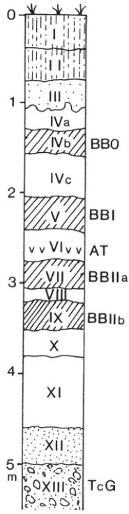
Show extracted lettering and translation
English translation of figure lettering
Depth: 0,1,2,3,4,5 m. Top to bottom: I,II,III,IVa,IVb (BB0),IVc,V (BBI),VI (AT),VII (BBIIa),VIII,IX (BBIIb),X,XI,XII,XIII (TcG).
Original Japanese lettering
深度0、1、2、3、4、5m。上→下:I、II、III、IVa、IVb(BB0)、IVc、V(BBI)、VI(AT)、VII(BBIIa)、VIII、IX(BBIIb)、X、XI、XII、XIII(TcG)。
KT-25 Tephra stratigraphy of the Tsukimino site group, Yamato City
小田静夫
- Locality: Tsukimino 7-chome and vicinity, Yamato City, Kanagawa Prefecture
- Coordinates: N35°31′32″ E139°28′34″
- Elevation: Approximately 79 m
- Exposure and condition: Artificial exposures; disappeared
- Deposits and age: Aeolian tephra; 70 ka to the Common Era
- Description dates: July–October 1968
- Keywords: Sagamino plateau, Tachikawa and Musashino Loam, Aira-Tn tephra, multilayer Paleolithic site group, Tsukimino sites
These predominantly Paleolithic sites lie along the middle Kuromegawa, a tributary of the Sakaigawa flowing along the eastern Sagamino plateau. Approximately 20 sites had been found concentrated along this middle reach. Emergency excavation associated with land readjustment in northern Yamato City targeted ten sites within approximately 2 km. Most had already been affected by construction: black topsoil was removed, loam exposed in many places, and numerous stone tools and pebbles visible in sections. Excavation therefore began from the stripped surface, and distinctive black bands and scoria beds were used to correlate levels between sites. The area has now been developed as a garden residential district.
The investigation identified 17 stone-tool assemblages at ten sites. Correlation between assemblages was significant in establishing Paleolithic chronology on the Sagamino plateau and human behavior within a single river catchment. Excavation of Tsukimino and Tokyo's Nogawa site marked an epoch in Japanese Paleolithic research since the discovery of Iwajuku, described as “before and after Tsukimino and Nogawa.”
The Holocene and Pleistocene tephras were divided visually by archaeologists into 14 natural layers. The approximately 1 m black topsoil is scoriaceous above, becoming clayey, progressively browner, and transitional into loam below. It had been stripped at many localities. The Pleistocene tephras occur on the third terrace surface of the Sagamino plateau, the Sagamino surface, correlated with the Musashino surface. Both Tachikawa and Musashino Loam are present. Tachikawa Loam exceeds 7 m, twice its thickness on the Musashino plateau.
The uppermost soft part of loam 1 (L1S) yielded an assemblage dominated by lanceolate projectile points at site IVA. Dark band 0 (B0) was sterile. The hard part of loam 1 (L1H) yielded lanceolate points and backed knives at sites IIIA, IIIB, IIID, IVA, and IVC. Dark band 1 (B1) yielded mainly backed knives with some lanceolate points at I, II, IIIA, IIIB, IIID, IVA, and IVC. Loam 2 (L2) yielded backed knives and lanceolate points at IIIC. Upper dark band 2 (B2U) yielded assemblages dominated by backed knives at IIIC and IVD. Lower dark band 2 (B2L) yielded knives resembling Moro-type backed knives at IVB. This was the lowest confirmed cultural horizon. No artifacts were established in loam 3 (L3), dark band 3 (BB3), or loam 4 (L4), although some pebble concentrations occurred in BB3.
Correlation with Musashino plateau levels showed that all the site's stone-tool cultures occurred within Tachikawa Loam. The markers were Sagamino Upper Scoria (S1S) in the upper part of L3 and Aira-Tn tephra (AT; 21–24 ka) below it. On the Musashino plateau, this AT consists of volcanic glass deposited in lower layer VI beneath Tachikawa Loam black band 1 (BB1).
References: 小野 (1979), 鈴木・矢島 (1978), 戸沢・安蒜 (1983), 月見野遺跡群調査団 (1969).
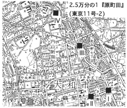
Show extracted lettering and translation
English translation of figure lettering
1:25,000 “Haramachida” (Tokyo 11-2). I,II,III,IV. Machida 7-/8-chome; Minami-Tsukushino; Minami-Naruse; Minami-Machida; Chuo-Rinkan 6-/7-chome; Tsukimino 1-/4-/5-/6-/7-/8-chome; Yamato City; Kuromegawa; 78.6.
Original Japanese lettering
2.5万分の1「原町田」(東京11号-2)。I、II、III、IV。町田七丁目・八丁目、南つくし野、南成瀬、南町田、中央林間六丁目・七丁目、つきみ野一丁目・四丁目・五丁目・六丁目・七丁目・八丁目、大和市、黒目川、78.6。
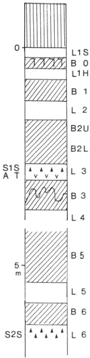
Show extracted lettering and translation
English translation of figure lettering
Depth: 0,5 m. Top to bottom: L1S,B0,L1H,B1,L2,B2U,B2L,L3 (S1S,AT),B3,L4,[omitted interval in the column],B5,L5,B6,L6 (S2S).
Original Japanese lettering
深度0、5m。上→下:L1S、B0、L1H、B1、L2、B2U、B2L、L3(S1S、AT)、B3、L4、[中略された区間]、B5、L5、B6、L6(S2S)。
KT-26 Fluvial gravel units and the Hadano fault cutting them, Hadano basin, Kanagawa Prefecture—Fuji/Hakone tephras and widespread tephras
上杉陽・内田法英・千葉達朗・関東第四紀研究会
- Locality: Soya, Hadano City, Kanagawa Prefecture
- Coordinates: N35°22′40″ E139°33′29″
- Elevation: 103–112 m
- Exposure and condition: Natural exposure; partly extant
- Deposits and age: Fallout tephra and fluvial gravel; 20–140 ka
- Description date: March 1981
- Keywords: Fuji-derived tephra, Hakone-derived tephra, Ontake-1 tephra, Aira-Tn tephra, Hadano fault
The exposure lies on the north side immediately below Shin-Kuzawa Bridge, where National Route 246 crosses the Kuzuhagawa. All the fluvial facies of lower Kissawa (Shimosueyoshi) Formation (100–140 ka), Iwakura gravel (55–70 ka), Saigato gravel (40–50 ka), Imaizumi gravel units (25–35 ka), and Ojiri gravel units (10–20 ka), distributed in the Oiso Hills and Hadano basin and described by 関東第四紀研究会 (1987), can be observed. It is also the type locality (上杉 et al., 1981) of the 3–4 km Hadano fault–Hadano flexure scarp (Kaneko, 1971), extending from Koganezawa at the basin's northeastern margin through Ochiai and this exposure to Fujimicho in the west-southwest. Continuous exposures for 2 km downstream along the cut bank show southeastward tilting of Fuji/Hakone and other tephras, including Aira-Tn (AT; 町田・新井, 1992), equivalent to Y-118 (上杉 et al., 1992), and of the Ojiri gravel cutting them. Subsidiary faults cutting the Ojiri gravel have also been confirmed (figure), suggesting that displacement continued after 20 ka (千葉, 1983).
Older units are more strongly tilted. Lower Iwakura gravel through lower Kissawa Loam is commonly overturned and dips north. Rates of tilting are similar in all units, 1–1.5° per 1,000 years. The Imaizumi surface has 45 m of relief across this flexure scarp. Contours of the Kissawa surface, which emerged at Hakone-Kissawa Lower 13–14 tephra (Hk-KlP13–14; 町田・新井, 1992), show a south-down flexure oriented ENE–WSW and centered on the sketch locality. Its position and reverse northwestward dip agree with the position of the scarp cutting the Ojiri and Imaizumi surfaces and their northwestward tilting (内田 et al., 1981). 長瀬 et al. (1982) reported that displacement of the base of the Hakone-Tokyo pumice-flow deposit across this fault reaches 72 m.
References: 千葉 (1983), Kaneko (1971), 関東第四紀研究会 (1987), 町田・新井 (1992), 長瀬 et al. (1982), 内田 et al. (1981), 上杉 et al. (1981, 1992).
Strike and dip: 1: N75E・35S; 2: EW・33S; 3: N83E・37S; 4: N80E・50S; 5: N85E・59S; 6: N75W・65S; 7: N80W・60S; 8: EW・67S; 9: N80E・70S; 10: N75E・50N; 11: N85E・75S; 12: N60E・15N; 13: N70E・40S; 14: EW・90; 15: N75E・50N; 16: N10W・30S; 17: N85W・80N; 18: EW・75S; 19: N80W・50N; 20: N45W・50N; 21: N65W・90; 22: N80W・35S.
Modified and supplemented from 内田 (1981), 上杉 et al. (1981), and 千葉 (1983).
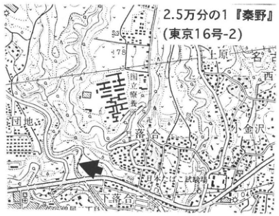
Show extracted lettering and translation
English translation of figure lettering
1:25,000 “Hadano” (Tokyo 16-2). Uehara, Nishi, Nagoki, Koganezawa, Ochiai, Hadano, housing estate, National Route 246, 78,104. Thick arrow: exposure.
Original Japanese lettering
2.5万分の1「秦野」(東京16号-2)。上原、西、名古木、小金沢、落合、秦野、団地、国道246、78、104。太矢印=露頭。
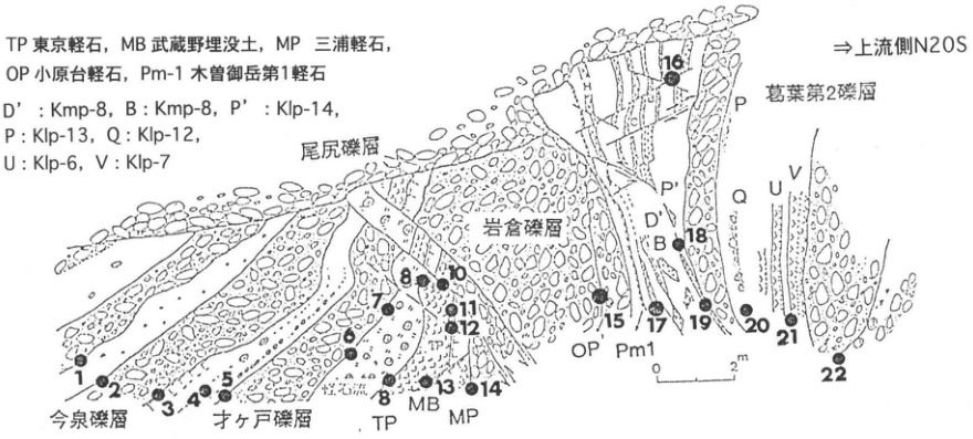
Show extracted lettering and translation
English translation of figure lettering
⇒Upstream N20S [as printed]. Imaizumi, Saigato, Ojiri, Iwakura, and Kuzuhagawa-2 gravel. TP: Tokyo pumice; MB: Musashino buried soil; MP: Miura pumice; OP: Obaradai pumice; Pm-1: Kiso-Ontake-1 pumice. D′: Kmp-8; B: Kmp-8; P′: Klp-14; P: Klp-13; Q: Klp-12; U: Klp-6; V: Klp-7. Points 1–22; scale 0–2 m.
Original Japanese lettering
⇒上流側N20S。今泉礫層、才ヶ戸礫層、尾尻礫層、岩倉礫層、葛葉第2礫層。TP 東京軽石;MB 武蔵野埋没土;MP 三浦軽石;OP 小原台軽石;Pm-1 木曽御岳第1軽石。D′:Kmp-8;B:Kmp-8;P′:Klp-14;P:Klp-13;Q:Klp-12;U:Klp-6;V:Klp-7。地点1–22、尺度0–2m。
KT-27 Tephra stratigraphy at the Godo-Kamijuku site, southeastern margin of the Tanzawa Mountains, Kanagawa Prefecture
上杉陽・御堂島正・上本進二・木村吉行・阿部友寿・柏木善治
- Locality: Godo, Isehara City, Kanagawa Prefecture
- Coordinates: N35°32′42″ E139°16′35″
- Elevation: 50 m
- Exposure and condition: Artificial exposure; disappeared
- Deposits and age: Aeolian tephra; from 24 ka onward
- Description dates: September 1994–March 1996
- Keywords: Fuji-derived tephra, Aira-Tn tephra, Hakone Central Cone pumice, standard Sagamino soil succession, lanceolate projectile points, Godo-Kamijuku site
The Godo-Kamijuku site (かながわ考古学財団, 1994), investigated during widening of the Tomei Expressway, occupies a narrow north–south plateau within the Kami-Kasuya alluvial-fan complex. It lies in the depression of the Magome–Susugaya tectonic line between the mountains to the west and the Isehara plateau to the east. The Tachikawa–Musashino-period fan complex continues to subside relatively, its margins buried beneath alluvial lowlands. Almost only tephras are exposed above the alluvial surface, occasionally interbedded with flood sand and gravel. The locality lies 50 km from Fuji's summit along N85°E; farther along this direction are the Yoshioka sites of the Sagamino plateau and Sodegaura Town, Kimitsu District, Chiba Prefecture. Individual tephras can be distinguished visually.
Y-118 (Aira-Tn; AT), assigned an average age of 24.5 ka by 池田 et al. (1995), occurs 5–6 m below ground. White Hakone pumice gravel (Hk-CCP-16; 上杉 et al., 1996) occurs in upper Y-128. At this level, Old Fuji pyroclastic flows occur at Fuji's eastern foot and Hakone pyroclastic flows at Hakone's western foot (上杉 et al., 1992). Its age is approximately 18 ka, making it an important marker for the base of L2 in the standard Sagamino archaeological succession (上本 et al., 1994). Lanceolate projectile points occur in Y-137-1–2 at the base of the hard loam, immediately above B1. The very top of Y-137-4 (approximately 14 ka?) may be a vermilion weathered zone to gray bleached zone, but is generally a dark band called the Sagamino B0 horizon. Y-141-3 (11.2–11.7 ka?) of the final Old Fuji phase is commonly compact black humic soil rich in reddish-brown scoria gravel and black lava fragments. Overlying New Fuji black soil (6.1–10.5 ka) developed in fluffy fine ash resembling roasted soybean flour (S-0-1–6; 上杉 et al., 1993). Early Jomon pottery occurs in S-1–3′, and Middle Jomon pottery in S-5–8. Dwelling remains of the beginning of ancient times cut S-9–11, with Nara–Heian artifacts scattered through their fill. Medieval ceramics occur immediately below the 1707 Hoei scoria.
References: 池田 et al. (1995), かながわ考古学財団 (1994), 町田・新井 (1992), 上本 et al. (1994), 上杉 (1990), 上杉 et al. (1992, 1993, 1996).
Ω denotes artifacts; detailed symbols are explained in 上杉 et al. (1992).
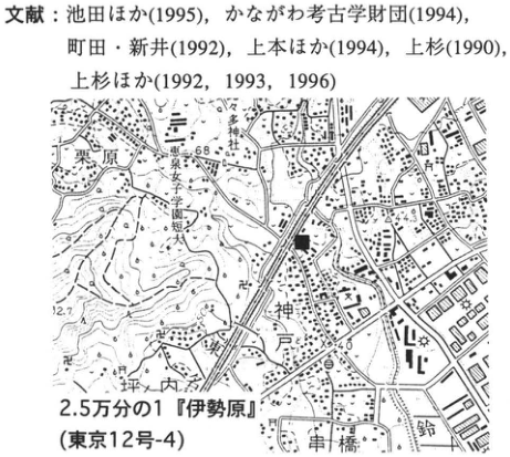
Show extracted lettering and translation
English translation of figure lettering
References: 池田 et al. (1995), かながわ考古学財団 (1994), 町田・新井 (1992), 上本 et al. (1994), 上杉 (1990), 上杉 et al. (1992,1993,1996). 1:25,000 “Isehara” (Tokyo 12-4). Kurihara, Godo, Tsubouchi, Kushihashi, Suzukawa; 68,44.3,40,12.7.
Original Japanese lettering
文献:池田ほか(1995),かながわ考古学財団(1994),町田・新井(1992),上本ほか(1994),上杉(1990),上杉ほか(1992,1993,1996)。2.5万分の1「伊勢原」(東京12号-4)。栗原、神戸、坪内、串橋、鈴川、68、44.3、40、12.7。
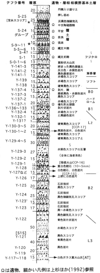
Show extracted lettering and translation
English translation of figure lettering
Tephra number / thickness / artifacts and facies / standard Sagamino soil succession. Ω: artifacts. フジクロ: Fuji Black Soil; ソフト: soft loam; ハードローム: hard loam; 漸移層: transition layer.
| Layer / number | Thickness (numbers as printed) | Description | Correlation |
|---|---|---|---|
| 最上部 | 20 | Fill containing rounded gravel | |
| S-25 宝永 | 25;12;8 | Compacted; gray-black with fine vesicles; Ω medieval ceramics | |
| S-24グループ | 10;13 | Ω Heian and Nara dwelling-fill layers | |
| S-9~11 | 10★ | Ω pit-dwelling floor | |
| S-5~6 | 15 | Ω Middle Jomon | |
| S-4? | 5 | [No annotation] | |
| S-1 | 15 | Ω Early Jomon | フジクロ |
| S-0-1~6 | 13 | Yellow powdery volcanic ash | |
| Y-141-3 | 10 | Compact black humic soil | 漸移層 |
| Y-141-2 | 15 | Gray-white and reddish-purple lithics | 漸移層 |
| Y-141-1 | 13 | Black fine dense lithics; reddish-brown scoria | 漸移層 |
| Y-139 | 15 | Reddish-brown scoria | ソフト |
| Y-138 | 13 | Hard blue-black scoria | ソフト |
| Y-137-4 | 15 | Ω flakes and gravel; green dense black and reddish-purple lithics | B0 |
| Y-137-3 | 15 | Black scoria | ハードローム |
| Y-137-2 | 20 | Reddish-brown scoria | ハードローム |
| Y-137-1 | 20 | Ω lanceolate projectile points | ハードローム |
| Y-136~133 | 10 | Flaky lithics | B1 |
| Y-132-4 | 12 | Reddish-brown scoria | L2 |
| Y-132-1 | 15 | Black-green lithics | L2 |
| Y-131? | 5 | [No annotation] | L2 |
| Y-130-3~5 | 20 | Hard blue-black scoria [CCP-17] | L2 |
| Y-130-1~2 | 15 | Black-purple and white lithics; hard blue-black scoria | L2 |
| Y-129-4~5 | 30 | Hard blue-black scoria and [continuation mark] | L2 |
| Y-129-3 | 27 | Alternating reddish-purple scoria beds (overall shrimp-brown) | L2 |
| Y-129-2 | 15 | [Same alternating beds] | L2 |
| Y-129-1 | 10 | [Hakone Volcano CCP-16] yellow-white pumice (10–5 mm) | L2 |
| Y-128 | 10 | White pumice and white lithics | L2 |
| Y-127など | 15 | [CCP-15] white lithics above | L2 |
| Y-126 | 17 | [No annotation] | B2 |
| Y-125 | 20 | Coal-cinder-like; black scoria | B2 |
| Y-124 | 25 | Coal-cinder-like; black scoria with fine vesicles | B2 |
| Y-123′ | 15 | Coal-cinder-like | B2 |
| Y-123 | 17 | Coal-cinder-like; black to reddish-brown scoria | B2 |
| Y-122 | 50 | Black finely vesicular scoria, blue flaky lithics, reddish-brown scoria | L3 |
| Y-121[S1S] | 40 | Black scoria; blue-black lithics | L3 |
| Y-120 | 20 | Black lithics | L3 |
| Y-119 | [なし] | [No annotation] | L3 |
| Y-117~118 | 15 | White glassy volcanic ash [AT] | L3 |
Original Japanese lettering
テフラ番号/層厚/遺物・層相/相模野基本土層。Ω=遺物。
| 層・番号 | 層厚(原図数字) | 記述 | 対比 |
|---|---|---|---|
| 最上部 | 20 | 円礫入り盛り土 | |
| S-25 宝永 | 25;12;8 | 押し固め、灰黒色微細気孔、Ω中世陶磁器類 | |
| S-24グループ | 10;13 | Ω平安覆土層、Ω奈良覆土層 | |
| S-9~11 | 10★ | Ω竪床 | |
| S-5~6 | 15 | Ω縄文中期 | |
| S-4? | 5 | [注記なし] | |
| S-1 | 15 | Ω縄文前期 | フジクロ |
| S-0-1~6 | 13 | 黄粉状火山灰 | |
| Y-141-3 | 10 | 締まった黒色腐植土 | 漸移層 |
| Y-141-2 | 15 | 灰白色・赤紫色岩片 | 漸移層 |
| Y-141-1 | 13 | 黒色微密岩片、赤褐色スコリア | 漸移層 |
| Y-139 | 15 | 赤褐色スコリア | ソフト |
| Y-138 | 13 | 硬青黒色スコリア | ソフト |
| Y-137-4 | 15 | Ω剥片、礫;緑密黒色・赤紫色岩片 | B0 |
| Y-137-3 | 15 | 黒色スコリア | ハードローム |
| Y-137-2 | 20 | 赤褐色スコリア | ハードローム |
| Y-137-1 | 20 | Ω槍先形尖頭器 | ハードローム |
| Y-136~133 | 10 | 剥片状岩片 | B1 |
| Y-132-4 | 12 | 赤褐色スコリア | L2 |
| Y-132-1 | 15 | 黒緑色岩片 | L2 |
| Y-131? | 5 | [注記なし] | L2 |
| Y-130-3~5 | 20 | 硬青黒色スコリア[CCP-17] | L2 |
| Y-130-1~2 | 15 | 黒紫色岩片・白色岩片、硬青黒色スコリア | L2 |
| Y-129-4~5 | 30 | 硬青黒色スコリアと[続く記号] | L2 |
| Y-129-3 | 27 | 赤紫色スコリアの互層(全体に海老茶色) | L2 |
| Y-129-2 | 15 | [同互層] | L2 |
| Y-129-1 | 10 | [箱根火山CCP-16]黄白色軽石(10~5mm) | L2 |
| Y-128 | 10 | 白色軽石、白色岩片 | L2 |
| Y-127など | 15 | [CCP-15]上部に白色岩片 | L2 |
| Y-126 | 17 | [注記なし] | B2 |
| Y-125 | 20 | 石炭殻状、黒色スコリア | B2 |
| Y-124 | 25 | 石炭殻状、黒色微細気孔スコリア | B2 |
| Y-123′ | 15 | 石炭殻状 | B2 |
| Y-123 | 17 | 石炭殻状、黒~赤褐色スコリア | B2 |
| Y-122 | 50 | 黒色細気孔スコリア、青色剥片状岩片、赤褐色スコリア | L3 |
| Y-121[S1S] | 40 | 黒色スコリア、青黒色岩片 | L3 |
| Y-120 | 20 | 黒色岩片 | L3 |
| Y-119 | [なし] | [注記なし] | L3 |
| Y-117~118 | 15 | 白色ガラス質火山灰[AT] | L3 |
KT-28 Tephra stratigraphy of the Yoshioka site group, Kanigaya, Ayase City, Kanagawa Prefecture
上杉陽・白石浩之・上本進二・砂田佳弘・米澤宏・由井将雄
- Locality: Kanigaya, Yoshioka, Ayase City, Kanagawa Prefecture
- Coordinates: N35°25′6″ E139°25′24″
- Elevation: 48–20 m
- Exposure and condition: Artificial exposures; disappeared
- Deposits and age: Aeolian tephra; from 40 ka onward
- Description date: March 1994
- Keywords: Fuji-derived tephra, Hakone-derived tephra, Aira-Tn tephra, mica-bearing greasy ash, trapezoid-like tools, backed knife-shaped tools, Yoshioka site group
The sites lie 63 km from Fuji along N84°E and 42 km from Hakone's central cone along N60°E. Following the tephras of both volcanoes in sequence permits almost entirely visual identification of the tephra levels containing artifacts (上杉, 1990; 上杉 et al., 1992). They occupy the northern end of the Koza Hills, composed of marine sand of 100–140 ka and overlying tephra. The central depression is a local subsidence zone where the top of the marine beds lies 5–8 m below its surroundings; tephra often displays blue-gray reduction colors. A narrow valley enters from the Sagamino surface one step lower to the west, branching in the center like a crab's legs. These geomorphic and hydrological conditions provided excellent watering and hunting places, but also produced small faults crisscrossing in many directions, and people suffered from fissures and collapses (米澤 et al., submitted; 上杉 et al., submitted; 上本 et al., submitted). A large collapse just before S-10, approximately 3.1 ka, occurred at almost the same time as the landslide and pyroclastic flow that recreated Lake Ashi at Hakone (上杉 et al., 1992).
Artifacts occur in Y-101–102 at approximately 35 ka (trapezoid-like tools and backed knives), Y-105–108 (trapezoid-like tools and partly polished stone axes), Y-110–113 (wedge-shaped tools), Y-115 (backed knives), Y-123–126 (backed knives, kiridashi-type tools, and pyramidal tools), Y-133–136 (backed knives and lanceolate points), Y-137–140 ≈ L1H–B0–L1S (points and microliths), Y-141-3–1 ≈ lower black soil to the transition layer (single-beveled stone axes and tanged points), S-0-6? (scratched pottery of the latter part of Initial Jomon), S-3? (Moroiso b pottery of Early Jomon), S-5–7? (Katsusaka pottery of Middle Jomon), and S-8–9? (Horinouchi pottery of Late Jomon) (白石・加藤, 1996; 砂田・縄野, 1996). Rounded pebbles of dark-green tuff (1–2 cm diameter; imoishi) occur in Y-99–95. They occur at nearly the same level at Sanmyoji at the foot of Ashitaka and at Meguro-Ohashi in Tokyo. Further observation of their occurrence and of the imoishi themselves is necessary.
References: 白石・加藤 (1996), 砂田・縄野 (1996), 上本 et al. (submitted), 上杉 (1990), 上杉 et al. (1992, submitted), 米澤 et al. (submitted).
Ω denotes artifacts, ★ cross-cutting relationships, and ∠ collapse; see 上杉 et al. (1992) for detailed symbols.
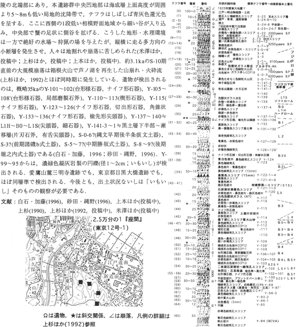
Show extracted lettering and translation
English translation of figure lettering
Tephra number / thickness / facies / visual characteristics / standard tephra number and Sagamino soil-unit name. Ω: artifacts; ★: cross-cutting relation; ∠: collapse. Map: 1:25,000 “Zama” (Tokyo 12-1). School; junior high school; 八次谷; 芦久保; Shiroyama; Edo-Michiminami; Uchikomi; Yoshioka; Ne; Shindo; 48.3,49.6. Body prose and references in the upper-left of the crop are reproduced fully in the body text. フジクロ下部: lower Fuji Black Soil; 漸移層: transition layer; ソフトローム: soft loam; ハードローム: hard loam; 相模野第一スコリア: Sagamino-1 Scoria; アカホヤ: Akahoya.
| Layer / number | Thickness (numbers as printed) | Description | Correlation |
|---|---|---|---|
| 0 | 100~0 | 1923 Great Kanto earthquake?; Ω Edo–Meiji ceramics and pits | |
| 1 | 70~5 | Finely vesicular scoria containing pumice | S-25 |
| 2・3 | 15 | Ω modern; collapse; road collapse | S-24-9~10 |
| 4 | 10 | Burnt soil | S-24-8 |
| 5~7 | 25~15 | Ω pit dwelling of first half of 7th century; reddish-brown scoria | S-23~24-7 |
| 8 | 10 | Hard reddish-brown–purple-brown scoria; Ω flakes and reddish-purple lithics | S-22 2200 years B.P. |
| 9~11 | 20★ | Gray scoria with fine vesicles; heavy gray-black finely vesicular lithics | S-18~18′;S-13′?;S-10~12? |
| 12~14 | 20 | Blue-green lithics | S-7~9 3250 years B.P. |
| 15 | 15 | Green clasts, reddish-purple lithics and scoria | S-5~6′ |
| 16 | 15 | Reddish-purple lithics | S-4 |
| 17~19 | 15~25 | Dark-brown b type; brown and reddish-brown scoria; ∠ gray volcanic sand | S-3;S-1~ 6100 years B.P. |
| 20 | 10~15 | Ω scratched pottery; scattered bubble-wall glass | S-0-6′;アカホヤK-Ah |
| 21 | 12~25 | Fine ash that has become black [wording as printed] | S-0-4~5 7500 years B.P. |
| 22 | 20~30 | Ω white lithics; abundant glass CCP18 | S-0-3 9200 years B.P. |
| 23 | 10★ | ∠ fine ash that has become black | S-0-1~2 |
| 24~26 | 40 | Ω Mikoshiba-type stone axe; Ω tanged points and single-beveled axes | Y-141-3~1;フジクロ下部・漸移層 |
| 27~28 | 40~30★ | ∠ scattered bubble-wall glass; reddish-brown–reddish-purple-brown scoria | Y-140;Y-139 L1S;Y-138ソフトローム |
| 29 | 20 | Ω? gravel; brown stones; dark–bleached zone; reddish-brown scoria | Y-137-4 B0;L1H |
| 30 | 20 | Green dense–red lithics; reddish-brown scoria | Y-137-1~3ハードローム |
| 31・32 | 40~25★★ | Ω backed knives and lanceolate points; black-purple scoria; ∠ black–yellow-brown weathered scoria | Y-133~136;Y-132B1;Y-131~130 |
| 33・34 | 60~40 | Shrimp-colored finely vesicular scoria; blue-black and reddish-purple lithics | L2;Y-127~129 |
| 35 | 30~20 | Red-sand-like; reddish-brown with fine vesicles | Y-126~126′ |
| 36 | 15 | Ω backed knives, kiridashi tools, pyramidal tools | B2U |
| 37・38 | 10 | Blue-white lithics; black finely vesicular scoria; black with fine vesicles; black and blue-black lithics | Y-124;Y-123 |
| 39 | 50~15 | Black finely vesicular scoria (15 mm); black-purple scoria (15 mm) | B2L;Y-122-1~4 |
| 40・41 | 15;20 | Yellow-brown scoria; blue-black and green-gray lithics; coal-cinder-like yellow-brown scoria | Y-121-4~6;相模野第一スコリア(S1S);Y-121-1~3 |
| 42 | 20 | Reddish-purple, black, and green-gray lithics; white bubble-wall glass (AT); black lithics | Y-120 L3;Y-117;Y-116 |
| 43 | 15★ | Reddish-brown–reddish-purple-brown scoria; black-brown–reddish-purple lithics | B3 |
| 44 | 25 | Ω backed knives; black-purple scoria; sherd-like lithics; reddish-purple lithics | Y-115 |
| 45 | 30~5★★ | Scoriaceous volcanic sand at base; black finely vesicular scoria | Y-114 L4 |
| 46・47 | 20~30 | Hakone white lithics CCP13 | Y-113 B3~B4 |
| 48 | 15~25 | Wedge-shaped tools; blue-white lithics; black scoria with fine vesicles | Y-111 B3~B4;Y-110 B3~B4 |
| 49 | 30~20 | Brown–black scoria; fragile reddish-brown scoria | Y-109 L4 |
| 50 | 30~10★ | Hakone white lithics CCP12 | Y-108′ B4 |
| 51 | 15~20 | Hakone white lithics CCP11 | Y-108 B4 |
| 52 | 25~10 | Ω trapezoid-like tools and partly polished axes; Hakone white lithics CCP10′ | Y-106~107 B4 |
| 53 | 10~18 | Reddish-purple and green-gray lithics; Hakone white lithics CCP10 | Y-104~105 B4 L5? |
| 54 | 30~25 | Pair of coal-cinder-like–finely vesicular scoria beds | Y-103 S2S? |
| 55・56 | 20~30 | Hornblende and quartz phenocrysts; dark–weathered zone; Ω trapezoid-like tools and backed knives | Y-103′ L5?L6?;Y-102~101 B5? |
| 57 | [なし] | Platy lithics; abundant plant opal | Y-100 S2S?L6? |
| 58 | 30~50 | Ω? rounded gravel; weathered–dark zone | Y-99 |
| 59 | [なし] | Scoria with fine vesicles; white pumice CCP9 | Y-98 |
| 60 | 10~15 | White glassy material (biotite, hornblende, quartz) | Y-97′ |
| 61 | 10 | Dense gray lithics; white pumice CCP7; black scoria with fine vesicles | Y-96-3 |
| 62 | 20 | Lithic-rich volcanic sand | Y-93-2 |
| 63 | 30~10 | White pumice (5 mm) | Y-96-1 |
| 64 | 12 | Ω? rounded gravel | Y-95 |
| 65 | 50 | Reddish-brown and blue-gray finely vesicular scoria; hydrothermal lithics; blue-gray finely vesicular scoria | Y-94(BCVA) |
Original Japanese lettering
テフラ番号/層厚/層相/肉眼的特徴/標準テフラ番号~相模野基本土層名。Ω遺物、★斜交関係、∠崩落。地図:2.5万分の1「座間」(東京12号-1)。学校、中学校、八次谷、芦久保、城山、江戸道南、内込、吉岡、根、新道、48.3、49.6。画像左上の本文・文献は本文欄に全文復元。
| 層・番号 | 層厚(原図数字) | 記述 | 対比 |
|---|---|---|---|
| 0 | 100~0 | 1923年関東大地震?、Ω江戸~明治陶磁器・土坑 | |
| 1 | 70~5 | 軽石入り微細気孔スコリア | S-25 |
| 2・3 | 15 | Ω近現・崩落・道路崩壊 | S-24-9~10 |
| 4 | 10 | 焼土 | S-24-8 |
| 5~7 | 25~15 | Ω7世紀前半竪穴住居跡、赤褐色スコリア | S-23~24-7 |
| 8 | 10 | 赤褐色~紫褐色硬いスコリア、Ω剥片・赤紫色岩片 | S-22 2200 years B.P. |
| 9~11 | 20★ | 灰色微細気孔スコリア、重い灰黒色細気孔岩片 | S-18~18′;S-13′?;S-10~12? |
| 12~14 | 20 | 青緑色岩片 | S-7~9 3250 years B.P. |
| 15 | 15 | 緑塊・赤紫色岩片・スコリア | S-5~6′ |
| 16 | 15 | 赤紫色岩片 | S-4 |
| 17~19 | 15~25 | 暗褐b式 褐色スコリア、赤褐色スコリア、∠灰色火山砂 | S-3;S-1~ 6100 years B.P. |
| 20 | 10~15 | Ω条痕文、泡壁状ガラス散在 | S-0-6′;アカホヤK-Ah |
| 21 | 12~25 | 黒色化をなした色細粒火山灰 | S-0-4~5 7500 years B.P. |
| 22 | 20~30 | Ω白色岩片、ガラス多しCCP18 | S-0-3 9200 years B.P. |
| 23 | 10★ | ∠黒色化をなした色細粒火山灰 | S-0-1~2 |
| 24~26 | 40 | Ω神子柴型石斧、Ω有舌尖頭器・片刃石斧 | Y-141-3~1;フジクロ下部・漸移層 |
| 27~28 | 40~30★ | ∠泡壁状ガラス点在、赤褐~赤紫褐色スコリア | Y-140;Y-139 L1S;Y-138ソフトローム |
| 29 | 20 | Ω?礫、褐石、暗色帯~漂白帯、赤褐色スコリア | Y-137-4 B0;L1H |
| 30 | 20 | 緑密~赤色岩片、赤褐色スコリア | Y-137-1~3ハードローム |
| 31・32 | 40~25★★ | Ωナイフ形石器、槍先形尖頭器、黒紫色スコリア、∠黒~黄褐色スコリア風化帯 | Y-133~136;Y-132B1;Y-131~130 |
| 33・34 | 60~40 | 海老色細気孔スコリア、青黒色・赤紫色岩片 | L2;Y-127~129 |
| 35 | 30~20 | 赤砂状、赤褐色微細気孔 | Y-126~126′ |
| 36 | 15 | Ωナイフ形石器・切出形石器・角錐状石器 | B2U |
| 37・38 | 10 | 青白色岩片、黒色細気孔スコリア、黒色微細気孔、黒色岩片・青黒色岩片 | Y-124;Y-123 |
| 39 | 50~15 | 黒色細気孔スコリア(15mm)、黒紫色スコリア(15mm) | B2L;Y-122-1~4 |
| 40・41 | 15;20 | 黄褐色スコリア、青黒色岩片、緑灰色岩片、石炭殻状黄褐色スコリア | Y-121-4~6;相模野第一スコリア(S1S);Y-121-1~3 |
| 42 | 20 | 赤紫色岩片・黒色岩片・緑灰色岩片、白色泡壁状ガラス(AT)、黒色岩片 | Y-120 L3;Y-117;Y-116 |
| 43 | 15★ | 赤褐色~赤紫褐色スコリア、黒褐色~赤紫色岩片 | B3 |
| 44 | 25 | Ωナイフ形石器、黒紫色スコリア、土器片状岩片、赤紫色岩片 | Y-115 |
| 45 | 30~5★★ | 最下部にスコリア質火山砂、黒色細気孔スコリア | Y-114 L4 |
| 46・47 | 20~30 | 箱根系白色岩片CCP13 | Y-113 B3~B4 |
| 48 | 15~25 | 楔形石器、青白色岩片、黒色微細気孔スコリア | Y-111 B3~B4;Y-110 B3~B4 |
| 49 | 30~20 | 褐色~黒色スコリア、脆い赤褐色スコリア | Y-109 L4 |
| 50 | 30~10★ | 箱根系白色岩片CCP12 | Y-108′ B4 |
| 51 | 15~20 | 箱根系白色岩片CCP11 | Y-108 B4 |
| 52 | 25~10 | Ω台形様石器、局部磨製石斧、箱根系白色岩片CCP10′ | Y-106~107 B4 |
| 53 | 10~18 | 赤紫色岩片、緑灰色岩片、箱根系白色岩片CCP10 | Y-104~105 B4 L5? |
| 54 | 30~25 | 二枚組石炭殻状~細気孔スコリア | Y-103 S2S? |
| 55・56 | 20~30 | 角閃石・石英斑晶、暗色帯~風化帯、Ω台形様石器・ナイフ形石器 | Y-103′ L5?L6?;Y-102~101 B5? |
| 57 | [なし] | 平板型岩片、プラントオパール多し | Y-100 S2S?L6? |
| 58 | 30~50 | Ω?円礫、風化帯~暗色帯 | Y-99 |
| 59 | [なし] | 微細気孔スコリア、白色軽石CCP9 | Y-98 |
| 60 | 10~15 | 白色ガラス質(黒雲母・角閃石・石英) | Y-97′ |
| 61 | 10 | 灰色ちみつ岩片、白色軽石CCP7、黒色微細気孔スコリア | Y-96-3 |
| 62 | 20 | 岩片質火山砂 | Y-93-2 |
| 63 | 30~10 | 白色軽石(5mm) | Y-96-1 |
| 64 | 12 | Ω?円礫 | Y-95 |
| 65 | 50 | 赤褐色細気孔スコリア、青灰色細気孔スコリア、熱水岩片、青灰色細気孔スコリア | Y-94(BCVA) |
KT-29 Tephra stratigraphy of Paleolithic artifact-bearing deposits at Tamanawa Castle, southern Sagamino
上本進二・上杉陽・鎌倉考古学研究所・遺跡層序研究会
- Locality: Nakamura, Shiromeguri, Kamakura City, Kanagawa Prefecture
- Coordinates: N35°21′15″ E139°30′33″
- Elevation: 30 m
- Exposure and condition: Artificial exposure; disappeared and developed for housing
- Deposits and age: Aeolian tephra; Holocene [as printed]
- Description date: June 1995
- Keywords: Tachikawa Loam, Paleolithic (pre-pottery) period, Sagamino plateau, Tamanawa Castle site
Paleolithic (pre-pottery) sites on the Sagamino plateau occur within Fuji tephras. Their chronology has mainly been organized around the Sagamino archaeological soil succession (figure), subdivided using the colors and compactness of artifact-bearing beds, characteristics of some coarse scoria gravel, and widespread Aira-Tn tephra (AT) (e.g., 鈴木, 1983). Although meaningful within the region, these subdivisions become less certain when correlated westward with the Oiso Hills and Isehara plateau or eastward with the Tama Hills and Musashino plateau. Stratigraphic redivision has therefore been attempted (上本 et al., 1994), based on the reference Fuji tephra succession around Suruga-Oyama Town, Sunto District, Shizuoka, east of Fuji (上杉 et al., 1992), and on characteristics of Fuji scoria and lithic fragments, intercalated pumiceous Hakone and other ash (上杉 et al., submitted), and glass shards.
Tamanawa Castle lies 72 km due east of Fuji's summit and 47 km from Hakone's central cone along N70°E. Here, 4–5 m of predominantly Fuji tephras overlie a 30 cm fluvial gravel bed of flattened, washed-out pebbles (上本, 1995). Several backed knives were recovered from latest Pleistocene tephra. They occur within lower Sagamino dark band 2 (B2l), approximately 15 cm below the interval from lower L2 containing Hakone pumice (CCP-16–15) to uppermost B2U (Y-128–125), and are considered to lie at Y-122-4–124.
References: 鈴木 (1983), 上本 (1995), 上本 et al. (1994), 上杉 et al. (1992, submitted).
Show extracted lettering and translation
English translation of figure lettering
1:25,000 “Totsuka” (Tokyo 8-4). Hattori, Sekiya, Shiromeguri; 35,50. Black square: locality.
Original Japanese lettering
2.5万分の1「戸塚」(東京8号-4)。服部、関谷、城廻、35、50。黒四角=地点。
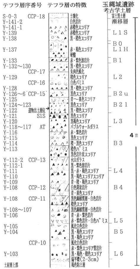
Show extracted lettering and translation
English translation of figure lettering
Tephra stratigraphic number / characteristics / Tamanawa Castle archaeological soil succession. Scale: 4 m. Bottom annotation: “uppermost part of soil layer.” 富士黒土層漸移層: Fuji Black Soil transition layer.
| Layer / number | Thickness (numbers as printed) | Description | Correlation |
|---|---|---|---|
| S-0-3 CCP-18 | [なし] | Soil formation | 富士黒土層漸移層 |
| Y-141-2 | [なし] | White lithics | 富士黒土層漸移層 |
| Y-141-1 | [なし] | Reddish-brown scoria | L1S |
| Y-139 | [なし] | Reddish-brown scoria | L1S |
| Y-138 | [なし] | Black/brown scoria | B0 |
| Y-137 | [なし] | Red/brown scoria; hardpan | L1H |
| Y-133 | [なし] | Red/purple lava fragments | B1 |
| Y-132~130 | [なし] | Black/brown scoria | L2 |
| CCP-17 | [なし] | Vermilion weathering | L2 |
| Y-129 | [なし] | Brown scoria | L2 |
| CCP-16 | [なし] | White pumice | L2 |
| Y-128 | [なし] | Black/brown scoria | L2 |
| Y-126~6′ CCP-15 | [なし] | Black scoria | B2u |
| Y-125 | [なし] | Blue–brown scoria | B2l |
| Y-124~123 | [なし] | Black scoria | B2l |
| Y-122 | [なし] | Black/brown scoria; artifact-bearing level → | B2l |
| Y-121 S1S | [なし] | Black scoria | L3 |
| Y-120 | [なし] | Black-brown scoria | L3 |
| Y-118~117 AT | [なし] | Bubble-wall glass | L3 |
| Y-116 | [なし] | Red/purple lithics | L3 |
| Y-115 | [なし] | Black scoria | B3 |
| Y-114 | [なし] | Orange/black scoria | B3 |
| Y-113 | [なし] | Orange pumice; black lithic-like scoria | B3 |
| Y-112-2 CCP-13 | [なし] | Volcanic glass | L4 |
| Y-112-1 | [なし] | Black/purple lava fragments | L4 |
| Y-111 | [なし] | Black/red/brown scoria | L4 |
| Y-110 | [なし] | Black/brown scoriaceous scoria [wording retained] | L4 |
| Y-109 | [なし] | Blue/brown/brown scoria [wording retained] | L4 |
| Y-108 CCP-12 | [なし] | White porphyritic lithics; blue/yellow scoria | B4 |
| Y-108 CCP-11 | [なし] | Black dense layer and white lithics; brown scoria | B4 |
| Y-108~107 | [なし] | Black dense layer and white lithics | L5 |
| Y-106 | [なし] | Blue/red/purple lithics; red/purple lithics and white pumice | L5 |
| Y-105 | [なし] | Weathered white lithics | L5 |
| Y-104 | [なし] | Black/brown scoria; black/brown scoria | B5 |
| CCP-10 | [なし] | Weathered white lithics; red/purple scoriaceous lithics | L6 |
| Y-103 | [なし] | Black/brown/brown scoria; flattened gravel (2–3 cm) | L6 |
| 土層最上部 | [なし] | Brown clay bed |
Original Japanese lettering
テフラ層序番号/テフラ層の特徴/玉縄城遺跡考古学土層。尺度4m。図の最下位注記は「土層最上部」。
| 層・番号 | 層厚(原図数字) | 記述 | 対比 |
|---|---|---|---|
| S-0-3 CCP-18 | [なし] | 土壌化 | 富士黒土層漸移層 |
| Y-141-2 | [なし] | 白色岩片 | 富士黒土層漸移層 |
| Y-141-1 | [なし] | 赤褐色スコリア | L1S |
| Y-139 | [なし] | 赤褐色スコリア | L1S |
| Y-138 | [なし] | 黒・褐色スコリア | B0 |
| Y-137 | [なし] | 赤・褐色スコリア、硬盤 | L1H |
| Y-133 | [なし] | 赤・紫色溶岩片 | B1 |
| Y-132~130 | [なし] | 黒・褐色スコリア | L2 |
| CCP-17 | [なし] | 朱肉色風化 | L2 |
| Y-129 | [なし] | 褐色スコリア | L2 |
| CCP-16 | [なし] | 白色パミス | L2 |
| Y-128 | [なし] | 黒・褐色スコリア | L2 |
| Y-126~6′ CCP-15 | [なし] | 黒色スコリア | B2u |
| Y-125 | [なし] | 青~茶色スコリア | B2l |
| Y-124~123 | [なし] | 黒色スコリア | B2l |
| Y-122 | [なし] | 黒・褐色スコリア、遺物出土層位→ | B2l |
| Y-121 S1S | [なし] | 黒色スコリア | L3 |
| Y-120 | [なし] | 黒褐色スコリア | L3 |
| Y-118~117 AT | [なし] | バブルウォールガラス | L3 |
| Y-116 | [なし] | 赤・紫色岩片 | L3 |
| Y-115 | [なし] | 黒色スコリア | B3 |
| Y-114 | [なし] | 橙・黒色スコリア | B3 |
| Y-113 | [なし] | 橙色パミス、黒色岩片状スコリア | B3 |
| Y-112-2 CCP-13 | [なし] | 火山ガラス | L4 |
| Y-112-1 | [なし] | 黒・紫色溶岩片 | L4 |
| Y-111 | [なし] | 黒・赤・褐色スコリア | L4 |
| Y-110 | [なし] | 黒・褐色スコリア質スコリア | L4 |
| Y-109 | [なし] | 青・褐・褐色スコリア | L4 |
| Y-108 CCP-12 | [なし] | 白色斑状岩片、青・黄色スコリア | B4 |
| Y-108 CCP-11 | [なし] | 黒色高密度層・白色岩片、褐色スコリア | B4 |
| Y-108~107 | [なし] | 黒色高密度層・白色岩片 | L5 |
| Y-106 | [なし] | 青・赤・紫色岩片、赤・紫色岩片・白色パミス | L5 |
| Y-105 | [なし] | 風化白色岩片 | L5 |
| Y-104 | [なし] | 黒・褐色スコリア、黒・褐色スコリア | B5 |
| CCP-10 | [なし] | 風化白色岩片、赤・紫色スコリア質岩片 | L6 |
| Y-103 | [なし] | 黒・褐色・褐色スコリア、偏平礫(2~3cm) | L6 |
| 土層最上部 | [なし] | 褐色粘土層 |
KT-30 Younger Loam at Shobu-Takenouchi, western Hadano basin, Kanagawa Prefecture, especially Hakone-Tokyo pumice and pyroclastic flow
上杉陽・米澤宏・由井将雄・原田昌一・米澤まどか・関東第四紀研究会
- Locality: Shobu-Takenouchi, Hadano City
- Coordinates: N35°22′7″ E139°55′58″
- Elevation: 140–150 m
- Exposure and condition: Natural exposure; partly extant
- Deposits and age: Wind-transported tephra deposited on land to wind-transported tephra deposited underwater, and pyroclastic-flow deposits; 30–250 ka
- Description dates: 1977–1991
- Keywords: Hakone-Tokyo tephra, Hakone-Miura tephra, Fuji-Yoshioka tephra, Tm-8, Tm-9, fossil wood, insect fossils
This exposure lies in the lower part of a small tributary valley entering the Shijuhassegawa. Most of tephras Y-64–93 of 上杉 et al. (1980) are wind-transported deposits laid down underwater, containing plant and insect fossils; pollen has also been detected (Tsuji et al., 1984). Scattered outcrops of the Tanzawa Group basement are covered by Soda Loam beginning with Tm-8 (TB-1; Soda Ham Pumice). Younger Loam truncates and covers these deposits throughout. Y-64, Y-69 (Fuji-Yoshioka; F-YP), Y-70 (Hakone-Anjin; Hk-AP), and Y-73 (Hakone-Miura; Hk-MP) are mostly wind-transported underwater deposits. Y-74–75 (Upper Musashino buried soil) truncates them, suggesting development of a stable, gently uneven slope. Y-76 (Hakone-Tokyo pumice; Hk-TP), 100–140 cm thick, and Y-77 (Hakone-Tokyo pumice-flow deposit; Hk-TPfl), approximately 5 m thick, fill the valley slopes. Fluvial sand-and-gravel to lacustrine mud facies of Y-80–93 (Saigato period) accumulated in this valley, then were covered by aeolian tephra beginning with Y-94 (BCVA). Scattered younger terrace gravels truncate them, dating from the so-called Tachikawa period (Imaizumi–Ojiri periods) onward (関東第四紀研究会, 1987). A type locality for Younger Loam lies above the cliff at the head of this tributary (■ locality).
A slight depositional hiatus separates Hk-TP (Y-76) and Hk-TPfl (Y-77) (原田, 1976). Accelerator mass-spectrometry estimates for charcoal in the uppermost ash-flow–pumice-flow part of Y-76 or the upper pyroclastic-flow part of Y-77 averaged 52,310±360 yr B.P. (中村 et al., 1992). Their typical regional sections are shown at right.
Hk-TP is a large pumice-fall deposit preceding a pyroclastic flow from Hakone. Hakone tephras with similar fallout and flow successions include Hakone-Obaradai (Hk-OP, Y-63) and Soda F5 (Tm-2, TCu-1, Doran).
References: 原田 (1976), 関東第四紀研究会 (1979, 1987), 町田・新井 (1992), 中村 et al. (1992), Tsuji et al. (1984), 上杉 (1976), 上杉 et al. (1980).
Supplemented from 関東第四紀研究会 (1979).
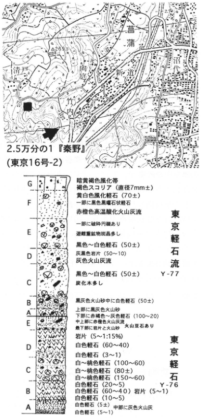
Show extracted lettering and translation
English translation of figure lettering
Map: 1:25,000 “Hadano” (Tokyo 16-2). Shobu, Numashiro, Shindo, Mukohara, Takenouchi, Kiyoto,269.3. ■ type locality; arrow: exposure. Parenthesized figures retain the original grain-size/content annotations; the table numeric column is not a thickness measurement for this figure.
| Layer / number | Thickness (numbers as printed) | Description | Correlation |
|---|---|---|---|
| Y-77 G | [なし] | Dark yellow-brown weathered zone; brown scoria (diameter 7 mm±) | |
| Y-77 F | 70± | Yellow-white weathered pumice; some black mica-like pumice; red-orange high-temperature-oxidized ash flow | |
| Y-77 E | [なし] | Some broken rounded gravel; abundant free heavy-mineral phenocrysts | |
| Y-77 D | 50±;50~10 | Black–white pumice; gray-black lithics; gray ash flow | |
| Y-77 C | 50± | Black–white pumice; abundant charcoal wood | |
| Y-77 B | 50± | White pumice in black-gray volcanic sand | |
| Y-77 A | 100~20 | Black-gray volcanic sand above; reddish-brown–gray pumice below; red-orange ash flow in middle-upper part; purple volcanic sand at base; accretionary lapilli | |
| Y-76 E | 5~1:15% | Lithic fragments | |
| Y-76 D | 60~40;3~1 | White pumice; white pumice | |
| Y-76 C | 100~60;80±;150~60 | White–pink pumice; white–pink pumice; white–pink pumice | |
| Y-76 B | 20~5;60~40;5~1;10~5 | White pumice; white pumice and lithics; white pumice | |
| Y-76 A | 5±;5~1 | White pumice, gray volcanic ash in middle, white pumice |
Original Japanese lettering
地図:2.5万分の1「秦野」(東京16号-2)。菖蒲、沼代、新道、向原、竹ノ内、清戸、269.3。■模式地,矢印露頭。柱状図の括弧内数字は原図の粒径・含有量を保持。
| 層・番号 | 層厚(原図数字) | 記述 | 対比 |
|---|---|---|---|
| Y-77 G | [なし] | 暗黄褐色風化帯、褐色スコリア(直径7mm±) | |
| Y-77 F | 70± | 黄白色風化軽石、一部に黒色黒雲石状軽石、赤橙色高温酸化火山灰流 | |
| Y-77 E | [なし] | 一部に破砕円礫あり、遊離重鉱物斑晶多し | |
| Y-77 D | 50±;50~10 | 黒色~白色軽石、灰黒色岩片、灰色火山灰流 | |
| Y-77 C | 50± | 黒色~白色軽石、炭化木多し | |
| Y-77 B | 50± | 黒灰色火山砂中に白色軽石 | |
| Y-77 A | 100~20 | 上部に黒灰色火山砂、下部に赤褐色~灰色軽石、中上部に赤橙色火山灰流、最下部に紫色火山砂、火山豆石あり | |
| Y-76 E | 5~1:15% | 岩片 | |
| Y-76 D | 60~40;3~1 | 白色軽石、白色軽石 | |
| Y-76 C | 100~60;80±;150~60 | 白~桃色軽石、白~桃色軽石、白~桃色軽石 | |
| Y-76 B | 20~5;60~40;5~1;10~5 | 白色軽石、白色軽石 岩片、白色軽石 | |
| Y-76 A | 5±;5~1 | 白色軽石、中部に灰色火山灰、白色軽石 |
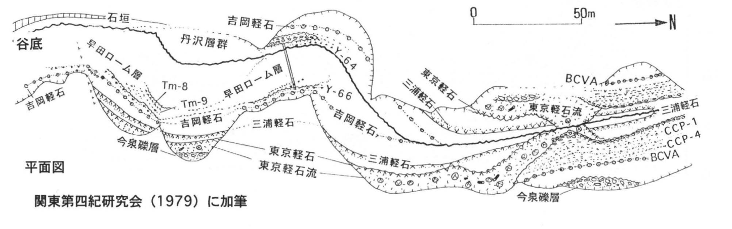
Show extracted lettering and translation
English translation of figure lettering
Plan-view sketch: stone wall; valley bottom; Tanzawa Group; Soda Loam; Tm-8,Tm-9; Yoshioka pumice; Miura pumice; Tokyo pumice; Tokyo pumice flow; Imaizumi gravel; Y-64,Y-66,BCVA,CCP-1,CCP-4. Scale: 0–50 m; N. Supplemented from 関東第四紀研究会 (1979).
Original Japanese lettering
平面図:石垣,谷底,丹沢層群,早田ローム層,Tm-8,Tm-9,吉岡軽石,三浦軽石,東京軽石,東京軽石流,今泉礫層,Y-64,Y-66,BCVA,CCP-1,CCP-4。尺度0–50m,N。関東第四紀研究会(1979)に加筆。
KT-31 Type locality of the Obaradai sand and gravel, Miura Peninsula—deposits of oxygen-isotope stage 5c
長田敏明・菊地隆男
- Locality: Futaba 1-chome, Yokosuka City, Kanagawa Prefecture
- Coordinates: N35°15′05″ E139°43′25″
- Elevation: 70 m
- Exposure and condition: Gravel pit, later a cliff behind a materials yard; extant
- Deposits and age: Beach deposits; Late Pleistocene
- Description date: August 1975
- Keywords: Hakone-derived tephra, Obaradai surface, Obaradai sand and gravel, Hashirimizu gravel, oxygen-isotope stage 5c
The Obaradai sand and gravel accumulated during formation of the Obaradai terrace (小原台団研グループ, 1965), dated to 100–110 ka (oxygen-isotope stage 5c). It occurs in eastern Yokosuka, with its depositional surface at 70–80 m above sea level and tending to decline slightly northwestward. Equivalent surfaces around Yokohama's Shimosueyoshi plateau lie below the Shimosueyoshi terrace at 30 m. The exposure is approximately 500 m northeast of Keikyu Uraga Station in eastern Yokosuka, at the southern end of the Obaradai terrace occupied by the National Defense Academy campus. The local basement is the Pliocene Zushi Formation of the Miura Group, overlain unconformably by the Yokosuka Formation. The latter is subdivided upward into Otsu sand and mud and Hashirimizu gravel (蟹江, 1977). Here, Hashirimizu gravel (20 m+ thick) is overlain unconformably by Obaradai sand and gravel (2 m−) and Kanto Loam (6 m+).
Hashirimizu gravel consists of flattened, pebble-sized chert, graywacke, slate, and other clasts, with large-scale cross-bedding. Submarine landslide traces and injection structures occur within it (蟹江 et al., 1977); sediment and structure characteristics suggest river-mouth alluvial-fan deposition. The unconformably overlying Obaradai unit is sand containing granules, often with parallel lamination. Although there is no clear evidence that it is marine, its distribution and depositional geometry suggest deposition on a wave-cut platform. White pumice grains and mica occur in its upper part; the stratigraphic relationship and mica-rich character suggest Ontake-derived Ontake-1 tephra (On-Pm1). The overlying Kanto Loam contains Hakone-Obaradai (Hk-OP), Hakone-Miura (Hk-MP), Hakone-Tokyo (Hk-TP), and Hakone Central Cone 1 (Hk-CC1), upward in that order.
References: 蟹江 et al. (1977), 走水団研グループ (1965).
Partly modified from 蟹江 et al. (1977).
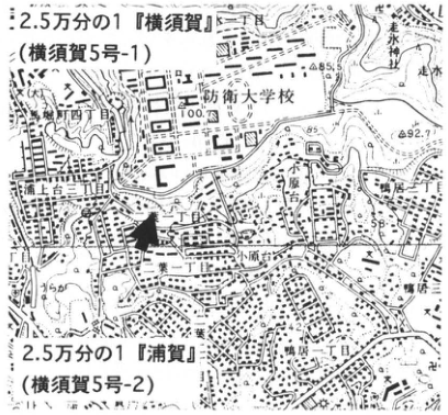
Show extracted lettering and translation
English translation of figure lettering
1:25,000 “Yokosuka” (Yokosuka 5-1) and “Uraga” (Yokosuka 5-2). National Defense Academy; Obaradai; Uragami-dai 2-/3-chome; Futaba 1-/2-chome; Kamoi 2-chome; Hashirimizu; Hashirimizu Shrine;85.5,100.7,92.7,58.
Original Japanese lettering
2.5万分の1「横須賀」(横須賀5号-1),2.5万分の1「浦賀」(横須賀5号-2)。防衛大学校、小原台、浦上台二丁目・三丁目、二葉一丁目・二丁目、鴨居二丁目、走水、走水神社、85.5、100.7、92.7、58。
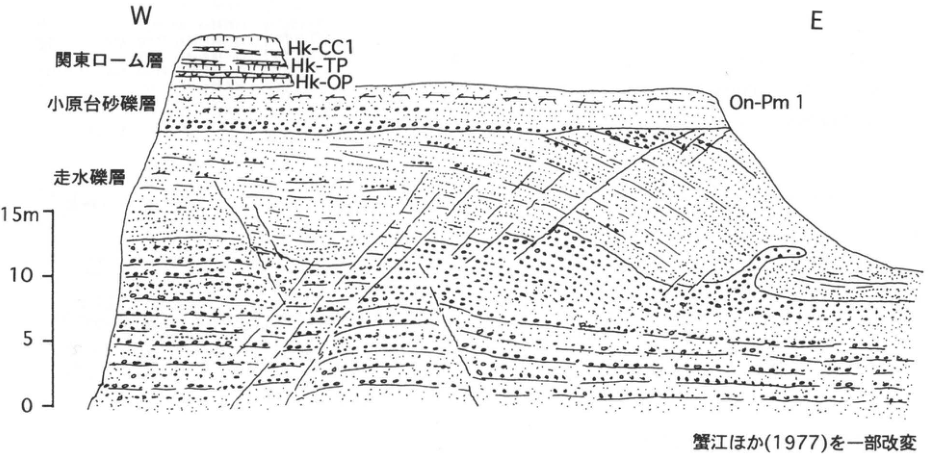
Show extracted lettering and translation
English translation of figure lettering
W,E. Kanto Loam: Hk-CC1,Hk-TP,Hk-OP. Obaradai sand and gravel: On-Pm1. Hashirimizu gravel. Scale:0,5,10,15 m. Partly modified from 蟹江 et al. (1977).
Original Japanese lettering
W、E。関東ローム層:Hk-CC1、Hk-TP、Hk-OP。小原台砂礫層:On-Pm1。走水礫層。尺度0、5、10、15m。蟹江ほか(1977)を一部改変。
KT-32 Shimosueyoshi Formation in northern Yokohama—transgressive deposits of oxygen-isotope stage 5e
菊地隆男・関東第四紀研究会
- Locality: Morooka, Kohoku Ward, Yokohama City, Kanagawa Prefecture
- Coordinates: N35°31′10″ E139°38′10″
- Elevation: 15 m
- Exposure and condition: Artificial exposure; disappeared through development of building sites from around 1975 onward
- Deposits and age: Marine deposits; Late Pleistocene
- Description date: August 1966
- Keywords: Shimosueyoshi terrace, Shimosueyoshi Formation, Shimosueyoshi transgression, valley-fill deposits, oxygen-isotope stage 5e
The Shimosueyoshi Formation constitutes the marine Shimosueyoshi terrace formed in oxygen-isotope stage 5e. This terrace extends across northern Yokohama at 40–45 m above sea level, but urbanization has greatly altered the terrain and exposures have become rare. The exposure described here was observed in 1966 and designated a type locality (関東第四紀研究会, 1970), but was completely removed for housing and artificial-slope works within a few years of publication. It lay approximately 300 m east of Okurayama Station on the Tokyu Toyoko Line, above the Shinkansen Okurayama Tunnel where Tsunashima Kaido crosses it. Two exposures on either side of this road are termed western and eastern.
The western exposure comprised, upward, 5 m of mud containing white pumice (10–5 mm diameter), 1 m of granule-bearing sand rich in blue-gray scoria (2–3 mm), and approximately 5 m of medium-grained sand. Across an indistinct unconformity lay 2.5 m of granule-bearing medium sand, the upper Shimosueyoshi Formation, covered by Shimosueyoshi Loam. Below the unconformity is the Tsurumi Formation (関東第四紀研究会, 1970). Its lower white pumice was identified as Tm-2 (= TCu-1) of the Oiso Hills (上杉, 1976; 町田 et al., 1974; identification by 岡 et al., 1984), placing the unit at approximately 200 ka, in the first half of oxygen-isotope stage 7.
At the eastern exposure, muddy lower Shimosueyoshi deposits cover the Tsurumi Formation across a clearly uneven unconformity. The mud is softer than Tsurumi mud and contains inner-bay molluscan fossils, including aramushiro (アラムシロ), urakagami (ウラカガミ), iyosudare (イヨスダレ), and Yokohama-chiyonohanagai (ヨコハマチヨノハナガイ). Sand-pipe-like trace fossils are abundant. The base is poorly sorted sandy mud containing plant fragments.
References: 関東第四紀研究会 (1970), 町田 et al. (1974), 岡・菊地・桂島 (1984), 上杉 (1976).
From 関東第四紀研究会 (1970). The topographic map published in 1982 shows altered terrain; the exposure has disappeared.
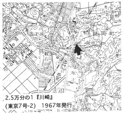
Show extracted lettering and translation
English translation of figure lettering
1:25,000 “Kawasaki” (Tokyo 7-2), published 1967. Morookacho, Ozonecho, Kikunacho, Okurayama, Kannon-gawa;13.1,42.6.
Original Japanese lettering
2.5万分の1「川崎」(東京7号-2),1967年発行。師岡町、大曽根町、菊名町、大倉山、観音川、13.1、42.6。
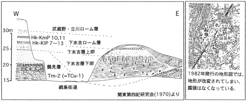
Show extracted lettering and translation
English translation of figure lettering
W,E. Elevation:15,20,25,30 m. Musashino/Tachikawa Loam, Shimosueyoshi Loam, Hk-KmP10,11, Hk-KlP7–13, upper/lower Shimosueyoshi Formation, Tsurumi Formation, Tm-2 (=TCu-1), Tsunashima Kaido. From 関東第四紀研究会 (1970). Right map: Morookacho, Okurayama,42.6. On the topographic map published in 1982 the terrain has been altered and the exposure has disappeared.
Original Japanese lettering
W、E。標高15、20、25、30m。武蔵野・立川ローム層、下末吉ローム層、Hk-KmP10,11、Hk-KlP7~13、下末吉層上部、下末吉層下部、鶴見層、Tm-2(=TCu-1)、綱島街道。関東第四紀研究会(1970)より。右図:師岡町、大倉山、42.6。1982年発行の地形図では,地形が改変されてしまい,露頭はなくなっている。
KT-33 Konan Formation and Middle Pleistocene marker tephras in southwestern Yokohama
町田洋
- Locality: Nagatacho, Minami Ward, Yokohama
- Coordinates: N35°25′48″ E139°35′36″
- Elevation: 45–65 m
- Exposure and condition: Cliff exposed by housing development; disappeared
- Deposits and age: Marine deposits and tephra; Middle Pleistocene
- Description date: June 1968
- Keywords: Konan Formation, oxygen-isotope stage 11, TE-5, Kn-1, Hachioji Biotite tephra
Southwestern Yokohama has exceptionally well-developed Middle Pleistocene marine deposits and tephras as well as Late Pleistocene Shimosueyoshi terrace deposits. Numerous exposures appeared during development up to the 1980s, but most have recently been covered. This account outlines a former type exposure, focusing on the relationship between tephras and marine deposits called the Konan or Kami-Kurata Formation, representing the third major transgression counted backward from the Shimosueyoshi Formation. These marine deposits can be observed from western Hodogaya Ward to Totsuka Ward, within the subsiding northern Miura Peninsula (Hadano–Yokohama Port subsidence zone), as shown in figure 2. Farther north and south, erosion leaves almost no observable exposures.
At this locality, sand and gravel lie on a horizontal truncation surface across the Miura Group. They form upper Konan Formation; middle and lower mud containing molluscan fossils and scoria beds occurs where valleys were filled. Several marker tephras cover the sand and gravel after emergence and are numbered Kn-1–6 upward, using Kn for Konan. The most important is Kn-4 (TE-5), a 30 cm gray-white ash bed characteristically rich in biotite phenocrysts. Widespread in southern Kanto, it corresponds to TE-5 (Tama E-5) in the Oiso Hills, Hachioji Biotite tephra (HBP) in the Tama Hills, and the tephra called Hy-3 in the Jizodo Formation of the Boso Peninsula. Kn-1 is yellow-white pumice erupted at the start of regression after Konan deposition. It may be absent or interbedded with sand in western Yokohama. It also occurs beneath the molluscan fossil bed in the Boso Jizodo Formation and was described as Hy-4 (三梨, 1973).
At this exposure, the Nishine Formation filling a valley cut through Konan and its tephras consists of Tama c (T-c)-period silt and upper sand and gravel. TCu-1 was deposited in a valley that further incised these beds. TCu-1 is approximately 250 ka pumice associated with formation of Hakone's old caldera. These relationships permit correlation of the valley-fill Nishine Formation with Oshinuma sand and gravel in the Tama Hills. The Konan Formation contains warm-climate molluscan fossils and Stegodon and is considered a product of the major Middle Pleistocene interglacial corresponding to oxygen-isotope stage 11. The position and elevation of the former shoreline of this transgression remain questions for future investigation.
References: 関東第四紀研究会 (1972), 町田 et al. (1974), 三梨 (1973), 三梨・菊地 (1982).
Composite sketch of large exposures on both sides of a north-opening valley. The upper half was on the east side, and the middle and lower parts on the west (町田 et al., 1974).
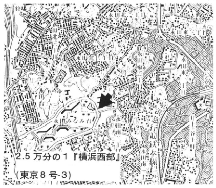
Show extracted lettering and translation
English translation of figure lettering
1:25,000 “Yokohama Seibu” (Tokyo 8-3). Nagatacho, Kawashimacho, Nagata-Minamidai, Mutsukawa 1-/2-/3-chome;63,91.7.
Original Japanese lettering
2.5万分の1「横浜西部」(東京8号-3)。永田町、川島町、永田みなみ台、六ツ川一丁目・二丁目・三丁目、63、91.7。
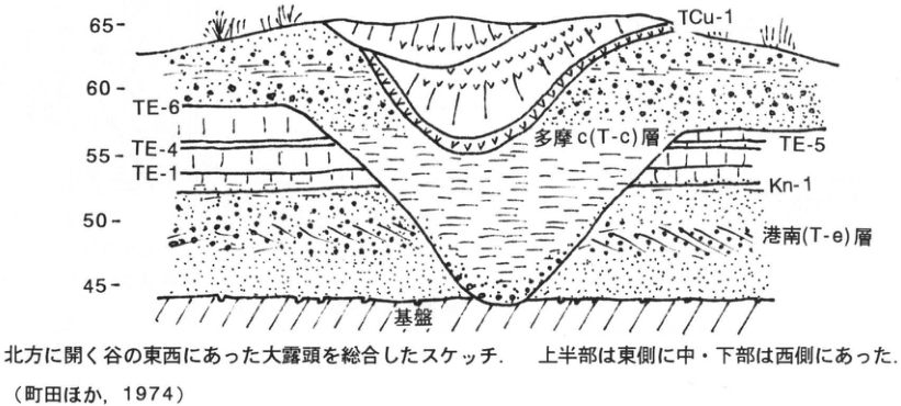
Show extracted lettering and translation
English translation of figure lettering
Elevation:45,50,55,60,65. TCu-1, Tama c (T-c) Formation, TE-6,TE-4,TE-1,TE-5,Kn-1, Konan (T-e) Formation, basement. Composite sketch of large exposures on both sides of a north-opening valley; upper half on the east, middle/lower parts on the west (町田 et al.,1974).
Original Japanese lettering
標高45、50、55、60、65。TCu-1、多摩c(T-c)層、TE-6、TE-4、TE-1、TE-5、Kn-1、港南(T-e)層、基盤。北方に開く谷の東西にあった大露頭を総合したスケッチ.上半部は東側に中・下部は西側にあった.(町田ほか,1974)
KT-34 Tama Loam at Oshinuma, Tama Hills
羽鳥謙三
- Locality: 400 m southeast of the Masugatayama triangulation point, Noborito, Kawasaki City, Kanagawa Prefecture
- Coordinates: N35°36′16″ E139°34′04″
- Elevation: 50 m
- Exposure and condition: Road cutting; disappeared
- Deposits and age: Aeolian tephra; Middle Pleistocene
- Description date: December 1990
- Keywords: Tama Loam, Tsuchihashi Loam, Gomashio, Doran, Bireley's, Uwabami, Oshinuma sand and gravel
Oshinuma was originally the name of a pond written 鴛鴦沼 (“mandarin-duck pond”). The pond had already disappeared when the name appeared on 1:25,000 maps in the late 1940s and early 1950s. 羽鳥・寿円 (1958) used it to name the Oshinuma sand and gravel, and the overlying Tama Loam became known as the Oshinuma exposure. It was a representative exposure of Tama Loam developed on the T2 surface where the Tama surface is subdivided into two. 鶴見・大村 (1966) later distinguished the upper loam as Tsuchihashi Loam. They named its pumice beds, downward, Uwabami (yellow-orange), Hyomon (yellow and blue-gray, coarse), and Arare (yellow and gray). The loam is rich in pumice and scoria throughout. They identified an unconformity approximately 3 m below the base of Arare, but the transition is gradational at this exposure. Below it is Tama Loam.
Prominent pumices in Tama Loam, downward, are orange Noborito Pumice II (Bireley's), yellow Noborito Pumice I (Doran), and Gomashio Pumice. 皆川・町田 (1971) subdivided the last into Gomashio-1 below and Gomashio-2 above. Although the two cannot be seen simultaneously on the same vertical line here, their presence as two beds is certain. Immediately beneath Gomashio-1, gray-white clay grades through yellow-gray silt into yellow-gray sand containing rounded gravel. If the clay is considered the subaqueous portion of Tama Loam, the silt and underlying beds constitute Oshinuma sand and gravel, whose top lies at approximately 50 m elevation.
The exposure appeared when a pass was cut around 1950 and long served as a standard Tama Loam exposure, but construction destroyed it at the end of 1990. A lacquer-film peel taken from its northeastern wall was preserved at Kawasaki City's Youth Science Museum in nearby Ikuta Ryokuchi. The marker tephras from Uwabami to Doran are known to derive from Hakone, and Gomashio from Yatsugatake; all are widespread across southern Kanto (町田 et al., 1974).
References: 羽鳥・寿円 (1958), 町田 et al. (1974), 皆川・町田 (1971), 高野 (1987), 鶴見・大村 (1966).
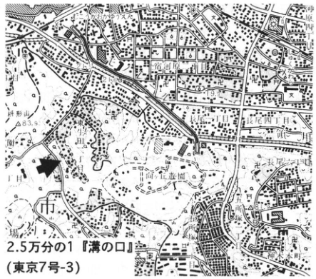
Show extracted lettering and translation
English translation of figure lettering
1:25,000 “Mizonokuchi” (Tokyo 7-3). Noborito; Masugatayama;83.9; Youth Science Museum; Ikuta Ryokuchi; はなぞ 4-chome [small characters uncertain]; Nagao; Higashi-Takane.
Original Japanese lettering
2.5万分の1「溝の口」(東京7号-3)。登戸、枡形山、83.9、青少年科学館、生田緑地、はなぞ四丁目、長尾、東高根。
Reading notes
はなぞ四丁目 — 地図の微小文字が不鮮明。日本語字形を保持。
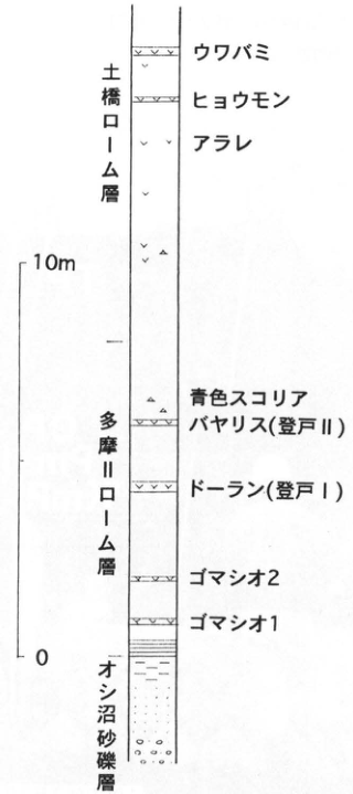
Show extracted lettering and translation
English translation of figure lettering
Scale:0–10 m. Top to bottom: Tsuchihashi Loam (Uwabami,Hyomon,Arare); Tama Loam (blue scoria, Bireley’s [Noborito II], Doran [Noborito I], Gomashio-2, Gomashio-1); Oshinuma sand and gravel.
Original Japanese lettering
尺度0–10m。上→下:土橋ローム層(ウワバミ、ヒョウモン、アラレ);多摩ローム層(青色スコリア、バヤリス[登戸II]、ドーラン[登戸I]、ゴマシオ2、ゴマシオ1);オシ沼砂礫層。
KT-35 Hikibashi terrace and overlying tephras, southern Miura Peninsula
宮内崇裕
- Locality: Takayama, Minami-Shitaura Town, Miura City, Kanagawa Prefecture
- Coordinates: N35°9′41″ E139°38′45″
- Elevation: 80 m
- Exposure and condition: Artificial exposure; concrete retaining wall
- Deposits and age: Sand on a wave-cut platform and fallout tephra; Late Pleistocene
- Description date: February 1990
- Keywords: Hakone-Kissawa Middle tephra group, Ontake-1 tephra, Hikibashi terrace, Miura Peninsula
The exposure lies very close to the type locality of the southern Kanto Hikibashi terrace. Terrace deposits and overlying terrestrially deposited tephras can be observed here (宮内, 1992). A 30 cm medium-sand bed lies on a wave-cut platform in Hatsuse Formation (Miura Group) basement; its top forms the Hikibashi terrace surface. The marine sand is covered by at least 3 m of brown weathered ash containing several marker tephras. Identified upward, these are Hakone-Kissawa Middle 7 (Hk-KmP7), Ontake-1 (On-Pm1), Hakone-Obaradai (Hk-OP), and Hakone-Tokyo (Hk-TP). Compared with the Hikibashi succession described by 町田 (1971), older tephras below Hk-KmP7—approximately 3 m thick with Hk-KmP1 at the base—are missing here. Elevation and landform continuity place Takayama on the so-called Hikibashi surface, but this may be a locality where the overlying tephras were lost at the terrace edge.
Machida (1974) regarded Hikibashi as a marine surface corresponding to an independent sea level between the Shimosueyoshi and Obaradai terraces. Subsequent reassessment using widespread-tephra stratigraphy led 町田・新井 (1992) to revise this to the possibility that Hikibashi forms part of the Shimosueyoshi terrace. The local stratigraphy holds the key to this question.
References: 町田 (1971), Machida (1974), 町田・新井 (1992), 宮内 (1992).
Photograph by 宮内, 19 February 1990.
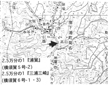
Show extracted lettering and translation
English translation of figure lettering
1:25,000 “Uraga” (Yokosuka 5-2) and “Miura Misaki” (Yokosuka 6-1/3). Kubo,Jinba,Ohara,Mizuyato,Nagasaku,Hikibashi,Takayama,Kikuna,Jizozaku,Saka;77.1,84.9,85.
Original Japanese lettering
2.5万分の1「浦賀」(横須賀5号-2),2.5万分の1「三浦三崎」(横須賀6号-1・3)。久保、陣場、大原、水谷戸、長作、引橋、高山、菊名、地蔵作、坂、77.1、84.9、85。
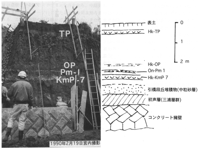
Show extracted lettering and translation
English translation of figure lettering
Photograph:TP,OP,Pm-I,KmP-7. Photograph by 宮内,19 February 1990. Column:topsoil,Hk-TP,Hk-OP,On-Pm1,Hk-KmP7,Hikibashi terrace deposit (medium sand),Hatsuse Formation (Miura Group),concrete retaining wall. Scale:0,1,2 m.
Original Japanese lettering
写真:TP、OP、Pm-I、KmP-7。1990年2月19日宮内撮影。柱状図:表土、Hk-TP、Hk-OP、On-Pm1、Hk-KmP7、引橋段丘堆積物(中粒砂層)、初声層(三浦層群)、コンクリート擁壁。尺度0、1、2m。
KT-36 Misaki terrace and tephras, Miura Peninsula
町田洋
- Locality: Uchikomi, Miura City, Kanagawa Prefecture
- Coordinates: N35°10′39″ E139°39′0″
- Elevation: 42 m
- Exposure and condition: Artificial exposure; disappeared
- Deposits and age: Marine-terrace deposits and fallout tephra; Late Pleistocene
- Description date: December 1992
- Keywords: Misaki terrace, Hakone-Obaradai tephra, Hakone-Tokyo tephra, Miura Peninsula
Together with Obaradai, Misaki is a prominent marine terrace on the southern Kanto Miura Peninsula. Approximately contemporary fluvial terraces are also well known in Musashino and Sagamino. It dates to oxygen-isotope stage 5a. Most Misaki terraces on the peninsula are wave-cut platforms with very thin deposits; this exposure has relatively thick tephra-bearing deposits showing the transition from transgression to regression. As illustrated, basement is not exposed, but at least 3.5 m of marine beach sand and gravel contains a weathered pumice bed regarded as Hakone-Obaradai (Hk-OP). Overlying mud with abundant trace fossils forms the marine unit's top at 35 m elevation. Above slightly consolidated laminated sand (aeolian?) the succession becomes scoriaceous volcanic-ash soil. Its terrestrially deposited tephras contain, upward, Hakone-Tokyo (Hk-TP), Hakone Tricolor Flag (Hk-SP), and Hakone Central Cone 1 (Hk-CCP1) pumice.
In relation to southern Kanto tephra stratigraphy, the formation process is interpreted as follows. After Obaradai terrace formation, regression proceeded around deposition of Ontake-1 and Kikai-Tozurahara (K-Tz), but changed to transgression before eruption of Hk-OP, probably between Aso-4 and K-Tz. Regression resumed probably after Fuji-Yoshioka (F-YP, not confirmed in the ash soil here). This final regression was large and corresponds to the stadial of oxygen-isotope stage 4. Equivalent marine terraces can be observed on land only on coasts with high uplift rates. In southern Kanto they are limited to the Miura Peninsula, the Ninomiya area of the Oiso coast (former shoreline reaching 110 m above sea level), and the Boso Peninsula.
Reference: 町田・新井 (1992).
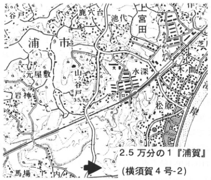
Show extracted lettering and translation
English translation of figure lettering
1:25,000 “Uraga” (Yokosuka 4-2). 鹿穴台,池代,Kami-Miyada,Motoyashiki,Iwagami,Mizufuka,木間,Matsubara,Baba,Uchikomi,浦市;4.3,35.9.
Original Japanese lettering
2.5万分の1「浦賀」(横須賀4号-2)。鹿穴台、池代、上宮田、元屋敷、岩神、水深、木間、松原、馬場、内込、浦市、4.3、35.9。
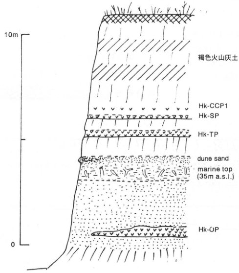
Show extracted lettering and translation
English translation of figure lettering
Scale:0–10 m. Top to bottom:brown volcanic-ash soil,Hk-CCP1,Hk-SP,Hk-TP,dune sand,marine top (35m a.s.l.),Hk-OP.
Original Japanese lettering
尺度0–10m。上→下:褐色火山灰土、Hk-CCP1、Hk-SP、Hk-TP、dune sand、marine top(35m a.s.l.)、Hk-OP。
KT-37 Kissawa and Tsuchiya Loam in the lower Shinokubo valley, northwestern Oiso Hills, Kanagawa Prefecture
上杉陽・長崎正・米澤宏・長田敏明・関東第四紀研究会
- Locality: Takao, Oi Town, Kanagawa Prefecture
- Coordinates: N35°20′23″ E139°11′06″
- Elevation: 115–145 m
- Exposure and condition: Natural exposure; partly disappeared
- Deposits and age: Wind-transported tephra deposited on land to underwater, and river-terrace gravel; 52–300 ka
- Description date: May 1992
- Keywords: Hakone-derived tephra, Shimosueyoshi buried soil, Kissawa Middle buried soil, Iwakura gravel, Hakone-Tokyo pumice, Oiso Hills
Upstream, consolidated rocks of the Tanzawa and Ashigara groups (千葉, 1986), the right-lateral Nakatsugawa fault (佐藤, 1976; 狩野 et al., 1979), and beds from uppermost Lower Tama Loam (Fujisawa Loam) to lowermost Middle Tama Loam (Soda Loam) can be observed. Downstream, Upper Tama Loam and younger units can be seen. At the upstream end of this exposure is the Tm-2 (F5; TCu-1; Doran) pumice-flow deposit of lower Middle Tama Loam (Soda Loam). It is overlain in a downward-eroding cross-cutting relationship by underwater-deposited, wind-transported Tu-17–20 (Tsuchiya Ho–To′) of Upper Tama Loam (Tsuchiya Loam). These are conformably covered by terrestrially deposited, wind-transported Tu-21–34 (Tsuchiya Do–So).
This succession forms a buried valley near the check dam slightly downstream. Here it is incised by lowermost Kissawa Loam (Shimosueyoshi buried soil; SB-0–4), which grades from land to underwater deposition. Lower Kissawa Loam (Hk-KlP1–15) truncates all these beds along a flat surface in an upward-eroding cross-cutting relationship. Above Kissawa Middle buried soil (KMB; 上杉・関東第四紀研究会, 1994) lie Hk-KmP1–11 of middle Kissawa Loam. These are truncated by Musashino-period fluvial Iwakura gravel and conformably overlying upper Musashino buried soil (MB). Overlying Hakone-Tokyo pumice (HK-TP; Y-76) and its pumice flow (Y-77) cut down through underlying beds near the confluence with the Nakamuragawa downstream (上杉, 1976; 上杉 et al., 1978).
SB-0 has a fission-track age of 147–143 ka (町田・鈴木, 1971); Tu-23 (Tsuchiya Ri; TAu-6) and Tu-7 were assigned approximate ages of 160 ka and 210 ka, respectively (磯 et al., 1975, 1981). The narrowly defined Shimosueyoshi transgression (上杉, 1982) advanced rapidly during the Shimosueyoshi buried-soil period, forming extensive wave-cut platforms and drowned valleys in the southern and eastern Oiso Hills, but did not reach this exposure (上杉 et al., 1978; 関東第四紀研究会, 1987). Emergence began during the SB period in uplifting areas, but generally occurred after Hk-KlP6. At this locality, slopes and flat surfaces were already stable immediately before Hk-KlP1 fallout.
References: 千葉 (1986), 磯 et al. (1975, 1981), 狩野 et al. (1979), 関東第四紀研究会 (1987), 町田・鈴木 (1971), 佐藤 (1976), 上杉 (1976, 1982), 上杉 et al. (1978), 上杉・関東第四紀研究会 (1994).
Sketch of the right-bank valley-wall exposure viewed from the river bed. For tephra numbers see 上杉 (1976) and 上杉 et al. (1978). SB-0=TAu-12; Tu-23=TAu-6; Tu-17=TAu-3; Tm-2=TCu-1.
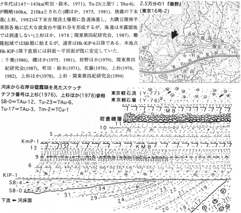
Show extracted lettering and translation
English translation of figure lettering
Prose and references in the upper-left crop are reproduced fully in the body. Map:1:25,000 “Hadano” (Tokyo16-2). Takao,Yokomichi,Nakamuragawa,road,Yanagi,Akada,Motomura;77.7,86.7. Sketch: right-bank valley wall viewed from river bed; tephra numbers after 上杉 (1976),上杉 et al.(1978). SB-0=TAu-12,Tu-23=TAu-6,Tu-17=TAu-3,Tm-2=TCu-1. Tokyo pumice flow (Y-77),Tokyo pumice (Y-76),MB,Iwakura gravel,KmP-1,5,10,11,KMB,KlP-1,6,9,13,15,SB-4,SB-0,Tu-17,18,19,20,21,22,23,24,29,31,34,Tm-2fl. Downstream ← river-bed surface.
Original Japanese lettering
画像左上の本文と文献は本文欄に全文復元。地図:2.5万分の1「秦野」(東京16号-2)。高尾、横道、中村川、道路、柳、赤田、本村、77.7、86.7。図:河床から右岸谷壁露頭を見たスケッチ.テフラ番号は上杉(1976),上杉ほか(1978)参照.SB-0=TAu-12,Tu-23=TAu-6,Tu-17=TAu-3,Tm-2=TCu-1.東京軽石流(Y-77)、東京軽石層(Y-76)、MB、岩倉礫層、KmP-1、5、10、11、KMB、KlP-1、6、9、13、15、SB-4、SB-0、Tu-17、18、19、20、21、22、23、24、29、31、34、Tm-2fl。下流←河床面。
KT-38 Middle Pleistocene tephras overlying Hakone Old Somma lava at the southeastern foot of Hakone Volcano
米澤宏・稲垣進・上杉陽・鵜浦武久・則茂雄・満岡孝・安野信・由井将雄・箱根団体研究グループ
- Locality: 扇ベラ, Nebukawa, Odawara City, Kanagawa Prefecture
- Coordinates: N35°11′5″ E139°7′5″
- Elevation: 420–470 m
- Exposure and condition: Artificial exposure; extant
- Deposits and age: Tephra and lava; Middle–Late Pleistocene
- Description date: August 1993
- Keywords: Hakone-derived tephra, Middle Tama Loam, Beige Tuff, Hakone Old Somma lava
The exposure lies approximately 1.5 km east of Hoshigayama at Hakone's southeastern foot, in a quarry beside the Shirogane forestry road running north–south halfway up the Old Somma slope. The lowest unit is columnar-jointed basaltic-andesite lava, one of the Hakone Old Somma lavas (OS2 of Kuno, 1950). It is considered to date from around eruption of Tm-2/F5 at the base of Middle Tama (Tm) Loam (上杉, 1976; equivalent to TCu-1 of 町田 et al., 1974).
It is covered by Middle–Late Pleistocene tephras containing Tm-3/F6 (上杉, 1976; TCu-2 of 町田 et al., 1974), Tm-6 (上杉, 1976; TCu-4 of 町田 et al., 1974), and Tm-8 (上杉, 1976; TB-1 of 町田 et al., 1974), for which 町田 (1977) reported fission-track ages of 234±18 ka and 246±12 ka. Two fine glassy ash beds occur between Tm-3 (上杉, 1976) and Tm-5 (上杉, 1976; TCu-3 of 町田 et al., 1974): Beige Tuff I and Beige Tuff II, upward (森 et al., 1982). One of these two beds has been correlated with the Middle Pleistocene widespread Ata-Torihama tephra (Ata-Th) (鈴木・早津, 1991). Several biotite-bearing pumice beds, including Tm-6 (上杉, 1976), are considered to derive from volcanoes other than Hakone.
References: Kuno (1950), 町田 (1977), 町田 et al. (1974), 森 et al. (1982), 鈴木・早津 (1991), 上杉 (1976).
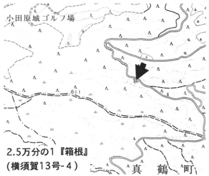
Show extracted lettering and translation
English translation of figure lettering
1:25,000 “Hakone” (Yokosuka13-4). Odawara Castle golf course,Manazuru Town,61. Arrow:quarry.
Original Japanese lettering
2.5万分の1「箱根」(横須賀13号-4)。小田原城ゴルフ場、真鶴町、61。矢印=採石場。
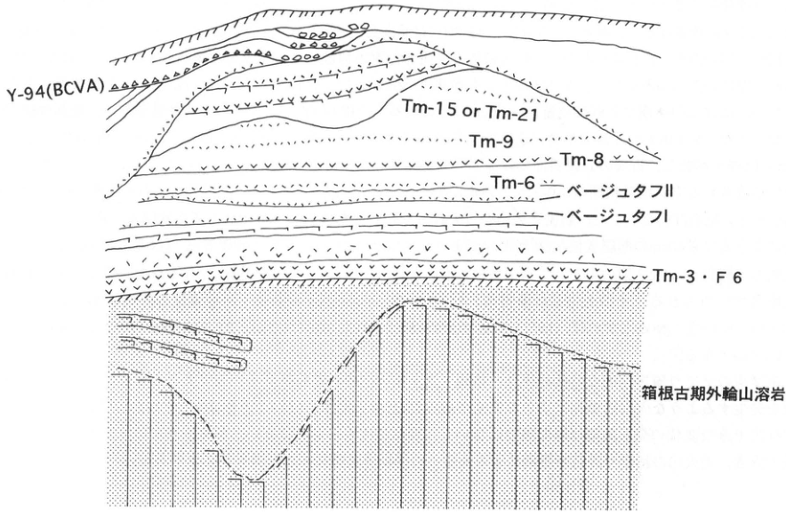
Show extracted lettering and translation
English translation of figure lettering
Top to bottom:Y-94(BCVA),Tm-15 or Tm-21,Tm-9,Tm-8,Tm-6,Beige Tuff II,Beige Tuff I,Tm-3/F6,Hakone Old Somma lava.
Original Japanese lettering
上→下:Y-94(BCVA)、Tm-15 or Tm-21、Tm-9、Tm-8、Tm-6、ベージュタフII、ベージュタフI、Tm-3・F6、箱根古期外輪山溶岩。
KT-39 Hirayama fault at the northern margin of the Izu Peninsula—its history inferred from tephra
上杉陽・伊藤谷生・米澤宏・染野誠・千葉達朗・狩野謙一
- Locality: Hirayama, Yamakita Town, Ashigarakami District, Kanagawa Prefecture
- Coordinates: N35°21′7″ E139°4′16″
- Elevation: 100–130 m
- Exposure and condition: Natural exposure; partly extant
- Deposits and age: River-terrace gravel and aeolian tephra; from 24 ka onward
- Description dates: 1982–1986
- Keywords: Hirayama fault, left-lateral reverse fault, northern Izu Peninsula
The Hirayama fault is one of the NE-trending faults among three sets (EW, NE, NW) developed at the northern Izu margin; its northwestern side, toward the Ashigara Mountains, is uplifted 500 m. It extends southward into Hakone's Old Somma as an 8 km left-lateral fault deflecting the caldera wall approximately 1 km southward, with both normal and reverse segments. Farther south, central cones stand in a north–south alignment, beyond which north–south left-lateral faults, including Tanna, cut the caldera wall and run along the central Izu Peninsula. This series began activity approximately 0.25–0.30 Ma, during upper Lower Tama to lower Middle Tama Loam time. Their displacement episodes coincide with those of the Kozu–Matsuda fault at the eastern side of the western Oiso Hills (伊藤 et al., 1986; Ito et al., 1987, 1989; 狩野 et al., 1988; 上杉 et al., 1985).
The exposure can be viewed from Ashigara Bridge south of Dai, Yamakita. Mean vertical displacement reaches 1 m per 1,000 years. Here the left-lateral and reverse components have a 1:1 ratio; strike and dip are N30°E, 60–80°NW (Ito et al., 1987). Shale lies east of the fault in the footwall, and conglomerate west in the hanging wall. These correspond, respectively, to the Doyama and Dai formations of 足柄団体研究グループ (1986a,b), and the Hinata tuffaceous sandstone/mudstone and Seto conglomerate of 今永 (1986).
The figure is supplemented and simplified from Ito et al. (1987). Tephra numbers and age interpretations follow 上杉 (1990), 上杉・木越 (1986), and 上杉 et al. (1992). The river bed here began emergence immediately after Aira-Tn fallout (AT; Y-118). During Y-120–121-1, event I on fault plane A caused 120 cm vertical displacement and collapse T1. Multiple events, including event II on plane B with 25–45 cm displacement, are inferred during Y-121-2–123, producing repeated collapses T2–T3. Y-121–122 was a particularly explosive Old Fuji phase. By Y-123, when development of the dark band (Sagamino B2) intensified across southern Kanto, the local fluvial gravel had fully emerged. During Y-123′–124, event III on fault C caused 260 cm vertical displacement and collapse T4.
During Y-128, both Hakone and Fuji produced pyroclastic flows and explosive breccia was widely transported into the eastern region (上杉 et al., 1992); collapse T5 occurred at this time. Collapse T6 occurred at the end of Y-129. A small Old Fuji pyroclastic flow occurred in late Y-133, and event III′ on plane D may have occurred around then with approximately 30–40 cm vertical displacement; no collapse deposit was detected. During the Y-140 volcanic mudflow, small event III″ on plane E caused 15 cm displacement and collapse T7. A 1 m boulder moved and landslides occurred on nearby hillslopes. Immediately before S-0-1 eruption in the earliest Holocene, when cross-cutting relationships between Old and New Fuji tephras formed widely, major event IV on plane F caused 205–235 cm displacement and displaced rock T8.
During S-14′–15′ at the end of Final Jomon to earliest Yayoi, when pyroclastic and debris flows descended repeatedly from New Fuji, event V on plane G caused 40 cm displacement and cut the S-14′ volcanic mudflow (Yamakita volcanic sand and gravel) almost vertically. Subsequently both hanging wall and footwall were truncated by a slightly consolidated, 10 m volcanic-mudflow deposit of S-15′? time, composed mainly of Fuji black basaltic lava gravel and loam mud. Yufune-2 scoria (S-22; 2.2 ka) lies above. Taking AT as 24.5 ka, Y-130 as 17.6 ka, and S-15′ as 2.58 ka gives event ages of I 23.5 ka, II 23.5–22.1 ka, III 21.5 ka, III′ 15.2 ka, III″ 12.5 ka, IV 10.5 ka, and V 2.6 ka.
Large displacements occurred around transitions in southern Kanto tephra stratigraphy and in Hakone/Fuji activity; smaller displacements occurred during other volcanic phases producing pyroclastic flows (上杉・米澤, 1987; 上杉 et al., 1992). Thus, the detected events are not equally spaced, and displacement rates are not constant. Future prediction requires supplementary investigation in Hakone to the south and historical investigation of synchronized and coupled relationships with activity of both volcanoes and deformation on the surrounding fault network.
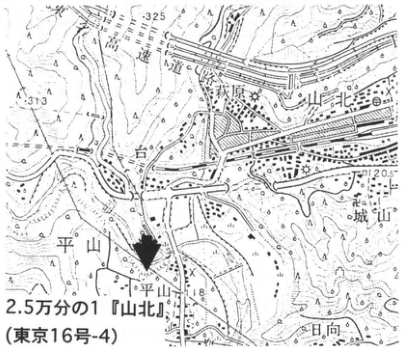
Show extracted lettering and translation
English translation of figure lettering
1:25,000 “Yamakita” (Tokyo16-4). Tomei Expressway,Ashigara Station,Yamakita,Sakawagawa,Dai,Hirayama,Hirayama Bridge,Shiroyama,Hinata;325,313,120.5,118.
Original Japanese lettering
2.5万分の1「山北」(東京16号-4)。東名高速道路、足柄駅、山北、酒匂川、台、平山、平山橋、城山、日向、325、313、120.5、118。
KT-39 (continued)
References: 足柄団体研究グループ (1986a, 1986b), 今永 (1986), 伊藤 et al. (1986), Ito et al. (1987, 1989), 狩野 et al. (1988), 上杉 (1989, 1990), 上杉 et al. (1985, 1992), 上杉・木越 (1986), 上杉・米澤 (1987), 山崎 (1971).
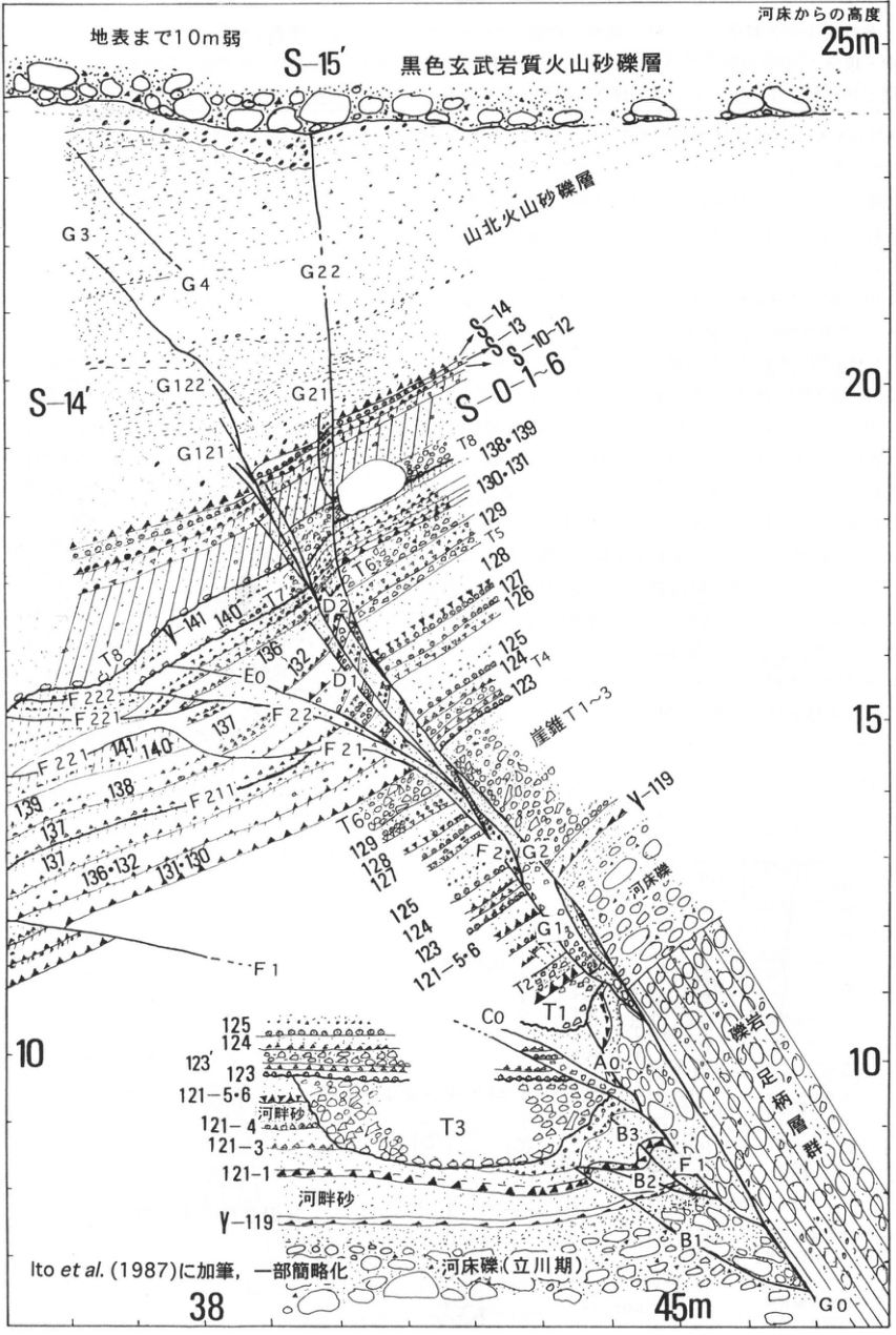
Show extracted lettering and translation
English translation of figure lettering
Less than 10 m to the ground surface. Height above the riverbed: 10, 15, 20, 25 m. Horizontal-axis labels: 38 and 45 m. S-15′; black basaltic volcanic sand and gravel. Yamakita volcanic sand and gravel. S-14′, S-14, S-13, S-10–12, S-0-1–6. Talus T1–3. Riverbed gravel (Tachikawa stage), riverbed gravel, riverside sand. Ashigara Group (conglomerate). Unit and structural labels (also repeated in the drawing): G0, G1a, G2, G3, G4, G21, G22, G121, G122; A0, B1, B2, B3, C0, D1, D2, E0; F1, F2, F21, F22, F211, F221, F222; T1, T2, T3, T4, T5, T6, T7, T8. Tephra labels: Y-119, 121-1, 121-3, 121-4, 121-5·6, 123, 123′, 124, 125, 126, 127, 128, 129, 130·131, 131, 131·130, 132, 136, 136·132, 137, 138, 138·139, 139, 140, 141. Modified from Ito et al. (1987), partly simplified.
Original Japanese lettering
地表まで10m弱。河床からの高度:10,15,20,25m。横軸の表示:38,45m。 S-15′,黒色玄武岩質火山砂礫層。山北火山砂礫層。S-14′,S-14,S-13,S-10~12,S-0-1~6。崖錐T1~3。河床礫(立川期),河床礫,河畔砂。足柄層群(礫岩)。 層・構造のラベル(図内の反復を含む):G0,G1a,G2,G3,G4,G21,G22,G121,G122;A0,B1,B2,B3,C0,D1,D2,E0;F1,F2,F21,F22,F211,F221,F222;T1,T2,T3,T4,T5,T6,T7,T8。 テフラのラベル:Y-119,121-1,121-3,121-4,121-5・6,123,123′,124,125,126,127,128,129,130・131,131,131・130,132,136,136・132,137,138,138・139,139,140,141。 Ito et al.(1987)に加筆,一部簡略化。
KT-40 Jomon-transgression deposits and peat in paleo-Nagareyama Bay, central Kanto Plain
遠藤邦彦
- Locality: Nazukari (名都借), Nagareyama City, Chiba Prefecture
- Coordinates: N35°0′48″ E139°5′12″
- Elevation: 5 m
- Exposure and condition: Artificial exposure produced by river improvement works; disappeared
- Deposits and age: Marine beds and peat; Holocene
- Description date: 1988
- Keywords: Jomon-transgression deposits, Yurakucho Formation, oyster reef, Shin-Fuji-derived tephra, inner Tokyo Bay, paleo-Nagareyama Bay
The Jomon transgression reached its maximum at 5.5–6.5 ka, penetrating approximately 50 km into the interior of the Kanto Plain and forming drowned valleys in many places. The dissected valley in the Shimosa Upland now occupied by the Sakagawa River also became a drowned valley. Oyster reefs developed widely in this small embayment, named paleo-Nagareyama Bay. River improvement works on the Sakagawa exposed an oyster reef approximately 60 cm thick near 0 m above sea level. Fresh shells of the Pacific oyster (マガキ) stand upright and are densely packed throughout. Radiocarbon ages of 5.8–5.9 ka were obtained from its middle to lower part (遠藤 et al., 1989). The reef indicates that a stable, shallow embayment with clear water existed here at that time. A borehole core at this locality shows marine beds extending down to approximately −10 m, with the base of the Yurakucho Formation at −12 m. The reef is overlain by silty sand containing allochthonous shell fossils (a ¹⁴C age of 4.8 ka; the ages below are also radiocarbon ages), brackish-water clay (4.4 ka), and, higher up, approximately 2 m of undecomposed peat (from 1.7–3.4 ka onward). This succession records the process by which the embayment of the Jomon transgression began to emerge by 5.0 ka, became brackish through approximately 4.0 ka, and had become a freshwater wetland by 3.5 ka. The peat contains eight scoria beds from Shin-Fuji volcano, named NZ-a through NZ-h downward from the top. These consist of dark-gray to gray scoria, 1–0.25 mm in grain size, with a small amount of olivine. They have been correlated with Shin-Fuji tephras (泉 et al., 1977; 宮地, 1988): NZ-c with Yu-2 (S-22), NZ-d with S-18, NZ-e, f, and g with S-15–17′, and NZ-h with Yu-1 (S-10, 11) (遠藤 et al., 1989). NZ-a and b probably belong to the Shin-Fuji Yu-3 group. The surface peat and soil are also absent from this exposure, although Shin-Fuji Hoei tephra (1707; S-25), Haruna-Futatsudake-Shibukawa (FA), Asama-a (As-a), and other tephras occur near the surface in the surrounding area. These scoriaceous and pumiceous tephras are widely found in peat beds and archaeological sites in the alluvial lowlands of the Kanto Plain (for example, the Akayama-Jinya site; 遠藤 et al., 1987). This exposure has been protected by bank revetment, but river improvement works are progressing farther inland, so exposures may appear again. For the results of diatom and pollen analyses of the Yurakucho Formation at this exposure, see 遠藤 et al. (1989).
References: 遠藤 et al. (1987, 1989), 泉 et al. (1977), 宮地 (1988).
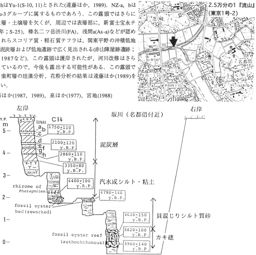
Show extracted lettering and translation
English translation of figure lettering
Body text and references included in the upper crop are reproduced in the main text. Map: 1:25,000 “Nagareyama” (Tokyo 1-2); Nazukari, Matsudo City, Sakagawa, Saiwaicho, ×, arrow. Sakagawa (near Nazukari). Left bank; right bank. Vertical axis: Y.P., m; 0, 1, 2, 3, 4, 5. TEPHRA: a, b, c, d, e, f, g, h. C14. Peat; brackish-water silt and clay; shelly silty sand; oyster reef. Original English lettering: “rhizome of Phragmites”; “fossil oyster bed (reworked)”; “fossil oyster reef (autochthonous)”. Ages, from the top of the drawing (y. B. P.): 1750±110, 2100±120, 2860±110, 3350±80, 4400±100, 4790±140, 4620±150, 5820±100, 5900±140.
Original Japanese lettering
上部に混入した本文・文献は本文に収録。地図:2.5万分の1『流山』(東京1号-2),名都借,松戸市,坂川,幸町,×,矢印。 坂川(名都借付近)。左岸,右岸。縦軸Y.P.,m:0,1,2,3,4,5。TEPHRA:a,b,c,d,e,f,g,h。C14。 泥炭層,汽水成シルト・粘土,貝混じりシルト質砂,カキ礁。rhizome of Phragmites;fossil oyster bed (reworked);fossil oyster reef (autochthonous)。 年代値(図の上から;y. B. P.):1750±110,2100±120,2860±110,3350±80,4400±100,4790±140,4620±150,5820±100,5900±140。
Reading notes
4620±150 — 図の先頭数字はやや不鮮明。原PDFの拡大では4と読み取れるが、年代の前後関係から別数字へ修正しない。
KT-41 Tephra stratigraphy of the Ushiomasu site, Inage Ward, Chiba City
上杉陽・飛田正美・上本進二・白根義久・建石徹・青沼道文・松田隆夫・武田宗久・遺跡層序研究会
- Locality: 子中台町 407-1 and other lots, Inage Ward, Chiba City
- Coordinates: N35°3′55″ E140°5′57″
- Elevation: 23–26 m
- Exposure and condition: Artificial exposure; disappeared
- Deposits and age: Aeolian tephra; from 38 ka onward
- Description date: February–March 1996
- Keywords: Fuji-derived tephra, Aira-Tn tephra, mica-bearing greasy ash, obsidian flakes, Ushiomasu (牛尾舛) site
The site occupies the western margin of a small upland surrounded by tributary valleys of the Kusano floodway drainage system. These valleys cut into the Shimosa Upland (Shimosueyoshi–Obaradai stages) between Inage and Kemigawa on the Sobu railway line; the upland extends northwest–southeast parallel to the shore of Tokyo Bay. Several shallow, dish-shaped depressions on its surface are filled with tephra. The site lies 128 km from Fuji volcano along N75°E. Holocene tephra is approximately 0.5 m thick here and has yielded Middle Jomon dwelling remains, Early and Late Kofun dwelling remains, one burial mound, a Nara-period pit burial, and an early modern ditch feature (飛田・白根, 1996). A dwelling abandoned in Middle Jomon times, on the southern margin of a dish-shaped depression opening westward, is cut by fissures trending N70°W with northeast-side-down displacement of 10–15 cm. A Late Kofun dwelling was subsequently constructed. During the intervening period, strong ground shaking capable of producing fissures probably occurred near the site, or a branch of a northwest–southeast active fault cutting the cover deposits appeared here. The Pleistocene tephras can generally be distinguished by eye, and the positions of their light and dark bands are essentially the same as in Sagamino. Aira-Tn tephra (AT) occurs 1.4 m below the surface. Layer 14 immediately above it, containing hard scoria clasts, corresponds to Sagamino-1 Scoria (S1S); the overlying dark band of layer 15 corresponds to B2u in the standard Sagamino soil sequence (上杉 et al., 1993; 上本 et al., 1994). The dark band of layer 17 corresponds to Sagamino B1. A biotite-rich band occurs in the upper part of layer 2, 2.5 m below the surface. From the characteristics of scoria clasts above and below it, this can be correlated with Y-97′ of 上杉 et al. (1980), the mica-bearing greasy ash (Gr). Its age is approximately 38.3 ka according to 叶内・杉原 (1994). Yellowish-white pumiceous volcanic sand also occurs between layers 3 and 4, 5 and 6, and 6 and 7, and in the lower part of layer 16. All are considered tephras from the central cones of Hakone volcano. For example, the white pumiceous volcanic sand of layer 16 is probably Hk-CCP16 and 17 of Y-128–130 (上杉 et al., 1996). Burnt soil and obsidian flakes were recovered immediately above AT in layer 13 (the middle of Sagamino L3), and obsidian flakes were recovered from the surface part of layer 14 (the surface of the lower part of Sagamino B2).
References: 飛田・白根 (1996), 叶内・杉原 (1994), 町田 et al. (1991), 上本 et al. (1994), 上杉 et al. (1980, 1992, 1993, 1996).
Ω denotes artifacts; see 上杉 et al. (1992) for details.
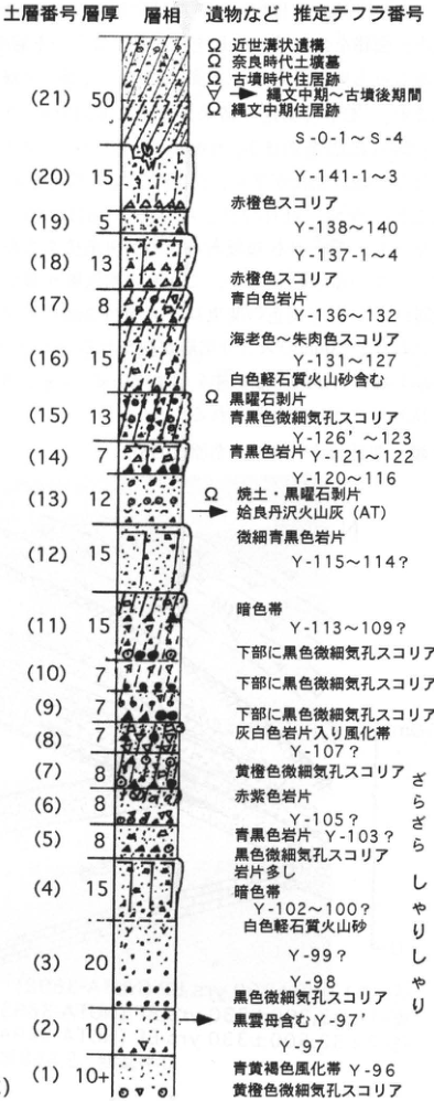
Show extracted lettering and translation
English translation of figure lettering
Soil-layer number / thickness / facies / artifacts, etc. / inferred tephra number. The thickness unit is not specified in the drawing. Ω denotes artifacts.
| Soil layer | Thickness | Characteristics and correlations in the figure |
|---|---|---|
| 21 | 50 | Ω early modern ditch, Ω Nara-period pit burial, Ω Kofun dwelling, ▽ interval from Middle Jomon to Late Kofun, Ω Middle Jomon dwelling; S-0-1–S-4 |
| 20 | 15 | Y-141-1–3 |
| 19 | 5 | Reddish-orange scoria; Y-138–140 |
| 18 | 13 | Y-137-1–4 |
| 17 | 8 | Reddish-orange scoria, bluish-white lithics; Y-136–132 |
| 16 | 15 | Shrimp-colored to vermilion scoria; Y-131–127; contains white pumiceous volcanic sand |
| 15 | 13 | Ω obsidian flakes, bluish-black scoria with fine vesicles; Y-126′–123 |
| 14 | 7 | Bluish-black lithics; Y-121–122; Y-120–116 |
| 13 | 12 | Ω burnt soil and obsidian flakes; Aira-Tanzawa ash (AT) |
| 12 | 15 | Very fine bluish-black lithics; Y-115–114? |
| 11 | 15 | Dark band; Y-113–109?; black scoria with fine vesicles in the lower part |
| 10 | 7 | Black scoria with fine vesicles in the lower part |
| 9 | 7 | Black scoria with fine vesicles in the lower part |
| 8 | 7 | Weathered band containing grayish-white lithics; Y-107? |
| 7 | 8 | Yellowish-orange scoria with fine vesicles |
| 6 | 8 | Reddish-purple lithics; Y-105? |
| 5 | 8 | Bluish-black lithics; Y-103? |
| 4 | 15 | Black scoria with fine vesicles, abundant lithics, dark band; Y-102–100?; white pumiceous volcanic sand |
| 3 | 20 | Y-99?, Y-98; black scoria with fine vesicles |
| 2 | 10 | Biotite-bearing Y-97′; Y-97 |
| 1 | 10+ | Blue-yellow-brown weathered band; Y-96; yellowish-orange scoria with fine vesicles |
Texture descriptions at the right: free-flowing (さらさら), gritty (しゃりしゃり).
Original Japanese lettering
土層番号/層厚/層相/遺物など/推定テフラ番号。厚さの単位は図に明記なし。Ωは遺物。
| 土層 | 層厚 | 図の特徴・対比 |
|---|---|---|
| 21 | 50 | Ω近世溝状遺構,Ω奈良時代土壙墓,Ω古墳時代住居跡,▽縄文中期~古墳後期間,Ω縄文中期住居跡;S-0-1~S-4 |
| 20 | 15 | Y-141-1~3 |
| 19 | 5 | 赤橙色スコリア;Y-138~140 |
| 18 | 13 | Y-137-1~4 |
| 17 | 8 | 赤橙色スコリア,青白色岩片;Y-136~132 |
| 16 | 15 | 海老色~朱肉色スコリア;Y-131~127;白色軽石質火山砂含む |
| 15 | 13 | Ω黒曜石剥片,青黒色微細気孔スコリア;Y-126′~123 |
| 14 | 7 | 青黒色岩片;Y-121~122;Y-120~116 |
| 13 | 12 | Ω焼土・黒曜石剥片;姶良丹沢火山灰(AT) |
| 12 | 15 | 微細青黒色岩片;Y-115~114? |
| 11 | 15 | 暗色帯;Y-113~109?;下部に黒色微細気孔スコリア |
| 10 | 7 | 下部に黒色微細気孔スコリア |
| 9 | 7 | 下部に黒色微細気孔スコリア |
| 8 | 7 | 灰白色岩片入り風化帯;Y-107? |
| 7 | 8 | 黄橙色微細気孔スコリア |
| 6 | 8 | 赤紫色岩片;Y-105? |
| 5 | 8 | 青黒色岩片;Y-103? |
| 4 | 15 | 黒色微細気孔スコリア,岩片多し,暗色帯;Y-102~100?;白色軽石質火山砂 |
| 3 | 20 | Y-99?,Y-98;黒色微細気孔スコリア |
| 2 | 10 | 黒雲母含むY-97′;Y-97 |
| 1 | 10+ | 青黄褐色風化帯;Y-96;黄橙色微細気孔スコリア |
右側の感触表示:さらさら,しゃりしゃり。
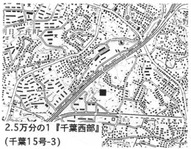
Show extracted lettering and translation
English translation of figure lettering
1:25,000 “Chiba-Seibu” (Chiba 15-3). Black square: site. Inage, Kemigawa, Miyanogi, Konakadai-cho (小中台町), Sonno (園生).
Original Japanese lettering
2.5万分の1『千葉西部』(千葉15号-3)。黒四角:遺跡。稲毛,検見川,宮野木,小中台町,園生。
KT-42 A 30,000-year-old marine terrace along the lower Isumi River, Boso Peninsula
菊地隆男・鈴木毅彦・桑原拓一郎
- Locality: 一ヶ谷, Misaki Town, Isumi District, Chiba Prefecture; residential subdivision of 東日総業KK
- Coordinates: N35°20′8″ E140°22′5″
- Elevation: 25 m
- Exposure and condition: Artificial exposure; northern and eastern faces remained exposed as of March 1994
- Deposits and age: Lagoonal beds; Late Pleistocene
- Description date: March 1995
- Keywords: Boso Peninsula, Isumi River, oxygen-isotope stage 3, Yoshitsuke surface
Because the Boso Peninsula has undergone marked uplift during the Quaternary, marine terraces formed during low sea levels in the latter part of the Late Pleistocene were expected to exist. This exposure was discovered in 1995. It reveals beds considered lagoonal deposits dating to around 30 ka (oxygen-isotope stage 3), regarded as a period of low sea level, and is of interest as evidence of paleo-sea-level elevation at that time. Pleistocene terraces along the lower Isumi River, in descending order, are the Taitosaki (70 m above sea level), Nagasaka (50 m), Yoshitsuke (30 m), and Matsumaru (18 m) terraces (桑原, 1995). The Yoshitsuke surface occurs around reservoirs such as the Shiigi weir east of this exposure. Medium-grained sand containing flat clasts, interpreted as marine deposits, can be observed unconformably overlying the underlying Kazusa Group. At this exposure, the terrace deposits consist in their lower part of massive silty fine sand containing fine pumice (1–0.5 mm), more than 4 m thick, and in their upper part of parallel-laminated clayey silt containing medium- to fine-gravel-sized silt clasts, approximately 4 m thick. The boundary between the lower and upper parts is relatively distinct and appears to represent a small hiatus. Peat beds occur at two levels in the lower part and one in the upper part; radiocarbon dating yielded ages of 31,000–33,000 yr B.P. for all of them (菊地 et al., 1996). Pollen analysis shows abundant evergreen conifers such as Picea and Tsuga, indicating an environment of the upper cool-temperate zone (analyst: 清永丈太). The refractive index n of pumice glass ranges from 1.503 to 1.512 and has multiple modes, raising the possibility that several pumice populations, including redeposited material, are mixed together. These water-laid beds are overlain by gravelly clay (1 m) and brown Kanto Loam (1.2 m). A scoria bed with particles 2–3 mm in diameter occurs in the upper part of the clay. Within the loam is a horizon enriched in volcanic glass with refractive indices n=1.499–1.502, considered to be Aira-Tn tephra (AT).
References: 菊地 et al. (1996), 桑原 (1995).
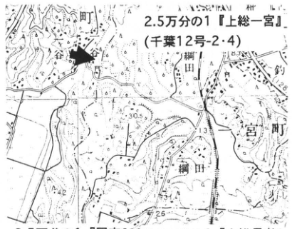
Show extracted lettering and translation
English translation of figure lettering
1:25,000 “Kazusa-Ichinomiya” (Chiba 12-2·4). Labels of adjoining sheets printed beneath the map in the original: 1:25,000 “Kuniyoshi” (Otaki 9-3) and 1:25,000 “Kazusa-Choja” (Otaki 9-1). Misaki Town, 網田, 一ヶ谷. Numerical labels: 30.5, 33.4, 42, 26. Arrow: exposure.
Original Japanese lettering
2.5万分の1『上総一宮』(千葉12号-2・4)。原著で図の下にある接合図幅の表示:2.5万分の1『国吉』(大多喜9号-3),2.5万分の1『上総長者』(大多喜9号-1)。岬町,網田,一ヶ谷。数値表示:30.5,33.4,42,26。矢印:露頭。
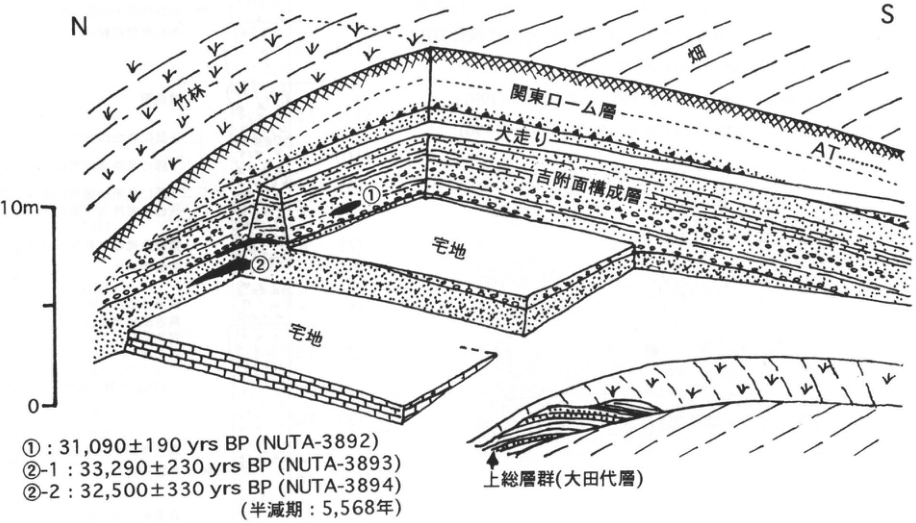
Show extracted lettering and translation
English translation of figure lettering
N, S. Bamboo grove; cultivated field; Kanto Loam; AT; 大走り (original label); deposits forming the Yoshitsuke surface; residential lots; ①, ②. Kazusa Group (Otadai Formation). Height scale: 0, 10 m. ①: 31,090±190 yrs BP (NUTA-3892) ②-1: 33,290±230 yrs BP (NUTA-3893) ②-2: 32,500±330 yrs BP (NUTA-3894) Half-life: 5,568 years.
Original Japanese lettering
N,S。竹林,畑,関東ローム層,AT,大走り,吉附面構成層,宅地,①,②。上総層群(大田代層)。高さ目盛:0,10m。 ①:31,090±190 yrs BP (NUTA-3892) ②-1:33,290±230 yrs BP (NUTA-3893) ②-2:32,500±330 yrs BP (NUTA-3894) 半減期:5,568年。
KT-43 Late Pleistocene tephra beds on the eastern shore of Tokyo Bay —Tephras from Hakone volcano—
杉原重夫
- Locality: 三光路, Kisarazu City, Chiba Prefecture
- Coordinates: N35°21′06″ E139°59′41″
- Elevation: 92 m
- Exposure and condition: Artificial exposure; still present in June 1996, but its cliff face was collapsing
- Deposits and age: Aeolian tephra and fluvial deposits; Late Pleistocene
- Description date: June 1996
- Keywords: Boso Peninsula, Anegasaki Formation, Shimosueyoshi Loam, Hakone-derived tephra, Hakone-Obaradai tephra, Hakone-Miura tephra, Hakone-Tokyo tephra, Hakone Central Cone 1 tephra
The vicinity of Kisarazu in the central Boso Peninsula lies along the distribution axes of many Hakone-derived tephras. This exposure lies approximately 6.5 km east-southeast of Kisarazu Station on the Uchibo line, in a cross-shaped road cutting on a narrow ridge of the dissected Kisarazu Upland (Obaradai surface). By car it is approximately 20 minutes from Kisarazu-kita interchange on the Tateyama Expressway. When the exposure was created approximately 20 years ago, it was an excellent locality for observing marker tephras and buried soils in the Kanto Loam. The lower half of the cliff face is now buried. Nevertheless, four Hakone-derived pumice beds can still be distinguished, upward from the bottom: Hakone-Obaradai (Hk-OP), Hakone-Miura (Hk-MP), Hakone-Tokyo (Hk-TP), and Hakone Central Cone 1 (Hk-CCP1). Fission-track ages of 66±6 ka for Hk-OP and 49±6 ka for Hk-TP have been determined (鈴木, 1976). At this exposure, buried soils such as black bands, as well as crack zones, could be observed exceptionally well in the volcanic-ash soils of the Shimosueyoshi Loam at and above Hk-OP and of the Tachikawa and Musashino Loams (conditions are now less favorable). Below Hk-OP, the Shimosueyoshi Loam consists of grayish-brown to greenish-gray clay, and Ontake-1 tephra (On-Pm1) could formerly be observed intercalated at this level. On the Kisarazu Upland, the upper half of the Shimosueyoshi Loam conformably overlies alternating sand and mud beds and sand-and-gravel beds of the Anegasaki Formation, which forms the Obaradai surface. The Anegasaki Formation can no longer be observed at this exposure, but its depositional facies suggest deposits laid down near a river mouth (deltaic deposits) during the emergence of the Kisarazu Upland.
References: 新井 et al. (1977), 町田 (1971), 杉原 et al. (1978), 鈴木 (1976).
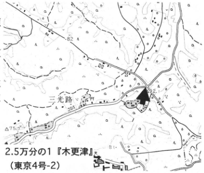
Show extracted lettering and translation
English translation of figure lettering
1:25,000 “Kisarazu” (Tokyo 4-2). 三光路. Spot heights: 82, 92.1, 75.7. Arrow: exposure.
Original Japanese lettering
2.5万分の1『木更津』(東京4号-2)。三光路。標高点:82,92.1,75.7。矢印:露頭。
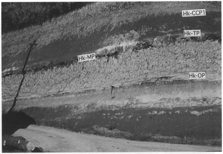
Show extracted lettering and translation
English translation of figure lettering
Hk-CCP1: Hakone Central Cone 1; Hk-TP: Hakone-Tokyo; Hk-MP: Hakone-Miura; Hk-OP: Hakone-Obaradai.
Original Japanese lettering
Hk-CCP1,Hk-TP,Hk-MP,Hk-OP。
KT-44 Gomashio-1 tephra (GoP1) and molluscan fossil assemblages in the Yabu Formation of the Shimosa Group
杉原重夫
- Locality: 長谷川ウナ, Semata, Ichihara City, Chiba Prefecture, in front of “Semata no seki” (瀬又の堰)
- Coordinates: N35°31′31″ E140°13′47″
- Elevation: 40 m
- Exposure and condition: Natural exposure?; only the fossil-bearing part was observable in June 1996 because of vegetation cover
- Deposits and age: Marine beds; Middle Pleistocene
- Description date: June 1996
- Keywords: Boso Peninsula, Shimosa Group, Yabu Formation, Semata Formation, Semata–Yabu tephra, Gomashio-1 tephra, Tokyo scallop (トウキョウホタテガイ)
The Shimosa Group (Narita Group) consists predominantly of marine beds distributed widely across the northern Boso Peninsula and yields molluscan fossils at many localities. This exposure has also long been known as a fossil locality. It lies approximately 2.5 km southeast of Honda Station on the Sotobo line, but the roads are circuitous and complicated, and it takes nearly an hour to reach the exposure from the station. By car, a convenient route leads from the Chiba-Sotobo road past the Tokyo hosiery industrial estate (東京靴下団地). The exposure is a large cliff with approximately 15 m of relief, formed where the upper Muratagawa River eroded the Shimosa Upland. Its lower half is now buried by collapsed material. In the upper half, only the fossil-bearing part remains free of vegetation, approximately 20 m wide and 5 m high. The fossil-bearing beds exposed here were formerly called the “Semata Formation,” but correlations of marker tephras have established that they belong to the Yabu Formation of the Shimosa Group. The principal tephras observable here are Semata–Yabu tephra (SY) and Gomashio-1 tephra (GoP1), approximately 270 cm above it. A fission-track age of 290±30 ka has been determined for GoP1 (鈴木, 1976). GoP1 is also a particularly important marker tephra in the Tama Loam and has been correlated with BBP of Yatsugatake (町田 et al., 1974).
Vertical changes in the molluscan fossil assemblages have been established at this exposure. Warm-current species occur below the SY horizon, both warm and cold elements occur between SY and GoP1, and relatively cold-water assemblages become more abundant above GoP1. The fossil species known as the Tokyo scallop (Pecten tokyoensis) occurs above SY and is found up to immediately above GoP1.
References: 青木・馬場 (1971), 青木 et al. (1970), 大原 (1968), 杉原 et al. (1978), 鈴木 (1976), 町田 et al. (1974).
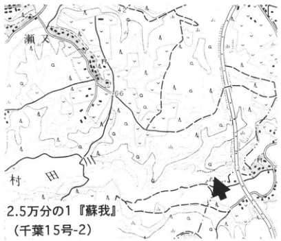
Show extracted lettering and translation
English translation of figure lettering
1:25,000 “Soga” (Chiba 15-2). Semata, Muratagawa. Numerical labels: 42, 66. Arrow: exposure.
Original Japanese lettering
2.5万分の1『蘇我』(千葉15号-2)。瀬又,村田川。数値表示:42,66。矢印:露頭。
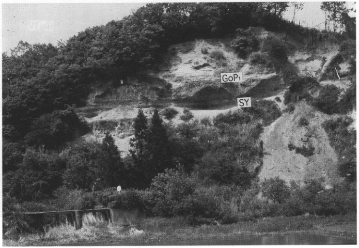
Show extracted lettering and translation
English translation of figure lettering
GoP1: Gomashio-1 tephra; SY: Semata–Yabu tephra.
Original Japanese lettering
GoP1,SY。
KT-45 Konan-1 tephra, TE-5 tephra, and fossil assemblages in the Jizodo Formation of the Shimosa Group
The horizon of oxygen isotope stage 11
杉原重夫
- Locality: Jizodo, Mariyatsu, Kisarazu City, Chiba Prefecture
- Coordinates: N35°21′53″ E140°06′09″
- Elevation: 50–60 m
- Outcrop type and condition: Artificial exposure; only the shell-fossil-bearing portion could be observed in June 1996
- Deposit type and age: Marine deposits; Middle Pleistocene
- Description date: June 1996
- Keywords: Boso Peninsula; Shimosa Group; Jizodo Formation; TE-5; Konan-1 tephra; Hachioji Biotite tephra
This outcrop is approximately 4 km east of Makuta Station on the Kururi Line. The area lies at the southern end of the Anesaki upland, and the exposure is on the northern bank of an incised valley of the Takeda River. The exposures extending along this valley constitute the type localities of the Jizodo and Yabu formations in the lower Shimosa Group and were designated a nature conservation area on 9 January 1976 (Showa 51). At this representative exposure of the Jizodo Formation, vertical changes in shell-fossil assemblages can be understood from their stratigraphic relationships to two tephras. Two marker tephras can be identified: Konan-1 tephra (Kn-1), at road level, which occurs in the uppermost Konan Formation in Yokohama (see 町田 et al., 1974); and TE-5, approximately 4 m above it, which occurs in the middle and lower portions of the Tama E tephra group at various localities in the Oiso and Tama hills and corresponds to the Hachioji Biotite tephra (HBP). TE-5 is certainly a widespread tephra, and a fission-track age of 390±80 ka has been reported (鈴木・杉原, 1983), although its source volcano is unknown.
The most noteworthy feature of the Jizodo Formation is the occurrence, from near Kn-1 to horizons within 2 m above it, of a shell-fossil assemblage better described as subtropical than merely warm-current in character, together with solitary corals, brachiopods, and bryozoans. This assemblage indicates the highest seawater temperatures recorded in the Shimosa Group. In Yokohama this interval of high water temperatures corresponds to the culmination of the transgression that formed the Konan surface; together with Ma8 of the Osaka Group, it is correlated with the globally warm marine conditions of oxygen isotope stage 11. Cold-water species are conspicuous among the fossils at TE-5 and higher horizons, suggesting a decline in seawater temperature.
References: 青木 et al. (1962); 青木・馬場 (1973); 町田 et al. (1974, 1980); 杉原 et al. (1978); 鈴木・杉原 (1983).
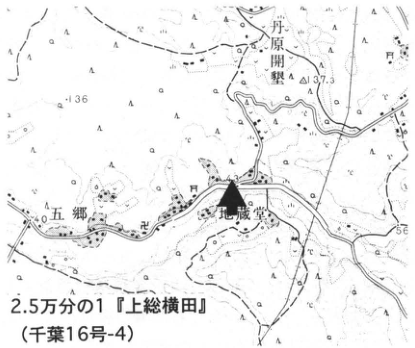
Show extracted lettering and translation
English translation of figure lettering
丹原開墾 (place name, reading unverified); 五郷 (place name); Jizodo; 136; △137.3; 40; 56; 1:25,000 “Kazusa-Yokota” (Chiba sheet 16-4).
Original Japanese lettering
丹原開墾;五郷;地蔵堂;136;△137.3;40;56;2.5万分の1『上総横田』(千葉16号-4)
Reading notes
地形図の微小な標高・地名 — 原画像でも一部の微小文字は判読困難。
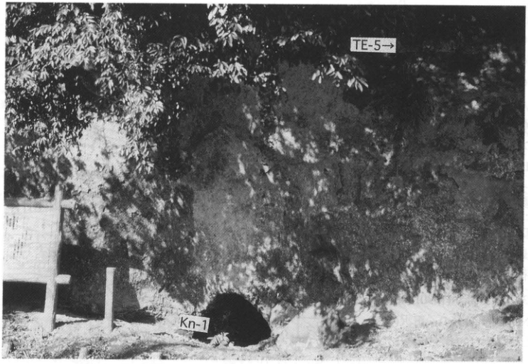
Show extracted lettering and translation
English translation of figure lettering
TE-5→; Kn-1
Original Japanese lettering
TE-5→;Kn-1
KT-46 The Numa coral bed and tephra at Tateyama, Boso Peninsula
遠藤邦彦・村田泰輔
- Locality: Koyatsu, Tateyama City, Chiba Prefecture
- Coordinates: N34°8′00″ E139°9′25″ [as printed]
- Elevation: 21 m
- Outcrop type and condition: Erosional cliff along a small stream; extant
- Deposit type and age: Holocene marine deposits
- Description date: July 1995
- Keywords: Tateyama; Numa Formation; Numa corals; Izu-Oshima Numa tephra
At the culmination of the Jomon transgression (5.5–6.5 ka), the area surrounding Tateyama Bay at the southern end of the Boso Peninsula formed drowned valleys in which the Numa Formation, containing reef-building corals, accumulated (松島, 1979). According to 浜田 (1963), approximately 90 species of reef-building corals have been identified from the Numa coral bed; they lived at depths of several metres or more below the intertidal zone. 松島 (1979) divided the Numa Formation into three members, in ascending order: the Numa lower mud bed (7.5–8.5 ka), the Numa coral bed (5.5–6.5 ka), and the Numa upper mud bed.
The Numa coral bed can currently be observed at B, C, D, E, and other sites as well as at this outcrop. At D there is a monument marking its designation as a natural monument, and coral fossils are preserved within a fence. At the present outcrop (site A), at the head of a small valley near Koyatsu, Tateyama City, two members can be observed overlying basement siltstone: the 1–2 m thick Numa coral bed (NM) and the overlying Numa upper mud bed (NU). The coral bed occurs at elevations of 18–21 m and consists of reef-building coral fossils and intervening mud containing shell fossils. The shell fossils associated with the corals indicate depths of several metres or more below the intertidal zone (松島, 1979). Numerous traces produced by boring molluscs at the culmination of the Jomon transgression are recognized in the basement siltstone; their upper limit reaches 28 m above sea level. The Numa upper mud bed consists of a lower sand-and-gravel bed and an upper dark-blue mud bed, neither of which yields coral or shell fossils. Open-ocean and inner-bay indicator assemblages occur in the Numa coral bed; marine to brackish sandy tidal-flat indicator assemblages occur in the sand-and-gravel bed of the Numa upper mud bed; and brackish muddy tidal-flat to freshwater benthic indicator assemblages occur in its dark-blue mud bed (小杉・村田, unpublished). These stratigraphic changes in fossil assemblages suggest environmental changes from the culmination of the Jomon transgression through the subsequent regression. A 1 cm thick black scoria layer was discovered beneath this upper mud bed, covering the upper surface of the Numa coral bed, and was named Izu-Oshima Numa tephra (Os-Nm; 小杉 et al., 1990). The chemical composition of this angular, somewhat poorly vesiculated scoria differs from the trends of Fuji volcano and the Higashi-Izu monogenetic volcanic group and agrees with the Izu-Oshima trend. It probably corresponds to O22 or O21 (田沢, 1981), or O35 (上杉 et al., 1994), of the younger main-stratovolcano stage (田沢, 1980; the Older Oshima Group of Nakamura, 1964). These scoria layers have been dated at 5.5 ka.
This is one of the few valuable exposures in which the Numa coral bed is exceptionally well preserved; any action that might destroy the exposure must therefore be strictly avoided.
References: 浜田 (1963); 小杉 et al. (1990); 松島 (1979); Nakamura (1964); 田沢 (1980, 1981); 上杉 et al. (1994).
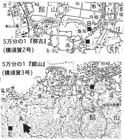
Show extracted lettering and translation
English translation of figure lettering
B; C; A; D; E; Tateyama City; Tateyama Bridge; 桑原; 西郷; 府中; 古; 大社; Tateyama; Shiroyama; 塩見; 1:50,000 “Nago” (Yokosuka sheet 2); 1:50,000 “Tateyama” (Yokosuka sheet 3).
Original Japanese lettering
B;C;A;D;E;館山市;館山大橋;桑原;西郷;府中;古;大社;館山;城山;塩見;5万分の1『那古』(横須賀2号);5万分の1『館山』(横須賀3号)
Reading notes
地形図微小地名・標高 — 一部は原図解像度でも判読困難。
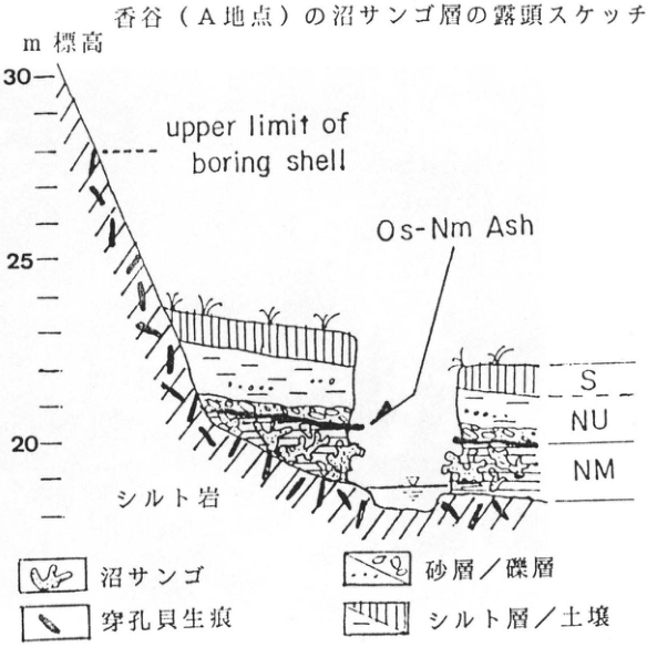
Show extracted lettering and translation
English translation of figure lettering
Outcrop sketch of the Numa coral bed at Koyatsu (site A); elevation, m; 30; 25; 20; upper limit of boring shell; Os-Nm Ash; S; NU; NM; siltstone; Numa coral; traces of boring molluscs; sand bed / gravel bed; silt bed / soil.
Original Japanese lettering
香谷(A地点)の沼サンゴ層の露頭スケッチ;m 標高;30;25;20;upper limit of boring shell;Os-Nm Ash;S;NU;NM;シルト岩;沼サンゴ;穿孔貝生痕;砂層/礫層;シルト層/土壌
KT-47 Discordant relationships within Older Oshima Group tephras and distal tephras at the Izu-Oshima Great Geological Section
上杉陽・新川和範
- Locality: Senbazaki, Izu-Oshima Town, Tokyo
- Coordinates: N34°41′58″ E139°22′3″
- Elevation: 70–80 m
- Outcrop type and condition: Artificial exposure; extant
- Deposit type and age: Aeolian tephra; 18–1.5 ka
- Description date: March 1991
- Keywords: Older Oshima Group tephras; Kikai-Akahoya tephra; discordant horizon produced by erosion extending upward; Awa glassy ash; Izu-Oshima
A series of exposures totaling 750 m in length occurs between Enshu-Aino (エンシュウーアイノー) and Mabushi along Tokyo Route 208 on the southwestern coast of Izu-Oshima. Oshima Town manages these as the “Great Geological Section” (地層大切断面), which can be observed at any time. Using this as the principal type locality, 田沢 (1980) provided a detailed description of the Older Oshima Group tephras. 上杉 et al. (1994) produced a continuous columnar section at 1:20 scale with partial additions and revisions. On the basis of the scale and form of discordant relationships, they divided the sequence, from top downward, into Senbazaki Unit 1 (Younger Oshima Group: Y, N, S; since 1.72 ka), Unit 2 (Osb1–O35; 1.72–5.6 ka), Unit 3 (Osb36–O63; 5.6–13.74 ka), Unit 4 (O64–Osb100; 13.74–20.52 ka), and Unit 5 (Osb101 and below; 20.52 ka and older). The figure below sketches the inland exposure 500–530 m northwest toward Motomachi from the side road descending from the Tokyo road to Suna-no-hama. A side road to Senbazaki occurs at the 240 m point. At the 525 m point, near road level, there is a 40 cm thick scoria-gravel bed, Osb86 (18.4 ka±). Its uppermost volcanic-sand portion contains transparent glass shards, fibrous to platy in form, 300–70 μm across. The uppermost part of O64, approximately 14 ka old, and higher strata are black and humified. Humification began 2–3 thousand years earlier here than east of Fuji. O63 (13.7 ka±), at the base of Unit 3, is a scoria sand-and-gravel bed 95–377 cm thick, immediately beneath which a prominent discordant horizon produced by erosion extending upward is developed. Earlier tephras are only slightly eroded in valley-fill portions, whereas they are extensively eroded on ridges. Osb81 through O76 are truncated in the ridge portions. Similar discordant relationships formed in southern Kanto during this same interval, corresponding to the early late-glacial transgression. Archaeological sites are considered more likely to occur on lower slopes and valley floors than on upper slopes. O58 (12.1 ka±) and O55-2 (10.4 ka±) contain distal white pumiceous ash. This pair of distal tephras can be correlated over a wide area (新川 et al., 1992b). 吉田 (1992) inferred Miyatsukayama on Niijima and Jogoroyama on Kozushima to be their sources. They are probably part of the Awa glassy ash (AG) of 杉原 et al. (1978). Kikai-Akahoya tephra (K-Ah) occurs in the upper part of Osb37-3 (新川 et al., 1992a). 町田・新井 (1978) placed it in O40 at O-no-hama, but O40 at the type locality contains different glass. A prominent discordant horizon produced by erosion extending upward occurs immediately beneath O35 (5.6 ka±).
References: 町田・新井 (1978); 新川 et al. (1992a, b); 杉原 et al. (1978); 田沢 (1980); 上杉 et al. (1994); 吉田 (1992).
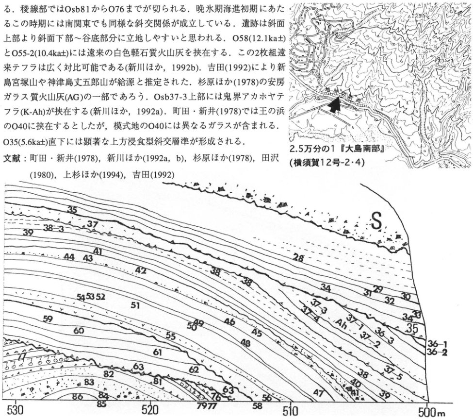
Show extracted lettering and translation
English translation of figure lettering
1:25,000 “Southern Oshima” (Yokosuka sheet 12-2/4); S; Ah; 28; 29; 30; 31; 32; 33; 34; 35; 36-1; 36-2; 36-3; 37-1; 37-2; 37-3; 37-5; 38; 38-3; 39; 40; 41; 42; 43; 44; 45; 46; 47; 48; 49; 50; 51; 52; 53; 54; 55; 58; 59; 60; 61; 62; 63; 76; 77; 79; 81; 82; 83; 84; 85; 86; 530; 520; 510; 500 m. The embedded prose fragment has been restored in the main text.
Original Japanese lettering
2.5万分の1『大島南部』(横須賀12号-2・4);S;Ah;28;29;30;31;32;33;34;35;36-1;36-2;36-3;37-1;37-2;37-3;37-5;38;38-3;39;40;41;42;43;44;45;46;47;48;49;50;51;52;53;54;55;58;59;60;61;62;63;76;77;79;81;82;83;84;85;86;530;520;510;500m。画像中の本文断片は本文に復元。
Reading notes
地形図微小文字および重なる断面ラベル — 微小文字の一部は完全には判読できない。
KT-48 Tephras from Izu-Niijima and Kozushima, and Aira-Tn tephra
吉田浩
- Locality: Daisanyama, Niijima Village, Tokyo
- Coordinates: N34°21′40″ E139°14′50″
- Elevation: 50 m
- Outcrop type and condition: Artificial exposure; extant in August 1995
- Deposit type and age: Pyroclastic-flow, pyroclastic-surge, and pumice-fall deposits; Late Pleistocene
- Description date: August 1995
- Keywords: Tephras from Izu-Niijima; tephras from Izu-Kozushima; Aira-Tn tephra
Izu-Niijima is a volcanic island consisting of flat surfaces of pyroclastic-surge deposits and groups of lava domes. This exposure lies on the Setoyama lava dome, erupted relatively early in the history of Niijima volcano, and is one of the few exposures where tephra stratigraphy since approximately 50 ka can be observed. Because of the steep cliff, direct hands-on observation is possible only from the Niijima Akazakimine tephra (吉田, 1992) downward. This tephra consists of accretionary lapilli of bronzite-andesite composition erupted before formation of the Akazakimine lava dome (一色, 1987). The direct relationship between the lowest Niijima Daisanyama tephra (吉田, 1992) and the Setoyama lava (一色, 1987) cannot be seen here.
The Niijima Akazakimine tephra stands out at this exposure because of its contrasting lithology. Beneath it is the Kozushima Takoudoyama tephra (吉田, 1991). Glass shards of Aira-Tn tephra (AT) were detected below the Takoudoyama tephra, near the head of the person in the photograph (吉田, 1992). The Niijima Minejidoyama tephra (吉田, 1992) consists of lower pyroclastic-surge deposits and upper pumice-fall deposits. Its juvenile material is cummingtonite-bearing rhyolite, although the matrix of the pyroclastic-surge deposits contains abundant biotite. A cracked zone in a 35 cm thick dark-brown paleosol is developed beneath this tephra. The Niijima Daisanyama tephra consists of lower pyroclastic-flow deposits and upper pyroclastic-surge deposits.
At an exposure behind the shrine on Jinaijima (地内島), approximately 2 km offshore northwest of this exposure, the sequence from Niijima Mukaiyama tephra (吉田, 1992) down to the Jinaijima lava (一色, 1987) can be observed directly by touch.
References: 一色 (1987); 吉田 (1991, 1992).
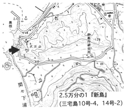
Show extracted lettering and translation
English translation of figure lettering
黒根; Daisanyama; 妙京寺研究所 [reading unverified]; 間下浦; 30.5; 126; 40; 1:25,000 “Niijima” (Miyakejima sheet 10-4, 14-2).
Original Japanese lettering
黒根;大三山;妙京寺研究所;間下浦;30.5;126;40;2.5万分の1『新島』(三宅島10号-4,14号-2)
Reading notes
妙京寺研究所 — 地形図の細字、読取りは暫定。
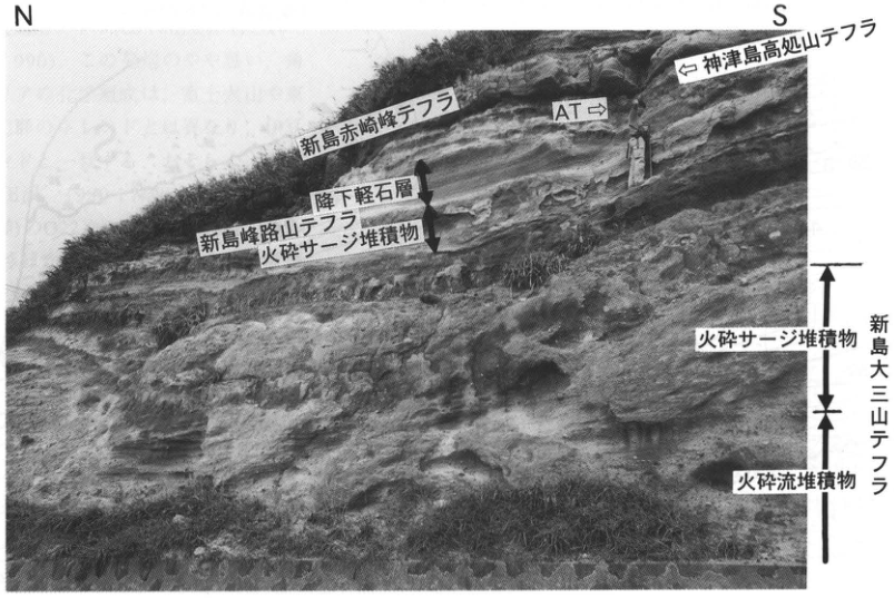
Show extracted lettering and translation
English translation of figure lettering
N; S; Niijima Akazakimine tephra; Kozushima Takoudoyama tephra; AT; pumice-fall bed; Niijima Minejidoyama tephra; pyroclastic-surge deposits; Niijima Daisanyama tephra; pyroclastic-flow deposits.
Original Japanese lettering
N;S;新島赤崎峰テフラ;神津島高処山テフラ;AT;降下軽石層;新島峰路山テフラ;火砕サージ堆積物;新島大三山テフラ;火砕流堆積物
KT-49 Successive ninth-century eruptions in the Izu Islands: Kozushima Tenjosan tephra and Niijima Mukaiyama tephra
吉田浩
- Locality: Fujimi Pass, Niijima Village, Tokyo
- Coordinates: N34°22′53″ E139°15′54″
- Elevation: 260 m
- Outcrop type and condition: Artificial exposure; extant in August 1995
- Deposit type and age: Pyroclastic-surge deposits and fallout tephra; ninth century
- Description date: August 1995
- Keywords: Niijima Mukaiyama tephra; Niijima Atchiyama tephra; Kozushima Tenjosan tephra
Correlation of descriptions in historical documents with strata has shown that crustal activity intensified in the Izu Islands and Izu Peninsula around the middle of the ninth century (上杉, 1993). Eruptions of the Kozushima and Niijima volcanoes and movement on the Tanna Fault occurred successively within slightly less than 50 years. In chronological order, the eruption of Tenjosan on Kozushima first occurred in AD 838, as indicated by the Shoku Nihon Koki and radiocarbon ages (一色, 1982). Historical documents record that the Kozushima Tenjosan tephra (吉田, 1991) erupted at that time fell to the north and west. Next, the Tanna Fault moved in AD 841; trenching has shown that this displaced the Kozushima Tenjosan tephra (杉原, 1984). Accounts thought to describe the eruption of Mukaiyama on Niijima also occur in the Fuso Ryakki and other records. These accounts and radiocarbon ages suggest that Mukaiyama erupted in AD 886 (一色, 1973).
The photograph shows the exposure at Fujimi Pass on the Akazakimine lava dome in central Niijima. It contains Niijima Mukaiyama tephra, deposited by the AD 886 eruption (吉田, 1992), Kozushima Tenjosan tephra, and an intervening bimodal fallout-ash bed of basaltic and rhyolitic compositions. 吉田 (1992) considered this tephra to have originated from Atchiyama (阿土山) in northern Niijima and called it Niijima Atchiyama tephra. Although it had been thought, from radiocarbon ages, to have erupted at 1.6 ka (一色・磯部, 1976), it was confirmed to have erupted after emplacement of the Kozushima Tenjosan tephra. Light-brown volcanic-ash soil occurs between the Kozushima Tenjosan and Niijima Atchiyama tephras, and dark-brown, humus-rich volcanic-ash soil occurs between the Niijima Atchiyama and Mukaiyama tephras.
References: 一色 (1973, 1982, 1987); 一色・磯部 (1976); 杉原 (1984); 上杉 (1993); 吉田 (1991, 1992).
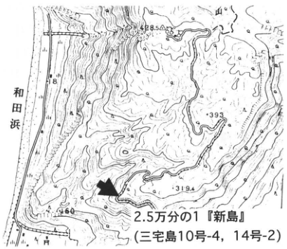
Show extracted lettering and translation
English translation of figure lettering
Wada Beach; 393; 319.4; 460; 428.5; 1:25,000 “Niijima” (Miyakejima sheet 10-4, 14-2).
Original Japanese lettering
和田浜;393;319.4;460;428.5;2.5万分の1『新島』(三宅島10号-4,14号-2)
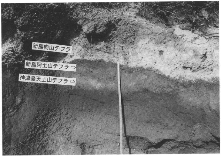
Show extracted lettering and translation
English translation of figure lettering
Niijima Mukaiyama tephra; Niijima Atchiyama tephra ⇒; Kozushima Tenjosan tephra ⇒.
Original Japanese lettering
新島向山テフラ;新島阿土山テフラ⇒;神津島天上山テフラ⇒
KT-50 Pumice-fall beds containing Aira-Tn tephra in the Sueyoshi I stage of Higashiyama volcano, Hachijojima
菅香世子
- Locality: Sueyoshi, Hachijo Town, Hachijojima, Tokyo; 50 m northeast of Kuyo Bridge
- Coordinates: N33°5′10″ E139°51′7″
- Elevation: 150 m
- Outcrop type and condition: Artificial exposure; vegetation cover advancing as of December 1995
- Deposit type and age: Pumice-fall deposits; Late Pleistocene
- Description date: July 1993
- Keywords: Aira-Tn tephra; Higashiyama volcano, Hachijojima; Sueyoshi stage
The Sueyoshi I stage of Higashiyama volcano on Hachijojima (the “Sueyoshi stage” of 津久井 et al., 1991, 1993) is characterized by andesitic to dacitic magma activity and is an exceptional interval in the history of this basaltic stratovolcano. This exposure (columnar section in 菅, 1994, Fig. 5, loc. 5) appeared when the Tokyo road was widened. A 6 cm thick Aira-Tn tephra (AT) bed occurs among approximately 30 pumice-fall units overlying debris-avalanche deposits. Weathered zones are sometimes recognizable between the pumice-fall units, some of which are surge deposits; this indicates that pumice eruptions occurred intermittently with intervening pauses. AT fell and accumulated during a pause in Higashiyama's activity and was preserved because it was rapidly covered by coarse ash falling at the beginning of the next eruption. The surge deposits 30–50 cm above AT represent the marginal facies of a pumice flow. Other observable features include traces of valleys that formed and were filled during the pumice falls, and numerous small-volume ash deposits of the Sueyoshi II stage. As of December 1995 this exposure was becoming covered by vegetation, but similar exposures repeatedly appear and disappear in the Sueyoshi district, where farm-road construction and other earthworks are active. The first report of AT on Hachijojima (杉原・小田, 1989) was from farmland 300 m north of this exposure. AT is also well preserved at Ishizumigahana (石積ヶ鼻), marked by ■ on the location map.
References: 菅 (1994); 杉原・小田 (1989); 津久井 et al. (1991, 1993).
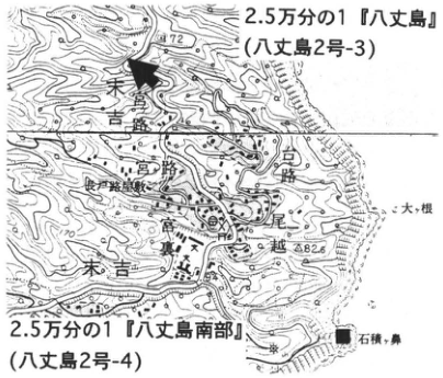
Show extracted lettering and translation
English translation of figure lettering
1:25,000 “Hachijojima” (Hachijojima sheet 2-3); 1:25,000 “Southern Hachijojima” (Hachijojima sheet 2-4); 高路; 宮路; Sueyoshi; 大根; 尾越; Ishizumigahana; 172; 82.6.
Original Japanese lettering
2.5万分の1『八丈島』(八丈島2号-3);2.5万分の1『八丈島南部』(八丈島2号-4);高路;宮路;末吉;大根;尾越;石積ヶ鼻;172;82.6
Reading notes
地図の微小地名 — 読みが確かでない固有名は日本語で保持。
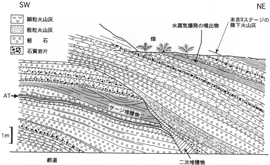
Show extracted lettering and translation
English translation of figure lettering
SW; NE; fine ash; coarse ash; pumice; lithic fragments; cultivated field; ejecta from a phreatic explosion; fallout ash of the Sueyoshi II stage; AT; surge deposits; 1 m; Tokyo road; secondary deposits.
Original Japanese lettering
SW;NE;細粒火山灰;粗粒火山灰;軽石;石質岩片;畑;水蒸気爆発の噴出物;末吉IIステージの降下火山灰;AT;サージ堆積物;1m;都道;二次堆積物
5. Chubu Region
CB-1 Pyroclastic-flow and debris-avalanche deposits and fallout tephra beds of Myoko volcano
早津賢二
- Locality: Sekigawa, Myokokogen Town, Nakakubiki District, Niigata Prefecture
- Coordinates: N36°52′04″ E138°11′53″
- Elevation: 615 m
- Outcrop type and condition: Artificial exposure; only the upper half remained in October 1995
- Deposit type and age: Aeolian tephra; Late Pleistocene
- Description date: May 1995
- Keywords: Myoko volcano; Daisen-Kurayoshi tephra; Myoko Shibutamigawa pyroclastic flow; Myoko Fukazawa pyroclastic flow
This exposure is immediately north of the point where the Joshin-etsu Expressway crosses the prefectural Ikenotaira–Myoko road. It appeared during expressway construction and is destined to disappear shortly. It is one of the few exposures where the stratigraphic relationships between the eruptive products forming the edifice of Myoko volcano and the fallout tephra beds around its base can be observed directly. Fallout tephra beds from Daisen-Kurayoshi tephra (DKP) upward and eruptive products from the end of Myoko's third active period through its fourth active period (早津, 1985; 早津 et al., 1994) can be observed. The fallout tephra beds (早津・新井, 1980) and Myoko pyroclastic-flow and debris-avalanche deposits (早津, 1985) exposed here are, in ascending order: Fukazawa pyroclastic-flow deposits (Myoko third active period); DKP; Kurohime Odaira scoria (Kh-Od); Kurohime Rokugatsu lapilli (Kh-Rg); Myoko Kanemata ash (Mk-Km); Shibutamigawa pyroclastic-flow deposits (Myoko fourth active period); Myoko Sekiyama scoria (Mk-Sy); Myoko Kannoki scoria (Mk-Kn); Myoko Takadoko scoria (Mk-Tt); Sekigawa debris-avalanche deposits (Myoko fourth active period; 19 ka); Taguchi debris-avalanche deposits (Myoko fourth active period; 8 ka); Akakura pyroclastic-flow deposits (Myoko fourth active period; 5.3 ka); and Myoko Otagirigawa ash (Mk-Ot; 4.2 ka). DKP forms a single continuous bed 5–6 cm thick. Peat beds or peaty soil beds occur at three horizons bracketing DKP; the peat bed within the lowermost Fukazawa pyroclastic-flow deposits yields abundant fossil seeds of Menyanthes.
References: 早津 (1985); 早津・新井 (1980); 早津 et al. (1994).
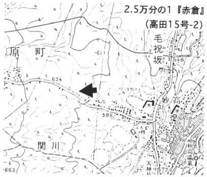
Show extracted lettering and translation
English translation of figure lettering
1:25,000 “Akakura” (Takada sheet 15-2); 原町; 毛祝坂; Sekigawa; 611; 634; 546; 585; 663; ■.
Original Japanese lettering
2.5万分の1『赤倉』(高田15号-2);原町;毛祝坂;関川;611;634;546;585;663;■
Reading notes
毛祝坂等の微小地名 — 読取り暫定、読み不明の地名は日本語で保持。
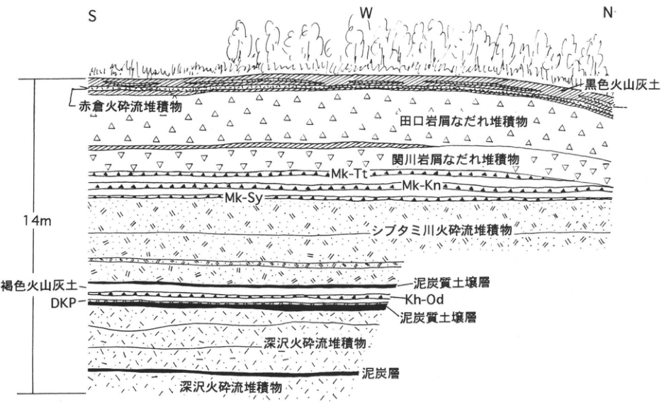
Show extracted lettering and translation
English translation of figure lettering
S; W; N; 14 m; black volcanic-ash soil; Akakura pyroclastic-flow deposits; Taguchi debris-avalanche deposits; Sekigawa debris-avalanche deposits; Mk-Tt; Mk-Kn; Mk-Sy; Shibutamigawa pyroclastic-flow deposits; brown volcanic-ash soil; DKP; Kh-Od; peaty soil bed; Fukazawa pyroclastic-flow deposits; peat bed.
Original Japanese lettering
S;W;N;14m;黒色火山灰土;赤倉火砕流堆積物;田口岩屑なだれ堆積物;関川岩屑なだれ堆積物;Mk-Tt;Mk-Kn;Mk-Sy;シブタミ川火砕流堆積物;褐色火山灰土;DKP;Kh-Od;泥炭質土壌層;深沢火砕流堆積物;泥炭層
CB-2 Fluvial terraces and their aeolian tephra cover along the middle Shinano River: the Taniage terrace and aeolian deposits since 350 ka
鈴木毅彦
- Locality: West of Tashiro, Nakazato Town, Niigata Prefecture (east of Miho, Tsunan Town)
- Coordinates: N36°58′53″ E138°42′12″
- Elevation: 585 m
- Outcrop type and condition: Roadcut; extant in October 1995
- Deposit type and age: Aeolian tephra; Middle to Late Pleistocene
- Description date: October 1995
- Keywords: Myoko volcanic group; Daisen-Kurayoshi tephra; Ontake-Nagawa tephra; Omachi APm tephra group; Taniage terrace
The area around Tsunan along the middle Shinano River, where it is joined by the Kiyotsu and Nakatsu rivers flowing out of the Mikuni Mountains, is one of Japan's areas with the best-developed fluvial terraces. The highest, Taniage terrace is covered by approximately 9 m of aeolian deposits. Tephras in the lower part of this cover suggest that the terrace formed at approximately 350 ka. Relationships between lower terraces and tephras are also relatively well understood (早津・新井, 1981), making this one of Japan's most thoroughly established Middle to Late Pleistocene fluvial-terrace chronologies. Most tephras in the aeolian deposits originated in the Myoko volcanic group; because the area is distant from the sources, most are thin, 10 cm thick or less. Widespread tephras also occur. All the tephras can be observed at this exposure on the Taniage terrace surface. Columnar sections are published in 早津・新井 (1981) and 新潟火山灰グループ (1981, 1995). The exposure extends discontinuously along the road, as shown in the figure. The upper third beneath the ground surface is best observed in the southern roadcut; the Daisen-Kurayoshi (DKP), Ontake-Nagawa (On-NG), and Iizuna-Kamitaru (Iz-KT) tephras provide useful markers despite their thinness. The lower portion is best observed in the northern roadcut, where the Yonehara pumice-bed group (MG), Omachi APm tephra group (APm), and other units can be seen. Correlation of the former may be somewhat difficult because each bed is thin and poorly continuous laterally within the exposure. Omachi APm can be observed only by excavating the base of the exposure or at the very top of the terrace scarp across the road.
References: 早津・新井 (1981); 新潟火山灰グループ (1981, 1995).
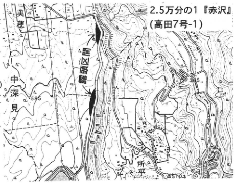
Show extracted lettering and translation
English translation of figure lettering
Miho; 豊田堰取入口 [Toyoda weir intake, reading unverified]; 中深見; Tokodaira; 598; 585; 510.3; 1:25,000 “Akazawa” (Takada sheet 7-1).
Original Japanese lettering
美穂;豊田堰取入口;中深見;所平;598;585;510.3;2.5万分の1『赤沢』(高田7号-1)
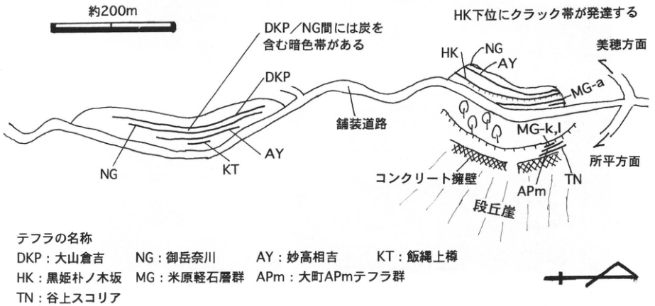
Show extracted lettering and translation
English translation of figure lettering
Approximately 200 m; a dark zone containing charcoal occurs between DKP and NG; a cracked zone is developed below HK; DKP; NG; KT; AY; HK; MG-a; MG-k,l; APm; TN; toward Miho; toward Tokodaira; paved road; concrete retaining wall; terrace scarp; tephra names: DKP, Daisen-Kurayoshi; NG, Ontake-Nagawa; AY, Myoko-Aiyoshi (相吉); KT, Iizuna-Kamitaru; HK, Kurohime-Honokizaka (朴ノ木坂); MG, Yonehara pumice-bed group; APm, Omachi APm tephra group; TN, Taniage scoria.
Original Japanese lettering
約200m;DKP/NG間には炭を含む暗色帯がある;HK下位にクラック帯が発達する;DKP;NG;KT;AY;HK;MG-a;MG-k,l;APm;TN;美穂方面;所平方面;舗装道路;コンクリート擁壁;段丘崖;テフラの名称:DKP:大山倉吉;NG:御岳奈川;AY:妙高相吉;KT:飯縄上樽;HK:黒姫朴ノ木坂;MG:米原軽石層群;APm:大町APmテフラ群;TN:谷上スコリア
CB-3 Late Pleistocene tephras and cultural chronology in northern Nagano Prefecture: tephras from Kurohime volcano and widespread tephras
近藤洋一・野尻湖地質グループ
- Locality: Kannoki, Shinano Town, Kamiminochi District, Nagano Prefecture
- Coordinates: N36°45′53″ E138°11′41″
- Elevation: 703 m
- Outcrop type and condition: Artificial exposure; eastern face extant in May 1996
- Deposit type and age: Aeolian tephra; Late Pleistocene
- Description date: 1984
- Keywords: Nojiri Loam Formation; Kamiyama Loam Formation; Kannoki; Lake Nojiri excavations; cultural chronology
This is the type exposure of the Nojiri Loam Formation, a Late Pleistocene volcanic-ash formation distributed in northern Nagano Prefecture. It is in the northeastern part of the Odaira hills, Shinano Town. As of 1996, major construction was underway because the Nagano route of the Joshin-etsu Expressway crosses these hills. Fortunately, the face containing the type exposure has barely survived. In these hills the Upper Kamiyama Loam Formation and Nojiri Loam Formation overlie the Middle Pleistocene Shinanomachi Loam Formation. The lower half of the type exposure can no longer be observed because of a concrete wall, but horizons from the Ikejiri River mudflow deposits within the Upper Kamiyama Loam Formation upward remain visible. In ascending order, the Upper Kamiyama Loam Formation contains: blue-gray fine ash (Kawara); reddish-brown coarse ash (Renga); blue-gray gravel-bearing coarse ash (Shirotsubu); orange pumice-bearing silty ash (Tsubu-orange); purplish-gray to gray coarse ash (Sumire); and yellowish-white to pale-purple coarse ash containing hornblende-andesite gravel (Haizara). The katakana names follow 野尻湖地質グループ (1984, 1994); other names follow 早津・新井 (1980) and 町田・新井 (1992).
The Nojiri Loam Formation is divided into lower, middle, and upper parts, each further subdivided. Lower Nojiri Loam I contains yellow-gray coarse ash (Ki-goma), correlated with Daisen-Kurayoshi tephra (DKP; 町田・新井, 1992). The “three-piece set” in Lower Nojiri Loam II is an alternation of ash and lapilli beds: a characteristic Kurohime-derived ash sequence identical to Kurohime Odaira tephra (Kh-Od). A hornblende-pyroxene-andesitic lapilli bed (the Breccia Zone) is particularly conspicuous in Lower Nojiri Loam III. Above it, a purplish-gray fine-ash bed (Kona-azuki) and yellow-gray coarse ash (Dry Curry) occur as a pair and correspond to Myoko Kanemata (My-Km) and Myoko Sekiyama (My-S), respectively. The reddish-brown scoria bed (Aka-suko) in Middle Nojiri Loam III is called Myoko Kannoki (My-K), but 野尻湖地質グループ (1984) attributed it to Kurohime volcano on the basis of its distribution. The Upper Nojiri Loam Formation is divided into I and II at the upper surface of the black band. A horizon with a concentration of glassy ash occurs within the black band, although it is difficult to distinguish as a discrete bed. This glassy ash (Nuka I) is correlated with Aira-Tn tephra (AT). The overlying Kashiwabara black ash bed is black volcanic ash containing lenses of yellowish-brown coarse ash (Kibidango I, II). These correspond to Myoko Akakura (My-A) and Myoko Otagirigawa (My-Ot), respectively. Petrographic characteristics of the ash beds are detailed in 野尻湖火山灰グループ (1984).
Figure 2.
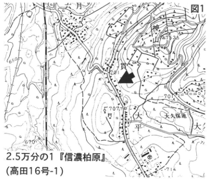
Show extracted lettering and translation
English translation of figure lettering
Figure 1; Kamiyama; Okubo Pond; 大; 650; 673.35; 701; 714; 1:25,000 “Shinano-Kashiwabara” (Takada sheet 16-1).
Original Japanese lettering
図1;神山;大久保池;大;650;673.35;701;714;2.5万分の1『信濃柏原』(高田16号-1)
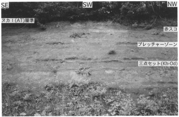
Show extracted lettering and translation
English translation of figure lettering
SE; SW; NW; Nuka I (AT) horizon; Aka-suko; Breccia Zone; three-piece set (Kh-Od); 1 m; Figure 2.
Original Japanese lettering
SE;SW;NW;ヌカI(AT)層準;赤スコ;ブレッチャーゾーン;三点セット(Kh-Od);1m;図2
CB-3 (continued)
In the Upper Nojiri Loam Formation, cultural horizons ranging from knife-shaped stone-tool culture through Jomon culture to the Heian period and later have been identified at and above the black band (Figure 4). In ascending order, they are the lower black-band, upper black-band, lowermost Upper II, lower Upper II, upper Upper II, upper surface of upper Upper II, lower Moya, Moya upper/lower, and upper Moya cultural horizons, and cultural horizons within the Kashiwabara black ash bed (野尻湖人類考古グループ, 1994). Using the Kannoki ash stratigraphy as a basis, precise stratigraphic subdivision and correlation with the Nojiri-ko Formation beneath Lake Nojiri have been carried out. This has enabled reconstruction of the last-glacial paleoenvironment and a detailed cultural chronology from the Early to Late Paleolithic (野尻湖発掘調査団, 1993).
Figure 3. Sketch of the Kannoki exposure (野尻湖発掘調査団地質グループ, 1975).
References: 早津・新井 (1980); 町田・新井 (1992); 野尻湖地質グループ (1984, 1994); 野尻湖発掘調査団 (1975, 1993); 野尻湖火山灰グループ (1984); 野尻湖人類考古グループ (1994, 1996).
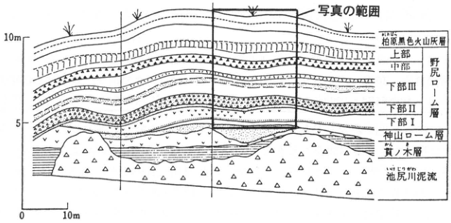
Show extracted lettering and translation
English translation of figure lettering
Photograph coverage; 10 m; 5; 0; 10 m; Kashiwabara black ash bed; upper; middle; lower III; lower II; lower I; Nojiri Loam Formation; Kamiyama Loam Formation; Kannoki Formation; Ikejiri River mudflow; Figure 3, sketch of the Kannoki exposure (野尻湖発掘調査団地質グループ, 1975).
Original Japanese lettering
写真の範囲;10m;5;0;10m;柏原黒色火山灰層;上部;中部;下部III;下部II;下部I;野尻ローム層;神山ローム層;貫ノ木層;池尻川泥流;図3 貫ノ木の露頭スケッチ(野尻湖発掘調査団地質グループ,1975)
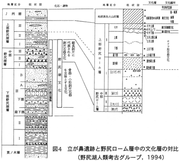
Show extracted lettering and translation
English translation of figure lettering
Stratigraphic subdivisions; columnar section; fossils and artifacts; J-row bed; Upper Nojiri-ko Formation III, II, I; Middle Nojiri-ko Formation III, II, I; Lower Nojiri-ko Formation III (B, A, lower, lowermost), II, I; Kannoki Formation; horizons yielding Naumann elephant and giant deer fossils; Nojiri-ko culture; flake-tool culture represented by elongated flakes; culture dominated by bone implements and small flake tools; cultural horizon; cultural chronology; Kashiwabara black ash bed; Upper Nojiri Loam II (Moya, upper, lower, lowermost), I (black band, upper [Hibiware]); Middle Nojiri Loam II [Aka-suko], I [Nise-nomi] [Ao-hige]; upper Moya; Moya upper/lower; lower Moya; upper surface of upper Upper II; upper Upper II; lower Upper II; lowermost Upper II; upper black band; lower black band; Heian period and later; Yayoi / Jomon; Jomon culture: Late, Initial; Incipient Jomon culture; microblade culture; knife-shaped stone-tool culture; Figure 4, correlation of cultural horizons at Tategahana and in the Nojiri Loam Formation (野尻湖人類考古グループ, 1994).
Original Japanese lettering
地層区分;柱状図;化石・遺物;J列層;上部野尻湖層III,II,I;中部野尻湖層III,II,I;下部野尻湖層III(B,A,下部,最下部),II,I;貫ノ木層;ナウマンゾウ・オオツノシカ化石の産出層準;野尻湖文化;縦長剥片に代表される剥片石器文化;骨器・小形剥片石器を主体とする文化;文化層;文化編年;柏原黒色火山灰層;上部野尻ローム層II(モヤ,上部,下部,最下部),I(黒色帯,上[ヒビワレ]);中部野尻ローム層II[赤スコ],I[ニセノミ][青ヒゲ];モヤ上部;モヤ上/下;モヤ下部;上II上部上面;上II上部;上II下部;上II最下部;黒色帯上部;黒色帯下部;平安時代以降;弥・縄;縄文文化:晩期,早期;縄文草創期文化;細石器文化;ナイフ形石器文化;図4 立が鼻遺跡と野尻ローム層中の文化層の対比(野尻湖人類考古グループ,1994)
Reading notes
中部Iの細字ラベル[ニセノミ][青ヒゲ] — 画像が小さく読取りは暫定。
CB-4 Tephra beds since the late Kurofu stage of Asama volcano: stratigraphic position of the Okuwa debris-avalanche deposits and tephras of the Hotokeiwa and Maekake stages
竹本弘幸
- Locality: Yagasaki, Karuizawa Town, Kitasaku District, Nagano Prefecture
- Coordinates: N36°20′24″ E138°39′00″
- Elevation: 945 m
- Outcrop type and condition: Artificial exposure; lost beneath vegetation and concrete blocks by 1995
- Deposit type and age: Aeolian tephra; Late Pleistocene to Holocene
- Description date: June 1994
- Keywords: Asama volcano; Asama-derived tephra; Kurofuyama; Hotokeiwa; Maekakeyama; Okuwa debris avalanche
This exposure was created during construction of the Hokuriku Shinkansen. Tephras from Aira-Tn tephra (AT) upward, unconformably overlying Tertiary tuff at Yagasaki, and intercalated Okuwa debris-avalanche deposits (OkAV) could be observed. OkAV had been called the Tsukahara, Shiozawa, Nakanojo, and Maebashi mudflows in different parts of its distribution, but all are the same deposit (早田, 1995, and others). Asamayama collectively comprises Kurofuyama, Hotokeiwa, Maekakeyama, Kamayama, and other peaks; its activity is divided into the Kurofu, Hotokeiwa, and Maekake stages. The present stage is the Maekake stage, active since approximately 10 ka. During the late Kurofu stage after AT fell, the following erupted over approximately three thousand years: Murota pumice (MP), four Itahana brown pumice beds (BP-1–4) → OkAV → Minamidake pumice (BP-5) → alternating ash beds → two BP beds (BP-6, -7; 竹本・久保, 1995). OkAV also contains blocks of the Shiraito pyroclastic-flow deposits erupted near Kunizakai-daira, Gunma Prefecture (荒牧, 1968), attesting to the violence of the collapse of Kurofuyama. Observable Hotokeiwa-stage tephras (approximately 20–10 ka) included the approximately 20 ka Kumoba pumice-flow deposits erupted from Hanareyama (Kb; 宇野沢・坂本, 1972, and others) → Shiraito-no-taki pumice (SP; 木崎 et al., 1971) → Okubosawa pumice 1 and 2 (OkP-1, 2; 中沢 et al., 1984) → Itahana yellow pumice (YP) → Soja pumice (Sj). Maekake-stage tephras within the kuroboku soil included, in ascending order, Fujioka pumice (Fo), D2 pumice, B pumice, and A pumice.
References: 新井 (1993); 荒牧 (1968); 早川 (1995); 木崎 et al. (1971); 中村 et al. (1992); 中沢 et al. (1984); 早田 (1995); 竹本 et al. (1995); 竹本・久保 (1995); 辻 et al. (1984); 宇野沢・坂本 (1972).
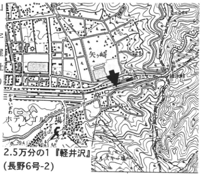
Show extracted lettering and translation
English translation of figure lettering
Yagasaki; 御前町; 市村堤; 943; 950; 955; 1:25,000 “Karuizawa” (Nagano sheet 6-2).
Original Japanese lettering
矢ケ崎;御前町;市村堤;943;950;955;2.5万分の1『軽井沢』(長野6号-2)
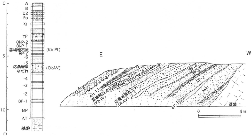
Show extracted lettering and translation
English translation of figure lettering
0; 5; 10; m; A; B; D2; Fo; Sj; YP; OkP-2; OkP-1; Kumoba pumice flow (Kb.Pf); BP-7; -6; -5; Okuwa debris avalanche (OkAV); -4; -3; -2; BP-1; MP; AT; basement; E; W; AH-1; BP-5-7; BP-4; BP-3; BP-2; BP-1; 0; 8 m.
Original Japanese lettering
0;5;10;m;A;B;D2;Fo;Sj;YP;OkP-2;OkP-1;雲場軽石流(Kb.Pf);BP-7;-6;-5;応桑岩屑なだれ(OkAV);-4;-3;-2;BP-1;MP;AT;基盤;E;W;AH-1;BP-5-7;BP-4;BP-3;BP-2;BP-1;0;8m
CB-5 Deposits forming gentle piedmont slopes in the western Kanto Mountains: angular gravel and tephra beds of the last glacial period
清水長正
- Locality: Takatoya-zawa, Kawakami Village, Nagano Prefecture
- Coordinates: N35°56′30″ E138°36′45″
- Elevation: 1,450 m
- Outcrop type and condition: Artificial exposure; lost
- Deposit type and age: Angular gravel beds and aeolian tephra; last glacial period
- Description date: October 1982
- Keywords: Kanto Mountains; gentle piedmont slopes; last glacial period; Kiso-Ontake-derived tephra; Aira-Tn tephra
This exposure shows the deposits forming gentle piedmont slopes in the Takatoya-zawa catchment at the headwaters of the Chikuma River in the western Kanto Mountains. Approximately 4 km southwest of Ikura village along the main Chikuma River, it is a cut slope of reclaimed farmland; its upper-right portion has been cut away. Angular gravel beds alternate with tephra beds from Kiso-Ontake and Aira-Tn tephra (AT). The exposure cuts the western margin of the gentle piedmont slope. On its western side (the viewer's right), Yatsugatake-Kawakami tephra (Yt-Kw) and Ontake-1 tephra (On-Pm1) dip eastward. This indicates that a depression occupied the site of the gentle slope until On-Pm1 fell. Angular gravel began accumulating during the last glacial period after On-Pm1; by the fall of Ontake-Mitake tephra (On-Mt; Pm-IV), it had filled the depression nearly level. More than 3 m of angular gravel subsequently accumulated before AT fell, essentially forming the gentle piedmont slope. Approximately 1 m of angular gravel deposited after AT finally modified its surface. Thus the angular gravel forming this gentle slope accumulated during the last glacial period, particularly in large quantities during its first half. No specific evidence establishes whether this accumulation resulted from periglacial processes. At 1,850 m elevation on nearby Ogawayama (■ in the figure), On-Pm1 has been recognized beneath a periglacial debris layer, and periglacial slopes in the Kanto Mountains have been stated to have formed after On-Pm1 (清水, 1983). In any case, abundant rock debris was certainly produced in the Kanto Mountains during the last glacial period.
References: 清水 (1983); 清水・百瀬 (1983).
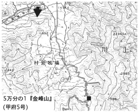
Show extracted lettering and translation
English translation of figure lettering
Village-operated pasture; 1552; 1960; 1742; 2085; 2273; 1988; 1:50,000 “Kinpusan” (Kofu sheet 5).
Original Japanese lettering
村営牧場;1552;1960;1742;2085;2273;1988;5万分の1『金峰山』(甲府5号)
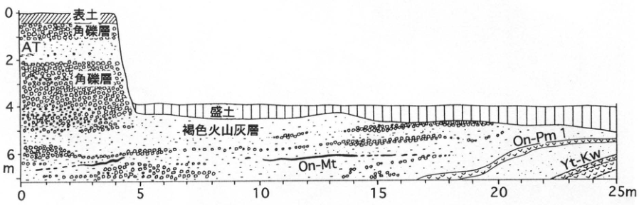
Show extracted lettering and translation
English translation of figure lettering
E; S; W; 0; 2; 4; 6 m; 0; 5; 10; 15; 20; 25 m; topsoil; angular gravel bed; AT; fill; brown volcanic-ash bed; On-Mt; On-Pm1; Yt-Kw.
Original Japanese lettering
E;S;W;0;2;4;6m;0;5;10;15;20;25m;表土;角礫層;AT;盛土;褐色火山灰層;On-Mt;On-Pm1;Yt-Kw
CB-6 Tephras from Ontake volcano at Osakada, Shiojiri City
鈴木毅彦
- Locality: East of Osakada Park, Shiojiri City, Nagano Prefecture (east of Osakada Bridge on the Chuo Expressway)
- Coordinates: N36°6′9″ E137°59′40″
- Elevation: 830 m
- Outcrop type and condition: Artificial exposure; extant
- Deposit type and age: Fallout tephra; Late Pleistocene
- Description date: June 1993
- Keywords: Shiojiri; Ontake-derived tephra; Ontake-1 tephra; Ontake-Yabuhara tephra; Ontake-Katamachi tephra; Ontake-Nagawa tephra
Tephras sourced from Kiso-Ontake volcano have long been studied. Particularly significant for Japanese Quaternary research was the tracing of Ontake-1 tephra (On-Pm1; 町田・新井, 1992; Kobayashi, 1960), first described in southern Shinshu, as far as southern Kanto (小林 et al., 1967), and its application to terrace correlation and chronology and the history of sea-level change. This book includes several exposures emphasizing Ontake-derived tephras (e.g., CB-8). The present exposure is east of Osakada Park, Shiojiri City, approximately 50 km northeast of Ontake volcano. Tephras distributed northeast of the source can therefore be observed well here. It is also very close to the area around Osakada Park, the type locality of the sequence called the Osakada type by 小林 (1961). The most conspicuous pumice-fall bed in the lower exposure, approximately 50 cm thick and composed of yellowish-white vesiculated pumice, is On-Pm1. Immediately above and in contact with it is the Ontake-Shiojiri pumice bed (SoP; 竹本 et al., 1987; Pm-1B of 木村, 1987b). Above it, separated from one another by volcanic-ash soil, follow Ontake-Yabuhara (On-Yb; 竹本 et al., 1987; Pm-2A of 木村, 1987b), Ontake-Katamachi (On-Kt; 竹本 et al., 1987; Pm-2B of 木村, 1987b), and Ontake-Nagawa (On-Ng; 竹本 et al., 1987; Pm-3C of 木村, 1987b). On-Yb and On-Kt are somewhat poorly continuous laterally. Among these tephras, On-Pm1 and On-Ng have also been found as far away as southern Tohoku (see WS-11-2, TH-26, KT-1, and other entries).
References: 木村 (1987b); 小林 (1961); Kobayashi (1960); 小林 et al. (1967); 町田・新井 (1992); 竹本 et al. (1987).
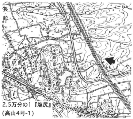
Show extracted lettering and translation
English translation of figure lettering
長畝; Shiojiri-machi; Kakizawa; Maruyama; 730; 771; 781; 772; 1:25,000 “Shiojiri” (Takayama sheet 4-1).
Original Japanese lettering
長畝;塩尻町;柿沢;丸山;730;771;781;772;2.5万分の1『塩尻』(高山4号-1)
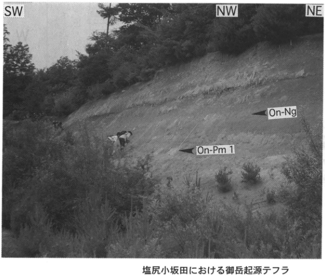
Show extracted lettering and translation
English translation of figure lettering
SW; NW; NE; On-Ng; On-Pm1; Ontake-derived tephras at Osakada, Shiojiri.
Original Japanese lettering
SW;NW;NE;On-Ng;On-Pm1;塩尻小坂田における御岳起源テフラ
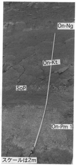
Show extracted lettering and translation
English translation of figure lettering
On-Ng; On-Kt; SoP; On-Pm1; scale is 2 m.
Original Japanese lettering
On-Ng;On-Kt;SoP;On-Pm1;スケールは2m
CB-7 Middle Pleistocene tephra beds overlying the Nashinoki Gravel in the southern Matsumoto Basin
鈴木保
- Locality: Nashinoki, Shiojiri City, Nagano Prefecture
- Coordinates: N36°4′52″ E137°54′18″
- Elevation: 845 m
- Outcrop type and condition: Artificial exposure; entire southwestern face extant in June 1996
- Deposit type and age: Aeolian tephra; Middle Pleistocene
- Description date: June 1996
- Keywords: Matsumoto Basin; Nashinoki Gravel; C1 Crystal Ash
The Matsumoto Basin, at elevations of approximately 600–800 m, is estimated to contain at least 500 m of basin-fill deposits. No borehole in the basin has reached basement rock, so the lower limit is unknown, but the basal surface is thought to lie near sea level. The lowest unit of these deposits is called the Nashinoki Gravel. It consists mainly of sand and gravel, with some peaty-silt interbeds, represents the initial deposits of the Matsumoto Basin, and is widely distributed around the basin margins. It is covered by aeolian deposits comprising, in ascending order, the Nashinoki, Osakada, and Hata loam formations. At this exposure, the C1 Crystal Ash (松本盆地団研, 1972), representative of the Nashinoki Loam Formation, and varicolored lapilli can be observed. In particular, C1 Crystal Ash is very likely to correlate with the Kamitakara pyroclastic-flow deposits in the Takayama Basin, dated at 0.65±0.25 Ma (柴田 et al., 1977). Regionally, it is correlated with Shirotsubu in the Matsui Loam Formation on the eastern foot of Yatsugatake, Nagano Prefecture, and with KS-22 in the Kasamori Formation of the Boso Peninsula, Chiba Prefecture (Sakai et al., 1996). At the ■ locality on the location map (松本盆地団研, 1972), the Late Pleistocene Osakada Loam Formation from the 100 ka Ontake-1 tephra (On-Pm1) upward can also be observed.
References: 松本盆地団研 (1972); Sakai et al. (1996); 柴田 et al. (1977).
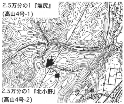
Show extracted lettering and translation
English translation of figure lettering
Nashinoki; Uto Pass (善知鳥峠); 848.8; 800; 1:25,000 “Shiojiri” (Takayama sheet 4-1); 1:25,000 “Kita-Ono” (Takayama sheet 4-2).
Original Japanese lettering
梨ノ木;善知鳥峠;848.8;800;2.5万分の1『塩尻』(高山4号-1);2.5万分の1『北小野』(高山4号-2)
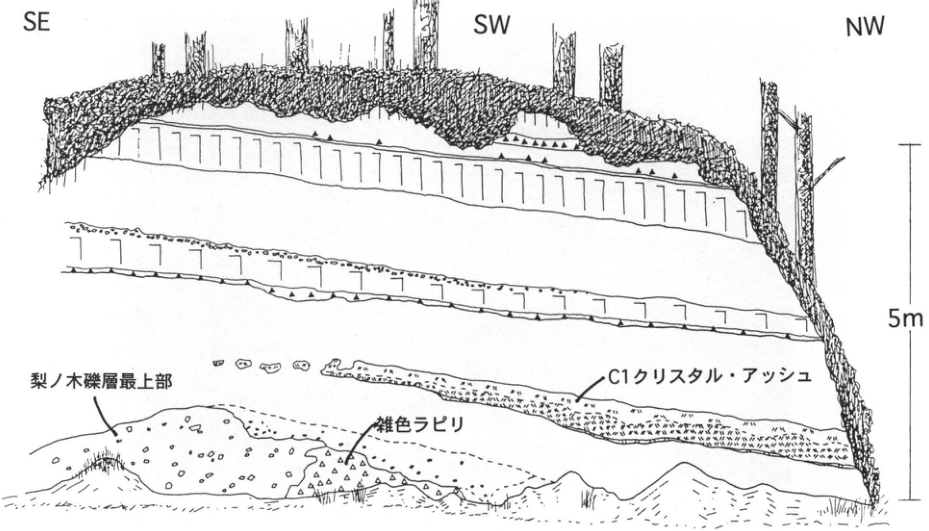
Show extracted lettering and translation
English translation of figure lettering
SE; SW; NW; 5 m; uppermost Nashinoki Gravel; varicolored lapilli; C1 Crystal Ash.
Original Japanese lettering
SE;SW;NW;5m;梨ノ木礫層最上部;雑色ラピリ;C1クリスタル・アッシュ
CB-8 Late Pleistocene tephra beds in the Ina Valley, Nagano Prefecture: Ontake-derived tephras at Rokudobara, Ina City
松島信幸・寺平宏
- Locality: Tobu Junior High School, Ina City, Nagano Prefecture
- Coordinates: N35°50′11″ E137°58′58″
- Elevation: 690 m
- Outcrop type and condition: Artificial exposure; partly covered by talus and vegetation
- Deposit type and age: Aeolian tephra; Late Pleistocene
- Description date: November 1995
- Keywords: Ina Valley; Rokudobara; Ontake-derived tephra; Ontake-1 tephra; Ontake-Ina tephra
This historic exposure was described with a color photograph by Kobayashi and Shimizu (1965) as the type exposure of Ontake-derived tephras in the Ina Valley. It is now covered by vegetation and cannot be adequately observed. Because it is within the grounds of Tobu Junior High School, digging into the slope, including sample collection, is prohibited, and a visit requires the school's permission. Fortunately, Rokudobara around the school is a broad upland on the Mibu River alluvial fan where exposures with the same occurrence as the type section can be observed. One is the white-clay quarry of Oharu Chemical Works' Ina plant (5315 Shimogata, Misuzu, Ina City). At Rokudobara, Ontake-1 tephra (On-Pm1; Pm-I) is kaolinized and quarried as high-quality clay for papermaking. The quarry exposes approximately 8 m of fresh younger Ontake tephras from the ground surface down to On-Pm1. As the working face moves around the ■ locality, it is advisable to contact Oharu Chemical (TEL 0265-72-5125) and obtain permission to visit. Good sections may be visible depending on the stage of quarrying. In ascending order, the sequence comprises On-Pm1, Ontake-Yabuhara (On-Yb; Pm-II), Kikai-Tozurahara (K-Tz), Ontake-Katamachi (On-Kt), Ontake-Ina (On-In; Pm-II), Aso-4 (Aso-4), Ontake-Tatsuno (On-Tt; Pm-III), Ontake-Senbonmatsu (On-Sn), Ontake-Mitake (On-Mt; Pm-IV), Ontake-Yashikino (On-Ys), Aira-Tn (AT), and Kikai-Akahoya (K-Ah). At Tobu Junior High School, Ontake-Kamidare (御岳上垂; On-Km; Pm-I′) lies beneath On-Pm1. Tephra abbreviations given in parentheses follow Kobayashi and Shimizu (1965).
References: Kobayashi and Shimizu (1965); 松島 (1995); 松島・寺平 (1990); 竹本 et al. (1987).
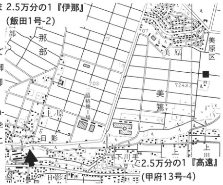
Show extracted lettering and translation
English translation of figure lettering
1:25,000 “Ina” (Iida sheet 1-2); 1:25,000 “Takato” (Kofu sheet 13-4); Rokudobara; Mihara district; Misuzu; Uehara; Shimo-Kawate; Kami-Kawate; 六道原機場 [facility label, reading unverified]; 707; 703; 724.8.
Original Japanese lettering
2.5万分の1『伊那』(飯田1号-2);2.5万分の1『高遠』(甲府13号-4);六道原;美原区;美篶;上原;下川手;上川手;六道原機場;707;703;724.8
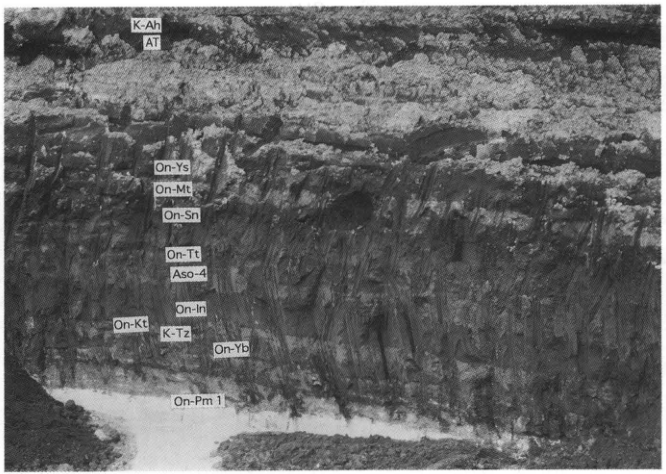
Show extracted lettering and translation
English translation of figure lettering
K-Ah; AT; On-Ys; On-Mt; On-Sn; On-Tt; Aso-4; On-In; On-Kt; K-Tz; On-Yb; On-Pm1.
Original Japanese lettering
K-Ah;AT;On-Ys;On-Mt;On-Sn;On-Tt;Aso-4;On-In;On-Kt;K-Tz;On-Yb;On-Pm1
CB-9 An active fault producing terrace-scarp-like topography in the Ina Valley, Nagano Prefecture: the Nentsuji Fault exposure in the Kegasawa River
松島信幸
- Locality: Kegasawa River bed below Suzuoka Park, Dashina, Iida City, Nagano Prefecture
- Coordinates: N35°28′59″ E137°49′41″
- Elevation: 410 m
- Outcrop type and condition: Natural exposure; preservation planned
- Fault form and age: Reverse fault, west side up and east side down; latest Middle to Late Pleistocene
- Description date: November 1995
- Keywords: Ina Valley; active fault; low fault scarp; Nentsuji Fault
This natural exposure in the Kegasawa River bed is not expected to become obscured except by river works. Discussions with the Nagano Prefecture Iida Construction Office aim to make preservation compatible with river works, while consultations with the Iida City Board of Education and Iida City Museum seek natural-monument designation and educational use. This locality is historically important in geomorphological geology. The Ina Valley had long been famous as one of Japan's basins with the most extensively developed fluvial terraces. During the 1960s, it became apparent that its terrace topography was “terrace-like topography” produced by active faults (松島, 1966). The Nentsuji Fault exposure in the Kegasawa River was the type exposure underlying this major change in interpretation. Here one can observe the fault that forms a low fault scarp 40–50 m high, extending from Hachimanyama in Matsuo, Iida City, to Usuihara in Ryukyu (竜丘). It is a reverse fault with the west side up and east side down; basement granite exposed in the hanging wall thrusts over terrace gravel in the footwall. The fault surface has a 2 cm wide gouge zone and slickensides; its strike and dip are N4°W, 35°SW, and its striations are N86°W, 52°SW. On the granite side the fractured zone extends to a width of approximately 50 m. The footwall gravel is strongly affected by the fault and markedly deformed. Several subsidiary faults occur within it, and deformation diminishes stepwise with distance from the main fault. Activity of the Nentsuji Fault began at the very end of the Middle Pleistocene. Vertical displacement is 100 m and the average displacement rate is 0.5–0.75 m per 1,000 years (松島, 1995).
References: 松島 (1966, 1995).
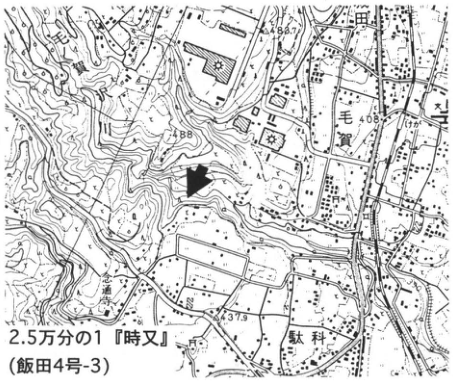
Show extracted lettering and translation
English translation of figure lettering
Kega; Dashina; 437.9; 488.7; 1:25,000 “Tokimata” (Iida sheet 4-3).
Original Japanese lettering
毛賀;駄科;437.9;488.7;2.5万分の1『時又』(飯田4号-3)
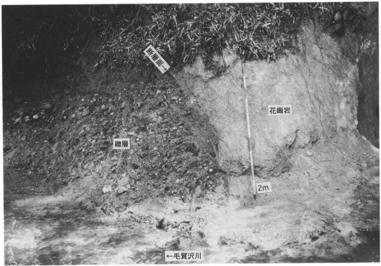
Show extracted lettering and translation
English translation of figure lettering
Fault surface →; granite; gravel bed; 2 m; ← Kegasawa River.
Original Japanese lettering
断層面→;花崗岩;礫層;2m;←毛賀沢川
CB-10 Kiso River mudflow deposits along the Suekawa River, Kaida Village, Nagano Prefecture
酒井潤一・千葉恵美
- Locality: Suekawa, Kaida Village, Kiso District, Nagano Prefecture, below the Kiso Country Club golf course
- Coordinates: N35°55′39″ E137°36′31″
- Elevation: 1,075 m
- Outcrop type and condition: Natural exposure
- Deposit type and age: Volcaniclastic deposits; 50 ka
- Description date: August 1994
- Keywords: Debris-avalanche deposits; Hata Loam Formation; Marishiten lavas; Ontake volcano
The Kiso River mudflow deposits are extensive deposits observable for more than 100 km from the northeastern foot of Kiso-Ontake to the Nobi Plain. Their depositional age is estimated at approximately 50 ka from radiocarbon dating of contained wood by 中村 et al. (1992). They occur within the middle of the fine, weathered ash of the Lower Hata Loam Formation and are overlain by the Upper Hata Loam Formation (木村, 1993). Here they preserve their original depositional surface, with hummocks 5–30 m high, and are more than 80 m thick (藤井, 1976). Their facies change downstream from debris-avalanche to mudflow deposits. Characteristics of debris-avalanche deposits are particularly well exposed here. The deposits are classified into six facies: five types of block facies and the surrounding matrix. This exposure shows “andesite blocks I and II” and “clinker blocks,” which make up most of the debris-avalanche megablocks. Most andesite clasts composing these are correlated with the Marishiten lava; the deposit is considered to have formed by collapse and downstream movement of that lava (千葉, 1995). Many other exposures of the Kiso River mudflow deposits occur along the Suekawa. At the ■ locality on the map, incorporated blocks of the Kisodani Formation, pyroclastic-rock blocks, and incorporated unconsolidated silt beds can be observed.
References: 千葉 (1995); 藤井 (1976); 木村 (1993); 中村 et al. (1992).
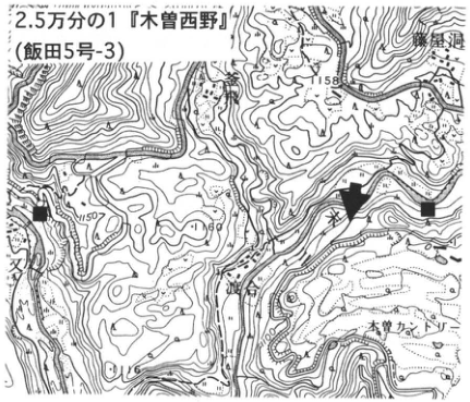
Show extracted lettering and translation
English translation of figure lettering
1:25,000 “Kiso-Nishino” (Iida sheet 5-3); Suekawa; 越; Kiso Country Club; 1158; 1150; 1100.
Original Japanese lettering
2.5万分の1『木曽西野』(飯田5号-3);末川;越;木曽カントリー;1158;1150;1100
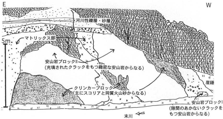
Show extracted lettering and translation
English translation of figure lettering
E; W; 5 m; fluvial gravel and sand beds; matrix facies; andesite block II (dense andesite with filled cracks); clinker block (mainly scoria and volcanic sand of the same composition); talus; andesite block I (andesite with cracks that are not open); Suekawa River.
Original Japanese lettering
E;W;5m;河川性礫層・砂層;マトリックス部;安山岩ブロックII(充填されたクラックをもつ緻密な安山岩からなる);クリンカーブロック(主にスコリアと同質火山砂からなる);崖錐;安山岩ブロックI(隙間のあかないクラックをもつ安山岩からなる);末川
CB-11 Fluvial gravel and tephras along the Jingugawa River at the northeastern foot of Kaikomagatake, Yamanashi Prefecture
平川一臣
- Locality: South of the Suntory Hakushu plant, Torihara, Hakushu Town, Yamanashi Prefecture
- Coordinates: N35°49′03″ E138°18′10″
- Elevation: 750 m
- Outcrop type and condition: Natural exposure; extant
- Deposit type and age: Debris-avalanche deposits, aeolian tephra, and fluvial sand and gravel; Middle to Late Pleistocene
- Description date: May 1980
- Keywords: Jingugawa; climatic terraces; Ontake-1 tephra; Ontake-Mitake tephra; Nirasaki debris-avalanche deposits
Tributary alluvial fans occur at the foot of Kaikomagatake and other mountains in the northeastern Akaishi Mountains. This large exposure was produced by lateral erosion of the Jingugawa (Nigorigawa on old topographic maps) and lies on the right bank approximately 1.5 km upstream from National Route 20. Riverbank protection works have facilitated encroachment by vegetation, but a substantial area remains observable. Fluvial sand and gravel containing Ontake-derived tephras is exposed over a height of approximately 40 m and a width of 400 m. Tephra chronology can therefore be used to date river erosion and deposition cycles and discuss so-called climatic terraces. The features identified are a valley (IIBV) incised into thick sand and gravel (IIISG in the figure), its infilling by sand and gravel (IISG), and the formation of another, shallower valley (IBV), followed by sand-and-gravel deposition (ISG). The 80–95 ka Ontake-1 tephra (On-Pm1; the so-called Pm I) fell during deposition of IISG (infilling of buried valley IIBV); Ontake-Mitake tephra (On-Mt; the so-called Pm IV) fell around its completion. Thus the Jingugawa repeated incision and deposition twice from the last interglacial through the last glacial period, with these episodes occurring in the earlier and later parts of the last glacial period. Subsequent exposure of the upstream (right-hand) end revealed that debris-avalanche deposits considered to be the so-called Nirasaki mudflow occur at the water-laid tephra horizon in IIISG.
Reference: 平川・中村 (1980).
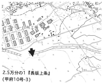
Show extracted lettering and translation
English translation of figure lettering
Hakushu plant; Matsubara; 668.8; 665.1; 695; 1:25,000 “Nagasaka-Kamijo” (Kofu sheet 10-3).
Original Japanese lettering
白州工場;松原;668.8;665.1;695;2.5万分の1『長坂上条』(甲府10号-3)
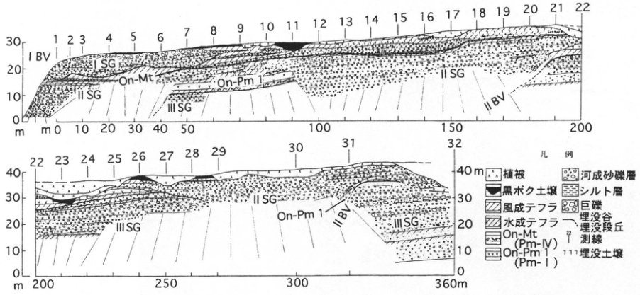
Show extracted lettering and translation
English translation of figure lettering
Survey lines 1–32; IBV; IIBV; ISG; IISG; IIISG; On-Mt; On-Pm1; vertical axes 0, 10, 20, 30, 40 m; horizontal axes 0, 10, 20, 30, 40, 50, 100, 150, 200, 250, 300, 360 m; legend: vegetation cover; kuroboku soil; aeolian tephra; water-laid tephra; On-Mt (Pm-IV); On-Pm1 (Pm-I); fluvial sand and gravel; silt bed; boulders; buried valley; buried terrace; survey line; buried soil.
Original Japanese lettering
測線1~32;IBV;IIBV;ISG;IISG;IIISG;On-Mt;On-Pm1;縦軸0,10,20,30,40m;横軸0,10,20,30,40,50,100,150,200,250,300,360m;凡例:植被;黒ボク土壌;風成テフラ;水成テフラ;On-Mt(Pm-IV);On-Pm1(Pm-I);河成砂礫層;シルト層;巨礫;埋没谷;埋没段丘;測線;埋没土壌
CB-12 Exposure of the Shimotsutaki Fault in the Itoigawa–Shizuoka Tectonic Line active fault system: the Yamanashi–Nagano prefectural boundary
奥村晃史
- Locality: Matsukidaira, Kobuchizawa Town, Yamanashi Prefecture
- Coordinates: N35°51′26″ E138°17′28″
- Elevation: 720 m
- Outcrop type and condition: Artificial exposure; trench restored, natural exposure extant
- Deposit type and age: Sand and gravel and humic soil; Holocene
- Description date: March 1995
- Keywords: Trench; Itoigawa–Shizuoka Tectonic Line; Shimotsutaki Fault; active fault; paleoearthquake
In the central part of the Itoigawa–Shizuoka Tectonic Line active fault system, between Matsumoto and Kobuchizawa, left-lateral active faults with high average displacement rates of up to 10 m/ka form a continuous zone (活断層研究会, 1991). The Shimotsutaki Fault lies at the southern end of this central part; it has an average left-lateral displacement rate of 1.5 m/ka and a southwest-side-up component no more than one-tenth as large (澤, 1985). River bends north of Shimotsutaki village and a low fault scarp with the northeastern side down clearly show this movement. A latest-Pleistocene alluvial-fan surface survives as an upland on the left bank downstream of Kokkaibashi Bridge. The fault has formed a pressure ridge in its southeastern part and a small graben to the north. At the natural exposure southeast of this upland, sand and gravel overlying basement rock has been displaced northeast-side-down by a high-angle reverse fault (澤, 1985). A trench was excavated northeast of the pressure ridge in March 1995. It revealed 8–12 ka sand and gravel thrust over a 6–9 ka black soil bed along a southwest-dipping low-angle reverse fault; the sand and gravel was additionally cut by a high-angle fault with a strike-slip component. Glass from Kikai-Akahoya tephra (K-Ah) is dispersed throughout nearly the entire black soil bed. The latest event identified in this trench occurred around the seventh to tenth centuries AD and may correspond to the earthquake of 841 (奥村 et al., 1996). In the Fujikawa River bed downstream of Kokkaibashi, scouring in 1985 formed a gorge that exposed a thrust fault associated with a bend in the Itoigawa–Shizuoka Tectonic Line. Granite thrust over Middle Pleistocene sand and gravel along a horizontal fault plane can also be observed here (小山, 1988).
References: 活断層研究会 (1991); 小山 (1988); 奥村 et al. (1996); 澤 (1985).
Natural fault exposure on the left bank downstream of Kokkaibashi [Figure 12 of 澤 (1985)]. Gravel ages: lower portion, approximately 20 ka; upper portion, approximately 10 ka. The trench was excavated along the northwestern continuation of the central low fault scarp, which drops to the northeast.
Southeastern wall of trench B, 1995. Ages are calendar years BP relative to 1950. a: low-angle reverse fault; b: high-angle fault; 1: topsoil; 2: black soil; 3: sand and gravel.
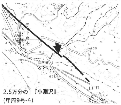
Show extracted lettering and translation
English translation of figure lettering
Shimotsutaki; Kokkaibashi; Yamaguchi; 710.8; 758; 707.4; 698.6; 690.3; 1:25,000 “Kobuchizawa” (Kofu sheet 9-4).
Original Japanese lettering
下蔦木;国界橋;山口;710.8;758;707.4;698.6;690.3;2.5万分の1『小淵沢』(甲府9号-4)
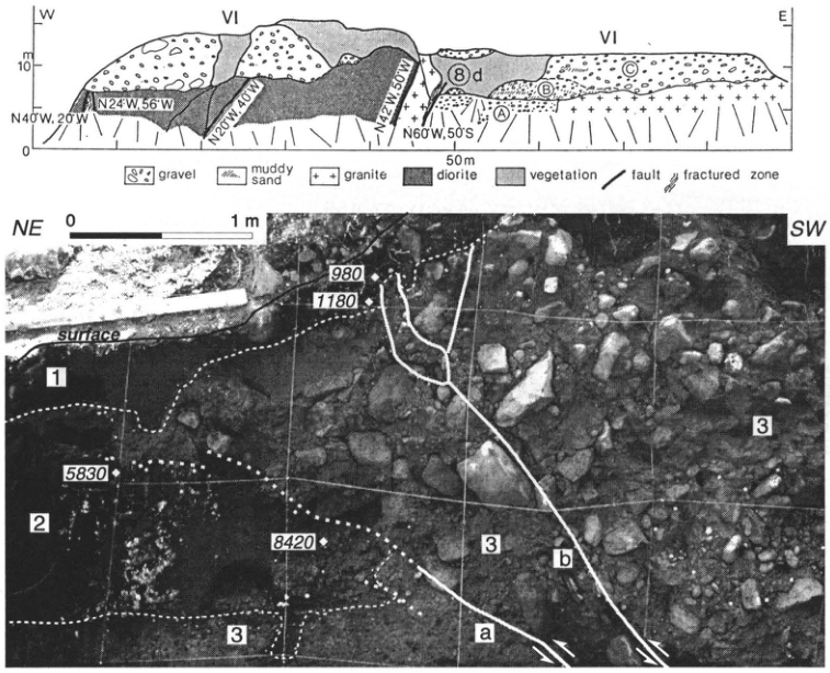
Show extracted lettering and translation
English translation of figure lettering
W; E; VI; 0; 10 m; 50 m; N40°W, 20°W; N24°W, 56°W; N20°W, 40°W; N42°W, 50°W; N60°W, 50°S; A; B; C; ⑧d; gravel; muddy sand; granite; diorite; vegetation; fault; fractured zone; NE; SW; 0; 1 m; surface; 980; 1180; 5830; 8420; 1; 2; 3; a; b.
Original Japanese lettering
W;E;VI;0;10m;50m;N40°W,20°W;N24°W,56°W;N20°W,40°W;N42°W,50°W;N60°W,50°S;A;B;C;⑧d;gravel;muddy sand;granite;diorite;vegetation;fault;fractured zone;NE;SW;0;1m;surface;980;1180;5830;8420;1;2;3;a;b
CB-13 Nirasaki debris-avalanche deposits: edifice-collapse deposits of the Older Yatsugatake stage
河内晋平
- Locality: North of Anayama Bridge, Anayama Town, Nirasaki City, Yamanashi Prefecture
- Coordinates: N35°45′38″ E138°24′16″
- Elevation: 445 m
- Outcrop type and condition: Natural exposure; extant
- Deposit type and age: Debris-avalanche deposits; Middle Pleistocene
- Description date: August 1969
- Keywords: Yatsugatake volcano; debris-avalanche deposits; Shichiriiwa; collapse deposits
The Nirasaki debris-avalanche deposits, totaling 9 km³, are continuously exposed along the left bank of the Kamanashi River, forming cliffs up to 200 m high, from central Nirasaki 6 km south of this exposure to the Nagano–Yamanashi prefectural boundary 15 km north. This is one of the representative sections through their hummocks. Part of an Older Yatsugatake-stage stratovolcano situated approximately 20 km north was probably fragmented by a phreatic explosion into blocks as large as 250 m in diameter and transported here while retaining its stratified structure. The exposure contains numerous steeply dipping lava layers, as shown in the photograph. Observations of these and paleomagnetic studies revealed that the block did not overturn during movement, but rotated only in the horizontal plane, like a coffee-cup ride in an amusement park. Small faults and fractured structures occur within its lava layers. The matrix facies that enclosed and transported the block is exposed at the left end of the photograph. Several large hummocks can be seen on the upland in the right half of the topographic map. Wherever their internal structure can be observed, these hummocks invariably contain sheet-like lava layers. More than 30 hummocks occur in total. At the ■ locality, a 40 cm thick Ontake-1 tephra (On-Pm1; 100 ka) unconformably overlies the Nirasaki debris-avalanche deposits.
References: 河内 (1977); 甲府盆地第四紀研究グループ (1969); 三村 (1985); Mimura and Kawachi (1981); 三村 et al. (1982).
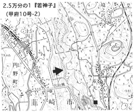
Show extracted lettering and translation
English translation of figure lettering
1:25,000 “Wakamiko” (Kofu sheet 10-2); Sakaizawa; 花ノ久保; Anayama Bridge; Nirasaki City; Kami-Tsuburai; Maruno Town; 664.3; 479.8; 445.8; 591.
Original Japanese lettering
2.5万分の1『若神子』(甲府10号-2);境沢;花ノ久保;穴山橋;韮崎市;上円井;円野町;664.3;479.8;445.8;591
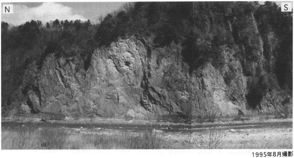
Show extracted lettering and translation
English translation of figure lettering
N; S; photographed in August 1995.
Original Japanese lettering
N;S;1995年8月撮影
CB-14 Flexural scarp and tephras in the Sone Hills on the southern margin of the Kofu Basin
平川一臣
- Locality: Fuefuki Service Area on the Chuo Expressway, Sakaigawa Village, Yamanashi Prefecture
- Coordinates: N35°35′50″ E138°36′20″
- Elevation: 300 m
- Outcrop type and condition: Artificial exposure; partly extant, vegetated
- Deposit type and age: Debris-avalanche deposits, aeolian tephra, alluvial-fan sand and gravel, and lacustrine deposits; Middle to Late Pleistocene
- Description date: November 1981
- Keywords: Sone Hills; Nirasaki debris-avalanche deposits; flexural scarp; Omachi A1 tephra; Ontake-1 tephra
Terrace-to-hill topography known as the Sone Hills occurs at the northwestern foot of the Misaka Mountains along the southern margin of the Kofu Basin. The hill front facing the basin lowland is a flexural scarp 50–100 m high. Major excavation of this frontal scarp during Chuo Expressway construction created this exposure and revealed a striking flexural structure. Only part of it now remains near the Fuefuki Service Area. Along with alluvial-fan gravel (SG1–7), lacustrine deposits (L), buried soils (S1–4), and other strata, the so-called Middle Pleistocene Nirasaki debris-avalanche deposits (N) and Omachi A1 tephra (A1Pm; estimated age 300–350 ka) were observed. Surrounding terrace surfaces are also covered by tephras extending down to immediately beneath Ontake-1 tephra (On-Pm1). Taken together, these strata resemble an anticline. However, the younger, stratigraphically higher beds on the basin-facing side dip more steeply. The structure was therefore formed by flexural movement dragging strata beneath the basin floor along its front, and the apparent anticline is regarded as a secondary phenomenon. Growth of the flexural scarp began approximately when the Nirasaki debris avalanche was deposited or later. It is a good example of flexural movement that remains active today.
Reference: 平川 (1992).
Legend: 1, sand and gravel (SG1–SG7); 2, sand; 3, silt and clay (L); 4, diatomite; 5, A1Pm; 6, Nirasaki debris-avalanche deposits (N); 7, peat; 8, buried alluvial soil; 9, buried soils (S1–S4). TS: pre-construction topographic profile of the terrace surface and flexural scarp. UC1–UC4: unconformities. Dotted lines indicate extrapolated geological structure.
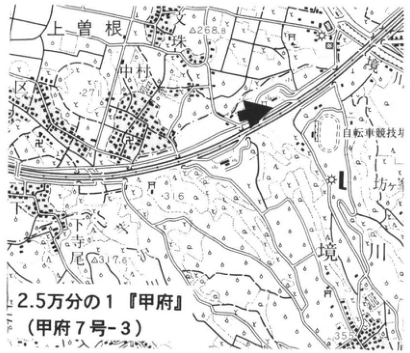
Show extracted lettering and translation
English translation of figure lettering
Kami-Sone; Tsukahara; Kobayashi; 坊; Sakaigawa; 4268.8 [partly illegible]; 317.6; cycling track; 1:25,000 “Kofu” (Kofu sheet 7-3).
Original Japanese lettering
上曽根;塚原;小林;坊;境川;4268.8[判読不明の一部を含む];317.6;自転車競技場;2.5万分の1『甲府』(甲府7号-3)
Reading notes
4268.8 — 地名と標高が重なるため確定不能。
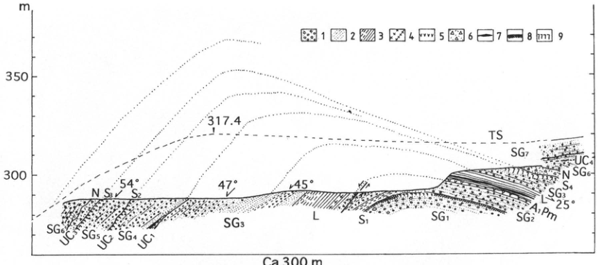
Show extracted lettering and translation
English translation of figure lettering
m; 350; 300; 317.4; 54°; 47°; 45°; 25°; ca. 300 m; 1–9; TS; SG1; SG2; SG3; SG4; SG5; SG6; SG7; L; N; A1Pm; S1; S2; S3; S4; UC1; UC2; UC3; UC4. Legend definitions are retained in the main text.
Original Japanese lettering
m;350;300;317.4;54°;47°;45°;25°;Ca 300m;1~9;TS;SG1;SG2;SG3;SG4;SG5;SG6;SG7;L;N;A1Pm;S1;S2;S3;S4;UC1;UC2;UC3;UC4。凡例説明は本文に保持。
CB-15 Tephra stratigraphic position of the large Older Fuji mudflow that entered the Sagami River: the Otsuki archaeological site, Otsuki City
上杉陽・長沢宏昌・高橋みゆき
- Locality: Tsuru High School, Otsuki, Otsuki City, Yamanashi Prefecture
- Coordinates: N35°36′20″ E138°56′28″
- Elevation: 365 m
- Outcrop type and condition: Artificial exposure; lost
- Deposit type and age: Aeolian tephra; since 17.6 ka
- Description date: October–December 1994
- Keywords: Fuji-derived tephra; Older Fuji mudflow deposits; simultaneous Fuji and Hakone eruptions; Otsuki site
When Fuji volcano erupts near its summit, many eruptions begin with fallout tephra and then produce lava or pyroclastic flows. The edifice contains countless lava flows and pyroclastic-flow deposits, associated debris-avalanche and debris-flow deposits, and rock-powder zones. During this phase, explosion breccia is scattered widely and accumulates above the fallout tephra, allowing pyroclastic-flow emission to be inferred even at distant sites. As these cycles repeat, the eruption wanes, shifts to a phase emitting fine lapilli to ash, and finally produces only fumaroles before activity ceases. Only a few pyroclastic flows, debris avalanches, and debris flows travel far beyond the edifice (町田, 1977). Many of the largest examples occurred after Aira-Tn tephra (AT) fell. On the eastern foot, one is known to have occurred at the end of the Y-130-2 stage (17,620±370 yr B.P.), almost simultaneously with a pyroclastic flow from Hakone's central cones (上杉 et al., 1992). The large Older Fuji mudflow that descended along the Sagami River on the northern foot also postdates AT and reached Sagamihara–Atsugi, 90 km downstream. Its precise tephra stratigraphic position had previously been unclear. Archaeological excavation began in October 1994 during gymnasium construction at Tsuru High School, Otsuki City, on the Older Fuji mudflow upland, revealing a good tephra section. The site lies 33 km from Fuji's summit in the N35°E direction; Lake Okutama, Tokyo, and Kumagaya, Saitama Prefecture, lie farther along that direction. The upper 1 m consists of the paddy-field plow pan, early-modern to modern fill, and material collapsed from the hill behind (Saruhashi dacitic lapilli tuff). Approximately 2 m of tephra lies beneath, underlain by consolidated pyroclastic-flow to debris-avalanche deposits (Older Fuji mudflow) containing abundant reddish-purple lava blocks. Macroscopic characteristics of related tephras, including a small pyroclastic flow of the Y-133 stage approximately 30 cm higher, indicate a Y-130-stage stratigraphic position. Thus Fuji emitted large pyroclastic flows and related deposits toward its eastern and northern feet during the Y-130 stage, when Hakone's central cones also generated a pyroclastic flow. Such contemporary pyroclastic flows at Fuji and Hakone occur frequently, attracting attention to their relationship with tectonic stress (上杉 et al., 1992). Small pottery sherds were recovered from S-5–9 beds, estimated at approximately 3.2–5 ka. They are thin, well fired, and decorated with incised lines on the exterior, probably dating from the end of Middle Jomon to Late Jomon. Kasori EIV-style pottery of Kanto tradition and buried pots of Sori V style, common in the Kofu Basin and elsewhere, were also recovered. This suggests that the locality was a meeting point between the two regions then, as it is today. One pit dwelling, six stone-paved dwellings, and four stone-lined hearths using lava were additionally identified (長沢・高橋, 1995; 高橋, 1995).
References: 町田 (1977); 長沢・高橋 (1995); 高橋 (1995); 上杉 (1990); 上杉 et al. (1992).
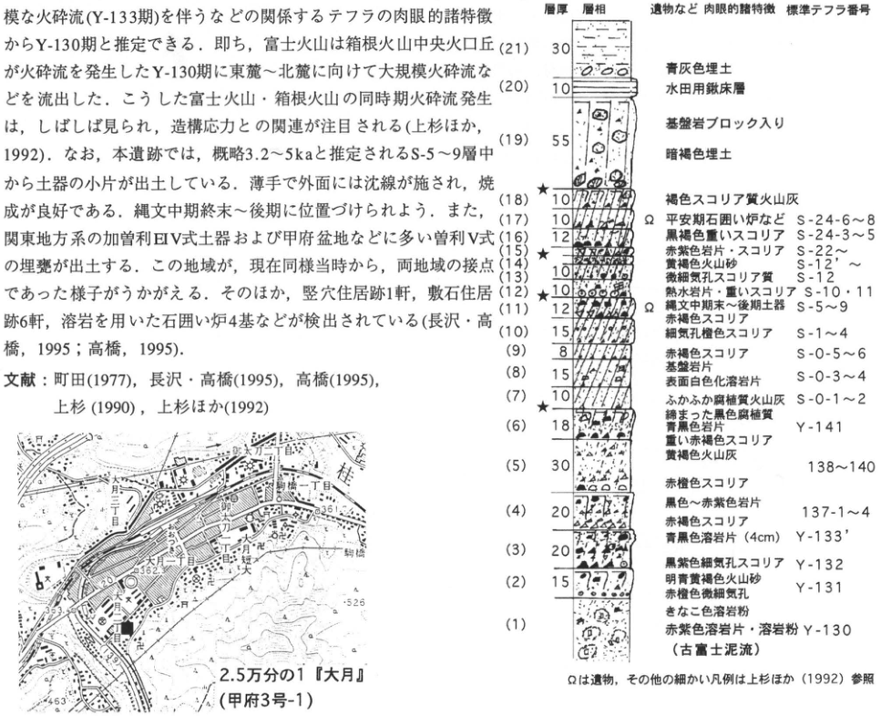
Show extracted lettering and translation
English translation of figure lettering
Bed thickness; lithology; macroscopic characteristics including artifacts; standard tephra number.
| Bed | Thickness (printed value) | Description and tephra number |
|---|---|---|
| 21 | 30 | Blue-gray fill |
| 20 | 10 | Paddy-field plow pan |
| 19 | 55 | Dark-brown fill containing basement-rock blocks |
| 18 | 10 | Brown scoriaceous ash |
| 17 | 10 | Ω Heian-period stone-lined hearths, etc.; S-24-6–8 |
| 16 | 12 | Blackish-brown dense scoria; S-24-3–5 |
| 15 | 4 | Reddish-purple rock fragments and scoria; S-22 and above |
| 14 | 10 | Yellowish-brown volcanic sand; S-12′ and above |
| 13 | 10 | Finely vesicular scoriaceous material; S-12 |
| 12 | 10 | Hydrothermally altered rock fragments and dense scoria; S-10, 11 |
| 11 | 12 | Ω End-Middle to Late Jomon pottery; S-5–9; reddish-brown scoria |
| 10 | 15 | Finely vesicular orange scoria; S-1–4 |
| 9 | 8 | Reddish-brown scoria; S-0-5–6 |
| 8 | 15 | Basement-rock fragments; lava fragments with whitened surfaces; S-0-3–4 |
| 7 | 10 | Loose humic ash; S-0-1–2 |
| 6 | 18 | Compact black humic material; blue-black rock fragments; dense reddish-brown scoria; Y-141 |
| 5 | 30 | Yellowish-brown ash; reddish-orange scoria; 138–140 |
| 4 | 20 | Black to reddish-purple rock fragments; reddish-orange scoria; 137-1–4 |
| 3 | 20 | Blue-black lava fragments (4 cm); Y-133′; blackish-purple finely vesicular scoria; Y-132 |
| 2 | 15 | Light bluish-yellowish-brown volcanic sand; reddish-orange finely vesicular material; Y-131 |
| 1 | Not stated | Roasted-soybean-flour-colored lava powder; reddish-purple lava fragments and lava powder; Y-130 (Older Fuji mudflow) |
Ω denotes artifacts; for other detailed legend symbols, see 上杉 et al. (1992). Stars occur near the top of 18, at 15, and near the base of 7. 1:25,000 “Otsuki” (Kofu sheet 3-1); Otsuki 2-chome; Tsuru High School; Otsuki 1-chome; 御太刀 1-chome and 2-chome; Tsukimidai; Saruhashi; 525; 526; 362.1; 361. Embedded prose is restored in the main text.
Original Japanese lettering
層厚・層相・遺物など肉眼的諸特徴・標準テフラ番号
| 層番号 | 層厚(原図の数値) | 記載・テフラ番号 |
|---|---|---|
| 21 | 30 | 青灰色埋土 |
| 20 | 10 | 水田用鍬床層 |
| 19 | 55 | 基盤岩ブロック入り暗褐色埋土 |
| 18 | 10 | 褐色スコリア質火山灰 |
| 17 | 10 | Ω 平安期石囲い炉など;S-24-6~8 |
| 16 | 12 | 黒褐色重いスコリア;S-24-3~5 |
| 15 | 4 | 赤紫色岩片・スコリア;S-22~ |
| 14 | 10 | 黄褐色火山砂;S-12′~ |
| 13 | 10 | 微細気孔スコリア質;S-12 |
| 12 | 10 | 熱水岩片・重いスコリア;S-10・11 |
| 11 | 12 | Ω 縄文中期末~後期土器;S-5~9;赤褐色スコリア |
| 10 | 15 | 細気孔橙色スコリア;S-1~4 |
| 9 | 8 | 赤褐色スコリア;S-0-5~6 |
| 8 | 15 | 基盤岩片;表面白色化溶岩片;S-0-3~4 |
| 7 | 10 | ふかふか腐植質火山灰;S-0-1~2 |
| 6 | 18 | 締まった黒色腐植質;青黒色岩片;重い赤褐色スコリア;Y-141 |
| 5 | 30 | 黄褐色火山灰;赤橙色スコリア;138~140 |
| 4 | 20 | 黒色~赤紫色岩片;赤橙色スコリア;137-1~4 |
| 3 | 20 | 青黒色溶岩片(4cm);Y-133′;黒紫色細気孔スコリア;Y-132 |
| 2 | 15 | 明青黄褐色火山砂;赤橙色微細気孔;Y-131 |
| 1 | 記載なし | きなこ色溶岩粉;赤紫色溶岩片・溶岩粉;Y-130(古富士泥流) |
Ωは遺物,その他の細かい凡例は上杉ほか(1992)参照.★印が18上,15,7下付近に付される.2.5万分の1『大月』(甲府3号-1);大月二丁目;都留高;大月一丁目;御太刀一丁目;御太刀二丁目;月見台;猿橋;525;526;362.1;361.画像中の本文断片は本文に復元.
CB-16 Tachikawa-stage tephras and Aira-Tn tephra at Kamishibanta on the eastern foot of Fuji
上杉陽・吉田千香子・寺門卓也・斉藤睦雄・小柳美文・片岡義順・関東第四紀研究会
- Locality: Kamishibanta, an exclave of Suruga-Oyama Town, Sunto District, Shizuoka Prefecture
- Coordinates: N35°20′47″ E138°53′40″
- Elevation: 655–675 m
- Outcrop type and condition: Artificial exposure; extant
- Deposit type and age: Aeolian tephra; since 40 ka
- Description date: November 1993
- Keywords: Fuji-derived tephra; Hakone-derived tephra; Aira-Tn tephra; mica-bearing greasy ash; Older Fuji mudflow deposits
This artificial exposure beside a prefectural road lies 14.5 km east of Fuji's summit and is one of the type exposures for latest Late Pleistocene Fuji tephras and Aira-Tn tephra (AT). The Y-97–130 tephra sequence, approximately 38–17 ka, comprises most of the so-called Tachikawa-stage tephras except their uppermost part (上杉 et al., 1993). Beds equivalent to L6–L2 of the Sagamino archaeological standard soil sequence and X–III of the Musashino archaeological standard soil sequence can be examined in detail as units deposited by individual continuous eruptions (上杉 et al., 1992). Near the uppermost right-hand part are 60–70 cm thick Y-130-stage debris-avalanche deposits, one of the so-called Older Fuji mudflows. Explosion breccia and Hakone-derived pyroclastic-flow to explosion-breccia deposits (Hk-CCP-17) occur widely at the same horizon and form a good marker. Uncharred wood collected from these mudflow deposits at Shimohara along the Ayuzawa River, 7.4 km downstream, yielded an age of 17,620±370 yr B.P. A white ash bed no more than 7 cm thick occurs slightly right of center. It lies within fall unit c (explosion breccia) of Y-117 tephra, which comprises fall units a–f; this is AT. When the great eruptive sequence beginning with Aira-Osumi pumice fall occurred in southern Kyushu, Fuji was also actively erupting Y-117 tephra (a→f). Older Fuji clearly repeatedly produced scoria-dominated fallout eruptions, but also frequently emitted surge deposits, mudflows, and lava. Y-104 tephra, toward the rear left, has an extremely thin white ash bed in its lower portion containing pale-pink, somewhat cloudy-glass-like bubble-wall glass with minute vesicles, 50–60 μm across, and high-temperature quartz (100–10 μm). The underlying Y-103 is a conspicuous scoria bed with hydrothermally altered rock fragments at its base. Its middle fall unit d contains orthopyroxene phenocrysts with transparent glass attached, 300 μm in long-axis length. High-temperature quartz, biotite and hornblende phenocrysts, and transparent glass ranging from flakes to flat thin plates occur frequently in Y-102 and lower tephras. Y-97 contains the widespread mica-bearing greasy ash (Gr).
References: 町田 (1977); 町田・新井 (1992); 上杉 et al. (1992, 1993). For the legend, see 上杉 et al. (1992).
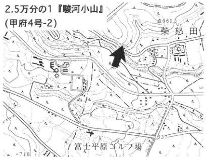
Show extracted lettering and translation
English translation of figure lettering
1:25,000 “Suruga-Oyama” (Kofu sheet 4-2); Shibanta; Fuji-Heigen golf course; 666.3; 637; 718.
Original Japanese lettering
2.5万分の1『駿河小山』(甲府4号-2);柴怒田;富士平原ゴルフ場;666.3;637;718
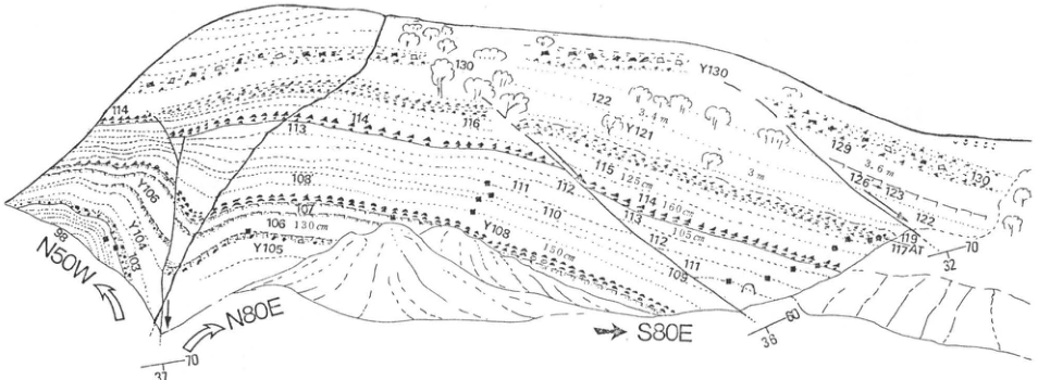
Show extracted lettering and translation
English translation of figure lettering
N50W; N80E; S80E; Y130; Y121; Y105; 98; 100; 103; 106, 130 cm; 107; 108; 108, 150 cm; 109; 110; 111; 112; 113; 113, 105 cm; 114; 114, 160 cm; 115, 125 cm; 116; 117AT; 119; 122; 123; 126; 129; 130; 3.4 m; 3 m; 3.6 m; 37; 70; 38; 60; 32.
Original Japanese lettering
N50W;N80E;S80E;Y130;Y121;Y105;98;100;103;106 130cm;107;108;108 150cm;109;110;111;112;113;113 105cm;114;114 160cm;115 125cm;116;117AT;119;122;123;126;129;130;3.4m;3m;3.6m;37;70;38;60;32
Reading notes
断面の微小数値 — 重なる数字の一部は判読不明。
CB-17 Latest Pleistocene to Holocene tephras at Suginazawa on the eastern foot of Fuji: particular reference to the Fuji Black Soil
上杉陽・土肥由美子・佐藤仁美・伊藤ひろみ・宮地直道
- Locality: Suginazawa, Suruga-Oyama Town, Sunto District, Shizuoka Prefecture
- Coordinates: N35°22′16″ E138°52′16″
- Elevation: Approximately 1,000 m
- Outcrop type and condition: Artificial exposure; partly extant
- Deposit type and age: Aeolian tephra; 2.5–20 ka
- Description date: May 1989
- Keywords: Fuji volcano; Fuji Black Soil; Yufune-1 scoria bed; latest-Pleistocene to earliest-Holocene seismic shaking
This exposure lies 11.25 km from Fuji's summit in the N84°E direction and was an important type locality for the middle Tachikawa Loam Formation and higher strata. Initially the entire sequence shown in the overview below, from Y-121 (Sagamino-1 scoria) to the Hoei scoria bed (S-25) erupted in 1707, could be examined and sampled in detail (上杉, 1990; 上杉 et al., 1992). Planting has since progressed; observation is possible in the central boxed area on benches four through six, shown enlarged in the figure. Discordance between Older Fuji tephras (Y-numbered) and Younger Fuji tephras (S-numbered; since 10.5 ka) can be observed at the eastern end. In the central part, slightly west of center in the overview, a typical discordant relationship produced by downward erosion can be observed between S-9 and S-10 (3.2–3.3 ka). These two intervals are the most important temporal boundaries of the Holocene. Viewed upward from the forest road on the valley floor, the interval from the upper half of Y-141, dating to the earlier half of the Incipient Jomon period (approximately 11.7 ka), to S-9, dating to the earlier half of Late Jomon (3.3 ka), appears as “black soil,” with “red soil” above and below. Most material called “Fujikuro” by archaeologists across southern Kanto belongs to this horizon. Among Holocene tephras, S-0-1–S-0-6 are particularly fine grained; S-1–9 become progressively coarser. Beginning with S-10 and 11 (Yufune-1 scoria bed), from the later half of Late Jomon, the character changes completely: thickness and grain size increase and deposition becomes faster. Various glass shards occur at many horizons, including Y-134–136, Y-137-3–4, middle Y-139, middle Y-140, middle Y-141, and upper Y-141. Platy glass shards derived from Kikai-Akahoya tephra are dispersed through S-0-5–S-1. The exposure is situated on a south-facing slope of the Tanzawa Mountains [as stated in the original]. Landslides and ground cracks occurred at each abrupt natural disturbance, and traces of these events are preserved in the tephra sequence (上杉・木越, 1986; 上杉, 1989). Abrupt natural disturbances occurred during Y-141-c (around 12 ka), immediately before S-0-3 (around 9.2 ka), immediately before S-0-4 (approximately 7.5 ka), and immediately before S-2 (around 6.1 ka).
References: 上杉 (1989, 1990); 上杉・木越 (1986); 上杉 et al. (1986, 1992).
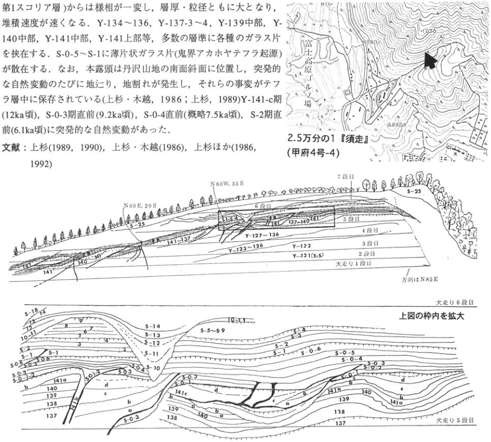
Show extracted lettering and translation
English translation of figure lettering
1:25,000 “Subashiri” (Kofu sheet 4-4); 須走馬場; 882.0; overview: N60E, 20S; N80W, 35S; bench 7; bench 6; bench 5; bench 4; bench 3; bench 2; bench 1; direction N85E; S-25; S15; 141; 140; 137–140; 141–137; Y-127–136; Y-123–126; Y-122; Y-121 (S1S); detail: bench 6; enlargement of the boxed area above; bench 5; S-18; 13–14; 12; 10–11; 5–6; 7; 9; 3; 4; S-14; S-13; S-12; S-11; S-10; S-5–S-9; S-3–4; S-3; S-2; S-1; S-0-6; S-0-5; S-0-4; S-0-3; S-0-2; S-0-1; 141a; 141b; 141c; 141d; 140; 139; 138; 137; a; b; c; d. Embedded prose is restored in the main text.
Original Japanese lettering
2.5万分の1『須走』(甲府4号-4);須走馬場;882.0;上図:N60E,20S;N80W,35S;7段目;6段目;5段目;4段目;3段目;2段目;犬走り1段目;方向はN85E;S-25;S15;141;140;137~140;141~137;Y-127~136;Y-123~126;Y-122;Y-121(S1S);下図:犬走り6段目;上図の枠内を拡大;犬走り5段目;S-18;13~14;12;10~11;5~6;7;9;3;4;S-14;S-13;S-12;S-11;S-10;S-5~S-9;S-3~4;S-3;S-2;S-1;S-0-6;S-0-5;S-0-4;S-0-3;S-0-2;S-0-1;141a;141b;141c;141d;140;139;138;137;a;b;c;d。本文断片は本文に復元。
Reading notes
Y-121(S1S)および微小ラベル — 微小な括弧内文字の読取りは暫定。
CB-18 Tephras and lava of Younger Fuji volcano on Fuji's eastern slope
宮地直道
- Locality: Tarobo, Gotemba City, Shizuoka Prefecture (south of parking area 1)
- Coordinates: N35°19′53″ E138°47′51″
- Elevation: 1,440 m
- Outcrop type and condition: Natural exposure; extant in July 1995, partly buried
- Deposit type and age: Aeolian tephra and lava; Late Pleistocene to Holocene
- Description date: July 1995
- Keywords: Fuji; Younger Fuji Tephra Formation; Fuji-Hoei tephra; Mishima lava
More than 100 Fuji-derived fallout tephra beds have accumulated thickly on Fuji's eastern foot. Numerous exposures formerly appeared through quarrying and other excavation, but few can now be observed. Tarobo is the New Fifth Station on the Gotemba ascent route, one of the eastern routes up Fuji; buses from Gotemba Station operate in July and August. This exposure lies in a valley incised by several recent snowmelt avalanches, whose walls expose major Younger Fuji tephras. Immediately beneath the surface are Fuji-Hoei tephra (F-Ho; S-25), erupted in AD 1707, and its secondary deposits. The tephra consists of lower coarse yellow-gray pumice and upper medium- to coarse-grained black-gray scoria. Approximately 40 underlying tephra beds can also be observed, including Futatsuzuka scoria (FTT), Fuji-Yufune-2 scoria (Yu-2; S-22), Fuji-Sunazawa (Sunazawa scoria; F-Zn; S-13), Yufune-1 scoria (Yu-1; S-10, 11), and Red Scoria I and II (R-I, II; S-5, 6). Pumice from Amagi-Kawagodaira (Kg), erupted from Izu-Amagiyama at approximately 3 ka, occurs scattered within the weathered ash between S-10 and S-11. In addition to fallout tephras, one can observe slush-flow deposits composed of poorly sorted, rounded scoria formed by snowmelt avalanches, and two pyroclastic-surge beds with cross-stratification and charred wood fragments. At the base of the eastern exposure is the approximately 10 ka Mishima lava, with ropy surface structures. Burial of the exposure by collapse of the valley walls is progressing, and exposure conditions may change substantially. Particular care against falling rocks and falls is necessary during observation.
References: 泉 et al. (1977); 町田 (1964); 宮地 (1988); Miyaji et al. (1990); 津屋 (1968); 上杉 et al. (1979).
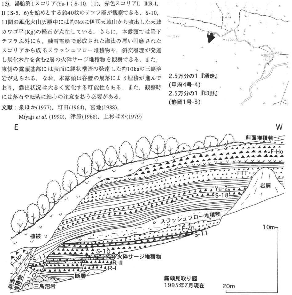
Show extracted lettering and translation
English translation of figure lettering
1414; 1547; △1402.4; Tarobo; 1282; 1:25,000 “Subashiri” (Kofu sheet 4-4); 1:25,000 “Inno” (Shizuoka sheet 1-3); E; W; slope deposits; F-Ho; FTT; Yu-2; S-18; rock debris; slush-flow deposits; F-Zn; S-11; vegetation cover; S-10; pyroclastic-surge deposits; R-II; R-I; fault; Mishima lava; sketch map of the exposure, as of July 1995; 10 m; 20 m. Embedded prose and references are restored in the main text.
Original Japanese lettering
1414;1547;△1402.4;太郎坊;1282;2.5万分の1『須走』(甲府4号-4);2.5万分の1『印野』(静岡1号-3);E;W;斜面堆積物;F-Ho;FTT;Yu-2;S-18;岩屑;スラッシュフロー堆積物;F-Zn;S-11;植被;S-10;火砕サージ堆積物;R-II;R-I;断層;三島溶岩;露頭見取り図 1995年7月現在;10m;20m。画像中本文・文献は本文に復元。
CB-19 Trenching of the source fault of the 1930 North Izu earthquake in the Tanna Basin
奥村晃史
- Locality: Myoga (名賀), Kannami Town, Shizuoka Prefecture
- Coordinates: N35°06′05″ E139°1′11″
- Elevation: 235 m
- Outcrop type and condition: Artificial exposure (trench); restored
- Deposit type and age: Peat, sand, and silt; Holocene
- Description date: February 1982
- Keywords: Trench; earthquake fault; Tanna Fault; Izu Peninsula; active fault; North Izu fault system
The North Izu fault system, extending approximately 30 km north–south across the base of the Izu Peninsula, ruptured as the source fault of the 1930 North Izu earthquake (M7.3). The Tanna Fault is the most conspicuous active fault in its central part; up to 3.5 m of left-lateral surface displacement was recorded during that earthquake (松田, 1972). Trenching was conducted in 1980 and 1982 in the Myoga district near the northern end of the Tanna Basin (loc. 1; 丹那断層発掘調査研究グループ, 1983). In 1982 a large trench, 25 m long, 22 m wide, and up to 7 m deep, was excavated. Its walls exposed predominantly fine-grained deposits containing abundant organic material and plant remains. Bed 16C at the bottom contained abundant glass from Kikai-Akahoya tephra (K-Ah). Tephras detected in beds 12 and 10 and at the top of bed 7 were correlated, respectively, with Amagi-Kawagodaira tephra (Kg; 2.8–2.9 ka, 町田 et al., 1984), Fuji-Sunazawa scoria (F-Zn; 2.5–2.8 ka, 町田 et al., 1984), and Kozushima Tenjosan tephra (Iz-Kt; AD 838, 町田 et al., 1984). Analysis of geological structures and thickness changes associated with fault movement identified nine earthquake events in approximately the past 7,000 years. Recurrence intervals are 700–1,000 years; the third-youngest event is considered to correspond to the Izu earthquake of 841. A trench at the western foot of Kawaguchi-no-mori in the basin's central part (loc. 2) revealed four earthquake traces in alluvial deposits above the K-Ah horizon, but also exposed younger Hakone pumice-flow deposits (Hakone-Tokyo tephra) and their secondary deposits 1.5–3.0 m below the surface (第3次丹那断層発掘調査研究グループ, 1988).
References: 第3次丹那断層発掘調査研究グループ (1988); 町田 et al. (1984); 松田 (1972); 丹那断層発掘調査研究グループ (1983).
Northern wall of the Myoga trench on the Tanna Fault: Figure 6a of 丹那断層発掘調査研究グループ (1983), with modified legend and added tephra names, and part of Figure 17. The vertical axis represents actual length on the wall inclined at 45°. A–I on the column indicate event horizons. 1: silt; 2: fine sand; 3: medium sand; 4: coarse sand; 5: sand and gravel; 6: peat; 7: humic soil; 8: volcanic ash; 9: debris-flow deposits; 10: fill; 11: paddy-field soil; 12: wood; 13: fault.
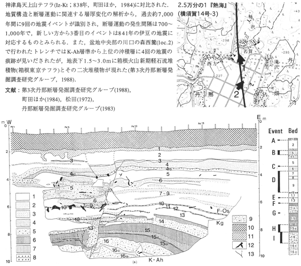
Show extracted lettering and translation
English translation of figure lettering
1:25,000 “Atami” (Yokosuka sheet 14-3); Kakizawa; Myoga; Nishikata; Takizawa; Tanna; Hata; 1; 2; 298; 295; 237; 43; W; E; m; 0, 2, 4, 6, 8, 10; N1; N5; N10; N15; bed labels 1, 2, 3, 4, 4a, 4c, 5, 6, 7, 7-9, 10, 11, 12, 13, 14, 15, 15a, 15b, 15c, 16, 16c, 16D; F-Os; Kg; K-Ah; Event Bed; A, B, C, D, E, F, G, H, I; legend 1–13 is defined in the main text. Embedded prose and references are restored in the main text.
Original Japanese lettering
2.5万分の1『熱海』(横須賀14号-3);柿沢;名賀;西方;滝沢;丹那;畑;1;2;298;295;237;43;W;E;m;0,2,4,6,8,10;N1;N5;N10;N15;地層番号:1,2,3,4,4a,4c,5,6,7,7-9,10,11,12,13,14,15,15a,15b,15c,16,16c,16D;F-Os;Kg;K-Ah;Event Bed;A,B,C,D,E,F,G,H,I;凡例1~13は本文説明。画像中本文・文献は本文に復元。
Reading notes
イベント柱状図の細字部層記号 — 微小ラベルの一部は読み取り困難。
CB-20 Tephras from the Higashi-Izu monogenetic volcanic group and widespread tephras in Ito City, Shizuoka Prefecture
小山真人
- Locality: Akazawa, Ito City, Shizuoka Prefecture (within the municipal cemetery)
- Coordinates: N34°52′33″ E139°03′43″
- Elevation: 700 m
- Outcrop type and condition: Artificial exposure; lost beneath vegetation
- Deposit type and age: Aeolian tephra; Late Pleistocene to Holocene
- Description date: June 1993
- Keywords: Ito; Higashi-Izu monogenetic volcanic group; Izu-Tobu volcanic group; Aira-Tn tephra
This was the best exposure for observing representative tephras from the Higashi-Izu monogenetic volcanic group in Ito City, Shizuoka Prefecture, whose active-volcano name is the Izu-Tobu volcanic group, and their relationships to widespread tephras. For convenience, several exposures created by large-scale earthworks around the stated locality are combined here as one exposure. It lies on a flat surface formed by andesitic lava flows of the Middle Pleistocene Amagi volcano in the eastern Izu Peninsula. A 15 m thick tephra/loess section deposited from approximately 200 ka to the present could be observed almost without gaps. The brown loam between local tephras is considered aeolian dust, that is, loess. See 早川・小山 (1992) and 小山 et al. (1995) for details. Major tephras dated using loess chronometry are, in descending order: Kawagodaira pumice of the Higashi-Izu monogenetic volcanic group (3.2 ka); Omuroyama scoria of that group (5 ka); Akakubo tephra (13 ka); Jizodo scoria (22 ka); widespread Aira-Tn tephra (AT); Hakone Da-5 pumice (88.5 ka); Hakone Da-4 pumice (103.5 ka); Maruno-yama tephra of the Higashi-Izu monogenetic volcanic group (107.5 ka); and Togasayama scoria of that group (142.5 ka). AT is recognizable as a 1 cm thick lens of white ash 25 cm below Jizodo scoria. For the characteristics and source volcanoes of the individual tephras, consult the references below. This exposure corresponds to localities 381–382, east of Togasayama, in 小山 et al. (1995).
References: 早川・小山 (1992); 小山 et al. (1995).
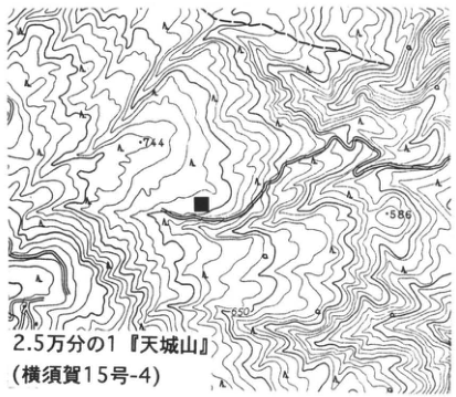
Show extracted lettering and translation
English translation of figure lettering
744; 586; 650; 1:25,000 “Amagiyama” (Yokosuka sheet 15-4).
Original Japanese lettering
744;586;650;2.5万分の1『天城山』(横須賀15号-4)
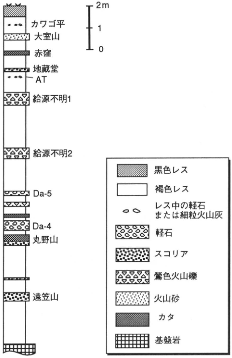
Show extracted lettering and translation
English translation of figure lettering
2 m; 1; 0; Kawagodaira; Omuroyama; Akakubo; Jizodo; AT; unknown source 1; unknown source 2; Da-5; Da-4; Maruno-yama; Togasayama; black loess; brown loess; pumice or fine ash in loess; pumice; scoria; olive-colored lapilli; volcanic sand; Kata; basement rock.
Original Japanese lettering
2m;1;0;カワゴ平;大室山;赤窪;地蔵堂;AT;給源不明1;給源不明2;Da-5;Da-4;丸野山;遠笠山;黒色レス;褐色レス;レス中の軽石または細粒火山灰;軽石;スコリア;鶯色火山礫;火山砂;カタ;基盤岩
CB-21 Tephra stratigraphy at the Sanmyoji site, at the foot of Ashitaka volcano, Shizuoka Prefecture
上杉陽・池谷信之・由井将雄・高尾好之・瀬川裕市郎
- Locality: Sanmyoji, Kitaobayashi (北小林), Numazu City
- Coordinates: N35°7′47″ E138°53′03″
- Elevation: 45–52 m
- Outcrop type and present condition: Artificial exposure, partly surviving
- Deposit type and age: Aeolian tephra, from 45 ka onward
- Date of description: April 1995 onward
- Keywords: Fuji-derived tephra; mica-bearing greasy volcanic ash; trapezoidal stone implements; Sanmyoji archaeological site
The site lies at the distal end of a plateau formed by the Momozawagawa pyroclastic-flow deposit, which flowed southeast during the younger stage of Ashitaka volcano (由井・藤井, 1989; a hundred-and-several tens of thousands of years ago?). The basic archaeological soil units in this area follow the volcanic-ash stratigraphic divisions of 愛鷹ローム団体研究グループ (1969). They are defined with nearly exact stratigraphic precision by numerous scoria clasts, pumice clasts, and glassy volcanic-ash marker beds. The site is 29 km from the summit of Fuji on a bearing of N152°E. The deposits above the Aira-Tn tephra (AT; Y-118) are 1–1.5 m thick, exceptionally thin compared with the approximately 3.5 m between AT and the mica-bearing greasy volcanic ash (Y-97′). This thickness differs little from that at the 牛尾舛 site in Chiba City, 128 km away on a bearing of N75°E. The reason is that the principal distribution axis for AT (Y-118) through Y-141 ran east-northeast, somewhat farther north, and that the erupted volume of Hakone-derived tephra declined thereafter. The basic soil-unit names and radiocarbon ages in the upper half of the diagram on the right follow 愛鷹ローム団体研究グループ (1969, 1970); those in the lower half follow 由井 (1995). The mica-bearing greasy volcanic ash Y-97 is approximately 38.3 ka old (叶内・杉原, 1994). Tephra numbers for the eastern foot of Fuji follow 上杉 (1990) and 上杉 et al. (1992). Artifact-bearing horizons from the surrounding area are also shown.
Nzu-16 is a dark band containing rounded pebbles approximately 1 cm in diameter. These resemble the “imoishi” of southern Kanto. Black humic soil (BBVII–BBIV; the upper half of Y-106 through 108′) occurs between 50 cm and 1 m above the paired scoria (Y-103), which immediately overlies a discordant horizon. This interval contains obsidian trapezoidal stone implements. They disappear at and above SCIII (Y-109–112), the next discordant horizon, where knife-shaped stone implements appear. Pyramidal stone implements have been recovered from BB0 (Y-136–133). Correlation with the tephra around the Yasumiba archaeological site could not be established. Knife-shaped implements, fluted points, and microliths have been recovered there. Y-141-3, from the very last phase of Older Fuji volcano, has developed into black humic soil throughout the area and yields ridged-pattern pottery of the Incipient Jomon period.
References: 愛鷹ローム団体研究グループ (1969, 1970); 池谷 (1995); 上杉 (1990); 上杉 et al. (1992); 叶内・杉原 (1994); 由井 (1995); 由井・藤井 (1989).
For the legend, see 上杉 et al. (1992).
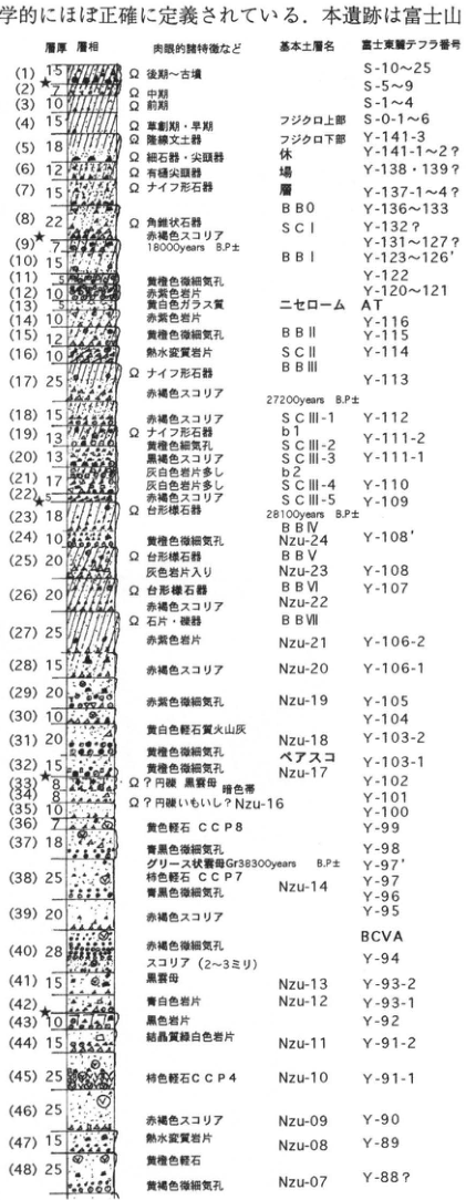
Show extracted lettering and translation
English translation of figure lettering
| Diagram number | Thickness (unit unprinted) | Macroscopic characteristics, etc. | Basic soil-unit name | Tephra number, eastern foot of Fuji |
|---|---|---|---|---|
| 1 | 15 | Ω Late Jomon–Kofun | — | S-10–25 |
| 2 | 7 | Ω Middle Jomon | — | S-5–9 |
| 3 | 10 | Ω Early Jomon | — | S-1–4 |
| 4 | 15 | Ω Incipient and Initial Jomon | upper Fujikuro | S-0-1–6 |
| 5 | 18 | Ω ridged-pattern pottery | lower Fujikuro | Y-141-3 |
| 6 | 12 | Ω microliths and points | Yasumiba bed | Y-141-1–2? |
| 7 | 15 | Ω fluted points; Ω knife-shaped stone implements | Yasumiba bed | Y-138・139?; Y-137-1–4? |
| 8 | 22 | Ω pyramidal stone implements; reddish-brown scoria | BB0; SC I | Y-136–133; Y-132? |
| 9★ | 7 | 18000 years B.P. ± | — | Y-131–127? |
| 10 | 15 | — | BB I | Y-123–126′ |
| 11 | 5 | yellow-orange, very fine vesicles | — | Y-122 |
| 12 | 10 | reddish-purple lithic fragments | — | Y-120–121 |
| 13 | 10 | yellowish-white glassy material | Nise Loam | AT |
| 14 | 10 | reddish-purple lithic fragments | — | Y-116 |
| 15 | 12 | yellow-orange, very fine vesicles | BB II | Y-115 |
| 16 | 10 | hydrothermally altered lithic fragments | SC II; BB III | Y-114 |
| 17 | 25 | Ω knife-shaped stone implements; reddish-brown scoria; 27200 years B.P. ± | BB III | Y-113 |
| 18 | 15 | reddish-brown scoria | SC III-1 | Y-112 |
| 19 | 13 | Ω knife-shaped stone implements; yellow-orange, fine vesicles | b1; SC III-2 | Y-111-2 |
| 20 | 13 | blackish-brown scoria; abundant grayish-white lithic fragments | SC III-3 | Y-111-1 |
| 21 | 17 | abundant grayish-white lithic fragments | b2; SC III-4 | Y-110 |
| 22★ | 5 | reddish-brown scoria | SC III-5 | Y-109 |
| 23 | 18 | Ω trapezoidal stone implements; 28100 years B.P. ± | BB IV | — |
| 24 | 10 | yellow-orange, very fine vesicles | Nzu-24 | Y-108′ |
| 25 | 20 | Ω trapezoidal stone implements; containing gray lithic fragments | BB V; Nzu-23 | Y-108 |
| 26 | 20 | Ω trapezoidal stone implements; reddish-brown scoria | BB VI; Nzu-22 | Y-107 |
| 27 | 25 | Ω stone flakes and pebble tools; reddish-purple lithic fragments | BB VII; Nzu-21 | Y-106-2 |
| 28 | 15 | reddish-brown scoria | Nzu-20 | Y-106-1 |
| 29 | 20 | reddish-brown, very fine vesicles | Nzu-19 | Y-105 |
| 30 | 10 | yellowish-white pumiceous ash | — | Y-104 |
| 31 | 20 | yellow-orange, very fine vesicles | Nzu-18 | Y-103-2 |
| 32 | 15 | yellow-orange, very fine vesicles | paired scoria; Nzu-17 | Y-103-1 |
| 33★ | 8 | Ω? rounded pebbles; biotite; dark band | — | Y-102 |
| 34 | 8 | Ω? rounded pebbles, imoishi? | Nzu-16 | Y-101 |
| 35 | 10 | — | Nzu-16 | Y-100 |
| 36 | 7 | yellow pumice CCP8 | — | Y-99 |
| 37 | 18 | bluish-black, very fine vesicles | — | Y-98 |
| 38 | 25 | greasy mica-bearing ash Gr; 38300 years B.P. ±; persimmon-colored pumice CCP7; bluish-black, very fine vesicles | Nzu-14 | Y-97′; Y-97; Y-96 |
| 39 | 20 | reddish-brown scoria | — | Y-95 |
| 39–40間 | — | — | — | BCVA |
| 40 | 28 | reddish-brown, very fine vesicles; scoria (2–3 mm) | — | Y-94 |
| 41 | 15 | biotite | Nzu-13 | Y-93-2 |
| 42★ | — | bluish-white lithic fragments | Nzu-12 | Y-93-1 |
| 43 | 10 | black lithic fragments | — | Y-92 |
| 44 | 15 | crystalline greenish-white lithic fragments | Nzu-11 | Y-91-2 |
| 45 | 25 | persimmon-colored pumice CCP4 | Nzu-10 | Y-91-1 |
| 46 | 25 | reddish-brown scoria | Nzu-09 | Y-90 |
| 47 | 15 | hydrothermally altered lithic fragments | Nzu-08 | Y-89 |
| 48 | 25 | yellowish-brown pumice; yellow-orange, very fine vesicles | Nzu-07 | Y-88? |
Lithofacies are shown by column patterns. Ω denotes artifacts. Stars mark (9), (22), (33), and (42).
Original Japanese lettering
| 図中番号 | 層厚(単位の印字なし) | 肉眼的諸特徴など | 基本土層名 | 富士東麓テフラ番号 |
|---|---|---|---|---|
| 1 | 15 | Ω 後期~古墳 | — | S-10~25 |
| 2 | 7 | Ω 中期 | — | S-5~9 |
| 3 | 10 | Ω 前期 | — | S-1~4 |
| 4 | 15 | Ω 草創期・早期 | フジクロ上部 | S-0-1~6 |
| 5 | 18 | Ω 隆線文土器 | フジクロ下部 | Y-141-3 |
| 6 | 12 | Ω 細石器・尖頭器 | 休場層 | Y-141-1~2? |
| 7 | 15 | Ω 有樋尖頭器;Ω ナイフ形石器 | 休場層 | Y-138・139?;Y-137-1~4? |
| 8 | 22 | Ω 角錐状石器;赤褐色スコリア | BB0;SC I | Y-136~133;Y-132? |
| 9★ | 7 | 18000 years B.P. ± | — | Y-131~127? |
| 10 | 15 | — | BB I | Y-123~126′ |
| 11 | 5 | 黄橙色微細気孔 | — | Y-122 |
| 12 | 10 | 赤紫色岩片 | — | Y-120~121 |
| 13 | 10 | 黄白色ガラス質 | ニセローム | AT |
| 14 | 10 | 赤紫色岩片 | — | Y-116 |
| 15 | 12 | 黄橙色微細気孔 | BB II | Y-115 |
| 16 | 10 | 熱水変質岩片 | SC II;BB III | Y-114 |
| 17 | 25 | Ω ナイフ形石器;赤褐色スコリア;27200 years B.P. ± | BB III | Y-113 |
| 18 | 15 | 赤褐色スコリア | SC III-1 | Y-112 |
| 19 | 13 | Ω ナイフ形石器;黄橙色細気孔 | b1;SC III-2 | Y-111-2 |
| 20 | 13 | 黒褐色スコリア;灰白色岩片多し | SC III-3 | Y-111-1 |
| 21 | 17 | 灰白色岩片多し | b2;SC III-4 | Y-110 |
| 22★ | 5 | 赤褐色スコリア | SC III-5 | Y-109 |
| 23 | 18 | Ω 台形様石器;28100 years B.P. ± | BB IV | — |
| 24 | 10 | 黄橙色微細気孔 | Nzu-24 | Y-108′ |
| 25 | 20 | Ω 台形様石器;灰色岩片入り | BB V;Nzu-23 | Y-108 |
| 26 | 20 | Ω 台形様石器;赤褐色スコリア | BB VI;Nzu-22 | Y-107 |
| 27 | 25 | Ω 石片・礫器;赤紫色岩片 | BB VII;Nzu-21 | Y-106-2 |
| 28 | 15 | 赤褐色スコリア | Nzu-20 | Y-106-1 |
| 29 | 20 | 赤褐色微細気孔 | Nzu-19 | Y-105 |
| 30 | 10 | 黄白色軽石質火山灰 | — | Y-104 |
| 31 | 20 | 黄橙色微細気孔 | Nzu-18 | Y-103-2 |
| 32 | 15 | 黄橙色微細気孔 | ペアスコ;Nzu-17 | Y-103-1 |
| 33★ | 8 | Ω? 円礫;黒雲母;暗色帯 | — | Y-102 |
| 34 | 8 | Ω? 円礫いもいし? | Nzu-16 | Y-101 |
| 35 | 10 | — | Nzu-16 | Y-100 |
| 36 | 7 | 黄色軽石 CCP8 | — | Y-99 |
| 37 | 18 | 青黒色微細気孔 | — | Y-98 |
| 38 | 25 | グリース状雲母Gr;38300 years B.P. ±;柿色軽石 CCP7;青黒色微細気孔 | Nzu-14 | Y-97′;Y-97;Y-96 |
| 39 | 20 | 赤褐色スコリア | — | Y-95 |
| 39–40間 | — | — | — | BCVA |
| 40 | 28 | 赤褐色微細気孔;スコリア(2~3ミリ) | — | Y-94 |
| 41 | 15 | 黒雲母 | Nzu-13 | Y-93-2 |
| 42★ | — | 青白色岩片 | Nzu-12 | Y-93-1 |
| 43 | 10 | 黒色岩片 | — | Y-92 |
| 44 | 15 | 結晶質緑白色岩片 | Nzu-11 | Y-91-2 |
| 45 | 25 | 柿色軽石 CCP4 | Nzu-10 | Y-91-1 |
| 46 | 25 | 赤褐色スコリア | Nzu-09 | Y-90 |
| 47 | 15 | 熱水変質岩片 | Nzu-08 | Y-89 |
| 48 | 25 | 黄褐色軽石;黄橙色微細気孔 | Nzu-07 | Y-88? |
層相は柱状図の模様で表示.Ωは遺物.★は(9)(22)(33)(42)に付される.
Reading notes
図の行間に配置された休場層・BB0・SC I・b1・b2など — 連続する名称や一部境界線は層厚番号の区切りと一致しない。表では該当する近傍行へ順序を保って配置し、厳密な境界は原図を参照。
年代値後の± — 原図は誤差数値を記さず±のみ印字。補完しない。
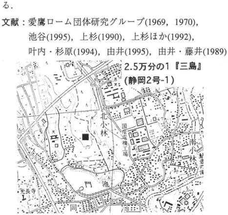
Show extracted lettering and translation
English translation of figure lettering
1:25,000 Mishima (Shizuoka sheet 2-1); Kitaobayashi (北小林); Minamiobayashi (南小林); Kochoji (光長寺); Kadoike (門池); Oka (岡); Tokaido Shinkansen; 66.0; 64.7; 25; solid square (site). The references and sentence fragment above the map are retained in the main text.
Original Japanese lettering
2.5万分の1『三島』(静岡2号-1);北小林;南小林;光長寺;門池;岡;東海道新幹線;66.0;64.7;25;■(地点)。上の文献・文末断片は本文に収録。
Reading notes
その他の極小の地図文字 — 解像度不足で確実に読めない。
CB-22 Ontake-1 tephra in the Udo Hills, Shizuoka Prefecture
杉山雄一
- Locality: Oya, Shizuoka City, Shizuoka Prefecture, south of the Shizuoka University campus
- Coordinates: N34°57′25″ E138°26′02″
- Elevation: 30 m
- Outcrop type and condition: Artificial exposure; extant in February 1996 but covered by vegetation
- Deposit type and age: Subaqueously deposited tephra; approximately 100 ka
- Description date: February 1996
- Keywords: Udo Hills; Oshika Formation; Ontake-1 tephra
The Late Pleistocene Kusanagi and Oshika formations are widely distributed in the northern and western Udo Hills, which span Shizuoka and Shimizu cities, but this is the only exposure where Ontake-1 tephra (On-Pm1) can be observed. It is a cut slope behind the materials yard of Showa Construction Co., Ltd. (formerly Showa Foundation Construction Co., Ltd.), south of Shizuoka University. In February 1996 the exposure was covered by Miscanthus vegetation with scattered low podocarp, pine, camellia, and other trees; the tephra could not be observed from the yard. A concrete retaining wall approximately 5 m high at the foot of the slope makes direct access from the yard difficult, but access is possible from farmland on the ridge. The exposure shows gently west-dipping alluvial-fan deposits of the Oshika Formation: lower gravel composed of rounded clasts 5–10 cm in diameter and upper gravel-bearing silt to clay. On-Pm1 occurs approximately 30 cm above the base of the clay bed. It is 5–10 cm thick, pink sandy ash containing dark minerals such as biotite and hornblende and displaying a salt-and-pepper appearance.
Reference: 北里・新井 (1986).
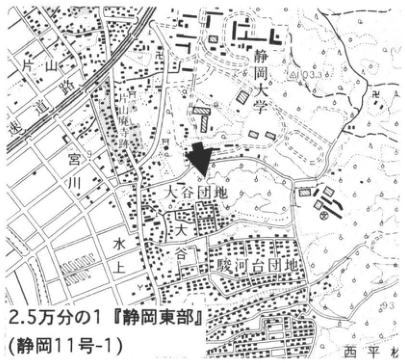
Show extracted lettering and translation
English translation of figure lettering
Shizuoka University; Miyagawa; Oya housing estate; Oya; Mizukami; Surugadai housing estate; Nishi-Hiramatsu; 103.3; 93; 1:25,000 “Eastern Shizuoka” (Shizuoka sheet 11-1).
Original Japanese lettering
静岡大学;宮川;大谷団地;大谷;水上;駿河台団地;西平松;103.3;93;2.5万分の1『静岡東部』(静岡11号-1)
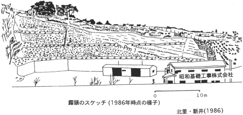
Show extracted lettering and translation
English translation of figure lettering
On-Pm1; Showa Foundation Construction Co., Ltd.; 0; 10 m; sketch of the exposure (conditions in 1986); 北里・新井 (1986).
Original Japanese lettering
On-Pm1;昭和基礎工事株式会社;0;10m;露頭のスケッチ(1986年時点の様子);北里・新井(1986)
CB-23 Middle Pleistocene tephras Ng-2 and Ng-4 in the Udo Hills, Shizuoka Prefecture
杉山雄一
- Locality: Northwest of Negoya, Shizuoka City, Shizuoka Prefecture
- Coordinates: N34°57′52″ E138°27′52″
- Elevation: 110 m
- Outcrop type and condition: Natural exposure; extant in February 1996
- Deposit type and age: Subaqueously deposited tephra; Middle Pleistocene
- Description date: February 1996
- Keywords: Udo Hills; Negoya Formation; Ng-2 tephra; Ng-4 tephra
The Middle Pleistocene marine to alluvial-fan Negoya Formation is widely distributed in the southern Udo Hills facing Suruga Bay. It contains the widespread Middle Pleistocene Ng-1 tephra described in WS-19-1, and higher tephras called Ng-2 and Ng-4 (近藤, 1985). This exposure corresponds to Loc. 31 of 近藤 (1985). Ascend the valley west of Negoya village for approximately 500 m, turn west at a valley junction, and continue approximately 400 m up the tributary; the exposure is in a small dry gully entering from the north. Ng-2 occurs in silt of the upper Negoya Formation exposed in the gully bed and comprises two ash beds separated by approximately 70 cm. The lower bed is 4–8 cm thick, of coarse-sand to granule size, and has an “aritama” appearance. The upper bed is 2–4 cm thick and finer, of medium- to fine-sand size. Ng-4 is pumiceous tephra approximately 10 m above Ng-2; pumice fragments approximately 1–3 cm in diameter are scattered through silt over a thickness of approximately 30 cm. Ng-2 is correlated with the Ha-6 and Ha-7 ash pair in the Sahama Mud on the eastern shore of Lake Hamana (CB-26, as printed; 杉山, 1991). Changes in shell-fossil assemblages identify the Ng-2 horizon as an interval of rising sea level, while pollen assemblages identify it as an interval of warming (近藤, 1985; 杉山, 1991). Several other tephras also occur in the Middle Pleistocene deposits of the Udo Hills and are described in the references below.
References: 近藤 (1985); 佐藤 (1991); 杉山 (1991).
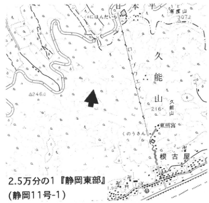
Show extracted lettering and translation
English translation of figure lettering
Nihondaira; Udoyama; 307.2; Kunozan; 216; Negoya; Toshogu; 246.0; きさんじ; 1:25,000 “Eastern Shizuoka” (Shizuoka sheet 11-1).
Original Japanese lettering
日本平;有度山;307.2;久能山;216;根古屋;東照宮;246.0;きさんじ;2.5万分の1『静岡東部』(静岡11号-1)
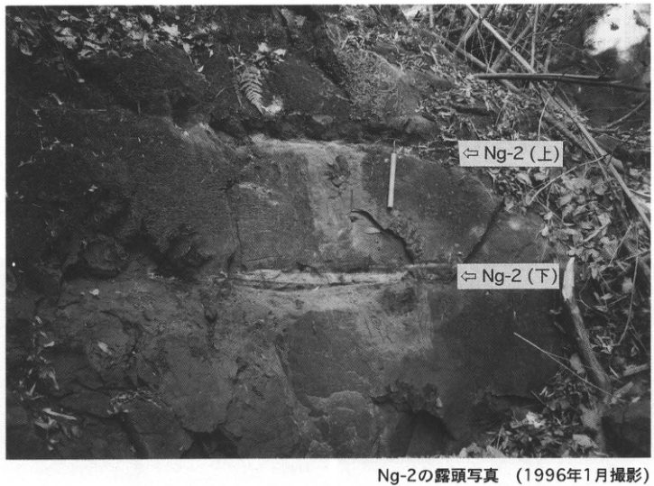
Show extracted lettering and translation
English translation of figure lettering
⇐ Ng-2 (upper); ⇐ Ng-2 (lower); photograph of the Ng-2 exposure (January 1996).
Original Japanese lettering
⇐Ng-2(上);⇐Ng-2(下);Ng-2の露頭写真(1996年1月撮影)
CB-24 Late Pleistocene tephras near Omaezaki, Shizuoka Prefecture
杉山雄一
- Locality: West of Jitogata, Sagara Town, Shizuoka Prefecture
- Coordinates: N34°37′56″ E138°11′03″ (Ka-1); N34°38′29″ E138°11′11″ (Ka-2)
- Elevation: 60 m (Ka-1); 73 m (Ka-2)
- Outcrop type and condition: Artificial exposures; extant in February 1996
- Deposit type and age: Subaqueously deposited tephra; Late Pleistocene
- Description date: February 1996
- Keywords: Omaezaki; Makinohara upland; Kasana terrace; Ka-1; Ka-2; Ontake-1 tephra; Kikai-Tozurahara tephra
The Makinohara upland, extending from Kanaya on the western bank of the Oi River to Omaezaki, is divided, from highest downward, into the Makinohara, Ochii, Kasana, and Omaezaki surfaces. The highest Makinohara surface is an alluvial-fan surface; the other three are beach-origin terraces. The Kasana terrace extends from Jitogata to Kasana in Sagara Town, and its deposits contain two tephras called Ka-1 and Ka-2. Glass morphology and refractive index, mineral assemblages, and other properties correlate Ka-1 with Ontake-1 tephra (On-Pm1) and Ka-2 with Kikai-Tozurahara tephra (K-Tz; 杉山 et al., 1988). Ka-1 can be observed in a small cut on the western side of a farm road: before the road from Horinoshinden to Kasana makes a U-shaped bend at the pass, south of the 54 m spot height, take the farm road branching south along the ridge and proceed approximately 50 m. The lower exposure consists of partly gravel-bearing sand and the upper exposure of beach gravel; On-Pm1 occurs in the upper part of the gravel-bearing sand. It is 3–10 cm thick fine ash of silt to fine-sand size, with a lower approximately 1 cm white portion and an orange upper portion. Ka-2 occurs in an artificial cliff behind a warehouse at the southern end of the Environmental Conservation Center, approximately 1 km north of the Ka-1 exposure. In the upper cliff in the southern part of this exposure, it forms a boulder approximately 28 cm in long-axis and 10 cm in short-axis diameter. The tephra clast lies at the base of poorly sorted gravel, considered fluvial, overlying beach gravel. The tephra is fine glassy ash of orange-tinged yellow color and is friable because of numerous minute pores. By February 1996 most of both tephras had been gouged out and they were nearly lost. To preserve the exposures, further sampling should not be conducted; small samples can be obtained from the contributing author.
References: 杉山 et al. (1987, 1988).
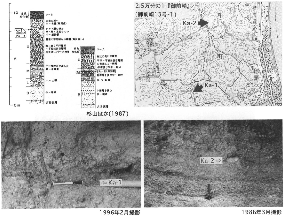
Show extracted lettering and translation
English translation of figure lettering
0 m; 5; 10; red weathering crust; loam; poorly sorted pebble-to-cobble gravel (fluvial); block of Ka-2 ash; silt interbed; gently south-dipping medium- to fine-sand beds; indistinct gravelly pebble bed (well sorted); U: gently south-dipping pebble-to-cobble beds with parallel to planar cross-stratification; M: granule-to-pebble bed with parallel stratification; L: pebble-to-cobble gravel; B: medium to fine sand; Furuya Mud; right column: well-sorted pebble bed; pebble bed with parallel to planar cross-stratification; pebble-bearing medium to fine sand; Ka-1 ash bed; medium to fine sand with granule beds; parallel stratification; medium to fine sand with pebble beds; Furuya Mud; 杉山 et al. (1987); 1:25,000 “Omaezaki” (Omaezaki sheet 13-1); Sagara Town; Jitogata; dedicated road; Ka-2; Ka-1; 38; 32; 25; 108; 63; ⇐ Ka-1; Ka-2 ⇒; photographed February 1996; photographed March 1986.
Original Japanese lettering
0m;5;10;赤色風化殻;ローム;淘汰の悪い中~大礫(河川成);Ka-2火山灰のブロック;シルト層の挟み;南へ緩く傾斜をもつ中~細砂層;礫質の不明瞭な中礫層(淘汰良い);U:南へ緩く平行層理~平板状斜交層理の発達した中~大礫層;M:平行層理の発達した細~中礫層;L:中~大礫;B:中~細砂;古谷泥層;右柱:淘汰の良い中礫層;平行~平板状斜交層理の発達した中礫層;中礫混じり中~細砂;Ka-1火山灰層;細礫層を挟む中~細砂;平行層理;中礫層を挟む中~細砂;古谷泥層;杉山ほか(1987);2.5万分の1『御前崎』(御前崎13号-1);相良町;地頭方;専用道路;Ka-2;Ka-1;38;32;25;108;63;⇐Ka-1;Ka-2⇒;1996年2月撮影;1986年3月撮影
Reading notes
柱状図の微小岩相文字 — 一部の字が粗く、最小限の判読不明が残る。
CB-25 Middle Pleistocene tephras on the eastern shore of Lake Hamana, Shizuoka Prefecture
杉山雄一
- Locality: South of Kiga, Hosoe Town (Ha-3); Yamazaki, Yuto Town (Ha-6, Ha-7), Shizuoka Prefecture
- Coordinates: N34°47′45″ E137°39′12″ (Ha-3); N34°42′47″ E137°37′39″ (Ha-6, Ha-7)
- Elevation: 10 m (Ha-3); 17 m (Ha-6)
- Outcrop type and condition: Artificial exposures; extant in February 1996
- Deposit type and age: Subaqueously deposited tephra; Middle Pleistocene
- Description date: February 1996
- Keywords: Lake Hamana; Hamamatsu Formation; Ha-3; Ha-6; Ha-7; Ata-Torihama tephra
The Middle Pleistocene Hamamatsu Formation occurs on the slopes of the Mikata-ga-hara upland on Lake Hamana's eastern shore. In ascending order it comprises the Miyakoda Gravel, Tenmadaira Mud, Hosoe Gravel, Sahama Mud, and Kamoe Gravel, unconformably overlain by the Upper Pleistocene Mikata-ga-hara Gravel forming the Mikata-ga-hara surface (武藤, 1987). Eight tephras, Ha-1–Ha-8 in ascending order, have been reported from the Hamamatsu Formation (杉山, 1991). This entry describes Ha-3, correlated with widespread Ata-Torihama tephra (Ata-Th), and the Ha-6/Ha-7 tephra pair, correlated with the two-bed Ng-2 tephra in the Udo Hills, Shizuoka City. Ha-3 is exposed in a former borrow pit opposite the road from Toeneck Co., Ltd.'s Hosoe office. Cross the Miyakoda River from Kiga, Hosoe Town, and follow the road south along Lake Hamana for approximately 750 m from the Yuden-side end of the bridge. As shown in the exposure sketch, Ha-3 occurs approximately 10 m from the northern end of the 6–7 m high cliff behind the parking lot and approximately 2 m below its top. The upper cliff exposes an approximately 3 m thick sandy-silt bed intercalated in the Hosoe Gravel; Ha-3 occurs within this silt. It is approximately 10 cm thick ash of fine-sand to silt size. Ha-6 and Ha-7 are exposed in a cliff at the northwestern end of developed land on the upland north of Yamazaki, Yuto Town. They occur within silt of the Sahama Mud exposed there. Lower Ha-6 is 3–10 cm thick coarse-sand to granule-sized ash with an “aritama” appearance. Ha-7 lies 1.2–1.3 m above Ha-6 and is approximately 0.5 cm thick silty ash. See 杉山 (1991) for details of Hamamatsu Formation tephras.
References: 礒見・井上 (1972); 武藤 (1987); 杉山 (1991).
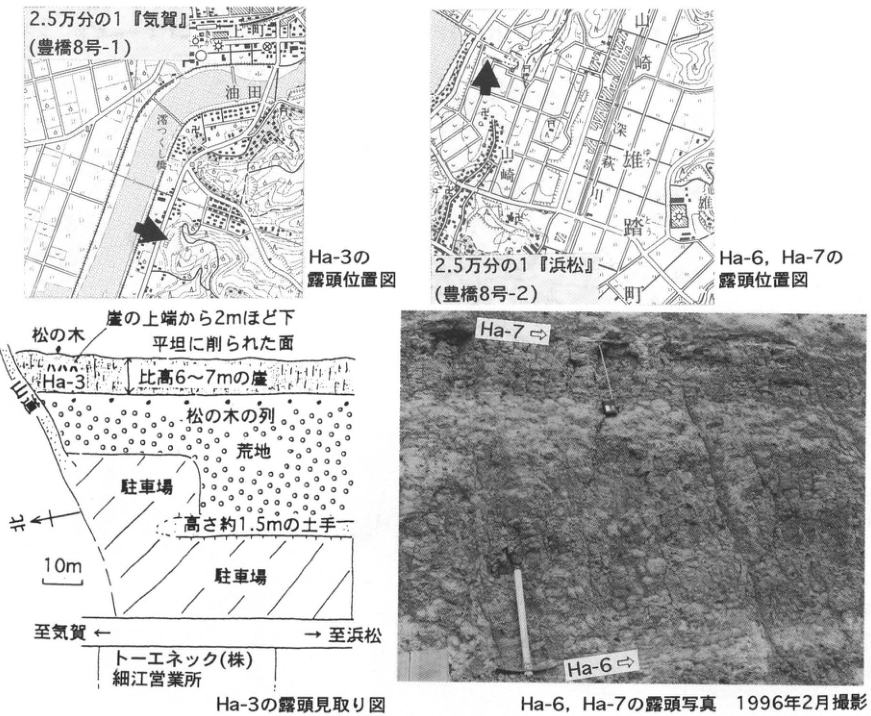
Show extracted lettering and translation
English translation of figure lettering
1:25,000 “Kiga” (Toyohashi sheet 8-1); Yuden; Miotsukushi Bridge; Ha-3 location map; 1:25,000 “Hamamatsu” (Toyohashi sheet 8-2); Yamazaki; 梵杭川; Yuto Town; Ha-6/Ha-7 location map; pine tree; approximately 2 m below cliff top; leveled surface; Ha-3; cliff 6–7 m high; row of pine trees; waste ground; parking lot; bank approximately 1.5 m high; north ←; 10 m; toward Kiga ←; → toward Hamamatsu; Toeneck Co., Ltd., Hosoe office; Ha-3 exposure sketch; Ha-7 ⇒; Ha-6 ⇒; Ha-6/Ha-7 exposure photograph, February 1996.
Original Japanese lettering
2.5万分の1『気賀』(豊橋8号-1);油田;澪つくし橋;Ha-3の露頭位置図;2.5万分の1『浜松』(豊橋8号-2);山崎;梵杭川;雄踏町;Ha-6,Ha-7の露頭位置図;松の木;崖の上端から2mほど下;平坦に削られた面;Ha-3;比高6~7mの崖;松の木の列;荒地;駐車場;高さ約1.5mの土手;北←;10m;至気賀←;→至浜松;トーエネック(株)細江営業所;Ha-3の露頭見取り図;Ha-7⇒;Ha-6⇒;Ha-6,Ha-7の露頭写真 1996年2月撮影
CB-26 Tephra and lava erupted onto glaciers at Tateyama in the Northern Japan Alps
町田洋・伊藤菜穂子
- Locality: Akakabe, Murododaira (Raichodai), Tateyama Town, Toyama Prefecture
- Coordinates: N36°34′50″ E137°36′14″
- Elevation: 2,360 m
- Outcrop type and condition: Cliff affected by glacial erosion and snow erosion; extant
- Deposit type: Glacial deposits, pumice, lava, and pyroclastic-flow deposits
- Description date: Summer 1995
- Keywords: Glaciers; Tateyama stage-2 pyroclastic-flow deposits; Tateyama D tephra; Tateyama E tephra; Tamadono lava; subglacial autobrecciated lava; Kikai-Akahoya ash; Murodo Gravel; Tateyama volcano; Tateyama Midagahara
Tateyama in the northern Northern Japan Alps is a mountain area where stratigraphic relationships between glacial landforms/deposits and volcanic products can be observed. This is because Tateyama volcano supplied tephra adjacent to Tateyama, which underwent glacial erosion during the last glacial period, and the Midagahara pyroclastic-flow upland preserves the deposits. This exposure is a steep cliff on a ridge continuing from Murododaira at 2,400 m above sea level. It lies in a Class I conservation area of the national park; reaching the exposure requires mountain-entry permission from both the Environment Agency and Forestry Agency. Those without permission should observe from the trail linking Mikurigaike and Raichodaira. The cliff also presents a rockfall hazard.
The lower half consists of welded Tateyama stage-2 pyroclastic-flow deposits, erupted during the Tateyama D tephra episode. Debris covers the area immediately above the welded tuff, but another exposure, along Otani at Tengudaira, contains Kikai-Tozurahara tephra (K-Tz) directly above the tuff (小林, 1990). Overlying sand and gravel is visible at the very bottom of this exposure; its granite clasts and abundant fine matrix make it appear glacial. Above it are volcanic deposits approximately 30 m thick, consisting of seven repeated sets grading from scoria- and pumice-dominated beds to angular gravel dominated by coarse andesite, also containing granite clasts (the Raichodai Sand and Gravel of 深井, 1975). Their pumice and scoria have the same petrographic characteristics as Tateyama E tephra at Omachi (町田・新井, 1979), indicating that the entire thick sequence was emplaced over a relatively short interval associated with that eruption. It is covered by typical glacial deposits with abundant matrix and predominantly basement-granite clasts (the main part of 深井's Murodo Gravel), in turn covered by autobrecciated Tamadono lava. This lava forms Murododaira. In cliffs cutting the flat surface, such as Tamadono Iwaya, it is solid, jointed lava; in several parallel valleys running south-southwest to north-northeast, however, autobrecciated facies characteristically dominate. Above it, four local Holocene tephra beds erupted from the Jigokudani crater alternate with peat. A thin Kikai-Akahoya tephra bed, approximately 4 mm thick, is visible in black mud between the second and third tephra beds from the bottom.
These observations allow the following relationships between volcanic activity and glacial advance to be discussed. No evidence of glacial advance occurs from the Tateyama stage-2 pyroclastic-flow deposits to the K-Tz horizon. Deposits considered glacial appear before the Tt-E eruption, however, and the sequence from the Murodo Gravel sensu stricto to Tamadono lava is considered to have accumulated under glacial influence. Tt-E-equivalent deposits are bracketed by glacial gravel and are thicker than at other Midagahara localities; they may therefore be regarded as material that fell onto glaciers, moved, and was redeposited. Numerous sand dikes in the lower part may also suggest effects of eruption activity or glacier movement. A stage-3 pyroclastic flow has been reported across Midagahara (Yamasaki et al., 1966), but it is very likely to be a mudflow containing Tt-E pumice. Tamadono lava also lies immediately above the Murodo Gravel and is therefore considered to have erupted while glaciers were developed. As described above, the lava is almost entirely autobrecciated in the west-northwest-trending depressions and valleys characteristic of Murododaira. This strongly suggests that the lava melted glacier ice and was rapidly chilled on contact with water.
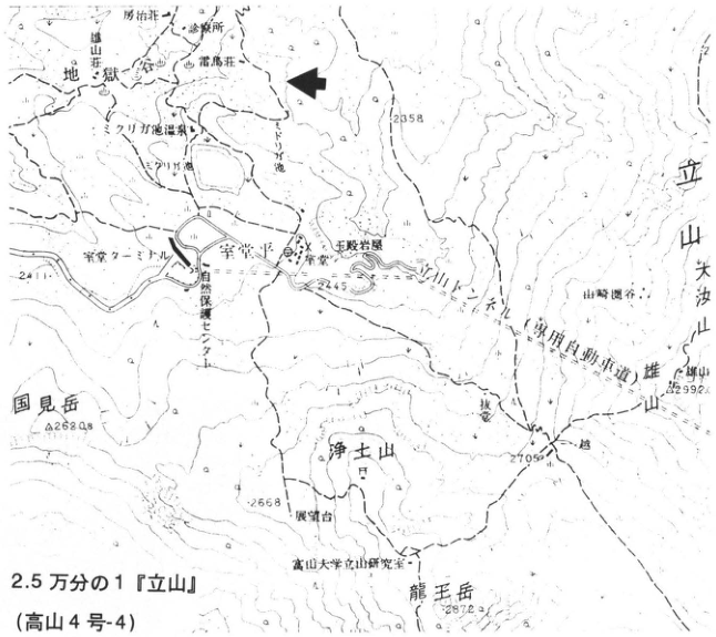
Show extracted lettering and translation
English translation of figure lettering
1:25,000 “Tateyama” (Takayama sheet 4-4); Jigokudani; Raichoso; 立山荘宿; Raichozawa; Mikurigaike hot spring; Murodo terminal; Murododaira; Tamadono Iwaya; Jodosan; Yamazaki cirque; Tateyama; Onanjiyama; Oyama; Kunimidake; Ryuo-dake; Toyama University Tateyama research station; nature conservation center; 2345; 2358; 2628; 2668; 2705; 2872; 2992.
Original Japanese lettering
2.5万分の1『立山』(高山4号-4);地獄谷;雷鳥荘;立山荘宿;雷鳥沢;みくりが池温泉;室堂ターミナル;室堂平;玉殿岩屋;浄土山;山崎圏谷;立山;大汝山;雄山;国見岳;龍王岳;富山大学立山研究室;自然保護センター;2345;2358;2628;2668;2705;2872;2992
Reading notes
立山荘宿等の微小地図文字 — 一部の文字は原解像度でも判読しにくい。
CB-26 (continued)
The glacial advance inferred from deposits immediately below Tt-E through Tamadono lava is considered to correspond to isotope stage 4, because Tt-E lies between marker tephras Aso-4 and DKP. The cold climate of this interval can also be discussed from pollen analyses at Takano in Shinshu and in southern Kanto. Distinctive subalpine-plant pollen zones have been reported immediately above Tt-E at Takano and immediately below Hk-TP in southern Kanto (叶内 et al., 1993; Tsuji et al., 1984).
References: 深井 (1975); 叶内 et al. (1993); 小林 (1990); 町田 (1992); 町田・新井 (1979); Tsuji et al. (1984); Yamasaki et al. (1966).
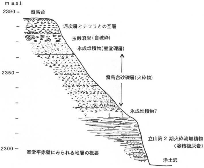
Show extracted lettering and translation
English translation of figure lettering
m a.s.l.; 2390; 2350; 2300; Raichodai; alternating peat and tephra; Tamadono lava (autobrecciated); glacial deposits (Murodo Gravel); Raichodai Sand and Gravel (pyroclastic material); glacial deposits?; Tateyama stage-2 pyroclastic-flow deposits (welded tuff); Jodozawa; outline of strata at Akakabe, Murododaira.
Original Japanese lettering
m a.s.l.;2390;2350;2300;雷鳥台;泥炭層とテフラとの互層;玉殿溶岩(自破砕);氷成堆積物(室堂礫層);雷鳥台砂礫層(火砕物);氷成堆積物?;立山第2期火砕流堆積物(溶結凝灰岩);浄土沢;室堂平赤壁にみられる地層の概要
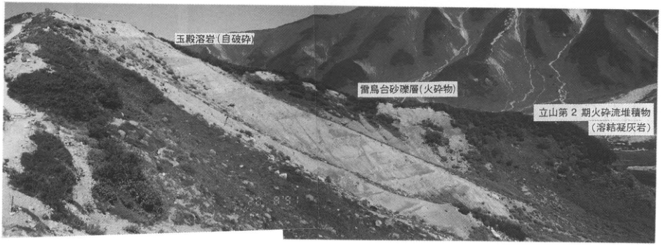
Show extracted lettering and translation
English translation of figure lettering
Tamadono lava (autobrecciated); Raichodai Sand and Gravel (pyroclastic material); Tateyama stage-2 pyroclastic-flow deposits (welded tuff).
Original Japanese lettering
玉殿溶岩(自破砕);雷鳥台砂礫層(火砕物);立山第2期火砕流堆積物(溶結凝灰岩)
CB-27 The Atotsugawa Fault exposure and Magawa lacustrine deposits in the upper Magawa River, Toyama Prefecture
奥村晃史
- Locality: Upper Magawa River, Oyama Town, Toyama Prefecture
- Coordinates: N36°31′05″ E137°30′42″
- Elevation: 1,160 m
- Outcrop type and condition: Artificial exposure; extant
- Deposit type and age: Sand and gravel and lacustrine deposits; Late Pleistocene
- Description date: September 1992
- Keywords: Active fault; Atotsugawa Fault; Magawa lacustrine deposits; Kikai-Tozurahara tephra; Tateyama volcano
Near its northeastern end, the Atotsugawa Fault trace runs northeast–southwest along the Magawa, a tributary of the Joganji River deeply incised into the northwestern Hida Mountains, and terminates inside the Tateyama caldera. Late Pleistocene impounded-lake deposits called the Magawa lacustrine deposits occur at elevations of 1,100–1,300 m over an area approximately coinciding with the fault's course along the river. At this exposure, the lacustrine deposits and underlying sand and gravel are juxtaposed against basement granite by a fault striking N50°E and dipping 80°SE (山田・竹内, 1983). The basal unconformity of the sand and gravel shows approximately 50 m of cumulative southeast-side-down displacement. Striations on the fault surface have a pitch of 20–30°SW, suggesting a right-lateral horizontal component two to three times the vertical component (山田・竹内, 1983). The lacustrine deposits near the fault exposure are 15–20 m thick and, near their base, consist of thin alternations of pale-brown fine sand to silt and brown silt to clay. These alternations contain numerous tree trunks flattened by compaction. Disturbed depositional structures also occur at several horizons. No tephra indicating depositional age has been detected in the lacustrine deposits near the fault exposure, but Kikai-Tozurahara tephra (75–95 ka; WS-10) has been detected in deposits considered part of the Magawa lacustrine sequence on the river's left bank north of Oritate. Activity of Tateyama volcano has also been considered a possible cause of the river impoundment that produced these deposits.
References: 大村 et al. (1990); 竹内 et al. (1990); 山田・竹内 (1983).
Large Magawa exposure of the Atotsugawa Fault, viewed by telephoto from the south. Granite abuts terrace gravel and the Magawa lacustrine deposits along a nearly vertical fault plane.
Schematic view of the large Magawa exposure, Atotsugawa Fault [Figure 12 of 竹内 et al. (1990), simplified and supplemented from 山田・竹内 (1983)].
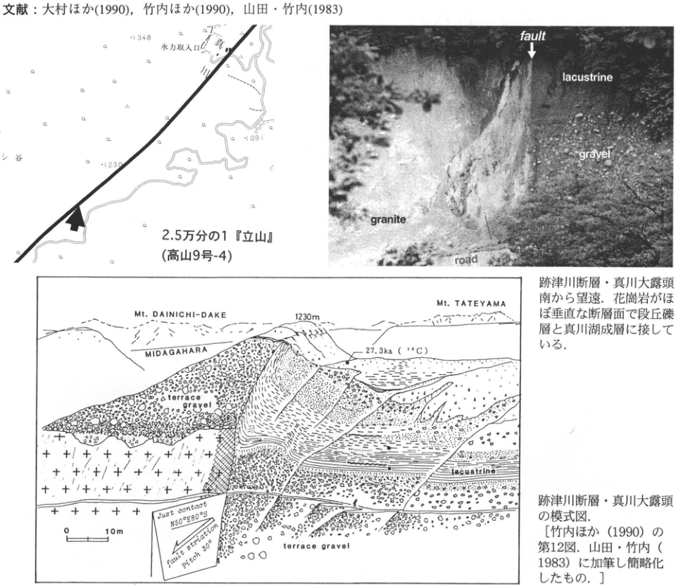
Show extracted lettering and translation
English translation of figure lettering
Hydropower intake; 1348; 1230; 1091; 1:25,000 “Tateyama” (Takayama sheet 9-4); fault; lacustrine; gravel; granite; road; Mt. DAINICHI-DAKE; MIDAGAHARA; Mt. TATEYAMA; 1230 m; 27.3 ka (¹⁴C); terrace gravel; lacustrine; 0; 10 m; Just contact N50°E80°S; fault striation pitch 30°.
Original Japanese lettering
水力取入口;1348;1230;1091;2.5万分の1『立山』(高山9号-4);fault;lacustrine;gravel;granite;road;Mt. DAINICHI-DAKE;MIDAGAHARA;Mt. TATEYAMA;1230m;27.3ka(¹⁴C);terrace gravel;lacustrine;0;10m;Just contact N50°E80°S;fault striation pitch 30°
CB-28 Sambe-Kisuki tephra on the Hiradoko Plateau, Noto Peninsula
豊蔵勇
- Locality: Uji, Misaki-machi, Suzu City, Ishikawa Prefecture
- Coordinates: N37°27′59″ E137°20′43″
- Elevation: 23 m
- Outcrop type and present condition: Artificial exposure (small scarp beside a field)
- Deposit type and age: Marine terrace deposits; water-laid volcanic ash; Late Pleistocene
- Date of description: 1989
- Keywords: Sambe-Kisuki tephra; Hiradoko Plateau; Uji shell bed
Sambe-Kisuki tephra (SK) has been discovered at four sites on the Hiradoko Plateau, Noto Peninsula (豊蔵 et al., 1991). At three sites it is interbedded in the uppermost marine sand forming the lower terrace surface at elevations of 20–30 m. At the remaining site it occurs in reddish-brown soil overlying marine terrace sand at an elevation of 60 m.
The photographed exposure is a small scarp created when a field was made beside the prefectural road 20–50 m west of the Uji shell-bed locality (solid square; 北陸第四紀研究グループ, 1969). SK occurs at approximately field-surface level, is yellow-orange, and is up to 15 cm thick. The sand or gravelly sand containing SK is approximately 5 m thick and is widely distributed, forming a terrace surface at 20–30 m elevation. At the diatomite quarry marked by a solid circle, valley-fill deposits occur below it. At their base is muddy sand containing abundant brackish-water shells, including Corbicula japonica. This shell bed occurs within pothole-like depressions formed by wave erosion of diatomaceous mudstone. It differs from the Uji shell bed, whose assemblage consists largely of shallow-marine, cold-current species (豊蔵 et al., 1991).
The discovery of the widespread SK tephra on the lower surface of the Hiradoko Plateau, a reference locality for middle and lower terraces in Hokuriku, indicates from its stratigraphic position and age that this surface correlates with the Obaradai surface of southern Kanto. The finding is significant because it requires reconsideration of the formation ages and processes of the Uji surface and shell bed, and ultimately of the Hiradoko shell bed as well.
References: 北陸第四紀研究グループ (1969); 豊蔵 et al. (1991).
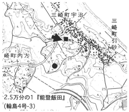
Show extracted lettering and translation
English translation of figure lettering
1:25,000 Noto-Iida (Wajima sheet 4-3); Uji, Misaki-machi; Hikisuna (引砂), Misaki-machi; 箭田 (name reading unverified); 25; solid square; solid circle; arrow.
Original Japanese lettering
2.5万分の1『能登飯田』(輪島4号-3);三崎町宇治;三崎町引砂;箭田;25;■;●;矢印。
Reading notes
その他の極小地図文字 — 解像度不足。
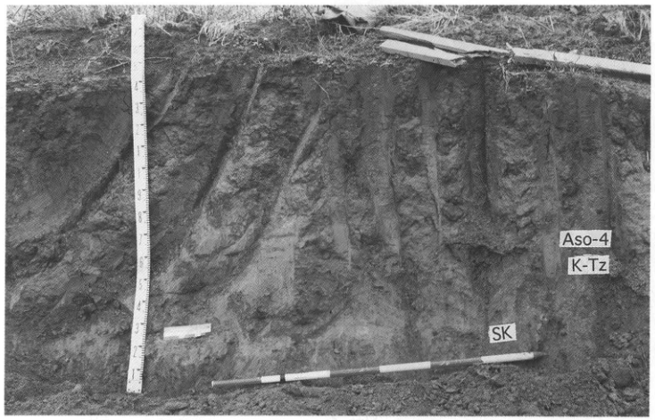
Show extracted lettering and translation
English translation of figure lettering
NE; SW; Aso-4; K-Tz; SK. Measuring-rod numerals including 1–9.
Original Japanese lettering
NE;SW;Aso-4;K-Tz;SK.測尺目盛の数字1~9等。
CB-29 Holocene peat beds and tephras at Midagahara, Hakusan
辻誠一郎
- Locality: Midagahara, Shiramine Village, Ishikawa District, Ishikawa Prefecture
- Coordinates: N36°8′30″ E136°46′7″
- Elevation: 2,335 m
- Outcrop type and present condition: Exposure along a hiking trail, surviving
- Deposit type and age: Peat and peaty deposits; Holocene
- Date of description: September 1982
- Keywords: Midagahara, Hakusan; Kikai-Akahoya tephra; vegetation history; snow patch; Hakusan-derived tephra
Midagahara, south of Gozengamine, the principal summit of Hakusan volcano, lies on a gentle slope at elevations of 2,325–2,350 m. Almost the entire area is wet grassland, with sloping peatlands supplied by meltwater from snow patches. Peat sections are exposed at numerous points along the hiking trail crossing the area, allowing observation of tephras produced mainly by eruptions of Hakusan. The peat sequence consists of peat, peaty deposits, and sand, reaching 1.5 m at its thickest. Radiocarbon dating places its basal age at approximately 11 ka, near the end of the last glacial period, or slightly earlier (遠藤, 1985). Eighteen primary tephra beds are distinguished in peat at Midagahara and at Minamiryugabanba to the south, named Hm-1 through Hm-16 upward, with Hm-7′ and Hm-9′ inserted between them (遠藤, 1985). Hm-6 was correlated with the widespread Kikai-Akahoya tephra (K-Ah). Almost all the other tephras are thought to derive from eruptions of Younger Hakusan. Particularly conspicuous are the Midagahara ash (Hm-4) and Nanryu ash (Hm-10). Together with K-Ah, the latter is among the tephras most commonly observed in sloping peatlands throughout Hakusan volcano, as well as at Midagahara. Available radiocarbon ages indicate approximately 10 ka for Hm-4 and 2.6 or 2.3 ka for Hm-10 (遠藤, 1985; 東野 et al., 1991).
Paleoenvironmental studies are investigating ecosystem changes in the mountains since the end of the last glacial period. They have shown that snow patches formed at the end of that period and developed into fully established meltwater-fed peatlands shortly before K-Ah deposition (辻, 1985; 矢笠 et al., 1994).
References: 遠藤 (1985); 高柳・守屋 (1991); 辻 (1985); 東野 et al. (1991); 矢笠 et al. (1994).
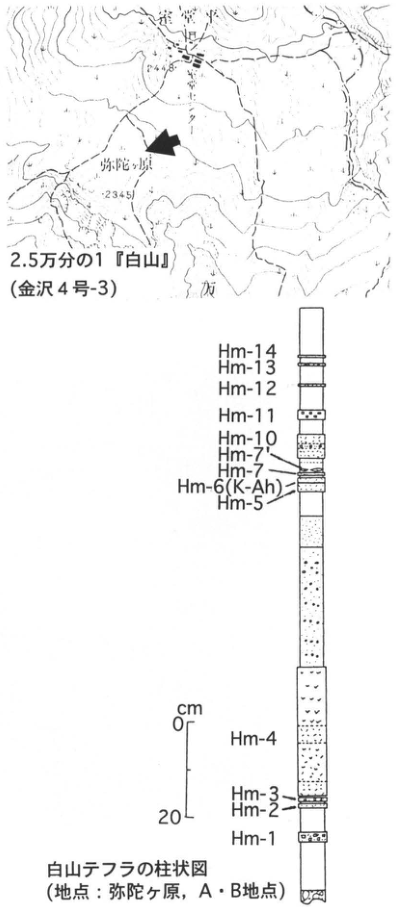
Show extracted lettering and translation
English translation of figure lettering
1:25,000 Hakusan (Kanazawa sheet 4-3); Midagahara; 2448; 2345; arrow.
Original Japanese lettering
2.5万分の1『白山』(金沢4号-3);弥陀ヶ原;2448;2345;矢印。
Reading notes
その他の極小文字 — 解像度不足。
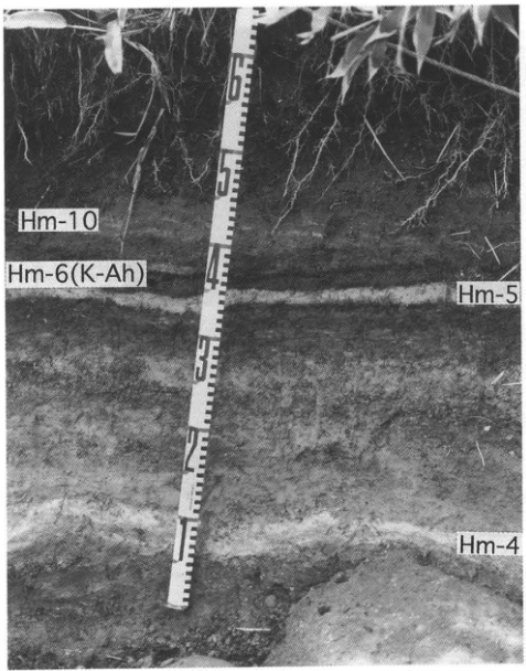
Show extracted lettering and translation
English translation of figure lettering
Photograph: Hm-10, Hm-6 (K-Ah), Hm-5, Hm-4. Column, top to bottom: Hm-14, Hm-13, Hm-12, Hm-11, Hm-10, Hm-7′, Hm-7, Hm-6 (K-Ah), Hm-5, Hm-4, Hm-3, Hm-2, Hm-1. Scale in cm: 0, 20. Column of Hakusan tephras (locality: Midagahara, sites A and B).
Original Japanese lettering
写真:Hm-10,Hm-6(K-Ah),Hm-5,Hm-4.柱状図(上から):Hm-14,Hm-13,Hm-12,Hm-11,Hm-10,Hm-7′,Hm-7,Hm-6(K-Ah),Hm-5,Hm-4,Hm-3,Hm-2,Hm-1.尺度cm:0,20.白山テフラの柱状図(地点:弥陀ヶ原,A・B地点).
CB-30 Aso-4 tephra interbedded in marine deposits of the Kaga-Hashitate Plateau
豊蔵勇
- Locality: Kurosaki-machi, Kaga City, Ishikawa Prefecture
- Coordinates: N30°20′11″ E136°17′41″ [as printed]
- Elevation: 22 m
- Outcrop type and present condition: Artificial exposure (small scarp beside a path)
- Deposit type and age: Marine terrace deposits; water-laid volcanic ash; Late Pleistocene
- Date of description: 1989
- Keywords: Aso-4 tephra; Katayamazu Formation; Kaga-Hashitate Plateau
On the Kaga-Hashitate Plateau, Aso-4 tephra is found within marine sand in an exposure beside a path descending the sea cliff of a plateau capped by old dune sand (豊蔵 et al., 1991). Aso-4 is yellow-orange, 2–4 cm thick, and interbedded in terrace deposits of coarse sand. Fossils of marine bivalves occur immediately above and below it, although weathering has made them fragile. Poor exposure makes it uncertain whether the beds from the unconformity to the tephra constitute a continuous sequence. Coarse sand with steeply inclined laminae, interpreted as old dune sand, also occurs at least 3–4 m above the tephra.
This marine sand is thought to correspond to what has traditionally been called the Upper Katayamazu Formation (北陸第四紀研究グループ, 1969). However, poor coastal exposure makes it uncertain whether the two are continuous or whether this sand occurs unconformably above the Upper Katayamazu sand. Further investigation is required.
From its stratigraphic position, the Aso-4-bearing marine sand probably correlates with the deposits forming the Misaki terrace in southern Kanto. Marine deposits of this age are rarely found above 25 m elevation, even in the Japanese archipelago with its vigorous uplift. The occurrence is significant in demonstrating that at least the northern Echizen coast is an area of pronounced uplift (豊蔵 et al., 1991).
References: 北陸第四紀研究グループ (1969); 豊蔵 et al. (1991).
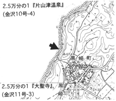
Show extracted lettering and translation
English translation of figure lettering
1:25,000 Katayamazu-Onsen (Kanazawa sheet 10-4); 1:25,000 Daishoji (Kanazawa sheet 11-3); Kurosaki-machi; 67.2; 23; 24.9; 50; arrow.
Original Japanese lettering
2.5万分の1『片山津温泉』(金沢10号-4);2.5万分の1『大聖寺』(金沢11号-3);黒崎町;67.2;23;24.9;50;矢印。
Reading notes
極小地図文字 — 一部判読不明。
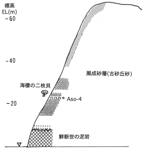
Show extracted lettering and translation
English translation of figure lettering
Elevation EL(m): 20, 40, 60. From top: aeolian sand (old dune sand); marine bivalves; Aso-4; Pliocene mudstone.
Original Japanese lettering
標高 EL(m):20,40,60.上から:風成砂層(古砂丘砂);海棲の二枚貝;Aso-4;鮮新世の泥岩.
CB-31 Large-scale pyroclastic flows sourced in the Hida Mountains (1): Middle Pleistocene Kamitakara pyroclastic-flow deposit and its source conduit
原山智
- Locality: Osobu Valley, Fukuji, Kamitakara Village, Yoshiki District, Gifu Prefecture
- Coordinates: N36°12′44″ E137°30′21″
- Elevation: 1,540 m
- Outcrop type and present condition: Natural exposure, surviving in January 1996
- Deposit type and age: Large-scale pyroclastic-flow deposit; Middle Pleistocene
- Date of description: 1990
- Keywords: Hida Mountains; Kamitakara pyroclastic-flow deposit; Fukuji Tuff Breccia Formation
This exposure, commonly called “Kabe” (the wall), forms a steep cliff approximately 200 m high, 2.5 km west-northwest of the source conduit. It is one of the few examples where a continuous section through a large-scale pyroclastic-flow deposit can be observed close to its source. A gently undulating surface called “Happongahara” (八本原) extends approximately 9 km westward from here (the pyroclastic-flow plateau of the Hida Highlands; 日本火山学会, 1984). It is a remnant of the depositional surface of the Kamitakara pyroclastic flow. A welded zone approximately 200 m thick, with well-developed columnar joints, is visible at this exposure. Below it are a nonwelded zone and the underlying Fukuji Tuff Breccia Formation (金子 et al., 1976). The latter consists chiefly of block-and-ash-flow deposits and is restricted to the vicinity of the source conduit; it is therefore interpreted as part of a former volcanic edifice near the conduit. A conglomerate occurs at its base (solid square on the topographic map) and was correlated with the Kiriyama gravel of the Takayama Basin by 斎藤 et al. (1984). This gravel indicates that a river flowed from near Kamikochi to Takayama during the Middle Pleistocene and is important for reconstructing the paleotopography. For descriptions of the individual lithofacies and the Kaisho (貝塩) source conduit of the Kamitakara pyroclastic flow, consult the 1:50,000 Kamikochi geological map sheet (原山, 1990).
The exposure is reached by following the Osobu Valley forestry road from Fukuji. A gate was recently installed near the road entrance, restricting vehicle access. Those entering for surveys or similar purposes are advised to inquire about forest-entry procedures at the Kamioka Forestry Office (TEL 0578-2-1106).
References: 原山 (1990); 金子 et al. (1976); 日本火山学会 (1984); 斎藤 et al. (1984).
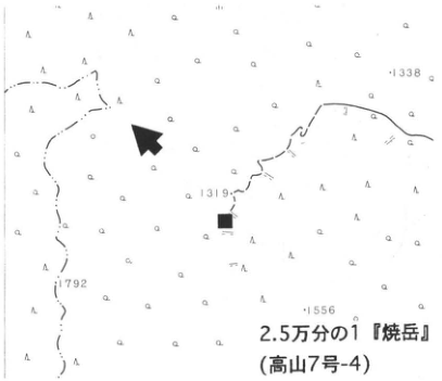
Show extracted lettering and translation
English translation of figure lettering
1:25,000 Yakedake (Takayama sheet 7-4); 1338; 1319; 1792; 1556; arrow; solid square.
Original Japanese lettering
2.5万分の1『焼岳』(高山7号-4);1338;1319;1792;1556;矢印;■.
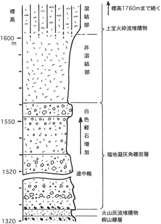
Show extracted lettering and translation
English translation of figure lettering
Elevation: 1600 m, 1550, 1520, 1320. Continues upward to 1760 m elevation. Top to bottom: Kamitakara pyroclastic-flow deposit (welded and nonwelded zones); Fukuji Tuff Breccia Formation (white pumice increases upward; intervening interval omitted); volcanic-ash-flow deposit; Kiriyama gravel.
Original Japanese lettering
標高:1600m,1550,1520,1320.標高1760mまで続く.上から:上宝火砕流堆積物(溶結部,非溶結部);福地凝灰角礫岩層(上方へ白色軽石増加;途中略);火山灰流堆積物;桐山礫層.
CB-32 Large-scale pyroclastic flows sourced in the Hida Mountains (2): Middle Pleistocene Kamitakara pyroclastic-flow deposit
原山智
- Locality: 数河, Takayama City, Gifu Prefecture
- Coordinates: N36°8′8″ E137°21′13″
- Elevation: 720 m
- Outcrop type and present condition: Artificial exposure, surviving in April 1996
- Deposit type and age: Large-scale pyroclastic-flow deposit; Middle Pleistocene
- Date of description: 1990
- Keywords: Hida Mountains; Kamitakara pyroclastic-flow deposit; Nyukawa pyroclastic-flow deposit
This exposure approximately 5 km east of Takayama City is a former quarry. Its excellent exposure and convenient roadside position have made it well known as a representative section. Since quarrying ceased, freshly broken surfaces have become harder to observe, and unfortunately a road tunnel was recently constructed through the middle of the exposure. Nevertheless, it remains the freshest and most readily observed exposure of the Kamitakara pyroclastic-flow deposit around the Takayama Basin. It is 18 km from the source and is the most distal locality of the welded lithofacies. Approximately 40 m of vertical section is visible. Typical columnar joints occur throughout, except in the lowest few meters of nonwelded material. At the top, the joints are somewhat indistinct, reflecting weaker welding. No clear cooling break is recognized, and the deposit comprises one cooling unit. Repeated vertical changes in the abundance and sizes of pumice and lithic fragments (column in 山田 et al., 1985), however, indicate multiple flow units. When the exposure was in better condition, banding marking flow-unit boundaries could be seen from a distance in its upper part (see photograph). Biotite in a sample from this exposure yielded a K–Ar age of 0.65±0.25 Ma (柴田・山田, 1977), and its natural remanent magnetization is known to have normal polarity (丹治 et al., 1977; 斎藤 et al., 1984). The latest Pliocene Nyukawa pyroclastic-flow deposit is exposed along the road to the east and is overlain by the Kamitakara deposit across an irregular unconformity.
References: 斎藤 et al. (1984); 柴田・山田 (1977); 丹治 et al. (1977); 山田 et al. (1985).
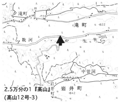
Show extracted lettering and translation
English translation of figure lettering
1:25,000 Takayama (Takayama sheet 12-3); Takimachi; 数河 (reading unverified); Nakazobora (中曽洞); Iwai-machi; Iwai; Kawakami; 778; 822; 842; arrow.
Original Japanese lettering
2.5万分の1『高山』(高山12号-3);滝町;数河;中曽洞;岩井町;岩井;川上;778;822;842;矢印。
Reading notes
固有名の読み・極小文字 — 未確認の地名は日本語併記。
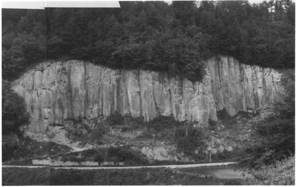
CB-33 Large-scale pyroclastic flows sourced in the Hida Mountains (3): Ebisutoge pyroclastic deposit and Nyukawa pyroclastic-flow deposit
原山智
- Locality: Name-dani (滑谷), Nyukawa Village, Gifu Prefecture
- Coordinates: N36°11′39″ E137°20′21″
- Elevation: 790 m
- Outcrop type and present condition: Artificial exposure
- Deposit type and age: Pyroclastic-flow deposits; latest Pliocene
- Date of description: 1995
- Keywords: Hida Mountains; Takayama Basin; Nyukawa pyroclastic-flow deposit; Ebisutoge pyroclastic-flow deposit
This excellent exposure allows almost all the principal latest Pliocene to Early Pleistocene tephras around the Takayama Basin to be observed under favorable conditions. It is a cut slope made by excavating a ridge to create fields for highland vegetables and other crops. From bottom to top, the observable units are the Nyukawa pyroclastic-flow deposit, Name-dani ash-fall bed, Chayano Tuff Formation, and Ebisutoge pyroclastic deposit. The uppermost Ebisutoge deposit is approximately 18 m thick. Its continuous transition from a lower nonwelded facies to an upper welded facies is so typical and striking that it could serve as a textbook example. Revegetation work in spring 1996 made the best exposure inaccessible to observation, but exposures under almost equivalent conditions survive on the cut slopes to both east and west.
For detailed descriptions and columns of the individual tephras, consult 長橋 (1995); for correlations with widespread tephras, consult 長橋 et al. (1996).
References: 長橋 (1995); 長橋・小坂・日比 (1996).
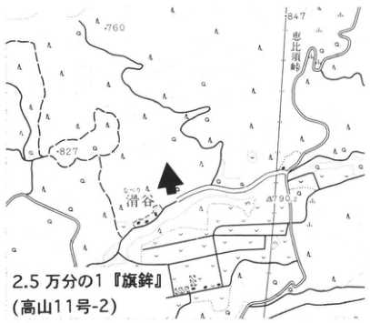
Show extracted lettering and translation
English translation of figure lettering
1:25,000 Hatahoko (旗鉾; Takayama sheet 11-2); Name-dani (滑谷); Ebisutoge; 760; 847; 827; 790.2; arrow.
Original Japanese lettering
2.5万分の1『旗鉾』(高山11号-2);滑谷;恵比須峠;760;847;827;790.2;矢印。
Reading notes
地名の読み — 滑谷・旗鉾は推定読みに日本語を併記。
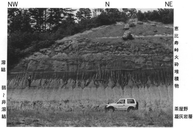
Show extracted lettering and translation
English translation of figure lettering
NW; N; NE; welded; weakly welded to nonwelded; Ebisutoge pyroclastic deposit; Chayano Tuff Formation.
Original Japanese lettering
NW;N;NE;溶結;弱~非溶結;恵比寿峠火砕堆積物;茶屋野凝灰岩層。
CB-34 Trench excavation of the Atotsugawa fault in the Nokubi district, Miyagawa Village, Gifu Prefecture
奥村晃史
- Locality: Nokubi, Miyagawa Village, Gifu Prefecture
- Coordinates: N36°19′28″ E137°08′26″
- Elevation: 410 m
- Outcrop type and present condition: Artificial exposure (trench), restored
- Deposit type and age: Sand, silt, and sand-and-gravel beds; latest Pleistocene–Holocene
- Date of description: August 1983
- Keywords: Trench; Atotsugawa fault; earthquake fault; active fault; Hietsu earthquake
The Atotsugawa fault is an active fault extending northeast–southwest across the northern Hida Mountains for approximately 70 km. Its average displacement rate per 1,000 years is 3–5 m of right-lateral slip and 1–1.5 m of north-side uplift (松田, 1966; 活断層研究会, 1991). The trench investigation at Nokubi, Miyagawa Village, by 跡津川断層トレンチ発掘調査団 (1989) was conducted where the fault forms an approximately 5 m high scarp, with the southeastern side downthrown, on a river terrace on the right bank of the Miyagawa. The trench was approximately 23 m long, at most 13 m deep, and at most 14 m wide. On the footwall, 1.5 m of stratified flood deposits overlie 4 m of coarse terrace gravel. Near the fault, wedge-shaped colluvium pinching out toward the footwall is interbedded with them. Between these deposits and granite exposed on the uplifted side, a steep fault striking N60–70°E and dipping 65–75° north cuts the ground surface at the base of the scarp. Striations on the fault plane predominantly have a pitch of 15–20°W, consistent with the right-lateral, north-side-up movement inferred from the landform. Subsidiary faults branching from the main fault displace the footwall flood deposits and agree with the stress configuration reconstructed from the striations. The distribution of deposits across these subsidiary faults, deposition of talus from slope failures associated with fault movement, and crosscutting and burial relations between faults and strata indicate ten events after terrace-gravel deposition. Four occurred within the past approximately 8,600 years; the latest is thought to correspond to the 1858 Hietsu earthquake (跡津川断層トレンチ発掘調査団, 1989).
References: 跡津川断層トレンチ発掘調査団 (1989); 活断層研究会 (1991); 松田 (1966).
West-wall log and event horizons of the Nokubi trench on the Atotsugawa fault [Figs. 5 and 9 of 跡津川断層トレンチ発掘調査団 (1989)].
1: fill; 2: paddy-field soil; 3: humic soil; 4: humic sand; 5: gravel; 6: coarse sand; 7: medium sand; 8: fine sand; 9: granite; 10: limestone; 11: fault; 12: fault clay; 13: radiocarbon sample and age (y.BP); 14: unit number.
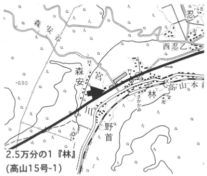
Show extracted lettering and translation
English translation of figure lettering
1:25,000 Hayashi (Takayama sheet 15-1); Nokubi; Moriyasu; Hayashi; Takayama Main Line; Miyagawa; 西忍 (reading unverified); 695; 648; arrow.
Original Japanese lettering
2.5万分の1『林』(高山15号-1);野首;森安;林;高山本線;宮川;西忍;695;648;矢印。
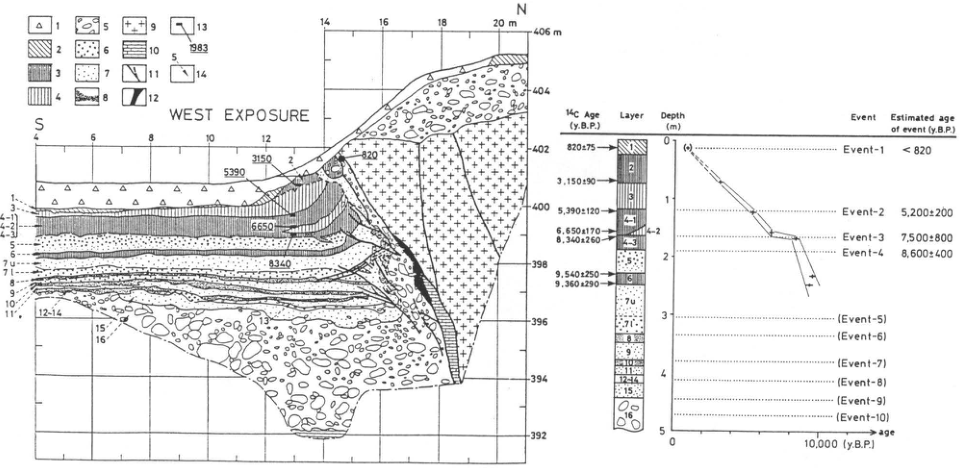
Show extracted lettering and translation
English translation of figure lettering
WEST EXPOSURE; S, N. Horizontal distances 4, 6, 8, 10, 12, 14, 16, 18, 20 m; elevations 392–406 m at 2 m intervals. Wall ages: 3150, 5390, 6650, 8340. Units: 1, 3, 4-1, 4-2, 4-3, 5, 6, 7u, 7l, 8, 9, 10, 11, 12-14, 15, 16. Legend symbols 1–14 are explained in the main text.
| ¹⁴C Age (y.B.P.) | Layer |
|---|---|
| 820±75 | 1 |
| 3,150±90 | 2 |
| 5,390±120 | near 3/4-1 |
| 6,650±170 | near 4-2 |
| 8,340±260 | near 4-3 |
| 9,540±250 | 6 |
| 9,360±290 | 6 |
Depth(m): 0, 1, 2, 3, 4, 5. Event / Estimated age of event (y.B.P.): Event-1 <820; Event-2 5,200±200; Event-3 7,500±800; Event-4 8,600±400; (Event-5) through (Event-10). Age axis: 0, 10,000 (y.B.P.).
Original Japanese lettering
WEST EXPOSURE;S,N.水平距離4,6,8,10,12,14,16,18,20m;標高392~406m(2m間隔).壁面年代3150,5390,6650,8340.ユニット1,3,4-1,4-2,4-3,5,6,7u,7l,8,9,10,11,12-14,15,16.凡例記号1~14(説明は本文).
| ¹⁴C Age (y.B.P.) | Layer |
|---|---|
| 820±75 | 1 |
| 3,150±90 | 2 |
| 5,390±120 | 3/4-1付近 |
| 6,650±170 | 4-2付近 |
| 8,340±260 | 4-3付近 |
| 9,540±250 | 6 |
| 9,360±290 | 6 |
Depth(m):0,1,2,3,4,5.Event/Estimated age of event (y.B.P.):Event-1 <820;Event-2 5,200±200;Event-3 7,500±800;Event-4 8,600±400;(Event-5)~(Event-10).age:0,10,000(y.B.P.).
Reading notes
放射性炭素試料と細かなユニット境界 — 矢印先が境界近くにあるので年代とユニットの厳密な対応は原図参照。
CB-35 Trench excavation of the Yugamine fault, Atera fault system, at Mitsuishi, Gero Town, Gifu Prefecture
奥村晃史
- Locality: Mitsuishi, Gero Town, Gifu Prefecture
- Coordinates: N35°47′10″ E137°17′45″
- Elevation: 605 m
- Outcrop type and present condition: Artificial exposure (trench), restored
- Deposit type and age: Peat and sand-and-gravel beds; Holocene
- Date of description: July 1986
- Keywords: Trench; active fault; Atera fault; Mitsuishi fault; Tensho earthquake
The Atera fault system is a prominent left-lateral fault system approximately 70 km long, extending northwest–southeast to north-northwest–south-southeast along the northeastern margin of the Mino–Mikawa Highlands. Numerous geomorphological and geological investigations, including trenching at more than ten sites, have been conducted (活断層研究会, 1991; 佃 et al., 1993). The Yugamine fault (佃 et al., 1993) is approximately 10 km long and lies at the northern end of the central part of the northwest–southeast-trending system. Ridges and valleys show systematic deflections along its trace, and terrace surfaces are displaced. The Mitsuishi trench site is on a lower terrace surface formed on the valley floor of a tributary of the Norimasa River. Fine material impounded by a 2–4 m high fault scarp has accumulated on the downthrown upstream (northeastern) side, forming low wetlands.
Trenches were excavated across this scarp in 1986 and 1990 (岡田 et al., 1987; 佃 et al., 1993). The trench at Loc. 7 on the detailed topographic map (figure) exposed a steep fault juxtaposing Nohi rhyolite basement and terrace deposits. Peat slightly less than 1 m thick overlies the terrace gravel. Five horizons of prism-shaped sand and gravel deposited during fault movement were recognized adjacent to the basement. The four most recent events are thought to have occurred at intervals of approximately 2,000 years during the past approximately 7,000 years. A small trench at Loc. 6 on the detailed map showed that the latest event occurred after approximately 1,000 years ago. Together with the results of 遠田 et al. (1994, 1995), this suggests that the latest activity of the Atera fault system corresponds to the 1586 Tensho earthquake.
References: 遠田 et al. (1994, 1995); 活断層研究会 (1991); 岡田 et al. (1987); 佃 et al. (1993).
Detailed topographic map near the Mitsuishi trench on the Yugamine fault and northwest-wall log [Figs. 8 and 11 of 佃 et al. (1993)].
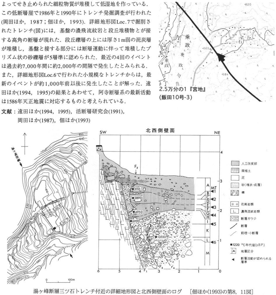
Show extracted lettering and translation
English translation of figure lettering
Map: 1:25,000 Miyaji (Iida sheet 10-3); Mitsuishi; Norimasa; Norimasa River; 820; 665; 684. Detailed map: Yugamine fault; Loc.6; Loc.7; 28a; 28b; 28c; contours 550–650 at 10 m intervals; 0, 100 m. Northwest wall: SW, NE; horizontal 0–6; vertical 1–4; F1, F2, F3, F4; units A, B, C, D, E, F, G, H, I, K, L, M; MT; events 1–6. Ages: 3110, 3890, 4950, 6990, 13550. Legend: artificially modified material; humic soil; mud; sand (massive/stratified); gravel; granitic rocks; Nohi rhyolitic rocks; fault gouge; fault; joint/minor fault; solid square 1220, radiocarbon age (y.B.P.); A, stratigraphic division; left triangle, horizon showing fault activity. Text and reference fragments are retained in the main text.
Original Japanese lettering
地図:2.5万分の1『宮地』(飯田10号-3);三ツ石;乗政;乗政川;820;665;684.詳細図:湯ヶ峰断層;Loc.6;Loc.7;28a;28b;28c;等高線550~650(10m間隔);0,100m.北西側壁面:SW,NE;水平0~6;縦1~4;F1,F2,F3,F4;地層A,B,C,D,E,F,G,H,I,K,L,M;MT;イベント1~6.年代:3110,3890,4950,6990,13550.凡例:人工改変部;腐植土;泥;砂(塊状・成層);礫;花崗岩類;濃飛流紋岩類;断層ガウジ;断層;節理・小断層;■1220 ¹⁴C年代値(y.B.P.);A 地層区分;◀ 断層活動が認められる層準.本文・文献断片は本文に収録。
CB-36 Takada trench on the Umehara fault, Nobi fault system
奥村晃史
- Locality: Takada, Takatomi Town, Gifu Prefecture
- Coordinates: N35°31′07″ E136°44′37″
- Elevation: 30 m
- Outcrop type and present condition: Artificial exposure (trench), restored
- Deposit type and age: Peat beds, sand, and silt; Late Pleistocene–Holocene
- Date of description: August 1981
- Keywords: Trench; Nobi fault system; Umehara fault; earthquake fault; Nobi earthquake
On October 28, 1891, a major magnitude-8.0 earthquake originating in western Gifu Prefecture caused severe damage and more than 7,000 deaths. In this earthquake, named the Nobi earthquake, the Nukumi, Neodani, and Umehara faults and others acted as earthquake-generating faults, producing surface displacement over approximately 80 km, with maximum right-lateral displacement reaching 8 m (松田, 1974). These active faults are collectively called the Nobi fault system. The Umehara fault is approximately 10 km long, lies farthest southeast in the system, and runs parallel to the southern Neodani, Nagataki, and Mugigawa faults, which did not move in 1891 (活断層研究会, 1991). Takada in Takatomi Town, trenched in 1981, lies on the margin of a small subsiding and aggrading basin formed by left-lateral movement of the Umehara fault with uplift on its southwestern side. The trench investigation by 岡田 et al. (1992) exposed 2–3 m of soft, mainly peaty beds overlying sand and gravel older than 30,000 years. A 2–3 cm thick Kikai-Akahoya tephra (K-Ah) occurs approximately 50 cm below the ground surface, and Aira-Tanzawa tephra (AT), up to approximately 20 cm thick, occurs at approximately 1 m depth. AT is locally deformed into waves and varies greatly in thickness. Apart from being faulted at the bottom of the exposure, the mainly peaty beds dip gently northeast over the fault zone and thicken in that direction, with clay and silt interpreted as flood deposits interbedded on the downthrown side. These deformation and depositional relationships indicate three events before 1891: approximately 20,000 years ago, 28,000 years ago, and earlier than 30,000 years ago. These recurrence intervals are markedly longer than those of the Neodani fault (岡田 et al., 1992).
References: 活断層研究会 (1991); 松田 (1974); 岡田 et al. (1992).
Takada trench on the Umehara fault (Fig. 5 of 岡田 et al., 1992).
1: paddy-field soil; 2: clay–silt; 3: sand and gravel; 4: peat; 5: K-Ah ash; 6: AT ash; 7: fault; 8: event horizon; 9: radiocarbon age.
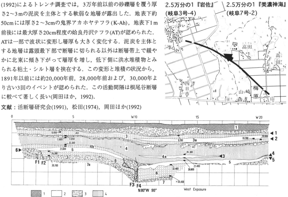
Show extracted lettering and translation
English translation of figure lettering
Map: 1:25,000 Iwasa (Gifu sheet 3-4); 1:25,000 Mino-Komi (美濃神海; Gifu sheet 7-2); Takada; Umehara; Yamazaki; Yokkaichi; 91; 26. West wall: West Exposure; N80°W 90°; distances 0, 5, W10, 15, W20; F1, F2, F3, F4; units 1, 2, 3, 3a, 4, 4a, 4b, 5, 6, 7, 7a; Ah; AT; events 1–6. Ages: 6,950; 17,800; 17,050; 32,300; 27,000; 29,200; 30,700; 6,160; 19,200; 20,900; 24,380; 27,490; 30,800; 33,460; >35,430. Legend 1–9 is in the main text. Text and reference fragments are restored there.
Original Japanese lettering
地図:2.5万分の1『岩佐』(岐阜3号-4);2.5万分の1『美濃神海』(岐阜7号-2);高田;梅原;山崎;四日市;91;26.西壁:West Exposure;N80°W 90°;距離0,5,W10,15,W20;F1,F2,F3,F4;ユニット1,2,3,3a,4,4a,4b,5,6,7,7a;Ah;AT;イベント1~6.年代:6,950;17,800;17,050;32,300;27,000;29,200;30,700;6,160;19,200;20,900;24,380;27,490;30,800;33,460;>35,430.凡例1~9は本文.本文・文献断片も本文に復元。
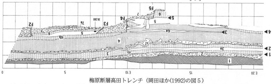
Show extracted lettering and translation
English translation of figure lettering
East Exposure; distances 0, 5, E10, 15, E20; F2, F3, F4, F5; units 1, 2, 3, 3a, 4, 4a, 4b, 5, 6, 7, 7a; AT; events 1–5; age 30,300.
Original Japanese lettering
East Exposure;距離0,5,E10,15,E20;F2,F3,F4,F5;ユニット1,2,3,3a,4,4a,4b,5,6,7,7a;AT;イベント1~5;年代30,300.
CB-37 Middle Pleistocene tephras on the Atsumi Peninsula, Aichi Prefecture
杉山雄一
- Localities: Hosoya-machi, Toyohashi City (At-2), and Takatsuka coast, Toyohashi City (At-3), Aichi Prefecture
- Coordinates: N34°40′20″ E137°28′05″ (At-2); N34°39′26″ E137°24′17″ (At-3)
- Elevations: 34 m (At-2); 14 m (At-3)
- Outcrop type and present condition: Artificial exposure (At-2), sea cliff (At-3), surviving in February 1996
- Deposit type and age: Aeolian tephra and subaqueously deposited tephra; Middle Pleistocene
- Date of description: February 1996
- Keywords: Atsumi Peninsula; Atsumi Group; At-2; At-3
The Middle Pleistocene Atsumi Group is widely distributed on the Atsumi Peninsula. It comprises three transgression–regression depositional cycles, named upward the Futagawa, Tahara, and Toyohashi formations (黒田, 1966). The uppermost Toyohashi Formation forms the high marine terrace surface called Tempakubara. Five tephras, At-1 through At-5 upward, have been reported from the Atsumi Group (杉山, 1991). Here the exposures described are At-2, interbedded in the uppermost Futagawa Formation, and At-3, within incised-valley-fill deposits (Akazawa mud) in the lower Tahara Formation. At-2 can be observed in an artificial cliff on the right side of the road at a left-hand bend approximately 500 m before the coast, reached by descending the road from Hosoya-machi, Toyohashi City, toward the shore. The lower cliff exposes regressive deposits representing a transition from shallow sea through beach to back marsh. At-2 is interbedded in the lower part of the back-marsh humic bed. It is a 15–18 cm thick, white silty ash with a slight pink tint. At-3 is visible in the sea cliff on the Takatsuka coast, Toyohashi City. The lower cliff exposes approximately 3–4 m of Ikobe gravel unconformably overlying sandy silt of the Futagawa Formation. Above this is approximately 15 m of silt to clay, the Akazawa mud. At-3 occurs in the lower part of that mud and consists of a pair of 1–2 cm thick, medium- to coarse-sand-sized ash beds. The two ash beds are separated stratigraphically by 5–8 cm. Pollen analyses show that the At-3 horizon represents a warming phase. For details of tephras in the Atsumi Group, see 杉山 (1991).
References: 廣木・木宮 (1990); 黒田 (1966); 島本 et al. (1994); 杉山 (1991).
At-3 exposure locality map and photograph (photographed February 1987).
At-2 exposure locality map and photograph (photographed February 1987).
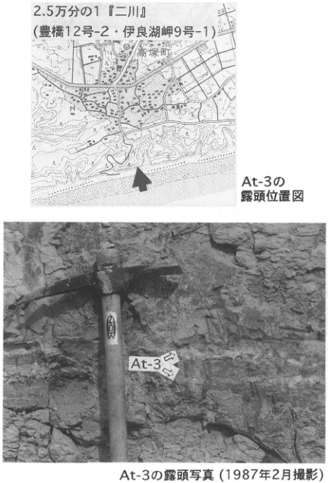
Show extracted lettering and translation
English translation of figure lettering
1:25,000 Futagawa (Toyohashi sheet 12-2 / Irago-Misaki sheet 9-1); Takatsuka-machi; At-3; two arrows.
Original Japanese lettering
2.5万分の1『二川』(豊橋12号-2・伊良湖岬9号-1);高塚町;At-3;矢印2本.
Reading notes
極小地図文字 — 一部判読不明。
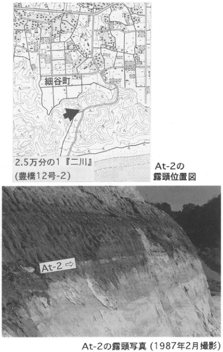
Show extracted lettering and translation
English translation of figure lettering
1:25,000 Futagawa (Toyohashi sheet 12-2); Hosoya-machi; At-2; arrow.
Original Japanese lettering
2.5万分の1『二川』(豊橋12号-2);細谷町;At-2;矢印。
6. Kinki region
KK-1 Volcanic-ash stratigraphy of the Takashima-oki borehole, Lake Biwa: a standard Middle Pleistocene–Holocene ash stratigraphy for western Japan
吉川周作
- Locality: 3.8 km offshore from Takashima Town, Takashima District, Shiga Prefecture
- Coordinates: N35°14′42″ E136°3′14″
- Elevation: Lake surface at 84.5 m
- Outcrop type and present condition: Borehole core drilled in 1986
- Deposit type and age: Lacustrine clay and volcanic ash; Middle Pleistocene–Holocene
- Date of description: 1987
- Keywords: Lake Biwa; lacustrine clay; widespread volcanic ash; standard ash stratigraphy
A homogeneous clay sequence reaching a maximum thickness of 250 m occurs beneath Lake Biwa. It is an important deposit preserving a high-resolution, continuous record of natural environmental change from approximately 400 ka to the present. The thick sublake clay was confirmed by the 200 m borehole (N35°13′04″ E136°01′06″) and 1,400 m borehole (N35°13′06″ E136°00′50″), drilled offshore from Omihachiman City in 1971 and 1982. Their cores have been investigated for lithofacies, volcanic ash, microfossils including pollen and diatoms, grain-size distributions, paleomagnetism, chemical properties such as δ¹³C, and fission-track ages (Horie, 1984).
In the subsequently drilled Takashima-oki borehole, core was obtained from the lake bottom, at 63 m water depth, to approximately 141.5 m below it, with 89.7% recovery. From 0 to 137.3 m depth, the core consists mainly of dark greenish-gray silty clay, apart from one thin sand bed; sand occurs below. Numerous ashes were discovered in the silty clay: 44 visually distinguishable ash beds and 31 ash-fall horizons identified by volcanic-glass analysis. They are numbered downward as BT1, 2, 3, …, 75, 76. Most are widespread ashes. BT3 corresponds to Kikai-Akahoya (K-Ah), BT4 to Ulleung-Oki (U-Oki), BT10 to Aira-Tn (AT), BT22 to Aso-4, BT25 to Kikai-Tozurahara (K-Tz), BT28 to Ata, BT34 to Aso-3, BT58 to Ata-Torihama (At-Th), BT61 to Aso-1, and BT66 to Handa ash (八田), among others. Numerous Daisen-derived tephras are also present. The borehole contains almost all widespread ashes associated with large-scale volcanism in Kyushu and San'in from approximately 400 ka to the present, as well as ashes from volcanoes in Chubu and Korea. Because Takashima-oki records ash better than any currently known exposure or borehole, it provides the standard ash stratigraphy for western Japan (吉川・井内, 1991). 吉川・井内 (1993) also established ages for the individual ashes, chiefly from relationships among the pollen stratigraphy of the Lake Biwa 200 m core, K–Ar ages of Aso pyroclastic flows, and oxygen-isotope stratigraphy.
References: Horie (1984); 吉川・井内 (1991, 1993).
Drilling scene at Takashima-oki (1987).
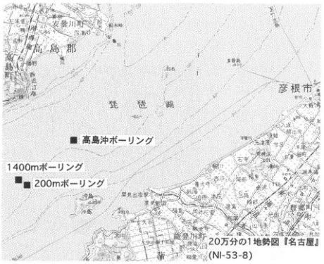
Show extracted lettering and translation
English translation of figure lettering
1:200,000 Nagoya regional topographic map (NI-53-8); solid squares: Takashima-oki borehole, 1,400 m borehole, 200 m borehole; Lake Biwa; Takashima District; Hikone City; Hachiman; Okishima; 65; 86.
Original Japanese lettering
20万分の1地勢図『名古屋』(NI-53-8);■高島沖ボーリング;■1400mボーリング;■200mボーリング;琵琶湖;高島郡;彦根市;八幡;沖島;65;86.
Reading notes
地勢図の極小地名 — 解像度不足により一部判読不明。
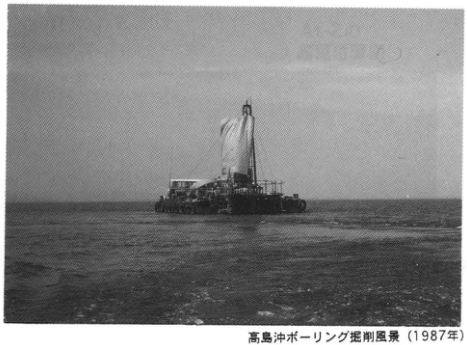
KK-1 (continued)
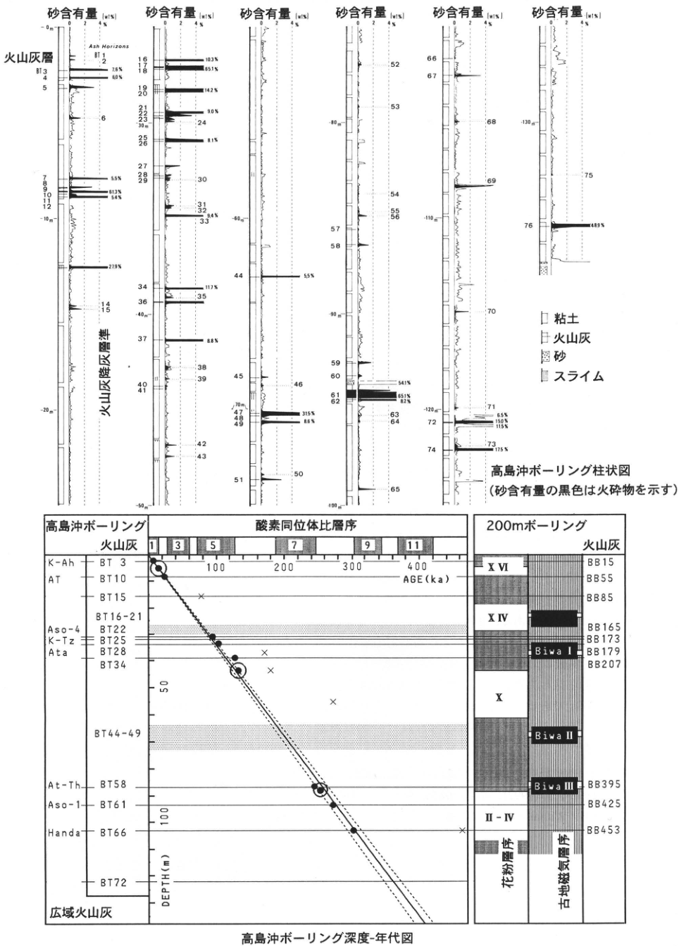
Show extracted lettering and translation
English translation of figure lettering
Takashima-oki borehole column (black areas in the sand-content curves indicate pyroclastic material). Sand content (wt%): 0, 2, 4% in six panels. Ash beds: BT3, 4, 5, 7, 8, 9, 10, 11, 12, 16, 17, 18, 19, 20, 21, 22, 23, 25, 26, 27, 28, 29, 34, 36, 37, 40, 41, 44, 45, 47, 48, 49, 51, 57, 58, 59, 60, 61, 62, 66, 67, 71, 72, 74, 76. Ash-fall horizons (Ash Horizons): BT1, 2, 6, 14, 15, 24, 30, 31, 32, 33, 35, 38, 39, 42, 43, 46, 50, 52, 53, 54, 55, 56, 63, 64, 65, 68, 69, 70, 73, 75. Depth ticks: 0, −10, −20, −30, −40, −50, −60, −70, −80, −90, −100, −110, −120, −130 m.
| Content annotation in diagram (downward) | Value |
|---|---|
| BT3 | 7.6% |
| BT4 | 6.0% |
| BT7 | 5.5% |
| BT9 | 61.3% |
| BT10 | 5.4% |
| Between BT12 and 14 | 27.9% |
| Near BT16–18 | 10.3%; 65.1% |
| Near BT19–20 | 14.2% |
| Near BT22–23 | 9.0% |
| Near BT25–26 | 8.1% |
| Near BT32 | 9.4% |
| BT34 | 11.7% |
| BT37 | 8.8% |
| BT44 | 5.5% |
| BT47 | 31.5% |
| BT49 | 8.6% |
| Immediately below BT60 | 54.1% |
| BT61 | 65.1% |
| BT62 | 8.2% |
| Near BT71–72 | 6.5%; 15.0%; 11.5% |
| BT74 | 17.5% |
| BT76 | 48.9% |
Legend: clay; volcanic ash; sand; slime.
Takashima-oki borehole depth–age diagram. Takashima-oki borehole / volcanic ash / widespread volcanic ash. Oxygen-isotope stratigraphy: 1, 3, 5, 7, 9, 11. AGE (ka): 100, 200, 300, 400. DEPTH (m): 0, 50, 100. Widespread ashes and numbers: K-Ah = BT3; AT = BT10; BT15; BT16-21; Aso-4 = BT22; K-Tz = BT25; Ata = BT28; BT34; BT44-49; At-Th = BT58; Aso-1 = BT61; Handa = BT66; BT72. 200 m borehole / volcanic ash: BB15, BB55, BB85, BB165, BB173, BB179, BB207, BB395, BB425, BB453. Pollen stratigraphy: XVI, XIV, X, II–IV. Paleomagnetic stratigraphy: Biwa I, Biwa II, Biwa III.
Original Japanese lettering
高島沖ボーリング柱状図(砂含有量の黒色は火砕物を示す).砂含有量(wt%):0,2,4%(6列).火山灰層:BT3,4,5,7,8,9,10,11,12,16,17,18,19,20,21,22,23,25,26,27,28,29,34,36,37,40,41,44,45,47,48,49,51,57,58,59,60,61,62,66,67,71,72,74,76.Ash Horizons:BT1,2,6,14,15,24,30,31,32,33,35,38,39,42,43,46,50,52,53,54,55,56,63,64,65,68,69,70,73,75.火山灰降灰層準.深度目盛:0,−10,−20,−30,−40,−50,−60,−70,−80,−90,−100,−110,−120,−130m.
| 図の含有量注記(上から) | 数値 |
|---|---|
| BT3 | 7.6% |
| BT4 | 6.0% |
| BT7 | 5.5% |
| BT9 | 61.3% |
| BT10 | 5.4% |
| BT12と14の間 | 27.9% |
| BT16~18付近 | 10.3%;65.1% |
| BT19~20付近 | 14.2% |
| BT22~23付近 | 9.0% |
| BT25~26付近 | 8.1% |
| BT32付近 | 9.4% |
| BT34 | 11.7% |
| BT37 | 8.8% |
| BT44 | 5.5% |
| BT47 | 31.5% |
| BT49 | 8.6% |
| BT60直下 | 54.1% |
| BT61 | 65.1% |
| BT62 | 8.2% |
| BT71~72付近 | 6.5%;15.0%;11.5% |
| BT74 | 17.5% |
| BT76 | 48.9% |
凡例:粘土,火山灰,砂,スライム.
高島沖ボーリング深度-年代図.高島沖ボーリング/火山灰/広域火山灰.酸素同位体比層序:1,3,5,7,9,11.AGE(ka):100,200,300,400.DEPTH(m):0,50,100.広域火山灰と番号:K-Ah=BT3,AT=BT10,BT15,BT16-21,Aso-4=BT22,K-Tz=BT25,Ata=BT28,BT34,BT44-49,At-Th=BT58,Aso-1=BT61,Handa=BT66,BT72.200mボーリング/火山灰:BB15,BB55,BB85,BB165,BB173,BB179,BB207,BB395,BB425,BB453.花粉層序:XVI,XIV,X,II–IV.古地磁気層序:Biwa I,Biwa II,Biwa III.
Reading notes
含有量注記と隣接する火山灰番号 — 密接したラベル・矢印の厳密な対応が一部曖昧なため近傍番号として記載。BT13番号は図で明瞭でないが27.9%値は保持。
KK-2 Kobiwako Group along the Kisen River, Katata Hills, Shiga Prefecture: lower Katata Formation stratigraphy and the Brunhes–Matuyama boundary
山崎博史・田中里志
- Locality: Wani, Shiga Town, Shiga District, Shiga Prefecture
- Coordinates: N35°9′36″ E135°54′44″ (site 1); N35°9′39″ E135°54′29″ (site 2); N35°9′36″ E135°54′10″ (site 3)
- Elevations: 120 m (site 1); 130 m (site 2); 160 m (site 3)
- Outcrop type and present condition: Natural exposures, surviving in February 1996
- Deposit type and age: Freshwater clastic deposits and ash-fall beds; Early–Middle Pleistocene
- Date of description: February 1996
- Keywords: Kisen River; Kobiwako Group; Katata Formation; paleomagnetic stratigraphy; pollen stratigraphy
The Katata Hills of southwestern Shiga Prefecture consist mainly of gravel, sand, and mud of the Katata Formation of the Kobiwako Group and terrace deposits. Along the Kisen River, which flows east at the northern end of the hills, the gently west-dipping lower Katata Formation, approximately 200 m thick, is relatively well exposed. Hayashi (林, 1974) organized its lithofacies and ash stratigraphy, and numerous paleomagnetic and paleontological studies have also been undertaken. Here, localities where ash beds are observable along the river and a stratigraphic column (岸, 1992) are presented. Ash-bed names follow 吉川 (1983).
At site 1, good exposures on the right riverbank and at the foot of the hill on the left bank show the Kisen ash at its type locality. Site 2 (Loc. 3 of 琵琶湖自然史研究会, 1986) exposes the Biotite I ash. Pollen, diatoms, macroplant remains, protozoans, sponges, molluscs, insects, and fish fossils have been reported from massive silt immediately above and below it (琵琶湖自然史研究会, 1986; 岸, 1992; 小寺, 1985; Matsuoka, 1983). Biotite II ash is observable at site 3, Kurihara I ash at site 4, and Kurihara II ash at site 5.
Hayashida et al. (1976, 1978) examined the paleomagnetic stratigraphy along this traverse and placed the boundary between the Brunhes normal-polarity chron and Matuyama reversed-polarity chron approximately 10 m above the Biotite I ash (called Biotite ash in Hayashida's papers). Samples near the boundary were collected at the arrowed locality, but bank-protection works now prevent sampling there. 岸 (1992) also recovered pollen fossils from almost every silt horizon along the traverse. He concluded that Early and Middle Pleistocene climate alternated between cold and warm phases at approximately 50,000–80,000-year intervals; the resulting curve can be matched with climatic changes inferred from deep-sea-core oxygen-isotope ratios. On this basis, the Katata Formation along the traverse correlates with oxygen-isotope stages 15–24 (Williams et al., 1988).
References: 琵琶湖自然史研究会 (1986); 林 (1974); Hayashida et al. (1976, 1978); 岸 (1992); 小寺 (1985); Matsuoka (1983); 吉川 (1983); Williams et al. (1988).
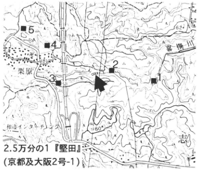
Show extracted lettering and translation
English translation of figure lettering
1:25,000 Katata (Kyoto and Osaka sheet 2-1); Kisen River; Kurihara; Wani-Takera (和迩タケラ); sites 1–5 (solid squares); arrow; 62; 150; 180.
Original Japanese lettering
2.5万分の1『堅田』(京都及大阪2号-1);喜撰川;栗原;和迩タケラ;地点1~5(■);矢印;62;150;180.
Reading notes
極小の地図文字 — 一部判読不明。
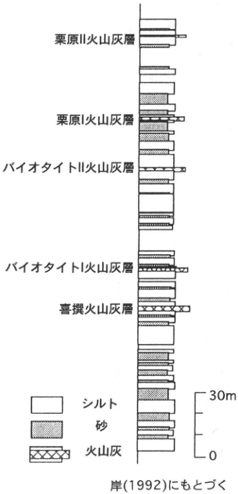
Show extracted lettering and translation
English translation of figure lettering
Top to bottom: Kurihara II ash; Kurihara I ash; Biotite II ash; Biotite I ash; Kisen ash. Legend: silt; sand; volcanic ash. Scale 0–30 m. Based on 岸 (1992).
Original Japanese lettering
上から:栗原II火山灰層;栗原I火山灰層;バイオタイトII火山灰層;バイオタイトI火山灰層;喜撰火山灰層.凡例:シルト,砂,火山灰.尺度0~30m.岸(1992)にもとづく.
KK-3 Widespread tephras in slope deposits of the central Kii Mountains: Aira-Tn and Kikai-Akahoya tephras
吉永秀一郎
- Locality: Kuwahata, Nakahechi Town, Nishimuro District, Wakayama Prefecture
- Coordinates: N33°49′01″ E135°31′18″
- Elevation: 180 m
- Outcrop type and present condition: Artificial exposure, lost (vegetation cover)
- Deposit type and age: Terrace and slope deposits; Late Pleistocene
- Date of description: March 1986
- Keywords: Kii Mountains; slope deposits; Aira-Tn tephra; Kikai-Akahoya tephra
Very little information is available on the chronology of slope deposits in the Outer Zone of southwestern Japan. This is one of the few exposures in the Kii Mountains where the relationship between gentle-slope and terrace deposits and the age of the gentle-slope deposits could be established using the widespread Aira-Tn (AT) and Kikai-Akahoya (K-Ah) tephras. At Kuwahata along the Nakagawa, a tributary of the Tondagawa, a river terrace and a gentle slope cutting into it occur approximately 40 m above the present riverbed. The gentle-slope deposits consist chiefly of silt with angular gravel, excavating and filling the terrace deposits. They are approximately 5 m thick, with clay in the middle and 20 cm of AT at the top. Above AT lies approximately 2 m of soil with angular gravel and an abundant volcanic-ash-rich matrix, overlain by approximately 50 cm of humic material. K-Ah is recognized at the base of the humic bed. These relationships show that, as in northeastern Japan, gentle slopes formed in the Kii Mountains during the last glacial period and their formation ceased in the postglacial period.
References: 町田・新井 (1978); 吉永 (1989).
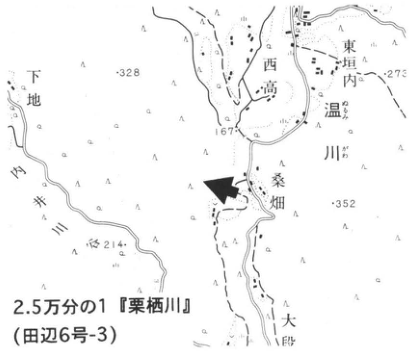
Show extracted lettering and translation
English translation of figure lettering
1:25,000 Kurisugawa (Tanabe sheet 6-3); Kuwahata; Nakagawa; 東垣内; 西高; Nukugawa (温川); 下地; 167; 328; 273; 352; 214; arrow. Unverified minor place-name readings are retained in Japanese.
Original Japanese lettering
2.5万分の1『栗栖川』(田辺6号-3);桑畑;中川;東垣内;西高;温川;下地;167;328;273;352;214;矢印。
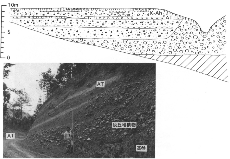
Show extracted lettering and translation
English translation of figure lettering
Section: 0, 5, 10 m; K-Ah; AT. Photograph: AT at two positions; terrace deposits; basement.
Original Japanese lettering
断面:0,5,10m;K-Ah;AT.写真:AT(2ヶ所);段丘堆積物;基盤。
KK-4 High marine terrace deposits along the Harima-nada coast, Hyogo Prefecture
八木浩司
- Locality: Inji (印路), Iwaoka-machi, Nishi Ward, Kobe City, Hyogo Prefecture
- Coordinates: N34°52′58″ E134°57′56″
- Elevation: 90 m
- Outcrop type and present condition: Artificial exposure; southern wall surviving in June 1996
- Deposit type and age: Marine terrace deposits and marine clay; Middle Pleistocene
- Date of description: June 1996
- Keywords: Meimi Hills; Meimi I surface
This is currently the best exposure for observing high marine terrace deposits developed along the Harima-nada coast in Hyogo Prefecture. The highest marine terrace surface, the Meimi I surface, occurs in discontinuous remnants below 100 m above sea level along the right bank of the Akashigawa (八木, 1983). The exposure cuts directly through the Meimi I surface. From bottom to top it shows more than 2 m of gravel composed chiefly of chert and shale, approximately 0.8 m of well-sorted grayish-white coarse sand, approximately 3.5–4 m of dark-gray clay, and 1.5 m of well-sorted sand containing occasional flattened rounded pebbles less than 1 cm across. Trace fossils interpreted as crab burrows and precipitated sulfur powder occur in the upper dark-gray clay. The top of the uppermost sand forms the Meimi I surface, with strongly reddened topsoil locally called “toraban” or “rosu.” Because the surface sand continuously overlies the dark-gray clay, these fine-grained deposits constitute a continuous marine to intertidal sequence forming the Meimi I surface. No tephra suitable for dating has been recognized in the deposits.
Reference: 八木 (1983).
Photographed June 1996.
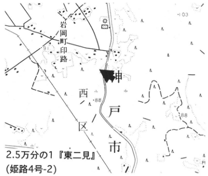
Show extracted lettering and translation
English translation of figure lettering
1:25,000 Higashi-Futami (Himeji sheet 4-2); Iwaoka-machi; Inji (印路); Kobe City; Nishi Ward; 103; 91; 88 at two points; arrow.
Original Japanese lettering
2.5万分の1『東二見』(姫路4号-2);岩岡町;印路;神戸市;西区;103;91;88(2ヶ所);矢印。
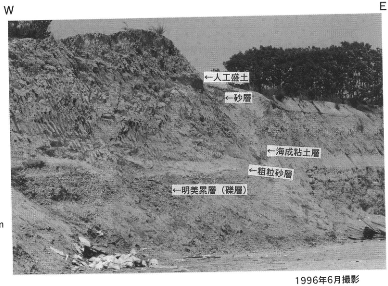
Show extracted lettering and translation
English translation of figure lettering
W; E; 1 m. Top to bottom: artificial fill; sand; marine clay; coarse sand; Meimi Formation (gravel).
Original Japanese lettering
W;E;1m.上から:人工盛土;砂層;海成粘土層;粗粒砂層;明美累層(礫層).
KK-5 Debris footslopes at the northern margin of the Sasayama Basin, Hyogo Prefecture: footslope deposits and Aira-Tn tephra at Gobodani
田中眞吾
- Locality: Gobodani, Nishiki Town, Taki District, Hyogo Prefecture
- Coordinates: N34°7′19″ E135°12′50″ [as printed]
- Elevation: 310 m
- Outcrop type and present condition: Artificial exposure, surviving beneath natural vegetation
- Deposit type and age: Debris-foot slope deposits, rock debris, and aeolian ash; Late Pleistocene
- Date of description: 1984
- Keywords: Aira-Tn tephra; Gobodani; Sasayama Basin
In the early stages of debris-foot slope research, this exposure revealed the depositional structures, fabric, depositional mechanisms, formation age, and other characteristics of the deposits. It lies at the end of a small debris footslope and appeared during widening of the major prefectural Tannan–Sanwa road. The footslope surface has now been excavated and built on, but the cliff itself survives under natural vegetation.
The footslope deposits consist chiefly of chert from the mountain behind, with poorly sorted angular clasts ranging from boulders up to 40–50 cm across to pebbles, somewhat consolidated and deposited without bedding or organization. At approximately 2–2.5 m below the ground surface, Aira-Tn tephra (AT) can be observed almost continuously for approximately 30 m, 20 cm thick and parallel to the ground surface. The angular-gravel lithofacies does not change across AT. Near the valley at the right-hand end of the exposure, these angular-gravel deposits are thinly overlain by younger gravel of water-worn pebbles.
Reference: 田中 et al. (1986).
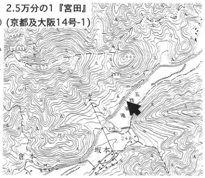
Show extracted lettering and translation
English translation of figure lettering
1:25,000 Miyata (Kyoto and Osaka sheet 14-1); Gobodani; Gobo Pond; Sakamoto; 248; 557.2; 350; 450; arrow.
Original Japanese lettering
2.5万分の1『宮田』(京都及大阪14号-1);五坊谷;五坊池;坂本;248;557.2;350;450;矢印。
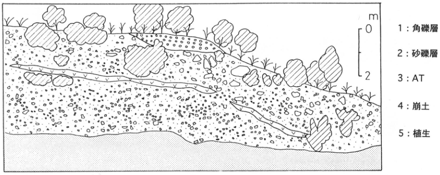
Show extracted lettering and translation
English translation of figure lettering
Scale in m: 0, 2. 1: angular-gravel deposits; 2: sand and gravel; 3: AT; 4: collapsed material; 5: vegetation.
Original Japanese lettering
尺度m:0,2.1:角礫層;2:砂礫層;3:AT;4:崩土;5:植生.
KK-6 Block stream at Ota Pond, Mineyama Plateau, central Hyogo Prefecture: depositional section and widespread tephras
田中眞吾・川崎輝雄
- Locality: Ota Pond, Okawachi Town, Kanzaki District, Hyogo Prefecture
- Coordinates: N35°7′33″ E134°41′48″
- Elevation: 810 m
- Outcrop type and present condition: Artificial exposure, surviving
- Deposit type and age: Block-stream deposits and widespread tephras; Late Pleistocene
- Date of description: 1995
- Keywords: Mineyama Plateau; Ota Pond; Aira-Tn tephra; Kikai-Akahoya tephra
The periglacial landforms and deposits on the plateaus of central Hyogo Prefecture were presented during an excursion at the 1987 meeting of the Japan Association for Quaternary Research and subsequently reported (田中 et al., 1988; 田中・野村, 1992). This exposure was shown during a Kinki geomorphology research-group excursion in late 1992. It allows direct observation of the transverse depositional configuration of a block stream and the superposition of blocks and Aira-Tn tephra (AT). On slopes of approximately 3° on the gently undulating plateau around Ota Pond, groups of blocks up to 2–3 m across extend in a belt approximately 100 m wide and 2 m thick. AT lies immediately beneath the blocks, and the upper block stream is covered by soil formed through development of Kikai-Akahoya tephra into black humic volcanic-ash soil (kuroboku). Beneath the block stream and AT is a thin layer of small gravel, locally yellowish-white, commonly found on the nearby plateau. Basement occurs below it. Since this exposure appeared in 1990, block fall-out and cover by collapsed material have progressed.
References: 田中・野村 (1992); 田中 et al. (1988).
1: kuroboku; 2: groups of blocks; 3: silt; 4: sand and gravel; 5: AT; 6: collapsed material; 7: vegetation cover; 8: spring water.
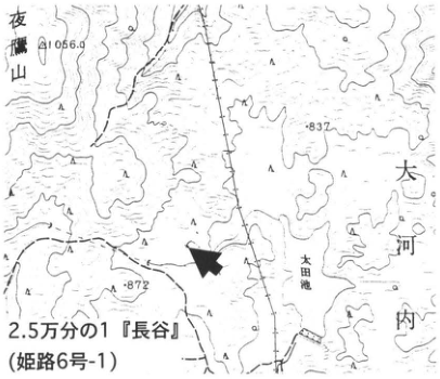
Show extracted lettering and translation
English translation of figure lettering
1:25,000 Hase (姫路6号-1); Ota Pond; Okawachi; Yotakayama (夜鷹山); 1056.9; 837; 872; arrow.
Original Japanese lettering
2.5万分の1『長谷』(姫路6号-1);太田池;大河内;夜鷹山;1056.9;837;872;矢印。
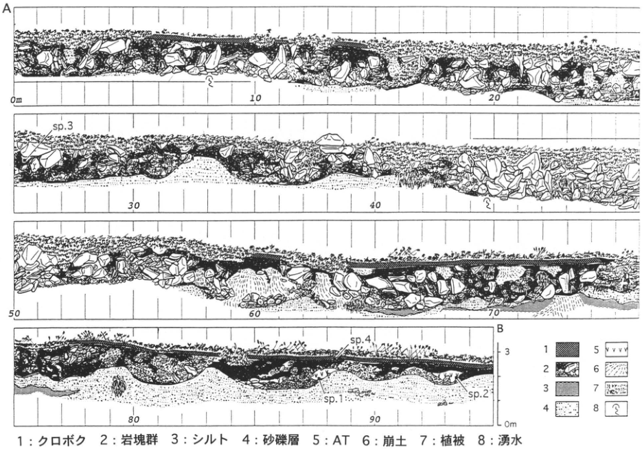
Show extracted lettering and translation
English translation of figure lettering
A, B; horizontal ticks 0 m, 10, 20, 30, 40, 50, 60, 70, 80, 90; vertical 0 m, 3; sp.1, sp.2, sp.3, sp.4; legend 1–8 (explained in the main text).
Original Japanese lettering
A,B;水平目盛0m,10,20,30,40,50,60,70,80,90;垂直0m,3;sp.1,sp.2,sp.3,sp.4;凡例1~8(説明は本文).
KK-7 Trench excavation of the Nojima fault, Awaji Island
渡辺満久・鈴木康弘
- Locality: Nashimoto, Hokudan Town, Tsuna District, Hyogo Prefecture
- Coordinates: N34°32′56″ E134°56′43″
- Elevation: 20 m
- Outcrop type and present condition: Excavated trench walls, lost
- Deposit type and age: Fluvial deposits; Pleistocene–Holocene
- Date of description: May 1995
- Keywords: Awaji Island; Nojima fault; 1995 southern Hyogo Prefecture earthquake; trench investigation
The Nojima fault along the western margin of Awaji Island is an active fault that also moved during the Late Quaternary (水野 et al., 1990; 活断層研究会, 1991). In 1995 it caused the southern Hyogo Prefecture earthquake and produced pronounced ground deformation (中田 et al., 1995; 太田 et al., 1995; 粟田 et al., 1995; 林 et al., 1995). Several trenches have been investigated across it. Here, following 鈴木 et al. (1996), photographs show walls of a trench excavated in early May 1995.
At the trench locality, the earthquake produced approximately 1 m of right-lateral surface displacement and 0.5 m of northwest-side-up vertical displacement. The valley line is also right-laterally offset by several hundred meters. The fault that moved in this earthquake (F1) lies near the middle of the trench wall. F2, left (southeast) of center, cuts the lower part of unit B (BL), which is dragged into the fault zone. Immediately above, however, the upper part of B (BU) overlies BL across an angular unconformity and is not displaced by F2. Thus F2 moved after BL deposition and before BU deposition. The radiocarbon ages of BU and BL are respectively 1,840 yr B.P. and 2,100 yr B.P.; the event is therefore thought to have occurred approximately between 100 B.C. and A.D. 200. Other trench investigations suggest possible movement in the fifteenth through seventeenth centuries as well.
References: 粟田 et al. (1995); 活断層研究会 (1991); 水野 et al. (1990); 中田 et al. (1995); 太田 et al. (1995); 林 et al. (1995); 鈴木 et al. (1996).
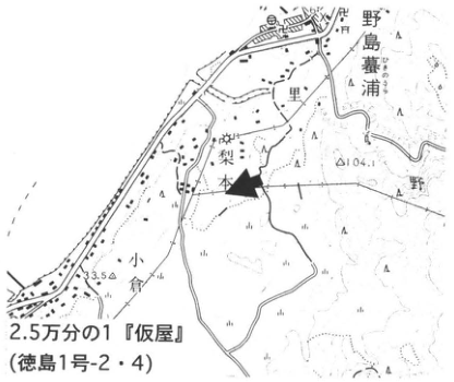
Show extracted lettering and translation
English translation of figure lettering
1:25,000 Kariya (Tokushima sheet 1-2/4); Nashimoto; Sato; Nojima-Hikinoura (野島墓浦); 向道; Ogura; 野; 104; 3.5; arrow. Minor unverified names retained in Japanese.
Original Japanese lettering
2.5万分の1『仮屋』(徳島1号-2・4);梨本;里;野島墓浦;向道;小倉;野;104;3.5;矢印。
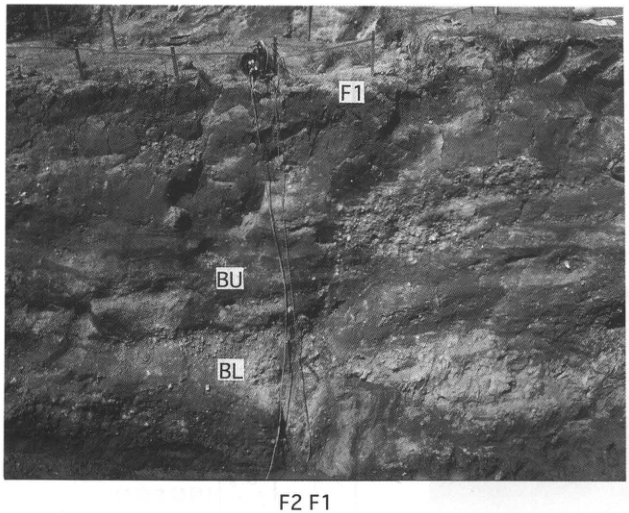
Show extracted lettering and translation
English translation of figure lettering
F1 at upper and lower positions; F2; BU; BL.
Original Japanese lettering
F1(上部と下部);F2;BU;BL.
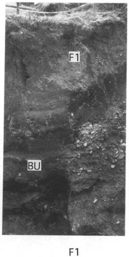
Show extracted lettering and translation
English translation of figure lettering
F1 within and below photograph; BU.
Original Japanese lettering
F1(写真中および下);BU.
KK-8 Late Pleistocene widespread tephras exposed on the southern bank of the Yamato River, Sakai City, Osaka Prefecture: terrace deposits and Kikai-Tozurahara, Aso-4, and Aira-Tn tephras
小倉博之
- Locality: Tokiwa-machi 2-chome, Sakai City, Osaka Prefecture
- Coordinates: N34°35′17″ E135°31′12″
- Elevation: 10 to −2 m
- Outcrop type and present condition: Artificial exposure, lost
- Deposit type and age: Aeolian tephras and middle and lower terrace deposits; Late Pleistocene
- Date of description: March 1991
- Keywords: Terrace deposits; Uemachi Formation; Tokiwa Formation; Kikai-Tozurahara tephra; Aso-4 tephra; Aira-Tn tephra
During bank-protection construction from approximately January to March 1991, Kikai-Tozurahara (K-Tz) and Aso-4 were observable in beds equivalent to the middle terrace deposits, with Aira-Tn (AT) in the overlying lower terrace deposits. This was the first exposure in Kinki where K-Tz and Aso-4 could be observed together, but after construction it was covered by the revetment and lost. In this area, 吉川・樽野 (1992) and 小倉 et al. (1992) call the ash correlated with K-Tz the Kitahanada ash, Aso-4 the Abiko (吾彦) ash, and AT the Heianjingu ash.
Terrace deposits in the Osaka Plain are broadly divided into high, middle, and lower terrace deposits, in decreasing age. The Uemachi Formation is regarded as the type unit for the middle terrace deposits (市原, 1960). This locality is at the southern end of the north–south-trending Uemachi Plateau in the central Osaka Plain, where the west-flowing Yamato River, excavated in 1704, crosses the plateau.
The lower Uemachi Formation here is a sandy marine deposit containing shells; the upper part is alternating freshwater sand and silt. K-Tz and Aso-4 are interbedded in the silt. K-Tz is pale pink, 40–20 cm thick, and somewhat dispersed. Aso-4 lies 1 m above K-Tz, forms a pale-brown to pale-pink lens up to 5 cm thick, and contains pumice grains approximately 5 mm across. The lower-terrace-equivalent deposits unconformably overlying the Uemachi Formation (middle terrace deposits) were named the Tokiwa Formation (小倉 et al., 1992). A 5–10 cm thick AT bed is interbedded in the 50 cm thick brown organic silt at the top of the Tokiwa Formation.
吉川・樽野 (1992) also reported Aso-4 on the opposite, northern bank of the Yamato River and K-Tz at a subway construction site approximately 1 km to the south.
References: 市原 (1960); 小倉 et al. (1992); 吉川・樽野 (1992).
Photographed March 1991.
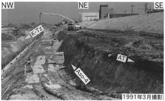
Show extracted lettering and translation
English translation of figure lettering
1:25,000 Osaka-Tonanbu (Wakayama sheet 5-3); Sakai City; Tokiwa-machi; Yamato River; Yamatogawa-machi; Sugimoto-machi; Asakayama Station; Kitahanada-machi 2-chome; 9.5; 8.9; arrow.
Original Japanese lettering
2.5万分の1『大阪東南部』(和歌山5号-3);堺市;常磐町;大和川;大和川町;杉本町;浅香山駅;北花田町二丁目;9.5;8.9;矢印。
Reading notes
多数の極小市街地文字 — 可読範囲を抽出、一部判読不明。
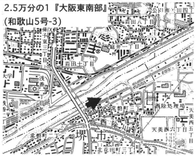
Show extracted lettering and translation
English translation of figure lettering
T.P. (m): 0, 5, 10. Ground surface; Tokiwa Formation; AT; 23,400±370 yr B.P.; unconformity; >44,100 yr B.P.; Uemachi Formation; Aso-4; K-Tz; wood; humic material; marine sand (containing shells). Described March 1991; after 小倉 et al. (1992).
Original Japanese lettering
T.P.(m):0,5,10.地表面;常磐層;AT;23,400±370yr B.P.;不整合面;>44,100yr B.P.;上町層;Aso-4;K-Tz;材;腐植;海成砂層(貝殻を含む).1991年3月記載;小倉ほか(1992)より.
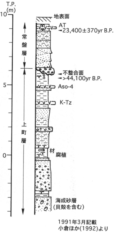
Show extracted lettering and translation
English translation of figure lettering
NW; NE; SE; K-Tz; Aso-4; AT.
Original Japanese lettering
NW;NE;SE;K-Tz;Aso-4;AT.
KK-9 Upper Osaka Group at Komyo Pond, Senboku Hills, Osaka
橋本定樹
- Locality: Komyo Pond, Izumi City, Osaka Prefecture
- Coordinates: N34°27′20–40″ E135°29′0–20″
- Elevation: 80 m
- Outcrop type and present condition: Artificial exposure, submerged in April 1996, exposed during low-water periods
- Deposit type and age: Alternating gravel, sand, and silt, with marine clay beds; Early–Middle Pleistocene
- Date of description: April 1996
- Keywords: Senboku Hills; Komyo Pond; upper Osaka Group; Azuki ash; Pink ash
The Osaka Group, consisting of unconsolidated gravel, sand, silt, and clay, is distributed in the Senboku Hills from Izumi to Sakai City. This representative Pliocene–Pleistocene sequence of Kinki contains approximately 50 ash marker beds and, in its upper half, twelve marine clay beds called Ma-1, Ma0, Ma1, …, Ma10 (市原, 1993). Extension of the Senboku Rapid Railway and development of the Hanwa Expressway have accompanied continuing large-scale residential construction for the Osaka commuter belt. New exposures thus repeatedly appear and disappear within a few months. Komyo Pond, completed in 1936 by damming a valley in the Izumi hills with a main and subsidiary dam, still retains natural woodland around it while serving as a large irrigation reservoir. Water is released several times weekly from June through September to irrigate rice fields, so at low water from summer into winter the surrounding slopes and pond bottom provide good Osaka Group exposures. The observable interval extends from Ma1 in the lower Osaka Group to Ma8 in the upper group and contains six ashes: Pink, Komyoike, Azuki, Hatchoike, Sakura, and Kasuri. Their ages and correlations with the Kobiwako and Tokai groups are summarized by 市原 (1993). Pink and Azuki were correlated respectively with the Yabakei and Imaichi pyroclastic flows of central Kyushu, allowing their sources to be inferred (檀原 et al., 1992; 鎌田 et al., 1994). Pink ash also occurs in the Niigata area approximately 800 km from Kyushu (富田 et al., 1994), and Azuki occurs in the Kazusa Group (町田 et al., 1980); both are therefore regarded as widespread Lower Pleistocene tephras. A molar of the Shiga elephant (Mammuths shigensis, spelling as printed) was found at site A in the figure.
Before visiting, please inquire about Komyo Pond's water level at Izumi City Hall (main number 0725-41-1551).
References: 檀原 et al. (1992); 林 (1979); 市原 (1993); 市原 et al. (1971); 鎌田 et al. (1994); 町田 et al. (1980); 富田 et al. (1994).
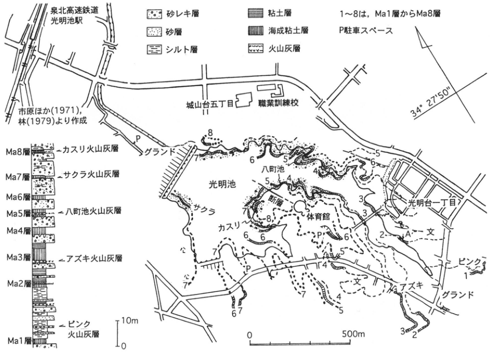
Show extracted lettering and translation
English translation of figure lettering
Senboku Rapid Railway; Komyoike Station; Shiroyamadai 5-chome; vocational training school; Komyodai 1-chome; sports grounds at two locations; gymnasium; fault; Hatcho Pond; Komyo Pond; A; P, parking space; 1–8 denote Ma1–Ma8; 34°27′50″; 0–500 m. Compiled from 市原 et al. (1971) and 林 (1979). Legend: sand and gravel; sand; silt; clay; marine clay; volcanic ash. Column downward: Ma8 and Kasuri ash; Ma7 and Sakura ash; Ma6; Ma5 and Hatchoike ash; Ma4; Ma3 and Azuki ash; Ma2; Pink ash; Ma1. 10 m scale (0, 10 m). Map ash labels: Sakura, Kasuri, Azuki, Pink; 文 (school symbol).
Original Japanese lettering
泉北高速鉄道;光明池駅;城山台五丁目;職業訓練校;光明台一丁目;グランド(2ヶ所);体育館;断層;八町池;光明池;A;P駐車スペース;1~8はMa1層からMa8層;34°27′50″;0~500m.市原ほか(1971),林(1979)より作成.凡例:砂レキ層,砂層,シルト層,粘土層,海成粘土層,火山灰層.柱状(上から):Ma8層・カスリ火山灰層,Ma7層・サクラ火山灰層,Ma6層,Ma5層・八町池火山灰層,Ma4層,Ma3層・アズキ火山灰層,Ma2層,ピンク火山灰層,Ma1層.10m尺度(0,10m).地図上:サクラ,カスリ,アズキ,ピンク,文(学校記号).
KK-10 Earthquake traces at the Kizugawa riverbed archaeological site and the 1596 (Keicho 1) Fushimi earthquake
奥村晃史
- Locality: Kizugawa riverbed archaeological site, Yawata City, Kyoto Prefecture
- Coordinates: N34°53′17″ E135°42′45″
- Elevation: 12 m
- Outcrop type and present condition: Archaeological site, backfilled after excavation
- Deposit type and age: Flood deposits (sand, silt, and clay); medieval–early modern periods
- Date of description: 1985–1986
- Keywords: Liquefaction; sand eruption; historical earthquake; Keicho Fushimi earthquake; Kizugawa riverbed site
Strong earthquake shaking of unconsolidated alluvial-lowland deposits with a high groundwater table causes liquefaction. Particularly where clay, silt, or paddy-field soil overlies susceptible sand, liquefied sand breaks through overlying strata and erupts at the surface. The age of an earthquake can be determined by establishing the crosscutting (deformation) and burial relationships between strata and the resulting sand dikes, sand eruptions, and deformation. Because liquefaction is related to shaking strength, it also functions as a natural seismometer. Even when precise seismic intensity cannot be estimated, mapping synchronous liquefaction can establish the source region and earthquake size. 寒川 (1992) applied this method at many archaeological sites, providing valuable information on the sequence of Nankai Trough earthquakes and the timing of inland active-fault movement.
The Kizugawa riverbed site, introduced here after 寒川 et al. (1987), is an extensive wetland archaeological site on the floodplain at the confluence of the Katsura, Uji, and Kizu rivers in the southwestern Kyoto Basin. Clayey soil deposited since the Yayoi period extends 2–3 m below the present ground surface over thick sand and gravel. Sand eruptions supplied from the lower sand and gravel cut strata and ditch walls dating through the Muromachi period, forming sand dikes and locally reaching the ground surface. Strata and traces of artificial modification from the mid-Edo period onward overlie or truncate the erupted sand. The earthquake responsible was inferred to be either the 1662 (Kanbun 2) Omi earthquake or the 1596 (Keicho 1) Fushimi earthquake (寒川 et al., 1987). Subsequent archaeological and trench investigations indicate that liquefaction at this site probably occurred during the Fushimi earthquake. In that earthquake, a succession of active faults along the Arima–Takatsuki Tectonic Line, Rokko fault system, and eastern coast of Awaji Island moved over more than 60 km, causing severe damage in Kyoto, Osaka, Kobe, and Awaji Island (寒川 et al., 1996a, b).
References: 寒川 (1992); 寒川 et al. (1987, 1996a, b).
1: clayey soil deposited in a mid-Edo-period ditch; 2: clayey soil deposited in a Nanbokucho-period ditch; 3: clayey soil; 4: very fine sand; 5: mud; 6: fine sand; 7: medium sand; 8: coarse sand. Liquefied units—a: fine sand; b: medium sand; c: coarse sand; d: sand and gravel. Fig. 5 of 寒川 et al. (1987).
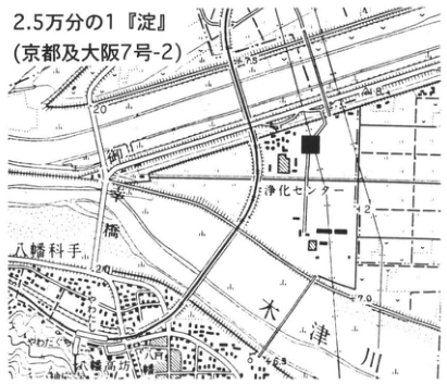
Show extracted lettering and translation
English translation of figure lettering
1:25,000 Yodo (Kyoto and Osaka sheet 7-2); Kizu River; Yawata; treatment center; 8.8; 5; 20; solid square.
Original Japanese lettering
2.5万分の1『淀』(京都及大阪7号-2);木津川;八幡;浄化センター;8.8;5;20;■.
Reading notes
市街図極小文字 — 一部判読不明。
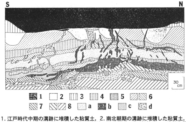
Show extracted lettering and translation
English translation of figure lettering
S; N; 30 cm. Legend 1–8 and a–d (fully explained in the main text).
Original Japanese lettering
S;N;30cm.凡例1~8,a~d(全説明は本文).
7. Chugoku and Shikoku regions
CG-1 Older and younger dune sands and tephra beds in the Tottori dunes
赤木三郎
- Locality: Hamayuyama, Fukube Village, Iwami District, Tottori Prefecture
- Coordinates: N35°32′32″ E134°5′10″
- Elevation: 14 m
- Outcrop type and present condition: Artificial exposure behind a house; difficult to observe because buildings obstruct it
- Deposit type and age: Yuyama sand and Daisen ash beds overlying older dunes; Late Pleistocene
- Date of description: October 1964 onward
- Keywords: Tottori dunes; Yuyama sand; older dunes; Daisen ash; Daisen-Kurayoshi tephra; younger dunes; water-laid sand
The Tottori dunes are among Japan's representative coastal dunes and are designated a Natural Monument. One reason is that Daisen tephras serve as marker beds distinguishing Pleistocene older dunes from Holocene younger dunes. Their stratigraphic relationships are readily observed on the inland side behind the dunes. Illustrated here are a large exposure showing older and younger dunes and ash beds (exposure A) and the adjacent Hamayuyama exposure, the type locality of the Yuyama sand (exposure B).
The Yuyama sand is a homogeneous sand sequence more than 40 m thick, forming a flat terrace surface at approximately 20 m elevation. Its uppermost part is a weathered bed slightly less than 1 m thick, comprising brown loam and loamy sand (F at exposure B). Ferromagnetic minerals with Curie points around 380°C recovered from it are interpreted as Aso-4-derived, whereas those with 510°C Curie points are interpreted as derived from Sambe SK (岡田 et al., 1993). Approximately 1 m below this is yellowish-brown medium-grained aeolian sand, the so-called older dune sand. Below lies sand with conspicuous horizontal laminae spaced 5–15 mm apart, undulating like crepe wrinkles. This medium-grained, well-sorted sand with highly rounded grains is termed “water-laid aeolian sand.”
The reddened loam above the Yuyama sand consists of Daisen-Kurayoshi tephra (DKP; 150 cm thick) and brown loam approximately 100 cm thick. Aira-Tn tephra (AT) overlies it, although it is indistinct in the exposure. The surface loam has developed into kuroboku and is covered by younger dune sand. The younger sand thickens abruptly toward the sea and westward toward the large exposure, locally developing black-sand humic horizons (kurosuna).
At exposure A, a discontinuity occurs between the water-laid aeolian sand and aeolian sand of the Yuyama sequence, and DKP can be seen to have slid.
References: 赤木 (1972, 1991); 新潟古砂丘グループ (1967); 岡田 et al. (1993); 山陰第四紀研究グループ (1969); 豊島 (1975).
Exposure A: large exposure at the southern foot of the Tottori dunes. Dn: younger dunes with humic laminae; Lm: ash beds (DKP, AT); Yu: Yuyama sand (water-laid and aeolian sands); Ba: basement (weathered Tertiary deposits).
Exposure B: large exposure at Hamayuyama, Tottori dunes. A: younger dune sand; B: humic soil; C: brown loam; D: Daisen-Kurayoshi tephra (DKP); E: bluish-gray clay; F: dark-brown clay; G: yellowish-brown older dune sand; H: yellowish-brown water-laid sand with horizontal laminae (Yuyama sand).
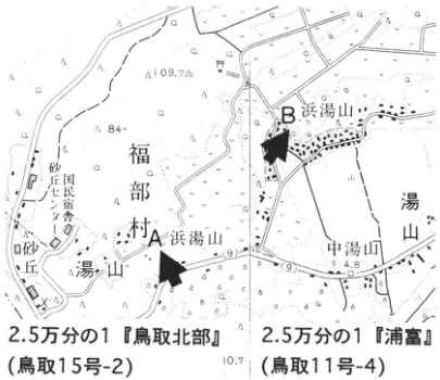
Show extracted lettering and translation
English translation of figure lettering
1:25,000 Tottori-Hokubu (Tottori sheet 15-2); 1:25,000 Uradome (Tottori sheet 11-4); A, B; Hamayuyama; Nakayuyama; Yuyama; Fukube Village; Nishida agricultural cooperative; dunes; 109.7; 84; 4.8; 10.7.
Original Japanese lettering
2.5万分の1『鳥取北部』(鳥取15号-2);2.5万分の1『浦富』(鳥取11号-4);A,B;浜湯山;中湯山;湯山;福部村;西田農業協同組合;砂丘;109.7;84;4.8;10.7.
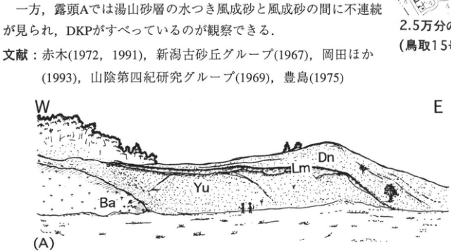
Show extracted lettering and translation
English translation of figure lettering
W, E; (A); Dn, Lm, Yu, Ba. Explanations are in the main-text caption.
Original Japanese lettering
W,E;(A);Dn,Lm,Yu,Ba.説明は本文キャプション.
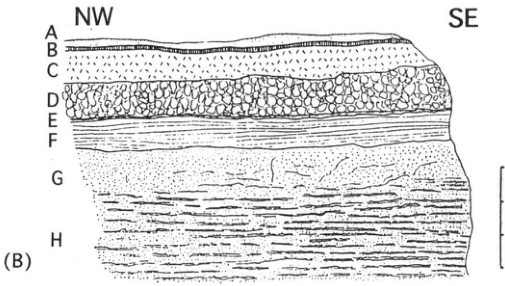
Show extracted lettering and translation
English translation of figure lettering
NW, SE; (B); A, B, C, D, E, F, G, H; scale 0, 1, 2, 3 m. Unit descriptions are in the main-text caption.
Original Japanese lettering
NW,SE;(B);A,B,C,D,E,F,G,H;尺度0,1,2,3m.各層説明は本文キャプション.
CG-2 Fault exposure along the Shikano fault, which moved during the Tottori earthquake
赤木三郎
- Locality: Akasaka Pass at the boundary of Shikano and Ketaka towns, Ketaka District, Tottori Prefecture
- Coordinates: N35°27′03″ E134°5′21″
- Elevation: 230 m
- Outcrop type and present condition: Artificial exposure, partly covered with protective mesh
- Deposit type and age: Biotite granite and gravel
- Date of description: 1983
- Keywords: Tottori earthquake; Shikano fault; Hakuto gravel
On September 10, 1943, the magnitude-7.2 Tottori earthquake occurred with its epicenter at Nozaka, Tottori City. The Shikano and Yoshioka faults moved during it. The Shikano fault extends approximately 8 km east–west. In its western part the northern side subsided relative to the southern side by up to 75 cm, generally 10–35 cm, and moved eastward right-laterally by up to 150 cm, generally less than 60 cm (津屋, 1944).
This exposure lies in the western part of the Shikano fault at Akasaka Pass on general prefectural road 304, the Myotokuji–Shikano route. Since it lies on the fault trace drawn by 津屋 (1944), it may have reactivated during the Tottori earthquake. Here subangular gravel of the Hakuto gravel, belonging to the Pliocene Misasa Group, unconformably overlies Paleogene Yoshioka Granite basement. The weathered gravel comprises boulders and is interpreted as a basal conglomerate. Two normal faults cut these units, striking N80°E and dipping 80°N. Approximately 1 m to the left of the fault when facing the exposure, another fault in the granite strikes N65°–72°E and dips 70°N, with 2 cm of fault clay. Four parallel minor faults occur near the unconformity with the Hakuto gravel. The gravel distribution and topography also suggest another fault near Akasaka Pass. Approximately 4 km west, near Horakuji, Sueyo, Shikano Town (sites 1 and 3), an irrigation channel offset during the earthquake is still visible. Foundation stones of the residence of the 丘主 family remain displaced, with approximately 46–56 cm of horizontal offset. Trenching at site 2 and Sugorokubara has also examined active-fault recurrence intervals (岡田 et al., 1981).
The exposure lies on the line from Horakuji, Shikano Town, toward Sugorokubara, Ketaka Town, and the fault-plane strike agrees with that line. It may therefore have moved during the Tottori earthquake.
References: 黒川 (1983); 西田 et al. (1991, 1993); 岡田 et al. (1981); 豊島 (1993); 津屋 (1944).
Fault exposure at Akasaka Pass on the Myotokuji–Shikano general prefectural road. 西田・黒川・赤木 (1993).
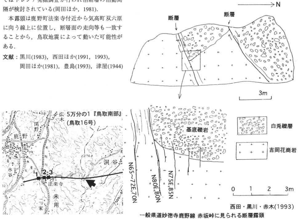
Show extracted lettering and translation
English translation of figure lettering
N; fault at two positions; 3 m scale. Detail: basal conglomerate; Hakuto gravel; Yoshioka Granite; N65–72E, 70N; N80E, 80N; N75E, 85N; 0, 1, 2, 3 m. Map: 1:50,000 Tottori-Nanbu (Tottori sheet 16); Shikano; Sueyo; Horakuji; 洞谷; Hiroki; Ogawa; Mizutani; 家原; 1, 2, 3; 2276 (decimal point illegible); 32.7; 143.3; arrow. Unverified minor place-name readings retained in Japanese.
Original Japanese lettering
N;断層(2ヶ所);3m尺度.詳細:基底礫岩;白兎礫層;吉岡花崗岩;N65~72E,70N;N80E,80N;N75E,85N;0,1,2,3m.地図:5万分の1『鳥取南部』(鳥取16号);鹿野;末用;法楽寺;洞谷;広木;小川;水谷;家原;1,2,3;2276(印字の小数点判読不明);32.7;143.3;矢印。
Reading notes
極小地図数字2276 — 小数点の位置を確定できない。
CG-3 Active fault exposed on the projected extension of the Oda fault, Tottori Prefecture
赤木三郎・佐治孝弌
- Locality: Fukumoto, Kurayoshi City, Tottori Prefecture
- Coordinates: N35°24′35″ E133°45′52″
- Elevation: 70 m
- Outcrop type and present condition: Artificial exposure, grassed for slope protection
- Deposit type and age: River terrace deposits and fallout tephra; Late Pleistocene
- Date of description: October 1994
- Keywords: Oda fault; Tenjinno; Namatake surface; Daisen-Kurayoshi tephra; Aira-Tn tephra; sand eruption
The straight Oda fault cuts the Tenjinno plateau south of the Kitadanigawa and forms a north-northwest–south-southeast lineament from Oda to Fukumoto. Across it, the western side of the Tenjinno plateau is relatively uplifted by approximately 10 m, and drainage is discontinuous. Similar features occur between Fukumoto and Kamiyonezumi on the plateau at the eastern foot of Takashiroyama, along the fault's extension. The exposure lies where the route from Fukumoto reaches the plateau and extends 100 m north–south. Although the Oda fault had been assigned certainty class I and activity class C, field geological surveys had previously failed to confirm a fault exposure.
The exposure comprises terrace deposits, overlying Daisen tephra, and talus. The terrace deposits consist upward of sand and gravel (>200 cm), humic clay (20–30 cm), white ashy clay (15 cm), alternating coarse sand and clay (80 cm), and white ashy clay (10 cm). Daisen tephra overlies them. Daisen-Namatake tephra (DNP) occurs only at the lower western roadside slope, not on the eastern slope. Daisen-Kurayoshi tephra (DKP) exceeds 4 m at its thickest, and Aira-Tn tephra (AT) is less than 20 cm thick; both are disturbed. Numerous minor faults intersecting the Oda fault strike N80°W and dip northward. Traces of liquefaction occur along them in sand to clay below the tephra. Most rise along the faults and intrude pumice and loam as sand dikes up to 10 cm wide. The lower boundary is flat, whereas the upper part extends into narrow columns and pinches out; these and other features led to interpretation as traces of liquefaction during fault movement. None reaches the ground surface. Since faults cut through AT, the fault movement and sand eruption were judged to postdate AT deposition.
References: 橋本 et al. (1980); 活断層研究会 (1981); 西田 et al. (1993); 鳥取県 (1989).
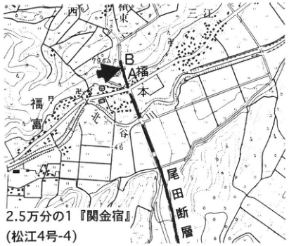
Show extracted lettering and translation
English translation of figure lettering
1:25,000 Sekigane-Shuku (Matsue sheet 4-4); Oda fault; Fukumoto; 光丘; Myoken (明見); Higashi; A, B; 79.6; 46; arrow. Unverified names retained in Japanese.
Original Japanese lettering
2.5万分の1『関金宿』(松江4号-4);尾田断層;福本;光丘;明見;東;A,B;79.6;46;矢印。
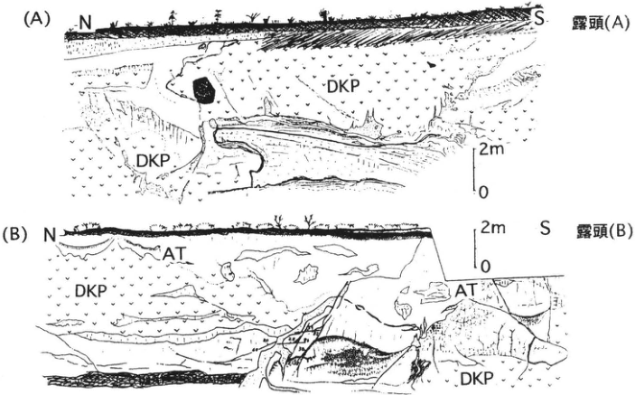
Show extracted lettering and translation
English translation of figure lettering
(A) N, S; exposure (A); DKP at two positions; scale 0, 2 m. (B) N, S; exposure (B); AT at two positions; DKP at two positions; scale 0, 2 m.
Original Japanese lettering
(A)N,S;露頭(A);DKP(2ヶ所);尺度0,2m.(B)N,S;露頭(B);AT(2ヶ所);DKP(2ヶ所);尺度0,2m.
CG-4 Lowermost Daisen tephra succession at the eastern foot of Daisen volcano
岡田昭明
- Locality: Okawachi, Kurayoshi City, Tottori Prefecture
- Coordinates: N35°23′10″ E133°43′16″
- Elevation: 200 m
- Outcrop type and present condition: Artificial exposure, surviving
- Deposit type and age: Fallout tephra; Middle Pleistocene–earliest Late Pleistocene
- Keywords: Daisen volcano; lowermost Daisen tephra beds
Daisen is a composite volcano comprising Older Daisen of the Early–Middle Pleistocene and Younger Daisen of the Middle–Late Pleistocene. Tephras erupted during Younger Daisen activity are collectively called the Daisen volcanic-ash beds (赤木, 1973). Fallout tephra is especially thick east of the edifice. The sequence is divided into upper, middle, lower, and lowermost members at specific horizons showing discordance (山陰第四紀研究グループ, 1969). The lowermost member is considered to predate the beginning of the Late Pleistocene and can be observed at the northern to northeastern, eastern, and southeastern foot of Daisen.
This exposure lies in southwestern Kurayoshi City, central Tottori Prefecture, approximately 17 km almost due east of Misen, Daisen's principal summit. It is one of the few exposures showing every horizon of the lowermost ash beds at Daisen's eastern foot (佐治 et al., 1975). Over the Mizoguchi Tuff Breccia Formation (Mz), consisting chiefly of Older Daisen pyroclastic flows, lie ten pumice beds—apm, cpm, dpm1, dpm2, fpm1–3, gpm, hpm1–2 upward—and five volcanic-sand beds (bvs1–2, dvs, evs, fvs), forming the lowermost tephra succession (岡田 et al., 1990). Intervening weathered volcanic-ash soils (loam) are reddened, a visible distinction from the younger members. At the top, Daisen-Namatake pumice (DNP) overlies the sequence with slight discordance. 町田・新井 (1979) correlated hpm1 and hpm2 respectively with Daisen-Matsue pumice (DMP) and Daisen-Hiruzenbara pumice (DHP). Curie-point measurements of ferromagnetic minerals, however, indicated that hpm1 and DMP are different tephras (岡田, 1983). Similarly, hpm2 and DHP at Hiruzenbara agree neither in heavy-mineral composition nor in Curie point, strongly suggesting that these too are different tephras.
References: 赤木 (1973); 町田・新井 (1979); 岡田 (1983); 岡田 et al. (1990); 佐治 et al. (1975); 山陰第四紀研究グループ (1969).
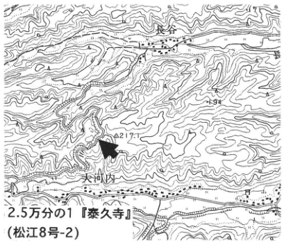
Show extracted lettering and translation
English translation of figure lettering
1:25,000 Taikyuji (Matsue sheet 8-2); Nagatani (長谷); Okawachi; 217; arrow.
Original Japanese lettering
2.5万分の1『泰久寺』(松江8号-2);長谷;大河内;217;矢印。
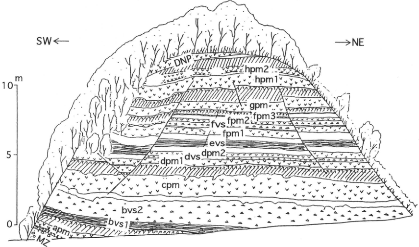
Show extracted lettering and translation
English translation of figure lettering
SW left, NE right; scale 0, 5, 10 m. Upward: Mz, apm, bvs1, bvs2, cpm, dpm1, dvs, dpm2, evs, fpm1, fvs, fpm2, fpm3, gpm, hpm1, hpm2, DNP.
Original Japanese lettering
SW←,→NE;尺度0,5,10m.下から:Mz,apm,bvs1,bvs2,cpm,dpm1,dvs,dpm2,evs,fpm1,fvs,fpm2,fpm3,gpm,hpm1,hpm2,DNP.
CG-5 Izumo dunes and Late Pleistocene tephras
岡田昭明
- Locality: West of Myokenyama, Sotozono-machi (外園町), Izumo City, Shimane Prefecture
- Coordinates: N35°20′33″ E132°40′54″
- Elevation: 50 m
- Outcrop type and present condition: Artificial exposure, surviving in May 1991
- Deposit type and age: Aeolian sand and fallout tephra; Late Pleistocene
- Keywords: Izumo dunes; older dunes; younger dunes; Daisen-Matsue tephra; Sambe-Kisuki tephra
The Izumo dunes extend along the coast from Taisha Town, Hikawa District, through Izumo City to Koryo Town, Hikawa District, Shimane Prefecture. They span approximately 12 km north–south and 2 km east–west, with the lowlands of the Izumo Plain and Lake Jinzai inland. Their aeolian sand overlies the Sashimi Formation (差海層), sand and gravel deposited during the last interglacial (三位・藤井, 1972). Tephras from Daisen and Sambe are interbedded in the dune sands and provide valuable evidence for their formation history. The sketch and description below follow 大西・松井 (1980).
The exposure lies in the central Izumo dunes immediately west of Myokenyama (56.9 m), which rises slightly above the dune crest at approximately 40 m elevation. Aeolian sand occurs throughout, with the gently inclined Koshihara pumice (三位, 1962) in the middle. This pumice separates the underlying older dunes from the overlying younger dunes. Within the older dunes, Agenogi pumice (上乃木; 三位, 1962) is markedly discordant with Koshihara pumice. Older Dune I (Kawamukai sand) lies below it and Older Dune II (Ishitani sand) above. A black humic sand bed (kurosuna) within the younger dunes separates lower Younger Dune I (Myoken sand) from upper Younger Dune II (Hamayama sand). Immediately above Koshihara pumice is a thin ash bed called Imaichi ash, possibly correlated with the Koyahara ash of Sambe volcano (松井・井上, 1971). Koshihara pumice corresponds to Kisuki pumice (K3) of 松井・井上 (1971), or Sambe-Kisuki pumice (SK) of 町田・新井 (1992); Agenogi pumice corresponds to Daisen-Matsue pumice (DMP) of 町田・新井 (1979).
References: 三位 (1962); 松井・井上 (1971); 三位・藤井 (1972); 大西 (1979); 町田・新井 (1979); 大西・松井 (1980); 町田・新井 (1992).
A: Older Dune I sand; B: Agenogi pumice; C: Older Dune II sand; D1: Koshihara pumice; D2: Imaichi ash; D3: ashy mud; E: younger dune sand, with E6 denoting kurosuna. A2, C2, C4, E2, and E4 are muddy sand; C4 is reddened sand. 大西・松井 (1980).
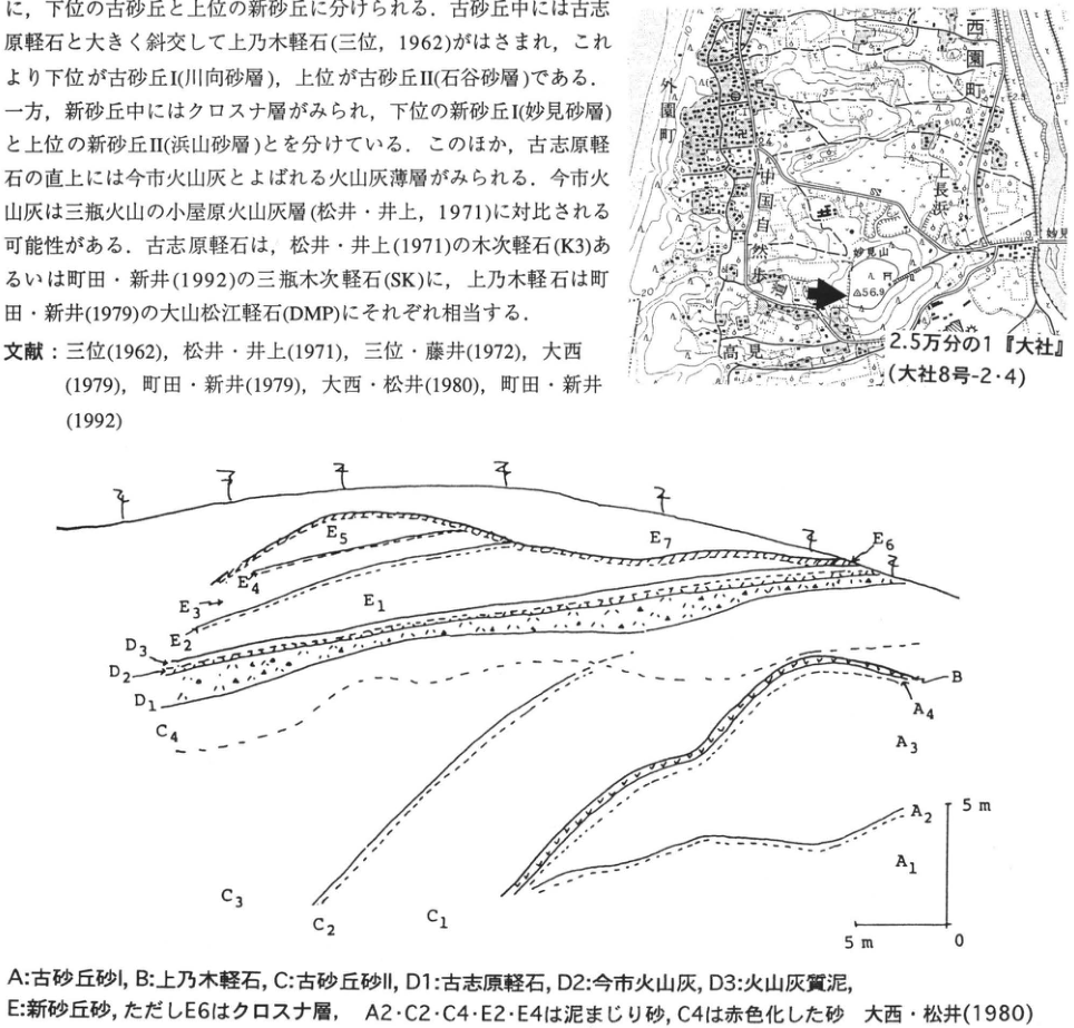
Show extracted lettering and translation
English translation of figure lettering
Map: 1:25,000 Taisha (Taisha sheet 8-2/4); Sotozono-machi (外園町); Nishizono-machi; Nagahama; Myokenyama; 56.9; 35; arrow. Section labels: A1–A4, B, C1–C4, D1–D3, E1–E7. Horizontal and vertical scales 5 m, origin 0. Symbol explanations are in the main text.
Original Japanese lettering
地図:2.5万分の1『大社』(大社8号-2・4);外園町;西園町;長浜;妙見山;56.9;35;矢印.断面ラベル:A1~A4,B,C1~C4,D1~D3,E1~E7.水平・垂直尺度5m,原点0.各記号説明は本文.
CG-6 Ohirayama tephra at the southwestern foot of Sambe, Oda City, Shimane Prefecture: the youngest products of Sambe volcano
中山勝博・山内靖喜・澤田順弘・松井整司
- Locality: Midorigaoka, Shigaku, Sambe-machi, Oda City, Shimane Prefecture
- Coordinates: N35°7′4″ E136°36′34″ [as printed]
- Elevation: 445 m
- Outcrop type and present condition: Artificial exposure, surviving in December 1995
- Deposit type and age: Fallout tephra and pyroclastic-flow deposits; Holocene
- Date of description: December 1995
- Keywords: Sambe volcano; Ohirayama fallout tephra; Ohirayama pyroclastic-flow deposit
This exposure at the southwestern foot of Sambe is one of the few where Sambe-Ohirayama tephra (SOh), erupted during Holocene activity, can be observed well. Its radiocarbon age is approximately 3.6 ka. Near the edifice, it consists of reddish-brown fallout tephra comprising units of varied grain-size composition, including base-surge deposits with antidune structures, ash beds, and lapilli beds, together with nonwelded pyroclastic-flow deposits of coarse dacitic blocks and fine material. Three (to five) beds each of fallout tephra and pyroclastic-flow deposits are recognized.
At this exposure, SOh overlies stage-5 base-surge deposits (松井・井上, 1971), separated by kuroboku. Upward, SOh comprises approximately 8 cm of pink, fine-grained fallout tephra (pfa in the figure; abbreviations below likewise refer to the figure); approximately 65 cm of base-surge deposits (bs) with sag structures (b), and approximately 40 cm of fallout tephra (pfa); approximately 55 cm of pyroclastic-flow deposits (pfl), locally containing thin fallout tephra; 15 cm of fallout tephra (pfa); and approximately 90 cm of pyroclastic-flow deposits (pfl). This valuable exposure allows the eruption sequence to be observed.
References: 服部 et al. (1983); 松井・井上 (1970, 1971).
Photographed November 1993.
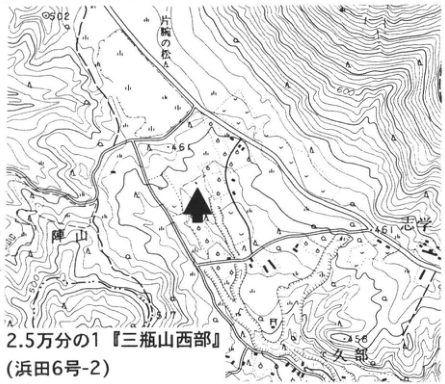
Show extracted lettering and translation
English translation of figure lettering
1:25,000 Sanbesan-Seibu (Hamada sheet 6-2); Kataude-no-matsu (片腕の松); 角井 (reading unverified); 46; 461; 612; arrow.
Original Japanese lettering
2.5万分の1『三瓶山西部』(浜田6号-2);片腕の松;角井;46;461;612;矢印。
Reading notes
小数字・地名 — 一部は印字が小さく読み未確認。
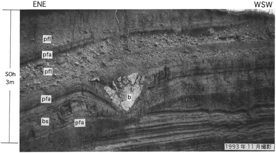
Show extracted lettering and translation
English translation of figure lettering
ENE, WSW; SOh, 3 m. Upward: pfa (fallout), bs (base surge), pfa, b (sag), pfl (pyroclastic flow), pfa, pfl.
Original Japanese lettering
ENE,WSW;SOh,3m.下からpfa,bs,pfa,b(サグ),pfl,pfa,pfl.
CG-7 Late Pleistocene tephras east of Sambe volcano
佐護浩一・町田洋
- Localities: Kinoshita, Yoshida Village (sites 1 and 2), and Fukuda, Akagi Town (site 3), Shimane Prefecture
- Coordinates: N35°09′43″ E132°50′21″ (site 1); N35°09′35″ E132°50′31″ (site 2); N35°0′45″ E132°42′43″ (site 3)
- Elevations: 350 m (site 1); 370 m (site 2); 440 m (site 3)
- Outcrop type and present condition: Scarps along farm roads and fields at all sites, surviving
- Deposit type and age: Tephra and volcanic-ash soil
- Date of description: April 1996
- Keywords: Sambe-Kisuki; Aso-4; Sambe-Unnan; Sambe-Ikeda; Sambe-Ukinuno tephras; Sambe volcano
Although small, Sambe comprises a caldera and central cones and has repeatedly erupted explosively from the Late Pleistocene through the Holocene, producing numerous tephras. Preservation is poor because their distribution area is mountainous, and few sites expose the whole succession. Sites 1 and 2 are in hills of a small basin approximately 20 km east of Sambe. They show the major Late Pleistocene Sambe tephras in relation to the Kyushu-derived widespread Aira-Tn (AT) and Aso-4 tephras (Figs. 1–3). At site 1, three pumice-fall beds approximately 1 m thick are, upward, Sambe-Kisuki (SK), Sambe-Unnan (SUn), and Sambe-Ikeda (SI). All are biotite-rhyolitic products of large explosive eruptions. SUn comprises alternating ash fall and pumice from phreatomagmatic eruptions and is thought to accompany the Oda pyroclastic-flow deposit north of the volcano. SK and SI are pumice falls from large Plinian eruptions. SK is more felsic and contains abundant biotite and quartz, whereas SI contains amphibole as well as biotite. SK's distribution axis trends east-northeast and SI's east-southeast. Both are recognizable hundreds of kilometers away. Distal SK was introduced in entries WS-12 and CB-28. SI occurs in cores from Lake Biwa and Jaishi Oike on the Izu Peninsula and closely resembles the biotite-bearing greasy ash described at the foot of Ashitaka in Shizuoka (愛鷹ローム団研グループ, 1969), probably representing the same bed (佐護・町田, 1996). Since this tephra occupies the upper Musashino Loam of southern Kanto, SI probably erupted around 40 ka. The reddish-brown patchy ash in the volcanic-ash soil immediately above SK at site 1 is Aso-4. A lenticular Sambe pumice-fall bed, Sambe-Yoshida tephra (SYP), occurs 50 cm below SUn.
Tephras above SI are visible at site 2. As the column in Fig. 2 shows, AT and Sambe-Ukinuno tephra (SUP) overlie SI. SUP is a yellowish-brown pumice fall, somewhat more mafic than SK or SI, and is a marker for oxygen-isotope stage 2. It is also recognizable far away in eastern Shikoku and southern Kinki.
Site 3 lies southeast of Sambe (Fig. 4), where SI forms a thick deposit (Fig. 5). Its lowest part includes a white-ash unit called Iinan ash (I1). Sambe has thus supplied valuable tephra markers to Chugoku–Kinki, where Late Pleistocene marker tephras are scarce.
References: 愛鷹ローム団研グループ (1969); 松井・井上 (1971); 三浦・林 (1991); 町田・新井 (1992); 佐護・町田 (1996).
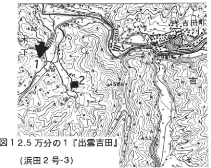
Show extracted lettering and translation
English translation of figure lettering
Fig. 1: 1:25,000 Izumo-Yoshida (Hamada sheet 2-3); 1, 2; Yoshida-machi; 445; 453; 400; arrow.
Original Japanese lettering
図1:2.5万分の1『出雲吉田』(浜田2号-3);1,2;吉田町;445;453;400;矢印。
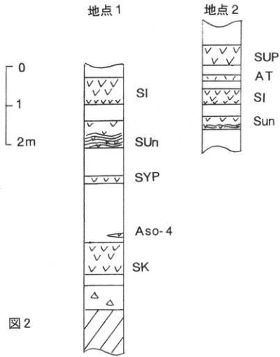
Show extracted lettering and translation
English translation of figure lettering
Fig. 2; scale 0, 1, 2 m. Site 1 upward: SK, Aso-4, SYP, SUn, SI. Site 2 upward: Sun, SI, AT, SUP. The original site-2 capitalization “Sun” is retained.
Original Japanese lettering
図2;尺度0,1,2m.地点1(下から):SK,Aso-4,SYP,SUn,SI.地点2(下から):Sun,SI,AT,SUP.
CG-7 (continued)
Figures 3, 4, and 5.
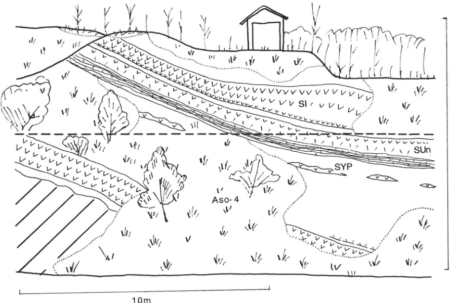
Show extracted lettering and translation
English translation of figure lettering
Fig. 3; SI, SUn, SYP, Aso-4; 10 m.
Original Japanese lettering
図3;SI,SUn,SYP,Aso-4;10m.
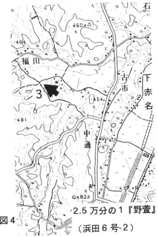
Show extracted lettering and translation
English translation of figure lettering
Fig. 4; 1:25,000 Nogaya (野萱; Hamada sheet 6-2); 3; Fukuda; Furuichi; Shimo-Akana; Nakadori; 462.4; 454; 483.2; arrow.
Original Japanese lettering
図4;2.5万分の1『野萱』(浜田6号-2);3;福田;古市;下赤名;中通;462.4;454;483.2;矢印。
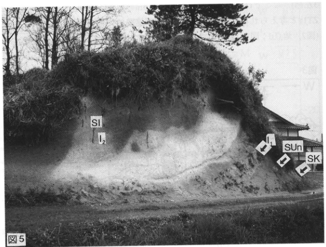
Show extracted lettering and translation
English translation of figure lettering
Fig. 5; SI; I2; I1; SUn; SK; arrows.
Original Japanese lettering
図5;SI;I2;I1;SUn;SK;矢印。
CG-8 Pliocene–Early Pleistocene Tsunozu Formation at Tsunozu, Gotsu City, Shimane Prefecture
水野篤行
- Locality: Tsunozu, Gotsu City, Shimane Prefecture
- Coordinates: N34°59′25″ E132°12′00″
- Elevation: 25–55 m
- Outcrop type and present condition: Artificial exposure, surviving in May 1996
- Deposit type and age: Sandstone and mudstone; Pliocene–Early Pleistocene
- Date of description: September 1995; additions and corrections in May 1996
- Keywords: Tsunozu Formation; M2; M2.5; M3
The Tsunozu Formation occurs scattered through hills along the Japan Sea coast of San'in, over older basement rocks and unconformably beneath the Shimanohoshi Formation. It is a 90–100 m thick clastic sequence deposited over approximately 2.5 million years, from near the Gauss–Gilbert chron boundary (approximately 3.6 Ma) to just after the Cobb Mountain subchron (approximately 1.1 Ma) (草加 et al., 1994). In Gotsu City it occurs in the Tsunozu–Gotsu district west of the lower Gonokawa and the Asari–Kuromatsu district east of it. Fluvial deposits predominate in both districts, but at least six “marine clay beds,” mostly brackish-lagoon deposits, are interbedded. These are relatively continuous and have long been called M1, M2, M3, and M4, with M2.5 and M3.5 recently added (水野 et al., 1994a). Volcanic material is scarce, but two relatively conspicuous thin tephras between M1 and M2 are named ZT1a and ZT1b upward (宇野, 1994). Figure 4 outlines the regional stratigraphy, including the overlying Shimanohoshi and Murokamiyama formations. The illustrated type exposure of the Tsunozu Formation lies at the northern edge of the Maruhachi Yogyo Co., Ltd. premises in Tsunozu, Tsunozu-machi. It is approximately 200 m long and 30 m high and was markedly weathered and collapsing in May 1996. Figure 3 shows its overview. The deeply excavated left-hand part was created during construction in 1995. Figure 2 shows a cliff exposed during that work, at the end of the extension of the step in front of Fig. 3, facing the excavation; it had disappeared by May 1996.
The Tsunozu Formation abuts irregular basement topography. To the right (east) of site a in Fig. 3, fluvial sandstone approximately 5 m below M2 overlies granodiorite basement. To the left (west), the basal surface descends and still lower strata occur, with the actual base unexposed (left part of Fig. 3). Here a thin, discontinuous white ash approximately 1.5 m above the excavation floor is interpreted stratigraphically as ZT1a (Fig. 2, site d; unconfirmed on the Fig. 3 exposure face). ZT1b is absent.
Figures 2 and 3.
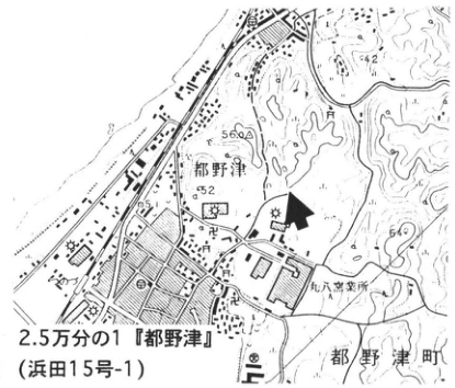
Show extracted lettering and translation
English translation of figure lettering
Fig. 1; 1:25,000 Tsunozu (Hamada sheet 15-1); Tsunozu; Tsunozu-machi; Maruhachi pottery works; 42; 56; 52; 60; arrow.
Original Japanese lettering
図1;2.5万分の1『都野津』(浜田15号-1);都野津;都野津町;丸八窯業所;42;56;52;60;矢印。
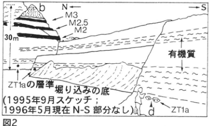
Show extracted lettering and translation
English translation of figure lettering
Fig. 2; b; d; N left, S right; M3, M2.5, M2; organic-rich; 30 m; ZT1a horizon; excavation floor; ZT1a. Sketched September 1995; N–S portion absent in May 1996.
Original Japanese lettering
図2;b;d;N←,→S;M3,M2.5,M2;有機質;30m;ZT1aの層準;掘り込みの底;ZT1a.1995年9月スケッチ;1996年5月現在N-S部分なし.
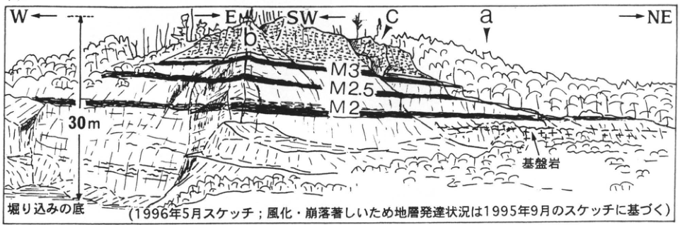
Show extracted lettering and translation
English translation of figure lettering
Fig. 3; W left, E right; SW left, NE right; a, b, c; M3, M2.5, M2; basement; 30 m; excavation floor. Sketched May 1996; because weathering and collapse were severe, the distribution of strata follows the September 1995 sketch.
Original Japanese lettering
図3;W←,→E;SW←,→NE;a,b,c;M3,M2.5,M2;基盤岩;30m;掘り込みの底.1996年5月スケッチ;風化・崩落著しいため地層発達状況は1995年9月のスケッチに基づく.
CG-8 (continued)
The Tsunozu Formation exposed here is an approximately 30 m interval extending from just below ZT1a to above M3. It comprises lagoonal M2, M2.5, and M3 (mudstone, locally highly organic) and fluvial deposits above and below them. The latter are mud-rich below and including M3; above M3 they are chiefly gravelly coarse sandstone with relatively large-scale, low-angle cross-bedding, 8 m thick and visible at site c together with overlying fluvial mudstone. Muddy rocks have been studied for remanent magnetization (井岡 et al., 1990), pollen (Onishi, 1969; 岩内 et al., 1993; 高山・水野, 1995, 1996), diatoms (松坂, 1989; 水野 et al., 1994a), and sulfur (水野 et al., 1994b). Combined with lithofacies and data from other exposures, these studies establish paleomagnetic polarity and paleoenvironmental changes at individual horizons (Fig. 5). The main points are as follows.
- Paleomagnetic ages—the only dating evidence available for the Tsunozu Formation—place M2 in the latest Gauss normal chron, M2.5 just after the Reunion subchron, and M3 in the Olduvai subchron.
- M2, M2.5, and M3 are lagoon deposits formed under warm climates.
- The mainly muddy fluvial deposits up to immediately below M3 formed in wetlands in the lowermost river reaches. The thick sandstone above M3 is interpreted as downstream river-bar deposits associated with river progradation following regression just after M3. These formed under cool climates.
- Transgression and regression—changes from fluvial to lagoonal depositional settings and back—closely correspond to paleoclimatic changes and are interpreted as reflecting sea-level changes.
Beds below M2, particularly M1 and the basal part, are visible at Kannushi, Ninomiya-machi, southwest of Tsunozu. Beds above M3 occur at various places along the northern hill margins in the Gotsu urban area to the northeast. A particularly large erosional structure immediately below M4 (水野 et al., 1994a, p. 44, Fig. 10) is a stratigraphic issue concerning the beds above M3 and a major question in the depositional history of the Tsunozu Formation.
References: Cande and Kent (1992); 調枝 (1970); 井岡 et al. (1990); 岩内 et al. (1993); 松坂 (1989); 水野・武智 (1993); 水野 et al. (1994a, 1994b); Onishi (1969); 大西 (1988); 大西・調枝 (1970); 山陰第四紀研究グループ (1969); 草加 et al. (1994); 高山・水野 (1995, 1996); 宇野 (1978, 1994).
Figure 5: Paleomagnetic time scale after Cande and Kent (1992). Circles to the left of the lithologic column show remanent-magnetization results: filled circles are normal polarity, open circles reversed polarity, and small symbols results from other exposures. All arrows on the right indicate northward paleocurrents. In sulfur analyses, M denotes marine–brackish conditions and F freshwater conditions. In pollen analyses, W denotes warm and C cool. Brackish-water diatom fossils have also been reported from M2.5 (松坂, 1989).
Figure 4.
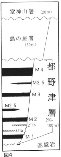
Show extracted lettering and translation
English translation of figure lettering
Fig. 4. Downward: Murokamiyama Formation (20 m); Shimanohoshi Formation (50 m); Tsunozu Formation (90–100 m): M4, M3.5, M3, M2.5, M2, ZT1b, ZT1a, M1; basement.
Original Japanese lettering
図4.上から:室神山層(20m);島の星層(50m);都野津層(90~100m):M4,M3.5,M3,M2.5,M2,ZT1b,ZT1a,M1;基盤岩.
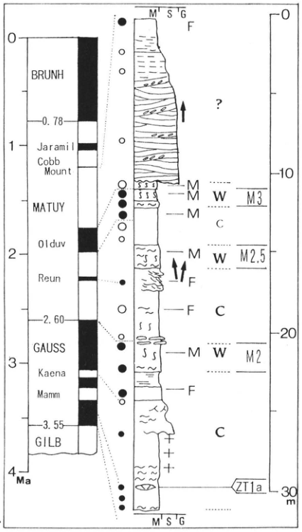
Show extracted lettering and translation
English translation of figure lettering
Paleomagnetic scale: 0, 1, 2, 3, 4 Ma; 0.78, 2.60, 3.55; original abbreviated labels BRUNH, Jaramill, Cobb Mount, MATUY, Olduv, Reun, GAUSS, Kaena, Mamm, GILB. Lithologic grain-size symbols M′, S′, G. Thickness ticks 0, 10, 20, 30 m. M3, M2.5, M2, ZT1a. Environmental symbols M, F, W, C; question mark; three northward arrows; filled and open circles. Legend meanings are in the main text.
Original Japanese lettering
古地磁気尺度:0,1,2,3,4Ma;0.78,2.60,3.55;BRUNH,Jaramill,Cobb Mount,MATUY,Olduv,Reun,GAUSS,Kaena,Mamm,GILB.岩相粒度記号M′,S′,G.標高方向の厚さ目盛0,10,20,30m.M3,M2.5,M2,ZT1a.環境記号M,F,W,C;?;北向き矢印(3本);●,○.図例の意味は主本文。
CG-9 Middle Pleistocene tephras in the Saijo Formation, Hiroshima Prefecture (Minokoshi, Kurose Basin)
水野篤行
- Locality: Minokoshi (箕越), Munachika-Yanagikuni, Kurose Town, Hiroshima Prefecture
- Coordinates: N34°19′25″ E132°42′40″
- Elevation: 170 m
- Outcrop type and present condition: Artificial exposure, weathered and being prepared for revegetation in February 1996
- Deposit type and age: Water-laid tephra; Middle Pleistocene
- Date of description: February 1996
- Keywords: Saijo Formation; Okago tephra; Seiganji-Toga tephra; Kurose Basin
The Middle Pleistocene Saijo Formation is distributed from northeast to southeast between Higashihiroshima City and Kurose Town, in the northern and southern Saijo basins and the Kurose Basin. It is approximately 50 m thick. In the latter two basins it consists mainly of sand and silt showing cyclic fluvial depositional facies, accompanied by gravel and lignite, and contains at least seven tephras in its middle to upper parts (Fig. 3; 東元 et al., 1985; 水野(篤)・平川, 1993).
This large, west-facing exposure at Minokoshi in the Kurose Basin is approximately 80 m long and 13 m high. It lies east of prefectural road 334, at the eastern margin of the Kihara Kogyo Co., Ltd. Kurose plant site. Grayish-white Okago ash, near the middle of the Saijo Formation, is approximately 30 cm thick and has an FT age of 0.57 Ma (東元 et al., 1985). It is visible approximately 6 m above the base at the southern end, but fine mesh installed for revegetation prevents detailed observation except at the northern end. At that end (Fig. 5; left, north of the leftmost building), white Narahara tephra (0.79 Ma; 東元 et al., 1985), or alternatively Imada tephra, occurs near the exposure base. In Figs. 2 and 4, Okago ash occurs immediately below the berm in the middle of the exposure south of arrow A, interbedded in cyclic alternating sand and silt. North of A, however, lignite approximately 2 m thick develops above and below that horizon and the tephra disappears. Okago ash itself is absent at the northern end, but the lower tephra and the full stratigraphic and depositional-facies succession at and above the Okago horizon, comprising cyclic sand and silt, can be observed well.
東元 et al. (1985) first described only the upper half of the northern end. 水野(篤)・平川 (1993) subsequently described the northern cliff before modification (Fig. 4). In February 1996, the exposure, subsequently extended both north and south, was newly described. The combined evidence suggests that Okago ash occurs only west of the dash-dot line crossing the exposure obliquely in Fig. 2.
Okago is a conspicuous tephra widely distributed in the Saijo Formation through the Kurose and southern Saijo basins and has been observed at numerous sites (東元 et al., 1985; 水野(清)・南木, 1986; 水野(篤)・平川, 1993). At site C20 south of Okago on the locality map (東元 et al., 1985, with a column; the site of the FT dating sample mentioned above), the characteristics of approximately 60 cm thick Okago tephra are clearly visible (see WS-23-2). Exposure conditions are relatively poor, however, and unsuitable for detailed observation of the surrounding stratigraphy and depositional facies.
東元 et al. (1985) described the properties and mineral compositions of Okago and other Saijo tephras in detail. The lowest of the seven named beds are Narahara and Imada, whose stratigraphic relationship remains unclear (Fig. 3). Saijo tephras, including these two, range from approximately 10 cm to several tens of centimeters thick. They are generally rich in amphibole, but Okago and the lowest Ichigahara (市ヶ原) tephras are notably amphibole-poor, containing respectively 8.0–9.5% and 1.0%. 東元 et al. (1985) regarded the relatively thick Okago tephra as an important widespread marker. Similarities in glass shape, heavy-mineral composition, and refractive indices of glass and orthopyroxene led them to correlate it with Toga tephra in the Osaka Group; they noted agreement with its FT age. 町田・新井 (1992) treat Okago as Seiganji-Toga, a Middle Pleistocene widespread tephra.
References: 東元 et al. (1985); 町田・新井 (1992); 水野(篤)・平川 (1993); 水野(清)・南木 (1986).
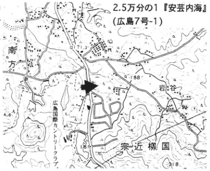
Show extracted lettering and translation
English translation of figure lettering
1:25,000 Aki-Uchinoumi (広島7号-1); Munachika-Yanagikuni; Minamigata; Iwatani; Hiroshima Kokusai Country Club; 171.3; 188; 181; 318; arrow.
Original Japanese lettering
2.5万分の1『安芸内海』(広島7号-1);宗近柳国;南方;岩谷;広島国際カントリークラブ;171.3;188;181;318;矢印。
Reading notes
細かい固有地名の読み — 未確認の固有名は日本語を併記。
CG-9 (continued)
Figure 2: Locality sketch of the Minokoshi exposure (paced survey).
Figure 3: Generalized Saijo Formation columns showing tephra positions; Kurose Basin on the left and southern Saijo Basin on the right (after 東元 et al., 1985).
Figure 4: A: Okago ash; B: Imada ash (or Narahara ash?); C: peat. The rear part of the exposure facing the viewer remains largely preserved. The abrupt replacement of Okago ash by lignite toward the rear is clear. This is exposure F in Fig. 7 of 水野(篤)・平川 (1993), but the face extending from the rear toward the right foreground was subsequently excavated and no longer exists; short dashed lines in the locality sketch show its former position.
Figure 5: Sketch of the west-facing Minokoshi exposure.
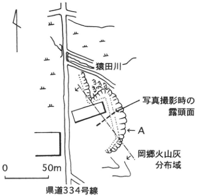
Show extracted lettering and translation
English translation of figure lettering
Sarutagawa; prefectural road 334; exposure face when photographed; A; Okago ash distribution area; 0, 50 m; north arrow.
Original Japanese lettering
猿田川;県道334号線;写真撮影時の露頭面;A;岡郷火山灰分布域;0,50m;北矢印。
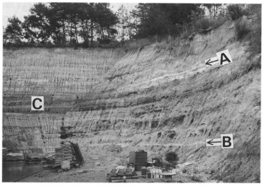
Show extracted lettering and translation
English translation of figure lettering
A; B; C.
Original Japanese lettering
A;B;C.
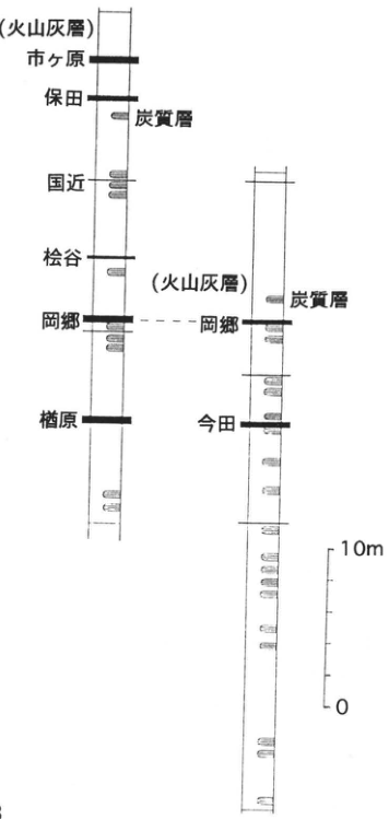
Show extracted lettering and translation
English translation of figure lettering
Left column upward: Narahara; Okago; Matsutani; Kunichika; Yasuda; Ichigahara (ash beds). Right column upward: Imada; Okago (ash beds). Both columns: carbonaceous beds. Scale 0, 10 m.
Original Japanese lettering
左柱(下から):楢原;岡郷;松谷;国近;保田;市ヶ原(火山灰層).右柱(下から):今田;岡郷(火山灰層).両柱:炭質層.尺度0,10m.
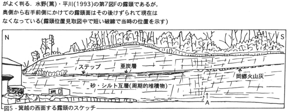
Show extracted lettering and translation
English translation of figure lettering
N, S; step; lignite; Okago ash; alternating sand and silt (cyclic deposits); A; writing inside the building door frame [illegible].
Original Japanese lettering
N,S;ステップ;亜炭層;岡郷火山灰;砂・シルト互層(周期的堆積物);A;建物のドア枠内の文字[判読不明].
Reading notes
左下の建物内文字 — 小さく判読不明。
CG-10 Pleistocene freshwater diatomite beds at Hiruzenbara, Okayama Prefecture
岡田昭明
- Locality: Hanazono, Yatsuka Village, Maniwa District, Okayama Prefecture
- Coordinates: N35°17′50″ E133°43′17″
- Elevation: 440 m
- Outcrop type and present condition: Artificial exposure, surviving
- Deposit type and age: Diatomite; Middle Pleistocene
- Keywords: Hiruzenbara; Hiruzenbara Formation; diatomite
Hiruzenbara lies in northern Okayama, bounded by the Daisen–Hiruzen volcanic group to the north and the backbone mountains of Chugoku to the south. It is an intermontane basin containing lacustrine deposits called the Hiruzenbara Formation. Of its approximately 100 m total thickness, the lower half is diatomite and the upper half sand and gravel. A molar of the Toyo elephant recovered from the sand and gravel led to assignment to the Middle Pleistocene. The sequence is valuable for reconstructing the history of an inland basin and because the diatomite is a high-grade mineral resource. The lower diatomite rarely crops out naturally, but detailed observation is possible at Showa Chemical Industry Co., Ltd.'s open-pit diatomite mine at Hanazono, Yatsuka Village, in the eastern basin. The exposures change annually because mining continues. In the pit operating in 1996 (western pit in the figure), walls are cut into three or four benches. The sketch by 北川・小室 (1993) describes the lowest benches of the west, south, and east walls in the southeastern pit. The sections described by 蒜山原団体研究グループ (1975a, b) lie south of the eastern pit. The unconsolidated diatomite is soft enough to indent with a finger. Millimeter-scale parallel laminae form pairs of dark and monochromatic layers. The principal diatom fossils are Stephanodiscus niagarae and Cyclotella comta. The diatomite is broadly horizontal, but folds, faults, and clastic dikes are locally strongly developed. Structural analysis by 北川・小室 (1993) explained these deformations as liquefaction caused by ground shaking associated with Daisen volcanism.
References: 蒜山原団体研究グループ (1975a, b); 北川・小室 (1993).
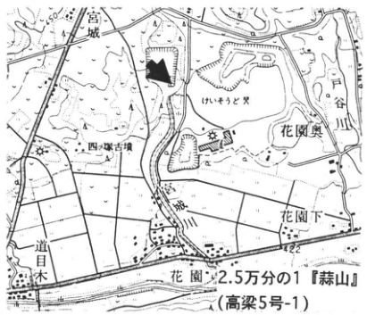
Show extracted lettering and translation
English translation of figure lettering
1:25,000 Hiruzen (Takahashi sheet 5-1); Hanazono; Hanazono-Oku; Hanazono-Shimo; 宮城; 道目木; Toyagawa (戸谷川); map text “砂レキと犬” (sand/gravel and dog, as read); 446; 422; arrow.
Original Japanese lettering
2.5万分の1『蒜山』(高梁5号-1);花園;花園奥;花園下;宮城;道目木;戸谷川;砂レキと犬;446;422;矢印。
Reading notes
砂レキと犬 — 地図の小文字はそのように見えるが末字が不明確。
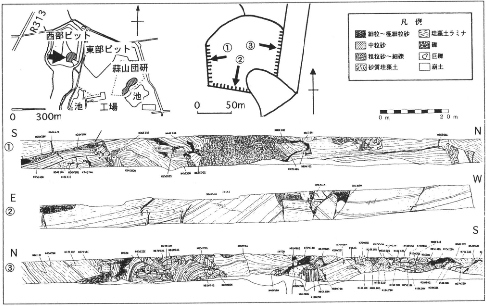
Show extracted lettering and translation
English translation of figure lettering
Western pit; eastern pit; Hiruzenbara joint research group; R313; two ponds; plant; 0–300 m. Detailed pit plan ①②③, 0–50 m. Wall ① S–N, ② E–W, ③ N–S; 0–20 m scale. Legend: fine to very fine sand; medium sand; coarse sand to fine gravel; sandy diatomite; diatomite laminae; gravel; boulders; collapsed material. Numerous strike/dip measurements occur on each wall [minute printing illegible].
Original Japanese lettering
西部ピット;東部ピット;蒜山団研;R313;池(2ヶ所);工場;0~300m.詳細ピット図①②③,0~50m.壁面①S–N,②E–W,③N–S;0~20m尺度.凡例:細粒~極細粒砂;中粒砂;粗粒砂~細礫;砂質珪藻土;珪藻土ラミナ;礫;巨礫;崩土.各壁に多数の走向傾斜数字[微小印字は判読不明].
Reading notes
多数の走向傾斜の小数字 — 原PDFも同じ解像度で、確実な数字列を判読できない。
SK-1 Early Pleistocene Ideguchi (Okubodani) ash along the Median Tectonic Line, Tokushima Prefecture
水野清秀
- Locality: Ideguchi, Awa Town, Awa District, Tokushima Prefecture
- Coordinates: N34°6′2″ E134°14′30″
- Elevation: 130 m
- Outcrop type and present condition: Artificial exposure, surviving
- Deposit type and age: Freshwater deposits; Early Pleistocene, approximately 1.0 Ma
- Date of description: May 1992
- Keywords: Ideguchi ash; Okubodani ash; Median Tectonic Line
Fluvial Pliocene–Pleistocene deposits occur intermittently along the Median Tectonic Line in Tokushima. Called the Dochu Formation, their ages and depositional environments are important for reconstructing the tectonic line's activity history. Several tephras are interbedded, including the Ideguchi ash at this exposure (水野, 1987). 阿子島・須鑓 (1989) call the same tephra Okubodani ash. This 30–80 cm thick glassy ash is described in detail by 水野 (1987) and 阿子島・須鑓 (1989). It has normal paleomagnetic polarity and a fission-track age of 1.0±0.2 Ma, probably corresponding to the Jaramillo event. A correlated ash has been found in the fluvial–lacustrine Mitoyo Group in Kagawa Prefecture (水野, 1987). A fault cutting the Dochu Formation occurs in the northern part of this exposure. Nearby gravel clasts commonly bear horizontal striations, indicating predominantly strike-slip movement.
References: 阿子島・須鑓 (1989); 水野 (1987); 水野 et al. (1993).
Reproduced from 水野 et al. (1993). Photographed April 1991.
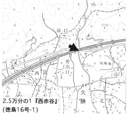
Show extracted lettering and translation
English translation of figure lettering
1:25,000 Nishi-Akadani (徳島16号-1); Ideguchi; Taniguchi; Nishioka; 勝命; Kitakubo; Sanno; 232; 130.3; 92; arrow. Unverified local name retained in Japanese.
Original Japanese lettering
2.5万分の1『西赤谷』(徳島16号-1);井出口;谷口;西岡;勝命;北久保;山王;232;130.3;92;矢印。
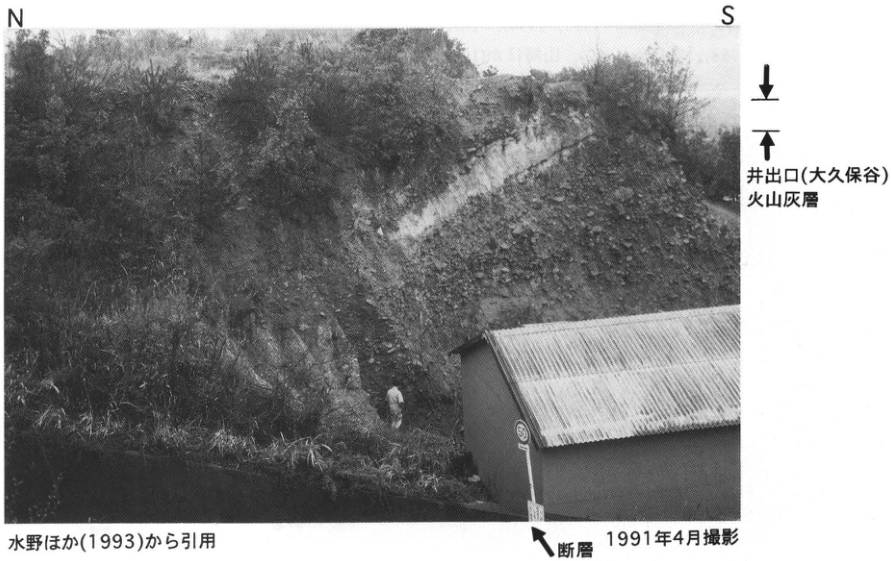
Show extracted lettering and translation
English translation of figure lettering
N; S; Ideguchi (Okubodani) ash; fault; 50 (road sign).
Original Japanese lettering
N;S;井出口(大久保谷)火山灰層;断層;50(道路標識).
SK-2 Recent activity of the Okamura fault, Median Tectonic Line
奥村晃史
- Locality: Iioka, Saijo City, Ehime Prefecture
- Coordinates: N33°54′10″ E133°14′29″
- Elevation: 50 m
- Outcrop type and present condition: Artificial exposure (trench), lost
- Deposit type and age: Peat, sand, and silt; Holocene
- Date of description: August 1988
- Keywords: Median Tectonic Line; Okamura fault; active fault; paleoearthquake
As an active fault, the Median Tectonic Line is Japan's longest onshore active fault, extending approximately 400 km from central Kii Peninsula to the southern margin of Iyo-nada (活断層研究会, 1991; 小川 et al., 1992; 水野 et al., 1993, 1994). In eastern Ehime it has active traces not only at the boundary of Sambagawa metamorphic rocks and the Izumi Group (Ishizuchi fault), but also 1–2 km north of that boundary. One of these, the Okamura fault, underwent large-scale trenching three times: in 1984 (岡田, 1988; trench 1 here), March 1988 (堤 et al., 1992; trench 2), and August 1988 (山崎 et al., 1992; trench 3). Trenches were excavated where the fault cuts a fan formed by an incised valley at the northern foot of hills composed of the Pliocene Okamura Formation. The sequences are broadly similar: alternating humic sand and mud dated 10–20 ka, overlain by sand and gravel containing silt and humic-soil beds dated 2–4 ka. A bed enriched in Kikai-Akahoya tephra (K-Ah) occurs in trench 3, but pottery from the earlier part of the Late Jomon period in the same horizon indicates redeposition around 3–4 ka (山崎, 1988). In trenches 1 and 2 the Okamura fault cuts every bed except the surface cultivated soil. Pottery within the fault zone in trench 1 dates the latest movement to after the fifth through seventh centuries (堤 et al., 1992). In trench 3 (figure), sand, gravel, and silt containing seventh-century Sue ware overlie the fault, placing the latest movement in the fourth through seventh centuries (山崎 et al., 1992). Up to four events, including the latest, are inferred within the past 3,000–4,000 years (岡田, 1988).
References: 活断層研究会 (1991); 水野 et al. (1993, 1994); 小川 et al. (1992); 岡田 (1988); 堤 et al. (1992); 山崎 et al. (1992).
Plan of Okamura fault trench 3 (left) and west-wall sketch of trench B (below) [Figs. 4 and 5 of 山崎 et al. (1992)].
Black arrows mark unconformities. Unit numbers agree between the plan and wall sketch.
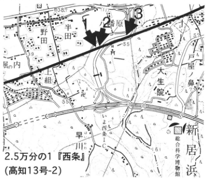
Show extracted lettering and translation
English translation of figure lettering
1:25,000 Saijo (Kochi sheet 13-2); Okamura; Noda; 舟内; 水生院; Niihama; Hayakawa; 1, 2, 3; 37; 39; 55; 57; arrow. Unverified minor names retained in Japanese.
Original Japanese lettering
2.5万分の1『西条』(高知13号-2);岡村;野田;舟内;水生院;新居浜;早川;1,2,3;37;39;55;57;矢印。
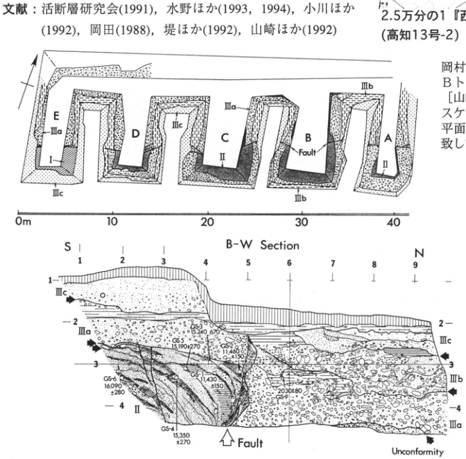
Show extracted lettering and translation
English translation of figure lettering
Plan: A, B, C, D, E; I, II, IIIa, IIIb, IIIc; Fault; 0, 10, 20, 30, 40 m. Wall: B-W Section; S, N; horizontal 1–9; vertical 1–4; II, IIIa, IIIb, IIIc; Fault; Unconformity. Ages: GS-1 11,430±150; GS-2 11,480±150; GS-3 15,240±670; GS-4 15,350±270; GS-5 15,190±270; GS-6 16,090±280; GS-9 2030±80. Original English legend: Artificial, Peat, Silt, Silty sand, Fine sand, Sand & Gravel. Surrounding reference and explanatory fragments are retained in the main text.
Original Japanese lettering
平面:A,B,C,D,E;I,II,IIIa,IIIb,IIIc;Fault;0,10,20,30,40m.壁面:B-W Section;S,N;水平1~9;縦1~4;II,IIIa,IIIb,IIIc;Fault;Unconformity.年代:GS-1 11,430±150;GS-2 11,480±150;GS-3 15,240±670;GS-4 15,350±270;GS-5 15,190±270;GS-6 16,090±280;GS-9 2030±80.凡例(原文英語):Artificial,Peat,Silt,Silty sand,Fine sand,Sand & Gravel.周囲の文献・説明断片は主本文。
SK-3 Tephras in the Pliocene–Pleistocene Gunchu Formation, Iyo City, Ehime Prefecture
水野清秀
- Locality: Coast southwest of Mori, Iyo City, Ehime Prefecture
- Coordinates: N33°43′10″ E132°40′16″ to N33°43′50″ E132°40′42″
- Elevation: 0 m
- Outcrop type and present condition: Sea cliff, surviving in January 1990
- Deposit type and age: Freshwater deposits; Pliocene–Early Pleistocene, approximately 1.0–2.0 Ma
- Keywords: Gunchu Formation
The Gunchu Formation, one of the Pliocene–Pleistocene sequences along the Median Tectonic Line active-fault system, occurs near Mori, Iyo City. The entire sequence is steeply inclined under the influence of the Gunchu fault. Along the coast, which crosses its strike obliquely, approximately 300 m of strata from lower to upper Gunchu Formation can be observed almost continuously. Columns are provided by 高橋・鹿島 (1985), 松井 et al. (1985), and 水野 (1987). Interbedded tephras were named T1–T8 upward and described in detail by 水野 (1987). In September 1990, two additional tephras were recognized higher in the sequence. Exposure conditions constantly change because of coastal erosion and gravel deposition. T1 is the easiest tephra to find, comprising glassy ash up to 70 cm thick. 松井 et al. (1985) called it GT1 and reported a fission-track age of 1.9±0.7 Ma. T3, approximately 10 m above it, is 40 cm thick and contains abundant cummingtonite. At and above T5, crystalline tephras composed chiefly of feldspar and amphibole become common. Plant fossils also occur: Tertiary-type Pseudolarix (inukaramatsu) from the lower part, and himebaramomi spruce indicating a cold climate from the upper part (水野, 1987).
References: 松井 et al. (1985); 水野 (1987); 高橋・鹿島 (1985).
Northern part of the complete exposure. Photographed January 1991.
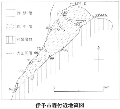
Show extracted lettering and translation
English translation of figure lettering
Geological map near Mori, Iyo City; alluvium; Gunchu Formation; Izumi Group; ash beds; T1, T4, T5, T6; 132°41′E; 33°44′N; dip figures 30, 90, 60, 66, 74, 76, 88, 66, 82; 0–1 km; north arrow.
Original Japanese lettering
伊予市森付近地質図;沖積層;郡中層;和泉層群;火山灰層;T1,T4,T5,T6;132°41′E;33°44′N;30,90,60,66,74,76,88,66,82;0~1km;北矢印。
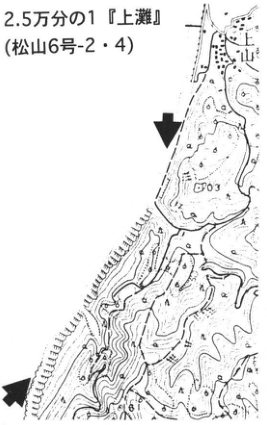
Show extracted lettering and translation
English translation of figure lettering
1:25,000 Kaminada (Matsuyama sheet 6-2/4); Kamiyama (上山); 103; two arrows.
Original Japanese lettering
2.5万分の1『上灘』(松山6号-2・4);上山;103;矢印2本。
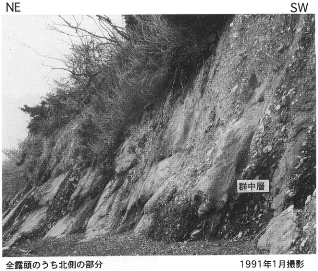
Show extracted lettering and translation
English translation of figure lettering
NE; SW; 群中層 (the original photograph uses 群, unlike 郡 in the text; Gunchu Formation).
Original Japanese lettering
NE;SW;群中層(写真の原著ラベル).
SK-4 Marine terrace deposits forming the Muroto-misaki surface, Kochi Prefecture
前杢英明
- Locality: Yasuda, Yasuda Town, Aki District, Kochi Prefecture
- Coordinates: N33°26′5″ E133°59′41″
- Elevation: 66 m
- Outcrop type and present condition: Artificial exposure, surviving in September 1994
- Deposit type and age: Marine sand and gravel; Late Pleistocene
- Date of description: February 1992
- Keywords: Cape Muroto; marine terrace; coseismic crustal movement
Marine terraces inferred to have formed in the Late Pleistocene are well developed along Shikoku's southern coast. On the Muroto Peninsula, where terrace landforms are especially prominent, exposures of thick terrace deposits, particularly marine deposits, are nevertheless scarce. Most marine terraces carry only thin veneers of sediment or are erosional surfaces exposing basement, ranging from wave-cut benches to marine abrasion platforms. Since the 1946 Nankaido earthquake, their formation history has been discussed in relation to coseismic crustal movement (吉川 et al., 1964, among others), but direct evidence dating the terrace deposits has not been reported. In contrast, shell fossils have been reported in middle marine terrace deposits along the southwestern Tosa Bay coast toward Cape Ashizuri, yielding an amino-acid age of 138 ka (満潮 et al., 1989). Kikai-Tozurahara tephra (K-Tz) has also recently been reported within sand in the middle terrace deposits (太田・小田切, 1994).
This exposure shows marine deposits forming the Muroto-misaki I surface (吉川 et al., 1964) on the left bank of the Yasudagawa mouth along the central western coast of the Muroto Peninsula. They consist mainly of coarse to medium sand containing flattened rounded fine gravel, with some beds of rounded medium gravel. No shells or other fossils have been found, but careful continuous sampling of the sand may reveal volcanic ash. The lower exposure is thought to be the Pliocene–Pleistocene Ananai Formation of the Tonohama Group. On the Muroto Peninsula, Late Quaternary marine terrace deposits can be difficult to distinguish from Pliocene–Pleistocene basement sand and gravel.
References: 太田・小田切 (1994); 満潮 et al. (1989); 吉川 et al. (1964).
Photographed December 1991.
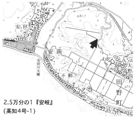
Show extracted lettering and translation
English translation of figure lettering
1:25,000 安岐 [sheet-title glyphs uncertain] (Kochi sheet 4-1); Yasuda; Yasudagawa; Fudo; Ono; Tano Town; 81.7; 3.5; 2.5; 57; 75.9; 9.3; arrow.
Original Japanese lettering
2.5万分の1『安岐[字形不明確]』(高知4号-1);安田;安田川;不動;大野;田野町;81.7;3.5;2.5;57;75.9;9.3;矢印。
Reading notes
図幅名「安岐」 — 原図字形が不明確。正確な図幅名称・読みは未確定。
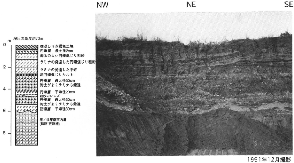
Show extracted lettering and translation
English translation of figure lettering
Photograph: NW, NE, SE; date 91.12.26. Column: terrace elevation approximately 70 m; depths 0, 2, 4, 6, 8 m. Upward: Ananai Formation, Tonohama Group (Pliocene–Pleistocene); boulder bed, mean diameter 30 cm; rounded gravel, maximum diameter 30 cm, well sorted with laminae; fine-sand lens; rounded gravel, mean diameter 20 cm; rounded gravel, maximum diameter 30 cm, well sorted with laminae; silt with fine rounded gravel; laminated medium sand; laminated coarse sand with rounded gravel; well-sorted coarse sand with rounded gravel; rounded gravel, maximum diameter 2 cm; reddish-brown gravelly soil.
Original Japanese lettering
写真:NW,NE,SE;日付91.12.26.柱状:段丘面高度約70m;深度0,2,4,6,8m.下から:唐ノ浜層群穴内層(鮮新~更新統);巨礫層 平均径30cm;円礫層 最大径30cm,淘汰がよくラミナも発達;細砂のレンズ;円礫層 平均径20cm;円礫層 最大径30cm,淘汰がよくラミナも発達;細円礫混じりシルト;ラミナの発達した中砂;ラミナの発達した円礫混じり粗砂;淘汰のよい円礫混じり粗砂;円礫層 最大径2cm;礫混じり赤褐色土壌.
8. Kyushu and the Nansei Islands
KS-1 Old coastal dunes and tephra in northern Kyushu
下山正一
- Locality: Nata, Higashi Ward, Fukuoka City
- Coordinates: N33°41′10″ E130°24′25″
- Elevation: 25m
- Exposure and condition: Natural outcrop; still present in December 1995, although a windbreak forest is growing on it
- Deposit and age: Old coastal dune sand; aeolian and pyroclastic-flow deposits; Late Pleistocene
- Date described: February 1987
- Keywords: Fukuoka; old dunes; Ata tephra; Aso-4 tephra
This outcrop forms a sea cliff facing the Genkai-nada and lies at the base of Uminonakamichi, approximately 600m north of Gannosu Station on the JR Kashii Line. Both young and old dunes are well developed along the northern Kyushu coast facing the Genkai-nada and Hibiki-nada. These dunes consist of several units of barrier deposits, reflecting shoreface erosion during the transgressions through their culmination in the last interglacial and Holocene, and of their secondary deposits reworked by wind. Some parts display the characteristic dune-sand sedimentary structure known as “tiger stripes.” Widespread aeolian dust accumulated during pauses in the growth of the old dunes, giving the upper part of each unit a brown color. The old dune sand can therefore be distinguished from young dune sand by its color. Most of this outcrop consists of old dune sand, overlain at the top by approximately 1m of young dune sand. Two tephra beds occur in the dust-enriched portions of the old dune sand: the lower is Ata tephra (Ata), and the upper is the Aso-4 pyroclastic-flow deposit (Aso-4) (下山 et al., 1989). Both beds are a few centimeters thick and reddish brown, but Aso-4 is readily distinguished by its large hornblende crystals. Since the main body of the old dune sand lies immediately below them, the principal interval of dune formation is interpreted as extending from approximately 130ka in the last interglacial to the Aso-4 eruption at 80–90ka (唐木田 et al., 1995). At an outcrop southwest of this one (■ on the map), approximately 20cm of volcanic kuroboku soil has developed near the boundary between the old and young dune sand. It is called the Gannosu kuroboku soil. The volcanic ash forming its main component is Kikai-Akahoya tephra (K-Ah) (下山 et al., 1989).
References: 唐木田 et al. (1995); 下山 et al. (1989).
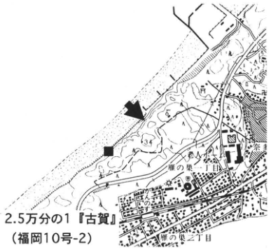
Show extracted lettering and translation
English translation of figure lettering
1:25,000 Koga sheet (Fukuoka sheet 10-2). Nata; Gannosu; Gannosu 1-chome and 2-chome. ■ and exposure-location arrow. 34.
Original Japanese lettering
2.5万分の1『古賀』(福岡10号-2)。奈多、雁ノ巣、雁の巣一丁目、雁の巣二丁目。■、露頭矢印。34。
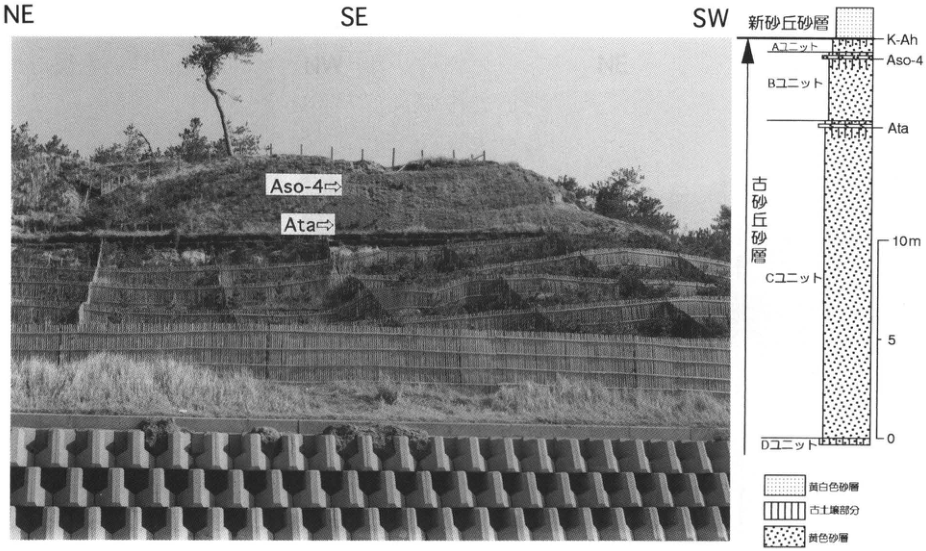
Show extracted lettering and translation
English translation of figure lettering
Photograph: NE, SE, SW, Aso-4, Ata. Column, top downward: young dune sand; K-Ah; Unit A; Aso-4; Unit B; Ata; Unit C; Unit D. Old dune sand. Scale: 0, 5, 10m. Legend: yellowish-white sand; paleosol portions; yellow sand.
Original Japanese lettering
写真:NE、SE、SW、Aso-4、Ata。柱状図(上から):新砂丘砂層、K-Ah、Aユニット、Aso-4、Bユニット、Ata、Cユニット、Dユニット。古砂丘砂層。目盛:0、5、10m。凡例:黄白色砂層、古土壌部分、黄色砂層。
KS-2 Widespread aeolian dust and tephra in northern Kyushu
下山正一
- Locality: Nanatsugama, Karatsu City, Saga Prefecture
- Coordinates: N33°32′40″ E129°56′00″
- Elevation: 17m
- Exposure and condition: Natural outcrop; preserved in the upper part of a sea cliff
- Deposit and age: Widespread aeolian dust; Late Pleistocene to Holocene
- Date described: July 1990
- Keywords: Saga; widespread aeolian dust; Aira-Tn tephra; Kikai-Akahoya tephra
This exposure in a sea cliff projecting into the Genkai-nada lies at the scenic Nanatsugama, approximately 10km north-northwest of Nishikaratsu Station on the JR Karatsu Line. The Higashi-Matsuura Peninsula has a gently northward-sloping lava plateau composed of basalt erupted at approximately 3Ma, near the end of the Tertiary. Yellowish-brown fine-grained soil layers frequently develop on the plateau; at Nanatsugama the fine-grained soil is approximately 2m thick. Its main constituents are fine quartz and vermiculite, so it is not simply a weathering soil derived from basalt. Measurements of oxygen isotopes in the quartz and Sr isotope ratios in the fine soil demonstrated that this material originated from old rocks on the Asian continent rather than island-arc rocks (溝田 et al., 1992). These isotope ratios agreed with those of muddy rain falling in Fukuoka in winter and spring. Since river sediment is also unlikely to be supplied to the plateau, the fine soil is considered to be widespread aeolian dust deposited on the plateau, or loess. The soil also contains fallout horizons of Kikai-Akahoya tephra (K-Ah) and Aira-Tn tephra (AT); a column is given in 溝田 et al. (1992). The age of the interval containing these two tephras indicates that soil formation spans only approximately 40,000 years to the present. There is a large temporal gap between the basalt eruption at approximately 3Ma and 40ka. Since it is unlikely that no widespread dust was supplied before 40,000 years ago, this suggests repeated episodes of soil erosion caused by heavy rainfall, exposure of bare ground, and similar processes.
Reference: 溝田 et al. (1992).
Photographed in April 1990.
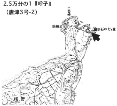
Show extracted lettering and translation
English translation of figure lettering
1:25,000 Yobuko sheet (Karatsu sheet 3-2). Megane-iwa; 三吉島; 福形石の七ツ釜; Yokono. Exposure arrow.
Original Japanese lettering
2.5万分の1『呼子』(唐津3号-2)。眼鏡岩、三吉島、福形石の七ツ釜、横野。露頭矢印。
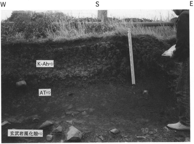
Show extracted lettering and translation
English translation of figure lettering
W, S, E. K-Ah; AT; basalt weathering crust. 90.4. Photographed in April 1990.
Original Japanese lettering
W、S、E。K-Ah、AT、玄武岩風化殻。90.4。1990年4月撮影。
KS-3 The Aso-4 pyroclastic flow and buried forest: destruction of vegetation by a gigantic pyroclastic flow
下山正一
- Locality: Tsutsumi, Kamimine Town, Miyaki District, Saga Prefecture
- Coordinates: N33°20′45″ E130°25′40″
- Elevation: 27m
- Exposure and condition: Excavated exposure, lost during field consolidation; the pyroclastic-flow deposit and trees were backfilled for preservation. A small exposure is present at ●
- Deposit and age: Pyroclastic-flow deposit; Late Pleistocene
- Date described: February 1993
- Keywords: Saga; buried trees; Aso-4 pyroclastic-flow deposit; vegetation destruction
This exposure lies near the boundary between the plateau and hills at the northern margin of the Chikushi Plain, approximately 1.4km west-northwest of Nakabaru Station on the JR Nagasaki Main Line. Excavations by the Saga Prefectural Board of Education and Kamimine Town Board of Education discovered numerous fossil trees and roots in the Aso-4 pyroclastic-flow deposit, including three large trees with trunks approximately 1m in diameter. Entire trees or their surfaces were scorched and carbonized. All the thick trees had broken at the base and their crowns pointed west. Pollen analyses of the strata below and above the Aso-4 tephra suggested cool-temperate forest vegetation dominated by spruce on either side of Aso-4, while secondary vegetation indicating forest destruction was recorded immediately above it.
At ■, 250m southeast of this exposure, a low-terrace scarp is present. Fine-grained soil up to 2m thick overlies the low-terrace surface. This soil is not derived from the basement, but is aeolian dust from the Asian continent, that is, loess. It contains fallout horizons of Kikai-Akahoya tephra (K-Ah) and Aira-Tn tephra (AT). These exposures are important for Quaternary studies; however, as of December 1995 the analyzed low-terrace-scarp exposure was covered with plastic netting and could not be investigated.
References: 下山 et al. (1994, 1995).
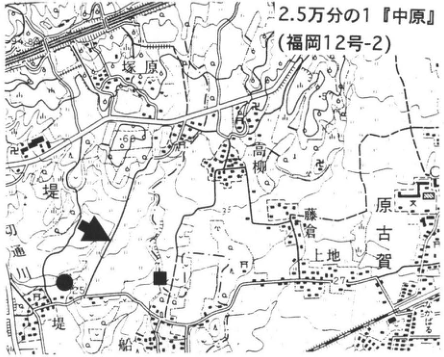
Show extracted lettering and translation
English translation of figure lettering
1:25,000 Nakabaru sheet (Fukuoka sheet 12-2). Tsutsumi; 坊原; 高柳; Harakoga; 上地; Nakabaru. ■, ●, arrows. 29, 25, 27, 60.
Original Japanese lettering
2.5万分の1『中原』(福岡12号-2)。堤、坊原、高柳、原古賀、上地、中原。■、●、矢印。29、25、27、60。
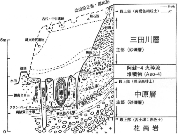
Show extracted lettering and translation
English translation of figure lettering
Low-terrace surface: original topography. Ancient and medieval sites; Jomon-period artifacts; microblades; road; paddy field; elevation 26m; charcoal tree fragments; investigation trench; buried trees; ground surge; humic paleosol; bluish-gray paleosol; [illegible] soil layer. Mitagawa Formation: uppermost part (yellowish-brown fine-grained soil), K-Ah, AT, loess; main part (sand and gravel), sand and gravel, black silt. Aso-4 pyroclastic-flow deposit (Aso-4). Nakabaru Formation: uppermost part (buried forest soil); main part (sand and gravel). Granite: uppermost part (paleosol: red soil). Scale 0, 5m.
Original Japanese lettering
低位段丘面:原地形。古代・中世遺跡、縄文時代遺物、細石器、道路、水田、標高26m、炭化樹木片、調査用トレンチ、埋没樹木、グランドサージ、腐植質古土壌、青灰色古土壌、[判読不明]土層。三田川層:最上部(黄褐色細粒土)、K-Ah、AT、レス;主部(砂礫層)、砂礫、黒色シルト。阿蘇-4火砕流堆積物(Aso-4)。中原層:最上部(埋没森林土);主部(砂礫層)。花崗岩:最上部(古土壌:赤色土)。目盛0、5m。
Reading notes
断面図の「[判読不明]土層」 — 埋没林の右側の斜めラベルは原画像でも先頭字を確定できない。
KS-4 Unzen eruptions and pyroclastic-flow deposits
山田スミコ・遠藤邦彦
- Locality: Uto-machi, Shimabara City, Nagasaki Prefecture (A); Minami-Kamikoba-machi (B)
- Coordinates: N32°7′18″ E130°0′19″ (A); N32°4′38″ E130°9′54″ (B)
- Elevation: 148m (A); 230m (B)
- Exposure and condition: Exposure created during dam construction on the Nakaogawa, lost (A); natural outcrop, preserved (B)
- Deposit and age: Pyroclastic-flow deposits; latest Pleistocene onward
- Date described: December 1994
- Keywords: Unzen; Fugen-dake; Mayuyama; Kureishibaru pyroclastic-flow deposit; Mutsugi pyroclastic-flow deposit; Mizunashigawa pyroclastic-flow deposit; Unzen eruption beginning in 1990
The Unzen eruption that began in November 1990 is characterized by pyroclastic flows generated by collapse of a lava dome. Ash from relatively large flows, including that of June 3, 1991, reached the opposite shore across the Ariake Sea and as far as Shikoku. Numerous small and medium flows also deposited ash containing accretionary lapilli on the Shimabara Peninsula. The total fallout-ash volume amounts to approximately 10% of the total erupted volume (200 million m³: Geographical Survey Institute) (遠藤 et al., 1993). These ashes are widely observed on flat ground and gentle slopes, at thicknesses of several centimeters (磯 et al., 1996). 渡辺・星住 (1995) subdivided Younger Unzen Volcano into Nodake Volcano (after Aso-4 tephra), Myoken-dake Volcano (around the time of Aira-Tn tephra, AT), and Fugen-dake/Mayuyama Volcano (after AT). Similar eruptions have occurred repeatedly at Unzen in the past. Sites A and B expose pyroclastic-flow deposits of Fugen-dake/Mayuyama Volcano, both block and ash flows rich in juvenile blocks. Pyroclastic surges and flows struck the Senbongi district on June 23 and 24, 1993, causing catastrophic damage. Mainly pyroclastic-surge deposits cover the ground in Minami-Senbongi (including site 1), while pyroclastic-flow deposits cover Kita-Senbongi (including sites 2 and 3) (遠藤 et al., 1996). Site A was exposed by construction of a sabo dam on the Nakaogawa. Its lower half comprises the Kureishibaru pyroclastic-flow deposit, formed early in the development of Fugen-dake Volcano. Above a soil containing Kikai-Akahoya tephra (K-Ah) lies the Mutsugi pyroclastic-flow deposit, with a ¹⁴C age of 4,330±80yr B.P. (GaK-18483); see KS-5.
Numerous pyroclastic-flow and debris-flow deposits formed since May 1991 are distributed along the Mizunashigawa and Akamatsudani. However, erosion has left only portions of the deposits of the large flows of June 3, June 8, and September 15, 1991. Site B is a natural exposure in Akamatsudani. Below a black soil covered with plastic sheeting from a tobacco field are several pyroclastic-surge and pyroclastic-flow deposits (the Mizunashigawa pyroclastic-flow deposit). Above the plastic are deposits of the September 15, 1991 flow and subsequent flows.
References: 遠藤 et al. (1993, 1996); 磯 et al. (1996); 小林・中田 (1991); 渡辺・星住 (1995).
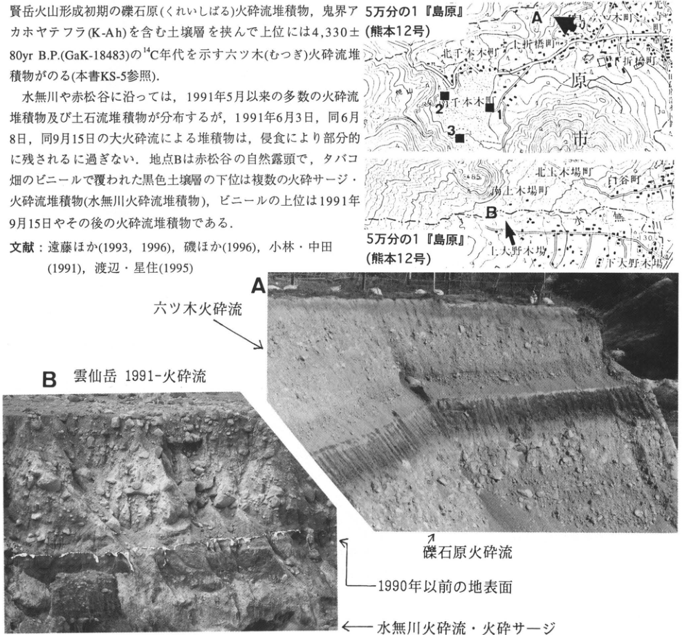
Show extracted lettering and translation
English translation of figure lettering
Two maps: 1:50,000 Shimabara sheet (Kumamoto sheet 12). A, B, 1, 2, 3. Uto-machi; Kita-Senbongi-machi; Minami-Senbongi-machi; Kita-Kamikoba-machi; Minami-Kamikoba-machi; Shiratani-machi; Kita-Onokoba; Minami-Onokoba. 85, 30.3. Photograph A: Mutsugi pyroclastic flow; Kureishibaru pyroclastic flow. Photograph B: Unzen 1991– pyroclastic flow; ground surface before 1990; Mizunashigawa pyroclastic flow and pyroclastic surge. Prose included in the crop is transcribed and translated in the body.
Original Japanese lettering
地図2図:5万分の1『島原』(熊本12号)。A、B、1、2、3。宇土町、北千本木町、南千本木町、北上木場町、南上木場町、白谷町、北大野木場、南大野木場。85、30.3。写真A:六ツ木火砕流、礫石原火砕流。写真B:雲仙岳1991-火砕流、1990年以前の地表面、水無川火砕流・火砕サージ。切出し内の本文は本文欄に収録。
KS-5 Pyroclastic-flow deposits from Younger Unzen Volcano and widespread tephra: stratigraphy on the northern flank of Unzen
星住英夫・渡辺一徳
- Locality: West of Uto-machi, Shimabara City, Nagasaki Prefecture
- Coordinates: N32°47′40″ E130°20′40″
- Elevation: 110m
- Exposure and condition: Artificial exposure, used as a borrow pit
- Deposit and age: Pyroclastic-flow deposits and aeolian tephra; Late Pleistocene to Holocene
- Date described: October 1994
- Keywords: Unzen Volcano; Mutsugi pyroclastic flow; Kureishibaru pyroclastic flow; Ipponmatsu pyroclastic flow; block and ash flow
Younger Unzen Volcano began activity approximately 100,000 years ago. It consists of numerous andesitic to dacitic lava domes and flows centered on Fugen-dake, and successively formed the Nodake, Myoken-dake, Fugen-dake and Mayuyama edifices. On the flanks in the central and eastern Shimabara Peninsula, pyroclastic-flow and debris-flow deposits from Younger Unzen, together with debris-avalanche deposits produced by edifice collapse, form gentle slopes (渡辺・星住, 1995). Sites 1 and 2 lie on the northeastern flank, on a plateau of lava and pyroclastic rocks of Older Unzen Volcano (approximately 500–170ka). The relationships between three pyroclastic-flow deposits (block and ash flow deposits) from Younger Unzen and widespread tephras can be observed here. The Aso-4T pyroclastic-flow deposit (Tosu orange pumice flow) at the bottom of site 2 is a nonwelded deposit containing orange, well-vesiculated pumice, erupted from Aso caldera approximately 90ka ago. The Ipponmatsu pyroclastic-flow deposit (Uz-Ip) is distinctive in containing two types of juvenile material: dense dark bluish-gray hornblende andesite and pale-yellow vesicular hornblende dacite. It is thickly exposed (approximately 7m) at its type locality, site 3, southwest of Ipponmatsu in Ariake Town. Uz-Ip lies below Aira-Tn tephra (AT; 24ka) and is correlated with the main edifice of Myoken-dake Volcano (approximately 25–30ka) on lithological grounds. The Kureishibaru pyroclastic-flow deposit (Uz-Kr) contains dense juvenile hornblende-dacite blocks approximately 2–30cm in diameter, in a matrix relatively poor in fines. It is thin, no more than 3m, and widely distributed, including the alluvial-fan surface near Kureishibaru in Shimabara City. Its type exposure at site 4, Nishi-machi, Shimabara City, is 2m thick. Charcoal in the deposit has yielded ¹⁴C ages of 13ka and 19ka (小林・中田, 1991). Lithological similarity suggests a possible Fugen-dake source. The Mutsugi pyroclastic-flow deposit (Uz-Mt) is a thin (<3m), relatively fines-poor deposit extending north of Shichimen-yama in Mayuyama. It comprises dense, somewhat glassy juvenile blocks approximately 2–40cm in diameter and a sand-sized matrix of the same material. At an exposure produced during sabo construction at site 5, it also overlies Kikai-Akahoya tephra (K-Ah; 6.3ka). Charcoal in the deposit yielded a ¹⁴C age of 4,220±110yr B.P. (星住・渡辺, in preparation). Its distribution and age suggest a Mayuyama source. Since site 2 lies near the margin of its distribution, only scattered material occurs in black volcanic-ash soil. Farther east, including site 6, it is approximately 3m thick and its upper surface is slightly reddened by high-temperature oxidation.
References: 小林・中田 (1991); 渡辺・星住 (1995).
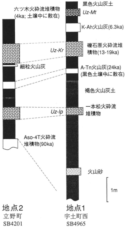
Show extracted lettering and translation
English translation of figure lettering
Site 2: Tateno-machi, SB4201. Site 1: Uto-machi west, SB4965. Black volcanic-ash soil; brown volcanic-ash soil; volcanic sand; fine volcanic ash. Uz-Mt: Mutsugi pyroclastic-flow deposit (4ka; scattered in soil). K-Ah ash (6.3ka). Uz-Kr: Kureishibaru pyroclastic-flow deposit (13–19ka). A-Tn ash (24ka; scattered in black soil). Uz-Ip: Ipponmatsu pyroclastic-flow deposit. Aso-4T pyroclastic-flow deposit (90ka). 1m.
Original Japanese lettering
地点2:立野町、SB4201。地点1:宇土町西、SB4965。黒色火山灰土、褐色火山灰土、火山砂、細粒火山灰。Uz-Mt:六ツ木火砕流堆積物(4ka;土壌中に散在)。K-Ah火山灰(6.3ka)。Uz-Kr:礫石原火砕流堆積物(13-19ka)。A-Tn火山灰(24ka)(黒色土壌中に散在)。Uz-Ip:一本松火砕流堆積物。Aso-4T火砕流堆積物(90ka)。1m。
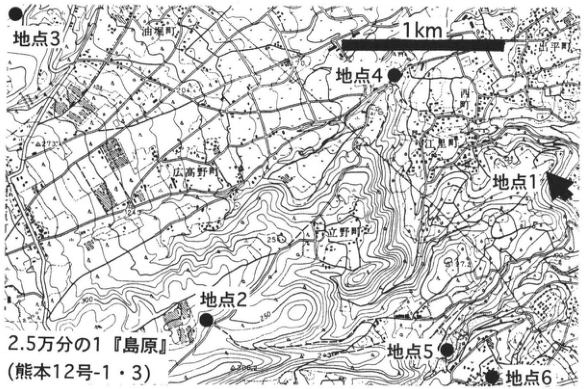
Show extracted lettering and translation
English translation of figure lettering
1:25,000 Shimabara sheet (Kumamoto sheets 12-1 and 12-3). Sites 1, 2, 3, 4, 5, 6. 1km. 油堀町; 広高野町; Tateno-machi. 250, 300, 97.2.
Original Japanese lettering
2.5万分の1『島原』(熊本12号-1・3)。地点1、地点2、地点3、地点4、地点5、地点6。1km。油堀町、広高野町、立野町。250、300、97.2。
KS-6 Fallout pyroclasts from Kuju Volcano and widespread tephra
鎌田浩毅・星住英夫
- Locality: Sakaigawa, Kuju Town, Naoiri District, Oita Prefecture
- Coordinates: N33°1′48″ E131°18′25″
- Elevation: 578m
- Exposure and condition: Artificial exposure, observable on both sides of the road
- Deposit and age: Fallout tephra; Late Pleistocene to Holocene
- Date described: March 1996
- Keywords: Kuju-1 pumice fall; Kuju A1 ash; Kuju-derived tephra; Aira-Tn tephra; Kikai-Akahoya tephra
Kuju is an active volcano that began activity approximately 150ka ago, principally repeating lava-dome formation and eruptions of Plinian pumice falls and pyroclastic flows. A phreatic explosion occurred on the northeastern slope of Hossho-zan in October 1995 (星住 et al., 1996), and small-scale fumarolic activity continued as of June 1996. The stratigraphy of the isolated lava domes has been established using the covering relationships of fallout pyroclasts associated with lava effusion (鎌田, 1997). Ages of the fallout pyroclasts are estimated from ¹⁴C ages of the black humic soils (kuroboku) bracketing them (鎌田・小林, 1996). This exposure lies on the southern flank and displays several Kuju-derived fallout pyroclasts and a mudflow deposit, together with two widespread tephras from southern Kyushu. The principal tephras visible to the naked eye are, from bottom upward, Kuju D volcanic-sand fall (Kj-D; 35ka), Kuju-1 pumice fall (Kj-P1; 35ka; 町田, 1980), a mudflow deposit, Aira-Tn tephra (AT; 25ka), Kikai-Akahoya tephra (K-Ah; 6.3ka), and Kuju A1 ash fall (Kj-A1; 5ka). Exposures occur on both sides of the road; the upper column can be observed on the west and the lower column on the east. Kj-D consists of interbedded bluish-gray medium-grained volcanic sand and yellowish-white fine ash. Immediately above it, Kj-P1 is a Plinian pumice-fall deposit of common-hornblende dacite. It consists of pale-yellow to grayish-white coarse pumice, with an average maximum diameter of 10cm, and abundant bluish-gray autoliths. The whole deposit forms one fall unit, but the bottom 10cm has smaller pumice than the overlying material and is rich in crystal fragments. The mudflow deposit consists mainly of subangular fragments of common-hornblende andesite from Kuju and is correlated with the Inabagawa mudflow, typically distributed southeast of this exposure (小野 et al., 1977). AT does not form a pure bed here, but occurs dispersed in brown soil (akaboku) as extremely vesicular white pumice no more than 3mm in diameter and fine glass flakes. Above the pale-orange K-Ah, a black soil separates it from the overlying pale-yellow Kj-A1. Kj-A1 originated near Taisen-zan in Kuju Volcano and is nearly as clearly visible as K-Ah. On the eastern side of Kuju, Danbaru scoria fall (4ka), composed of orange to black scoria, also occurs above Kj-A1.
References: 星住 et al. (1996); 鎌田 (1997); 鎌田・小林 (1996); 町田 (1980); 小野 et al. (1977).
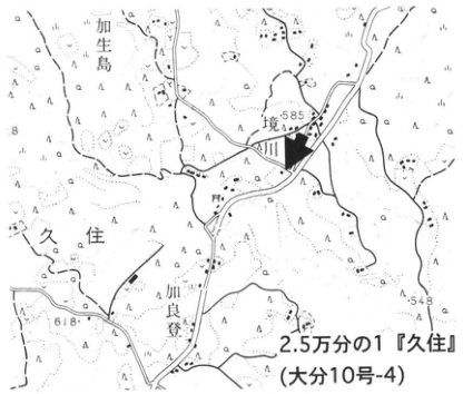
Show extracted lettering and translation
English translation of figure lettering
1:25,000 Kuju sheet (Oita sheet 10-4). 加生島; Sakaigawa; Kuju; 川良登. 585, 618, 548. Exposure arrow.
Original Japanese lettering
2.5万分の1『久住』(大分10号-4)。加生島、境川、久住、川良登。585、618、548。露頭矢印。
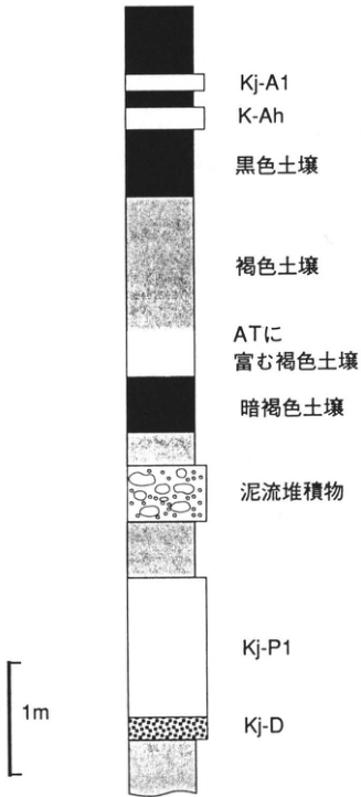
Show extracted lettering and translation
English translation of figure lettering
Top downward: Kj-A1; K-Ah; black soil; brown soil; AT-rich brown soil; dark-brown soil; mudflow deposit; Kj-P1; Kj-D. 1m.
Original Japanese lettering
上から:Kj-A1、K-Ah、黒色土壌、褐色土壌、ATに富む褐色土壌、暗褐色土壌、泥流堆積物、Kj-P1、Kj-D。1m。
KS-7 The Yufugawa pyroclastic-flow deposit: a large pyroclastic flow erupted in central Kyushu approximately 600,000 years ago
星住英夫・竹村恵二
- Locality: Shimoichigi (下櫟木), Shonai Town, Oita Prefecture
- Coordinates: N33°11′46″ E131°28′46″
- Elevation: 60m
- Exposure and condition: Natural outcrop, observable as of June 1996
- Deposit and age: Pyroclastic-flow deposit and pumice fall; Early Pleistocene
- Date described: March 1996 (printed as 1996月3月)
- Keywords: Yufugawa pyroclastic-flow deposit; Kamiyashiki pyroclastic-flow deposit; Shimoichigi
The Yufugawa pyroclastic-flow deposit is a large biotite-rhyolite deposit in eastern central Kyushu, distributed mainly in the Oitagawa drainage and along the southwestern coast of Beppu Bay (小野, 1963; 星住 et al., 1988). Its eruption age is estimated at approximately 0.6Ma from ages of the underlying and overlying volcanic rocks (星住・鎌田, 1991). An FT age of 0.60±0.10Ma has also been obtained (竹村・檀原, 1993), using a sample from site 3 in this report. The deposit reaches a maximum thickness of 200m; its surviving volume is estimated at 5km³ and its inferred volume at 20km³ (Kamata, 1989b). Younger volcanic rocks now extend around its distribution, and no crater morphology or caldera that could be its source has been found. Lithic-fragment sizes, elevations of the deposit surface, and Bouguer gravity-anomaly data suggest a source near Mizukuchiyama (水口山) or the Yufuin basin, buried by younger volcanic rocks (星住・鎌田, 1991).
At site 1 in the Oitagawa riverbed at Shimoichigi, Shonai Town, a 2m pumice-fall bed occurs at the base of the Yufugawa deposit. A thin soil separates it from the underlying Kamiyashiki pyroclastic-flow deposit (星住 et al., 1988). The latter comprises pyroclastic-surge deposits with dune structures, unstratified massive pumice-flow deposits, and sorted, stratified redeposited crystal and glass fragments, alternating at intervals of several meters. The surge deposits contain accretionary lapilli approximately 2–8mm in size (星住 et al., 1988, p.46, fig.27). Approximately ten charcoal trees were found in the Yufugawa pumice-fall and pyroclastic-flow deposits at site 1 (竹村・星住, 1994). Carbonized roots occur on the upper surface of the underlying Kamiyashiki deposit, and upright carbonized trees occur in the Yufugawa pumice fall and pyroclastic-flow deposit (photograph 1). Fallen charcoal trees also occur in the flow deposit. Around the trees, the ash matrix is stained black, and some portions are poor in fines, forming so-called “fossil smoke.” These charcoal trees are designated cultural properties of Shonai Town.
The basal Yufugawa pumice fall at site 1 is exposed along a NW–SE trend in the riverbed. It is susceptible to river erosion, however, and as of June 1996 many portions had been eroded and submerged. At site 2 on the opposite bank, Harunodan in Hasama Town, the Kamiyashiki deposit occurs at riverbed level, overlain by Yufugawa pumice fall (2m thick) and the main pyroclastic-flow deposit (approximately 13m thick). The fallout consists of white to pale-orange pumice, more vesicular than the pumice in the main flow, and a small amount of lithic fragments. At site 2 the average size of the three largest pumices is 6cm, and the average size of the three largest lithic fragments, ML, is 2.3cm. The pumice fall is also exposed at other places; for example, it is more than 1m thick at Minami-Taheiji in Oita City, approximately 11km east of site 2, within the 1:25,000 Oita sheet (吉岡 et al., 1997).
The main Yufugawa pyroclastic-flow deposit overlies the pumice fall without a weathering or erosional hiatus. At sites 1 and 2 it contains pumice in a grayish-pink to gray matrix of fine glassy ash and is entirely nonwelded. The pumice is mainly 1–4cm in diameter, pale pink to white, with fine elongated vesicles. It contains plagioclase, biotite and green common hornblende up to 2mm in size. As lithic fragments, it contains angular gray glassy rhyolite considered to be cognate material, as well as small amounts of accidental fragments such as pyroxene andesite and hornblende andesite.
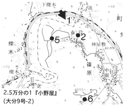
Show extracted lettering and translation
English translation of figure lettering
1:25,000 Onoya sheet (Oita sheet 9-2). 1, 2, 5, 6. Shimoichigi; Harunodan; Kamiyashiki; Shinohara; Nakazono; 櫟木. 108, 103.7, 253.4, 168, 172.
Original Japanese lettering
2.5万分の1『小野屋』(大分9号-2)。1、2、5、6。下櫟木、春ノ段、神屋敷、篠原、中園、櫟木。108、103.7、253.4、168、172。
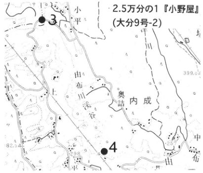
Show extracted lettering and translation
English translation of figure lettering
1:25,000 Onoya sheet (Oita sheet 9-2). 3, 4. 小平; Yufu; 奥詰; Uchinari; Nakahata. 399.0, 257, 298, 82.3.
Original Japanese lettering
2.5万分の1『小野屋』(大分9号-2)。3、4。小平、由布、奥詰、内成、中畑。399.0、257、298、82.3。
KS-7 (continued)
Most of the Yufugawa pyroclastic-flow deposit is weakly welded to nonwelded. Rivers have incised it deeply, forming gorges exemplified by Yufugawa Gorge, which is narrow, deep and long. In some of its deepest portions it is only 2–3m wide but reaches a depth of 80m (吉川, 1987). At site 3, beneath Saruwatari Bridge at 小平 in Hasama Town, and site 4, Tanigawabuchi at 平 in Hasama Town, stairs and chains provide access to the valley floor. At site 3 the weakly welded Yufugawa deposit is exposed in the sheer cliffs on both sides (photograph 2). Although apparently structureless, close observation reveals some weakly stratified portions. It consists of fine glassy-ash matrix and mainly 1–3cm pumice, and is pinkish gray overall. The pumice is not flattened, but joints in the exposure, especially its upper part here, indicate weak welding. The valley is deeper at site 4, where similar facies can be observed; the valley floor and access path had been improved and an admission fee was charged as of summer 1987.
Strongly welded portions of the Yufugawa deposit are confirmed only in a very limited area near its base along the Oitagawa. The site 5 exposure at Harunodan, Hasama Town, shows eutaxitic texture formed by aligned small black glass lenses approximately 1cm or less in size. This strongly welded portion is laterally continuous, but grades vertically into weakly welded material within a few meters.
In thick portions along the Oitagawa, devitrification and vapor-phase crystallization have progressed in the upper weakly welded part. The matrix hardens, while the pumice becomes friable and falls out from the exposed surface, producing a pitted appearance. Such vapor-phase-crystallized facies can be observed along the road ascending 小倉山 (253.4m), immediately southwest of Nakazono in Hasama Town, at site 6 (星住 et al., 1988, p.50, fig.32).
References: 星住・鎌田 (1991); 星住 et al. (1988); Kamata (1989b); 小野 (1963); 竹村・檀原 (1993); 竹村・星住 (1994); 吉川 (1987); 吉岡 et al. (1997).
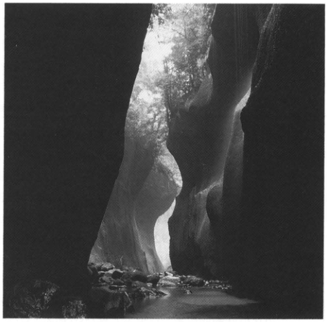
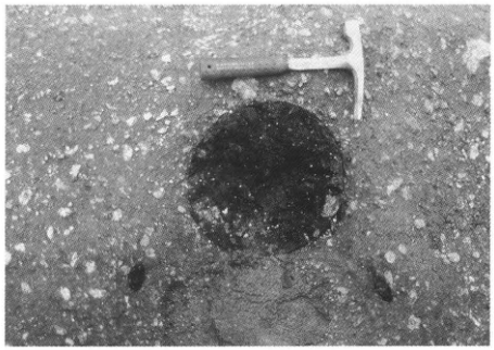
KS-8 Tephra of the Aso central cones near the Kumamoto Prefectural Aso Youth Center
渡辺一徳・宮縁育夫
- Locality: Valley southwest of the Aso Youth Center, Ichinomiya Town, Kumamoto Prefecture
- Coordinates: N32°54′43″ E131°6′38″
- Elevation: 280m
- Exposure and condition: Artificial exposure in a small-path cut slope
- Deposit and age: Pyroclastic-flow deposits and fallout tephra; Late Pleistocene to Holocene
- Date described: June 1995
- Keywords: Aso central cones; Aso Nakadake eruptive products; Nakadake pyroclastic-flow deposit; Kikai-Akahoya tephra
Activity of the central cones of Aso caldera began immediately after the Aso-4 pyroclastic-flow eruption at approximately 90ka (渡辺, 1992; 小野・渡辺, 1995). The central cones comprise an assemblage of at least 17 visibly independent volcanoes, of which only Nakadake continues to erupt. Large quantities of pyroclastic material, consisting of ash fall with minor intercalated scoria and pumice falls, have accumulated around them. 高田 (1989) outlined these deposits, and a detailed eruptive history for the last approximately 15,000 years is now emerging (渡辺, 1992; 小野 et al., 1995). The column and dates at right are from 宮縁・渡辺 (in preparation). Focusing on “periods of relatively quiet volcanic activity or dormancy” indicated by buried kuroboku soils and weathered soils in this exposure, 渡辺 (1992) and 小野 et al. (1995) divided Nakadake activity into phases N1 to N19, in order from youngest to oldest. Phases before N19 require further study. Most deposits are loam consisting of ash from Nakadake ash eruptions or its weathered products. Intercalated within them are Ojodake scoria (OjS) in N4, Kishimadake scoria (KsS) in N6, Aso central-cone first pumice (ACP-1) in N7, and Kikai-Akahoya tephra (K-Ah) in N13. At the bottom of the exposure is a pyroclastic-flow deposit thought to originate from Nakadake. Its juvenile blocks are poorly vesicular basaltic scoria, and the whole deposit underwent weak red oxidation at high temperature. Charcoal in it gives a ¹⁴C age of 14,520±210yr B.P. (渡辺, 1992). The other buried kuroboku-soil ages in the column are recently obtained ¹⁴C dates.
N1 is the phase continuous with Nakadake's present activity. N2 contains deposits of a large Nakadake phreatomagmatic explosion (宮縁・渡辺, 1996). The N4 OjS and N6 KsS are scoria-fall beds extending more than 20km east of the eruptive centers, produced by sub-Plinian eruptions that were large for basaltic eruptions (中村・渡辺, 1995). ACP-1 in the N7 sandy loam erupted near Janoo Volcano. Rather than forming a bed of measurable thickness, it occurs as scattered pumice particles up to a few centimeters in diameter at approximately the same horizon. Except very close to the eruptive center, where it forms a 10–100cm bed, this pumice is only dispersed in ash. However, it can be traced more than 30km east of the center and is therefore a useful marker among the relatively uniform central-cone eruptive products (小野 et al., 1995).
References: 宮縁・渡辺 (1996); 中村・渡辺 (1995); 小野・渡辺 (1985); 小野 et al. (1995); 高田 (1989); 渡辺 (1992).
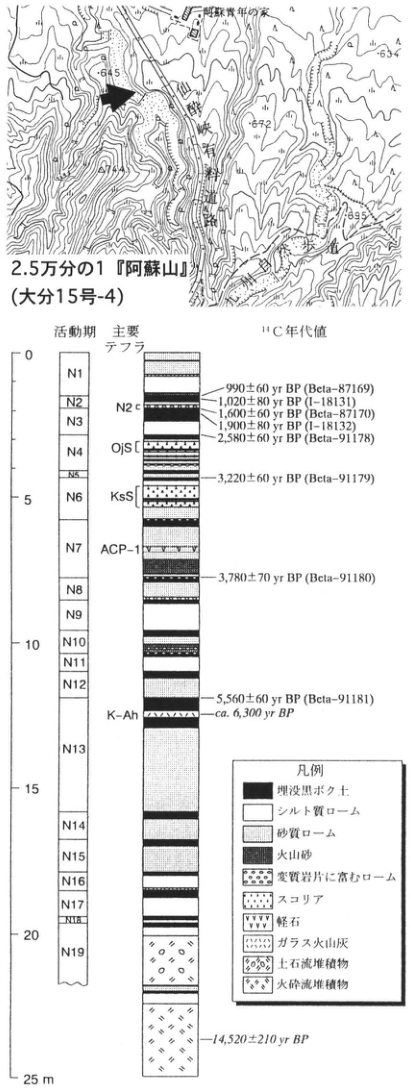
Show extracted lettering and translation
English translation of figure lettering
Map: 1:25,000 Asosan sheet (Oita sheet 15-4). Aso Youth Center; Fukiage; 645, 634, 672, 714, 695; exposure arrow. Column: activity phases N1, N2, N3, N4, N5, N6, N7, N8, N9, N10, N11, N12, N13, N14, N15, N16, N17, N18, N19. Principal tephras: N2 c, OjS, KsS, ACP-1, K-Ah. Scale 0, 5, 10, 15, 20, 25m. ¹⁴C dates: 990±60yr BP (Beta-87169); 1,020±80yr BP (I-18131); 1,600±60yr BP (Beta-87170); 1,900±80yr BP (I-18132); 2,580±60yr BP (Beta-91178); 3,220±60yr BP (Beta-91179); 3,780±70yr BP (Beta-91180); 5,560±60yr BP (Beta-91181); ca. 6,300yr BP; 14,520±210yr BP. Legend: buried kuroboku soil; silty loam; sandy loam; volcanic sand; loam rich in altered rock fragments; scoria; pumice; glassy ash; debris-flow deposit; pyroclastic-flow deposit.
Original Japanese lettering
位置図:2.5万分の1『阿蘇山』(大分15号-4)。阿蘇青年の家、吹上、645、634、672、714、695、露頭矢印。 柱状図:活動期N1、N2、N3、N4、N5、N6、N7、N8、N9、N10、N11、N12、N13、N14、N15、N16、N17、N18、N19。主要テフラ:N2 c、OjS、KsS、ACP-1、K-Ah。目盛0、5、10、15、20、25m。 ¹⁴C年代値:990±60yr BP(Beta-87169);1,020±80yr BP(I-18131);1,600±60yr BP(Beta-87170);1,900±80yr BP(I-18132);2,580±60yr BP(Beta-91178);3,220±60yr BP(Beta-91179);3,780±70yr BP(Beta-91180);5,560±60yr BP(Beta-91181);ca. 6,300yr BP;14,520±210yr BP。 凡例:埋没黒ボク土、シルト質ローム、砂質ローム、火山砂、変質岩片に富むローム、スコリア、軽石、ガラス火山灰、土石流堆積物、火砕流堆積物。
KS-9 Late Pleistocene tephra covering the Sanzaibaru surface in the Miyazaki Plain
長岡信治
- Locality: East of Daianji, Tonokori (都於郡), Saito City, Miyazaki Prefecture
- Coordinates: N32°3′24″ E131°23′15″
- Elevation: 90m
- Exposure and condition: Former borrow pit
- Deposit and age: Aeolian tephra; Late Pleistocene
- Date described: January 1996
- Keywords: last interglacial; Sanzaibaru surface; Ata tephra; Aso-4 pyroclastic-flow deposit; Kirishima-derived tephra
Middle to Late Pleistocene terraces are well developed in the Miyazaki Plain. Among them, the Sanzaibaru surface is a marine terrace of the last interglacial (長岡, 1986). Tephras covering the Sanzaibaru surface (大塚, 1930) can be observed in this exposure (長岡, 1986). From bottom upward, the sequence comprises the sand forming the surface (Sanzaibaru Formation; 大塚, 1930; 遠藤 et al., 1962; 遠藤・鈴木, 1986), Ata tephra (Ata; 90–110ka), separated from the sand by a soil, the Aso-4 pyroclastic-flow deposit (Aso-4; 70–90ka), Aira-Iwato pumice fall (A-Iw), Kirishima-Iwaokoshi pumice fall (Kr-Iw), and Kirishima-Awaokoshi scoria fall (Kr-Aw). All are considerably weathered, so petrographic descriptions are necessary to distinguish them. Widespread tephras such as Kikai-Tozurahara (K-Tz) and Aira-Fukuyama pumice fall (A-Fk) are missing between Aso-4 and Ata here. Vegetation is gradually covering the exposure. Good exposures also occur around 土中 to the west (■), but Ata is often absent there.
References: 遠藤・鈴木 (1986); 遠藤 et al. (1962); 長岡 (1986); 大塚 (1930).
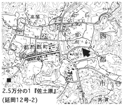
Show extracted lettering and translation
English translation of figure lettering
1:25,000 Sadowara sheet (Nobeoka sheet 12-2). Tonokori-machi; Takaya; Daianji; 土中; 黒ノ貫. ■, exposure arrow. 96.8, 100.9.
Original Japanese lettering
2.5万分の1『佐土原』(延岡12号-2)。都於郡町、高屋、大安寺、土中、黒ノ貫。■、露頭矢印。96.8、100.9。
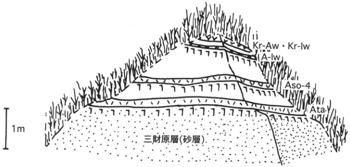
Show extracted lettering and translation
English translation of figure lettering
Top downward: Kr-Aw and Kr-Iw; A-Iw; Aso-4; Ata; Sanzaibaru Formation (sand). 1m.
Original Japanese lettering
上から:Kr-Aw・Kr-Iw、A-Iw、Aso-4、Ata、三財原層(砂層)。1m。
KS-10 Ata and Ito pyroclastic flows entering the Kakuto caldera lake (Kakuto basin)
Subaqueous deposition of pyroclastic flows and deformation by Kirishima lava flows
長岡信治
- Locality: Road north of Momogasako, Ura, Ebino City, Miyazaki Prefecture
- Coordinates: N31°1′45″ E130°46′33″
- Elevation: 250–300m
- Exposure and condition: Artificial exposure
- Deposit and age: Water-laid tephra; Late Pleistocene
- Date described: January 1996
- Keywords: ancient Kakuto lake; subaqueously deposited pyroclastic flows; load-induced subsidence of lava; Ata pyroclastic-flow deposit; Aira-Ito pyroclastic-flow deposit
On the plateau at the northern foot of Iimoriyama Volcano, in northwestern Kirishima, the Ikemure Formation (荒牧, 1968) and Kyomachi Formation (伊田, 1948; 伊田・篠山, 1951; 伊田 et al., 1956; 荒牧, 1968) can be seen. They flowed into and accumulated in a lake within Kakuto caldera. The former is correlated with the Ata pyroclastic-flow deposit (Ata; 90–110ka) (渡辺, 1985), and the latter with the Aira-Ito pyroclastic-flow deposit (A-Ito; 22–25ka) (荒牧, 1968). Both were deposited underwater after flowing from the southeast, and were deformed by the overlying Kirishima Iimoriyama lava flow (荒牧, 1968). The plateau in the southeastern corner of the topographic map is the lava flow that descended from the southeast. The wrinkled hills around the exposure are landforms produced by its pushing action. The deformed Ikemure and Kyomachi formations are continuously exposed here. The strata dip northwestward or westward at several to a little over ten degrees. At the bottom, the Ikemure Formation consists of more than 5m of yellowish-white glassy ash. Above it are more than 10m of lacustrine strata composed of alternating silt and sand. These beds are folded into waves and accompanied by small faults. Conformably overlying them, the Kyomachi Formation consists of more than 50m of grayish-white pumiceous ash, with lamination developed in its upper part. The Ikemure Formation has a color similar to the Kyomachi Formation, but can be distinguished by its scarcity of pumice.
References: 荒牧 (1968); 伊田 (1948); 伊田・篠山 (1951); 伊田 et al. (1956); 渡辺 (1985).
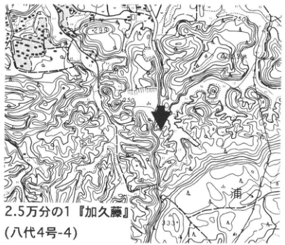
Show extracted lettering and translation
English translation of figure lettering
1:25,000 Kakuto sheet (Yatsushiro sheet 4-4). Ura. 299, 250, 330. Exposure arrow.
Original Japanese lettering
2.5万分の1『加久藤』(八代4号-4)。浦。299、250、330。露頭矢印。
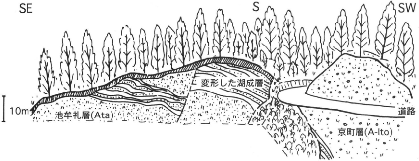
Show extracted lettering and translation
English translation of figure lettering
SE, S, SW. Ikemure Formation (Ata); deformed lacustrine strata; road; Kyomachi Formation (A-Ito). 10m.
Original Japanese lettering
SE、S、SW。池牟礼層(Ata)、変形した湖成層、道路、京町層(A-Ito)。10m。
KS-11 Kirishima tephra of the last approximately 7,000 years on the eastern flank
井村隆介
- Locality: Kamamuta (蒲牟田), Takaharu Town, Miyazaki Prefecture
- Coordinates: N31°54′05″ E130°59′05″
- Elevation: 215m
- Exposure and condition: Artificial exposure, preserved as of March 1996
- Deposit and age: Aeolian tephra; Holocene
- Date described: August 1988
- Keywords: Kirishima Volcano; Kirishima-Miike tephra; Takachiho composite volcano; Vulcanian eruption
Almost all Kirishima tephras of the last approximately 7,000 years can be observed at this exposure on the eastern flank. It is a narrow road cutting, but traffic is heavy and care is necessary. Descending the road, one encounters topsoil / Kirishima-Shinmoe-Kyoho (Kr-SmK) // Ohachi ash (OhA) // Kirishima-Ohachi-Enryaku (Kr-OhE) // Miyasugi ash (MsA; 井ノ上, 1988) // Katazoe scoria (KzS; 井ノ上, 1988) // Kirishima-Miike (Kr-M) // Maeyama pumice (MyP; 井ノ上, 1988) // Oji scoria (OjS; 井ノ上, 1988) // Mochibaru ash (望原; MhA; 井ノ上, 1988) // upper Ushinosune ash (UsA-U; 井ノ上, 1988) / Kikai-Akahoya (K-Ah) / lower Ushinosune ash (UsA-L; 井ノ上, 1988). Several unnamed tephras also occur between them. Most erupted from the southeastern Kirishima group that 井ノ上 (1988) called the Takachiho composite volcano.
OhA, MsA, MhA, and UsA-U and UsA-L consist of poorly vesicular bluish-gray volcanic sand. Their fine stratification and plant remains at all horizons suggest deposits of repeated small Vulcanian eruptions (井ノ上, 1988).
K-Ah divides UsA into upper and lower parts because it fell within a short time during a continuous episode of UsA activity. Consequently K-Ah around Kirishima is thick and well preserved. Its relationship with the Old Takachiho edifice demonstrates that UsA was ejected during the growth of that edifice (井ノ上, 1988).
Kr-M was produced by one of the largest Holocene Plinian eruptions of Kirishima. Base-surge deposits occur around its crater (金子 et al., 1985). Here it is thin, just under 50cm, but the maximum diameters of pumice and lithic fragments are 12cm and 20cm, respectively. Coarse particles relative to deposit thickness characterize the margins of Plinian-eruption deposits.
References: 井ノ上 (1988); 金子 et al. (1985).
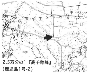
Show extracted lettering and translation
English translation of figure lettering
1:25,000 Takachihonomine sheet (Kagoshima sheet 1-2). Kamamuta; Maeno. 223, 228. Exposure arrow.
Original Japanese lettering
2.5万分の1『高千穂峰』(鹿児島1号-2)。蒲牟田、前野。223、228。露頭矢印。
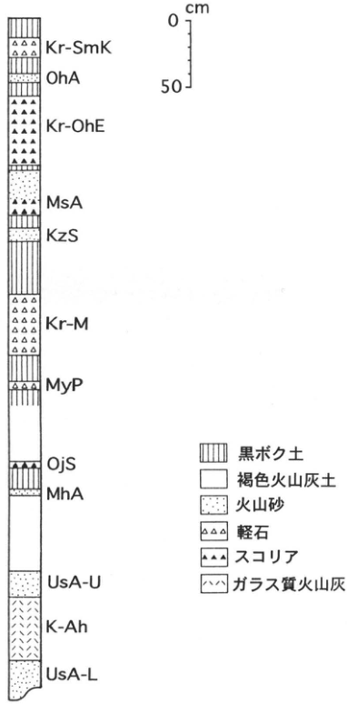
Show extracted lettering and translation
English translation of figure lettering
Top downward: Kr-SmK, OhA, Kr-OhE, MsA, KzS, Kr-M, MyP, OjS, MhA, UsA-U, K-Ah, UsA-L. Scale 0, 50cm. Legend: kuroboku soil; brown volcanic-ash soil; volcanic sand; pumice; scoria; glassy ash.
Original Japanese lettering
上から:Kr-SmK、OhA、Kr-OhE、MsA、KzS、Kr-M、MyP、OjS、MhA、UsA-U、K-Ah、UsA-L。目盛0、50cm。凡例:黒ボク土、褐色火山灰土、火山砂、軽石、スコリア、ガラス質火山灰。
KS-12 Debris-avalanche deposits of Hinamori-dake, Kirishima Volcano, and the overlying tephra
井村隆介
- Locality: Serikawa, Kobayashi City, Miyazaki Prefecture
- Coordinates: N31°58′45″ E131°13′50″
- Elevation: 340m
- Exposure and condition: Artificial exposure, preserved as of May 1996
- Deposit and age: Collapse deposits, debris-avalanche deposits and aeolian tephra; Late Pleistocene to Holocene
- Date described: March 1993
- Keywords: Kirishima Volcano; Hinamori-dake; Aira-Tn tephra; Kikai-Akahoya tephra; Kirishima-Kobayashi tephra
This exposure cuts a hummock associated with a debris avalanche produced by edifice collapse near present Hinamori-dake approximately 35ka ago. The hummock's internal structure and overlying fallout tephra can be observed. The debris-avalanche deposit is a chaotic assemblage of large lava blocks or angular fragments, with sand and mud filling the spaces between them. It sometimes incorporates blocks of pumice-fall beds or soil retaining their sedimentary structures. Hinamori-dake brown scoria I (HnrbS I; 井村, 1994) rests directly on this debris-avalanche deposit, and redeposited material can be seen on the lower hummock slope. Approximately 10cm above HnrbS I is Hinamori-dake brown scoria II (HnrbS II; 井村, 1994). Above a kuroboku soil, Aira-Osumi (A-Os) and thin Aira-Ito (A-Ito) can be observed. The indistinct lamination in A-Ito here, together with thick A-Ito deposits in valleys around the hummocks, suggests that it is an ignimbrite veneer deposit (Walker et al., 1980) left on the hummock slope by the main pyroclastic flow. Two conspicuous tephras occur in the middle and lower portions of the near-surface kuroboku soil. The upper orange tephra is Kikai-Akahoya (K-Ah), immediately underlain by bluish-gray lower Ushinosune ash (UsA-L; 井ノ上, 1988), erupted from Old Takachiho in Kirishima. The lower orange bed is Kirishima-Kobayashi pumice (Kr-Kb). Reddish-purple Karakuni-dake scoria (KrS; 井村・小林, 1987) occurs approximately 50cm below it.
References: 井村 (1994); 井村・小林 (1987); 井ノ上 (1988); Walker et al. (1980).
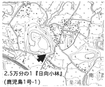
Show extracted lettering and translation
English translation of figure lettering
1:25,000 Hyuga-Kobayashi sheet (Kagoshima sheet 1-1). 309, 313. 東浦; 南ケ口. Exposure arrow.
Original Japanese lettering
2.5万分の1『日向小林』(鹿児島1号-1)。309、313。東浦、南ケ口。露頭矢印。
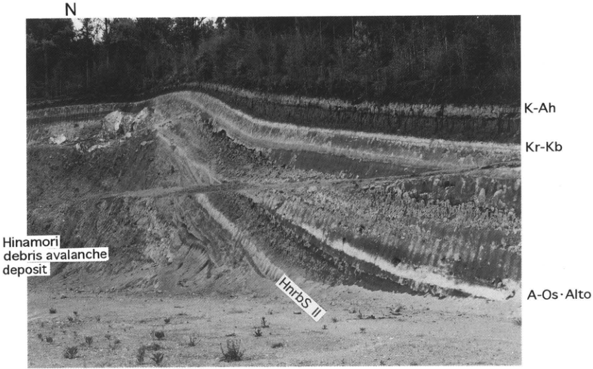
Show extracted lettering and translation
English translation of figure lettering
N. K-Ah; Kr-Kb; A-Os・AIto; HnrbS II. Hinamori debris avalanche deposit.
Original Japanese lettering
N。K-Ah、Kr-Kb、A-Os・AIto、HnrbS II。Hinamori debris avalanche deposit。
KS-13 Tephra at Nitanno, Aya Town, Miyazaki Prefecture: widespread tephra and tephra from Kirishima Volcano
井村隆介
- Locality: Nitanno (二反野), Aya Town, Miyazaki Prefecture
- Coordinates: N31°58′45″ E131°13′50″
- Elevation: 220m
- Exposure and condition: Artificial exposure, preserved as of May 1996
- Deposit and age: Aeolian tephra; Middle Pleistocene to Holocene
- Date described: March 1994
- Keywords: pre-Chausubaru surface; Kirishima-Iwaokoshi tephra; Kirishima-Awaokoshi tephra; Kirishima-Kobayashi tephra; Aira-Iwato tephra; Aira-Fukuyama tephra; Aira-Tn tephra; Kakuto pyroclastic-flow deposit
This exposure lies on a high terrace (the pre-Chausubaru surface) at the southwestern edge of the Miyazaki Plain and is suitable for observing Kirishima-derived and widespread tephras distributed in the southern plain. At its base is the markedly weathered nonwelded part of the main Kakuto pyroclastic-flow deposit (Kkt). Two white fine-pumice beds stand out near the middle of the cliff. The lower tephra, characteristically containing hornblende, is Aira-Fukuyama (A-Fk); the upper, bright-orange tephra containing quartz is Aira-Iwato (A-Iw). Kikai-Tozurahara (K-Tz) occurs approximately 50cm below A-Fk, and Ata approximately 60cm below K-Tz. Patchy Aso-4 occurs approximately 40cm above A-Fk. All are weathered and require petrographic characterization for accurate identification. Kirishima-derived tephras such as Aya pumice (長岡, 1984) and Nitanno scorias III–V (井村, 1994) occur between these widespread tephras, but none is conspicuously thick, representing a large eruption. In contrast, immediately above A-Iw are many Kirishima-derived tephras separated by thin loam, including conspicuous thick Kirishima-Iwaokoshi (Kr-Iw), erupted from Onamiike crater, and Kirishima-Awaokoshi (Kr-Aw), erupted from Hinamori-dake, as well as Honmachi scorias I and II (長岡, 1984). Thick kuroboku soil has developed at the top of this exposure and contains two conspicuous orange tephras. The lower is Aira-Tn tephra, consisting from bottom upward of Aira-Osumi (A-Os), Aira-Ito (A-Ito), and Aira-Tn (AT). The upper is Kikai-Akahoya (K-Ah). A-Os is approximately 10cm thick and composed of coarse-sand-sized pumice. Kirishima-Kobayashi pumice (Kr-Kb), erupted from Karakuni-dake, occurs approximately midway between these two widespread tephras, AT and K-Ah, in the kuroboku soil.
References: 井村 (1994); 長岡 (1984).
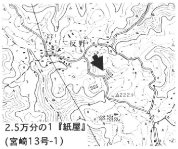
Show extracted lettering and translation
English translation of figure lettering
1:25,000 Kamiya sheet (Miyazaki sheet 13-1). Nitanno. 221, 222.9. Exposure arrow.
Original Japanese lettering
2.5万分の1『紙屋』(宮崎13号-1)。二反野。221、222.9。露頭矢印。
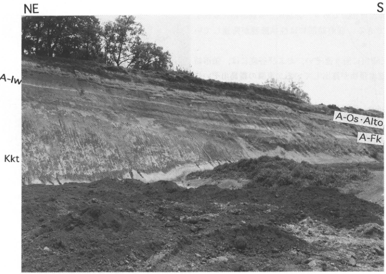
Show extracted lettering and translation
English translation of figure lettering
NE, S. A-Iw; Kkt; A-Os・AIto; A-Fk.
Original Japanese lettering
NE、S。A-Iw、Kkt、A-Os・AIto、A-Fk。
KS-14 Pyroclastic-flow stratigraphy from the Kakuto deposit onward north of Aira caldera
小林哲夫
- Locality: Around Tsumaya, Kokubu City, Kagoshima Prefecture
- Coordinates: N31°46′–48′ E130°45′–48′
- Elevation: 40–200m
- Exposure and condition: Artificial roadside exposures
- Deposit and age: Pyroclastic-flow deposits and fallout tephra; Late Pleistocene
- Date described: December 1995
- Keywords: Aira; Ito pyroclastic flow (“deposit” omitted in the following keywords); Aira-Tsumaya pyroclastic flow; Aira-Iwato pyroclastic flow; Ata pyroclastic flow; Kakuto pyroclastic flow; Aira caldera; Kokubu
Pyroclastic-flow deposits are generally more than 10m thick, so their entire sequence cannot be observed at a single exposure. Three roadside routes are therefore introduced.
Route 1 follows the busy national highway from Kokubu to Kirishima Jingu. An Ata pyroclastic-flow exposure occurs at Togami, where the uphill road begins at the edge of the alluvial plain. It is dark gray and weakly welded, with some columnar joints. Lacustrine strata appear farther along, but at approximately 100m elevation, beside a sabo dam, the sequence from Osumi pumice fall to the Tsumaya pyroclastic-flow deposit, erupted from Aira caldera at 24.5ka, is visible, with the Ito pyroclastic-flow deposit higher in the cliff. Farther along, near 160m elevation, there is a good exposure of strongly welded Ito deposit. On reaching the upper plateau, a nonwelded exposure more than 10m thick is present.
Route 2 is a narrow road ascending from Iwato to the Haruyamabaru (春山原) plateau. Above approximately 100m, Osumi pumice fall is deposited with two intercalated fallout tephras, and facies similar to those on route 1 can be observed. No welded portion is exposed on this route, however. The lower half comprises the Iwato pyroclastic-flow deposit, displaying a transition from nonwelded to weakly welded material. Columnar joints are developed in the weakly welded portion.
Along route 3 beside the Amorigawa and in the valley floor, strongly welded Kakuto pyroclastic-flow deposits are exposed. They also occur along the neighboring Kirishimagawa to the east.
References: 荒牧 (1969); 池田 et al. (1995).
Route 1: strongly welded portion of the Ito pyroclastic-flow deposit near 150m elevation.
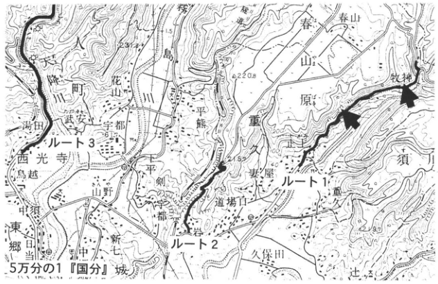
Show extracted lettering and translation
English translation of figure lettering
1:50,000 Kokubu sheet. Routes 1, 2, 3. 国分城; Amorigawa; 花山; Kirishimagawa; Haruyamabaru; 牧神; 武安; 宇都; Saikoji; 熊重; Shimokubo; Tsumaya; 道場口; Togami; 平剣; Yamano; 七社; 新中; 郷田; Kubota; 須川. 237, 220.8, 215.8, 160. Heavy route lines and exposure arrows.
Original Japanese lettering
5万分の1『国分』。ルート1、ルート2、ルート3。国分城、降川、花山、霧島川、春山原、牧神、武安、宇都、西光寺、熊重、下久保、妻屋、道場口、止上、平剣、山野、七社、新中、郷田、久保田、須川。237、220.8、215.8、160。太いルート線と露頭矢印。
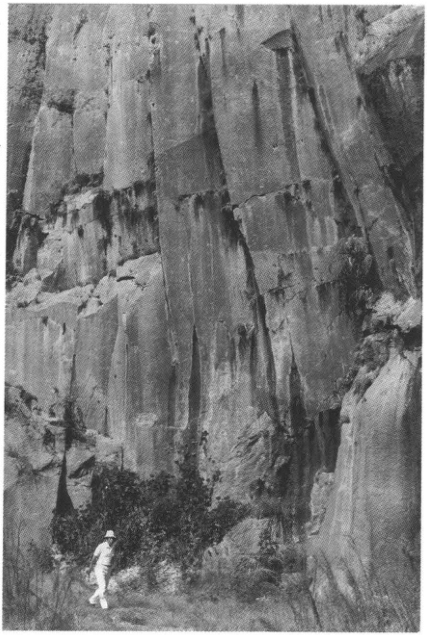
KS-15 Pleistocene tephra forming the Hakamagoshi plateau on the western shore of Sakurajima
森脇広
- Locality: Hakamagoshi, Sakurajima Town, Kagoshima District, Kagoshima Prefecture
- Coordinates: N31°35′33″ E130°36′08″
- Elevation: 50m
- Exposure and condition: Artificial and natural exposures, partly preserved
- Deposit and age: Pyroclastic-flow deposits; Middle to Late Pleistocene
- Date described: June 1989
- Keywords: Aira caldera; Hakamagoshi; Sakurajima; Torihama pyroclastic flow; Ata pyroclastic flow; Kamewarizaka breccia
The Hakamagoshi plateau has an origin distinct from Sakurajima eruptions. Wall construction in 1989 exposed most of its western cliff, from top to base. Most is now covered by artificial structures, but portions can be seen in the western and southern cliffs. Previously regarded as a plateau of an unidentified Hakamagoshi pyroclastic flow, it has been shown to consist of several known pyroclastic-flow deposits (町田 et al., 1993). From the present shore to approximately 10m above it lies the Middle Pleistocene Torihama pyroclastic-flow deposit (Ata-Th), derived from Ata caldera. Here Ata-Th contains coarse pumice up to approximately 20cm, in an ash matrix rich in phenocrysts such as quartz, hornblende and orthopyroxene. Its poor sorting is characteristic of pyroclastic-flow deposits, and no subaqueous-depositional facies are recognized; sea level at that time is therefore considered to have been lower than this exposure. Ata-Th forms the basement of the plateau. Above it, the Ata pyroclastic-flow deposit overlies sand and gravel with rounded clasts, a marine deposit of the last interglacial. Here Ata consists of extremely fine ash with little coarse pumice. It fines upward and shows grading. Above it, Kamewarizaka breccia, a member of the Aira-Tn tephra, fills a valley incised into the Ata deposit. This breccia contains extremely little juvenile material. An ash flow thought to be the Tsumaya pyroclastic-flow deposit slightly incises and overlies the breccia. At the top is Sakurajima-Satsuma tephra (Sz-S), comprising pumice fall and overlying base-surge deposits.
Reference: 町田 et al. (1993).
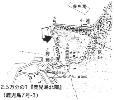
Show extracted lettering and translation
English translation of figure lettering
1:25,000 Kagoshima-Hokubu sheet (Kagoshima sheet 7-3). Hakamagoshi; Koike; Yokoyama-machi; public lodging; Sakurajima Volcano Observatory; fish farm; 方荷. Exposure arrow.
Original Japanese lettering
2.5万分の1『鹿児島北部』(鹿児島7号-3)。袴腰、小池、横山町、国民宿舎、桜島火山観測所、養魚場、方荷。露頭矢印。
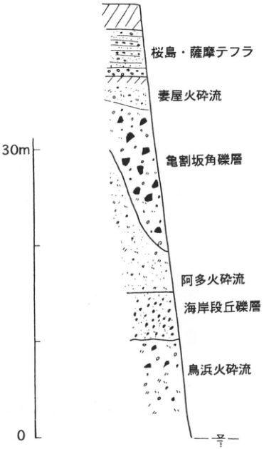
Show extracted lettering and translation
English translation of figure lettering
Top downward: Sakurajima-Satsuma tephra; Tsumaya pyroclastic flow; Kamewarizaka breccia; Ata pyroclastic flow; marine-terrace gravel; Torihama pyroclastic flow. Scale 0, 30m.
Original Japanese lettering
上から:桜島・薩摩テフラ、妻屋火砕流、亀割坂角礫層、阿多火砕流、海岸段丘礫層、鳥浜火砕流。目盛0、30m。
KS-16 Late Pleistocene and Holocene tephra at Takatoge, Osumi Peninsula: tephra from Sakurajima Volcano
森脇広
- Locality: Horikiri (Takatoge), Tarumizu City, Kagoshima Prefecture
- Coordinates: N31°30′58″ E130°46′42″
- Elevation: 540m
- Exposure and condition: Artificial exposure, preserved
- Deposit and age: Fallout tephra; Late Pleistocene to Holocene
- Date described: July 1989
- Keywords: Osumi Peninsula; Takatoge; Sakurajima-derived tephras; Kikai-Akahoya tephra; Sakurajima-Satsuma tephra
This good exposure lies 12km south-southeast of Sakurajima and displays many of its tephras. Fifteen tephra beds occur in the northern Osumi Peninsula east of Sakurajima (森脇, 1994), eight of which can be recognized here above the Aira-Ito pyroclastic-flow deposit. This is one of the type localities for Sakurajima tephra stratigraphy, with beds named Sakurajima-Takatoge 1 (Sk-Tk1) through Sakurajima-Takatoge 6 (Sk-Tk6), from top downward (森脇, 1994). Two thick pumice beds in the middle are particularly conspicuous. The upper pale-brown pumice-fall bed is Tk3. The lower is Sakurajima-Satsuma tephra (Sz-S), consisting of at least five units, including phreatomagmatic ash fall and base-surge deposits. Kikai-Akahoya tephra (K-Ah) overlies Tk3. It consists of fine glassy ash and differs markedly in facies from the other Sakurajima-derived tephras, which consist mainly of coarse pumice. Tk4 below Sz-S is also phreatomagmatic ash fall: an indurated reddish-brown ash bed containing accretionary lapilli. The uppermost Tk1 is poorly sorted pumice rich in fine ash and is a phreatomagmatic product. It is considered to originate from the Nabeyama pumice cone on Sakurajima's eastern flank. The lowest Tk6 is Sakurajima's oldest tephra, dated at approximately 22ka (奥野 et al., 1996). It consists mainly of reddish-brown pumice fall, with pumice rich in bluish-gray lithic fragments in the upper part and black scoria in the lower part. Detailed distributions and stratigraphy of Sakurajima tephras are given in 森脇 (1994) and 小林 (1986).
References: 福山・荒牧 (1973); 小林 (1986); 奥野 et al. (1996); 町田・新井 (1992); 森脇 (1994).
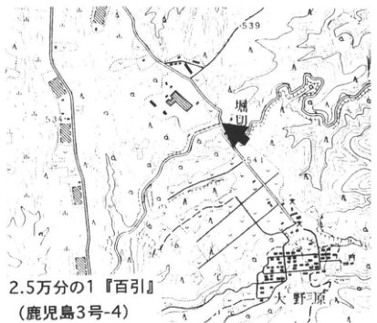
Show extracted lettering and translation
English translation of figure lettering
1:25,000 Hyakuhiki sheet (Kagoshima sheet 3-4). Horikiri; Yanohara. 539, 541, 534. Exposure arrow.
Original Japanese lettering
2.5万分の1『百引』(鹿児島3号-4)。堀切、矢野原。539、541、534。露頭矢印。
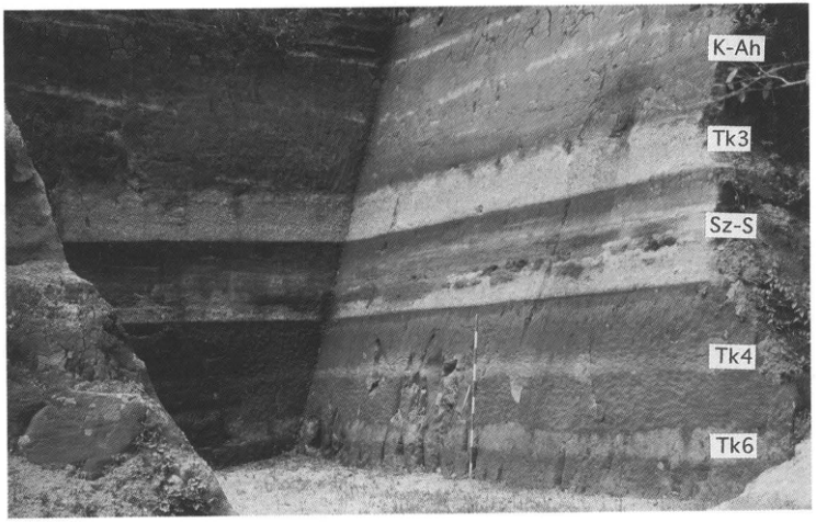
Show extracted lettering and translation
English translation of figure lettering
K-Ah, Tk3, Sz-S, Tk4, Tk6.
Original Japanese lettering
K-Ah、Tk3、Sz-S、Tk4、Tk6。
KS-17 Liquefaction traces formed during the Kikai-Akahoya eruption in the central Osumi Peninsula
成尾英仁
- Locality: Haraguchioka site, Haraguchi, Shimomyo, Aira Town (吾平町), Kimotsuki District, Kagoshima Prefecture
- Coordinates: N31°20′31″ E130°54′45″
- Elevation: 250m
- Exposure and condition: Excavated exposure, partly preserved
- Deposit and age: Fallout tephra and secondary shirasu; 6.3ka
- Date described: June 1995
- Keywords: central Osumi Peninsula; Kikai-Akahoya tephra; Haraguchioka site; liquefaction
This exposure is a section through a shirasu plateau along the Kimotsukigawa in the central Osumi Peninsula. The lowest observable tephra is Aira-Tn (approximately 2.4ka as printed), comprising Osumi pumice fall (A-Os), the Ito pyroclastic-flow deposit (A-Ito; shirasu), and redeposited shirasu called secondary shirasu. Above intervening loam are tephras including Sakurajima-Satsuma (Sz-S; approximately 11ka), Kikai-Akahoya (K-Ah; approximately 6.3ka), and Ikeda pumice fall from Ikeda caldera (Ik; approximately 5.5ka). A-Os can be seen along rises in the former topography, but is generally hidden beneath shirasu. The shirasu is more than 10m thick, overlain by several meters of secondary shirasu comprising silty sand, pumiceous sand and pumiceous gravel. Here and nearby, the secondary shirasu and A-Os liquefied, and sand dikes penetrate the loam and Sz-S to reach K-Ah. In plan view, sand mixed with pumice and small gravel was ejected along zones 10–20cm wide and 5–10m long, but the dikes have no consistent orientation. In section, the ejected sand reaches into K-Ah, mixes with the ash and is covered by further ash. In places, ash has also subsided as wedges several tens of centimeters deep. These observations make it highly possible that a large earthquake occurred during the K-Ah eruption. The liquefied sand penetrates Koya pumice fall, is covered by ash and mixes with that ash, suggesting liquefaction at the onset of ash fall, immediately after the large pyroclastic-flow eruption. Active development in the vicinity frequently creates artificial exposures, including those marked ■, where numerous traces of liquefaction at this time can be observed.
Reference: 成尾 et al. (1995).
a: Liquefaction trace cutting an Early Jomon layer (scale 10cm).
b: Liquefaction trace cutting Osumi pumice fall (scale 20cm).
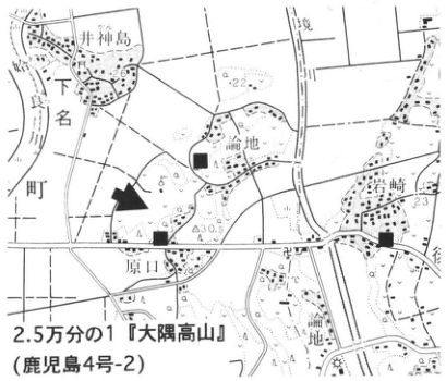
Show extracted lettering and translation
English translation of figure lettering
1:25,000 Osumi-Koyama sheet (Kagoshima sheet 4-2). 井神島; Sakaigawa; Shimomyo-machi; 論地; Iwasaki; Haraguchi. ■, exposure arrow. 26, 22, 23, 30.5.
Original Japanese lettering
2.5万分の1『大隅高山』(鹿児島4号-2)。井神島、境川、下名町、論地、岩崎、原口。■、露頭矢印。26、22、23、30.5。
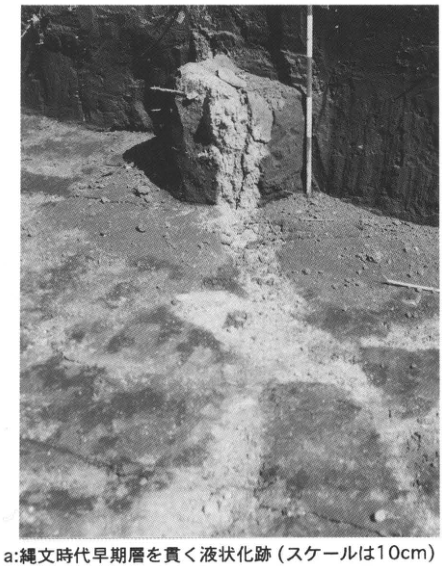
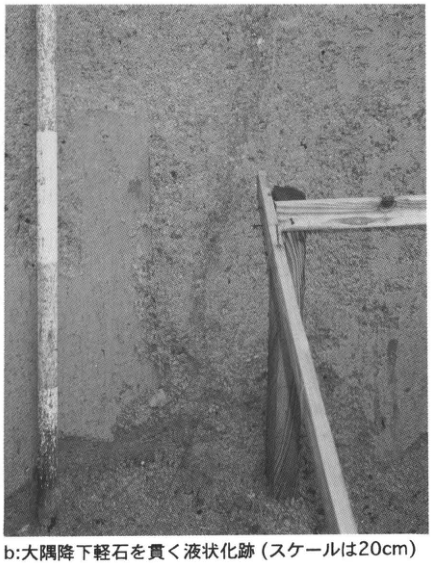
KS-18 Phreatomagmatic Sakurajima-Satsuma tephra covering shirasu plateaus in the northern Satsuma Peninsula
森脇広
- Locality: Kagoshima University Faculty of Medicine campus, Usuki-machi, Kagoshima City
- Coordinates: N31°32′43″ E130°31′49″
- Elevation: 70m
- Exposure and condition: Artificial exposures; B is preserved
- Deposit and age: Aeolian tephra; Late Pleistocene to Holocene
- Date described: March 1996
- Keywords: Kagoshima; Sakurajima-Satsuma tephra; base surge
Kagoshima City and its surroundings in the northern Satsuma Peninsula lie west of Sakurajima, and therefore have fewer Sakurajima-derived tephras than the northern Osumi Peninsula to the east. Nevertheless, the thick, conspicuous marker Sakurajima-Satsuma tephra (Sz-S) is distributed here. Sz-S has numerous units, characteristically including phreatomagmatic products, ash fall and base-surge deposits. Because these units dispersed in all directions from Sakurajima, Sz-S is widespread on both peninsulas and is extremely useful for archaeological chronology of the Incipient Jomon period and other purposes. This exposure, revealed during archaeological excavation on the medical campus (A on the map), displays almost all Satsuma tephra units found in the Satsuma Peninsula (I–X; 森脇, 1990). Units I and VII are the large pumice falls, both with distribution axes southwest of the source. Phreatomagmatic products occur between them. The base-surge deposit, unit V, contains abundant fine accidental lithic fragments and displays thin bedding. It can be recognized to at least 15km from the present Sakurajima crater. Unit VI is fine ash altered to clay, with scattered coarse pumice. This phreatomagmatic ash fall is not particularly thick even near the source, but can be recognized widely at distant sites together with pumice-fall unit I. Sz-S has a ¹⁴C age of 11–11.5ka (奥野, 1996, and others). Since it is commonly recognized in the alluvium of the Kotsukigawa lowland in Kagoshima City (岩松・横田, 1991; 藤山, 1992; 森脇 et al., 1993), it is useful for the chronology of paleogeography and sea-level change around the Younger Dryas in this region. Kikai-Akahoya tephra (K-Ah) overlies Satsuma tephra; these two are conspicuous markers in the central and northern Satsuma Peninsula. Below Sz-S, fine pumice fall containing bluish-gray lithic fragments occurs scattered in the soil. This is correlated with Sakurajima-Takatoge 6 (森脇, 1994), the oldest Sakurajima-derived tephra. Exposure A is now lost, but the principal Sz-S units can be observed at B.
References: 新井・町田 (1980); 岩松・横田 (1991); 藤山 (1992); 福山・荒牧 (1973); 小林 (1986); 町田・新井 (1992); 森脇 (1990, 1994); Moriwaki (1992); 森脇 et al. (1993); 奥野 (1996).
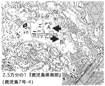
Show extracted lettering and translation
English translation of figure lettering
1:25,000 Kagoshima-Kennanbu sheet (printed title 鹿児島県南部; Kagoshima sheet 7-4). A, B. Usuki-machi; Chuzan-machi; Obara; Sasanuki. 88, 57.
Original Japanese lettering
2.5万分の1『鹿児島県南部』(鹿児島7号-4)。A、B、宇宿町、中山町、小原、笹貫。88、57。
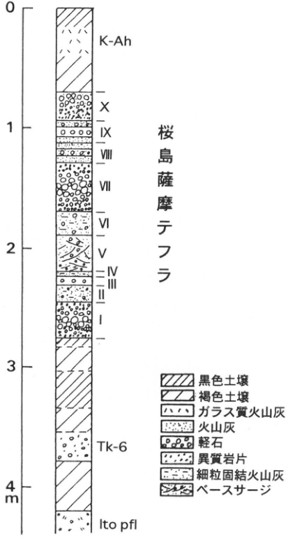
Show extracted lettering and translation
English translation of figure lettering
Top downward: K-Ah; Sakurajima-Satsuma tephra X, IX, VIII, VII, VI, V, IV, III, II, I; Tk-6; Ito pfl. Scale 0, 1, 2, 3, 4m. Legend: black soil; brown soil; glassy ash; ash; pumice; accidental lithic fragments; fine indurated ash; base surge.
Original Japanese lettering
上からK-Ah、桜島薩摩テフラX・IX・VIII・VII・VI・V・IV・III・II・I、Tk-6、Ito pfl。目盛0、1、2、3、4m。凡例:黒色土壌、褐色土壌、ガラス質火山灰、火山灰、軽石、異質岩片、細粒固結火山灰、ベースサージ。
KS-19 Late Pleistocene tephra near Onejime Town in the southern Osumi Peninsula
奥野充
- Locality: Yadoribaru (宿利原), Onejime Town, Kagoshima Prefecture
- Coordinates: N31°15′45″ E130°50′51″
- Elevation: 200m
- Exposure and condition: Artificial exposure, now vegetation-covered
- Deposit and age: Aeolian tephra; Late Pleistocene
- Date described: January 1993
- Keywords: tephra from Ata caldera; tephra from Aira caldera; tephra from Kikai caldera
The southern Osumi Peninsula lies east of Ata caldera. In addition to tephra from Ata, tephras sourced from Aira and Kikai calderas are distributed here. This exposure displays the sequence above the 105ka Ata tephra (Ata; pyroclastic-flow deposit). Ata occurs at the base as more than 2m of pale-brown weakly welded pyroclastic-flow deposit. Tashiro tephra (Ts; pyroclastic-flow deposit), a 60cm brown fine-ash bed, covers an erosion surface on Ata. Kikai-Tozurahara tephra (K-Tz) occurs 20cm above it. This is a 60cm orange glassy-ash bed subdivided into a well-bedded lower part and an upper part rich in accretionary lapilli. Aira-Fukuyama tephra (A-Fk) is an 18cm olive-colored fine-ash bed 25cm above K-Tz, characteristically containing hornblende. Hananki (花之木) tephra (Hn), 65cm above it, comprises a 2cm orange fine-ash bed (Hn-a) overlain by a 28cm yellowish-white pumice bed (Hn-p). Kiyomidake tephra (Ky), 70cm above Hn, is cemented and subdivided from bottom upward into grayish-brown ash (Ky-l), orange to brown pumice fall (Ky-m), and yellowish-brown ash (Ky-u). Ky-l is 25cm thick with scattered pumice. Ky-m is 30cm thick and has two recognizable fall units. Ky-u is 35cm thick and particularly cemented. Yadoribaru tephra (Yd) is a 35cm yellowish-brown pumice-fall bed 110cm above Ky. Its bottom 6cm consists almost entirely of pumice, but the yellowish-brown ash content gradually increases, producing grading overall. Pumice and free crystals are concentrated in the uppermost 10cm, which displays lamination and slight cementation. Osumi pumice fall (A-Os), a member of Aira-Tn tephra (AT), occurs 50cm above Yd. Above it, Kikai-Akahoya (K-Ah), Ikedako (Ik) and Kaimondake (Km) tephras can be observed. A similar stratigraphy can also be observed at ■ on the location map.
References: Nagaoka (1988); 奥野 et al. (1995).
Photographed in January 1993.
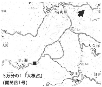
Show extracted lettering and translation
English translation of figure lettering
1:50,000 Onejime sheet (Kaimondake sheet 1). Yadoribaru; 厚ヶ瀬; 安水; Okubo; Shirai; 耳池; 上尾; 大濱. 193.4, 141.8, 279.0, 218.8. ■, exposure arrow.
Original Japanese lettering
5万分の1『大根占』(開聞岳1号)。宿利原、厚ヶ瀬、安水、大久保、白井、耳池、上尾、大濱。193.4、141.8、279.0、218.8。■、露頭矢印。
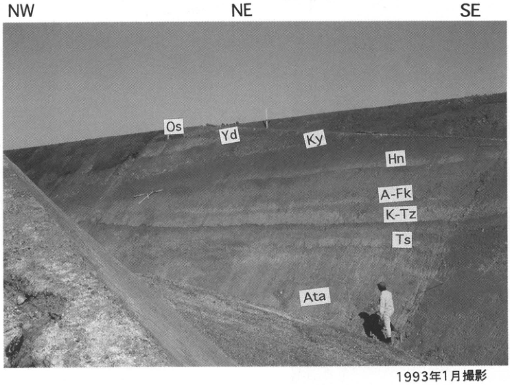
Show extracted lettering and translation
English translation of figure lettering
NW, NE, SE. Os, Yd, Ky, Hn, A-Fk, K-Tz, Ts, Ata. Photographed in January 1993.
Original Japanese lettering
NW、NE、SE。Os、Yd、Ky、Hn、A-Fk、K-Tz、Ts、Ata。1993年1月撮影。
KS-20 Kaimondake tephra at the Hashimuregawa site, Ibusuki City, Kagoshima Prefecture: an archaeological site affected by volcanic disasters
成尾英仁
- Locality: National Historic Site “Hashimuregawa site” (橋牟礼川遺跡), Jutchō, Ibusuki City, Kagoshima Prefecture
- Coordinates: N31°13′36″ E130°38′52″
- Elevation: 20m
- Exposure and condition: Excavated exposure, backfilled in March 1996; peel samples exhibited at the Ibusuki City Archaeological Museum
- Deposit and age: Aeolian tephra; Holocene
- Date described: January 1992
- Keywords: Ibusuki City; Hashimuregawa site; Kaimondake tephra; volcanic disaster
The Hashimuregawa site (original phonetic gloss: はしむね, “Hashimune”) was the first Japanese archaeological site where the Jomon and Yayoi periods (the latter now assigned to the Kofun period) were distinguished in relation to tephra. It became a National Historic Site in 1924 (Taisho 13). Excavations continue as of 1996; the site has outdoor facilities for observing strata, and an archaeological museum stands nearby. Four Kaimondake tephra beds occur in the site. Kaimondake lies approximately 12km west-southwest, a double volcano 922m high formed within Ata caldera. Eruptions began approximately 4ka ago, and the last eruption in 885 (Ninna 1, Heian period) formed the summit lava dome. Five large eruptions occurred in this interval: at 4ka, 2.5ka, 2ka, and in the seventh and ninth centuries. All the erupted tephras are firmly cemented and called “kora.” The seventh- and ninth-century tephras are distinct at the site (figure 2). The seventh-century tephra (blue kora; AK) comprises two scoria beds and approximately 30cm of fine ash rich in accretionary lapilli. Fields, an old road and pottery of the late seventh century are buried immediately below it. There were two ninth-century eruptions, in 874 (Jogan 16) and 885. The former erupted and deposited purplish fine ash containing lapilli (purple kora; MK). A thin bed of soybean-sized lapilli lies at the bottom, and the total thickness is approximately 50cm. The site contains post-eruption mudflow deposits, as well as fields, buildings and woodland buried beneath tephra. Some are exhibited at the Ibusuki City Archaeological Museum.
References: 藤野 et al. (1992); 中村 (1967); 成尾 (1992).
Figure 1.
Figure 2.
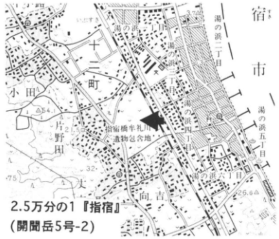
Show extracted lettering and translation
English translation of figure lettering
1:25,000 Ibusuki sheet (Kaimondake sheet 5-2). Area containing the Hashimuregawa site; Oda; Jutcho; 片野田; Mukoyoshi; Yunohama 1-, 2-, 4-, 5- and 6-chome; Ibusuki. 54, 75, 32, 2.5, 26.6. Exposure arrow.
Original Japanese lettering
2.5万分の1『指宿』(開聞岳5号-2)。指宿橋牟礼川遺跡包含地、小田、十町、片野田、向吉、湯の浜一丁目・二丁目・四丁目・五丁目・六丁目、指宿。54、75、32、2.5、26.6。露頭矢印。
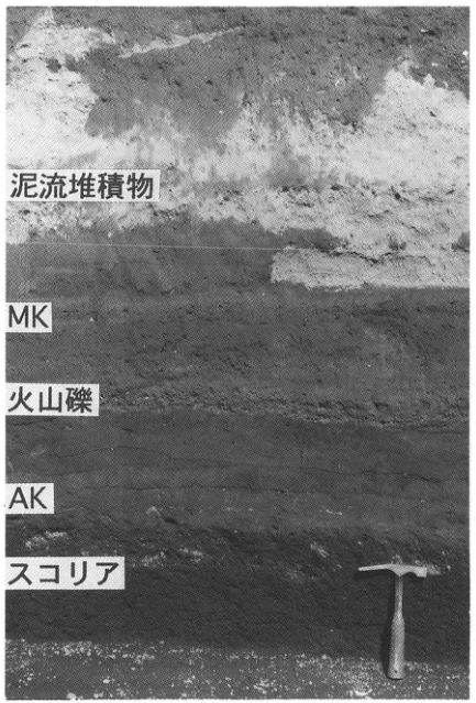
Show extracted lettering and translation
English translation of figure lettering
Mudflow deposit; MK; lapilli; AK; scoria.
Original Japanese lettering
泥流堆積物、MK、火山礫、AK、スコリア。
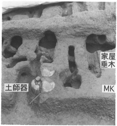
Show extracted lettering and translation
English translation of figure lettering
House rafters; Haji ware; MK.
Original Japanese lettering
家屋垂木、土師器、MK。
KS-21 Late Pleistocene aeolian tephra covering marine terraces on Tanegashima
長岡信治
- Locality: North of Tsubakiyama, Minamitane Town, Kagoshima Prefecture
- Coordinates: N30°26′12″ E130°52′47″
- Elevation: 155m
- Exposure and condition: Road cutting
- Deposit and age: Aeolian tephra and marine deposits; Late Pleistocene
- Date described: May 1985
- Keywords: Tanegashima; Ata tephra; Kikai-Tozurahara tephra; Aira-Tn tephra
Middle to Late Pleistocene marine terraces are developed on Tanegashima. Last-interglacial terraces are divided into four surfaces (中田, 1968; 町田, 1969). They are covered by more than 5m of aeolian tephra from southern Kyushu volcanoes (町田, 1985; 中田 et al., 1989). This exposure displays aeolian tephra covering Middle Pleistocene marine-terrace gravel. Ata tephra, unconformably overlying the gravel, Kikai-Tozurahara tephra (K-Tz; 75–95ka), and Aira-Tn tephra (AT; 22–25ka) are clearly recognizable. K-Tz can be divided into several units (長岡, 1988); here a lower pyroclastic-flow or pyroclastic-surge deposit with conspicuous cross-lamination and upper ash fall rich in accretionary lapilli are recognized. Thin tephras called Tane I, Tane II, Tane III and Tane VI occur between K-Tz and AT (長岡, 1988; 奥野・小林, 1994), but are not particularly distinct here. They can be seen at Hamatsuwaki in Nakatane Town and Okigahamada in Nishinoomote City, in northern Tanegashima. Above AT, Kikai-Akahoya tephra (K-Ah) and the Kikai-Koya pyroclastic-flow deposit (宇井, 1973) can be seen.
References: 町田 (1969, 1985); 長岡 (1988); 中田 (1968); 中田 et al. (1989); 奥野・小林 (1994); 宇井 (1973).
Photographed in May 1985.
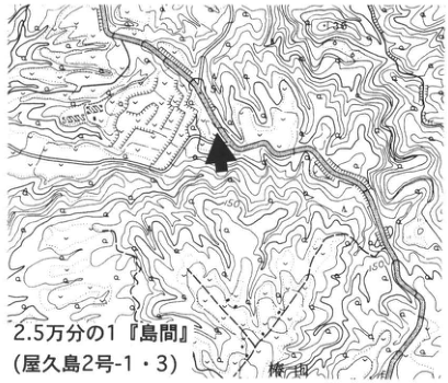
Show extracted lettering and translation
English translation of figure lettering
1:25,000 Shimama sheet (Yakushima sheets 2-1 and 2-3). Tsubakiyama. 100, 150; exposure arrow.
Original Japanese lettering
2.5万分の1『島間』(屋久島2号-1・3)。椿山。100、150、露頭矢印。
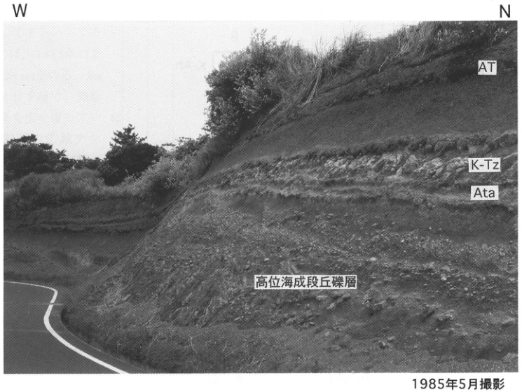
Show extracted lettering and translation
English translation of figure lettering
W, N. AT; K-Tz; Ata; high marine-terrace gravel. 1m. Photographed in May 1985.
Original Japanese lettering
W、N。AT、K-Tz、Ata、高位海成段丘礫層。1m。1985年5月撮影。
KS-22 Late Pleistocene tephra on Yakushima
森脇広
- Locality: Boundary between Yaku Town and Kamiyaku Town, Kagoshima Prefecture
- Coordinates: N30°21′49″ E130°39′50″
- Elevation: 80m
- Exposure and condition: Artificial exposures, preserved as of January 1994
- Deposit and age: Aeolian tephra; Late Pleistocene
- Date described: July 1989
- Keywords: Yakushima; Ata tephra; Kikai-Tozurahara tephra
The two exposures shown lie on opposite banks of the 落川, which forms the boundary between Kamiyaku and Yaku towns in eastern Yakushima. Takami Bridge across the river is a useful landmark. Marine terraces are widely developed nearby, and these tephras are important markers for their chronology. In exposure A on the southern bank, two tephras overlie approximately 3m of gravel above basement of the Kumage Group. The lower tephra is 60cm of ash weathered reddish brown, deposited immediately above the gravel. It commonly contains orthopyroxene with refractive index γ=1.705–1.708, measured by Fusao Arai, emeritus professor at Gunma University, and is considered to be Ata tephra. Above a 20cm soil lies a 12cm orange tephra comprising ash-rich pumice. Its common quartz identifies it as Kikai-Tozurahara tephra (K-Tz). K-Tz is widely recognized on Yakushima and is an extremely useful marker for terrace chronology in this region. At exposure B on the northern bank, K-Tz is 80cm thick and well preserved. Three units can be distinguished, from bottom upward: bedded ash, glassy ash rich in accretionary lapilli, and ash containing pumice. The terrace gravel here is up to 17m thick and fills the 落川 valley.
References: 町田 (1977); 町田・新井 (1992); 小野 et al. (1982).
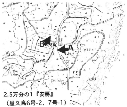
Show extracted lettering and translation
English translation of figure lettering
1:25,000 Anbo sheet (Yakushima sheets 6-2 and 7-1). A, B, Takami Bridge. 66, 85.7, 39, 69.
Original Japanese lettering
2.5万分の1『安房』(屋久島6号-2、7号-1)。A、B、高見橋。66、85.7、39、69。
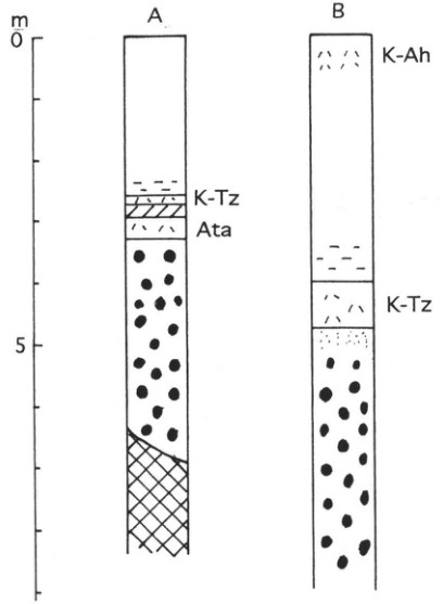
Show extracted lettering and translation
English translation of figure lettering
A, B. A: K-Tz, Ata. B: K-Ah, K-Tz. Scale 0, 5m.
Original Japanese lettering
A、B。A:K-Tz、Ata。B:K-Ah、K-Tz。目盛0、5m。
KS-23 Quaternary tephra on Suwanosejima, Tokara Islands
森脇広
- Locality: Suwanosejima, Toshima Village, Kagoshima District, Kagoshima Prefecture
- Coordinates: N29°37′02″ E129°42′16″
- Elevation: 220m
- Exposure and condition: Artificial exposure, preserved as of August 1993
- Deposit and age: Aeolian tephra; Pleistocene to Holocene
- Date described: August 1993
- Keywords: Tokara Islands; Suwanosejima; pumice fall; Bunka–post-Bunka scoria group; Aira-Tn tephra
Road construction toward 根上岳 revealed a large exposure with 50m of relief, 1km north of the village in southern Suwanosejima. More than 20 Quaternary tephra beds are accumulated here, making it a good exposure for establishing the island's basic Quaternary tephra stratigraphy. They are divided into five groups, from bottom upward: southern Suwanosejima lower tephra (Ss-L), lower scoria (Ss-Ls), upper pumice (Ss-Up), upper scoria (Ss-Us), and Bunka–post-Bunka scoria (Bn-PBn sc) (Moriwaki et al., 1996). A noteworthy feature is evidence for pumice eruptions on Suwanosejima, represented by Ss-L1 and Ss-Up. Ss-L1 is a relatively large pumice fall and pyroclastic flow; Ss-Up comprises seven pumice-fall beds, of which the lowest, Ss-Up1, is thickest. Ss-Ls comprises ten scoria beds, with the lowest Ss-Ls1 thickest and well preserved on the southern lava plateau. Ss-Us is an accumulation of fine scoria from intermittent multicycle eruptions and is massive overall. At the top lies the Bunka scoria (Bn sc) of 1813. Bn is a coarse scoria bed widely covering the island's surface. Aira-Tn (AT), a widespread tephra from southern Kyushu, is found near the boundary between Ss-Ls and Ss-Up. Bunka and post-Bunka scoria are described in detail by 平沢・松本 (1983), 小林 (1989) and 井村 (1991); prehistoric tephras are described by Moriwaki et al. (1996).
References: 平沢・松本 (1983); 井村 (1991); 小林 (1989); Moriwaki et al. (1996).
Tephra stratigraphy of southern Suwanosejima. 1: scoria fall; 2: ash fall; 3: pumice fall; 4: glassy ash; 5: pyroclastic flow; 6: debris flow; 7: soil; 8: basement rock.
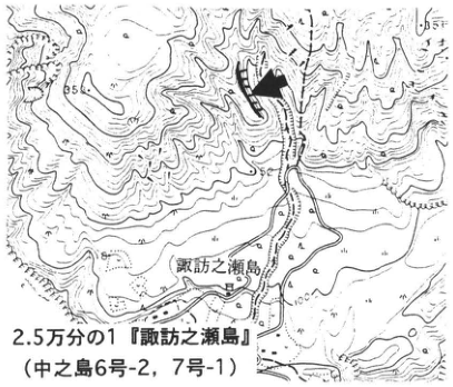
Show extracted lettering and translation
English translation of figure lettering
1:25,000 Suwanosejima sheet (Nakanoshima sheets 6-2 and 7-1). Suwanosejima. 55, 56, 100, 200. Exposure arrow.
Original Japanese lettering
2.5万分の1『諏訪之瀬島』(中之島6号-2、7号-1)。諏訪之瀬島。55、56、100、200。露頭矢印。
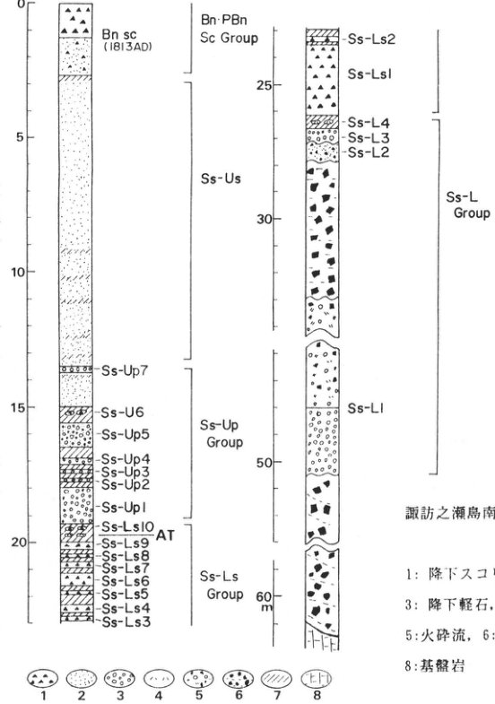
Show extracted lettering and translation
English translation of figure lettering
Two-column stratigraphy. Bn sc (1813AD); Bn-PBn Sc Group; Ss-Us; Ss-Up Group; Ss-Ls Group; Ss-L Group. Ss-Up7; Ss-U6 [as printed]; Ss-Up5; Ss-Up4; Ss-Up3; Ss-Up2; Ss-Up1. Ss-Ls10; AT; Ss-Ls9; Ss-Ls8; Ss-Ls7; Ss-Ls6; Ss-Ls5; Ss-Ls4; Ss-Ls3; Ss-Ls2; Ss-Ls1. Ss-L4; Ss-L3; Ss-L2; Ss-L1. Scale 0, 5, 10, 15, 20, 25, 30, 50, 60m. The meanings of legend symbols 1–8 are transcribed in the caption.
Original Japanese lettering
2列柱状図。Bn sc(1813AD)、Bn-PBn Sc Group、Ss-Us、Ss-Up Group、Ss-Ls Group、Ss-L Group。 Ss-Up7、Ss-U6[原図表記]、Ss-Up5、Ss-Up4、Ss-Up3、Ss-Up2、Ss-Up1。Ss-Ls10、AT、Ss-Ls9、Ss-Ls8、Ss-Ls7、Ss-Ls6、Ss-Ls5、Ss-Ls4、Ss-Ls3、Ss-Ls2、Ss-Ls1。Ss-L4、Ss-L3、Ss-L2、Ss-L1。目盛0、5、10、15、20、25、30、50、60m。凡例1~8の意味は図説明に収録。
KS-24 Holocene coral-reef terraces on Kikaijima, Nansei Islands
大村明雄
- Locality: Kikai Town, Kagoshima Prefecture
- Coordinates: N28°19′ E129°58′
- Elevation: 0–20m
- Exposure and condition: Natural exposures; preserved as of August 1995 except near ports, with some portions also lost
- Deposit and age: Coral-reef deposits and coral limestone; Holocene, partly Pleistocene
- Date described: August 1995
- Keywords: Kikaijima; Holocene coral-reef terraces; coral limestone; uplifted fringing reef
Kikaijima is covered by coral-reef limestone, which Hanzawa (1935) divided into Pleistocene Ryukyu limestone and Holocene uplifted coral-reef limestone. The latter formed as a fringing reef completely encircling the island, subsequently emerged and now forms four marine terraces, I, II, III and IV from highest downward (中田 et al., 1978; 太田 et al., 1978). Given their present preservation, size and ease of observation, it is no exaggeration to describe these magnificent Holocene coral-reef terraces as a natural heritage of international significance. Since 三位・木越 (1966) applied ¹⁴C dating, the constituent coral limestone has been dated by Konishi (1974), Omoto et al. (1976), Koba et al. (1982), and others. Because coral-reef terraces are useful indicators of relative former sea-level elevation, or paleotide gauges, their elevations and dates have been used to discuss sea-level and crustal changes.
At site 1, Shitooke coast, and site 3, Araki coast, in the map at right, the unconformity between Pleistocene Ryukyu limestone and Holocene coral limestone can be observed. At site 2, Nakaguma coast, shallow drilling by 小西 et al. (1983) revealed the reef's internal structure, and the relationship between regression, mainly caused by crustal movement, and reef-growth patterns was discussed.
A schematic topographic and geological section of the Holocene terraces at Shitooke coast (site 1), as of May 1994, is shown with recent high-precision uranium-series dates of in-situ coral fossils. The illustrated surfaces were surveyed along a line approximately perpendicular to the coast through a comparatively smoothly eroded portion of the otherwise rugged Holocene terraces. Here the Holocene coral limestone unconformably overlies Pleistocene rhodolith limestone. Uranium-series ages of in-situ corals retaining their growth positions immediately above the boundary suggest that (1) Holocene coral-limestone formation at this site had begun by approximately 7.2ka at the latest; (2) the fringing reef subsequently grew laterally seaward; and (3) terraces II and lower formed through erosion associated with relative sea-level fall, followed by growth of corals and coralline algae on the erosion surfaces.
References: Hanzawa (1935); Koba et al. (1982); 小西 et al. (1983); Konishi et al. (1974); 三位・木越 (1966); 村瀬 (1994); 中田 et al. (1978); 太田 et al. (1978); Omoto et al. (1976).
Topographic and geological section of Holocene coral-reef terraces at Shitooke coast.
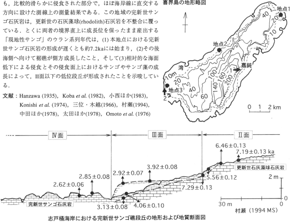
Show extracted lettering and translation
English translation of figure lettering
Schematic topographic map of Kikaijima: sites 1, 2, 3; Wan; Kadon; photograph directions 1 and 2. Contours 10, 20, 40, 60, 100, 140, 160, 200. Scale 0, 1, 2km; north arrow. Section: surfaces IV, III, II. Holocene coral limestone; Pleistocene rhodolith limestone. Uranium-series ages (ka): 2.62±0.06, 2.85±0.08, 2.92±0.07, 3.13±0.08, 4.06±0.10, 3.92±0.08, 7.29±0.13, 5.56±0.12, 6.46±0.13, 7.19±0.13. Vertical scale 0–2m; horizontal scale 0–30m. 村瀬 (1994 MS). Prose and references included in the crop are transcribed and translated in the body.
Original Japanese lettering
喜界島の地形略図:地点1、地点2、地点3、湾、嘉鈍、写真方向1・2。等高線10、20、40、60、100、140、160、200。縮尺0、1、2km、北矢印。 断面:IV面、III面、II面。完新世サンゴ石灰岩、更新世石灰藻球石灰岩。ウラン系列年代(ka):2.62±0.06、2.85±0.08、2.92±0.07、3.13±0.08、4.06±0.10、3.92±0.08、7.29±0.13、5.56±0.12、6.46±0.13、7.19±0.13。縦尺度0~2m、横尺度0~30m。村瀬(1994 MS)。切出し中の本文・文献は本文欄に収録。
KS-24 (continued)
Photograph 1: View of Holocene coral-reef terraces on the Kadon coast from Hyakunodai.
Photograph 2: Holocene coral-reef terraces on the Araki coast.
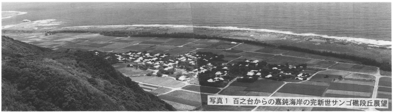
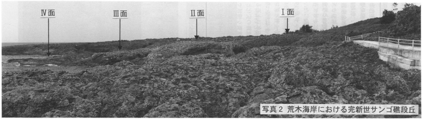
Show extracted lettering and translation
English translation of figure lettering
Surfaces IV, III, II, I; arrows identify each surface.
Original Japanese lettering
IV面、III面、II面、I面、各面を示す矢印。
KS-25 Basal strata of the Ryukyu Group in southern Okinawa Island
兼子尚知・伊藤孝
- Locality: Yamashiro, Itoman City, Okinawa Prefecture
- Coordinates: N26°5′0″ E127°41′9″
- Elevation: 55m
- Exposure and condition: Artificial exposure, preserved as of July 1995; a preservation plan is being prepared
- Deposit and age: Limestone; Early Pleistocene
- Date described: July 1995
- Keywords: Ryukyu Islands; Okinawa Prefecture; Ryukyu Group; limestone; coral reef
The basal Ryukyu Group exposed here is called “red limestone” for its distinctive color (兼子, 1994). It is an approximately 1.2–1.8m reef-limestone bed unconformably overlying mudstone of the Shinzato Formation, Shimajiri Group, and unconformably overlain by the Naha Formation, Ryukyu Group. Its color and sharp boundary clearly distinguish it from the overlying white Naha limestone. Traditionally, the Ryukyu Group in southern Okinawa has been divided, from bottom upward, into “Chinen Sandstone,” Naha Formation and Minatogawa Formation (for example, Nakamori, 1986; 氏家, 1988). Isotopic ages and terrace correlations suggest deposition of the Naha Formation before 0.3Ma (木崎 et al., 1984), and the Minatogawa Formation at approximately 120–150ka. Regarding the origin of the coral reefs now developed in the Ryukyu Islands, Koba (1992) argued that reefs began to develop after the Kuroshio entered behind the land bridge that had extended from China to Okinawa in the Early Pleistocene, beginning in the Middle Pleistocene (0.6–0.7Ma). Reef limestone such as the “red limestone” below the Naha Formation had not previously been known. 兼子・伊藤 (1995) measured ⁸⁷Sr/⁸⁶Sr ratios in fossils in limestone from this and other exposures, assigning the red limestone an age of approximately 1.3Ma and the Naha Formation a mean age of approximately 0.4Ma. Meanwhile, 佐渡 et al. (1992) reported from nannofossil analysis of Ryukyu-limestone borehole cores on Irabu Island that the lowest part dates back to 1.20–1.30Ma. These data show that reef development began several hundred thousand years or more earlier than previously thought. This is extremely important for considering the tectonic history of the Ryukyu arc, including bending and subsidence of the land bridge and changes in the Kuroshio route. Thus this exposure is valuable for new findings on Ryukyu Group stratigraphy and ages, and as evidence filling a former temporal gap in reconstructions of Ryukyu arc history. Following a request to the Itoman City authorities for preservation, it was incorporated into the city's park plan; a preservation plan was being prepared as of June 1995. After park development is completed, the exposure will be permanently available for observation.
References: 兼子 (1994); 兼子・伊藤 (1995); 木崎 et al. (1984); Koba (1992); Nakamori (1986); 佐渡 et al. (1992); 氏家 (1988).
Photographed in July 1994.
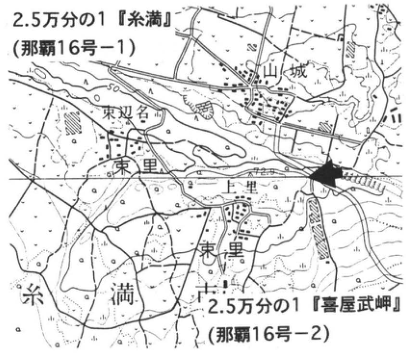
Show extracted lettering and translation
English translation of figure lettering
1:25,000 Itoman sheet (Naha sheet 16-1) and Kyanmisaki sheet (Naha sheet 16-2). Yamashiro; 東双名; Uezato; 東里; Itoman. Exposure arrow.
Original Japanese lettering
2.5万分の1『糸満』(那覇16号-1)、2.5万分の1『喜屋武岬』(那覇16号-2)。山城、東双名、上里、東里、糸満。露頭矢印。
Show extracted lettering and translation
English translation of figure lettering
Photograph: berm; photographed in July 1994. Column: Naha Formation, Ryukyu Group (coral limestone), Middle Pleistocene (mean approximately 400ka: Sr age); basal Ryukyu Group (“red limestone”), Early Pleistocene (Ca 1.30Ma: Sr age); Shinzato Formation, Shimajiri Group (mudstone), Late Pliocene. 2m.
Original Japanese lettering
写真:犬走り、1994年7月撮影。柱状図:琉球層群那覇層(サンゴ石灰岩)、中期更新世(平均約400ka:Sr年代);琉球層群基底層(“赤色石灰岩”)、前期更新世(Ca 1.30Ma:Sr年代);島尻層群新里層(泥岩)、後期鮮新世。2m。
KS-26 The present-day Shiraho coral reef on Ishigaki Island: diverse reef-building coral communities in the reef lagoon
長谷川均
- Locality: Offshore Shiraho, Ishigaki City, Okinawa Prefecture
- Coordinates: N24°21′47″ E124°15′27″ (near pole 2)
- Water depth: Approximately 0–4m
- Exposure and condition: Coral-reef lagoon approximately 1km wide on the southeastern coast
- Deposit and age: Fringing reef with a reef flat; present-day
- Date described: September 1995
- Keywords: Ishigaki Island; coral reef; fringing reef; reef-building corals; blue coral; red-soil (sediment) inflow
Shiraho reef is a fringing reef extending 12km north–south, up to approximately 1km wide, from Miyara Bay on Ishigaki's southeastern coast to the mouth of the 通路川 on the eastern coast. A magnificent reef ecosystem can be observed along approximately 7km from Shiraho village to the eastern side of Karadake; the aerial photograph shows its southern half. Large blue-coral (Heliopora coerulea) colonies have lived here for at least 600 years. Numerous enormous massive Porites australiensis colonies and microatolls, thought to be approximately 200–500 years old, also occur, with more than 130 around pole II alone (described below). Reef-building corals are estimated to number more than 70 species in 30 genera; diverse organisms including algae, seagrasses and fishes can also be observed. One can swim from the beach to the reef crest facing the open sea, clearly observing the zonation from reef lagoon through reef flat to reef crest. At low tide, it is also possible to reach the crest along exposed Watanji rises. Iron posts, poles I–IV, remain offshore from a former proposed airport site and provide good landmarks. For safety, however, the text recommends taking an irregularly operated coral-viewing boat around high tide, following the guide's directions and snorkeling with care to avoid damaging the coral. Boats visit blue-coral colonies, Montipora foliosa colonies, microatolls and Porites cylindrica colonies. With healthy reefs now extremely scarce because of development and water pollution, Shiraho reef is highly valuable. In recent years, however, land development has also caused substantial red-soil sediment inflow here.
References: IUCN (1988); 目崎 (1991); 日本自然保護協会 (1991); WWFJ (1986, 1995).
Show extracted lettering and translation
English translation of figure lettering
Montipora foliosa; microatoll; blue coral; reef flat at low tide. IV, III, II, pole I; Todorokigawa; Watanji; Shiraho village. Scale 0–1km, north arrow, boxes and connecting lines identifying colony locations.
Original Japanese lettering
ウスコモンサンゴ、マイクロアトール、アオサンゴ、干潮時の礁原。IV、III、II、第Iポール、轟川、ワタンジ、白保集落。縮尺0~1km、北矢印、群落位置を示す囲みと連結線。
[Blank page]
References
Translation note: Titles and publication details originally in Japanese are translated for this edition; these renderings are not presented as the publications' official English titles. Original English citations are retained, with verified OCR errors corrected. Japanese author names are preserved for identification.
A
相沢忠洋(1969) The discovery of “Iwajuku.” Kodansha, 207 pp.
赤木三郎(1972) Formation processes of the Tottori sand dunes. Memoirs of the Geological Society of Japan, 7: 125–135.
赤木三郎(1991) The secrets of sand dunes. Exploring the History of the Earth, no. 9, Aoki Shoten, 170 pp.
赤松守雄・山田悟郎・渡邊真人・江郷雅樹・奥村晃史(1990) Age of the deposits containing Naumann’s elephant and their paleovegetation at Churui Village, Hokkaido. Bulletin of the Hokkaido Branch of the Geological Society of Japan, inaugural issue: 37–40.
阿子島功・須鎗和巳(1989) Formation processes of the Yoshinogawa graben along the Median Tectonic Line. Earth Science (Chikyu Kagaku), 43: 428–442.
阿久津純(1957) The Kanto Loam (volcanic ash) Formation near Utsunomiya. Earth Science (Chikyu Kagaku), 33: 1–11.
青木かおり・町田洋(1996) Identification of volcanic ash on the deep seafloor of the northwestern Pacific off northeastern Japan. Abstracts of the Japan Association for Quaternary Research, 26: 78–79.
青木直昭・馬場勝良(1971) Molluscan fossil assemblages of the Semata, Kamiizumi, and Narita formations in the Kisarazu–Ichihara area and their stratigraphic occurrence. Journal of the Geological Society of Japan, 77: 137–151.
青木直昭・堀口興・馬場勝良(1970) The Pleistocene succession near Anegasaki and Chiba City, Boso Peninsula. Journal of the Geological Society of Japan, 76: 303–308.
青木直昭・池田宣弘・杉山悠紀子・粟野俊昭・堀口興・小池桂子・吉村文・川瀬嶺子・西川正子(1962) Redescription of the type stratigraphy and molluscan fossil assemblages of the Jizodo and Yabu formations. Journal of the Geological Society of Japan, 68: 507–517.
青森県埋蔵文化財調査センター編(1994) Sannai-Maruyama site (4): preliminary report on archaeological excavations associated with the expansion of the prefectural sports park. Aomori Prefectural Board of Education, 19 pp.
新井房夫(1962) Quaternary chronology of the northwestern Kanto Basin. Bulletin of the Faculty of Education, Gunma University, Natural Sciences, 10: 1–79.
新井房夫(1964) Absolute age of the Maebashi peat deposits and the age of the Paleolithic artifact-bearing deposits. Earth Science (Chikyu Kagaku), 70: 37–38.
新井房夫(1965) Plant fossils and age of the Nakanojo lacustrine deposits, Gunma Prefecture. Daiyonki (第四紀), 8: 20–22.
新井房夫(1967) Eruption age of the Maebashi mudflow and the Iwajuku I cultural period: radiocarbon ages of Quaternary deposits in Japan, XXXII. Earth Science (Chikyu Kagaku), 21: 46–47.
新井房夫(1972) Identification of tephra using refractive indices of orthopyroxene and hornblende: a fundamental study of tephrochronology. The Quaternary Research, 11: 254–269.
新井房夫(1979) Tephra layers from the Jomon period onward in the northwestern Kanto region. Kokogaku Journal (考古学ジャーナル), 157: 41–52.
新井房夫(1993) Volcanic-ash archaeology. Kokon Shoin, 264 pp.
新井房夫・町田洋(1980) A tephra catalog for Japan, I: petrographic properties of Late Quaternary marker tephras from western Japan to Tohoku. Journal of Pumice Studies (軽石学雑誌), 6: 65–76.
新井房夫・町田洋・杉原重夫(1977) Late Pleistocene marker tephra layers in southern Kanto: descriptions of their properties and related issues. The Quaternary Research, 16: 19–40.
新井房夫・大場忠道・北里洋・堀部純男・町田洋(1981) Late Quaternary paleoenvironment of the Japan Sea, based on tephrochronology, foraminiferal assemblage analysis, and oxygen-isotope ratios. The Quaternary Research, 20: 209–230.
Arai, F., Machida, H., Okumura, K., Miyauchi, T., Soda, T. and Yamagata, K. (1986) Catalog for Late Quaternary Marker-Tephras in Japan (II) —Tephras Occurring in Northeast Honshu and Hokkaido. Geographical Report of Tokyo Metropolitan University, 21: 223-250
荒牧重雄(1968) Geology of the Kakuto Basin. Bulletin of the Earthquake Research Institute, 46: 1325–1343.
荒牧重雄(1968) Geology of Asama volcano. Monograph of the Association for the Geological Collaboration in Japan, 14: 45 pp.
荒牧重雄(1986) Asama volcano. In 大森昌衛, 端山好和, and 堀口万吉 (eds.), Geology of Japan, vol. 3: Kanto Region. Kyoritsu Shuppan, pp. 218–220.
荒牧重雄・宇井忠英(1966) The Ata pyroclastic flow and Ata caldera. Journal of the Geological Society of Japan, 72: 337–349.
Aramaki, S. and Ui, T. (1966) The Aira and Ata pyroclastic flows and related caldera land depressions in southern Kyushu, Japan. Bull. Volcanol., 29: 29-47
足柄団体研究グループ(1986a) Stratigraphy and geological structure of the Ashigara Group: studies of the Neogene and Quaternary deposits in the Ashigara area (2). Earth Science (Chikyu Kagaku), 40: 47–63.
足柄団体研究グループ(1986b) Formation processes of the Ashigara Group: studies of the Neogene and Quaternary deposits in the Ashigara area (3). Earth Science (Chikyu Kagaku), 40: 399–416.
愛鷹ローム団体研究グループ(1969) Loam deposits at the foot of Ashitaka volcano, with emphasis on exposures at construction sites of the Tomei Expressway. The Quaternary Research, 8: 10–21.
愛鷹ローム団体研究グループ(1970) Radiocarbon ages of buried humic layers in the upper Ashitaka Loam: radiocarbon ages of Quaternary deposits in Japan (52). Earth Science (Chikyu Kagaku), 24: 73–75.
跡津川断層トレンチ発掘調査団・岡田篤正・竹内章・佃為成・池田安隆・渡辺満久・平野信一・升本真二・竹花康夫・奥村晃史・神嶋(竹村)利夫・小林武彦・安藤雅孝(1989) Trench excavation of the Atotsugawa Fault at Nokubi, Miyagawa Village, Gifu Prefecture. Journal of Geography, 98: 62–85.
粟田泰夫(1988) 1983 trench investigation of the Urata Fault, Morioka fault group, in the Urata district. Active Fault Research, 5: 23–28.
粟田泰夫・水野清秀・杉山雄一・下川浩一・井村隆介・木村克己・奥村晃史・佃栄吉(1995) Surface earthquake faults accompanying the 1995 southern Hyogo Prefecture earthquake. Abstracts of the Seismological Society of Japan: A83.
B
琵琶湖自然史研究会(1986) Freshwater fossil assemblages of the Kobiwako Group on the southwestern shore of Lake Biwa. Bulletin of the Mizunami Fossil Museum, 13: 57–103.
C
千葉恵美(1995) Characteristics of the Kiso River mudflow deposits and reconstruction of their source area. 1995 Abstracts of the Volcanological Society of Japan, 2: 74.
千葉達朗(1983) An exposure of the active Hadano Fault, Hadano City, Kanagawa Prefecture. Urban Kubota, 21: back cover.
千葉達朗(1986) Oiso Hills. In 大森昌衛, 端山好和, and 堀口万吉 (eds.), Geology of Japan, vol. 3: Kanto Region. Kyoritsu Shuppan, pp. 91–94.
千葉達朗・羽鳥謙三・遠藤邦彦・宮地直道・鈴木正章(1982) Study of the Nogawa peat deposits, Chofu City (1): fall-unit subdivision of the Tachikawa Loam. Abstracts of the Geological Society of Japan, 25: 115.
千葉とき子(1961) Petrological study of Zao volcano. Ganko (岩鉱), 46: 73–82.
中馬教充・吉田義(1982) Geology of the southern foot of Bandai volcano. Fukushima University special research project, “Nature of Lake Inawashiro,” Research Report, 3: 21–32.
張一飛・井上克弘・佐瀬隆(1994) Widespread eolian dust in Iwate volcanic tephra layers deposited after the Toya ash. The Quaternary Research, 33: 131–151.
調枝勝幸(1970) Study of tile-clay deposits in the Iwami region, part 1: occurrence and mineral composition of Tsunozu clay. Report of the Shimane Prefectural Industrial Research Institute, 6: 50–59.
D
第3次丹那断層発掘調査研究グループ(1988) 1985 trench investigation of the Tanna Fault in the Tanna and Nenokami districts. Active Fault Research, 5: 42–49.
檀原徹・鎌田浩毅・山下透(1992) Correlation of the Pink ash of the Osaka Group with the Yabakei pyroclastic-flow deposits in central Kyushu. 1992 Abstracts of the Volcanological Society of Japan, 2: 108.
檀原徹・柴田賢・松本哲一・岩野英樹(1992) Additional age data for OGPK, a candidate domestic geochronological reference sample. Fission-Track Newsletter, 5: 73–77.
檀原徹・鎌田浩毅・林田明・岩野英樹・山下透(1994) Additional age and correlation data for OGPK (Pink ash of the Osaka Group), a candidate domestic age-standard sample (4): fission-track ages of the source Yabakei pyroclastic-flow deposits and related data. Fission-Track Newsletter, 7: 18–22.
土井宣夫(1989) The thin distal part of the Hirakasa debris-flow deposit, Iwate volcano. Abstracts of the 96th Annual Meeting of the Geological Society of Japan: 524.
土井宣夫(1990) Volcanic-ash stratigraphic study of Iwate volcano. Doctoral dissertation, Faculty of Science, Tohoku University, 223 pp.
土井宣夫(1991) Eruption sources of the Yukiura pumice fall and Oide black volcanic ash, Iwate volcano. Geological Papers Commemorating the Retirement of Professor Hisao Nakagawa, pp. 13–22.
土井宣夫(1993) Occurrence of the Towada–Ofudo and Hachinohe pyroclastic-flow deposits near Morioka City. Bulletin of the Tohoku Branch of the Geological Society of Japan, 22: 8–9.
土井宣夫・新井房夫(1987) Hachinohe tephra from Towada volcano at the foot of Iwate volcano. Bulletin of the Tohoku Branch of the Geological Society of Japan, 17: 11–13.
土井宣夫・大石雅之・川上雄司(1986) Radiocarbon ages of the Wakare ash, Iwate volcano, and Holocene volcanic activity: radiocarbon ages of Iwate volcanic products and related deposits (2). Bulletin of the Iwate Prefectural Museum, 4: 29–38.
E
遠藤秀典・鈴木祐一郎(1986) Geology of the Tsuma and Takanabe districts. Quadrangle Series, 1:50,000 geological maps, Geological Survey of Japan, 105 pp.
遠藤良二(1977) Fossil periglacial phenomena in the upper Kitakami River basin. Abstracts of the Association of Japanese Geographers, 12: 22–23.
遠藤邦彦(1984) Environmental changes in coastal Hokkaido since the last glacial period. In 福田正己, 小疇尚, and 野上道男 (eds.), Natural Environments of Cold Regions. Hokkaido University Press, pp. 231–250.
Endo, K. (1986) Coastal sand dunes in Japan. Proceedings of Institute of Natural Sciences, Nihon University, 21:37-54
遠藤邦彦(1987) Parabolic dunes, in relation to liquefaction. Research report for Special Research on Natural Disasters (1), “Estimation of liquefaction depth based on sedimentary structures in liquefied layers,” pp. 67–71.
遠藤邦彦・小杉正人(1989b) Geomorphological environment. Studies of Yayoi Culture, vol. 1: The Yayoi People and Their Environment. Yuzankaku, pp. 131–147.
遠藤邦彦・辻誠一郎(1977) Quaternary deposits along the Dekishima coast, Nishitsugaru District, Aomori Prefecture. Research Bulletin of the Institute of Natural Sciences, College of Humanities and Sciences, Nihon University, 12: 1–10.
遠藤邦彦・上杉陽(1972) Geomorphology and geology of the Tokoro coastal plain on the Sea of Okhotsk. Tokoro, edited by the Laboratory of Archaeology, Faculty of Letters, University of Tokyo, pp. 493–504.
遠藤邦彦・上杉陽(1977) Quaternary stratigraphy and pre-Jomon stone-tool-bearing deposits around the Gifu No. 2 site, Tokoro. Gifu No. 2 Site, pp. 53–64, Tokoro Town.
遠藤邦彦・関本勝久・辻誠一郎(1979) Holocene stratigraphy and paleoenvironment in the upper Nakamura River basin, southwestern Oiso Hills. Research Bulletin of the Institute of Natural Sciences, College of Humanities and Sciences, Nihon University, 14: 9–28.
遠藤邦彦・関本勝久・高野司・鈴木正章・平井幸弘(1983) The “Chusekiso” deposits of the Kanto Plain. Urban Kubota, 21: 26–43.
遠藤邦彦・宮地直道・鈴木茂・鈴木正章・吉川純子・千葉達朗・隅田まり・菱田量・印牧もとこ(1987) Geology and stratigraphy of the Akayama Jinya site, Kawaguchi City. Kawaguchi City Archaeological Research Association Report no. 10: Akayama, Paleoenvironment volume, pp. 5–80.
遠藤邦彦・隅田まり・宇野リベカ・宮原智哉(1988) Late Holocene tephra stratigraphy in Hokkaido and its source volcanoes. Abstracts of the Japan Association for Quaternary Research, pp. 78–79.
遠藤邦彦・五十嵐八枝子・隅田まり・鈴木敬治・宮田雄一郎(1988) Paleoenvironment over the past 15,000 years, reconstructed at Barasan on the Notsuke coast, eastern Hokkaido. Report of a Grant-in-Aid for Cooperative Research, principal investigator 井関弘太郎, “Formation of alluvial plains and Chusekiso deposits in Japan and their relationship to natural environments at the end of the Quaternary,” pp. 45–52.
遠藤邦彦・隅田まり・宇野リベカ(1989) Late Holocene tephra stratigraphy in eastern Hokkaido and its source volcanoes. Journal of Geography, 98: 506–510.
遠藤邦彦・小杉正人・松下まり子・宮地直道・菱田量・高野司(1989) History and significance of Holocene environmental changes around paleo-Nagareyama Bay, Chiba Prefecture. The Quaternary Research, 28: 61–77.
遠藤邦彦・磯望・宮原智哉・陶野郁雄・大野希一(1993) Volcanic ash fall from the eruption of Unzen-dake. Japanese Society of Soil Mechanics and Foundation Engineering, “Volcanic disasters at Unzen-dake: geotechnical issues,” pp. 45–58.
遠藤尚・松田剛・法元紘一・児玉三郎(1962) Terraces composing the Hyuga Plain. Bulletin of the Faculty of Liberal Arts and Education, Miyazaki University, 14: 9–27.
F
藤井昭二(1966) Terraces in the Joganji River basin. Geological excursion guide, “Tateyama volcano,” pp. 11–15.
藤井登美夫(1976) Occurrence of the Kiso River mudflow deposits from Ontake volcano and their flow and depositional modes. Geographical Reports, Aichi University of Education Geographical Society, 45: 114–120.
藤村新一・鎌田俊昭・横山裕平・梶原洋(1995) Third investigation of the Kamitakamori site. Abstracts of the 9th Meeting on the Paleolithic Culture of Northeastern Japan, pp. 2–8.
藤村新一・児玉哲也・鈴鹿八重子・武田耕平・吉田義・鈴木敬治(1993) Early Paleolithic stone-tool assemblages at the Takenomori site, Fukushima City. Fukushima Archaeology (福島考古), 34: 1–10.
藤野直樹・小林哲夫(1992) Eruption and depositional modes of the Kora layer from Kaimon-dake. Reports of the Faculty of Science, Kagoshima University, Earth Sciences and Biology, 25: 69–83.
藤岡一男(1959) The 1:50,000 geological map “Toga and Funakawa” and its explanatory text. Geological Survey of Japan, 61 pp.
藤岡一男(1973) Geology of the Oga Peninsula. Nature Conservation Society of Japan survey report, 44, Akita Prefecture, pp. 5–34.
藤岡一男・高安泰助・的場保望・大口健志・秋田大学鉱山学部鉱山地質学教室(1973) Geological map of the Oga Peninsula, Akita Prefecture, 1:50,000. Nature Conservation Society of Japan and Akita Prefecture.
藤山賢一郎(1992) Formation processes of Chusekiso deposits in the Kagoshima lowland. Master’s thesis, Graduate School of Humanities, Kagoshima University.
藤田和久(1988) Geomorphic development of Nasu volcano over the past 40,000 years. Geographical Reports of the Faculty of Letters, Kanazawa University, 4: 111–123.
福田理・高野貞(1951) Geology of the Azuyama Hills north of Ome Town, Tokyo. Journal of the Geological Society of Japan, 57: 459–472.
福岡孝昭・鈴木毅彦・奥村晃史・町田洋(1996) Middle Pleistocene Aso-1 tephra and a glassy volcanic-ash layer that may correlate with it. Abstracts of the Japan Association for Quaternary Research, 26: 90–92.
福沢仁之(1995) Annually laminated lake sediments as a natural “clock” and “detector of environmental change.” The Quaternary Research, 34: 135–149.
福山博之・荒牧重雄(1973) Radiocarbon ages of volcanic-ash soils derived from Sakurajima volcano on the Osumi Peninsula. Bulletin of the Volcanological Society of Japan, 18: 35.
G
鴈澤好博・柳井清治・助川剛・古森康晴(1992) Late Pleistocene–Holocene volcanic eruption history of the Kameda Peninsula, southwestern Hokkaido: tephrochronology of Komagatake, Esan volcano, Nigorikawa caldera, and Zenikamezawa volcano. Papers Commemorating the Retirement of Professor Yukio Matsumoto, pp. 347–357.
H
八甲田湿原研究グループ(1969) Age of peat deposits in the Hakkoda wetlands, Aomori Prefecture (abstract). The Quaternary Research, 8: 64–65.
浜田隆士(1963) Issues concerning the Numa coral deposits, Chiba Prefecture. Special issue of Chigaku Kenkyu (地学研究), pp. 94–119.
Hanzawa, S. (1935) Topography and geology of Riukiu Islands. Sci Rep. Tohoku Univ., 2nd Ser., 17:1-61.
原田昌一(1976) Distribution and depositional modes of the Tokyo Pumice bed. Kanto no Shiki (関東の四紀), 3: 51–55.
原山智(1990) Geology of the Kamikochi district. Quadrangle Series, 1:50,000 geological map, Geological Survey of Japan, 175 pp.
原山智・竹内誠・中野俊・佐藤岱生・滝沢文教(1991) Geology of the Yarigatake district. Quadrangle Series, 1:50,000 geological map, Geological Survey of Japan, 190 pp.
橋本哲夫・能登屋信・白井更知(1993) Red thermoluminescence (RTL) dating using coarse quartz grains from strata associated with the Takamori site. Tohoku Historical Museum (ed.), Takamori Site II, pp. 43–51.
橋本知昌・星野和夫・加藤碩一(1980) Active faults in eastern Shimane and western Tottori prefectures. Bulletin of the Geological Survey of Japan, 31: 93–97.
走水団体研究グループ(1965) Quaternary deposits near Obaradai, Miura Peninsula. Earth Science (Chikyu Kagaku), 80: 1–11.
羽鳥謙三・寿円晋吾(1958) Quaternary geological history of the western margin of the Kanto Basin (1). Journal of the Geological Society of Japan, 64: 181–194.
服部仁・鹿野和彦・鈴木隆介・横山勝三・松浦浩久・佐藤博之(1983) Geology of the Sambesan district. Quadrangle Series, 1:50,000 map, Geological Survey of Japan, 168 pp.
早川由紀夫(1983) Hachinohe ash from Towada volcano deposited as accretionary lapilli. Bulletin of the Volcanological Society of Japan, 28: 25–40.
Hayakawa, Y. (1985) Pyroclastic geology of Towada volcano. Bull. Earthq. Res. Inst., Univ. Tokyo, 60: 507-592
早川由紀夫(1995) Geological excursion guide to Asama volcano. Journal of Geography, 104: 561–571.
早川由紀夫・小山真人(1992) Eruption history of the Higashi-Izu monogenetic volcanic region, 1: 0–32 ka. Bulletin of the Volcanological Society of Japan, 37: 167–181.
林隆夫(1974) The Kobiwako Group in the Katata Hills. Journal of the Geological Society of Japan, 80: 261–276.
林隆夫(1979) Komyoike. In 市原実 (supervising editor), Osaka Branch of the Association for the Geological Collaboration in Japan (ed.), Exploring the Nature of Osaka and Kobe: A Geoscience Guide, pp. 110–117.
Hayashida, A., Yokoyama, T., Takemura, K., Danhara, T. and Sasajima, S. (1976) Preliminary report on magetostratigraphy of the Kobiwako Group on the west coast of Lake Biwa, central Japan. Paleolimn. Lake Biwa Japan. Pleist. , 4:96-108
Hayashida, A., Sasajima, S. and Yokoyama, T. (1978) The Brunhes/Matuyama polarity epoch boundary in the Kobiwako Group on the west coast of Lake Biwa, central Japan. Rock Magnetism and Paleogeophysics, 5:55-64
早津賢二(1985) The Myoko volcanic group: its geology and history of activity. Daiichi Hoki Shuppan, 344 pp.
早津賢二・新井房夫(1980) Quaternary tephra layers in the Myoko volcanic group tephra region: description of marker tephras and their relation to volcanic activity. Journal of the Geological Society of Japan, 86: 243–263.
早津賢二・新井房夫(1981) Tephra layers and ages of terrace formation in the middle Shinano River basin. Journal of the Geological Society of Japan, 87: 791–805.
早津賢二・清水智・板谷徹丸(1994) History of activity of the Myoko volcanic group: “multigeneration volcanoes.” Journal of Geography, 103: 207–220.
Higaki, D. (1988) Chronological study of gentle slopes and river terraces in the eastern Kitakami Mountains, Northeast Japan. Sci. Repts. Tohoku Univ., 7th. Ser. (Geogr.)38:10-31.
東野外志男・守屋以智雄・高柳一男(1991) Age of the Nanryu ash from Hakusan volcano, inferred from radiocarbon ages of peat deposits in the Nanryugababa wetland. Report of the Hakusan Nature Conservation Center, Ishikawa Prefecture, 18: 1–3.
樋口和雄(1989) Study of the activity history of Asama volcano. Chikuma (千曲), 66: 15–33.
平川一臣(1984) Fossil periglacial phenomena in the Tokachi Plain. Bulletin of the Faculty of Education, Yamanashi University, 35: 120–132.
平川一臣(1984) Fossil periglacial phenomena and paleoenvironments. In 福田正己, 小疇尚, and 野上道男 (eds.), Natural Environments of Cold Regions. Hokkaido University Press, pp. 123–142.
平川一臣(1992) Flexural scarp of the Sone Hills at the southern margin of the Kofu Basin. Chikyu Monthly, special issue no. 5, commemorating the retirement of Professor Tokihiko Matsuda, pp. 84–88.
平川一臣・中村六郎(1980) Materials on the geomorphology of Yamanashi Prefecture (I): deposition and erosion by the Jingu River at the northeastern foot of Kaikomagatake. Bulletin of the Faculty of Education, Yamanashi University, 31: 132–141.
平沢晃一・松本幡郎(1983) Volcanic geology of Suwanosejima in the Tokara Islands, Kagoshima Prefecture. Bulletin of the Volcanological Society of Japan, 28: 101–115.
平山次郎・市川賢一(1966) The Shirasu flood 1,000 years ago: an excavated Lake Towada legend. Geological News, 140: 10–28.
廣木義久・木宮一邦(1990) Development of a barrier-island and coastal-plain system accompanying glacioeustatic sea-level changes: an example from the Pleistocene Atsumi Group. Journal of the Geological Society of Japan, 96: 805–820.
広岡公夫・田中彰子・山田晃弘(1995) Paleomagnetic stratigraphy of the Middle Pleistocene deposits at Kuranosawa, Furukawa City, Miyagi Prefecture. Tohoku Historical Museum (ed.), Takamori Site II, pp. 33–40.
蒜山原団体研究グループ(1975a) Quaternary deposits of the Hiruzen Plain (蒜山原), Okayama Prefecture (1). Earth Science (Chikyu Kagaku), 29: 153–160.
蒜山原団体研究グループ(1975b) Quaternary deposits of the Hiruzen Plain (蒜山原), Okayama Prefecture (2). Earth Science (Chikyu Kagaku), 29: 227–237.
北陸第四紀研究グループ(1969) Quaternary deposits of the Hokuriku region. Monograph of the Association for the Geological Collaboration in Japan, 15: 263–297.
北海道火山灰命名委員会(1972) Distribution map of volcanic ash in Hokkaido.
北海道火山灰命名委員会(1979) Distribution map of volcanic ash in Hokkaido.
Horie, S. (1984) Lake Biwa: Monographiae biologicae, Dr. W. Junk Publishing, 654p. Dortrecht.
星住英夫(1993) Geology of the Toyooka district, VI: Quaternary deposits, Lower Pleistocene. Quadrangle Series, 1:50,000 geological map, Geological Survey of Japan, pp. 33–43.
星住英夫・鎌田浩毅(1991) Eruption age of the Yufugawa pyroclastic flow. Bulletin of the Volcanological Society of Japan, 36: 393–401.
星住英夫・森下祐一(1993) Geology of the Toyooka district. Quadrangle Series, 1:50,000 geological map, Geological Survey of Japan, 75 pp.
星住英夫・吉岡敏和・小野晃司(1992) Geology of the Inukai district, XIV: Lower Pleistocene–Holocene deposits. Quadrangle Series, 1:50,000 geological map, Geological Survey of Japan, pp. 102–115.
星住英夫・小野晃司・三村弘二・野田徹郎(1988) Geology of the Beppu district. Quadrangle Series, 1:50,000 geological map, Geological Survey of Japan, 131 pp.
I
胆振団体研究会(1987) Radiocarbon ages of pyroclastic deposits from Kuttara volcano and fossil forests at two stratigraphic levels. Earth Science (Chikyu Kagaku), 41: 188–193.
胆振団体研究会(1990) Pyroclastic deposits from Kuttara volcano: reassessment of the tephra stratigraphy of Shikotsu volcano and tephrochronology. Earth Science (Chikyu Kagaku), 44: 95–112.
市川米太(1983) Thermoluminescence ages of the Zazaragi site and surrounding sites. Stone Tool Culture Discussion Group (ed.), Zazaragi Site: Cooperation between Archaeology and Natural Science, pp. 95–96.
伊田一善(1948) Natural gas and geology in southern Kyushu. Journal of the Japanese Association for Petroleum Technology, 13: 251–259.
伊田一善・本島公司・安国昇(1956) Report on a natural-gas investigation near Kobayashi City, Miyazaki Prefecture. Report of the Geological Survey of Japan, 168: 46 pp.
伊田一善・篠山昌市(1951) Report on the geology of natural gas at Kakuto, Miyazaki Prefecture. Bulletin of the Geological Survey of Japan, 2: 178–184.
五十嵐八枝子・高橋伸幸(1985) Origin and vegetation history of upland wetlands in the Daisetsuzan Mountains, central highlands of Hokkaido (1). The Quaternary Research, 24: 99–109.
飯島南海夫(1967) Problems concerning loam deposits in northeastern Shinshu. Daiyonki (第四紀), 11: 39–49.
池田晃子・奥野充・中村俊夫・筒井正明・小林哲夫(1995) Accelerator mass spectrometric radiocarbon ages of charred wood in the Osumi pumice fall and Ito pyroclastic flow from Aira caldera, southern Kyushu. The Quaternary Research, 34: 377–379.
池田稔彦・勝井義雄(1986) Formation of Toya caldera and its eruptive products. 1986 Abstracts of the Volcanological Society of Japan, 2: 1.
池田保夫・向山栄(1983) Stratigraphy and correlation of pyroclastic-flow deposits in the Furano–Asahikawa area, Hokkaido. Journal of the Geological Society of Japan, 89: 163–172.
池谷信之(1995) Stratigraphy and excavated stone tools at the foot of Ashitaka and Hakone volcanoes. Shizuoka Prefectural Archaeological Society, Abstracts on Paleolithic Chronology at the Foot of Ashitaka and Hakone, pp. 9–12.
今田正・大場与志男(1985) Volcanic geology of Zao volcano. Comprehensive Academic Survey Report on the Zao Range, Yamagata Prefectural Comprehensive Academic Survey Association, pp. 1–24.
今永勇(1986) Stratigraphy and structure of the Ashigara Group. Chikyu Monthly, 8: 637–641.
井村隆介(1991) Eruption deposits of Suwanosejima volcano over the past 200 years: evaluating changes in eruptive activity using volcanic-sand layers. Journal of the Geological Society of Japan, 97: 865–868.
井村隆介(1994) Geology of Kirishima volcano. Bulletin of the Earthquake Research Institute, 69: 189–209.
井村隆介(1994) Eruption history of Goshikidake, Zao volcano. Abstracts of the 1994 Spring Meeting of the Volcanological Society of Japan: 370.
井村隆介・小林哲夫(1987) Formation history of Karakunidake, Kirishima volcano. Bulletin of the Volcanological Society of Japan, 32: 360–361.
Inoue, K. (1980) Stratigraphy, distribution, mineralogy, and geochemistry of late Quaternary tephras erupted from the Akita-Komagatake volcano, northeast Japan. Soil Sci. Plant Nutr., 26: 43-61.
井上克弘・金子和己・吉田稔(1981) Late Pleistocene periglacial phenomena and volcanic-ash stratigraphy in the upper Kitakami River basin. The Quaternary Research, 20: 61–73.
井ノ上幸造(1988) Eruptive history of the Takachiho composite volcano in the Kirishima volcanic group. Ganko (岩鉱), 83: 26–41.
井岡昇・水野篤行・山崎俊嗣(1990) The Pliocene–Pleistocene Tsunozu Formation in western San’in: paleomagnetic stratigraphy and depositional age. The Quaternary Research, 29: 257–266.
Ishida, S., Maenaka, K. and Yokoyama, T. (1969) Paleomagnetic chronology of volcanic ash of the Plio-Pleistocene Series in Kinki district, Japan. Jour. Geol. Soc. Japan, 75:183-197
石垣忍・竹越智(1982) The upper rounded-gravel beds of the Hanno gravel deposits at the eastern margin of the Kanto Mountains. Monograph of the Association for the Geological Collaboration in Japan, 24: 209–214.
石井克己・梅沢重昭(1994) Kuroimine site: Japan’s Pompeii. Yomiuri Shimbun, 230 pp.
石坂信也・岩崎泰頴・長谷義隆・渡辺一徳・岩内明子・田尻雅則(1995) Last-interglacial deposits beneath the Kumamoto Plain and the rate of subsidence of the plain. The Quaternary Research, 34: 335–344.
磯望・福岡久・遠藤邦彦・上杉陽(1981) Fission-track ages and mineralogical properties of Middle Pleistocene tephras in the Oiso Hills. Abstracts of the Japan Association for Quaternary Research, 11: 83.
磯望・鈴木正男・上杉陽(1975) Fission-track ages of obsidian in pumice beds of the upper Tsuchiya Loam, Oiso Hills. Abstracts of the Japan Association for Quaternary Research, 4: 7.
磯望・陶野郁雄・遠藤邦彦(1996) Volcanic-ash fall layers associated with the 1990–1995 eruption of Unzen-Fugendake. Studies in Childhood Education, Seinan Gakuin University, 22: 75–90.
磯見博・井上正昭(1972) Geology of the Hamamatsu district. Quadrangle Series, 1:50,000 geological map, Geological Survey of Japan, 35 pp.
一色直記(1973) Radiocarbon age of Mukaiyama volcano, Niijima, Izu Islands. Bulletin of the Volcanological Society of Japan, 18: 169–170.
一色直記(1982) Geology of the Kozushima district. Quadrangle Series, 1:50,000 map, Geological Survey of Japan, 75 pp.
一色直記(1987) Geology of the Niijima district. Quadrangle Series, 1:50,000 map, Geological Survey of Japan, 85 pp.
一色直記・磯部一洋(1976) Age and mode of high-alumina basaltic activity near Niijima, Izu Islands (abstract). Bulletin of the Volcanological Society of Japan, 21: 213.
板垣直俊・豊島正幸・寺戸恒夫(1981) Latest Pleistocene scoria layers in Sendai and its surrounding region. Tohoku Geography, 33: 48–53.
Itihara, M. (1953) Mechanical analysis of the Hattyoike alternations of the Neogenic Osaka Group. Jour. Inst. Polytech. Osaka City Univ., Ser. G. 1: 19-33.
市原実(1960) Problems concerning Quaternary deposits in the Osaka–Akashi area. Earth Science (Chikyu Kagaku), 49: 15–25.
市原実(1993) The Osaka Group. Sogensha, Osaka, 341 pp.
Itihara, M., Yoshikawa, S., Inoue, K., Hayashi, T., Tateishi, M. and Nakajima, K. (1975) Stratigraphy of the Plio-Pleistocene Osaka Group in Sennan-Senpoku area, south of Osaka, Japan. Jour. Geosci. Osaka City Univ., 19: 1-29
市原実・吉川周作・林隆夫・井上和俊(1971) A geological excursion in Osaka, focusing on the Osaka Group at Komyoike. Land and Education (国土と教育), 2, 4: 26–29.
Ito, T., Kano, K., Uesugi, Y., Kosaka, K. and Chiba, T. (1989) Tectonic evolution along the northern border of the Philippine Sea Plate since about 1Ma. Tectonophisics, 160:305-326
伊藤谷生・上杉陽・狩野謙一・千葉達朗・米澤宏・染野誠・本間睦美(1986) Paleogeographic changes and tectonics of the Ashigara–Oiso Hills area over the past million years. Chikyu Monthly, 8: 630–639.
Ito, T., Uesugi, Y., Yonezawa, H., Kano, K., Someno, K., Chiba, T. and Kimura, T. (1987) Analytical method for evaluating superficial fault displacements in case of the Hirayama Fault, south of Tanzawa Mountains, central Japan, since 21500 years B.P. Journal of Geophysical Research, 92, B10: 10,683-10,695
Itoh, Y., Katsura, I. and Danhara, T. (1989) Magnetic glasses in the Azuki and AT volcanic ashes in Japan. Earth and Planetary Science Letters, 96: 220-228
IUCN (1988) Shiraho Coral Reef. 231p
岩松暉・横田修一郎(1991) Preparation of a prediction map of ground-vibration disasters accompanying a large eruption of Sakurajima. Report of a fiscal 1990 Grant-in-Aid for Scientific Research, Priority Areas (2), principal investigator 岩松暉, 32 pp.
岩崎孝明(1983) Volcanic ash in eastern Aomori Prefecture. Geographical Studies of the Graduate School, Komazawa University, 13: 33–39.
岩田修二(1977) Periglacial asymmetrical valleys near Kamishunbetsu in the Konsen Plain. Geographical Review of Japan, 50: 455–470.
岩内明子・長谷義隆・水野篤行(1993) Pollen analysis of the Pliocene–Pleistocene Tsunozu Formation, Shimane Prefecture. Abstracts of the 100th Annual Meeting of the Geological Society of Japan: 284.
泉浩二・木越邦彦・上杉陽・遠藤邦彦・原田昌一・小島泰江・菊原和子(1977) Holocene loam deposits on the eastern foot of Mount Fuji. The Quaternary Research, 16: 87–90.
J
重粘地グループ(1964) Surficial geology and genetic soil types in the eastern Tenpoku region. Earth Science (Chikyu Kagaku), 75: 1–12.
K
Kamata, H. (1989a) Shishimuta caldera, the buried source of the Yabakei pyroclastic flow in the Hohi volcanic zone, Japan. Bull. Volcanol., 51: 41-50
Kamata, H. (1989b) Volcanic and structural history of the Hohi volcanic zone, central Kyushu, Japan. Bull. Volcanol., 51: 315-332
鎌田浩毅(1997) Geology of the Miyahara district. Quadrangle Series, 1:50,000 geological map, Geological Survey of Japan, in press.
鎌田浩毅・小林哲夫(1996) Geology and eruption history of Kuju volcano. Abstracts of the 103rd Annual Meeting of the Geological Society of Japan: 273.
鎌田浩毅・檀原徹・林田明・星住英夫・山下透(1994a) Correlation of the Imaichi pyroclastic-flow deposits with similar deposits in central Kyushu and estimation of their eruption source. Journal of the Geological Society of Japan, 100: 279–291.
鎌田浩毅・檀原徹・山下透・星住英夫・林田明・竹村恵二(1994b) Correlation of the Azuki ash of the Osaka Group and Ku6C ash of the Kazusa Group with the Imaichi pyroclastic-flow deposits in central Kyushu: co-ignimbrite ash erupted from Shishimuta caldera. Journal of the Geological Society of Japan, 100: 848–866.
かながわ考古学財団(1994) Godo and Kamijuku (No. 15) sites. Annual Report of the Kanagawa Archaeology Foundation, 2.
印牧もとこ(1987) Geology and stratigraphy of the Akayama Jinya site, Kawaguchi City. Kawaguchi City Archaeological Research Association Report no. 10: Akayama, Paleoenvironment volume, pp. 5–80.
叶内敦子・杉原重夫(1994) Stratigraphy and pollen analysis of a 40-m core from the 蛇石大石 wetland. Abstracts of the Japan Association for Quaternary Research, 24: 58–59.
兼子尚知(1994) Stratigraphy of the Ryukyu Group in southern Okinawa Island. Abstracts of the 101st Annual Meeting of the Geological Society of Japan, Sapporo: 61.
兼子尚知・伊藤孝(1995) Strontium-isotope composition of the basal Ryukyu Group in southern Okinawa Island. Abstracts of the 102nd Annual Meeting of the Geological Society of Japan, Hiroshima: 116.
Kaneko, S. (1971) Neotectonics of Oiso Hills and contiguous districts in south Kanto, Japan. Jour. Geol. Soc. Japan. 77:345-358
金子智幸・山崎正男・佐藤博明(1977) The Takaharagawa pyroclastic-flow deposits in the Hida Mountains. Bulletin of the Volcanological Society of Japan, 21: 127–128.
蟹江康光・新井重三・長沼幸男・大越章・長田敏明・高橋輝雄(1977) Quaternary deposits near Yokosuka in the eastern Miura Peninsula. Journal of the Geological Society of Japan, 83: 157–168.
蟹沢聰史(1985) The Medeshima pumice in Sendai and its surrounding region and the plutonic fragments it contains: estimation of the eruption source and occurrence of exceptionally K₂O-poor tonalite. Journal of the Japanese Association of Mineralogists, Petrologists and Economic Geologists, 80: 352–362.
蟹沢聰史・吉田武義・青木謙一郎(1986) Trace components of the Adachi–Medeshima pumice near Sendai and tonalitic lithic fragments. Research Report of the Laboratory of Nuclear Science, Tohoku University, 19: 130–138.
狩野謙一・伊藤谷生・上杉陽(1979) Character and displacement of the Shiozawa fault system cutting the Kannawa reverse fault. Proceedings of the 16th Comprehensive Symposium on Natural Disaster Science, pp. 315–318.
狩野謙一・染野誠・上杉陽・伊藤谷生(1988) Fault activity since the Middle Pleistocene in the northwestern Ashigara area: an example of deformation in the shallow part of a mechanical plate boundary. Geoscience Reports of Shizuoka University, 14: 57–83.
関東第四紀研究会(1970) Geological problems of the Shimosueyoshi upland and its surrounding region. Earth Science (Chikyu Kagaku), 24: 151–166.
関東第四紀研究会(1972) Older loam deposits newly discovered in southern Yokohama. Geological News, 215: 17–23.
関東第四紀研究会(1979) Cooperative biogeographical research: excursion guide to the western margin of southern Kanto. Kanto Quaternary Research Group, 51 pp.
関東第四紀研究会(1987) Stratigraphy and structure of the Oiso Hills. Kanto no Shiki (関東の四紀), 13: 3–46.
関東ローム研究グループ(1965) Kanto Loam: its origin and properties. Tsukiji Shokan, 378 pp.
関東山地西縁丘陵研究グループ(1995) Geology of the hills along the western margin of the Kanto Plain (1): stratigraphy, structure, and ages around the Kasumi Hills. Earth Science (Chikyu Kagaku), 49: 391–405.
上峰町教育委員会(1994) Kamimine Town Cultural Property Investigation Report no. 11: Aso-4 pyroclastic flow and buried forests in the Saga Plain. Kamimine Town, 81 pp.
唐木田・富田宰臣・下山正一・千々和和豊(1994) Geology of the Fukuoka district. Quadrangle Series, 1:50,000 geological map, Geological Survey of Japan, 192 pp.
苅谷愛彦(1994a) Formation age of buried peat deposits in the subalpine zone of Mount Gassan, based on radiocarbon dating and tephrochronology. The Quaternary Research, 33: 269–276.
苅谷愛彦(1994b) Changes in geomorphic environments on Mount Gassan at 3–2 ka: a preliminary report. Abstracts of the Japan Association for Quaternary Research, 24: 120–121.
苅谷愛彦(1995) Spatial variation in the thickness of weathering rinds on gravels in a snowpatch hollow on Mount Gassan. Geographical Review of Japan, 68A: 260–272.
Kariya, Y., Sasaki, A. and Arai, F. (1996) Initiation of alpine grassland and wet meadow soils on snowy high mountains in central Japan: a tephrochronological estimate. Geogr. Rep. Tokyo Metropol. Univ., 31:105-118.
鹿島愛彦・白石邦幸・本村泰久・高橋和・高橋治郎(1982) Discovery and significance of tephra layers in terrace deposits along the Iyo-nada coast and in the Nomura Basin, western Shikoku. Memoirs of Ehime University, Natural Sciences, Earth Sciences, 9: 63–72.
柏原信(1970) Radiocarbon ages of low-terrace deposits in the southern Nopporo Hills. Earth Science (Chikyu Kagaku), 24: 149–150.
柏原信・広瀬保志・香川正人・菅恵一・春日井昭・山岸一夫(1976) Tephra of Yotei volcano: pumice- and scoria-fall deposits and their radiocarbon ages. The Quaternary Research, 15: 75–86.
春日井昭・木村方一・小坂利幸・松沢逸巳・野川潔(1968) The so-called “Obihiro volcanic sand” in the Tokachi Plain. Earth Science (Chikyu Kagaku), 22: 137–146.
春日井昭・藤田亮・細川貢四朗・岡村聡・佐藤博之・矢野牧夫(1980) Late Pleistocene tephra of the southern Ishikari Lowland: a comparative study of orthopyroxene refractive indices and Mg–Fe ratios. Earth Science (Chikyu Kagaku), 34: 1–15.
潟西層団体研究グループ(1983) The Katanishi Formation in the Katanishi area, northeastern Oga Peninsula. Earth Science (Chikyu Kagaku), 37: 69–80.
加藤誠・熊野純男・岡田昭明(1981) A new occurrence of Fortipecten takahashii near Kushiro. Earth Science (Chikyu Kagaku), 35: 19–25.
加藤茂弘(1994) Fallout age of the Eniwa A pumice-fall layer and paleoclimate before and after its deposition. Geographical Review of Japan, 67A: 45–54.
加藤茂弘・山縣耕太郎・奥村晃史(1995) Accelerator mass spectrometric (AMS) radiocarbon ages of tephras from Shikotsu and Kuttara volcanoes. The Quaternary Research, 34: 309–313.
活断層研究会(1991) Active faults in Japan, new edition: distribution maps and data. University of Tokyo Press, 437 pp.
勝井義雄(1958) Fossil forests in the Shikotsu pumice-fall deposits. Journal of the Geological Society of Japan, 64: 379–385.
勝井義雄(1959) Shikotsu pumice-fall deposits, with emphasis on activity immediately before formation of Shikotsu caldera. Bulletin of the Volcanological Society of Japan, 4: 33–48.
勝井義雄・伊藤太一(1975) Ohachidaira caldera, Daisetsuzan. Bulletin of the Volcanological Society of Japan, 20: 113.
勝井義雄・加藤誠・河内晋平・和田恵治(1988) Geology near Amagiiwa, Sounkyo. “The 1987 collapse of welded tuff at Sounkyo, Hokkaido, and associated disasters,” report of an emergency disaster investigation, Ministry of Education Grant-in-Aid no. 6224004, comprehensive research team for the Priority Area “Natural Disasters,” pp. 9–16.
勝井義雄・佐藤博之(1963) The 1:50,000 geological map “Mokotoyama” and its explanatory text. Hokkaido Development Agency, 36 pp.
勝井義雄・篠沢達也・知本康男・山田裕丈(1986) Historical pyroclastic flows of Hokkaido-Komagatake. Report of Special Research on Natural Disasters, “Characteristics and hazards of dry granular flows accompanying volcanic eruptions,” principal investigator 荒牧重雄, pp. 91–113.
勝井義雄・鈴木建夫・曽屋龍典・吉久康樹(1989) Geological map of Hokkaido-Komagatake, 1:50,000. Geological Survey of Japan.
Katsui, Y. and Yamamoto, M. (1981) The 1741-1742 activity of the Oshima-Ohshima Volcano, North Japan. Jour. Fac. Sci. Hokkaido Univ., Ser. 4, 19: 527-536.
勝井義雄・横山泉・藤田隆男・江原幸男(1975) Komagatake: volcanic geology, eruption history, current activity, and disaster prevention. Hokkaido Disaster Prevention Council, Sapporo, 194 pp.
川端経男(1967) Kanto Loam in northern Joshu. Gunma Geoscience (群馬地学), 2: 1–5.
河内晋平(1977) Geology of the Yatsugatake district. Quadrangle Series, 1:50,000 map, Geological Survey of Japan, 93 pp.
川口市遺跡調査会編(1987) Kawaguchi City Archaeological Research Association Report no. 10: Akayama, Paleoenvironment volume.
風岡修・立石雅昭・小林巖雄(1986) Stratigraphy and lithofacies of the Uonuma Group in the Uonuma area, Niigata Prefecture. Journal of the Geological Society of Japan, 92: 829–853.
キダー,J.E.(1995) Nogawa site (1) and (2). Occasional Papers, no. 9, 192 pp. and 306 pp., Archaeology Research Center, International Christian University.
吉川清志(1990) Tephra identification using ICP emission spectrometry and its applications. Journal of Geography, 99: 743–758.
吉川清志・今井登・奥村晃史・水野清秀(1989) Identification of tephra layers using ICP emission spectrometry of volcanic glass. Bulletin of the Geological Survey of Japan, 40: 1–19.
吉川清志・水野清秀・杉山雄一(1991) Widespread correlation of Early–Middle Pleistocene tephras from Kanto to Kyushu. Chikyu Monthly, 13: 228–234.
菊地隆男・鈴木毅彦・桑原拓一郎・奥野充・中村俊夫(1996) Radiocarbon age and significance of a marine terrace formed 30,000 years ago along the lower Isumi River, Boso Peninsula. Summaries of Research Using the Accelerator Mass Spectrometer at Nagoya University, XII, pp. 236–242.
木村純一(1987a) Pleistocene deposits on the northern foot of Mount Hijiri, Nagano Prefecture: Middle–Upper Pleistocene deposits. Journal of the Geological Society of Japan, 93: 245–257.
木村純一(1987b) Late Pleistocene fallout pyroclastic stratigraphy in Nagano Prefecture. The Quaternary Research, 25: 247–263.
木村純一(1993) Ontake volcano in the Late Pleistocene: reassessment of its history of activity using volcanic-ash stratigraphy. Earth Science (Chikyu Kagaku), 47: 301–321.
木野義人・太田良平(1976) Geology of the Nojiri district. Quadrangle Series, 1:50,000 geological map, Geological Survey of Japan, 45 pp.
北川博也・小室裕明(1993) Analysis of fractures developed in the Hiruzenbara Formation (蒜山原層). Geological Reports of Shimane University, 12: 35–43.
北村信・大沢穠・石田琢二・中川久夫(1981) Geology of the Furukawa district. Quadrangle Series, 1:50,000 map, Geological Survey of Japan, 32 pp.
岸英順(1992) Paleoclimatic changes based on pollen analysis of the Katata Formation, Kobiwako Group. Bulletin of the Mizunami Fossil Museum, 19: 495–508.
北里洋(1975) Geology and age of the Upper Cenozoic succession of the Oga Peninsula. Contributions from the Institute of Geology and Paleontology, Tohoku University, Japanese series, 75: 17–49.
北里洋・新井房夫(1986) On-Pm1 tephra intercalated in the Oshika Formation, Udo Hills. Geoscience Reports of Shizuoka University, 12: 245–249.
木崎甲子郎・古川博恭・平良初男・大出茂(1984) Dating of Ryukyu Limestone. Bulletin of the Faculty of Science, University of the Ryukyus, 37: 29–41.
木崎喜雄・新井房夫・野村哲編(1971) Sunday geoscience walks on Asama volcano. Miyama Bunko, 38: 125–134.
小疇尚・野上道男・岩田修二(1974a) Fossil periglacial phenomena in eastern Hokkaido and their paleoclimatic significance. The Quaternary Research, 12: 177–191.
小疇尚・野上道男・岩田修二(1974b) Ice-wedge casts in eastern Hokkaido. Journal of Geography, 83: 48–60.
Koba, M. (1992) Influx of the Kuroshio Current into the Okinawa Trough and inauguration of Quaternary coral-reef building in the Ryukyu Island Arc, Japan. Quaternary Research, 31: 359-373.
Koba, M., Nakata, T. and Takahashi, T. (1982) Late Holocene eustatic sea-level changes deduced from geomorphological features and their ¹⁴C dates in the Ryukyu Islands. Palaeocimatol. Palaeogeogr. Palaeoecol., 39:231-260
Kobayashi, K. (1960) Bearing of "Shinshu Loam" on the Pleistocene geology of Matsumoto basin in Central Japan. Jour. Fac. Lib. Arts& Sci. Shinshu Univ., 10: 21-67
小林国夫(1961) The so-called “Shinshu Loam”: studies of Shinshu Loam, part 1. Journal of the Geological Society of Japan, 67: 32–47.
Kobayashi, K. and, Shimizu, H. (1965) Classification and correlation of Shinshu Loam in the south Shinshu tephrogenetic region, central Japan. Jour. Fac. Lib. Arts and Sci. Shinshu Univ., 15: 37-59
小林国夫・清水英樹・北沢和男・小林武彦(1967) The first pumice layer of Ontake volcano: studies of the first Ontake pumice layer, part 1. Journal of the Geological Society of Japan, 73: 291–308.
小林達雄・小田静夫・羽鳥謙三・鈴木正男(1971) Study of the pre-pottery-period Nogawa site. The Quaternary Research, 10: 231–270.
小林哲夫(1986) Formation history of Sakurajima volcano and pyroclastic flows. Ministry of Education Grant-in-Aid for Special Research on Natural Disasters, planned research report, principal investigator 荒牧重雄, “Characteristics and hazards of dry granular flows, including pyroclastic flows, accompanying volcanic eruptions,” pp. 277–292.
小林哲夫(1989) Suwanosejima. In 荒牧重雄, 白尾元理, and 長岡正利 (eds.), Japan’s Volcanoes Seen from the Air. Maruzen, pp. 215–217.
小林哲夫・中田節也(1991) Radiocarbon ages and developmental history of pyroclastic-flow and debris-avalanche deposits from Unzen volcano. 1991 Abstracts of the Volcanological Society of Japan, 2: 140.
小林保彦(1987) Molluscan fossils of the Otanoshike Formation. Papers Commemorating Professor 松井愈, pp. 113–129.
小寺春人(1985) Paleontological evidence concerning the emergence of the species gengorobuna: histological comparison of modern and fossil pharyngeal teeth. Earth Science (Chikyu Kagaku), 39: 272–281.
小池一之・岩崎孝明・壇原徹・百瀬貢(1985) Fission-track ages of the lower Shimotsuke volcanic-ash succession and their significance for geological history. Komazawa Geography, 21: 39–67.
小泉武栄・山川信之・原篤・坂本里美(1984) Late Holocene climatic changes inferred from buried peat deposits on Mount Tairappyo, Joetsu. Geographical Review of Japan, 57A: 739–748.
近藤康生(1985) Stratigraphy of the Upper Pleistocene deposits of the Udo Hills, Shizuoka Prefecture. Journal of the Geological Society of Japan, 91: 121–140.
Konishi, K., Omura, A. and Nakamichi, O. (1974) Radiometric coral ages and sea level records from the late Quartanary reef complexes of the Ryukyu Islands. Proc. 2nd Intern. Coral Reef Symp., 2: 595-613
小西健二・辻喜弘・後藤十志朗・田中武男・二口克人(1983) Multiple shallow drilling of coral reefs: an example from Holocene deposits on Kikai Island. Marine Sciences Monthly, 15: 154–164.
輿水達司(1983) Fission-track ages of the Zazaragi site and surrounding area. In 石器文化談話会 (ed.), Zazaragi Site: Collaboration between Archaeology and Natural Science, pp. 97–99.
小杉正人(1987) Fossil diatom assemblages and paleoenvironment of the Akayama Jinya site, Kawaguchi City. Kawaguchi City Archaeological Research Association Report no. 10: Akayama, Paleoenvironment volume, pp. 81–104.
小杉正人・谷口英嗣・日本大学古生態ゼミナール(1990) Discovery of Izu-Oshima–Numa volcanic ash (Os-Nm), a scoria layer derived from Izu-Oshima that overlies the Numa coral bed. The Quaternary Research, 29: 371–375.
甲府盆地第四紀研究グループ(1969) Geology of the southern foot of Yatsugatake. Journal of the Geological Society of Japan, 75: 401–416.
小山彰(1988) The Shimotsutaki thrust fault at a bend in the Itoigawa–Shizuoka Tectonic Line. Journal of the Geological Society of Japan, 94: 257–277.
小山真人・早川由紀夫・新井房夫(1995) Eruption history of the Higashi-Izu monogenetic volcano field, part 2: mainly volcanoes older than 32 ka. Bulletin of the Volcanological Society of Japan, 40: 191–209.
Kuno, H. (1950) Geology of Hakone Volcano and Adjacent Area, Part I. Jour. Fac. Sci. Tokyo Univ., Sect. II 7:257-279.
黒田啓介(1966) Plant remains from the lower and middle parts of the Atsumi Group. The Quaternary Research, 5: 49–58.
黒川勝巳・富田裕子(1995) Correlation of the Znp-Ywg volcanic ash in the Niigata region with the PM volcanic ash (Himi Group) and the Ohtani and Akogi volcanic ashes (Tokai Group): detection of widespread Pliocene volcanic ash in central Japan. Abstracts of the 102nd Annual Meeting of the Geological Society of Japan, p. 244.
桑原拓一郎(1995) Terrace landforms along the Isumi River, Chiba Prefecture: crustal movement and sea-level change since the later part of the Late Pleistocene. Undergraduate thesis, Department of Geography, Faculty of Science, Tokyo Metropolitan University, academic year 1994, 45 pp.
M
町田洋(1964) Developmental history of Fuji volcano and surrounding areas based on tephrochronology, parts 1 and 2. Journal of Geography, 73: 293–308, 337–350.
町田洋(1969) Landforms of the Satsunan Islands, with emphasis on marine terraces. In 平山輝男 (ed.), Comprehensive Studies of the Satsunan Islands, Meiji Shoin, pp. 20–52.
町田洋(1971) Tephrochronology of southern Kanto, part I: sources, stratigraphy, and ages of tephra since the Shimosueyoshi stage. The Quaternary Research, 10: 1–20.
Machida, H. (1975) Pleistocene sea level of south Kanto, Japan, analysed by tephrochronology. In Quaternary Studies (Suggate, R. and Cresswell, M. M. eds. ), The Royal Society of New Zealand, Wellington: 215-222
町田洋(1977) What volcanic ash tells us. Soju Shobo, 324 pp.
町田洋(1980) Tephra (volcanic ash) at the Iwato site. Studies of Upper Paleolithic Culture at Iwato, Kiyokawa Village, Oita Prefecture, 広雅堂書店, pp. 443–454.
町田洋(1981) Volcanic-ash layers found at the Torihama shell midden. Fukui Prefectural Board of Education, Preliminary Report on the 1980 Excavation of the Torihama Shell Midden, pp. 102–106.
Machida, H. (1984) The significance of explosive volcanism in the Prehistory of Japan. Geol. Surv. Japan, Rept., 293, 301-313.
町田洋(1985) From plateau to hills: the west coast of Tanegashima. In 貝塚爽平, 太田陽子, 小疇尚, 小池一之, 野上道男, 町田洋, and 米倉伸之 (eds.), Geomorphology Illustrated by Photographs and Diagrams, University of Tokyo Press, pp. 34–35.
町田洋(1990) Tephrochronology since Kunio Kobayashi, with emphasis on the first Ontake pumice layer. Selected Papers of Professor 小林国夫, pp. 649–662.
町田洋(1992) Quaternary geological history of Tateyama and surrounding areas, with emphasis on widespread tephra. Research Materials of the Tateyama Museum of Toyama, 50 pp.
町田洋(1996) History of Oyama Town: Natural History volume. History of Oyama Town, Shizuoka Prefecture, vol. 6, Oyama Town, pp. 25–141.
町田洋・新井房夫・村田明美・袴田和夫(1974) Middle Quaternary chronology of southern Kanto based on tephra correlation. Journal of Geography, 83: 302–338.
町田洋・新井房夫(1976) Widespread volcanic ash: discovery and significance of the Aira-Tn volcanic ash. Kagaku (Science), 46: 339–347.
町田洋・新井房夫(1978) Widespread tephra erupted from Kikai caldera, southern Kyushu: the Akahoya volcanic ash. The Quaternary Research, 17: 143–163.
町田洋・新井房夫(1979) The Daisen-Kurayoshi pumice layer: its widespread distribution and significance for Quaternary chronology. Journal of Geography, 88: 33–50.
町田洋・鈴木正男(1971) Absolute ages of volcanic ash and Late Quaternary chronology: an application of the fission-track method. Kagaku (Science), 41: 263–270.
町田洋・新井房夫・杉原重夫(1980) Correlation and chronology of Middle Pleistocene deposits in southern Kanto and Kinki: an approach using tephra. The Quaternary Research, 19: 233–261.
Machida, H., Kato, Y., Ota, Y., Kaizuka, S., Yamazaki, H., Oki, Y. and Hakamata, K. (1980) Fuji, Hakone Volcanoes and Ooiso coast—Geomorphological and Pedological features—. Roadlog for excursion DT-1, XXIV IGC, 153p.
町田洋・新井房夫・森脇広(1981) Tephra that crossed the Japan Sea. Kagaku (Science), 51: 562–569.
町田洋・新井房夫・李柄高・森脇広・古田俊男(1984) Tephra on Ulleung Island, Korea. Journal of Geography, 93: 1–14.
町田洋・新井房夫・小田静夫・遠藤邦彦・杉原重夫(1984) Tephra and Japanese archaeology: a catalog of tephra relevant to archaeological research. In 古文化財編集委員会 (ed.), Conservation Science and the Humanities and Natural Sciences Relating to Ancient Cultural Properties, Dohosha, pp. 865–928.
町田洋・新井房夫・百瀬貢(1985) Aso-4 volcanic ash: its widespread distribution and significance as a Late Pleistocene marker tephra. Bulletin of the Volcanological Society of Japan, 30: 49–70.
町田洋・新井房夫・宮内崇裕・奥村晃史(1987) Toya volcanic ash, widely distributed across northern Japan. The Quaternary Research, 26: 129–145.
町田洋・新井房夫・横山卓雄(1991) Reexamination of marker tephra layers in the 200-m Lake Biwa core. The Quaternary Research, 30: 439–443.
町田洋・新井房夫(1992) Atlas of Tephra in and around Japan. University of Tokyo Press, 276 pp.
町田洋・新井房夫(1994) Sea-level fall during stage 5d immediately after the last interglacial, as indicated by the Aso-3 time-marker tephra. Journal of Geography, 103: 749–759.
町田洋・松島義章・今永勇(1975) Quaternary deposits near Suruga-Oyama on the eastern foot of Mount Fuji, with emphasis on paleogeographic changes and movement of the Kannawa fault. The Quaternary Research, 14: 77–90.
町田洋・森脇広・杉原重夫(1981b) Identification of widespread tephra by activation analysis. Reports of Research through Joint Use of the Musashi Institute of Technology Nuclear Reactor, 6: 79–83.
町田洋・森脇広・長岡信治(1993) Field meeting of the Tephra Research Committee: guide to the tephrochronology of southern Kyushu. Tephra Research Committee, Japan Association for Quaternary Research, and Kagoshima Prefecture, 87 pp.
Machida, H., Arai, F., Oba, T. and Kitazato, H. (1987) Late Quaternary tephrochronology and paleo-oceanography of the sediments of the Japan Sea. In: International Union for Quaternary Research, XIIth international congress; programme with abstracts, 217
Machida, H., Moriwaki, H. and Zhao, D.C. (1990) The recent major eruption of Chanbai Volcano and its environmental effects. Geogr. Rep. Tokyo Metropol. Univ., 25:1-20.
町田洋・奥村晃史・山縣耕太郎(1994) Field meeting of the Tephra Research Committee: guide to the tephrochronology of Hokkaido (Ishikari–Tokachi–eastern Hokkaido). Tephra Research Committee, Japan Association for Quaternary Research, 70 pp.
町田瑞男(1985) A pumice layer discovered in the Kanto Mountains. Bulletin of the Saitama Museum of Natural History, 3: 55–57.
的場保望(1992) Changes in Late Cenozoic benthic foraminiferal assemblages in the Japan Sea region of northeastern Honshu. Memoirs of the Geological Society of Japan, 37: 125–138.
松田時彦(1966) Strike-slip displacement of the Atotsugawa fault. Bulletin of the Earthquake Research Institute, 44: 1179–1212.
松田時彦(1972) Surface rupture of the 1930 Kita-Izu earthquake. In 星野通平 and 青木斌 (eds.), Izu Peninsula, Tokai University Press, pp. 79–93.
松田時彦(1974) Surface rupture of the 1891 Nobi earthquake. Earthquake Research Institute Research Bulletin, 13: 85–126.
松井和夫・長谷川修一・山田仁(1985) Age of the Gunchu Formation southwest of Iyo City, Ehime Prefecture. Abstracts of the 92nd Annual Meeting of the Geological Society of Japan, p. 52.
松井愈・木村学・小林保彦・宮坂省吾・生川淳一(1987) Quaternary deposits of the Kushiro region. Papers Commemorating Professor 松井愈, pp. 105–112.
松井整司・井上多津男(1970) Radiocarbon ages of products of Sanbe volcano: radiocarbon ages of Quaternary deposits in Japan (56). Earth Science (Chikyu Kagaku), 24: 112–114.
松井整司・井上多津男(1971) Products and stratigraphy of Sanbe volcano. Earth Science (Chikyu Kagaku), 25: 147–163.
松本盆地団体研究グループ(1972) Overview of the Quaternary geology of the Matsumoto Basin: studies of the formation of the Matsumoto Basin. Memoirs of the Geological Society of Japan, 7: 294–304.
Matsuoka, K. (1983) Pleistocene freshwater sponges (Porifera: Spongillidae) from the Katata Formation of the Kobiwako Group Shiga Prefecture, central Japan. Jour. Earth Sci., Nagoya Univ., 31:1-16
松島信幸(1966) Terraces of the Ina Valley. Materials for the Geological History of Shimoina, 2, 25 pp.
松島信幸・寺平宏(1990) Landforms and geology of Iijima Town. History of Iijima Town, Natural History volume, pp. 11–136.
松島信幸(1995) History of landform construction in the Ina Valley. Research Reports of the Iida City Museum, 3, 145 pp.
松島義章(1979) Changes in molluscan assemblages associated with the Jomon transgression in southern Kanto. The Quaternary Research, 17: 243–265.
松島義章(1980) The Jomon transgression and crustal movement in southern Kanto inferred from molluscan assemblages. Chikyu Monthly, 2: 52–65.
松坂智之(1989) Basic study of the “Tsunozu Formation” around Aoyama Junior High School and its use in teaching materials. Research Reports of the Shimane Prefectural Education Center, 63: 1–22.
目黒大橋遺跡調査(1996) Ohashi: overview of excavations at the Ohashi site, Meguro Ward. Meguro-Ohashi Site Research Association.
目崎茂和編(1991) Coral-reef environment of Ishigaki Island. WWF (World Wide Fund for Nature Japan Committee), 214 pp.
三村弘二(1985) The Nirasaki debris avalanche of Yatsugatake. Chikyu Monthly, 7: 379–384.
三村弘二・河内晋平・藤本丑雄・種市瑞穣・日向忠彦・市川重徳・小泉光昭(1982) The Nirasaki debris avalanche and hummocks inferred from natural remanent magnetization. Journal of the Geological Society of Japan, 88: 653–663.
皆川紘一(1968) Loam deposits and Quaternary geological history in the mountainous part of the Sagami River basin, I. The Quaternary Research, 7: 101–108.
皆川紘一(1969) Loam deposits and Quaternary geological history in the mountainous part of the Sagami River basin, II. The Quaternary Research, 8: 1–9.
皆川紘一・町田瑞男(1971) The Tama Loam of southern Kanto. Earth Science (Chikyu Kagaku), 25: 164–176.
三位秀夫(1962) Overview of the Sanin collaborative geological investigation. Daiyonki (第四紀), 3: 47–48.
三位秀夫・藤井一泰(1972) Quaternary deposits of the Izumo sand-dune area. Posthumous Manuscripts and Selected Papers of Dr. 三位秀夫, Association for the Geological Collaboration in Japan, pp. 25–38.
三位秀夫・木越邦彦(1966) Radiocarbon ages of former shoreline deposits and coastal dunes on Kikai Island, Amami Islands. Earth Science (Chikyu Kagaku), 82: 43–45.
三梨昂・菊地隆男(1982) Geology of the Yokohama district. Quadrangle Series, 1:50,000 geological map, Geological Survey of Japan, 105 pp.
三梨昂・安国昇・品田芳二郎(1959) Stratigraphy of the Kazusa Group along the Yoro and Obitsu rivers, Chiba Prefecture. Bulletin of the Geological Survey of Japan, 10: 82–98.
三梨昂・安国昇・品田芳二郎(1973) Changes in sedimentary basins from the Miocene to the Pleistocene in southern Kanto and the Niigata district. Earth Science (Chikyu Kagaku), 27: 48–65.
満潮大洗・西川徹・三本健(1989) Pliocene–Pleistocene deposits in the Nunozaki and Oki districts of Tosashimizu City. Research Reports of Kochi University, Natural Sciences, 38: 63–72.
Miura, H. (1995a) A proposal for the source vent of the Rishiri-Wankonosawa tephra (Rs-Wn), the late Pleistocene marker tephra in northern Hokkaido. Geographical Reports of Tokyo Metropolitan University, 30: 133-145.
Miura, H. (1995b) Quaternary geological and geomorphological study on consolidated fine-grained soil occurring in northern Hokkaido. Doctoral dissertation, Tokyo Metropolitan University, 160 pp.
三浦英樹・平川一臣(1995) Origin of fossil frost-crack structures in northern and eastern Hokkaido. Journal of Geography, 104: 189–224.
Mimura, K. and Kawachi, S. (1981) Nirasaki debris avalanche, a catastrophic event at the Yatsugatake volcanic chain, central Japan. 1981 IAVCEI Symposium- Arc Volcanism: 237
宮縁育夫・渡辺一徳(1996) Deposits of a large phreatomagmatic explosion at Nakadake, Aso volcano. Abstracts of the 1996 Joint Meeting of Earth and Planetary Science Societies, p. 439.
宮地六美(1987) Correlation of pyroclastic-flow deposits in southern Kyushu. Geological Reports of the College of General Education, Kyushu University, 25: 9–38.
宮地直道 (1988) History of activity of Younger Fuji volcano. Journal of the Geological Society of Japan, 94: 433–452.
Miyaji, N., Endo, K., Togashi, S. and Uesugi, Y. (1992) Tephrochronological history of Mt. Fuji. 29th IGC field trip guide book 4, Volcanoes and geothermal fields of Japan, 75-109, Geological Survey of Japan
宮本真二・苅谷愛彦(1996) Pollen analysis of alpine soils near the snow-patch hollow of Daisekijo, Mount Gassan. Proceedings of the Association of Japanese Geographers, 49.
宮田雄一郎・山口昇一・矢崎清貫(1988a) Geology of the Kenebetsu district. Quadrangle Series, 1:50,000 geological map, Geological Survey of Japan, 72 pp.
宮田雄一郎・曽根敏雄・中村俊夫(1988b) Radiocarbon ages of Late Pleistocene tephra layers in the Konsen Plain measured by accelerator mass spectrometry: radiocarbon ages of Quaternary deposits in Japan (169). Earth Science (Chikyu Kagaku), 42: 303–305.
宮内崇裕(1988) Correlation and chronology of Late Pleistocene marine surfaces in northern northeastern Japan. Geographical Review of Japan, 61A: 404–422.
宮内崇裕(1992) Terraces and marker tephra of southern Kanto. In 大原隆, 井上厚行, and 伊藤慎 (eds.), Reconstruction of the Earth’s Environment, Asakura Publishing, pp. 164–170.
宮崎一博・吉岡敏和(1994) Geology of the Saganoseki district. Quadrangle Series, 1:50,000 geological map, Geological Survey of Japan, 40 pp.
水野篤行・平川昇一(1993) Fluvial sedimentary facies of the Middle Pleistocene Saijo Formation. Journal of the Sedimentological Society of Japan, 38: 73–84.
水野篤行・武智賢樹(1993) Debris-flow deposits in the upper part of the Tsunozu Group, western Sanin, and their significance. Journal of the Geological Society of Japan, 99: 403–406.
水野篤行・北尾秀夫・杉浦敏彦・増田哲史(1994a) The Pliocene–Pleistocene Tsunozu Group of western Sanin: new stratigraphic and sedimentological findings near the type locality and issues for future study. Sanin Region Research (Natural Environment), 10: 35–51.
水野篤行・杉浦敏彦・増田哲史・草加恵子・高山夏子・北尾秀夫(1994b) The Tsunozu Group near the type locality: depositional history and its significance. Abstracts of the 101st Annual Meeting of the Geological Society of Japan, p. 144.
水野清秀(1987) Pliocene–Pleistocene deposits along the Median Tectonic Line in Shikoku and Awaji Island: a preliminary report. Bulletin of the Geological Survey of Japan, 38: 171–190.
水野清秀(1992) Sedimentary basins of the Second Setouchi period along the Median Tectonic Line: their ages and changes. Memoirs of the Geological Society of Japan, 40: 1–14.
水野清秀・服部仁・寒川旭・高橋浩(1990) Geology of the Akashi district. Quadrangle Series, 1:50,000 geological map, Geological Survey of Japan, 90 pp.
水野清秀・南木睦彦(1986) Stratigraphy of Quaternary deposits in the southern Saijo Basin, Hiroshima Prefecture. Bulletin of the Geological Survey of Japan, 37: 183–200.
水野清秀・岡田篤正・寒川旭・清水文健(1993) Strip map of the Median Tectonic Line active fault system in Shikoku, 1:25,000, and its explanatory text. Tectonic Map no. 8, Geological Survey of Japan, 60 pp.
水野清秀・寒川旭・佃栄吉(1994) Strip map of the Median Tectonic Line active fault system in the Kinki region, 1:25,000, and its explanatory text. Tectonic Map no. 9, Geological Survey of Japan.
水野清秀・山崎晴雄・下川浩一・吉川清志(1989) Early and Middle Pleistocene fault activity in southern Oita City. Abstracts of the Japan Association for Quaternary Research, 19: 38–39.
水野清秀・吉川清志(1991) Examination of the widespread distribution of the Middle Pleistocene Ng-1 volcanic ash. The Quaternary Research, 30: 435–438.
溝田智俊・下山正一・窪田正和・竹村恵二・磯望・小林茂(1992) Fine-grained soil layers derived from eolian dust on gentle slopes in northern Kyushu. The Quaternary Research, 31: 101–111.
最上川団研グループ(1969) Quaternary deposits of the upper Mogami River basin and Shonai coastal region. Comprehensive Quaternary Research, Quaternary Deposits of Japan, Association for the Geological Collaboration in Japan, pp. 85–97.
森慎一・米澤宏・関東第四紀研究会(1982) Quaternary deposits of the Kozu–Matsuda fault region, part 1: results and issues from the 1981 collaborative investigation of the western Oiso Hills. Kanto Quaternary (関東の四紀), 9: 1–9.
Moriwaki, H. (1992) Late Quaternary phreatomagmatic tephra layers and their relation to paleo-sea levels in the area of Aira caldera. southern Kyushu, Japan. Quaternary International, 13/14: 195-200
森脇広(1994) Sakurajima tephra: stratigraphy, distribution, and stratigraphic positions of fine-grained volcanic-ash layers. Research report for the 1992–1993 Grant-in-Aid for Scientific Research (C), principal investigator 森脇広, Paleoenvironmental Study of Late Quaternary Fine-grained Volcanic-ash Layers around Kagoshima Bay, pp. 1–20.
Moriwaki, H., Westgate, J. and Arai, F. (1996) Quaternary tephra layers of Suwanose Island in the Tokara Islands, south Japan. Geographical Reports of Tokyo Metropolitan University, 31: 1-10.
守屋以智雄(1968) Geomorphic development of the Agatsuma River basin. Geographical Review of Japan, 39: 59–62.
守屋以智雄(1968) Landforms and geology of Akagi volcano. Maebashi Regional Forestry Office, 64 pp.
守屋以智雄(1970) Formation history of Akagi volcano. Bulletin of the Volcanological Society of Japan, 15: 120–131.
守屋以智雄(1979) Geomorphic development and classification of Japan’s Quaternary volcanoes. Geographical Review of Japan, 52: 479–501.
村岡洋文・高倉伸一(1988) Explanatory text for the 1:100,000 geological map of the Hakkoda geothermal area. Miscellaneous Map Series (21-4), Geological Survey of Japan, 27 pp.
村瀬隆(1994) Formation history of Holocene coral-reef terraces on the Shitooke coast, northeastern Kikai Island. Undergraduate thesis, Department of Earth Sciences, Faculty of Science, Kanazawa University, 48 pp.
村山磐(1966) Volcanic ash of Zao volcano and surrounding areas. Geographical Review of Japan, 39: 591–603.
村山磐(1972) Landforms and volcanic ash of Zao volcano. Nature and Development of the Zao Region, Bulletin of the Institute for Research in Northeastern Japan Culture, Tohoku Gakuin University, 4: 214–202.
武藤鉄司(1987) Geology of the Mikata-ga-hara and Iwatahara plateaus near the lower Tenryu River: interpretation from present-day dissected alluvial fans. Journal of the Geological Society of Japan, 93: 259–273.
N
長浜春夫(1961) The 1:50,000 geological map “Otanoshike” and its explanatory text. Hokkaido Development Agency, 53 pp.
長橋良隆(1995) Pliocene–Middle Pleistocene volcaniclastic deposits in the Takayama Basin, Gifu Prefecture: stratigraphy and petrographic characteristics. Earth Science (Chikyu Kagaku), 49: 109–124.
長橋良隆・小坂共栄・日比伸子(1996) Large Late Pliocene pyroclastic-flow deposits in Gifu and Nagano prefectures and their correlation: examples of the Nyukawa pyroclastic-flow deposits, Ebisutoge pyroclastic deposits, and equivalent beds. Earth Science (Chikyu Kagaku), 50: 29–42.
長岡信治(1984) Late Pleistocene tephra distributed from the northern Osumi Peninsula, southern Kyushu, to the Miyazaki Plain. Journal of Geography, 93: 347–370.
長岡信治(1986) Geomorphic development of the Miyazaki Plain during the Late Pleistocene. The Quaternary Research, 25: 139–163.
長岡信治(1988) A felsic pyroclastic-flow eruption at Kikai caldera near the end of the last interglacial and formation of pyroclastic surges. Journal of Geography, 97: 156–169.
Nagaoka, S. (1988) The late Quaternary tephra layers from the caldera volcanoes in and around Kagoshima Bay, Southern Kyushu, Japan. Geogr. Rept. Tokyo Metropol. Univ., 23:49-122.
長岡信治・前杢英明・松島義章(1991) Holocene geomorphic development of the Miyazaki Plain. The Quaternary Research, 30: 59–78.
長沢宏昌・高橋みゆき(1995) Otsuki site. Annual Report of the Yamanashi Prefectural Archaeological Center, 11, Yamanashi Prefectural Archaeological Center, pp. 40–41.
長瀬和雄・木村政子・相原宗由・小林徳博・島田利子・山谷秀樹(1982) Displacement of the Hadano reverse fault. Journal of the Geological Society of Japan, 88: 401–403.
長友恒人(1993) Thermoluminescence dating of tephra associated with the Takamori site. In Tohoku Historical Museum (ed.), Takamori Site II, pp. 39–42.
長友恒人・宇野稔・藤本研(1995) Thermoluminescence age of Takamori first tephra (Tm-1). In Tohoku Historical Museum (ed.), Takamori Site II, pp. 17–21.
中川久夫・小川貞子・鈴木養身(1960) Quaternary deposits and landforms near Sendai, part 1. The Quaternary Research, 1: 219–227.
中川久夫・相馬寛吉・石田琢二・竹内(小川)貞子(1961) Quaternary deposits and landforms near Sendai, part 2. The Quaternary Research, 2: 30–39.
Nakamori, T. (1986) Community structures of recent and Pleistocene hermatypic corals in the Ryukyu Islands, Japan. Tohoku Univ., Sci. Rep., 2nd Ser.(Geol.), 56: 71-133
Nakamura, K. (1964) Volcano-stratigraphic study of Oshima Volcano, Izu. Bull. Earthq. Res. Inst., Univ. Tokyo, 42:649-728.
中村真人(1967) Volcanic products and history of activity of Kaimondake. Bulletin of the Volcanological Society of Japan, 12: 119–131.
中村武・渡辺一徳(1995) Findings concerning products of Kishimadake and Ojodake, Aso volcano, and kuroboku soil. Journal of the Kumamoto Earth Science Association, 110: 2–5.
中村俊夫・藤井登美夫・鹿野勘次・木曽谷第四紀巡検会(1992) Accelerator radiocarbon ages of buried trees collected from Kiso River mudflow deposits at Yaotsu Town, Gifu Prefecture. The Quaternary Research, 31: 29–36.
中村俊夫・岡重文・坂本亨(1992) Radiocarbon age of charred wood in Tokyo pumice-flow deposits, measured by accelerator mass spectrometry. Journal of the Geological Society of Japan, 98: 905–908.
中村俊夫・辻誠一郎・竹本弘幸・池田晃子(1992) Accelerator radiocarbon ages of the tephra succession near Minami-Karuizawa. Abstracts of the Japan Association for Quaternary Research, 22: 58–59.
中野俊(1989) Geology of Washiba and Kumonotaira volcanoes, Northern Japan Alps. Bulletin of the Volcanological Society of Japan, 34: 197–212.
中田高(1968) Marine terraces and crustal movement of Tanegashima. Geographical Review of Japan, 41: 601–614.
中田高・前杢英明・長岡信治(1989) Northern Tanegashima. In Kyushu Research Group for Active Structures (ed.), Active Structures of Kyushu, University of Tokyo Press, pp. 552–553.
中田高・高橋達郎・木庭元晴(1978) Holocene coral-reef terraces and sea-level changes in the Ryukyu Islands. Geographical Review of Japan, 51: 87–108.
中田高・蓬田清・尾高潤一郎・坂本晃章・朝日克彦・千田昇(1995) Surface rupture of the 1995 Hyogo-ken Nanbu earthquake. Journal of Geography, 104: 127–142.
中山茂樹(1978) River terraces in the Usui River basin. Komazawa Geography, 14: 245–251.
中谷進(1972) Omachi tephra deposits and tephrochronology. The Quaternary Research, 11: 305–317.
中沢英俊・新井房夫・遠藤邦彦(1984) Tephra stratigraphy of Asama volcano from the Kurofu to Maekake stages. Abstracts of the Japan Association for Quaternary Research, 14: 69–70.
直良信夫(1954) Studies of the Japanese Paleolithic. Neiraku Shobo, 298 pp.
奈良国立文化財研究所(1990) Reading history in tree rings: establishment of dendrochronology in Japan. Dohosha, 195 pp.
成尾英仁(1988) Strata of the Tsuchihama-Yaya site. In Kagoshima Prefectural Board of Education (ed.), Tsuchihama-Yaya Site, pp. 71–80.
成尾英仁(1989) An eruption of Kaimondake during the Heian period. Bulletin of the Volcanological Society of Japan, 34: 165.
成尾英仁(1992) Kaimondake eruption products and aspects of the disaster at the Hashimuregawa site, Ibusuki City. Journal of the Kagoshima Prefecture Earth Science Association, 67: 1–17.
成尾英仁・小林哲夫(1983) Fallout deposits formed during the formation of Ikeda caldera. Bulletin of the Volcanological Society of Japan, 9: 148.
日本火山学会(1984) Volcanic landforms of Japan shown in aerial photographs. University of Tokyo Press, 192 pp.
日本自然保護協会(1991) Effects of construction of the New Ishigaki Airport on the coral-reef ecosystem. 119 pp.
新潟火山灰グループ(1981) Loam deposits in Niigata Prefecture, part 1: the Shinano River Loam. Earth Science (Chikyu Kagaku), 35: 294–311.
新潟火山灰グループ(1995) Loam deposits in Niigata Prefecture, part II: stratigraphic position of the Shinano River Loam. Earth Science (Chikyu Kagaku), 49: 188–202.
新潟古砂丘グループ(1967) Ancient sand dunes on the Japan Sea side. The Quaternary Research, 61: 19–237.
新妻信明(1976) Paleomagnetic stratigraphy of the Boso Peninsula. Journal of the Geological Society of Japan, 82: 163–181.
西田良平・黒川泰・赤木三郎(1993) The Yoshioka and Shikano faults associated with the 1943 Tottori earthquake, and ground deformation in surrounding areas. Bulletin of the Faculty of General Education, Tottori University, 27: 187–226.
西田良平・岡田昭明・渋谷拓郎(1991) Earthquakes and active faults in the Tottori region. 230 pp.
西田史朗・和田穣隆(1991) Chemical stratigraphy of the Azuki volcanic ash: changes in magma composition. Geological Papers Commemorating the Retirement of Professor 中川久夫, pp. 215–221.
西村裕一・宮地直道(1993) Characteristics of tsunami deposits associated with the 1640 eruption of Hokkaido-Komagatake. Abstracts of the 1993 Autumn Meeting of the Volcanological Society of Japan, p. 12.
Nishimura Y. and Miyaji, N. (1995) Tsunami deposits from the 1993 Southwest Hokkaido Earthquake and the 1640 Hokkaido Komagatake Eruption, northern Japan. PAGEOPH, 144: 719-733
O
野川遺跡調査会(1970) Excavation of the Nogawa site, Tokyo. Kokogaku Journal (考古学ジャーナル), 49: 18–20.
野井英明(1987) Stratigraphy and pollen analysis of Middle Pleistocene deposits in the Nojiri–Takaoka region, Miyazaki Prefecture. Journal of the Geological Society of Japan, 93: 897–907.
野尻湖地質グループ(1984) Stratigraphy of the Kamiyama Loam and Nojiri Loam: geology of the Lake Nojiri excavation area and its surroundings, part 4 (1979–1983). Monograph of the Association for the Geological Collaboration in Japan, 27: 23–44.
野尻湖地質グループ(1994) Stratigraphy of the lower Kamiyama Loam: geology of the Lake Nojiri excavation area and its surroundings, part 9. Research Reports of the Nojiriko Museum, 2: 43–50.
野尻湖発掘調査団(1975) Excavations at Lake Nojiri, 1962–1973. Kyoritsu Shuppan, 278 pp.
野尻湖発掘調査団(1993) Overview and results of the 11th Lake Nojiri excavation. Excavations at Lake Nojiri, 6: 1–6.
野尻湖人類考古グループ(1994) Cultural layers and Paleolithic cultures in the Lake Nojiri site group. Research Reports of the Nojiriko Museum, 2: 1–16.
野尻湖人類考古グループ(1996) Results of the seventh terrestrial excavation at the Nakamachi site. Research Reports of the Nojiriko Museum, 4: 127–164.
野尻湖火山灰グループ(1984) Sand-grain composition of Quaternary deposits at Lake Nojiri. Monograph of the Association for the Geological Collaboration in Japan, 27: 45–55.
大場忠道(1991) Aso-4 and Ata tephras in oxygen-isotope stratigraphy. Chikyu Monthly, 13: 224–227.
Oba, Y. (1966) Geology and petrology of Usu Volcano, Hokkaido, Japan. Jour. Fac. Sci. Hokkaido Univ., Ser. 4, 13:185-236.
小田静夫(1983) The Nogawa site, Tokyo. Exploration of Pre-pottery Sites, Yuhikaku, pp. 202–209.
大上和良・土井宣夫(1978) Stratigraphy of the Pliocene–Pleistocene succession in the northern Kitakami Lowland. Research Reports of the Faculty of Engineering, Iwate University, 31: 63–79.
大上和良・畑村政行・土井宣夫(1980) Stratigraphy of the Pliocene–Pleistocene succession in the northern Kitakami Lowland, part 2. Research Reports of the Faculty of Engineering, Iwate University, 33: 53–73.
大上和良・町田瑞男・吉田充(1986) Fission-track ages of volcanic ash in the Isawa alluvial-fan region, Iwate Prefecture. The Quaternary Research, 24: 309–313.
大上和良・吉田充(1984) Volcanic-ash stratigraphy in the Isawa alluvial fan, middle Kitakami River basin. Research Reports of the Faculty of Engineering, Iwate University, 37: 69–81.
小川光明・岡村真・島崎邦彦・中田高・千田昇・中村俊夫・宮武隆・前杢英明・堤浩之(1992) Holocene activity of submarine active faults along the Median Tectonic Line in northeastern Iyo-nada. Memoirs of the Geological Society of Japan, 40: 75–97.
小倉博之・吉川周作・此松昌彦・木谷幹一・三田村宗樹・石井久夫(1992) Plateau-forming deposits and age of landform surfaces in the southern Uemachi Plateau, Osaka Prefecture. The Quaternary Research, 31: 179–185.
大原隆(1968) The Semata Formation at its type locality. Bulletin of the Faculty of Literature and Science, Chiba University (Natural Sciences), 5: 303–318.
岡重文・菊地隆男・桂島茂(1984) Geology of the southwestern Tokyo district. Quadrangle Series, 1:50,000 geological map, Geological Survey of Japan, 111 pp.
岡重文・宇野沢昭・安藤高明・桂島茂・森和雄・黒田和男(1972) Geological map of the Kanto Loam in the northwestern Tama Hills, 1:10,000. Geological Survey of Japan.
References (continued)
岡重文・宇野沢昭 (1989) Geological map of the Kanto Loam in the northwestern Tama Hills. Kanto no Shiki, 15: 25-43.
岡田篤正 (1988) The 1984 trench investigation of the Okamura Fault, Median Tectonic Line active fault system, in the Saijō area. Active Fault Research, 5: 35-41.
岡田篤正・渡辺満久・安藤雅孝・佃為成・平野信一 (1992) Investigation of paleoearthquakes generated by the Nōbi active fault system: trench investigation of the Umehara Fault. Journal of Geography, 101: 1-18.
岡田篤正・安藤雅孝・佃為成 (1981) Excavation of the Shikano Fault and geomorphological, geological, and seismological interpretation. Annuals of the Disaster Prevention Research Institute, Kyoto University, 24: 105-126.
岡田篤正・粟田康夫・奥村晃史・東郷正美 (1987) Determination of the timing and intervals of activity on the Hagiwara Fault of the Atera fault system by trench excavation. Journal of Geography, 96: 322-325.
岡田昭明 (1983) Stratigraphy of the Daisen volcanic ash beds, particularly correlation of the lowermost volcanic ash beds using Curie points of ferromagnetic minerals. Research Reports of the Faculty of Education, Tottori University (Natural Sciences), 32: 39-51.
岡田昭明・谷口恵・木下直美 (1990) Thermomagnetic properties of ferromagnetic minerals in the lowermost Daisen volcanic ash beds at the type locality. Research Reports of the Faculty of Education, Tottori University (Natural Sciences), 39: 143-160.
岡田昭明 and six others (1993) Investigation of the subsurface structure of the Tottori Sand Dunes by scientific drilling. Investigation Report on Conservation of the Tottori Sand Dunes: 23-34.
岡田康博 (1994) The character of Jōmon settlements as seen at the Sannai-Maruyama site. Hirosaki University Studies in Japanese History, 96: 48-52.
岡田康博 (1995) Japan’s largest Jōmon settlement, the Sannai-Maruyama site: a new ‘discovery of the original Japanese.’ In Discovery of Jōmon Civilization. PHP Institute: 31-49.
岡田康博・伊藤由美子 (1995) Plant use in the cylindrical-pottery culture: the example of the Sannai-Maruyama site. Archaeological Journal, 389: 20-24.
岡崎由夫・長浜春夫 (1965) 1:50,000 geological map sheet ‘Oboro’ and explanatory text. Hokkaido Development Agency, 65 pp.
大木公彦 (1974) Stratigraphy of Quaternary deposits in western Kagoshima City. Memoirs of the Faculty of Science, Kagoshima University (Earth Sciences and Biology), 7: 15-22.
大木公彦・早坂祥三 (1970) Stratigraphy of Quaternary deposits in northern Kagoshima City. Memoirs of the Faculty of Science, Kagoshima University (Earth Sciences), 3: 67-92.
奥村晃史 (1985) Pleistocene tephras and marine terraces in eastern Hokkaido. Abstracts of the Japan Association for Quaternary Research, 15: 52-53.
Okumura, K. (1988) Recurrence of large pyroclastic flows and innovation of volcanic activity in eastern Hokkaido. Proceedings of Kagoshima International Conference on Volcanoes: 518-521.
奥村晃史 (1991) Quaternary tephra research in Hokkaido. The Quaternary Research, 30: 379-390.
Okumura, K. (1996) Tephrochronology, correlation, and deformation of marine terraces in eastern Hokkaido, Japan. Geogr. Rep. Tokyo Metropol. Univ., 31: 19-26.
奥村晃史・井村隆介・今泉俊文・澤祥・東郷正美 (1996) Recent seismic activity and segmentation of the Itoigawa–Shizuoka Tectonic Line active fault system. Abstracts of the 1996 Joint Meeting of Earth and Planetary Science Societies: 147.
奥村晃史・町田洋・新井房夫 (1985) Widespread tephras in eastern Hokkaido, with particular reference to Kutcharo pyroclastic deposits. Abstracts of the Association of Japanese Geographers, 27: 22-23.
奥野充 (1996) Accelerator ¹⁴C ages of latest Quaternary tephras in southern Kyushu: preliminary report. Summaries of Research Using the Accelerator Mass Spectrometer at Nagoya University, VII: 89-109.
奥野充・小林哲夫 (1994) Late Pleistocene tephras distributed on Tanegashima. The Quaternary Research, 33: 113-117.
奥野充・中村俊夫・森脇広・小林哲夫 (1996) Ages of fallout tephras in southern Kyushu based on accelerator ¹⁴C ages of paleosols. Transactions, Japanese Geomorphological Union, 17: 51.
奥野充・成尾英仁・新井房夫・小林哲夫 (1995) Late Pleistocene tephras distributed in the southern Ōsumi Peninsula. Memoirs of the Faculty of Science, Kagoshima University (Earth Sciences and Biology), 28: 101-110.
大森博雄 (1975) Coastal terraces near Esashi on the Oshima Peninsula, Hokkaido. The Quaternary Research, 14: 63-76.
Omoto, K., Nakata, T. and Koba, M. (1976) Tohoku University radiocarbon measurements, IV. Sci. Rep. Tohoku Univ., 7th Ser., 26: 299-310.
大村一夫・伊熊俊幸・藤井昭二・竹内章・神嶋利夫・中村俊夫・鈴木三男・竹内貞子 (1990) Age of formation of the ‘真川 lacustrine deposits’ distributed at the eastern end of the Atotsugawa Fault. Abstracts of the 97th Annual Meeting of the Geological Society of Japan: 231.
Onishi, I. (1969) Pollen flora of the Tsunozu Group in Shimane Prefecture, Japan. Mem. Fac. Sci., Shimane Univ., Nat. Sci., 2: 42-62.
大西郁夫 (1979) Quaternary deposits of the Izumo coastal plain. Memoirs of the Faculty of Science, Shimane University, 13: 131-144.
大西郁夫 (1988) Quaternary deposits of the Chugoku region. Memoirs of the Geological Society of Japan, 30: 127-144.
大西郁夫・調枝勝幸 (1970) The Tsunozu Group: Pliocene and Pleistocene deposits of the San’in region. The Quaternary Research, 9: 149-152.
大西郁夫・松井整司 (1980) Quaternary deposits of eastern Shimane Prefecture. Excursion Guidebook for the 87th General and Annual Meeting of the Geological Society of Japan, 32 pp.
小野晃司 (1963) 1:50,000 geological map sheet ‘Kuju’ and explanatory text. Geological Survey of Japan, 124 pp.
小野晃司 (1965) Geology of eastern Aso Caldera. Journal of the Geological Society of Japan, 71: 541-553.
小野晃司・松本征夫・宮久三千年・寺岡易司・神戸信和 (1977) Geology of the Taketa district. Quadrangle Series, 1:50,000 geological map sheet, Geological Survey of Japan, 145 pp.
小野晃司・曽屋竜典・細野武男 (1982) Geology of the Satsuma-Iwojima district. Quadrangle Series, 1:50,000 geological map sheet, Geological Survey of Japan, 80 pp.
小野晃司・渡辺一徳 (1985) Geological map of Aso Volcano. Geological Survey of Japan.
小野晃司・渡辺一徳・星住英夫・高田英樹・池辺伸一郎 (1995) Ash eruptions of Nakadake, Aso Volcano, and their deposits. Bulletin of the Volcanological Society of Japan, 40: 133-151.
小野晃司・渡辺一徳・星住英夫・鎌田浩毅・町田洋 (1996) Tephra Research Committee field meeting: guidebook to tephrochronology of central Kyushu. Tephra Research Committee, Japan Association for Quaternary Research, 62 pp.
小野正敏 (1979) Site complexes and groups of the preceramic period. Learning Japanese Archaeology (3). Yūhikaku: 88-101.
小野有五・平川一臣 (1974) Volcanic ash stratigraphy in the western and southern Tokachi Plain. The Quaternary Research, 13: 35-47.
小野有五・平川一臣 (1975a) Discovery of the Eniwa-a pumice-fall deposit in the Hidaka Mountains and its significance. Journal of the Geological Society of Japan, 18: 333-334.
小野有五・平川一臣 (1975b) Geomorphic environments around the Hidaka Mountains during the Würm glacial period. Geographical Review of Japan, 48: 1-26.
小野有五・五十嵐八枝子 (1991) Natural history of Hokkaido: a journey through glacial-period forests. 北大図書館刊行会, 219 pp.
大貫康行・井島行夫・春日井昭・佐藤博明 (1977) ¹⁴C age of ‘N, Us-c’ pumice fall: its stratigraphic relationship with tephras of Yotei Volcano. Earth Science (Chikyū Kagaku), 31: 87-89.
小貫義男・三位秀夫・島田郎・竹内貞子・石田琢二・斉藤常正 (1963) Alluvial deposits of the Lake Jūsan area, Tsugaru, Aomori Prefecture. Science Reports of Tohoku University, Geology and Palaeontology, Japanese Series, 58: 1-36.
References (continued)
小山内熙・三谷勝利・魚住悟・松下勝秀・松波武男・中村定男・重山武 (1971) Geology of the elephant-fossil-bearing beds at Chūrui. Research Reports of the Historical Museum of Hokkaido, 1: 53-62.
大島治 (1986) Haruna Volcano. In Geology of Kanto, edited by the Kanto Editorial Committee of Geology of Japan. Kyōritsu Shuppan: 222-224.
太田陽子・堀野正勝・国土地理院災害地理調査班 (1995) The Nojima earthquake fault that appeared during the 1995 Hyōgoken-Nanbu earthquake and associated damage. Journal of Geography, 104: 143-155.
太田陽子・町田洋・堀信行・小西健二・大村明雄 (1978) Holocene marine terraces on Kikaijima, Ryukyu Islands: an approach to the study of Holocene sea-level change. Geographical Review of Japan, 51: 109-130.
Ota, Y. and Machida, H. (1987) Quaternary sea-level changes in Japan. In Sea-level changes (Tooley, M. J. and Shennan, I. eds.) Blackwell, Oxford, 182-224.
太田陽子・小田切聡子 (1994) Marine terraces and Late Quaternary crustal deformation along the southwestern coast of Tosa Bay. Journal of Geography, 103: 243-267.
大塚弥之助 (1930) Geological problems around Takanabe, Miyazaki Prefecture. Geographical Review of Japan, 6: 1048-1073.
大塚弥之助 (1932) Crustal deformation of the Hyūga coastal plain since the Early Pliocene and related questions. Geographical Review of Japan, 8: 81-94.
Otuka, Y. (1934) Marine Pleistocene terrace near Kusiro, Hokkaido. Bull. Earthq. Res. Inst., 7: 798-803.
大塚弥之助 (1937) Geological structure of southern Kanto: between Yokohama and Fujisawa. Bulletin of the Earthquake Research Institute, 15: 974-1040.
P
Palyno Survey Co., Ltd. (パリノ・サーヴェイ株式会社) (1990) Stratigraphic and geomorphological analysis of the Motosōja-Myōjin site. In Motosōja-Myōjin Site (9), edited by the Maebashi City Archaeological Excavation Team: 34-36.
R
林愛明・井宮裕・宇田進一・飯沼清・三沢隆治・吉田智治・情松保貴・和田卓也・川合功一 (1995) Investigation of the Nojima earthquake fault formed on Awaji Island by the Hyōgoken-Nanbu earthquake. Journal of Geography, 104: 113-126.
S
三枝正彦・庄子貞雄 (1984) Distribution and characteristics of Zao volcanic ash. Pedologist, 28: 14-25.
相模原市地形・地質研究会 (1986) Geomorphology and geology of Sagamihara: investigation report, third report. Sagamihara City Board of Education, 96 pp.
佐護浩一・町田洋 (1996) The source of ‘mica-bearing, grease-like volcanic ash’ at the foot of Mount Ashitaka: Mount Sambe. Abstracts of the Japan Association for Quaternary Research, 26: 88-89.
西城潔・小松原琢 (1988) Middle Holocene tephras along the crests of the Iide and Asahi Mountains and their significance for the chronology of mountain slopes. Journal of Geography, 97: 611-618.
西城潔・八木浩司 (1990) Changes in river-bed elevation around Obanazawa, Yamagata Prefecture, at approximately 20,000 years ago. The Quaternary Research, 28: 427-429.
斉藤尚人・塩野敏昭・三谷豊 (1984) Takahara volcanic rocks and Quaternary deposits east of Takayama City. Journal of the Geological Society of Japan, 90: 371-382.
佐治孝弌・田崎和江・赤木三郎・麻田斉 (1975) Stratigraphy and characteristics of fallout deposits of Daisen Volcano. Earth Science (Chikyū Kagaku), 29: 199-210.
坂口一 (1986) Haji and Sue pottery beneath the FA and FP beds from Futatsudake, Haruna. In Arato-Kitahara Site, Imai Shrine Tumulus Group, and Arato-Aoyagi Site, edited by the Gunma Prefecture Board of Education: 103-119.
阪口豊 (1959) Crustal deformation in the younger geological periods of Hokkaido. Geographical Review of Japan, 32: 401-431.
阪口豊 (1974) Geoscience of peatlands. University of Tokyo Press, 329 pp.
Sakaguchi, Y. (1976) Characteristics of Ozegahara deposits and climatic changes since Lateglacail in Central Japan. Bull. Dept. Geogr., Univ. Tokyo, 8: 1-24.
阪口豊 (1989) Natural history of Ozegahara. Chūōkōronsha, 229 pp.
Sakaguchi, Y., Arai, F. and Sohma, H. (1982) On deposits of the Ozegahara Basin—a contribution to late Quaternary evolution of the largest raised bog in Japan and its paleo-environments. Hara, H. et al. (ed.) Ozegahara; Scientific Research of the Highmoor in Central Japan: 1-29.
Sakaguchi, Y. and Okumura, K. (1986) Interglacial Climates and Red Soils in Northern Japan Based on Pollen Records of Interglacial Deposits in Eastern Hokkaido. Bull. of the Dept. of Geogr., Univ. of Tokyo, 18: 29-48.
Collaborative Research Group for Matsumoto Basin (1996) Correlation on the middle Pleistocene tephra in central Honshu, Japan. Proceedings on the Research of Stratotype for the Lower-Middle Pleistocene Boundary, Japan Association for Quaternary Research of INQUA. 80-87.
酒井潤一 (1987) Late Pleistocene paleoclimate in the Chubu region. The Quaternary Research, 25: 269-275.
坂本亨 (1972) Quaternary deposits around Ōarai, Ibaraki Prefecture, particularly the progression of the marine transgression during deposition of the Miwa Formation (Shimosueyoshi transgression). Bulletin of the Geological Survey of Japan, 23: 511-517.
寒川旭 (1992) Earthquake archaeology. Chūōkōronsha, 251 pp.
寒川旭・粟田泰夫・杉山雄一 (1996a) The active fault system responsible for the Keichō-Fushimi earthquake. Abstracts of the 1996 Joint Meeting of Earth and Planetary Science Societies: 149.
寒川旭・岩松保・黒坪一樹 (1987) Earthquake traces recognized at the Kizugawa river-bed archaeological site, Kyoto Prefecture. Zisin, 40: 575-583.
寒川旭・杉山雄一・須藤宗孝 (1996b) Excavation of the Arima–Takatsuki Tectonic Line active fault system. Abstracts of the 1996 Joint Meeting of Earth and Planetary Science Societies: 148.
山陰第四紀研究グループ (1969) Quaternary deposits of the San’in coastal region. Monograph of the Association for the Geological Collaboration in Japan, 15: 355-376.
更別グループ・藤則雄・朝比奈正二郎 (1966) Quaternary deposits of the Wakkanai and Sarobetsu region. The Quaternary Research, 5: 1-11.
佐々木竜夫 (1972) Tephras of southern Shiribeshi. Soil Survey Reports of the Hokkaido National Agricultural Experiment Station, 21: 113-121.
佐々木竜夫・片山雅弘・富岡悦郎・佐々木清一・矢沢正士・山田忍・矢野義治・北川芳男 (1971) A study of the chronology of humic volcanic ash in Hokkaido. The Quaternary Research, 10: 117-123.
佐瀬隆・井上克弘・張一飛 (1995) Phytolith assemblages and paleoenvironments of Iwate Volcano tephra beds since the Toya ash fall. The Quaternary Research, 34: 91-100.
佐々保雄 (1939) The Lower Pleistocene Kushiro Series of Hokkaido. Collected Papers Commemorating Professor Yabe’s Sixtieth Birthday: 569-587.
佐藤弘幸 (1991) Tephras and stratigraphy of the Middle and Upper Pleistocene deposits in the Udo Hills. Research Reports of Shizuoka Institute of Science and Technology, 3: 1-22.
佐藤博之 (1968) Late Pleistocene volcanic ash and terraces in the Shari region, eastern Hokkaido. Bulletin of the Geological Survey of Japan, 19: 115-126.
佐藤博之 (1969) Recent ¹⁴C age determinations relating to volcanic activity in Hokkaido. Chishitsu News, 178: 30-35.
佐藤博之・垣見俊弘 (1967) 1:50,000 geological map sheet ‘Teshikaga’ and explanatory text. Hokkaido Development Agency, 67 pp.
References (continued)
佐藤正 (1976) The Nakatsugawa dextral fault system, newly named. Journal of the Geological Society of Japan, 82: 617-623.
佐藤時幸・高山俊昭・加藤道雄・工藤哲朗 (1988) Calcareous microfossil stratigraphy of uppermost Cenozoic deposits along the Japan Sea coast, Part 3: the Akita region and Oga Peninsula. Journal of the Japanese Association for Petroleum Technology, 53: 199-212.
澤祥 (1985) Active faults around Fujimi at the western margin of the central Fossa Magna. Geographical Review of Japan, 58A: 695-714.
澤口晋一 (1992) Fossil periglacial phenomena of the latter half of the last glacial period in the upper Kitakami River basin: timing of solifluction-lobe and terracette formation and paleoenvironments. Quarterly Journal of Geography, 44: 18-28.
佐渡耕一郎・亀尾浩司・小西健二・結城智也・辻善弘 (1992) New findings on the depositional age of Ryukyu Limestone from calcareous nannofossil analysis of borehole-core samples from Irabujima, Okinawa Prefecture. Journal of Geography, 101: 127-132.
石器文化談話会, ed. (1983) The Zazaragi site: collaboration between archaeology and the natural sciences. 136 pp.
石器文化談話会, ed. (1991) The Takamori site. 29 pp.
柴田賢・山田直利 (1977) K-Ar ages of Takahara volcanic rocks and Ueno Basalt in eastern Gifu Prefecture. Earth Science (Chikyū Kagaku), 31: 15-18.
渋川市教育委員会 (1987) Summary report of excavations at the Nakasuji site. 16 pp.
島本昌憲・東野浩史・鈴木秀明・下川浩一・田中裕一郎 (1994) Geological age and correlation of the Pleistocene Atsumi Group on the Atsumi Peninsula, Aichi Prefecture. Journal of the Geological Society of Japan, 100: 618-630.
清水長正 (1983) Fossil periglacial slopes in the Chichibu Mountains. Geographical Review of Japan, 56: 521-534.
清水長正 (1989) Altitudinal changes in slope stability from the last glacial period to the beginning of the Holocene in the southern Yūbari Mountains and western Hidaka Mountains. The Quaternary Research, 28: 159-170.
清水長正・百瀬貢 (1983) Deposition of angular gravel during the last glacial period at the northern foot of Ogawayama, Chichibu Mountains. Tohoku Geography, 35: 26.
下川浩一・山崎晴雄・水野清秀 (1986) Pyroclastic-flow deposits in the Ōita Group. Bulletin of the Volcanological Society of Japan, 31: 301.
下山正一・溝田智俊・新井房夫 (1989) Widespread tephras identified around the Fukuoka Plain. The Quaternary Research, 28: 199-205.
下山正一・渡辺一徳・西田民雄・原田大介・鶴田浩二・小松譲 (1994) Giant trees burned by Aso-4: Late Pleistocene trees unearthed in Kamimine Town, Saga Prefecture. The Quaternary Research, 33: 108-112.
下山正一・松本直久・黒田登美雄・竹村恵二・浜本礼子・溝田智俊・ケヴィンフォーレ・西田民雄 (1995) Late Pleistocene paleoenvironments of the Tsukushi Plain. Science Reports of the Faculty of Science, Kyushu University (Earth and Planetary Sciences), 19: 53-79.
新東晃一 (1978) Volcanic ash and pottery forms in southern Kyushu. Dolmen, 19: 40-54.
新川和範・上杉陽・遠藤邦彦・木越邦彦 (1992a) Akahoya volcanic ash in the Older Oshima Group on Izu-Oshima. Abstracts of the Japan Association for Quaternary Research, 22: 62-63.
新川和範・上杉陽・遠藤邦彦・木越邦彦・富田哲夫 (1992b) White tuff in the Older Oshima Group. Abstracts of the 1992 Meeting of the Volcanological Society of Japan, 2: 65.
白石建雄 (1987) Geology of the Byōbuyama dunes, Tsugaru, Aomori Prefecture. Report of Research Results, Special Research on Natural Disasters (1), ‘Estimation of liquefaction depth based on sedimentary structures of liquefied layers’: 56-66.
白石建雄・新井房夫・藤本幸雄 (1992) Discovery of drift pumice and fallout ash from western Japan on the Oga Peninsula, Akita Prefecture, and its significance. The Quaternary Research, 31: 21-27.
白石浩之・加藤智恵子 (1996) Kanagawa Archaeological Foundation Investigation Report 6: Yoshioka Site Group II. Kanagawa Archaeological Foundation.
白井正明・多田隆治 (1966) Distribution of sedimentary facies along the Anden coast of the Oga Peninsula: considering the contribution of vertical crustal movements. Abstracts of the 103rd Annual Meeting of the Geological Society of Japan: 122.
白鳥良一 (1980) Changes in pottery excavated at the Tagajō site. Bulletin of the Miyagi Prefectural Tagajō Site Research Institute, 7: 1-38.
首藤次男 (1953) Geological history of the Hōshū Group (1). Journal of the Geological Society of Japan, 59: 225-240.
早田勉 (1989) Two sixth-century eruptions of Haruna Volcano and their disasters. The Quaternary Research, 27: 297-312.
早田勉 (1989) Examination of Early Paleolithic artifact-bearing horizons by tephrochronology, with particular reference to archaeological sites in the northern Sendai Plain. The Quaternary Research, 28: 269-282.
早田勉 (1990) Nature and natural setting of Gunma Prefecture. In History of Gunma Prefecture, General History 1: Prehistory and Antiquity 1, edited by the Gunma Prefectural History Compilation Committee: 39-129.
早田勉 (1993) Examination by tephrochronology of the stone-tool-bearing horizons at the Takamori site, Tsukidate Town. In Takamori Site II, edited by the Tohoku Historical Museum: 25-37.
早田勉 (1993) Eruption of Futatsudake, Mount Haruna, during the Kofun period. In Volcanic Ash Archaeology, edited by 新井房夫. Kokon Shoin: 128-150.
早田勉 (1995) Eruptive history of Mount Asama inferred from tephras. History of Miyota Town, Natural History Volume: 22-46.
早田勉・西城潔 (1987) Tephras distributed around Adatara Volcano. Tohoku Geography, 39: 205.
早田勉・八木浩司・西城潔・新井房夫・高田将志 (1988) A marker tephra of the Jōmon period: Azuma Ash. Tohoku Geography, 40: 231.
草加恵子・水野篤行・井岡昇 (1994) Paleomagnetic chronology of the Tsunozu Formation and its significance. Abstracts of the 101st Annual Meeting of the Geological Society of Japan: 144.
曽根敏雄 (1985) Fossil periglacial phenomena in the Shari region, Hokkaido. Abstracts of the Japan Association for Quaternary Research, 15: 74-75.
曽根敏雄 (1988) ¹⁴C ages of late last-glacial volcanic ash beds in the Shari region. Research Reports of the Shiretoko Museum, 9: 11-17.
曽根敏雄・米村衛・隅田まり (1991) Stone tools resembling microblades from approximately 20,000 years ago at the Koshikawa site, Hokkaido. The Quaternary Research, 30: 107-114.
曽屋龍典・勝井義雄・新井田清信・堺幾久子 (1981) Geological map of Usu Volcano. Geological Map of Volcanoes 2, Geological Survey of Japan.
Stuiver, M. and Reimer, J. (1993) Extended ¹⁴C data base and revised CALIB 3. 0 ¹⁴C age calibration program. Radiocarbon, 35: 215-230.
菅香世子 (1994) Eruptive history of Higashiyama Volcano, Hachijōjima. Bulletin of the Volcanological Society of Japan, 39: 13-24.
杉原重夫 (1984) Petrographic characteristics and eruption ages of marker tephras in trenches in the 名賀 area of the Tanna Fault. Chikyu Monthly, 6: 171-177.
杉原重夫・新井房夫・町田洋 (1978) Tephrochronology of the Middle and Upper Pleistocene deposits in the northern Boso Peninsula. Journal of the Geological Society of Japan, 84: 583-600.
杉原重夫・小田静夫 (1989) Discovery of Aira-Tn and Kikai-Akahoya volcanic ashes in the tephra beds of Higashiyama (Miharayama) Volcano, Hachijōjima, and its significance. Abstracts of the 1989 Spring Meeting of the Volcanological Society of Japan: 98.
杉原重夫・吉村光敏・細野衛・森脇広 (1978) Late Pleistocene tephra beds and coastal terraces in the southern Boso Peninsula. The Quaternary Research, 16: 255-262.
杉原荘介 (1956) Stone-tool culture discovered at the Iwajuku site, Gunma Prefecture. Research Reports of the Faculty of Letters, Meiji University, Archaeology, 1: 30.
杉村新 (1952) Pumice-flow plateau east of Gassan. Journal of Geography, 59: 89-91.
杉山雄一 (1991) Middle Pleistocene deposits from the Atsumi Peninsula to the eastern shore of Lake Hamana: transgressive–regressive depositional cycles and their regional correlation. Bulletin of the Geological Survey of Japan: 42, 75-109.
References (continued)
杉山雄一・寒川旭・下川浩一・水野清秀 (1987) Terrace deposits (Upper Pleistocene) of the Omaezaki region, Shizuoka Prefecture, and Late Pleistocene crustal deformation. Bulletin of the Geological Survey of Japan, 38: 443-472.
杉山雄一・寒川旭・下川浩一・水野清秀 (1988) Geology of the Omaezaki district. Quadrangle Series, 1:50,000 geological map sheet, Geological Survey of Japan, 153 pp.
隅田まり (1988) Tephra stratigraphy of the Shari region. Research Reports of the Shiretoko Museum, 9: 19-32.
隅田まり (1990) A tephrochronological study of the eruptive histories of Kutcharo and Mashu volcanoes. Doctoral dissertation, Graduate School of Science and Technology, Nihon University, 216 pp.
隅田まり (1993) Eruptive history of Kutcharo Volcano. Report of the Planned Research Project, Special Research on Natural Disasters, Ministry of Education Grants-in-Aid for Scientific Research, ‘Magnitude and characteristics of volcanic disasters’ (principal investigator: 荒牧重雄): 15-26.
隅田まり・遠藤邦彦・宇野リベカ (1987) Some problems concerning Holocene tephras of Hokkaido-Komagatake Volcano (abstract). Abstracts of the 1987 Meeting of the Volcanological Society of Japan, 1: 18.
隅田まり・吉川清志・宮田雄一郎 (1989) Late Pleistocene volcanic ash stratigraphy of the Shari–Konsen region, eastern Hokkaido. Abstracts of the 96th Annual Meeting of the Geological Society of Japan: 531.
砂田佳弘・縄野匡哉 (1996) Kanagawa Archaeological Foundation Investigation Report 6: Yoshioka Site Group I. Kanagawa Archaeological Foundation.
須鑓和巳・阿子島功 (1977) The Median Tectonic Line along the Yoshino River. Guide book for Excursion 2, 84th Annual Meeting of the Geological Society of Japan: 1-29.
鈴木次郎 (1983) The Hayakawa-Tenjinmori site. Kanagawa Prefectural Archaeological Center. 398.
鈴木次郎・矢島国雄 (1978) Stone-tool assemblages of the preceramic period and their chronology. Learning Japanese Archaeology (1). Yūhikaku: 144-169.
鈴木敬治・竹内貞子 (1989) Middle to Late Pleistocene paleofloras, with particular reference to the Tohoku region. The Quaternary Research, 28: 303-316.
鈴木守・松井公平・東三郎・大場与志男 (1970) Geology of Date Town, Usu District, Hokkaido. Date Town, 69 pp.
鈴木正章 (1992) Paleoenvironments during formation of the Kurosuna bed along the western coast of the Oshima Peninsula. Bulletin of the Junior College, Dohto University, 26: 81-91.
鈴木正章 (1994) Late Holocene tephra stratigraphy at the Yukanboshi E9 site, Eniwa City. Eniwa City Archaeological Excavation Reports, ‘Yukanboshi E9 Site and Yukanboshi E3 Site.’ Eniwa City Board of Education, Hokkaido: 118-125.
鈴木正章・吉川昌伸・遠藤邦彦・高野司 (1993) Environmental changes over the past 32,000 years in the Sakuragawa lowland, Ibaraki Prefecture. The Quaternary Research, 32: 195-208.
鈴木雅宏 (1985) Quaternary deposits of the Shinjō and Obanazawa basins. Geological History of Yamagata Prefecture: Collected Papers Commemorating Professor Nobuya Minagawa. Committee Commemorating Professor Nobuya Minagawa’s Retirement: 115-128.
鈴木正男 (1976) The science of exploring the past. Kōdansha, 234 pp.
鈴木正男・杉原重夫 (1983) The Pliocene/Pleistocene boundary in the Kazusa Group viewed through fission-track ages. Abstracts of the Japan Association for Quaternary Research, 10: 69-70.
鈴木毅彦 (1989) Formation of Late Pleistocene terraces and buried valleys in the southern Jōban coast. Geographical Review of Japan, 62A: 475-494.
鈴木毅彦 (1990a) Eruptive history of Akagi Volcano over the past 200,000 years from tephrochronology. Journal of Geography, 99: 60-75.
鈴木毅彦 (1990b) Tephras distributed along the northern Kanto coast and related findings. Kanto Plain, 3: 23-32.
鈴木毅彦 (1992) Tephrochronology of Nasu Volcano. Bulletin of the Volcanological Society of Japan, 37: 251-263.
鈴木毅彦 (1993) Marker tephra beds distributed around Nasunohara, northern Kanto. Journal of Geography, 102: 73-90.
鈴木毅彦・早川由紀夫 (1990) Stratigraphic position and age of the Ōmachi APm tephra group erupted during the Middle Pleistocene. The Quaternary Research, 29: 105-120.
鈴木毅彦・早津賢二 (1991) Quaternary tephra research in the Kanto and Chubu regions, particularly the importance of Middle Pleistocene tephras. The Quaternary Research, 30: 361-368.
鈴木毅彦・小池一之 (1994) Correlation of pyroclastic-flow deposits in the Kitsuregawa Hills, Tochigi Prefecture, with the Shirakawa pyroclastic-flow deposit group. Abstracts of the Association of Japanese Geographers, 46: 62-63.
鈴木毅彦・早田勉 (1994) Numazawa–Kanayama tephra erupted approximately 50,000 years ago from Numazawa Volcano, Oku-Aizu. The Quaternary Research, 33: 233-242.
鈴木毅彦・木村純一・早田勉・千葉茂樹・小荒井衛・新井房夫・吉永秀一郎・高田将志 (1995) Widespread tephras distributed around Bandai Volcano. Journal of Geography, 104: 551-560.
鈴木毅彦・藤原治・壇原徹 (1996) New fission-track age determinations for Quaternary tephras distributed in northern Kanto. Abstracts of the Japan Association for Quaternary Research, 26: 188-189.
鈴木康弘・渡辺満久・吾妻崇・岡田篤正 (1996) The Rokko–Awaji active fault system and the surface earthquake faults of the 1995 Hyōgoken-Nanbu earthquake. Geographical Review of Japan, 69A: 1-13.
T
高田英樹 (1989) Preliminary report on tephras of the central cone group of Aso Volcano. Journal of the Kumamoto Earth Science Association, 90: 8-11.
高田将志 (1986) Fossil periglacial smooth slopes and fossil nivation hollows around the main ridge of the Mikuni Mountains. Geographical Review of Japan, 59A: 729-749.
高橋治郎・鹿島愛彦 (1985) The Gunchū Formation exposed along the coast at Mori, Iyo City, Ehime Prefecture. Memoirs of the Faculty of Education, Ehime University, Natural Sciences, 5: 19-29.
高橋誠・早川由紀夫 (1995) Plant remains in the Nakanojō lacustrine deposits, Gunma Prefecture. Memoirs of the Faculty of Education, Gunma University, 43: 71-86.
高橋みゆき (1995) The Ōtsuki site. Abstracts of the Archaeological Investigation Presentation Meeting for the Second Half of Fiscal 1994, Yamanashi Prefectural Archaeological Center: 6-7.
高橋伸幸・五十嵐八枝子 (1986) Origin and vegetation history of upland mires in the Daisetsu Mountains, central highlands of Hokkaido (II). The Quaternary Research, 25: 113-128.
高橋伸幸・中村俊夫・曽根敏夫・五十嵐八枝子 (1988) ¹⁴C ages near the base of peat beds in mires of the Daisetsu Mountains. The Quaternary Research, 27: 39-41.
高野繁昭 (1987) Stratigraphy of Middle and Upper Pleistocene deposits in the eastern Tama Hills and Shimosueyoshi Upland. Journal of the Geological Society of Japan, 93: 121-139.
宝田晋治 (1994) Debris-avalanche blocks in the Zenkoji debris-avalanche deposit, Usu Volcano, southwestern Hokkaido. Abstracts of the 101st Annual Meeting of the Geological Society of Japan: 220.
Takarada, S. (1995) Flow and deposition mechanisms of the Zenkoji debris avalanche, Usu Volcano, southwestern Hokkaido, Japan. Abstracts of 1995 IUGG Meeting at Boulder, Colorado, USA. : A457.
高島勲・本田朔郎・納谷宏 (1990) Thermoluminescence ages of pyroclastic-flow deposits in the Hakkoda region, Aomori Prefecture. Journal of Mineralogy, Petrology and Economic Geology, 85: 459-468.
高山夏子・水野篤行 (1995) Pollen analysis of the Pliocene and Pleistocene Tsunozu Formation in central and western Shimane Prefecture. Abstracts of the 102nd Annual Meeting of the Geological Society of Japan: 95.
高山夏子・水野篤行 (1996) Pollen-stratigraphic study of the Pliocene–Pleistocene Tsunozu Formation. Bulletin of the Western Japan Branch of the Geological Society of Japan (submitted).
高山俊昭・佐藤時幸・亀尾浩司・後藤登美子 (1995) Quaternary calcareous nannofossil stratigraphy and age of the Pliocene/Pleistocene boundary. The Quaternary Research, 34: 157-170.
References (continued)
竹越智・石垣忍・足立久男・藤田至則 (1979) A study of the development of Pliocene–Pleistocene sedimentary basins at the eastern margin of the Kanto Mountains. Journal of the Geological Society of Japan, 85: 557-569.
竹本弘幸 (1984) River terraces in the Katashina River basin. Abstracts of the Geographical Society, 25: 64-65.
竹本弘幸 (1991) Daisen-Kurayoshi Pumice and related problems. Komazawa Geography, 21: 131-150.
竹本弘幸・久保誠二 (1995) Volcanic ash of Gunma. Miyama Bunko, 180 pp.
竹本弘幸・久保誠二・鈴木正幸・高橋正樹・新井房夫 (1995) Eruptive history of the Maekake stage of Asama Volcano inferred from tephras. Abstracts of the 1995 Joint Meeting of Earth and Planetary Science Societies: 96.
竹本弘幸・百瀬貢・平林潔・小林武彦 (1987) Stratigraphy and age of younger Ontake tephra beds: their chronological significance in central Japan. The Quaternary Research, 25: 337-352.
竹本弘幸・米澤宏・由井将雄・小池一之 (1987) Stratigraphy and fission-track ages of the Nakanojō lacustrine deposits. Komazawa Geography, 23: 93-108.
竹村恵二・檀原徹 (1993) Fission-track age of the Yufugawa pyroclastic flow. Bulletin of the Volcanological Society of Japan, 38: 63-66.
竹村恵二・星住英夫 (1994) Standing charred wood discovered in the Ōita River bed and the Yufugawa pyroclastic flow (abstract). Bulletin of the Western Japan Branch of the Geological Society of Japan, 106: 3.
竹内章・和田博夫・三雲健・神嶋利夫・中村俊夫・酒井英男 (1990) A traverse along the Atotsugawa Fault. Excursion Guidebook for the 97th Annual Meeting of the Geological Society: 85-110.
田村晃一・中山清美 (1988) The 喜子川 site. Amami Archaeology, 1: 23-66.
田中眞吾・野村亮太郎 (1992) Late Pleistocene depositional landforms and their formative environments in the eastern Chugoku Mountains. Geographical Review of Japan, 65A: 180-194.
田中眞吾・野村亮太郎・井上茂 (1986) Colluvial footslope surfaces in the Taki Mountains, Hyōgo Prefecture. Geographical Review of Japan, 59A: 261-275.
田中眞吾・野村亮太郎・井上茂・田中智彦・土田恵子・小倉博之・高田和則 (1988) Landforms and block streams of Mineyama Highland, central Hyōgo Prefecture. Geographical Review of Japan, 61A: 851-871.
丹治耕吉・山田直利・斉藤友三郎 (1977) Natural remanent magnetization of several Pleistocene volcanic rocks in eastern Gifu Prefecture. Bulletin of the Geological Survey of Japan, 28: 49-57.
丹那断層発掘調査研究グループ (1983) Excavation of the Tanna Fault in the 名賀 area, northern Izu. Bulletin of the Earthquake Research Institute, 58: 797-830.
田沢堅太郎 (1980) Volcanic activity on Izu-Oshima during the 10,000 years preceding caldera formation. Bulletin of the Volcanological Society of Japan, 26: 69-70.
田沢堅太郎 (1981) ¹⁴C ages and mean eruption interval of the Older Oshima Group. Bulletin of the Volcanological Society of Japan, 26: 69-70.
寺田和雄・太田貞明・鈴木三男・能城修一・辻誠一郎 (1994) Application of dendrochronology to the buried forest immediately beneath Hachinohe tephra at the eastern foot of Towada Volcano. The Quaternary Research, 33: 153-164.
寺岡易司・宮崎一博・星住英夫・吉岡敏和・酒井彰・小野晃司 (1992) Geology of the Inukai district. Quadrangle Series, 1:50,000 geological map sheet, Geological Survey of Japan, 129 pp.
飛田正美・白根義久 (1996) The 牛尾舛 site. Abstracts of the Chiba City Archaeological Site Presentations for Fiscal 1995, Chiba City Board of Education and Chiba City Cultural Property Investigation Association: 13-14.
遠田晋次・井上大榮・高瀬信一・久保内明彦・富岡伸芳 (1994) Timing of the latest activity of the Atera Fault: the possible 1586 Tenshō earthquake. Zisin, 47: 73-78.
遠田晋次・井上大榮・久保内明彦・高瀬信一・二階堂学 (1995) Activity of the Atera fault system and the 1586 Tenshō earthquake: trench investigations in the 小郷, 青野原, and 伝田原 areas. Zisin, 48: 401-422.
東北地方第四紀研究グループ (1969) Quaternary sea-level changes in the Tohoku region. Quaternary Deposits of Japan, Monograph of the Association for the Geological Collaboration in Japan, 15: 37-83.
東北大学埋蔵文化財調査委員会 (1986) Annual Report of Archaeological Investigations at Tohoku University, volume 2, 195 pp.
東北旧石器文化研究所 (1995) The Kamitakamori site, Tsukidate Town, Miyagi Prefecture. Paleolithic Archaeology, 50: opening plates and commentary.
東北歴史資料館・石器文化談話会, eds. (1986) Babadan A Site I: a study of the Early Paleolithic.
十勝団体研究会 (1971) Outline of geology around the Naumann’s elephant fossil locality and characteristics of the fossil-bearing bed. Annual Research Reports of the Historical Museum of Hokkaido, 1: 16-28.
十勝団体研究会 (1978) The Tokachi Plain. Monograph of the Association for the Geological Collaboration in Japan, 22, 433 pp.
徳井由美 (1988) Source and eruption age of Meakan-a volcanic ash distributed in eastern Hokkaido. Abstracts of the 1988 Meeting of the Volcanological Society of Japan, 1: 28.
徳井由美 (1989) Volcanic eruptions in Hokkaido since the seventeenth century and their effects on the human environment. Ochanomizu Geography, 30: 27-33.
徳井由美 (1993) Volcanic eruptions that struck Hokkaido in the early modern period. In Volcanic Ash Archaeology, edited by 新井房夫. Kokon Shoin: 194-206.
東京都 (1996) Basic Land Classification Survey: 1:50,000 ‘Ōme’ surficial geological map. Tokyo Metropolitan Bureau of Labor and Economic Affairs.
富岡悦郎・音羽道三 (1973) Soil survey report for the Sōya Subprefecture. Soil Survey Reports of the Hokkaido National Agricultural Experiment Station, 22, Hokkaido National Agricultural Experiment Station, 154 pp.
富田裕子・黒川勝己 (1994) Correlation of Osaka Pink volcanic ash with Ogi volcanic ash in the Niigata region. Earth Science (Chikyū Kagaku), 48: 467-476.
東元定雄・松浦浩久・水野清秀・河田清雄 (1985) Geology of the Kure district. Quadrangle Series, 1:50,000 geological map sheet, Geological Survey of Japan, 93 pp.
豊蔵勇・大村一夫・新井房夫・町田洋・高瀬信一・中平啓二・伊藤孝 (1991) Identification of Sambe-Kisuki tephra in marine terraces of Hokuriku and its significance. The Quaternary Research, 30: 79-90.
豊島吉則 (1975) Coastal dunes of San’in. The Quaternary Research, 14, 4: 221-230.
豊島吉則 (1993) The Yoshioka, Shikano, and Iwatsubo active faults. Outstanding Nature of Tottori Prefecture: Geomorphology and Geology Volume: 88-89.
戸沢充則・安蒜政雄 (1983) The Tsukimino site group, Kanagawa Prefecture. Visiting Preceramic Archaeological Sites. Yūhikaku: 237-247.
辻誠一郎 (1989) Reconstruction of paleoenvironments surrounding archaeological sites in dissected valleys: Holocene paleoenvironments at the Akayama-Jinya site, Kawaguchi City, central Kanto Plain. The Quaternary Research, 27: 331-356.
辻誠一郎 (1992) Fossil pollen assemblages from the Late Pleistocene Nogawa peat bed, Chōfu, Tokyo. Japanese Journal of Historical Botany, 1: 21-26.
辻誠一郎・遠藤邦彦 (1978) New findings on Quaternary deposits along the western coast of the Tsugaru Peninsula. Research Reports of the College of Humanities and Sciences, Nihon University (Applied Earth Sciences), 13, 69-72.
辻誠一郎・木越邦彦 (1992) Radiocarbon ages of the Maebashi peat bed. Japanese Journal of Historical Botany, 1: 27-28.
辻誠一郎・小杉正人 (1991) Effects of Aira-Tn ash fall (AT) on ecosystems. The Quaternary Research, 30: 419-426.
Tsuji, S., Minaki, M., and Osawa, S. (1984) Paleobotany and Paleoenvironment of the Late Pleistocene in the Sagami Region, Central Japan. The Quaternary Research, 22: 279-296.
辻誠一郎・宮地直道・新井房夫 (1984) Tephras around Karuizawa. Kanto Plain, 1: 8-9.
辻誠一郎・宮地直道・遠藤邦彦 (1987) Geology and stratigraphy of the Kita-Egota site. In Excavation Report of the Kita-Egota Site, edited by Nakano Ward and the Kita-Egota Site Investigation Association: 398-418.
辻誠一郎・植田弥生・南木睦彦 (1994) Paleoenvironments of the lowland area of the Kosannai site. Excavation Report of the Kosannai Site. Aomori City Board of Education: 125-133.
辻誠一郎・吉川昌伸・吉川純子・能城修一 (1985) Plant fossil assemblages and vegetation on the Maebashi Upland from the end of the Pleistocene to the beginning of the Holocene. The Quaternary Research, 23: 263-269.
References (continued)
月見野遺跡群調査団 (1969) Preliminary report of the Tsukimino site group. 38 pp.
佃栄吉・粟田泰夫・山崎晴雄・杉山雄一・下川浩一・水野清秀 (1993) 1:25,000 strip map of the Atera fault system and explanatory text. Tectonic Map, 7, Geological Survey of Japan, 39 pp.
津久井雅志 (1984) Geology of Daisen Volcano. Journal of the Geological Society of Japan, 90: 643-658.
津久井雅志・柵山雅則 (1981) Discovery of pumice-fall beds from Sambe Volcano at the foot of Daisen and its significance. Journal of the Geological Society of Japan, 87: 559-562.
津久井雅志・森泉美穂子・鈴木将志 (1991) Eruptive history of Higashiyama Volcano, Hachijōjima, over the past 22,000 years. Bulletin of the Volcanological Society of Japan, 36: 345-356.
津久井雅志・鈴木将志・佐野綾子 (1993) Changes in the magma supply system of Higashiyama Volcano, Hachijōjima, over the past 30,000 years. Bulletin of the Volcanological Society of Japan, 38: 199-212.
鶴見英策・大村纂 (1966) Some findings concerning landforms and loam beds in the eastern Tama Hills. The Quaternary Research, 5: 59-64.
津屋弘造 (1968) Geological map of Mount Fuji, 1:50,000, and geology of Fuji Volcano, an English outline. Geological Survey of Japan, 24 pp.
堤浩之・岡田篤正・中田高・安藤雅孝 (1992) Near-surface structure and Holocene activity of the Okamura Fault, Median Tectonic Line: trench excavation in the Saijō area in spring 1988. Memoirs of the Geological Society of Japan, 40: 113-127.
U
内田法英・上杉陽・千葉達朗 (1981) Fluvial terraces and their deformation in the northeastern Hadano Basin. Kanto no Shiki, 8: 33-44.
上本進二 (1995) Visit to the Tamanawa Castle site, Kamakura City, Kanagawa Prefecture. Bulletin of the Archaeological Site Stratigraphy Research Group, 1: 2-3.
上本進二・上杉陽・由井将雄・米澤宏・中村喜代重 (1994) The Tachikawa Loam and archaeological soil layers of southern Kanto: correlation of soil layers from the eastern foot of Fuji through western Kanagawa Prefecture, Sagamino, Musashino, and the Boso Peninsula. Kanagawa Archaeology, 30: 159-175.
上本進二・上杉陽・由井将雄・米澤宏 (submitted) Earthquake traces in the Yoshioka site group. Kanagawa Archaeological Foundation Investigation Reports. Kanagawa Archaeological Foundation.
上杉陽 (1976) Tephras of the Ōiso Hills. Kanto no Shiki, 3: 28-38.
上杉陽 (1982) Problems concerning the so-called Shimosueyoshi period. Quaternary, 22: 67-86.
上杉陽 (1989) Traces of sudden events preserved in younger loam beds. Kanto no Shiki, 15: 11-23.
上杉陽 (1990) Standard tephra column for the region east of Fuji Volcano, Part 1: S-25–Y-114. Kanto no Shiki, 16: 3-28.
上杉陽 (1993) Eruption prediction for Fuji Volcano based on tephra stratigraphy. The Quaternary Research, 32: 271-282.
上杉陽・遠藤邦彦・原田昌一・小島泰江・泉浩二 (1979) Discordant relationships within Holocene tephra formations at the northern and eastern feet of Mount Fuji. The Quaternary Research, 17: 207-214.
上杉陽・伊藤谷生・歌田実・染野誠・澤田臣啓 (1985) A thrust fault exposed in the western Ōiso Hills. Kanto no Shiki, 11: 3-15.
上杉陽・狩野謙一・伊藤谷生 (1981) Late Quaternary fault movement from the southern Tanzawa Mountains to the Ōiso Hills. Excursion Guidebook for the 88th Annual Meeting of the Geological Society of Japan: 73-85.
上杉陽・関東第四紀研究会 (1994) Stratigraphic position of Aso-4 volcanic ash in southern Kanto. Quaternary, 26: 23-37.
上杉陽・木越邦彦 (1986) ¹⁴C ages of the Fuji Black Soil. Bulletin of the Volcanological Society of Japan, 31: 265-268.
上杉陽・長崎正・森慎一 (1978) Age of the Shimosueyoshi buried soil layer. Kanto no Shiki, 5: 10-21.
上杉陽・新川和範・木越邦彦 (1994) Tephras in the exposed geological sections at Senbazaki, Izu-Oshima Volcano: a standard columnar section. The Quaternary Research, 33: 165-187.
上杉陽・上本進二・伊藤ひろみ・佐藤仁美・土肥由美子 (1993) Tephra ages of the so-called Tachikawa period. Kanto no Shiki, 18: 13-28.
上杉陽・上本進二・米澤宏 (submitted) Tephra stratigraphy of the Yoshioka site group, Ayase Town, Kanagawa Prefecture. Kanagawa Archaeological Foundation Investigation Reports. Kanagawa Archaeological Foundation.
上杉陽・米澤宏・開原志寿恵・中村仁子・重籐伸子・岩井郁乃 (1980) Older Fuji tephra formations along the eastern margin of Mount Fuji. Research Reports of Hiratsuka City Museum, ‘Nature and Culture,’ 3: 33-46.
上杉陽・米澤宏・千葉達朗・宮地直道・森慎一 (1983) The Kanto Plain viewed through tephras. Urban Kubota, 21: 1-17.
上杉陽・米澤宏 (1987) Timing of activity on the Hirayama Fault at the northern margin of the Izu Peninsula. Zisin, 40: 122-124.
上杉陽・米澤宏・宮地直道・千葉達朗・肥田木守・細田一仁・米澤まどか・由井将雄 (1992) Tephra stratigraphy of volcanic mudflows of the Fuji system. Kanto no Shiki, 17: 3-33.
上杉陽・米澤宏・上本進二・都留文科大学地学ゼミ火山灰グループ (1996) Stratigraphy of fallout pyroclastic deposits in the Aonohara bypass site group, middle and lower Dōshi River basin. Kanagawa Archaeological Foundation.
Ui, T. (1971) Genesis of magma and structure of magma chamber of several pyroclastic flows in Japan. Jour. Fac. Sci. Univ. Tokyo, Ser.II, 18: 53-127.
宇井忠英 (1973) The Koya pyroclastic flow: discovery of a pyroclastic flow that spread and accumulated in an extremely thin sheet. Bulletin of the Volcanological Society of Japan, 18: 153-168.
氏家宏 (1988) Geological map of central and southern Okinawa Island, based on planktonic foraminiferal zones. Kokuken.
馬追団体研究会 (1983) Middle and Upper Pleistocene deposits southeast of the Umaoi Hills: two marine transgressions. Earth Science (Chikyū Kagaku), 37: 8-21.
梅津譲 (1986) Data on the ages of Eniwa-a and Tarumai-d pumice-fall deposits. Tohoku Geography, 38: 141-143.
宇野リベカ (1989) Activity of Yotei Volcano inferred from tephras. Abstracts of the 1989 Autumn Meeting of the Volcanological Society of Japan: 110.
宇野沢昭・坂本亨 (1972) Recent geological history around Minami-Karuizawa, Nagano Prefecture. Journal of the Geological Society of Japan, 78: 489-494.
宇野泰光 (1978) Stratigraphy and structure of the Tsunozu Formation in the Gōtsu–Hamada region, Shimane Prefecture: a study of the Tsunozu Group, Part 1. Journal of the Geological Society of Japan, 84: 571-582.
宇野泰光 (1994) Lithostratigraphy and facies distribution of the Pliocene–Pleistocene Tsunozu Formation in the Gōtsu–Yunotsu region, Shimane Prefecture. Journal of the Geological Society of Japan, 100: 815-827.
宇都浩三・須藤茂 (1985) K-Ar ages of volcanic rocks in the Hōhi geothermal region. Reports of the Geological Survey of Japan, 264: 67-83.
和知剛・大上和良・越谷信・土井宣夫 (1993) Volcanic ash stratigraphy around Akita-Komagatake. Bulletin of the Tohoku Branch of the Geological Society of Japan, 22: 7.
W
Walker, G.L., Heming, R.F., and Wilson, C.J.N. (1980) Low-aspect ratio ignimbrite. Nature, 283: 286-287.
Watanabe, K. (1978) Studies on the Aso pyroclastic flow deposits in the region to the west of Aso Caldera, Southwest Japan: 1. Geology 2. Petrologyof the Aso-4 pyroclastic Flow Deposits. Mem. Fac. Educ., Kumamoto Univ, Nat. Sci., 27: 97-120 and 28: 75-112.
渡辺一徳 (1985) Ata pyroclastic-flow deposits distributed in the Hitoyoshi Basin. Memoirs of the Faculty of Education, Kumamoto University, 34 (Natural Sciences): 55-62.
渡辺一徳 (1992) Aso Volcano. Excursion Guidebook for the 99th Annual Meeting of the Geological Society of Japan: 13-35.
References (continued)
渡辺一徳・星住英夫 (1995) Geological map of Unzen Volcano. Geological Map of Volcanoes 8, Geological Survey of Japan.
渡辺一徳・小野晃司・奥村公男 (1983) Pull-apart structures and extrusion of juvenile lenses in Aso pyroclastic-flow deposits. Bulletin of the Volcanological Society of Japan, 28: 87-99.
渡辺満久 (1991) Chronology of fluvial terrace surfaces and Late Pleistocene debris supply in the Kitakami lowland. The Quaternary Research, 30: 19-42.
渡辺満久・池田安隆・鈴木康弘・須貝俊彦 (1993) The 1990 trench investigation of the 上平 fault group, western-margin active fault system of the Kitakami lowland, in the Hanamaki area. Active Fault Research, 11: 60-64.
Willams, D.F., Thunell, R.C., Tappa, E., Rio, D. and Raffi, I. (1988) Chronology of the Pleistocene oxygen isotope record: 0 - 1.88 m.y.B.P.. Palaeogeogr., Palaeoclimatol., Palaeoecol., 64: 221-240.
Wilson, C.J.N. and Walker, G.L. (1982) Ignimbrite depositional facies: anatomy of a pyroclastic flow. Jour. Geol. Soc. Lond., 139: 581-592.
WWFJ (Japan Committee of the World Wide Fund for Nature) (1986) Report of scientific investigations of the Shiraho coral reef waters. First Shiraho Marine Scientific Investigation Team, Japan Committee of the World Wildlife Fund (now WWFJ), 53 pp.
WWFJ (Japan Committee of the World Wide Fund for Nature) (1995) Coral reefs of Shiraho. 48 pp.
Y
矢笠登美子・遠藤邦彦・辻誠一郎・東野外志男 (1994) Holocene vegetation changes on Hakusan. Abstracts of the Japan Association for Quaternary Research, 24: 56-57.
八木浩司 (1983) Quaternary crustal deformation in the middle Kakogawa River basin. Tohoku Geography, 35: 72-80.
八木浩司・早田勉 (1989) Late Pleistocene widespread tephras in central and northern Miyagi Prefecture and their stratigraphic positions. Journal of Geography, 98: 871-885.
矢口裕之・田辺智隆 (1990) Middle Pleistocene volcanic ashes distributed in northern Gunma Prefecture. Abstracts of the Japan Association for Quaternary Research, 20: 120-121.
矢口裕之・野村哲・檀原徹・高崎地学愛好会 (1993) Stratigraphy of Middle Pleistocene deposits southeast of Haruna Volcano. Abstracts of the 100th Annual Meeting of the Geological Society of Japan: 297.
山田淳夫・竹内章 (1983) A fault exposure at the eastern end of the Atotsugawa Fault. Chikyu Monthly, 5, 399-404.
山田直利・足立守・梶田澄雄・原山智・山崎晴雄・豊遥秋 (1985) Geology of the Takayama district. Quadrangle Series, 1:50,000 geological map sheet, Geological Survey of Japan, 111 pp.
山縣耕太郎 (1994) Tephrochronology of Shikotsu and Kuttara volcanoes. Journal of Geography, 103: 268-285.
山縣耕太郎・町田洋・新井房夫 (1989) 銭亀–女那川 tephra: Late Pleistocene tephra erupted offshore of Hakodate in the Tsugaru Strait. Geographical Review of Japan, 62A, 195-207.
山口一俊 (1975) Landforms of the Nakanojō Basin and its surroundings. Geographical Studies of the Graduate School, Komazawa University, 5: 28-39.
山口昇一・佐藤博之 (1966) 1:50,000 geological map sheet ‘Kamisato’ and explanatory text. Hokkaido Development Agency, 38 pp.
山本憲志郎 (1989) Timing of movement of periglacial slope deposits in the northern Hidaka Mountains during the Holocene. The Quaternary Research, 28: 139-157.
山崎晴雄 (1988) Deformation structures of the Tanna Basin revealed by drilling. Journal of Geography, 97: 731-746.
山崎晴雄・町田洋・水野清秀 (1994) Quaternary geological history of the plate-collision zone at the northern end of the Izu Bar. Excursion Guidebook for the 1994 Meeting of the Japan Association for Quaternary Research, 45 pp.
山崎晴雄・佃栄吉・奥村晃史・衣笠善博・岡田篤正・中田高・堤浩之・長谷川修一 (1992) Trench excavation of the Okamura Fault, Median Tectonic Line, in Saijō City, Ehime Prefecture. Memoirs of the Geological Society of Japan, 40: 129-142.
山崎稲雄 (1971) From Yamakita to 酒水 Falls. Geological Guide to Kanagawa Prefecture. Corona Publishing: 67-72.
柳田誠 (1992) Age data for Shikotsu Pumice Fall 1 (Spfa-1). The Quaternary Research, 33: 205-207.
Yanagida, T. (1995) A study of Middle Palaoelithic age along Abukuma River Drainage. Bull. Koriyama Wom. Coll., 31: 121-131.
柳井清治・雁沢好博 (1988) Discovery of a fossil forest at the foot of Hokkaido-Komagatake and its significance. Earth Science (Chikyū Kagaku), 42: 25-28.
柳井清治・鴈澤好博・古森康晴 (1992) Stratigraphy and distribution of Nigorikawa tephra erupted at the end of the last glacial period. Journal of the Geological Society of Japan, 98: 125-136.
矢野牧夫 (1970) Remains of Larix gmelini from Quaternary deposits of Hokkaido. Journal of the Geological Society of Japan, 76: 205-214.
八ケ岳団体研究グループ (1988) Middle Pleistocene deposits at the foot of Yatsugatake. Monograph of the Association for the Geological Collaboration in Japan, 34: 53-89.
横山泉・勝井義雄・江原幸雄・小出潔 (1973) Mount Usu: volcanic geology, eruptive history, current activity, and disaster-prevention measures. Hokkaido Disaster Prevention Council, 254 pp.
Yokoyama, T. (1975) Plio-Pleistocene Kobiwako Group on the west coast of Lake Biwa with special reference to correlation the 200m core sample of Lake Biwa by tephra. Paleolimnology of Lake Biwa and Japanese Pleistocene, 3: 114-137.
横山卓雄・楠木幹浩 (1967) The Azuki volcanic ash bed intercalated in the Osaka Group: studies of younger Cenozoic deposits in the Kinki region, Part 8. Science and Engineering Reports of Doshisha University, 2: 57-75.
横山卓雄・楠木幹浩 (1969) Volcanic ash beds as marker beds, particularly those of the Osaka Group. Science and Engineering Reports of Doshisha University, 9: 270-305.
米地文夫・菊池強一 (1966) The Obanazawa Pumice bed. Tohoku Geography, 18: 23-27.
米澤宏・上杉陽・上本進二 (submitted) Development of the Kōza Hills containing the Yoshioka site group, Kanagawa Prefecture, with particular reference to borehole data. Kanagawa Archaeological Foundation Investigation Reports. Kanagawa Archaeological Foundation.
米澤宏・竹本弘幸・岡田武幸・由井将雄・丸山三美 (1984) Tephras around the Nakanojō Basin, particularly the age of the Nakanojō lacustrine deposits. Kanto Plain, 1: 2-5.
米澤宏 (1981) River terraces in the middle Sagami River basin and Dōshi River basin. Kanto no Shiki, 8: 21-32.
吉田英人・高橋正樹 (1991) Geology of the eastern part of the Shirakawa pyroclastic flow. Journal of the Geological Society of Japan, 97: 231-249.
吉田浩 (1991) Eruptive history of the Kōzushima monogenetic volcano group. Joint Meeting of Earth and Planetary Science Societies, Volcanological Society of Japan session, Abstracts of the 1991 Spring Meeting: 28.
吉田浩 (1992) Eruptive history of Niijima Volcano. Abstracts of the 1992 Meeting of the Volcanological Society of Japan, 2: 63.
吉田真理夫 (1995) Stratigraphy and lithofacies of pyroclastic deposits near the craters from the 1977–1978 eruption of Mount Usu. Bulletin of the Volcanological Society of Japan, 40: 249-262.
吉川満 (1987) Yufugawa Gorge. Streams and Headwaters of Kyushu. Ashi Shobō, Fukuoka: 363-371.
吉川茂重 (1979) Distribution and physicochemical properties of Hijiori volcanic ash and physicochemical properties of the Katanuma-series volcanic ashes. Graduation thesis, Laboratory of Soil Site Science, Faculty of Agriculture, Tohoku University, 47 pp.
吉川周作 (1973) The Osaka Group in southeastern Osaka. Journal of the Geological Society of Japan, 79: 33-45.
References (continued)
吉川周作 (1976) Volcanic ash beds of the Osaka Group. Journal of the Geological Society of Japan, 82: 497-515.
吉川周作 (1983) Correlation of volcanic ash beds in the Osaka and Kobiwako groups. Monograph of the Association for the Geological Collaboration in Japan, 25: 45-61.
Yoshikawa, S. (1984) Volcanic ash layers in the Osaka and Kobiwako Groups, Kinki district, Japan. Jour. Geosci. Osaka City Univ., 27: 1-40.
吉川周作・井内美郎 (1991) Volcanic ash stratigraphy of a borehole core offshore of Takashima, Lake Biwa. Earth Science (Chikyū Kagaku), 45: 81-100.
吉川周作・井内美郎 (1993) Middle Pleistocene to Holocene eruptive history inferred from volcanic ash in the borehole offshore of Takashima, Lake Biwa. Earth Science (Chikyū Kagaku), 47: 97-109.
吉川周作・樽野博幸 (1992) Middle terrace deposits and volcanic ash beds of the Osaka Plain. Quaternary, 24: 61-67.
吉川周作・立石雅昭・風岡修 (1994) Correlation of the Fukuda volcanic ash bed of the Osaka Group with the Tsujimatagawa volcanic ash bed of the Uonuma Group. Journal of the Geological Society of Japan, 100: 486-494.
Yoshikawa, S., Fujimoto, J. and Nagahashi, Y. (1995) Lithofacies and petrographic properties of the 1.6Ma Fukuda volcanic ash bed and its correlatives in the Kinki and Tokai Districts, Central Japan. Jour. Geosci. Osaka City Univ., 38: 153-166.
吉川周作・里口保文・長橋良隆 (1996) Widespread volcanic ash beds at the Tertiary/Quaternary boundary horizon: the Fukuda, Tsujimatagawa, and Kd38 ash beds. Journal of the Geological Society of Japan, 102: 258-270.
吉川虎雄・貝塚爽平・太田陽子 (1964) Coastal terraces and crustal deformation along the northeastern coast of Tosa Bay. Geographical Review of Japan, 37: 627-648.
吉永秀一郎 (1989) Slope deposits in the central Kii Mountains. Abstracts of the Association of Japanese Geographers, 36: 180-181.
吉永秀一郎 (1996) Changes over approximately 100,000 years in the accumulation rate of fine quartz in the Kanto Loam: the example of Saotome in the Kitsuregawa Hills, northern Kanto. The Quaternary Research, 35: 87-98.
吉永秀一郎・鈴木毅彦・木村純一・岩崎誠・真鍋健一 (1995) Tephra stratigraphy of the Kitsuregawa Hills, Tochigi Prefecture. Abstracts of the Japan Association for Quaternary Research, 25: 114-115.
吉岡敏和・星住英夫 (1992) Geology of the Inukai district, XIII: the Pliocene and Lower Pleistocene Sekinan Group. Quadrangle Series, 1:50,000 geological map sheet, Geological Survey of Japan: 95-102.
吉岡敏和・星住英夫・宮崎一博 (1997) Geology of the Ōita district. Quadrangle Series, 1:50,000 geological map sheet, Geological Survey of Japan, in press.
由井将雄・藤井敏継 (1989) Geology of Ashitaka Volcano. Bulletin of the Earthquake Research Institute, 64: 347-389.
由井将雄 (1995) Formation of Ashitaka and Hakone volcanoes and the Ashitaka Loam. Shizuoka Prefectural Archaeological Society, Abstracts on Paleolithic Chronology at the Feet of Ashitaka and Hakone: 360-363.
Index
A
| Index entry | Pages / cross-reference |
|---|---|
| At-2 tephra | 262 |
| At-3 tephra | 262 |
| AW-type tephra | 43, 173, 174 |
B
| Index entry | Pages / cross-reference |
|---|---|
| BCVA | 194 |
| block and ash flow | 298 |
C
| Index entry | Pages / cross-reference |
|---|---|
| C1 crystal ash | 231 |
H
| Index entry | Pages / cross-reference |
|---|---|
| Ha-3 tephra | 249 |
| Ha-6 tephra | 249 |
| Ha-7 tephra | 249 |
K
| Index entry | Pages / cross-reference |
|---|---|
| Ka-1 tephra | 248 |
| Ka-2 tephra | 248 |
| Kd38 tephra bed | 98 |
| Kn-1 | 204 |
| Kpfl-I | 108 |
| Ku6C tephra | → 曲–Azuki tephra (曲―アズキテフラ) |
M
| Index entry | Pages / cross-reference |
|---|---|
| M2 | 284 |
| M2.5 | 284 |
| M3 | 284 |
N
| Index entry | Pages / cross-reference |
|---|---|
| Ng-1 tephra | 71, 72 |
| Ng-2 tephra | 247 |
| Ng-4 tephra | 247 |
O
| Index entry | Pages / cross-reference |
|---|---|
| O7 tephra | 92 |
T
| Index entry | Pages / cross-reference |
|---|---|
| TE-5 | 204, 217 |
ア (A)
| Index entry | Pages / cross-reference |
|---|---|
| Aira–Tsumaya tephra (A-Tm) | |
| Aira–Tsumaya tephra: pyroclastic-flow deposit [A-Tm(pfl)] | 308 |
| Aira | 308 |
| Aira-Tn tephra (AT) | |
| Aira-Tn tephra: Kanto | 21, 22, 175, 193, 195, 196, 197, 198, 199, 213, 220, 222 |
| Aira-Tn tephra: Kyushu | 11, 18, 295, 299, 306, 307, 315, 317 |
| Aira-Tn tephra: Kinki | 267, 269, 270, 272, 278 |
| Aira-Tn tephra: Shikoku | 20 |
| Aira-Tn tephra: Chugoku | 30 |
| Aira-Tn tephra: Chubu | 31, 229, 240, 244 |
| Aira-Tn tephra: Tohoku | 139 |
| Aira–Ito tephra (A-Ito) | 8 |
| Aira–Ito tephra: pyroclastic-flow deposit [A-Ito(pfl)] | 18, 55, 304, 308 |
| Aira–Iwato tephra (A-Iw) | 18, 307 |
| Aira–Iwato tephra: pyroclastic-flow deposit [A-Iw(pfl)] | 308 |
| Aira–Osumi tephra (A-Os) | 8, 18 |
| Aira Caldera | 308, 309 |
| Tephra derived from Aira Caldera | 313 |
| Aira–Fukuyama tephra (A-Fk) | 18, 307 |
| Blue coral | 321 |
| Akagi–Okkai tephra (Ag-OK) | 164 |
| Akagi–Kanuma tephra (Ag-KP) | 172, 176 |
| Tephra derived from Akagi | 32, 168, 169, 170, 172, 173, 176 |
| Akagi–Mizunuma tephra (group) [Ag-Mz(gr)] | 176 |
| Akagi–Yunokuchi tephra (Ag-UP) | 176 |
| Influx of red soil (sediment) | 321 |
| Akayama Jinya-ato archaeological site | 188 |
| Akan pumice flow | 112 |
| Akan tephra (Akn) | |
| Akan tephra: pyroclastic-flow deposit [Akn(pfl)] | 103 |
| Akan tephra: upper part of the pyroclastic-flow deposit [Akn-U(pfl)] | 103, 107 |
| Akan welded tuff | 103 |
| Akita-Komagatake | 150 |
| Tephra derived from Akita-Komagatake | 148, 150 |
| Akita-Koma–Koiwai tephra (Ak-K) | 143 |
| Asama–Itahana Brown tephra (As-BP) | 175 |
| Asama–Itahana Yellow tephra (As-Yp) | 175, 184 |
| Asama Volcano | 182, 228 |
| Tephra derived from Asama | 175, 178, 179, 182, 184, 228 |
| Ashino pyroclastic flow | 166 |
| Azuki tephra | → 曲–Azuki tephra (曲―アズキテフラ) |
| Azumaya Volcano | 80 |
| Azumaya–Minohara tephra (Az-MiP) | 80, 183 |
| Aso-1 tephra (Aso-1) | 52, 70 |
| Aso-1 tephra: pyroclastic-flow deposit [Aso-1(pfl)] | 58, 68 |
| Aso-3 tephra (Aso-3) | 36, 56, 60 |
| Aso-3 tephra: pyroclastic-flow deposit [Aso-3(pfl)] | 55, 58, 68 |
| Aso-4 tephra (Aso-4) | |
| Aso-4 tephra: pyroclastic-flow deposit [Aso-4(pfl)] | 33, 55, 58, 68, 296, 303 |
| Aso-4 tephra: Kanto | 42, 169 |
| Aso-4 tephra: Kyushu | 56, 294 |
| Aso-4 tephra: Kinki | 272 |
| Aso-4 tephra: Chugoku | 282 |
| Aso-4 tephra: Chubu | 36, 255 |
| Aso-4 tephra: Tohoku | 45, 52, 155, 164, 165 |
| Aso-4 tephra: Hokkaido | 24, 38, 63, 64, 111, 118, 120 |
| Aso-ABCD tephra (Aso-ABCD) | 56 |
| Aso central cones | 302 |
| Eruptive products of Aso Nakadake | 302 |
| Ata pyroclastic flow | 309 |
| Tephra derived from Ata Caldera | 313 |
| Tephra derived from Adatara | 164 |
| Adataradake pumice | 164 |
| Adachi Volcano (安達火山) | 159 |
| Adachi–Medeshima pumice (Ad-Md) | 159 |
| Ata tephra (Ata) | 8, 18, 40, 54, 56, 294, 303, 315, 316 |
| Ata tephra: pyroclastic-flow deposit [Ata(pfl)] | 54, 55, 304, 308 |
Index (continued)
ア (A, continued)
| Index entry | Pages / cross-reference |
|---|---|
| Ata–Torihama tephra (Ata-Th) | 65, 66, 67, 80, 209, 249, 309 |
| Azuma Volcano | 164 |
| Azuma tephra | 163 |
| Atsuma Formation | 64 |
| Atsumi Group | 262 |
| Atsumi Peninsula | 262 |
| Atera Fault | 260 |
| Atosanupuri tephra (Anp) | |
| Atosanupuri tephra: pyroclastic-flow deposit [Anp(pfl)] | 109 |
| Atotsugawa Fault | 252, 259 |
| Anegasaki Formation | 215 |
| Abashiri | 62 |
| Amami Oshima | 11 |
| Ayase | 199 |
| Alkaline-rock tephra | 14 |
| Awa | 289 |
| Awa glassy tephra | 219 |
| Awaji Island | 271 |
| Awasuno Terrace | 31 |
| Awa earth pillars (阿波ノ土柱) | 94 |
| Anden Formation (安田層) | 52 |
イ (I)
| Index entry | Pages / cross-reference |
|---|---|
| Mount Iide | 163 |
| 伊座敷 fallout tephra | 54 |
| Isawa Upland | 45, 149 |
| Ishigaki Island | 321 |
| Ishikari Lowland | 125 |
| Izu Oshima | 219 |
| Izu-Oshima–Numa tephra | 218 |
| Tephra derived from Izu Kozushima | 220 |
| Izu-Kozushima–Tenjosan tephra | 221 |
| Izu-Tobu volcanic field | 244 |
| Izu Niijima | 220, 221 |
| Izu-Niijima–阿土山 tephra | 221 |
| Tephra derived from Izu Niijima | 220 |
| Izu-Niijima–Mukaiyama tephra | 221 |
| Izu Peninsula | 243 |
| Izu Peninsula: northern margin | 210 |
| Isumi River | 214 |
| Izumo dunes | 280 |
| Itabashi Clay Bed | 192 |
| Ipponmatsu pyroclastic flow | 298 |
| 井出口 tephra | 289 |
| Itoigawa–Shizuoka Tectonic Line | 236 |
| Ito | 244 |
| Ito pyroclastic-flow deposit | → Aira–Ito pyroclastic-flow deposit |
| Itoman City | 320 |
| Inage | 213 |
| Ina Valley | 232, 233 |
| Ibusuki City | 314 |
| Imaichi tephra (Imc) | |
| Imaichi tephra: pyroclastic-flow deposit [Imc(pfl)] | 33, 58, 68, 88 |
| Imoishi (いもいし; “potato stones”) | 194 |
| Imokubo Gravel Bed | 190 |
| Iwakura Gravel Bed | 208 |
| Iwajuku archaeological site | 181 |
| Iwate Volcano | 147 |
| Tephra derived from Iwate | 144, 147, 148 |
| Involution | 29 |
ウ (U)
| Index entry | Pages / cross-reference |
|---|---|
| Uemachi Formation | 272 |
| Uonuma Group | 97 |
| 牛尾舛 archaeological site | 213 |
| Uji Shell Bed | 253 |
| Eruptive products of Usu, 1977–1978 | 130 |
| Usu Volcano | 48, 50 |
| Usu Volcano: summit area | 130 |
| Usu Volcano: southern foot | 129 |
| Usu Volcano: Bunsei nuée ardente deposit | 130 |
| Utsunomiya | 172 |
| Ulleung–Oki tephra (U-Oki) | 12, 14 |
| Ulleung Island | 12 |
| Udo Hills | 71, 246, 247 |
| Umehara Fault | 261 |
| 上段 Terrace | 31 |
| Uwabami (ウワバミ) | 205 |
| Unzen Volcano | 297, 298 |
| Eruption of Unzendake, 1990 onward | 297 |
エ (E)
| Index entry | Pages / cross-reference |
|---|---|
| Permafrost | 116 |
| Permafrost environment | 101 |
| Liquefaction | 274, 311 |
| Egota Formation | 193 |
| Echizen coast | 47 |
| Tephra derived from Eniwa | 125 |
| Eniwa-a tephra (En-a) | 26, 28, 116, 117, 121, 136 |
| Ebisu-toge pyroclastic-flow deposit | 258 |
| Ebino City | 304 |
オ (O)
| Index entry | Pages / cross-reference |
|---|---|
| Okuwa debris avalanche | 228 |
| Okuwa debris-avalanche deposit | 182 |
| Oiso Hills | 67, 85, 208 |
| Oita Group | 84, 86 |
| Niu, Oita | 84 |
| 大久保谷 tephra | 289 |
| Ozai Formation | 75 |
| Osaka Group | 95, 96 |
| Osaka Group: upper part | 273 |
| Osaka Pink tephra (Pnk) | 94 |
| Osumi Peninsula | 54, 310 |
| Osumi Peninsula: central part | 311 |
| Osumi Peninsula: southern part | 313 |
| 太田 Pond | 270 |
| Otaki Village | 186 |
| Otsuki archaeological site | 239 |
| Onejime | 8, 65, 313 |
| 太平山 pyroclastic-flow deposit | 281 |
| 太平山 fallout tephra | 281 |
| Omachi A₁ tephra (A₁Pm) | 238 |
| Omachi APm tephra (group) [APm(gr)] | 76, 77, 78, 79, 80, 225 |
| 岡郷 | 85 |
| 岡郷 tephra (Okg) | → 誓願寺–栂 tephra (誓願寺―栂テフラ) |
Index (continued)
| Entry | Original pages / cross-reference |
|---|---|
| Oga Peninsula | 52, 152, 154 |
| Okamura fault | 290 |
| Okinawa Prefecture | 320 |
| Inner Tokyo Bay | 212 |
| Okuhida tephra (Okh) | |
| —Pyroclastic-flow deposit [Okh(pfl)] | 78, 79 |
| 小鹿 Formation | 246 |
| Oshinuma sand and gravel | 205 |
| Oshima-Oshima a tephra (Os-a) | 135 |
| Oshima-Komagatake | 131, 133 |
| Oshima Peninsula | 132, 135 |
| Ozegahara | 179 |
| Oda fault | 278 |
| Otanoshike Formation | 112 |
| Odawara | 10, 67, 209 |
| Onikobe | 155 |
| Obanazawa basin | 162 |
| Obaradai sand and gravel | 202 |
| Obaradai surface | 202 |
| Ofuji debris-avalanche deposit | 168 |
| Omaezaki | 248 |
| Ontake-Ina (Ontake-2′) (On-In) | 36, 232 |
| Ontake Volcano | 234 |
| Ontake-Katamachi tephra (On-Kt) | 230 |
| Ontake-derived tephra | 34, 230, 232 |
| Ontake-1 tephra (On-Pm1) | |
| —Kanto | 42, 168, 169, 176, 186, 192, 197, 206 |
| —Chubu | 36, 44, 230, 232, 235, 238, 246, 248 |
| —Tohoku | 45, 154, 155 |
| Ontake-Nagawa (Ontake-3′) tephra (On-Ng) | 165, 225, 230 |
| Ontake-Mitake (Ontake-4) tephra (On-Mt) | 235 |
| Ontake-Yabuhara (Ontake-2) tephra (ON-Yb) | 230 |
| [Ka] | |
| Marine | |
| —Molluscan fossils | 10 |
| —Terrace deposits | 24, 40 |
| —Alluvium | 10 |
| Marine terrace | 292 |
| Kaimondake tephra (Km) | 314 |
| Kaga-Hashitate plateau | 255 |
| Oyster reef | 212 |
| Pyramidal stone tool | 194 |
| Kakuto tephra (Kkt) | 73, 74, 75, 76, 77, 80 |
| —Pyroclastic-flow deposit [Kkt(Pfl)] | 73, 307, 308 |
| Kagoshima | 312 |
| Kasana terrace | 248 |
| Kasamori 11 tephra | →Kobayashi-Kasamori tephra |
| Kasari Peninsula | 11 |
| Volcanic disaster | 180, 314 |
| Accretionary lapilli | 92 |
| Volcanic-piedmont alluvial-fan deposit | 176 |
| Kaji Hills | 187 |
| Kazusa Group | 91, 98 |
| Kasumigaura | 32 |
| Fossil periglacial phenomena | 28, 144, 148 |
| Fossil frost-crack structure | 101 |
| Fossil ice wedge | 116 |
| Fossil forest | 26 |
| Katata Hills | 82, 90 |
| Katata Formation | 266 |
| Katanishi Formation | 154 |
| Katayamazu Formation | 255 |
| Gassan | 161 |
| Active fault | 233, 236, 243, 252, 259, 260, 290 |
| Volcanic conduit rock | 78 |
| Shikano fault | 277 |
| Fossil pollen assemblage | 22 |
| Pollen stratigraphy | 266 |
| Pollen analysis | 102 |
| Kamakura | 200 |
| Kamamuta (蒲牟田) | 305 |
| Kamiogi | 82 |
| Kamiogi tephra | →Kobayashi-Kasamori tephra |
| Kami-Obihiro I surface | 120 |
| Kami-Sarabetsu III surface | 118 |
| Kamitakara tephra (Ktr) | |
| —Pyroclastic-flow deposit [Ktr(pfl)] | 256, 257 |
| Kamiyashiki pyroclastic-flow deposit | 300 |
| Kamiyama Loam Formation | 226 |
| Kamewarizaka breccia | 309 |
| Fine glassy tephra | 67, 70, 80, 91 |
| Glassy tephra | 5, 20, 21 |
| Karumai | 64 |
| Kawaminami | 60 |
| Mica-bearing greasy tephra | 194, 199, 213, 240, 245 |
| Biotite-bearing rhyolitic fallout tephra | 114 |
| Korea | 12 |
| Holocene coral-reef terrace | 318 |
| Debris-avalanche deposit | 234, 237 |
| Kanto Mountains | 186, 229 |
| Kanto Plain | 22 |
| Kanto Loam | 21, 181 |
| Kannoki | 226 |
| [Ki] | |
| Kii Mountains | 267 |
| Kikai-Akahoya tephra (K-Ah) | |
| —Kanto | 10, 179, 219 |
| —Kyushu | 6, 8, 9, 11, 295, 299, 302, 306, 310, 311, 315, 316 |
| —Kinki | 267, 270 |
| —Shikoku | 20 |
| —Chubu | 250, 254 |
| —Tohoku | 161, 163 |
| Kikai-caldera-derived tephra | 313 |
| Kikaijima | 318 |
| Kikai-Tozurahara tephra (K-Tz) | 6, 8, 18, 36, 40, 42, 43, 56, 248, 252, 272 |
| Climatic terrace | 235 |
| Kishiwada | 96 |
| Kisengawa | 266 |
| Kisen tephra bed | 90 |
| Kiso-Ontake-derived tephra | 229 |
| North Izu fault system | 243 |
| Kitakamigawa |
Index (continued)
| Entry | Original pages / cross-reference |
|---|---|
| Kitakamigawa—upper drainage | 144, 148 |
| Kitakami Mountains | 143 |
| Western margin of the Kitakami Lowland | 146 |
| Kitahara tephra (Kth) | 45 |
| Kitami basin | 103 |
| Middle Kissawa buried soil | 208 |
| Kizugawa riverbed archaeological site | 274 |
| 鬼付女川 | 9 |
| Kitsuregawa Hills | 170 |
| Reverse fault | 146 |
| Old dunes | 135, 138 |
| Paleolithic period | 181, 193, 200 |
| Multilevel Paleolithic archaeological sites (group) | 195, 196 |
| Paleolithic culture | 181 |
| Kyogoku Town | 128 |
| Fringing reef | 321 |
| Kirishima-Awaokoshi tephra (Kr-Aw) | 307 |
| Kirishima-Iwaokoshi tephra (Kr-Iw) | 307 |
| Kirishima Volcano | 305, 306 |
| Kirishima-derived tephra | 303 |
| Kirishima-Kobayashi tephra (Kr-Kb) | 306, 307 |
| Kirishima-Miike tephra (Kr-M) | 305 |
| Kiwada Formation | 98 |
| 金勝寺 fallout pyroclastic deposit | 166 |
| [Ku] | |
| Kugino | 81 |
| Kugino Formation | 81 |
| Kugino gravel | 66 |
| Kuju A1 tephra | 299 |
| Southeast of Kuju Volcano | 33 |
| Kuju-derived tephra | 299 |
| Kuju-1 tephra (Kj-Mg) | 299 |
| Kushiro | 112 |
| Kushiro Group | 114 |
| Kushiro Series | 112 |
| Kuchoro tephra bed | 114 |
| Kutcharo I tephra | 38 |
| Kutcharo II/III tephra | 38 |
| Kutcharo IV tephra | 38 |
| Kutcharo pyroclastic-flow deposit | 103, 107 |
| Kutcharo pyroclastic-flow deposit IV | 62, 111 |
| Kutcharo pyroclastic-flow deposit I | 25, 29 |
| Kutcharo Volcano | 105 |
| Kutcharo pumice deposit | 112 |
| Kutcharo-caldera-derived tephra | 102, 111, 114 |
| Kutcharo-derived tephra | 110 |
| Kutcharo-Haboro tephra (Kc-Hb) | 62, 64, 119 |
| Kuttara Volcano | 122, 124, 126 |
| Kuttara-1 tephra (Kt-1) | 120, 126 |
| Kuttara-2 tephra (Kt-2) | 126, 128 |
| Kuttara-3 tephra (Kt-3) | 126 |
| Kuttara-4 tephra (Kt-4) | 126 |
| Kuttara-5 tephra (Kt-5) | 126 |
| Kuttara-6 tephra (Kt-6) | 120, 126 |
| Kuttara-8 tephra (Kt-8) | 24, 120 |
| Kutcharo-4 tephra (Kc-4) | |
| —Pyroclastic-flow deposit [Kc-4(pfl)] | 24 |
| Kutcharo caldera | 109 |
| Kutcharo-Shoro tephra (Kc-Sr) | 24, 25 |
| Kutcharo-Haboro tephra (Kc-Hb) | 63, 122 |
| Kumonotaira Volcano | 79 |
| Kumonotaira gravel | 79 |
| Crystal ash | 77, 79 |
| Kurumi-date archaeological site (胡桃館) | 151 |
| Kureishibaru pyroclastic-flow deposit | 297 |
| Kuroimine archaeological site | 180 |
| Kurose basin | 286 |
| Kurofu-yama | 228 |
| Gunchu Formation | 291 |
| [Ke] | |
| Diatomite | 288 |
| Keicho-Fushimi earthquake | 274 |
| Kemanai pyroclastic-flow deposit | 151 |
| [Ko] | |
| Widespread aeolian dust | 295 |
| High terrace | 72 |
| Pumice fall | 317 |
| Alpine soil | 161 |
| Earthquake shaking in the latest Pleistocene to earliest Holocene | 241 |
| 神戸・上宿 archaeological site | 198 |
| Konan Formation | 204 |
| Konan-1 tephra (Kn-1) | 217 |
| Komyoike | 273 |
| 郡 fallout tephra | 54 |
| Ancient Kakuto lake | 304 |
| 河頭 | 74 |
| Older Oshima Group tephra | 219 |
| Kokubu | 308 |
| Kokumoto Formation | 91 |
| Obsidian flake | 213 |
| Old dunes | 138, 276, 280, 294 |
| Goshikidake | 160 |
| Paleoearthquake | 236, 290 |
| Paleovegetation | 184 |
| Lacustrine clay | 264 |
| Paleomagnetic stratigraphy | 266 |
| Gotentoge gravel | 191 |
| Gotemba | 242 |
| Gotemba mudflow deposit | 21 |
| Ancient Nagareyama Bay | 212 |
| Kobayashi-Kasamori tephra (Kb-Ks) | 81, 82, 83 |
| Kobiwako Formation (Group) | 82, 90, 266 |
| Older Fuji mudflow deposit | 239, 240 |
| Kobuchizawa | 236 |
| Gobodani | 269 |
| Komagatake c1 tephra (Ko-c1) | 108 |
| Komagatake c2 tephra (Ko-c2) | 104, 108, 109, 133 |
| Komagatake d tephra (Ko-d) | 131, 133, 135 |
| Komagatake h2 tephra (Ko-h2) | 133 |
| Komagatake debris-avalanche deposit | 133 |
| Komagatake-Kurumizaka debris-avalanche deposit | 133 |
| Komagatake tephra (Ko) | 132 |
| Koma Hills | 187 |
Index (continued)
| Entry | Original pages / cross-reference |
|---|---|
| Gomashio-1 tephra (GoP1) | 216 |
| Gomashio tephra (GoP) | 191 |
| Konsen Plain | 106, 110, 111, 114 |
| [Sa] | |
| Last interglacial | 303 |
| Last glacial period | 121, 139, 229 |
| Saijo Formation | 85, 286 |
| Microblades | 194 |
| Zao Volcano | 160 |
| Zao-Kawasaki scoria | 160 |
| Zao-Togatta volcanic-sand beds | 160 |
| Saga | 295, 296 |
| Sakai | 95, 272 |
| Sakaibayashi gravel | 170 |
| Sagamino standard soil layers | 198 |
| Sagamino plateau | 196, 200 |
| Sakuragawa lowland | 175 |
| Sakurajima | 309 |
| Sakurajima-derived tephras | 310 |
| Sakurajima-Satsuma tephra (Sz-S, Sz-14) | 310, 312 |
| Sakura tephra | →Kobayashi-Kasamori tephra |
| Sasayama basin | 269 |
| Zazaragi archaeological site | 158 |
| Northern Satsuma Peninsula | 312 |
| Sanuma Hills | 156 |
| Sabane surfaces | 162 |
| Sayama Hills | 190 |
| Sarobetsu Plain | 100 |
| Lake Saroma | 102 |
| Coral reef | 320, 321 |
| Coral-reef deposits | 318 |
| Coral limestone | 318 |
| Sanzaibaru surface | 303 |
| Oxygen-isotope stage 11 | 204 |
| Oxygen-isotope stage 3 | 214 |
| Oxygen-isotope stage 5c | 202 |
| Oxygen-isotope stage 5e | 203 |
| Sannai-Maruyama archaeological site | 140 |
| Sambe-Ikeda tephra (SI) | 282 |
| Sambe-Ukinuno tephra (SUP) | 282 |
| Sambe-Unnan tephra (SUn) | 282 |
| Sambe Volcano | 281, 282 |
| Sambe-Kisuki tephra (SK) | 30, 45, 46, 47, 154, 253, 280, 282 |
| Sanmyoji archaeological site | 245 |
| Gentle piedmont slope | 117, 143, 229 |
| [Shi] | |
| Shiojiri | 230, 231 |
| Shikotsu pyroclastic-flow deposit (Spfl) | →Shikotsu-1 tephra |
| Shikotsu Volcano | 122, 124 |
| Shikotsu caldera | 26 |
| Shikotsu-1 tephra (Spfa-1) | 24, 26, 28, 38, 50, 105, 116, 117, 120, 126, 128 |
| Shishimuta caldera | 88, 92 |
| Earthquake-related crustal movement | 292 |
| Earthquake fault | 243, 259, 261 |
| Shizukuishi | 150 |
| Jizodo Formation | 217 |
| Shichihyaku terrace | 141 |
| Shichirigaiwa | 237 |
| Middle Shinanogawa | 225 |
| Shibigawa Formation | 52 |
| Shibushi Port | 18 |
| Shimoichigi (下櫟木) | 300 |
| Shimosa Group | 216, 217 |
| Shimokita Peninsula | 51 |
| Shimosueyoshi transgression | 203 |
| Shimosueyoshi Formation | 203 |
| Shimosueyoshi terrace | 203 |
| Shimosueyoshi buried soil | 208 |
| Shimosueyoshi Loam Formation | 215 |
| Shimotajima I surface | 9 |
| Shimotsutaki fault | 236 |
| Slope deposits | 186, 267 |
| Shari Plain | 25, 29, 38 |
| Shoro | 24 |
| Periglacial phenomena | 121 |
| Joganjigawa | 31 |
| Joban coast | 43, 173, 174 |
| Upward-erosional oblique stratigraphic horizon | 219 |
| Jomon-transgression deposits | 212 |
| Jomon period | 140, 188, 193 |
| Vegetation history | 254 |
| Vegetation destruction | 296 |
| Vegetation change | 22 |
| Shirakawa tephra (Sr) | |
| —Pyroclastic-flow deposit [Sc(pfl)] | 166 |
| Shirasu flood | 151 |
| Shiraho | 321 |
| White tuff | →Toya tephra |
| Shiroyama Formation | 112 |
| Shiwa Formation | 146 |
| Younger peat layer | 179 |
| Jingugawa | 235 |
| Young dunes | 135, 138, 276, 280 |
| Younger Fuji Volcano tephra formation | 242 |
| Younger Fuji-derived tephra | 212 |
| [Su] | |
| Suien-dani volcanic conduit (水鉛谷) | 77, 78 |
| Lake Suigetsu | 14 |
| Subaqueously deposited pyroclastic flow | 304 |
| Subaqueously deposited tephra | 247 |
| Sueyoshi stage KT-50 | 222 |
| Sugadaira Highland | 80 |
| Sugadaira tephra (SgA) | 80 |
| Sukumo | 20 |
| Suruga-Oyama | 44, 240 |
| Suwanosejima | 317 |
| [Se] | |
| Limestone | 320 |
| Snowpatch | 254 |
| Zenigame Volcano | 134 |
| Zenigame-Menagawa tephra (Z-M) | 124, 131, 134 |
Index (continued)
| Entry | Original pages / cross-reference |
|---|---|
| Semata Formation | 216 |
| Semata-Yabu tephra (SY) | 216 |
| Serikawa | 306 |
| Seiganji pumice bed | 84 |
| Seiganji-Toga tephra (Se-Tg) | 286, 84, 85, 286 |
| Early Paleolithic | 157, 158, 159, 164 |
| Zenkoji debris-avalanche deposit | 129 |
| Pre-Chausubaru surface | 307 |
| Preceramic period | →Paleolithic period |
| Senboku Hills | 273 |
| [So] | |
| Reef-building coral | 321 |
| Sone Hills | 238 |
| Solifluction | 117 |
| [Ta] | |
| Trapezoid-like stone tool | 199, 245 |
| Daishaka | 142 |
| Daishaka Formation | 142 |
| Taisetsu-Ohachidaira tephra | 105, 115 |
| Taisetsuzan | 115 |
| Daisen Volcano | 30, 279 |
| Daisen-Kurayoshi tephra (DKP) | 30, 31, 32, 164, 224, 225, 276, 278 |
| Lowermost Daisen tephra beds | 279 |
| Daisen-Sasaganaru tephra (DSs) | 30 |
| Daisen-Sekigane tephra (DSP) | 30 |
| Daisen tephra beds | 276 |
| Daisen-Namatake tephra (DNP) | 30, 36 |
| Daisen-Higashidaisen tephra (DHg) | 30 |
| Daisen-Hiruzen tephra (DHP) | 30 |
| Daisen-Matsue tephra (DMP) | 30, 46, 280 |
| Dainohara terrace | 159 |
| Tairappyo-yama | 178 |
| Takajo-machi tephra (Tks) | |
| —Pyroclastic-flow deposit [Tks(pfl)] | 68 |
| Takadate terrace | 141 |
| Takachiho composite volcano | 305 |
| Takatoge | 310 |
| Takano Formation | 34 |
| Takamori archaeological site | 157 |
| Takamori tephras | 157 |
| Takayama basin | 258 |
| Takaragi Loam | 172 |
| Takeshima | 6 |
| Takeshima pyroclastic-flow deposit | 6 |
| Taketa | 58, 68 |
| Takenomori archaeological site | 164 |
| Tachikawa and Musashino loams | 196 |
| Tachikawa Loam marker horizons | 195 |
| Tachikawa Loam Formation | 200 |
| Tateyama | 218 |
| Tateyama D tephra (Tt-D) | 250 |
| Tateyama E tephra (Tt-E) | 250 |
| Tateyama Volcano | 250, 252 |
| Tateyama-derived tephra | 34 |
| Tateyama stage-2 pyroclastic-flow deposit | 250 |
| Tateyama-Midagahara | 250 |
| Valley-fill deposit | 203 |
| 谷上 terrace | 225 |
| Tanegashima | 40, 315 |
| Upper Tama C tephra group | 67 |
| Tama Hills | 191 |
| Middle Tama Loam Formation | 209 |
| Tamadono lava | 250 |
| Tamanawa Castle site | 200 |
| Tama I Loam Formation | 190 |
| Tama II Loam Formation | 205 |
| Tama Loam Formation | 67 |
| Tarumai a tephra (Ta-a) | 104, 108, 109, 115 |
| Tarumai b tephra (Ta-b) | 4, 116 |
| Tarumai c tephra (Ta-c) | 4, 104 |
| Tarumai d tephra (Ta-d) | 116, 117, 121 |
| Tarumai-derived tephra | 125 |
| Tarumai tephra (group) [Ta(gr)] | 26 |
| Tarumizu City | 310 |
| Tawara Loam | 172 |
| Terrace deposits | 272 |
| Tanzawa Mountains | 198 |
| Monogenetic volcano | 159 |
| Tanna fault | 243 |
| [Chi] | |
| Chanai tephra (Ch) | 110 |
| Median Tectonic Line | 289, 290 |
| People's Republic of China | 2 |
| Central Japan | 77 |
| Changbai pyroclastic-flow deposit | →Baitoushan–Tomakomai tephra |
| Changbai Mountain | →Baekdusan |
| [Tsu] | |
| Tsugaru Strait | 134 |
| Tsugaru Peninsula | 138 |
| Tsukimino archaeological site | 196 |
| Tsukuba | 175 |
| Tsujimata | 97 |
| Tsujimatagawa tephra | 97 |
| 土橋 Loam | 205 |
| Tsunami deposit | 129, 131 |
| Tsunozu Formation | 284 |
| Fingernail-impressed pottery | 11 |
| [Te] | |
| Peat layer | 5 |
| Low fault scarp | 233 |
| Dekijima coast | 139 |
| Tengudai terrace | 141 |
| Tensho earthquake | 260 |
| Tenjinno | 278 |
| [To] | |
| Doran | 205 |
| Tokyo Formation | 192 |
| Tokyo scallop | 216 |
Index (continued)
| Entry | Original pages / cross-reference |
|---|---|
| Flexure scarp | 238 |
| Cryoturbation | 100 |
| Toya pyroclastic-flow deposit | 50 |
| Toya caldera | 48 |
| Toya tephra (Toya) | |
| —Tohoku | 45, 51, 52, 141, 154, 155 |
| —Hokkaido | 38, 48, 63, 64, 111, 118, 120, 122 |
| 通山浜 Formation | 60 |
| Toga tephra | →Seiganji-Toga tephra |
| Tokachi tephra (Tok) | |
| —Pyroclastic-flow deposit [Tok(pfl)] | 114 |
| Tokachi Plain | 28, 116, 117, 118, 120 |
| Tokara Islands | 317 |
| Joban Formation | 272 |
| Tokoro | 104 |
| Tokoro tephra | 104 |
| Tottori sand dunes | 276 |
| Tottori earthquake | 277 |
| Totsuka | 83 |
| Tottabetsu glaciation | 136 |
| Tozurahara | 42 |
| Dochu tephra | 94 |
| Tomakomai | 4 |
| Tomamae terrace | 63 |
| Torihama shell midden | 14 |
| Torihama pyroclastic flow | →Ata-Torihama tephra |
| Trench | 236, 243, 259, 260, 261 |
| Trench investigation | 271 |
| Towada-a tephra (To-a) | 5, 16, 151, 161 |
| Towada-b tephra (To-b) | 16 |
| Towada-Aosuji tephra (To-AP) | 141 |
| Towada-Ofudo tephra (To-Of) | 16, 141 |
| Towada caldera | 16 |
| Towada-derived tephra | 140, 147 |
| Towada-Godo tephra (To-GP) | 141 |
| Towada-Chuseri tephra (To-Cu) | 16, 161, 163 |
| Towada-Nambu tephra (To-Nb) | 16 |
| Towada-Hachinohe tephra (To-H) | 16, 141 |
| Towada-Biscuit 1 tephra (To-BP1) | 141 |
| Towada-Red tephra (To-RP) | 141 |
| Tonbetsu Plain | 101 |
| [Na] | |
| Backed knife-shaped stone tool | 194, 199 |
| Naumann's elephant | 119 |
| Nakasuji archaeological site | 180 |
| Nagase pyroclastic-flow deposit | →Kikai-Tozurahara tephra |
| Naka plateau | 43, 173 |
| —Sand and gravel | 43 |
| Nakadake pyroclastic-flow deposit | 302 |
| Naganeyama surface | 162 |
| Nakanojo lacustrine deposits | 183 |
| Nakanojo basin | 183 |
| Naka-Shunbetsu tephra (Nl) | 110 |
| Nashinoki gravel | 231 |
| Nasu Volcano | 168 |
| Nasunogahara | 169 |
| Nazukari | 212 |
| Nanatsunuma cirque | 136 |
| Namadake surface | 278 |
| Narimasu shell bed | 192 |
| Narimasu gravel | 192 |
| Naruko-derived tephra | 155 |
| —Pyroclastic-flow deposit | 156, 158 |
| [Ni] | |
| Nigorikawa caldera | 132 |
| Nigorikawa tephra (Ng) | 131, 132 |
| Nishigo pyroclastic flow | 166 |
| Secondary shirasu | 311 |
| Nisemitsu | 190 |
| Nikko-derived tephra | 169, 170 |
| Ninokura Dam | 16 |
| Ninokura tephra group | 16 |
| Nyukawa pyroclastic-flow deposit | 257, 258 |
| Nyu plateau | 75 |
| Nirasaki | 237 |
| Nirasaki debris-avalanche deposit | 235, 237, 238 |
| [Nu] | |
| Nuka 4 | 70 |
| Numa coral | 218 |
| Numa Formation | 218 |
| [Ne] | |
| Negoya Formation | 71, 247 |
| Nentsuji fault | 233 |
| [No] | |
| Nobi earthquake | 261 |
| Nobi fault system | 261 |
| Nogawa archaeological site | 195 |
| 野鹿 | 56 |
| Nojima fault | 271 |
| Lake Nojiri excavation | 226 |
| Nojiri Loam Formation | 226 |
| Notsuke coast | 108 |
| Nomura basin | 72 |
| [Ha] | |
| Hakamagoshi | 309 |
| Hagimori-2 pumice (H2P) | 149 |
| Hakusan-derived tephra | 254 |
| Hakusan-Midagahara | 254 |
| Hakuto gravel | 277 |
| Baitoushan pumice-fall deposit | 2 |
| Baekdusan (Changbaishan) | 2 |
| Baitoushan-Oga tephra | 52 |
| Baitoushan–Tomakomai tephra (B-Tm) | 2, 4, 5, 109, 115, 125, 135, 138, 140 |
| Hakone-Obaradai tephra (Hk-OP) | 36, 207, 215 |
| Hakone-derived tephra | 197, 199, 202, 208, 209, 215, 240 |
| Hakone-Kissawa Lower 7 tephra (Hk-KlP7) | 173 |
| Hakone-Kissawa Middle tephra (group) (Hk-Km) | 206 |
| Hakone Old Somma lava | 209 |
Index (continued)
| Entry | Original pages / cross-reference |
|---|---|
| Hakone Central Cone 1 tephra (Hk-CC1) | 215 |
| Hakone Central Cone pumice (Hk-CC) | 198 |
| Hakone-Tokyo tephra (Hk-TP) | 32, 207, 208, 215 |
| Hakone-Miura tephra (Hk-MP) | 215 |
| Hashimuregawa archaeological site | 314 |
| Hatajiri terrace | 51 |
| Hadano fault | 197 |
| Hadano basin | 197 |
| Hata Loam Formation | 234 |
| Hachioji Biotite tephra | 190, 191, 204, 217 |
| Hachijojima Higashiyama Volcano | 222 |
| Hachirotaro legend | 151 |
| Hakkoda | 5 |
| Hakkoda tephra (Hkd) | |
| —Pyroclastic-flow deposit [Hkd(pfl)] | 142 |
| Babadan A archaeological site | 158 |
| Haboro | 63 |
| Lake Hamana | 249 |
| Hamamatsu Formation | 249 |
| Hashirimizu gravel | 202 |
| Bireley's | 205 |
| Haraguchioka archaeological site | 311 |
| Parabolic dune | 138 |
| Haruna Volcano | 180 |
| Haruna-derived tephra | 179, 188 |
| Haruna-Futatsudake-Ikaho tephra (Hr-FP) | 178, 180 |
| Haruna-Futatsudake-Shibukawa tephra (Hr-FA) | 180 |
| Bandai-derived tephra | 165 |
| Bandai Volcano | 165 |
| Hanno gravel | 187 |
| [Hi] | |
| Hietsu earthquake | 259 |
| Higashi-Izu monogenetic volcano group | 244 |
| Higashi-Ibaraki plateau | 174 |
| Higashi-Mokoto | 107 |
| Hikibashi terrace | 206 |
| Hijiori-Obanazawa tephra (Hj) | 162 |
| Hijiori caldera | 162 |
| Hidaka Mountains | 136 |
| Hida Mountains | 78, 256, 257, 258 |
| Left-lateral reverse fault | 210 |
| Hitoyoshi basin | 55, 73 |
| Bibi | 26 |
| Hinamoridake | 306 |
| Hinata-1 pumice (Hn1P) | 149 |
| Glacier | 250 |
| Hyogoken-Nanbu earthquake | 271 |
| Standard tephra stratigraphy | 264 |
| Stranded pumice | 47 |
| Subglacial autobrecciated lava | 250 |
| Byobugaura-2 tephra | →Kobayashi-Kasamori tephra |
| Byobuyama sand dunes | 138 |
| Biraotori Formation | 120 |
| Hiradoko plateau | 253 |
| Hirayama fault | 210 |
| Hiruzenbara | 288 |
| Hiruzenbara Formation | 288 |
| Hiwaki tephra | 74 |
| Lake Biwa | 264 |
| Pink tephra (Pk) | 92, 95, 273 |
| [Fu] | |
| Fukuoka | 294 |
| Fukuda tephra (bed) | 96, 97 |
| Fukuji tuff breccia | 256 |
| Fugendake | 297 |
| Fuji Volcano | 241, 242 |
| —Eastern foot | 36, 44, 240 |
| Fuji-derived tephra | 188, 193, 194, 197, 198, 199, 213, 239, 240, 245 |
| Fuji Black Soil bed | 241 |
| Fuji scoria bed | 21 |
| Simultaneous eruption of Fuji and Hakone | 239 |
| Fuji-Hoei tephra (F-Ho) | 242 |
| Fuji-Yoshioka tephra (F-YP) | 36 |
| Funakura pyroclastic-flow deposit | →Kikai-Akahoya tephra |
| Funakura pumice-fall deposit | 6 |
| Brunhes-Matuyama chron boundary | 152 |
| Vulcanian eruption | 305 |
| Bunka-post-Bunka scoria group | 317 |
| Cultural chronology | 226 |
| Sand eruption | 274 |
| Sand-eruption phenomenon | 278 |
| [He] | |
| Beige Tuff | →Ata-Torihama tephra |
| Base surge | 312 |
| Betsukai | 111 |
| [Ho] | |
| Collapse deposit | 237 |
| Hoshitoge Biotite | 170 |
| Hoshakuji Loam | 172 |
| Boso Peninsula | 91, 98, 214, 215, 216, 217 |
| Boso-Futtsu | 83 |
| Eastern Hokkaido | 25, 62, 103, 107 |
| Hotokeiwa | 228 |
| Horoiwa tephra | 102 |
| Horokayanto Formation | 119 |
| [Ma] | |
| Buried earth hummock | 106 |
| Buried tree trace | 182 |
| Buried tree assemblage | 296 |
| Buried forest | 139 |
| Maekakeyama | 228 |
| Maebashi peat bed | 184 |
| Magari | 86 |
| Magari-Azuki tephra (Mg-Az) | 86, 88, 90, 91, 273 |
| —Pyroclastic-flow deposit [Mg-Az(pfl)] | 86 |
| Magawa lacustrine deposits | 252 |
| Makinohara plateau | 248 |
| Mashu-b tephra (Ma-b) | 104, 109 |
| Mashu Volcano | 105 |
Index (continued)
| Entry | Original pages / cross-reference |
|---|---|
| Mashu-derived tephra | 106, 108, 110 |
| Mashu tephra | |
| —Pyroclastic-flow deposit | 109 |
| Mashu Loam | 106 |
| Matsue | 46 |
| Matsumoto basin | 231 |
| Matuyama-Brunhes geomagnetic boundary | 91 |
| Mameyakibashi | 186 |
| Mayuyama | 297 |
| Marishiten lavas | 234 |
| [Mi] | |
| Miura Peninsula | 206, 207 |
| Misaki terrace | 207 |
| Mishima lava | 242 |
| Mizutsuki sand bed | 276 |
| Mizunashigawa pyroclastic-flow deposit | 297 |
| Mitsuishi fault | 260 |
| Mitsugumi | 190 |
| Minami-Ashigara | 21 |
| Mineyama highland | 270 |
| Miyazaki Plain | 9, 60, 66, 303 |
| Myoko-Akakura tephra (My-A) | 178 |
| Myoko volcano (group) | 224, 225 |
| Myoko-Shibutamigawa pyroclastic flow | 224 |
| Myoko-Fukazawa pyroclastic flow | 224 |
| Miwa Upper, Middle, and Lower Pumice beds | 173 |
| Miwa Formation | |
| —Upper member | 43, 173 |
| —Middle member | 174 |
| [Mu] | |
| Musashino plateau | 195 |
| Mutsugi pyroclastic-flow deposit | 297, 298 |
| Murodo gravel | 250 |
| Cape Muroto | 292 |
| [Me] | |
| Meimi I surface | 268 |
| Meimi Hills | 268 |
| Meguro-Ohashi archaeological site | 194 |
| Mera | 86 |
| Mera pyroclastic flow | 86 |
| [Mo] | |
| Moka tephra (MoP) | 172, 174 |
| Momisawadake Volcano | 77, 79 |
| Monbetsu tephra-1 (Mb-1) | 102 |
| [Ya] | |
| 矢颪 Tuff | 187 |
| Yakushima | 316 |
| Yakeishidake | 149 |
| Eastern foot of Yatsugatake | 70, 76 |
| Yatsugatake Volcano | 237 |
| Yatsugatake-Kawakami tephra (Yt-Kw) | 186 |
| Yabakei tephra (Ybk) | |
| —Pyroclastic-flow deposit [Ybk(pfl)] | 92 |
| Yabu Formation | 216 |
| Yamanote plateau | 192 |
| Lanceolate projectile point | 198 |
| [Yu] | |
| Yubari Mountains | 121 |
| Yurakucho Formation | 212 |
| Yufugawa tephra (Yfg) | |
| —Pyroclastic-flow deposit [Yfg(pfl)] | 300 |
| Yufune-1 Scoria bed | 241 |
| Yuyama sand bed | 276 |
| [Yo] | |
| Load-induced subsidence of lava | 304 |
| Yotei-derived tephra | 128 |
| Yotei-Mukawa tephra (Yo-Mk) | 124 |
| Yokosuka | 202 |
| Yokohama | 83, 203, 204 |
| Yoshioka archaeological site group | 199 |
| Yoshitsuke surface | 214 |
| Yoneshirogawa | 151 |
| [Ri] | |
| Rishiri-derived tephra | 100 |
| Rishiri-Hotoku tephra (Rs-Ht) | 100 |
| Rishiri-Wankonosawa tephra (Rs-Wn) | 100, 101 |
| Uplifted fringing reef | 318 |
| Ryukyu Group | 320 |
| Ryukyu Islands | 320 |
| [Re] | |
| Historical earthquake | 274 |
| Gravelly patterned ground | 117 |
| [Ro] | |
| Rokudohara | 232 |
| [Wa] | |
| Wakimoto Formation | 152 |
Inventory of Quaternary Outcrops—Tephras in Japan: Editorial Committee and Contributors
Editorial committee
| Name | Affiliation (at publication) |
|---|---|
| 遠藤邦彦 | College of Humanities and Sciences, Nihon University |
| 熊井久雄 | Faculty of Science, Osaka City University |
| 町田洋 | Formerly Faculty of Science, Tokyo Metropolitan University |
| 奥村晃史 | Geological Survey of Japan, Agency of Industrial Science and Technology |
| 清水長正 | 立地 Research Institute |
| 鈴木毅彦 | Faculty of Science, Tokyo Metropolitan University |
| 渡辺満久 | Faculty of Letters, Toyo University |
| 辻誠一郎 | National Museum of Japanese History |
| 上杉陽 | Tsuru University |
| 池田安隆 | Graduate School of Science, University of Tokyo |
Contributors (alphabetical order)
| Name | Affiliation (at publication) |
|---|---|
| 阿部友寿 | Kanagawa Archaeology Foundation |
| 赤木三郎 | Faculty of Education, Tottori University |
| 赤松守雄 | Historical Museum of Hokkaido |
| 青沼道文 | Chiba City Cultural Properties Research Association |
| 新井房夫 | Formerly Faculty of Education, Gunma University |
| 千葉恵美 | Faculty of Science, Shinshu University |
| 千葉達朗 | Asia Air Survey |
| 土井宣夫 | Geothermal Engineering |
| 土肥由美子 | Asahi Elementary School, Tsuru City, Yamanashi Prefecture |
| 遠藤邦彦 | College of Humanities and Sciences, Nihon University |
| 藤井亨 | College of Humanities and Sciences, Nihon University |
| 原田昌一 | Kanagawa Prefectural Sagamihara High School |
| 原山智 | Geological Survey of Japan, Agency of Industrial Science and Technology |
| 長谷川均 | Faculty of Letters, Kokushikan University |
| 橋本定樹 | Kansai University Daiichi High School and Junior High School |
| 羽鳥謙三 | Kyoai Gakuen Women's Junior College |
| 早津賢二 | Myoko Volcano Research Institute |
| 飛田正美 | Chiba City Cultural Properties Research Association |
| 檜垣大助 | Civil Engineering Department, Kanagawa Prefectural Government |
| 平川一臣 | Graduate School of Environmental Earth Science, Hokkaido University |
| 星住英夫 | Geological Survey of Japan, Agency of Industrial Science and Technology |
| 星住(宇野)リベカ | Jiyu Gakuen |
| 池谷信之 | Numazu City Cultural Properties Center |
| 井村隆介 | Faculty of Science, Kagoshima University |
| 稲垣進 | Kanagawa Prefectural Okazu High School |
| 伊藤ひろみ | Kitakami Junior High School, Kitakami Town, Miyagi Prefecture |
| 伊藤菜穂子 | Mitsui Home |
| 伊藤孝 | Faculty of Education, Ibaraki University |
| 伊藤谷生 | Faculty of Science, Chiba University |
| 岩田修二 | Faculty of Science, Tokyo Metropolitan University |
| 鎌田浩毅 | Geological Survey of Japan, Agency of Industrial Science and Technology |
| 兼子尚知 | Geological Survey of Japan, Agency of Industrial Science and Technology |
| 狩野謙一 | Faculty of Science, Shizuoka University |
| 苅谷愛彦 | Geological Survey of Japan, Agency of Industrial Science and Technology |
| 柏木善治 | Kanagawa Archaeology Foundation |
| 片岡義順 | Saeki (さえき) |
| 河内晋平 | Faculty of Education, Shinshu University |
| 川崎輝雄 | Graduate School of Cultural Studies, Kobe University |
| 菊地隆男 | Faculty of Science, Tokyo Metropolitan University |
| 木村純一 | Faculty of Education, Fukushima University |
| 木村吉行 | Kanagawa Archaeology Foundation |
| 北村繁 | Graduate School of Science, Tohoku University |
| 小疇尚 | School of Arts and Letters, Meiji University |
| 小林哲夫 | Faculty of Science, Kagoshima University |
| 近藤洋一 | Nojiri Lake Museum, Shinano Town |
| 小山真人 | Faculty of Education, Shizuoka University |
| 久津間文隆 | Saitama Prefectural Urawa-Nishi High School |
| 桑原拓一郎 | Graduate School of Science, Tokyo Metropolitan University |
| 町田洋 | Formerly Faculty of Science, Tokyo Metropolitan University |
Contributors (continued)
| Name | Affiliation (at publication) |
|---|---|
| 町田瑞男 | Saitama Museum of Natural History |
| 前杢英明 | Faculty of Education, Yamaguchi University |
| 的場保望 | Mining College, Akita University |
| 松田隆夫 | Fuchu City Office |
| 松井愈 | Formerly Faculty of Science, Hokkaido University |
| 松井整司 | Research Center for Coastal Lagoon Environments, Shimane University |
| 松島信幸 | Ina Valley Friends of Nature |
| 松島義章 | Kanagawa Prefectural Museum |
| 御堂島正 | Kanagawa Prefectural Board of Education |
| 満岡孝 | National Science Museum |
| 三浦英樹 | National Institute of Polar Research |
| 宮縁育夫 | Kyushu Research Center, Forestry and Forest Products Research Institute |
| 宮地直道 | Hokkaido National Agricultural Experiment Station |
| 宮田雄一郎 | Faculty of Science, Yamaguchi University |
| 宮内崇裕 | Faculty of Science, Chiba University |
| 水野篤行 | Formerly Faculty of Science, Ehime University |
| 水野清秀 | Geological Survey of Japan, Agency of Industrial Science and Technology |
| 森脇広 | Faculty of Law, Economics and Humanities, Kagoshima University |
| 両角まり | Meguro-Ohashi Archaeological Site Research Association |
| 村田泰輔 | Graduate School of Environmental Earth Science, Hokkaido University |
| 長岡信治 | Faculty of Education, Nagasaki University |
| 長崎正 | Tokyo Metropolitan Ichigaya Commercial High School |
| 長沢宏昌 | Yamanashi Prefectural Center for Archaeological Operations |
| 中野俊 | Geological Survey of Japan, Agency of Industrial Science and Technology |
| 中山勝博 | Interdisciplinary Faculty of Science and Engineering, Shimane University |
| 成尾英仁 | Kagoshima Prefectural Museum |
| 則茂雄 | Meiji High School, affiliated with Meiji University |
| 小田静夫 | Tokyo Metropolitan Board of Education |
| 小倉博之 | Faculty of Science, Osaka City University |
| 岡田昭明 | Faculty of Education, Tottori University |
| 奥村晃史 | Geological Survey of Japan, Agency of Industrial Science and Technology |
| 奥野充 | Graduate School of Human Informatics, Nagoya University |
| 大村明雄 | Faculty of Science, Kanazawa University |
| 小野晃司 | Oyo Corporation |
| 小野有五 | Graduate School of Environmental Science, Hokkaido University |
| 長田敏明 | Izumo Junior High School, Ota Ward |
| 小柳美文 | Hachioji City Office |
| 佐護浩一 | Dia Consultants |
| 西城潔 | Faculty of Education, Miyagi University of Education |
| 斎藤睦雄 | Oyamaguchi Elementary School, Shiroi Town, Chiba Prefecture |
| 佐治孝弌 | Hojo Elementary School, Tottori Prefecture |
| 酒井潤一 | Faculty of Science, Shinshu University |
| 佐々木明彦 | School of Arts and Letters, Meiji University |
| 佐藤仁美 | Kiso-Jiban Consultants |
| 澤田順弘 | Interdisciplinary Faculty of Science and Engineering, Shimane University |
| 澤口晋一 | Faculty of Information Culture, Niigata University of International and Information Studies |
| 瀬川裕市郎 | Numazu City Cultural Properties Center |
| 清水長正 | 立地 Research Institute |
| 下山正一 | Faculty of Science, Kyushu University |
| 新川和範 | Hiroo Elementary School, Hiroo Town, Hokkaido |
| 白石浩之 | Kanagawa Archaeology Foundation |
| 白石建雄 | Faculty of Education, Akita University |
| 白根義久 | Chiba City Cultural Properties Research Association |
| 染野誠 | Kiso-Jiban Consultants |
| 相馬秀廣 | Faculty of Letters, Nara Women's University |
| 早田勉 | Paleoenvironment Research Institute |
| 菅香世子 | Bureau of Port and Harbor, Tokyo Metropolitan Government |
| 杉原重夫 | School of Arts and Letters, Meiji University |
| 杉山雄一 | Geological Survey of Japan, Agency of Industrial Science and Technology |
| 隅田まり | Environmental Science Center, Kiel University, Germany |
| 砂田佳弘 | Kanagawa Archaeology Foundation |
| 鈴木正章 | Dohto University Junior College |
| 鈴木毅彦 | Faculty of Science, Tokyo Metropolitan University |
| 鈴木保 | Faculty of Science, Shinshu University |
| 鈴木康弘 | Faculty of Letters, Aichi Prefectural University |
| 高橋伸幸 | Faculty of General Education, Hokkai-Gakuen University |
| 高橋みゆき | Yamanashi Prefectural Center for Archaeological Operations |
| 高尾好之 | Numazu City Cultural Properties Center |
| 武田宗久 | Chiba City Cultural Properties Advisory Committee |
| 竹本弘幸 | Graduate School of Science and Engineering, Ibaraki University |
| 竹村恵二 | Graduate School of Science, Kyoto University |
| 田中里志 | Kyoto University of Education |
| 田中眞吾 | Formerly Faculty of Letters, Kobe University |
| 建石徹 | Tokyo Gakugei University |
| 寺平宏 | Ina Valley Friends of Nature |
| 寺門卓也 | Naigai Map Production |
| 豊蔵勇 | Dia Consultants |
| 辻誠一郎 | National Museum of Japanese History |
| 土屋真一 | Eniwa City Local History Museum |
| 内田法英 | Ibaraki High School |
| 上本進二 | Kanagawa Prefectural Asahi High School |
| 上杉陽 | Tsuru University |
| 鵜浦武久 | Tokyo Metropolitan Saginomiya High School |
| 渡辺満久 | Faculty of Letters, Toyo University |
| 渡辺一徳 | Faculty of Education, Kumamoto University |
| 八木浩司 | National Defense Academy |
| 山田スミコ | Daisan Elementary School, Shimabara City |
| 山縣耕太郎 | Social Studies, Joetsu University of Education |
Contributors (continued)
| Name | Affiliation (at publication) |
|---|---|
| 山内靖喜 | Interdisciplinary Faculty of Science and Engineering, Shimane University |
| 山崎博史 | Lake Biwa Museum |
| 柳井清治 | Hokkaido Forestry Research Institute |
| 安野信 | Kanagawa Prefectural Ooka High School |
| 米澤宏 | Dokkyo Gakuen |
| 米澤まどか | Kanto Quaternary Research Group |
| 吉田千香子 | Volunteer 365 |
| 吉田真理夫 | Graduate School of Science, Hokkaido University |
| 吉田浩 | Graduate School of Science, Tokyo Metropolitan University |
| 吉川周作 | Faculty of Science, Osaka City University |
| 吉永秀一郎 | Shikoku Research Center, Forestry and Forest Products Research Institute |
| 吉岡敏和 | Geological Survey of Japan, Agency of Industrial Science and Technology |
| 由井将雄 | Meiji High School |
Contributing groups
- Hakone Collaborative Research Group
- Archaeological Site Stratigraphy Research Group
- Kamakura Archaeological Research Institute
- Western Kanto Plain Hills Collaborative Research Group
- Kanto Quaternary Research Group
- Nojiri Lake Geology Group
Inventory of Quaternary Outcrops—Tephras in Japan
- Publication date: 21 August 1996
- List price: ¥3,500
- Editor: Editorial Committee for the Inventory of Quaternary Outcrops, Japan Association for Quaternary Research
- Publisher: Japan Association for Quaternary Research
- Address: Gakkai Center C21, 5-16-9 Honkomagome, Bunkyo-ku, Tokyo 113
- TEL: 03-3814-5801
- FAX: 03-3814-5820
- Printer: Showa Kogyo Shashin Insatsusho Co., Ltd. (株式会社 昭和工業写真印刷所)
- Address: 5-14-3 Mita, Minato-ku, Tokyo 108
- TEL: 03-3452-8451
Inventory of Quaternary Outcrops—Tephras in Japan
Inventory of Quaternary Outcrops
—Tephras in Japan—
August 1996
Japan Association for Quaternary Research
Gakkai Center C21, Honkomagome 5-16-9, Bunkyo-ku, Tokyo 113, Japan
Contents · Editorial notes · Glossary